58
Ocean Currents

Ocean Currents
Friday, February 8th
• Winds/Coriolis Worksheet: Due Today
• Lab Worksheet: Finish Questions

Convection
cell model
Non-rotating Earth
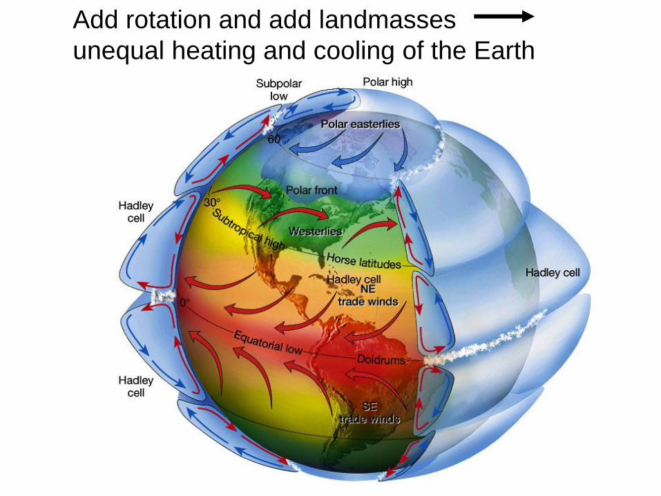
Add rotation and add landmasses
unequal heating and cooling of the Earth
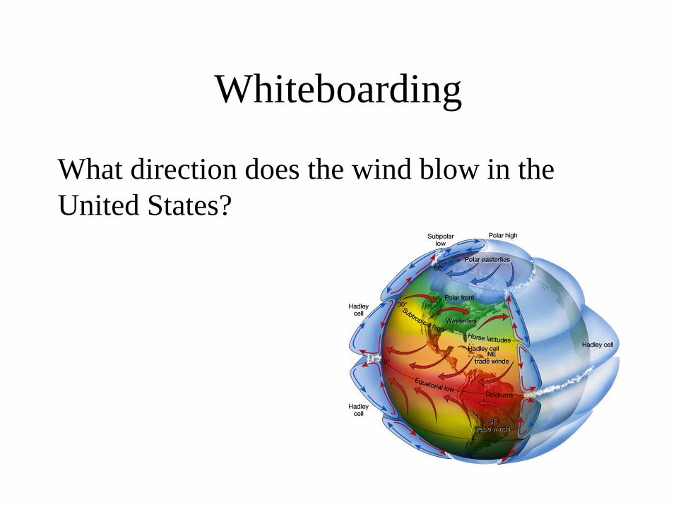
Whiteboarding
What direction does the wind blow in the
United States?

Whiteboarding
What flight would you expect to take longer:
flying from Las Vegas to New York, or New
York to Las Vegas?

Physical properties of the
atmosphere: Density
• Warm, low density
air rises
• Cool, high density
air sinks
• Creates circular-
moving loop of air
(convection cell)

Physical properties of the
atmosphere: Pressure

Whiteboarding
What type of air pressure exists between the
Hadley and Ferrel Cells?

ITCZ intertropical
convergence
zone= doldrums
Low pressure,
wet climate
High pressure, dry climate
Low pressure, wet climate
30o
30o
60o
60o
90o
90o
0o
High pressure, dry climate

The Coriolis effect
• The Coriolis effect
– Is a result of Earth’s rotation
– Causes moving objects to follow
curved paths:
• In Northern Hemisphere, curvature
is to right
• In Southern Hemisphere, curvature
is to left
– Changes with latitude:
• No Coriolis effect at Equator
• Maximum Coriolis effect at poles
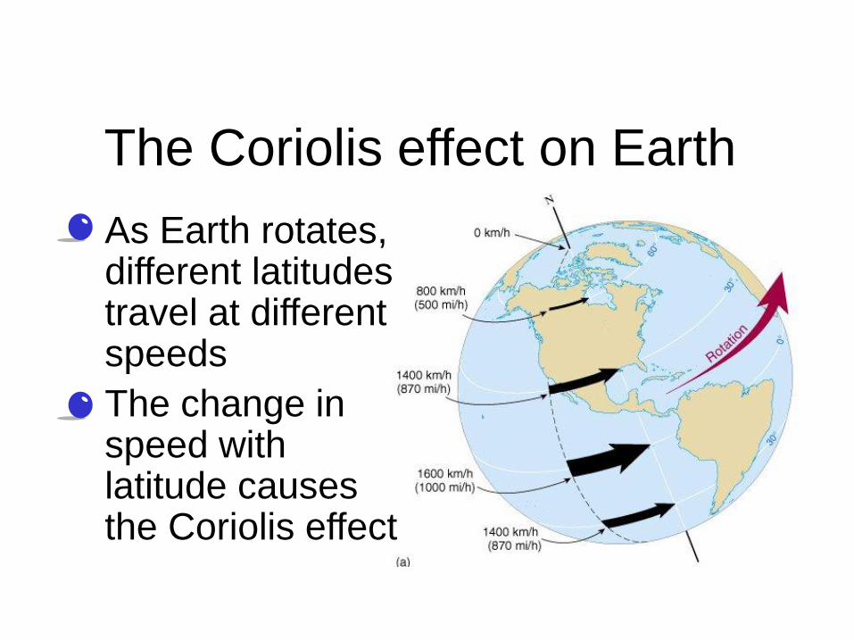
The Coriolis effect on Earth
• As Earth rotates, different latitudes travel at different speeds
• The change in speed with latitude causes the Coriolis effect

Whiteboarding
What direction will a plane traveling from Las
Vegas to Canada be deflected due to the
Coriolis Effect?

Whiteboarding
What direction will the same plane be
deflected on the return flight from Canada to
Las Vegas?

Whiteboarding
Which of the following accurately shows the
deflection of a flight due South in the
Southern Hemisphere?

Monday, February 11th
• Grab the Ocean Currents Notes (if you
don’t have them already) from the front lab
table.
• Copy the objective and work on the warm-
up.
• Objective: We will diagram and explain the
causes of Surface Currents and Deep Water
Currents.

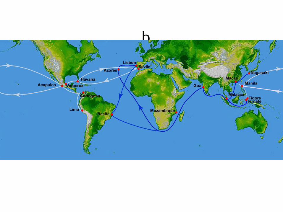
b


Surface Currents
The upper 400 meters of the ocean
(10%).
Deep Water Currents
Thermal currents (90%)
Ocean Currents
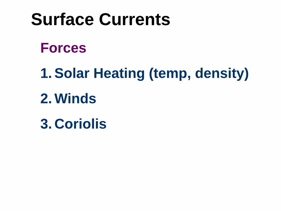
Surface Currents
Forces
1. Solar Heating (temp, density)
2. Winds
3. Coriolis

Wind-Driven and Density-Driven
Currents
• Wind-driven currents occur in the
uppermost 100 m or less
• Density differences causes by
salinity and temperature produce
very slow flows in deeper waters.

Wind-driven surface currents
http://www.classzone.com/book
s/earth_science/terc/content/vis
ualizations/es2401/es2401page
01.cfm?chapter_no=visualizatio
n

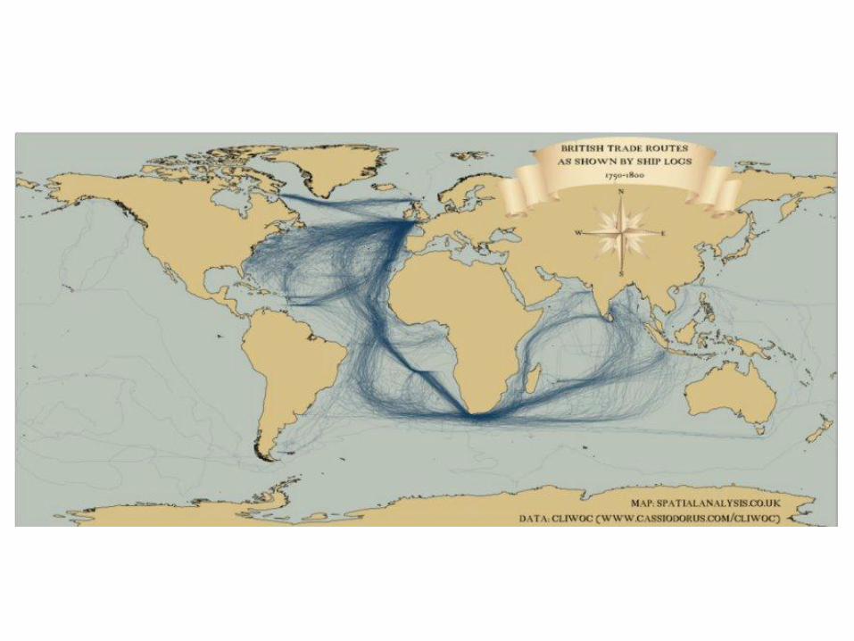
Sailors have know about ocean
currents for centuries
Sailors have know that “rivers” flow in the
seas since ancient times. They used
them to shorten voyages, or were
delayed by trying to stem them.
If navigators do not correct to deflection
by currents, they may be far away from
where they think they are and meet
disaster.
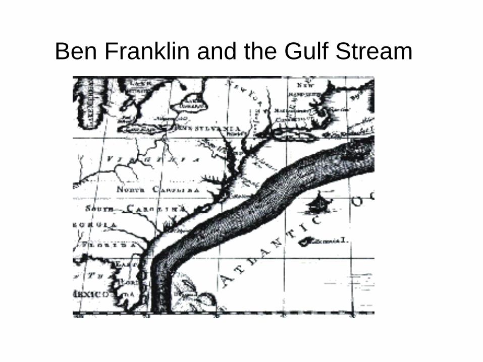
Ben Franklin and the Gulf Stream

Matthew Fontaine Maury
The first systematic study
of currents was done
by Maury based on
logbooks in the US
Navy’s Depot of Charts
and Instruments.
His charts and “Physical
Geography of the Sea”
assisted navigators
worldwide.
http://www.npg.si.edu/exh/brady/gallery/97gal.html

Winds and surface water
• Wind blowing over the ocean can move it due to frictional drag.
• Waves create necessary roughness for wind to couple with water.
• One “rule of thumb” holds that wind blowing for 12 hrs at 100 cm per sec will produce a 2 cm per sec current (about 2% of the wind speed)

Gyres
• Water moved by winds is then deflected by
the Coriolis Effect, forming Gyres.

Gyres are large circular-moving loops of water
Five main gyres (one in each ocean
basin):
• North Pacific
• South Pacific
• North Atlantic
• South Atlantic
• Indian
• Generally 4 currents in each gyre
• Centered about 30o north or south
latitude
Current Gyres


What do Nike shoes,
rubber ducks, and
hockey gloves have to
do with currents?
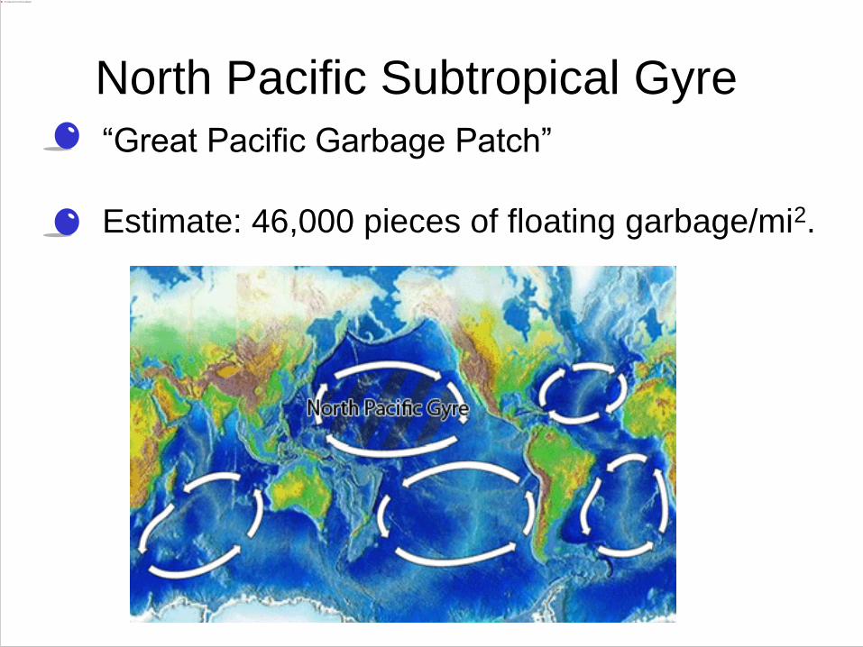
• “Great Pacific Garbage Patch”
• Estimate: 46,000 pieces of floating garbage/mi2.
North Pacific Subtropical Gyre

North Pacific Subtropical Gyre
135° to 155°W and 35° to 42°N
North Pacific Subtropical Gyre
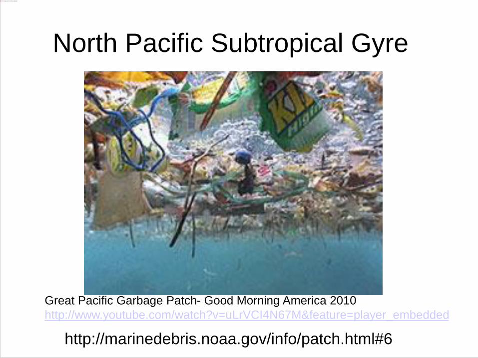
http://marinedebris.noaa.gov/info/patch.html#6
Great Pacific Garbage Patch- Good Morning America 2010
http://www.youtube.com/watch?v=uLrVCI4N67M&feature=player_embedded

Surface and Deep-Sea Current
Interactions
Giant convection cell circulating around the Earth’s
oceans. Known as the “Global Ocean Conveyor
Belt”
http://seis.natsci.csulb.edu/rbehl/ConvBelt.htm

Global ocean circulation that is driven by differences in
the density of the sea water which is controlled by
temperature and salinity.
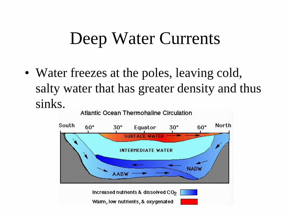
Deep Water Currents
• Water freezes at the poles, leaving cold,
salty water that has greater density and thus
sinks.
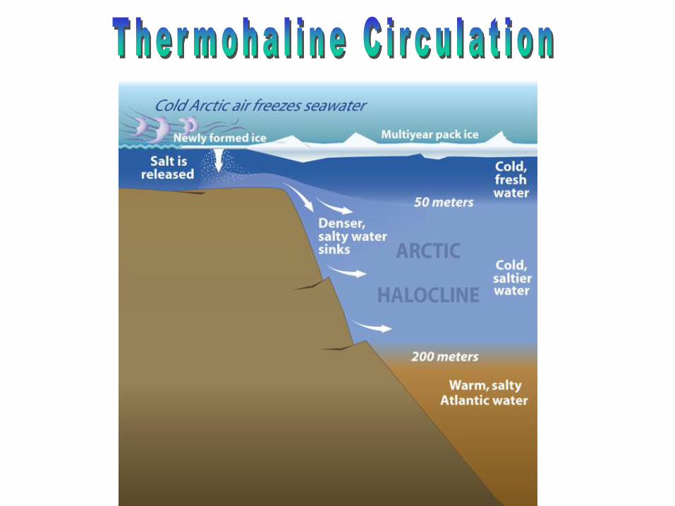

Deep Water Currents
• Water at the equator warms up from the sun
and thus has a lower density and rises.
• Warm surface currents flow towards the
poles.

Deep Water Currents
• Results in huge, slow moving, ocean current
• Just like demonstration in class.

White sections represent warm surface currents.
Purple sections represent deep cold currents

Venn Diagram
• Complete sentences: “One force causing surface currents
is…” or, “Both surface currents and deep water currents
are affected by…”
• Include:
– Forces that cause them
– Definitions of each
– Keywords associated with each (i.e. gyre and thermohaline
circulation)
– Direction of movement

Quick Questions
1. What is the primary force causing surface
currents?

Quick Questions
2. Surface Currents in the Southern
Hemisphere rotate ______________.
Quick Questions 3. Which of the following comparisons
between winds and ocean currents is NOT a
good comparison?
a. With the exception of the Ferrel Cell, warm air
and warm currents flow toward the poles.
b. Both are caused by the uneven heating of the
Earth’s surface.
c. Both are affected by the Coriolis Effect.
d. Both winds and currents can be caused by
differences in salinity.

Quick Questions 4. Based on the following picture, garbage dumped
off the East Coast in the United states would most
likely be found some time later on which of the
following continents?
a. Australia
b. Asia
c. Africa
d. Antartica

El Niño-Southern Oscillation
(ENSO) • El Niño = warm surface current in
equatorial eastern Pacific that occurs periodically around Christmastime
• Southern Oscillation = change in atmospheric pressure over Pacific Ocean accompanying El Niño
• ENSO describes a combined oceanic-atmospheric disturbance

El Niño
• Oceanic and atmospheric
phenomenon in the Pacific Ocean
• Occurs during December
• 2 to 7 year cycle
Sea Surface Temperature
Atmospheric Winds
Upwelling
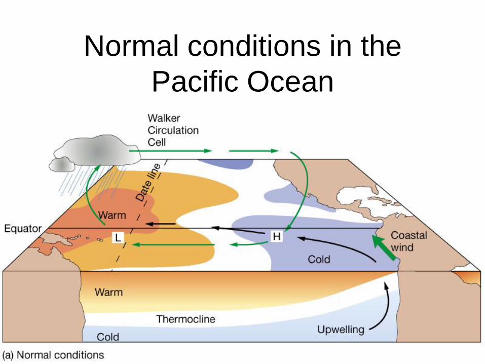
Normal conditions in the
Pacific Ocean

El Niño conditions (ENSO
warm phase)

La Niña conditions (ENSO
cool phase; opposite of El
Niño)

El Niño Non El Niño
1997

Non El Niño
El Niño
thermocline
upwelling

El Niño events over the last 55 years
El Niño warmings (red) and La Niña coolings (blue) since
1950. Source: NOAA Climate Diagnostics Center
http://esminfo.prenhall.com/science/geoanimations/ani
mations/26_NinoNina.html
El Nino Animation
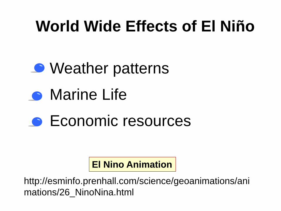
World Wide Effects of El Niño
• Weather patterns
• Marine Life
• Economic resources

Effects of severe El Niños


