Today, Socorro is a crossroad city for the automobile. How Socorro ended up being at the crossroads of an Interstate Highway and a coast-to-coast U.S. highway is an interesting story.
Credit for the first automobile goes to Karl Benz, of Germany. It was patented in 1886. Powered by a gasoline internal combustion engine, the vehicle consisted of two drive wheels in the rear and a single wheel in front for steering. Benz’ invention became the genesis of today’s Mercedes-Benz Company. Brothers Charles and Frank Duryea formed the Duryea Motor Wagon Company in 1893 — the first successful American commercial automobile. During the 1890s, inventors across the country began designing and building a better “horseless carriage,” with the hope of forming their own automobile company. A few of these attempts were successful. They produced limited numbers of automobiles, all built by hand, with a handsome price tag. These early cars were considered “toys of the rich” and used mostly for local travel or novelty driving.
A Great Automobile Adventure The first person to drive an automobile across the country was Dr. Horatio Nelson, a wealthy medical doctor and businessman from Vermont. In 1903, while in San Francisco, Nelson engaged in a $50 wager (about $1,250 today) that an
automobile could be used to drive across the country — even though previous attempts had failed. For the challenge, he hired Sewall Crocker to be his mechanic and backup driver. Crocker convinced Nelson to purchase a Winton touring car for the trip. The Winton was considered a robust car for the day, and sported a 20 horsepower engine. On May 23, the duo departed San Francisco in their attempt to reach New York City. In those days, there were no auto roads. Instead, one used wagon roads, followed railroad tracks, or any other path to be found. Nelson elected to take a northern route through Sacramento to join the Oregon Trail. Travel on the mountain roads was rough and bouncy, and the pair lost half their camping equipment in the first week. Block and tackle was used to haul the car across rivers or to free it from mud. By June, Nelson had to telegraph Sacramento for more tires. A week later, a fuel leak sent one of the men on a 25-mile ride on a rented
Courtesy of University of VermontDr. Horatio Nelson and Sewall Crocker were the first to drive across the country in 1903. They used a Winton touring car.
bicycle to Burns, Ore., for more gas. From broken axles to cracked wheel bearings, somehow mechanic Crocker kept the touring car running through the mountains. After a month on the trail, Nelson and Crocker finally arrived in Cheyenne, Wyo., at the end of June. By now, they had become celebrities as hundreds of ranchers and town’s people got their first glimpse of an automobile. From Cheyenne, they followed the Mormon Trail and the transcontinental railroad across the
The Good Roads Movement The Good Roads movement was started in 1880 to improve the ratty network of wagon roads for use by local communities, farmers and a growing number of bicyclists. Increased automobile traffic further stressed the old dirt roads. The Good Roads movement shifted their emphasis to developing automobile roads in 1900. In 1908, the flair of the automobile changed forever when Henry Ford introduced his Model T. Mass production techniques allowed Ford to offer
In addition to his famous Model T, Henry Ford also invented the “assembly line” method of production, allowing Ford to go from manufacturing a few automobiles per day by hand to thousands. The lower production costs allowed the Model T to be affordable to the middle class.
Photos courtesy of Ford Motor Company
Ford’s Highland Park plant in Detroit, Michigan is now a National Historic Landmark.
Ford’s Model TG r e a t P l a i n s . T h e y arrived at Omaha, Neb., on July 12. From here onward, relatively good wagon roads allowed them to arrive in New York City on July 26. The first auto drive across the country, some 3,600 miles , too k a blistering 63 days — an average of 55 miles per day. It is not known what the trip cost Dr. Nelson, but it was substantial — far beyond his $50 bet ( w h i c h h e n e v e r collected). Over the next few years, others repeated t h e t a s k , a l w a y s accompanied with much fanfare and fueling the A me r i c an d r ea m o f owning an automobile to tour the country. B y 1 9 0 9 , A l i c e Ramsey, a 22-year-old housewife and mother from Hackensack, N.J., attempted the coast-to-coast challenge with three companions. This team of four women left Manhattan in a sturdy M a x w e l l c a r . T h e y arrived in San Francisco 59 days and 3,800 miles later, and became the first women to drive coast to coast.
his iconic car for just $650, a fraction of the cost of previous hand-built cars. For the first time, the automobile became affordable for the middle class. And, t h e m i d d l e c l a s s purchased them by the thousands. By 1910, a Model T w a s r o l l i n g o f f t h e production line every three minutes. There were 180,000 of these cars registered across the country. A few years later, production was m e a s u r e d i n t h e thousands per day — more than 2 million Model T autos being built annually. W hen pr od u ct ion ceased in 1927, more than 15 million Model T cars had been produced and were on the road. Other automobile manufacturers set up assembly lines as well. By the time of New Mexico’s statehood, a large number of middle class American’s owned an automobile. For a few cents per gallon for gas, a family could hop in their Model T and drive across the country — if only there were good roads to do so.
The ear liest mention I could find for automobiles in Socorro was in the Feb. 5, 1910, Socorro Chieftain. The brief article reported: “Zim Gibbons accomplished a remarkable feat yesterday morning by making the trip from Socorro to Magdalena in two hours and ten minutes in his new Ford automobile. He thus beat the Santa Fe train schedule by fifteen minutes. Cashier E.L. Price of the Socorro State Bank is going to try to clip off ten minutes in his automobile. This thing may become interesting.” In 1910, there were no auto roads in Socorro County. Gibbons used the old wagon road through Blue Canyon and across the La Jencia basin to reach Magdalena.
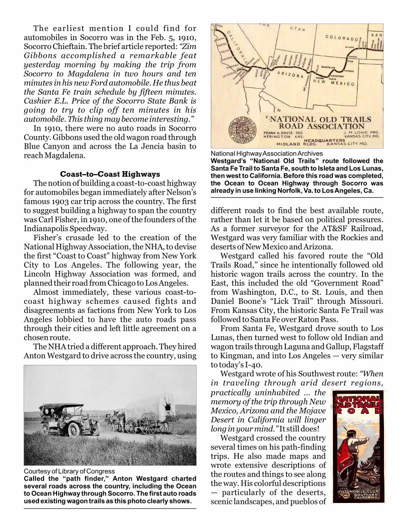
Coast–to–Coast Highways The notion of building a coast-to-coast highway for automobiles began immediately after Nelson’s famous 1903 car trip across the country. The first to suggest building a highway to span the country was Carl Fisher, in 1910, one of the founders of the Indianapolis Speedway. Fisher’s crusade led to the creation of the National Highway Association, the NHA, to devise the first “Coast to Coast” highway from New York City to Los Angeles. The following year, the Lincoln Highway Association was formed, and planned their road from Chicago to Los Angeles. Almost immediately, these various coast-to-coast highway schemes caused fights and disagreements as factions from New York to Los Angeles lobbied to have the auto roads pass through their cities and left little agreement on a chosen route. The NHA tried a different approach. They hired Anton Westgard to drive across the country, using
different roads to find the best available route, rather than let it be based on political pressures. As a former surveyor for the AT&SF Railroad, Westgard was very familiar with the Rockies and deserts of New Mexico and Arizona. Westgard called his favored route the “Old Trails Road,” since he intentionally followed old historic wagon trails across the country. In the East, this included the old “Government Road” from Washington, D.C., to St. Louis, and then Daniel Boone’s “Lick Trail” through Missouri. From Kansas City, the historic Santa Fe Trail was followed to Santa Fe over Raton Pass. From Santa Fe, Westgard drove south to Los Lunas, then turned west to follow old Indian and wagon trails through Laguna and Gallup, Flagstaff to Kingman, and into Los Angeles — very similar to today’s I-40. Westgard wrote of his Southwest route: “When in traveling through arid desert regions,
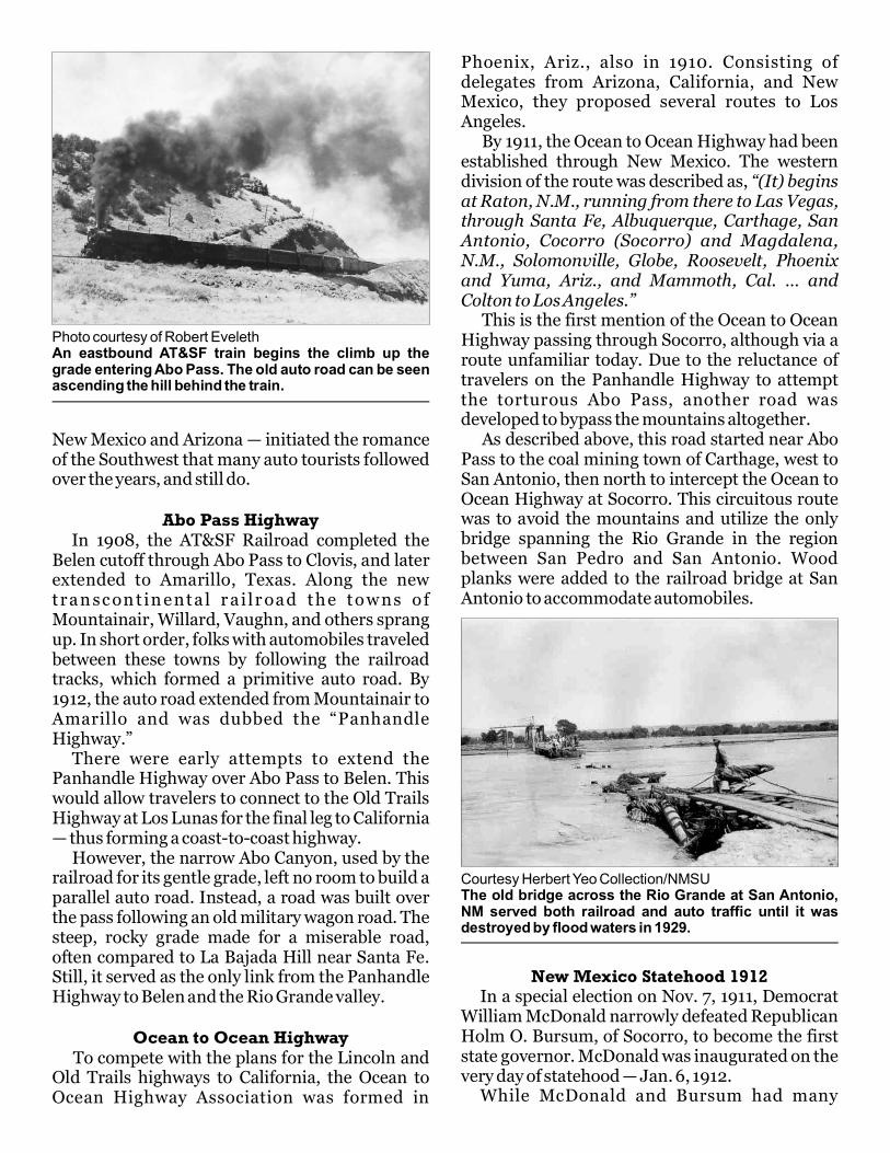
Courtesy of Library of CongressCalled the “path finder,” Anton Westgard charted several roads across the country, including the Ocean to Ocean Highway through Socorro. The first auto roads used existing wagon trails as this photo clearly shows.
National Highway Association ArchivesWestgard’s “National Old Trails” route followed the Santa Fe Trail to Santa Fe, south to Isleta and Los Lunas, then west to California. Before this road was completed, the Ocean to Ocean Highway through Socorro was already in use linking Norfolk, Va. to Los Angeles, Ca.
practically uninhabited … the memory of the trip through New Mexico, Arizona and the Mojave Desert in California will linger long in your mind.” It still does! Westgard crossed the country several times on his path-finding trips. He also made maps and wrote extensive descriptions of the routes and things to see along the way. His colorful descriptions — particularly of the deserts, scenic landscapes, and pueblos of
New Mexico and Arizona — initiated the romance of the Southwest that many auto tourists followed over the years, and still do.
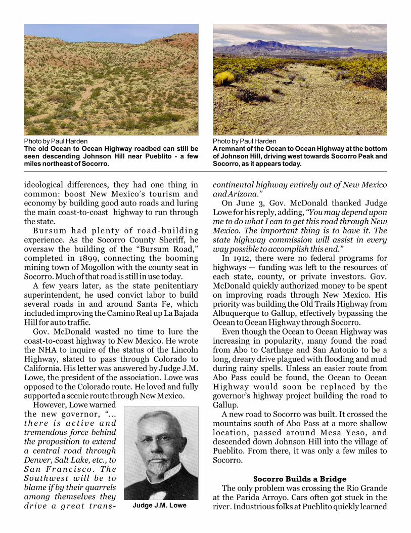
Abo Pass Highway In 1908, the AT&SF Railroad completed the Belen cutoff through Abo Pass to Clovis, and later extended to Amarillo, Texas. Along the new tran sc on t in enta l r a i l r oad the tow ns o f Mountainair, Willard, Vaughn, and others sprang up. In short order, folks with automobiles traveled between these towns by following the railroad tracks, which formed a primitive auto road. By 1912, the auto road extended from Mountainair to Amarillo and was dubbed the “Panhandle Highway.” There were early attempts to extend the Panhandle Highway over Abo Pass to Belen. This would allow travelers to connect to the Old Trails Highway at Los Lunas for the final leg to California — thus forming a coast-to-coast highway. However, the narrow Abo Canyon, used by the railroad for its gentle grade, left no room to build a parallel auto road. Instead, a road was built over the pass following an old military wagon road. The steep, rocky grade made for a miserable road, often compared to La Bajada Hill near Santa Fe. Still, it served as the only link from the Panhandle Highway to Belen and the Rio Grande valley.
Ocean to Ocean Highway To compete with the plans for the Lincoln and Old Trails highways to California, the Ocean to Ocean Highway Association was formed in
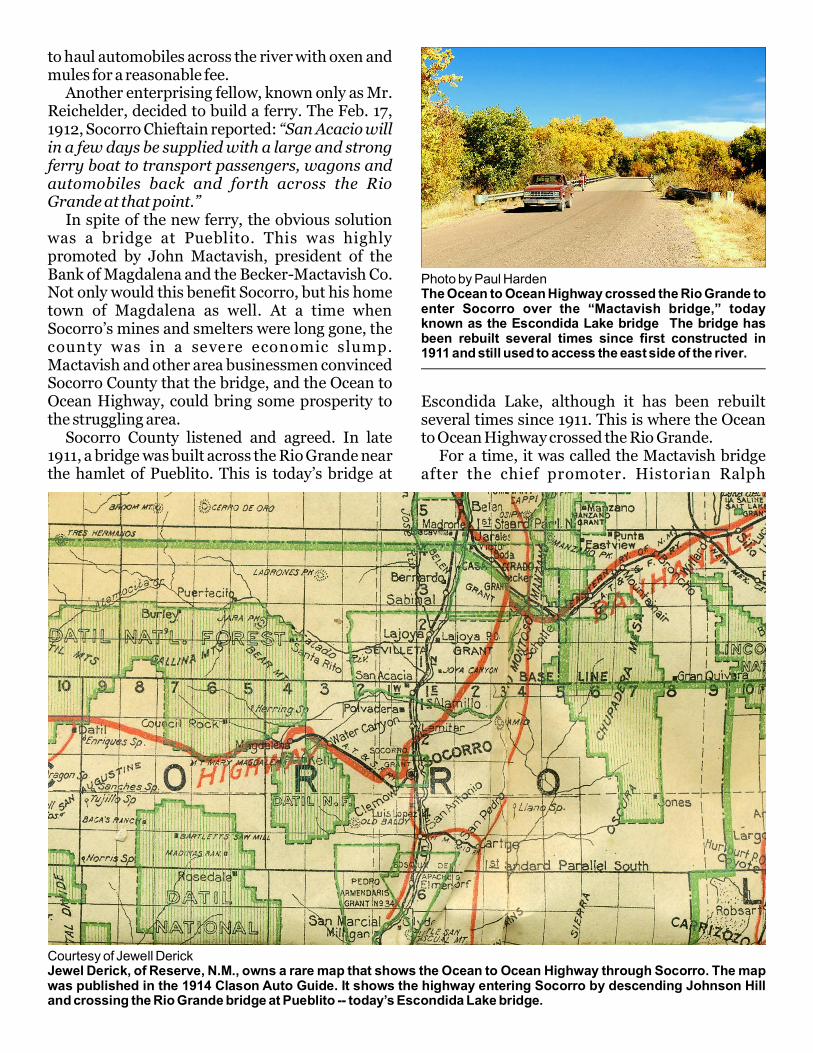
Phoenix, Ariz., also in 1910. Consisting of delegates from Arizona, California, and New Mexico, they proposed several routes to Los Angeles. By 1911, the Ocean to Ocean Highway had been established through New Mexico. The western division of the route was described as, “(It) begins at Raton, N.M., running from there to Las Vegas, through Santa Fe, Albuquerque, Carthage, San Antonio, Cocorro (Socorro) and Magdalena, N.M., Solomonville, Globe, Roosevelt, Phoenix and Yuma, Ariz., and Mammoth, Cal. … and Colton to Los Angeles.” This is the first mention of the Ocean to Ocean Highway passing through Socorro, although via a route unfamiliar today. Due to the reluctance of travelers on the Panhandle Highway to attempt the torturous Abo Pass, another road was developed to bypass the mountains altogether. As described above, this road started near Abo Pass to the coal mining town of Carthage, west to San Antonio, then north to intercept the Ocean to Ocean Highway at Socorro. This circuitous route was to avoid the mountains and utilize the only bridge spanning the Rio Grande in the region between San Pedro and San Antonio. Wood planks were added to the railroad bridge at San Antonio to accommodate automobiles.
Photo courtesy of Robert EvelethAn eastbound AT&SF train begins the climb up the grade entering Abo Pass. The old auto road can be seen ascending the hill behind the train.
New Mexico Statehood 1912 In a special election on Nov. 7, 1911, Democrat William McDonald narrowly defeated Republican Holm O. Bursum, of Socorro, to become the first state governor. McDonald was inaugurated on the very day of statehood — Jan. 6, 1912. While McDonald and Bursum had many
Courtesy Herbert Yeo Collection/NMSUThe old bridge across the Rio Grande at San Antonio, NM served both railroad and auto traffic until it was destroyed by flood waters in 1929.
ideological differences, they had one thing in common: boost New Mexico’s tourism and economy by building good auto roads and luring the main coast-to-coast highway to run through the state. B ur s u m h ad p le nt y o f ro ad - bu i ld i n g experience. As the Socorro County Sheriff, he oversaw the building of the “Bursum Road,” completed in 1899, connecting the booming mining town of Mogollon with the county seat in Socorro. Much of that road is still in use today. A few years later, as the state penitentiary superintendent, he used convict labor to build several roads in and around Santa Fe, which included improving the Camino Real up La Bajada Hill for auto traffic. Gov. McDonald wasted no time to lure the coast-to-coast highway to New Mexico. He wrote the NHA to inquire of the status of the Lincoln Highway, slated to pass through Colorado to California. His letter was answered by Judge J.M. Lowe, the president of the association. Lowe was opposed to the Colorado route. He loved and fully supported a scenic route through New Mexico.
Judge J.M. Lowe
However, Lowe warned the new governor, “... t h e r e i s a c t i v e a n d tremendous force behind the proposition to extend a central road through Denver, Salt Lake, etc., to S a n F r a n c i s c o . T h e Southwest will be to blame if by their quarrels among themselves they dr iv e a g reat trans-
continental highway entirely out of New Mexico and Arizona.” On June 3, Gov. McDonald thanked Judge Lowe for his reply, adding, “You may depend upon me to do what I can to get this road through New Mexico. The important thing is to have it. The state highway commission will assist in every way possible to accomplish this end.” In 1912, there were no federal programs for highways — funding was left to the resources of each state, county, or private investors. Gov. McDonald quickly authorized money to be spent on improving roads through New Mexico. His priority was building the Old Trails Highway from Albuquerque to Gallup, effectively bypassing the Ocean to Ocean Highway through Socorro. Even though the Ocean to Ocean Highway was increasing in popularity, many found the road from Abo to Carthage and San Antonio to be a long, dreary drive plagued with flooding and mud during rainy spells. Unless an easier route from Abo Pass could be found, the Ocean to Ocean Highway would soon be replaced by the governor’s highway project building the road to Gallup. A new road to Socorro was built. It crossed the mountains south of Abo Pass at a more shallow location, passed around Mesa Yeso, and descended down Johnson Hill into the village of Pueblito. From there, it was only a few miles to Socorro.
Socorro Builds a Bridge The only problem was crossing the Rio Grande at the Parida Arroyo. Cars often got stuck in the river. Industrious folks at Pueblito quickly learned
Photo by Paul HardenThe old Ocean to Ocean Highway roadbed can still be seen descending Johnson Hill near Pueblito - a few miles northeast of Socorro.
Photo by Paul HardenA remnant of the Ocean to Ocean Highway at the bottom of Johnson Hill, driving west towards Socorro Peak and Socorro, as it appears today.
to haul automobiles across the river with oxen and mules for a reasonable fee. Another enterprising fellow, known only as Mr. Reichelder, decided to build a ferry. The Feb. 17, 1912, Socorro Chieftain reported: “San Acacio will in a few days be supplied with a large and strong ferry boat to transport passengers, wagons and automobiles back and forth across the Rio Grande at that point.” In spite of the new ferry, the obvious solution was a bridge at Pueblito. This was highly promoted by John Mactavish, president of the Bank of Magdalena and the Becker-Mactavish Co. Not only would this benefit Socorro, but his home town of Magdalena as well. At a time when Socorro’s mines and smelters were long gone, the county was in a severe economic slump. Mactavish and other area businessmen convinced Socorro County that the bridge, and the Ocean to Ocean Highway, could bring some prosperity to the struggling area. Socorro County listened and agreed. In late 1911, a bridge was built across the Rio Grande near the hamlet of Pueblito. This is today’s bridge at
Escondida Lake, although it has been rebuilt several times since 1911. This is where the Ocean to Ocean Highway crossed the Rio Grande. For a time, it was called the Mactavish bridge after the chief promoter. Historian Ralph
Photo by Paul HardenThe ighway crossed the Rio Grande to Ocean to Ocean Henter Socorro over today the “Mactavish bridge,”known as the Lake Escondida bridge The bridge has been rebuilt several times since first constructed in 1911 . and still used to access the east side of the river
Courtesy of Jewell DerickJewel Derick, of Reserve, N.M., owns a rare map that shows the Ocean to Ocean Highway through Socorro. The map was published in the 1914 Clason Auto Guide. It shows the highway entering Socorro by descending Johnson Hill and crossing the Rio Grande bridge at Pueblito -- today’s Escondida Lake bridge.
Emerson Twitchell described Mactavish as “an enthusiastic booster of the Ocean to Ocean highway and its routing through Socorro and Magdalena.” The bridge was a success for Socorro County. Remember Anton Westgard, the path finder? He promoted Gov. McDonald’s highway from Los Lunas to Gallup as the Coast to Coast Highway through New Mexico. However, due to the new bridge near Socorro, he must have changed his mind, for he wrote in 1912, “Though assured by the State Engineer that the new road from Albuquerque to Gallup will be open for traffic this spring … a fair road leads from Albuquerque to Socorro, crossing a new bridge over the Rio Grande near the latter town, and thence on good-to-fair roads via Magdalena across the Augustine Plains and the Datil Mountains to Springerville, Arizona.” Exactly when the bridge at Pueblito was built is a bit hazy. The scant information on the subject ci tes from 1911 through 1918. However, Westgard’s 1912 report above clearly states the “new bridge over the Rio Grande” near Socorro was in place before Spring 1912. It should be noted that Westgard’s “fair road” from Albuquerque was on the east side of the river, going through Peralta and Valencia to La Joya. From there, it followed El Camino Real to Pueblito, where it joined the new road from Abo coming down Johnson Hill. There is no further reference to Reichelder’s ferry found in the Socorro Chieftain. Upon
completion of the Mactavish bridge at Pueblito, the San Acacia ferry was no doubt short lived.
Socorro Crossroads At the same time the Ocean to Ocean Highway was being completed through Socorro and on to California, the Camino Real Highway was also nearing completion. This became the first El Paso to Santa Fe highway, roughly following the historic El Camino Real trail. To Socorroans, this brought a nice road along the west side of the river for traveling south to San A n t o n i o o r S an Ma r c i a l , an d n or t h t o Albuquerque. State highway N.M. 1 through Socorro County roughly traces the old Camino Real Highway. The Ocean to Ocean and El Paso-Santa Fe (El Camino) highways made Socorro the principal crossroad city in central New Mexico. The town quickly responded by serving the growing number of auto travelers. Several gasoline stations and restaurants were built around the Plaza to cater to the traveler. The Chambon Freight Company, which hauled freight to outlying areas, converted from wagons to auto trucks. Another wagon enterprise, owned by George Cook, also converted to gasoline-powered trucks. Additionally, he converted his hay barn and livery stable on California Street into an auto garage and service station. The Cook Garage served travelers through Socorro for decades. Keith’s Ocean to Ocean Garage was built, in 1916, on the Socorro Plaza, where the Post Office is
Courtesy of Socorro County Historical SocietyAn early photo of Keith’s Ocean to Ocean Garage. It was located on the northwest corner of the Socorro plaza. The famous garage was destroyed by fire in 1956.
Photo by Paul HardenOne of the signs that once marked the way to Socorro – and Keith’s Ocean to Ocean Garage is now on display – at the Hammel Museum.
By 1925, according to the Census Bureau, more than 20 mi l l i o n a u to mob i le s w e r e registered in the United States and the limited number of good roads were well used, congested, and confusing. F i n a l l y , t h e f e d e r a l government realized a national highway system was needed. The J o i n t B o ar d o f I n t e r s ta t e Highways was created, and adopted a U.S. Highway system. The highway shield was also designed, the familiar U.S. Highway shield still in use today. A t t h a t t i m e , ea s t - w es t highways ended in zero, such as U . S . 6 0 , a n d n or t h- s o u t h
Datil. This segment runs south of today’s U.S. 60, and passes through the Very Large Array radio telescope. Other old sections of the road are seen near Quemado, Red Hill and Springerville. And, of course, the old road down Johnson Hill is still there. Although called a “highway” since 1910, the Ocean to Ocean Highway remained a dirt road for years. It was not paved from Socorro to Springerville until 1947. The new U.S. 60, the one driven today from Socorro to Springerville, was built and paved 1953-1956.
Photo by Paul HardenThe U.S. Highway shield was designed in 1925, and is still used t o d a y t o d e s i g n a t e U . S . highways.
today. At a time when road maps were scarce, they printed a detailed map of the Ocean to Ocean Highway and placed signs on the road pointing the way to Socorro — and, of course, to Keith’s Ocean to Ocean Garage. These early marketing techniques, visionary for their time, made Keith’s Ocean to Ocean Garage and Socorro popular stops on the now famous coast-to-coast highway. In 1919, the Val Verde Hotel was built to offer travelers luxurious dining and overnight accommodations. It likewise became a famous stop on the two major highways through Socorro. Auto travelers converted Socorro from a sleepy, economically depressed town into one with some measure of prosperity. The hotels, restaurants, gas stations and garages all provided badly needed jobs in Socorro. Other towns along the Ocean to Ocean Highway, such as Magdalena, Datil and Quemado, also prospered.
From Named Highways to Numbers By the mid-1920s, there was the Lincoln Highway, National Old Trails Highway, Pike’s Peak Ocean to Ocean Highway, the Panhandle Highway, the Camino Real, the Sunset Highway, Ocean to Ocean Highway, and a few others. Confused? So were the auto travelers.
ran neither north-south nor east-west, and therefore shouldn’t end in zero or five. After several contentious meetings, a compromise was finally reached. The south-west running highway was renumbered to U.S. 66, or more commonly, Route 66. Suddenly, U.S. 60 was left unassigned. In November 1926, the short-lived U.S. 70 designation for the Ocean to Ocean highway was changed to U.S. 60 — the designation it still holds today. Shortly thereafter, a substantial road was bladed over Abo Pass, rerouting U.S. 60 to Bernardo, as it does today. This bypassed the route down Johnson Hill and across the bridge at Pueblito.
U.S. Highway 60 U.S. 60 is the original Ocean to Ocean Highway from Virginia Beach, Va. to Los Angeles, although it has seen numerous realignments over the years. Today, U.S. 60 merges with Interstate 10 near Brenda, Ariz. Portions of the old highway can be seen west of Socorro near the U.S. 60 shrine and the Pound Ranch Road. A long stretch remains from Magdalena, across the Plains of San Agustin, to
highways ended in five, such as U.S. 85. Through Socorro County, the Ocean to Ocean highway was designated U.S. 70; the Camino Real highway was assigned U.S. 85. The ink was barely dry on this plan when supporters of the Lincoln Highway objected to the plan. They pointed out that their famous highway
The Grapes of WrathDuring the Great Depression, countless thousands left the economic disaster and devastating dust storms of the Midwest looking for a better life. Most went to California. The classic movie, “Grapes of Wrath,” depicts a family traveling to California on Route 66 during this
He drove U.S. 60, not Route 66, to document the West. Lee stopped at Pie Town and spent several days photographing the impoverished town and those who were homesteading the area during the 1930s. These Pie Town photos along U.S. 60 have become iconic images of the Great Depression.
Old U.S. 60 has also been memorialized for New Mexico’s centennial in the book, “Sunshine and Shadows In New Mexico’s Past,” Vol. 3, Chapter 30. The chapter was written by former Socorro resident and historian Spencer Wilson.
Whether you take a jaunt from Socorro to Mountainair, or a drive to Magdalena, you are driving on one of the oldest coast-to-coast highways in America still in use. Although most have been replaced by the interstate highways, including Route 66, Socorro’s U.S. 60 has endured. It is steeped in history with Socorro at the crossroads.
Some of the References used in this article:
“The National Old Trails Road,” Federal Highway Administration; “Motor Routes to the California Expositions,” by A.L. Westgard; “Highway 60 and the Belen Cutoff,” by Dixie Boyle; numerous issues of the Socorro Chieftain newspaper, and field work by the author.
Images by Paul Harden unless otherwise noted.
Courtesy of Library of CongressThis iconic photo of the Great Depression was taken along U.S. 60 in 1938 . by photographer Russell LeePictured are Pie Town homesteaders Faro and Doris Caudill. Lee was one of the first depression era photographers to use the newly introduced color film.
More photosnext page
time and the hardships they endured.However, U.S. 60 saw more traffic from those
who were relocating to Arizona and California than did Route 66. Before Santa Fe was bypassed, in 1937, U.S. 60 through Socorro was the more direct route to California.
In 1936, photographer Russell Lee was hired by the Farm Security Administration to document the hardships of America during the depression.
More Photos of the old Ocean to Ocean Highway(Photos by Paul Harden except as noted)
The old Ocean to Ocean Highway and the first U.S. 60 runs parallel to today’s U.S. 60 west of Socorro.
The old road bed is still seen west of Socorro where it rounds the lava outcropping near Nogal Canyon. The gully (foreground) was once spanned by a bridge.
The 1930s built “Augustine CCC camp” was built on old U.S. 60. The CCC built water wells every 10 miles for the cattle drives headed for Magdalena.
Old U.S. 60 across the Plains of San Augustin towards Datil, as seen west of the VLA radio telescope. This portion was finally paved in 1947.
Courtesy New Mexico State PoliceThe Eagle Guest Ranch in Datil, NM, 1932. It was a popular service station and restaurant on the Ocean to Ocean Highway – and still is!
Today’s U.S. 60 (right) as seen from the old road bed of the Ocean to Ocean highway west of Socorro.