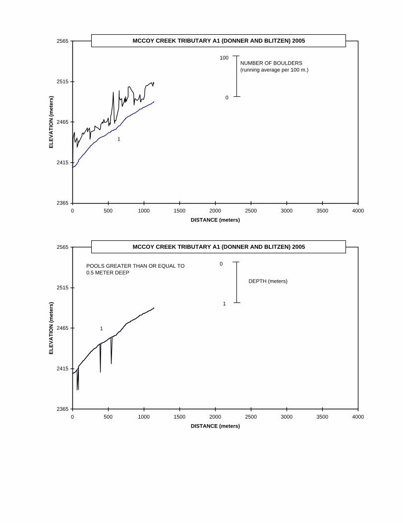
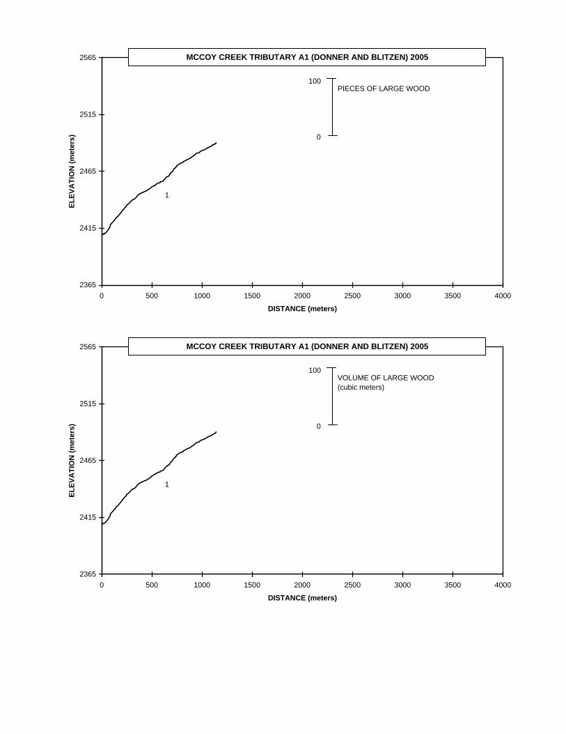
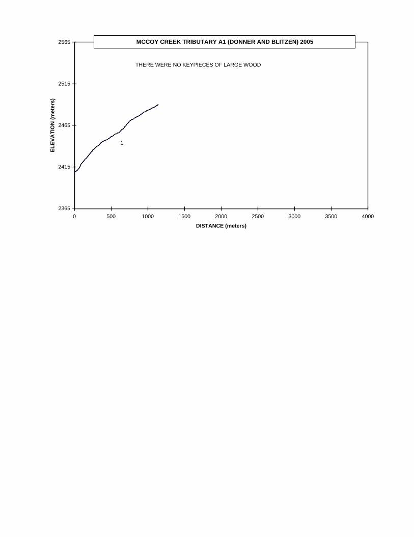
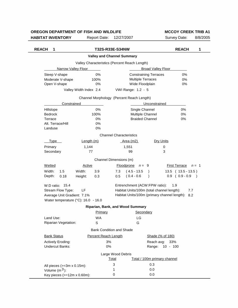
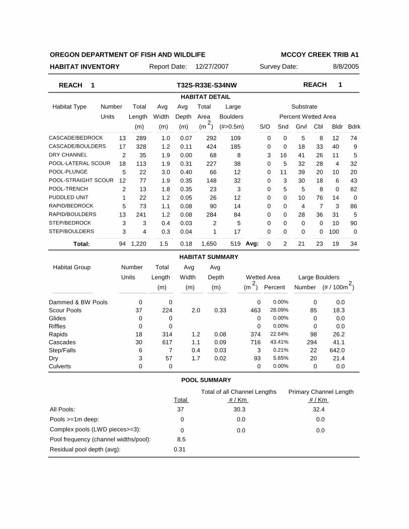
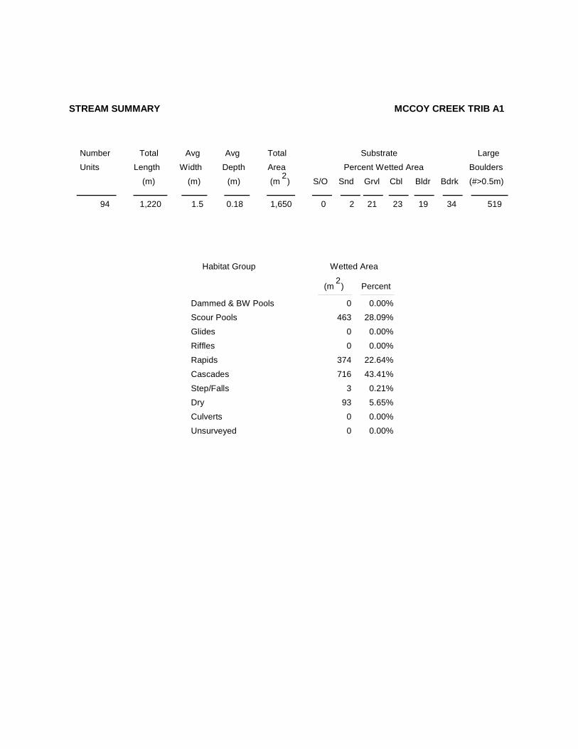
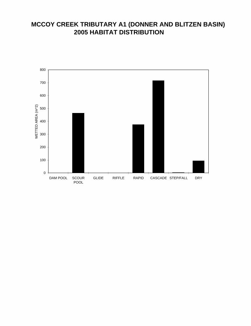
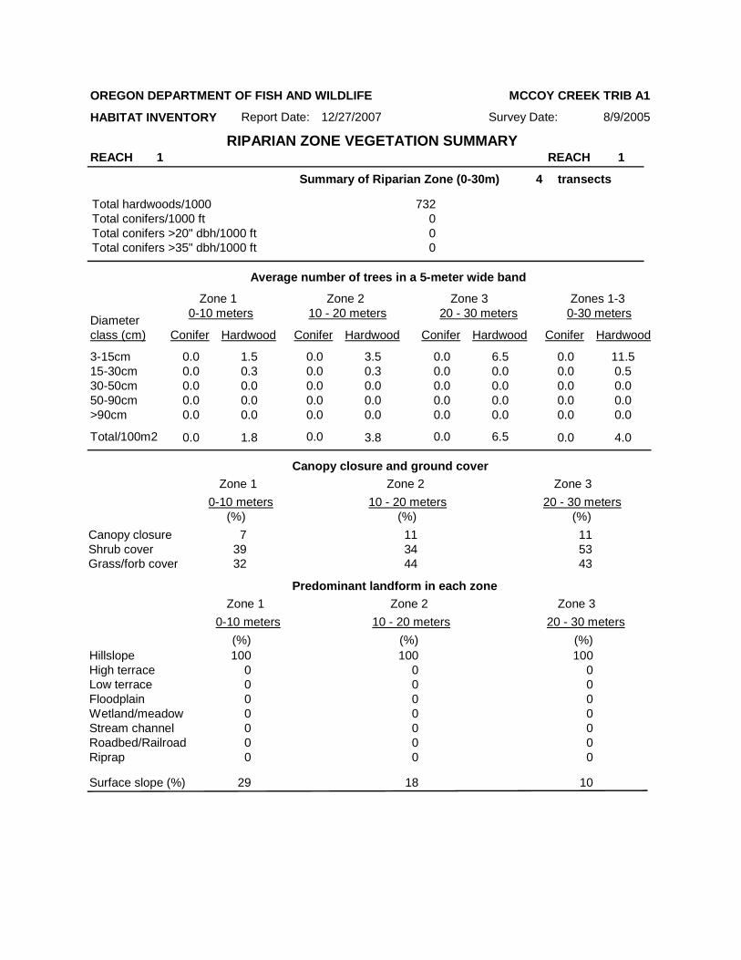
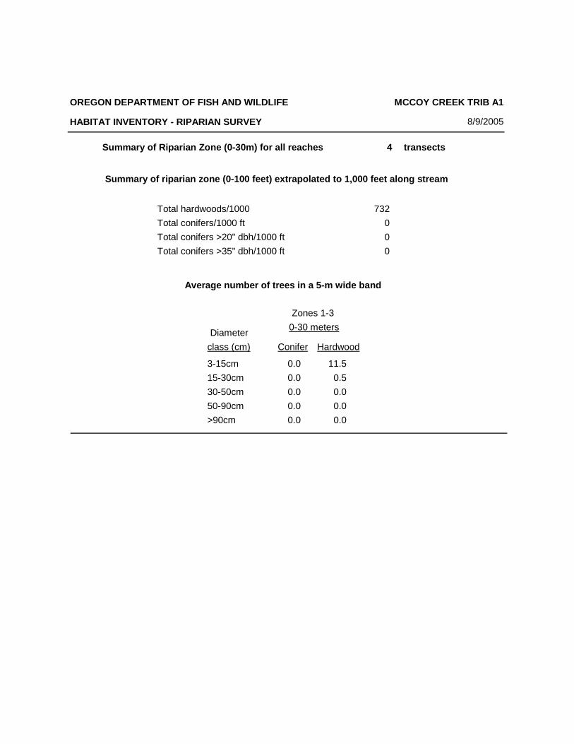
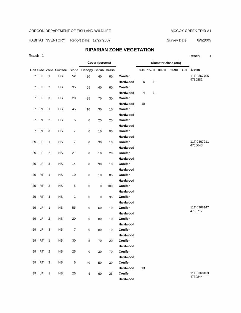
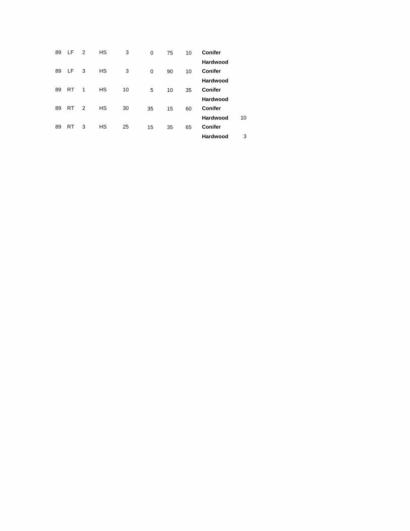
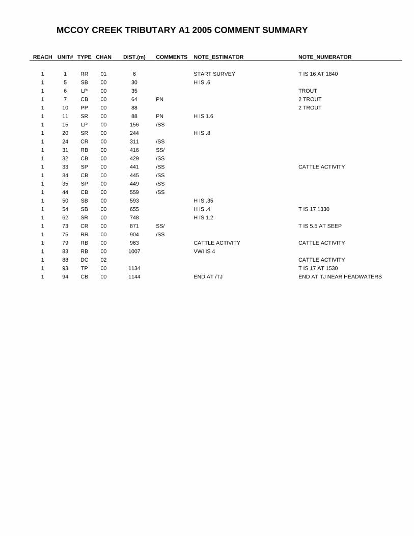
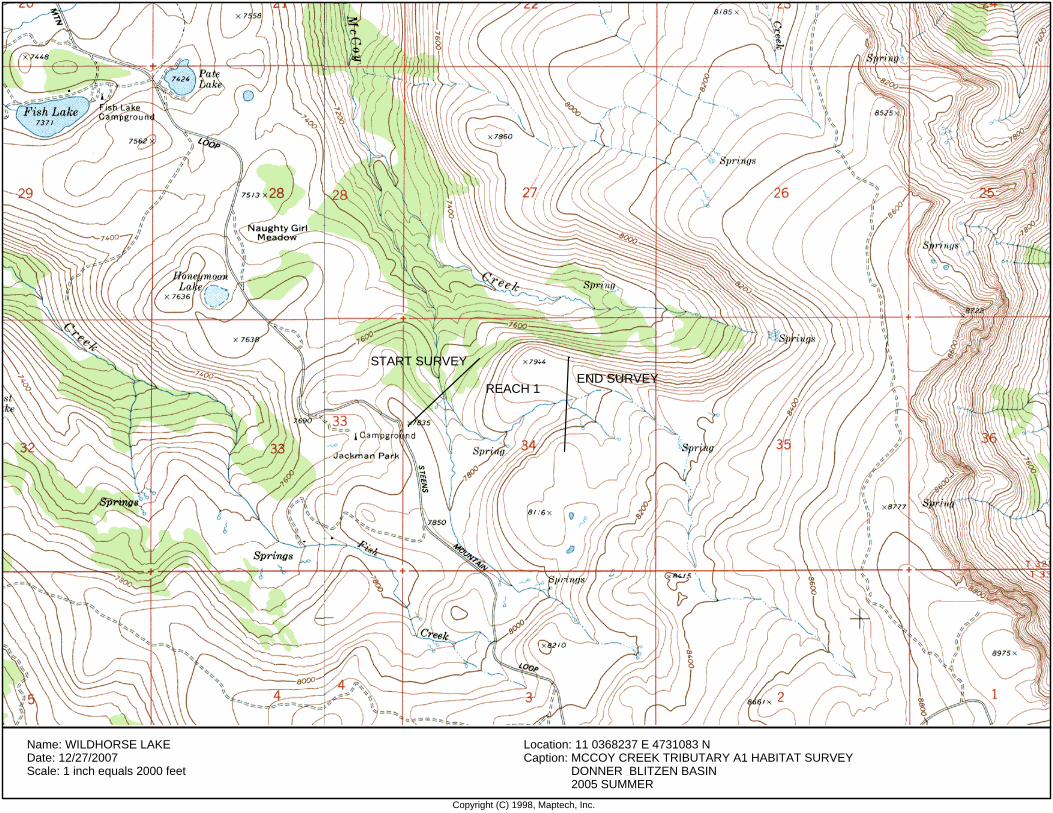
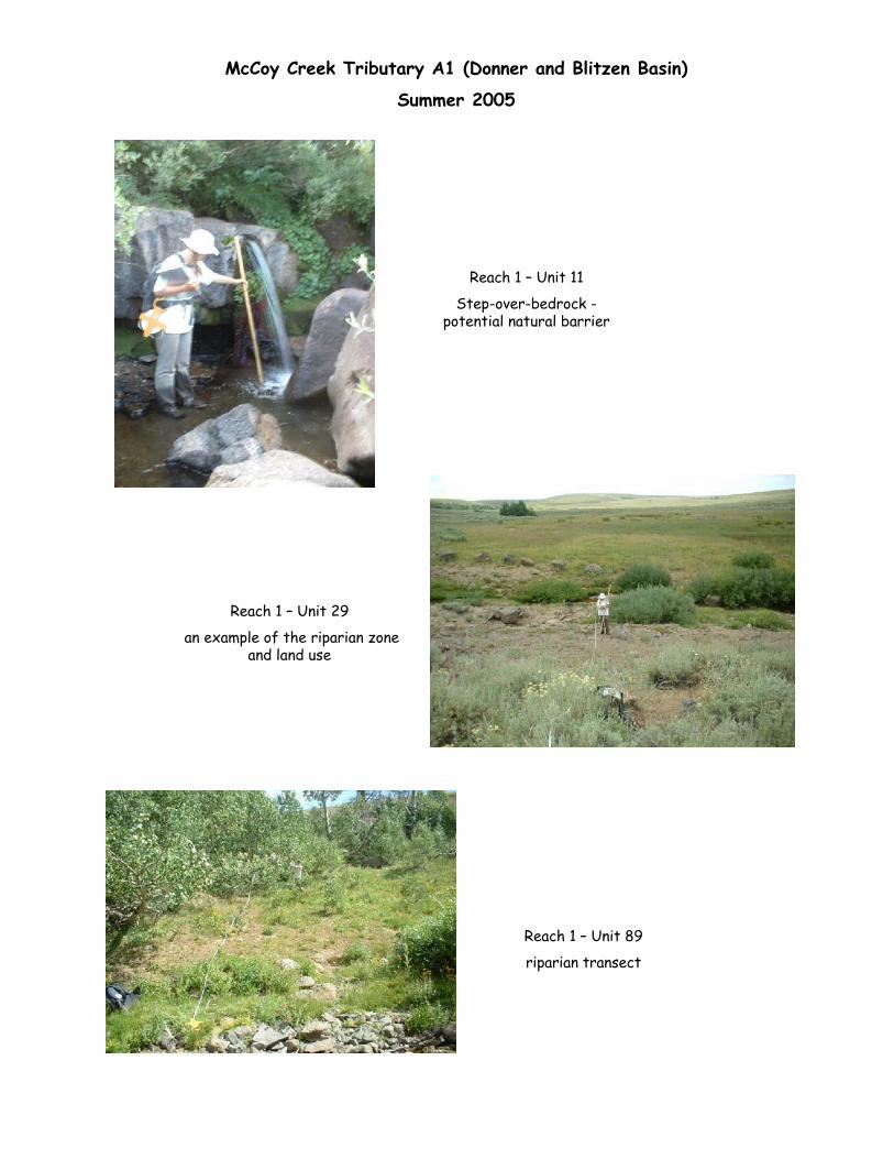
ODFW AQUATIC INVENTORY PROJECT STREAM REPORT STREAM: McCoy Creek Tributary A1 BASIN: Donner and Blitzen DATES: August 9, 2005 SURVEY CREW: Tom Stassen and Nicole Judge REPORT PREPARED BY: S. Stein STREAM ORDER: 2 BASIN AREA: 3.4km 2 FIRST ORDER TRIBUTARIES: 1 USGS MAPS: Wildhorse Lake ECOREGION: High Desert HUC NUMBER: 17120003 LLID: none GENERAL DESCRIPTION: (T32S-R33E-S34NW) The McCoy Creek Tributary A1 habitat survey began at the confluence with McCoy Creek Tributary A and continued upstream 1,144 meters. The channel was bedrock- constrained in a moderate v-shaped valley floor. The average valley width index was 2.4 (range: 1.2-5.0). Land uses for the reach were wilderness area and light grazing. The average unit gradient was 7.1 percent. Cascades (43%), scour pools (28%), and rapids (23%) were the dominant stream habitats. Bedrock (34%), cobble (23%), gravel (21%), and boulder (19%) comprised most of the primary stream substrate. No large wood debris was recorded in the reach. The average residual pool depth was 0.31m. The trees found most frequently in the riparian zones were hardwoods 3- 15cm (based on four riparian transects). COMMENTS The crew observed trout. There is a 1.6m bedrock step at unit 11 (88 meters) that was a potential barrier to upstream fish migration. The upper fish distribution was not determined. There were many spring seeps entering the stream. Cattle activity was noted in the upper length of the reach.
Transcript
ODFW AQUATIC INVENTORY PROJECT
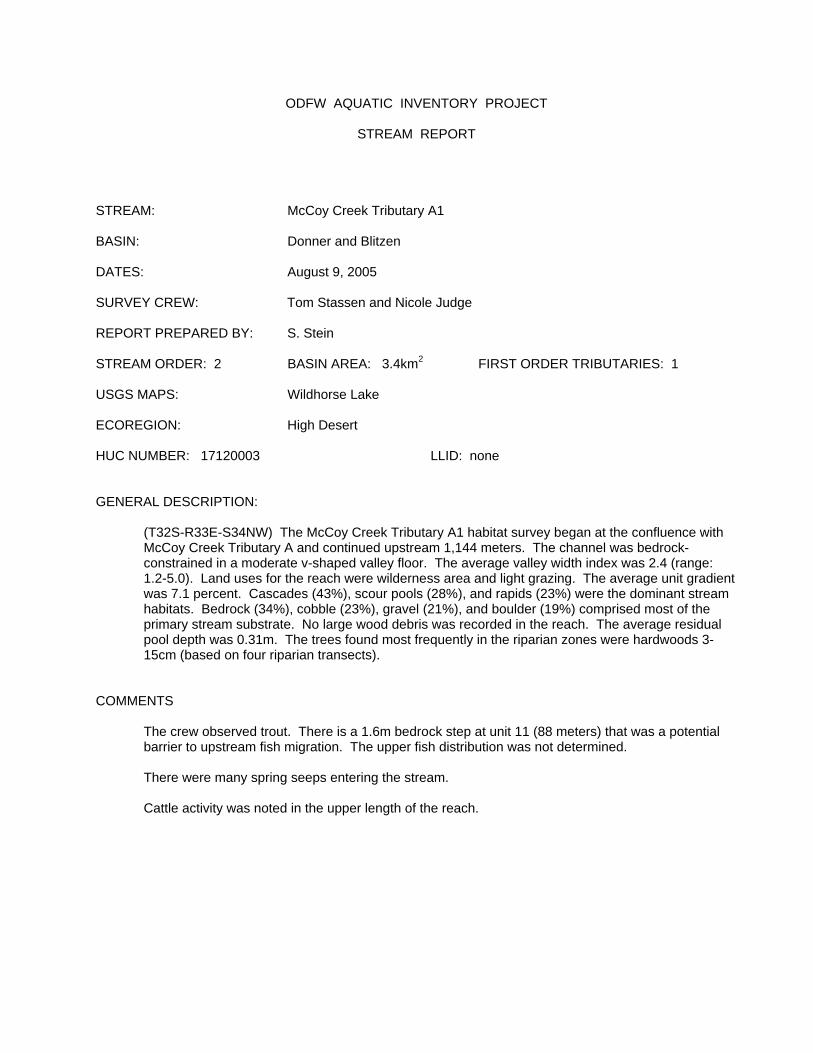
STREAM REPORT STREAM: McCoy Creek Tributary A1 BASIN: Donner and Blitzen DATES: August 9, 2005 SURVEY CREW: Tom Stassen and Nicole Judge REPORT PREPARED BY: S. Stein STREAM ORDER: 2 BASIN AREA: 3.4km2 FIRST ORDER TRIBUTARIES: 1 USGS MAPS: Wildhorse Lake ECOREGION: High Desert HUC NUMBER: 17120003 LLID: none GENERAL DESCRIPTION: (T32S-R33E-S34NW) The McCoy Creek Tributary A1 habitat survey began at the confluence with
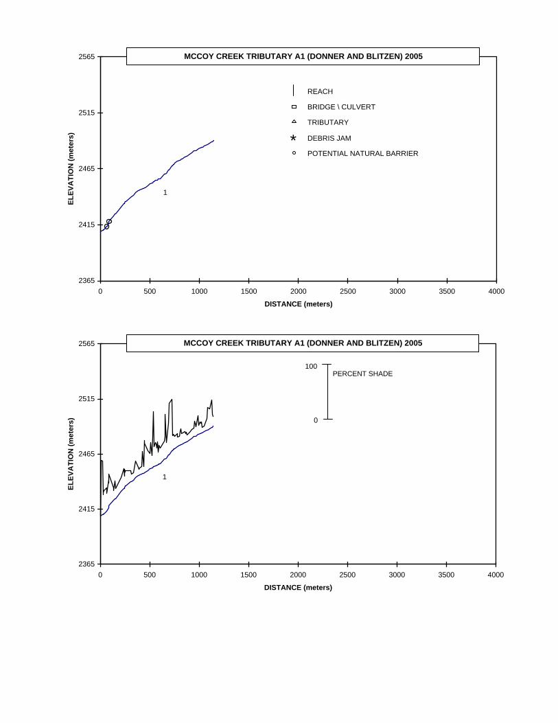
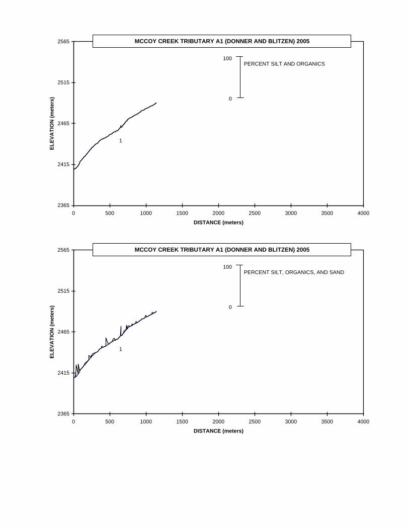
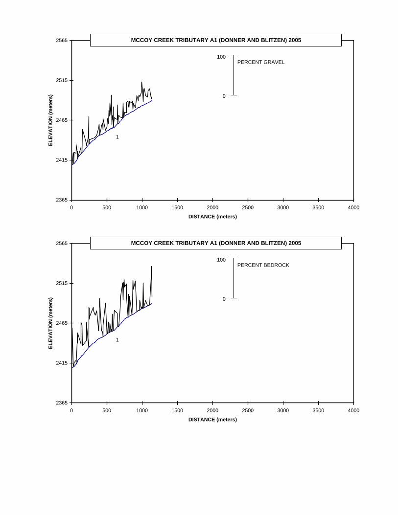
McCoy Creek Tributary A and continued upstream 1,144 meters. The channel was bedrock-constrained in a moderate v-shaped valley floor. The average valley width index was 2.4 (range: 1.2-5.0). Land uses for the reach were wilderness area and light grazing. The average unit gradient was 7.1 percent. Cascades (43%), scour pools (28%), and rapids (23%) were the dominant stream habitats. Bedrock (34%), cobble (23%), gravel (21%), and boulder (19%) comprised most of the primary stream substrate. No large wood debris was recorded in the reach. The average residual pool depth was 0.31m. The trees found most frequently in the riparian zones were hardwoods 3-15cm (based on four riparian transects).
COMMENTS The crew observed trout. There is a 1.6m bedrock step at unit 11 (88 meters) that was a potential
barrier to upstream fish migration. The upper fish distribution was not determined.
There were many spring seeps entering the stream. Cattle activity was noted in the upper length of the reach.
2365
2415
2465
2515
2565
0 500 1000 1500 2000 2500 3000 3500 4000
DISTANCE (meters)
ELEV
ATI
ON
(met
ers)
REACH
BRIDGE \ CULVERT
TRIBUTARY
DEBRIS JAM
POTENTIAL NATURAL BARRIER
MCCOY CREEK TRIBUTARY A1 (DONNER AND BLITZEN) 2005
1
*
2365
2415
2465
2515
2565
0 500 1000 1500 2000 2500 3000 3500 4000
DISTANCE (meters)
ELEV
ATI
ON
(met
ers)
MCCOY CREEK TRIBUTARY A1 (DONNER AND BLITZEN) 2005
1
0
100PERCENT SHADE
2365
2415
2465
2515
2565
0 500 1000 1500 2000 2500 3000 3500 4000
DISTANCE (meters)
ELEV
ATI
ON
(met
ers)
MCCOY CREEK TRIBUTARY A1 (DONNER AND BLITZEN) 2005
1
0
100PERCENT SILT AND ORGANICS
2365
2415
2465
2515
2565
0 500 1000 1500 2000 2500 3000 3500 4000
DISTANCE (meters)
ELEV
ATI
ON
(met
ers)
MCCOY CREEK TRIBUTARY A1 (DONNER AND BLITZEN) 2005
1
0
100PERCENT SILT, ORGANICS, AND SAND
2365
2415
2465
2515
2565
0 500 1000 1500 2000 2500 3000 3500 4000
DISTANCE (meters)
ELEV
ATI
ON
(met
ers)
MCCOY CREEK TRIBUTARY A1 (DONNER AND BLITZEN) 2005
1
0
100PERCENT GRAVEL
2365
2415
2465
2515
2565
0 500 1000 1500 2000 2500 3000 3500 4000
DISTANCE (meters)
ELEV
ATI
ON
(met
ers)
MCCOY CREEK TRIBUTARY A1 (DONNER AND BLITZEN) 2005
1
0
100PERCENT BEDROCK
2365
2415
2465
2515
2565
0 500 1000 1500 2000 2500 3000 3500 4000
DISTANCE (meters)
ELEV
ATI
ON
(met
ers)
MCCOY CREEK TRIBUTARY A1 (DONNER AND BLITZEN) 2005
1
0
100NUMBER OF BOULDERS (running average per 100 m.)
2365
2415
2465
2515
2565
0 500 1000 1500 2000 2500 3000 3500 4000
DISTANCE (meters)
ELEV
ATI
ON
(met
ers)
MCCOY CREEK TRIBUTARY A1 (DONNER AND BLITZEN) 2005
1
1
0POOLS GREATER THAN OR EQUAL TO 0.5 METER DEEP
DEPTH (meters)
2365
2415
2465
2515
2565
0 500 1000 1500 2000 2500 3000 3500 4000
DISTANCE (meters)
ELEV
ATI
ON
(met
ers)
MCCOY CREEK TRIBUTARY A1 (DONNER AND BLITZEN) 2005
1
0
100PIECES OF LARGE WOOD
2365
2415
2465
2515
2565
0 500 1000 1500 2000 2500 3000 3500 4000
DISTANCE (meters)
ELEV
ATI
ON
(met
ers)
MCCOY CREEK TRIBUTARY A1 (DONNER AND BLITZEN) 2005
1
0
100VOLUME OF LARGE WOOD (cubic meters)
2365
2415
2465
2515
2565
0 500 1000 1500 2000 2500 3000 3500 4000
DISTANCE (meters)
ELEV
ATI
ON
(met
ers)
MCCOY CREEK TRIBUTARY A1 (DONNER AND BLITZEN) 2005
1
THERE WERE NO KEYPIECES OF LARGE WOOD
OREGON DEPARTMENT OF FISH AND WILDLIFEHABITAT INVENTORY Survey Date: 8/8/2005Report Date: 12/27/2007
MCCOY CREEK TRIB A1
REACH 1 REACH 1T32S-R33E-S34NWValley and Channel Summary
Narrow Valley Floor Broad Valley Floor Valley Characteristics (Percent Reach Length)