224
/ --S 4 4 /2 /6 oontk47i Iffy, - BLO AND SURVEYORS OF THE PUBLIC DOMAIN 1185 - 1915

/
--S4 4 /2 /6
oontk47i Iffy, -
BLO
AND SURVEYORS
OF THE PUBLIC DOMAIN
1185 - 1915
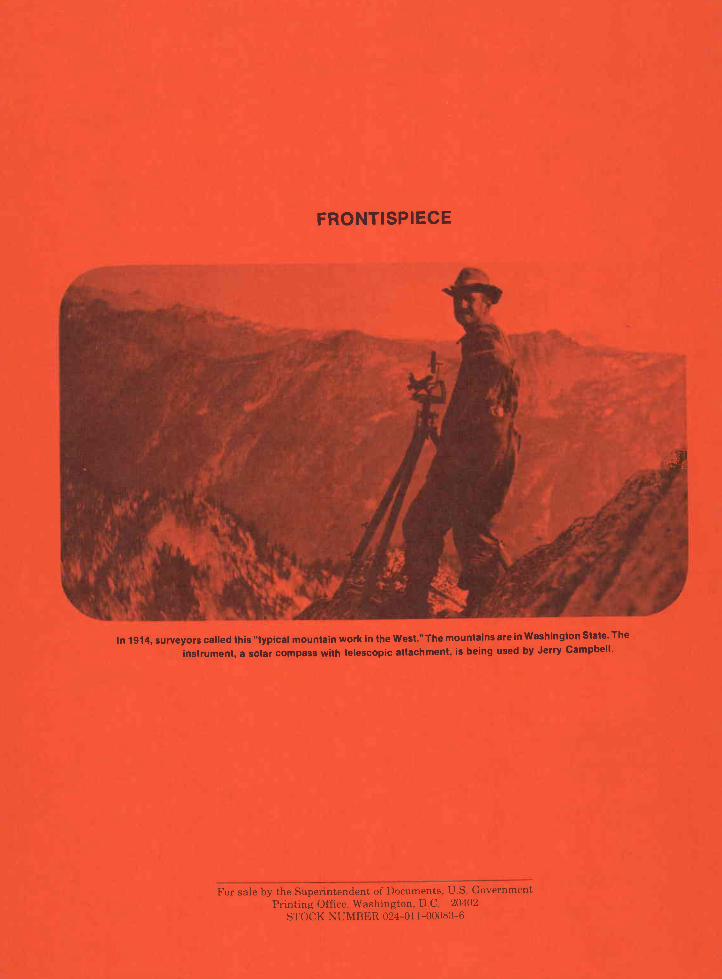
FRONTISPIECE
In 1914, surveyors called this "typical mountain work in the West." The mountains arein Washington State. The
instrument, a solar compass with telescopic attachment, is being used by Jerry Campbell.

SURVEYS AND SURVEYORS
OF THE PUBLIC DOMAIN
1785-1975
by
Lola Cazier
DEDICATION
Over the years since 1785 there have been perhaps a few thousand public land
surveyorseach one worthy of his own story. The names of many of them appear in these
pages. Yet, the story of all those who are not mentioned is here too, for it took all of them
the many unnamed no less than those written aboutto mark the lines and corners of the
public lands. They are the people who have done, and are still doing, the work upon which
rests the title to the public lands.

CONTENTS
Foreword
AcknowledgmentsPage
Ancient Surveys 1
Colonial America 5
The Beginning of the Rectangular Surveys 13
The Ellicotts and Benjamin Banneker 21
The Proving Ground 25
Congressional Authority for Management of the Public Lands 35
The Refinement of the Rectangular Survey System 47
Pioneer Surveyors 53
The Far West 65
In the Vanguard 87
The Direct System 97
About Cadastral Surveys 107
Alaska 145
The Early Years of the Direct System 153
Modernization of the System 195
News, Notes, and Anecdotes 205
The Bureau of Land Management 213
References 219
Index 223

FOREWORD
Cadastral surveys are performed to create, mark, and define, or to retrace theboundaries between abutting land owners, and, more particularly, between land of the
Federal Government and private owners or local governments. As referred to here,cadastral surveys were performed only by the General Land Office during its existence and
by the Bureau of Land Management. The Bureau of Land Management is the only agency
that is currently authorized to determine the boundaries of the public lands of the UnitedStates.
Proper understanding of the basis for performance of cadastral surveys includes an
understanding of the history of the public land surveys. An understanding of that history
requires some consideration of the people who performed these surveys and of the people
whose land was affected by them.
These chapters were written to be used as an aid in training cadastral surveyors in the
application of surveying principles. The learner is expected to gain from the factual material
on survey laws and their formation, as well as from a study of the people who performed the
surveys. Many of the men who had an important role in the history of cadastral surveying are
still living, but only those who have retired are included in the present document.

ACKNOWLEDGMENTS
The assistance of many persons was necessary to the completion of this book. It would
be impossible to thank them all, but I would like to express my gratitude to at least a few of
those who generously helped me in this project.
Without James A. Simpson, leader of the Cadastral Survey Training Staff, BLM, it would
not have been started, much less finished. Thomas A. Tiliman, civil engineer, BLM (retired),
contributed valuable assistance, criticism, and suggestions. Renee Munoz improved the
manuscript by her thoughtful and constructive editing. Line drawings and illustrationswere done by Kasper Schaff, Herman E. Weiss, Diane Colcord, and Sharon Foster. F.
Mason, Teledyne Gurley, Troy, N.Y., loaned me a photograph of Arthur D. Kidder and
Joseph Thoma. W. R. (Roy) Bandy, now deceased, permitted me to use many photographs
taken during his long career as a cadastral surveyor. Theodore VanderMeer, John S.Knowles, and Roger Wilson, now deceased, all long-time cadastral engineers, also shared
their personal photographs and reminiscences with me as did C. Albert White, supervisory
land surveyor, BLM (retired), and P. T. Reilly, who worked on various cadastral survey crews
during the 1930's. David Nelson, cadastral surveyor, Alaska State Office, BLM,and Hobart
Hyatt, cadastral surveyor, Alaska State Office, BLM (retired), also permitted me to usetheir
personal photographs. Clark Gumm, chief, Division of Cadastral Surveys, BLM (retired),
permitted me to use photographs taken by many surveyors in many places that he had
gathered and preserved over a period of years. Last, and most important, special thanks to
my husband, Dell Cazier, who kept me "on line."

When the first individual felt the desire topossess land, the need for the work of a cadastralsurveyorto define boundaries and propertylinesbecame inevitable. This occurrence is lostin antiquity, as is the moment man first perceivedthe principle of the wheel, but it is also noteworthy.
Before there was recorded history, cave dwellersclaimed their homes and hunting grounds by rightof occupancy and/or weapon (the club). Disputesover boundaries have always, along with religion,politics, and taxes, awakened people's hiddenpassions. Thus, to the surveyor must go the creditfor the lessening of disagreements over propertylines.
Surveying itself has no "point of beginning." Weknow that an ancient Assyrian clay tablet exists. Itwas found at Nuzi, near Kirkuk, and dates from thedynasty of Sargon of Akkad, well over 5,000 yearsago. Scratched into its surface is a map that showsa surveyed part of what is now Iran (northernMesopotamia) 32
NILE VALLEY
Under the Pharaohs, the Egyptians devisedextremely precise methods of measurement. TheGreat Pyramid of Giza (Khufu or Cheops) is themost famous example. Its base is oriented in thecardinal directions. The four sides (9,068.8 inches)have an average of just one-sixteenth of an inch inlength and 12 seconds in angle from a perfectsquare. It was constructed about 4700 B.C.114 Norecord exists today of the methods the Egyptiansused, nor of their equipment; we do know,however, that they were concerned with the surveyof land lines for purposes of taxation. The land inthe Nile Valley had to be surveyed repeatedlybecause of the river's annual flooding.
Three or four thousand years ago, theBabylonians took surveying seriously. There are inexistence today a few of the boundary stones setduring that period. One of them has much carvingupon it, most of which has been translated. It refersto the size of the land, five gur of cornland,measured by the great cubit. The stone gives thedistrict, the province, and the location. The name ofthe surveyor is also noted, along with the fact that itwas an official survey and established the land asthe property of Gula-Eresh. The translation alsogives, at great length, numerous curses to befallanyone so foolish as to move the stone.117
Chapter 1
ANCIENT SURVEYS
BIBLICAL MEASUREMENT
Long before the reign of Caesar, the first fivebooks of the Old Testament were written. Thesefive books, the Pentateuch, at one time consisted offour major documents that were combined into asingle literary unit about 400 B.C.31 Many timeswithin the Pentateuch and in the rest of the Bible,references are made to land survey:
And as for the western border, ye shall evenhave the great sea for a border; this shall be yourwest border.
Numbers 34: 6
And the border shall go down to Jordan, and thegoings out of it shall be at the salt sea: this shallbe your land with the coasts thereof roundabout.
Numbers 34: 12
Then said I, Whither goest thou? And he saidunto me, To measure Jerusalem, to see what isthe breadth thereof, and what is the lengththereof.
Zechariah 2: 2
And the city lieth foursquare, and the length isas large as the breadth: and he measured thecity with the reed, twelve thousand furlongs.The length and the breadth and the height of itare equal.
Revelation 21: 16
And he measured the wall thereof, an hundredand forty and four cubits, according to themeasure of a man, that is, of the angel.
Revelation 21: 17
And there are more: I Samuel 14: 14 describeshalf an acre of land, Isaiah 5: 10 discusses the yieldfrom 10 acres of vineyard, and both Ezekiel 40: 5and 44: 13 described the long cubita cubit and ahand breadth.
Biblical units of measure were simple and ratherinexact. For the most part they consisted ofapproximates arrived at by the use of one's body.The cubit was the length of a man's arm from hiselbow to his extended finger tipabout 18 inches.A span was the reach of a man's outstretched hand,from fingertip to fingertip, or about9 inches. (Twospans equalled 1 cubit.) A palm was alifourfingers,or about 3 inches, and a finger was about three-fourths of an inch.

In Ezekiel 40: 5 and 43: 13, a long cubit ismentioned, comparing it to a cubit and a hand-breadth. Fathoms are mentioned in Acts 27: 28.This was the length of a man's outstretched arms,or about 6 feet.
The Bible contains many other references to theinstruments used by land surveyors in ancienttimes:
I lifted up mine eyes again, and looked, andbehold a man with a measuring line in his hand.
Zechariah 2: 1
When he prepared the heavens, I was there:when he set a compass upon the face of thedepth.
Proverbs 8: 27
Thus he showed me: and, behold, the Lordstood upon a wall made by a plumbline, with aplumbline in his hand.
And he brought me thither, and, behold, therewas a man, whose appearance was like theappearance of brass, with a line of flax in hishand, and measuring reed; and he stood in thegate:
Ezekiel 40: 3
He measured the east side with the measuringreed, five hundred reeds, with the measuringreed round about.
Ezekiel 42: 16
He measured the north side, five hundred reeds,with the measuring reed round about.
Ezekiel 42: 17
He measured the south side, five hundred reeds,with the measuring reed.
Ezekiel 42: 18
He turned about to the west side, and measuredfive hundred reeds with the measuring reed.
Ezekiel 42: 19
The reed was an instrument used in measuring,and, according to Ezekiel 40: 5, it was 6 cubitslong. In the first book of Samuel 14: 14, themeasurement of land was related to the area a teamof oxen could plow in a day. In some places, an acrewas the part of afield that could be seeded in barleyin a day. In Mesopotamia the meaning of acres, asused in Isaiah 5: 10, was about two-fifths of ourpresent acre.31
THE GROMA
A surveying instrument called a groma wasfound in the ruins of Pompeii. It was of the typeused by the Romans in dividing land to bedistributed to veterans. The groma had four arms,
2
set at 90 degrees to one another, with which thecorners of rectangular plots were established. TheRoman system of land subdivision was called agrocenturiatoland divided into hundreds.32 JuliusCaesar ruled Rome when agro centuriato wasintroduced. He died 44 years before the birth ofChrist, but the subdivision pattern created bydifferent land uses under this survey system is stillvisible from the air.33
ERATOSTHENES
About 500 years before the birth of Christ, theGreek philosopher and mathematician Pythagorassuggested that the Earth might be spherical ratherthan flat. Eratosthenes of Cyrene, who lived from276 until 196 B.C., believed Pythagoras wascorrect. Erathosthenes was a learned man whobecame the head of the Alexandrian Library. Hisintellectual curiosity was aroused when he dis-covered that, at the peak of the summer solstice,the sun illuminated a deep vertical well in Syene.At noon, on the longest day of the year,Eratosthenes measured the angle of the shadowcast by a vertical wall in Alexandria. It was equal toone-fiftieth of a circle. He thought that Alexandriaand Syene were on a direct north-south line, and heknew the accepted distance between the two cities.Based upon his observations, his theory was thatthe distance between the cities was equal to one-fiftieth of the circumference of the Earth.
Eratosthenes came very close. He used units oflength called stadia, and, because of compen-sating errors, arrived at a distance of 24,662 miles.Since the Earth is not a perfect sphere, and sinceSyene and Alexandria are not exactly the distanceapart that he used, nor are they on a perfect north-south line, he was a little off in his estimationtheprecise figure is 24,899 miles.32
This was the first attempt to find the cir-cumference of the Earth by measuring the arc of ameridian. It was quite a feat in the advancement ofsurveying. The only thing wrong was that peoplecould not believe that the Earth was that large. Untilthe close of the 15th century, geographers wouldnot accept the findings of Eratosthenes. Instead,they used the calculations of Poseidonius (130 to51 B.C.) and came up with a circumference of18,000 miles.32
During the Middle Ages, the church used the18,000-mile figure to help convince people thatJerusalem was the center of the world. The maps ofthat period are narrow in concept. They are oftencalled 'T in 0" maps, due to their stylized depictionof what the church wanted the world to look like.27

DOMESDAY BOOK
When William the Conqueror invaded England in1066, he changed the existing manorial land tenuresystem to the feudalism of France.118 Under thisnew system, the lords of the manors paid a fixedsum to the king.
About 20 years later, William ordered a survey ofthe lands of England so that there might be a moreaccurate assessment of the sum he was to receive.The survey was completed and its results werepublished as the "Domesday Book." It was, in fact,a cadastral surveya description of the land, withthe names of the owners and the extent, nature,and value of their holdings.12
3
Parc//elII
Sun Rays
Eratosthenes' application of basic geometry in determining thecircumference of the Earth.
THE INCAS
During the 11th to 14th centuries, whileEuropean Crusaders tried to free the Holy Landfrom the Muslims, the Incas in South America weresurveying land and constructing cities, pyramids,bridges, and an extensive system of roads.
Using methods unknown to us, they developedterraces on the hillsides for cultivation and builttremendous irrigation works. Though they had noiron or steel tools, there are canals they built thatcan still be traced for miles. At Cajamarca, a canalthat was cut in solid rock extended for more than amile. At one place they cut the canal in a zig-zagpattern; apparently, this was one of their methods

Facsimile of aT in 0 map showing the usual depiction of the world inthe Middle Ages. Jerusalem was shown at the center of the world,and the Asian location of Paradise gave us the phrase "to orient amap."
of controlling the flow of water. At Huandoval, theIncas built two canals that met and crossed, oneabove the other. There was once even a third canalbelow the other two.23
The ancient Inca fortress city of Machu Picchu,situated at 7,000 feet above sea level, near amountain top, was built of huge blocks of stone. Nocement was used in its construction, but the stoneswere so carefully fitted that some of the walls andstairs are still intact and are plainly visible in aerialphotographs.18
PORTUGUESE EXPLORATION
The real beginning of European exploration tookplace in the 15th century during the time of Prince
4
Henry the Navigator (A.D. 1394-1460). ThroughPrince Henry's farsighted effort, Portugal beganexploring the seas at least 50 years before the restof Europe.
One of the major factors in Portugal's expansionof travel to the unknown was the discovery of theAzores and the growth of the Portuguese settle-ment there. Christopher Columbus lived therewithhis wife's family, where his father-in-law taught himto use navigational and surveying instruments.Undoubtedly, it was in the Azores that Columbusfirst dreamed of sailing farther than man had sailedbefore.32

THE NEW WORLD
Shortly after Columbus' famous voyage, anItalian navigator in the service of England, JohnCabot (Giovanni Caboto), discovered the coast ofNorth America in 1497. Soon after, Juan Ponce deLeon explored Florida and claimed it for Spain. In1519 Hernando Cortez began to explore andconquer Mexico, also on behalf of Spain. One yearlater, Ferdinand Magellan sailed through the straitthat bears his name and thus confirmed the theorythat the world was round.
During the next 20 years or so, Lower Californiaand the Gulf of California were found and explored.Coronado explored a large area north of the RioGrande and claimed it for Spain. The GrandCanyon was discovered by Don Garcia Lopez deGardenas, and Hernando de Soto began to explorethe Mississippi River.
On the evening of November 16, 1532, the lastInca king of Peru, Atahualpa, was ambushed andtaken prisoner by Francisco Pizarro. The Inca armywas overwhelmed and scattered. In3or4hours thestrength of the most powerful empire in the NewWorld was broken. The riches of Peru went toSpain, and a civilizationrecognized asremarkable even by those who destroyed itwasended.23
At about this same time, a 21-year-old publishernamed Gemma Frisius issued the first edition of"Cosmographia," written by Peter Apian. Thesecond edition, published in 1533, detailed asurveying method Frisius claimed was completelynew. It was a way of surveying a large area withoutdirect measurement. The idea was that if all anglesand the length of one side were known, the lengthsof the other two sides of a triangle could bedetermined on paper.
TRIANGULATION
Although the ancient Greeks probablyoriginated the idea of triangulation, Frisius was thefirst to publish it. Some 80 years later, the formulawas finally put to actual use. In 1615, a Dutchmathematician named Willebrord Snell, a
professor at Leyden University, measured a baseline and used triangulation to determine the arc of ameridian.32
Most land surveyors in the early 17th century didnot have the training and background in
Chapter 2
COLONIAL AMERICA
mathematics that Snell had. It was to compensatefor the fact that the geometrical devices used intriangulation were beyond their grasp that theplane table became popular. Surveyors of that timealso possessed the compass, chain, astrolabe,telescope, and a forerunner of the theodolite.32
AMERICAN COLONIES
About 20 years after the first Spanish colony inAmerica was founded at St. Augustine, Florida, in1565, Sir Walter Raleigh asked the famousmathematician and surveyor Thomas Harriot toaccompany British naval commander Sir RichardGreynville to America. The voyage was successfuland Harriot surveyed parts of what was to becomethe State of Virginia.125
Jamestown, the first permanent English colonyin America, was founded by the Virginia Companyin 1607. About the time the Dutchman Snelldetermined a meridional arc by triangulation, theheadright system of land tenure was adopted inVirginia. Under this system, each person who paidhis own or someone else's transportation toAmerica from England was granted 50 acres ofland.1
In 1620 EIder William Brewster brought severalbooks to America with him on the Mayflower.Among them was a work on surveying. Althoughthere is no record of which book it was, AaronRathbone's "The Surveyor," which had beenpublished in London in 1616, was well thought of atthe time,125 and could possibly have been the bookBrewster brought to the New World.
New England settlers were granted tracts of 10 to100 acres by the general courts. The Englishofficials who made these "generous" grants could,on occasion, be even more lavish: they votedthemselves tracts of from 1,000 to 9,000 acres.1 Thesurveying of all these new tracts of land was vitallyimportant to the colonists.
COLONIAL SURVEYORS
Nathaniel Foote was one of the first Americancolonial surveyors. He surveyed in Massachusettsbut left there in 1634, going by way of theConnecticut River, to settle Wethersfield, Connec-ticut. Foote laid out the town common and homelots. Later, he established the Hartford-Wethersfield boundary line.


Benjan:in Baunaker'sPENNSYLVANIA, DELAWARE, MARY-
LAND, AND VIRGINIA
ALMANAC,FOR THE
YEAR of our LORD '795;Being the Third after Leap-Year.
0000000' 0040 0000 0000 CtO 0000 000 000C CCC.) 0O CC] 0000 00000000 0000 0000 0 Or) CCC.)
0000 aa 000 Cooc cow wco 'o C. q 4J Cno 0000 CC0 c: 0000 000) 4.* .a £0000000
PRINTED FOR-4 And Sold by JOHN FIS1IR, sWatoc;:cr.
BALTJMOR:
8
In 1715, John Chandler surveyed more than10,000 acres of land, "adjoining to the saidTownship of Hadley on the North, on Connecticott[sic] river Westerly and on Springfield Southerly.The Lines are run by the needle of my instrument,allowing no variationProtracted by a scale of 200perch to an inch......133
Fifteen years later, during the summer of 1730,Timothy Dwight completed the survey of a plot ofland containing 200 acres, "adjoining to the SouthSide of Chickabey River on both sides of
p
Portrait of Benjamin Bannaker on the cover of his 1795 almanac.
Chickabey brook by order of the Great and GeneralCourt or Assembly of the Province of theMassachusetts Bay Begun and Held at SalemAugust 28, 1729......133
During the colonial period, Augustine Herrmansurveyed and made maps of Maryland and Virginia,Andries Hudde surveyed and mapped NewAmsterdam, and Solomon Saffrey and NathanielWoodward ran the boundary between RhodeIsland and Massachusetts. Even though theinstruments they used were rough and crude by

9
subject of surveys and land lines was of greatimportance in the everyday life of the colonists.One of the people most admired in a colonialcommunity was the land surveyor, or theboundsgoer. Young boys often trailed along as
the surveyors ran their lines. Many of them learnedthe fundamentals of the skill as they walked beside
present standards, these men did a creditable jobof surveying, as did Daniel Leeds, surveyor generalof West Jersey Province (New Jersey), and QuakerSurveyor General Edward Penington of Penn-sylvania.125
In colonial times, many schoolmasters taughtevening classes so that those who could not attendschool during the day could receive an education.Surveying and navigation were said to be the mostpopular mathematical subjects taught. This mayhave been due to the fact that the bounds of a vastnew land were in the process of being marked. And,
A portrait of Andrew Ellicott
because the land grants were often unclear, the
the boundsgoer.6John Jenkins, Sr. (1728-85) and his son John,
Jr. (1751-1827) worked as a survey team. Inbetween fighting the Indians, they surveyed the

area in northeastern Pennsylvania known as theWyoming Valley.126 This rich anthracite region wasclaimed by both Pennsylvania and Connecticut.The Susquehanna Company was formed in 1753,in Connecticut, to develop and settle the valley.This settlement resulted in the Pennamite Wars.The military leader of the Connecticut settlers wasZebulon Butler. In 1778, during the AmericanRevolution, Loyalist Commander John Butler andsome Indian allies massacred the Connecticutsettlers. Perhaps this is why the land claim conflictwas finally decided in favor of Pennsylvania.
An engraved portrait of David Rittenhouse
10
Abraham Clark (1726-94) of New Jersey was asurveyor, but he is better remembered as a signerof the Declaration of Independence. Roger Sher-man (1721-93), also a signer, was a countysurveyor in Connecticut from 1745 to 1758. He wasthe only person who signed all four of thedocuments used in founding the United States ofAmerica: the Articles of Association (1774), theDeclaration of Independence (1776), the Articles ofConfederation (1781), and the Constitution(1787) 126

'I.
t - v
,_L' /Yl/d
c
Township 5, first range, Old Seven Ranges. Surveyed by Absalom Martin of New Jersey in 1786.
Joshua Fry, another colonial surveyor was bornin England and attended Oxford University. Inabout 1720, he emigrated to Virginia, and surveyedalong the Carolina border with the deputy surveyorof Virginia's Albemarle County, Peter Jefferson,Thomas Jefferson's father. (The Jeffersons includ-ed many men who were surveyors besides Peter.Peter's grandfather had also been a surveyor, andThomas Jefferson himself later became the sur-veyor of Albemarle County.32)
When Fry was professor of mathematics atWilliam and Mary College, he approved GeorgeWashington's registration as the surveyor of newly
11
created Culpepper County. George Washingtonwas just 17 years old when the registration wasapproved, but he was already an experiencedsurveyor. When only 16, he crossed the BlueMountains with veteran surveyor James Genn,surveying land for Lord Fairfax in 1747 and 1748.121
In the early 1750's, then-Colonel Joshua Fry ledthe Virginia militia against the French. He grew illwith fever and died in May 1754. LieutenantColonel George Washington was named hissuccessor. It was Washington's leadership duringthis campaign that made his name well known inthe Colonies.125

THE MASON-DIXON LINE
The Mason-Dixon Line became the boundaryrepresenting the division between the Blue and theGray armies during the Civil War. Because it is theeast-west line separating Maryland and Penn-sylvania, with a part extending south and east todivide Maryland and Delaware, it is unclear why itwas given this place in history, for all three Statesfought on the Union side.116
The Conflict
Its real place in history goes back much further.In the middle of the 17th century, the rich land ofthe peninsula between the Chesapeake andDelaware Bays was claimed by both the Calvertfamily of Maryland and the Government of theNetherlands. When the Dutch were compelled toleave, the dispute was carried on by William Penn.The charters of Penn and Lord Baltimore wereopen to interpretation because of the vagueness ofthe documents. This caused quarrels so bitter thatthe disagreement continued for decades.
The Decision
After years of dispute, a compromise decision byEngland's Court of Chancery awarded Marylandmost of the peninsula. Pennsylvania was to keepthe northeastern part, which later becameDelaware. The agreement was signed and the workof marking the boundaries was begun by localsurveyors in 1760.116
Although the entire episode lasted for more thana hundred years, Penn and Lord Baltimore weresuddenly anxious to settle it. When the work did notgo quickly enough to suit them, they decided tohire Charles Mason and Jeremiah Dixon to get onwith it.29
Mason and Dixon
Mason was 35 years old and held the post ofassistant astronomer at Greenwich Observatory inEngland. Dixon, an astronomer, mathematician,and surveyor, was 30.116 The two men reachedPhiladelphia in the middle of November 1763 andmet with the commissioners of Maryland andPennsylvania.29
In checking the work already completed, theyfound it accurate, so in January 1764, theyestablished their headquarters at the Harlan Farm.When the weather improved in the spring, the
12
surveyors went south from the Harlan Farm along ameridian. Distance measurements were taken asthey went along, by chain on level ground and bylevels on slopes. They set a post in a field on thefarm of Alexander Bryan and marked it "West ' It
marked the latitude 15 miles south of the southpoint of Philadelphia. That post was the referencepoint for the parallel of latitude separating Penn-sylvania from Maryland.29
The large survey party set heavy boundarymarkers at 5-mile intervals. These stones had thePenn coat of arms on one side and the Calvert coatof arms on the other. Smaller stones, marked 'P'on one side and "M" on the opposite side, were alsoset along the line.116 The West Line, as Mason andDixon called the parallel between Pennsylvaniaand Maryland, extended from Delaware to thesummit of the Allegheny Mountains by the timethat the winter of 1766-67 grew cold.29
There was only Indian country west of theAlleghenies. Thus, the following spring, thesurveyors had to wait until an escort could beobtained from the Indians of the Six Nations tosafely carry on their work. All that spring andsummer they continued the survey By the end ofSeptember, the West Line reached theMonongahela River.
Because the Shawnee and Delaware Indiansheld the land beyond the Monongahela, 26 ofMason and Dixon's men quit the day the surveyorscrossed the river. Nonetheless, the surveyors wenton until they had crossed a "war path" and reachedthe top of a great dividing ridge. The terminationpoint was noted in Mason's diary on October 18,1767: "See on top of very lofty ridge ... at 233miles 17 chains 48 links from the Post marked Westin Mr. Bryan's field, we set up a Post marked W onthe West side and heaped around it earth andstone......29 Mason and his quiet Quaker co-worker Dixon handed the completed boundarymap to the commissioners on January 29, 1768.
The Result
The survey project had lasted 4 years and wasthe largest surveying accomplishment in ColonialAmerica. The Mason-Dixon Line is probably thebest known boundary in this country, even if for thewrong reason. The survey cost just $75,000 andwas amazingly accurate. An elaborate resurveyjust a few years ago showed a difference in latitudeof only 2.3 seconds.116

THE TRANSITION
Some of the early American surveyors do notreally fit into either the colonial period or the periodfollowing the Revolutionary War. The Ritten housebrothers, for example, were surveyors during bothtimes.
The Rittenhouse Brothers
To David arid Benjamin Rittenhouse must go alarge share of the credit for elevating the colonialart of surveying to the far more scientific art itbecame as the United States emerged as a na-tion 126
David Rittenhouse was born at Paper Mill Run,near Germantown outside Philadelphia, in April1732.29 Pictures of him, such as the portrait byCharles Willson Peale, show him as an adult withlong hair, a thoughtful face, deep-set eyes, andwearing the garb of an 18th-century Philadelphiagentleman. In his earlier years, however, he was anobscure young country Quaker. He grew up on hisfather's farm and became a farmer himself. Later,he made clocks and surveying instruments that heused in his jobs as a local surveyor. DavidRittenhouse taught himself how to do these usefulthings; he had always been a brilliant and curious-minded person who, in spite of the limitedschooling available to Pennsylvania farm boys ofhis time, mastered astronomy, mathematics, andNewton's "Principia." Rittenhouse was thedesigner and maker of the first magnetic declina-tion arc for a surveyor's compass, and he was thefirst American to put a spider web, for cross hairs,atthefocus of a telescope. He calculated the transitof Venus in 1769 and observed it with instrumentshe had designed and built. When his observationswere reported, David Rittenhouse became aninternationally famous astronomer. Soon he mov-ed to Philadelphia.
His first surveying job of any note was aboundary survey for William Penn. He laid out the12-mile radius around Newcastle, Delaware, whichformed the part of the boundary that Mason andDixon found so accurate that they incorporated itinto their own survey.29 This work was done withinstruments Rittenhouse had made for himself,several years before he achieved a reputation.6Over a period of years, David Rittenhouse surveyed
Chapter 3
THE BEGINNING OFTHE RECTANGULAR SURVEYS
13
boundaries for more than half of the ThirteenOriginal States. His younger brother Benjamin wasalso a surveyora very fine one. Both David andBenjamin were known for making the finest ofsurveying instruments.126
In 1796, by order of Congress, BenjaminRittenhouse made a surveyor's chain. Afterward,this chain was used as the standard of the UnitedStates Land Office.29 The respect accorded theRittenhouse brothers was evidenced by the 1815"Instructions for Deputy Surveyors," issued bySurveyor General Edward Tiff in. These instruc-tions required both "a good compass ofRittenhouse construction," and the adjustment "bythe standard chain," of "a two pole chain of 50links." Several of the surveying instruments madeby the Rittenhouse brothers today are part ofvaluable museum collections. Among them are twosurveyor's compasses made for GeorgeWashington.
In 1792, Washington appointed DavidRittenhouse as first director of the Mint. AlthoughDavid Rittenhouse died in 1796, streets, a citysquare, a social club, parks, a school, and ascientific body all bear his name, and the clocksmade by him probably are still keeping accuratetime.
Andrew Porter
Andrew Porter, a soldier in the RevolutionaryArmy, was also a surveyor noted for his precise andexcellent work. Both he and David Rittenhouseserved as commissioners on the survey of theVirginia-Pennsylvania boundary in 1784-85. In1800, Andrew Porter was sent to do the survey tosettle the Wyoming Valley conflict. He became thesurveyor general of Pennsylvania 9 years later.126
Robert Erskine
Robert Erskine was born in Scotland andeducated there as a surveyor and engineer. Helived in England until about 1771. Then Erskine wasmade manager of the holdings of the AmericanIron Company in the northern part of New Jersey.He was about 36 years old when he arrived inAmerica.
A few years later when the 13 Colonies declaredtheir independence from England, Erskine not only
remained in America, he joined the militia. WhenGeorge Washington heard about Erskine's survey-ing background, he asked him to serve asgeographer of the Continental Army. Erskineaccepted the job, subsequently surveying andmaking topographic maps of the Hudson-Highlands region. These maps were used in thesuccessful American campaign to keep NewEngland from being cut off from the other Coloniesand to defend the area and keep the Americans incontrol. Unfortunately, Robert Erskine did not liveto see the new republic established that he hadhelped to bring into being.
Simeon De Witt
In 1778 General James Clinton recommendedhis nephew, Simeon De Witt, to GeorgeWashington because of the young man's excep-tional ability as a surveyor and cartographer. DeWitt soon became the assistant to Washington'schief geographer, Colonel Robert Erskine, whomhe succeeded in 1780. De Witt was attached toWashington's headquarters and served in thecampaigns that led to the surrender of Cornwallisat Yorktown in 1781.
In May 1784, De Witt was named surveyorgeneral of New Yorka position he held for thefollowing 50 years.
LAND BOUNTIES
About 1 month after the Declaration of In-dependence was signed, the Continental Congressoffered deserters from the British Army, includingthe Hessian mercenaries, American citizenshipand 50 acres of public land. A little over a monthafter that, an act was passed that promised landbounties for naval and military services during theRevolutionary War. Though there was no "PublicDomain" and the very existence of the UnitedStates was still at issue when the bounties wereoffered, land warrants were later issued toveterans. More than 2.5 million acres of public landin the old Northwest Territory (Ohio) was reservedas a "military district."1
STATE LAND CLAIMS
The Thirteen Original States, including land thatis now the States of Maine, Vermont, Tennessee,West Virginia, and Kentucky, were never a part ofthe Public Domain of the United States. Kentuckyand Tennessee were formed out of territory onceclaimed by Virginia and North Carolina, respec-
14
tively. Maine was part of Massachusetts until 1820,and Vermont was the subject of conflicting claimsof its neighboring States until it became a State in1791.34 West Virginia was separated from Virginiaand became a State in 1863, by act of Congress. Allof these States kept title to the unappropriated,vacant lands inside their borders.34
Even before the preliminary peace treaty wassigned at the close of the Revolutionary War, theCongress was faced with debts, expenses, conflic-ting colonial claims to western lands, no money,and the duty of providing a financial policy and aplan for settlement. All of these matters had to beresolved if this new country was to survive.
Seven of the Colonies claimed jurisdiction overportions of the vast, unoccupied, somewhatnebulous area called "the western lands." No onewas able to state, with any conviction, just wherethe colonial boundaries lay. The six Colonies thathad no charter claim to this land felt that, as it hadbeen won by common effort, it should be held incommon. The new National Government, lookingupon the lands as revenue-producing assets,agreed.
STATE CESSIONS
New York unconditionally ceded all of herwestern land claimsto Congress in 1780. Followingthis, Virginia and Connecticut gave up control overOhio, but Congress permitted them to retain title tocertain areas. Massachusetts preceded Connec-ticut in giving up her claim. South Carolinarelinquished her claims in 1787, North Carolina in1790. Georgia held out the longest. In reading theconditions of her cession,19 it is apparent that herinability to cope with the Indians and settle the landwithout the aid of the Federal Government waslargely responsible for Georgia finally grantingdeed of cession in 1802.
The most complicated of the State claims wasdisposed of with Virginia's cession. This put thenew Government in the awkward position of beingmuch too poor to maintain a capital, but in chargeof a vast Public Domain. Congress had agreed thatthe land should be disposed of for the commonbenefit of the United States.9 Benefit could bederived in either of two ways: (1) the landasmuch of it as possiblecould be sold for thehighest possible price; or (2) it could be surveyed,and pioneers could be encouraged to buy andsettle the land, making it possible to hold it againstforeign claims and Indians.
JEFFERSON'S REPORT
This was the situation in the spring of 1784, whenthe Continental Congress appointed a committeeto develop a plan for locating and selling thewestern lands. Thomas Jefferson was the chair-man of the committee, and the report delivered toCongress that year is in his handwriting.28
Nearly a year went by before anything more wasdone. Jefferson's report was read and reread.Another committee was appointed, this time with amember from each State. Jefferson had gone toEurope, so William Grayson took his place as therepresentative from Virginia. This committeeamended the first report; notably, township sizewas reduced from 10 miles square to 7 milessquare.9
Congress, at that point, did some amending of itsown. It reduced township size to 6 miles square.The portion of Jefferson's report calling for surveysbefore sales, and for the lines of these surveys to berun and marked due north and south with otherlines crossing these at right angles, was retained.
1785 LAND ORDINANCE
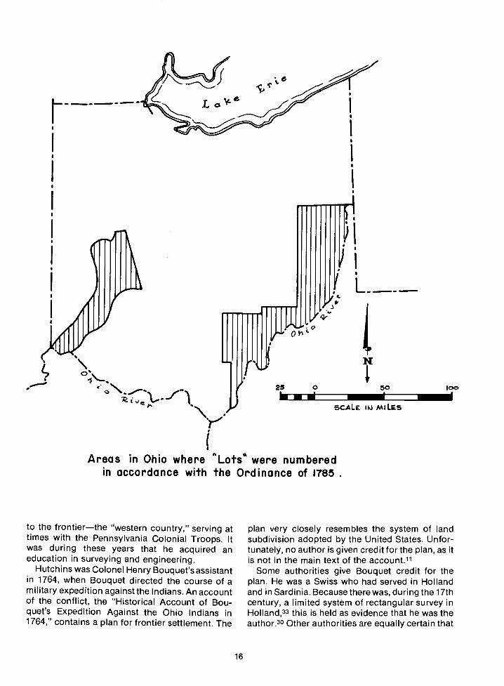
The first land ordinance, the 1785 Land Or-dinance, which was approved by the ContinentalCongress on May 20, incorporated theseprovisions. It also included the remarkable provi-sion that, in each township, section 16 would besetaside for the maintenance of public schools. Underthe terms of this ordinance, the plats of thetownships were to be subdivided into lots 1 milesquare "in the same direction as the external lines,and numbered from 1 to 36; always beginning thesucceeding range of lots with the number next tothat with which the preceding one con-cluded......
In the surveys executed under the 1785 LandOrdinance, and in some other areas in Ohio,sections are numbered from ito 36, with section 1in the southeast corner of each township. In theseareas, the numbers run from south to north in eachrange of sections. In 1796, the system of number-ing sections was changed to the system now used,with section number 1 in the northeast corner ofthe township.
The Canadian system of land subdivision is insome ways patterned upon that of the UnitedStates, but section number 1 is in the southeastcorner of their townships.11 Both American andCanadian section numbers run in opposite direc-
15
The chain is the unit of linear measurement for thesurvey of the public lands as prescribed by law. Allreturns of measurement in the rectangular system aremade in the true horizontal distance in links, chains,and miles. The only exceptions to this rule are specialrequirements for measurement in feet in mineralsurveys and townsite surveys.
Linear Measurement
1 Chain = 100 links or 66 feet
1 Mile = 80 chains or 5,280 feet
Area Measurement
1 Acre = 10 square chains or43,560 square feet
1 Square Mile = 640 acres
tions in alternate lines. The Greeks have a word-boustrophedoflicfor this style of writing. Itsliteral translation is "turning like oxen in plowing."
THE GEOGRAPHER
Under the terms of the 1785 Land Ordinance,Congress was to appoint surveyors, one from each
State, to serve under the direction of thegeographer of the United States. The geographerwas empowered to give oaths to the surveyorsappointed to serve under his instructions. Theywere to swear to do their duty faithfully. Thechainmen on the survey crews took a similaroath.
Under the 1785 Ordinance the surveyors wereinstructed to measure their lines with a chain, markthem "with chaps on the trees," describe themexactly upon a plat upon which they were to note"at their proper distances, all mines, salt springs,salt licks, mill seats, that shall come to hisknowledge; and all water courses, mountains, andother remarkable and permanent things over ornear which lines shall pass, and also the quality ofthe land."
Thomas Hutchins, named as geographer of theUnited States in July 1781, was chosen to direct thesurveys under the Land Ordinance of 1785.Hutchins was born in Monmouth County, NewJersey. When he was little more than a boy, he went
y(
Areas in Ohio where Lots were numberedin accordance with the Ordinance of 1785
to the frontierthe "western country," serving attimes with the Pennsylvania Colonial Troops. Itwas during these years that he acquired aneducation in surveying and engineering.
Hutchins was Colonei Henry Bouquet's assistantin 1764, when Bouquet directed the course of amilitary expedition against the Indians. An accountof the conflict, the "Historical Account of Bou-quet's Expedition Against the Ohio Indians in1764," contains a plan for frontier settlement. The
16
25
I
L
plan very closely resembles the system of landsubdivision adopted by the United States. Unfor-tunately, no author is given credit for the plan, as itis not in the main text of the account.11
Some authorities give Bouquet credit for theplan. He was a Swiss who had served in Hollandand in Sardinia. Because there was, during the 17thcentury, a limited system of rectangular survey inHolland,33 this is held as evidence that he was theauthor.3° Other authorities are equally certain that
0 50 100
SCALE 1t4 MILES

THE RECTANGULAR SURVEY SYSTEM
The U.S. rectangular system of surveys isa marvel of simplicity. Because of the system and the cadastral surveyors whotransferred it from a plan on paper to regular lines upon the land, the swift and orderly settlement of a vast public domainbecame a reality.
Separate large pieces of the Public Domain are, in themselves, huge survey areas. There are 31 principal meridiansand
base lines In the contiguous United States and 5 in Alaska. At the intersection of these two lines Is the initial point of eachof the survey areas. Some of the principal meridians are numbered and the rest have proper names. The numbered onesgo only to the Sixth Principal Meridan. Most of the other (named) meridians give a clue as to the area they govern: for
example, the Boise Meridian, the New Mexico Principal Meridian, and the Humboldt Meridian. Townships are numberednorth or south of the base line. A line or column of townships Is called a range, and they are numbered east or west of the
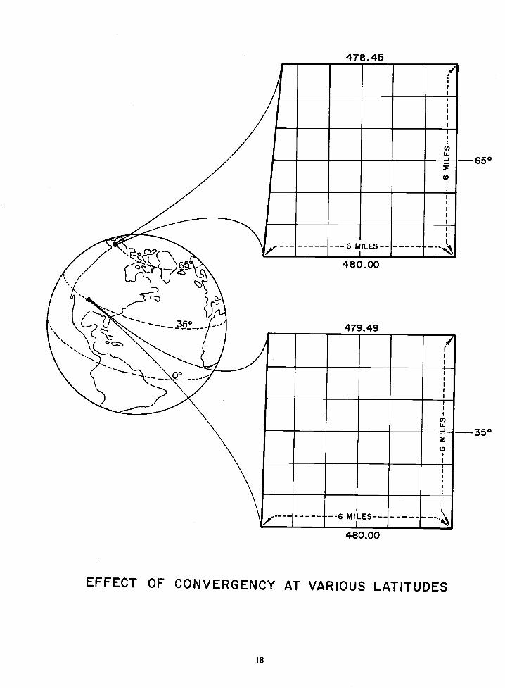
principal meridian.At the beginning of the use of the rectangular system, no provision was made for the convergence of meridians or the
iimitation of accumulated error. At a later time standard parallels and guide meridians were included in the plan. Between
the standard parallels the excess or deficiency of measurement caused by convergency and accumulated error in each
township is placed in the sections lyIng against the north and west township boundaries. Each of the other sections
theoreticaiiy contains 640 acres.Each 6-mile-square township Is divided into 1-mile-square sections numbered from ito 36. The section numbers run in
opposite directions In alternate lines, beginning with section number 1 In the northeast corner of the township. Thesenumbered sections may be further divided into aliquot parts, and thus described and identlf led. The southeast quarter ofthe southeast quarter of the southeast quarter of sectIon 5, Township 2 North, Range 3 West, of the Boise Meridian,describes just one parcel of land. The description even tells the initiated how many acres are being described. The familiarBLM abbreviation for this particular 10 acres is SE¼SE¼SE1/4 sec. 5, T. 2 N., R. 3 W., Boise Mer., Idaho.
Land, and the hope of sharing in its ownership, provided an attraction strong enough to bring millions of people to thiscountry. The straightforward system of cadastral surveying and land identification added to the attraction. By its adoptionthe United States, for the most part, avoided the disputes, litigation, and bloodshed inherent in a metes and boundssystem.
17
T.2tJR.3E.
5TAJDAD SIIIP CORMERS
FIRST STA3DARD
4W R3t.! RZW RIW R3E
U.I2TIAL
UT39
P4 24
FIRST
MILES
STANDARD PARALLELT45
So..TH
+TL _L+_I_-I-S--------------_Lr.L_ ..L.t_L I-
- ni 1 fl -'H- I I I I4-IS---------------- 24--, I I
-I I I I
4-80- - -26- -27- -26- -25--il I
I I
I I4-31-----------
I35-
I
-
lM0..
li/a NE Y4MO c.
5V2 hJEYA80
8wJlNWE.SEI
NW4SWJ NEi'.SWY. I42Y.s2'/.5jNWl4SEJ440oe 4O. 40.
20..WYa EVa M',Y* 061'.
SWY.5WY. SEi4SWY. 80'. 9Il4 95W. 651'.sal'. $64
4O.. SE4SEY.SEtt20o. 2Oo 56W. 5611.
3 21
5'/a JW '/4 5 l/ 14 E /48Oc.
2
SW Y4 SE /4
18
478.45
480.00
479.49
480.00
EFFECT OF CONVERGENCY AT VARIOUS LATITUDES
650
350
(I
(I)
----6 MILES--- ---
/
U,w-J
(0
----- -6 MILES -----------

Thomas Hutchins was the originator of the plan.11They cite the fact that he was in the habit of keepingrecords of his travels and his work, and that he hadbeen employed to lay out plans for a number ofmilitary posts. Military establishments had longbeen laid out in a rectangular manner.
Hutchins served as a British officer at Fort Pitt.He made exploratory journeys from there north toLake Erie and overland to Lake Michigan and theupper Wabash Valley. His expeditions also tookhim down the Ohio River and to the Mississippi.Hutchins compiled a general map of the West as aresult of these travels, which established him as aauthority on the area.
By the time the Revolutionary War was declared,Hutchins had attained the rank of captain of the60th Foot or Royal American Regiment of theBritish Army. He was in London atthe beginning ofthe war, and the British, quite naturally, planned toput his experience to their use. After all, he was theBritish Army's leading expert on the Americanfrontier.
The British, however, had forgotten one veryimportant fact: Hutchins was an American.Because he refused to fight against otherAmericans, he was imprisoned in August 1779.When he was released in February 1780, Hutchinscontacted Benjamin Franklin, who was in France atthe time. Through Franklin, arrangements weremade for Hutchins to travel to South Carolinawhere he joined the American forces underNathanael Greene. In May 1781, Congress ap-pointed him geographer of the southern army andthe following July he was given the title ofgeographer of the United States.
Two years later, Hutchins was commissioned bythe State of Pennsylvania to extend the survey fromthe western end of the Mason-Dixon Line to thepoint that was to be the southwest corner of theState, and from there to survey the west boundaryof Pennsylvania north to the Ohio River. The linewas to be the boundary between PennsylvaniaandVirginia, so Virginia also appointed surveyorsAndrew Ellicott and Joseph Neville.82 There were,in fact, three men from each State on this particular
19
survey. The two others from Pennsylvania wereDavid Rittenhouse and Andrew Porter.13°
Point of Beginning
The survey marking the southern boundary ofPennsylvania was completed in 1784. Before thesurvey of the western boundary began the follow-ing year, Hutchins was told his services asgeographer would be needed. Thus, the 1785 LandOrdinance was passed. It called for the survey ofthe public lands to begin". . . on the River Ohio ata point that should be found to be due north fromthe western terminus of a line which has been runas the southern boundary of the State of Penn-sylvania."
Four boundary surveyorsDavid Rittenhouseand Andrew Porter, who had been commissionedby Pennsylvania, and Andrew Ellicott and JosephNeville, who surveyed for Virginiaestablishedthis point on August 20, 1785.26 Following theirarrival on the south bank of the Ohio, near themouth of Mill Creek, Andrew Porter noted theevent:130
This morning continued the Vista over the hill onthe south side of the River and set a stake on it bythe signals, about two miles in front of theInstrument, brought the Instrument forward andfixed it on a high post, opened the Vista down tothe River, and set a stake on the flat, the northside of the River.
The Geographer's Line
Hutchins, as geographer of the United States,was to "personally attend to the running of" a linewestward from the newly established "point ofbeginning." This line extends the width of theSeven Ranges-42 milesand is known as theGeographer's Line. Later surveys show it to beabout 1,500 feet south of its intended position atthe western end.13° Even so, it was the first linesurveyed under the rectangular system of theUnited States. It was the start of the mostmagnificent cadastral survey project in history.

THE CAPITAL
On the last day of April 1789, GeorgeWashington became President of the United Statesunder the new constitution. This was just 2 daysafter the death of Thomas Hutchins, the manresponsible for the survey that had undoubtedlybeen the most significant project under theConfederation. Now, however, there was anotherproject to think about. This Nation was, at last, to
have a Constitutional Capitalthe City of
Washington.Jefferson and Hamilton made a political agree-
ment to move the capital to Philadelphia from NewYork in 1790, where it was to remain for 10 years.Following that, the capital was to be situated in the10-mile-square tract of Federal land near the placewhere the Anacostia River joins the Potomac River.
THE ELLICOTTS
In February 1791, Secretary of State Jefferson, atPresident Washington's suggestion, asked AndrewEllicott to go "by the first stage to the FederalTerritory on the Potomac for the purpose ofmaking a survey of it."124 It is not surprising thatAndrew Ellicott was the surveyor designated to dothis important work. At the time he was perhaps the
most highly regarded surveyor in the UnitedStates. Moreover, he and his brothers had lived notfar from the chosen site for almost 20 years. in1770, Ellicott's father and two uncles had settled on
the Patapsco River, some 10 miles east ofBaltimore, and had built Ellicott's Mills. The townthat grew up around that mill is today calledEllicott City.
Andrew was only 16 years old, Joseph, Jr., was10, and Benjamin just 5 when they left BucksCounty, Pennsylvania, where they were born.These Quaker boys were exceptionally good atmathematics, and all three of them becamesurveyors. They knew and admired the Ritten-house brothers, and Andrew had studied under ahighly respected Irish mathematics professor,Robert Patterson, in Pennsylvania.127 In spite of aboyhood filled with gentle Quaker teaching, tall,large-framed Andrew joined the Elk Ridge Bat-
talion of the militia and fought with it through theRevolutionary War. He attained the rank of major, atitle by which he was recognized the rest of his life.
Chapter 4
THE ELLICOTTS AND BENJAMIN BANNEKER
Soon after the war, he was appointed by Virginia
as a member of the survey to continue the
westward Mason-Dixon Line, survey of which had
been stopped by unfriendly Indians in 1767. In the
following years he surveyed other boundary lines,6
including the meridian northward from the pointof beginning on the north bank of the Ohio River.
This Ohio-Pennsylvania boundary is calledEllicott's Line.30 The line along the 31st parallel,which will be discussed later, is called Ellicott'SLine of Demarcation.
As Major Ellicott worked on the survey of the
Federal Territory, Jefferson contacted the
tempestuous, fiery-tempered Frenchman and
American Revolutionary War veteran, Pierre
Charles L'Enfant, ". . . to have drawings of theparticular grounds most likely to be approved for
the site of the Federal Town and
buildings . . . connecting the whole with certainfixed points on the map Mr. Eliicott is preparing."124
BENJAMIN BANNEKER
Benjamin Banneker, a brilliant surveyor-
astronomer, was also hired to work on thepreliminary survey of the capital site. Banneker, ablack man, was a friend of the Ellicott brothers and
their cousin, George Ellicott. His mother Mary wasthe oldest daughter of a white indentured servantnamed Molly Welsh and a Negro slave namedBanneker (or Bannaker) whom she purchased,freed, and married. Ban neker's father Robert wasfrom Guinea, and he, too, had been a slave.5Benjamin Banneker was born free, because the law
said he was to follow the status of his mulattomother instead of that of his freedman father.Perhaps this law is the reason that Robert hadtaken Mary's name when they were married.
Even when Benjamin Banneker was very young,people were impressed by his many interests and
by the speed and ease with which he learned. Forexample, he was able to read by the time he was 4
years old.22 When Banneker was 6, probably in thelate 1730's, his father bought a large farm about 10
miles from Baltimore, Maryland. Banneker attend-
ed the school of a Quaker farmer, along with theother young people in the area. He soon surpassed
the other students in mathematics, and amazedthose who knew him with his unusual gifts. A trader
gave him a watch, and from drawings made from it,
21

Banneker actually constructed a clock. Its frameand movements were made entirely of wood. It wasthe first instrument of its type ever made inAmerica.22 Even though his clock was the wonderof the community, Banneker remained a farmeruntil he was well past 50 years old.5
When the Ellicotts moved to Maryland, Ban nekerhelped in the construction of their mills. Thewonderful wooden clock came to their attention,and they were pleased to help Banneker acquirethe knowledge for which he hungered. TheEllicotts loaned him books, tools, and in-struments.6 More than that, they gave him theirfriendship. All of them, but George perhaps most ofall, encouraged Banneker to pursue his studies.
Banneker learned surveying and developed adedicated interest in astronomy. He spent manynights studying the stars and their courses, and hebecame adept with his borrowed instruments. Helearned to calculate ephemerides and finishedcomputing data for his first almanac in the spring of1790. Banneker, then nearly 60 years old, wasdisappointed because it was not published im-mediately. Due to the Ellicotts' interest, thealmanac came to the attention of the PennsylvaniaSociety for the Abolition of Slavery, and, eventuallythis led to its publication.5
According to an account by Silvio A. Bedini in"Early American Scientific Instruments and TheirMakers,"6 Benjamin Banneker, while assistingEllicott in surveying the City of Washington,"completed his almanac and gave it to GeorgeEllicott, Andrew's cousin, as a subject of possibleinterest. Apparently George Ellicott turned it overto the Honorable James McHenry of Baltimore,who in turned [sic] submitted it to the firm ofGoddard & Angell, who published it......
According to another account, also by Silvio A.Bedini, titled "Benjamin Banneker and the Surveyof the District of Columbia, 1791,"5 after Bannekercompleted his work as scientific assistant to MajorEllicott during the preliminary survey of theFederal Territory, he returned home. Hethensettowork finishing his calculations for 1792. Bannekerhad begun collecting dataforthis almanac while hewas still working on the survey of the City ofWashington, but he finished it in Baltimore County.In June 1791, Elias Ellicott, George's brother, sentword to James Pemberton in Philadelphia thatBanneker's ephemeris was ready to be printed.
Banneker's place in history is firmly secured bythe fact that he made the observations andcalculations needed in the survey of the 10-milesquare in which our Nation's capital is situated.Adding to his stature is the fact that six of the
22
ephemerides calculated by this largely self-taughtblack farmer were published, over a period ofyears, in nearly 30 different editions.5
L'ENFANT'S PLAN
The L'Enfant-El-Iicott team made rapid headwayon the survey and plans for the capital. Joseph andBenjamin Ellicott joined their brother on theproject in late spring in 1791. Under L'Enfant,broad avenues took graceful shape, and the plansbegan to show a more and more beautiful city.When L'Enfant submitted his plans for approval byCongress, however, they were, mainly because ofhis demands, refused. L'Enfant then resigned andwould not allow the plans to be used at all.124
In March 1792, Andrew Ellicott was placed incharge of finishing the capital survey. He revisedand redrew L'Enfant's plan for the city. It wasaccepted by Congress, and the final minor pointsof the project were completed by Major Ellicott'sassistants.
In 1793, Pennsylvania commissioned AndrewEllicott, already gray-haired at the age of 39, tolocate a road and lay out the towns of Erie, Warren,and Franklin. It was a large and difficult task, butthe major finished it by the fall of 1796. At aboutthis time, Joseph Ellicott was working on surveysfor the Holland Land Company in the western partof New York. These surveys were of subsequentvalue when people started talking about buildingthe Erie Canal. Joseph also laid out a city he calledNew Amsterdam, which is now Buffalo, NewYork. 127
ELLICOTT'S LINE OF DEMARCATION
President George Washington personally ap-pointed Major Ellicott to work with the Spanishsurveyors in running and marking the boundaryline between the Mississippi Territory and SpanishFlorida, which was determined by the treaty datedOctober 27, 1 7956 The boundary was to be latitude31° N. A marker was set where the 31st parallel ofnorth latitude intersected the Mississippi River, inwhat is now Mobile County, Alabama.
Ellicott's Stone, as it is called, is sandstone andmeasures some 2 feet wide. It is about 8 inchesthick and stands 2 feet abovethe ground. "U.S. Lat.31, 1799" is cut deeply into its north side; the southside reads, "Domino de SM. Carlos IV, Lat. 31,1799."115 Even though the stone was placed as apart of a boundary survey, it was also the basis formany other surveys in the southern part ofAlabama. Some of the distance measurementswere, later, found long,77 but as shown by the U.S.

Coast and Geodetic Survey marker set in Ellicott'sStone at a later time, the survey was reasonablyaccurate. The U.S. Coast and Geodetic Surveyvalues on it read: Lat. 300 59' 51.463" and Long. 88°01' 21.076".115
OTHER BOUNDARY SURVEYS
The Georgia-North Carolina boundary was acontroversial one. The dispute over it was settled in1810, when Major Ellicott determined the 35thdegree of north latitude.29 Georgia had hired him todo the survey, and, using either Rittenhouseinstruments or those made by himself or his
23
brothers, he did his usual fine and accurate job,with the result that his survey added land to NorthCarolina. This was not at all the information thatGeorgia wanted, so, consequently, Ellicott wasnever paid for his work.127
Andrew Ellicott's last surveying project was thelong-disputed international boundary along the45th parallel. In 1817, he was asked to locate aportion of this U.S.-Canadian boundary in accor-dance with article 5 of the Treaty of Ghent. In orderto do so, he was granted leave from the UnitedStates Military Academy at West Point to whichPresident Madison had appointed him professor ofmathematics in 1815. Major Ellicott held thisprofessorial post until his death in 1820.6
LAND SUBDIVISION IN OHIO
Ohio has oftenand accuratelybeen calledthe proving ground of the rectangular system. Thepublic land surveys there were affected by severaldifferent factors, all of which make the relativelocation of Ohio townships difficult to determine.
First, there were two large tracts of land in Ohioto which the United States had no claimVirginia'sMilitary Reserve and Connecticut's WesternReserve and Firelands. These two tracts weresurveyed according to the laws of the States thatclaimed them. Two other sizeable tracts of Ohioland were sold to large companies of speculatorsshortly after the rectangular system was adopted.These tracts were surveyed by the companies thathad purchased them, sometimes according to theirown rules.
AN UNPERFECTED SYSTEM
Most important, the rectangular system itself hadnot yet been perfected. No basic framework existedso that the relative location of townships could beascertained with ease. No plan had been for-mulated for the eventual expansion of the surverys.Also, there was no provision for eliminating thebasic conflict brought about by the law, whichcalled for the surveys to be both rectangular andhave sides running in the cardinal directions. Thiswas, obviously, an impossible requirement on aplanet where meridians converge as they near thepoles. These basic imperfections in the LandOrdinance of 1785 were not resolved when theLand Act of 1796 was passed. In addition, whereasboth the Land Ordinance of 1785 and the Land Actof 1796 assumed that townships and ranges wouldbe numbered, neither of them provided a plan forthat numbering. For some unknown reason,however, the system of numbering sectionsadopted under the Ordinance of 1785 was changedby the Land Act of 1796.
SURVEYS WITH NO INITIAL POINTFOR TOWNSHIP IDENTIFICATION
The west boundary of Pennsylvania served asthe first reference meridian for the public landsurveys and the Ohio River as the base from whichtownships were numbered. A number of otherreference meridians and bases were also used in
Chapter 5
THE PROVING GROUND
25
Ohio to govern certain areas for the purpose of thedisposal of the land. As a result, there are eightpublic land surveysseven in Ohio and one inIndianathat have no initial point as an origin ofboth township and range numbers.137
THE OHIO RIVER SURVEY AREA
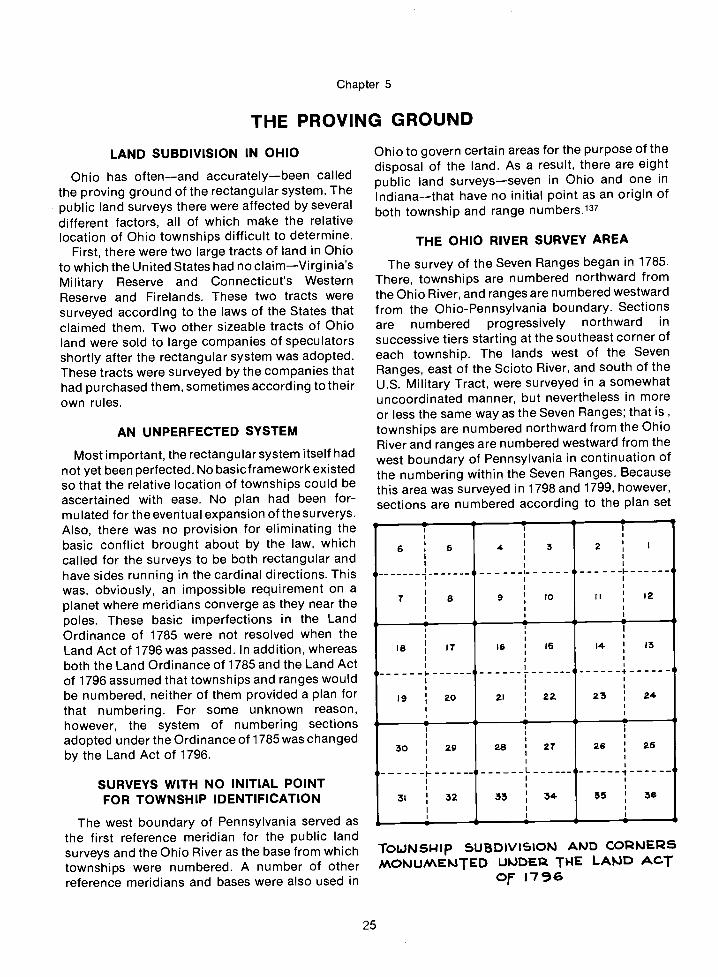
The survey of the Seven Ranges began in 1785.There, townships are numbered northward fromthe Ohio River, and ranges are numbered westwardfrom the Ohio-Pennsylvania boundary. Sectionsare numbered progressively northward insuccessive tiers starting at the southeast corner ofeach township. The lands west of the SevenRanges, east of the Scioto River, and south of theU.S. Military Tract, were surveyed in a somewhatuncoordinated manner, but nevertheless in moreor less the same way as the Seven Ranges; that is,townships are numbered northward from the OhioRiver and ranges are numbered westward from thewest boundary of Pennsylvania in continuation ofthe numbering within the Seven Ranges. Becausethis area was surveyed in 1798 and 1799, however,sections are numbered according to the plan set
TOLJNSI.1Ip 5UBD)VI5IOP'J AIJD COJPSMONUMEI'JTED UlJDE1 TWE LA,3D ACT
O 1736
S S S S S
6 5 4 3 2 I
S 5 0
7 8 9 (0 II I2
5 0ft 0 5
(8 (7 (6:
I- -S S +-
ao 21 22.
1
24
30 29 2.8 27 26 25
.. -. L __ 4
31 32 35 34. 55 56
- S S S S

Numbering of Sections
26
System used under
Ordinance of May 20, 1785
Act of May 18, 1796
System used in Canad&s
Dominion, or public, lands.
The dimensions of Canadian
townships usually differ from
those of the United States
due fo their provision for
roadways between or within
sections.
36 30 24 18 12 6
35 2923 17 II 5
34 28 22 16 10 4
33 27 21 15 9 3
32 26 20 14 8 2
31 25 19 13 7 I
6543217 8 9 10 II 12
18 17 16 15 14 13
19 20 21 22 23 2430 29 28 27 26 25
31 32 33 34 35 36
31 32 33 34 35 36
30 29 28 27 26 25
19 20 21 22 23 2418 17 16 15 14 13
7 8 9 10 II 12
654321

position for the State boundary as claimed byMichigan. When the State boundary was finallyestablished the public land surveys were closedupon that boundary. The lands originally surveyedunder the Michigan Meridian and situated south of
forth by the Land Act of 1796. The lands north ofthe Seven Ranges and the U.S. Military Tract andsouth of Connecticut's Western Reserve weresurveyed during 1799 in the same manner as thosewest of the Seven Ranges. All of this area, includingthe Seven Ranges, is called the Ohio River Surveyarea.
THE U.S. MILITARY SURVEY
Under the provisions of a Congressional actpassed on June 1, 1796, the United States MilitaryTract was surveyed into 5-mile-square townships.The ranges in this survey area are designated byprogressive numbers west from the west boundaryof the Seven Ranges. Townships are numberednorthward from the south boundary of the militarytract. According to the terms of the Act of March 1,1800, 50 quarter townships of land that stillremained unclaimed at that time, together withunclaimed fractional quarter townships, weresubdivided into lots of 100 acres each and reservedto satisfy military warrants. The remainder of thelands in this survey area was surveyed into sectionsof 640 acres each and offered for sale on the samebasis as other public lands. Each of thesetownships, however, contains only 25 sections.These sections are numbered according to thepresent plan.
WEST OF THE GREAT MIAMI RIVER
In 1798, the survey of the public lands lying westof the Great Miami River in Ohio was begun. In ittownships are numbered northward from the GreatMiami River, and ranges are numbered eastwardfrom the meridian surveyed north from the mouthof the Great Miami, now the Ohio-Indiana boun-dary. In this area, which is bounded on the north bythe Greeneville Treaty Line, sections are numberedaccording to the revised plan.
OHIO RIVER BASEINDIANA
The Ohio River Base survey area in Indiana is theonly one outside of Ohio that has no initial point asan origin of numbering both townships and ranges.In this areaknown as the Gore of Indianatownships are numbered north from the Ohio Riverand ranges are numbered west from the Ohio-Indiana boundary and its projection south. Thesurvey of this area was started in 1799 and in itsections are numbered according to the revisedplan.
27
SCIOTO RIVER BASE
The Scioto River Base survey in Ohio was also
surveyed in 1799. Townships in this area arenumbered north from the Scioto River and rangesare numbered west from west boundary of Penn-sylvania.
MUSKINGUM RIVER SURVEY
The Muskingum River Survey area was surveyedin 1800. Its range is numbered 10 and its townshipsare numbered 1 and 2.
BETWEEN THE MIAMI RIVERS,NORTH OF SYMMES PURCHASE
The public land area known as Between theMiami Rivers, north of Symmes Purchase, wassurveyed beginning in 1802 in continuation of theplan adopted by Symmes in the survey of his tract.In this area, contrary to all other public landsurveys, townships are numbered east from theGreat Miami River and ranges are numbered northfrom the Ohio River, in continuation of Symmes'numbering. The sections are numbered accordingto the same plan as those in the Seven Ranges.
TWELVE-MILE SQUARE RESERVE
The last public land survey area to have no initialpoint as a basis for township identification wassurveyed in 1805. It is the Twelve-Mile-SquareReserve and it has no range number. Its townshipsare simply numbered 1 through 4137
NORTHWESTERN OHIO
The intersection of a base line with the FirstPrincipal Meridian was adopted in 1819 as theinitial point for public land surveys in northwesternOhio. Public land surveys in this part of Ohio wereexecuted along the lines of the present plan.
CONFLICT WITH MICHIGAN
As if all this were notenough, Michigan and Ohiocould not agree on the position of their commonboundary. The question was not resolved untilMichigan was admitted as a State in 1837. Longbefore that time, the surveys in the southernportion of the area governed by the MichiganMeridian had been executed and extended to the

4j.- -k. --
OG A N
SHELA__a- C A IcI
MIAMI1tti:aiii19 CLAR&
M ONTG OM EjIJr
d6 IGREENE
'II,,ItW'RR
dEIJN
/ND/4NL AKE
HAM IL
BUTLER
0
28
The private survey of the Symmes Purchase
(shaded area) was the basis of a unique Ohiopublic land survey. In the "Between the Miami
Rivers" survey area, townships are numbered
eastward from the Great Miami River andranges are numbered northward.

Bctse Ltne,1819Connect icut bJetern Reserve
be Lin1199
TweLve -MiLe-Sc4Uore, 1805
'?( \.__- Symrn.ePurcloBe _\_
Vir9inio flULi+cn'yReserve.
the State line continue to be governed by theMichigan Meridian although they are administeredwithin the State of Ohio.138
THE SEVEN RANGES
1785
In the summer of 1785 the first United StatesGovernment survey party, under the direction ofThomas Hutchins, met at Pittsburgh whereteamsters, horses, and supplies had beengathered. Although there were to have been 13surveyorsone from each Stateonly 8 actuallybegan the survey. They were Edward Dowse ofNew Hampshire, Benjamin Tupper ofMassachusetts, Isaac Sherman of Connecticut,Absalom Martin of New Jersey, William W. Morrisof New York, Alexander Parker of Virginia, James
I
29
.Point of Begiflfl&flgof the RectanguLarSjstem of Surveys,
; 1785
0
&
50
SCALE N MILES
oi.Iuo LAtJD5 SUBDI'JI5IOIJ
Simpson of Maryland, and Robert Johnston ofGeorgia.
Hutchins and the rest of the party moveddownstream from Pittsburgh and set up camp atthe mouth of Beaver Creek, near the point ofbeginning.113 On the last day of September,starting at the initial point, Hutchins personallysupervised the start of the first east-west linetheGeographer's Line. Yet on October 8, 1785, aftersurveying just 4 miles of the Geographer's Line,Hutchins stopped work for the season. He reportedthat the work had been halted due to "disagreeableintelligence concerning the Indians."131
1786
Apparently the intelligence concerning theIndians was more agreeable by the followingspring, because Major Winthrop Sargent tried to
25 0
SEVENTHR%AN 6E
Geojraper's Line
3
2.
3 2
3
.3
2
.3
VIRGINIA
WE5I VIRGIMtPr
THE 3EVEN RANGES
30
FiR1 RANGESwvcyed by4bsa/orn Ma,tin
PEN NSYLVAN IA
L_

get an appointment as a surveyor at that time.Sargent was from Massachusetts and had been adistinguished artillery officer in the RevolutionaryWar. He, along with many other soldiers, hadsuffered financial reverses while he had been in theservice of his country. Some of these veteransjoined together in organizing the Ohio Company ofAssociates, which planned settlement in thewestern country. Sargent was elected secretary ofthe group.102General Henry Knox, then Secretary of War, was
an old army friend of his, so Sargent went to himabout securing the appointment. Knox told himthat the appointments had been made, but thatthey might need more surveyors. Knox andHutchins agreed that Sargent would be a good manto have along. Hutchins had heard that thesurveyor for North Carolina might not be able toaccept. He advised Sargent to try for the vacancy,should it occur.By June 11, 1786, Knox was sure there would be at
least one vacancy and wrote to Sargent suggestingthat a man already in the area would have the bestchance of getting the job. Sargent took the hint andstarted west toward Fort Mcintosh. While he wason his way to the fort, he was elected by Congressas the surveyor from New Hampshire, to replaceEdward Dowse, who had resigned.
Sargent's Diary
For the next few months, Sargent kept a diary. Hebegan it on June 18, as he left Boston, and heended it upon his return from the field, just beforeChristmas 1786. John Mathews, later to becomeSargent's assistant, also kept a log. They wereunusual in this respect because few of thesurveyors there or on later surveys took the time tokeep a record other than their field notes.On his trip west, Sargent stopped in Philadelphia
long enough to visit and dine with BenjaminFranklin. Though he enjoyed this social encounter,he did not seem to be too happy with the rest ofPennsylvania. In Pittsburgh, which was then a townof about 80 long huts, he stayed "at Smith's Tavernwhich tho' as good as any Place is bad enough andvery extravagant."Beyond Pittsburgh, Sargent traveled with Major
John F. Hamtramck, commander of Fort McIntosh.The day after their arrival, Sargent crossed the riverand reached the surveyor's camp opposite themouth of Little Beaver Creek,102 where all of theother surveyors were assembled. They drew lots tosee who would survey which range. In August1786, 6 miles due west of the point of beginning,
31
Absalom Martin of NewJersey started south on thesurvey of the first range.101 He had drawn lotnumber one and thereby gained a small measure offame. Sargent drew number five.102Danger from Indian attack was discussed, and the
other surveyors were not as optimistic as Hutchins.They requested troops to protect them. Hutchinsarranged for military escort from Fort Harmarbecause he did not want another time like his firstattempt.Sargent was detained in camp because his
supplies had not arrived on schedule. While hewaited, three of his Revolutionary War friendsstopped to visit. They were on their way down riverto Fort Harmar, but they spent the evening sittingaround the campfire talking over old adventuresand speculating about the future. One of theirtopics of conversation was their hope of findingpeace and justice in their new homes in the westerncountry and their desire that, in these homes, "theveteran soldier and honest man should find aRetreat from ingratitude......These words expressed some of the bitterness
Sargent and other Revolutionary War veterans feltbecause of the reverses they had suffered duringthe war and the neglect with which they and theirproblems had been treated in the Eastern Statesafter the war was over.Because his supplies had not yet arrived and it
appeared that there would be several days beforework could begin, Sargent went with his friends ontheir trip to Fort Harmar. They went by river. Theweather was fine and the land they saw along theirway was rich and level, yet not wet nor too low.Sargent's diary tells that he could picture cattlegrazing in the luxuriant meadows. The trees alongthe banks of the river were majestic oaks andwalnuts. Hickory and maple trees of huge propor-tions were also noted. During the time (July 23 toAugust 2) that he spent at Fort Harmar, Sargentmade several excursions into the surroundingarea. His diary indicates his appreciation of thecountry.On his trip from Fort Harmar back to his own
camp, Sargent noted the farms of several squatterson the north shore of the river. He resented theirpresence in an area he would have liked for theOhio Company settlement and referred to them as"lawless banditti." Later, Sargent was to find thatthis attitude was one the squatters did not findparticularly endearing as they consideredthemselves adventurous pioneers.Sargent's days of rest, with time for exploring the
country, came to an end when the chainmen,packers, and horses reached camp. The pay forthe
packers was a "half Joe" each per month and 30shillings per head for the horses. (A half Joe was aPortuguese gold coin which was equivalent toabout $8.)The survey work actually began on September 2,
1786. Dense swamps and thick undergrowth madeprogress slow. In many places the only way to getthrough was to cut a line every rod of the distance.There were not enough men and their instrumentslacked modern refinement. These first surveys didhave inaccuracies but, considering the odds themen worked against, they were very well doneindeed.In reaching his own rangethe fifthSargent
spoke of the others. The first range was "tolerablygood but a little broken"; the next was "fine lands,by no means high, but level"; for the third, "extremebad-broken and some very high hills." The fourthrange he called "good lands." His range lay beyondthese others and was covered with thick under-brush.At times no more than 2 miles a day could be made
with the surveying. For this work the surveyorreceived, including all expenses, $2 per mile. WhenSargent had run the east-west line of his range, hewas asked to run Simpson's on the sixth range.Sargent completed it and returned to work on thefifth range.About this time a rumor of the presence of a large
band of Shawnee Indians was being circulated.The report caused Hutchins and the surveyors withhim to return to camp. Sargent did not believe thereport; he had not seen any Indians, and even ifthere were any, he could not see that he shouldbehave any differently than when he was in thearmy and exposed to danger every day. He and hiscrew stayed on the job, and he wrote a letter toHamtramck asking if there were any truth to thewhole thing. The last line of the letter tells of hisplan to go West until he received and answer.Fortunately the rumor, this time, was false.Before the end of September, the rumors of Indian
hostilities were becoming alarming. Sargent andhis crew returned to the camp at the mouth of LittleBeaver Creek. Hutchins called all the mentogether there to consult with them about the work.Sargent was of the opinion that, since they had notbeen attacked, they should not have stopped theirwork. He was certain it would be taken as a sign ofweakness by the Indians.Hutchins told the assembled survey crews that he
thought four ranges should be completed. Workbeyond/that range he left up to a vote of thesurveyors. They voted that it was too dangerous to
32
go beyond the fourth range. Sargent did not agree.He also did not agree with the manner in whichHutchins had handled the situation. His diary entryon September 28 shows his annoyance.
For my part, I would prefer to receive and obeyorder, rather than decide for myself and I amsorry to find Mr. Hutchins, who is our principalso fond of council and so wanting in decision.He is good character, a worthy man, but standsin need of confidence in himselfwhich wesurveyors have all very sensibly felt, and whichhas sometimes involved us in disagreeablealtercations and disputes about modes andforms and the more essential of our duties.
Isaac Sherman, third range surveyor, andEbenezer Sproat, fourth range surveyor, had theoption of returning to their work. Sargent asked fora similar privilege. Hutchins refused to order him toresume surveying but agreed to let him continue ifhe chose to do so. Sargent requested a militaryescort and went back to the field. The men werebecoming worried, but Sargent was not to beturned aside. He wanted to finish the south line tothe river and take the meanders of the Ohio. Thiswould allow the sale of one range more thanHutchins had planned.To accomplish his goal, Sargent hired more men.
One of them was John Mathews, a well-educatedNew England schoolteacher who had not beenable to find a teaching job. As was true of many ofthe men on early survey crews, he was attracted bythe idea of adventure on the frontier. He became achainman in a party now numbering 36 men. Themarch from camp back to the survey area was aslow one, but by the middle of October they wereagain at work.Sometimes Sargent found the escort of troopers
more trouble than it was worth. The men were notwell equipped for the work and lacked properclothing. Sargent sympathized with them andwould have dismissed them except for the fact thathis hunter became convinced that Indians werenearby.When all the horses, except one sick one, were
stolen, it became apparent that the hunter wasright. Without the horses the work became far moreexhausting. Then the weather turned bad and themen began hinting that they had done all thesurveying they wanted to do for one season. EvenSargent started to feel apprehensive. So hecompleted the seventh township in range 5 in earlyNovember and returned to the surveyors' camp.Hutchins then wanted Sargent to finish the range.This made Sargent even more critical of Hutchins.

Survey Halted
Before Sargent could return to the field,however, General Richard Butler, superintendentof Indian Affairs, sent word that the Indians haddemanded that the surveyors halt their work. As thebad weather would have made the survey extreme-ly expensive even if there had been no Indianthreat, Hutchins decided to comply with theIndians' wishes. On November14, 1786, the surveywas stopped for the year. Hutchins reported toCongress that four ranges and seven townships inthe fifth range had been completed. About 800,000acres had been surveyed and were ready for sale asa result of the work that season.
The surveyors, including Sargent, sent a memoto Congress asking for a provision to pay them fortheir expenses in the past and to increase their payin the future. They said that they would take a partof this in land. Sargent's actual expenses were$250, and his pay, at $2 per mile, was only $120.
33
Although Sargent had felt that his efforts werenot appreciated by Hutchins, a comment Hutchinswrote showed quite the opposite. In it he spoke ofthe fact that Sargent had exerted himself to the bestof his abilities for the "Public Good" and that hehad lamented being unable to finish his range.When Sargent wrote to Hutchins the followingyear, offering his services to complete the fifthrange, there were enough surveyors already atwork and it was not necessary for him to cross themountains to finish his work.
After the Ordinance 011787 encouraging masssettlement was passed, Sargent was electedsecretary of the territory northwest of the OhioRiver. He was acting governor much of the timeduring the 10 years he served in this office. He leftthe old Northwest Territory in 1798 after acceptingan appointment as governor of the just-organizedMississippi Territory.102

CONGRESSIONAL AUTHORITY FORMANAGEMENT OF THE PUBLIC LANDS
Inevitably, in a new democracy, questions doarise concerning who has proper authoritythelocal, State, or National Government. Asbackground for these conflicts, recall that theAmerican colonists developed town and countygovernments based predominately on a sharedEnglish heritage and their needs as a frontierpeople. However, as time passed, conflicts arosebetween the Colonies and England. In 1774, inorder to establish unity of action in regard to theircommon grievances against English colonialpolicy, the colonists convened the First Continen-tal Congress.
COLONIAL INDEPENDENCEThis first step toward the creation of the Union
was followed by the Declaration of Independence.Signed on July 4, 1776, this document made theThirteen Colonies the Thirteen Original States.However, each State remained completelysovereign until the need for unified action duringthe Revolutionary War led to the adoption of theArticles of Confederation and Perpetual Union. In1777, these were submitted to the States forratification, which was completed in 1781, formingthe United States of America.
Although a semblance of National Governmentexisted at that point, there were weaknesses in thearrangement. Foremost was the fact that there wasno national executive branch or judiciary. TheConfederation had no power to regulate interstateand foreign commerce, and this lack soon led toserious economic conflicts between the States. Toremedy these inherent weaknesses, a con-stitutional convention met in 1787 for the purposeof forming "a more perfect Union." Congresssubmitted the Constitution to the States forratification on September 28, 1787, and, on March4, 1789, it became legally operative as the "Con-stitution of the United States."
Authority for congressional disposition andmanagement of the public lands and resources isderived from Article IV, Section 3, Clause 2 of theU.S. Constitution. The clause states that Congressshall have the power "to dispose of and make allneedful rules and regulations respecting theterritory or other property belonging to the UnitedStates. . . ." This congressional power has beenheld to be without limitation.
During the first year of the new constitutionalform of government, Congress allowed the Land
Chapter 6
35
Ordinance of 1785 to expire, although it reenacted(with some modification) the Northwest Ordinanceof 1787.
LAND LAW UNDER THE CONSTITUTION
The Land Act of 1796, entitled 'An Act providingfor the Sale of the lands of the United States, in theterritory north-west of the river Ohio and above themouth of the Kentucky river," was the first new landlaw to take effect under the Constitution. Survey-ing, as authorized under the law, was confined tothree areasnorth of the Seven Ranges, west ofthe Seven Ranges, and west of the SymmesPurchase. Yet, in spite of these limitations, theLand Act of 1796 became the legal basis of allsubsequent United States public land surveys.
Although it restated the basic principles of theLand Ordinance of 1785frequently in terms verymuch like those of the earlier ordinancethe LandAct of 1796 did make some changes. Under the newlaw, the geographer, who had died in 1789, was tobe replaced by a surveyor general who was to"engage a sufficient number of skillful surveyors,"without reference to States, and proceed with thesurveying.
Of particular interest to surveyors were the half-dozen words in the new law that called for north-south lines to be "run according to the truemeridian." These few words restored an importantprovision of the Land Ordinance of 1785, whichhad been repealed as a convenience to thesurveyors of the Seven Ranges.
The new law set the surveyor general's salary at$2,000 per year and raised the pay of deputysurveyors for their labors from $2 to $3 per mile ofline surveyed. The system of numbering sectionswas changed to the present system. Alternatesection lines were to be traced in the field inalternate townships, thus forming 2-mile squareson the ground. Corners were to be set 1 mile aparton these lines, giving each section three cornersthat were actually set in the field. Under the LandOrdinance of 1785, the corners had been establish-ed by the surveyors along the township lines only,and the section (lot) lines were added on paper inthe office.
Five-Mile Townships
On June 1, 1796, Congress approved "An Actregulating the grants of land appropriated for

Military services, and for the Society of the UnitedBrethren for propagating the Gospel among theHeathen?' This act provided for a special surveythatdid not conform with the general principles setforth in the Land Act. Under its provisions, thesurveyor general was to "cause the said tracts to bedivided into townships five-miles square, byrunning, marking, and numbering the exterior linesof the said townships, and marking corners in thesaid lines, at the distance of two and one half milesfrom each other, in the manner directed......Thisact applied to the lands in the United States MilitaryDistrict, although the State of Connecticut usedthe same plan in its Western Reserve.
Appointment of the Surveyor General
The appointment of a surveyor general was thefirst priority under the 1796 land law. PresidentWashington selected Simeon De Witt, who hadshared Thomas Hutchins' title of geographer to theUnited States during the Revoluntionary War. DeWitt, who was satisfied in his post as the surveyorgeneral of New York State, declined the appoint-ment. Thus, on October 1, 1796, Washingtonappointed Rufus Putnam as the first surveyorgeneral of the United States.
It was a good choice. Putnam had been amongthose championing the settlement of the Ohiocountry for years. Only a short while before hebecame surveyor general, he had been namedsuperintendent of the survey of Zane's Trace. Thisroadway, opened through the forest by EbenezerZane in 1796, was the only important road in theOhio country of that time.26
Putnam had also served as superintendent ofsurveys for the Ohio Company. He had supervised,on behalf of the Federal Government, thesurveyoflots at Gallipolis for the poor French farmers whohad been induced by the Scioto Company to leavetheir homes and settle in Ohioonly to find, whenthey reached Ohio, that the Scioto Company hadfailed and there were no lands for them.
THE CONTRACT SYSTEM
Rufus Putnam's most enduring contribution tothe public land surveys, lasting for more than acentury, was the establishment of the terms underwhich deputy surveyors were to be employed. Theidea of placing the responsibility upon the deputysurveyor for "the wages of chain carriers, markersand every other expense of executing the surveys,"was spelled out in the Land Ordinance of 1785, butit required no binding contract calling for thecompletion of a specific assignment. The Land Act
36
of 1796 did not even specify that deputy surveyorswere to assume the responsibility for the expensesof the surveys; it provided only that 'the Presidentof the United States may fix the compensation ofthe assistant surveyors, chain carriers and axe-men," and that the total amount paid for thesurveying was not to exceed $3 per mile.
Putnam's instructions from the Secretary of theTreasury, at that time the highest official directlyconcerned with the surveys, asked that Putnam begoverned by considerations of economy, thenatural course of settlement, the comparativefertility of the various tracts, and the probability ofquick sale. The matter of the terms under which thesurveyors were to be hired was left completely inPutnam's hands. Putnam chose to continue apractice with which he had become familiar as thesuperintendent of surveysforthe Ohio Companythat of drawing up contracts binding the surveyorsto the performance of specific surveyingassignments, while allowing them to hire their ownsurveying crews.26
In 1797, Absalom Martin, who had surveyed thefirst of the Seven Ranges, along with ZaccheusBiggs, received the first two surveying contractsissued by Putnam. They wereforthe subdivision ofpart of the U.S. Military District.26 Under thesesurveying contracts, Putnam assigned a specifictract of land to each contract holder. The terms ofthe contracts limited the claims of the contractholders against the Federal Government to a setcompensation for each mile of line surveyed, andmade the contract holder accountable for rec-tifying any errors in the survey. The deputies hiredtheir own surveying parties, and the men of thecrews were required, as were the deputies, to swearto perform their duties faithfully. This contractsystem, inaugurated by Putnam, remained in effectuntil 1910.
THE ACTS OF MARCH 1 AND MAY 10, 1800
While Rufus Putnam was still surveyor general,two other congressional acts of great importanceto surveyors were passed. The Act of March 1, 1800(2 Stat. 14), set a precedent in the United Statesinvolving a surveying principle, mention of whichcan be found in the Bible. The act refers specifical-ly to the 5-mile townships surveyed to rewardmilitary services and for the Society of the UnitedBrethren. In effect, what it says is that a corner setunder regulations by a surveyor in the field is a truecorner, whether interior lines extended from it areparallel to the exterior lines or not. It is a true cornereven if later surveys indicate that it was placedincorrectly.
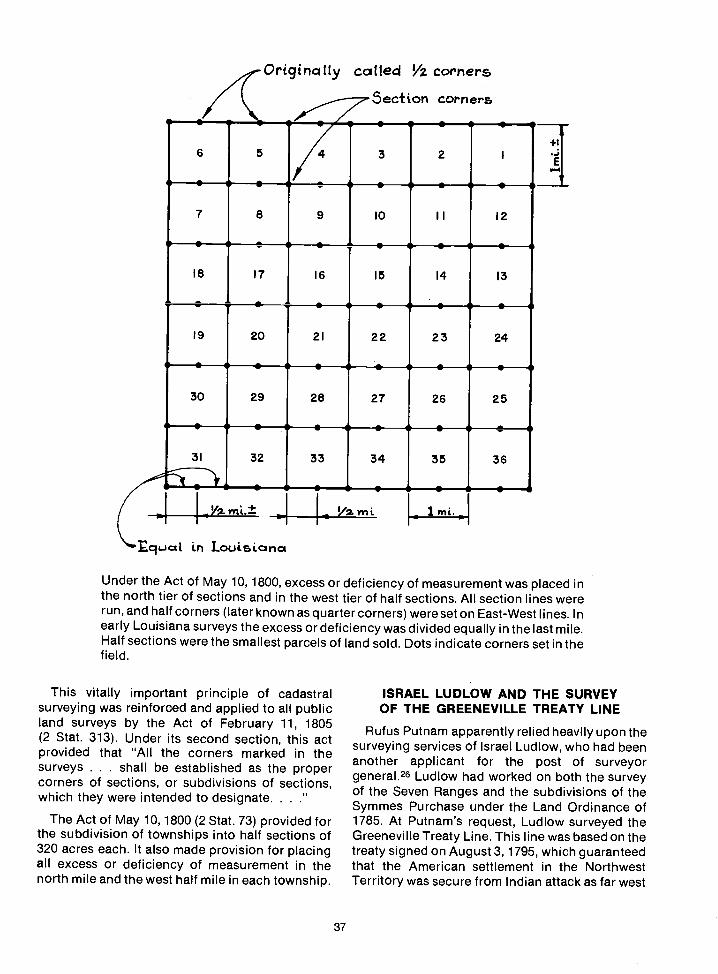
cucL in Louiic.nc*
Under the Act of May 10, 1800, excess or deficiency of measurement was placed inthe north tier of sections and in the west tier of half sections. All section lines wererun, and half corners (later known as quarter corners) were set on East-West lines. Inearly Louisiana surveys the excess or deficiency was divided equally in the last mile.Half sections were the smallest parcels of land sold. Dots indicate corners set in thefield.
This vitally important principle of cadastralsurveying was reinforced and applied to all publicland surveys by the Act of February 11, 1805(2 Stat. 313). Under its second section, this actprovided that 'All the corners marked in thesurveys . . shall be established as the propercorners of sections, or subdivisions of sections,which they were intended to designate......
The Act of May 10, 1800(2 Stat. 73) provided forthe subdivision of townships into half sections of320 acres each. It also made provision for placingall excess or deficiency of measurement in thenorth mile and the west half mile in each township.
Originc11y catted Vz corners
37
ISRAEL LUDLOW AND THE SURVEYOF THE GREENEVILLE TREATY LINE
Rufus Putnam apparently relied heavily upon thesurveying services of Israel Ludlow, who had beenanother applicant for the post of surveyorgeneral.26 Ludlow had worked on both the surveyof the Seven Ranges and the subdivisions of theSymmes Purchase under the Land Ordinance of1785. At Putnam's request, Ludlow surveyed theGreeneville Treaty Line. This line was based on thetreaty signed on August 3, 1795, which guaranteedthat the American settlement in the NorthwestTerritory was secure from Indian attack as far west
5ec±ton corr,ers
6 5
S S
S
2
S S
+1
E
7 8 9 10
.II
S
12
S
18 17 16 15 14 13
19 20 21 22 23 24
30 29 28 27 26 25
31 32 33 34 35 36

Even In Biblical times, the corners established bysurveyors in the field were intended to be permanentmarkers of the land:
Thou shalt not remove thy neighbor's land-mark which they of old times have set in thineinheritance which thou shalt Inherit in theland that the Lord thy God giveth thee topossess it.
Deuteronomy 19: 14
Cursed be he that removeth his neighbor'slandmark. And all the people shall say, Amen.
Deuteronomy 27: 17
Remove not the ancient landmark, which thyfathers have set.
Proverbs 22: 28
Remove not the old landmark; and enter notinto the fields of the fatherless.
Proverbs 23: 10
The Bible offers a good description of a surveyingparty:
Give out from among you three men for eachtribe and I will send them, and they shall rise,and go through the land, and describe Itaccording to the inheritance of them: andthey shall come again to me.
Joshua 18: 4
It also tells of the field notes returned by thesurveying party after they had completed their work:
And the men went and passed through theland, and described it by cities into sevenparts in a book, and came again to Joshua tothe host at Shiioh.
Joshua 18: 9
as a line that met the Ohio River at a point oppositethe mouth of the Kentucky River. This was the land,other than that already patented, to which the LandAct of 1796 specifically applied.
Ludlow began the survey of the GreenevilleTreaty Line at what the treaty called "the crossingplace above Fort Lawrence." Putnam himselfjourneyed north to mark the beginning pointacrossing place over the Tuscarawas branch of theMuskingum River a mile or so upstream from FortLaurens.26 During the 1797 survey season, Ludlowsurveyed the line in a southwest direction for a
38
distance of 150 miles to Loramies Store on theupper waters of the Great Miami River.26 Ludlowfinished running the treaty line in 1799 by firstsurveying the line from Loramies Store to FortRecovery and then southwest to a point oppositethe mouth of the Kentucky River, as specified in thetreaty.
The Indians had requested that a wide corridorbe cut through the forest all along the line so that itwould be impossible for white settlers to overlook itin their search for land to live on. However, sincethere were no funds available with which to hireextra axemen for this work, the treaty line wasmarked in the same manner as other survey linesby stakes and marked trees.26 Since the time IsraelLudlow first used them, two hacks (or notches) online trees have been required under approvedsurveying practice.7
Public Land Eligible for Survey in 1796
The lands eligible to be surveyed as public landsunder the Land Act of 1796 were largely boundedby the Greeneville Treaty Line. This treaty line,which was to permanently separate whitesettlements from Indian villages and huntinggrounds, turned out to be only the first of manysuch boundaries. All were set forth in solemnlysworn treaties, yet each boundary, in its turn, gaveway as new treaties with wider boundaries weresigned. In this way, American settlement movedrelentlessly westward toward the Pacific.Nevertheless, in 1796 the United States PublicDomain included only the land north of the SevenRanges, east of the Tuscarawas River, and south ofthe 41st parallel (which had been designated as thesouth boundary of Connecticut's WesternReserve), and the public lands west of the SevenRanges. It did not include the Virginia MilitaryReserve, the Ohio Company's Purchase, theSymmes Purchase, nor the area set aside byCongress as the United States Military District,even though that land also had to be surveyed.
Subdivision of the U.S. Military District
Ludlow stopped work on the treaty line in 1798and went to the United States Military District.Putnam had divided the Military District into fiveareas for surveying purposes, and had assignedLudlow to one of them. Other surveyors of theMilitary District included Zaccheus Biggs, Ab-salom Martin, John Jackson, and John Mathews.26All of the returns on the subdivision of the MilitaryDistrict were in Putnam's hands before the end ofNovember 1798.26 This included the returns for the
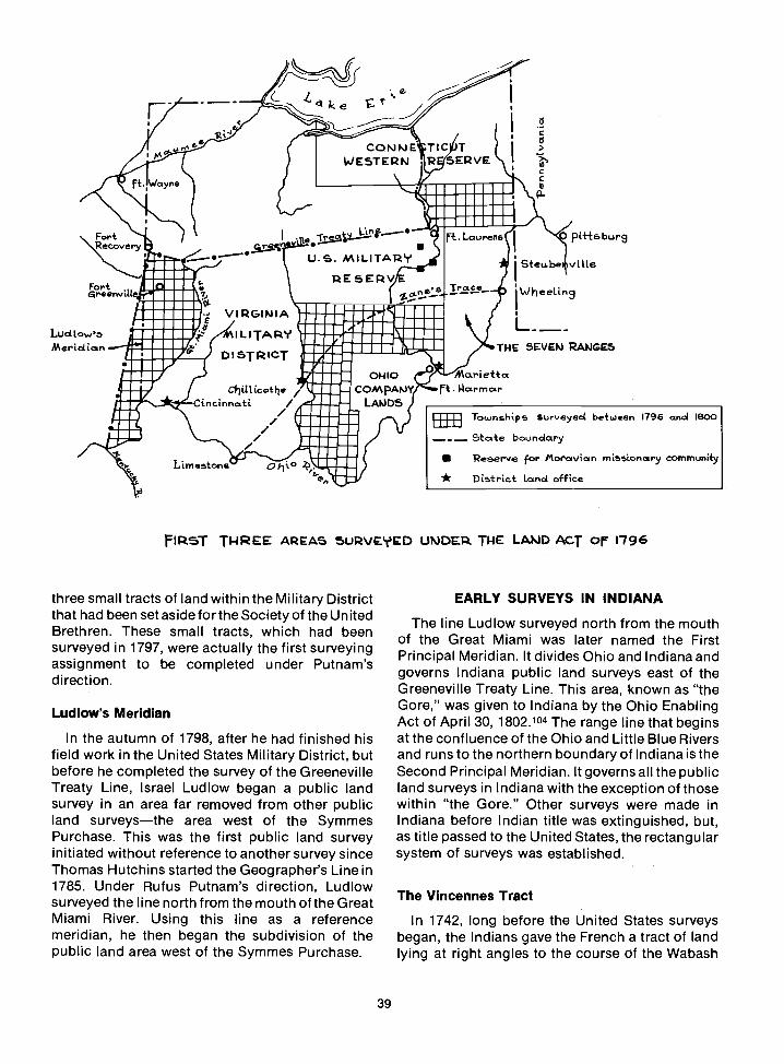
ff. Wayne
COMIJt.JESTERN
w;iNuU1UIiliuuulUilau.ilu...u_U....
TIC TSERVE
three small tracts of land within the Military Districtthat had been set aside for the Society of the UnitedBrethren. These small tracts, which had beensurveyed in 1797, were actually the first surveyingassignment to be completed under Putnam'sdirection.
Ludlow's Meridian
In the autumn of 1798, after he had finished hisfield work in the United States Military District, butbefore he completed the survey of the GreenevilleTreaty Line, Israel Ludlow began a public landsurvey in an area far removed from other publicland surveysthe area west of the SymmesPurchase. This was the first public land surveyinitiated without reference to another survey sinceThomas Hutchins started the Geographer's Line in1785. Under Rufus Putnam's direction, Ludlowsurveyed the line north from the mouth of the GreatMiami River. Using this line as a referencemeridian, he then began the subdivision of thepublic land area west of the Symmes Purchase.
R'.
Q.'N ke -
39
C
0)
CC
FI5T TWR AREAS SURVED UPJDP TIlE LAJ4D ACT or 1796
EARLY SURVEYS IN INDIANA
The line Ludlow surveyed north from the mouthof the Great Miami was later named the FirstPrincipal Meridian. It divides Ohio and Indiana andgoverns Indiana public land surveys east of theGreeneville Treaty Line. This area, known as "theGore," was given to Indiana by the Ohio EnablingAct of April 30, 1802.104 The range line that beginsat the confluence of the Ohio and Little Blue Riversand runs to the northern boundary of Indiana is theSecond Principal Meridian. It governs alithe publicland surveys in Indiana with the exception of thosewithin "the Gore." Other surveys were made inIndiana before Indian title was extinguished, but,as title passed to the United States, the rectangularsystem of surveys was established.
The Vincennes Tract
In 1742, long before the United States surveysbegan, the Indians gave the French a tract of landlying at right angles to the course of the Wabash
Fortecovery
Iiu UU.S. MILITA1'?
1E5EIVC
L Lauren . pft8 bur9
SteLLbe vjUe
WheettngFort -reenvitt .....a IUiiiLiliiU...., VIRGINIA jii..ii.E %ilUUiULud IL I TAYMerictiart TH 5EVEP*3 RAI'JGE.5
DISTR%CT
0.I 10'duIi.Cjjttcete C0MAP4Y rt.,Va.riettalla.rmarI.. /
Cincinnati / LAI)DS/ 41111ia.'U / 'U.'... .... Townships Surveyed be+ween 1796 and 800U..., uiiii - - - SctLe boundary
Reserve for !'toravian missionary communy
,, I.....vii..Limestone O.1to * Distric.+ Land office'U-
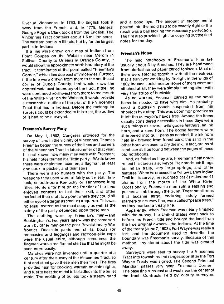
River at Vincennes. In 1763, the English took itaway from the French, and, in 1779, GeneralGeorge Rogers Clark took it from the English. TheVincennes Tract contains about 1.6 million acres.The western part is in Illinois, but by far the largestpart is in Indiana.
If a line were drawn on a map of Indiana fromPoint Coupee on the Wabash near Merom inSullivan County to Orleans in Orange County, itwould show the approximate north boundary of thetract. It terminates at the point called "Freeman'sCorner," which lies due east of Vincennes. Further,if the line were drawn from there to the southeastcorner of Dubois County, that would show theapproximate east boundary of the tract. If the linewere continued northwest from there to the mouthof the White River on the Wabash, it would providea reasonable outline of the part of the VincennesTract that lies in Indiana. Before the rectangularsurveys could be extended to this tract, the outlineof it had to be surveyed.
Freeman's Survey Party
On May 1, 1802, Congress provided for thesurvey of land in the vicinity of Vincennes. ThomasFreeman began the survey of the lines and cornersof the Vincennes Tract in late summer of that year.It is not known how many men were with Freeman;his field notes termed it a "little party." We do knowthere were chainmen, axemen, a flagman, at leastone cook, a packer, and teamsters.
There were also hunters with the party. Theweapons they used were of fairly soft metal, f lint-lock, smooth-bore Kentucky or Tennessee longrifles. Hunters for hire on the frontier of the timeenjoyed contests to test their skill, and oftenperfected their craft to a point where they could hiteither eye of a target as small as a squirrel. This wasno small matter, as the meat supply as well as thesafety of the party depended upon these men.
The clothing worn by Freeman's menandBuckingham's, two years laterwas the same sortworn by other men on the post-Revolutionary Warfrontier. Buckskin pants and shirts, boots (ormoccasins and leggings) and raccoon-skin capswere the usual attire, although sometimes theflagman wore a red flannel shirt so that he might beseen more easily.
Matches were not invented until a quarter of acentury after the survey of the Vincennes Tract, soflint and steel gave these men their fires. The firesprovided heat for cooking, warmth on cold nights,and fuel to heat the metal to be ladled into the bulletmold. The molding of bullets took a steady hand
40
and a good eye. The amount of molten metalpoured into the mold had to be exactly right or theresult was a ball lacking the necessary perfection.The fire also provided light for copying out the field
notes for the day.
Freeman's Notes
The field notebooks of Freeman's time areusually about 3 by 6 inches. They are handmadefrom old-fashioned paper called foolscap. Most ofthem were stitched together with all the neatnessthat a surveyor working by firelight in the wilds of1802 Indiana could muster; some of them were notstitched at all, they were simply tied together withvery thin strips of buckskin.
As he worked, Freeman carried all the smallitems he needed to have with him. He probablyused a buckskin pouch suspended from hisshoulder by a strap. This was a common practice asit left the surveyor's hands free. Among the itemsusually considered necessities in those days weresuch things as several wild goose feathers, an inkhorn, and a sand horn. The goose feathers weresharpened into quill pens as needed, the ink hornheld ink brewed from forest bark; the sand in theother horn was used to dry the ink. In fact, grains ofsand can still be found between the pages of theseold notebooks.
And, as faded as they are, Freeman's field notesreflect his care as a surveyor. He noted such thingsas Indian trails, very large springs, and otherfeatures. When he crossed the Yellow Banks IndianTrail in his survey, he recorded itas3l milesand4lchains from the mouth of the White River.Occasionally, Freeman's men split a sapling andpushed a limb through the trunk. These smalltreesthat became large, enduring, oddly formedmarkers of a survey line, were called "peacetrees,"as they marked a treaty line.
Apparently, when Freeman was nearly finishedwith the survey, the United States went back tobefore the French title and bought the land fromthe true original ownersthe Indians. At the timeof the treaty (June 7, 1803), Fort Wayne was really afort, and the document used to describe theboundary was Freeman's survey. Because of thismethod, any doubt about the title was clearedaway.
Surveyocs were sent to survey the VincennesTract into townships and ranges soon afterthe FortWayne Treaty was signed. The Second PrincipalMeridian passes very near "Freeman's Corner."The base line runs east and west near the center ofthe tract. Contracts held by deputy surveyors
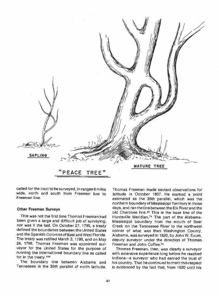
SAPLING
"PEACE TREE"
called for the tract to be surveyed, in ranges 6 mileswide, north and south from Freeman line toFreeman line.
Other Freeman Surveys
This was not the first time Thomas Freeman hadbeen given a large and difficult job of surveying,nor was it the last. On October 27, 1795, a treatydefined the boundaries between the United Statesand the Spanish Colonies of East and West Florida.The treaty was ratified March 3, 1796, and on May24, 1796, Thomas Freeman was appointed sur-veyor for the United States for the purpose ofrunning the international boundary line as calledfor in the treaty.104
The boundary line between Alabama andTennessee is the 35th parallel of north latitude.
41
'
MATURE TREE
Thomas Freeman made sextant observations forlatitude in October 1807. He marked a pointestimated as the 35th parallel, which was thenorthern boundary of Mississippi Territory in thosedays, and ran the line between the Elk River and theold Cherokee line.34 This is the base line of theHuntsville Meridian.74 The part of the Alabama-Mississippi boundary from the mouth of BearCreek on the Tennessee River to the northwestcorner of what was then Washington County,Alabama, was surveyed in 1820, by John W. Exum,deputy surveyor under the directiqn of ThomasFreeman and John Coffee.74
Thomas Freeman, then, was clearly a surveyorwith extensive experience long before he reachedIndianaa surveyor who had earned the trust ofhis country. That he continued to merit this respectis evidenced by the fact that, from 1820 until his

death in November 1821, he was surveyor generalof the Public Domain south of the State ofTennessee.104 Although this office was a politicalone, experience did count in this instance.
French Claims
Within the Vincennes Tract were claims of earlyFrench settlers. The United States honored theseclaims and used the French system in surveyingthem. Usually, they consisted of 400 acres, lying inlong, narrow lots at right angles to the rivers. Thedeputy surveyors who contracted to subdivide theVincennes Tract closed upon these French boun-daries.
Settlers started for Vincennes as soon as thetreaty was in effect. Shortly after Buckingham sethis first section corner, a land office was establish-ed and the new land was opened for settlement.Many people came from Kentucky; because therewas no rectangular system there, many of Ken-tucky's pioneers had losttheir land simply becausethere had been no survey. Many titles were indoubt, including those of Thomas Lincoln andDaniel Boone. Hundreds of families came toIndiana by way of the old trails across Indian land.To ensure the safety of the pioneers, the purchaseof the land crossed by these trails was necessary.
The Buffalo Trace
The most notable early land route in the areaentered Indiana at the Falls of the Ohio andfollowed a generally northwest course toVincennes. It was called the "Buffalo Trace," forbuffalo had made it and used it in uncountednumbers. It was the most prominent of the severalbuffalo trails in the Indiana of that era, and it hadbeen the most important trail as long as Indianmemory before that. It was significant enough, infact, to be used as a means of determining a treatyline.104
The Vincennes Treaty
The Vincennes Treaty was negotiated betweenGeneral William Henry Harrison and the Indians in1804. The treaty called for all of the Buffalo Trace tobe within the tract ceded to the United States, andfor the boundary in that part to be a straight line,parallel to the "road" from the eastern boundary ofthe Vincennes Tract (granted to the Americans inthe Fort Wayne Treaty) to Clark's Grant. The linewas to be no more than a half mile from thenorthernmost bend in the road.
The location of the "straight line" was establish-ed by first surveying the Buffalo Trace by chain and
42
compass. This was done by a surveyor namedWilliam Rector, who became surveyor general ofIllinois, Missouri, and Arkansas in 1814. Beginningon July 11, 1805, trees were marked each milealong the trail with the distance from Clark's Grant.The Vincennes Treaty permitted settlers to enterIndiana across land owned by the United States.
THE SECOND PRINCIPAL MERIDIAN
The Vincennes Treaty and the land between theOhio River and the Vincennes Tract covered by itare probably the reason for the location of theSecond Principal Meridian. The base line wassurveyed in 1804 by Ebenezer Bucking ham, Jr. Theline began at a point on the Freeman line on thesouth side of the Vincennes Tract in Illinois and raneast. Buckingham marked trees along his line, kepthis notes, and set mile and half-mile posts. He didnot set any corners, he merely ran a line east for adistance for 671/2 miles.
It was autumn when Buckingham began survey-ing at Thomas Freeman's southeast corner of theVincennes Tract and ran a line due north (now theDubois-Orange County line) until he reached hisbase line. After intersecting the baseline, ata point3.60 chains east of hispreviouslyset671/2-mile post,he went east on the base line, marking sectioncorners, half-section corners, and witness trees.He recorded them as he went along until he met theFreeman line on the east end of the VincennesTract. Beyond that lay Indian land, so Buckinghamreturned to the intersection point on the presentcounty line. He then went west along his base line,marking his corners and witness trees, andprobably resetting all his mile and half-mile posts3.60 chains east, until he was again in lllinoisatthesouth Freeman line.104
When Buckingham began recording sectioncorners, he recorded two beech trees as witness(bearing) trees. These are very special trees. Bothare north of the base line; one is in Dubois County,the other in Orange County. They are the "witness"trees for the corner of four townships, and they arethe first ones on record, in reference to a townshipcorner, in all the surveys controlled by this baseline and the Second Principal Meridian.104
In September 1805, Ebenezer Buckinghamextended his base line east to a point 12 miles fromthe Dubois-Orange County line. He then ran theline north to the north line of the Vincennes Treatyline (not the Vincennes Tract linethe treaty linesurveyed by William Rector). This Buckinghamnorth-south line is the Second Principal Meridian.The location makes sense when the facts as theyexisted at the time of the survey are considered: it is

there because it isl2 miles (two ranges) east of thesoutheast corner of the Vincennes Tract. Thenortheast corner of the tract could not have beenused as a basis for establishing a principalmeridian at the time surveyor Buckingham con-tracted to do the work, because one step north orsouth of that corner would have put him on Indianland.
THE TEN O'CLOCK LINE
Clashes with Indians were fairly commonoccurrences, but Deputy Surveyor John McDonaldhad more than the expected amount of in-
terference from them when he undertook thesurvey of the northeast linethe "Ten O'ClockLine"of the Harrison Purchase. This line beginswhere Raccoon Creek enters the Wabash River andruns southeast to a point 30 miles from thenortheast "Freeman Corner."104
By 1809, the Indians had seen the results ofseveral treaties. They were becoming aware of theloss of their land. They saw numbers of white menin the area south of where once only Indians hadbeen. The deputy surveyors, who arrived as soonas the treaties were signed, had begun to sym-bolize the wave of settlement that so swiftlyfollowed them. By this time some 250,000 trees hadbeen marked by surveyors. To the Indians, thesehacks, blazes, and other cryptic symbols were suresigns of an advancing alien culturesigns thattheir lands were slipping from them. By the time ofthe Harrison Purchase, the total amount of landceded to the United States undertreaties signed byHarrison was close to 30 million acres.
There is a tale that the "Ten O'Clock Line" got itsname from the Indians' suspicion of the surveyor'sinstruments. They wanted to mark the line by theshadow cast by the sun and an upright stake at 10o'clock in the morning, because the surveyor couldnot manage the sun as he did the compass.104
Indian Conflict
The Indian leader Tecumseh was suspiciousnot only of the instruments, he was also dissatisfiedwith the sale of the land south of the Ten O'ClockLine. He insisted that all the Indians held all theland in common and that no tribe could sell any ofthe land because it belonged to all Indians.Harrison, of course, believed that Indians had aright to dispose of the land that they occupied, thatit was theirs by right of occupancy. The discontentTecumseh and some of the warriors felt about thetreaty and the surveys continued to grow. In 1811, itled to the Battle of Tippecanoe.
43
In November 1819, the conditions were still lessthan ideal, as noted by a surveyor near the Indiantown called Mississinewa:
. the Indians held another council on the6th . . . which was much against me. Myprovisions were much wasted here, as we had toaccompany their chiefs to the town, where theIndians made free with my bread. On theseventh they added another chief to my surveyparty, which I had to support with bread andmeat.
The situation rapidly grew worse. A later entry inthe field notes reads:
Here the Indians, in an imperious manner toldme I was going wrong, and said I should go nofarther that way, saying that I was going to go totheir town and if I would not go 10 miles east ofthe town they would not let me go on. I saw bytheir looks and the way they behaved that I wasunsafe, so I stopped. They would scarcelypermit me to make a mark and appeareddispleased. We left the line and started for FortRecovery [Ohio] where we arrived on the 29th ofthe month [November 29, 1819].
This entry is signed, "J.S. Allen, D.S." The nextparagraph in the field notes begins "March 18,1820. Began where the Indians stopped me on the25th of November, 1819," Deputy surveyor Allenpersevered: he began this survey on November 3,1818, and completed it on March 20, 1820.104
Other Problems
Northwestern Indiana presented its own forms ofdifficulty. Deputy Surveyor Uriah Biggs reported inJanuary 1835 that Township 33 North, Range 6West, had only a small part which could becultivated. He found the Kankakee River a"sluggish stream, its banks very low and lined oneach side with a heavy growth of timber, mostlyash . . . undergrown with swamp alder and wildrose, etc. . . . covered with water during theseason." Surveyor Biggs described the soil in "thisforest or swamp" as loose yellow sand andmentioned that he could approach the river onlywhen the swamp was frozen.
Jeremiah Smith, working 12 miles east of UriahBiggs, did not find things much better. He couldnot see his line at all. It was in the "expanded waterof Yellow River." Of the next township north,Township 34, he had this comment: "There is butlittle room left for general remarks in this township.There is such an endless sameness ofmarsh . . . that there is nothing upon which todigress from the monotony of lamentation."

0C"
Salt Springs
Sometimes the deputy surveyors made rarefinds. Edward W. Tupper and Augustus Stone,surveying in Township 1 North, Range 2 West,Second Principal Meridian, made note of aprominent salt spring. The surveyors estimated thequantity of water to be "sufficient to form a sheet ofwater two feet wide and one inch deep." About fourchains southeast they found another salt springwith more than twice the amount of water affordedby the first spring. The two springs joined a freshwater spring located between them, and formed acreek from 12 to 20 feet wide. Salt springsoccasionally could be seen boiling up through thestream. Several springs, both salt and fresh, united
INDIANA
44
Treaty at Vinenn5
LOCATION OF THE CtTEN 0' CLOCK LINE"
OHIO
to form a creek about 8 inches deep, which seemedto stay very salty. The field notes indicate that thetwo surveyors made special note of both section 3,Township 1 North, Range 2 West, and section 34,Township 2 North, Range 2 West, because of thesalt discovery. The surveyors did not give thesesprings the names they are now called; French Lickand West Baden were just "Salt Springs on SaltCreek," on the 1804 survey plat.104
Ziba Foote
Two years after the discovery of these saltsprings, Ziba Foote became one of the adven-turous young Indiana surveyors. Born in 1785, hewas a bright Connecticut Yankee who had

graduated from Yale with high honors at the age of20. He began surveying under the direction ofWilliam Rector, deputy surveyor to SurveyorGeneral Mansfield of Cincinnati, soon after hisgraduation.
One of Foote's first assignments was the surveyof a pond in Township 3 South, Range 13 West,Second Principal Meridian. The pond was about 20chains across and nearly a mile long. It appeared tobe quite shallow, and he started through it with hiscompass and his Jacob's staff fastened to his belt.A little way out he found himself over his depth andtoo weighted down to regain his footing. Hedrowned before anyone could reach him. The menrecovered his body and prepared a bark coffin.They buried him on a knoll near the pond, whichthey named "Foote's Grave Pond."104
David Sandlord
Surveyor David Sandford was born in Newtown,Connecticut. Sandford, like Foote, also went toYale, graduating in 1804. In 1805, he subdivided
45
Range 5 of the Vincennes Tract. He obtained acontract to survey four townships on the MaumeeRiver, but became ill and died at Fort Wayne,October 11, 1805, at the age of about 25. George R.Wilson, one-time county surveyor of DuboisCounty where young Sandford worked,resurveyed a number of his lines in Range 5, andbore witness to Sandford's efficiency. In his fieldnotes David Sandford mentioned a "remarkableledge of rocks on the north bank [of White River]That ledge is still readily indentifiable becauseSandford did exactly what most young men wouldhave done: he cut his initialsD. S.into the rock.
Some of the words and phrasesfound in thefieldnotes written by deputy surveyors during the early1800's sound strange now. They mention "middl-ing soil," "sorry land," "gladly land," and "wavelyland." They rose [went up] a hill, or found a"handsome spot." No matter how strange theirexpressions sound now, however, these menexecuted the most creditable surveys that hadbeen done up to that time.104

THE LOUISIANA PURCHASE
Thomas Jefferson became President of theUnited States in 1801 and learned, almost im-mediately, that Spain had given Louisiana toFrance under a secret treaty. In order to rid thiscountry of the possibility of any colonial ambitionsthat Napoleon might have, Jefferson asked him toconsider selling his holdings in America. While heawaited an answer, the President quietly plannedto send an expedition across the continent. Inpreparation for the journey, Jefferson sent youngMeriwether Lewis to Philadelphia, where RobertPatterson and Andrew Eflicott instructed him inmathematics and surveying.20 Meanwhile, in April1803, Napoleon agreed to sell Louisiana to the U.S.The deal was completed and the United Statesthereby more than doubled its territory.
When Captain Meriwether Lewis and his co-leader Lieutenant William Clark started theirhistoric expedition in the late spring of 1804, theywere able to travel from the mouth of the MissouriRiver all the way to the Rocky Mountains on landowned by the United States.
JARED MANSFIELD
The year 1803 also marked an advance in thedevelopment of the rectangular surveys. JaredMansfield, who was Thomas Jefferson's personalchoice for the office, replaced Rufus Putnam assurveyor general.
Mansfield, in his mid-40's, was a brilliant andtechnically able man. He had been acting professorof mathematics at the U.S. Military Academy atWest Point prior to his appointment as surveyorgeneral. It was he who recognized the need forestablishing base lines and principal meridians as asystem of control for the rectangular surveys.
When Mansfield anticipated the survey of theVincennes Tract in Indiana, hefound himself facedwith some perplexing problems. For one, theVincennes Tract lay in the interior of the territoryand was completely unconnected to any otherpublic land. It would have been impractical to carrythe old plan of numbering townships and rangesinto such an area. In addition, there were no naturalor permanent boundaries from which to begin thesurveys. Also, the acquisition of Indian landsseparating the Vincennes Tract from older
Chapter 7
THE REFINEMENT OF THERECTANGULAR SURVEY SYSTEM
47
cessions was being considered and there was nopoint in carrying existing confusionwhich ex-perience in Ohio had by this time been shown to beconsiderableinto areas not yet acquired. A planof survey was necessary and, fortunately, SurveyorGeneral Mansfield was able to develop one.
The Plan
The segments of Mansfield's plan existed before1800, but no one had seen them as a basis for asystem for organizing the rectangular surveys.
Ellicott's Line was a meridian and theGeographer's Line was a base line, but Hutchinsdid not use their intersection as a basis fortownship identification. The south boundary of theUnited States Military Tract was a base line fromwhich Putnam numbered townships northward,but elsewhere he continued to use the Ohio Riveras a basis for the numbering of townships. In thearea west of the Symmes Purchase, Ludlowestablished a reference meridian from which henumbered ranges both east and west, but he didnot survey a base line.
Mansfield saw these scattered segments as thebasis of a unified plan. When Ludlow's Meridianwas renamed the First Principal Meridian, and thepositions of the Indiana base line and the SecondPrincipal Meridian were established byastronomical observation, the pieces became asystem of rectangular coordinates. Mansfield'splan of intersecting meridians and base lines,introduced in 1804, immediately provided a con-venient basis for township identification. Later, itwas also used as the basis for the compromisenecessary in the execution of rectangular surveysof the surface of a spheroidal planet.
Legislative Changes
About this same time, changes in the land systemwere also brought about through legislation. OnMarch 3, 1803, Congress amended the Land Act of1800 and created the office of surveyor of the landssouth of Tennessee. The duties of this officer werenot unlike those of the surveyor general of thelands northwest of the Ohio River and above themouth of the Kentucky River. The appointment ofIsaac Briggs to this office marked the beginning ofthe era in which the number of surveyors general,

Virtce flnes
o.
01234MILES
Base Line(Surveyed. by
Buckingotm)
Ill II I i I U IN
MAPJS FIELD's pLAtJ OF TUE pRIIJCIALMER1DIAM AP4D BASE LI1JE,I8O4
and their influence, was to increase as the surveysstretched across the continent.
The Act of March 26,1804(2 Stat. 277) extendedthe authority of the surveyor general over "all of thepublic lands of the United States to which theIndian title has or shall hereafter be extinguished,north of the river Ohio, and east of the riverMississippi......This act also provided that:
whenever any of the public lands shall havebeen surveyed in the manner directed by law,they shall be divided by the Secretary of theTreasury into convenient surveying districts;
48
Second principal ft\eridian(Surveyed by Buckin9hQm)
Clark's rant
and a deputy shall . . . be appointed by thesurveyor general for each district . . . whoseduty it shall be to run and mark such lines as maybe necessary for subdividing the lands surveyedas aforesaid, into sections, half sections, orquarter sections.
The Act of February 11, 1805 (2 Stat. 313)contains the last really important statutory amend-ment to the original Land Ordinance of 1785. Sinceits original enactment, this law has had particularsignificance for surveyors. Among other things, itprovided for the completion of surveys previously
2222I IIII I I I
2222

made by running alternate mile lines under theLand Act of 1796 and for the partial subdivision intoquarter sections of lands "purchased previous tothe first day of July last......Its provision for thesubdivision of new public lands was reenactedunder the Revised Statutes in 1874 (Sec. 2396, Rev.Stat.) and is still in effect.
THE GENERAL LAND OFFICE
Josiah Meigs, who had worked under ThomasHutchins on the survey of the Seven Ranges,1 wasappointed surveyor general of all the public landseast of the Mississippi River when Mansfieldresigned the office.
Meanwhile, half a dozen clerks of the TreasuryDepartment had been keeping land records inaddition to their other work. By 1812, the work loadhad increased to a point where this was no longerpossible. The guardianship of the public landsdemanded a more effective national office tohandle the administration of this country's PublicDomain.
Thus, by the Act of April 25, 1812 (2 Stat. 717),Congress established the General Land Office asabureau of the U.S. Treasury Department. The chiefofficer of the GLO was a commissioner whoseduties were "to superintend, execute, and performall such acts and things touching or respecting thepublic lands of the United States . . . as haveheretofore been directed by law to be done orperformed in the office of the Secretary of State, ofthe Secretary and Register of the Treasury, and ofthe Secretary of War."
Under provisions of this act, all officers oremployees of the General Land Office wereforbidden to "directly or indirectly be concerned inthe purchase of any right, title, or interest, in anypublic land. . . ." The post of surveyor general,however, remained independent of the GLO, acircumstance that created problems for severalyears to come.
Edward Tiffin
Edward Tiff in, an Ohio statesman and formersurveyor, was chosen as the first commissioner ofthe General Land Office. Tiffin immediately setabout planning and developing a more efficientsystem of land management. At that time, therecords, surveys, maps, and reports regarding thepublic lands were found in various places in all thebranches of the Government, particularly the Stateand War Departments. Under Tiff in's direction, thisinformation was brought together and arranged in
49
useful order, permitting, for the first time, theefficient administration of public land matters.
1812 Land Bounties
The creation of the General Land Office tookplace on the eve of an impending struggle withGreat Britain. It was not a popular conflict, so theGovernment again resorted to the offer of bountylands to encourage military enlistments. Some 6months before the war began, Congress authoriz-ed the creation of three new military districts. Oneof them was in an unspecified part of MichiganTerritory, one between the Illinois and MississippiRivers in Illinois Territory, and the other betweenthe St. Francis and Arkansas Rivers in Louisiana(later Arkansas Territory). Military warrants wereto be issued and 6 million acres were to besurveyed. After surveying these areas were to beopened for entry by the holders of the militarywarrants.
Townsites
On June13, 1812, Congress granted public landsfor townsites and confirmed the boundaries ofsome towns that already existed in Missouri. Thisact, as it was later amended, became the basis forthe survey and use of public lands for newtownsites and town holdings in unreserved areas ofthe Public Domain. Five days after the passage ofthis act, Congress declared war against GreatBritainand thus began the War of 1812.
Business as Usual
Near the end of 1812, Commissioner Tiffinsubmitted a report to the 13th Congress regardingthe accomplishments of the first year of the newsystem of Federal land management. The reportfeatured an exhibit compiled with the help of thesurveyors general, especially Josiah Meigs ofOhio. For the first time the exhibit showed thelocation and quantities of the public lands,together with data regarding such specifics asmineral deposits, military land bounty tracts, andlarge stands of timber.
By that time there were 16 district land officesoperating as part of the new system headed byTiffin. The State land offices in Ohio were atSteubenville, Marietta, Chillicothe, Cincinnati,Zanesville, and Canton. In Louisiana the officeswere at New Orleans, Opelousas, and Ouachita.Territorial land offices were at Detroit, Michigan;Vincennes and Jeffersonville, Indiana; Kaskaskia,Illinois; Washington, Mississippi; and St. Stephensand Huntsville, Alabama.1

THE WAR OF 1812
In June 1814, General Andrew Jackson succeed-ed General William Henry Harrison as commanderof the 7th Military District, composed ofTennessee, Louisiana, and the MississippiTerritory.
Robert A. Butler, who had served as a captainunder Harrison during the Indian Wars, transferredto Jackson's command as adjutant general.129 In1814, Col. Butler was commissioned by Jackson toleave Mobile and return to Tennessee to raise aforce of mounted volunteers for the command ofGeneral John Coffee.129
In late August 1814, near the end of the War of1812, British troops marched into Washington andset fire to several government buildings. Amongthose burned was the two-story frame building thathoused both the State and Treasury Departments.The building was a total loss and the records of theGeneral Land Office were destroyed.2
Treaty of Ghent
On Christmas Eve of 1814, a treaty of peace wassigned at Ghent, Belgium, between Great Britainand the United States, which also settled some ofthe disputed land boundaries. Because newstraveled slowly in those days, however, the famousBattle of New Orleans actually took place severaldays after the end of the war. Robert Butler waswith Jackson during that fight and, at the close ofthe battle, he and two other officers went out tomeet the flag of truce brought forward by theBritish 129
THE SURVEY PLAN PERFECTED
Meanwhile, in 1814, in a very neat exchange ofjobs, Josiah Meigs became the second com-missioner of the General Land Office and EdwardTiff in became the surveyor general of territorieseast of the Mississippi, a position he held for thefollowing 15 years.
With great administrative energy, and withoutadding to his staff of 10 clerks, Meigs managed toimprove clerical procedures and enlarge facilitiesto better cope with various types of land transac-tions. He planned that the functions of the GLOwould include collections of various scientific data.Meigs was particularly interested in meteorologyand hoped to have the registers of the various localland offices return meteorological observationsalong with their regular reports.2
Although Congress did not adopt his plan, Meigsdid not give up his idea. On April 12,1817, hesenta
50
circular to the registers of the local land officesasking for their voluntary assistance in makingcertain regular weather and other scientific obser-vations.73
As surveyor general, Edward Tiffin was responsi-ble for the solution to the problem that hadperplexed surveyors from the beginning of therectangular systemthe paradoxical requirementthat townships were to have sides running in thecardinal directions and that they were to berectangular.
Surveyors knew from the outset that fulfillingthat requirement would be made impossible by thefact that the Earth is spheroidal. There had evenbeen discussions before the Continental Congressabout the problem, but nothing was done about ituntil Tiffin devised a plan of correction lines andoffered it as a solution.
GUIDE MERIDIANS ANDSTANDARD PARALLELS
When Jared Mansfield was surveyor general, theIndians still held central and northern Indiana. As aresult, the surveys completed under his leadershipdid not extend far from the base line. Gradually, asIndian title was extinguished, the surveys began toreach farther north, and it soon became apparentthat additional controlling lines were necessary.
In submitting a plan for extending the surveys inIndiana, Tiffin first proposed, on March 20, 1819,that a "line of correction" be run betweenTownships 16 and 17 north of the Second PrincipalMeridian. If this was not done, he wrote, the rangeswould be diminished to a point that the townshipswould no longer be 6 miles square. Tiffin's plan ofguide meridians and standard parallels, as it wasused and refined, became one of the mostimportant parts of the public land survey system.
The spacing of guide meridians and standardparallels has not always been the same. From thetime Surveyor General Edward Tiff in firstsuggested "lines of correction" until 1851, sur-veyors general were instructed that correctionlines were to be run at "stated distances" north orsouth of the base line. The distances were thenstated in the correspondence or instructions thataccompanied the surveying contract in each case.
The instructions to the surveyor general ofOregon, issued in 1851, stated that standardparallels were to be run at distances of fourtownships north of the Columbia River and fivetownships south of the Columbia. These distanceswere repeated in 1855, when the General LandOffice published the first "Manual of SurveyingInstructions."
The 1881 Manual altered the 1855 Manual andrequired that the public lands be divided into"bodies of land 24 miles square, as near as may be."Standard lines and "auxiliary meridians" were to beat 24-mile intervals. The 1890 Manual referred to"guide meridians" rather than "auxiliary"meridans. The 1930 Manual retained the previousrequirements and added a provision for in-termediate auxiliary standard parallels or guidemeridians. Some original lines had been run atintervals of more than 24 miles, therefore, it was
51
necessary to limit the errors of the old surveys or toadd additional lines for the control of new ones.These intermediate lines were, and still are, runexactly like regular standard parallels or regularguide meridians, since their purpose, as stated inthe 1930 Manual, is the establishment of con-trolling lines "at intervals sufficiently near eachother to maintain a practical workable adherenceto the legal definition of the primary unit, thetownship 6 miles square......
As has previously been mentioned, Congressoffered bounty lands to men as an inducement toserve in the War of 1812in Michigan Territory,between the Illinois and Mississippi Rivers inIllinois Territory, and between the St. Francis andArkansas Rivers in the part of Louisiana Territorythat later became Arkansas. Six million acres wereto be surveyed and opened for entry by warrantholders who were allowed to choose the area inwhich they wanted their land located. Other thanthat, location was to be by lottery.
1815 MICHIGAN REPORT
In 1815, Edward Tiffin, who was in charge of thesurvey of the military tract in Michigan, made areport on the land his men had surveyed there. Thehighly unfavorable report described low wet land,numerous marshes and swamps, scrubby oaks,and barren soil, where not even one acre in ahundred was worth cultivating.
Tiffin's report was enough to cause Congress toabandon the Michigan tract. To make up for it,500,000 acres in the Missouri Territory were addedto the Iflinois tract. There were, however, a fewhardy souls who read Tiff in's report and proceededbravely to the frontier in spite of it. Some othersfailed to read it at all, for one reason or another, andthus ventured forth, unaware of the conditions thatawaited them.
HERVEY PARKE
On March 21, 1821, Captain Hervey Parke leftCamden, New York, on his way to the wilds ofMichigan Territory. Parke had not seen Tiffin's1815 report; he knew only that the public landsurveys were under way there, and he had made uphis mind to become a government land surveyor.Fortunately, Parke later wrote his memoirs fromwhich we know the following about his adven-tu res.101
Parke was not quite 31 years old when he walkedthe 500 miles from his home in New York, throughpart of Canada, to his destination in Michigan. Hecarried a knapsack heavily weighted with survey-ing equipment, and it took him "sixteen daysfaithful travel through mud and water, often kneedeep" before he reached the Detroit River andcrossed over it in a rowboat to the small city ofDetroit.
Chapter 8
PIONEER SURVEYORS
53
From there Parke went "through the wildernessto the interior." He reached the village of Pontiacon June 1, 1821, and soon afterward met HoratioBall, who had a contract for subdividing 10townships of land between the Flint and CassRivers. Parke accompanied Ball on this survey.
They arrived at Flint River to find that heavy rainshad so swollen the river that it was impossible tocross. They solved this problem by going up riverwhere they "felled a suitable pine." After they hadremoved about 16 feet of it from the main body ofthe tree they shaped it into a crude canoe "diggingout the same, so far as could be done with axes, andfloated it down river and landed it on the north sidewhere the city of Flint is now located." At that time,however, there was no city; there was but one loghouse, which belonged to Jack Smith, an Indiantrader.
Joseph Wampler, the surveyor who had thecontract to run the township lines, met Ball andParke at Smith's trading house and furnished themwith the necessary field notes. Almost immediate-ly, Ball and Parke began their work "in town [ship]seven north, of range seven east." One week laterthe two surveying parties again met at Smith'strading house. Wampler's men had refused tocontinue the survey "on account of the sufferingthey had endured from the mosquitoes, both menand horses being weak from loss of blood and wantof rest." Ball and Parke had to discontinue theirwork too, since the township lines had not beencompleted.
Early in the autumn, however, Wampler returnedto finish his work. This also enabled Ball tocomplete his contract. It took two months, and, dueto Ball's inexperience and the fact that the weatherwas not as warm as it had been when they firststarted their work in June, they had a hard time of it.Parke described it this way:101
We suffered both from hunger and cold. We hadno tents, only an old second-hand tarpaulin,which had been laid aside as useless forhatchway service. In the absence of a kneedingtrough, our cook made use of this piece ofcanvas to mix his bread. This was unfortunate,for on our first visit to the trading-house, someswine, attracted by the adhering dough, nearlydevoured and entirely destroyed it, and we hadnow no cover besides our blankets. Ourprovisions were inadequate; we were frequentlyreduced to a short allowance of only buggy

peas, and at one time, when weak from want offood, we found a wigwam where a squaw wascooking succotash, which she kindly dividedwith us. This occurred on the last day of oursurvey, while meandering the river. Closing ourwork on the line of the reserve at sunset andfollowing up the river, forcing our way throughthick beds of rushes knee high, at about nineo'clock we reached Smith's trading-house, sohungry from several days short allowance, thatwe took the potatoes from the kettle half boiled.
Parke Meets Tiff in
The surveyors finished their work on the last ofDecember and went to Chillicothe, Ohio, to maketheir reports to the surveyor general. Parke hadletters of recommendation from Governors Cass ofMichigan and Clinton of New York, as well as onefrom Judge Wright, chief engineer of the ErieCanal. He presented these letters to SurveyorGeneral Edward Tiffin and was promised futurework as a government surveyor.
On the strength of Tiffin's promise of work, Parkereturned to New York, gathered up his wife anddaughter and, in May 1822, again set out forMichigan. He and his wife disposed of all theirfurniture and belongings except the fewpossessions they considered indispensable, in-cluding Parke's surveying equipment.
Return to Michigan
At that time, Hervey Parke was 32 years old. Hisworldly goods consisted of a borrowed cabin, ahand-hewn table and chairs, several trunks, thepersonal and household items he had brought withhis family from New York, his surveying equip-ment, and $8.50 in cash.101
For a time Parke worked at small surveying jobsand at teaching school. Then, in February 1823, heand John Mullett, a surveyor who lived in Detroit,decided to travel together to Chillicothe to arrangefor surveying contracts. Between them they hadtwo blankets, one pony, and one saddle.
They made a crude box sled out of a crockerycrate and padded the inside of it with straw. Parkeand Mullett then hitched the pony to the sled,climbed in and glided over the ice from Detroit toSandusky, Ohio. There they abandoned thehomemade sled and continued their journey onfoot and horseback. Since there was only one ponyand saddle, Parke and Mullett took turns riding.One of them rode a certain distance, dismounted,tied the pony to a convenient tree and proceededon foot. The other man walked to the place wherethe pony was tied and mounted it. After a time he
54
passed his companion, rode on to the proper placeand dismounted. He then took his turn at walking.They continued this ride-and-tie arrangement untilthey reached the surveyor general's office inChillicothe.
Parke Appointed Deputy Surveyor
Surveyor General Edward Tiff in kept his word.He administered the oath of office to both Parkeand Mullett and each received a contract. Theywere among the first surveyors appointed fromMichigan. Always in the vanguard of civilization,they were true pioneers, as were their fellowsurveyors Lucius Lyon and his brother Orson, plusSylvester Sibley, Clark 0. Risden, and JudgeWilliam Burt, among others.
When Parke began his public land surveyingcareer, James Monroe was President of the UnitedStates, which had a population of fewer than 10million people.l By the time he finished his lastcontract, John Tyler was President and thepopulation had grown to more than 17 million.1During these years Parke surveyed in Iowa andWisconsin, as well as throughout large areas ofMichigan. He surveyed through blizzards, acholera epidemic, and the Black Hawk War. Hefaced swamps, Indians, high prices, short rations,and bitter cold. And he rarely complained,although once, after a protracted snow storm leftdrifts up to 20 feet deep, he did mention that hefound surveying in prairie country discouragingunder those conditions. Parke, who was born inApril 1790, lived to be nearly 90 years old. He diedin Pontiac, Michigan, on October 3, 1879.101
A Battle and a Name
In 1825, or 1826, John Mullett and his crew wereworking near the banks of a nameless creek in apart of Michigan still inhabited by Indians. TheIndians did not trust the surveyors and went tosome effort to hinder them in their work.
Finally, one day, Edwin Baldwin, the packer, andTaylor, the cook, were alone in camp whensuddenly two Indians appeared. One of themgrabbed a camp kettle. The cook grabbed him andtried to get it back. The second Indian went to theaid of the first one, so the packer struck at him witha big handspike that was used as a fire poker. Thebattle grew hotter and one Indian fired his rifle. Theshot missed, but the powder scorched Baldwin'sclothing.
Soon Baldwin knocked his opponent out andrushed to help the cook, who was a small man witha crippled hand. He found Taylor knocked on the
ground with the Indian on top of him. The packersoon quieted that Indian, too.
When Mullett's party returned to camp, theyfound one Indian securely bound and the otherunconscious. They decided it would not be wise tostay there and, the following morning, they turnedthe Indians loose, broke camp, and headed forhome.
When they reached Parke's survey camp some20 miles to the east, they told him what hadhappened. Fortunately, Parke continued his surveyunmolested, and finished it in about 3 weeks.Mullett returned to his survey area a few weekslater. To commemorate the small but fierce battlethat had taken place between the packer, the cook,and the two Indians, the surveyors henceforthcalled the creek near their camp "Battle Creek."And that, so the story goes, is how Battle Creek,Michigan, got its name.101
SURVEYS SOUTH OF TENNESSEE
In 1816, General Andrew Jackson wrote toPresident James Monroe to recommend theappointment of General John Coffee to theposition of surveyor of the northern part of thelands south of the State of Tennessee. Followingthis, Coffee received the apointment as surveyor ofall the public lands that are now included inAlabama.129
Florida Cession
In 1819, Spain ceded both East and West Floridato the United States. Under the terms of the treaty,conflicting claims were settled, and the boundarybetween the two countries was defined as the linemade by following the west bank of the SabineRiver to the 32nd parallel, then north to the RedRiver, and along its course to longitude 1000 W. ofLondon. (The treaty also specifies this position aslongitude 23° W. of Washington, so there was someuncertainty to this boundary location. The positionwas recognized aslongitudeloo° W.of Greenwichin separate acts of September 9, 1850, and June 5,1858.) The boundary then ran due north to theArkansas River and along its southern bank to the42nd parallel, then along that parallel to thePacific.34 This Spanish cession and the variousboundary adjustments involved added more than46 million acres to the Public Domain.
Jackson Recommends Butler
In 1824, Colonel Robert A. Butler was appointedas surveyor of the public lands of Florida. The
55
appointment was made by President JamesMonroe at the request of General Andrew Jackson,Butler's commanding officer during the War of1812. As surveyor general of Florida, Butler was tohave "the same power and authority as by lawappertained to the Surveyor South of the State ofTennessee."129
Initial Point for Florida Surveys
One of Butler's first tasks was the selection of theinitial point for the Florida public land surveys.Walton, Florida's lieutenant governor, asked thatconsideration be given the fact that the FederalGovernment had granted the Territory of Floridathe southeast quarter of section 36, Township 1North, Range 1 West, as a seat of government.Walton wanted to be sure the capitol buildingwould be in the approximate center of that quartersection when the initial point was chosen. Butlercomplied with his wishes. The initial point for theTallahassee Meridian and Base Line was about aquarter of a mile south and a quarter of a mile eastof the site of the capitol. It was situated in a low areanear the place where two streams joined.129
Florida Public Land Surveys Begin
Benjamin Clements, a deputy surveyor, sur-veyed the principal meridian north to the northernboundary of the territory and south to the Gulf ofMexico. C. C. Stone established the base lineeastward to the Atlantic.
Butler was instructed to appoint "one of yourmost skilful [sic] surveyors" to run theTallahassee Base Line west to the Perdido River.Benjamin Clements and James Exum did this, andwell. In the places where it has not been destroyedby man, more than a century and a half later, it canstill be successfully recovered. This base line wasextended west from the initial point to the westboundary of Range 18 West; from there it was offsetnorth 6 miles and extended west from that point inorder to avoid Choctawhatchee Bay and other baysand inlets of the Gulf of Mexico.129
Early surveys based upon the TallahasseeMeridian were closed upon the St. Stephens BaseLine as there was some doubt as to the position ofthe Florida-Alabama boundary. The state line, asoriginally surveyed by Andrew Ellicott in 1798, waslater resurveyed and the public land surveys wereclosed against it. This resulted in some landsgoverned by the Tallahassee Meridian beingadministered in the State of Alabama.138
The General Land Office in Washington in-structed Robert Butler to survey 20 public land

townships in the vicinity of Tallahassee as soon aspossible. Settlers were arriving and clearing land,and the emphasis in both Alabama and Florida wasplaced upon surveying and subdividing townshipsas quickly as possible in order to keep pace withthe demand.
Butler's Term of Office
Butler served as surveyor general of Florida from1824 until 1842, when President John Tylerappointed Valentine Conway to the position. Atthat time the office was relocated from Tallahasseeto St. Augustine. When in 1845 Florida became aState, Robert Butler was again appointed surveyorgeneral of Florida, serving until 1849, whenZachary Taylor became President.129
Early Florida surveys proceeded well, in spite ofthe complications inherent in the surveying of suchan area. Perhaps this was so because Butler chosehis deputy surveyors with care; among them wereBenjamin Clements, James W. Exum, and, par-ticularly, Henry Washington.
Washington executed a number of surveys inFlorida, including those of complex private claims.He also worked in Louisiana, and later in Califor-nia. Everywhere that surveyors have retraced hislines, whether in Florida swamp or Californiadesert, their conclusions have been unanimous:Henry Washington was one of the best.
Half-Mile Posts
Procedures developed in the States of Floridaand Alabama were markedly similarand marked-ly different from those in other public land areas.Both States share the unique existence of half-mileposts. These were established on exterior sectionlines and may or may not coincide with quartercorners used in the proper subdivision of thesections.138
EAST FLORIDA DONATION ACT
Certain settlement laws were designed to attractpopulation to the farthest flung territories of theUnited States. In order to encourage settlement inEast Florida, which was desirable, especially fromthe standpoint of national defense, Congresspassed the Act of August 4, 1842 (5 Stat. 502),which provided that any person who was the headof a household or any single man over the age of 18years who had settled, orwould settlewithin 1 year,on the land and live on it and improve it for 5consecutive years would be entitled to 160 acres ofpublic land.
56
SWAMP ACTS
During this same era, attention was also directedto the millions of acres of lands in the MississippiValley, which had been bypassed by settlersbecause of the danger of flooding. In the periodprior to the Civil War, voices began to be raised inthe interest of flood control on the MississippiRiver. The ultimate result was the introduction ofFederal aid for reclamation.
In 1848 the Land Commissioner recommendedthat swamplands along the Mississippi and inFlorida be ceded to the States in which they weresituated, on condition that the proceeds be appliedto the reclamation of the lands. The economicbenefits of such an action were pointed out, andthe Federal Government responded by the passageof the Act of March 2, 1849 (9 Stat. 352), whichgranted to the State of Louisiana all its swamp andoverflowed lands for the purpose of aiding in theirreclamation. The Act of September 28, 1850(9 Stat.519), extended the grant to other public land Statesthen part of the Union. The grant was extended toOregon and Minnesota by the Act of March 12,1860 (12 Stat. 3).
The swampland grants applied to all swamp andoverflowed lands unappropriated at the dates ofthe granting acts, whose character at the time ofthe act would bring them within the provisions ofthe grant. These lands were surveyed as publiclands and subject to classification at that time. Oneexception to the swampland laws is in the ArkansasCompromise Act of April 29, 1898 (30 Stat. 367; 43U.S.C. 991). Under the terms of this act all right,title, and interest to the remaining unappropriatedswamp and overflowed lands reverted to theFederal Government.
To bring land within the definition of the severalswampland granting acts, the greater part of anyquarter-quarter section or any lot must have beenso swampy or subject to overflow during theplanting, growing or harvesting season, in themajority of years at or near the date of the grant, asto be unfit for cultivation in any staple crop of theregion in which it is located unless some artificialmeans of reclamation were provided. Surveyscovering or relating to swamp and overflowedlands required a knowledge of the provisions of theswampland granting acts. The grants of swamp-lands within the borders of each State hadreference only to the public land States thenexisting, and no State subsequently admittedacquired any rights under it.
The swampland grants took effect on the date ofthe passage of the act. However, the State's title to

Acts States
-_ L -
- - _;2 - - -- -:. / )
-
the lands was inchoate until the lands wereidentified and title issued as provided by the act.The following table shows the acts and the date oftheir passage. It also shows the public land Statesthat received grants under the terms of each act.
Louisiana Swamp Land Act of Louisiana
March 2, 1849 (9 Stat. 352)
Swamp Lands Act of September Alabama
28, 1850 (9 Stat. 519) Arkansas*
CaliforniaFloridaIllinoisIndiana
Iowa
MichiganMississippi
MissouriOhioWisconsin
Swamp Lands Act of March 12, Minnesota
1860 (12 Stat. 3) Oregon
Under the terms of the Act of April 29, 1898 (the ArkansasSwamp Lands Compromise Act), Arkansas relinquished allright, title, and interest to the remaining unappropriatedswamp and overflowed lands within its boundaries (43 U.S.C.,sec. 987).
57
THE RED RIVER OF THE NORTH
In 1818, while Tiff in was still surveyor general, aboundary settlement with Great Britain gave a richportion of the Red River Valley south of the 49thparallel to the United States.'5 Early settlers along theRed River north of the parallel surveyed land using theIndian measurement of 2 mIles for the depth of a lot.They had found that the distance bounded by ahorizontal line of sight made under the belly of a horsemeasured somewhere near 2 miles, if the land was
level.32
The States were allowed optional methods ofpreparing lists of the subdivisions to be identifiedwithin the meaning of the acts granting swamplands. In Alabama, Indiana, Louisiana, Michigan,Minnesota (except lands within Indian reser-vations), Mississippi, Ohio, and Wisconsin, theswampland lists are based on the survey field noterecord. In California, the swampland lists are basedupon the representations of the survey plat. InFlorida, Illinois, Iowa, Missouri, and Oregon, andwithin the Indian reservations in Minnesota, theswampland lists are based upon investigations andreports by representatives of the State and of the

Bureau of Land Management. These represen-tatives utilize survey information in preparing theirreports.138
The fifteen public land States that did not receiveswamp and overflowed lands under the actsgranting such lands are: Alaska, Arizona,Colorado, Idaho, Kansas, Montana, Nebraska,Nevada, New Mexico, North Dakota, Oklahoma,South Dakota, Utah, Washington, and Wyoming.
LUCIUS LYON
When he was about 21, Lucius Lyon became oneof Michigan's rugged pioneer surveyors. Sevenyears later, on July 4, 1828, this soft-spokenbachelor from Vermont was aboard a steamer, onhis way from Detroit to Green Bay. He had acontract to make the first official public land surveyin what would soon be Wisconsin Territory.132Lyon hired a canoe and paddlers at Green Bay andwent to the Fox-Wisconsin portage. There, on July19, he surveyed the 648-acre wedge-shaped parcelof land claimed by Augustine Grignon.
Two days later, Lyon began the survey of Prairiedu Chien. In that area the French land claims wereheld by descendants of voyageurs and fur traders.Although the United States had granted deeds tothese claims in the early 1820's, it was Lyon'ssurveys that established the official boundaries ofthe first privately owned land in Wisconsin. FromPrairie du Chien, Lyon went to Galena, the heart ofthe lead mine region. He and Morgan L. Martin, afrontier lawyer, speculator, and politician, con-ducted a quick and unofficial survey that resultedin a (surprisingly accurate) map of the Wisconsin-Illinois lead country.
Although Lyon soon went back to Detroit, hereturned to the lead country in 1830 to survey theIndian land ceded to the United States under theterms of the 1829 Treaty of Prairie du Chien. Otherthan fort locations, this land was the first Wisconsinland acquired by the United States.
Lucius Lyon and his brother Orson started thesurvey 10 miles north of the village of Chicago.They surveyed northwest to the blue mounds, eastto Lake Mendota, northeast to the southernmostbay of Lake Puckaway, and north to Portage.
Wisconsin SurveysInitial Point
In 1831 Lucius Lyon was appointed UnitedStates commissioner on the survey of the northboundary of the State of Illinois. He set a post anderected a mound of earth 6 feet square at the pointwhere this boundary intersected the FourthPrincipal Meridian. The Wisconsin public land
58
surveys were started from this point in 1831. Lyonsurveyed 16 townships in southwestern Wisconsinduring 1832 and 1833, thus opening what laterbecame Wisconsin Territory to settlement.
When Lyon had completed the 16 townshipscalled for in his contract, he left the field to learnthat he had been chosen as the Democratic Party'scandidate for congressional delegate fromMichigan Territory. He was elected in July by theterritorial legislature and left the lead country in themiddle of June 1833. Although Lucius Lyon neverreturned to the lead country, his brother Orsonremained a deputy surveyor and acted as agent forLucius in the purchase of several thousand acres ofland, including large holdings in Madison,Milwaukee, and Cassville.
Senator Lyon
In 1835 Lucius Lyon became one of Michigan'sfirst two U.S. Senators. Four years later, hereturned to Michigan to oversee his largeinvestmentsexperimental sugar-beet farming, asalt well, a canal, and steamboats on the GrandRiverand all failed. In the early 1840's, Lyon'smortgages came due at a time when land priceshad dropped drastically. Lyon lost everything. Heset about to return to his former job as a surveyor.Before he had found such work, however, he waselected to the U.S. House of Representatives.
Surveyor General Lyon
After that political duty, Lyon finally returned tohis first job; he was appointed surveyor general forIndiana, Ohio, and Michigan. He accompaniedsurvey crews into upper Michigan in 1846 to searchfor gold. Although they did not find gold, they didfind what was, at that time, the largest knowndeposit of iron ore in America. Lyon's fortuneswere on the upswing when he suddenly died in1851 132
As is true of most pioneer public land surveyors,there is little to commemorate Lucius Lyonatleast in the way of conventional commemoration.There are only his field books describing thedistances he measured and the directions of hislines, the stakes he set, and the trees he blazed. Hisfield books record accurate descriptions of thefrontier of his day, and his work helped give thesettlers who followed him security in the posses-sion of their land.
CONGRESSIONAL ATTITUDE CHANGES
During the early 1800's, the attitude of Congresstoward settlers on the public lands began to

undergo a subtle change. The importance ofmoney from the sale of the land was giving way toan interest in encouraging settlement.2 Duringthese years a migration of optimistic, restlesspeople began. They moved westward witheverything they owned. The magnet that drewthem was land. They searched for good farms andfor the adventure and success that might be theirson the American frontier.
The laws governing the sale of the public landscalled for survey prior to settlement, butsurveyors'lines sometimes ran through fields already beingtilled. At first the people who took up land ahead ofthe surveys were looked upon as trespassers.Unauthorized settlers on the land of the PublicDomain stopped being a big problem whenCongress began to view them as brave pioneersrather than "squatters."
As a result of this change in attitude, the surveyand sale of half-quarter sections was permitted, forthe first time, under the Act of April 24, 1820. Thisallowed people of limited means to buy land at theminimum cash price of $1.25 per acre. By the timethis act was passed by Congress, about half of thePublic Domain land in Alabama, Indiana, and Ohiowas surveyed. The surveys had started in Arkan-sas, Louisiana, and Mississippi, and about aquarter of Missouri and Illinois had been sur-veyed.30
Ten years later, the passage of the Act of May 29,1830, made it illegal to obstruct the survey of thepublic lands, and called for the protection of thesurveyors in the discharge of their official duties.
ABRAHAM LINCOLN
When Abraham Lincoln left Indiana on his way toIllinois in 1830, he followed the heavily traveledBuffalo Trace, and crossed White River on a ferryowned by a man named Harlan.104 Lincoln servedas captain in the Illinois Militia during the BlackHawk Indian Wars1 and came home to New Salemand to a period of hard times in 1832. He wasfriendly and well liked, but there just were not manyjobs available. He accepted the position of post-master, even though the pay was meager. He mademore friends, but he had had to resort to odd jobs tomeet his expenses by the time he becameacquainted with John Calhoun, the surveyor ofSangamon County.122
Sangamon County was a large county in thoseyears, and settlers created a need for surveys.Calhoun offered Lincoln a job, even though at thattime Lincoln had no experience as a surveyor.Lincoln took the job and began studying with
59
single-minded purpose. Perhaps he recalled thathis father had lost his family home in Kentuckybecause of uncertain land lines, and he realized theimportance of the work.
Lincoln's Surveys
Lincoln was ready to begin surveying on his ownby the end of 1833. The secondhand surveyor'scompass he bought was one made by Rittenhouseand Company. It had two opposed leveling vialsand an improved vernier. The Gunter's chain heused was only 33 feet long, perhaps because hewas working in an area of heavy undergrowth.
The first record of a survey by Abraham Lincolnis dated January 6, 1834, just over a month beforehis 25th birthday. The work was done for ReasonShipley, who owned eight 80-acre parcels inTownship 19 North, Range 7 West, Third PrincipalMeridian (now in Menard County, then inSangamon County).
In the latter part of 1822, Deputy Surveyors D.Miller and A. Monday had surveyed the sub-divisional lines of the township, placing stakes setin mounds at the section and quarter-sectioncorners. Abe Lincoln probably used their fieldnotes extensively in located their original points.Later, Lincoln surveyed another section forShipley, making a total of about 1,280 acres.
The majority of Lincoln's surveys were in thesame general area. For his work he was paid therate set by law; he received $2 for each half-quartersection he established. The records indicate thathe did about 30 surveys, the last one in 1836shortly after he had been admitted to the Illinoisbar. Some of Lincoln's later work as a lawyer cameto him as a direct result of his experience insurveying. For example, on January 6, 1859, agroup of Illinois surveyors hired him to formulate alegal opinion for the correct method of dividing asection into quarters.
Lincoln's position as a surveyor also helped himto solve his financial problems and make a modestliving. He proved himself to be an energetic,capable man by working hard and becoming agood surveyor. For more than 2 years, while he wasin his 20's, Lincoln practiced not only themathematics of surveying, but also the investiga-tion and observation, the skillful examination ofevidence, and the knowledge of land law requiredby this profession. Perhaps these characteristicsinfluenced the people who set Lincoln on hispolitical career by electing him to the IllinoisGeneral Assembly in 1836.122

( "A LAND-OFFICE BUSINESS"
In 1812, on the eve of war with Great Britain, the General Land Office was created. With Its inauguration, administrativemachinery that was to manage about a billion and a halfacres that were stretched across the public land States came intobeing. This administrative machinery, headed by a commissioner, was eventually to handle the transfer (through salesand grants of various types to individuals, companies, states, and railroads) of two-thirds of this enormous area.
The commissioner, his assistant, the surveyors general (15 of them by 1889), the registers and receivers (52 of each by1911), superintendents of public sales, an ever increasing number of clerks, deputy surveyors, and later, investigatingagents, made the machinery run. For many years the people of the public land States were in much closer touch with theGeneral Land Office than with any other Federal office of the United States. It was during this era of rapid and extensivebusiness that a new phrase, a "land-office business," became a part of the American language. And everyone knew\ectly what it meant.
K
7' Protection for surveyors in the execution of their duties was afforded by the Act of March 3, 1925 (R.S. 2413; 43 Stat.1144; 43 U.S.C. 774).
Whenever the President Is satisfied that forcible opposition has been offered, or Is likely to be offered, to anysurveyor or deputy surveyor In the discharge of his duties in surveying the public lands, it may be lawful for thePresident to order the marshal of the State or district, by himself or deputy, to attend such surveyor or deputysurveyor with sufficient force to protect such officer in the execution of hisduty, and to remove force should anybe offered.
Section 57 of the Criminal Code of 1909 restated theancient Biblical admonishment against the removal of landmarks.On June 25, 1948 (Ch. 645, 62 Stat. 789; 18 U.S.C. 1858), the wording was modified to read:
Whoever willfully destroys, defaces, changes, or removes to another place any section corner, quarter-sectioncorner, or meander post, on any Government line of survey, or willfully cuts down any witness tree or any treeblazed to mark the line of a Government survey, or willfully defaces, changes, or removes any monument orbench mark of any Government survey, shall be fined not more than $250 or imprisoned not more than sixmonths, or both.
Lincoln Survey Retraced
In 1834, Abraham Lincoln had laid out theoriginal 15 blocks of a small Mississippi River towncalled New Boston, Illinois. In later years, the towngrew into a disordered puzzle of streets meetingthe original streets at unorthodox curves andangles. For many years people speculated aboutthe "crooked" original survey. John B. Freund, aregistered professional engineer and land surveyorfrom Illinois, and William Gordon, a survey partychief, also speculated about it. So, some 130 yearsafter Lincoln completed his survey, they decided to.retrace Lincon's steps to see why he surveyed ittheway he did.72
They discovered that Lincoln had used perfectlyacceptable surveying practices, and that it wasonly subsequent events that caused his streetsto appear to be crooked. Lincoln used theMississippi River as a boundary line, a commonpractice in the early 1830's. His lines, if retraced
60
from the river, are quite straight and true, con-sidering his lack of modern equipment. As the areaaround the town was surveyed into townships andranges using the cardinal directions instead of thecurve of the river, however, the resulting roads andstreets were connected to the old streets of thetown in such a way that Lincoln's surveyed linesappear crooked and angular.72
IRA COOK
In the late summer of 1849, Colonel John Evansreceived a contract to subdivide 10 townships inIowa. He sold a half interest in the contract to IraCook, and they made plans to begin the survey.100Even though there were thousands of settlers inIowa several years before that,2 their contract layfar beyond the populated area. They knew thesurvey would take quite some time, so theyplanned accordingly.
2

In relating his experiences nearly 50 years later,Ira Cook described the outfit they assembled asbeing a tent, ". . . the simplest necessities of foodand clothing. A barrel or two of salt pork, flour inbarrels, navy beans, with sugar, coffee, salt andpepper. . . . For bedding we had rubberblankets, buffalo robes, and heavy woolenblankets. With these we could keep both warm anddry."10° Their survey party consisted of 11 men,because they used two instruments. In addition tothe instrument men there were four chainmen, twoaxemen or mound builders, two teamsters whoalso acted as flag men, and a cook.
It took them 2 weeks to reach the land they wereto survey. The 'numerous branches of the Grandand Missouri Platte" slowed them up considerably.Occasionally, they found two large cottonwoodtrees on opposite banks of the streams. They cutthem down in such a way that they met andoverlapped to form a foot bridge. They thenunloaded the wagon, carried everything across,swam the horses over, fastened the axles andwheels of the wagon to the box so they would float,and floated the wagon to the other side. When thewagon reached the other side, they hitched thehorses to the wagon tongue. As the men lifted andthe horses pulled, the wagon was pulled onto theriver bank. Then they set the axles and wheels forland travel, reloaded the wagon, and started outagain.
If it was late by the time they completed one ofthese crossings, they ate cold food, drank hotcoffee, grabbed their blankets, and hunted a softplace on the ground to spend the night. When theyreached their contract area, they started work eachmorning as soon as they could see. They oftenworked until dark and then hiked back to camp.
End of the Contract
Ira Cook and his crew finished the contract inJanuary 1850. Because there were people livingalong the Missouri, they went south so that theymight sooner reach some settlement. By the timethey reached the Platte River, they were ac-customed to cold weather and were not surprisedwhen they found the ground so frozen they couldnot drive the tent stakes. There was no timber forshelter, and few scattered trees to use for firewood.They used the wagon for a windbreak and sleptwith their bedrolls pulled closeto thefire. They hadno idea of the actual temperature until theyreached a settlement in Gentry County, Missouri,the next day. They were told that the thermometerhad registered 31° below zero the night before.
61
Solar Compass
For several months in 1851, Cook and his partysurveyed in the swamps and heavy timber betweenthe Wisconsin and Wolf Rivers, on the dividebetween the Mississippi River and the Great Lakes.Because Cook wrote of their inability to see the sunin some places, we know they must have beenusing a solar compass. The survey soon took theminto places that were impassable for the wagon.They packed the camp equipment on the horses,and traveled that way as far as they could. When thehorsed could not go any farther, the men carriedwhat they could on their backs. The farther theywent, the lighter their load grew, as their rations offood shrank. Finally, for a day and a half, theysubsisted on salt pork and coffee.
1852-53 Survey
From September 1852 until just after the NewYear, 1853, Cook's 11-man survey party subdivided10 townships in a part of Iowa that lay well beyondthe limits of white settlements. During those 4months they had not one word from the worldoutside their camp. They did not even know whohad been elected President of the United States in
November.
Snowstorm
On their way back to civilization, Cook's partycarried provisions for 3 days. It should have beenenough; it should not have taken that long to reachthe squatter's cabin where they had cached someof their food. However, a snowstorm changedeverything. By 9 a.m. on the 2nd day, it wassnowing so hard that they could not see their way,so they pulled down into some timber, made camp,and agreed to ration what was left of the food. Twodays later they dug themselves out of the snow andcrossed the river on the ice. The men formed linesand broke a trail for the horses and wagon throughthe knee-deep snow. It was slow, exhausting travel.On the morning of the 7th day they left the wagonbehind in order to save the horses. That day the sunfinally came out. It served to warm their spirits as itmelted some of the snow. At 4 a.m. on the 8th day,
. the cook made a pot of strong coffee anddistributed the very last of our food, whichconsisted of one small biscuit (then five daysold) and one very small spoonful of cold boiledbeans to each, and long before daylight we weretramping over the prairie by moonlight, break-ing the frozen crust of the snow. . .

Later that morning Ira Cook and his men saw thecabin in the distance. Although the men sufferedno ill effects, Cook must have decided to quit whilehe was ahead; it was his last contract as a deputysurveyor.lOO
HAPPY AND UNHAPPY ENDINGS
Alex Anderson's Field Notes
Not all of the men on early surveys ended theircareers on such a happy note. The abrupttermination of employment of one of the men onAlex Anderson's survey crewwas duly recorded inthe field notes. The survey line was near SiouxCity, and the 1852 field notes read: "Ivy Johnson,one of my men, was accidentally shot yesterdayand died almost instantly." The field note recordcontinues with bearings and distances and in-cludes a "tie" to Ivy Johnson's grave.14
Daniel G. Major's Field Notes
Then there was Daniel G. Major's survey party,which worked westward on the survey of theOregon-California boundary in 1869. Major usedmany descriptive words about the brush his partyencountered. In his field notes some of it is called"thick," "dense," "tangled," and "difficult"; some ofit is termed "heavy," "matted," 'troublesome," and"impassable." When they had surveyed about 168miles through the brushland, he noted that theyhad to descend the "fearfully brushy" side of amountain and cross the Steamboat Branch ofApplegate Creek. As the ill-tempered survey partyrested beside the stream, the men noticed "ex-cellent gold indications." Forgetting about thebrush, they successfully panned gold for an houror so. And, when they continued on theirway, theirspirits were lighter and their pockets were heavywith gold.
Nathan Butler's Reminiscences
Nathan Butler had vivid memories of his publicland surveys in Minnesota. Among the strongest ofhis recollections were those of some things thatalmost happened, but somehow did not.98 Butler'sfirst experience in public land surveying occurredin 1861 when he "assisted J. W. Meyers in runningthe township lines between the first and secondstandard parallels and the fifth and sixth guidemeridians, in the area that is now Murray andPipestone Counties." Because, at that time the
62
population around Lake Shetek, which was nearthe head of the DesMoines River, consisted ofabout half a dozen settlers and many Indians, thesurveyors were somewhat concerned for theirsafety.
The Indians did not bother the surveyors,however; they just sat on the hills and watchedthem all day, "evidently anxious to see what wewere doing; and we would sit up nights and watchthem, just as anxious to know what they were doingor wanted to do," noted Butler.
Later that year, in the same area, the Indians didnot steal the surveryors' horses, although theytried. The surveyors were careful; they hauled thewagon close to the front of the tent and tied thehorses fast to the wagon and "to make the thingdoubly safe, we tied a picket rope to each horse'sforefoot and the other end of the rope to theteamster lying in the tent. Within ten minutes of thetime when we extinguished the light, one of thehorses started and hauled the teamster out of hisblankets." The halter rope had been untied, but thepicket rope had save the horse from Indian capture.
The next year, 1862, Butler worked with GeorgeB. Wright and Isaac A. Banker. Although they werenot attacked by Indians, there were rumors oftrouble, so the surveyors stayed at Fort Ripley.Once, a "false alarm about midnight turned outeveryone in the fort. Men, women, and childrencould be seen running from one building toanother in their night clothes. Had the Indiansmade an attack they might have killed the greaterpart of us, for we could not dare to shoot onaccount of the danger of killing our own people."
One of Butler's most interesting commentsabout his work reads:98
In the winter of 1872-3, I was surveyingtownship 57 [northJ, range 23 [west]. On theeast line of that township the local attractionwas so great that the magnetic needle was of nouse. I had to use the solar compass. There weremillions of dollars of the best kind of iron oreunder my feet, and I did not know it. I thought itwas drift that had come down from the MesabiRange.
WILLIAM A. BURT
William Austin Burt was born in Massachusettson June 13, 1792. He grew up in New York State,where he spent much time studying such subjectsas geometry, navigation, and surveying. Althoughhis formal schooling was limited to only a few

IREMOVE NOT THE ANCIENT LANDMARK
During the early summer of 1931 some Montana State Highway Department employees were clearing a highway right of
way when they noticed a slab of rock about 14 by 24 inches in size. It was firmly imbedded in the ground and bore the
markings:
2 HES98
The workmen pondered about the possible meaning of the cryptic inscription. Finally, they decided that it was a gravestone marking the burial place of two men ("hes") who had died in 1898.
Then they notified the proper authorities that it would be necessary to remove the remains from the right of way. In due
time, the coroner, a deputy sheriff, and a Highway Department official proceeded to the burial site andbegan to dig.
When several hours of hard labor failed to reveal the remains of the two dead men, It was decided that the earth had
somehow slipped and the unfound remains must be further up on the hillside and thus out of the right of Way.
About this time the matter came to the attention of a more knowledgeable official. He sent a copy of a memorandum
about it to J. Scott Harrison, assistant supervisor of surveys for Montana, so that he might know how Corner No. 2 of
Homestead Entry Survey No. 98 came to be destroyed. (Memorandum from A. A. Abbott to J. Scott Harrison,June 22,
\11)
weeks, these subjects along with mechanicsfascinated him.99
Before Burt became a United States deputysurveyor, he had been a district and countysurveyor in Michigan and had held awide variety ofother jobs: soldier in the War of 1812, businessman,mill builder, justice of the peace, school inspector,postmaster, and Michigan Territory legislaturemember. It was because he was also an associatedistrict judge that "Judge" is the title by which hewas known during his years as a deputy surveyor.30
Burt, who received his first public land surveyingcontract in 1833,29 taught surveying to allfive of hissons. BLM records show that the Burt clansurveyed enormous areas of land in the upperpeninsula of Michigan, and also in Wisconsin andIowa. These surveys cover about 25 yearsfromthe early 1830's until about 1858.
The Solar Compass
While William Burt surveyed public lands innorthern Michigan, he found he had great difficultybecause of the deviation of the needle of themagnetic compass. Because he discovered whatwas causing its erratic behavior, he has beencredited with the discovery of iron ore in theregion.99 Yet knowing what caused the problem didnot solve it, however. Burt fretted about thewandering needle until he came up with an ideathat evolved into the solar compass. Burt con-structed a model of his invention in 1835 in order totest its principles, and laterthatyear he had WilliamJ. Young, an instrument maker in Philadelphia,make the first working solar compass. Burtreceived the patent for it in 1836. In recognition of
63
its enormous value, he was awarded a premium ofall of $20 and a Scots' Legacy medal by thescientific committee of the Franklin Institute ofPhiladelphia.
The Test
For a time after the invention of the solarcompass, it was primarily used as an auxiliary tothe ordinary compass. Gradually, however, it cameinto more widespread use. Because deputy sur-veyors of those days made no notes of theinstruments they used, it is impossible to knowexactly when and where the solar compass wasfirst used in public land surveys, but it wasprobably soon after it was patented.
On March 3, 1849, Congress passed the bill thatauthorized the survey of the Iowa-Minnesotaboundary. Over a period of time, more than $30,000was appropriated to defray the expenses of thissurvey, which was made by Captain AndrewTalcott of the Topographical Bureau in 1852. Inorder to test the practicality of his solar compass asthe primary instrument of such a survey, JudgeBurt sent Captain James M. Marsh of Dubuque,Iowa, to run this line with a solarcompass ahead ofthe government party. Marsh's line proved to beperfectly correcta fact that led to much discus-sion afterward since the survey would have costabout $6,500 had it been done by Marsh, using thesolar compass, under a regular government surveycontract at $25 per mile.98
Burt's Recommendations
The publication of a book in the 1850's addedauthorship to Judge Burt's credits. It was entitled

"A Keyto Solar Compass, and Surveyor's Compan-ion," and it included a list of tents and othercampequipment, clothing, bedding, provisions, packanimals and gear, and surveying instruments thatBurt had found were needed by a six-mansurveying party for a 4-month survey of the publiclands. Experience apparently had taught Burt thatthings did not always go well, because he listed asrequirements such things as "4 papers of 3 oz.tacks for nailing boots," and ". . . needles, awls,thread, twine, small cord, & c.' He also made apoint of mentioning that the 2 dozen boxes ofmatches were to be of the "best kind," and that thecamp kettles should be riveted ". . . where theywould be likely to separate when exposed to thef ire."8
Survey Examinations
William Burt was not only a gifted man; he was anhonest one. In 1849, the same year that the InteriorDepartment was created, Judge Burt was namedexaminer for some of the surveys in Michigan. Twoof his sons had surveyed in the area, and he knewall the surveyors. When Burt found several of thesurveys erroneous or fraudulent, including one forwhich he had signed as security, he reported thefraud at substantial cost to himself. He later madegood on the contract by surveying it.12
MAGNETIC COMPASS PROHIBITED
Burt's solar compass was officially recom mend-ed as early as 1850, but it was not required byregulations until 1890. The "Manual of SurveyingInstructions" issued that year prohibited the use ofthe magnetic needle except in subdividing andmeandering, and then only if the locality wasknown to be free of local magnetic attraction. Themanual issued 4 years later required that allsurveys of the public lands of the United States,embracing all classes of lines, be made withreference to the true meridian, independent of themagnetic needle. The 1902 Manual was evenstronger in denouncing the use of the magneticcompass. In 1919, a booklet was issued tosurveyors. It contained the first part of the manualthat was published in its entirety in 1930. This 1919publication unqualifiedly prohibited the use of the
64
needle compass as a means of determining thedirection of lines of the public land surveys.138
Nathan Butler, who surveyed the public lands inMinnesota for 30 years (from 1861 until the winterof 1890-91), wrote this about the solar compass:98
The solar corn pass, invented by William A. Burtof Detroit, Mich., is the most convenient andefficient instrument ever used in surveyinggovernment lands. It can only be used when thesun shines, but it can be set up, and the coursecan be determined with it, without reference toany back-sights or other surrounding object,and in spite of any local magnetic attraction.When kept in perfect adjustment and properlymanipulated, it will do perfect work; but if it getsa little out of adjustment, it will throw a line out ofcourse worse than any other instrument. Itconsists of a common railroad compass with afull vernier. To the vernier plate is attached thelatitude arc, with a limb or radius of five or sixinches in length, according to the size of thecompass. In the center, at a right angle to thislimb, is a socket an inch and a half long andthree eights in diameter, to receive the polar axisof the instrument. On this polar axis is anotherlimb, bearing the declination arc, on which isturned off the declination of the sun.
Butler explained exactly how the solar compassworks and concluded by stating:98
The solar compass has the reputation, among acertain class of men, of being imperfect andunreliable. It has done poor work, no doubt, butthat was not the fault of the compass--rather ofthe man who was using it.
THE SOLAR ATTACHMENT
In 1880, in Colorado, another deputy UnitedStates surveyor, Benjamin H. Smith, developed thetelescopic solar attachment for an engineer'stransit. It was the prototype of the modern solarattachment. The instrument now in use owes muchto the dedicated efforts of Arthur D. Kidder, whowas for many years the associate supervisor ofsurveys in the General Land Office. In cooperationwith respected instrument makers, Kidder con-ducted studies that resulted in improvements in thesolar transit.

THE RIVER OF THE WEST
As early as 10 years prior to the RevolutionaryWar, Major Robert Rogers, commander of an upperMississippi Valley English post, requested permis-sion from King George Ill to send an explorationparty to the Pacific Ocean by way of a river "calledby the Indians Ouragon."3 No such party was eversent. The river called "Ouragon," "Origan,""Oregan," or "Oregon" remained a legendthemysterious "River of the West"until an American,Captain Robert Gray, sailed into its mouth on May11, 1792. Although the journal kept by CaptainGray has been lost, the one kept by John Boit, hisfifth officer, has been preserved. It tells of thediscovery of the river and that it was named"Columbia" in honor of Gray's ship.
When Lewis and Clark reached the mouth of theColumbia River on a bleak November day in 1805,they proved that travel overland from the East waspossible. They spent the winter about 6 milessouthwest of the point where John Astor's partylater set up a fur trading post in 1811.
As a result of the War of 1812, the British tookcommand of Astor's Post (Astoria) and held it until1818, when it was returned to the United States.However, it remained under the domination of theBritish Hudson's Bay Company, whose head-quarters was moved up river to Fort Vancouver(Washington) in 1824.
In 1831, the first permanent Indian reservation,called Indian Territory, was established on publiclands west of Iowa, Missouri, and Arkansasandthe survey of Louisiana was begun.1 It was manyyears before the Indians left much of the vast areaof the Louisiana Purchase and the Floridas, yearsbefore these lands were surveyed and settled, yetAmericans pushed on, always searching for newland. Millions of rich acres in Minnesota, Iowa, andthe other Prairie States remained unsettled. And, inthe South, the most productive cotton land in theworld went begging while restless Americansfollowed the trail tramped out bythe mountain menand used by the missionariesthe trail to Oregon.
DREAMS OF EMPIRE
Men other than Americans also dreamed ofempires. In 1834, Johann August Sutter left hisnative Switzerland (as well as his wife and childrenand his unpaid debts), and sailed aboard the
Chapter 9
THE FAR WEST
square-rigged Esperance when it left Havre,France, on its maiden voyage to New York.1° In
1838, about the time the surveys in Iowa andWisconsin were started, Sutter followed theOregon Train to Fort Vancouver, on the ColumbiaRiver, and from there he sailed to Honolulu.
While there, Sutter arranged for a group ofHawaiian workmen to be sent to meet him at SanFrancisco Bay when he sailed back to California.These "Kanakas" were part of his plan to build agrand and powerful place for himself to live.Mexican Governor Alvarado conferred Mexicancitizenship on Sutter and gave him 11 squareleagues of land wherever he chose to establish hiscolony. Sutter chose the Sacramento Valley, nearthe mouth of the American River.
Soon, houses, a tannery, a gristmill, and awinerywere built. Sutter's men drained and cultivatedland. Crops and vines were planted; Sutteracquired cattle and horses. Before long, GovernorAlvardo's successor, Michel Torena, grantedSutter enough land to increase his holdings to 33square leagues. Within a few years Sutter had builta large fort and purchased the Russian claim toland in northern California.17 All this was to bedoomed, a few years later, by an event that mighthave meant still greater riches.
65
THE GREAT EMIGRATION
In 1842, the East Florida Donation Act waspassed. It granted a quarter section of public landin eastern Florida to any man who settled in the partof the state occupied by hostile Indians. That sameyear, Dr. John McLoughlin, chief factor of theColumbia River Department of the Hudson's BayCompany, gave the name "Oregon City" to thesmall village at "the falls of the Wilhamet." He hadthe town platted by an American recently arrivedwith the first large group of settlers. The man wasSidney Walter Moss, a stone cutter,21 who waschosen to do the survey for a very simple reason:Moss owned a pocket compass.3
The settlers who reached the Willamette Valleythe following year, 1843, made up the body knownas the Great Emigration. It was called that not onlybecause of its size, which was without precedent,but also because of the number of its members whowere unusually able, and who became leadersamong the Americans in the Oregon country.17 Thewagons of the Great Emigration assembled near

In 1860, Abraham Lincoln received a patent for 160 acres of public land for his services In the Black Hawk Indian War, InNovember of that year he was elected President of the United States. Shortly afterward, three new surveying districts wereestablished, and surveys began in Colorado, the Dakotas, and Nevada.
On April25, 1862, the 50th anniversary of the founding of the General Land Officewas celebrated. Less than one monthlater, on May 20, 1862, Congress passed the Homestead Act, which went into effect on the same day President Lincolnissued his Emancipation ProclamationJanuary 1, 1863.
The Homestead Act fairly shone with generous western spirit. To acquire a patent to 160 acres of public land, onlyresidence, cultivation, and some improvement upon it was required. After 5 consecutive years, the homesteader couldapply for and receive a patent to the land for the cost of the $15 filing fee. If he preferred, the homesteader could, after 6months, purchase the land at the rate under which it was held, $1.25 or $2.50 per acre. Homesteading was open toanyonewho was the head of a household or 21 years of age, and who was or intended to become a citizen.
Homesteading was not permitted on unsurveyed lands. In spite of previous preemption laws, and the lack of a positiveprohibition of it, homesteading on land that had not been surveyed was not legal until 1880.
Independence, Missouri, in early May, and thewagon train set out for Oregon at the end of themonth. Peter H. Burnett, later to become the firstgovernor of California, was chosen captain andJames W. Nesmith, later a U.S. Senator fromOregon, was the orderly sergeant.
Soon the company divided into two factionsthose who had cattle and those who did not. Thosewithout cattle did not want to move so slowly and tohave to stand guard over the livestock. Unable toresolve the problem, Peter Burnett resigned hispost. Those pioneers without cattle chose WilliamMartin as their captain and moved on.
Those pioneers with livestock eventually choseJesse Applegate as their leader. This group formeditself into what became known as the "cowcolumn," and fell in behind.17
Jesse Applegate
Jesse Applegate, the leader of the cow column,was born in July 1811 in Kentucky. He and his olderbrothers, Charles and Lindsey, left there with theirparents in 1820. They settled on a farm in the OsageValley, not far from St. Louis, Missouri. Whenadults, Charles and Lindsey each had families with6 children. Jesse chose to work as a clerk in theoffice of the surveyor general of Missouri at St.Louis, eventually becoming a deputy surveyorthere. Later, he too, married and had 13 children.All three Applegate brothers and their familieswere part of the Great Emigration as it crossed theGreat Plains; they all settled first in an area laterknown as Polk County. Then, in 1849, they movedto the southwestern Oregon area they calledYoncalla. Although the brothers were prominent
66
early Oregonians, it was Jesse who became anoted pioneer politician.
In 1844, Jesse Applegate did what was probablythe first of his many survey jobs in Oregon. He wasgiven the task of replatting Oregon City, andmaking it larger than the first, or Moss, survey.Because he did not have a regularsurveyor's chainat the time, he used a rope 4 rods long. The lengthof the rope varied due to the dampness oftenencountered in the Willamette Valley, whichaccounts for the none-too-regular size of OregonCity lots.3 Upon completion of the Applegatesurvey, the legislature of the newly formedprovisional government granted Oregon City acharter, making it the first town west of theMissouri River to be incorporated. It was still theonly seat of American government on the PacificCoast in 1850, when San Francisco was platted.Because of this, the original plat of the City of SanFrancisco is filed in the office of the ClackamasCounty clerk in Oregon City.3
The Oregon Compromise
In 1846 Jesse and Lindsey Applegate went withLevi Scott and 12 other men on an expedition tolocate and blaze a trail that would provide access towestern Oregon by way of a southern route. Thetrail they opened was called the Scott-ApplegateTrail.
Some of the emigrants who started for thecontested Oregon country the year the Scott-Applegate Trail was opened found, upon theirarrival, that a treaty making Oregon part of theUnited States had been signed. The compromiseboundary line followed the 49th parallel to the Gulf
I THE HOMESTEAD ACT
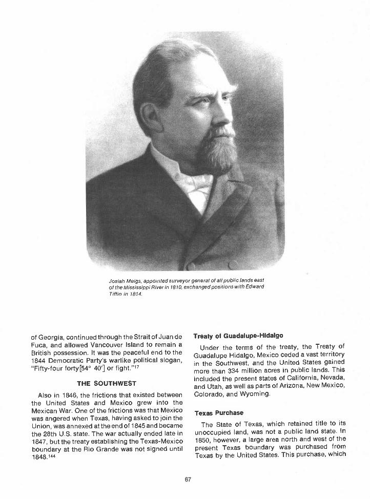
67
of Georgia, continued through the Strait of Juan deFuca, and allowed Vancouver Island to remain aBritish possession. It was the peaceful end to the1844 Democratic Party's warlike political slogan,"Fifty-four forty54° 40'J or fight."17
THE SOUTHWEST
Also in 1846, the frictions that existed betweenthe United States and Mexico grew into theMexican War. One of the frictions was that Mexicowas angered when Texas, having asked to join theUnion, was annexed at the end of 1845 and becamethe 28th U.S. state. The war actually ended late in1847, but the treaty establishing the Texas-Mexicoboundary at the Rio Grande was not signed until1848.144
Josiah Meigs, appointed surveyor genera! of a!! pub!ic lands eastof the Mississippi River in 1810, exchanged positions with EdwardTiffin in 1814.
Treaty of Guadalupe-Hidalgo
Under the terms of the treaty, the Treaty ofGuadalupe Hidalgo, Mexico ceded a vast territoryin the Southwest, and the United States gainedmore than 334 million acres in public lands. Thisincluded the present states of California, Nevada,and Utah, as well as parts of Arizona, New Mexico,Colorado, and Wyoming.
Texas Purchase
The State of Texas, which retained title to itsunoccupied land, was not a public land state. In1850, however, a large area north and west of thepresent Texas boundary was purchased fromTexas by the United States. This purchase, which
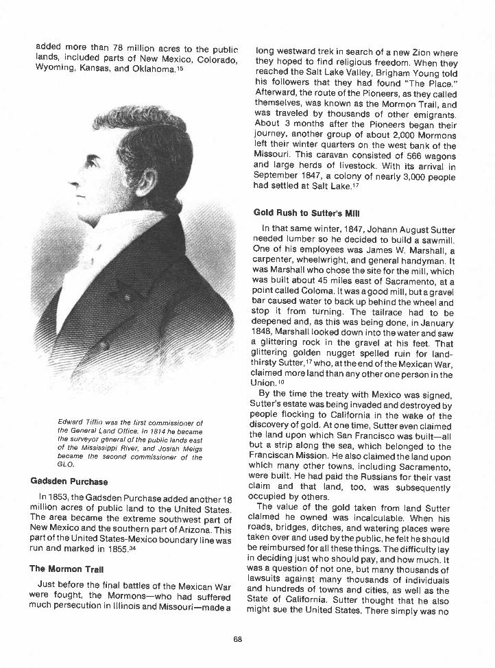
added more than 78 million acres to the publiclands, included parts of New Mexico, Colorado,Wyoming, Kansas, and Oklahoma.15
Edward Tiffin was the first commissioner ofthe General Land Office. In 1814 he becamethe surveyor general of the public lands eastof the Mississippi River, and Josiah Meigsbecame the second commissioner of theGLO.
Gadsden Purchase
In 1853, the Gadsden Purchase added another 18million acres of public land to the United States.The area became the extreme southwest part ofNew Mexico and the southern part of Arizona. Thispart of the United States-Mexico boundary line wasrun and marked in 1855.34
The Mormon Trail
Just before the final battles of the Mexican Warwere fought, the Mormonswho had sufferedmuch persecution in Illinois and Missourimadea
68
long westward trek in search of a new Zion wherethey hoped to find religious freedom. When theyreached the Salt Lake Valley, Brigham Young toldhis followers that they had found "The Place."Afterward, the route of the Pioneers, as they calledthemselves, was known as the Mormon Trail, andwas traveled by thousands of other emigrants.About 3 months after the Pioneers began theirjourney, another group of about 2,000 Mormonsleft their winter quarters on the west bank of theMissouri. This caravan consisted of 566 wagonsand large herds of livestock. With its arrival inSeptember 1847, a colony of nearly 3,000 peoplehad settled at Salt Lake.17
Gold Rush to Sutter's Mill
In that same winter, 1847, Johann August Sutterneeded lumber so he decided to build a sawmill.One of his employees was James W. Marshall, acarpenter, wheelwright, and general handyman. Itwas Marshall who chose the site for the mill, whichwas built about 45 miles east of Sacramento, at apoint called Coloma. It was a good mill, but a gravelbar caused water to back up behind the wheel andstop it from turning. The tailrace had to bedeepened and, as this was being done, in January1848, Marshall looked down into thewater and sawa glittering rock in the gravel at his feet. Thatglittering golden nugget spelled ruin for land-thirsty Sutter,17 who, at the end of the Mexican War,claimed more land than any other one person in theUnion. 10
By the time the treaty with Mexico was signed,Sutter's estate was being invaded and destroyed bypeople flocking to California in the wake of thediscovery of gold. At onetime, Sutter even claimedthe land upon which San Francisco was builtallbut a strip along the sea, which belonged to theFranciscan Mission. He also claimed the land uponwhich many other towns, including Sacramento,were built. He had paid the Russians for their vastclaim and that land, too, was subsequentlyoccupied by others.
The value of the gold taken from land Sutterclaimed he owned was incalculable. When hisroads, bridges, ditches, and watering places weretaken over and used bythe public, he felt heshouldbe reimbursed forall thesethings. The difficulty layin deciding just who should pay, and how much. Itwas a question of not one, but many thousands oflawsuits against many thousands of individualsand hundreds of towns and cities, as well as theState of California. Sutter thought that he alsomight sue the United States. There simply was no


way to obtain judgments against all the people andgovernments Sutter believed owed him money.
A California judge named Thompson was able toobtain a life pension of $3,000 a year from the Stateof California for Sutterthe man who, for a while,had thought of himself as the richest man inAmerica. Even so, most of Sutter's pension went tounscrupulous people who said they would helphim with "his case." Beginning in the 1860's, Suttermade various petitions to the United States.Congress did not act on his case and he died 2decades later, on June 17, 1880, a penniless,demented old man.1°
MINING FRONTIERSThe discovery of gold in California changed the
course of settlement in the United States, and, withthe tide of settlement, came the need for surveys.Miners from all over the world found their way intothe California mining area almost overnight. The
Abraham Lincoln, surveyor.
70
hordes of people who made up the Gold Rush of1849 were, collectively and individually,trespassers on the public lands of the UnitedStates. All they thought of was the gold, and theyconsidered it to be theirs for the taking.
Because of this prevalent attitude, thesettlements based upon mining were not at all likethe more orderly westward movement of trappersand farmers. The mining frontier followed a seriesof new finds, each of which set the miners off in anew direction to another remote area. For many ofthem, first came the rush, and then disillusionment.If there was enough precious metalsilver or goldor whatevera roaring mining town grew andprospered. At least the gamblers and saloonsprospered. Then, as happened in California in thelate 1850's, the mines gave out. About the time atown realized it must rid itself of the outlaw elementthat seemed to follow the miners, it was on its wayto becoming a ghost town, unless its residents

A
k
knew the real treasure, which was, more often thannot, the land.
As the easiest mining ended in California, tales ofprecious minerals in Colorado lured the minersthere. Or to Nevada. Or to parts of Oregon andIdaho. Later, Montana and the Black Hills of SouthDakota beckoned. Later still was the rush to theYukon.
71
CREATION OF THE DEPARTMENT OFTHE INTERIOR
In 1849, in the face of this, the General LandOftice was transferred from the jurisdiction of theTreasury Department to the Department of theInterior, which had just been created. Therewas nomajor change in the responsibility of the GLO,
, ft, -4' 4-47
fri ,2-t-. %-Me I, fr
,v ..-, /
A facsimile of the legal opinion formulated by Abraham Lincoln concerning subdivision of sections
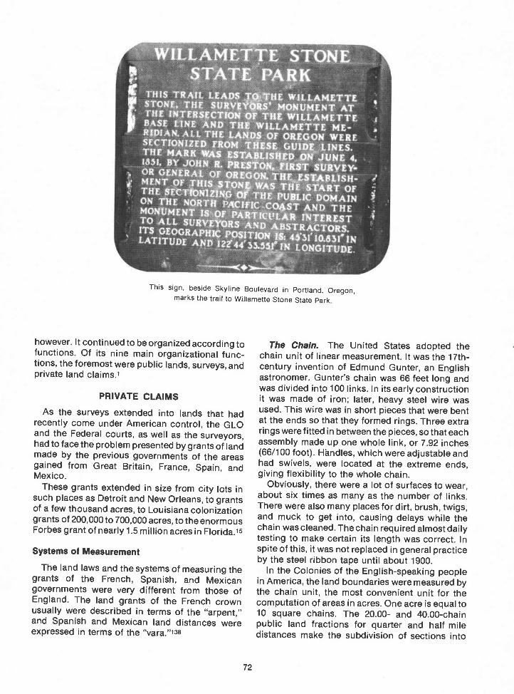
S ARKTHIS TRAil LEAPS Ti. HE WILJ.Ai4LTTESTONE. THE SURVt# ' MONUMENT AT[ THE INTERSECTION £ WII1M4TTCI BASE LINE AND TU ILLAM?Y1 ME' R$PIAN.AUTPIE or OREGON WERE
SECTIONIZEE) FROM 1St GUIDZ)j.INES.THE MARK WAS UTAJLISP.DWJUNE 4.1831, BY JOHN R. PRESTON. flUT SURvEY-, OR GLNER.1L OF OREOOLTHLJflBLISH-MENt OF IHIS TON&WS THE START OFTHE SE1N1N 0, TUE PU DOMAINON THE NOR1 PACIVIC-004ST AND THEMONUMLN1 ISOF PA'44TVVtA* iNTERESTTO ALL SURVEYORS 'AND ABSTRATORS,ITS GEOGRAPHIC POSITION 4$3l' IO.83I1NLATITUDE ANfl l2244'LONGITUDE.
a
I
however. It continued to be organized according tofunctions. Of its nine main organizational func-tions, the foremost were public lands, surveys, andprivate land claims.1
PRIVATE CLAIMS
As the surveys extended into lands that hadrecently come under American control, the GLOand the Federal courts, as well as the surveyors,had to face the problem presented by grants of landmade by the previous governments of the areasgained from Great Britain, France, Spain, andMexico.
These grants extended in size from city lots insuch places as Detroit and New Orleans, to grantsof a few thousand acres, to Louisiana colonizationgrants of 200,000 to 700,000 acres, to the enormousForbes grant of nearly 1.5 million acres in Florida.15
Systems of Measurement
The land laws and the systems of measuring thegrants of the French, Spanish, and Mexicangovernments were very different from those ofEngland. The land grants of the French crownusually were described in terms of the "arpent,"and Spanish and Mexican land distances wereexpressed in terms of the "vara."138
This sign, beside Skyline Boulevard in Portland, Oregon,marks the trail to Willamette Stone State Park
72
The Chain. The United States adopted thechain unit of linear measurement. It was the 17th-century invention of Edmund Gunter, an Englishastronomer. Gunter's chain was 66 feet long andwas divided into 100 links. In its early constructionit was made of iron; later, heavy steel wire wasused. This wire was in short pieces that were bentat the ends so that they formed rings. Three extrarings were fitted in between the pieces, so that eachassembly made up one whole link, or 7.92 inches(66/1 00 foot). Handles, which were adjustable andhad swivels, were located at the extreme ends,giving flexibility to the whole chain.
Obviously, there were a lot of surfaces to wear,about six times as many as the number of links.There were also many places for dirt, brush, twigs,and muck to get into, causing delays while thechain was cleaned. The chain required almost dailytesting to make certain its length was correct. Inspite of this, it was not replaced in general practiceby the steel ribbon tape until about 1900.
In the Colonies of the English-speaking peoplein America, the land boundaries were measured bythe chain unit, the most convenient unit for thecomputation of areas in acres. One acre is equal to10 square chains. The 20.00- and 40.00-chainpublic land fractions for quarter and half miledistances make the subdivision of sections into

aliquot parts (called quarter-quarter and quartersections) fairly simple. In units of area, these are,respectively, 40 and 160 acres. Ten chains alongthe section boundary gives the side of a quarter-quarter-quarter unit, or a 10-acre subdivision.
The Arpent. The French arpent was not used asa direct linear measure, but tracts of land weredescribed in length and breadth in terms ofarpents, the unit meaning the length of the side of1 square arpent. In Louisiana, Mississippi,Alabama, and the northwestern part of Florida, 1arpent was very nearly 0.84625 acres. The side of asquare arpent equalled 2,909 chains.138
The Vara. The vara was a unit of linear measurein both the Spanish and Mexican land grants. In thePublic Domain of the southwestern United States,it equalled 4.1658 links. One hundred varas were4.1658 chains, or 274.943 feet.141
The solar compass pictured above is the type ofinstrument used in the original surveys of theWillamette Meridian and Base Line. The picture wastaken in Willamette Stone State Park.
As if this were not complex enough, the valuesaccorded the arpent and the vara differed indifferent areas. In Arkansas and Missouri an arpentwas 0.8507 acres, and the side of a square arpentwas 2.91667 chains, or 192.500 feet. In Florida, 100varas equalled 4.2136 chains, or 278.100 feet.138
Doubtful Claims
Adding to the problem was the fact that, from thebeginning of American control, there was amplereason for the court to have doubts about theauthenticity of many of the grants. In LouisianaTerritory, for example, Silas Bent, a governmentsurveyor, reported that the records of his officehad:
undergone a revolution, there has been Leavescut out of the Books and others pasted in withLarge Plats of Surveys on them. . . . the dates

have been evidently altered in a large proportionof the certificates, Plats have been altered fromsmaller to Larger, Names erased and otherincerted and striking difference in collour of theink etc.
Although the writing was imperfect, his messagewas clear.15
In 1812, the State of Louisiana, formerly theTerritory of Orleans, was admitted to the Union. Atthat time, the Territory of Louisiana was made theTerritory of Missouri. When the Board of LandCommissioners for Missouri Territory made itsreport that year, it was found that all of the reallylarge claims had been rejected. The aristocrats ofthe vast fur trading empire, such as the Chouteaufamily, then exerted their (considerable) influenceto have the requirements for confirmation of theirclaims relaxed. Eventually, large grants wereconfirmed to members of the wealthy fur tradingfamilies, but they were only a small part of the landthey had once claimed. All of this made more workfor the surveyors, because, as grants once con-firmed and surveyed were enlarged, they had to besurveyed again. In some cases, due to litigationand legislation, a third survey was required.
Private ClaimsBefore and After 1846
In the territory acquired prior to 1846, there were18,643 private claims confirmed in 12 states. Thetotal area was 10,253.671 acres.15
When the treaty with Great Britain ending jointoccupancy of the Oregon country was signed,143and land from Mexico was acquired under theTreaty of Guadalupe-Hidalgo, the private claimproblem once again presented problems.
Article 8 of the treaty with Mexicol44 said:
Mexicans now established in territoriespreviously belonging to Mexico, and whichremain for the future within the limits of theUnited States, as defined by the present treaty,shall be free to continue where they now reside,orto remove at any time to the Mexican republic,retaining the property which they possess in thesaid territories, or disposing thereof, andremoving the proceeds wherever they please,without their being subjected, on this account,to any contribution, tax, or charge whatever.
Those who shall prefer to remain in the saidterritories, may either retain the title and rightsof Mexican citizens, or acquire those of citizensof the United States. But they shall be under theobligation to make their election within one yearfrom the date of the exchange of ratifications of
74
this treaty; and those who shall remain in thesaid territories after the expiration of that year,without having declared their intention to retainthe character of Mexicans, shall be consideredto have elected to become citizens of the UnitedStates.
In the said territories, property of every kind,now belonging to Mexicans not establishedthere, shall be inviolably respected. The presentowners, the heirs of these, and all Mexicans whomay hereafter acquire said property by contract,shall enjoy with respect to its guaranties equallyample as if the same belonged to citizens of theUnited States.
When the American government took overcontrol in California, about 813 private land claimshad to be decided. Some grants were small gardenplots near the missions, but the majority of themwere from 1 to 11 square leagues (a square leaguewas 4,426 acres). Most of the grants had beenintended for grazing livestock and were not undercultivation. None were fenced, and most of themlacked identifiable boundaries. New Mexico,Arizona, and parts of Colorado also had tangledclaims remaining from the period when Mexicoruled the area.
The United States government had the respon-sibility of translating the Spanish-Mexican puzzleof incomplete, conditional, unlocated, and un-surveyed land grants into a vastly different landsystem: one that recognized only fee simple titlesor the type of conditional rights that hadobligations to be fulfilled before title could beissued.15
New Mexico
In July 1890, the surveyor general of New Mexicoexplained a part of the reason behind the problemsof private claims in that territory. The problem hadits beginnings at about the time of the discovery ofNew Mexico, when Emperor Charles V of Germany(who was also the King of Spain) decreed:
If in that which is already discovered in theIndies there should be any places and districtsso good that it may be proper to foundsettlements, and any person should makeapplication to settle and reside in them, in orderthat with a greater will and profit they may do so,the viceroys and presidents may give them inour name lands, house lots, and water inconformity with the disposition of the land.

Aluminum Young and Son solar compass no. 8510. Records show it was in Colorado in 1911 and 1912. it came tothe Olympia, Washington, GLO in 1913 and was used by Andrew Nelson that year. Herbert Raymond used it in1914, and George R. Campbell used it from 1915 through 1918. The instrument is still in good adjustment and is stillin use.
Further, the surveyor general reported,
This plan was pursued until the annexation ofthe territory by the United States. Under theRepublic of Mexico the colonization laws andregulations became a . . . completesystem . . . adapted to the . . . people .and to the . . . country to be occupied.
After explaining the differences between thatsystem and the rectangular survey system used bythe United States, the surveyor general com-mented that the remedy for the problems would besurveys, because "certain title to the land is the
75
foundation of all values. Enterprise in this Territoryis greatly retarded because that foundation is sooften found lacking."135
Surveying these claims was also made difficultby the necessity of reconciling them with theAmerican system of townships and ranges. Finally,the rectangular surveys were fitted around theolder grants, no matter what their origin, shape, orsize, or in what direction they lay. Many oddcorners were produced by the closing of therectangular surveys against the lines of theseclaims.

:C Q .yt),:ait / f2 i/7/2 cL- 74"2 %L_1v
g.g_2L I'- --' /56
e' i1Z1e14-2;
hg-
9'z& 9'
wanted to establish a claim. The 1848 Organic Actcreating Oregon Territory, which voided "All lawsheretofore passed in the said Territory of Oregonmaking grants of land or otherwise affecting orencumbering the title to lands .....was,therefore, most upsetting to Oregonians.
Their distress must have reached Congress,because in September 1850, another DonationLand Law was passed. It was "An Act to Create theoffice of Surveyor-General of the public lands inOregon, and to provide for the survey, and to makedonations to settlers of the said public lands." Thislaw granted 320 acres to every male settler,including American half-breeds, over the age of 18who was a citizen or who had declared his intention
24Jz/ ,,z-1-1 cai'- 2
/', (g-
2' e-/zt) '
1&e4' Z C%C/4 eZ'e/-a) ib ,Ø2zg4.
,-4__ -ji-
ZZ /Z)
Vd/..2aO /iaZi os.- ae&i
A small portion of deputy surveyor John W. Garretson's field notes of his 1855 survey of the New Mexico Principal Meridian.(Courtesy of Duane Olsen.)
OREGON DONATION LAW
The settlers in Oregon had passed an act thatcreated a provisional government 3 years beforethe signing of the treaty that set the northernboundary at the 49th parallel. Under that law, anyman was permitted to hold 640 acres wherever he
76
of becoming one before December 1, 1851, andwho had lived in Oregon Territory and cultivatedthe land for 4 consecutive years prior to December1, 1850. Further, if he married by December 1, 1851,his wife was entitled to a grant of a like amount ofland to hold in her own right!(At that time, it was avery uncommon privilege for a wife to be allowed tohave real property in her own name.) White malecitizens or intended citizens who emigrated toOregon Territory between December 1, 1850, andDecember 1, 1853, and who had met the otherobligations required by the act, were to have 160acres.15
The Donation Land Law did not clarify titlesimmediately. It applied to unsurveyed lands notoffered for public sale. The purpose of the law wasto protect the bona-fide settlers until they had filedclaims and received patents. After this wasaccomplished, the remaining lands, once they hadbeen surveyed, came under the regular lawsdealing with the sale of the public lands.2°

(h 4 dia17 1iljnw 4'$I>rad2A//((
fv//a'// rzc4/7WIJ/h2/ 7< hyi
94'/Y/A /
/1/fl aatb&cá Jt- f//7t (4 4x%,d/ iuy2/d)&cr%frutfr// TI 2A grn'zdni 4-dM/qtth/ /4Z&I (/zdJziitn 6jY4/e>/J-
kJ (k7hz liv hU7
4/ %Kz/'/v( z/,177F/t7f1,/ 4 4
77
The field notes of the 1879 survey of the Wyoming-Montana boundary include this early case of trespass on thepublic lands.
Under the law, if the land was 'deemed unfit forcultivation," only township lines were to be run. Inother cases, only "necessary" lines were to besurveyed. A settler's request for a survey, in thecase of individual land claims, made those surveys"necessary," as that was the only way to acquireclear title, or patent, to the land.
The Willamette Meridian and Base Line wereestablished, and the survey of townships andranges in Oregon's most heavily populated areaswas begun in 1851. Even so, because the law hadprovided no required time for the donation-landclaimants to complete their titles, often they werein no hurry to do so. In 1857, the Secretary of the

Interior stated in his report that "not having beenempowered to hasten the surveys of private landclaims . . . surveying in many townships goes ontardily, because settlers still withhold their re-quests for surveys." Because of this, much of thesettled land was held under incomplete rights. Asalways, surveys were necessary before the sale ofpublic lands, so no public lands were offered forsale in Oregon until 1862.20
In other areas, particularly in the Southwest U.S.,private land claims delayed the extension ofsurveys into surrounding land and thereby keptthose lands from being entered and settled. Often,when the claims were not valid and were notconfirmed, the most desirable lands were affected.The fact that they were held back from survey andsettlement sometimes retarded the development ofa whole area.
The English-European heritage of the AmericanGovernment made it extremely aware of propertyrights, and all claimants were given every oppor-tunity to prove the validity of their claim to land. Inall, 34 million acres of land in 19 States wereconfirmed to the holders of private claims.15
OREGON SURVEYS
John B. Preston, surveyor general for Oregon,chose a point in the hills just west of Portland as theinitial point for the Oregon public land surveys.William Ives, who held Oregon Public Land SurveyContract Number 2, marked the point with a cedarstake on a day in early June 1851. This initial point,the intersection of the Willamette Meridian and itsbase line, is now well inside Portland's city limits.The cedar stake has long since been replaced witha concrete monument, and a small area around ithas been set aside as Willamette Stone State Park.
In choosing the initial point, Preston followed theinstructions given to him by Justin Butterfield,commissioner of the General Land Office. He usedgreat care in selecting the place from whichoriginal surveys were extended for over 100 millionnorthwest acres. Farms, fields, and forests from theCalifornia boundary to the Canadian border aredescribed as east or west of the WillametteMeridian, and north or south of its base line.
In a letter Preston wrote to the commissioner ofthe General Land Office on June 14, 1851, heexplained why he designated what now appears tobe an obscure spot in Portland's west hills as thepoint of beginning for the surveys of the publiclands of Oregon Territory:
78
Surveyor General's OfficeOregon City, June 14, 1851.
Hon. J. Butterfield, Commissioner,General Land Office.
Sir: I have had the honor to transmit herewith acontract made with James E. Freeman, Esq., forsurveying the Willamette meridian from the base linesouth to the Umpqua valley, and a copy of the specialinstructions given him. I also transmit a contract madewith William Ives, Esq., for the survey of the Willamettemeridian north of the base line to Pugets Sound andthe base line from the Pacific Coast to the summit ofthe Cascade mountains, and a copy of the specialinstructions given him.
Previous to making these contracts I organized a partyand visited the Columbia river and found it necessaryto go as far east as the Cascade mountains in order todetermine the point to start the base line so as to"avoid its southerly bend." After determining this Imade a partial examination of the country near themouth of the Willamette to find a proper point to crosswith the meridian line. In the examination, I found thatthere was one small lake that would interfere butconsidered this much less of an obstacle than thebroken country the line would have to pass over ifthrown west of the lower mouth of the Willamette nearSt. Helens. Also believing that if the line was changedto the east there would be greater danger in runninginto the broken country at the foot of the Cascademountains, I determined to locate the line on the pointdesignated in the map accompanying your instruc-tions. The point of intersection of the base andmeridian line is 31/2 miles west of Portland. The baseline will run through Portland on the Willamette andHillsboro in Tualatin plains, 151/2 miles west ofPortland. The meridian will run about five miles west ofOregon City. If the deputy surveyors find difficulty ingetting men to assist them, the farmers are nowoffering $5 and $6 per day for men to assist inharvesting.
In order to advance the surveys, it will be necessary togive out some contracts for surveying township linesbefore the surveys of the base and meridian lines arecompleted. I have therefore desired the deputies onthose lines to return their notes after they havesurveyed 75 miles each. After these notes have beenapproved will get out contracts for surveying 25township lines.
Very respectfully, your obedient servant,
JNO. B. PRESTON,Surveyor General.
In his letter, Preston makes a rather casualmention of "visiting" various areas in his examina-tion of the country to determine the site of theinitial point. It would be well to remember,however, that, except for the emigrant trails and afew settled areas in the valleys, there were no roads

-I.'
r--
pa
C
0
C
WI L
LAM
ErI
E
0v
0 C
C a
IAN
'"-(I
",--
-,
4
NG
E
/
St. Helens
.-.Broken'Counfry,_
In p.. In -BASE LINE
Between Columbia Riverand slopes of Mt. Hood
Crossing Columbia Riverat an island chain
Crossing Willamelfe Riveron east-west crossing
PRESTON'S CONSIDERATIONSIN LOCATING AN INITIAL POINT IN OREGON
0 0 20 30 40 50 00
SCALE IN MILES

in Oregon Territory in 1851. At that time, riverswere the main highways of the Oregon country.
The men who accompanied Preston to OregonTerritory were all men whose work had rec-ommended them. James E. Freeman had been adeputy surveyor in Wisconsin and Iowa.35 He heldpublic land survey contracts in Keokuk and VanBuren counties in Iowa in the early 1840's.14
Freeman's Survey Party
James E. Freeman's party surveyed theWillamette Meridian from the initial point south "tothe Canyon Mountains."21 According to surveyorswho have retraced his lines, James Freeman wasone of the best of the early surveyors. His work isconsidered excellent even by modern standards,as is the work done by William Ives, who initiatedthe survey of the Willamette Base Line in 1851 160
When James E. Freeman started south on theinitial survey of the Willamette Meridian, a youngman named Zenas Ferry Moody was a member ofhis survey party. Moody, born in Granby,Massachusetts, was 18 years old when he traveledto Oregon by way of Panama. He arrived in OregonCity in April 1851. Just after his 19th birthday,Moody went to work as a chainman on one of thefirst United States surveys in Oregon Territory.21
On June 10, 1851, another adventurous youngman arrived in Oregon City. His name was KimballWebster. Webster had had less than unqualifiedsuccess in seeking his fortune in the 1849California gold rush, so in 1851 he started north.35When he arrived in Oregon City, Webster wasdisappointed to learn that the survey parties werealready at work and had left the area. Later thatyear, Kimball Webster went south to join theFreeman party.
Zenas Moody was still one of the chainmen, andKimball Webster became the axeman. He wasdoing a good job as axeman when Freemandiscovered that Webster was well versed intrigonometry. It was Webster's good fortune thathe had joined James Freeman's party, for Freemanwas so dedicated to his job that he encouraged themen on his surveys to learn and assist him, andthus advance their own careers.
When Webster first joined the Freeman party,George Hyde was assisting Freeman in makingcalculations. After Hyde's departure, Freemanasked Webster to assist in making calculations. Assoon as Freeman knew he could count onWebster's work, the job of making calculationsbecame Kimball Webster's job.35
If one reads the field notes of Freeman's Oregonpublic land surveys, a record of the progress of the
80
men of the survey party becomes clear. The fieldnotes tell of both Zenas Moody's and KimballWebster's education in the survey of the publiclands. They were axeman, flagmen, markers,assistants, and instrument men. Over a period oftime, they held all the jobs that would help themunderstand cadastral surveying. They were am-bitious young men, but the opportunities to usewhat they had learned were opened to them byFreeman. It is to his credit that both Moody andWebster became competent surveyors and soonheld survey contracts in their own names.
In March 1852, Kimball Webster was employedon a contract held by Robert Elder. Elder was thechief clerk in Surveyor General Preston's officewhen Webster first met him, shortly after his arrivalin Oregon City. By the time Kimball Websterreceived his first appointment as a United Statesdeputy surveyor on April 25, 1852, he had his ownsolar compass. It cost him $350.35 In June 1852, asurvey contract was issued to Elder and Webster.Under this contract the two men operated a jointparty. Kimball Webster received something over$100 per month for his work. Webster's firstcontract in his own name was issued in December1852.
Zenas Moody stayed with the Freeman surveyparty until 1853, and he became a deputy surveyorin Oregon in 1855. In 1856, he was appointedinspector of the United States surveys in Califor-nia. After completing his job in California, Moodywent to Illinois as the surveyor of Morgan County.In 1862, he returned to Oregon.21
In 1880, Zenas F. Moody became an Oregonstate representative, and in 1882 became theseventh governor of the State of Oregon. His termwas the longest single term of any Oregongovernor. Moody was a popular governor, and histerm of office was a smooth one. He died in Salemin 1917.
SURVEYS TO 1865
Information compiled by the General LandOffice in 1865 indicated that, up to that time, nocadastral surveys had been executed in Arizona,Idaho, Montana, North Dakota, Oklahoma, orWyoming. The surveys that had been done inColorado were in the vicinity of Denver andColorado Springs, as a result of the discovery ofgold in that area.111 Surveys in Nevada had beenstarted,1 and a few surveys had been executed inthe Salt Lake City area of Utah because of theMormon settlement. The settlers who lived alongthe Rio Grande prior to the annexation of Texashad required surveys, and that was the only area inNew Mexico that had been surveyed.111

81
THE STRANGE CASE OF THE SAN BERNARDINO INITIAL POINTS
Due to an extraordinary series of events that occurred over a period of years, there are three initial points for the SanBernardino Meridian and Base Line. These points and the surveys that established them were resurveyed by employees ofthe San Bernardino County Road Department as commissioned by the San Bernardino County Museum In 1966.
The story of the three Initial points began in November 1852 when Henry Wshington, a highly respected deputysurveyor, established the initial point for the San Bernardino Meridian and Base Line in southern California. The problemshe encountered, including the lack of sufficient funds and the height and ruggedness of San Bernardino Mountain, areamply described in a report he sent to Samuel D. King, the surveyor general of California, the following month.128
Washington did not survey the meridian and base line from the point he had established. His fleid notes do not Indicatewhat method he used in surveying away from his Initial point, but he did survey the west and south boundaries ofTownship 1 South, Range 2 West, and the west, south, and a portion of the east boundaries of Township 2 South, Range IWest.
In 1876, Deputy Surveyor Albert Ruxton surveyed in the same area. He established monuments on the San Bernardinoduring a partial survey of Township 1 North, Range 1 East. Although Ruxton did not survey to the initial point, one of hismonuments was established only 2 miles from it.
Deputy Surveyor John C. Rice completed the survey of the San Bernardino Meridian from the north, probably alongRuxton's lIne. He intersected the base line ate point he showed as being 13.45 chains east of Washington's initial point.Rice established a second Initial point at that location. (The distance of this point from the first initial point was measuredby the resurvey expedition as 14.04 chains.)
In 1907 George W. Pearson, deputy surveyor, set a third initial poInt when he completed the survey of the SanBernardino Meridian from the south. Pearson reached the base line at a point he said was 4.20 chaIns west of Rice'smonument.
in 1917, Frank W. Chapin, a cadastral engineer, surveyed a part of Township 1 South, Range 1 West. Since surveys in thearea were tied to them, Chapiin accepted both Rice's and Pearson's points. He reset them with brass-capped regulationiron posts. These points have been measured as being 4.44 chains apart.
in 1927, Dupree Reed Averlil, a UnIted States surveyor, set a brass-capped regulation iron post beside the original 1907marker set by Pearson. He also set the corner between Range 1 East and Range 2 East next to Pearson's marker of thesame point.
The San Bernardino Meridian is offset 4.44 chains at the baseline. Henry Washington's initial point would have put themeridian 9.40 chains west of the 1907 Pearson monument. Washington's point also lies 6 links south of the present SanBernardino Base Line according to later measurements.128
T. I N., R. I W. T. IN ,R.I E.
Sec. 36 Sec 31
Woshinghn,'s
-6 Initial Point
T. I S , R. I W.
Sec. Sec. 6
Initial Points of the San Bernardino Meridian and Base Line asdetermined by the Washington Initial Point Resurvey Expedition.

/ F?
3 Tor'' rv -
a -
4r ''o9E47YON6 .4'i' '/ ,'4vz/E
Much of California had been surveyed becauseof the gold found at Sutter's mill, and also becauseof the settlementof California's agricultural land bypeople from the east. They had not found gold, butthey did recognize the value of the land. There hadalso been a demand for surveys by the people whowere living in California before the signing of theGuadalupe-Hidalgo Treaty of 1848.
Only a small portion of the southeastern part ofSouth Dakota had been surveyed by 1865. Thewestern parts of both Kansas and Nebraska werestill completely unsurveyed at the end of the CivilWar, even though settlements along the rivers and
7L/NLy / //.c?yD /3 6iv%'ro,"c9C4 J'pO4 I // MJJ'M'/es- /..L '7é' //it'9I/.9 ',',., /2 Cpi t4'j,;'c,v / 2?ryr -1/WRO /.9 f/t-'iei74D
Sc' v.' .'r?A p 'C4 C EAA.5Montana, U.S. Surveyor-General's office clerks, about 1890.
82
in the timbered areas of Western Oregon andWashington had created the need for surveysthere.1 11
U.S.-CANADIAN BOUNDARY SURVEY
During the early years of the 1870's, surveys thathad been delayed by the Civil War were beingexecuted in many areas all across the UnitedStates. While the regular work of the cadastralsurveyors continued, British and American sur-veyors were also at work marking the UnitedStates-Canada boundary. The line along the 49thparallel westward from the Red River occupied the

boundary commission during the 1873-74 surveyseason. It is probable that the first people whobenefited from the fact that the internationalboundary line had been surveyed and marked inthat area were Sitting Bull and his warriors. Theyfled across it after the Battle of the Little Big Horn,in 1877, to escape the pursuing American Army.24
BLACK HILLS GOLD RUSH
At about this same time, geologists accom-panied General Custer's expedition into the BlackHills in South Dakota. News leaked out of theirreports that those hills were full of gold. The UnitedStates started negotiations to purchase the landmeanwhile attempting to keep out gold seekersand settlers. Prospectors managed to evade thearmy's efforts to keep them away from the Siouxlands and, in 1875, Deadwood Gulch was the sceneof an incredibly rich gold strike. By the beginningof 1876, there was another gold rush.24
MORE OREGON SURVEYS
William H. Odell, who became surveyor generalof Oregon in 1871, was born on December 25,1830.When he was 21 years old he crossed the GreatPlains with his father and spent 3 years helping hisfamily become established on a donation landclaim near Dayton, Oregon. Odell then entered theOregon Institute (Willamette University) where hestudied mathematics and surveying and became achainman on a government survey party in 1854.16He was a deputy surveyor in Oregon from 1864until 1871, when he became the surveyor general.
83
In his 1872 report to the Commissioner of theGeneral Land Office, Odell stated that no one butthe men who had surveyed west of the CascadeMountains could know what the work entailed. Henoted that "the interminable undergrowth andimmense fallen trees make it exceedingly difficultto progress." In spite of this, he also recommendedthe swift extension of the surveys, due to the valueof the timber and agricultural lands in the area.People were beginning to settle the land and hadalready gone ahead of the surveys in someareas.14°
By the latter years of the 1870's, the surveys inOregon had long since finished with the WillametteValley. By that time, the valleys in western Oregonwere considered an "old" part of the United States.As early as 1871, a newspaper editorial stated thatmany newcomers to western Oregon expecting tofind a new country were disappointed to find that itwas as old as Kansas or Minnesota.25
As the surveys were extended over more ofOregon, other deputy surveyors were hired.Among them were the Fitzhugh brothers, John andGeorge, who worked in Curry County.
In 1879, John Fitzhugh, wrote a wry commentabout the solar compass:
The solar compass is a fine instrument in thehands of an astronomer and mathematician.When in perfect order its results are quick andreliable, but under the control of an "ignoramus"it is the wildest "machine" that ever was used totrace a line.

Nc / fa9O0j, r. (I pn .- "AL 1: 0
_IIII, -1°
110 CIt
:i (':
.r
?KO <0' I /
''¼\::
-S .tn.t/r:u',5 I
4'
4
S
'4'
.n 34
4'.
'4p1 (.4I.
'-a4)
.frr 26
.0
t a
110 UG
---1L aI /
KJ..jtnv'ft
I
(0 #1 IIi0(!O . S. *p 4'
p
440
J('( 20I I Co
'1460 .500
3
1fL
A portion of a p/at approved in 1849 The survey was done by William A and Austin Burt and William Ives
wsc 5)

85

Early surveyors, like other pioneers, acceptedhardship and dangeras part of their job. Field notessometimes give small glimpses of the everyday lifeof the surveyors, or scanty, unembellished ac-counts of high adventure. Records of surveyors'experiences are usually short and disconnected.They tell of such diverse tribulations as camp life,rough country, storms, prairie fires, swamps, orhostile Indians.
WISCONSIN-1847
Deputy Surveyor Harry A. Wiltse once wrote afirst-hand description of life on an 1847 Wisconsinsurvey. The survey lines ran through many miles ofinsect-infested swamp. In order to do their work,the surveyors had to carry all their food andequipment on their backs as they waded throughhigh water and climbed over fallen trees. For fourlong weeks they endured attacks by clouds ofmosquitoes. Their clothing was wet both day andnight. Finally, they ran out of food and had to makea forced march in search of provisions. Wearingclothes that were nearly rotted away, theystruggled for 3 days to reach a place where theycould find food. During that 3 days there wasnothing at all to eat. Little wonder Wiltse closed hiswritten account of this survey by stating that he"would not again, after a lifetime of experience inthe field, and a great fondness for camp life, enterupon the same, or a similar survey, at any pricewhatever."30
SURVEYS PROGRESS
By the middle 1850's, the active period of publicland surveys had ended in Ohio, Alabama, Arkan-sas, Illinois, Indiana, and Missouri. Iowa publicland surveys were three-quarters finished, as werethose in Michigan and Mississippi. The surveys inFlorida, Louisiana, and Wisconsin were about halffinished, and those in Minnesota, California,Kansas, Nebraska, New Mexico, Oregon,Washington, and Utah had been started.3°
The survey of the Nebraska-Kansas boundary,which is the base line of the Sixth PrincipalMeridian, was started in 1854. The line was run andmarked, mainly with small wooden posts, for 108miles westward from the initial point (52.55 chainswest of the right bank of the Missouri River, on the40th parallel). The cast-iron monument for the
Chapter 10
IN THE VANGUARD
87
initial point was set in 1855. It ismarked: "NEBRASKA" on the north, "1854" onthe east, "40° N LAT" on the west, and "KANSAS"on the south. When the line was resurveyed andremonumented during 1855-56, the formermarkers were destroyed. The line was extendedfrom the 108th mile westward to the RockyMountains in 1858-59, as a base line of the surveysof the public lands.34
Kansas Problems
Field note records of some original surveysexecuted in Kansas yield interesting insights intosurveyconditions. Considerthisexampleofagoodexplanation for a delay in completing a surveycontract:1 11
we would state that on or about the 1st ofAugust, 1854, we repaired to the field ofoperations preparatory to executing the con-tract. On arriving in the field we found our workwas immediately in the vicinity of headquartersof the hostile Indians and after skirmishing withus 2 days, they fired the prairies, completelydemolishing everything for our cattle to subsiston for many miles, in fact the whole countrylying between the Solomon and RepublicRivers, and we were forced to abandon ourwork.
Here is another:111
At this place a party of Indians fired on me andmy men. Their design was to kill me; they hadpreviously threatened to shoot me and my menIf I did not quit surveying there. A shell struck atree against which I was leaning at that time,while my compass needle was setting [settling]not 6 inches from me.
Nebraska Troubles
Deputy M. McManus, from Sangamon County,Illinois, had a contract to survey in NebraskaTerritory in 1855. He wrote a letter that Decemberto the Surveyor General John Calhoun. In theletter, McManus wrote that one of his mules hadbroken its neck. He went on to lament about thetroubles he had experienced on the survey andnoted that it was surely not the same matter asretracing old lines in Sangamon County.13

Michigan Hazards
In 1855 the surveyor general of Michigan filed areport dealing with the swamps and the weather:3°
a considerable portion of thesurfaceof thecountry is low and swampy. . . In conse-quence of frequent rains the country has beenrendered unhealthy, and nearly every party hassuffered by sickness, and in one instance, bydeath. The duties have been so laborious thatmen have in some cases become refractory andleft the field, making it necessary for thedeputies to abandon their work for a time toengage new assistants.
Oregon Annoyances
In 1855, in Oregon, Deputy Surveyor HarveyGordon reported that he had run into unexpectedproblems.83 He had been "obliged to carry mycamp equipment on men's shoulders . . . over thecoast mountains, which are inaccessible tohorses." He continued, saying that, after that hike,the men ". . . were unable to continue the work. Iaccordingly suspended operations to form a newparty, but before I could do so the entire laboringportion of the community was seized with the goldpanic......Wages climbed from $52 to $100 permonth, and still Gordon could not find good men,even at that inflated wage.
Additional Survey Hazards and Difficulties
In Nebraska and Kansas that same year, 1855,the trouble was Indians. The surveyor generalreported:
The progress of the surveys under my chargehas been suspended . . . on account of thepositive refusal of the Pawnee Indians to allowus to proceed. . . . Some Indians(chiefs) . . . ordered us to leave . . . andbacked their orders with repeated threat thatevery man who did not leave the survey beforethe sun should arrive at meridian should beshot. . . . They then pulled up all the posts seton the north side of the river, told us they woulddestroy all of the landmarks made in the vicinity,and that we must and should leave.
There was an Indian war in what is now the Stateof Washington in 1857. The surveyor general'sreport stated:3°
The paralysis caused by the Indian war, thescarcity of men and general impoverishment ofthe inhabitants, including the few land sur-veyors of the country, together with the ex-ceeding topographical difficulty of the country,
88
has made it impossible to find deputies willing tocontract for any work other than that reported.
In 1856, John S. Zieber, surveyor general ofOregon, called attention to the rugged scenery:83
The public lands which remain to be surveyed inOregon are probably rougher than any that havebeen sectionized in the Territories of the UnitedStates. Scarcely an unsurveyed township ofland can be found without canyons, ravines, orprecipitous hills; and most of the unsurveyedterritory abounds in heavy timber (often stan-ding and fallen), dense tangled undergrowth ofbushes, briars, ferns, and grass, in many placescovering a rocky surface almost impassable.
While all these events were occurring,homesteading was coming into its own and thesurveyors were kept busy executing neededsurveys and overcoming hardships. During thelatter part of the 19th century, the fires thatsometimes swept over the prairie land were often ahazard. In Nebraska in 1872, a surveyor named W.E. Harvey suffered a great loss from such a fire.One day in July, when his cook went to the river forwater, the prairie grass caught fire and burned alltheir clothing, bedding, and most of theirprovisions. Surveyor Harvey counted himself luckybecause he was able to save the field notes.13
Water was also a problem. Moses K. Armstrong,on a survey of the south line of Dakota, had toomuch. He wrote that he was "quite sick with a coldfrom wading so much in mud and water." At othertimes, the problem was too little water. Occasional-ly surveying parties had to haul water many miles.Deputy surveyor W. A. Richards once wrote: "OldJim (a mule) tipped over on a side hill but didnothing worse than smash a water pailwhich isbad enough in this country."13
One terse entry in the field notes of an early-daydeputy surveyor in the southwest states, "The pointfor the corner fell on top of a bluff occupied byhostile Indians. I set a witness corner."157
A Surveyor's Journal
W. A. Richards kept a journal on a survey of thesouthern boundary of Wyoming. The contract forthe survey was held by Alonzo V. Richards; W. A.Richards was a member of the survey party.14° TheSeptember 16, 1873, entry describes an evening ina survey camp:13
The camp was in a wooded area and consistedof a temporary shelter of boughs. There was ablazing, pine-log fire burning and the mules hadbeen tied at one side of the bivouac for the night.

The surveyors packs were stacked at the otherside of the camp and a nearby tree was"decorated" with a dressed-out deer.
He said that the men were sitting by the campfireplaying their nightly game of euchre [a cardgameJ. In his journal, Richards also mentionedhaving copies of "Harpers Weekly" with him, andhe noted that he had also read "Martin Chuzzlewit,""Tom's Vindication," and "Nicholas Nickelby"during that summer survey season.13
Frontiersmen by Choice
While many early surveyors became expertwoodsmen, plainsmen, and mountaineers, theywere not really like most of the trappers andcowboys who lived a similar frontier life. Thesurveyors were, for the most part, not born toprimitive conditions. They were often among thebest educated men of their time.
Some of them were accustomed to luxury, andmany of them had known the pleasures of a well-ordered, comfortable existence. The two-sidedworld to which they adapted was of their ownchoosing. They chose an exhausting and excitinglife of adventure in the marking of America'sfrontier lands, even though a number of them wereas familiar with good food and service in elegantsurroundings as they were with tin plates of saltpork and beans in a survey camp.
Buck's Tragedy
With all their problems, most surveyors faredbetter than did Deputy Surveyor Nelson Buck.Buck had been a surveyor for more than 30 yearswhen he made application, in 1867, to survey thearea from Red Willow and Frontier Counties inNebraska westward to the Colorado line.13 Hisapplication was refused because of the hostility ofthe Indians in the area.96 Buck reapplied in early1868 and explained that he would have a large,well-armed survey party. He felt sure they would beable to protect themselves. He also mentioned hislong and successful career as a frontier surveyor.The officials relented, and on June 29, 1869, anitem in the Plattsmouth, Nebraska, newspaperstated that Buck had received the surveyingcontract. This became locally known when Buckarrived in Plattsmouth, and hired two teamsters,bought provisions, arranged for wagons andteams, and started out for Fort Kearney.
Buck wrote a letter on July21, 1869, and mailed itfrom Fort Kearney. In it he mentioned that he hadnot obtained the arms and ammunition at the fort
89
that he had wished to take with his party. He alsowrote that reports of more trouble with the Indianshad caused some of his men to "take otheremployment."
That letter was the last communication anyoneever received from Nelson Buck or the men whowere with him when he started his survey. InOctober it was found that no corners had been set.No evidence of any survey work could be located,nor could the survey party. Later, a place where thesurvey party camped was found, silent witness towhat must have taken place. The camping equip-ment was there, as were tripods, part of a wagon,canned goods, and even an engraved silver spoon.The campsite was less than 40 chains north of theKansas Line, about 4 miles southwest of Dan-bury.96
Allason's Tribulations
In November 1869 another Nebraska deputysurveyor, W. J. Allason, reported that he hadencountered several difficulties and found himselfface to face with ruin. He felt that the surveyorgeneral was not sympathetic, and told him so in aletter:13
Cl cannot] see what satisfaction you [thesurveyor general] can reap by taking advantageof the misfortunes of one who has nearly all he isworth in this one contract. I had to correct amistake in my line and was hindered on accountof high water and to cap the climax I was burntout. And now you are so I learn trying to get theCommissioner to claim the forfeit of mybondsmen and annul my work altogether. Godknows I never did you any harm byword or deedand if you cause my ruin by what may be yourlegal power may your future happiness andprosperity be in accordance with its justice.
ARIZONA INITIAL POINT
In 1863, a surveyor general was appointed for thenewly created Territory of Arizona. He started forArizona, but the Report of the Commissionerof theGeneral Land Office for that year stated that "noreport has been received from him since hisdeparture." Apparently they never did hear fromhim, so finally, the job of selecting the initial pointfor the Arizona surveys fell to the surveyor generalof New Mexico, John A. Clark.
On May 24, 1865, Clark made the followingreport:1 12
Immediately opposite the mouth of the Saladoon the south side of the Gila, there is a conical

GENERAL DESCRIPTION OF T. 24 N., R. 108 W., SIXTHPRINCIPAL MERIDIAN, WYOMING (1900)
On page 62 of the "Manual of Surveying Instructions, 1894," there appeared the following requirement:
"Besides the ordinary notes taken on line (and which will always be written down on the spot, leaving nothing to besupplied by memory), the deputy will subjoin, at the conclusion of his book, such further description or informationtouching any matter or thing connected with the township (or other) survey which he may be able to afford, and may deemuseful or necessary to be knownwith a general description of the township in the aggregate, as respects the face of thecountry, its soil and geological features, timber, minerals, waters, etc."
On May 3, 1900, Edward F. Stahle, U.S. deputy surveyor, penned a general description of a township (T. 24 N., R. 108W.,6th P.M., located about 10 mIles southwest of Farson, Wyoming) he had lust surveyed. In it he follows the above manualrequirement to the letterand a bit beyond:
"The land in this township may have, at one time, been covered with a luxurlent growth of grass, but at the presentwriting, that is the scarcest product of the soil.
"Both the nobie red man and the magnificent bison doubtless had many an exciting chase over its billowy stretches,owing to the number of arrowheads used by the former, and the horns of the latter, scattered over it. But there are nonehere now.
"It was doubtless covered with water at one time, as is demonstrated by the vast number of fossils found upon it, but Iregret to say, that there is no water here now. Our parched lips and swoilen tongues emphasized this condition too oftenfor comfort.
"There were a large number of trees growing on it, during the grassy, watery days of yore as we found a number ofpetrified stumps, but there are no trees here now. Our frugal noonday repast could not be partaken of under the shade ofa petrified stump and we were compelled to expose our handsome, bewhiskered, sun-browned visages to the scorchingrays of the meridian sun.
"As we did not find any banana peelings, coconut bark, peanut shells or corn husks, It Is fair to assume that the soil neverwas fruitful or productive. In fact, it is not now.
"Indications point strongiy to the fact, that It was adapted to neither horticulture or fioricuiture. We found no signs ofcarnations, roses, or honeysuckies. We occasionally stumble over a protruding root but doubt that they ever belonged tothe grape vine.
"This may have been a paradise for birds and bees; not that we found any vestiges of antiquated aviaries or apiaries orany other signs of bird or bee life, but they may have winged their filght across the township. However, there are none herenow.
"A meadow iark did warble his lay on a twig of rabbit brush, and then disappeared. That Is the lark; the rabbit brushremains as proof of my story. While animal and bird life seems to have become extinct here, we are not entirely void of livecompanionship. Horned toads, scorpions, centipedes and many other like charming bed fellows, are quite plentiful.
"Nature has, at the present time, been niggardly In distributing shade trees and shrubbery, but while there are no sweetpeas, gladlolas or lemon verbena, the beautiful white and sweet sage and prairie cactus abound.
"If perchance we failed to notice the latter in perambulating about, and our foot came In contact with it, we have heardother names applied to it than beautiful. As one pursuing sedentary habits would avoid a tack on a chair, so we, whosehabits are of a peripatetic nature are cautious of the sharp needled points of the cactus.
"Taking it all in all, however, for some unaccountable reason sheep manage to exist herein the winter time and that is allthere is of It, excepting a few scattered agates and topaz."
Edward F. StahieU.S. Deputy Surveyor
hill about one hundred and fifty feet in height,upon the pinacle of which Mr. Bartlett, in makingthe survey of the boundary line under the treatywith Mexico of Guadalupe Hidalgo, establisheda corner "to mark the mouth of Salt River." Ivisited this monument and found it compactlybuilt of stone, circular, about eight feet diameterat the base, four feet at the top, and eight feethigh, with a post four inches in diameterprojecting from the center of the top about sixfeet, upon which is marked: "United States and
90
Mexican Boundary Survey, 1851.This monu-ment erected in 1851 to mark the junction of theGila and Salt River.-A.H. Gray, U.S. Surveyor."The hill upon which the monument is erectedis . . . a remarkable landmark: andbeing . . . opposite the mouth of the Salado orSalt Riverthe geographical position of whichhas been determinedand, with respect to thearabie land of Arizona, being very central, I haveselected it as the initial point for the Meridian ofthat Territory.

The "conical hill" isa short distance southwest ofPhoenix. It is named Monument Butte. It was fromthe monument selected by Clark that the Arizonacadastral survey grid was extended. On January19, 1867, William H. Pierce and a party of four menbegan the survey of the Gila and Salt River BaseLine. They surveyed eastward, and in 4 days theyhad completed 36 miles along the route of present-day Baseline Road. In 1911, surveyor Guy P.Harrington made surveys from this initial point. Hetook photographs of the hill and the monument,and for many years afterward the monumentremained intact.
In 1945, a cadastral engineer named Ty Whitemade the tie from a nearby triangulation station toa point that he identified as the initial point. Aphotograph was taken then, too. Rocks from themound described by Surveyor General Clark 80years before were shown scattered about, insteadof piled neatly as they were formerly for so long.112
On April 25, 1962, the 150th anniversary of thefounding of the General Land Office, a historicalmonument marking the point of beginning for thecadastral survey of the public lands of Arizona wasdedicated. It is not a grand heap of rocks, as wasthat first monument. Instead, it is a regulationbrass-capped iron survey post, set in a short,slightly tapering concrete pillar. On one side of thesmall obelisk is a granite plaque that tells thenature of the marker and lists the important datesconcerning its history.119
RAILROAD GRANTS
During the Civil War, before John A. Clark chosethe initial point for the Arizona surveys, the needfor a connecting link between the isolated Pacificcoast and the eastern part of the Nation becameevident. Out of this need came the grants, in thelatter half of the 19th century, of extensive portionsof the public lands to aid the construction of atranscontinental railroad and telegraph system.The grants were for the rights of way, plus alternatesections of land. Some of the land granted to therailroads was sold to settlers. Other people settledon the alternate sections of public land along theroute of the railroads.
The Act of July 2, 1864, under which land wasgranted to the Northern Pacific Railroad, provided"That the President of the United States shall causethe lands to be surveyed for forty miles in width onboth sides of the said road, after the general routeshall be fixed, and as fast as may be required by theconstruction of said railroad. . . . The route forthe railroad was selected by railroad surveyors, but
91
the railroad land grant surveys were public landsurveys. They were executed by United Statesdeputy surveyors.75
O&C Lands
Certain odd-numbered sections of the PublicDomain in western Oregon were granted to theOregon and California Railroad Company in 1866.The terms of the grant were violated, so Congress,in 1916, ordered the remaining unsold part of thegrant returned to public ownership. The checker-board pattern of the O&C revested lands, alongwith the reconveyed Coos Bay Wagon Road grantlands, include more than 2.5 million acres of someof the most valuable and productive timber lands inthe United States.106
Golden Spike
The Union Pacific and the Central PacificRailroads were the first to receive land grants.When they met at Promontory Point, Utah, on May10, 1869, a golden spike was driven. At the sametime, an iron one was to be driven, and it wasattached to the telegraph system in such a way thatthe contact of the hammer's blow, as the spike wasdriven to join the two sets of rails, sent a signalacross the nation from the Atlantic to the Pacific.13
In the latter half of the 19th century, Congresspassed several acts that authorized grants of publicland for various purposes. The Homestead Act andthe Act of July 1, 1862, which granted public landsfor railroad rights of way, and the Morril I Act, whichauthorized public land grants to aid in theestablishment of certain state colleges, were allpassed in 1862. The Homestead Act was liberalizedseveral times in the following years. This was inaccordance with the idea that homesteaders wouldbecome permanent settlers.
In 1869, the first extensive geological andgeographical surveys were authorized. Thesesurveys were of potential mineral lands, particular-ly within the Rocky Mountain region. They wereexecuted by United States deputy surveyors whoheld private contracts under the supervision of theGeneral Land Office. Geographical and geologicalsurveys continued in this way for 10 years. At thattime the Geological Survey was established as aseparate office of the Department of the Interior.2
Mining, Timber, and Railroad Interests
The Mining Law of 1872 opened the valuablemineral deposits in the lands belonging to theUnited States to further prospecting and develop-ment. One of the requirements for obtaining a
WESTERN TRAVELBEFORE THE RAILROADS
Something of western travel conditions In the early 1860's may be learned from an account written by Benjamin Randallwho left Boston, to take care of business In Colorado, during the summer of 1862.103
Randall was 20 years old, and enthusiastic about his adventure as he traveled by rail as far as Atchison, Kansas. Therewas no railroad across the prairie west of the Missouri River, so he was interested to learn that the Butterfield OverlandDispatch Route had just sent a stagecoach from Atchison to Denver. He was on the next one when It left on September29th.103
The Stagecoach
It was a Concord coach, the most popular typeof stagecoach In the West. Its name came from its place of manufactureConcord, New Hampshire. It was said to be the most comfortable vehicle of its era for travel over unpredictable roads. Itsswaying, ship-at-sea motion was caused by the fact that the coach body was suspended on heavy leather straps attachedto rocker springs.13
Inside the coach were two seats, one facing frontward, the other backward. A removable third seat was often placedbetween the other two. With three seats in place, It was considered a 9-passenger vehicle. The driver sat In front of thecoach, feet forward against the footboard. On the floor in this section were carried tools, a water pail, a buffalo robe, andthe strong box. The baggage section projected from the rear of the coach and was covered with heavy canvas or leather.Extra baggage and mail sacks were carried on top of the coach. They were held there by a railing around the roof.13 TheConcord coach that carried young Randall had three seats, and was pulled by four good horses. There was a new roadacross the rolling prairie, so they reached Topeka at 10 o'clock that night.'°3
They ate supper and started out again. That night Randall traveled through his first Indian country, the PotawatamiIndian Reserve, so he did not sleep much. The travelers changed horses at St. Mary's Stage Station at 4 a.m.
The Last House on the Plains
They reached Sauna, "the last house on the plains," at 3 o'clock the following morning. For the next 400 miles there wasnothing but open country and the huts where the herders for the stage teams stayed. Randall described the first of thesehuts as being "two forked sticks five feet long stuck In the ground and a stick laid from one to the other so that when he (theherder) threw his blanket over the cross stick it made an 'A' tent."
Surveyers Noted
As the teams were being changed, the station herder told them there had been no return stage.The herder was sure theIndians had "inspected" it. At this point, Randall noted that a party of U.S. Government surveyors had killed somerattlesnakes nearby. The stagecoach continued on. Later they came across the missing stage passengers and driver, whohad taken refuge with a wagon train. The stage had, indeed, been "inspected" by the Indians at Monument Rocks StageStation.
In order to have help sent to the wagon train and its unexpected guests, Randall's stage started back toward Atchison.Along the way they saw "Immense herds of buffalo." They reached Rushton Stage Station at 6 o'clock in the evening, andmet a Government survey party. This time the surveyors had a cavalry escort. The stage driver and his passengers werehungry, so the surveyors treated them to a meal of buffalo steaks.
The people on the stage took a different route and had no more trouble on their way to Denver. One assumes that thesurvey party, still surrounded by hostile Indians out on the remote, rattlesnake-infested 1862 Kansas prairie, went right onwith its surveying.103
patent to a mining claim was a boundary survey.The survey was to be paid for by the claimant.
The Timber Culture Act of 1873 granted tracts ofthe public lands to settlers who planted trees on theplains. The Timber Cutting Act of 1878 permittedsettlers in Colorado, Nevada, the Territories ofIdaho, Montana, Dakota, Wyoming, Utah, and NewMexico to cut timber for agricultural, mining, ordomestic purposes on lands that were not subjectto entry except for mining.15
92
All of these acts, along with the Forest Manage-ment Act of 1897, with its Forest Lieu Section, andthe Preemption and liberalized Homestead Acts,were passed to help settlers. Many of the peoplewho backed some of these laws, such as SenatorHenry Moore Teller of Colorado, did so in goodfaith. Unfortunately, by the time the laws wereactually passed, they were so full of loopholes thatthey almost invited fraud.16 Fraudulent use,speculative abuse, and the exploitation of vast
natural resources on the public lands for privategain was the ultimate result.
The first National Forest Reserve, called theYellowstone Park Timberland Reserve, was es-tablished under the Act of June 4, 1897. It was to besurveyed, protected, and managed by the GeneralLand Office.1 The GLO was really prepared tohandle only one part of the jobthe surveys.Binger Hermann, then commissioner of the GLO,apparently realized the limitations caused by thisfact. And from the beginning, many personsincluding Hermann were disturbed by the forestlieu portion of the Forest Management Act. Underthis provision, any owner or claimant to land withinthe reserves was allowed to give up that tract andselect an equal area of vacant land in its place.
The lieu provision was intended to help settlerswho feared that their land would not be permittedaccess roads if it was enclosed by forest reserves,or that churches and schools would be kept outand that their land would thus be made lessvaluable. Regardless of the good intent, however, itwas soon apparent that the lieu provision wasbeing taken advantage of by speculators whobought State or railroad land that had little value orfrom which the timber had already been cut. Theselands were then exchanged for choice timberlandsoutside the reserves.15
The major beneficiaries of this Act were theSanta Fe, the Northern Pacific, and the SouthernPacific Railroads. Through the purchase of lieuscrip from the railroads, the timber companies alsoacquired valuable lands. The railroads frequentlyexchanged lands fit only for grazing for lieu scrip,which they then sold to the timber companies. Thehuge timber companies then exchanged the scripfor extremely valuable timber holdings.
In October 1898, Binger Hermann warned thatthe forest lieu land selections were being misused.He was afraid that the open exchange of grazingland or land that had already been logged forvaluable timber land would lead to pressure fromthe people who were actually making money fromthis law, for the creation of more land reserves withmore lieu land scrip. Six months after he hadexpressed this fear, Mount Rainier National Parkwas created, and the Northern Pacific Railroad wasgiven the right to exchange its worthless rock andbrush land on the side of the mountain for surveyedand unsurveyed lands outside the Mount RainierNational Park.15
Transfer of Forest Reserves
During the next few years, as the General LandOffice made little headway in the administration of
93
the forest reserves, Gifford Pinchot mounted alarge-scale campaign to transfer the forestreserves to the Department of Agriculture so thatthey would come under his direction. Meantime,Binger Hermann fell into difficulty with corruptelements in Oregon who were using the veryloopholes he had once warned against. Prior to hisdismissal, I-lermann destroyed incriminatingevidencean act for which he was later indicted.The ensuing scandal (which involved variousofficials including a U.S. Congressman and aSenator) fairly well discredited the General LandOffice's administration of the forest reserves.
By the Act of February 1, 1905 (33 Stat., Part 1, p.628), Congress, with the approval of W. A.Richards, Hermann's successor in 1903,transferred the forest reserves to the Department ofAgriculture. The General Land Office retainedresponsibility for surveys and for the administra-tion of the mining and land laws within the NationalForests.l
Wasson's Report
Commissioner Hermann was not the first personto inform Congress of the inequities and abusesinherent in the various public land laws. In his 1880report to the commissioner of the General LandOffice, John Wasson, the surveyor general ofArizona, seconded the conservation and resourcemanagement ideas of the Public Land Commis-sion, which had been authorized by Congress in1879. The Land Commission had collected infor-mation and made recommendations to be used indisposing of the public lands in the western part ofthe United States to actual settlers. Wasson'sreport stated:136
It is mere bosh to orate about our vast unsettledand uncultivated domain which cannot bepopulated to any great extent under presentlegislation; and it is a cruel wrong to the poor toinduce them to go upon . . . [nonirrigable landvaivable only in large tracts for pasturage] tomake homes. . . . [I recommend] all theirrigable agricultural . . . landsbe . . . immediately surveyed into townshipsand offered for sale in large tracts . . . with theimperative condition of providing water . . . asthe case may require. . .
Apparently there were enough surveyorsavailable to help prevent claim disputes and abusesof the mining laws in some States. Albert Johnson,the surveyor general of Colorado, commented in1880 that the part of his report giving the names ofthe deputy surveyors was of interest
"chiefly ... from the fact that there are so manyof them." The vast majority of them were mineralsurveyors, so he went on to say that, "claimants canmake no just complaint of the scarcity of surveyors,as there are large numbers in every miningcamp. . . . It seems as if surveyors especially hadheeded the admonition of the . . . sage [HoraceGreeley], whose advice was, 'Go West, youngman.' "136
Reservation of Public Lands
The reservation of public lands was a high-minded effort to preserve certain areas for thepeople of the United States. In the early years of thewestward migration, the land of the United Statesseemed so vast as to be almost limitless. That iswhy the provision, under the Ordinance of May 20,1785, which set aside land in each township forthesupport of public schools was so remarkable.
It also required great foresight, during the early1800's, to reserve townships in Indiana thatcontained salt springs, as did the action by whichfour sections surrounding the Hot Springs inArkansas Territory were "reserved for the futuredisposal of the United States" by section 3 of theAct of April20, 1832. The survey of the public landsdid not reach the area of the Hot Springs until earlyin 1838. At that time, the south half of both sections28 and 29, all of both sections 32 and 33 inTownship 2 South, Range 19 West, and the northhalf of both sections 4 and 5, in Township 3 South,Range 19 West, were reserved.136
Gradually, other public lands that were of greatnatural beauty, or that were in some way unique,were set aside. In 1864, the "Gorge" andheadwaters of the Merced River "known as the Yo-Semite Valley" and the "Mariposa Big Tree Grove"of giant sequoias were given to the State ofCalifornia to be held for all time for "public use,resort, and recreation."15
In 1872, some 2 million acres on the UpperYellowstone River, near the junction of theboundaries of Idaho, Montana, and Wyoming, wereset aside and dedicated "as a public park orpleasuring ground for the benefit and enjoyment ofthe people." In 1890, legislation set aside lands inCalifornia that became Sequoia, General Grant(later part of Kings Canyon), and YosemiteNational Parks. Prior to 1900, as an outgrowth ofthis legislation, Mount Rainier National Park inWashington was also created.
The State Park in Yosemite Valley was eventuallyceded back to the United States. It became a part ofYosemite National Park in 1906.15 As years passed,
94
other tracts of public land were withdrawn anddedicated as National Parks, National Monuments,Wildlife Sanctuaries, and National ForestReserves. The boundaries of these areas were runand marked by cadastral surveyors.
More of the speculation and fraud possible undercertain laws was pointed out by the commissionerof the General Land Office in his 1890 report:135
The Act of June 3, 1878, providing forthe sale of[timber and stone] lands in California, Oregon,Nevada, and Washington should be repealed. Ihave found . . . that while it provides forentries of not more than 160 acres in all, for thesole use and benefit of the entryman . . . it hasbeen made the vehicle of speculative andfraudulent appropriation from the begin-fling . . . and has caused thedestruction of theforests where most needed [to protect thewatersheds].
This actthe 1878 Timber and Stone Acteventually was repealed, as was suggested in 1890.However, such things apparently take time; it wasnot repealed until 1955.1
Fraudulent Surveys
In the 1800's, General Land Office examiners ofsurveys discovered evidence of both faudulententry upon the public lands and fraudulent surveysof those lands. A large-scale investigation follow-ed. The annual reports of the GLO for the years ofthose investigations showthatthefraudseventual-ly involved persons in positions of trust. Unfor-tunately, this included afew deputy surveyors whowere unable to resist the temptations offered tothem.
Of those cases that involved fraudulent surveys,the California frauds were the worst. Of them, theBenson Syndicate cases stand out as the mostinfamous. Among them were cases of fictitiousholders of surveying contracts, false witnesses,faked field notes, false oaths, and fraudulentpayment of drafts on the United States Treasury.Those involved in the Benson Syndicate activitiesincluded employees in the office of the surveyorgeneral as well as deputy surveyors, well-knownbankers, and John A. Benson himself. The syn-dicate operated in California and other WesternStates primarily in the 1870's and 1880's. Severalsurveying contracts and a few hundred thousanddollars were ultimately involvedin all, a verysmall percentage of the number of surveysexecuted during those years. This regrettable eraended in 1898 when the last of the Benson fraudcases was closed.30

Business as Usual
During the era of fraudulent surveys, theordinary, honest surveys proceded as usual. In1880, the surveyor general of Utah reported thatthere had been a good bit of trouble in UtahTerritory because of the loss or destruction of thepublic survey corners established in certainlocalities during the 1850's. He wrote that, accor-ding to his information, the principal reason behindthe destruction of the markers was the fact that theMormons, having been instructed by their churchto do so, plowed up and destroyed all the cornersand had their land run off into 5- and 10-acrelots.136
Public land in the central part of Indian Territory(Oklahoma) was opened to homesteaders on April22, 1889.1 Thousands of settlers took part in athundering stampede for choice land in the new
95
area. In the years that followed, other well-known"runs" occurred, as treaties were negotiated, andIndians took allotments for their reservations. Lesswell known is the fact that all these areas had beenfully surveyed before they were opened for settle-ment.
With all the usual difficulties, including illnessand injuries, early surveyors also had their share ofred tape to untangle. On March 19, 1889, DeputySurveyor Thomas S. Wilkes wrote to Douglas W.Taylor, then surveyor general of Oregon, about hisfield notes. Wilkes wrote Taylor that he possessedpatience76
. . of vast extent, and I'll keep sticking on myautograph as long as it lasts and . . hope toget the notes written up inside of the period ofmy natural life so that they suit thefastidiousness of the General Land Office andfill all their red tape requirements.

F. V. HAYDEN
During the 1850's, the Sioux of the northernplains grew accustomed to seeing a slim, beardedyoung man with a bag over his shoulder and a smallpick in his right hand. They thought him madbecause all he did was hurry from place to place,gathering rocks. They gave him an Indian namethat was said to mean"man-who-picks-up-stones-running," and left him alone. His real name wasFerdinand Vandiveer Hayden,4 and he was notmad; he was an unusual young man who had founda career in geology at atime when it was not really arespectable thing to do.
Hayden had become a teacher at the age of 16and two years later entered Oberlin College inOhio. When he graduated from Oberlin in 1850 hewas considered an impractical, dreamy youngman. Nevertheless, Hayden entered medicalschool, studying geology and paleontology whilehe earned his degree in medicine. Immediatelyafter receiving his M.D., he accepted an opportuni-ty to spend a season in the Nebraska Territory (nowSouth Dakota), collecting Tertiary and Cretaceousfossils of the White River Badlands.4 This was thebeginning of Hayden's remarkable career as ageologist and explorer-surveyor.
During the following 10 years, Hayden served hisapprenticeship as a scientific explorer. He decidedthat he wanted to explore the headwaters of theYellowstone River, for he had heard fantastic talesof it. And he also wanted to explore the centralRocky Mountain region. He had the germ of an ideafor a Government-financed geological survey thatmight serve to introduce the great naturalresources of the country to the people of the East.
In the comparatively peaceful period that follow-ed the agony of the Civil War, the American peoplefocused their interest on the West. By 1867,Andrew Johnson was President of the UnitedStates. The rails of the Union Pacific were beingextended westward while those of the CentralPacific already reached east to the High Sierras.Cattle were being raised in Texas, and soon theywould be driven north to feed upon the Great Plainswhere as yet only buffalo grazed. The time wasright for experienced scientists to take advantageof the situation. A handful did, and one of them wasF. V. Hayden.
Chapter 11
THE DIRECT SYSTEM
97
Hayden's Surveys
Hayden's opportunity to have his own surveycame about when Nebraska became a State onMarch 1, 1867. Money had been appropriated todefray the expenses of the Nebraska TerritorialLegislature and some of it was unspent. Congressgranted this unused sum "for the purpose ofprocuring a geological survey of Nebraska, saidsurvey to be prosecuted under the direction of theCommissioner of the General Land Office" (14Stat. 470).
Hayden was appointed the geologist in charge ofthe Geological Survey of Nebraska. The followingyear, he was authorized to conduct another survey.By 1869, the transcontinental railroad was com-pleted and Hayden's appropriation had grown to$10,000double that of the first two years. TheGeological Survey was removed from the ad-ministration of the commissioner of the GeneralLand Office and put directly under the authority ofthe Secretary of the Interior. It was also given a newnamethe United States Geological Survey of theTerritories (15 Stat. 306).
Yellowstone-Teton RegionIn the next few years, large, well-outfitted parties
under Hayden's leadership explored and mappedthe legendary Yellowstone area and the splendidTeton Mountains. The Indians called this region,which now includes Yellowstone National Park andGrand Teton National Park, "the top of the world."Mountain men knew this magnificent land existed,but fur-bearing animals were plentiful in moreaccessible areas, so they did not go there.Travelers on the Oregon Trail bypassed it becausethe few passes that exist are snowfilled for 9months or so of each year. And the miners who hadfound gold in Montana, Colorado, and the Dakotashad no reason to go there. So, until 1871, whenHayden led the first Government expedition intothe area, it was virtually an unknown land. Withouta doubt, the Hayden survey helped make theAmerican people aware of the grandeur of the areaand fanned their interest in its preservation.
Central Rockies
The Ute Indians were removed from much of thecentral Rocky Mountain mining area by the San

Juan Cession of 1873. It was an area that was aboutto feel the pressure of westward expansion and,suddenly, the fact that no reliable maps of theregion had ever been produced became a matter ofimportance. In his "Annual Report of the UnitedStates Geological and Geographical Survey of theTerritories, Embracing Colorado, Being a Reportof Progress of the Exploration for the Year 1873,"Hayden stated that". . . The prospect of its rapiddevelopment within the next five years, by some ofthe most important railroads in the West, renders itvery desirable that its resources be made known tothe world at as early a date as possible." It wasHayden's seventh annual report and the first yearthat "Geographical" was a part of the title.4 By thistime, Hayden occupied a well-established positionboth in the West and in Washington. His work washis passion and he had become adept at gettingCongress to see things his way.
Washington Visits
During the time Hayden spent in Washington hewas a frequent visitor at the home of his friendRobert Marshall Johnson, the president of theMetropolitan Iron Works. Hayden enjoyed his visitswith the Johnson family, and so, especially, did oneof Johnson's sons, Frank.
Frank Minitree Johnson, born on November 4,1872, was fascinated by Hayden's experiences.From the time he was a small boy, Frank listenedavidly to Dr. Hayden's adventures. He askedendless questions about the work and neverseemed to tire of hearing of the days of danger anddiscovery that were part of Hayden's life. He wasequally impressed with the explorer-surveyor'scommitment to his work. His talks with Haydeninstilled in young Johnson an interest in theexacting but exciting work of surveying. Hayden'shistoric exploration of the Yellowstone, his ridesthrough Colorado's San Luis Valley, and hispictures of such things as the ancient cliffdwellings along the Mancos River were certainlyfuel for a boy's imagination, but beyond that therewas the inspiration of this visionary man of sciencewhose intellect and drive had made him one of thegiants of his time.
Geological Survey
In the 11 years from 1867 until the variousgeological surveys were consolidated by thecreation of the United States Geological Survey in1879, Hayden's survey accomplished the pop-ularization of the Great West. It gave easterners anew, vital, and more accurate picture of the
98
western scene while fulfilling its basic function ofmapping the West and providing the foundation fora good deal of our knowledge of the natural historyand topography of the region. Hayden, who wasappointed geologist of the Montana division of thenew U.S. Geological Survey, remained active until1886 when illness forced him to resign. When Dr.Hayden died in 1887, Frank Johnson was 15 yearsold. All his life he would remember not onlyHayden's tales of adventure, but his dedication andhis pride in his work.
THE OPENING OF THE WEST
Until after the Civil War, the High Plains countrywas looked upon as the Great American Desert.With the advent of the railroads and homesteaders,it was presumed that the area would soon besettled, but the main result was conflict. As therailroads reached the plains, cattlemen movedtheir herds northward from Texas to meet the rails."Nesters," who wanted to fence and farm the land,were in conflict with the cowboys who wanted thewhole area from Texas to Canada to be declaredopen range. Both were in conflict with a thirdgroupthe Indians. An enormous part of thisregion was Indian land and, therefore, was notavailable to either the cattlemen or thehomesteaders.
Dawes General Allotment Act
By 1887, pressure to open more land to surveyand for settlement had resulted in passage of theDawes General Allotment Act (Act of Feb. 8, 1887,24 Stat. 388). Under this act, individual Indianswere granted allotments (which they could sellonce they had clear title), and the "surplus" Indianland could be purchased by the United States. Theland could then be surveyed and disposed of in thesame manner as other public land. As portions ofthe ceded land were surveyed and opened tosettlement, a series of land 'runs" took place in1889, 1891, 1892, 1893, 1895, and 1901.
During these years there was speculation aboutthe merit of combining scientific and public landsurveys, and, in 1895, the U.S. Geological Surveybegan the surveysboth topographic andcadastralof the recently ceded lands of the FiveCivilized Tribes in Indian Territory.
Field Examinations of Surveys
The various surveyors general were responsiblefor examining surveys in the field in their respectivedistricts until July 1881, when a system calling for

the examination of plats and field notes in the officeof the commissioner was inaugurated. Under thenew system, each surveyor general still approvedthe surveys in his own district, even though he nolonger examined surveys in the field. The approvalconsisted of little more than a comparison of fieldnotes and plats so that any discrepancies could becorrected. This was because, no matter howdiligently the field notes and plats were checked inthe office, there was no way to tell whether or notthe actual lines surveyed and monuments es-tablished on the ground were as represented in thesurvey returns.
In his report of October 25, 1881, the com-missioner urged that funds for the field examina-tion of surveys be disbursed by his office. Herecommended that the system be changed so adeputy surveyor would no longer be expected toexamine the surveys of other deputies who would,in turn, examine his work, as had been true in thepast. Instead, under the recommended system,experienced surveyors would be employed asexaminers of surveys and would be directlyresponsible to the General Land Office, not to asurveyor general.
Such field examinations were put into effectabout 1882 and, beginning shortly after theestablishment of a career Civil Service in 1883, allexaminers of surveys were hired directly by theGLO under Civil Service regulations.
FRANK M. JOHNSON
Johnson's Early Career
In September 1895, Frank M. Johnson, finallyoutof school, reported for work as an axeman for afield party working north of the South CanadianRiver not far from present-day Calvin, Oklahoma.Johnson arrived in the West when painted andfeathered Indians could still be seen strolling aboutin their blankets, beads, and buckskins. However, itwas a time of unbelievably swift change. OklahomaCity was only 6 years old, but in that short time ithad grown from a handful of tents and shacks into abustling metropolis of frame houses, stone banks,and multi-storied business buildings. By 1910,Oklahoma and Indian Territories had populationsof 790,301 and 107,658, respectively.15
Johnson was well prepared when he applied fortemporary work with the Geological Survey. Hehad attended the prestigious Corcoran ScientificSchool of Columbian (later George Washington)University, where he had excelled in mathematicsand was active in athletics. Johnson was notonlya
99
good student and a zealous athlete, he was also amathematics instructor for two years, and he hadthe foresight to work for various engineering firmsduring the early 1890's, while he watched for achance to go West.
His training, experience, and enthusiasm forhard work impressed his superiors in the U.S.Geological Survey. Soon he was advanced to theposition of assistant topographer, then to transitwork, and, within a few short months, he hadbecome a surveyor in charge of field partiesmaking public land surveys. During the next fewyears, Frank M. Johnson surveyed in nearly all ofthe "Five Nations."
When the field work ended, Johnson completedthe necessary office computations and, onNovember 30, 1898, he resigned from theGeological Survey. His experience in public landsurveying prompted him to take the regular CivilService examination for examiners of surveys andhe thus began his career with the General LandOffice the following March.
Arthur D. Kidder
When the field season in Colorado and NewMexico ended in 1900, Johnson returned toWashington. There he met a young scientist andengineer named Arthur Dale Kidder. Kidder, bornon March 26, 1876, had graduated with honorsfrom a course in civil engineering at the RosePolytechnic School in Terre Haute, Indiana, theprevious year. He was a serious and scholarlyyoung man with a great interest in astronomy andsurveying. Kidder had been appointed to a positionin the General Land Office in July 1900, so he hadbeen there only a short time when he and FrankJohnson first met.
In April 1901, Johnson took charge of thecompletion of the subdivisional surveys in theIndian Territory, including those in the WichitaMountain Area (now the Wichita National Forestand Game Preserve in southwestern Oklahoma).Arthur Kidder was his associate on that survey and,later, on the survey of three townsites in what wasthen the Kiowa and Commanche Indian Reserva-tion, prior to the opening of that land to homesteadsettlement. During the execution of these surveys,Johnson and Kidder became close friends.Although they were very different in temperamentand personality, they found they worked welltogether. They were both dedicated young menand they learned to have great respect for eachother. It was the beginning of an association theyboth were to value for the rest of their lives.
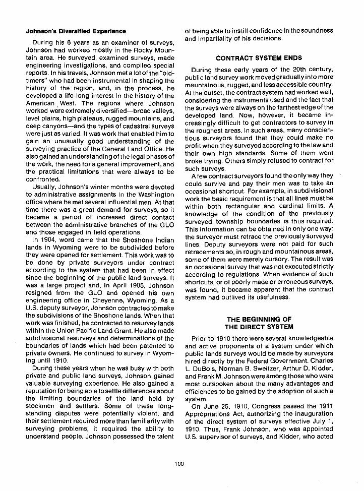
Johnson's Diversified Experience
During his 6 years as an examiner of surveys,Johnson had worked mostly in the Rocky Moun-tain area. He surveyed, examined surveys, madeengineering investigations, and compiled specialreports. In his travels, Johnson met a lot of the "old-timers" who had been instrumental in shaping thehistory of the region, and, in the process, hedeveloped a life-long interest in the history of theAmerican West. The regions where Johnsonworked were extremely diversifiedbroad valleys,level plains, high plateaus, rugged mountains, anddeep canyonsand the types of cadastral surveyswere just as varied. It was work that enabled him togain an unusually good understanding of thesurveying practice of the General Land Office. Healso gained an understanding of the legal phases ofthe work, the need for a general improvement, andthe practical limitations that were always to beconfronted.
Usually, Johnson's winter months were devotedto administrative assignments in the Washingtonoffice where he met several influential men. At thattime there was a great demand for surveys, so itbecame a period of increased direct contactbetween the administrative branches of the GLOand those engaged in field operations.
In 1904, word came that the Shoshone Indianlands in Wyoming were to be subdivided beforethey were opened for settlement. This work was tobe done by private surveyors under contractaccording to the system that had been in effectsince the beginning of the public land surveys. Itwas a large project and, in April 1905, Johnsonresigned from the GLO and opened his ownengineering office in Cheyenne Wyoming. As aU.S. deputy surveyor, Johnson contracted to makethe subdivisions of the Shoshone lands. When thatwork was finished, he contracted to resurvey landswithin the Union Pacific Land Grant. He also madesubdivisional resurveys and determinations of theboundaries of lands which had been patented toprivate owners. He continued to survey in Wyom-ing until 1910.
During these years when he was busy with bothprivate and public land surveys, Johnson gainedvaluable surveying experience. He also gained areputation for being able to settle differences aboutthe limiting boundaries of the land held bystockmen and settlers. Some of these long-standing disputes were potentially violent, andtheir settlement required more than familiarity withsurveying problems; it required the ability tounderstand people. Johnson possessed the talent
100
of being able to instill confidence in the soundnessand impartiality of his decisions.
CONTRACT SYSTEM ENDS
During these early years of the 20th century,public land survey work moved gradually into moremountainous, rugged, and less accessible country.At the outset, the contract system had worked well,considering the instruments used and the fact thatthe surveys were always on the farthest edge of thedeveloped land. Now, however, it became in-creasingly difficult to get contractors to survey inthe roughest areas. In such areas, many conscien-tious surveyors found that they could make noprofit when they surveyed according to the law andtheir own high standards. Some of them wentbroke trying. Others simply refused to contract forsuch surveys.
A few contract surveyors found the only way theycould survive and pay their men was to take anoccasional shortcut. For example, in subdivisionalwork the basic requirement is that all lines must bewithin both rectangular and cardinal limits. Aknowledge of the condition of the previouslysurveyed township boundaries is thus required.This information can be obtained in only one way:the surveyor must retrace the previously surveyedlines. Deputy surveyors were not paid for suchretracements so, in rough and mountainous areas,some of them were merely cursory. The result wasan occasional survey that was not executed strictlyaccording to regulations. When evidence of suchshortcuts, or of poorly made or erroneous surveys,was found, it became apparent that the contractsystem had outlived its usefulness.
THE BEGINNING OFTHE DIRECT SYSTEM
Prior to 1910 there were several knowledgeableand active proponents of a system under whichpublic lands surveys would be made by surveyorshired directly by the Federal Government. CharlesL. DuBois, Norman B. Sweitzer, Arthur D. Kidder,and Frank M. Johnson were among those who weremost outspoken about the many advantages andefficiences to be gained by the adoption of such asystem.
On June 25, 1910, Congress passed the 1911Appropriations Act, authorizing the inaugurationof the direct system of surveys effective July 1,1910. Thus, Frank Johnson, who was appointedU.S. supervisor of surveys, and Kidder, who acted

as U.S. surveyor and supervisor,36 were given thechance to prove their point. They were to supervisethe new cadastral surveying organization.
First Direct System Survey
On July 14, 1910, Special Instructions for GroupNo. 1, Colorado, were approved. AssignmentInstructions to execute the retracement of certainexterior lines and the subdivision of fractionalTownship 14 South, Range 100 West, SixthPrincipal Meridian, were then issued to Albert C.Horton, Jr., a former examiner of surveys. Hortonimmediately went to the field, near White Water,Colorado, and began official work on the survey.The returns were filed in short order, and thesurvey was approved by Timothy O'Conner,surveyor general for Colorado, on September 30,1910.
Later, Johnson frequently told cadastral sur-veyors about this survey. He always insisted thatthe extraordinary efficiency and speed shown bythe survey crew under Horton was responsible forthe overwhelmingly favorable reaction to the directsystem from the Department of the Interior, theCongress, and the public. All newly appointed U.S.surveyors and transitmen were encouraged toemulate the efficiency of Horton's crew.159
When the survey of Township 14 South, Range100 West, was completed in 1937 under Group No.297, Colorado, all the Horton corners were found.The first survey completed and approved underthedirect system was found to be acceptable in itsentirety.159
The Idea Behind the Direct System
The idea of the direct system was not a new one;on December 23, 1894, in his second annualmessage to Congress, President Clevelandstated :94
The suggestion that a change be made in themanner of securing surveys of the public landsis especially worthy of consideration. I amsatisfied that these surveys should be made by acorps of competent surveyors under the im-mediate control and direction of the Com-missioner of the General Land Office.
Even though this suggestion did not become lawuntil 16 years later, no guidelines had ever beenestablished for organizing the scattered, highlyindependent men who were experienced in ex-ecuting public land surveys into a cohesivesurveying corps with uniformly high standards.
101
Early Problems
In fact, Johnson and Kidder quickly discoveredthat in 1910 there was not even a permanent surveyoffice in Denver. It was only after some time andsome discussion that they were permitted to hire apart-time "typewriter," as typists were called inthose days.15°
Johnson and Kidder also discovered that therewas an expanding need for surveys to accom-modate the swift settlement of the land then takingplace. And then there were all the complicated,isolated, fragmentary surveys upon which noqualified surveyor had dared to stake his reputa-tion under the contract system waiting to be done.Meanwhile, the need for resurveysparticularly inColorado, Wyoming, and Nebraskawas rapidlybecoming urgent.
Under the new system, all surveys and resurveyspertaining to the public lands were to be made bysurveyors who were employed directly by the GLOunder Civil Service regulations. The roll of U.S.surveyors who were eligible under Civil Serviceregulations was formed from the former list of U.S.examiners of surveys. One or two of these menwere already in the field examining currentcontract surveyswork that had to be done.Several well-qualified contract surveyors whomight have passed Civil Service examinations werealready busy executing surveys under contractsthat had been signed prior to the creation of thedirect system. This meant that there were only 10 or12 U.S. surveyors actually available in July1910 tomeet the immediate and enormous need forsurveys and resurveys.
It is to the credit of both Johnson and Kidder thatthey did not allow these pressures to force theminto following the sketchy plan that originally hadbeen contemplated. That idea, apparently, had twosupervisors in the field organizing survey partieswhile simultaneously trying to promote field workuniformity and efficiency.
One Supervisor of Surveys
Even though the law (36 Stat. 1416) provided fortwo supervisors of surveys, both Johnson andKidder realized that neither economy of operationnor efficiency of service to the public would beserved under divided authority. Both were too wisein the ways of double survey parties to allow thenew organization to stumble into the pitfall ofconfused responsibility. (In a double party thereare two surveyors; each runs a surveying crew.However, in order to ensure a well-coordinated

/ Surveyors occasionally had problems reconciling the directives of the General Accounting Office with the realities oftheir unusual line of work. For example, in 1922 the GAO sent out a statement to the effect that the purchase of drinkingwater was not permitted without a certificate from the local board of health, or a reliable anaiysis stating that the water wasImpure or unwholesome.
A. C. Horton took exception to the directive. Out In the desert where his men were working it was not a matter of impurewater; It was a matter of no water at all. As he put it, "Occasionally during the progress of our cadastral work we encounter,on the desert, cattle holes and other stagnant pools, which we are only too glad to find and the water from which we usewithout cost. However, in most instances we are obliged to buy the water."58
surveying operation and keep the lines of authorityfrom becoming blurred, only one is designatedparty chief; the other is his associate.)
Almost from the beginning of the directsystem itwas clear that, of the two men, Frank Johnson wasthe stronger organizer and administrator. Alongwith a superior technical knowledge, he had anunusual capacity for dealing with the public, theauthorities in Washington, and the personnel of agrowing staff.
Kidder, much more the scientist, freely gaveJohnson credit for the success of the organizationof the surveying service under the new system. Inturn, Johnson was openly appreciative of Kidder'sparticular talents and contributions. The roles theyadopted were complementary rather than com-petitive. Kidder, acknowledging Johnson's greateradministrative capabilities, acted as his associate.Virtually from the start, then, Johnson was the U.S.supervisor of surveys.
Johnson brought a certain flair and zest to therole. He knew Washington politics, cadastralsurveying, and surveyors. He was at his best indealing with the large scope of his new respon-sibilities. Aside from that, he had a thorough graspof the legal basis of the public land surveys. All hisenergies were dedicated to the improvement ofthose surveys under the direct system. He ap-proached the task with a view to creating asurveying service that would be both technicallyexcellent and administratively sound.
Johnson was highly esteemed by officials and bythe men of the surveying service. It was Johnson'spersonality and drive that molded the character ofthe cadastral surveying service, and for nearly 34years he gave it both form and direction. Under hiscareful guidance and due in large measure to hisknowledge, understanding, and encouragement,the surveying service kept pace with advances inthe art and science of surveying.
Kidder's Role
Johnson and Kidder agreed at the outset that thework was to be carried out in accordance with the
102
highest technical and scientific standards; and, inso doing, Kidder gained wide public recognitionthrough his knowledge of the theory, construction,and use of surveying instruments, and his work onvarious publications, including both the 1930 and1947 Manuals. His surveys and resurveys in theEastern and Southern States were intricate incharacter and frequently involved considerationssuch as mineral or riparian rights. Kidder spentmuch of his career as a boundary commissionerand surveyor. Over the years his surveys settleddisputes that involved land worth many millions ofdollars. He contributed a great deal to the scienceand art of surveying, and in so doing he achievedan enviable reputation as a scientist and surveyor.The academic world took note, and his services asa speaker were frequently in demand.
In the matter of surveying, Kidder's standardswere as high as Johnson's. It was Kidder whorevised the earlier tables used by the U.S. Govern-ment in observing the position of the Sun, theNorth Star, and other selected stars. Thesecomputations were then arranged in the form of thepresent statistical tables technically called theephemeris. Though it was first published in 1910 tomeet the needs of the new surveying service,Kidder continued to prepare the ephemeris an-nually until 1944. Still published annually, theephemeris aids surveyors in establishingastronomical bearings for the determination of thedirections of their survey lines.
Kidder also calculated and compiled the "Stan-dard Field Tables and Trigonometric Formulas,"which was also published in 1910 as an aid tosurveyors under the new direct system. It proved itsusefulness and is currently in its eighth edition.Cadastral surveyors have become so familiar withthe small maroon-bound volume that they almostnever use its long, impressive title; they refer to itsimply as "The Red Book."
The New Organization
Johnson, quick to recognize and acknowledgemerit in others, rapidly gathered around him a

corps of competent surveyors. A number of menhired under the new organization were drawn fromthe ranks of contracting deputy surveyors who hadbeen engaged in western surveys prior to 1910.There were a few who had specialized in publicland surveys but there had been, for the most part,no continuity of employment. Initially, surveyorswere detailed to whatever area in which surveyshad to be made, and were furloughed without payafter their field notes were written.160 Obviously, ifgood surveyors were to be retained, this systemhad to be changed.
The size of the area under his jurisdiction (Alaskato Florida, inclusive) prompted Johnson's firstmajor moveto divide the country into surveyingdistricts. Men who had been examiners of surveysformed the nucleus of a supervisory corps. Theywere assigned to the various districts as assistantsupervisors of surveys. Each assistant supervisorwas permanently assigned a group of surveyors totake care of the surveys within his district, though,when needed elsewhere, they were detailed toother districts or to the headquarters office. Kidder,as Johnson's associate, was placed in charge of theEastern States district on much the same footing asthe assistant supervisors.
In the early years of the direct system, theassistant supervisors of field surveying districtswere as follows:
District No. 1, Montana: J. Scott HarrisonDistrict No. 2, Wyoming and Colorado: Her-
man JaeckelDistrict No. 3, Nebraska and South Dakota:
N. B. SweitzerDistrict No. 4, New Mexico: A. E. ComptonDistrict No. 5, Arizona and California: A. C.
Horton, Jr.District No. 6, Utah and Nevada: Geo. D. D.
KirkpatrickDistrict No. 7, Idaho: Frank S. SpoffordDistrict No. 8, Oregon and Washington:
Ernest P. RandsDistrict No. 9, Alaska: John P. Walker
Indian Land Surveys
At the beginning of the direct system, all surveyson Indian lands were executed under the directionof F. A. Dunnington, topographer in charge ofIndian surveys. In 1916, however, Dunnington wastransferred to a clerical position in the GLO and thecommissioner directed that all Indian land surveyswere to be done under the general surveyingorganization of the GLO. The surveyors andtransitmen of Dunnington's group were detailed to
103
work under the direction of the assistant supervisorof surveys of the district in which they werecurrently working. It was assumed that they wouldcontinue to work on Indian land surveys whennecessary, as they were experienced in that type ofwork.
The camping and transportation equipmentused by Dunnington was also to be transferred tothe district in which it was situated at the time thetransfer actually took effect. It was expected thatDunnington's surveyors would be busy on officework concerning surveys that were already un-derway until about July 1, 1916. In the meantime,Indian land surveys were to be scheduled andworked on by cadastral surveyors along withregular public land surveys.24
Results
Surveyors, almost by definition, are independentindividuals. Under Johnson they worked with a willtoward a common goalthe success of the newsurveying corps. As supervisor of surveys, John-son was required to spend some time inWashington each year, and he was well respectedthere. He also made it a point to keep in touch withthe surveying districts and their varying con-ditions. The assistant supervisors welcomed hisvisits, as indicated in the following letter:49
DEPARTMENT OF THE INTERIOR
GENERAL LAND OFFICE
Portland, Oregon,March 10, 1912.
Mr. Frank M. Johnson,Supervisor of Surveys,Denver, Colorado.
My dear Mr. Johnson:
I have your note of the 8th inst., advising that you mayreach here about the 26th inst., which is indeed goodnews. There are a good many things I would like totake up with you in connection with survey matters.
Now as to when the rainy season ends will say that itwas here when I arrived in Oregon forty-three yearsago and hasn't ended yet. However, we still havehopes.
Yours very sincerely,
E. P. Rands,Asst. Supervisor of Surveys

REGULATION IRON POSTS
Under the Act 01May27, 1908(35 Stat. 347), a regulationiron post was adopted for monumenting the public landsurveys. Until then, the identifying cornersthe vitallyimportant markers which made up the physical groundrecord of the surveys of the public landswere made ofwhatever materials were at hand. Often these materialswere wood posts, or sod or stone mounds. The wood wassubject to deterioration and the sod could flatten. Stones, ifwell marked, were extremely durable, but unfortunately noteveryone recognized a marked stone as a corner of a publicland survey. Settlers sometimes destroyed them withoutknowing their value.
In the Land Office Report 011880, the surveyor general ofCalifornia, Theodore Wagner, stated that it was a "matter ofsurprise" to him that action had not been taken long before,toward a "system of monumentation calculated toperpetuate the corners of the public surveys." He notedthat many of the corners that had been established acomparatively short time before were already obliterated.He made strong recommendation that "ironmonuments. . . be used to mark the corners of the publicsurveys. . . at as early a date as possible."l
With his recommendation he sent a detailed descriptionand a drawing of a design for a metal marker. He estimatedthat in San Francisco it would cost $6.25, including thetownship, range, and section plates, and the screws toattach them. The marker was to be 41/3 inches in diameterand 44 inches long, with a heavy extended base, of metalthree-eights of an inch thick. Wagner estimated it wouldweigh about 80 pounds.l36
Even though Wagner was right about the need for astandard metal marker, surveyors agree that It is a goodthing a less cumbersome one was finally accepted. Morethan 20 years passed before the General Land Office finallyasked that a metal marker be devised, It had to be of a sizethat could be carried, easy to install, and economical tomanufacture. Most important, it had to last.
After experimentation, the marker finally evolved into theregulation iron post now in use. It Is a 30-inch long,wrought-iron, zinc-galvanized pipe. Its inside measure-ment is 2 inches, and its base is flanged so it can be firmly
THIS DESIGN APPEARED IN THE 1880
GENERAL LAND OFFICE REPORT(levAr/ON
Surface of Qround
81/2"
anchored. Regulation posts weigh about 12 pounds andhave a brass cap securely fastened to the top. These brasscaps are inscribed with Information identifying the cornersthey mark.
It is thought that brothers John and Scott Stewart set thefirst of the many thousands of these posts that now markthe surveys of the public lands. Their survey area was nearGreen River, Wyoming.
The assistant supervisors of surveys had fairlyfrequent contact with Johnson and the authoritiesin the Washington office. They understood theaims of the organization and the importance of thesurveys.
Johnson's faith in the superiority of the directsystem over the contract system was justified evenin the first year of its existence. The best surveyorsavailable had been hired "solely upon their pastrecord for efficient services." Most of the new forcewas composed of men who had been employedbefore by contract surveyors "whose work had
104
been passed upon and found correct byexaminersof surveys." The surveys of this first year resulted ina savings of $5 per mile, and the work was abovereproach.134 In early 1913, in recognition of thewaythe organization was already operating, thecommissioner of the General Land Office officiallydesignated Frank M. Johnson as chief supervisorof surveys and Arthur D. Kidder as associatesupervisor of surveys.43
Johnson counted on his men and he wasstraightforward in his dealings with them. Theyresponded with hard work, respect, and admira-

tion. He rarely gave orders as one would toemployees. Still, his pleasant manner was seldommisunderstood; the surveyors knew he wouldbrook no slipshod surveying practice or shirking oftheir jobs. By the same token, they also knew thathe would back them up if they were right, or that ifan honest error occurred, they would be assisted incorrecting it. Gradually, surveyors who did notmeasure up to the high standards set by Johnsonwere weeded out of the service. By 1915 thesurveying force had been built up to 160 chiefs offield parties.
105
By then, most of the surveyors were young menwho had gained their skills under the direct system.The fact that several of them had become effectiveparty chiefs was a particular source of satisfactionto the supervisor of surveys. The high morale andthe wholesome friendly rivalry between districtsand between survey parties also pleased Johnson.In 1916 he wrote (with pardonable pride) that heknew of ". . . no field service of the Government oranywhere else where more effective hard work isdone than in ours."43
(

THE BASIS OF CADASTRAL SURVEYS
Cadastral surveys deal with one of the oldest andmost fundamental facets of human societyownership of land. They are the surveys thatcreate, mark, define, retrace, or reestablish theboundaries and subdivisions of the public lands ofthe United States. They are not at all like scientificsurveys of an informative character, which may beamended due to the availability of additionalinformation or because of changes in conditions orstandards of accuracy. Although cadastral surveysemploy scientific methods and precise measure-ment, they are not based upon science, they arebased upon law. Cadastral surveys cannot berepudiated, altered, ignored, or corrected; theboundaries created or reestablished by them areunchangeable so long as they control rights vestedin the lands affected.
The official record of the field work of a cadastralsurvey ordinarily consists of a plat and the fieldnotes, both of which must be approved by properauthority. A plat, as used technically by the BLM, isa drawing that represents the particular areaincluded in a survey (such as a township, privateland claim, or mineral claim) and the linessurveyed, established, retraced, or resurveyed. Itshows the direction and length of each of thesurveyed lines; the relationship to the adjoiningofficial surveys; the boundaries, descriptions, andarea of each parcel of land subdivided; and, insofaras is practicable, the relief and improvementswithin the limits of the survey. Field notes are theofficial written record of the survey, certified by thefield surveyor. Originally transcribed by hand, theyare now typewritten.
In general, cadastral surveys are based upon theintent of the 1785 Land Ordinance, which es-tablished the rectangular system of surveys. Muchinformation concerning the various subsequentamendatory statutes, the regulations and instruc-tions required by the laws, and the variousapplicable court decisions may be found in volume43 of "United States Code Annotated."
All cadastral surveys (including resurveys orother officially approved actions that result inmodifying or changing the record of the originalsurvey) contain three basic elements:
1. The initiating documents, including:a. A written request with proper justification
Chapter 12
ABOUT CADASTRAL SURVEYS
107
The Special InstructionsThe Assignment Instructions
The actual field survey and the preparation ofthe official records of the field work
The official approval process, including:The required filingAny required publication
Years after a survey has been officially acceptedand approved, the initiating documents of thesurvey often prove to be a critically important partof the survey. The written request for survey is thebasis for determining the validity of the survey andwhether or not the survey is authorized by law; itinitiates a chain of official action.
The Special Instructions cite the pertinentauthority, the appropriation or other funding, thenature of the work to be performed, and specificinstructions for the survey that may not be coveredin the current "Manual of Surveying Instructions."
Assignment of a group number is also includedin the Special Instructions. Since the beginning ofthe direct system of surveys in 1910, cadastralsurvey projects authorized under a single set ofinstructions have been referred to by their groupnumber, for example, Group No. 1, Colorado.Assignment Instructions authorize the responsibleemployee or employees to execute the work citedin the Special Instructions.
Thus, cadastral surveys are far more than themeasurement of lines and angles and the establish-ment of corners in the fi.eld. The results of cadastralsurveys are quasi-legal documents that can beobtained only by a series of events in which allthese elements are present in their proper order. Inthe case of Cragin v. Powell (128 U.S. 691,696), theSupreme Court held:
It is a well settled principle that when lands aregranted according to an official plat of thesurvey of such lands, the plat itself, with all itsnotes, lines, descriptions and landmarks,becomes as much a part of the grant or deed bywhich they are conveyed, and controls so far aslimits are concerned, as if such descriptivefeatures were written out upon the face of thedeed or the grant itself.
Cadastral surveys are, in fact, the foundation uponwhich rests title to all land that is now, or was once,part of the Public Domain of the United States.

SOME PUBLIC LAND STATISTICS
The public lands of the United States date fromthe time of the formation of the Union. Atthattime,and soon afterward, seven of the Thirteen OriginalStates ceded to the Federal Government more than233 million acres of land. Thereafter, throughtreaties and purchases, the United States acquiredanother billion acres of Public Domain land. Thelast of these public land acquisitions was thepurchase of Alaska from Russia in 1867. In all,nearly 2 billion acres of land in 32 Statesfour-fifths of the 2.3-billion-acre gross area of theNationhave been a part of the Public Domain atone time or another.139
At first these lands were sold for the revenue theycould produce but, as hardy pioneers movedwestward, the revenue-raising policy was changedto one emphasizing the settlement and develop-ment of the land. Over the years, title to about 1.1billion acres of Public Domain land has beentransferred to individual citizens, businesses, andnon-Federal governmental organizations underthe Federal legal authority known as the "PublicLand Laws." The Homestead Laws alone ac-counted for the transfer from Foderal ownership ofapproximately 278 million acres.
Many more millions of acres were transferred toprivate ownership through military, railroad, andother land grants, including various grants to theStates. However, some 715 million acres of theoriginal Public Domain lands remain in Federalownership-364 million acres in Alaska alone. Tothis must also be added the 52 million acresacquired over the years for various purposes, thusbringing the amount of Federally owned lands toapproximately 770 million acres: roughly one-thirdof the entire land area of the United States.139
Some of these lands have been reserved asNational Parks, National Forests, or for otherspecific purposes, but more than half make up the"vacant and unappropriated" Public Domain. Thisareasome 450 million acrescomprises thelands under the exclusive jurisdiction of theBureau of Land Management.139
At its maximum extent, the original PublicDomain consisted of about 1.8 billion acresapproximately 78 percent of all the land area of thecontinental United States. Since its beginning in1785, the rectangular system of surveys has beenextended over some 1.4 billion acres of thisimmense area. At the close of fiscal year 1973,there were more than 440 million acres of publicland that had not yet been surveyed. Nearly 80percent of this total is in Alaska. The remaining
108
unsurveyed land is situated exclusively in the 11Western Statesalmost 4 percent of the total is inNevada alone.139
Many of the surveys of these government landswere executed a century or more ago and thematerials used to mark themwood posts, earthmounds, and the likesometimes proved to be lessthan permanent. Time, humans, and the elementshave obliterated many of these old survey markers,thus creating an urgent need for the resurvey ofmore than 50 million acres of land so that theboundaries of the public lands might be properlymarked. Resurveys made up nearly 48 percent ofthe 3.5 million acres of the cadastral surveys thatwere officially accepted during fiscal year 1973.139
RESURVEYS
According to the provisions of law, originalcorners established during the process of acadastral survey remain fixed in position, evendisregarding technical errors that may have passedundetected before the survey was accepted.
The courts have attached major importance toevidence relating to the original position of thecorner, granting it much greater weight than therecord relating to bearings and lengths of lines.The corner monument is direct evidence of theposition of the corner. Although they aresometimes used as if they were interchangeable,the terms 'corner" and "monument" are notsynonymous. A "corner" is a point determined bythe surveying process; a "monument" is the objector the physical structure that marks the cornerpoint.)
The ground rules for identifying an approvedofficial survey are not exactly the same as thoserules under which the survey was originally made.The purpose of a dependent resurvey is not to"correct" the original survey by finding out where anew, or even a possibly more exact, running of theline would locate a certain corner. Rather, thepurpose is to determine where the corner wasestablished originally.
Legislation Regarding Resurveys
Resurveys have been made since the early daysof the public land surveys. In the beginning, theywere made as corrective surveys under the generalsurveying appropriations when gross errors werediscovered. Certain resurveys were later authoriz-ed by special acts of Congress. The enactment ofgeneral legislation providing for resurveys cameabout when it became apparent that the lines and

corners of many older surveys were becoming soobliterated or distorted that their identification wasin doubt.
The Act of March 3, 1909 (35 Stat. 845) asamended June 25,1910(36 Stat. 884; 43 U.S.C. sec.772) authorized extensive resurveys of the publiclands in order that they might be properly marked.This 1909 Act, the Act of September 21, 1918 (40Stat. 965; 43 U.S.C. 733), and the Act of July 14,1960 (43 U.S. C. 1364) provide the authority for theexecution of resurveys of the public lands. The lawmakes very clear the fact that no resurvey may beexecuted in such a way that it could impair therights of the claimants of the lands affected.
The Challenge
Following the passage of general legislationproviding for resurveys, surveyors have, from timeto time, been assigned the challenging job ofretracing lines established by the men whosurveyed before them. In all resurveys, the applica-tion of legal principles and statutory acts regardingthe location of surveyed lines are important andperplexing considerations. The bewilderment andfrustration caused by the gradual changes in theexecution of the survey system are well known to
109
THE 0RIGIJAL TI.1IRTEEM STAIES
1790 PJORIU CAROLIMA CESS$0P4
1781-1802 STATE CESSI03S
1803 L0OISIAMA ucWASE
1818 RED RIVER O TI4E t4ORTI1
1819 TREATY 1,)1T14 SPAIIJ
1845 AtsJl'JEXED TEXAS
1846 OPEGOI.3 coNpR0MISE
184$ AkEXICAJ CESSIOP4
1850 puRcHASED rRoM TEXAS
© 1853 GADSDN pLJRcI.IASE
ai pURCMASED RUSSIA
1898 AIJIUEXED g1AWAII
anyone who has attempted to 'follow in thefootsteps" of someone who surveyed more than ahundred years ago, within boundary lines that arenot the same as they once were, according to lawsand instructions that have changed, and underconditions that no longer exist.
Erroneous Subdivision Rule
Mistaken ideas about correct procedure havealso been held by surveyors from time to time. In1856, for example, even though there was muchaccurate information available, Thomas A. Hen-dricks, then commissioner of the GLO, gave thefollowing inaccurate rule for locating the center ofa section: "Run a true line from the quarter-sectioncorner on the east boundary, to that in the westboundary, and at the equidistance between themestablish the corner for the center of the section."14
This same erroneous opinion was given earlierby the surveyor general of Missouri and Illinois.The courts did not agree, nor did the GLO in any ofits rulings, sofaras can be determined. In 1868, thisincorrect rule was explicitly set aside by theSecretary of the Interior, but not before it had beenfollowed by a number of deputy surveyors in bothIllinois and Missouri.14
ACQUlSlTiOP.3 or TE tQRITOIY Of TIlE UtITED STATES

Other Resurvey Considerations
A surveyor must consider several factors whenhe tackles the job of retracing an old surveysuchas the weather, the equipment in use at the time ofthe original survey, and the mood and dispositionthe local Indian tribes which may have had a directbearing upon how a survey was done.
DEPENDENT RESURVEYS
As the need for resurveys grew, so did therealization that the measuring of land is one of thesimpler parts of a cadastral surveyor's duty. Oftenhis hardest work is finding the land to be measured.In the past, public lands were often marked withshort-lasting monuments. Parcels were sometimescarelessly conveyed. Fences were not always built"on line." At times, corners were inadvertently (andsometimes purposely) destroyed or moved. Time,weather, and the advancing tide of settlementoccasionally brought about obliteration of themost carefully established survey monuments.
As a result, cadastral surveyors must consistent-ly perform two related tasks. First, they must defineclearly the boundaries of the land they are tomeasure, and then they must make themeasurements. Although the latter requirestechnical skill and training, it is the former thatpresents by far the greater challenge.
No two resurvey problems involve exactly thesame complications, so there can be no inflexiblerules of procedure. Somehow, by experience,training, or instinctor possibly a combination ofall threecadastral surveyors acquire a certainamount of clear and reliable information about therelative importance of various kinds of evidence,both circumstantial and direct. Frequently theyformulate their own methods of finding the line tobe measured. Still, their methods are often similarto a marked degree, because, even though theyhave had differing experiences, the conclusionthey all inevitably reach is that the protection ofrights in the ownership of land depends not onlyupon the accuracy of measurement, but also on thereliability of the location of the line. After all, ameasurementno matter how accurate orpreciseis of no value whatever if it is in the wrongplace.
N. B. Sweitzer
N. B. Sweitzer did much to formulate present-day resurvey procedures. Some of his proposalswere foreign to the thinking of his day, but theyhave become more acceptable as the accuracy and
110
infallibility of resurveys gained ascendance overmatters of volume and speed.159
During the early years of the direct system ofsurveys, Sweitzer, as assistant supervisor ofsurveys for District 3, was faced with some of theearly, complicated resurveys in the Nebraskasandhills and the Missouri River flood plain. Themain difficulty in the sandhills was the changingcontour of the land and the obliteration of surveymonuments. The flood plain resurveys had thoseproblems tooand with them other problems thataccompany riparian rights and questions ofacqretion or avulsion.
In a dependent resurvey, the surveyor mustrestore, in its original position, the original surveyby which the lands were patented. But there ismore involved in matters of riparian rights. Variousmaps must be constructed that show the dates ofthe various movements of the river, and a com-posite map of all these changes must be made.These movements must be studied so it may bedetermined whether they were influenced byaccretion or avulsion. This is important for thesimple reason that avulsion does not change aboundary; boundaries are changed by accretion.But in some of the cases resurveyed underSweitzer there was still another questionthat ofthe submersion and emersion of land. Each of thecases had to be decided on its own merit, as suchcases still must be. Much of the present practice ofthe recovery of evidence of original corners is theresult of Sweitzer's research and the procedures heproposed.
From his hard-won knowledge in such matters,Sweitzer once explained that a surveyor was notreally competent to handle resurveys until hehad:5°
at least three years of field experience, as itrequires that time for a man to be in a position toauthoritatively pronounce whether a corner lostfor forty to fifty years in the sandy soil inNebraska has been found and to understand thetechnical part of finished resurveys. .
Everglades Resurveys
Nebraska sandhi us are not the only places wheredependent resurveys are difficult. Problems ofterrain may differ in various areas, but they are noless problems. The original surveys of the strangeand beautiful Florida Everglades were, forthe mostpart, executed in the 1870's and 1880's. Recently,part of this wilderness was resurveyed, and it wasfound that some conditions had not changedmaterially in nearly 100 years. The dense un-

dergrowth and cypress trees described by theoriginal surveyors were still in evidence. The muckand water, the scorpions and insects, and thecottonmouth (water moccasin) snakes were alsomuch as the old field notes described them.97 Hastein completing a survey might be understood insome of the circumstances encountered by thoseearly surveyors. In one instance, a surveyor namedSolee concluded the field note record of his surveyin this way: "Water 30 inches deep, insects fierce,snakes all around. Twenty to 30 alligators ahead ofme. End of survey."97
Independent Resurveys
Independent resurveys are not the same asdependent resurveys. Before an independentresurvey can be run, however, the outboundaries,or limiting boundaries, must be dependentlyresurveyed. After this has been done, the areawithin can be independently resurveyed, creatingnew township or section lines; that is, providedhowever that all alienated land and bona-fiderights within the area are protected as required bylaw. These areas are protected by the surveyor wholocates them by the best available evidence. Thismay consist of the land itself as occupied by theclaimant or it may be evidence of the originalsurvey.
During the early 1900's, W. R. Bandy executedsome independent resurveys in Wyoming inaccordance with special instructions issued orapproved by W. T. Paine, chief of Division E of theGLO. During the course of these independentresurveys, an entirely new set of section lines wasrun over land originally surveyed in the 1880's,because some of the earlier surveys had proven tobe either erroneous or fraudulent. Private land andvalid claims were run out in accordance withcorners of the original survey as far as possiblethat is, where the corners could be found. Theprivate land and valid claims were given tractnumbers beginning with number 37 in eachtownship. Closing corners were set on the in-dependent resurvey lines where they entered andleft private lands. Any of the old corners of theformer survey that were found, but that did notaffect private land, were destroyed.145
This was done because, as is true in the case oforiginal surveys, the records of resurveys mustform a lasting basis for the security of the title to alllands acquired thereunder. If not destroyed, oldcorners of a cancelled survey remain on the groundand cause confusion. The surveyor therefore hadto exercise great care in his field work and in thepreparation of the record so that the independent
111
resurvey would take care of the existing problemswithout creating new ones.
THE EVOLUTION OF THE"MANUAL OF SURVEYING INSTRUCTIONS"
Various regions of the United States have beensurveyed under amended or differing instructionsfrom the passage of the 1785 Land Ordinance tothe present. That ordinance gave fairly explicitcadastral surveying instructions, which were to becarried out under the personal supervision of thegeographer of the United States, ThomasHutchins.
His successor, Rufus Putnam, was given the titleof "Surveyor General of the Northwest Territory"under the terms of the Land Act of May18, 1796. Bythen, the surveys were becoming more complex;half the townships were to be subdivided into 2-mile blocks, and the section numbering systemwas changed to the one now in use.
Gradually, other laws were passed that called forfurther subdivision, and the system of rectangularsurveys was refined. During these early yearsgeneral instructions and advice were given to thesurveyor general by the Secretary of the Treasury,who was then the highest official directly concern-ed with the survey and disposal of the public lands.Later this became the duty of the commissioner ofthe General Land Office. Instructions to the variousdeputy surveyors were issued by the surveyorgeneraleither in letters or as a part of theinstructions accompanying the contract for thesurvey involved.
A surveyor for the lands south of the State ofTennessee was appointed in 1803. His duties weremuch the same as those of the surveyor general.Over a period of time, as more land was acquired bythe United States, a surveyor general was ap-pointed for each of the public land States andTerritories. Each of these officers had a fairly freehand in issuing instructions to the deputies eachemployed.
There is good evidence that Jared Mansfield,Putnam's successor, issued fairly detailed instruc-tions to his deputies in 1804 when he contemplatedthe survey of the Vincennes Tract in Indiana.Unfortunately, Mansfield did not sign or date theinstructions. The sole proof that he issued themconsists of the content of the instructions and thefact that a careful comparison of letters signed byMansfield and the handwritten, undated instruc-tions shows the handwriting to be nearly identicalin all respects.16°
In 1815 Edward Tiff in, who succeeded JosiahMeigs as surveyor general of the Territories east of

the Mississippi, issued the first signed and datedgeneral instructions for the guidance of deputysurveyors, although they were undoubtedly basedpartially on the instructions issued earlier byMansfield.
Other printed circulars followed, and in 1831 thecommissioner of the General Land Office, ElijahHayward, issued detailed instructions to thesurveyors general concerning surveys and plats.The applicable parts were issued by the individualsurveyors general in bound volumes of instruc-tions suitable for use by the deputies in the field.
In 1849, the GLO was transferred from theTreasury Department to the newly created Depart-ment of the Interior. However, of much greaterimportance as far as the surveys were concernedwas the Act of July 4, 1836, to reorganize theGeneral Land Office. This act, which placed theresponsibility for surveying the public lands in thehands of the commissioner of the GLO, ended thecontinuing conflict with the various surveyorsgeneral.
Under the terms of this act, the overall directionof the public land surveys was placed under theprincipal clerk of surveys in the General LandOffice. The man who held this office for manyyears, John M. Moore, prepared the immediateforerunner of the present manual series in 1851. Itwas entitled 'Instructions to the Surveyor Generalof Oregon; Being a Manual for Field Operations."The use of this 1851 Manual was immediatelyextended to California, Minnesota, Kansas,Nebraska, and New Mexico.
Later, Commissioner Thomas A. Hendricksasked John M. Moore to prepare a slightly revisededition of the Oregon manual. This new edition wasissued in 1855 as "A Manual of Surveying Instruc-tions, to Regulate the Field Operations of DeputySurveyors."
The Congressional Act passed on May 30, 1862(12 Stat. 409), provided:
That the printed manual of instructions relatingto the public surveys, prepared at the GeneralLand Office . . . the instructions of the Com-missioner of the General Land Office, and thespecial instructions of the surveyor general,when not in conflict with said printed manual, orthe instructions of said Commissioner, shall betaken and deemed to be a part of every contractfor surveying the public lands of the UnitedStates.
Revisions of the 1855 Manual have appearedfrom time to time, as the need has arisen. The 1871Manual was a reprint of the 1855 edition, followedin 1881 and 1890 by other revisions.
112
The 1894 Manual was written under the directionof Commissioner Silas Lamoreaux by one man,Major Shinn. It was, in Frank M. Johnson's opinion,"a high-class technical work," while the 1902Manual, written by A. W. Barber, was "a passablerehash of the 1894 Manual" that "served itspurpose."61 This was the manual in use at thebeginning of the direct system. However, theappropriation act approved by Congress on June25, 1910 (36 Stat. 775-997), included $3,000 to beused toward the preparation and publication of anew revision of the manual. This appropriation wasmade in recognition of the fact that the problemsfaced, and the methods used in solving them underthe direct system, had not been contemplated inthe 1902 Manual.
The new manual was prepared under thedirection of the commissioner by a board ofexperts, one of whom was Arthur D. Kidder. Thepress of business was such, however, that only theadvance sheets of the first six chapters were readyfor publication by 1919. This portion of the revisedmanual was issued to surveyors in pamphlet formin mid-June of that year. Meanwhile, work con-tinued on the remainder of the material to beincluded in the new manual.
A manuscript edition of the ninth chapter of therevision was issued and became effective on March1, 1928. The first complete and fully revisedinstructions for the survey of the public landsunder the direct system was finally published asthe "Manual of Surveying Instructions, 1930." (Thiswas the first manual to include instructions formineral surveys. Prior to that time, separateinstructions to U.S. Deputy Mineral Surveyors hadbeen issued in 1879, 1889, 1890, 1893, 1895, 1897,and 1909.)
The "Manual of Surveying Instructions, 1947"was published by the General Land Office'ssuccessor agency, the Bureau of Land Manage-ment, which had been created in 1946. Again,Arthur D. Kidder was instrumental in its prepara-tion.
In 1964, Thomas A. Tillman was selected as oneof a four-man team to rewrite and update the 1947Manual. In the letter officially detailing Tillman todo this work, the director of the BLM stated, "Inreviewing the capabilities of the field force for thiswork, Tom Tillman stands out as one specificallyqualified." It was soon apparent that what had beencontemplated asan updating project would requirea complete revision, along with a revision of themanual supplement, "Restoration of Lost orObliterated Corners."

Meanwhile, the Washington office was facedwith retirements that left it grossly understaffed inthe face of ever-increasing demands by otherexecutive departments. Tillman was asked totransfer to Washington to fill this void. In re-questing this transfer, C. E. Remington, chief,Division of Engineering, said of Tom Tillman, "Heis an avid reader of cadastral history and is the bestqualified in cadastral law of anyone in the field."
Although Tillman's primary duty in Washingtonwas the rewriting of the manual, his expertise inquestions of cadastral law and surveying techni-ques interrupted his work on the manual forconsiderable periods of time while he preparedlegal support papers and appeared as an expertwitness as requested by the Department of Justice.In rewriting the manual, Tillman achieved oneother long-desired result. In 1915, Frank M.Johnson had expressed the hope that the manualthen in preparation might be written with simplicityand directness.41 "The Manual of SurveyingInstructions, 1973" meets all the requirementsbrought about by the many aspects of theinterrelationship of technology and law in theexecution of cadastral surveys, and it does so in awell-organized and most readable manner.
The manual has been accorded the force andeffect of law in many court decisions and is cited inthe laws of most public land States as mandatory inthe execution of retracement, resurvey, andsubdivision survey of patented public land byprivate surveyors, even though it is issued primarily
for the guidance of cadastral surveyors in theexecution of public land surveys.
MANUAL SUPPLEMENTSThere are three supplements to the "Manual of
Surveying Instructions, 1973." They are:
"Standard Field Tables and TrigonometricFormulas." This supplement was first published in1910; its eighth edition, in 1956. The tables and datait contains are designed for use by cadastralsurveyors in the field and office.
"The Ephemeris of the Sun, Polaris and otherSelected Stars with Companion Data and Tables."This supplement has been published annually inadvance since 1910.
"Restoration of Lost or Obliterated Cornersand Subdivision of Sections: A Guide for Sur-veyors." The subject matter presented in thissupplement first appeared in the decisions of theDepartment of the Interior. There have beenseveral revisions and extensions of this work, thelatest in 1974. It provides an introduction to therectangular system of public land surveying andresurveying, along with a compendium of basiclaws relating to the system. It answers manyquestions arising in practical surveying work, andalthough primarily intended for surveyors outsidethe Bureau of Land Management, it is also ofinterest to attorneys and others who haveprofessional interests in former or present publiclands.

,' OurGi/mon
4....4fcry Thifr.hn H ,&Aard'oche C/arkàrrest m,th
ZJohn a Sc/es6. char/eq Wi/son
3.
Q. tiaretEMoore /7 os,Math/ascThayer /8.1.. CYonHooktt.E jqj fl//veiS. Ton,-.frn----.
ank Cone 20.George Poore . .__Zi. Edward .Jess'4
kF/s/can-i P Ho/rn an
/909Pc/ph DeCampWfr,c/,es/er Dickei1.gon
$ Joel/0 /ra
/2F-
/4-/5. Jcc/6 1-V/I/i
Montana, U S Surveyor-General's office clerks, 1909
T/ioni/ohn
22. Frcn* E. Cone

Around the campfire in 1902, Yellowstone National Park. FrankM. Johnson, examiner of surveys, is standing at the left.
Richard E. (Elmer) Bandy, who joined the Brunt survey party inthe early 1900's.
115

Standing left to right: GrantDawson, Col. Samuel W. Brunt,and Arthur Brunt. Seated left toright: young Sam Dawson onMrs. Dawson's lap, Mrs. Brunt,and Mrs Arthur Brunt and sonBill. (Mrs. Dawson was SamBrunt's daughter.) Photo wastaken near Meeteetsee, Wyom-ing.
116
Col. Samuel VI. Brunt in camp in theMcCullough Peaks, east of Cody, Wyom-ing, in 1905.

117
b
Surveyors pause for lunch on moving day. Note moss-box and Sibley stoves on wagon, and horse (at extreme left) eating
from nosebag. Man at left is Sam Hutton: fourth and fifth from loft are Elmer Bandy and his wife. Lula; socond from right is
Arthur Brunt. Photograph taken in Sunlight Basin. Wyoming. in 1907.
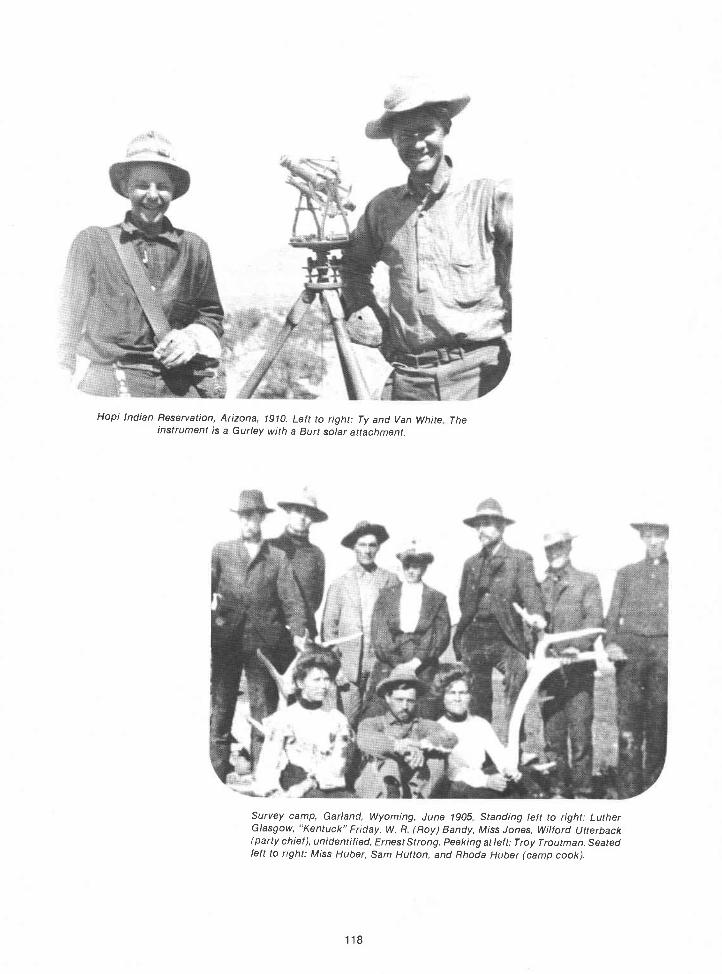
Hopi Indian Reservation, Arizona, 1910. Left to right: Ty and Van White Theinstrument is a Gurley with a Burt solar attachment.
Survey camp, Garland, Wyoming, June 1905 Standing left to right: LutherGlasgow, "Kentuck" Friday, W. R (Roy) Bandy, Miss Jones, Wi/ford Utterback(party chief), unidentified, Ernest Strong. Peeking at left: Troy Troutman. Seatedleft to right: Miss Huber, Sam Hutton, and Rhoda Huber (camp cook).
118

119
Roy Bandy's survey camp on the move, Montana, 1921. Note two motor vehicles atextreme right, as well as mule teams and wagons.
Glenn F. Sawyer's survey crew, Missouri River Breaks. Notepack horse at left carrying tools and iron posts.

Guy P. Harringfons outfit shown hauling water to a side camp duringDunnington survey which was begun November 8. 1911. T. 4 N.. R. 20W.,Gila and Salt River Meridian, Arizona.
120
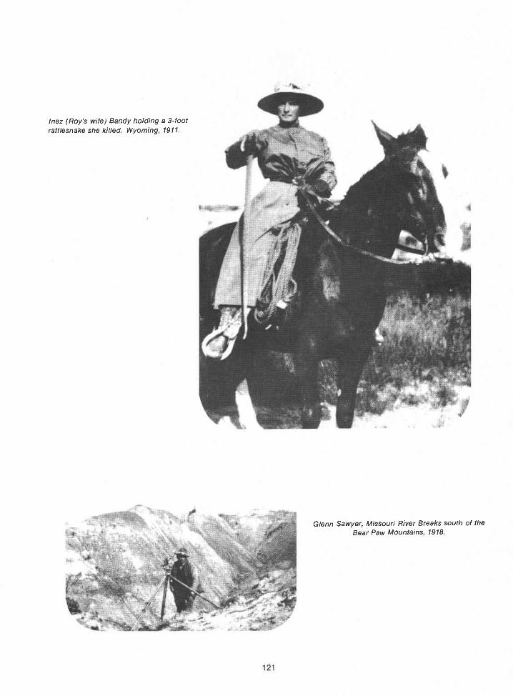
121
lnez (Roy's wife) Bandy holding a 3-footrattlesnake she killed. Wyoming, 1911.
Glenn Sawyer, Missouri River Breaks south of theBear Paw Mountains, 1918.
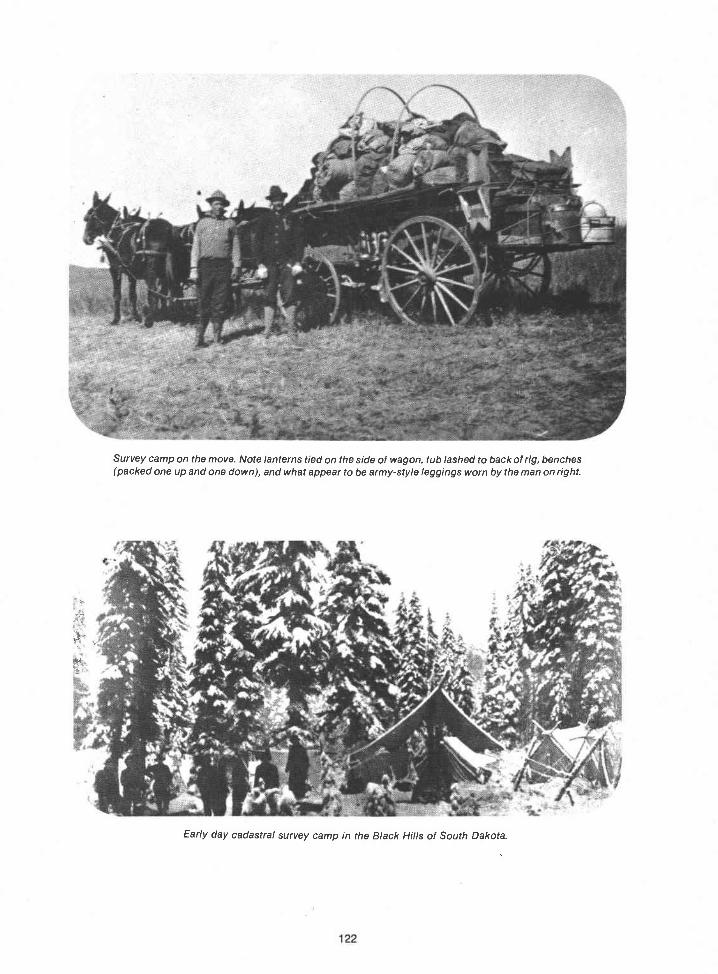
Survey camp on the move. Note lanterns tied on the side of wagon, tub lashed to back of rig, benches(packed one up and one down), and what appear to be army-style leggings worn by the man on right.
Early day cadastral survey camp in the Black Hills of South Dakota.

123

William E. H/ester's survey party, August 1927; 1/4 corner between sections 8 and 9,T 41 N., R. 3 W., Mt Diablo Meridian, California.
"Breakfast in the Big Horns." Photograph from an oil painting by Montanaartist Shorty Shope. It was painted from a photograph taken on an Augustmorning in 1912. Left to right: Willis Bandy, Roy Bandy, lnez Bandy, andchainmen George Homer and Howard Pitt.
124

125
Noon-hour rest for some General Land Office surveyors near Sebring, Florida, in1918 Hal 0 Craig is under the transit.
Suppertime in a 1917 survey camp in the mountains of Washington State. C. W.Blocker is on the right; Quint/n Campbell is third from right.

Wash day on a Sunday inSeptember 1914. The surveycamp is in Fergus County,Montana
The year, place, and surveyors are unidentified, but thesituation is familiar.
126

127
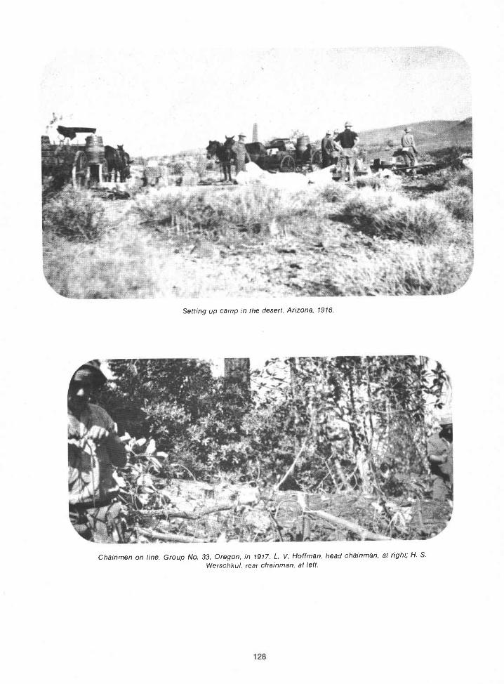
Setting up camp in the desert. Arizona, 1916.
Chainmen on line. Group No. 33, Oregon, in 1917. L. V. Hoffman, head chainman, at right; H. S.
Werschkul, rear chainman, at left.

Missouri River Breaks. 1918. Art St ens/and at the transit
129
I-!. S Werschku/, rear chainman, GroupNo. 33, Oregon, 1917.

Roy Bandy's survey camp in the Missouri River Breaks south of the Bear Paw Mountains, 1918. Note home-made water tank (center)they had to haul the water 15 miles. Also note use of both wagons and motorvehicles.
Interior of cook tent, GLO survey camp, near Wilson, Arkansas, November 1915. Note kerosene lampproviding the light, and William I-hester (at extreme left) eating a big piece of pie the cook has Just served him.
130


A survey party at work in heavy timber in the area nearGypsum, Colorado, in the early 1920's. Roger Wilson is at theextreme left standing next to Emil Voigt. Hans Voigt is fifthfrom left
132

Moving camp in 1914, FIatwil/ow Creek, Fergus County, Montana.
United States cadastral surveyors in southern Wyoming. The year is not known, but is probably in the late1920's or early 1930's The horse was used for carrying iron posts, tools, and lunches.
133

134

A beautiful site for a survey camp: T 24 N., R. 13 or 14 E., Willamette Meridian, Washington State, 1914. ltis probably CathedralRock in the background.
Left to right: Ernest Rands, assistant supervisor of surveys for Oregon; ClayTa//man, commissioner of the General Land Office; and Frank M. Johnson,supervisor of surveys, circa 1914.
135

Four feet of snow, September 1912, in the Big Horn Mountains, Wyoming Secondfrom left is lnez Bandy, standing beside the square "office tent."
Moving camp in "the good old days." January 1915, Group No. 41, Arizona.
136

'
137
Rare 3-mule wagon outfit moving camp. T. 5 N., R. 7 E., San Bernardino Meridian, California, March 1920.Group No. 62. Quintin Campbell, U.S. Surveyor.
When trucks or mules could not pack in the equipment andsupplies, the men had to fashion water transportation. This photowas taken about 1923.

A portion of the double survey party on Belly-Ache Mountain,near Eagle, Colorado, in 1920. The man who is second fromthe right in the photo is John S. Knowles; to his right is HansVoight. Kneeling on the ground (first from left) is Roger(Shrimp) Wilson; this was his second season with Knowles'party.
Bernard (Benny) Lange (on theleft) and John Dixon (on theright) on the job in the SmithRiver area in 1932.
138
On a weekend morning, surveyors often adjusted the In a photo taken in 1912, N. Price issolar attachments on the meridian. The date of this shown with E. Strickler.photo is 1925.

These two early surveyors are T. 0.Johnson (left), and TedVanderMeer (right), in early 1917.
Free time in camp in the Cascades in 1923. Bud Kent is the man onthe right in the photo; note some of his carvings in the middlebackground of the photo.
139
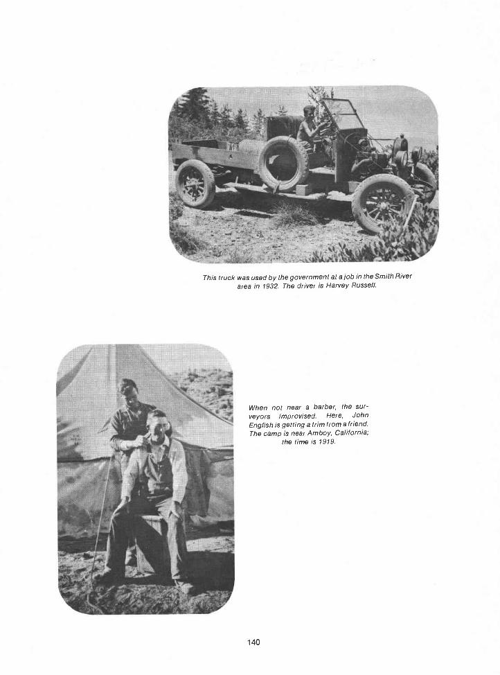
This truck was used by the government at a job in the Smith Riverarea in 1932. The driver is Harvey Russell.
When not near a barber, the sur-veyors improvised Here, JohnEnglish is getting a trim from a friend.The camp is near Amboy, California;
the time is 1919.
140


ItJohn
Morrison
This picture shows those attending the Denver Conference of the Cadastral Engineering Service, held July 10-14, 1923.
Alonzo E. Compton, J. 0. Naret, H. R. M. Atkinson, Judge William H. Lewis, W. H. Clark, Thomas Mathias, A. C. Horton, Jr.,
McCord, Frank S. Spofford, Frank A. Lewis, Ralph W. Nelson, George F. Naden, Guy P. Harrington, Raymond C
Goodale, and Ernest P. Rands.
142

because so many men pictured are important figures in the history of the Cadastral Survey. Left to right, they are:John W. Rowland, Russell K. Allen, Herman Jaecke!, G. 0. D. Kirkpatrick, Norman L. King, J. Scott Harrison. Alan A.
T. Paine, N. B. Swe,tzer, William Spry, Frank M. Johnson, John P. Walker, Arthur D. Kidder, T. C. Have!!, Samuel W.
143

Alaska was the last acquisition adding publicland to the United States. Although Hawaii laterbecame the 50th State, it had been first a monarchyand then a republic; its formal annexation in 1898added no vacant, unappropriated public land. Incontrast, nearly all of Alaska's 580,000 square mileswas Public Domain. There were a few surveyedtown lots in Sitka, title to which had been grantedby Russia, but most of Alaska was unexplored andunsurveyed upon its entry to the Union.
Alaska reaches northward 1,170 miles through18 degrees of latitude. It extends from 130° W., pastthe 180° line and on to 1721/20 E. (571/2 degrees oflongitude). The difference in time (3 hours and 50minutes) from one of these extremes to the other isgreater than that between New York and SanFrancisco. Alaska actually has four time zonesPacific, Yukon, Alaska, and Bering. It is the onlystate that crosses the International Date Line.Alaska's Point Barrow is the northernmost point inthe United States; the westernmost point (172°27'E.) is at Cape Wrangell, Attu Island.
Alaska has several high mountains, includingNorth America's highest peakMt. McKinley. Ithas innumerable lakes and nearly 34,000 miles ofcoastline. The Yukon, Kuskokwim, Copper, andSusitna Rivers, among others, empty some 800million acre feet of water into the sea each yearabout 40 percent of all the fresh water availableunder the United States flag.
EARLY HISTORY
Alaskan NativesEskimos, Aleuts, andIndiansapparently had their own methods ofmeasuring distance and direction and their ownways of allocating area, but more modern survey-ing arrived in Alaska with the "civilized" men led byVitus Bering. Alaska's recorded history began in1741 when Vitus Bering, a Danish navigator in theservice of Russia, sailed east from Siberia andlanded in Alaska. Bering made preliminary ex-plorations of the southwestern coast of Alaska, theAlaskan peninsula, and the Aleutian Islands.
Though the reports of Bering's expeditioncontained information that should have beengreeted as a great contribution to man's knowledgeof the geography of the region, they were scarcelyused. One fact obscured all the restBering'sexpedition had discovered the valuable fur of thesea otter.
Chapter 13
ALASKA
145
EARLY EXPLORATION
In 1778 Captain James Cook, an Englishman,sailed through Bering Strait and up the Cook Inlet.His voyage, the first scientific navigation in thearea, resulted in some fairly accurate charts.
Then, during the summers of 1792 and 1794,Captain George Vancouver, another Englishman,explored and surveyed the coast of Alaska. Formany years Vancouver's charts were the acceptedstandard. The 1825 Southeast Alaska boundarytreaty separating Russian Alaska from EnglishCanada probably was based on Vancouver's sur-veys.
The English, the Spanish (who had exploredSoutheast Alaska), and the French (who hadexplored Lituya Bay) had all voiced claims tovarious parts of Alaska by the time Vancouver'scharts were published. The Russians, who had"discovered" the region and establishedsettlements there, took a dim view of these claims.
ALASKA PURCHASE
When Alaska was purchased from Russia by theUnited States in 1867, Congress and the pressreacted violently to the news that a treaty betweenRussia and the United States had been signed andthat $7.2 million in gold had been agreed upon asthe selling price. Many persons considered Alaskaa vast, frozen wasteland and its purchase a foolishexpenditure. Others believed Alaska to be animmense storehouse of natural resources andthought it was a wise investment.
Coast Survey Report
When the Senate approved the purchase treatywith only one vote to spare, the administrationrealized that more information about Alaska wasneeded. An expedition to supply it was organizedunder the guidance of the Smithsonian Institutionand the Treasury Department, which was in chargeof the activities of both the Coast Survey and theRevenue Service. George Davidson of the CoastSurvey was chosen to head the small groupcharged with making a geographical survey of thecontroversial new territory. By the time he wasselected to take charge of the preliminarygeographic survey of the new territory, Davidsonhad gained a wide reputation as a civil engineer,geographer, hyd rographer, and geodesist.
In the Congressional debates prior to thepassage of the Alaska appropriation bill, manyreferences were made to George Davidson and theCoast Survey Report. The report was apparentlysuccessful in influencing at least a few Con-gressmen to decide that Alaska was worth thepurchase price of nearly 2 cents per acre.
1867-1 880
The Alaska appropriation bill finally passednearly a year after the flag of the United States wasfirst raised at Sitka on October 18, 1867. Aftermaking Alaska a Customs district, Congressseemed to forget about the new territory. No planswere made for its development; no means wereprovided for the filing of claims or the acquisition ofland. There were no means of setting up localgovernments, nor was there a Civil or a criminalcode. Military law was nonexistent; soldiersstationed at Sitka had no authority other than thatof defending Alaska against attack by foreigners orhostile Indians.
During the next few years the Coast Survey madea few sporadic coastal surveys; but by 1877, whenthe soldiers left Sitka to fight the Nez Perce Indiansin Idaho, there were still no public land surveys. Forthat matter, there was still no public land law. NoAlaskan settler could clear land or build a cabinwith any assurar,ce of owning it. No prospectorcould stake a mining claim with any security. Landcould not be deeded or transferred. Wills were notvalid. lnjured parties could secure redress forgrievances only by their own acts. In the matter ofcrime, gun law prevailed.
Gold and Civil Government
This state of affairs lasted until Joe Juneau andRichard Harris found gold in Southeast Alaska in1880. This event seemed to awaken Congress tothe problems, and, in 1884, by passage of theOrganic Act of May 17 (23 Stat. 24), the laws ofOregon were extended to Alaska, as far as waspracticable, and a civil governor was appointed.There was still no law governing settlement orpublic land surveys, but the mining laws of theUnited States were extended to Alaska. A Federaljudicial district was formed with a judge and otherlaw enforcement authorities. One of them, the U.S.Marshal, was also to act as ex officio surveyorgeneral. The following letter explains the duties ofthat double office:5
146
October 5, 1887 Sitka, Alaska
To theSecretary of the Interior
Sir:
I respectfully represent that since assuming theduties of Marshal of this district, no business apper-taming to my twin office, that of Surveyor General, hasuntil quite recently, been presented, but each mailnow brings its full quota of applications for surveysand patents for mineral lands, principally fromJuneau, Douglas Island and the Berners Bay District.
I have not, as yet, received a department com-munication concerning the office of SurveyorGeneral, no instructions in connection therewith, haveno blanks, no books of record, and there is none to behad within one thousand miles of my office, andwithout money to buy them were they at hand. Withthe duties of the office I have no experience, and whatis more serious, the office itself has no emolumentsother than the cursing I get for insisting that the landlaws shall be strictly complied with in every instance.
The duties of the Marshal of this district aremultifarious and rapidly assuming large proportions. Iam custodian of the Territorial prison, crowded withculprits two of whom are likely to require hanging inthe near future. I have the care of fifteen prizeschooners together with fifteen thousand fur sealskinsto keep from spoiling until they can otherwisebe disposed of. At present I am inflicted with an orderof the Court to proceed to San Francisco on urgentpublic business, with the moral certainty that mysalary will be confiscated by the Treasury Departmentshould I absent myself from home without consent ofthe Department of Justice, while public interest doesnot admit of the delay necessary to procure suchconsenttwo months or more. I am not allowed aclerk at either of my headquarters-180 miles apart; atwhich places I am often required to be simultaneous.
Therefore Resolved: That a competent clerk is anactual requirement in the office of the U.S. Marshal-Ex-officio Surveyor General, of the Territory ofAlaska.
Very respectfully,Your obd't Serv't
Barton AtkinsU.S. Marshal and
Ex Officio Surveyor GeneralHon. L. Q. C. Lamar
Secretary of the Interior,Washington, D.C.
Surveys Needed
The activities of the Coast Survey, renamed theCoast and Geodetic Survey by the Act of June 20,1878 (20 Stat. 206, 215), were also spurred byJuneau's discovery of gold. The field work for thetriangulation of Southwest Alaska was started in1882. The U.S. Coast and Geodetic Survey was

responsible for the establishment of geodeticpositions that were, and still are, of great value fordetermining precise positions on thesurfaceoftheEarth.
The discovery of another rich gold lode caused arush to the Klondike region of the Canadian Yukonin 1896. It and the gold rush to Nome, Alaska, twoyears later, helped to swell Alaska's population andcall attention to the need for surveys. EvenCongress paid heed, and by the Act of March 3,1899 (30 Stat. 1098; 48 U.S.C. 351), the principalpublic land laws, including the rectangular systemof surveys, were extended to Alaska.
The rush to the Klondike, adjacent to Alaska,also drew attention to the fact that the location ofthe boundary between Alaska and Canada had notyet been permanently decided. There had beendiscussions about it from the time Alaska was firstpurchased by this country, but it was not until 1904that both Canada and the United States sentsurveyors to mark the boundary line as it had beenfixed by a six-man joint commission.
PUBLIC LAND SURVEYS
In 1904 the first contract for an Alaskan publicland survey was let. It was for the survey of 12Mission sites, one of which was in lat. 700 N.90The following year the initial point for the CopperRiver Meridian system of surveys was established.Its latitude and longitude were determined byreference to the Coast and Geodetic Surveytriangulation net. From this initial point, A. B.Lewis, a U.S. deputy surveyor, surveyed 12 miles ofthe Copper River Base Line, 72 miles of thePrincipal Meridian, 72 miles of the Third StandardParallel North, and 36 miles of the First GuideMeridian East. The first township subdivisionsurvey in Alaska was executed in 1910 by ThomasA. Haigh, a 38-year-old U.S. deputy surveyor fromMichigan.9°
USGS Experiment, 1910
About the same time the direct system of surveyswent into effect, the U.S. Coast and GeodeticSurvey determined the geodetic position for theinitial point of the Fairbanks Meridian and BaseLine. For some reason, the first survey from thisposition was not executed by GLO surveyors.Instead, the U.S. Geological Survey ran the first 18miles of the base line, 24 miles of the PrincipalMeridian, and several township exteriors.90However, instead of surveying lines directly fromastronomic observations, they used geodeticcontrol data to establish and adjust the rectangularsystem.
147
Tenana Valley, 1911.
The unsuccessful experiment was short-lived,and in 1911, a double party of GLO surveyors underW. H. Thorn, U.S. surveyor, connected sub-divisional lines to the exterior township cornersthus established, first replacing wood postmonuments with iron posts wherever necessary.9°
It took a dedicated man to handle surveys suchas those near Fairbanks in the Tenana Valley in1911. There were problems to overcome in tying tothe Geological Survey markers and extending therectangular surveys. In fact, just getting to the areapresented problems, as Thorn explained in a letterto Frank M. Johnson:38
I am getting along slowly. Had a hard timegetting in. Mushed over the ice on Lake LaBarge. The boat I was on struck a rock and sunkthirty miles below Lake La Barge May 21st. Thenwe were picked up by the Steamer Pauline and itnearly sunk twice before we got to Dawson. Hada good trip from Dawson to Fairbanks.
My! we had a hard trip over the ice. Laid outwithout shelter three nights, and the lake ice, inplaces, was just like walking on a blanket. Pulledour stuff across on sleds. Could not get dogs tohaul the baggage. I certainly was all in when Igot to Lower La Barge. There were about twohundred came in on the ice. It certainly was adangerous trip. From White Horse we floateddown to the lake in a barge. It cost me $17.00extra to get over the Lake or get down to it. If I
had waited for navigation, it would have beenmuch later, for the ice did not go out until the8th. I got in here nineteen days ahead of the firstthrough boat. . . . I was just a month on theway from Seattle to Fairbanks.
Seward Meridian
The same season that Thorn worked in theTenana Valley, a similar double party under J.Frank Warner extended the surveys governed bythe Copper River Meridian and Base Line and athird double party, under John P. Walker, in-augurated the system of surveys under the newlyadopted Seward Meridian and Base Line. Walker'sparty was not troubled by snow and ice; they had adifferent set of problems, according to a letterWalker wrote:38
The mosquitoes and bugs of all classes havefully come up to expectations this summer andare the curse of this country.
I met a big brown bear on line Aug. 2nd with arather pugnacious disposition and we hadrather a close call, but by the aid of a few smallthrees and a little brisk climbing we managed to

come out unharmed. I claim the record thoughfor setting up an instrument in minimum time, asI had the instrument on my shoulder when I metthe lady on a dead run for me and only about 100feet away and to set up an instrument on allthree legs, drop the plumb bob without pullingthe instrument over and climb a tree in onesecond less than it takes a bear to run 100 feet isgoing some.
Coal Fields
In 1914, the leasing of coal lands in Alaska wasauthorized for the first time (38 Stat. 471). Thiscreated a sudden demand for a survey of the coalfields, and a special appropriation was made forthat purpose. In 1915 John P. Walker was namedassistant supervisor of surveys for Alaska, and thesurvey of the Nenana, Bering River, and Matanuskacoal fields became his responsibility.42 The onlyproblem in this was that he was expected tocomplete all three surveys in one short surveyseason.
In order to get the survey under way, Frank M.Johnson accompanied Walker to Alaska. For twomonths they worked together, organizing andplacing the necessary 15 surveying parties in thefield. When this was done, Johnson returned toDenver. Although it was an enormous task and thenew assistant supervisor was under considerablepressure, he was able to report before the end ofthe season that both rectangular and topographicsurveys of all three areas had been completed. Theplats and field notes were finished during thewinter and the coal lands were offered for lease onschedule the following spring.90
George A. Parks
George A. Parks, then chief of the Field Divisionof the General Land Office in Alaska, assumedWalker's duties as assistant supervisor of surveyswhen Walker was transferred to Idaho followingFrank Spofford's death in 1924. When Parks tookcharge, the surveying of public lands in Alaska hadreached a stage where the work was more complexthan it had been at the beginning of the directsystem. By then it involved the survey of suchthings as townsites, isolated homesteads, NationalPark boundaries, forest reserve boundaries, navaland military reservations, and Indian allotments, aswell as retracement of the boundaries of oldsurveys, examination of nonmineral surveys, andextension of the rectangular surveys.
In his first report to the supervisor of surveys,Parks speculated about the future:64
148
It is almost impossible to estimate the cost ofwork during the coming year, but from theinformation available I believe we should have atleast 40,000.00 alloted to Alaska. Much of ourwork will be scattered and transportation costsare high. If it becomes necessary to makeadditional surveys in the oil fields we wouldprobably need more than that amount but I
assume that we could be given an additionalallotment of five or ten thousand if absolutelynecessary.
One year later, Parks became governor of AlaskaTerritory. A new assistant supervisor of surveys forAlaska was not named. Martin George, officecadastral engineer, toQk over Parks' duties whenParks resigned. (In 1925 the offices of the sur-veyors general were abolished. In the ensuingreorganization, the chief clerks of the surveyorsgeneral's offices become office cadastralengineers and assistant supervisors becamedistrict cadastral engineers.) When Martin Georgedied on December 27, 1925, Eckley C. Guerin wasnamed engineer in charge of Alaska Surveys.64 Heheld this position until Parks returned to theGeneral Land Office as district cadastral engineerafter his term as governor expired in 1933.
Matanuska Project
By then, the United States was in the depths ofthe Great Depression. The Roosevelt administra-tion took steps to assist stricken farm families byestablishing a Government-sponsored colony inthe Matanuska Valley, northeast of Anchorage.Before the colonists arrived, the most desirablesections of the valley were surveyed into 40-acretracts-200 of them.
The colonization of the Matanuska Valley wasnot an unqualified success; 40 acres proved to betoo small a holding on which to make a living at thattime, so many of the settlers gave up and leftAlaska. The settlers who remained graduallyenlarged their holdings, and Matanuska Valleyfarms were eventually numbered among the finestin Alaska.
George Parks retired from the Bureau of LandManagement in 194 after devoting some 40 yearsof his life to Govenment service in Alaska. InMarch of that year, as he contemplated retirement,Parks wrote:64
Insofar as the Public Survey Office work isconcerned there need be no apprehension. Formore than a year Mr. Ross has been workingwith me on all phases of the work and he isfamiliar with the procedures and details in the

office and field. Mr. Berlin has had wideexperience in the field and knows Alaska. Thesemen have remained with the organization inAlaska notwithstanding other attractive offers ofemployment and it is my feeling that they haveearned, and are entitled to, first considerationfor advancement. In fact I do not know ofanyone else who is qualified to carry on thework.
Mt. Mckinley National Park
The boundaries of Mt. Mckinley National Parkwere run and marked by cadastral surveyors. Theneed for the surveys came about followinginformation that 2 million acres, surrounding thehighest mountain peak in North America, had beenset aside as a National Park in 1917, by order ofPresident Woodrow Wilson. The southern boun-dary of Mt. Mckinley National Park was surveyedby a large party, including Leonard M. Berlin andFloyd Betts, during a summer season in about1933. In 1936, the boundaries on the north and westhad to be undertaken, but they presented quite adifferent challenge. The tundra, muskeg flats, andswift-flowing, unbridged rivers along thoseborders made winter ice a necessity for overlandtravel. No matter; to the men who had been on theearlier survey, the ice sounded infinitely preferableto the mosquitos.107
The Men. Alaska survey veterans Berlin andBetts volunteered for the job. In choosing the restof the party, veterans of prior North-countrysurveys, they sought men who were able to takecare of both themselves and emergencies. Therewere no budget provisions for a cook, medic, oreven a camp roustabout. The other men chosenwere ken Nelson, Larry Dauphiny, Herbert C.Torgerson, W. C. Conover, and Grant Pearson.
At that time, Floyd Betts was considered the"dean of Alaska surveyors." He had been surveyinglonger than any of the others.107 Berlin gave himcredit for teaching them more of the practical sideof surveying in the Far North than they could everhave learned from books. Berlin put it all to gooduse later as a member of Admiral Byrd's 1939expedition to Antarctica. Later still, Berlin becamearea cadastral engineer in Portland, Oregon, andstate engineering officer in California.164
Supplies and Equipment. All of the supplies andgear these seven men took with them had to betransported by dog sled. The concrete-filled ironposts that were used for markers on the surveyweighed over three-quarters of a ton, which alone
149
limited the remainder of the supplies they wereable to carry. Each man took one change ofclothes, the best and warmest available. Thesnowshoes were also the best ones made, in spiteof a limited mid-1930's budget, for obviousreasons. Food was another matter: they hadplanned that there would be plenty of game formeat, but in all the timetheywere out on thesurveythey did not see even one rabbit. Their dinnermenus were therefore limited to beans, dehydratedpotatoes, dried apples, rice pudding, coffee,cocoa, and baking powder biscuits.
The Work. The surveyors developed a systemthat worked fairly well for getting the work done,but it did not allow time for enjoying the spec-tacular views of the mountains, lakes, and NorthernLights. They had a 7-day work week, and were, byturns, scouts, solar observers, chainmen, and post-hole diggers.
That last-named duty was a rough one. Eachpost weighed 16 pounds, and each had to be buried28 inches into the frozen ground. Of course thesnow had to be cleared away before the groundcould be reached, and this gave rise to theinvention of altogether new invectives.
The men had to snowshoe across open spaces,set posts every mile, slash a 10-foot passagethrough tall trees when the line crossed timberedcountry, and pile up rock cairns nearly 6 feet highon all the high points of the barren areas. Thus thesurveyors felt a justifiable pride when they lookedback over their line and saw the miles they hadmarked through the icy land. To celebrate thedistance covered, they put up a sign, "NationalPark Boundary." One of the men added anotherline, "If you've come this far, Brother, you may aswell go on in."
On the last day of the survey Leonard Berlin wasoperating the instrument, with two men about amile ahead of him, who had the only rifle in theparty. Berlin could see them, but they were too faraway to be of any help to him when he heard wildand threatening noises close to his position. Berlinhad cut enough timber that season so that he feltpretty secure with a double-bitted ax in his hands.Soon four wolves lay dead at his feet. Becausethere was a bounty on wolves at that time, Berlinearned 80 depression dollars (almost a wholemonth's pay) from a few minutes with his ax.107
Results. The surveyors completed the boundarywork 5 days ahead of schedule, at the cost that hadbeen estimated, and went on to Fairbanks. Oncethere, they rented rooms in a hotel and one of the

men announced, "I've rented this bathroom, I'mgoing to get my money's worth." The other menswore that he took seven baths that one day.
SURVEYS FOLLOWING STATEHOOD
Leonard Berlin was named regional cadastralengineer when George Parks retired. Shortly afterthat, Alaskans raised a forceful cry against theirstatus as "second-class citizens." In 1956, with aview to impending statehood, the Kateel and UmiatInitial Points were established by designatingUSC&GS triangulation stations as initial points forthe rectangular system. Thus, at least in theory, theentire State was covered by the rectangular systemat about the time Alaska was admitted to the Unionin 1959.
At the time of that historic event, however, lessthan 2 percent of Alaska had been surveyed. Underthe terms of the legislation establishing Alaska asthe 49th State, roughly 105 million acres of thePublic Domain was to be turned over to Alaska. Theland was in locations to be selected by the State ofAlaska, and the BLM was directed to survey theboundaries of the State selections.
Because less than 3 million acres had beensurveyed in the preceding92years, itwasapparentthat the immensity of such a surveying under-taking, coupled with the difficulty of the terrain,demanded surveying methods not contemplated inthe 1947 Manual. Ultimate responsibility fordeveloping and implementing such new methodsfell upon Donald B. Clement, chief of cadastralsurveys in Washington, D.C., and his successor, C.E. Remington, chief engineer, who was assisted byClark L. Gumm, chief of cadastral surveys.162
About this time, Berlin transferred to Oregon andWendell G. Hall, a civil engineer and veteransecond-generation cadastral surveyor, wastransferred from New Mexico to Anchorage. It wasHall who developed the necessary officeorganizations to implement the new methods. In1961, after Hall had developed the new techniquesand procedures, D. R. W. Wager-Smith replacedHall.
The Hall SystemWith less than 2 percent of Alaska surveyed, it
was usually many miles from any monumentedcorner of the rectangular system to almost anyblock of State-selected land. Therefore it wasnecessary to relate new surveys to the establishedrectangular system by means of related geodeticcoordinates.
150
Under Hall's leadership, a system of protractedsurveys, or plan of surveys, was developed fornearly all of Alaska's vast land and water area. Theprotracted surveys were all based upon existingcoordinate systems. Protraction diagrams wereprepared, each containing 16 townships, or a 24-mile "square," at a scale of about 2 inches per mile.The recomputed geographical coordinates foreach township corner were shown on thesediagrams. BLM field parties then extended theexisting USC&GS triangulation net as the actualfield surveys were executed. Since 1959, thissystem, which requires the processing of enor-mous amounts of data, has involved the use ofelectronic computers.162
Photogrammetry
In order to place topography and culture on theprotraction diagrams, the BLM contracted foraerial photography of areas to be surveyed. TheBLM's photogrammetric branch in Anchorage hadits own plotter and coordinatograph. Later itacquired its own airplane and aerial camera. Byreversing this process, the lines of the rectangularsystem could be plotted directly on the aerialphotographs, and the ground location of proposedState-selection boundary monuments could bechosen. Such monuments were not placed at allsection corners, but only at intervals of about 2miles along the township boundaries.
In order to set a monument by this method, fieldparties equipped with theodolites and electronicdistance measuring equipment occupied intervisi-ble points with known geodetic coordinates. Byhand-held radios they talked a visible third fieldparty to the point where the new monument was tobe set, or as close to it as visibility would permit.Often in wooded areas where the monumentationparty was obscured by trees much of the time, theywould be talked onto a point as close as possible tothe intended monument. The geodetic position ofthis alternate point would then be determined, anda traverse would be calulated and run to the pointfor the monument. Radio communication with themathematics section in Anchorage was often usedto facilitate such comp4ltations.162
Photogrammetric support helped to make possi-ble the execution of more than a million acres ofState-selection surveys in the decade followingstatehood. It has also been extremely valuable inplanning surveys of existing Native townsites andin the surveying of Alaska's myriad water boun-daries.

Airborne Electronic Survey System
The chief difficulty encountered in using the newsystem was the frequent lack of a direct line of sightfrom the theodolite parties to the monumentationparty, necessitating the calculation and running ofthe traverse. It was the classic surveyor's problem:the range pole just was not long enough. Jerry R.Harris, supervisor of theodolite field parties, whoadapted the airborne control system to BLMsurveys, helped improve the situation. He learnedthrough some of his former associates with theGeological Survey that they had developed adevice which they called the Hover Sight. Thisdevice enabled a helicopter pilot to see a spot onthe ground directly beneath aflashing target on topof his hovering helicopter. At last the surveyor hada range pole that was high enough. The theodoliteparties used radios to talk the flashing target to apoint directly over the precomputed position forthe monument. The pilot or his assistant thendropped an iron pipe monument draped withcolored flagging directly onto the point to bemonumented, or very close to it. Later a monumen-tation party set the monument, hoping that aplayful bear had not carried it off before they got toit.162
Meanwhile, in Fairbanks, Don Hardingdeveloped another variation of the theodolite-EDMmethod by using "smoke jumper" tactics. He andhis men parachuted into wooded areas with powersaws to clear heliports so theodolite crews couldbe landed.
The Hall/Wager-Smith/Harding Period
The early years of surveys after statehood, whichmight properly be called the Hall/Wagner-Smith/Harding period, saw the development of thesystem that permitted the survey of some 1.5million acres a yearacres that could not havebeen surveyed in 20 years at the same cost usingconventional ground methods. Those early yearswere not without their anxious moments, however.Field parties who were inexperienced in the newmethods were constantly exposed to all manner ofhazards and discomforts, including bears andmosquitoes, downed aircraft, glaciers and icyraging rivers, sudden blizzards and earthquakes.Yet, even though there were a few close calls, not aman was lost nor a critical injury suffered.
Much of the risk arose from the field parties'almost complete dependence on aircraft to get
151
them into and out of the most remote andprecarious locations. Greatcredit is dueto John W.McCormick, chief pilot of the BLM fleet of aircraft,who kept the planes flying safely, and Brannon C.Caster, electronics engineer, who kept the fieldparties in constant communication withAnchorage and Fairbanks headquarters by ahighly sophisticated radio network that coveredmuch of the state.162
SPECIAL SURVEYS
Cadastral surveys that involve unusualapplications of, or departures from, the rectangularsystem are called special surveys. These surveysfrequently carry out the provisions of particularlegislative acts and include such work as small-tract surveys; townsite surveys; island and omittedland surveys; homesite, homestead, and trade andmanufacturing site surveys; mineral segregationsurveys; and various metes and bounds surveys.
Metes and bounds surveys are required to definethe boundaries of irregular tracts that do notconform to legal subdivisions. Ordinarily thisinvolves the establishment of the boundaries ofclaims, grants, or reservations, such as Indianreservations, small-holding claims, forest-entryclaims, National Parks, and National Monuments.
Due to their very nature, certain types of specialsurveys occasionally involve a bit more adventurethan might be expected during the course of someof the regulation surveys, as was true of the 1936Mt. McKinley National Park boundary survey.
Prior to statehood there were vast areas ofAlaska into which it was not feasible to extend therectangular net. The coming of statehood did notalter the situation; this condition still prevailsexcept for the protraction diagrams previouslydescribed. Yet the demand for official U.S. surveysof homestead entries (HES) or small claims haspersisted. This has brought about the execution ofgreat numbers of metes and bounds surveys nottied directly to the rectangular net. These Alaskan'special surveys" which include townsites as wellas isolated settlement claims, are scattered fromKetch ikan to Point Barrow and from the Canadianborder to the western Aleutian Islands, and all ofthem are tied to natural features or previously setmonuments. They are also tied to the rectangularsystem on diagrams and thus to the monuments ofState selections.162

Chapter 14
THE EARLY YEARS OF THE DIRECT SYSTEMAs authority and responsibility for retracements
and resurveys expanded, the work of surveying thepublic lands became increasingly specialized.Rising land values helped make the public aware ofthe importance of the surveyor's work. A fewpeople were even beginning to understand thatone of their oldest and most fundamental rightsthe right to own and inherit landwas dependentupon the work of the U.S. surveyors.
The pride and esprit de corps of the surveyorsgrew as the men became more experienced. All thiscombined to fire the imagination of many youngmen who clamored for places on the surveycrewsboys who longed to savor the prestige andadventure of life in the survey camps. On June 3,1914, Frank M. Johnson wrote a letter to C. L.DuBois, chief of the Division of Surveys of theGeneral Land Office, in which he discussed thetrials that accompanied the employment of theseadventure-hungry youths from the East:39
. I am rapidly reaching the conclusion thatthe fewer young men we secure from the Eastwho have no conception of the work the better. Iam receiving letters from mothers and fathersand sisters and aunts who seem to hold mepersonally responsible for every little incident inthe surveying lives of their boys. The followingincident is typical. A young man from the Eastwas recently assigned to a surveying party inMontana on which there was working a teamsterby the name of George and a mule by the nameof Dynamite. One Sunday morning Georgeendeavored to remove a cactus thorn from theinstep of Dynamite's hind foot. After they hadswept up George and reassembled him, he gavevent in the expressive and picturesque languageof the plains to an opinion of mules in generaland of Dynamite in particular. The young manfrom the East was horrified and of courseimmediately wrote home, describing the inci-dent with, I suppose, such embellishments aswould make good reading matter. I am now inreceipt of a letter from his aunt intimating verystrongly that I am personally responsible forGeorge's vocabulary and for the weaknesses towhich mule flesh is heir. This is just one case.There are many others. I think we can do betterwith Western boys who understand the customsof the country and the cussedness of mules.
153
TRANSITIONS
And other things were changing, too.Supplementary publications to assist the sur-veyors had been published, a new manual ofsurveying instruction was being prepared, andsurveying instruments were being improved. Also,the traditional mode of field transportationmulesor horses and wagonswas giving way to moremodern means of travel. The packer and teamsterslowly began to disappear, along with thestagecoach driver and other colorful characters ofthe Old West.
Though they may have nostalgically mournedthe passing of the old ways, the surveyors werequick to perceive the advantages of such modernvehicles as trucks and motorcycles. In some areas,trucks proved their worth in the first few days oftheir use, but in remote and rugged places the oldways died hard. Remarked N. B. Sweitzer, "Thecrews all more than like the new trucks. However,occasionally one heaves a sigh for one of the oldfavorite mules, who, like Gunga Din, had manyfriends among the crews."5°
SOME OF THE MEN
John S. Knowles
John S. Knowles, who was to later serve asoffice engineer of Montana and Colorado, as wellas area cadastral engineer for Area 3, went to workon a Colorado survey crew in 1912 when he was 16years old.
In those days, physical ability and the ability toget along with both men and mules counted almostas much. as technical proficiency. Knowles himselfhas said, 'In those days if the field engineer let youoff on Sunday, you thought he had gone soft." Atthe beginning of his long and distinguished career,Knowles, as one of the younger surveyors, wasassigned the field completion of several jobs in therugged Elk and San Juan Mountains in Colorado.On those jobs all iron posts, groceries, and feed forthe mules were packed in by mule. After camp wasset up, the mules could rest; the equipment foreach day's work was packed by the men.
Once, in complaining about the lack of cornersto an old contract surveyor who had done original

DEPARTMENT OF THE INTERIOR
GENERAL LAND OFFICE
Office of Assistant Supervisor of Surveys250 Federal Building, Phoenix, Arizona
May 6, 1919
Mr. Frank M. JohnsonSupervisor of SurveysDenver, Colorado
Dear Sir:
in view of your description of the 1st., Mr. Francis F. Joy, U.S. Cadastral Engineer, would be a very welcome additionindeed to the field forces in California, but my smile faded when I came to the last paragraph of your letter wherein it isproposed to exchange for Mr. Joy, Mr. Arthur W. Brown, U.S. Cadastral Engineer. I am glad you are giving me theopportunity to voice my views on the subject, which are as follows:
Since Mr. Brown came to California, many times have I thought with satisfaction of the healthy atmosphere he hascreated among the surveyors In that state. As you know, he has plenty of jazz and the way he has hopped over thepinnacles and double timed across the deserts has kept the other surveyors up on their toes in an attempt to snap into it asquickly as Brown. . . . California needed new, young blood, It got it. Naturally I am loath to lose it.
While It is true that the number of resurveys in California Is insignificant compared to Colorado resurveys, yetCalifornia has its complicated resurveys and Brown is the only surveyor I have who has the knowledge, judgment andexperience to bring them to a successful conclusion. . . . I need one good, bang-up resurveyor and Brown is one.
I understand that Mr. Brown has made extensive family arrangements in California. Of course he is the sort who wouldgo anywhere he is sent without complaint, but If I am not mistaken a move to Colorado would cause him considerableannoyance and expense.
I have always had the feeling, possibly a mistaken one, that Brown belonged to me. As you remember, he started outon our surveys as my axeman and later became the most satisfactory chainman I ever had. I know him and his waysintimately. He knows me and my ideas, It is a source of great satisfaction to me to have him in my district.
If the reasons for his transfer to Colorado outweigh those given above, I shall be reconciled to the change.
Very respecfully,
A. C. HortonAsst. Supervisor of Surveys
The reply to this was a telegram from Frank M. Johnson dated May 9, 1919:
"Joy will be transferred to California. Brown may also remain there. Send district eight surveyors north at earliest possibledate or whole Oregon and Washington program will fail."
154
surveys in the area, Knowles told the surveyor (whowas "about 94 years old at the time") that theycould find almost no evidence of some of thecorners. The old surveyor sympathized, tellingKnowles that sometimes it was difficult to findthose corners two days after they had been set.They had used wood stakes at that time, and theIndians often removed them to use for firewood inthat treeless prairie land. Resurveying in that area,Knowles found, meant that the surveyors had tolook for "any physical evidence we could findburied charcoal, axe marks, a stack of buffalohorns, mounded sodanything the original sur-veyors might have used to mark or witness theircorners."152
Glenn R. Haste
Glenn R. Haste began his Government service in1913 as a cornerman with a cadastral surveyingcrew in New Mexico. He later became areaengineering officer at Denver, a position he stillheld at thetime of his retirement in 1961. During theintervening years he gained a reputation for speedand quantity of work, as well as for excellence inthe performance of his duties. As early as 1919,Alonzo Compton, then assistant supervisor ofsurveys in New Mexico, wrote of him: "In myopinion Mr. Haste is a valuable man to hold in thesurveys, and will soon rise to the top as anengineer, Incidentally Mr. Haste was the principalassistant who chained 21 miles of townshipexteriors in one day."46
Dupree R. (Herk) Averill
Another surveyor who started his career aboutthe same time as Haste and Knowles was Dupree A.(Herk) Averill. He was born shortly before 1900,and started surveying in about 1914.
One of his early survey assignments was in athen-remote part of the Kofa Mountains in Arizona.Averill was flagman, and he decided to give theinstrument man a point he could not occupy withthe instrument. He found his opportunity when atall chimneylike pinnacle fell on the line. Somehowhe climbed it. The instrument man refused to playAverill's game and simply ran an offset line aroundthe pinnacle.164 It was at that point that Averillfound that he could not get off the pinnacle. Theobscure hand- and footholds he had used climbingup were not visible as he looked downward. Thesurvey party left him there overnight to teach him alesson.
Dupree R. (for Reed) Averill's name might not berecognized by his peers or surveyors who came
155
after him, because he was always called "Herk."7° Itwas the name given to him by men who were tryingto unload some water barrels from the bed of a rigthey were using on their survey. When it becameevident that they had no idea how to do the job,Averill snorted in disgust and said that he wouldshow them how to unload a water barrel.
There is a trick to dealing with something of thatsort. Men on the survey crews learned to let theweight and motion of such objects work for them.Averill just quickly tipped the barrel up on its rimand, as its momentum helped him, he used his kneefor leverage and lowered the 400-pound barrel tothe ground. From that time on, he was known as"Herk" because of the men's admiration of his"Herculean" strength.164
The Harringtons
Guy P. and Earl G. Harrington were both with theGeneral Land Office and the Bureau of LandManagement for many years. Guy P. Harringtonwas appointed assistant supervisor of surveys forNew Mexico on March 17, 1922, upon the resigna-tion of Alonzo E. Corn pton.
In 1908, when he was about 18 years old, EarIG.Harrington, Guy's younger brother, became a fieldassistant on a General Land Office survey party inMinnesota, his home State. It was the beginning ofa long career in cadastral surveying.
In 1928-29, Earl G. F-Iarrington, then a cadastralengineer, resurveyed a part of the Michigan-Wisconsin line, under the direction of com-missioners representing the two States. The line hereestablished was originally surveyed by WilliamAustin Burt in 1847.32 Earl Harrington located thestumps of two of the original bearing trees and asmall circular mound of stone about 6 inches belowthe ground surface. These marked thewestern endof Burt's line. The east end of the line was re-established from what Harrington believed to bethe first bearing tree Burt had marked on this line.Burt's name, the date, and the initial mile numberwere found incribed on the tree.
Harrington found nearly three-quarters of theoriginal mile and half-mile corners. In a few places,stone monuments were found. In most cases whereone of Burt's corners was found, the location of atleast one of the original bearing trees enabledHarrington to find the corner. Sometimes the outerchip removed from an old bearing tree showed themirror-image of the markings as plainly as theoriginal markings appeared on the tree itself.
Harrington reported that the line surveyed byWilliam Austin Burt varied only slightly from its
intended bearings and distances. He credited itwith being one of the best of the early surveys.30
Earl G. Harrington was cadastral engineeringstaff officer of the Bureau of Land Managementwhen he retired in 1959. His career in cadastralsurveying had lasted for more than 50 years.Following his retirement, he remained interested insurveying and served as consultant for theLouisiana Land and Exploration Company. He diedin June 1966.
Donald B. Clement
Donald B. Clement became cadastral surveystaff officer of the Bureau of Land Managementfollowing Earl Harrington's retirement. At the timehe accepted this position he had been involved incadastral surveying for almost 50 years.
Clement, like the Harringtons, was fromMinnesota. On August 20, 1910, he joined a surveyparty in eastern Montana. He was about 18 yearsold, and his job was digging holes and plantingcorner posts. In 1914, Clement went toWashington, D.C., and, with the exception of 2years with the Iowa State Highway Commission, heworked there the rest of his life.
In later years, Donald Clement earned a reputa-tion as an expert in solving riparian rightsproblems. Clement retired from the Bureau of LandManagement in the early 1960's and died in lateNovember 1965.
Andy Nelson
Minnesota was the State where still anotherlong-time cadastral surveyor got his start. Hisname was Andrew Nelson. He was first employedin the survey of the public lands in 1904, when hewas 16 years old. Young Andy Nelson wasassigned to work with an examiner checkingsurveys near the Minnesota-Canada boundary thatfirst winter. He and the examiner worked throughtemperatures of 50° below zero. They traveled bycanoe or snowshoes, and the main part of their dietwas moose meat.
Nelson was given a temporary appointment in1910, when the contract system was discarded infavor of the system that allowed the General LandOffice to form its own group of competentsurveyors. In 1917, after taking a Civil Serviceexamination, Andy Nelson accepted a permanentappointment as a cadastral engineer. His careertook him to a dozen States and over some of thewildest, most rugged terrain on the globe, in-cluding the deeply carved, perpendicular sceneryof Bryce and Zion Canyons.11°
156
Andy Nelson liked to tell of his survey of thesouthern part of the Salt Lake Meridian. It had beenrun south from Salt Lake City to a mountainousarea, but not all the way to the Utah-Arizonaboundary. Nelson was given the task of es-tablishing the southern end of the meridian so thatsurveys could begin in the southern part of theState. He and another surveyor spent several daysmaking longitude observations, and completedtheir task. In later years, both ends of the Salt LakeMeridian were finally joined. The two ends missedan exact connection by less than a quarter of amile, which is still considered quite accurate forlongitude.151
During the course of a 1926 survey, Andy Nelsonlooked through his transit and saw a part of awagon wheel. That barely visible wheel led him towhat was left of three wagons that had beenabandoned by the unfortunate Donner party asthey crossed the Great Salt Lake Desert in 1846. Onthis same survey, Andy Nelson found moreevidence of preservation in this desert. Nelson hadto tie his survey to one done nearly 30 years earlier,and it turned out to be so easy he could scarcelybelieve it. He found the tracks of the previoussurvey party still clearly marked in the salt. Heliterally followed the footsteps to the corner hesought.11°
For more than 50 years, Andy Nelson was acadastral surveyor. He often told people that heenjoyed his rugged life. Perhaps that is why, evenwhen he was past the age of 70, he remained asstrong and lean as a whip.158 After he retired, hereturned to the BLM to execute some specialsurveys in Utah. Until shortly before his death inthe middle 1960's, Nelson'sstepstillhadaspringtoit, and his hair was without a streak of gray.
While he was still an active surveyor, AndyNelson became almost a legend. It was said that hehad surveyed more miles than any other cadastralsurveyor. It was also said that he made it a practiceto supervise the marking of each corner on hissurveys. Men who have retraced his lines havefound they could depend upon the accuracy ofsurveys done by Andy Nelson.158
Roger F. Wilson
Roger F. Wilson, California's most prolificsurveyor, retired in 1963 with a record that put himin the same league with Andy Nelson. At hisretirement, Wilson was given a "diploma," whichindicated that he had signed his name under 36,000miles of various types of surveys during his careeras a cadastral surveyorb to 40 miles each week

for 6 months or more each year for more than 42years add up to many miles.
A bad ear had kept Roger Wilson out of WorldWar I, and at the beginning of 1919, he had, in hisown words, "a cushy job that netted more than 300[dollars] a month . . . and no worries." Then oneday, an old high school friend, Johnny Knowles,came by. Johnny was home from the war andbursting with excitement. He had passed the CivilService examination for U.S. transitman before hewent away, and now, at last, he was preparing toleave with his first field party.163
John Knowles must have made cadastral survey-ing sound like the good life, because on May 13,1919, Roger Wilsonwhose background in sur-veying consisted of a good foundation inmathematics and a genuine liking fortrigonometryboarded a train with Hans Voigt andwas off to the canyon of the Grand River. Wilson'spay consisted of plenty of fresh air and $60 amonth, though he did work all the way up to $75 amonth that season. His first assignment was asnotekeeper (rear chainman) for John Knowles.
That summer, Roger Wilson's education in thesurvey of the public lands began. He credits HansVoigt with being one of the best instructors theGLO ever had. Hans Voigt arranged his instruc-tions so that the men had to become involved withthe problems. This was accomplished so smoothlythat they did not even realize until later that theywere being taught. Forexample, Roger Wilson saidthat he was required to get up at 3 a.m. to take anobservation on Polaris, at elongation, to "check"the hour angle Hans Voigt had taken at a moreconvenient twilight hour. He learned to keep notesby being sent out with an experienced dragchainman, to rechain a mile of line that "didn'tclose," and to write down the topography as it wascalled off to him. From the following day, RogerWilson was on his own, having learned exactlywhat Hans Voigt planned for him to learn. SoonJohn Knowles had Wilson preparing the daily solardeclination chart and course and distancediagrams. He learned to close his own sectionswithin half the allowable limits and also to closeelevations within 50 feet using vertical angles anddistancesa far from easy matter.
On November 13, 1919, Wilson returned toDenver, but was back with the survey party again inMay 1920, when they finished the work begun theyear before in the beautiful but rugged ColoradoRockies. By that time, John Knowles had RogerWilson "checking his transit all day Sundays on thecamp meridian and reading the 'Bible' [the Manualof Instructions] in . . . [his] spare time."
157
On February 9, 1921, Wilson took the CivilService examination for U.S. transitman and thenext day he was on a train headed for another job.Joe Davis had a survey party in the northwesterncorner of Arizona, and he needed a notekeeper.Wilson spent 3 months there, and for that 3 monthswork he received $225, which was about what histrain fare and expenses had cost him. He was backin Denver in time to go to southeastern Coloradowith John Knowles early in June. That area isprairie land, and they timed themselves once at 1/2mile in 9 minutes. They dragged the tape out all 5chains and gave it a flip. The rear chainman held5.00 next to the pin on the ground, and the frontchain man stuck the pin at 0.00. When he had usedhis 8th pin, they got lined in for the corner point.John Knowles kept up with the chainmen in aModel T converted flatbed truck.
Wilson went back to Denver in December. He hadpassed the examination and accepted a temporaryappointment in California. He left for California onFebruary 13, 1922. The train dropped him at Goff,which is situated some miles west of Needles,California, and "some miles in any direction fromany place else fit to be inhabited." He was pickedup by the truck driver and they drove for milesalong dirt tracks to the survey camp.
After several assignments in California, Wilsonhad his own field parties except for a part of 3 or 4years in the 1920's when he worked with CarlSeibecker and with Herk Averill. Tom Winkler wasone of his principal field assistants for some 25
years, which was about the length of time J. D.
Dukes served as the cook for Wilson's surveycrews.
For most of his long career, Wilson surveyed inCalifornia, Nevada, and Arizona. In the mid-i 930's,however, he was assigned to a job near Spartan-burg, South Carolina. Some of the lines that heresurveyed there were property lines that had beenoriginally surveyed by George Washington 163
Roger Wilson always took pride in the surveys heexecuted. He advised the men on his survey crewsto pretend, as he did, that the land they weresurveying was worth a thousand dollars a footinstead of the less than nothing it sometimesappeared to be. It was a good guess, because someof those surveys are used to describe oil-producinglands now valued at very nearly that amount.
WORLD WAR I
The effect of World War I on the surveyingservice was well described in a letter Frank M.
Johnson received from N. B. Sweitzer, assistantsupervisor of surveys in Omaha. It stated, in part:5°
to thoroughly understand the conditionsinvolved as regards the resurveys, I beg to statethat at the declaration of war practically theentire field and office force in the ThirdSurveying District volunteered. All that remainsof as an efficient an organization as the GeneralLand Office ever had are some who could notget into the army.
And, of course, some of the surveyors who went offto the Great War did not come back.
NEW MANUAL
In 1918, the work was resumed on the newmanual of surveying instructions that had been inprocess of preparation for some time. Chapters I
EPISODE AT THE MEXICAN BORDER-1916
Although by 1916, Frank M. Johnson was well pleased with the way the surveys were progressing, occasionally therewere incidents that affected them adversely. And sometimes those things had no relationship whatever to the surveysthemselves. For example, in March 1916, Pancho Villa raided a small American army town in New Mexico.44
Mexico's leader, Carranza, agreed to allow American troops to pursue Villa into Mexico, but apparently he had notenvisioned General John J. Pershing's 7,000-man army, which plunged some 300 miles into Mexican territory. TheMexican people felt they had been invaded and demanded that the troops be pulled back. Meanwhile, many Americansinsisted that only a military invasion could bring peace to the strife-torn border country.
While this was taking place, a survey under Group No. 36, California, was under way, a fact that involved WilfordUtterback and his crew in "an unpleasant and provoking difficulty with the Mexican Customs Officials at Tecate,Mexico......Apparently, on May 20, 1916, Utterback, who was busy with computations and paper work, sent three of hisassistants "to make search for and destroy the old corners set by Deputy Surveyor S. W. Brunt, along the InternationalBoundary in 1878."
Assistants Adams, Valentine, and Webb drove a team to the boundary line. There they found the road had been washedto a deep rut on the north side of the fence defining the northern boundary of the 60-foot-wide neutral strip on theAmerican side of the boundary line. The surveying assistants did not want to block the road, so they drove through thefence and pulled the wagon off the road to allow the passage of other teams. They then went of f to work.
The three men finished their assigned task and returned to thewagon at 6 p.m. They were immediately "accosted bythree armed Mexican border guards." The guards ordered the men to measure the distance from the fence to the team.They did so and discovered that the forefeet of the mules were on Mexican territory.
At gun point, Adams, Webb, and Valentine were forced to pick up their transit and other equipment and accompany theguards to Tecate, Mexico, where they were placed in custody by Mexican soldiers.
By 8 p.m., when the survey party had not returned to camp, Utterbackgrew uneasy and rode to the boundary. He foundthe place where the men had planned to leave the team and discovered that they had driven south into Mexico.
Utterback (along with a Campo, California, U.S. customs officer named Osborne and a U.S. immigration inspectornamed Webb) drove to Tecate, Mexico, where they, with the help of an interpreter, were able to effect the release of themen. However, they were not able to get the team and equipment back without a hearing.
Problems between the local customs officers and the officer in charge of the soldiers at Tecate caused some delay, butlate Monday evening a message came from Governor Cantu of Mexicali, Mexico, suggesting a three-man commission betaken to the scene of the arrest, If conditions were found to beas represented by Utterback, Cantu directed the mules andother confiscated property would be released.
Utterback telephoned to Campo for an automobile. When It arrived, he and the officials selected by Governor Cantustarted for the border. When they reached the place, they found that conditionswere as Utterback had described them.They went back to Tecate where the mules, wagon, and other equipmentwere cleared by the customs officer. Utterbackgathered up the confiscated property and was back at his survey camp by noon on May 24. The following day he wrote areport of the incident to A. C. Horton, Jr., assistant supervisor of surveys for District No. 5 (California and Arizona). Itincluded the following statement of expenses incurred:
through V treating Regulations Imposed by Law,Instruments and Methods, System of RectangularSurveys, Corner Monuments, and Restoration ofLost and Obliterated Corners, respectively, werefinished and had received the formal approval ofthe board overseeing the project. Chapter VI,which dealt with the complex and farreachingsubject of resurveys, was being revised because ofthe difficulty encountered in treating such animportant and intricate subject in a comprehensivemanner in the space allotted for it. Chapter VII onSpecial Surveys and Instructions, chapter VIII onField Notes, and chapter IX on Plats were all beingwritten.88
One of the minor changes in chapter VIII showeda definite trend toward modernization. Originally,field notes were transcribed by hand in ink butbeginning in 1894, either handwritten or
158

May 24, room and breakfast at J. Thing's residencefeed mules overnight
May 24, hire of automobile to drive Mexican Commissioners from Tecate, Mexico to scene of arrest
May 20a, hire of automobile to haul me to Tecate, Mexico, from Campo May 20
May 21b, hire of automobile to transport assistants from Tecate, California to Campo
(items a and b not yet settled but will be about $15.00)
May 22, telegram sent by Immigration Inspector Webb to Governor Cantu at Mexicali explaining arrest ofparty, and asking immediate release
(The above made at my request, as Mr. Webb has personal acquaintance with Governor Cantu.)
\\(ol. 90Report from Wilford Utterback to A. C. Horton, May 25, 1916)
typewritten field notes were acceptable. Followinga 1910 directive (confirmed by the "Manual ofSurveying Instructions, 1930"), all final field noteshave been typewritten on regulation field notepaper.37
The original plan for this sixth manual ofsurveying instructions had called for only ninechapters, but a tenth, dealing the Mineral Surveys,was eventually added.
DIRECTING THE CADASTRAL SURVEY
In 1919, Clay Tallman, then commissioner of theGLO, inquired about the high cost of surveys inWashington State. Frank Johnson, who hadrecently returned from a visit to the Northwest,replied in part:52
the cost of field work anywhere is regulatedlargely and often entirely by physicalcharacteristics of the country under survey[topography and vegetation], weather con-ditions and location with respect to supplystations. This is particularly true of surveys inWashington where we are surveying the Stateexchange lands. These lands lie along thewatersheds of the Cascades and OlympicMountains in some of the roughest and
DEPARTMENT OF THE INTERIOR
GENERAL LAND OFFICE
STATEMENT OF EXPENSES INCURRED IN LIBERATING TEAM AND MEN APPREHENDED BY MEXICAN OFFICERSON THE INTERNATIONAL BOUNDARY LINE, MAY 20, 1916.
May 23, feed two mules May 21 and 22, at 50C per head $2.00
May 23, board and lodging self and assistants at Tecate, Cal. store, May 21, 22, and 23, and incidentalexpenses 6.70
159
brushiest and wettest country in the UnitedStates or Alaska, and are so remotely situatedwith respect to the beaten paths of travel and thebases of supplies that it is often necessary forthe entire surveying crew to cut and build trailsbefore they can manpack their outfits to the fieldof operation. The almost daily rains and fogs,the trail cutting, and the natural difficulties ofprogress on the line on account of the rough-ness of the surface and the density of thevegetation, when it is possible to work on theline, bring up the cost of the work to a high figureif we measure it on a mileage basis . . . but Ibelieve it is commensurate with the work inhand. It could not have been done at all underthe old system.
As the surveys progressed, it became clear thatFrank Johnson could be stern. He could and didgive orders in a blunt, no-nonsense manner if hehad to, as indicated by the following letter:53
June 23, 1920
Dear Mr. Kidder:
I have your telegram this morning quotingtelegram from [name], U.S. transitman, in which hesays "Transfer to Denver office not accepted without
1.10
1.00
.50
10.00

increased compensation one fifty [$150] monthincluding bonus unless office work very limited."
I have sent the following telegram to [the transit-man]:
'Referring your telegram to Kidder complyimmediately with official orders issued you. Furtherinstructions will be given you from time to time as thesituation warrants and as the good of the service mightdictate."
As you know I have little patience with men in thisservice who threaten to quit unless certain con-cessions are granted them. Such men may quit andunless they are very careful they will be asked to quit;nor am I gven to debating the question of assignmentor salary with surveyors and transitmen.
Mr. []can either comply with these ordersand take his chances of promotion along with the restof the men, or he can send in his resignation.
It is probable that after assisting Mr. Brown forawhile on some office work here, I shall send him tothe field.
Very Sincerely,
Frank M. JohnsonSupervisor of Surveys
Johnson could also follow ordersas wasnecessary when his forwardlooki ng, innovativemethods were not entirely appreciated by hissuperiors:66
October 27, 1925
Mr. Frank M. Johnson,Supervisor of SurveysDenver, Colorado.
Sirs:
You are hereby directed to discontinue at oncethe use of the radio as a communication service.Hereafter, whenever a more expeditious means ofcommunication than is afforded by the mails isnecessary, the telegraph will be used exclusively.
Very respectfully,
William SpryCommissioner
USGS TAKEOVER ATTEMPT
Beginning with the passage of the first landordinance in 1785, surveyors were required to notemines, salt springs, salt licks, mill sites, watercourses, mountains, and other remarkable andpermanent things over and near which their linespassed, as well as the quality of the land. From timeto time, surveyors general issued instructions that
160
enlarged the list of items the surveyors were tonote.
Because of the fact that the surveyor usually wasthe first scientific-minded observer in each newarea, it was considered natural that he should coverseveral fields. By the mid-1800's, full-scalegeological surveys were being made in Iowa andWisconsin in conjunction with the public landsurveys. In fact, most agencies concerned withFederal public lands trace their beginnings, at leastin part, to the General Land Office. During the earlyyears of the GLO, deputy surveyors were expectedto deal with things far beyond the normal conceptof their duties for a simple reasonfor the mostpart, the surveyors were the only ones there. Fornearly a hundred years, no agency other than theGLO was much concerned with the public lands.
Following its creation in 1879, the U.S.Geological Survey made several attempts to takeover the rectangular surveys. All of these moveswere unsuccessful, including the major campaignlaunched in 1920 to have the cadastral surveysplaced under the topographic branch of theGeological Survey. Successful resistance to thismove was probably due to Frank Johnson's wideacquaintance with Western Senators and Con-gressmen, his own excellent reputation, his pastexperience, and his ability to communicate hiswell-founded objections to the proposal.
At the start of his career, Johnson had worked ona combined cadastral and topographic surveyproject on the lands of the Cherokee, Choctaw,Chickasaw, Seminole, and Creek Indians in IndianCountry (Oklahoma). He had first-hand knowledgeof the difficulties brought about by the differencesin purpose behind topographic and cadastralsurveys. While Johnson agreed that it might betheoretically expedient to consolidate similarsurveys under one agency, he also pointed out thatthere is no similarity between topographic surveysand cadastral surveys. Topographic surveys aremade for informative purposes; cadastral surveysare based upon, interwoven with, and regulated bythe law; they thus permit the fundamental nationalland policy of managing and disposing of thepublic lands under proper guarantee of title to becarried out.
Scientific surveys made for informative purposescan be changed as more information is madeavailable, as conditions change, or as betterequipment becomes available. By way of contrast,cadastral surveys mark the lines and corners of thepublic lands according to specific law, and for alltime.
SURVEYORS GENERAL UNDERTHE DIRECT SYSTEM
For many years, a surveyor general was apolitical appointee for each state and territory onwhich public land surveys were being executed.They then made contracts with deputy surveyorsfor the surveys in their respective districts. Thisgeneral scheme was still in effect when Congressabolished the contract system in 1910, and deputysurveyors ceased to exist as such. However, theoffices of the surveyors general, which were a basicpart of the contract system, were not abolished atthe same time. This made the surveyors generalsomething of an anachronism; their offices wereorganized to handle a situation that no longerexisted.
The surveyors general still had considerablepolitical influence, even though their powers weregreatly reduced. Because their offices still existed,they were utilized as well as possible under the newsystem--a circumstance that created an unwieldydivision of duties that was neither satisfactory noreconomically sound.
The work of surveying the public lands is a singleprocess completed in a series of related steps.Technical instructions are issued and the surveysare executed in the field, including the preparationof the records thereof. Then the field notes aretranscribed for the permanent record and theofficial plats are prepared. After that, there is atechnical review prior to acceptance of the survey.
During the first 15 years of the direct system ofsurveys, the U.S. surveyors were detailed towhatever area in which surveys had to be made.They worked under assistant supervisors who weredirectly responsible to Frank M. Johnson. Johnsonwas directly responsible to the commissioner ofthe General Land Office. The Special Instructionsfor the surveys were, however, issued by thesurveyors general. And in 11 Western States andAlaska, the work of transcribing the field notes andthe preparation of the official plats was done bytranscribers and draftsmen under the varioussurveyors general. Because of this, there was noreal standardization in the making of official plats.Each office engaged in constructing official platsof surveys complied with the general technicalrequirements on base plats, but each relied mainlyon its own conception of artistic value in showingtopography and cultural features.
The surveyors general also handled the disbur-sing of funds for their own offices, and, after thebeginning of the direct system, for the field as well,except in Alaska. The surveyors general were not
161
accountants, however, so financial clerks werehired to do the work.62
The returns of surveys were sent to Washingtonfor final examination prior to their acceptance bythe commissioner. Thus the surveys were executedby the surveying service, approved by the sur-veyors general, and accepted by the com-missioner.
The retention of the offices of the surveyorsgeneral, along with the awkward division ofsurveying responsibility, was recognized as acostly carry-over from the contract system.Nevertheless, it continued until Congress, by theAct of March 3, 1925, abolished the offices of thesurveyors general. Two of the offices which hadexisted under the surveyors general since 1800those of register and receiverwere consolidated,and all references to "receiver" were dropped.Under the terms of this act, all references tosurveyors general were changed to "supervisor ofsurveys."
The news that the supervisor of surveys was totake over the administrative duties of the surveyorsgeneral was widely approved. In early April 1925,Frank M. Johnson received a letter that apparentlyexpressed not only the writer's view, but also that ofmany other people. It stated, in part:67
The abolition of the offices of SurveyorsGeneral, while a foregone conclusion, carriedwith it the problem of subsequent administra-tion, and your selection for this duty was anexceedingly happy solution. Indeed, I doubtvery much whether the Supervisor of Surveyswould have been the legislative successor of theSurveyors General if he had not been Frank M.Johnson.
THE CONSOLIDATED SURVEYING SERVICE
As soon as the abolition of the offices ofsurveyors general was announced, Frank M.Johnson began to set in motion a plan tostreamline the consolidated surveying service.Frank L. Lewis became chief clerk and senioraccountant and auditor,66 and the titles of thefollowing assistant supervisors of surveys werechanged to district cadastral engineer: Guy P.Harrington, J. Scott Harrison, Albert C. Horton, Jr.,Herman Jaeckel, George D. D. Kirkpatrick, ErnestP. Rands, Nelson B. Sweitzer, and John P. Walker.
The titles of the following chief clerks of officesof surveyors general were changed to officecadastral engineer: Martin George, John D.Adams, James M. Wasson, Alan R. McCord, Ralph

W. Nelson, Norman L. King, John W. Rowland,George F. Nader, and Joel 0. Naret.
Thomas F. Mathias, chief draftsman of the officeof surveyor general at Helena, Montana, was alsonamed office cadastral engineer, as was S. W.Goodale, acting chief clerk in the Salt Lake Cityoffice of the surveyor general. George A. Parksresigned his position as assistant supervisor ofsurveys and public lands for Alaska when hebecame Governor of the Territory on June 15,1925. Martin George, in his capacity as officecadastral engineer, was authorized to perform theroutine duties that had been performed by Parks.At the time there were only three cadastralengineers in Alaskaall experienced menso itwas not deemed necessary to replace Parks at thattime.66
Johnson found that there had been a prolifera-tion of the title of "draftsman" within the offices ofthe surveyors general. Transcribers of field notes,accountants, clerk-stenographers, and evenmessengers had been given that designation. Yet,"Whyte of the Denver office is listed as a copyist-draftsman, but actually makes and has made formany years the most difficult of plats, those ofresurveys." Others with no particular distinction inthe kind of work they were doing were called"clerk-draftsmen," "topographic draftsmen," and"draftsmen." Johnson recommended that, in theinterest of proper administration, everyone begiven proper titles.66
Russell K. Allen
Russell K. Allen, former chief clerk in the office ofthe surveyor general in Denver, was appointed as"administrative cadastral engineer." Highly es-teemed by Johnson, Allen was widely recognized
162
as one of the best informed men on cadastralsurveys and cadastral survey procedures in theGLO, or, for that matter, in the private sector. For anumber of years he edited, and in effect approved,every set of Special Instructions issued by thesupervisor of surveys.159
Until his retirement, virtually every controversialsurvey or resurvey problem resolved in the GLOwas reviewed by "R.K.A." Over the years, thoseinitials on a regulation or decision became ahallmark of technical excellence, giving to suchdocuments unquestioned authority. Allen'sknowledge of mineral surveys and the problemsrelated to them qualified him as an expert in thefield. He was, in large measure, responsible for thebasic content of chapter X of the 1930 and 1947Manuals, as well as for a great many other decisivedirectives that form the body of the mineral surveyand resurvey procedure that is still in use.159
Nebraska Office Abolished
During the years immediately following theconsolidation of the surveying service, the need forsurveys in Nebraska gradually declined and therewas talk of abolishing the surveying office there.Frank M. Johnson opposed the move because heconsidered N. B. Sweitzer's experience on bothsurveys and resurveys too valuable to lose.Nevertheless, in 1929 the office was consolidatedwith the Denver office under the direction ofHerman Jaeckel. Although this news must havebeen a blow to Sweitzer, it was nothing comparedto the crash of the stock market with which italmost coincided. N. B. Sweitzer retired inDecember 1929, and the United States plungedheadlong into the Great Depression of the 1930's.
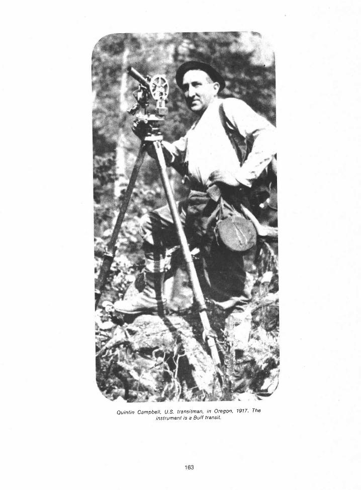

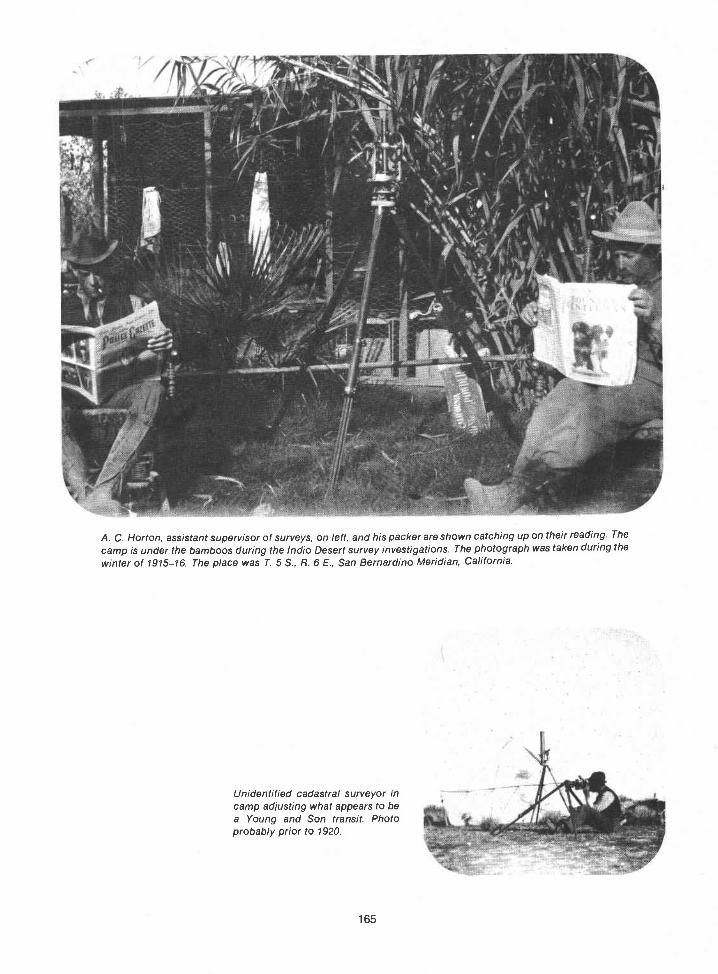
A. C. Horton, assistant supervisor of surveys, on left, and his packer are shown catching up on their reading. Thecamp is under the bamboos during the lndio Desert survey investigations. The photograph was taken during the
winter of 1915-1 6. The place was T. 5 S., R. 6 E., San Bernardino Meridian, California.
Unidentified cadastral surveyor incamp adjusting what appears to bea Young and Son transit. Photoprobably prior to 1920.
165

A camp in southern Idaho, faIl 1919 The men in the photo are not identified.
Blackfoot Indian Reservation on Milk River, Montana, 1922 Divide Peak in Glacier National Park forms thebackground for the camp of surveyors Roy Bandy, Ernest Parker, and D. W. Eaton.
166

Humphrey Mountain on the east boundary ofYellowstone Park, 1931 The men at the top of the peakare building a corner. There is another corner on therock under Roy Bandys transit
167

July 1940, survey of islands in the vicinity of PointLobos, California. The surveyor, Elmer D. Calvin, isusing a pipe as a walkway.
Typical Nevada desert survey, 1949 The instrument/s aGurley transit
168
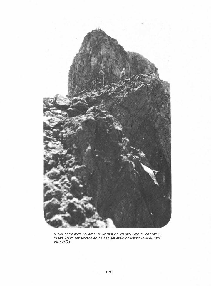
Survey of the north boundary of Yellowstone National Park, at the head ofPebble Creek. The corner is on the top of the peak; the photo was taken in theearly 1930's.
169

Roy Bandy's crew, 1931. Left to right: Roy Bandy, Tin gley, Jack Morris, Ariel Barney,Don Thompson, Marvin Thompson, and Frank Mont bilier. The men are carrying surveyequipment, blankets, food, tools, and corner posts, Their destination, 2,000 feet uptothe
top of the ridge at the foot of Cody Peak, is too rough for pack mules.
Two surveyors, at the top of the photo, view theplace where the survey line crosses the GunnisonRiver in Colorado. The river is 2,500 feet below them.Group No. 333, 1940.
170

United States cadastral survey office. Helena. Montana, AprilHarris; J. Scott Harrison, assistant supervisor of surveys; GStanding left to right: Ernest Parker, Ranney V. Lyman; Phi/lipDan P. Mumbrue; George F. Tyrrell, draftsman; Melvin J. DaThomas, clerk,
Seated loft to right: Guy H. Richardson; A. T. (A/ox)Rigby; H. B or A. H. Hibbard, mineral draftsman.ude F. Warner; W. R. (Roy) Bandy; Fred L. Cumming;clerk; H. J. (Jim) Goodal/, of tice engineer; Minerva
14, 1930.eorge F.Inch; CIavis, chief

i
m
William B. Kimmel in camp inWyoming; year unknown. He isholding a young wildcat.
172
Anthony (AC.) Kimmell wascalled "Tony." It is believed thatthis photograph was taken inArkansas, but the year is un-known.

A. N. Kimmell and party on the roof of the Federal Building in Anniston, Alabama, May1916. Left to right: unidentified, Hal D. Craig, Frank Constantine, unidentified, A. N.Kimmell, Thomas E. Hiester, Jim Quigley (2), and Arthur C. Buttrick.
Near Cimarron, Colorado. The year is not known, but the man on the left in the wagon isEverett H. Kimmell. A. N. Kimmell, fifth from left in the above photo, was Everett's father.William B. Kimmel and A. C. Kimmell were Everett's uncles. Keith K. Kimmell (notpictured) was his cousin.
173
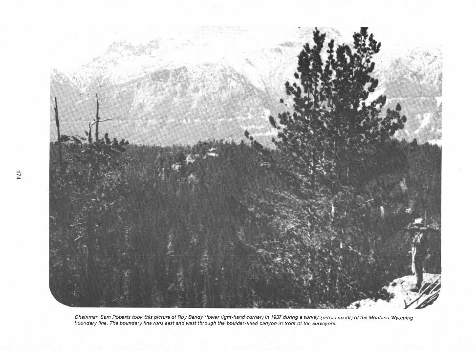
Chainman Sam Roberts took this picture of Roy Bandy (lower right-hand corner) in 1937 during a survey (retracement) of the Montana-Wyomingboundary line. The boundary line runs east and west through the boulder-filled canyon in front of the surveyors.

A mountain stream for General Land Office surveyors Guy R Veal (with steel tape) and Hugh Crawford (at transit) to contend with

Looking for a pack trail route to the isolated eastern part of Yellowstone National Park in 1932. Leftto right: Ariel Barney, Roy Bandy, and Ed Wilson.
Shown descending Notch Mountain on the easternboundary of Yellowstone Park in 1932 are JackMorris (above) and Oliver Tin gley (below).
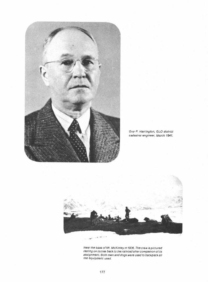
177
Guy P. Harrington, GLO districtcadastral engineer, March 1941.
Near the base of Mt McKinley in 1936. The crew is picturedresting on its trek back to the railroad after completion of itsassignment. Both men and dogs were used to backpack allthe equipment used.


179
A cook tent in some rugged countrya spike camp, section 14, T. 37 N., R. 109 W.,Sixth Principal Meridian, Wyoming, 1935. Pictured are Arnold Bigler and friend.
Wyoming, 1935. Left to right: Lester Stoll, Charles Hansen, Dave Todd, Dick Simmers, BillAnderson, Leo Peterson (party chief and later, area cadastral engineer, Area 2), Willis Brown,Elmer Lenhart, and Victor Stalick.

Roy Bandy's pack train moving along the eastern boundary of Yellowstone National Park at the top of the
Pack train halts for packer to check the loads. The survey party is moving along the eastern boundary ofYellowstone National Park in 1932

In camp during the 1936 survey of Mt McKinley National Park boundary, in Alaska. Left to right:Herbert C. Torgerson, Leonard M. Berlin, Kenneth M. Nelson, and Grant Pearson.
181
Herman Jaeckel, district cadastralengineer, in his office at the U.S.Customs House, Denver, Colorado,April 7, 1941.
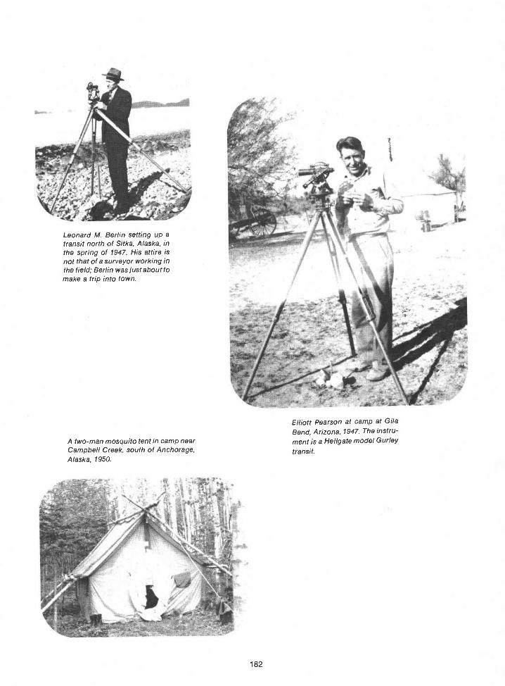
Leonard M. Berlin setting up atransit north of Sitka, Alaska, inthe spring of 1947. His attire isnot that of a surveyor working inthe field; Berlin was just about tomake a trip into town.
182
Elliott Pearson at camp at GilaBend, Arizona, 1947. The instru-
A two-man mosquito tent in camp near ment is a Hellgate model GurleyCampbell Creek, south of Anchorage, transit.Alaska, 1950.

Dupree R. Averill at Cuyama Valley, California, during thewinter of 1948-49.
A. C (Tony) Kimmell in May1938. The camp is in the desertsouth of Wamsufter, Wyoming.
183
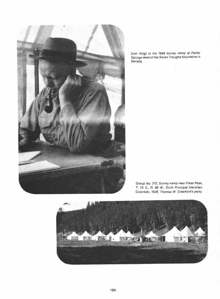
184
Emil Voigt in his 1949 survey camp at PorterSprings west of the Seven Troughs Mountains inNevada.
Group No. 312, Survey camp near Pikes Peak,T. 15 S., R. 68 W., Sixth Principal Meridian,Colorado, 1938. Thomas W. Crawford's party.

August 26, 1948, on the Utah-Wyoming Stateline near mile post 37. The survey party isunder the direction of F. Wayne Forrest. Theman in the foreground (kneeling) is stampingthe section number into the brass cap of asurvey monument.
185
Surveyor C A/bert White onrocky pinnacle in the SevenTroughs Mountains, west ofLove/ock, Nevada c/rca 1948

Thomas W. Crawford.Year and place not known.
Herk Averill in the southwesternpart of Arizona during the wintersurvey season of 1946-47.
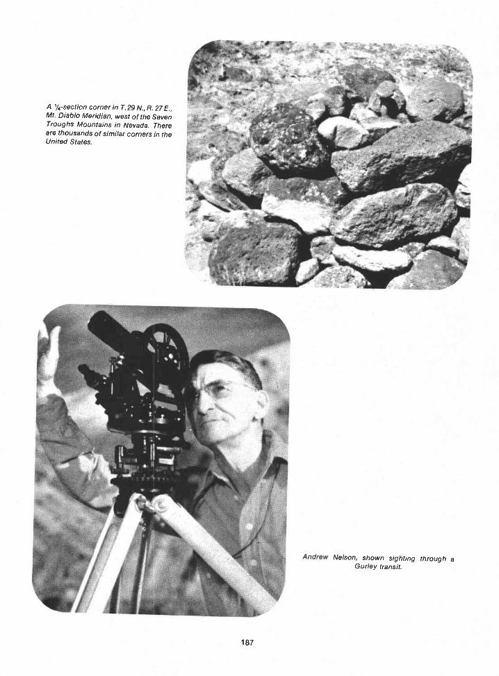
tC
A 1/4-section corner In T. 29 N., R. 27 E.,Mt. Diablo Meridian, west of the SevenTroughs Mountains in Nevada. Thereare thousands of similar corners in theUnited States.
187
Nelson, Shown sighting through aGurley transit.
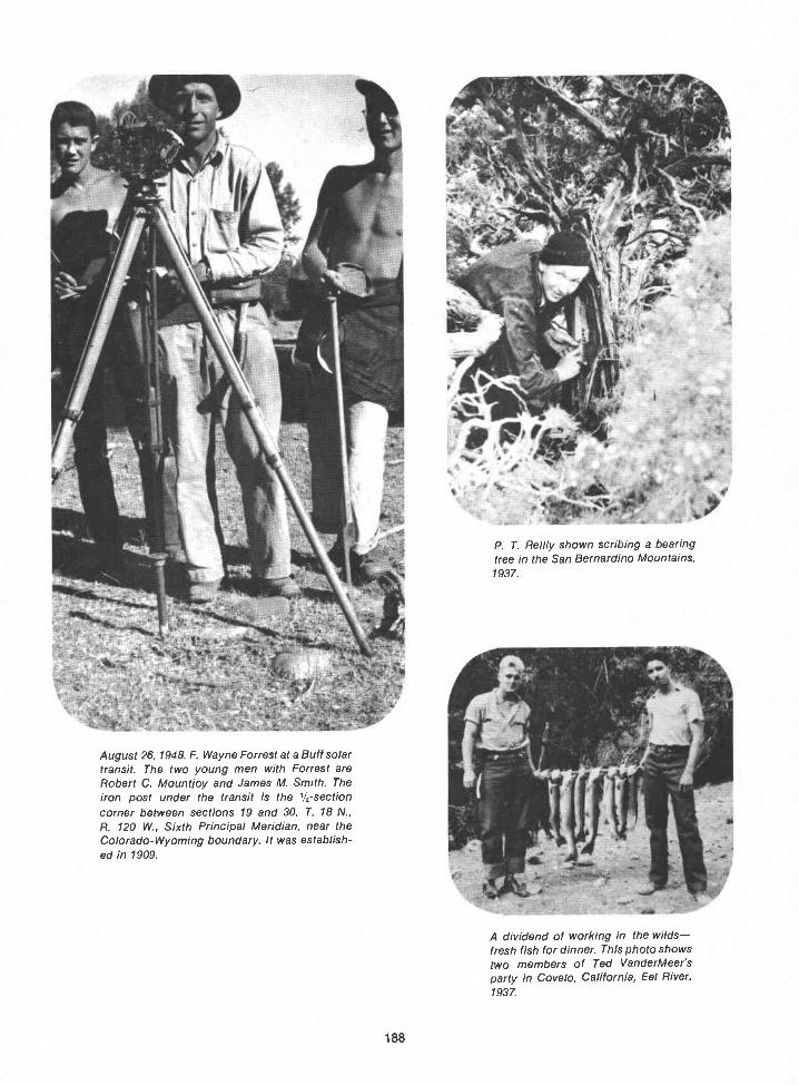
a
1,
August 26, 1948. F. Wayne Forrest at a Buff solartransit. The two young men with Forrest areRobert C. Mountloy and James M. Smith. Theiron post under the transit is the l/4-sectioncorner between sections 19 and 30, T. 18 N.,R. 120 W., Sixth Principal Meridian, near theColorado-Wyoming boundary. It was establish-ed in 1909.
188
P. T. Reilly shown scribing a bearingtree in the San Bernardino Mountains,1937.
A dividend of working in the wildsfresh fish for dinner. This photo showstwo members of Ted VanderMeer'sparty in Covelo, California, Eel River,1937.
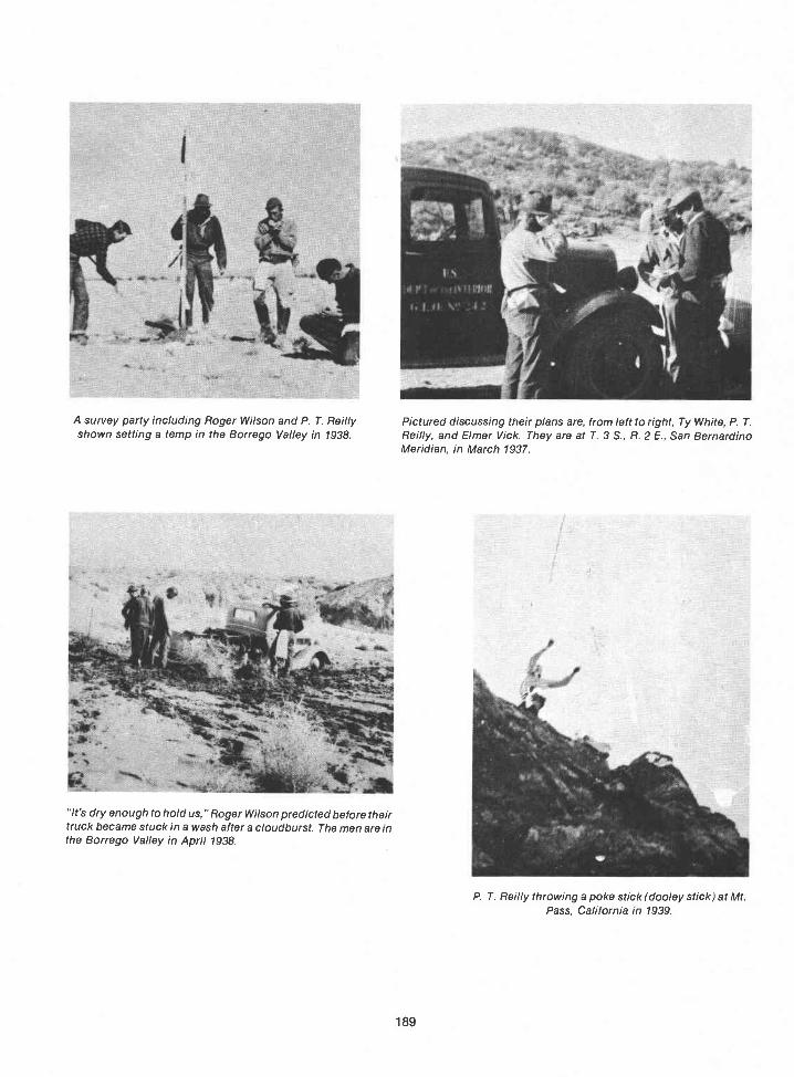
It's dry enough to hold us," Roger Wilson predicted before theirtruck became stuck in a wash after a cloudburst. The men are inthe Borrego Valley in April 1938.
189
P. T. Reilly throwing a poke stick (dooley stick) at Mt.Pass, California in 1939.
A survey party including Roger Wilson and P. T. Reilly Pictured discussing their plans are, from left to right, Ty White, P. T.shown setting a temp in the Borrego Valley in 1938. Reilly, and Elmer Vick. They are at T. 3 S., R. 2 E., San Bernardino
Meridian, in March 1937.
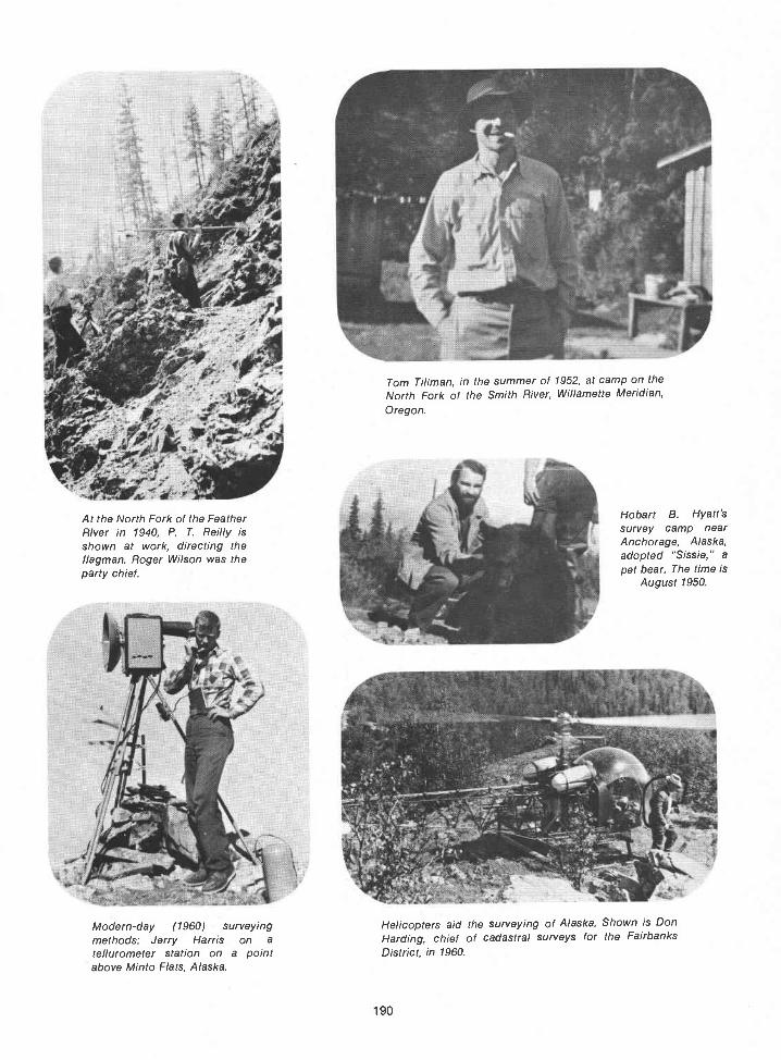
a ,'.it
:'
At the North Fork of the FeatherRiver in 1940, P. T. Reilly isshown at work, directing theflagman. Roger Wilson was theparty chief.
Modern-day (1960) surveyingmethods: Jerry Harris on a
tellurometer station on a pointabove Minto Flats, Alaska.
Tom Tillman, in the summer of 1952, at camp on theNorth Fork of the Smith River, Willamette Meridian,Oregon.
Hobart B. Hyatt'ssurvey camp nearAnchorage, Alaska,adopted "Sissie," apet bear. The time is
August 1950.
Helicopters aid the surveying of Alaska. Shown is DonHarding, chief of cadastral surveys for the FairbanksDistrict, in 1960.
190

191
Frank M. 1910, a
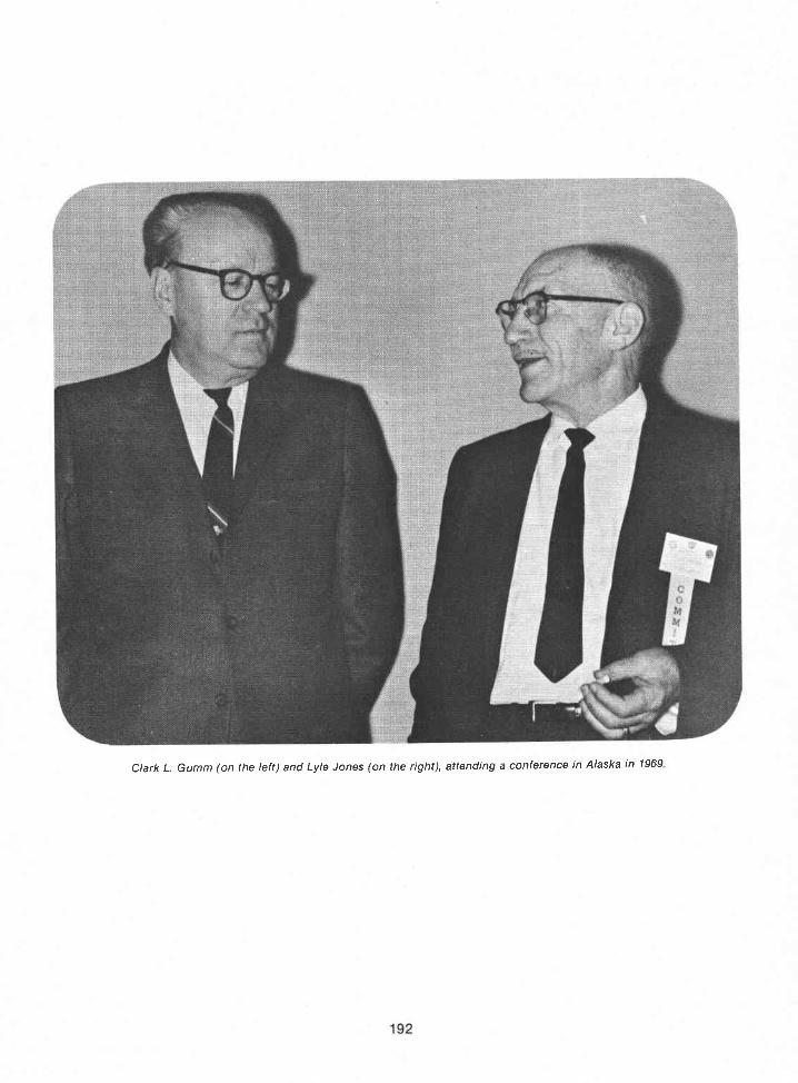


William Teller, long time second-generation cadastral surveyor.At the time of his retirement (1976), Teller was chief, CadastralSurveys, Denver Service Cente,.
Emil Voigt and Marion Clawson in Nevada, 1949. Clawson was BLM directorfrom March 1948 until April 1953.
194
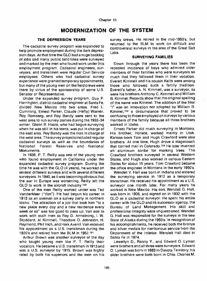
THE DEPRESSION YEARS
The cadastral survey program was expanded tohelp promote employment during the dark depres-sion days. At that time the GLO had a huge backlogof jobs and many public land lines were surveyedand marked by the men who found work under thisemployment program. Cadastral engineers, sur-veyors, and transitmen were regular Civil Serviceemployees. Others who had cadastral surveyexperience were granted temporary appointments,but many of the young men on the field crews werethere by virtue of the sponsorship of some U.S.Senator or Representative.
Under the expanded survey program, Guy P.Harrington, district cadastral engineer at Santa Fe,divided New Mexico into two areas. Fred L.Cumming, Ernest Parker, Claude (Hefty) Warner,Roy Romberg, and Roy Bandy were sent to thewest area to run survey parties during the 1933-34winter. Glenn R. Haste, who had begun surveyingwhen he was still in his teens, was put in charge ofthe east area. Roy Bandy was the man in charge ofthe west area. The survey projects included regularcadastral surveys as well as the boundaries ofNational Forest Reserves and NationalMonuments.
In 1936, P. T. Reilly was one of the young menwho found employment in California under theexpanded cadastral survey program. During thetime he was with the GLO (4 years), he worked onseveral different surveys and with several differentsurveyors. In 1940, as it was becoming obvious thatthe war in Europe was worsening, Reilly left theGLO to work in the aircraft industry.156
One of the men Reilly worked under was TedVanderMeer ("Van"). He had begun his career in1913 as an axeman on a survey party in northernIdaho. The attraction of a job that took him "to anew place every day and a new residence everyweek or so" was too good to pass up. Van was towork with such men as Ray D. Armstrong, I. W.Stoddard, Al Kimmell, Theodore 0. Johnston, H.Raymond, Phil Inch, and Herk Averill. Van receivedhis appointment as a U.S. transitman during the1920's and retired from the BLM in 1952.161
Arthur Brown was another surveyor of the daywho taught young men like P. T. Reilly theirvocation. He became a U.S. transitman in 1913 andwas a U.S. surveyor by 1915. Brown was highlyrated by both his superiors and the men on his
Chapter 15
MODERNIZATION OF THE SYSTEM
195
survey crews. He retired in the mid-1950's, butreturned to the BLM to work on difficult andcontroversial surveys in the area of the Great SaltLake.
SURVEYING FAMILIES
Down through the years there has been therepeated incidence of boys who admired oldermembers of their families who were surveyors somuch that they followed them in their vocation.Everett Kimmell and his cousin Keith were amongthose who followed such a family tradition.Everett's father, A. N. Kimmell, was a surveyor, aswere his brothers Anthony C. Kimmell and WilliamB. Kimmel. Records show that the original spellingof the name was Kimmel. The addition of the final"I" was an innovation not adopted by William B.Kimmel,159 a circumstance that proved to beconfusing to those employed on surveys by variousmembers of the family because all three brothersworked in Idaho.
Ernest Parker did much surveying in Montana.His brother, Horace, worked mainly in Utah.Kansas-born Tom and Hugh Crawford were alsobrothers. At one time, Hugh drove a stagecoachthat carried mail in Colorado.159 He later inventedan aluminum scribe for marking trees. TheCrawford brothers surveyed in several WesternStates, and Hugh also worked in various EasternStates for about 15 years. Tom Crawford becamethe office engineer in Montana in the early 1950's.
Wendell V. Hall was born in Indiana and enteredthe surveying service in 1912 as a temporarytransitman. He received his appointment as a U.S.surveyor one month later. For many years heworked in New Mexico. His son, Wendell G. Hall,was born in 1906, and signed on in 1932 with theGLO as a cadastral surveyor. He spent his entirecareer with the GLO and its successor agency, theBureau of Land Management. His skill andprofessional integrity were unquestioned. WendellG. Hall was responsible for the surveys in the newState of Alaska during the 1950's. In recognition ofhis accomplishments, he received both the bronzeand silver medals for meritorious service from theDepartment of the Interior. Wendell Hall died inSanta Fe in 1974.
Lewellyn D., Ranny Y., and Edward 0. Lymanwere brothers and all three were surveyors. Edward0. Lyman was born in 1883 in Dakota Territory; hisolder brothers were both born in Ohio. Charles M.

Pidgeon was born in late 1862 in Clarke County,Virginia; his surveyor son was C. ChandleePidgeon. Fred and Frank S. Spofford werebrothers. Fred's first surveying job was as secondassistant with his brother when Frank was anexaminer of surveys.
Brothers Van and Ty White worked in Arizonaabout 1910. Ty also worked in California. Later,Wendell G. Hall and Ty White both worked in theDakotas as did William Teller, son of Addison R.Teller who was an examiner of surveys along withFrank M. Johnson. Bill Teller was just a boy whenhe first worked on his father's survey crew. Later,his knowledge and years of experience, along withhis amazing memory with regard to public landsurveying matters, made him a popular speaker.Teller was named chief of cadastral surveys in theDenver Service Center in 1965. He still held thatposition at the time of his recent retirement. Tellerwas actively involved in public land surveying fornearly half a century.
The Saxons were a family surveying team, aswere William Hiester and his younger brother,Tom, who worked mainly in southern Utah andArizona. Hans Voigt and his younger brother, Emil,were of German extraction. They both weresurveyors for many years. Emil worked for severalyears in Nevada, while Hans surveyed mainly inColorado. Two more pairs of surveyor brotherswere Fred L. and James A. Cumming and Lester L.and Donald B. Clement. Richard E. (Elmer), W. R.(Roy), and Willis W. Bandy were all born inMissouri. Elmer was born on Lincoln's birthday,1880; Roy, exactly 5 years later; and Willis, inAugust 1890.
Elmer taught school in Routt County, Colorado,for a couple of years, and in April of 1904, he joinedthe public land survey crews of Colonel Samuel W.Brunt and his son Arthur H. Brunt. Arthur was awell-known engineer and surveyor, and both of theBrunts were, atthattime, contractsurveyorsfortheGeneral Land Office in the Big Horn Basin ofnorthwestern Wyoming.
Colonel Brunt was a gray-bearded veteran whohad held survey contracts in California as early as1879.136 Colonel Brunt asked Elmer if he had anybrothers back in Missouri that they could use, so, inJune 1905 Roy Bandy joined the Brunt survey partyat Garland, Wyoming.145
One of Roy Bandy's first public land survey jobswas as chainman on Arthur Brunt's contract for thesurvey of part of the Twelfth Standard ParallelNorth in Wyoming. The line ran westward from apoint 15 miles north of Worland, Wyoming, across
196
a rough 60 miles to Carter Mountain, west ofMeeteetse. The first 40 miles of the survey line werethrough desolate, arid, rock-covered badlandcountry.12°
Early in July, the nine-man crew left Cody,Wyoming. Their two wagons were loaded withsurveying equipment, tents, beds, and cookingequipment. The men rode atop the loaded wagons.They traveled in this manner for about a hundredmiles, until they reached a log house on the westside of the Big Horn River. That log house wasWorland, Wyoming.
Breakfast was at 6 a.m. and supper was at 6p.m.which meant a 12-hour work day. The menhiked to and from the work area. They carried theirlunch in a handkerchief or a piece of flagging tiedto their belts. The quart canteen of water theypacked with them had to last all day.
The survey line was run with a solar compass or asolar transit. A one-chain steel tape was used, andthe tape was leveled. (The modern clinometer hadnot yet been invented.) The chainmen kept track ofthe distance by the time-honored method ofcounting the tally pins, one pin for every chain. Ifthe ground slope was steep and it was necessary totake less than a chain, a mark was made, and thepin stuck in the ground when the full hundred linkswere reached.
The chainmen, in this instance, Arthur Brunt andRoy Bandy, took turns going ahead with the chain.They changed every ten chains. The same manalways started out from a corner and went tenchains. The front chainman had ten pins, and whenthe last of them was stuck into the ground, hewould call out, "Tally one." The rear chainman thenwalked up counting his pins. If the count was tenpins, he would say, "Tally one, ten pins." In thismanner it was known immediately if either one hadlost a pin, If one was missing, they went back, alsoin the time-honored manner, and chained it over, inorder to be sure of the distance. The rear chainmantook the lead for the second ten chains. One manalways had all the even-numbered tallys and theother man had all the odd-numbered tallys.
On this survey, where they were running astraight line all the way, camp was moved aboutevery 2 days. For 2 months they surveyed the lineand set stone corners. At the end of the 60 miles,they went on to another jobthat of subdividing atownship on the east slope of Carter Mountain.During that entire 4-month survey season they sawonly one townMeeteetse, Wyomingwhich, in1905 consisted of one general store and threesaloons.120
In 1906 Alpheus P. Hanson, surveyor general ofWyoming, appointed Roy Bandy a U.S. deputysurveyor. Bandy and Arthur Brunt were awarded acontract for the survey of six townships in the BigHorn Basin, so Roy Bandy, at the age of 21, becamethe youngest deputy surveyor to hold a contractthat year. That contract was completed thefollowing summer.
Elmer Bandy surveyed with the BruntS untilshortly before the beginning of the direct system.Frank M. Johnson hired him in 1910 and assignedhim to work under J. Scott Harrison, assistantsupervisor of surveys for Montana. He stayed withthe GLO and surveyed in Montana, California, andArizona until he grew ill in late 1915. He died twomonths later, on January 15, 1916.56
Wilford Utterback and Roy Bandy, who had bothrun survey crews for the Brunts, were employed in1911 as cadastral surveyors working out of theCheyenne, Wyoming, office. Charles M. Pidgeonand his son, C. Chandlee Pidgeon, and Mark Kelly,Herman Jaeckel, Homer and Wesley C. Saxon, andHans and Emil Voigt also worked out of theWyoming office at that time.145
In 1914, Roy Bandy was transferred to Helena,Montana, under J. Scott Harrison. One of his firstassignments was to work with Guy R. Veal andGlenn Sawyer on the survey of the breaks along theMissouri River. The Missouri River Breaks, south ofthe Bear Paw and Little Rocky Mountains, is an areaof spectacularly fractured land. It is badlandscountry with strange, abrupt upward thrusts ofsandstone, and canyons that plunge downward forhundreds of feet. It is a rugged, tortured land, andthe few scrub pine and cedar trees that try to growthere are gnarled and twisted like the rest of thelandscape.
While Roy surveyed in Montana, Willis Bandyalso worked on the public land surveys. He was afield assistant several summers and went on tobecome a surveyor. Willis Bandy was promoted tothe position of party chief in the 1920's, and, fromall accounts, he was a good one. At about this time,Glenn Sawyer, Ernest Parker, David Eaton, A.Parker Warner, Phillip Inch, and Charley Seeley allran survey crews under Roy Bandy on the survey ofthe Crow Indian Reservation.
In 1928, J. Scott Harrison characterized RoyBandy as "the finest executive I have in theservice."69
Roy Bandy completed a law degree while he wasa working cadastral surveyor. It must have beendifficult, but he knew it would give him a betterunderstanding of land laws, and he hoped thatwould make him a better surveyor. After 4 long
197
years and much dedication, he received his degreein law. Bandy put in many hard years of work withthe Bureau of Land Management, and finallyretired in the midl95O's.
EL DORADO SPRINGS
Before the Hiesters, Kimmells, Crawfords, andother families of surveyors had all retired, anothername began to appear on the roster of cadastralsurveyors. It was not a family name, but a town,andit occurred so often that people began to wonderabout itEl Dorado Springs, Missouri. Roy Bandyfinally explained what made this small Missouritown so well known in cadastral surveying circles.
It began with Eddie Wilson, who had worked onBandy's survey party for a time. Eventually, Wilsonwent back to Missouri, and settled down in ElDorado Springs. Because his wife was related toBandy's wife he and Bandy kept in touch. Once,when Bandy needed some new recruits for hissurvey party, he let Ed Wilson know about it.Wilson, who was well acquainted with the people inhis area, knew Bandy believed that bright, hard-working farm boys sometimes made the bestsurveyors. Wilson talked to some of the youngmen, and one of them joined Bandy's survey party.Over a period of time, Wilson encouraged severalyoung men to become cadastral surveyors, and anumber of them are still with the Bureau of LandManagement.145
YELLOWSTONE PARK BOUNDARY
1n1931 Frank M.Johnson asked J. ScottHarrisonto assign Roy Bandy to the survey of the revisedeast and north boundaries of Yellowstone NationalPark. The revision of the boundary lines changedthem from straight lines that crossed mountainsand drainages to lines following the divides thatseparated the watersheds. The new east boundarywas high atop the divide between the watersflowing into the Yellowstone system and thoseflowing into the Shoshone River.
The change in boundary was made to ease thework of the rangers employed by the National Parkand National Forest Services. It did not, however,ease the work of the men sent to survey the newlines. The surveyors had to run a broken line alongthe crest of the mountain ranges, keeping always tothe sinuosities of the divide. This meant that thesurveyors were required to climb the highest peaksand set corners on them.
It took three summers to complete the surveythat established this park boundary. The surveyorsclimbed upward to the top of 11,360-foot Eagle

Peak, the highest point in the park, before their jobwas finished.145
MISSOURI RIVER BASIN PROJECT
During the next few years as Congressionalappropriations for cadastral surveys were shrink-ing, the need for resurveys within the areasadministered by the Bureau of Reclamation wasgrowing. Roy Bandy was convinced that thecadastral surveyors employed by the GLO were thepeople who were best trained and equipped to dothe work. In 1939, he talked about this to FredMunro, who was a project engineer for the Bureauof Reclamation. Munro took the idea to hissuperiors, and funds were allotted for a surveyneeded in connection with a plan for the resettle-ment of homesteaders on the Yellowstone River.145That survey was the start of the vast reimbursablecadastral resurvey project in the Missouri RiverBasin.
At the beginning of 1946, A. C. Horton, thensupervisor of surveys, and Herman Jaeckel, theassistant supervisor of surveys for Montana,Wyoming, and Colorado, visited the Helena office.They announced that the Bureau of Reclamationhad requested that all the cadastral surveys in theMissouri River Basin States be executed by theGLO. This area included Montana, North Dakota,South Dakota, Wyoming, Colorado, Nebraska,Kansas, Missouri, and Iowa.
Roy Bandy was directed to take charge of theimmense project. He was to make preparations tobegin the surveys in April, so he obtainedauthorization from Horton to call up as manyexperienced cadastral surveyors as he needed.Funds were made available to him for the purchaseof the vehicles and equipment that would beneeded. On schedule, in April 1946, Roy Bandyopened an office in Fort Peck, on the Missouri Riverin Montana. George F. Rigby, who had beenrecalled from retirement, was his helper. Glenn R.Haste, acting as Bandy's assistant, opened anoffice in Flaxton, North Dakota.
In one month there were 18 survey parties in thefield. The party chiefs were all experiencedcadastral surveyors: R. Y. Lyman, Ernest Parker,Andy Nelson, Arthur Brown, Lloyd Toland, EmilVoigt, Russell McDonald, Willis Bandy, TomCrawford, Hugh Crawford, John S. Knowles, LeoPeterson, Lyle F. Jones, William Teller, Wendell G.Hall, Ty White, Quintin (Jerry) Campbell, andClaude (Hefty) Warner.145
Wendell Hall and his survey party werestationedat Crosby, North Dakota. Ty White's crewexecuted
198
surveys at Mellette, South Dakota. Later in thesummer, they surveyed in the area near Mcintosh.Lloyd Toland's survey party was working in thesame area along the Grand River. Both crews wereworking on the survey for the Shady Hills FloodControl project.
CAMP COOKS
Cooks in the survey camps were often in-teresting types. One cook was called "WhisperingWillie." He had been a fighter and his vocal cordshad been damaged in the ring.148 Another, GusRitter, was characterized as "an ornery old goatwho could destroy a case of beer (24 cans) in onenight by opening one can after another from hiscot."156 Sometimes the wife of the party chiefbecame camp cook, but this was rarely more than atemporary occurrence. Generally, camp cookswere men who understood their importance in thescheme of things and were proud of their line ofwork. Some of them were friendly and somegrouchy, some were clean, and some werecareless. The menu often depended, to someextent, on the cook's background. if the cook,whatever his origins or interests, understood thatmen who work hard in the open care little for fancyfood but have a great need for good, wholesome,and nutritious food, the crew could count itself alucky one. Many culinary sins could be forgiven if ahot cup of coffee was always on hand and therewas an occasional piece of pie to go with it.
Keeping fresh meats, milk, and vegetables onhand was difficult in some areas, so someingenious methods were devised to handle theproblem. One fairly common sort of coolerconsisted of three or four frames about 20 inchessquare with screen bottoms, and wet gunny sackshung from the sides. These were hung one abovethe other by knotted ropes at the corners, and theunit was then suspended from a tree. If there wasno tree, the cooler could be placed on a stand inwhatever shade was available. Frequently, in theold days that was the shade afforded by the wagonor the tents. Later, trucks provided the shade.These evaporative coolers worked well, especiallyin the desert.
Camp cooks also had to deal with stoves thatwere not the sort found in the average kitchen. TheKimmel camp stove was a favorite. William Kimmelinvented it. A particularly good feature of the stovewas that it could be telescoped for packing. Beingboth sturdy and portable, it met most of therequirements for camp cooking.

Ai! in 'rnr t'tra.g aJ J1JQ
INVENTED BY WM. B. KIMMELU. S. SURVEYOR
a man \vh Ins Iifc lii survcv c: aii knovsliard..liip.. and (lsC11 toru the (r(ij;\ -flect -tceI camp
'ihis stove is the reuit f 'years of stud': vercome in;mct the i11conveuc1ccs a;id discomfort canp flrepoorcooking, burned bread, cold food, chopping small wood, stovesburning up and fires going out.
PROBLEM SOLVED AT LAST
SEVENTEEN REASONSWHY THIS STOVE
IS THE BEST
You can hake bread with a red hot fire while doingvout other cooking. This is impcssible with an other sheetstccl camp Stove made.
This is the only sheet steel camp stove made uponwhich it is possible to prepare a complete hot neal. \Vithother stoves you have hot bread and a cold meal or a hot mealand cold bread. Oven top is used for a warming closet.
Our Xo. 1 stove has the largest oven of any sheet steelcamp stove in use. Oven is iS inches deep. 22 inches wide.74 inches high.
Oven protected by asbestos board and dead air space,reinforced with steel, making oven ever-lasting and preventsburning of bread and meats while baking.
Fire box vill lat for years. No backs or bottoms toburn outno lids to lose. Don't have lids.
Our No. 1 'ye has c'tra larc irchox male of heavysteel, size ot fire box 1:x1'x!S inches with 9x13 inch feeddoor, lop has channel steel strips on under side to preventsagging from heat and weight.
199

7. '.O fl)Or c'r: r,i \VOOil r h ;t\uu can l,urii 1 i ae hrushthus eliiiiinatint half of tIic(lrudgerv 01 caiiqJ luc.
. Ihi stove viii 11 Id fire over nu1it .as it is absolutelyair tight.
\ou can take thk stve (l:\vil r set it U P1 OI1C Ilililtiteon any kud CO ground. No tools required.
\ou can .cook for six to fifteen men on ur regularNo. 1 stove, which has tirree times the capacity in cookingsurface of any ether sheet steel camp St ye made.
Three joints of pipe packed in the oven : the legs foldand arc held firntiv in place: the even tcie-cepcs inside ofextra havv fire box, making a package of our No. 1 13x1x2Sinches and veigliing .51.1 potmds. lade ot heavy steel.
TIns stove i exccptionaflv handy to pack and carr onpack animal. It cait be used for side pack in regular alforjas.
1:3. A LEG BRACEIn connection with the folding legwe have attached a folding leg brace winch securely locks theleg. Stove absolutely rigid now when set up. Held iii place.set up or knocked down, by same fastener.
DETACHABLE COLLARSCollar on the fireboxanti oven are now removable and packed in oven. These col-lard simply drive into place and securely held there.
Xot necessary to crate stove in shipping; the packageis smooth on all sides. This saves ten pounds in weight onthe crate, and a big advantage in packing on pack animal.
Un all door fasteners we arc now using large steel key.rings. Besides folding out of the way, they give the user asecure hold in operating the handles.
\Vc have also quit using (lraft slide in the fee(l (lOoN.for the reason that all doors burn out first at this point inever camp stove. :S Our firehox sets on the ground I seecut) all that is required for draft is to dig a small hole underedge of firebox: the size of the opening regulates the drait4simpIc solutionh lv covering this opening completely thestove is made airtight and vill hold fire for forty-eight hoursor more. Tops of fireboxes and ovens are now reinforced withChannel Iron to pre-ent sagging from heat and weight ofutensils.
In using stove to prolong its life do not build a bonfire infire box, because it is large. Make a small fire and placegreen-back logs if possible on each side. This protects thefirebox.
200

IN ADDITION TO OUR NO. 1 LARGE SIZE TELE-SCOPE CAMP STOVE WE ARE NOW MAKING
A NO 2 SMALL SIZE, INTENDED FORSMALL CAMPING PARTIES OF
TWO TO FOUR MZN.Size of firchox No. 2 stove. 2:Yxfl iiiJes 1w inches
11Ih, which is alsj ti'e outidc mcaurefl1ents when tele-scooed. Oven 12 inches deep by ] inches wide and iinches high. \eight 33 pounds. made oi No. 24 gauge steeL
All oven doors have new oven (loor supports with patentclips that do not bind.
OUR STOVES ARE ESPECIALLY ADAPTED FOR SUR-VEYORS, FOREST SERVICE MEN, SHEEP MEN,
PROSPECTORS. CAMPERS. HOMESTEAD-ERS, MINERS AND AUTOMO-
BILE TOURISTS.Thi stove has been used cctensveiv a1 ver thy \vest br
the last four years by Forest Service men and U. S. Stir-vevors.
The following letter speaks for itself (received last earjDepartment of the interior.
General Land Office.Office of Assistant Supervisor oi Surveys.
Boise. Idaho. March 23-14.;1'elescope Camp Stove Co., floise, Idaho.Gentlemen :-
Please quote inc prices of 2.5 of our new improved Kim-mel Pat. Camp Stoves No. 1, Large Size, as per Sampk sub-nutted, to be delivered at our warehouse. I believe with yournew method of protecting the oven with extra sheet steel and½-inch dead air space. together with asbestos board, that youhave the most ideal oven ever put in a camp stove.
\Ve have been using your Kinincl Camp Stove in Cuiorado.New Mexico and Montana for 4 ears and consider theni thebest Camp Stove ma(le. Mv department has purchased about50 during this time. Yours truly,
FRANK S. SPOFFORD,Assistant Supervisor of Sur'evs.
PRICES F. 0. B. BOISENo. 1Large size. 13 x18'x28. wt. 50 lbs. - $10.00No. 2Small size. 12"x1311x23.wt. 35 lbs. - 8.00
1505 NORTH TWELFTH ST., BOISE, IDAHO
201
te1escop Camp Stouc Company

THE FOUR CORNERS
The State boundaries of most States west of theMississippi River, plus a number of the central andsouthern States, were surveyed under the directionof the General Land Office. Many resurveys orretracemerits of parts of these State boundary lineshave been made in the course of the regularcadastral surveys of the public lands. Sometimes,several surveyors, over a period of years, had a partin establishing or marking these boundaries. Onesuch case, albeit an unusual one, began with thesurvey of the southern boundary of Colorado fromthe southeast corner of the State westward to the103rd Meridian. It was surveyed by Macomb, in1858-59. The same portion of the south boundaryof Colorado was resurveyed by John G. Major, adeputy surveyor.
The New Mexico-Colorado boundary from the103rd Meridian westward was surveyed by UnitedStates Surveyor E. N. Darling. He was instructed tosurvey along the 37th parallel, but later, investiga-tion showed gross errors in the line in the area nearEdith, Colorado.
In 1902-3, H. B. Carpenter resurveyed the entireline dividing the State of Colorado from theTerritories of New Mexico and Oklahoma. His linediffered from Darling's and resulted in a boundarydispute. The United States Supreme Court, in anopinion dated January 26, 1925, stated thatDarling's line was the correct one in spite of itserrors and regardless of the temporary GeneralLand Office use of Carpenter's line. The Carpenterline was not used after that time for public landsurveys. In 1917, the portion of Darling's linebetween mileposts 202 and 241 had been rerun byW. C. Perkins of the General Land Office. Perkins'line was monumented with iron posts, and it wasaccepted by the court.
The court appointed Arthur Kidder as com-missioner to resurvey Darling's line. The field workwas done under his supervision, but the executionof the survey was slow, due to delays in the receiptof funds from the States involved. After Kidder'sdeath in 1958, Joseph C. Thoma was appointed asthe new commissioner. It was he who prepared thefinal report that was approved by the SupremeCourt on October 24, 1960.
Monuments set in 1859 by Macomb and in 1900by Levi S. Preston in a resurvey of Major's line 21/2miles eastward to the northeast corner of NewMexico were to be the controlling points in thesurvey, according to instructions of the court.
Kidder's survey began at the Macomb monu-ment, which he replaced with a concrete post
202
bearing a bronze tablet. The line then ran east tothe Preston monument; then west, reestablishingDarling's survey. This resurvey was controlled bythe monuments established by Darling that wererecovered. Bronze-tableted concrete milepostswere set on the line between the original mileposts.Perkins' iron posts were reset in concrete in theiroriginal positions. The Carpenter monuments thatwere known to have been used as points ofreference for local surveys were preserved, but theboundary marker identification was removed fromthem. All the other Carpenter monuments weredestroyed
The closing point on the west end of the line wasa point set by Deputy Surveyor C. Robbins as hesurveyed the Arizona-New Mexico line in 1875.This line is on a meridian determined by referenceto a landmark peak called "The Needles" by theWheeler survey of 1874. Robbins called it "thesouthwest needle point of Wilson's Peak." Theboundary line was run west and north to the pointwhere the 32nd Meridian west of Washingtonintersects the south boundary of Colorado. Thepoint established by Robbins was 1 mile 45 chainseast of the mark that had been established byDarling, in 1868, as the southwest corner ofColorado. Robbins' point was accepted, and thusbecame the only monument in the United Statesmarking the common corner of four StatesUtah,Colorado, New Mexico, and Arizona. From thispoint the west boundary of Colorado was surveyedin 1879. The Utah-Arizona boundary, whichintersected Robbins' point, was run in 1901.
In 1899, the original sandstone marker was founddamaged. It was replaced that year by Page andLutz. In 1931, Everett H. Kimmell replaced the Pageand Lutz stone with the present concrete monu-ment. Subsequently, the Department of the Interiorplaced a 28-foot-square concrete paving blockaround the monument in 1962. It is oriented in thecardinal directions, with the names and seals offour States appearing in their correct quadrants.35
WORLD WAR II
Frank M. Johnson was still supervisor of surveyswhen the bombing of Pearl Harbor plunged theUnited States into World War II. By then he hadserved under six administrations (Taft was Presi-dent when the direct system was inaugurated). Heguided the surveying service through several majorcrises including World War I, the 1929 stock marketcrash, and the Great Depression that followed it.But Johnson did not live to see the end of WorldWar II. He died on March 27, 1944. Johnson was 71
years old and had been employed by the Depart-ment of the Interior for nearly 49 years. For morethan 33 of those years he had been the head of thecadastral surveying service.
Johnson had always been a forward-lookingmanone who was very aware of the fact thatchange is one of the few certainties of life.Although his half century of service saw much ofthe Public Domain transferred to private citizens orto business or non-Federal Governmentalorganizations under various land laws, it was alsoan era characterized in large measure by programsaimed toward the ultimate conservation of the
203
Public Domain. This was true in spite of the long-held public'attitudè that management of the publiclands was a temporary measure, to be used onlyuntil the lands could be transferred to otherownership or assigned to special use reservationsas they had been in the past.
About the time of Johnson's death, this attitudebegan to undergo a profound change. The value ofadministering some of the Public Domain formultiple uses and reserving it for futuregenerations began to gain recognition. The era ofthe transfer of the public lands, with its emphasison private interests, was definitely on the wane.

LAND SERVICE BULLETIN
Beginning in 1917 and continuing into the1930's, a monthly "Land Service Bulletin" wasprinted by the General Land Office. Composed ofnews notes from all the offices, the Bulletin wasedited by Judge S. V. Proudf it of the GLO. Newsabout the surveying service was gathered from theassistant supervisors by Frank M. Johnson, whoselected items and prepared them for the Bulletin.During its first few years, the Bulletin was filled withinteresting happenings and personalities, but laterthe administration issued an edict stating that theBulletin should be more formal intone. Thus, for itsremaining years, the Bulletin contained materialnot unlike that which now appears in the "FederalRegister."
The following item appeared in the August 1917Bulletin:86
The newly appointed transitmen in the FieldSurveying Service were assigned to the field asfollows: Thomas Walter Bates, Willis J. Millrick,Barney M. Pellum and Courtenay Q. Wheeler,District No.7; Roy 1. Campbell, J. Pierce Dunn,Herman F. Mader and Chester W. Pecore,District No. 8; Glenn ft Haste, District No. 4;Marvin J. Lytle, District No. 2; Charles F.Moore, District No. 1; and Andrew Nelson,District No. 6.
Barney Pellum was lucky to make that list. Twoyears earlier, he had been chainman on WilfordUtterback's crew (Group No. 61, Idaho) and hadslept outside the tent one warm Septemberevening. At about 1 a.m. he was attacked by a rabidcoyote and bitten on the forehead. Fortunately, theparty chief got Pellum to Boise where he receivedthe Pasteur treatment for rabies, and thus sur-vived.40
RED RIVER
Meander of Red River in OklahomaThe General Land Office will undertake next
summer the remeandering of the north bank ofRed River in Oklahoma west of the 98thmeridian in order to admit of the properdisposition of lands in the former Kiowa andComanche Reservations which border on theriver. The boundary lines of lots formed by thesubdivisional surveys of 40 years ago have beenmaterially changed by erosion, and in somecases purchasers of land from the Governmenthave not been able to find any landremaining 84
Chapter 16
NEWS, NOTES, AND ANECDOTES
205
A Boundary Survey
The discovery of oil in the Red River Valley inTexas caused land prices to skyrocket. Suddenly,the location of the state boundary became vitallyimportant. The Oklahoma-Texas line along theRed River was at one time a part of the boundarybetween the United States and Spanish holdings inthe Southwest. Any rights to the bed or to the banksof the river were dependent upon the wording ofthe Treaty of 1819. One hundred years after thetreaty was signed, Oklahoma brought suit againstTexas, and the United States intervened to protectthe rights of the Kiowa and Comanche Indians. Theamount in question was in excess of $100 million.
As a result of these suits, Supreme Courtproceedings fill more than 5,000 pages in nineseparate volumes. More than 5 years passed beforethe case was settled, and more than 400 witnesseswere questioned about the 539-mile-long riverboundary. A new and unprecedented principle oflaw for the establishment of river boundaries cameinto being when the U.S. Supreme Court declaredthat the boundary between Oklahoma and Texaswas to be determined by the "medial line" betweengradient lines on each bank of Red River. Priorauthority for such a ruling did not exist. BoundaryCommissioners Arthur D. Kidder and Arthur A.Stiles were largely responsible for the properlocation of the lines as decreed by the court.
In 1919, General Land Office surveyors wereworking on a survey and examination on behalf ofthe Indian allottees along the north bank of RedRiver within the Red River oil field. The situationwas touchy because the question of jurisdictionwith respect to the boundary between Texas andOklahoma was as yet unsettled where the boun-dary survey had not yet been completed.
Armed guards were employed at some of the oilclaims, and the situation hovered on the brink ofopen warfare on the morning of October 18, 1919,when an unsuspecting survey party went out towork as usual. The crew was in an Indian Agencyautomobile plainly marked "U.S." when it crossedthe Red River over the Grandfield Bridge to thesouth side. After parking at a fence that enclosed aguarded claim within the bed of Red River, thesurvey party beqan to assemble the instruments forthe day's work, which was in the area just beyondthe enclosure.

The men were still beside the vehicle when aguard approached on horseback and gave themorders not to cross the enclosure. He threatened tokill anyone who went any farther. The guard thenrode away and came back shortly with a secondguard. Both were armed with rifles. Assistant W. 0.Tarr, who was in charge of the survey party for theday, explained the survey party's presence. Hisexplanation apparently did not satisfy the guards,one of whom clubbed Tarr with the barrel of hisrifle. The guards tossed Tarr's instrument over thefence and ordered the survey party to leave, addingthat Tarr would be killed if he came back.
When the incident was reported to theauthorities, criminal action against the guards andtheir employer was recommended. It was areasonable idea, but, as Arthur Kidder pointed out,until the surveyors completed the boundarysurvey, then underway, there was no way ofknowing whether Oklahoma or Texas courts wouldhave jurisdiction in the matter.53
ALL ABOUT SURVEYORS
Not Surveyor Material
Further evidence that the work of the FieldSurveying Service is highly specialized is foundin the fact that the Civil Service examination forSurveyors and Transitmen held on March 26thand 27th[1919], failed to establish any ap-preciable eligible list from which appointmentsto these positions may be made. A secondexamination was held on April23 and 24, but theresults of this examination are not yet known.The Supervisor of Surveys has recommendedthe appointment of a limited number of Tem-porary Transitmen in order that the work of theSurveying Service may not fall behind.92
Early in 1918, Frank M. Johnson offered a youngman a job on William H. Thorn's crew in Arizona.The young man replied by telegram: "Consideringsalary and expense season in Arizona desert noinducement."
In a subsequent letter to Thomas Havell,Johnson managed to be quite philosophical aboutthe young man's refusal:45
Everything, however, seems to always turnout for the best. . . . His telegram convincesme he is hardly the man for our work. I am thisday sending to Thorn a young man whosetelegram reads:'Anywhere, the rougher thebetter." Somehow I can't help but warm up to theman who is willing and anxious to take hischances and rely on his own brains, nerve andenergy to get ahead.
206
In 1920, G. D. D. Kirkpatrick penned thispostscript on a letter to Frank M. Johnson: "Justgot a wire from Voigt that his only experienced manquit. $70 & 75 in Nevada will get onlyayoung kid."5
Frank M. Johnson once wrote in a letter,61
I have lost the friendship of many fathers who ina vague way hold me responsible for theshortcomings of their sons on the surveyingparties. But this is quite natural. Fathers,however, should remember that failure in oneline, especially in such an unusual line as this,does not mean failure in other walks of life, andis no reflection on their son's intelligence orability. One of the poorest field assistants weever had some years ago is one of the foremostplaywrights in the country, and there are manyother similar cases.
Greener Pastures
May 27, 1920
Mr. N. B. SweitzerAsst. Supervisor of SurveysNeligh, Nebraska
Dear Sir:
Referring to yours of the 20th instant, wherewith youenclose a letter from Mr. Wills, I would suggest thatyou let me know regarding Kippell just as soon as youhear from him.
What Wills says in the last paragraph of his letter isundoubtedly true. Some of our surveyors have left andare with oil companies in the new fields in Wyoming.They were promised big salaries, which they willundoubtedly get if the fields turn out as expected. Idon't blame the boys for going; in fact, lam very muchinclined to think that if I were in their position I wouldgo too unless my sober judgement got the better ofme. It is just as well to remember that the country is in abad way and it is not improbable that we are on theverge of a panic. You know what the banks are doing inregard to making loans and curtailing credit. Cor-porations are having a hard time making any headway,and undoubtedly many of the oil companies and othercompanies on this order will have to suspendoperations. In this event the boys who have left for thebig salaries will be out of a job and it is also well toremember that nothing weathers a financial panic likea Government job. I am mentioning these things,which of course you know yourself, simply to indicatethat the Government job has some advantages whichother jobs may not, in view of the situation, continue toenjoy.
I return herewith Wills' letter.
Very respectfully,
Frank M. JohnsonSupervisor of Surveys50

Characteristics of Ideal Types of Surveyors
On September 23, 1926, John P. Walker, thenassistant supervisor for District No. 7 (Oregon andWashington), sent Frank M. Johnson a descriptionof the sort of man required for survey work inAlaska: "The ideal man in my estimation would beone of five or six years of experience, young,husky, not afraid of work, resourceful......68
That year a surveyor meeting those re-
quirements, Floyd G. Betts, transferred fromOlympia, Washington, to Juneau, Alaska.
In 1918, William B. Douglass was among thosesurveyors recommended for promotion by AlonzoCompton:46
Mr. William B. Douglass has been in the serviceabout 15 years, and was in the Geologicalservice about 8 years previous to that. Mr.Douglass is a surveyor worthy of the highestrespect from the stand point of industry,sincerity, absolute honesty and dependability,loyalty and faithfulness to the Service. Mr.Douglass is a hard worker and is improving inthe quantity of work he turns out. He has laboredunder an almost painful exactness in monu men-tation, blazing, instrumental adjustment, etc., inhis surveys. Mr. Kirkpatrick remarked to mewhen he left the New Mexico district that "if hewanted the absolute facts in an examination,without fear or favor, he would get them when hesent Douglass."
Promotion Recommendations
When the assistant supervisors of survey maderecommendations for promotion or transfer, theywere sometimes painfully blunt in their appraisals.One man who was recommended for an increase insalary was characterized as: "A hard, fast worker;not very intelligent but pounds out a lot of work."47
Another deserved a promotion because, eventhough he made a mistake now and then, he had"done a lot of mean, thankless fragmentary work inCalifornia."47
When surveyor Fred Mench was beingrecommended for a temporary detail to theWashington, D.C., office, his supervisor wrote:49
I do not think you have ever met Mr. Mench andprobably have him pictured as the rough,uncouth mountaineer he has been described.However true this may be when he is in the field,when he is in the office, while not a stylishdresser, he is always well and neatly dressed. Heis a very quiet man but when he opens his mouthto say anything it is well worth your while tolisten. I would rather trust his judgment onsurveys than any of the other surveyors workingin this district.
207
Once a Surveyor, Always a Surveyor
During the summer of 1921, Frank S. Spofforddescribed the areas then being surveyed inWashington State as "probably the most difficult tosurvey of all the work being done in the countrytoday. The townships being surveyed are locatedon or near the summit of the Cascade Range whichextends North and South through the state. Thesemountains are grand from a picturesque point ofview but from the surveyors' standpoint they are ahard proposition."6°
In spite of such difficulties, however, somesurveyors loved their work so much that they neverthought of retiring. Frank Johnson once wrote to acolleague: "By the way, I heard the other day thatold man Brunt is hale and hearty, and hoping thatsome day he will get back on the work. It seems tome he must be about 90 years of age at this time."71
EDWARD T. BEST
Edward T. Best, U.S. transitman of District No.3,resigned from the surveying service and was sentto France, where he took part in the Battles of St.Mihiel and the Argonne Forest. Later, Best wasdesignated acting sergeant in the Battalion In-telligence Section of the 355th Infantry atBeauclair, France. On November 4, 1918, thesection was ordered to leave the house in whichthey were stationed. Best stepped into the streetjust as a shell exploded. Four men were killed andseveral were wounded, including Best, who Iostthesight of one eye. Seven days laterNovember 11,1918armistice was declared.50
In June of the following year, 1919, District 3reported:5°
Nebraska has had six weeks of nearlycontinuous rains, which reminds one of dearold Oregon. Transitman Leo Peterson, who ison an island survey, reports the Niobrara Riverin that state as "looking like the Pacific Ocean."
First Lieutenant Fetz and Sergeant Best, latelyof France, now U.S. Surveyors again . . . aregearing up the trucks and adjusting transits forsand hill resurveys.
A. PARKER WARNER
The following members of the Field SurveyingService are now on detail at Washington in theSurveying Division of the General Land Office:David W. Eaton, A. Parker Warner, Joseph C.Thoma, Roy E. Chase, Robert W. Livingston,Elmer F. Strickler, William H. Richards, Jr.,Alonzo H. Adams, Francis W. DuBois and EarlG. HarringtorL89

Surveyors were (and are) often detailed tovarious areas. There is a persistent story about anincident said to have happened in May 1922, whenA. Parker Warner was detailed to Utah for a season.Surveyors who knew both Warner and George D.D. Kirkpatrick believed the story, although now itcannot be entirely verified. It has been handeddown by several oldtimers and goes something likethis:
A. Parker Warner, a Montana party chief, wasdetailed to Utah for the survey season and was toreport to Kirkpatrick, the assistant supervisor ofsurveys. He reported as directed, and someonepointed out Kirkpatrick's office.Warner stood in thedoorway for several minutes and cleared his throat,but Kirkpatrick, who apparently could be arrogantand pugnacious on occasion, would not look up.Kirkpatrick continued to ignore Warner. Finally,Kirkpatrick looked up with a frown and asked,"Who the hell are you and what do you want?"Warner, whose patience was gone by that time,answered, "I'm A. Parker Warner and I don't want agoddam thing." With that, he turned on his heel andwalked out, anddepending on the teller of thetalehe could not befound for 2 hours, 2 days, or 2weeks.16°
(When Kirkpatrick made the customary reportshowing the names of surveyors who were at workin the field in his district on May 15, 1922, A. ParkerWarner's name was on the list for Utah.)59
W000BURY ABBEY
Woodbury Abbey, Cadastral Engineer, and E.C. Guerin, Transitman, are engaged in sec-tionizing the Chilkat Valley in the vicinity ofHaines, Alaska. The U.S. Coast and GeodeticSurvey triangulation system, which has so oftenserved as a basis for the computation of positionof segregated groups of surveys under the threeprimary systems in Alaska, has again beencalled into service. The position of the initialpoint of the Chilkat Valley surveys was deter-mined from the Coast Survey monuments in thevicinity of Haines and referred to the CopperRiver Base and Meridian. The extension of therectangular net to this section of the country willnot only take care of the homesteaders alreadythere, about fifty in number, but will un-doubtedly stimulate settlement and contributeto the general knowledge of the country.93
Earlier, Woodbury Abbey had a very close call.The steamship Sophia sank in the Lynn Canal, inSoutheastern Alaska. Among those lost were threefield assistants who had worked for Abbey in theAlaskan Interior and were on their way home at theend of the season. Only the fact that the Sophia, a
208
British ship, was not allowed to carry passengersbetween Alaskan ports saved Abbey from the samefate. He was waiting in Skagway for a ship to takehim to Alaska's capital, Juneau.51
GUERIN AND THEHAZARDS OF THE AUTOMOBILE
By 1930, Eckley C. Guerin (then cadastralengineer in charge at Juneau, Alaska) had beendriving automobiles for several years without anaccident, as had his oldest daughter.
One day, however, a woman in Juneau smashedinto the Guerin carhit and run. As the damagewas not great and no one was injured, Guerin hadthe car repaired and said no more about it.
Soon afterward the same woman drove "acrossthe street intersection where the City Ordinancerequires cars to stop before crossing," and againhit the Guerin car, "mashing two running boards,one fender, one door and handle and burying atelephone pole in the top of the car......Insteadof stopping to see if anyone was hurt, she drove tothe Guerin home and told Mrs. Guerin that she hadrun into her daughter. The Guerin car was in theshop for 6 weeks waiting for replacement partsfrom Seattle. Because Guerin had no wish tooffend the lady's husband, a long-time friend of his,he again paid the costs of the repairsthough hedid mention the incident to his friend. The manadmitted that his wife had bumped his own car "somuch that [I] had to get a new one."
Not long after the car was repaired, Guerinrounded a curve on the highway and met a carcoming "from the opposite direction . . . ata highrate of speed and on the wrong side of theroad......He took to the ditch "to avoid a head oncollision which would no doubt have killed theoccupants in both cars . . . she could very easilyhave avoided hitting me as the road is about thirtyfeet wide on this curve, but instead she turnedtoward my car, striking my rear wheel, tearing offthe end of my rear fender and guard rail; she wentright on down the road and I had to call severaltimes to get her to stop; I had no idea who had hitme until she stopped, got out of her car and calledback and asked me 'what is the matter' in a tone ofvoice that would rile the patience of Jobe [sic]."
Guerin admitted that he lost his temper that time,but he also said that he could not understand whythe woman's husbandhis long-time friendhadwritten to Frank Johnson to lodge a complaintagainst him for swearing at the man's wife when hemerely was trying to avoid having his familymaimed or killed, "as three time is enough in oneseason......70

SURVEY INSTRUMENTS
Solar Transit No. 8484
Young and Sons solar transit No. 8484, whichhas been used in this Service since the in-auguration of the Direct System of surveys in1910, has come in for repairs for the first time[1919J. This instrument was used up to 1914 inIdaho, was sent to Arizona in January, 1915, wasreturned to Idaho in June, 1915, again sent toArizona in November, 1915, and sent to Mon-tana in June, 1916, where it has since been used.The care that has been given this instrumentboth while in use in the field and in transit fromone district to another reflects great credit onthose to whom it has been assigned.91
Blout's Solar Transit
Good care was not always sufficient to protect aninstrument. The very nature of public land surveysmeant that equipment would sometimes be lost ordamaged. For example, Sidney E. Blout, then ayoung U.S. surveyor working in Arizona, wasproud of his Buff and Buff solar transit and tookgood care of it. However, on the evening of May31,1916, the singletree on the line wagon in which hewas riding became detached from the doubletreeand dropped down, hitting one of the mules on theleg. When the frightened mule started to run, thisjerked the lines from the driver's hands, and thewagon went careening downhill behind a team ofdriverless mules.
Blout grabbed his instrument and jumped.Unfortunately, he did not land, as he put it, "in themost graceful style," and the eyepiece of the solarattachment and the guard on the latitude arc struckthe ground with enough force to "disarrange thesolar parts" to such an extent that Blout was notable to make the adjustments in the field.44
Miller's Clinometer
Frederic C. Miller lost his clinometer during a"mix-up" that occurred when he, Osterhoudt, andthree assistants were on their way back to campone Sunday. They were in a mule-drawn wagonand were about halfway home when the wagoncrashed through a bridge "about 30 ft. high andabout as long." They fell straight to the bottom andthe wagon landed upside down. All but one of themen were thrown clear. Although pinned in thewreckage and in considerable pain, luckily the manwas not seriously hurt.5°
209
Wilson's Solar Transit
During a 1924 California survey, Buff and Buffsolar transit no. 9221 slipped out of transitmanRoger Wilson's hands, and, unfortunately, into theKlamath River. Although Wilson was "known to bean expert swimmer and diver," the instrument wasnot recovered.63
TWO CONTRASTING SURVEYORREPORTS ON THE LAND
Alaska
A recent report of the survey of a farm-homestead, within seventy miles of the Arcticcircle, situated between snowy peaks of theCrazy Mountains and saw-tooth heights ofDolomite range, shows how cruel naturesometimes smiles upon the adventurous settler,as evidence of what she can do when she will.
Six generous hot springs well forth in a clusterfrom the bedrock, in a gulch at the foot of atreeless mountain, yielding a copious rivulet ofpure healthful mountain water, which firstcomes from the volcanic caves below bearing atemperature of 138° F. to warm the rich alluvialsoil, where the homesteader has been building,irrigating, draining, planting, sowing, reaping,and selling valuable food-stuff for yearspast. .
The following abstract is taken from a surveyor'sfield notes:
The quantity and variety of produce from thisclaim are both surprising and excellent inquality. During my stay there (five days inAugust, 1917), the following vegetables wereserved, all of which were grown on the tract:
Beets, carrots, cauliflower, celery,cucumbers, endive, horseradish, lettuce,onions, parsley, parsnips, peas, potatoes,rhubarb, rutabagas, tomatoes, and turnips; alsocranberries, raspberries, service berries andwonder berries.
The following were also growing on the landat the same time: asparagus, barley, celery,corn, garlic, kale, kohl-rabi, leeks, mint, oats,radishes, sage, spinach and tobacco; all ofwhich mature in the open air.
The output for 1916 was stated to me by theclaimant to consist of the produce of the land, tosupply all the neighboring mining camps up tothirty miles away, and even some of the riversteamers on the Yukon, forty miles away. 87
Utah
Andy Nelson was not fond of paper work,especially the required reports of conditions in hissurvey area that tended to be dull and repetitious.He once received word from his superiors askingwhy no report on the agricultural and livestock-raising possibilities of his survey area had beenreceived. Nelson's reply was short and to the point:"When I have surveyed enough land to support acow," he wrote them, "I'll let you know."148
SURVEYORS' TRANSPORTATION
Wagons
Wagon No. 1 was used on Group 43 Nevadathis season, and is now in the bottom ofJarbidge Caui'on, in the extreme northern part ofNevada. . . . I recommend that it be left whereit is and dropped from the property list. . 48
Trucks
Motor trucks have more than justifiedthemselves. One truck is more effective than awagon and 4 horses and also more economical.It is hard to tell what we could have done withoutthem during the changes of the last threeyears . . . the motor truck has come to stayfor surveys, both for economy and efficiency.5°
Mules
Perhaps there are few memories of the olddays so cherished by the field man as thoseassociated with the faithful, ornery, lovable oldsurvey mule; and indeed there are few incidentsof surveying history before the days of the motortruck, in which he did not figure and play aheroic part. The luster of the deeds of Kit andBelle, Buck and Daisy and Punch and Judy hasnot been dimmed by the passing years. Theyand others of their kind generally rose to theoccasion no matter what it was and won theadmiration and gratitude of those dependentupon them.55
LEGENDS ABOUT SURVEY COOKS
Shortly after he was named assistant supervisorof surveys for New Mexico, Guy P. Harringtonbegan a district-wide monthly distribution of aseries of "Service Letters." One contained thiscomment:
The position of assistant on our survey partiesis almost a trade in itself and is so regarded bymany of our assistants who are staying with ourwork. The oldest assistant in point of service is
210
Mah Ion L. (Doc) Mishler, who first came on ourparties in 1914 as a cook and is still holdingdown his job. "Doc" maintains that cooking isthe most important job on a survey party for hesays that a transitman or a chainman can bepicked up on short notice at any time, but thatgood camp cooks are scarce. . . . There is nota man in this district with whom he has notworked at some time or other.57
The Bear That Was a Stove
There is a tale about another cook in a surveycamp in Montana or Wyoming. This particular manhad complained long and often about the batteredold stove he had to use for cooking. Finally heconvinced the party chief (reported to have beenone of the Bandy brothers) that a new stove wasnecessary. When camp was set up in the mountainsthat season, a new cook stove occupied one cornerof the cook tent. The men started work on the linethey were running, and, during the first day or two,they saw signs of a bear in the area. One of thesurveyors asked the cook what he would do if abear wandered into camp when the surveyors wereaway. The cook showed him a gun he had tuckedaway and told the surveyor that he was not worriedabout bears or any other wild animals.
Early one morning, before daylight, however, abear came into camp. Naturally, there was a lot ofyelling. The cook jumped out of bed, grabbed hisgun, and shot at the hulking black shadow loominginside the cook tent. At the sound of the shots, thesurveyors rushed to see if the cook was all right. Hewas fine, but his brand-new stove was full ofholes.153
The Cook Who Was No Cook
In marked contrast to men like Mishler, somecooks did not last long. Wrote Kirkpatrick toJohnson, "[] has been out on our parties and isnot worth a damn. . . . He claims to be a cook, butis a joke."54
DISCOVERIESREAL AND NOT-SO-REAL
Rainbow Bridge National Monument
In the early autumn of 1908, Deputy SurveyorWilliam Boone Douglass, then 44 years old, startedto survey the White Canyon Natural Bridges in thesoutheastern part of Utah. A Paiute Indian thencalled "Mike's Boy," but later known as Jim, wasworking as axeman on Douglass' survey party.Mike's Boy told Douglass of a great rainbow-arched natural bridge that was located "near the

Navajo Mountain." This was reported to theGeneral Land Office on October 7, 1908. About 2weeks later, the commissioner of the GLO in-structed Douglass to investigate the reportedbridge. If he found it worthy, he was to segregate it.
The snow that fell during the winter of 1908-9made it impossible to carry outthe commissioner'sinstructions immediately. While he waited forbetter weather, Douglass made more inquiries butlearned nothing more of the bridge. Later that yearDouglass was again instructed to seek out thereported bridge, and to segregate it if he thought itto be of sufficient interest to become a NationalMonument.
Douglass left Bluff, Utah, in early August1909, tocontinue his search for the bridge. His partyconsisted of John R. English and Jean F, Roger-son, chainmen; Daniel Perkins, flagman andpacker; and John Keenan, flagman. Jim (or Mike'sBoy) was their guide. When the survey partyreached Oljato, Utah, they met other bridgehuntersa professor and three students. The twoparties continued together. Later, another guide,Masja Begay, was hired. Also a Paiute Indian, hewas more familiar with the area than Jim was.
He took them along crude Indian trails. Soon thehorses could not continue on the narrow trails withfull packs, and the survey party was forced to leavebehind all but a bare minimum of provisions.
They sighted the bridge on the morning ofAugust 14, 1909. Douglass, the chainman, and theflagman were the only ones in the combined partywho actually reached the top of the gracefulnatural bridge that arches, rainbow-like, across a
211
span of 278 feet. It stands 309 feet above the littlestream that winds through the deep and jaggedgorge beneath it. Rainbow Bridgeis only 33 feetwide, and the arch is just 42 feet thick. It is located 4miles northwest of the towering Navajo Mountain.It is N. 60° 25' W., 7 mIles, 65,87 chains frommilepost 179 of the Utah-Arizona boundary line.Due to the perseverance in their quest, RainbowBridge was preserved as a National Monument.109
Craters of the MoonIn 1924, Murray D. Badgley, a technical assistant
in Boise, Idaho, took particular exception to anarticle entitled "First Expedition through theCraters of the Moon," which appeared in the Marchissue of the "National Geographic."
When Badgley read the article, he immediatelyfired off an angry letterto the editor. In Ithe pointedout that the author of the article was not the firstperson through the region. Some 50 years before,in 1873, AlIen M. Thompson, a U,S. deputysurveyor, had surveyed the Boise Base Line acrossthe area containing the craters. Badgley alsopointed out that monuments set by Thompson atthat time were still "in excellent preservation andeasily found." Further, the author of the article waswell aware that Government surveyors had preced-ed him, although he gave them no credit. Infact, he had stopped at GLO's surveying head-quarters in Boise and obtained copies of the"official maps showing the boundaries of the lavabeds, roads, trails, water holes, and some of thecraters . . ." before he started Out on his trip of"discovery."

GLO ORGANIZATION
During the early years of the direct system ofsurveys the General Land Office was made up ofthe following six units: the Washington Head-quarters Office, the Offices of the SurveyorsGeneral, the District Land Offices, the FieldService, the Surveying Service, and the LoggingService. The commissioner, the assistant com-missioner, the recorder, the surveyors general, andthe registers and receivers of district land officeswere all appointed by the President of the U.S.
As organized at that time, a division in theheadquarters office had general control of allcadastral surveys on public lands, no matter whatthe managing agency was. The surveying service,under the leadership of the supervisor of surveys,executed cadastral surveys in the various survey-ing districts into which the country had beendivided. All instructions for surveys issued in thefield were examined in the Division of PublicSurveys. In the early days of the direct system, thedivision chief was Charles L. DuBois. W. T. Painewas the assistant chief, and the commissioner ofthe General Land Office was Fred Den nett. Fred W.Johnson became the last commissioner of theGeneral Land Office on May 20, 1933.
The Bureau of Land Management
In the summer of 1934, the Taylor Grazing Actwas passed, and the Division of Grazing wasformed within the Department of the Interior. It wasrenamed in 1939, and became the Grazing Service.Under the Taylor Grazing Act, all the remainingunappropriated and unreserved public lands, withthe exception of those in Alaska, were closed tounrestrained settlement and use. Mining claimscould still be staked upon the public lands, andthey remained open to outdoor recreation.
Farrington R. Carpenter was the first director ofthe Division of Grazing. One of his first respon-sibilities was the classification of the lands, whichwere mainly in 10 Western States. This presentedsomething of a problem, because neitherCarpenter nor anyone else seemed to know justwhere the public lands were located or how muchpublic land there was. Carpenter found that therewas only one place where this vital information wasobtainable. The township plats of the GLO showed
Chapter 17
THE BUREAU OF LAND MANAGEMENT
213
the surveys and the private lands had been markedoff on the tracts in the local land off ices.11°
In 1946, the Grazing Service and the GeneralLand Office were consolidated to form the Bureauof Land Management. The director of the newbureau was granted authority, under the directionof the Secretary of the Interior, to perform allexecutive duties respecting the public lands,including the public land surveys. Fred W. John-son, the last commissioner of the General LandOffice, was named as the first director of theBureau of Land Management.
Surveying Districts
In the years since the passage of the LandOrdinance of 1785, many changes in the arrange-ment of surveying districts have been required.Generally, these changes have reflected theenlargement of the Public Domain, the progress ofsettlement, or the major surveying activities of theperiod in which they existed.
At the beginning of the Bureau of Land Manage-ment, the major surveying activities were centeredin the Western States and Alaska. This active areawas divided into seven field regions. The directionof the public land surveys was conducted by theregional branches of Engineering and Construc-tion. These branches were under the ad-ministrative supervision of a regional ad-ministrator. The authority over field operationsexercised by each regional branch was limited bythe regulations and instructions issued by thedirector to the various regional administrators.
Now, in the mid-1970's, public land surveys areconducted by cadastral survey branches of theBureau of Land Management's Service Center atDenver, Colorado, 11 state offices, and the EasternStates office at Silver Spring, Maryland. Authorityover field operations is limited by instructionsissued by the director of the Bureau of LandManagement to the directors of the various fieldoffices.
The Last Supervisor of Surveys
Albert C. Horton, Jr., who had executed the firstsurvey approved under the direct system ofsurveys, succeeded Frank M. Johnson as UnitedStates supervisor of surveys. He was thus the thirdand last person to hold that title. For, on July 16,

1946, President Truman issued executiveReorganization Plan No. 3 and the office ofsupervisor of surveys ceased to exist. The planalso abolished the offices of commissioner,assistant commissioner, and registers of theGeneral Land Office, along with those of thedirector and assistant director of the GrazingService. Functions of the 134-year-old GeneralLand Office were combined with those of the 12-year-old Grazing Service to form the Bureau ofLand Management.
Though his duties and responsibilities remainedunchanged, A. C. Horton became acting chiefcadastral engineer. Earl G. Harrington was namedacting assistant chief cadastral engineer. In 1946the Public Domain consisted of the 480 millionacres that remained after 150 years of transferpolicy, of being held in trust, opened to settlement,and used mainly at the behest of individuals. Thereorganization plan that assigned responsibilitiesto the Bureau of Land Management for "the majorportions of the multiple-use federally owned landsnow held by the Department of the Interior" made itclear that, under the new agency, the public landswere to be administered with an emphasis onmultiple uses and public, rather than private,interests. A new era was dawning.
Even so, for cadastral surveyors, many of theproblems remained the same as those faced at thebeginning of the rectangular system.
GETTING THERE
The rectangular survey system extends acrossthe land in huge networks of lines. These are notimaginary lines; they are real lines that have beensurveyed by many men. They cross open prairies,swamps, canyons, and mountains. They are blazedthrough forests and cut narrowly through nearlyimpenetrable brush. They are marked by stakes,pits, mounds, marked stones, or iron posts. Theywere marked by men who followed straight linesbecause the system provided for in the LandOrdinance of 1785 required that the public land bedivided into "townships six miles square, by linesrunning due north and south, and others crossingthese are right angles." There was no mention inthe ordinance of just how they were to travel thosestraight lines, nor was there any mention of howthey were to get to the survey area to begin theirwork. "Getting there" has been a problem since thebeginning.
Distance
The field of surveying operations was (and is)
214
sometimes hundreds of miles from the officeissuing the surveyor's instructions. Distance is oneof the facts of life with which public land surveyorshave always had to deal, whether they were deputysurveyors working under a surveyor general, orU.S. surveyors or cadastral engineers workingunder an assistant supervisor of surveys, or U.S.land surveyors receiving instructions from acadastral survey branch chief.
Supplies
Even in the earliest days of the rectangularsystem, the surveyor, his assistants, the equipmentand suppliessometimes enough to last forseveral monthshad to be transported to thesurvey area. In the early years, flour and pork werebought by the barrel. Bushels of beans and driedapples were purchased, along with pounds ofcoffee or tea, salt, pepper, sugar, rice, oatmeal, andsaleratus. Seventy pounds of coffee and 10 poundsof saleratus were enough to last a six-man party 4months.8
As early as June 1797, there were writtencomplaints. Israel Ludlow had trouble gettingsupplies in Ohio, so he planned to drive "two orthree small cattle to furnish ourselves withprovisions......95 On occasion, supplies wereaugmented by wild game and/or fish. If thesurveyors were lucky, they could find wild honey.By and large, however, deputy surveyors had totransport themselves, all their supplies, theirinstruments, plus the camp and other equipment.The means of doing so varied according to thecircumstances and the times.
In 1821, when Hervey Parke first went toMichigan to become a deputy surveyor, he usedthe classic, time-honored method of gettingtherehe walked. Sometimes the men were able tomake use of waterways, traveling by boat orcanoe.More often, since the surveyor's path is a straightone, the waterways were in the way. Horses andwagons were suitable for some areas, but their usewas not always beneficial. Even in reasonably levelopen country, sand and bogs and rivers that hadescaped their banks were factors that had to betaken into account.
In the early days, packmen used a "portagestrap." It was made of leather and was usuallyabout 10 or 12 feet long. The strap consisted ofthree sectionsthe middle one of which rested onthe packman's forehead or chest. The middlesection was about 2 feet long and 3 inches wide inthe center, tapering toward both ends. Leatherthongs were fastened to the ends of the centersection, which were tied around the pack.
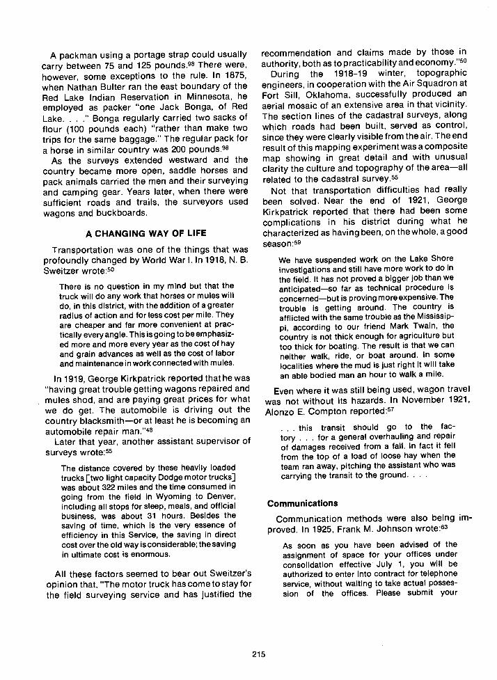
A packman using a portage strap could usuallycarry between 75 and 125 pounds.98 There were,however, some exceptions to the rule. In 1875,when Nathan Bulter ran the east boundary of theRed Lake Indian Reservation in Minnesota, heemployed as packer "one Jack Bonga, of RedLake......Bonga regularly carried two sacks offlour (100 pounds each) "rather than make twotrips for the same baggage." The regular pack fora horse in similar country was 200 pounds.98
As the surveys extended westward and thecountry became more open, saddle horses andpack animals carried the men and their surveyingand camping gear. Years later, when there weresufficient roads and trails, the surveyors usedwagons and buckboards.
A CHANGING WAY OF LIFE
Transportation was one of the things that wasprofoundly changed by World War I. In 1918, N. B.Sweitzer wrote:5°
There is no question in my mind but that thetruck will do any work that horses or mules willdo, in this district, with the addition of a greaterradius of action and for less cost per mile. Theyare cheaper and far more convenient at prac-tically every angle. This is going to be emphasiz-ed more and more every year as the cost of hayand grain advances as well as the cost of laborand maintenance in work connected with mules.
In 1919, George Kirkpatrick reported that he was"having great trouble getting wagons repaired andmules shod, and are paying great prices for whatwe do get. The automobile is driving out thecountry blacksmithor at least he is becoming anautomobile repair man."48
Later that year, another assistant supervisor ofsurveys wrote:55
The distance covered by these heavily loadedtrucks [two light capacity Dodge motor trucks]was about 322 miles and the time consumed ingoing from the field in Wyoming to Denver,including all stops for sleep, meals, and officialbusiness, was about 31 hours. Besides thesaving of time, which is the very essence ofefficiency in this Service, the saving in directcost over the old way is considerable; the savingin ultimate cost is enormous.
All these factors seemed to bear out Sweitzer'sopinion that, "The motor truck has cometo stayforthe field surveying service and has justified the
215
recommendation and claims made by those inauthority, both as to practicability and economy."5°
During the 191 8-19 winter, topographicengineers, in cooperation with the Air Squadron atFort Sill, Oklahoma, successfully produced anaerial mosaic of an extensive area in that vicinity.The section lines of the cadastral surveys, alongwhich roads had been built, served as control,since they were clearly visible from the air. The endresult of this mapping experiment was a compositemap showing in great detail and with unusualclarity the culture and topography of the areaallrelated to the cadastral survey.55
Not that transportation difficulties had reallybeen solved. Near the end of 1921, GeorgeKirkpatrick reported that there had been somecomplications in his district during what hecharacterized as having been, on the whole, a goodseason:59
We have suspended work on the Lake Shoreinvestigations and still have more work to do inthe field. It has not proved a bigger job than weanticipatedso far as technical procedure isconcernedbut is proving more expensive. Thetrouble is getting around. The country is
afflicted with the same trouble as the Mississip-pi, according to our friend Mark Twain, thecountry is not thick enough for agriculture buttoo thick for boating. The result is that we canneither walk, ride, or boat around. In somelocalities where the mud is just right it will takean able bodied man an hour to walk a mile.
Even where it was still being used, wagon travelwas not without its hazards. In November 1921,Alonzo E. Compton reported:57
this transit should go to the fac-tory . . . for a general overhauling and repairof damages received from a fall. In fact it fellfrom the top of a load of loose hay when theteam ran away, pitching the assistant who wascarrying the transit to the ground. .
Communications
Communication methods were also being im-proved. In 1925, Frank M. Johnson wrote:63
As soon as you have been advised of theassignment of space for your offices underconsolidation effective July 1, you will beauthorized to enter into contract for telephoneservice, without waiting to take actual posses-sion of the offices. Please submit your

recommendations in this matter as soon as youare in position to do so.
In arranging for telephone service it will ofcourse be understood that no provision shouldbe made for any branches [extensions] notabsolutely necessary for the proper conduct ofpublic business. No branches should be in-stalled in the drafting and the engineers' rooms.
Airborne Surveys
That same year, George A. Parks planned tofurnish cadastral survey information to be used inestablishing control for a proposed aerial survey ofthe islands in Southeastern Alaska. According tothe proposal, three large planes were to beoperated from bases established along the InsidePassage.64
Often, even now, the men themselves must carrytheir own supplies and equipment for somedistance. This was, and is, especially true whererugged terrain or swamps render other forms oftransportation impossible to use. For example, nowheeled vehiclewagon or truck or even four-wheel drivecan make it through some of thereally rugged and remote canyon land thatsurveyors must traverse.
Finally, surveyors and officials began to discussthe feasibility of using helicopters to move thesurveying crews and their equipment acrossterrain so broken and upended that crossing itseemed all but impossible. In 1956, a limitedhelicopter operations test was made with results soencouraging that a substantially enlargedcadastral surveying program was undertakenduring the 1957 field season. The experiment wasmore successful than anyone had anticipated itwould be.
In the deep, steep, rugged, and remote parts ofUtah where this method was Vrst used, conven-tional surveys had cost about $155 for each mile ofline surveyed, with each crew covering an averageof 1.2 miles per day. With helicopters, the cost ofeach surveyed mile was reduced to about $125,with the crew averaging about 2.6 miles per daya20 percent saving in cost, with the surveying outputmore than doubled. These results clearly indicatedthe practicalityof the use of aerial transport in areaswhere large-scale surveys had to be made overterrain too rough for trucks and jeeps.148
216
CONTINUING LEADERSHIP
Clark Gumm
Much of the credit for the success of thecadastral surveying program in the Bureau of LandManagement rests with men who began theircareers before the BLM came into being. WilliamTeller, retired chief of cadastral surveys for theDenver Service Center, is one such man. Another,Clark Gumm, became a field assistant on acadastral survey crew in New Mexico in 1933. In1936, after he had passed a written Civil Serviceexamination, he was appointed a public landsurveyor. Gumm, who attended the ColoradoSchool of Mines, demonstrated both an unusualinterest in the work and a high degree ofaggressiveness in his study of prescribed andimproved methods and procedures regarding alltypes of cadastral surveys. Because of this, he wasgiven progressively more complicated fieldassignments. He handled difficult survey projectssuch as the 1949 underground survey of a bat caveabove the Colorado River in the Grand Canyon, alocation accessible only by water.
In 1950, Gumm was assigned the responsibilityof investigating conditions and executing a surveyof the unal lotted Choctaw-Chickasaw Indian triballands along the Red River in Oklahoma. TheBureau of Indian Affairs had requested the surveyof these landssome 60 isolated tracts of irregulardescription extending through 25 townships andalong both the Texas and Oklahoma sides of theRed River west from the Arkansas State line forabout 175 miles. The manner in which Gummhandled this unusual survey brought approval fromthe Indian bureau and credit to the BLM.
During the early 1950's, Gumm was assigned tothe International Cooperation Administration inIraq as advisor to the Iraq Government on cadastralsurveys and related land reform matters. When hereturned to the U.S. in October 1954, he wasassigned to the Area Cadastral Survey office inDenver. During 1957 he was in charge of a doublesurvey party working on important resurveys inNew Mexico when he was selected to fill a vacancyin the Cadastral Engineering Unit in Washington,D.C. In 1961, he was named chief of the Branch ofCadastral Engineering (under C. E. Remington,who was chief of the Division of Engineering).
When the Division of Cadastral Survey was formedby a reorganization in late 1968, Gumm became thechief of the Division of Cadastral Survey.
Clark Gumm's wide and diversified experiencemade him one of the most knowledgeable andhighly respected surveyors in this country. In 1974he was named assistant to the assistant director ofTechnical Services, BLM, a position he held untilhis retirement later that year.
Thomas A. Tiliman
Another man who deserves much credit for hisaccomplishments in the BLM isThomas A. Tillman.He, too, began his cadastral surveying career in atime-honored manner: on June 8, 1936, he went towork as an axeman on an GLO survey party.Tiliman was 18 years old and had just graduated atthe top of his high school class in Pendleton,Oregon.
Tiliman worked hard and learned quickly. By the1938 season, he had been promoted to the positionof principal assistant. When that survey seasonended, he began his studies at the University ofWashington. Tillman followed this routine for thenext few years. His routine was interrupted byWorld War II. When Tillman returned from militaryservice in 1945, he, with admirable single-mindedness, resumed his duties as principalassistant with cadastral survey crews during thefield season and his formal education during therest of the year, receiving his degree in civilengineering in 1948.
That same year, Tiliman was given a permanentappointment as a cadastral engineer, and beganadvancing rapidly to positions of increasingresponsibility. In 1955 he became assistant to thearea cadastral engineer and in 1961 he was named
217
chief of the branch of cadastral engineering for theStates of Oregon and Washington.
In 1964 Tillman was selected as one of a four-man team to update the "1947 Manual of SurveyingInstructions." It was soon apparent that what hadfirst appeared to be a fairly minor updating projectwas going to be, of necessity, a complete revision.
At about the same time, the Washington officewas going to be understaffed because ofretirements and the growing demands of otherdepartments. Again, Tillman was the choice to fillthe void. He was transferred to Washington, D.C.Several times, Tillman's interest in cadastralhistory, along with his superb knowledge ofcadastral law, created a demand for his experttestimony.
Even though Tillman's contribution in rewritingand updating the 1947 Manual and the manualsupplement, "Restoration of Lost or ObliteratedCorners," cannot be overstated, the intangiblebenefits initiated by him in training and influencingsurveyors will have even more far-reaching effects.
Although many cadastral surveyors over theyears have been forward-looking individuals, it isunlikely that anyone was able to foresee onedramatic effect of the cadastral surveys of thepublic lands. It was an effect certainly notanticipated by the men who were there at thebeginning of the rectangular surveys, even thougha similar effect had been brought about by the landuse pattern under the ancient Roman system ofsubdivision. During the mid-1960's, as part of theNASA Gemini space program, Gemini V tookphotographs of Earth from a distance of about 100miles up. In the photo that showed the ImperialValley of California and the northern part ofMexico, there was only one visible man-madefeaturethe rectangular land use pattern createdby the United States cadastral survey system.
Books:
1) Anonymous. 1962. Historical Highlights of PublicLand Management. Washington, D.C.: U.S. Dept.Interior, Bur. Land Management, pp. 3, 7, 9, 15-17,20-22, 24, 29, 31, 36, 40-41, 43, 60.
1962. Landmarks in Public LandManagement. U.S. Dept. Interior, Bur. Land Manage-ment, pp. 13, 15, 18, 34.
1951. Oregon, End of the Trail,American Guide Series, Federal Writer's Project. Rev.ed. with added material by Howard Mckinley Corning.Portland, Ore.: Binfords and Mort, pp.44, 104,150-152,192-193, 198, 229.Bartlett, Richard A. 1966. Great Surveys of theAmerican West. Norman, OkIa.: University of OklahomaPress, pp. 4, 5, 76.Bedini, Silvio A. 1971. BenJamin Banneker and theSurvey of the District of Columbia, 1791. Reprinted fromthe records of the Columbia Historical Society,1969-1970, ed. Francis Coleman. Washington, D.C., pp.7-8, 13, 29, 30.
1964. Early American Scientific In-struments and Their Makers. U.S. National MuseumBull. 231: pp. 7, 15, 19, 21-22, 24.Brown, Curtis M. 1969. Boundary Control and LegalPrinciples. 2nd ed. New York: Wiley, p. 35.Burt, William A. 1888. A Key to the Solar Compass,and Surveyors Companion. 5th ed. New York: D. VanNostrand, pp. 79-81.Carstensen, Vernon, ed. The Public Lands. Studies inthe History of the Public Domain. Madison, Wis.: Univ.Wisconsin Press, pp. xvi, 7-8, 111, 213.Cendrars, Blaise. 1926. Sutter's Gold. Translatedfrom the French by Henry Longon Stuart. New York andLondon: Harper and Brothers, pp. 12, 71, 125, 178.Clark, Frank Emerson. 1959. Clark on Surveying andBoundaries. 3rd ed. Indianapolis: Bobbs-Merrill Com-pany, Inc., pp. 54, 957.Cross, Arthur Lyon. 1939. A Shorter History ofEngland and Greater Britain. 3rd ed. New York:Macmillan Co., pp. 56, 58.Dick, Everett. 1941. Vanguards of the Frontier. NewYork: Appleton-Century Company, pp. 323-324, 387,41 8-423, 425.Dodds, J. S., ed-in-chief. 1943. OriginallnstructionsGoverning Public Land Surveys of Iowa. Ames, Ia.: IowaEngineering Society, pp. 265, 270, 272-273, 388, 548.Gates, Paul W. 1968. History of Public Land LawDevelopment. Washington, D.C.: U.S. GovernmentPrinting Office, pp. 79, 85-87, 96, 99, 108, 113, 115,118-119, 394, 465, 552, 556-557, 586-588.Gatke, Robert Moulton. 1943. Chronicles ofWillamette, The Pioneer University of the West.Portland, Ore.: Binfords and Mort, pp.131-132,476-478,581.Ghent, W. J. 1929. The Road to Oregon. London,New York, and Toronto: Longmans, Green and Co., pp.70-71, 86-87, 9295, 150-152.Grimal, Pierre, general ed. 1963. Larousse WorldMythology. New York: G. P. Putnam's Sons, pp.480,483.Hibbard, Benjamin H. 1965. A History of the PublicLand Policies. Madison and Milwaukee: University ofWisconsin Press, p. 12.
REFERENCES
219
Johnson, Dorothy 0. 1967. Empire of the Columbia.2nd ed. New York and London: Harper and Row, pp.73-74, 232, 237.Lang, H. 0., ed. 1885. History of the WillametteValley. Portland, Ore.: Himes and Lang, pp. 610,740-741.Lindenmeyer, Otto. 1970. Black History: Lost, Stolenor Strayed. New York: Discus Books, Avon, pp. 42-43.Metraux, Alfred. 1969. The History of the Incas.Translated from the French by George Ordish. NewYork: Pantheon Books, pp. 2-3, 67-68, 200.Monaghan, Jay, ed-in-chief. 1963. The Book of theAmerican West. New York: Julian Messner, Inc., pp.156-1 57, 232-233, 238.O'Callaghan, Jerry. 1960. The Disposition of thePublic Domain in Oregon. Washington, D.C.: U.S.Government Printing Office, p. 13.Pattison, William D. 1957. Beginnings of theAmerican Rectangular Land Survey System, 1784-1800.Univ. Chicago Dept. Geography Research Paper 50.Raisz, Erwin. 1962. Principles of Cartography. NewYork: McGraw-Hill Book Co., Inc., p. 5.Robbins, Roy M. 1962. Our Landed HeritageThePublic Domain, 1776-1 936. Lincoln, Neb.: Univ.Nebraska Press, p. 7.Smart, Charles E. 1962. The Makers of SurveyingInstruments in America since 1700. Troy, N.Y.: RegalArt Press, pp. xx, xxi, 23, 42, 136, 138-1 39.Stewart, Lowell 0. 1935. Public Land SurveysHistory, Instructions, Methods. Ames, Ia.: CollegiatePress, Inc., pp. 5, 38-39, 44, 57-58, 66, 72-73, 84-86.Tenney, Merrill C., gen. ed., 1963. Zondervan Pic-torial Bible Dictionary. Grand Rapids, Mich.: ZondervanPublishing House, pp. 633-634, 890-891.Thomson, Don W. 1966, 1967. Men and Meridians.Vol 1, Prior to 1867; Vol.2, 1867 to 1917. Ottawa, Canada:Queen's Printer and Controller of Stationery, Vol 1: pp.1,4, 8, 15-16, 21, 24, 84, 313; Vol. 2: pp. iv, 20 (footnote),171, 175.Thrower, Norman J. W. 1966. Original Surveys andLand Subdivision. Chicago: Rand McNally & Co., p. 8.Van Zandt, Franklin. 1966. Boundaries of the UnitedStates and the Several States. U.S. GeoI. Survey Bull.1212: 1-2, 42-43,46,93, 174-175, 224,229-231,238,251,255-256, 260.Webster, kimball. 1917. The Gold Seekers of '49.Manchester, N.H.: Standard Book Co., pp. 189-190,193-194, 196-201, 222, 230.
Correspondence Files of the Supervisor of Sur-veys, 1910-1946:
(In National Archives, Regional Office, Denver,Colorado)
Vol. 7. Letter from T. O'Conner, Surveyor General forColorado, Dec. 7, 1910.Vol. 17. General Instructions to A. D. Kidder from theSurveyor General's Office, Boise, Idaho, and Denver,Colorado, Dec. 7, 1910.Vol. 19. Letter from W. Thorn to F.M. Johnson, July17,1911. Letter from J. P. Walker to Johnson, Aug.30, 1911.

39) Vol.50. Letterfrom F.M. Johnson to C. L. DuBois, June3, 1914.
40) Vol. 71. Letter from F. Spofford to F. M. Johnson, Sept.14, 1915.
41) Vol. 73. Letter from F. M. Johnson toW. T. Paine, May1, 1915.
42) Vol. 76. Letter from Commissioner C. Tallman to J. P.Walker, Apr. 21, 1915.
43) Vol. 84. Letter from the Commissioner of the GLO to F.M. Johnson, Feb. 24, 1913. Letter recommendingpromotions from Johnson to the Commissioner, June6,1916.
44) Vol.90. Letter from S. Blout to F. M. Johnson, June 10,1916. Letter from W. Utterback to A. C. Horton, May 25,1916.
45) Vol. 114. Letter from F. M. Johnson to T. Havell, Mar.23, 1918.
46) Vol. 121. Letter from A. Compton to F. M. Johnson,May 17, 1919. Letter from Compton to Johnson, April11,1918.
47) Vol. 122. Letter from A. C. Horton to F. M. Johnson,May 6, 1919.
48) Vol. 123. Letter from G. D. D. Kirkpatrick to F. M.Johnson, Jan. 28, 1919. Letter from Kirkpatrick toJohnson, May 16, 1919.
49) Vol. 124. Letter from F. M. Johnson to E. P. Rands, Mar.16, 1916. Letter from Rands to Johnson, Dec. 8, 1920.Letter from Rands to Johnson, Mar. 10, 1921.
50) Vol. 125. Letter from F. C. Miller to F. A. Lewis, Sept. 8,1917. Letter from N. B. Sweitzer to F.M. Johnson, Oct. 8,1918. Letter from Sweitzer to Johnson, Dec. 20, 1918.Notes for the Bulletin, Sweitzer to Johnson, Feb. 19,1919, and June 12, 1919. Letter from Sweitzer toJohnson, Oct. 3, 1919. Letter from Johnson to Sweitzer,May 27, 1920.
51) Vol. 127. Survey Notes, May 23, 1919.52) Vol.131. Letter from F.M. Johnson to C. Tallman, Aug.
9, 1919.53) Vol. 132. Letter from F. M. Johnson to A. D. Kidder,
June 23, 1920. Letter from Kidder to Johnson, Mar. 22,1920.
54) Vol. 138. Letter and postscript from G. D. D. Kirkpatrickto F. M. Johnson, June 30, 1920.
55) Vol. 144. Survey Notes, Sept. 24, 1919; Oct. 24, 1919;Apr. 24, 1920.
56) Vol. 147. Letter from F. A. Lewis to the Commissionerof the GLO, Apr. 15, 1921.
57) Vol. 157. Letter from A. Compton to F. M. Johnson,Nov. 10, 1921. Service letter, District No. 4, Guy P.Harrington, May 1, 1922.
58) Vol. 158. Letter from A. C. Horton to J. Plover, U.S.Surveyor General, California, Apr. 19, 1922.
59) Vol. 160. Letter from G. D. D. Kirkpatrick to F. M.Johnson, Dec. 14, 1921. Report from Kirkpatrick toJohnson, May 15, 1922.
60) Vol. 161. Letter from F. Spofford to F.M. Johnson, Aug.2, 1921.
61) Vol. 175. Letter from F. M. Johnson to F. Bond, Sept.14, 1923. Letter from Johnson to Bond, Nov. 3, 1923.
62) Vol. 183. Letter from F. M. Johnson to the Com-missioner of the GLO, Aug. 14, 1924.
63) Vol. 188. Letter from A. C. Horton to F. M. Johnson,Sept. 23, 1924. Letter from Johnson to Horton, May 28,1925.
64) Vol. 190. Letter from G. A. Parks to F.M. Johnson, June26, 1924. Telegrams, 12/27 and 12/28, 1925. Letter fromParks to Johnson, June 13, 1925.
220
Vol. 194. Letter from M. D. Badgley to GilbertGrosvenor, editor, National Geographic Society, Mar. 7,1924.Vol. 196. Letter from F. M. Johnson to the Com-missioner of the GLO, May 29, 1925. Letter from W. Spryto Johnson, June 10, 1925. Letter from the Com-missioner to Johnson, Oct. 27, 1925.Vol. 207. Letter from Judge Proudf it to F. M. Johnson,Apr. 3, 1925.Vol. 225. Letter from J. P. Walker to F. M. Johnson,Sept. 23, 1926.Vol. 226. Letter recommending promotions from J. S.Harrison to F. M. Johnson, May 12, 1928.Vol. 229. Letter from E. C. Guerin to F. M. Johnson,Sept. 17, 1930.Vol. 232. Letter from F. M. Johnson to H. B. Patten,Sept. 2, 1926.
Files, Clippings, and Collections:
Arpy, Jim. 1960. Davenport Times-Democrat. NewBoston, Illinois.Circular from Josiah Meigs to the Registers of theGeneral Land Offices of the United States, Apr. 12, 1817.Huntsville Meridian and Base Line (1807). From CardIndex of Initial Points, Bur. Land Management,Washington, D.C.Letter to Mr. James Turner from Clark L. Gumm, chief,Division of Cadastral Survey, Bur. Land Management.Washington, D.C., Nov. 17, 1971.Letter Book No. 3, Letter #204, Mar. 19, 1889, fromThomas S. Wilkes, and Letter #320, Nov. 1889, fromWilliam Thiel. Bur. Land Management Archives, Seattle,Washington.Letter by Isaac Briggs, Dec. 12, 1803. General LandOffice, Vol. 52, National Archives, Washington, D.C.Note on Mrs. Jeremiah H. Doherty. Oregon HistoricalSociety Collection, Portland, Oregon.Note on Mrs. Mary Moody. Oregon Historical SocietyCollection, Portland, Oregon.The Oregonian, Feb. 7, 1959. Oregon Historical SocietyCollection. Portland, Oregon.The Oregonian, Oct. 17, 1948. Oregon State Office, Bur.Land Management, Portland, Oregon.Preliminary Statement, Group 1, Ohio, Reestablishmentof the Point of Beginning. Bur. Land Management,Washington, D.C.Prosch, Thomas W. n.d. Notes from a GovernmentDocument on Oregon Conditions in the Fifties. Mutt-nomah County Central Library Collection, Portland,Oregon, pp. 196-198.
Land Service Bulletin, General Land Office:
Vol. 1, No. 2, p. 12. Apr. 1, 1917.Vol. 1, No.3, p.3. May 1, 1917.Vol.1,No.6,p.9.Aug.1,1917.Vol.1,No.11,p.20.Jan.1,1918.
88) Vol. 1, No. 12, p. 7. Feb. 1, 1918.Vol. 2, No. 2, p. 8. Apr. 1, 1919.Vol. 2, No. 11, pp. 4-6. Jan. 1, 1919.Vol.2, No. 12, p.7. Feb. 1, 1919.Vol. 3, No.3, p.5. May 1, 1919.Vol. 3, No.4, pp. 16-17. June 1, 1919.Vol. 4, No. 5, pp. 7-8. July 1, 1920.
Magazines and Periodicals:
Agnew, Dwight L. Mississippi Valley Historical Review,Vol. 28, p. 371.Anonymous. 1967. "Nelson Buck's Surveying Party."Frontier Times 41(4):41.Brownell, EdwinR. 1971. "RetracementintheFloridaEverglades." Papers from the 1971 ASP-ACSM FallConvention, pp. 37, 39-40.Butler, Nathan. 1907. "Boundaries and Public LandSurveys of Minnesota." Minnesota Historical Society12:650, 659-660, 666-668.Cannon, George H. 1884. "The Life and Times ofWilliam A. Burt, of Mt. Vernon, Michigan." MichiganPioneer and Historical Society 5:115-123.Cook, Ira. 1897. "Government Surveying in EarlyIowa." Annals of Iowa 2(8):603-613.Parke, Hervey. 1880. "HerveyParke Reminiscences."Michigan Pioneer & Historic Society 3:572-591.Pershing, B.H. 1937. "A Surveyor on the SevenRanges." Ohio State Archaelogical and HistoricalQuarterly 46(3):258-270.Randall, Benjamin. 1967. "Three Hundred Miles fromNowhere." Frontier Times 41(1):22-23, 52.Wilson, George R. 1919. "Early Indiana Trails andSurveys." Indiana Historical Society Publications6(3):364-365, 388, 404, 409-415, 417-420, 423, 425,427-428, 433, 435, 442-443, 447-449, 452-453, 456.Anonymous. 1959. Our Public Lands 9(1):12.
1953. "Land Users 0. and A. Corner."Our Public Lands 3(2):12.Berlin, Leonard M. 1959. "Adventuresatoenali."OurPublic Lands 8(3):4-5, 12-14.Carpenter, Farrington R. 1963. "Beginnings of theDivision of Grazing, Part II." Our Public Lands 13(1):14.Douglass, William B. 1955. "The Discovery of Rain-bow Natural Bridge." Our Public Lands 5(2):8-9, 14-15.Halliday, Robert 5. 1956. "Trail of the Transit." OurPublic Lands 6(1):12-13, 15.Harrington, Earl G. 1955. "Surveys Spur Settle-ments." Our Public Lands 5(1):7.Haste, Glen R. 1952. "Early Cadastral Surveys." OurPublic Lands 2(1):19.O'Callaghan, J.A. 1965. "Beginning of Public LandSurveys." Our Public Lands 14(4):19.Teller, William. 1958. "Measuring Distance at 669,-600,000 Miles an Hour." Our Public Lands 8(2):8.Anonymous. 1969. "Ellicott's Stone-HistoricalLandmark." Surveying & Mapping 29(1):120.
1967. "Young Mason and Dixon Trac-ed Their Famous Line for $75,000." Surveying &Mapping 27(4):679-680.
1966. "Kudurru of Gula-Eresh." Sur-veying & Mapping 26(2):287.
1966. "Right to Own Land Dates toAntiquity." Surveying & Mapping 26(2):309.
1962. "Historical Marker Dedicated byBLM." Surveying & Mapping 22(3):502.Bandy, W. R. 1966. "Early Day Surveying Methods."Surveying & Mapping 26(4):698-699.Berns, Thomas B. 1969. "Surveying and AmericanHistory." Surveying & Mapping 29(1):111-113.
1968. "Abe Lincoln, Surveyor." Survey-ing & Mapping 28(3):497-498, 500.Clement, Donald B. 1960. "Point of Beginning."Surveying & Mapping 20(4)477.
221
Fitzsimons, Neal. 1968. "The First Surveyors underthe Constitution." Surveying & Mapping 28(1 ):1 12-113.
1967. "Colonial American Surveyors."Surveying & Mapping 27(3):476.
1967. "Early Surveyors of the NewRepublic. Surveying & Mapping 27(4):677-678.
1967. "The Ellicott Brothers."Surveying & Mapping 27(1) :78.Laurie, Bill D. 1967. "Washington MonumentResurvey Expedition." Surveying & Mapping27(2):302-304, 310.Merkel, Donald E. 1974. "Colonel Butler and thePublic Land Survey of Florida (1824-1849)." Surveying &Mapping 34(4) :331-336.O'Callaghan, Jerry. 1967. "Point of BeginningDedicated." Surveying & Mapping 27(1):81-82.Popp, Robert. 1966. "Landmark Dedication Slatedfor Area's Survey Monument." Surveying & Mapping26(3) :478.Schmiedeke, J. M. 1972. "With Chain and Compass."Surveying & Mapping 32(1) :63-67.Solander, A. A. 1967. "Pre-Revolutionary Sur-veyors." Surveying & Mapping 27(4):685.
Manuals, Reports, and Treaties:
Annual Report of the Commissioner of the General LandOffice, Fiscal Year Ending June 30, 1911. 1911.Washington, D.C.: U.S. Government Printing Office, p.28.
Annual Report of the Commissionerof the General LandOffice, Fiscal Year Ending June 30, 1890. 1890.Washington, D.C.: U.S. Government Printing Office, pp.86, 432, 434-435.Annual Report on the Commissioner of the GeneralLand Office, Fiscal Year Ending June 30, 1880. 1881.Washington, D.C.: U.S. Government Printing Office, pp.90,279,288,294,521,681; drawing on unnumbered pagefollowing 288.Bureau of Land Management. 1973. Manual of In-structions for the Survey of the Public Lands of theUnited States, 1973. Washington, D.C.: U.S. Govern-ment Printing Office, Table, p. 61.
1947. Manual of Instructions for theSurvey of the Public Lands of the United States, 1947.Washington, D.C.: U.S. Government Printing Office, pp.4, 40, 167, 171, 380; Appendix II, pp.464-466; AppendixV, p. 512.Public Land Statistics, 1973. Dept. of the Interior, Bureauof Land Management. Washington, D.C.: U.S. Govern-ment Printing Office, pp. 1, 2, 10 (Table 7), 140.Report of the Commissioner of the General Land Office.1872. Washington, ftC.: U.S. Government PrintingOffice, pp. 18, 108, 110, 169, 226, 229.Standard Field Tables and Trigonometric For-mulas. 1956. 8th ed. Washington, D.C.: Bur. LandManagement, p. 226."Surveying in Alaska." 1970. Bur. Land Management,Alaska State Office, p. 2, mimeographed.Treaty with Great Britain, June 15, 1846. 1851. InUnited States Statutes at Large, Vol. 9. Boston: Little,Brown, pp. 869-870.Treaty with the Republic of Mexico, February 2,1848. 1851. In United States Statutes at Large, Vol. 9.Boston: Little, Brown, pp. 929-930.
Personal Communications, Conversations, and/orLetters:
Bandy, W. R. (Roy). Bur. Land Management, areacadastral engineer, Billings, Montana (Deceased.)Photographs and/or negatives.Barron, Roger T. Bur. Land Management, Div. CadastralSurvey, Washington, D.C. Plat and note.Berns, Thomas B. Lincoln legal opinion, plat of NewBoston (received in letter).Cazier, Dell. Bur. Land Management, cadastral surveyor,Cadastral Training Unit, Denver Service Center, Denver,Colorado.Glenn, William W. Bur. Land Management, chief, Branchof Cadastral Survey, Oregon State Office, Portland,Oregon. Photographs.Gumm, Clark. Bur. Land Management, chief, Division ofCadastral Survey, Washington, D.C. (Retired.)Harding, Donald E. Bur. Land Management, cadastralsurveyor, Portland Service Center, Portland, Oregon.(Retired.) Photographs.Knowles, John S. Bur. Land Management, engineer,Denver, Colorado. (Retired.)Minnie, James. Bur. Land Management, chief,Branch ofCadastral Surveys, Montana State Office, Billings,Montana.Oakes, Richard. Bur. Land Management, chief, Branchof Cadastral Surveys, Wyoming State Office, Cheyenne,Wyoming.
222
Pittman, Gerald F. (Jerry). Bur. Land Management,cadastral surveyor, Lake States Project Office, Duluth,Minnesota. Plats and photographs.Reilly, P. T. Bur. Land Management, former fieldassistant. Sun City, Arizona. (Retired.)Simpson, James A. Bur. Land Management, chief,Cadastral Training Unit, Denver Service Center, Denver,Colorado.Sylvester, Woodrow. Bur. Land Management, chief,Branch of Cadastral Surveys, Utah State Office, SaltLake City, Utah. Photograph.Teller, William. Bur. Land Management, chief, Branch ofCadastral Surveys, Denver Service Center, Denver,Colorado. (Retired.)Tillman, Thomas A. Bur. Land Management, civilengineer, Division of Cadastral Survey, Washington,D.C. (Retired.)VanderMeer, Theodore. Bur. Land Management,cadastral surveyor. (Retired.)Wager-Smith, D. A. W. Bur. Land Management, chief,Cadastral Surveys, Alaska. (Retired.)Wilson, Roger F. Bur. Land Management, cadastralsurveyor, Sacramento, California. (Deceased.)White, C. Albert. Bur. Land Management, supervisorycadastral surveyor, Portland Service Center, Portland,Oregon. (Retired.) Photographs.
Abbey, Woodbury, 208acts, Congressional
1800, March 1, 361800, May 10, 36, 371802, April 30 (Ohio Enabling Act), 391804, March 26, 481805, February 11, 37, 48-49 1820, April 24, 591830, May 29, 591836, July4, 1121842, August 4, 561849, March 2, 56-581850, September 28, 56-581860, March 12, 56-581862, May 30, 1121864, July 2, 911884, May 17 (Alaska Organic Act), 1461887, February 8 (Dawes General Allotment Act), 981897, June 4, 931898, April 29 (Arkansas Compromise Act), 56, 571899, March 3, 1471905, February 1,931909, March 3, 1091918, September21, 1091925, March 3, 601960, July 14, 109
Adams, Alonzo H., 207Adams, John D., 161aerial photography, 150, 151, 215, 217agro centuriato, 2airborne surveys, 151, 216Alaska
produce, 209-210purchase, 145-146state selection surveys, 150, 151statistics and early history, 145survey camp, 190 (photos)survey party, 181-1 82 (photos)
Allason, W. J., 89Allen, J. 5., 43Allen, Russell K., 162Anderson, Alex, 62Apian, Peter, 5Applegate, Jesse, 66Arizona Initial Point, 89-91Arizona survey camp (1916), 128 (photo)Arkansas survey camp (1915), 130 (photo)Armstrong, Moses K., 88Armstrong, Ray D., 195arpent, 73assignment instructions, 107assistant supervisors of surveys, 103astrolabe, 5Atkins, Barton, 146auxiliary guide meridians, 51auxiliary standard parallels, 51Averill, Dupree Reed (Herk), 81, 155, 157, 183 (photo),
(photo), 195
INDEX
A B
Badgley, Murray D., 211Ball, Horatio, 53Bandy, lnez, 121 (photo)Bandy, Richard E. (Elmer), 115 (photo), 196, 197Bandy, W. R. (Roy), 111, 174 (photo), 178 (photo), 195,196-198Bandy, Willis W., 196, 198Bandy survey camps and crews
Big Horn Mountains (1912), 136 (photo); (1914), 124 (paint-ing)
Missouri River Breaks (1918), 130 (photo)Montana (1914), 133 (photo); (1921), 119 (photo)Yellowstone Park boundary (1931-1932), 167, 169, 170, 176,
180 (photos)Bandy-Parker-Eaton survey camp, Montana (1922), 166 (photo)Banker, Isaac A., 62Banneker, Benjamin, 8 (illus.), 21-22Barber, A. W., 112Bates, Thomas Walter, 205Battle Creek, Michigan, 54-55Benson, John A., 94Benson Syndicate, 94Bering River coal field, 148Bering, Vitus, 145Berlin, Leonard M., 149, 150Best, Edward T., 207Betts, Floyd G., 149, 207Between the Miami Rivers North of Symmes Purchase, 27, 28biblical references
corners, 38land measurement, 1, 2surveying party, 38
Biggs, Uriah, 43Biggs, Zaccheus, 36, 38Black Hills
gold rush, 83photos, 122, 123
Blout, Sidney E., 209Boone, Daniel, 42boundary surveys
Ellicott's Line, 21Ellicott's Line of Demarcation, 22Florida-Alabama, 55-56Four Corners, 202Georgia-North Carolina, 23Illinois, 58Oklahoma-Texas, 205-206U.S.-Canadian, 23, 82-83Wyoming, 88-89
Bouquet, Col. Henry, 16Briggs, Isaac, 47Brown, Arthur W., 154, 195, 198Brunt, Arthur H., 196, 197Brunt, Col. Samuel W., 116 (photo), 158, 196; survey party
(Meeteetsee, Wyo.), 116 (photo); survey party (SunlightBasin, Wyo., 1907), 117 (photo), 207
186 Buck, Nelson, 89Buckingham, Ebenezer, 42-43
223

Buffalo Trace, 42Bureau of Land Management (BLM)
continuing leadership, 216-217inaugurationof, 213
Burt, William A., 54, 62-64, 155-156Butler, Nathan, 62, 64Butler, Robert A., 50, 55, 56
C
Cabot, John (Caboto, Giovanni), 5Cadastral Engineering Service Conference, Denver (1923),
142-1 43 (photo)cadastral surveys, basisof, 107Calhoun, John, 59Calvin, Elmer D., 168 (photo)Campbell, Quintin (Jerry), 134 (photo), 163 (photo), 198; survey
camp (Wash., 1917), 125 (photo)Campbell, Roy, 205Canada-U.S. boundary, 82-83Carpenter, Farrington R., 213Carpenter, H. B., 202cessions, state
Florida, 55Thirteen Original States, 14
chain, 5, 15, 72-73chaining, 196Chandler, John, 8Chapin, Frank W., 81Chase, Roy E., 207Clark, Abraham, 10Clark, Gen. George Rogers, 40Clark, John A., 89-90, 91Clark, Lt. William, 47, 65Clawson, Marion, 194 (photo)Clement, Donald B., 150, 156, 196Clement, Lester L., 196Clements, Benjamin, 55, 56coal fields, Alaska, 148Coast and Geodetic Survey, 145, 146-147Coffee, John, 41, 50, 55Colorado survey party (1925), 132 (photo)Columbus, Christopher, 4Compton, Alonzo E., 103, 207, 215Conover, W. C., 149Continental Congress, 35contract system, 36, 100convergency, effects of, 18Conway, Valentine, 56Cook, Ira, 60-62Cook, Capt. James, 145cooks, 198, 210Copper River Meridian, 147correction lines, 50Cortez, Hernando, 5"Cosmographia," 5Cragin v. Powell, 107Craters of the Moon, 211Crawford, Hugh, 175 (photo), 195, 198Crawford, Thomas W., 186 (photo), 195, 198cubit, 1-2Gumming, Fred L., 195, 196Gumming, James R., 196
D
Darling, E. N., 202Dauphiny, Larry, 149
224
Davidson, George, 145Dennett, Fred, 213Depression, 195De Soto, Hernando, 5De Witt, Simeon, 14, 36direct system, 100-101, 153-161Dixon, Jeremiah, 12"Domesday Book," 3Douglass, William B., 207, 211Dowse, Edward, 29, 31draftsmen, 162DuBois, Charles L., 100, 153, 213DuBois, Francis W., 207Dukes, J. D., 157Dunn, J. Pierce, 205Dunnington, F. A., 103Dwight, Timothy, 8
E
Earth, circumference of, 2, 3Eaton, David W., 207Elder, Robert, 80Ellicott, Andrew, 9 (illus.), 19-23, 47; see also Ellicott's Line,
Ellicott's Line of Demarcation, and Ellicott's StoneEllicott, Benjamin, 21Ellicott City, 21Ellicott, Elias, 22Ellicott, George, 21-22Ellicott, Joseph, Jr., 21-22Ellicott's Line, 21, 47EIIicott's Line of Demarcation, 21-23Ellicott's Stone, 22English, John, 140 (photo)"Ephemeris of the Sun, Polaris and Other Selected Stars with
Companion Data and Tables," 113Eratosthenes, 2, 3Erskine, Robert, 13-14Evans, Col. John, 60Exum, John W., 41, 55, 56
F
Fairbanks Meridian, 147"Federal Register," 205field examination of surveys, 98-99field notes, typewritten, 158-159first direct system survey, 101First Principal Meridian (Ludlow's), 39, 47Five Civilized Tribes (Cherokee, Choctaw, Chickasaw,
Seminole, and Greek Indians), 98, 160Five Nations, 99five-mile townships, 27, 35-36Fitzhugh, George, 83Fitzhugh, John, 83Florida
cession, 55Donation Act, 56, 65Everglades, 110-111survey crew (1918), 125 (photo)
Foote, Nathaniel, 5Foote, Ziba, 44-45Forest Management Act of 1897, 92-93Forrest, F. Wayne, 188 (photo); survey party (Utah-WyO. state
line, 1948), 185 (photo)Four Corners, 202Fourth Principal Meridian, 58

Freeman, James E., 78, 80Freeman, Thomas, 40-42Freeman's Corner," 40
Freund, John B., 60Frisius, Gemma, 5Fry, Joshua, 11
G
Gadsden Purchase, 68General Land Office (GLO)
consolidation with Grazing Service, 213establishment, 49first commissioner, 49organization, 213
Genn, James, 11Geographer, 15Geographer's Line, 19, 29, 39George, Martin, 148, 161-1 62Gold Rush of 1849, 70Goodale, S. W., 162Gordon, Harvey, 88Gordon, William, 60Gore, The" (Indiana), 39
Grazing Service, 213, 214Great Pyramid, 1Greeneville Treaty Line, 37, 38, 39Greynville, Sir Richard, 5groma, 2group numbers, 107Groups Nos.
1, Colorado (1910), 10133, Oregon (1917), 128, 129 (photos)41, Arizona (1915), 136 (photo)62, California (1920), 137 (photo)
312, Colorado, 184 (photo)333, Colorado, 170 (photo)
Guadalupe-Hidalgo, Treaty of, 67, 74Guerin, Eckley C., 148, 208guide meridian, 50Gumm, Clark L., 150, 192 (photo), 216-217Gurley transit, 168 (photo)
H
Haigh, Thomas A., 147Hall, Wendell G., 150, 151, 195, 196, 198Hall, Wendell V., 195Hall system, 150Harding, Donald E., 151, 190 (photo)Harrington, Earl G., 155-156, 207, 214Harrington, Guy P., 91, 155, 161, 177 (photo), 195, 210Harriot, Thomas, 5Harris, Jerry, 190 (photo)Harrison, J. Scott, 161, 197Harrison Purchase, 43Harvey, W. E., 88Haste, Glenn R., 155, 195, 198, 205Havell, Thomas, 206Hayden, Ferdinand Vandiveer (F.V.), 97-98Hayward, Elijah, 112Hendricks, Thomas A., 109, 112Hermann, Binger, 93Herrman, Augustine, 8Hiester, Tom, 196Hiester, William E., survey parties 124, 164 (photos), 196Homestead Act, 66
225
Homestead Entry Survey, 63Horton, Albert C., Jr., 101, 102, 103, 154, 158-159, 161, 165
(photo), 198, 213-214Hover sight, 151Hudde, Andries, 8Huntsville Meridian, 41Hutchins, Thomas, 15-16, 19, 29, 31, 32, 33, 49, 111Hyatt, Hobart B., 190 (photo)Hyde, George, 80
IdahoPriest Lake (1911), 131 (photo)survey camp (1919), 166 (photo)
Incas, 3-4Inch, Philip, 195Indian land surveys, 103Indian Territory (OkIa.), 99Indian tribes
Alaskan, 145Choctaw-Chickasaw, 216Comanche, 99, 205Crow, 197Five Civilized Tribes, 98, 160Five Nations, 99Kiowa, 99, 205Potawatami, 92Shoshone, 100Sioux, 83, 97Ute, 97-98
initial point, public land surveys without, 25-28initiating documents, 107Instructions to U.S. Deputy Mineral Surveyors, 112Interior, Department of the, 71, 72iron post, regulation, 104
J
Jackson, John, 38Jaeckel, Herman, 103, 161, 181 (photo), 198Jenkins, John, Jr., 9Jenkins, John, Sr., 9Jefferson, Peter, 11Jefferson, Thomas, 11, 15,47Johnson, Albert, 93Johnson, Frank M., 98, 99, 100-105, 115 (photo), 135 (photo),
148, 153, 154,157-160, 161-162, 191 (photo), 197,202-203,205, 206, 207, 213, 215-216
Johnson, Fred W., 213Johnston, Theodore 0., 139 (photo), 195Jones, Lyle F., 192 (photo), 198Joy, Francis F., 154
K
Kidder, Arthur D., 64, 99, 100-101, 102, 112, 159-160, 193(photo), 202. 205-206
Kimmel stove, 198-201Kimmel, William B., 172 (photo), 195Kimmell, Albinus N. (A.N.), 195; survey party (Ala., 1918), 173
(photo)Kimmell, Anthony C. (Tony), 172 (photo), 183 (photo), 195Kimmell, Everett H., 195, 202; survey party (Cob., n.d.), 173
(photo)Kimmell, Keith, 195

King, Norman L., 162King, Samuel D., 81Kirkpatrick, George D. 0. (G. D. D.), 103,161,206,207,208,210,
215Klondike gold rush, 147Knowles, John S., 138 (photo), 153, 155, 157, 198
L
Lamoraux, Silas, 112land bounties1812 land bounties, 49Revolutionary War, 14
land grantscolonial, 5New England, 5railroad, 91
"Land Office Business," 60"Land Service Bulletin," 205Lange, Bernard (Benny), 138 (photo)Leeds, Daniel, 9L'Enfant, Pierre Charles, 21-22Lewis, A. B., 147Lewis, Frank L., 161Lewis, Capt. Meriwether, 47, 65Lincoln, Abraham, 59-60, 70 (illus.), 71 (facsimile doc.)Lincoln, Thomas, 42Little Big Horn, Battle of, 83Livingston, Robert W., 207Lopez de Gardenas, Don Garcia, 5Ludlow, Israel, 37, 38, 39, 214Ludlow's Meridian, 39, 47Lyman, Edward 0., 195-196Lyman, Lewellyn D., 195Lyman, Ranny V., 195-196, 198Lyon, Lucius, 54, 58Lyon, Orson, 54, 58Lytle, Marvin J., 205
M
Mader, Herman F., 205Magellan, Ferdinand, 5magnetic compass, 5, 64Major, Daniel G., 62Major, John G. 202Mansfield, Jared, 47, 48, 111
Instructions, 111"Manual of Surveying Instructions"
Booklet(1919), 64, 158-159Evolution of, 111-113Manuals
1855, 50, 511881,511890, 51, 631894, 631902, 631930, 51, 158-1591947, 2171973, 113Supplements, 113, 217
Marsh, Capt. James M., 63Martin, Absalom, 29, 31, 36, 38Mason, Charles, 12Mason-Dixon Line, 12, 21
226
Matanuskacoal field, 148Valley Project, 148
Mathews, John, 31, 32, 38Mathias, Thomas F., 162McCord, Alan R., 161McDonald, John, 43McDonald, Russell, 198McManus, M.. 87medial line, 205Meigs, Josiah, 49, 50, 67 (illus.), 111-112Mench, Fred, 207Mexican border incident, 158-1 59Meyers, J. W., 62Michigan Report (1815), 53Mike's Boy (Jim), 210-211Miller, D., 59Miller, Frederic C., 209Millrick, Willis J., 205mineral surveyors, 94Mining Law of 1872, 91-92Mishler, Mahlon L. (Doc), 210Missouri River Basin Project, 198Missouri River Breaks survey (Mont., 1918), 129 (photo)Monday, A., 59Montana survey crew (1914), 126 (photo)Moody, Zenas Ferry, 80Moore, Charles F., 205Moore, John M., 112Morris, William, 29Mt. Mckinley National Park
boundary survey, 149-1 50boundary survey party (1936), 177, 181 -182 (photos)
mules, 153, 158-159, 210, 215Mullett, John, 54Munro, Fred, 198Muskingum River survey, 27
N
Nader, George F., 162Naret, Joel Q., 162"National Geographic," 211Nelson, Andrew (Andy), 156, 187 (photo), 198, 205, 210Nelson, Ken, 149Nelson, Ralph W., 161Nenana coal field, 148Neville, Joseph, 19New Boston, 69 (plat)New Mexico Principal Meridian, 76 (photo of field notes)Nile Valley, 1Northwest Territory (Ohio), 14, 33
0Odell, William H., 83Ohio
conflict with Michigan, 27land subdivision, 25, 27, 29Northwestern, 27Seven Ranges, 29-33
Ohio River Base, Indiana, 27Ohio River survey area, 25, 27Oregon
Compromise, 66-67Donation Law, 76-78Manual (1851), 50, 112Territory, 65, 78-80

Paine, Walter T., 111, 213Parke, Hervey, 53-55, 214Parker, Alexander, 29Parker, Ernest, 195, 198Parker, Horace, 195Parks, George A., 148-149, 162, 216Patterson, Robert, 21, 47peace tree 40, 41 (illus.)Pearson, Elliott, 182 (photo)Pearson, George W., 81Pearson, Grant, 149Pecore, Chester W., 205Pellum, Barney M., 205Penington, Edward, 9Perkins, W. C., 202Peterson, Leo, 198; survey party (Wyo., 1935), 179 (photo)photogrammetry (Alaska), 150-151Pidgeon, C. Chandlee, 196Pidgeon, Charles M., 196Pierce, William H., 91Pizarro, Francisco, 5Point Lobos survey, California (1940), 168 (photo)point of beginning, 19Ponce de Leon, Juan, 5Porter, Andrew, 13, 19Portugese exploration, 4Preston, John B., 78-80Preston, Levi S., 202Price, N., 138 (photo)Proudfit, Judge S. V., 205private claims, 72, 73-75Putnam, Rufus, 36, 37, 38, 39, 111
A
Rainbow Bridge National Monument, 210-211Randall, Benjamin, 92Rands, Ernest P., 103, 135 (photo)Raymond, H., 195rectangular survey system, 17Rector, William, 42Red River of the North, 57Red River (OkIa.), 205-206, 216Reilly, P. T., 188-189 (photos), 195Remington, C. E., 150, 216Restoration of Lost or Obliterated Corners," 112, 113
resurveys, 108-111Richards, W. A., 88-89, 93Richards, William H., Jr. 207Rigby, George F., 198Risden, Clark 0., 54Rittenhouse, Benjamin, 13Rittenhouse, David, 10 (illus.), 13, 19Ritter, Gus, 198Robbins, C., 202Romberg, Roy, 195Rowland, John W., 162Ruxton, Albert, 81
$
Saffrey, Solomon, 8San Bernardino Initial Point, 81Sargent, Maj. Winthrop, 29, 31-33
227
Sawyer, Glenn F., 121 (photo); survey crew (Missouri RiverBreaks, Mont.), 119 (photo)
Saxon, Homer, 196-197Saxon, Wesley C., 196-1 97Scioto River Base, 27Second Principal Meridian, 39, 40, 47, 48sections (numbering of), 25, 26Seeley, Charley, 197Seibecker, Carl, 157Seven Ranges, 19, 25, 27, 29-33, 36, 37Seward Meridian, 147-148Sherman, Isaac, 29, 32Sherman, Roger, 7 (illus.), 10Shinn, Major, 112Sibley, Sylvester, 54Simpson, James, 29Sitting Bull, 83Sixth Principal Meridian, 87Smith, Benjamin H., 64Smith, Jeremiah, 43Snell, Willebrord, 5solar attachment, 64solar compass, 63-64, 73 (photo), 75 (photo), 83solar transit, 209special surveys (Alaska), 151Special Instructions, 107Spofford, Frank S., 103, 196, 207Spofford, Fred, 196Sproat, Ebenezer, 32St. Stephens Meridian and Base Line, 55"Standard Field Tables and Trigonometric Formulas," 102,113standard parallels, 50state boundaries, surveyed by GLO, 202statistics, public land, 108Stiles, Arthur A., 205Stoddard, I. W., 195Stone, Augustus, 44Stone, C. C. 55Strickler, Elmer F., 138 (photo), 207subdivision rule (erroneous), 109survey markers, destruction of, 60surveying districts, 103, 213"Surveyor, The," 5Surveyor General of the Northwest Territory, 111Surveyor of the Lands South of Tennessee, 47, 55, 111surveyors general
appointment of, 36office abolished, 161-162under the direct system, 161
Sutter, Johann August, 65, 68, 70Swamplands
acts, 56-58grants, 56-58
Sweitzer, Norman B. (N. B.), 100, 103, 110, 153, 158, 161, 162,206,215
Symmes Purchase, 28, 37
T"T in 0" map, 2,4 (illus.)Talcott, Capt. Andrew, 63Tallahassee Meridian, 55Tallman, Clay, 135 (photo), 159Taylor, Douglas W., 95Taylor Grazing Act, 213Tarr, W. 0., 206

Tecumseh, 43Teller, Addison R., 196Teller, William, 194 (photo), 196, 198, 216Ten O'Clock Line, 43, 44 (illus.)Tenana Valley, 147Texas Purchase, 67-68Texas-Oklahoma boundary, 205Third Principal Meridan, 59Thirteen Original States
cessions, 14governmental authority, 35land claims, 14
Thoma, Joseph C., 193 (photo), 202, 207Thompson, Allen M., 211Thorn, William H., 147, 206Tiff in, Edward
career, 49, 50, 54, 111-112illustration, 68Instructions for Deputy Surveyors (1815), 13Michigan report (1815), 53
Tiliman, Thomas A., 112-113, 190 (photo), 217Timber Culture Act of 1873, 92Timber Cutting Act of 1878, 92Timber and Stone Act of 1878, 94Tippicanoe, Battle of, 43Toland, Lloyd, 198Torgerson, Herbert C., 149Township 5, First Range, 11 (plat)townsites, 49transportation, means of
airborne, 214-216foot, 214horses, 214, 215mules, 210, 215trucks, 210, 215wagons, 210, 214, 215
triangulation, 5Tupper, Benjamin, 29Tupper, Edward W., 44Twelve-Mile Square Reserve, 27
U
U.S. Cadastral Survey Office, Montana, 193tJ171 (photo)U.S. Civil Service, 99U.S. Coast and Geodetic Survey, 145, 146-147U.S. Constitution 35U.S. Department of the Interior, 112U.S. Geological Survey
cadastral survey experiment, 147establishment or, 91, 98public-land surveys, Indian Land (OkIa.), 99takeover attempt, 160under the GLO, 91, 97, 98
U.S. Military District, 36, 38-39U.S. Military Survey, 27, 35-36U.S. supervisor of surveys, 100-102U.S. Surveyor General's Office, Montana
staff, 1890 (photo), 82staff, 1909 (photo), 114
U.S. Treasury Department, 112Utterback, Wilford, 158-159, 197, 205; survey party (Garland,
Wyo., 1905), 118 (photo)
228
V
VanderMeer, Theodore (Van), 139 (photo), 195vara, 73Vincennes Tract, 39-40, 42, 43, 44 (illus.), 47, 111Vincennes Treaty, 42Voigt, Emil, 184, (photo), 194 (photo), 196, 198Voigt, Hans, 132 (photo), 138 (photo), 157, 196
wWager-Smith, D. A. W., 150, 151Walker, John P., 103, 141 (photo), 147-148, 161, 207Wampler, Joseph, 53Warner, A. Parker, 207-208Warner, Claude (Hefty), 195, 198Washington, D.C., 21-22Washington, George, 6 (illus.), 11, 21, 36Washington, Henry, 56, 81Washington, state of
frontispiecesurvey camp (1914), 127 (photo), 135 (photo)survey costs, 159
Wasson, James M., 161Wasson, John 93Webster, Kimball, 80West Line (Mason-Dixon Line), 12West of the Great Miami River, 27Wheeler, Courtenay 0., 205Wheeler Survey, 1874, 202Whispering Willie, 198White, C. Albert, 185 (photo)White, Ty, 91, 118 (photo), 196, 198; survey (Calif., 1937), 189
(photo)White, Van, 118 (photo), 196Wilkes, Thomes S., 95Willamette Meridian, 77-78, 80Willamette Stone State Park, 72 (marker-photo)William the Conqueror, 3Wilson, Roger F., 132 (photo), 138 (photo), 156-157, 209; survey
party (Calif., 1938), 189 (photos),survey party (Calif., 1940),190 (photo)
Wiltse, Harry A., 87Winkler, Tom, 157Wisconsin plat
aerial photo, 1950, 851849 plat (copy), 84
Woodward, Nathaniel, 8World War I, 157-158World War II, 202Wright, George B., 62Wyoming Valley, 10, 13Wyoming-Montana boundary, 77 (field notes, photo)
V
Yellowstone Park boundary, 197-198Yellowstone-Tetofl region, 97
zZiber, John S., 88
U. S. GOVERNMENT PRINTING OFFICE: 1978 275-685/6494