+ All Categories
Home > Documents > or CmlPLETION OF WELL WORK - kgs.uky.edu

or CmlPLETION OF WELL WORK - kgs.uky.edu

Date post: 07-Apr-2022
Category:
Upload: others
View: 2 times
Download: 0 times
Share this document with a friend
21
FORM 17 (Draft 07-09,,82) API Well No. 45 Ic5 -Lee ;1..0 - 529 , 'APPEtmIX--TYPE A, SHEET 1 (OBVERSE) State County Permit Date: Nov. 23 19 82 Operator's Well No. Ely-l REPORT or CmlPLETION OF WELL WORK IF DRILLING, REDRILLING OR DEEPENING IS INVOLVED DRILLING CONTRACTOR Stone Oilwell Completions Address: P.O. Box 2768 Crossville, TN 38555 Telephone: _______________ __ GEOLOGICAL TARGET _________ T_r_e_n __ ________ ____ DEPTH OF COMPLETED WELL __ 1_8_2_0 __ feet DRILLING RIG Cable GEOLOGICAL DATA Depth Thickness Top Bottom Fre' sh water: None Salt water: None Coal seams: None Oil arid gas: 1518' - 1820' Name Name MINING IN AKi.A',' Mined Yes No Out Shale - Trenton Limestone The data on depth of strata is based on the source(s) checked below: Applicant's own , drilling experience in the area --information supplied by the' coal operator in the ar.ea --Information already in ·tbepossession of the Inspector X As follows : information · from previous wells drilled in area
Transcript

~I

FORM 17 (Draft 07-09,,82) API Well No. 45 Ic5

-Lee ;1..0 - 529

, 'APPEtmIX--TYPE A, SHEET 1 (OBVERSE) State County Permit

Date: Nov. 23 19 82

Operator's Well No. Ely-l

REPORT or CmlPLETION OF WELL WORK IF DRILLING, REDRILLING OR DEEPENING IS INVOLVED

DRILLING CONTRACTOR Stone Oilwell Completions

Address: P.O. Box 2768 Crossville, TN 38555 Telephone: _______________ __

GEOLOGICAL TARGET FOR~~TION _________ T_r_e_n __ t_o~n~. -L-i-m-e-s-t-o-n-e--. --------------________ ____

DEPTH OF COMPLETED WELL __ 1_8_2_0 __ feet

DRILLING RIG Rotary~1 Cable tool~1

GEOLOGICAL DATA Depth Thickness Top Bottom

Fre'sh water: None

Salt water: None

Coal seams: None

Oil arid gas: 1518' - 1820'

Name

Name

MINING IN AKi.A',' Mined

Yes No Out

Reedvill~ Shale - Trenton Limestone

The data on depth of strata is based on the source(s) checked below: Applicant's own ,drilling experience in the area

--information supplied by the' coal operator in the ar.ea --Information already in ·tbepossession of the Inspector

X As follows : information · from previous wells drilled in area

FORl'l 17 (Draft 07-09-82) APP'ENDIX--TYPE A, SHEET 1 (REVERSE)

OTIIER GENLRAL INFORMATION

An electric log survey was I was not~1 conducted pursuant to Code of Virgin~a § 4S.1-333.B.2, at the coal owner's or operator's request .

An electric ' log survey was X I was not __ 1 run for other purposes. This ' survey did ____ 1 did not X I disclos~ the vertical location of a coal

seam.

Note: If a coal seam was located, the part of the survey from the surface through the coal is attached in accordance with Code of Virginia § 4S.1-333.B.3.

Deviation surveys were ' I were not~1 required ' unC1~ .. : ~oci£ of Vir~inia § 4S . 1-333.C "to the ' bottom of the lowest published coal seam depth".

tiote: If deviation surveys were required, the survey results are attached.

A continuous survey was ____ 1 was not~1 , ~equired under Code of Virginia § 4S.1-333.C.

Note: If a continuous directional survey was required, the survey results are attached.

CHANGES IN THE PEIDfITTED WELL WORK

The well operator did ___ 1 did not~1 make any change(s) in the permitted well work, verbally approved by the Inspector or Assistant Inspector under Regulation 4.03 of the Regulations under the Virginia Oil and Gas Act, for the purpose of insuring successful completion of the well ·"ork.

Note: The nature and purpose of ~ach such change, if any, is set out below or on additional sheets if such are required .

( ,

I I

I

I I

. \

, .. >. ~ r ••

,. ,. fORM 17 '(Draft 07~09-82) ,APPEl\'DIX - TYPE A, SHEET 2 (OBVERSE,)

API Well No. 45 - Lee - 529 State County Permit

Ely-l

CASING AND TUBING PROGRAM

PRELHIINARY INFORMATION

Is the subject well 'underlaid by the red shales? Ye,s ___ , No~' If tty " 1 . es , was a coa protection str1Dg set to the red shales? Yes ___ ' ' No~'

PROGRAM DETAILS Perforated

Size Top Bottom Length From To

Conductor 9 3/4" 0' 50 50'

Casing circulated and cemented in to the surface~

with r eturns to surface

7" O.D. cemented to 904'

Coal prr ection casing ~et under the special r:ule of Code of Virginia § 4S.1-33t. .B: .

N/A

Other casing and t 1;l> ing left in the well: 4" b.D. casing to 1750' with

set-down packer at 1720' - 2 3/~ production tubing set at 1790'

Liners left , in well, under Code of Virginia § 45 ; 1~336 or otherwise:

None

Other casing used in drilling but not left , in the well:

None •

Packers or bridge plugs: Kind Size Set At

Set-down 6 3/4" 1720'

REMARKS (SHUT DOWN DEPTIIS, DATES; FISHING JOB DEPTHS, DATES; CAVING; ETC.)

Shut-down at 1750' 8-26-82 to 11-6-82 Testing

SAMPLES AND CUTTINGS

will_,._/ will not ___ 1 be available for exam.ination by a member of the Virginia Geological Survey;

will~' will not __ 1 be furnished the Virginia Geological Survey upon request; previously submitted

will_' will not_I ,require : sacks to be furnished by the Survey .

t UKM 11 (Uraft 07-09-82) . APPENPIX--TYPE A, SHEET 2 (RE\~RSE)

D~lLLER; SLOG

Compiled by --------~-------------------------------

Depth (feet) Geologic Age '

S i lur i an

Formation Generai

Lithology Color ,' Top Bottom Thickness

Hancock Dolomite gray 0 98'

S i lur i an Cli,nt.on Shale red/green , 98' 376'

, Clinch Silurian Sand- whit~/green stone 376' 632'

Ordovician Sequatchie silt- red/g,reen stone 632' 982'

Ordovician Reedville shale gray 982' 1358' limestone

Ordov ic i an Trenton Limestone gray 1358' 1820'

(Complete on supplemental sheets as necessary.)

98'

278'

256'

350'

376'

462'

Remarks

(

.FOR~l 17 (Draft 07 -09 -82) APPENDIX --TYPE D

API \I'e 11 No . 45 - Lee - 5.2 9 State County Permit

Date : ______ N_O_v_. __ 2_3 ___ • 198 2

Operator's Well No. Ely-l

APPENDIX TO REPORT OF CmlPLETION OF \l1ELL WORK ON A wtLL DRILLED IN SEARCH OF OIL OR GAS

DISCOVERY OF OIL OR INDICATlONS THEREOF

Indicated potential flow: No flow-pump

Before stimulation Cif available), After stimulation,

80

Gravity and grade: 44- Pennsylvanian

DISCOVERY OF GAS OR INDICATIONS THEREOF

Indicated potential flow:

Before stimulation Cif available), After stimulation ,

Rock pressure: _____ psig

RECORD OF STHlULATION

Bbl/d Bbl/d

B1;>l/d Bbl/d

~ull description of stimulation: No stimulation

API No.

HUBBARD SPRINGS 6-5

VDMR Well

__ ----'4:t....L5 =.-..1....] Ou....L5 _-...... 2 J..LO .L5 ...... 2 ::.1...9 _-Ol.l..O!o.l..--~0,L3 ____ Re p. No •

DMQ File No. LE-100 (Lf-I:r~) Operator _AR~A~T~N~TAR~E~E~O~I~L~C~O~M~P~A~N~Y_4(~A~1~~~I~~~~~N~D~P~IL~ll~N~~~M~H~OO~~~Y~JL-___ _

Farm GT,ADYS ET.Y UNIT

Co. Well No. #] OMNI UNIT

(GLAbYS" ELY)

! ELY:i), County ___ TLJ,.,Eu..Ew--____ ---..-.ro: __ Quadrangl e HUBBARD \ SPRINGS - 7~'

~30 810 Loca t i on (uTM) _...LlN~4~J.>.I.O ..... 6..:J:4~J.-!:ti-ft~_+;--=E~3~0~8...2.,-=H..::!.3-G~ _____ UTM Zone _1_7 __

(Lat. and Long.) · _______________________ _

Fi el d BEN HUB Province VALLEY AND RIDGE

El ev. (specify) 1782' GR TD 1820' Form at TO TRENTON --=-::.-=-.::.--

I n it i a 1 Flow - Age ORDOVICIAN

Date compl. or abandoned _--"-1N-><O..!..V.=.E.=..M=B.=.E.!:.!R--=2..::.3..1.,---=.1..::;.9..:;:8=2 __________ _

Result OTT. WELL Gas Shows __________________________ _ Gas Pays ___________________________ _

M a i n Product i on 1 518 ' TO 1820 ' Pr od. Form. _T=-:R:;.::.:E=-:N:.:...T:::..O:..:N:..:...-____ _

Treatment: THIS WAS A NATURAL WELL

Initi al Production 80 BARRELS PER DAY FLNAL1P~ODUCTION - 80 BARRELS PER DAY

Tlna Flow-

Age ORDOVICIAN

Oil shows __________________________ _

Water FW ___ at ______ at ______ at __ _

SW at at at ---Coal Plat ____ Plotted Completion Report __ ~X:.....-____ _

Drillers Log X Geologic Log _______________ _

Sampl es Interval Sheet ___ _

Sample Interval Remarks _________________________ _

Geophysical Logs S.P. ___ Res ___ Gamma X Neutron

Density ___ Sonic ___ Other LITHO DENSITY, TEMPERATURE,

AUDIO

Stratigraphic Data Source

Datum

Formation TO[1 (Subsea) Thickness

HANCOCK 0 1782' 98

CLINTON 98 1684 278

CLINCH 376 1406 256

SEQUATCHIE 632 1150 350

REEDSVILLE . 982 800 376

TRENTON 1358 424 462

Remarks ____________________________________________________ __

References ------------------------------------------------

Released to Open File: Completion FEBRUARY 21, 1983 Samples __ ~N~O~ ________________________ __

(Note: UTM measurements in meters. all others in feet)

OIL AND GAS WELL SUMMARY REPORT

API No.: 45-105-20529-00-03 VDMR Well Rep. No.

Div. Gas & Oil File No.: LE-152

Operator: ADKINSON DRILLING COMPANY

Farm: GLADYS ELY

County: LEE Co. Well No.: ELY 9

Quadrangle: HUBBARD SPRINGS - 7-1/2 1

Location (UTM): N 4.064.430: E 308.810 UTM Zone: 17

Field: BEN HUR Province: VALLEY AND RIDGE

Elev. (specify): 1782 1 GR TO: 1820 1 Formation at TO: TRENTON

Initial Gas Flow Age: ORDOVICIAN

Date compl. or abandoned: NOVEMBER 23. 1982

Result: OIL WELL

Gas Shows

Gas Pays

Main Production: 1518 1 TO 1820 1 Producing Formation: TRENTON

Final Gas Flow Age: ORDOVICIAN

Treatment: THIS WAS A NATURAL WELL.

Initial Oil Production: 80 BARRELS PER DAY.

Final Production: 80 BARRELS PER DAY.

Oi 1 Shows

Water

Coal

Plat

FW SW:

at at:

Plotted

at at

at at

Completion Report: X

Dri 11 ers Log: X

Sampl es

Sampl e Interval

Geophysical Logs

Geologic Log

Interval Sheet

S.P. Res Gamma: X

Density Sonic Other: LITHO DENSITY. TEMPERATURE. AUDIO

Stratigraphic Data Source:

Datum Formation Top (Subsea)

HANCOCK 0 1782' CLINTON 98 1684 CLINCH 376 1406 SEQUATCHIE 632 1150 REEDSV ILLE 982 800 TRENTON 1358 424

Remarks:

References:

Released to Open File: Completion: FEBRUARY 21. 1983 Samples: NO

(Note: UTM measurements in meters. all others in feet)

Neutron

Thickness 98

278 256 350 376 462

OIL AND GAS WELL SUMMARY REPORT

API No.: 45-105-20529-00-03 VDMR Well Rep. No.

Div. Gas & Oil File No.: LE-100

Operator: RAINTREE OIL COMPANY

Farm: GLADYS ELY UNIT

County: LEE Co. Well No.: #1 OMNI UNIT

Quadrangle: HUBBARD SPRINGS - 7-1/2 1

Location (UTM): N 4.064.430: E 308.810 UTM Zone: 17

Fi el d: BEN HUR Province: VALLEY AND RIDGE

Elev. (specify): 1782 1 GR TO: 1820 1 Formation at TO: TRENTON

Initial Gas Flow Age: ORDOVICIAN

Date compl. or abandoned: NOVEMBER 23. 1982

Result: OIL WELL

Gas Shows

Gas Pays

Main Production: 1518 1 TO 1820 1 Producing Formation: TRENTON

Final .Gas Flow Age: ORDOVICIAN

Treatment: THIS WAS A NATURAL WELL.

Initial Oil Production: 80 BARRELS PER DAY.

Final Production: 80 BARRELS PER DAY.

Oil Shows

Water

Coal

Pl at

FW SW:

at at:

Plotted

at at

at at

Completion Report: X

Drillers Log: X Geologic Log

Samples Interval Sheet

Sampl e Interval

Geophysical Logs S.P. Res Gamma: X Neutron

Density Sonic Other: LITHO DENSITY. TEMPERATURE. AUDIO

Stratigraphic Data Source:

Datum Formation Top (Subsea) Thickness

HANCOCK 0 1782 1 98 CLINTON 98 1684 278 CLINCH 376 1406 256 SEQUATCHIE 632 1150 350 REEDSV ILLE 982 800 376 TRENTON 1358 424 462

Remarks:

References:

Released to Open File: Completion: FEBRUARY 21. 1983 Samples: NO

(Note: UTM measurements in meters. all others in feet)

/ t : . i . t: ' : .f'

0 ' , 0

I. ' '::, :t ' I - .

, I " ; ,

'" "I! " ,

! ~ I

i: ' :! .

" .. ,

, ~

, '0

- ,'

.. .:-.... .. .. . , " . ~ . .... ...... ,,_·H· .' .• ~ •. _ ... . ....... . .

,-, ' . ' ,. , .':,. OIL ' AND GAS HELL ": ',' " :. ' ; 'i, ,'-"', SUfr.r·1ARY REPORT

. . : , , VDMR Well

AP I No., __ 45_-_1_0_5-_' 2_:0_'52,..;"9_'-_0_0-_0..,;3..;,.' _' ______ Rep. No.

DNQ File No. .I E 1 00

Operator ' RAINTREE 'oiL C'OMraNY '/' .

Farm GL ADYS ET,Y UNIT

Co •. He 11 flo. /I I , OMNI UNIT'

County LEE ' Quadrangle HUBBARD SPRI NGS 7~ '

location (UTM) N4 . 064 . 310 : E308 , 130 Un1 Zone _]L...,j7~ __ _

(lat. and Long.) ________________________ _

Field BEN HUR Prov;ncc VALLEY AND RIDGE ' ----------------------------~-~

E1 ev. (sped f}) .;:1;..:.7.;;;;8.:;.2...;' G:;;.;:R~ ____ : 'TO 1820 ' Form. (l t TO ..... T,Ll..RE ..... N""'T ...... O ...... N ____ _

I\ge ORDOVICIAN

Do te comp1. or abandoned NOVEMBER 23, 1982 --~--~.,--~---------------------~------

Rcsul t . OIL WELL

Gas Shows , -------------------------------------------------------Gas Pays

Ha ; n ProGuct 1 on 1,518 ' 1'0 1820 ' Prod. F orm ~ TRENTON ---------- ~~~~-----------, I\ge ORDOVICIAN

. '. ' . Treatm~nt: THIS wAs A NATURAL WELL

Initial Production 8 0 BARRELS P ER D AY

FINAL PRODUCTION ~ ~9 BARRELS PER ,DAY I

Oil S hONS ____________ -.;. ________________________________________ _

Hatcl- FH ___ at ____ .,..-_ at ______ at ,I

SH at at at --- ------ ------ ---,.-C(la1. ' __________ ---_______________ _

Plat ____ Plotted Completion Report _....Jx~ ______ _

Drillers Log x' Geologic Log _______________ _

Samples Interval Sheet __ _ Sample Int~rval

Rcmar:<s ____ .!-_________________ -----------

Geophysical Logs SIP. Res --- ___ Neutron __ -Gamma ---Density ___ Sonic ___ Other _____________ _

------_.,-_._-- --. __ ._._--

I

Stratigraphic Dnta Source

Formation. TOE

HANCOCK 0

CLINTON 2'8

CLINCH n6

SEQUATCHIE 032 REEDSYILLE . 982 · TRENTON 1358 ·

RcmarkG

Reforences

Releasod to Open Fila: Completion

Surnploo

Datum (Subsea) Thickness

1782 ' 98

1Q8ft 278

HQ6 2 56

] ] 50 . 3 50

8'00 376 424 462

FEBRUARY 21 , 1983 , .

NO

(Note I tJI'M meaGurcmonto in motero, nll othcro in feet)

:

API No.

" , . ... 'W • •••• ~ , .. . • . ' . . .... ' .. ........ . .

.... . , . .

" ~ ':'" .' ' ... . . ' OIL ' ANIJlmS \'!ELL

SUl1i:·tARY REPORT

. . 45-105-20529-00-03 .

VDMR Hell Rep. No.

01·10 File No. LE":'100

Operator ' R & T RAiNTREE or.L COMPANY, INC.

Farm GLADYS ELY

Co.· Hell Tlo. ELY #1

County __ ~I~,E~E~ ________________ Ouudrungle ___ ~H~U~E~E.&\R~rn~gHP~RdI~N~G~S~~7~~~'-Location (UTI1) N4.,064,310; ' E308,130 unl Zone 17

--~~--~---------------- ---~~----(La t. and Long.)

I Field ____ ~B~E~N~H~lffi~ __________________ ~ ____ Provincc VAllEY AND RIDGE

Elev. (specify) 1,782'GR :'TO 1820' Form. ilt TO TRENTON ------------- --------- ~~~~-----

Age ORDOVICIAN

Oil t e com pl. or il ba ndon ed __ ...LN ..... ? .... V-"'E"':'¥B..u.EJ.:..RIlo.-,2'-3..1...j.~1~9~8.L2 ________________ _

Result OIL WELL

Gas Shay,s

Gas ' PilYs

~'a i n ProC:uct 1 on Prod. Form. ------------------ TRENTON

Aoc ORDOVICIAN

.Trcil tm~n t: THIS WAS A NATURAL WEU;

Initial Production 80 BARRELS PER DAY

SETTLED P.RODUCTION - 3 BARRELS PER DAY

011 S ho\'IS 1518' to 1820:

Ha tCl4 HI at tit tit ---SH at at ilt ---

C(l'~ 1

x Plat Plotted ' Completion Report --------- ---------------Orillcrs Log x 'Gcologic Log

Samples Interval Sheet ----Sample Int~rval

Rema r:(s

l1e5 Geophysical Logs S.P. --- ---Density ___ Sonic Other ---

--------_ .. __ ._. -- .... _._-.. ---- ..

-

Gilmma Neutron ----

", l 1'1

-- ==ro ...... S trat,igro.phic Datil. !Jourco "'!!lie ':-c

" DLltum I

Formation, (SubGca) Th:lckncso To,e,

I HANCOCK "

0 +1782 98 ' I

CLINTON " " 98 +1684 278 oS " CLINCH 376 .+1406 256 , I

SEQUATCHIE 632 +1150 ,350

REEDSVILLE ' 982 + 800 376 r,

TRENTON l3S'8' + 424 462 . r

R.c.rn ax k G

Roforcncc!J

Releasod to Open Fila: Completion FEBRUARY 21, 1983 -~-~ ....

Sumploo . NO

(Nota I tJI'H mcaaurcmanto in motcro, all othCl:O in fcet)

, "

=~=

FORM 17 (Draft 07-09~82) 'APPE~~IX--TYPE A, SHEET 1 (OBVERSE)

ktrRA/MR££C)/L C't1. /A/e, &£A.t?YS EL)'" )

API Well No. 45 -Lee - 529 State County Permit

Date: _....;;.N~O;...v;....;.... _2;;...;;,.3 ___ , 19 82

Operator's Well No ._~E;.;:;l.y_-...:l:....-____ _ EL:.Y;#:f

L'['- /nJ #~S~~/4C.J-7t./ REPORT OF COl'lPLETION OF WELL WORK

17ga / St/R, EL, IF DRILLING, REDRILLING OR DEEPENING IS INVOLVED

DRILLING CONTRACTOR Stone Oilwell Completions

Address: P. O. Box 2768 Crossville, TN 38555 Telephone: _______ _

GEOLOGICAL TARGET FOR~~TION. ____ T_r~e_n~t_o~n~L~i~m~e~s~t~o~n~e ______________ __

DEP'rn OF COMPLETED WELL._--.:;;1:..;;;.8~2.:;..0 __ feet

DRILLING RIG Rotary~/ Cable tool~1

GEOLOGICAL DATA Depth Thickness Top Bottom

Fresh water: None

Salt water: None

Coal seams: None Name

Name

MINING IN AREA'" Mined

Yes No Out

Oil and gas: 1518' - 1820' Reedville Shale - Trenton Limestone

The data on depth of strata is based on the source(s) checked below: Applicant's own drilling experience in the area

----Information supplied by the coal operator in the area Information already in the possession of the Inspector

X As follows: information from previous wells drilled in area

FORN 17 (Draft 07-09-82) APPENDIX--TYPE A, SHEET 1 (REVERSE)

OTHER GEffi:RAL INFORMATION

An electric log survey was / was not X I conducted pursuant to Code ( of Virginia § 45.1-333.B.2, at the~al owner's or operator's request.

An electric · log survey was X I was not I run for other purposes·. This . survey did ___ ' did not X I disci~ the vertical location of a coal

seam.

Note: If a coal seam was located, the part of the survey from the surface through the coal is attached in accordance with Code of Virginia § 45.1-333.B.3.

Deviation surveys were ____ · / were not~1 required und~~ ~oa£ of Vireinia § 45.1-333.C "to the bottom of the lowest published coal seam depth".

Note: If deviation surveys were required, the survey results are attached.

A continuous survey was I was not~1 required under Code of Virginia § 45.1-333 . C. ---

Note: If a continuous directional survey was required, the survey results are attached .

CHANGES IN THE PERl-lInED WELL WORK

The well operator did ___ 1 did not~1 make any change(s) in the permitted well work, verbally approved by the Inspector or Assistant Inspector under Regulation 4.03 of the Regulations under the Virginia Oil and Gas Act, for the purpose of insuring successful completion of the well ""ork.

Note: The nature and purpose of ~ach such change, if any, is set out below or on additional sheets if such are required.

---.~--- ---.. . -----

J

.I

'{ I.'

/:'. .. . , .. ..... .

/ ':: \

-- .. -,-

-- ,-

/ .' J'

.' .FO}{!1 17 (Draft 07-09-82) i -APPENDIX - TYPE A, SHEET 2 (OBVERSE)

API Well No. 45 - Lee -529 State County Permit

Ely-l

CASING AND TUBING PROGRAM

PRELUIINARY INFORMATION

Is the subject- well -underlaid by -the red shales? Yes I NoX I If "Yes", was a coal protection string set to the red shales?Yes I -No~/

PROGRAM DETAILS Perforated

Size Top Bottom Length From To

Conductor 9 3/4" 0' - 50 50'

Casing circulated and cemented in to the surface:

with returns to surface

7"O.D. cemented to 904'

Coal prc :-ection casing ~ et under the special rule of Code of Virginia § 45.1-334 . B:_

NjA

Other casing and t\~bing left in the well:

set-down packer at 1720' - 2 3/g'

4" O.D. casing to 1750' with

production tubing set at 1790'

Liners left in well. under Code of Virginia § 45 . 1-336 or otherwise:

None

Other casing used in drilling but not left in the well:

None •

Packers or bridge plugs: Kind Size Set At

Set-down 6 3/4" 1720'

REMARKS (SHUT DOWN DEPTHS. DATE_S; FISHING JOB DEPTHS J DATES; CAVING; ETC.)

Shut-down at 1750' 8-26-82 to 11-6-82 Testing

SAMPLES AND CUTIINGS

will_--_I will not_I

will~1 will not_I

will_I will not_I

be available for eXamination by a member of the Virginia Geological Survey; be furnished the Virginia Geological Survey upon request; previously submitted require sacks to be furnished by the Survey.

FORM 17 (Draft 07-09-82) APPENDIX--TYPE A, SHEET 2 (RE\~RSE)

DRILLER'S LOG

Compiled by ____________________________________________ _

Depth (feet)

\

\,

\

( ,

Geologic Age

Silurian

Generai Formation Lithology Color Top Bottom Thickness Remarks

Silurian

Silurian

Ordovician

Ordovician

Ordovician

Hancock Dolomite gray o 98'

Cli.nton Shale red/green , 98' 376'

. Clinch Sand- whit~/green stone 376' 632'

Sequatchie silt- red/green . stone 632' 982'

Reedville shale limestone

gray 982' 1358'

Trenton Limestone gray 1358' 1820'

(Complete on supplemental sheets as necessary.)

98'

278'

256'

350' ,

376 -'-

462'

,":" i

I

\

\

\

' .. ! . / .FOR~I 17 (Draft 07-09-82)

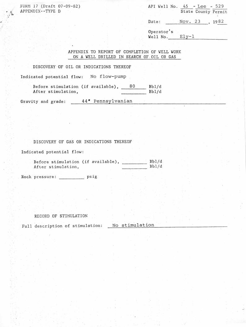
. , APPENDIX--TYPE D

/; I

API ""lell No .

Date :

Operator's Well No.

45 - Lee State County

Nov. 23

Ely-l

APPENDIX TO REPORT OF CmlPLETION OF \t.lELL WORK ON A WELL DRILLED IN SEARCH OF . OIL OR GAS

DISCOVERY OF OIL OR INDICATIONS THEREOF

Indicated potential flow : No flow-pump

Before stimulation (if available), After stimulation,

__ 8_0 __ Bbl/d Bbl/d

Gravity and grade: 44- Pennsylvanian

DISCOVERY OF GAS OR INDICATIONS THEREOF

Indicated. potential flow:

Before stimulation (if available), After stimulation,

Rock pressure: psig

RECORD OF STHlULATION

____ B~l/d Bbl/d

Full description of stimulation: No stimulation

- 529 Permit

1982


Recommended