1 Otay Mesa The San Diego newspaper wrote in 1899: "Much has been written and spoken of the famed Otay mesa of this county, an elevated plateau some 300 feet above the sea level. Girt in on every side by the everlasting hills, is a rolling tract that might be easily taken for an Iowa prairie, with remarkable soil, remarkable by reason of its marked ability to retain moisture. Olives, almonds, apricots and other fruits are raised without irrigation." One hundred years later, the newspaper wrote another glowing report: "The sky is clean and clear and the air is sweet. Songbirds flit from stalk to stalk of the barley and wheat growing on large tracts of agricultural land. Farm workers stoop to pick tomatoes, lop off celery tops and pluck lettuce from the rich, black earth. This is the Otay Mesa, where elevated points offer a sweeping view from the mesa of the bright, blue Pacific. In the past few years, the area has been catapulted from a haven of tranquil farming ventures into the choicest bit of real estate in San Diego County. The rapidly developing mesa has been called the last, great frontier in San Diego County." South Bay Historical Society Bulletin Issue No. 6 November 2014 Henry Piper cuts barley on his Otay Mesa farm at the turn of the century.
Transcript
1
Otay MesaThe San Diego newspaper wrote in 1899: "Much has been written and spoken of the famed Otay mesa of this county, an elevated plateau some 300 feet above the sea level. Girt in on every side by the everlasting hills, is a rolling tract that might be easily taken for an Iowa prairie, with remarkable soil, remarkable by reason of its marked ability to retain moisture. Olives, almonds, apricots and other fruits are raised without irrigation." One hundred years later, the newspaper wrote another glowing report: "The sky is clean and
clear and the air is sweet. Songbirds flit from stalk to stalk of the barley and wheat growing on large tracts of agricultural land. Farm workers stoop to pick tomatoes, lop off celery tops and pluck lettuce from the rich, black earth. This is the Otay Mesa, where elevated points offer a sweeping view from the mesa of the bright, blue Pacific. In the past few years, the area has been catapulted from a haven of tranquil farming ventures into the choicest bit of real estate in San Diego County. The rapidly developing mesa has been called the last, great frontier in San Diego County."
South Bay Historical Society BulletinIssue No. 6November 2014
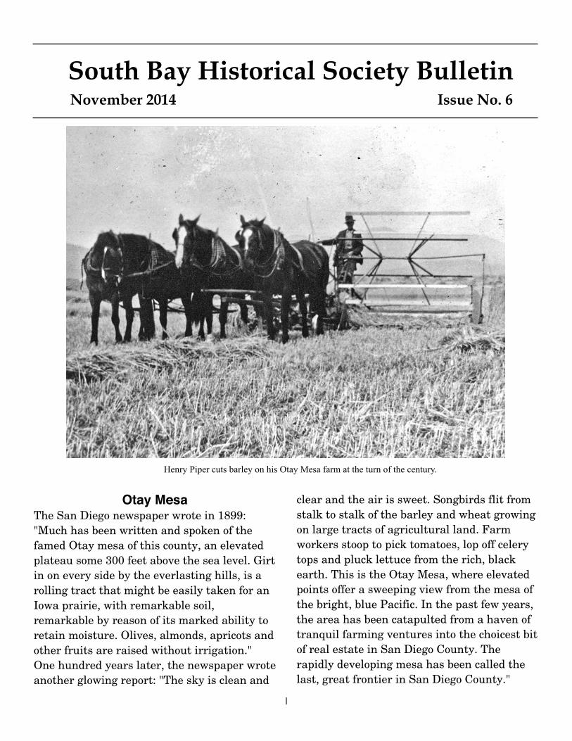
Henry Piper cuts barley on his Otay Mesa farm at the turn of the century.
2
My grandparents William and Lily Wolfe came to the Otay Mesa from Canada around 1910. At that time it was an overnight buckboard trip to San Diego from Otay Mesa. My mother Ella Ida Wolfe was the first child in the family born in California. There were 8 children in all, 2 boys and 6 girls. The last 4 were born in California. They all attended Alta School, a one-room schoolhouse on the Otay Mesa. In spite of the fact they had no running water and no electricity, everything was quite well organized. The stairs going to the attic were between the two small bedrooms. The attic was unfinished but adequate for additional sleeping space. Not much of anything was up there except two old trucks filled with old books. I spent quite a bit of time pouring through the books. The water was provided by the cistern which collected
MY RECOLLECTIONS ON LIFE ON THE HOMESTEAD ON THE OTAY MESAby Pattie Frazer
The Wolfe home on Otay Mesa near Cactus and Airway Road ca. 1940
William and Lily Wolfe
3
the water from the eaves troves. I asked what they did when they had a drought condition. They brought water in to the Alta School in water wagons and everyone came with their barrels to get their supply. There was a lined pit near the house with some sort of chemical that produced a gas which was piped into the house to provide gas lights in some of the rooms. The cooking was all done on a large wood range with water storage, large oven and cooking space on top. The prep table for cooking was right by the wood range. At the end of the prep table was a walk in pantry-cooler.
They grew most of their own vegetables—corn, tomatoes, carrots, etc. They did have a good sized vineyard, mostly Muskcat grapes, which they used to make wine in the winery. I don't know how they justified that since they were Seventh Day Adventists and there was Prohibition. Their main crops were wheat and beans. My grandfather did experimental crops for the University of California. Garbanzo
beans were one of the most successful crops. Considering it was all dry farming, they were somewhat limited. The soil up there was interesting—adobe-like. When it was plowed, it remained in big chunks, which helps conserve on the water. In the grainery where all crops were stored, there were scales, bags, etc. The barn was for the milk cows and their hay. The cattle were usually taken out to pasture each day. The dogs were trained for this. There were quite a few chickens to provide eggs and meat. The house had a wire fence around it. In the summer when it was hot, they slept outside and the wire fence kept the coyotes out. The outhouse worked and there were pots under the beds for night visits. Bathing was a community effort. They had a large galvanized tub. More than one person used the water. Baths seemed to be in age order. I don't remember about washing clothes but that must have been a real production. It wasn't all work. I still remember the 4th of July celebrations at the Community Building (across the road from the
The house was two story, and this is the floor plan on the first floor.
4
Alta School). What a production—right up there with Christmas! It was an all day and most of the night affair. They had races with prizes for all ages, 3-legged races, watermelon eating contests, greased pigs, baseball, dancing and a huge feast. My grandfather sold the homestead at the end of World War II and moved into a smaller place with more creature comforts, closer to San Ysidro. Their original property was right on the border. I often wondered who build the house and about the acreage of the homestead. I've gone back there two different times looking for the location. The house burned down and someone knocked down and removed the stone entry walls. The
trees were still there and they had a well. My grandfather had used a divining rod and selected the place for the well—they did get water. The second time about 2 years ago, I went back and everything was gone—no trees, nothing and even the small canyon that was close by was gone. The Otay Mesa has made a real transition from dry farming, starting in the 1850s to today, with all the industrial development in connection with Brown Field and the Tijuana Airport.
Below, photo of Grandmother Lily with her 6 daughters Alice, Nellee, Ella, Lily, Mae, Florence and Joanne.
The outside in the immediate vicinity was also very well organized.
5
Map
of
Ota
y M
esa
wit
h n
um
bere
d lo
cati
ons
of h
isto
ric
site
s.
6
Historic Otay Mesaby Steve Schoenherr
The following are descriptions of the historic sites numbered on the map above.
1. A large camp site at end of Otay Mesa Road was a Native-American village 7000 years ago, one of 220 sites on Otay Mesa that showed widespread human habitation on the mesa during the Holocene era.
2. Wilson McCool was the earliest settler to live on Otay Mesa. He moved from Monterey in the 1870s with his wife Elizabeth and children Alex, Evaline, John, George and Eugene. His oldest son, James McCool also came from Monterey with his wife Emma. By 1880 they homesteaded a section of land, 640 acres, with a house on the old road to Lower Mexico. Emma's father, John T. Farley, owned the section of land on the north side of McCool in 1872, but did not live there. In 1896 Wilson McCool moved to Riverside with his second wife and died soon after in Los Angeles. James McCool and his brothers continued to live on the mesa.
3. The Wetmore family were early pioneers on the mesa soon after the McCools. George H. Wetmore had been a banker in Iowa but wanted to move west and become a pioneer. In 1885 he bought 640 acres of land that had been homesteaded, probably the Farley tract north of the McCools. Wetmore was a member of the Otay Horticultural Society and experimented with different crops, raising figs and walnuts and planting a wide variety of fruit trees. With his wife Mary Ann he raise 4 sons, Eugene, Charles, Frank, and George. Eugene’s daughter, Clella, married Claude Kuebler in 1910.
4. Daniel O. McCarthy was the third American to settle on the mesa. In 1883 he was operating a horse and cattle ranch on the old road to Lower California and in 1889 formally filed a homestead claim for the 160-acre ranch, having met the qualification of living on the land for five years. By 1890 McCarthy had developed the town of Siempreviva on his ranch at the boundary line with Mexico, with a general store, post office, blacksmith shop, and oval track for horse racing. His son J. Harvey McCarthy helped run the store that sold American goods to Mexicans, and Mexican goods to Americans. The government
charged McCarthy with illegal smuggling and by 1895 he had lost his ranch and town. The post office was moved to a different location with the name of Lemon, but it soon closed. A third border crossing and port of entry called Otay Mesa East is planned to open in 2017 where D. O. McCarthy's General Store had been located in 1890. Route 11 will be a new four-lane highway connecting the crossing with SR 905, following the same route as the old road to Lower Mexico.
5. Christmas eve 1885 for the 10 families living on Otay Mesa was held at the house of Henry Chester. The location of this house is not known, but it must have been near the road that became known as Chester Grade, the road down the ridge on the west side of Otay Ranch to the Otay Valley, part of today's Heritage Road.
6. Henry C. Tibbetts was the first owner of what later became the Kuebler Ranch, when he purchased 160 acres on the eastern Mesa in 1886.
7. Alta School was a small one-room schoolhouse established in January 1886. The Alta School District for the entire mesa operated until 1967. Lutheran church services were held there until 1889 when the German Lutherans planned and built their own church a half mile west of the school. Construction of the church began in September, and St. John's Lutheran Church was completed in November. By
7
1971, only the cemetery remained from the church, and because it was in the path of the construction of Route 75, it was transferred to Glen Abbey Memorial Park in Bonita.
8. Lyman Modie settled near the Alta School and grew potatoes on his farm; he was a founder of the Otay Mesa Horticultural Society in 1889.
9. The Cordes brothers, Diedrick and August, were German settlers in 1887 near Johnson Canyon and were successful in raising grapes without irrigation. Diedrick and his wife Catherine were founders of the Otay Mesa Horticultural Society.
10. Charles Piper immigrated from Germany in 1867 and lived in Nebraska with his wife Herminia and two daughters Margarita and Johanna. In 1887 they filed a timber claim for 160 acres on Otay Mesa. A daughter Emma was born 1889 and a son Henry C. was born 1892. The children attended the Alta School with other pioneer children on the mesa. The Piper farm was located in the center of Otay Mesa and the school was one mile west of this farm. The sons of Henry C. were Herman and Henry Piper. Fred Piper, cousin of Charles, owned another farm near Brown Field.
11. John and Annie Geyser owned land in 1887 near their nephew, Fred Piper. Both Geyesers were murdered by Indian Joe in 1892.
12. The Stark farm was located in 1887 at the western end of today's Brown Field, near the Schroeder farm.
13. Pete Beckley came to Otay in 1887 with father Henry Beckley and three brothers Herb, William, and George. Pete's wife Lucy and William's wife Florence taught at the Alta School. The Beckley ranch was located at Otay Mesa Raod and Alta Road.
14. Several families of Lohmans came from Minnesota in 1880s and settled on the mesa. Frederick W. Lohman and his wife Caroline were born in Prussia, farmed for a few years on the mesa, then moved to San Diego where Fred died in 1912. Henry G. Lohman and his wife Rebecca settled on a farm near the Wolfes. Their son William Lohman and his wife Catherine bought the McCool farm in 1902. William's son Arnie Lohman became one of the original Border Patrol agents in 1924.
15. Dietrich Lampe came from Germany with his wife Sophie, and settled on a farm in 1887.
16. John H. Schroeder and his wife Ella were German immigrants to the mesa in 1887.
17. William and Lila Wellpott came from Pennsylvania in 1887. William immigrated from Germany when he was 18 years old and was a blacksmith before moving to Otay. He owned and operated a farm there until 1919, when he moved to National City, He was a carpenter, financier and owner of apartment houses in San Diego and National City.
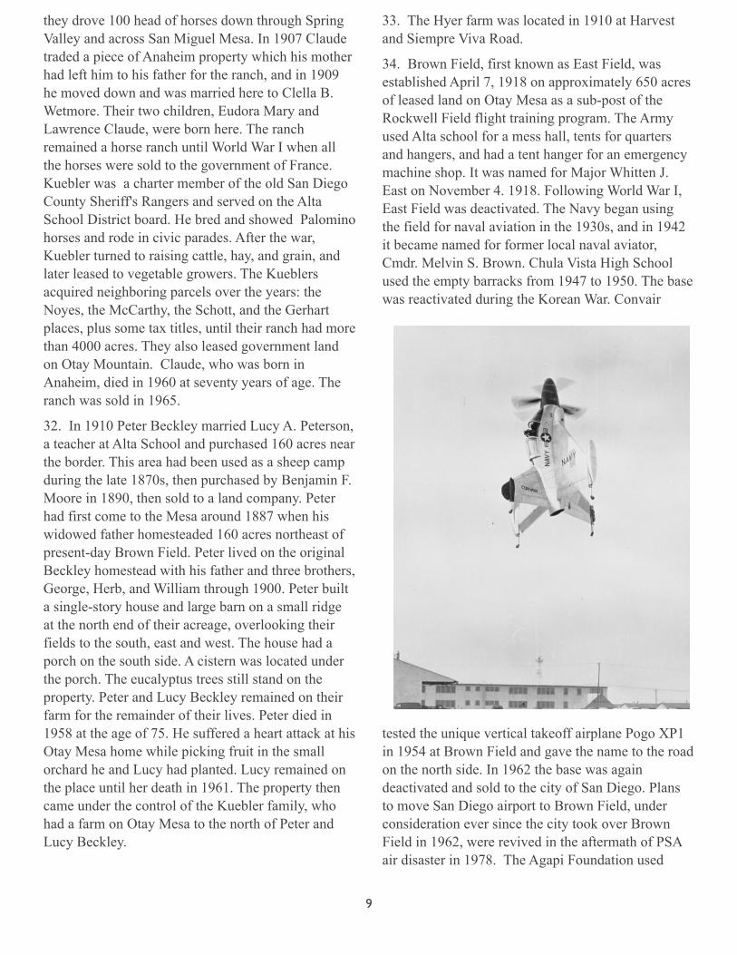
William Wolfe in The Union, June 14, 1925
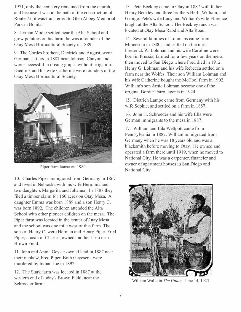
Piper farm house ca. 1980
8
18. George F. Roll was a rancher born in Germany who came to the mesa about 1890, with his wife Elizabeth and 5 daughters Elizabeth, Matilda, Rose, Julia and Alvina, and 3 sons Fritz, Carl and John Roll. Their house was built on La Media road southeast of Brown Field. George was an apprenticed bookbinder in Germany. His wife Elizabeth came to the United States to work out her passage money as an indentured housemaid, before marrying George. Together, they raised nine children. Son Fritz Roll married Violet Banks who was well-known in the Otay Valley for years as co-proprietor with her late husband Howard of the Banks General Store on Main Street in Otay. In 1913 Fritz drilled the first water well (380 feet deep) on Otay Mesa. Neighbors brought their horse-drawn tank wagons to his well for their water. In 1948, he drilled an 830-foot well for irrigating gardens and crops. After Fritz's well came in, Otay Mesa farmers raised the first irrigated crops of celery and tomatoes. Fritz was a founder of the Otay Water District in the 1950s. He developed a white strain of barley which he shipped to China to substitute for rice. Fritz was the first to raise garbanzo beans and ship them to Greece, Cuba and New York.
19. The William P. Wolfe home was built in 1892 at Cactus and Airway.
20. The Albert Wolfe home was near Dillon Canyon.
21. Antonio Guatelli was an Italian immigrant who came to Otay from Coulterville in the 1880s. He lived on 60 acres near the Otay River and by 1892 owned another 60 acres on Otay Mesa near Johnson Canyon.
22. Hugh O'Neal settled in 1892 near the canyon that today bears his name.
23. Henry Dillon owned land in 1892 around the canyon on the southwest edge of the mesa that today is known as Dillon Canyon and Dillon Trail.
24. The Diedrich Cordes farm was near Johnson Canyon in 1896.
25. The Johnson brothers, Thomas and Berger, came from Sweden in 1896 to the rim of the canyon that bears their name.
26. The William Wier house was the polling place in 1898 for the Loma Alta election district.
27. Henry Schott and his wife Ella came from Germany and in 1899 homesteaded 160 acres in the foothills near O'Neal Canyon, later purchased by the Kueblers.
28. Martin V. Peterson and his wife Amy came from Nebraska in 1900 and lived near the Shaws on Lone Star Road. In 1934 Martin was elected president of the Otay Mesa Improvement club that met in the Loma Alta club house.
29. George Dallett came to Otay Mesa in 1900 from Alsace Lorraine, with his wife Hannah, sons Carl and Silliam, and daughter Laura. After George's death in 1938, Carl took over the farm and it became one of largest on the mesa.
30. The Herman and Rosa Wruck farm was built in 1904 at 1200 Cactus Road. They had five daughters, Mary, Effie, Luella, Gladys and Viola; and three sons, Frank, Walter and Fred.
31. Claude and Clella Kuebler developed the largest ranch on Otay Mesa, 4500 acres four miles east of Brown Field and south of Otay Reservoir. In 1907 Claude's father, Harrison Kuebler of Anaheim, traded for the original 160 acres owned by Bob Tibbetts, and The Kuebler ranch house has been
restored as the Alta Cafe.
9
they drove 100 head of horses down through Spring Valley and across San Miguel Mesa. In 1907 Claude traded a piece of Anaheim property which his mother had left him to his father for the ranch, and in 1909 he moved down and was married here to Clella B. Wetmore. Their two children, Eudora Mary and Lawrence Claude, were born here. The ranch remained a horse ranch until World War I when all the horses were sold to the government of France. Kuebler was a charter member of the old San Diego County Sheriff's Rangers and served on the Alta School District board. He bred and showed Palomino horses and rode in civic parades. After the war, Kuebler turned to raising cattle, hay, and grain, and later leased to vegetable growers. The Kueblers acquired neighboring parcels over the years: the Noyes, the McCarthy, the Schott, and the Gerhart places, plus some tax titles, until their ranch had more than 4000 acres. They also leased government land on Otay Mountain. Claude, who was born in Anaheim, died in 1960 at seventy years of age. The ranch was sold in 1965.
32. In 1910 Peter Beckley married Lucy A. Peterson, a teacher at Alta School and purchased 160 acres near the border. This area had been used as a sheep camp during the late 1870s, then purchased by Benjamin F. Moore in 1890, then sold to a land company. Peter had first come to the Mesa around 1887 when his widowed father homesteaded 160 acres northeast of present-day Brown Field. Peter lived on the original Beckley homestead with his father and three brothers, George, Herb, and William through 1900. Peter built a single-story house and large barn on a small ridge at the north end of their acreage, overlooking their fields to the south, east and west. The house had a porch on the south side. A cistern was located under the porch. The eucalyptus trees still stand on the property. Peter and Lucy Beckley remained on their farm for the remainder of their lives. Peter died in 1958 at the age of 75. He suffered a heart attack at his Otay Mesa home while picking fruit in the small orchard he and Lucy had planted. Lucy remained on the place until her death in 1961. The property then came under the control of the Kuebler family, who had a farm on Otay Mesa to the north of Peter and Lucy Beckley.
33. The Hyer farm was located in 1910 at Harvest and Siempre Viva Road.
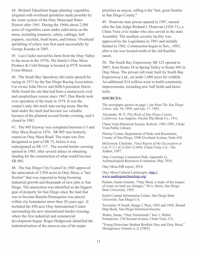
34. Brown Field, first known as East Field, was established April 7, 1918 on approximately 650 acres of leased land on Otay Mesa as a sub-post of the Rockwell Field flight training program. The Army used Alta school for a mess hall, tents for quarters and hangers, and had a tent hanger for an emergency machine shop. It was named for Major Whitten J. East on November 4. 1918. Following World War I, East Field was deactivated. The Navy began using the field for naval aviation in the 1930s, and in 1942 it became named for former local naval aviator, Cmdr. Melvin S. Brown. Chula Vista High School used the empty barracks from 1947 to 1950. The base was reactivated during the Korean War. Convair
tested the unique vertical takeoff airplane Pogo XP1 in 1954 at Brown Field and gave the name to the road on the north side. In 1962 the base was again deactivated and sold to the city of San Diego. Plans to move San Diego airport to Brown Field, under consideration ever since the city took over Brown Field in 1962, were revived in the aftermath of PSA air disaster in 1978. The Agapi Foundation used
10
Brown Field as a refugee center for Vietnamese in 1975 and expanded by 1976 as a temporary home for refugees from 10 other nations. Larry Val Dumlao established a colony for visual and theatrical artists at Brown Field in 1987. Ralph Pierson established his Jet Engine Museum in 1988 and shared space with many of the private airplane services that occupied the former military buildings.
35. D. B. Shaw settled on his farm in the 1920s. The Shaws were one of the 16 families living on the mesa after World War II. When the new Otay Mesa post office opened in 1947, many landowners were allowed to name the roads they lived on. The Shaws named their road Lone Star.
36, Larry Kuebler lived on his ranch at 6942 Otay Mesa Rd., and in 1935 built his own house on the foothills of Otay Mountain. He was born on the mesa in 1912, attended Alta School and married the former Mrs. Byron Jacquot.
37. Glen and Tosh Yonekura had a large farm of 100 acres on Otay Mesa after World War II at the east end of Alta Road. The Yonekura farm extended to bottom of Johnson Canyon south of Otay River.
38. Agnes McCown, a niece of William and Peter Beckley, moved to the mesa in 1947 with her husband Richard and negotiated with the U.S. Postal Service to get mail delivered to Otay Mesa. Prior to this time the roads on the Mesa had no official
designations. A meeting was held at the community clubhouse to name the roads so that addresses could be assigned for mail delivery. Each household designated the name for the roads on or near where they lived. Mrs. Shaw chose the name Lone Star. Mrs. Dallett named Cactus Road after a cactus garden at her home. The Kueblers named Alta Road. The McCowns designated Heritage Road, Pete Beckley chose Siempreviva, and the Rolls named Airway Road.
39. The George Yamamoto farm was near the border below the Robert Egger farm in 1952. Yamamoto was one of the earliest farmers in the region to install a well and farm vegetables with irrigation.
40. Robert Egger and Emil Ghio built a reservoir to water their farm east of Brown Field in 1957.
41. Jesus Martinez purchased 60 acres at 2160 Cactus Road.
42. The Naval Space Surveillance system was installed in 1961 at north end of Brown Field, at the end of Pogo Row. Also, the former INS Shooting Range was located northeast of Pogo Row.
43. The Rohr Engine Test Facility, currently vacant, was established in 1968 at 1500 Heritage Road.
11
44. Richard Takashima began planting vegetables irrigated with overhead sprinklers made possible by the water system of the Otay Municipal Water District after 1961. During the 1960s about 2,500 acres of vegetables came under cultivation on the mesa, including tomatoes, celery, cabbage, bell peppers, zucchini, bush beans, and lettuce. Overhead sprinkling of celery was first used successfully by George Kusaka in 1965.
45. Luis Cacho moved his farm from the Otay Valley to the mesa in the 1970s. His family's Otay Mesa Produce & Cold Storage is located at 8578 Avenida Costa Blanca.
46. The South Bay Speedway dirt track opened for racing in 1971 by the San Diego Racing Association. Car owner John Driver and SDRA president Harris Mills found the site that had been a motorcycle oval and steeplechase course since 1967. Don Basile took over operation of the track in 1974. It was the county's only dirt-track auto racing arena. But the land under the track had become too valuable because of the planned second border crossing, and it closed in 1983.
47. The 905 freeway was completed between I-5 and Otay Mesa Road in 1976. SR 905 was formerly routed on Otay Mesa Road. The route was first designated as part of SR 75, before it was redesignated as SR 117. The second border crossing opened in 1985, after several delays in obtaining funding for the construction of what would become SR 905.
48. The San Diego City Council in 1985 approved the annexation of 3,956 acres in Otay Mesa, a "last frontier" that was expected to bring booming industrial growth and thousands of new jobs to San Diego. The annexation was identified as the biggest gain of property for San Diego since the land that was to become Rancho Penasquitos was placed within city boundaries more than 20 years ago. It included the 450-acre Otay International Center surrounding the new international border crossing, where the first industrial and commercial development began. Roger Hedgecock identified the industrialization of the mesa as one of his major
priorities as mayor, calling it the "last, great frontier in San Diego County."
49. Donovan state prison opened in 1987, named after the late Judge Richard J. Donovan (1926-71), a Chula Vista civic leader who also served in the state Assembly. The medium security facility was approved by the Legislature in 1981 and initially funded in 1982. Construction began in Nov., 1985, after a site was located north of the old Kuebler ranch.
50. The South Bay Expressway SR 125 opened in 2007, from Route 54 in Spring Valley to Route 905 in Otay Mesa. The private toll road, built by South Bay Expressway Ltd., set aside 1,000 acres for wildlife. An additional $14 million went to build community improvements, including new ball fields and horse trails.
SOURCES:
The newspaper quotes on page 1 are from The San Diego Union, July 10, 1899, and Apr. 17, 1983.Alexander, W. E. Plat Book of San Diego County, California. Los Angeles: Pacific Plat Book Co., 1911.Chula Vista Historical Society Bulletin, 1981-1991, Chula Vista Public Library.History Center, Department of Parks and Recreation, County of San Diego, 5500 Overland Avenue, Suite 410.McGowan, Charlotte. Final Report of the Excavation of Cal. F:5:1 (CA-SDI-12,809). Chula Vista, CA : The Author, 1997. Otay Crossings Commerce Park, Appendix G, Archaeological Resources Evaluation, May 2010.Otay Mesa EIR report, 2014.Otay Mesa Cultural Landscapes, http://www.sandiegoarchaeology.org/Painter, Susan Annette. "Otay Mesa: a study of the impact of water on land use changes," M.A. thesis, San Diego State University, 1985. South Coastal Information Center, San Diego State University, San Diego CA.Township 18 South, Range 2 West, 1892 and 1896, Bound Map Book, San Diego Historical Society.Walter, Susan. "Otay Farmsteads," box 1, Walter Enterprises, 238 Second Avenue, Chula Vista, CA."Young Historians Student Booklet Otay and Otay Mesa," Montgomery School, n. d. [1983]
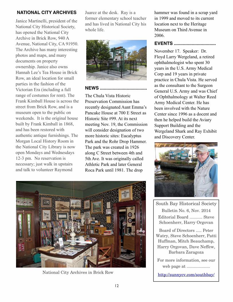
Janice Martinelli, president of the National City Historical Society, has opened the National City Archive in Brick Row, 940 A Avenue, National City, CA 91950. The Archive has many interesting photos and maps, and many documents on property ownership. Janice also owns Hannah Lee’s Tea House in Brick Row, an ideal location for small parties in the fashion of the Victorian Era (including a full range of costumes for rent). The Frank Kimball House is across the street from Brick Row, and is a museum open to the public on weekends. It is the original house built by Frank Kimball in 1868, and has been restored with authentic antique furnishings. The Morgan Local History Room in the National City Library is now open Mondays and Wednesdays 12-3 pm. No reservation is necessary; just walk in upstairs and talk to volunteer Raymond
Juarez at the desk. Ray is a former elementary school teacher and has lived in National City his whole life.
NEWS .....................................The Chula Vista Historic Preservation Commission has recently designated Aunt Emma’s Pancake House at 700 E Street as Historic Site #99. At its next meeting Nov. 19, the Commission will consider designation of two more historic sites: Eucalyptus Park and the Rohr Drop Hammer. The park was created in 1926 along C Street between 4th and 5th Ave. It was originally called Athletic Park and later General Roca Park until 1981. The drop
hammer was found in a scrap yard in 1999 and moved to its current location next to the Heritage Museum on Third Avenue in 2006.
EVENTS .................................November 17. Speaker: Dr. Floyd Larry Wergeland, a retired ophthalmologist who spent 30 years in the U.S. Army Medical Corp and 19 years in private practice in Chula Vista. He served as the consultant to the Surgeon General U.S. Army and was Chief of Ophthalmology at Walter Reed Army Medical Center. He has been involved with the Nature Center since 1996 as a docent and then he helped build the Aviary Support Building and the Wergeland Shark and Ray Exhibit and Discovery Center.
South Bay Historical Society
Bulletin No. 6, Nov. 2014
Editorial Board ........... Steve Schoenherr, Harry Orgovan
Board of Directors ..... Peter Watry, Steve Schoenherr, Patti Huffman, Mitch Beauchamp, Harry Orgovan, Dave Neffew,
Barbara Zaragoza
For more information, see our web page at ....................
http://sunnycv.com/southbay/National City Archives in Brick Row