16
Our Changing World and the Role of Geospatial Information
Our Changing World and the Role of
Geospatial Information

Inertial Surveying Transit GPS Multi-GNSS + Inertial
Photogrammetry Airborne Scanning High Resolution Remote Sensing
Barometers, Gravimeters RFID Automotive Sensors Billions Devices/Sensors
Manual
Computation
Digital
Computation Real Time Information
Theodolites, tapes, chains EDM Total Stations 3D Scanning
Photogrammetry &
Remote Sensing
Angle & Distance
Measurement
Space & Inertial
Measurement
Peripheral
Sensors
Computation &
Communications
Integrated
Mobile
Mapping
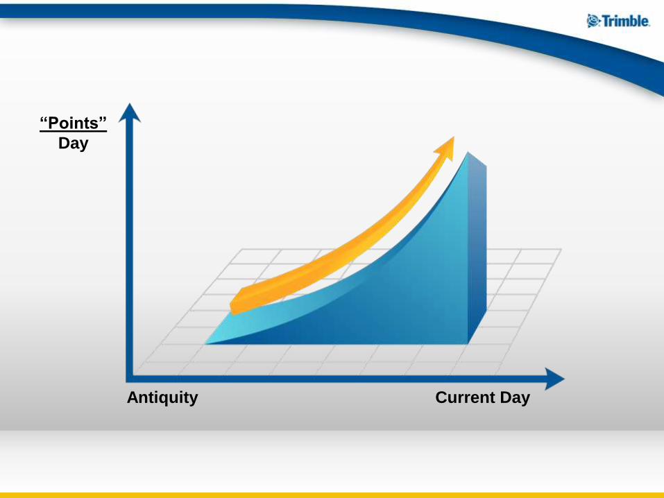
Antiquity Current Day
“Points”
Day
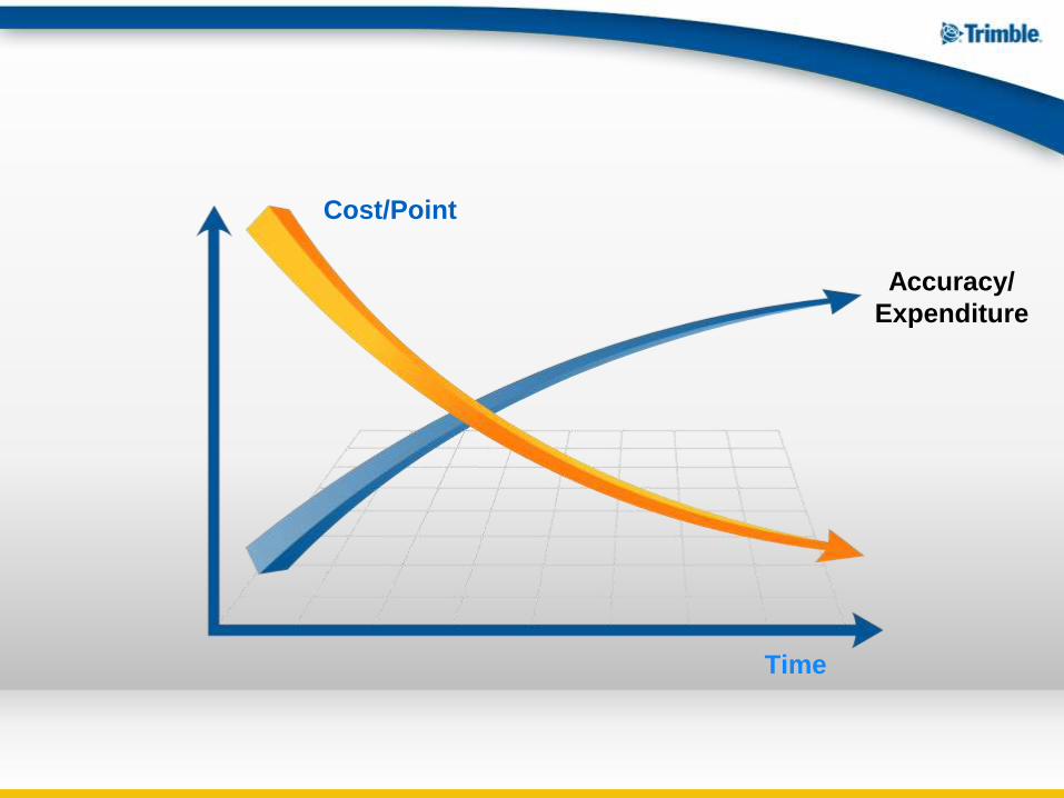
Time
Accuracy/
Expenditure
Cost/Point
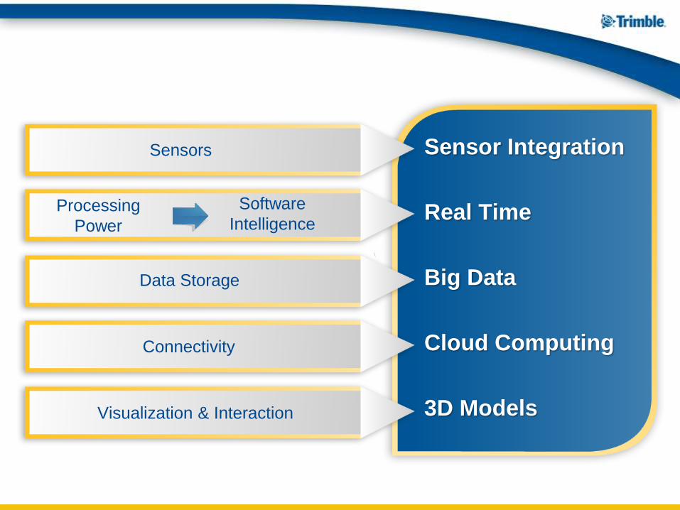
Sensor Integration
Real Time
Big Data
Cloud Computing
3D Models
Sensors
Software
Intelligence Processing
Power
Data Storage
Connectivity
Visualization & Interaction
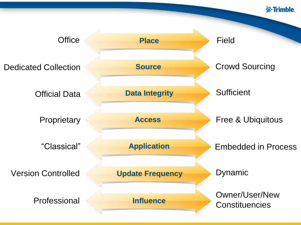
Field Office
Dedicated Collection Crowd Sourcing
Official Data Sufficient
Free & Ubiquitous Proprietary
“Classical” Embedded in Process
Version Controlled Dynamic
Owner/User/New
Constituencies Professional
Place
Source
Data Integrity
Access
Application
Update Frequency
Influence
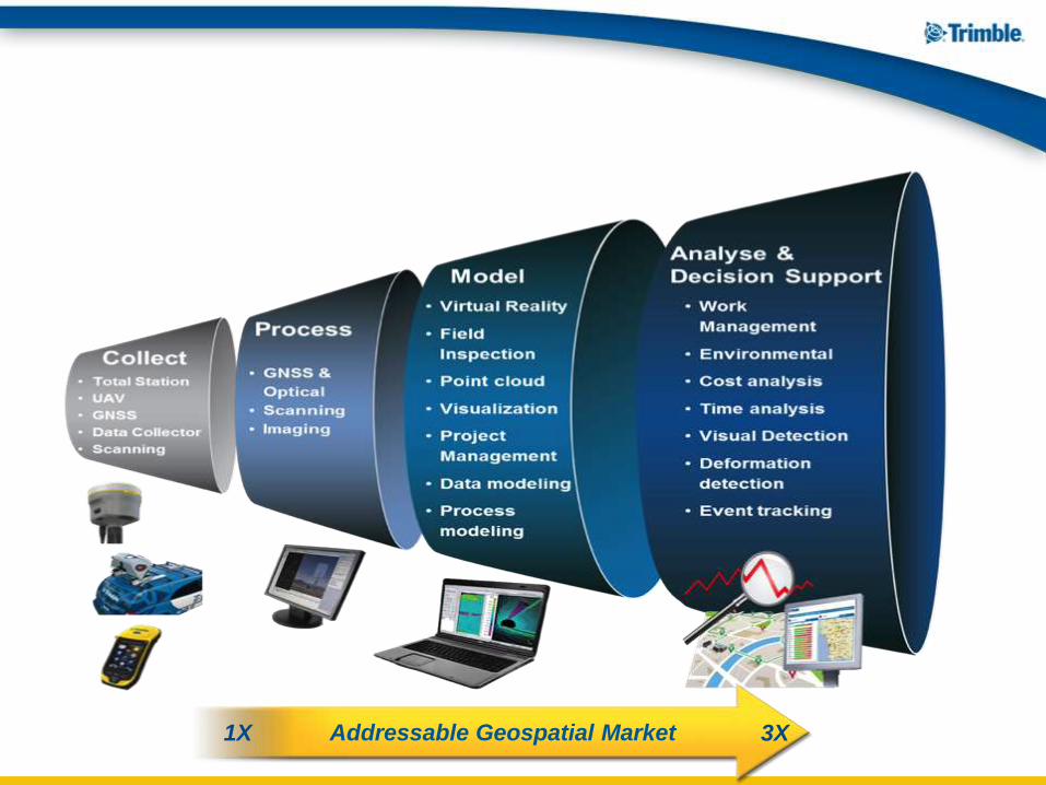
1X 3X Addressable Geospatial Market
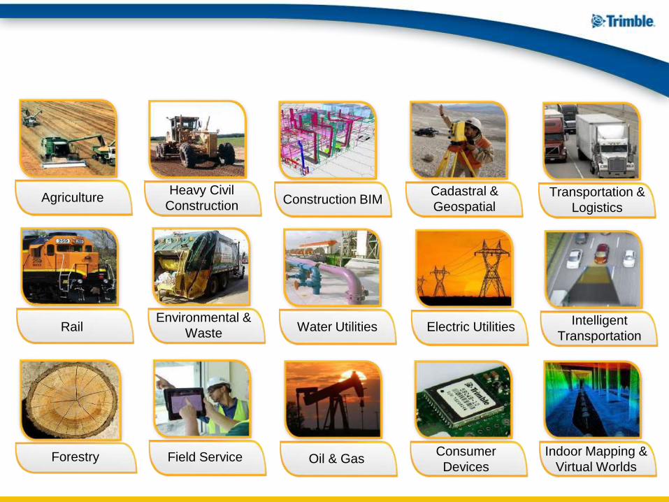
Agriculture Heavy Civil
Construction Construction BIM
Cadastral &
Geospatial Transportation &
Logistics
Rail Environmental &
Waste Water Utilities Electric Utilities
Intelligent
Transportation
Forestry Field Service Oil & Gas Consumer
Devices
Indoor Mapping &
Virtual Worlds
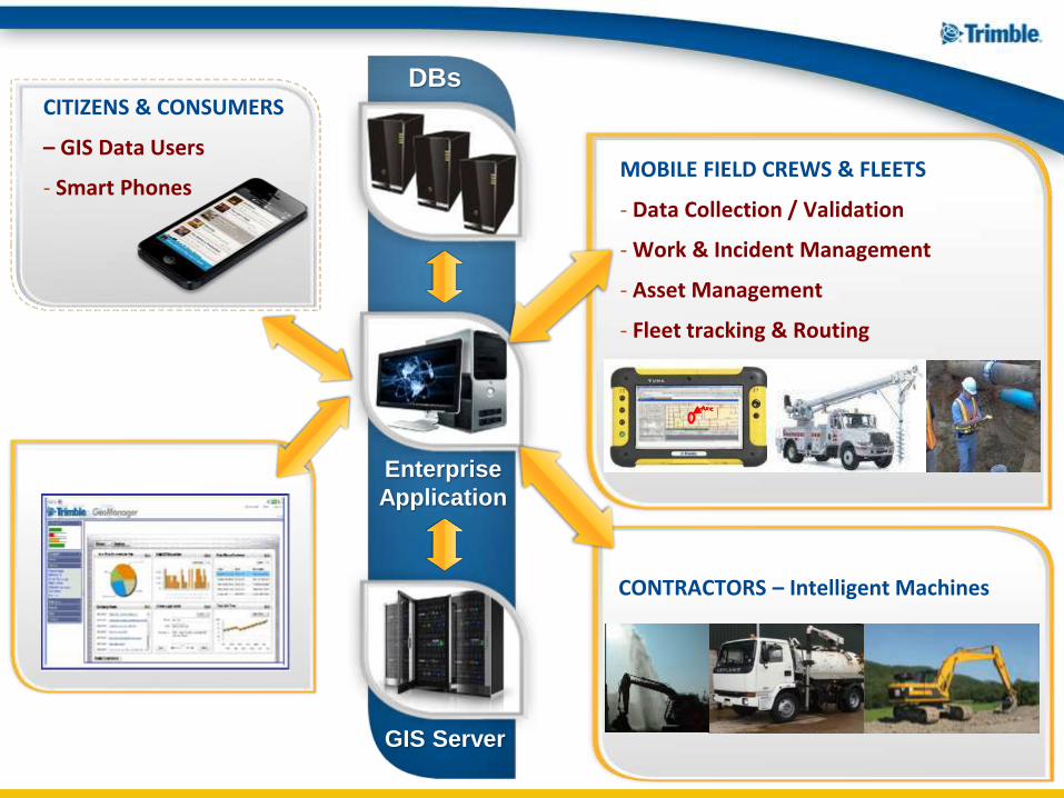
DBs
GIS Server
Enterprise
Application
CITIZENS & CONSUMERS
– GIS Data Users
- Smart Phones
MOBILE FIELD CREWS & FLEETS
- Data Collection / Validation
- Work & Incident Management
- Asset Management
- Fleet tracking & Routing
CONTRACTORS – Intelligent Machines

3D geospatial information &
technology is a key enabler
for the entire process
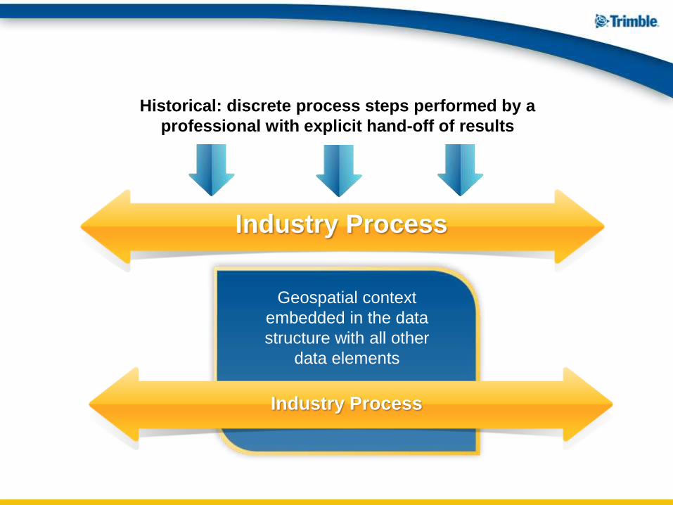
Historical: discrete process steps performed by a
professional with explicit hand-off of results
Geospatial context
embedded in the data
structure with all other
data elements
Industry Process
Industry Process

Key Skills: Establishing context
Managing complexity
Data management
Key Values: Accuracy
Credibility
Reliability
Collaboration
Analysis,
Modeling &
Applications
Roles to Be Defined
“Data Management”
Traditional Comfort Zone
“Data Collection”
Key Skills: Instrumental precision
Meticulous calculations
Key Values: Accuracy
Credibility
Reliability
Measurement
& Data
Collection
Interpretation
& Quality
Control


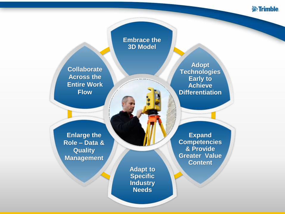
Collaborate
Across the
Entire Work
Flow
Enlarge the
Role – Data &
Quality
Management
Embrace the 3D Model
Adopt Technologies
Early to Achieve
Differentiation
Expand Competencies
& Provide Greater Value
Content Adapt to Specific Industry Needs

Thank you


