DIABLO CANYON AREA SEISMIC HAZARD OF THE GEOLOGICAL BEDROCK A photo-documented geological circumnavigation of the terrestrial area around the Diablo Canyon Power Plant By Ralph Bishop Prepared for the Alliance for Nuclear Responsibility And the Santa Lucia Chapter of the Sierra Club Brecciated Jasper – Example of Faulted Bedrock DATE RECD. DOCKET 09-IEP-1L 9/14/2009
Transcript
DIABLO CANYON AREA SEISMIC HAZARD OF THE GEOLOGICAL BEDROCK
A photo-documented geological circumnavigation of the terrestrial area around the Diablo Canyon Power Plant
By Ralph Bishop Prepared for the Alliance for Nuclear Responsibility
And the Santa Lucia Chapter of the Sierra Club
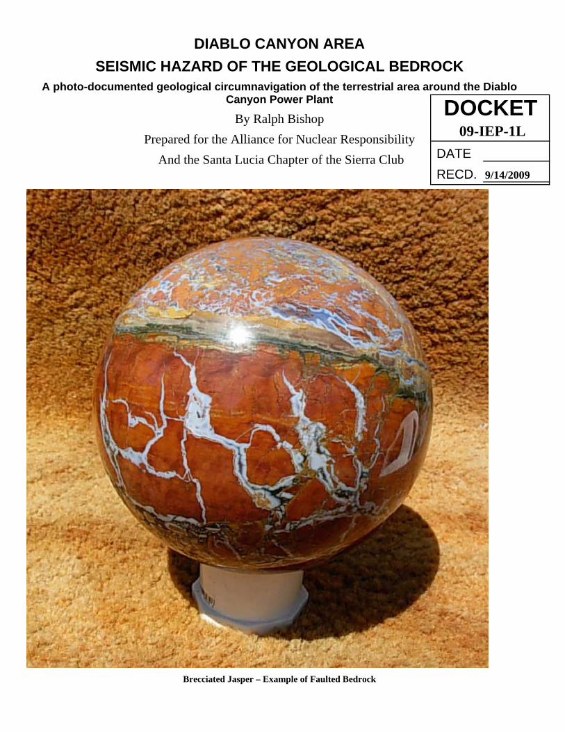
Brecciated Jasper – Example of Faulted Bedrock
DATE RECD.
DOCKET09-IEP-1L
9/14/2009
2
Geological Overview
Our central coast, including the Avila area, constitutes the leading edge of the Pacific tectonic plate where it interlaces and subducts under the more stable American plate. Our landform is composed of a crushed terrestrial sliver of the Pacific plate where it’s "irresistible force meets an immovable object." The result of this is a network of chaotic multidimensional faulting. The main trending faults such as the San Andreas and Nacimiento are known as "strike slip" faults that move in a relatively horizontal plane. Transecting these faults are '"thrust faults" or transform faults that run at even conceivable angle off the main trending faults and thrust vertically at chaotic angles. Between these myriad of faults are individual rock units known as terranes (rock unit) that react independently under crushing effects of seismic earth movements. While some terranes are angular and blocky in shape and miles wide, others are sliver shaped miles long but very narrow or any shape imaginable in between. These terranes are multidimensional both horizontally and vertically. These macro-terranes in turn are also faulted accordingly due to independent pressure exerted by adjacent macro-terranes. The rock specimens provided in the following photo documented geological tour are micro examples of the resulting bedrock-shattering that constitutes the geological foundation of the Avila area, driven by the unrelenting process of tectonics. The rock specimens were cut to exhibit their multidimensional nature of the rock units as "floating block" terranes that exist in the macro subterranean world. Although the epicenters of many earthquakes take place on or near main trending faults, the terranes crushed between them are always impacted by the vertical thrust fault that separate them and often creates a higher degree of jeopardy and damage. "Undiscovered" or "blind" thrust faults that riddle the bedrock can also rupture independent of main trending faults at any given time. The word "dormant" is often tossed about when discussing faults. This term instills a sense of complacency for those who do not comprehend that even the "best plans of mice and men" are made foolish by the forces of nature. In our geological tour, we will see positive indications in the form of hydrothermal mineral springs, that faulting in the Avila area is not dormant. Deep-seated hydrothermal water under unimaginable heat and pressure courses to the surface through open faulted conduits along our plate boundary, taking with it such minerals as iron, sulfur and silica in solution. The lubricating effect of the pressurized hydro solutions on the lithic interfaces is a well-documented fact of geological physics. Now let's take a photo-documented day tour that will allow the earth to speak. After taking the tour, it should be impossible to avoid asking oneself how professional geological consultants could have approved the placement of a nuclear facility in this area.
3
Photo Documented Geological Tour This tour consists of a geological investigation of the terrestrial area to the north, south and east of the Diablo Nuclear Power Plant. While the Western margin is shrouded by the Pacific Ocean, the other three cardinal directions are exposed, allowing the earth to speak without prejudice. We all realize we reside on the faulted interface of two major tectonic "plates," however few people grasp the degree to which our bedrock foundation is shattered by tectonic force. The area encompassing this tour is riddled with vertical thrust faulting that often holds more jeopardy for seismic damage than epicenters on main trending faults. Many seemed surprised that an "unknown" fault was recently discovered in close proximity to the Diablo facility. After reviewing this tour, nothing of this nature should surprise you again.
Figure - 1. North side of Avila Bay showing a headland terrane composed of “Pillow Lava” (approx. 90 million years old)
We will begin our tour on the north side of the Avila embayment just over a rocky hill from the Diablo facility; a headland terrane juts from the ocean waves (Figure -1). This headland is composed of a formation of "Pillow Lava", the finest example of its kind I have ever seen.
4
Figure - 2. Sea Cliff exposure of “Pillow Lava”
Figure -3 Close-up showing the dynamics of an elongated “pillow” that has burst from a more bulbous “pillow.”
A closer view (Figure -3) exhibits in exquisite detail a submarine lava extrusion frozen in time. The same process is happening on the Hawaiian Islands today.
5
Figure -4 Faulted zone in “Pillow Lava” formation showing resealed brecciation.
At a number of places on this once solid formation, there are zones where tectonic forces have shattered the lava, opening up fissures that are now filled with Lavic Breccia. These fissures were then resealed with silica and calcite mineralization that was carried by deep-seated hydrothermal solutions (Figure –4).
Figure -5 South side of Avila Bay showing a headland terrane of rhyolite (approx. 25 million years old).
6
We now travel to the south side of Avila Bay. Here we encounter another headland terrane composed of 25 million-year-old rhyolite, as dissimilar in make up as it is in age from the “pillow lava” rising vertically from the sea (Figure –5).
Figure –6 Promontory sheared by a vertical line thrust fault from the main body of terrane. Location
where brecciated rhyolite specimen was found.
On the northern margin of this formation, one comes across two quite noticeable faults exposed on the sea cliff. The first is on the backside of a promontory that protrudes seaward (Figure –6). This textbook example of a vertical thrust is noticeably sheared from the rest of the terrane.
Figure -7 Specimens of brecciated rhyolite resealed by silica (agate).
7
At this location, specimens of brecciated rhyolite are found consolidated by silica in the same manner as the “pillow lava” formation (Figure –7). Certain specimens up to 2 feet wide are a positive indication that an earthquake event opened up a fissure at least that wide in a once stable rhyolite formation.
Figure -8 Second fault exposure that runs at a right angle from promontory fault. Note yellow sulfur stain precipitated from
mineral spring.
The second fault only 30 yards down the beach runs at a perpendicular angle to the first fault along the sea cliff (Figure –8).
Figure -9 Crumbles of sulfur below faulted spring face.
8
This fault strikes at 45° and actively weeps mineralized water, precipitating iron and sulfur that stain the rhyolite and constantly crumble onto the beach sand (Figure –9).
Figure-10 Specimen of brecciated rhyolite discolored by hydrothermal mineralization.
In close proximity to this hydro active fissure is a substantial remnant of crushed bedrock, the result of thrust faulting (Figure –10). Infusion of minerals carried by hydrothermal upwelling has discolored the brecciated mass. Natural weathering has created a textbook specimen of lithic brecciation.
Figure -11 Close-up of brecciated rhyolite specimen showing mineral leaching (oxidation).
9
A close-up view of this mass exhibits large and small clasts (angular rocks) that compose this specimen (Figure –11).
Figure -12 Avila Hot Springs Resort
We will next travel up Avila Valley to the east. The Avila Valley transects the two major terranes we have already visited. The Avila Valley marks the northern boundary of the rhyolite terrane, where it is overlain by 12-million-year-old Monterey shale formation. The road to Avila follows this faulted margin, passing two large commercial hot spring resorts. The first is Avila Hot Springs, whose hydrothermal was has a defined stench of sulfur (Figure –12). The second is Sycamore Mineral Springs (Figure –13).
Figure -13 Sycamore Hot Springs Resort
These two significantly active deep-seated hydrothermal springs are a positive indication that there is an open faulted conduit beneath the surface. It is often difficult to group the chaotic angles that are created by vertical thrust faults by viewing unstratified formations like the "pillow lava" and rhyolite. The Monterey shale formation, on the other
10
hand, allows one to see the radical uplift and tilting of the once horizontal bedding plane. Near the stop light on Avila Valley road, such an example is exposed in a road cut on the south side of the road (Fig #14). Here the shale is tilted at 70° facing north, while the same formation is nearly horizontal on the north side of the roadbed (Fig #15). Where would you suppose that fault lies?
Figure -14 Monterey shale formation (approx. 12 million years old) radically tilted from its original horizontal plane, facing
north.
Figure -15 Monterey shale formation in nearly horizontal position on the opposite side of Avila Valley road.
11
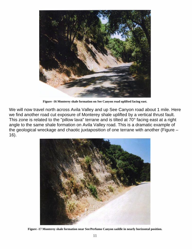
Figure -16 Monterey shale formation on See Canyon road uplifted facing east.
We will now travel north across Avila Valley and up See Canyon road about 1 mile. Here we find another road cut exposure of Monterey shale uplifted by a vertical thrust fault. This zone is related to the "pillow lava" terrane and is tilted at 70° facing east at a right angle to the same shale formation on Avila Valley road. This is a dramatic example of the geological wreckage and chaotic juxtaposition of one terrane with another (Figure –16).
Figure -17 Monterey shale formation near See/Perfumo Canyon saddle in nearly horizontal position.
12
Farther up See Canyon road. Nearing the saddle between See and Perfumo Canyons, another road cut exposure shows the shale strata again nearly horizontal (Fig 17). Over the breadth of the saddle, geological exposures turn from shale to sandstone and into serpentine. Although I have not pinpointed the fault scarps in this area, ample evidence can be found on the hillsides and creeks. Here we find specimens of brecciated jasper with dissimilar colored Jasper and mineralized infilling (Figures -18. -19, -20).
Figure -18 Brecciated Jasper found on hillside of serpentine near sandstone interface.
Figure -19 Large specimen of brecciated Jasper found in creek showing that at least 1 seismic fissure in this zone was at least 3
feet wide.
13
Jasper is formed as a solid infilling of open seismic fissures. During subsequent earth movements, this solid material is shattered and then resealed by mineralized hydrothermal solutions. Some specimens show multiple shattering events (Figure -20).
Figure -20 Specimen of brecciated Jasper exhibiting multiple shattering events by earthquakes.
Figure -21 Specimen of brecciated Jasper showing dissimilar coloration of Jasper and silica/manganese infilling.
14
Because of the many colors of both the jasper and reseals, I believe there are a number of faults at the interface between the serpentine and sandstone formations.
Figure -22 Looking across Morro Bay with Cayucos at the base of horizon. Morro Rock (right of center) is composed of very
dissimilar granite material.
From this saddle we travel down Perfumo Canyon to Los Osos Valley and then to Montana De Oro State Park, due north of the Diablo facility. From a high vantage point, we can look across Morro Bay to the foothill horizon of Cayucos (Figure -22). This is where the recent 6.0 earthquake occurred. I have included photos of brecciated jasper from that area to drive home the point that the same tectonic and depositional process occurs in both areas (Figures -23, -24, -25).
Figure -23 Specimens of brecciated Jasper showing offsetting of “miniature terranes”. Whether small or miles wide, tectonic
forces create the same effect.
15
Figure -24 Rough and cut specimens of brecciated Jasper. A macro view of the central coasts geological wreckage would be
We proceed south to the main cove of Montana De Oro. From this point, we follow a hiking trail south along the rim of an ocean playa. Here the sea cliffs are composed of stratified shale, again of the Monterey formation, and tilted from 60° to 70°. At about a
16
mile, we come to a small cove where the shale on the north side is tilted facing south (Figure -26,-27 and -28).
Figure -26 North side of cove at Montana De Oro showing tilted sedimentary strata facing south.
Figure -27 Closer view of nearly vertical shale strata north of cove.
17
Figure -28 South side of cove at Montana De Oro showing tilted sedimentary strata facing north.
In Figure -29, left of center where the darkened mountain descends, is the Diablo facility.
Figure -29 Closer view of sedimentary strata south of the cove. Headland (center left) is location of Diablo facility.
18
Found in this cove was a rock specimen of brecciated sedimentary rock infused and resealed by calcitic material showing at least two shattering events (Fig #30). This is a positive indication that a fault runs through the center of the cove.
Figure -30 Specimen of brecciated sedimentary material exhibiting at least two shattering events. Specimen found in cove at
Montana De Oro. We have now finished our terrestrial navigation around the Diablo area, hopefully providing a better understanding as to the extent of faulting encompassing the Diablo facility.
19
CONCLUSIONS My intent is not to be alarmist but rather to elicit sober judgment concerning future operations at the Diablo facility. I do not subscribe to the "not in my backyard" mentality of power generation, however I am concerned about the law of unintended consequences that could shape our future. My intent is to raise awareness and allow the earth to speak without prejudice. Our bedrock foundation has no axe to grind, is not hampered by strict ideology, and has no desire for monetary gain. For years I was complacent concerning this local issue. The wake up call for me was the 6.0 earthquake near Cayucos, which proved to me our area is not the least bit seismically dormant. In some areas landforms were elevated up to three inches by vertical thrust faults and major structural damage occurred as far away as Paso Robles. The seismic damage that subsequently occurred at a nuclear facility in Japan did not escape my attention. That facility, like Diablo, is built on the leading edge of the Pacific Plate and shares the same tectonic jeopardy. I am not a lettered gentleman; my knowledge comes from half a century of fieldwork in our area. Hands on experience in the college of hard rocks has been an exceptional teacher. I have provided in this report a visual day tour around the Diablo area that can be taken in person with relative ease. If a picture is worth 1,000 words, this tour should speak volumes as to the extent of the thrust faulting in close proximity to the Diablo facility, yet what you see is just the tip of the iceberg, where easy access is available. It is my hope that these visual images will sufficiently validate what words struggle to verify. I lack the knowledge to address most aspects of nuclear power generation. In the realm of local geology, however, I can say without equivocation that the placement of the nuclear facility at Diablo Canyon was a seismic error. No geologist that was "worth his salt" should have signed off on their project. I seriously question whether they ever scuffed their boots before cashing their checks. Their "pin the tail on the donkey" placement of nuclear jeopardy initiated a more serious game of “seismic Russian Roulette" with the central coast's future. In my opinion the initial error in judgment was compounded by glaring ineptitude in engineering and construction procedures, as seen in the disorientation of the reactor domes, and electrical wiring. I have come to the conclusion that this corporate entity lacks the competence and integrity to continue their operations without extreme scrutiny and independent oversight. It can be truthfully argued that the "Doomsday scenario" has not occurred but I submit that this is not because of PG&E’s decision-making but rather dumb luck. The communities of Cayucos, Paso Robles, and the people in Japan living on the leading edge of the Pacific plate were lucky until recently when the tectonic hammer fell. When a corporate entity imposes great risk by their actions on the environment, it should be incumbent upon them to take equal responsibility without obstruction or
20
complaint. As the situation stands today, the very least PG&E should do is initiate a detailed "seismic accounting" of all faults in a significant circumference around their facility using state of the art technology. Wallowing in ignorance, trying to save a dollar and having to pay for a reactive calamity will not serve the community, and for that matter PG&E's shareholders. I would equate reluctance on the part of PG&E to complete a "seismic accounting" to the failure of other corporations in the recent past to maintain proper monetary accounting that has caused our nation's economic "meltdown". The empirical data derived from such a seismic investigation should be made transparent, devoid of any smoke or mirrors. For years, those who support PG&E have dismissed legitimate and logical concerns. This report is not meant only for those who oppose the operations at Diablo but also for those of independent mind like myself who have straddled the fence of concern for years. The solid bedrock of intelligence is common sense. Would you build your home on a shattered foundation?