Page 1
Pelotas Basin: Brazil
Seismic Reprocessing Project
Data available for Licensing
SpecPartners and Geotrace are pleased to announce
their Pelotas Basin, Brazil, Reprocessing Project - data
from which is available for licensing by oil companies.
Page 2
Pelotas Basin, Brazil: Seismic Reprocessing Project
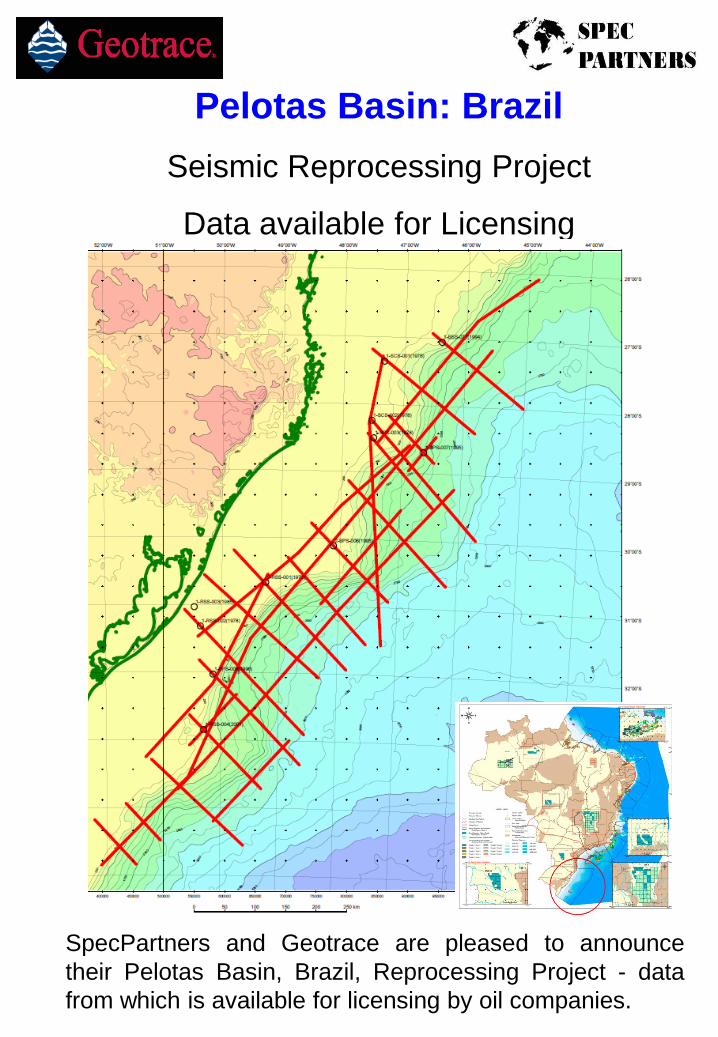
Under an agreement with the Brazilian Licensing Authority (ANP) Spec Partners
and Geotrace are undertaking the reprocessing (from field tapes) of 15,000 kms of
2D seismic data in the Pelotas Basin, offshore Brazil. Phase 1 of the project, as
shown on the map, consists of a regional grid of ~6,500 km of data whose vintages
range from 1986 to 2000. The Phase 1 grid ties the available wells in the area.
The Pelotas Basin is situated south of the Santos Basin and runs southwards to
offshore Uruguay. The northern part of the survey area falls within the southern part
of the Santos salt basin where the southern extent of the salt is defined by the
Florianopolis Ridge.
Geologically then, much of the Pelotas Basin is different from the Santos and
Campos Basins and is more frontier in nature, with only 12 wells being drilled over
the last 35 years. However evidence from the seismic data shows that the
sedimentary thickness is sufficient to generate hydrocarbons and this is borne out
by the presence of gas chimneys and other hydrocarbon indicators.
The new data is being processed through a state-of-the-art sequence which includes
both Time and Depth sections plus Bandwidth Extension, and will allow companies
to evaluate the area in preparation for future Bid Rounds. With only 6 blocks
currently licensed, almost the whole of this 210,000 sq km area is available for
future exploration study.
Processing of the data began in June 2010 and final data will be available in 4Q
2010/1Q 2011.
For further details please contact:
Glyn Roberts, Spec Partners Ltd, +44 1234 353887, [email protected]
Gavin Hills Jones, Geotrace, + 44 1483 263100, [email protected]
George Stilgoe, Geotrace (Brazil), +55 21 2210 6353, [email protected]
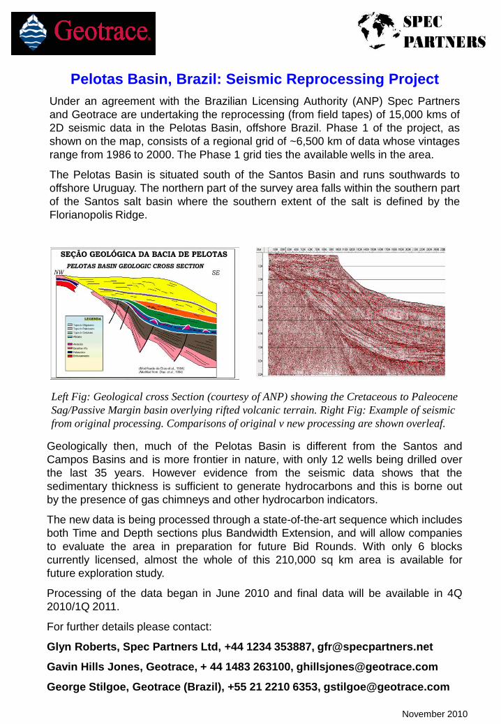
Left Fig: Geological cross Section (courtesy of ANP) showing the Cretaceous to Paleocene
Sag/Passive Margin basin overlying rifted volcanic terrain. Right Fig: Example of seismic
from original processing. Comparisons of original v new processing are shown overleaf.
November 2010
Page 3
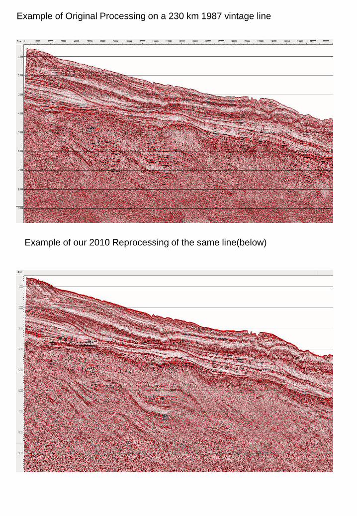
Example of Original Processing on a 230 km 1987 vintage line
Example of our 2010 Reprocessing of the same line(below)
Page 4
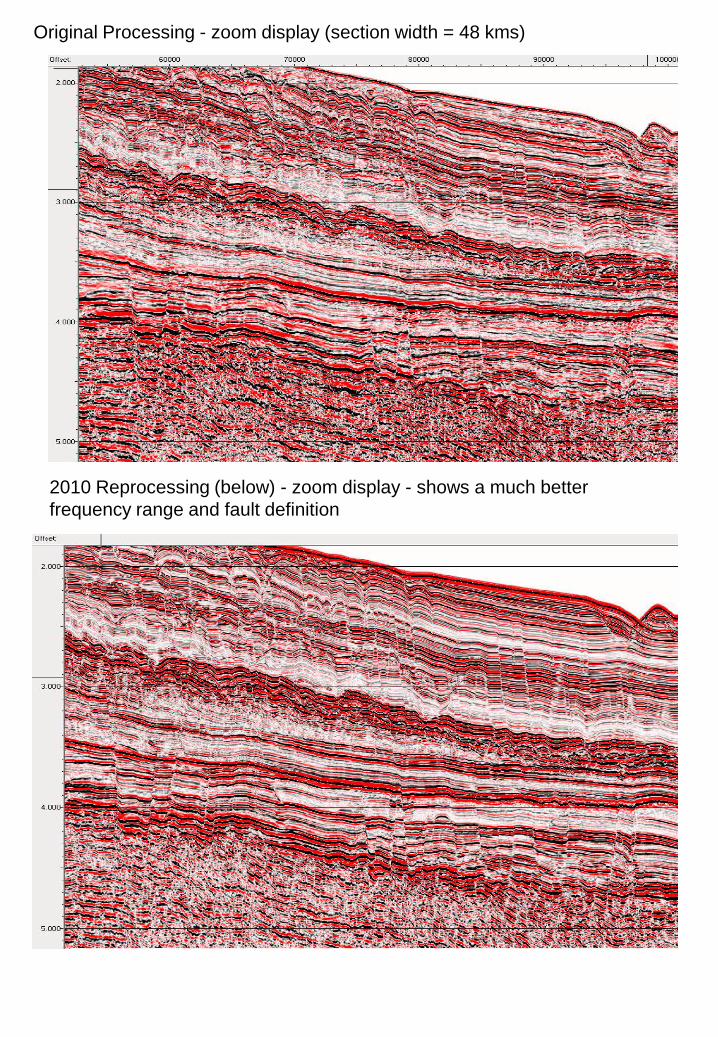
Original Processing - zoom display (section width = 48 kms)
2010 Reprocessing (below) - zoom display - shows a much better
frequency range and fault definition