30
Pengantar Kegempaan Geoteknik (Geotechnical Earthquake Engineering) Dr.Eng. Agus S. Muntohar Program Teknik Sipil – FT UMY 1 Pertemuan ke-12: 1-6 Juni 2015

Pengantar Kegempaan Geoteknik (Geotechnical Earthquake Engineering) Dr.Eng. Agus S. Muntohar Program Teknik Sipil – FT UMY
1
Pertemuan ke-12: 1-6 Juni 2015

2
3
4

Kegempaan Geoteknik berkaitan
dengan :
• Penentuan gerakan permukaan tanah (ground motions) –
terutama pengaruh kondisi lokal tanah.
• Likuifaksi (Liquefaction) dan bahaya ikutannya (penurunan,
gerakan tanah lateral, dll.)
• Evaluasi gerakan tanah pada lereng
• Bendungan/embankments
• Desain struktur penahan tanah
• Analisis fondasi
• Struktur bawah permukaan tanah (Underground structures)
: terowongan, dll.) 5

Buku Acuan :
• Kramer, S.L. (1996) Geotechnical Earthquake Engineering,
Prentice Hall
6

Gedung runtuh

Struktut lantai dasar yang lemah (Soft first story)
Loma Prieta earthquake damage in San Francisco. The soft first story is due to construction of garages in the first story and resultant
reduction in shear strength. (Photo from: http://earthquake.usgs.gov/bytopic/photos.html)
On October 17, 1989, at 5:04:15 p.m. (P.d.t.), a magnitude 6.9 (moment magnitude; surface-wave magnitude, 7.1)

Sambungan fondasi yang tidak memadai
House shifted off its foundation, Northridge earthquake.
(Photo from: Dewey, J.W., Intensities and isoseismals, Earthquakes and Volcanoes, Vol. 25, No. 2, 85-93, 1994)

Foundation and column of a dwelling at the long-bean-shaped hill
(Kashmir October 8, 2005)
Keruntuhan pilar jembatan

Suspension Bridge in Balakot (Kashmir October 8, 2005)
Right Abutment Moved Downstream

Keruntuhan akibat likufaksi
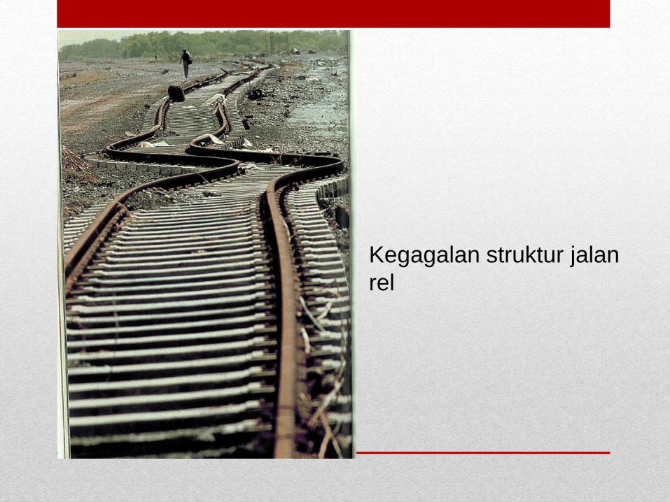
Kegagalan struktur jalan
rel

Pergerakan tanah pada lereng

Nishinomia Bridge 1995 Kobe earthquake, Japan
Likuifkasi

Sand blow in mud flats used for salt production southwest of Kandla Port, Gujarat
Sand boiling selama gempa
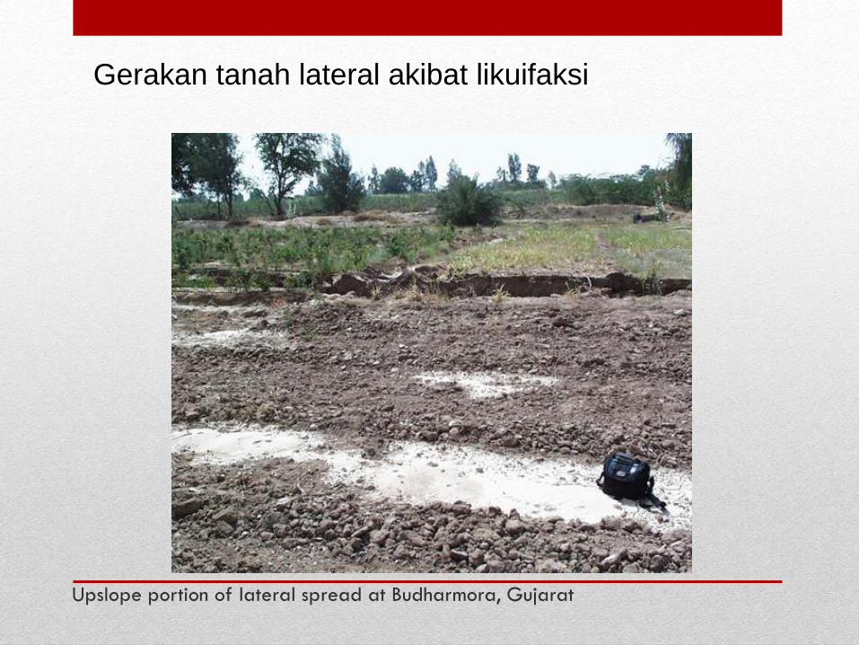
Upslope portion of lateral spread at Budharmora, Gujarat
Gerakan tanah lateral akibat likuifaksi

Cracked Highway, Alaska, 1964
Lateral spreading in the soil beneath embankment causes the
embankment to be pulled apart, producing the large crack down the
center of the road.

Liquefied soil exerts higher pressure on retaining
walls,which can cause them to tilt or slide.

Increased water pressure causes collapse of
dams

Pengukuran Magnitudo
Gempa 21

How Richter magnitude (ML) was
measured
ML = log10 of the maximum ground motion (in millimeters) recorded on a
Wood-Anderson short-period seismometer 100 km from the earthquake

Source Study of the 1906 San Francisco Earthquake by David J. Wald David J. Wald, Hiroo Kanamori and Donald V. Helmberger
Bull. Seism. Soc. Am., 83, 981-1019, 1993

Other magnitude scales
Magnitude Symbol Wave
Local (Richter) ML S or Surface Wave*
Body-Wave mb P
Surface-Wave Ms Rayleigh
Moment Mw Rupture Area, Slip

Moment Magnitude - Mw
• Mw = (2/3)log10Mo – 10.7
• Mo = Seismic Moment
Mo = μAu
o μ = shear modulus (typically 30 x 109 N/m2 or 30 x 1010
dyne/cm2)
o A = area of fault rupture
o u =average displacement along fault
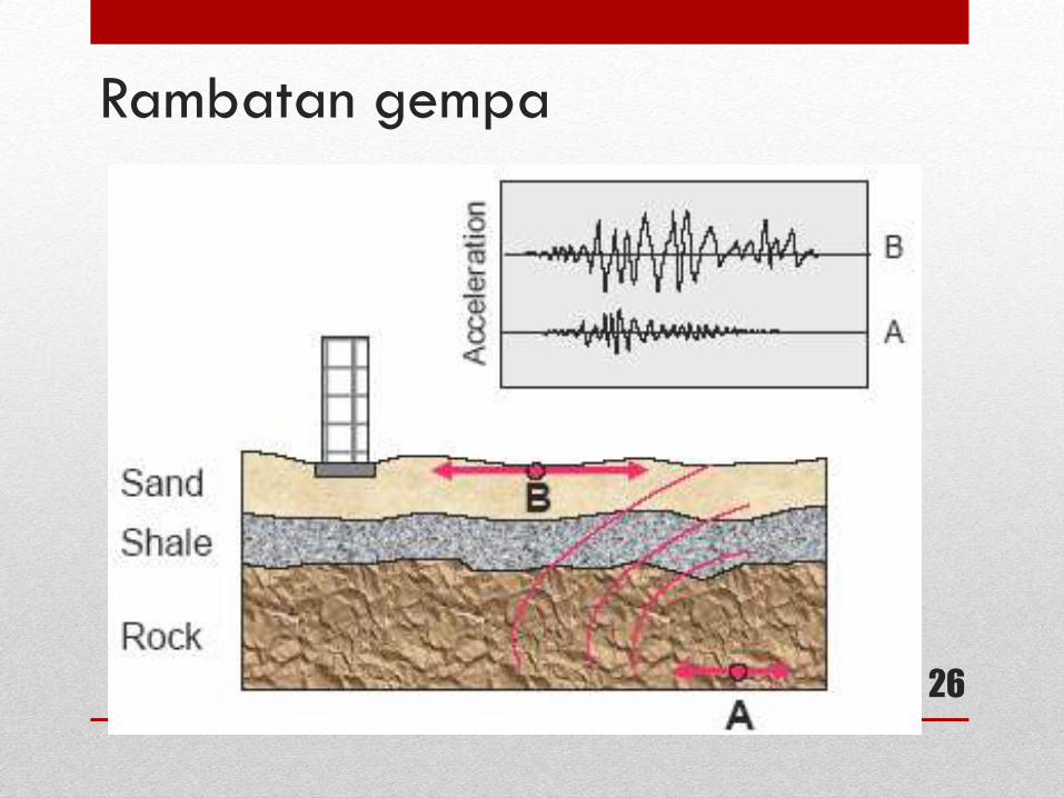
Rambatan gempa
26

Konservasi energi menyeabkan amplifikasi gerakan
permukaan tanah
27

Definisi amplifikasi
28

SNI 1726-2012 Klasifikasi Situs Untuk Desain Seismik
29

30


