https://youtu.be/crHD68gzCNw
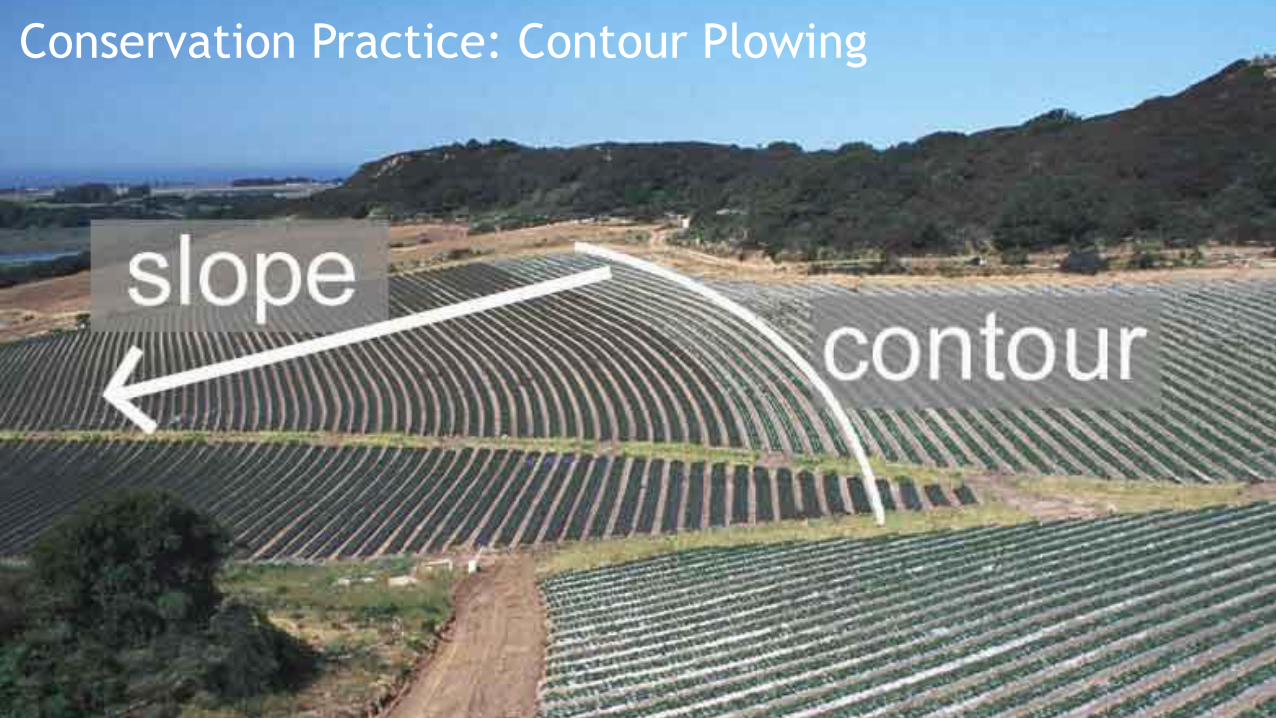
Conservation Practice: Contour Plowing
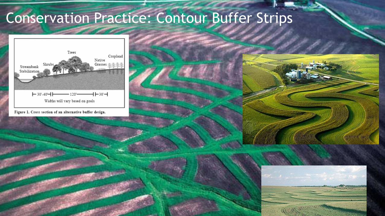
Conservation Practice: Contour Buffer Strips
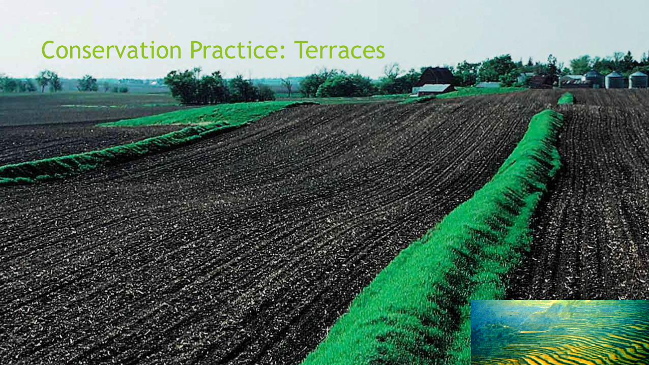
Conservation Practice: Terraces
http://www.agrentools.com/blog/
Introduction to ArcGIS - nezpercegis.org · Introduction to ArcGIS Using ESRI ArcView 10.1 and VT GIS Data VCGI July 2013
Documents
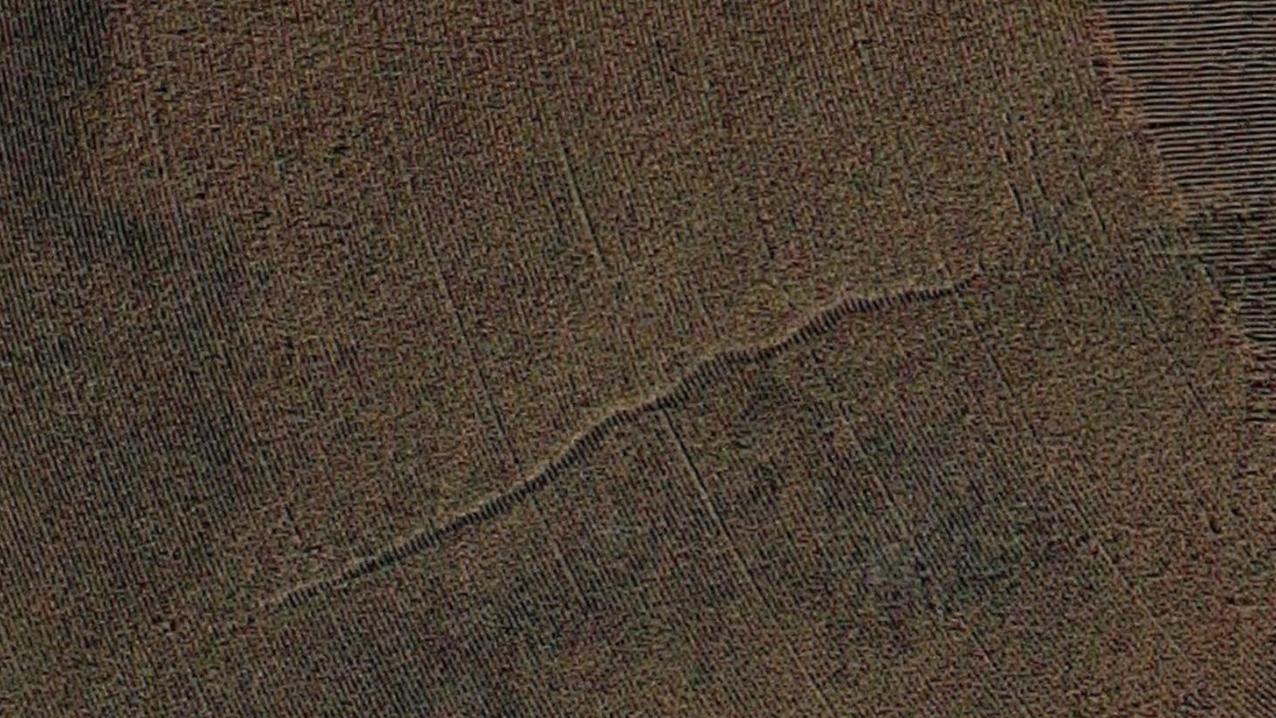
Act 64 Implementation: Draft Required Agricultural Practice ......a particular soil. RUSLE2 • Field born gully erosion will be managed through appropriate BMP. • Annual croplands
State of Vermont Agency of Administration Location Strategyvcgi.vermont.gov/sites/vcgi/files/aboutvcgi/egc/publications... · State of Vermont - Location Strategy iii ... basic mapping
Conservation Planning and Regulatory Compliance Handbook€¦ · The conservation plan case file and the copy provided to the customer will contain RUSLE2 plan and management view
The application of the Revised Universal Soil Loss ... · The Revised Universal Soil Loss Equation, Version 2 (RUSLE2), provides robust ... Recent RUSLE2 enhancements allow estimation
Vermont Center For Geographic Information, Inc. (VCGI)...Feb 11, 2014 · Carr of Brandon Cross of Winooski Dickinson of St. Albans Town Kupersmith of South Burlington, Clerk Ralston
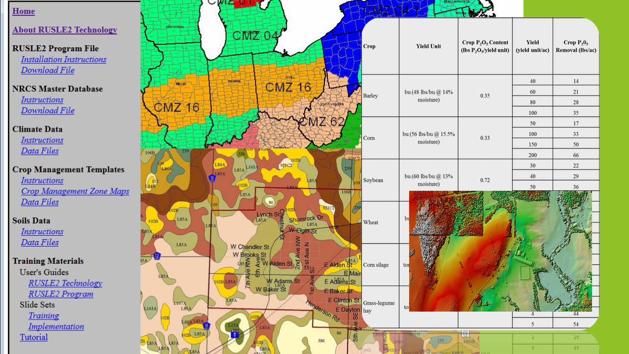
RUSLE2 User Ref Guide
1Updated February 2015 RUSLE 2 Database Management Linda Scheffe, NSSC Agronomist (NRCS RUSLE2 database manager) Linda Scheffe, NSSC Agronomist (NRCS RUSLE2.
RUSLE2 - Instructions & User Guide - USDA
N Leaching Index RUSLE2 instructions
RUSLE2 Users Guide€¦ · RUSLE2 Users Guide South Dakota ... Scroll down the list of User Templates and select NRCS ... (CMZ)* that the slope occurs in. *South Dakota has 4 CMZs
1 RUSLE 2 Wisconsin Website da.gov/technical/cons plan/rusle Judy Derricks-WI RUSLE2 MANAGER.
Idaho RUSLE2 · Web view2006/12/23 · In doing so, this facilitates incorporating the Soil Conditioning Index into the Revised Universal Soil Loss Equation, Version 2 (RUSLE2),
1 RUSLE2 Users Guide South Dakota September 2004.
REVISED UNIVERSAL SOIL LOSS EQUATION-Version 2 Predicting Soil Erosion By Water: A Guide to Conservation Planning RUSLE2.
Chapter 9: Creating Map Layouts- Printing, Publishing to ...vcgi.vermont.gov/sites/vcgi/files/training/chapter_9.pdf · Chapter 9 Page 131 Intro to GIS, VT Geo. Data, and QGIS (2017)
Using RUSLE2 to Determine Sediment Basin Size€¦ · RUSLE2 was run using the survey data as well as the plans at both the clearing and grubbing phase (natural topography) and the
GIS Smartphone Apps - Welcome to VCGI's Web Page | …vcgi.vermont.gov/sites/vcgi/files/event_archive/GCS Research... · Vermont Parcel App • Google Android ... –open source mobile