37
PROPOSED WINDSOR BRIDGE REPLACEMENT WINDSOR, NSW MARITIME A RCHAEOLOGICAL S TATEMENT OF HERITAGE I MPACT Final Working Paper Report October 2012 Windsor NSW

PROPOSED WINDSOR BRIDGE
REPLACEMENT WINDSOR, NSW
MARITIME ARCHAEOLOGICAL
STATEMENT OF HERITAGE IMPACT
Final Working Paper Report
October 2012
Windsor
NSW

Windsor Bridge � Maritime Archaeological Statement of Heritage Impact
Cosmos Archaeology Pty Ltd
Proposed Windsor Bridge Replacement: Maritime Archaeological
Statement of Heritage Impact
Windsor, NSW
Final Working Paper REPORT
Prepared for:
Roads and Maritime Services NSW (RMS)
By:
Chris Lewczak
October 2012
J12_06
Cover Image: “Wharf at Windsor on the Hawkesbury River near Windsor Bridge” (ca.1890 to ca.1900). The photograph shows the wharf, including the closely spaced piles (Source: Hawkesbury City Council Library Service).

Windsor Bridge � Maritime Archaeological Statement of Heritage Impact
Cosmos Archaeology Pty Ltd
i
Executive Summary
The Roads and Maritime Services NSW (RMS) is seeking approval to construct a new bridge
across the Hawkesbury River at Windsor approximately 35 m downstream from the current
bridge. Cosmos Archaeology has been engaged by RMS to prepare a statement of heritage
impact for the project for impacts to known and potential maritime archaeological relics within
the project area.
Cosmos Archaeology has previously undertaken two assessments for the preliminary
investigation works associated with the project. In 2008�09 Cosmos Archaeology undertook a
maritime archaeological survey on the site of the known location of a wharf built in ca.1814 on
the southern band of the river, to the east of the current Windsor Bridge. Archaeological
remains associated with the former wharf were found to be present on the site.
In May 2012 Cosmos Archaeology also undertook a desktop maritime archaeological
assessment to assess the potential for maritime archaeological remains to be present within
the project area, and prepare a significance assessment of the archaeological relics. The
assessment found that there was high archaeological potential within and immediately adjacent
to the known archaeological remains associated with the wharf constructed in ca.1814. It also
identified that these remains are considered to be of State significance. The assessment found
that limited archaeological remains are likely to exist associated with a former punt crossing
that operated in a similar location from ca.1810. The remains were assessed as being limited
to the northern landing location, and being of local significance.
This assessment has found that:
Historical findings
• A wharf was first constructed at the initial settlement at Windsor in 1795.
• The wharf supplied the early store and military garrison and also provided transportation
for crops from the surrounding farms.
• A second wharf was built at Windsor in ca.1814 and repaired in 1820 under the
direction of Governor Macquarie.
• A private punt service also started in 1815 using the wharf as the southern landing.
• In 1832 the punt was taken over and operated by the Government.
• In c.1835 the location of the punt moved upstream and a cabling system was installed
for the crossing.
• The bridge across the Hawkesbury River was built in 1874 with the punt service ceasing
soon after.
• A temporary bridge was constructed in 1896 for the raising of the main bridge across
the Hawkesbury River.
• The temporary bridge was built in six weeks, although, no other details relating to the
location of the bridge is known. It is believed to be located on the upstream side of the
current bridge.
• The second wharf was present on the site until the late 1930s or early 1940s.

Windsor Bridge � Maritime Archaeological Statement of Heritage Impact
Cosmos Archaeology Pty Ltd
ii
Archaeological Investigations and archaeological potential
• A maritime archaeological survey on the site of the former wharf identified above and
below water structural remains present on the site in situ.
• The archaeological potential at the wharf site is considered to be high in the location of
the rock ballast, and moderate for an area up to 5 m around the boundary of the ballast.
• There is likely to be structural remains associated with the wharf and artefact deposits
associated with the functioning of the structure, located behind the southern riverbank.
• There is considered to be moderate potential for archaeological remains associated with
the punt landing on the northern side of the river on the upstream side of the current
bridge associated with the relocation of the punt service in ca.1835; but a low
archaeological potential along the route of the punt across the river;
• A second maritime archaeological survey was conducted in 2012 on seven anomalies
identified from a side scan sonar survey of the project area and the post 1835 southern
punt landing;
• The survey located timber structural remains located on the northern side of the river,
close to the bank on the eastern (downstream) side of the current bridge location,
possibly relating ca.1950 mooring posts or a retaining wall built in the area;
• The timber remains are not considered to have archaeological or research value;
• Four other anomalies within the river were surveyed and were either found to be sterile
or continuing modern material;
• A natural sandstone rock shelf was located in the location of the southern punt landing
location. This shelf was located 15 m into the river and was not considered to be part of
the landing area.
Heritage significance
• The archaeological remains associated with the former ca.1814 wharf have been
assessed as being of State significance.
• The significance of the archaeological remains associated with the former punt has
been assessed as being of local significance.
Impact Assessment
• The project would have both a direct and indirect impact on known and potential
archaeological remains associated with the former wharves and punt crossing from the
placement of in�water piers and retaining walls.
• Redesigning elements of the bridge that would allow for the retention and protection of
the known and potential archaeological remains has been investigated; however,
impacts cannot be avoided.
Based on an understanding of the development history of Windsor, the stratigraphy of the river
sediment and previous maritime archaeological surveys completed in the vicinity of the former
wharf site, the following actions are recommended to progress the maritime archaeological
cultural heritage component of the project.

Windsor Bridge � Maritime Archaeological Statement of Heritage Impact
Cosmos Archaeology Pty Ltd
iii
Recommendation 1
An above and below water maritime archaeological salvage excavation should be undertaken
within the area assessed to have high archaeological potential relating to the remains
associated with the former ca.1814 wharf. This includes the area immediately behind the
southern bank of the river that may contain land ties (also known as deadman anchors) and
other structural remains.
As the project is being assessed under Section 5.1 of the EP&A Act, no permits under the NSW
Heritage Act (1979) are required for the project. The excavation should, however, be
conducted by a qualified maritime archaeologist after the preparation of a research design.
The research design should include, as a minimum, an excavation methodology, research
questions and provisions for an artefact analysis at the conclusion of the excavation phase of
the project.
Excavation and other on6site investigation should be coordinated with the Aboriginal and non6
Aboriginal archaeological investigations as part of a single coordinated process of examining
the human history of Windsor.
An archaeological excavation report should be prepared at the conclusion of the excavation,
and the report submitted to the Office of Environment and Heritage for their records.
The results of the excavation and artefact analysis should be used in on6site interpretation of
the maritime history and heritage of the Windsor area, where appropriate.
Recommendation 2
Archaeological monitoring works should be undertaken as part of the early site works on the
northern side of the existing bridge in the general location of the northern punt landing. This
archaeological monitoring should occur during early site preparation works to record any
remaining archaeological remains, relics or landscape features that remain of the former
crossing.
This work should be done by a qualified archaeologist and an archaeological monitoring report
should be prepared at the end of the monitoring works and submitted to the Office of
Environment and Heritage for their records.

Windsor Bridge � Maritime Archaeological Statement of Heritage Impact
Cosmos Archaeology Pty Ltd
iv
TABLE OF CONTENTS
1.0 INTRODUCTION ................................................................................................... 5
1.1 Background .................................................................................................................................... 5
1.2 The Study Area .............................................................................................................................. 6
1.3 Description of the Project .............................................................................................................. 6
1.4 Objectives of the Study .................................................................................................................. 8
1.5 Method of Approach ...................................................................................................................... 8
1.6 Abbreviations Used........................................................................................................................ 9
2.0 STATUTORY REQUIREMENTS ......................................................................... 12
2.1 Introduction .................................................................................................................................. 12
2.2 Environmental Planning and Assessment Act 1979 .................................................................... 12
2.2.1 Director Generals Requirements ......................................................................................... 12
2.3 Commonwealth Heritage Act ....................................................................................................... 13
2.4 NSW Heritage Act 1977 .............................................................................................................. 14
2.4.1 Roads and Maritime Services s170 Heritage and Conservation Register .......................... 14
2.4.2 Hawkesbury City Council Local Environmental Plan (Draft 2011) ...................................... 14
3.0 HISTORICAL OVERVIEW AND ANALYSIS ........................................................ 16
4.0 MARITIME ARCHAEOLOGICAL SURVEY WORK ........................................................... 36
4.1 Maritime Archaeological Survey (Cosmos Archaeology 2009) ................................................... 36
4.2 Side Scan Sonar Survey .................................................................................................................. 47
4.3 Maritime Archaeological Underwater Survey (2012) ................................................................... 54
4.3.1 Recording Process .............................................................................................................. 54
4.3.2 Findings ............................................................................................................................... 55
4.3.3 Summary ............................................................................................................................. 60
5.1 Historical and Present River Depths and Geology ...................................................................... 62
5.1.1 River Depths ........................................................................................................................ 62
5.1.2 Geo6technical Data .............................................................................................................. 65
5.2 Comparative Analysis .................................................................................................................. 68
5.2.1 Heart of the River, Bremer River, Ipswich Queensland (2006) ........................................... 68
5.2.2 Echuca Wharf Maritime Archaeological Test Excavation, Echuca Victoria (2011) ............. 70
5.2.3 Summary ............................................................................................................................. 72
5.3 Archaeological Potential .............................................................................................................. 73
5.3.1 Wharf (Submerged) ............................................................................................................. 73
5.3.2 Wharf (Terrestrial) ................................................................................................................ 74
5.3.3 Punt ...................................................................................................................................... 74
5.3.4 Northern Side of the River downstream of Bridge ............................................................... 75
6.0 ASSESSMENT OF SIGNIFICANCE .................................................................... 77
6.1 Introduction .................................................................................................................................. 77
6.2 Evaluation .................................................................................................................................... 77
6.2.1 Windsor Wharf (1795 – ca. 1800 and ca. 1814 – ca. 1940) ....................................................... 78
6.2.2 Punt Crossing ............................................................................................................................. 80
7.0 IMPACT ASSESSMENT .......................................................................................... 83
7.1 Potential Impact ........................................................................................................................... 89
7.2 New Bridge Crossing ........................................................................................................................ 94
7.3 Punt Crossing ................................................................................................................................... 96
8.0 SUMMARY AND RECOMMENDATIONS ........................................................................ 98
8.1 Summary ..................................................................................................................................... 98
8.2 Recommendations ....................................................................................................................... 99
REFERENCES ................................................................................................................ 101

Windsor Bridge � Maritime Archaeological Statement of Heritage Impact
Cosmos Archaeology Pty Ltd
5
1.0 INTRODUCTION
1.1 Background
The NSW Roads and Maritime Services (RMS) is seeking approval to construct a
replacement bridge over the Hawkesbury River at Windsor, approximately 35 m
downstream of the existing bridge and undertake associated road improvement and
landscaping (known for this report as “the project”). The project includes:
• Construction of a replacement bridge over the Hawkesbury River at Windsor,
around 35 metres downstream of the existing Windsor bridge.
• Reconstruction and upgrading of existing intersections and bridge approach roads
to accommodate the replacement bridge, including:
− Removal of the existing roundabout and installation of traffic signals at the
intersection of George and Bridge Streets.
− Construction of a new dual lane roundabout at the intersection of
Freemans Reach Road, Wilberforce Road, northern bridge approach road
and the access road to Macquarie Park. All roads serviced by the new
roundabout would require minor realignments.
− Realignment of the southern and northern bridge approach roads. The
new southern bridge approach road would generally follow the alignment
of Old Bridge Street along the eastern side of Thompson Square. The
northern bridge approach road would be a new road connecting the bridge
to the new dual lane roundabout.
• Construction of a shared pedestrian/cycle pathway for access to and across the
replacement bridge.
• Removal of the existing bridge approach roads and then backfilling, rehabilitating
and landscaping these areas.
• Demolition of the existing Windsor Bridge including piers and abutments.
• Landscaping works within Thompson Square parkland and adjacent to the northern
intersection of Bridge Street, Wilberforce Road, Freemans Reach Road and the
access road to Macquarie Park.
• Redevelopment of part of The Terrace to provide continuous access along the
southern bank of the river and under the replacement bridge to Windsor Wharf.
• Construction of scour protection works on the southern and northern banks and
around three bridge piers.
• Construction of a permanent water quality basin to capture and treat stormwater
runoff from the bridge and northern intersection prior to stormwater being
discharged to the Hawkesbury River.
• Architectural treatments for noise mitigation, as required, where feasible and
reasonable and in agreement with affected property owners.
• Ancillary works including:

Windsor Bridge � Maritime Archaeological Statement of Heritage Impact
Cosmos Archaeology Pty Ltd
6
− Adjustment, relocation and/or protection of utilities and services, as
required.
− Construction and operation of temporary construction, stockpiling and
compound sites.
Cosmos Archaeology has previously undertaken two assessments for the preliminary
investigation works associated with the project. In 2008�09 Cosmos Archaeology
undertook a maritime archaeological survey on the site of the known location of a wharf
built in ca.1814 on the southern bank of the river, to the east of the current Windsor
Bridge. Archaeological remains associated with the former wharf were found to be
present on the site.
In May 2012 Cosmos Archaeology also undertook a desktop maritime archaeological
assessment to assess the potential for maritime archaeological remains to be present
within the project area, and prepared a significance assessment of the archaeological
relics. The assessment found that there was high archaeological potential within and
immediately adjacent to the known archaeological remains associated with the wharf
constructed in ca.1814. It also identified that these remains are considered to be of
State significance. The assessment found that limited archaeological remains are
likely to exist associated with a former punt crossing that operated in a similar location
from ca.1815. The remains were assessed as being limited to the northern landing
location, and of local significance.
Cosmos Archaeology has since been engaged to prepare a statement of heritage
impact (SoHI) for the maritime archaeological components of the project. Biosis
Research has been engaged to prepare a SoHI report for the terrestrial built heritage
and historical archaeological potential for the project. Kelleher Nightingale Consulting
has been engaged to prepare the Aboriginal heritage report for the project. Both of
these reports are being prepared separately.
1.2 The Study Area
The study area for this assessment is the proposed corridor for the new bridge across
the Hawkesbury River at Windsor (Figure 1). The study area for this assessment has
primarily been the river sections of the proposed building corridor; however, the
assessment has extended to the banks of the river where maritime infrastructure was
present.
1.3 Description of the Project
Overview The project would comprise:
• Construction of a replacement bridge over the Hawkesbury River at Windsor,
around 35 metres downstream of the existing Windsor bridge.
• Reconstruction and upgrading of existing intersections and bridge approach roads
to accommodate the replacement bridge, including:

Windsor Bridge � Maritime Archaeological Statement of Heritage Impact
Cosmos Archaeology Pty Ltd
7
• Removal of the existing roundabout and installation of traffic signals at the
intersection of George and Bridge Streets.
• Construction of a new dual lane roundabout at the intersection of Freemans
Reach Road, Wilberforce Road, northern bridge approach road and the access
road to Macquarie Park. All roads serviced by the new roundabout would require
minor realignments.
• Realignment of the southern and northern bridge approach roads. The new
southern bridge approach road would generally follow the alignment of Old
Bridge Street along the eastern side of Thompson Square. The northern bridge
approach road would be a new road connecting the bridge to the new dual lane
roundabout.
• Construction of a shared pedestrian/cycle pathway for access to and across the
replacement bridge.
• Removal of the existing bridge approach roads and then backfilling, rehabilitating
and landscaping these areas.
• Demolition of the existing Windsor Bridge including piers and abutments.
• Landscaping works within Thompson Square parkland and adjacent to the northern
intersection of Bridge Street, Wilberforce Road, Freemans Reach Road and the
access road to Macquarie Park.
• Redevelopment of part of The Terrace to provide continuous access along the
southern bank of the river and under the replacement bridge to Windsor Wharf.
• Construction of scour protection works on the southern and northern banks and
around three bridge piers.
• Construction of a permanent water quality basin to capture and treat stormwater
runoff from the bridge and northern intersection prior to stormwater being
discharged to the Hawkesbury River.
• Architectural treatments for noise mitigation, as required, where feasible and
reasonable and in agreement with affected property owners.
• Ancillary works including:
• Adjustment, relocation and/or protection of utilities and services, as required.
• Construction and operation of temporary construction, stockpiling and compound
sites.
In Figure 1 the main elements of the project are shown including the construction zone and project boundary. In addition to the above�listed work elements, early works for further identification, salvage, recording and protection of Aboriginal and non�Aboriginal heritage, would be carried out as part of impact mitigation for the project. These early works would include:

Windsor Bridge � Maritime Archaeological Statement of Heritage Impact
Cosmos Archaeology Pty Ltd
8
• Salvage excavation at identified Aboriginal heritage sites on the southern bank of
the river in accordance with the procedures identified in the Aboriginal heritage
chapter of the Environmental Impact Statement for the project.
• Recording and protection of historic heritage in accordance with the procedures
identified in the historic heritage chapter of the Environmental Impact Statement for
the project.
Specific details regarding each component of the project is outlined in Section 7.1 of
this report.
1.4 Objectives of the Study
The key objective of this maritime archaeological SoHI report is to: Prepare a Statement of Heritage Impact for the impacts that the project would have on known and potential maritime archaeological remains.
1.5 Method of Approach
This maritime archaeological SoHI has been conducted in the following manner:
1. Review relevant statutory and non6statutory heritage listings
A review of cultural heritage registers and state and local environmental planning policies was undertaken. A summary of the relevant statutory and non�statutory instruments is presented in Section 2.0. The heritage register listing status of the maritime components for this project has been presented for all registers and can also be found within Section 2.0.
2. Review current and previously completed historical and archaeological
assessments at Windsor
A review of the previously completed maritime and historical archaeological and built heritage assessments has been completed to understand the construction history of Windsor. This has included reviewing the current archaeological and built heritage assessment being undertaken by Biosis Research for this project.1
3. Site inspection and current site configuration
Cosmos Archaeology undertook an underwater site inspection of two localities associated with the project in December 2008. This inspection will be used in this report. A side scan sonar survey of the river was prepared by RMS in June 2012 and has been used in this report. No further site inspections were carried out for this SoHI.
1 Biosis Research Pty Ltd in association with Cultural Resources Management, (August 2012) Windsor
Bridge Replacement Project: Non6Aboriginal Heritage Report and Statement of Heritage Impact. Report prepared for the RMS.

Windsor Bridge � Maritime Archaeological Statement of Heritage Impact
Cosmos Archaeology Pty Ltd
9
4. Significance assessment
A significance assessment has previously been prepared by Cosmos Archaeology for all known and potential archaeological remains within the maritime archaeological boundary of the study area.2 This significance assessment has been updated and is presented in Section 6.0 of this report.
5. Prepare a Statement of Heritage Impact
The SoHI is presented in Section 7.0 in accordance with the guidelines set out in the NSW Heritage Office publication Statements of Heritage Impact.3
6. Provide recommendations aimed to avoid, minimise or mitigate against impacts
to the identified cultural heritage values identified within the project area.
Based on the findings of the impact assessment, a series of recommendations have been devised which aim to avoid, minimise or mitigate adverse impacts to the heritage significance of all known and potential maritime archaeological remains present within the study area. These recommendations are provided in Section 8.0.
1.6 Abbreviations Used
cm Centimetre
EPBC Environment Protection and Biodiversity Conservation Act 1999
ft Feet
LEP Local Environmental Plan
LGA Local Government Area
m Metres
mm Millimetres
REP Regional Environmental Plan
RMS Roads and Maritime Services NSW
RTA Roads and Traffic Authority (NSW)
SEPP State Environment Planning Policy
SOHI Statement of Heritage Impact
SL State Library (NSW)
2 Cosmos Archaeology Pty Ltd, (May 2012) Proposed Windsor Bridge Replacement: Maritime
Archaeological Desktop Assessment, Windsor, NSW. Report prepared for the RMS. 3 NSW Heritage Office & Department of Urban Affairs & Planning (2002) NSW Heritage Manual –
Statements of Heritage Impact.

Windsor Bridge � Maritime Archaeological Statement of Heritage Impact
Cosmos Archaeology Pty Ltd
10
Figure 1: Project Study area outlined in pink (Source: SKM).)

Windsor Bridge � Maritime Archaeological Statement of Heritage Impact
Cosmos Archaeology Pty Ltd
11
Figure 2: Design of the new bridge crossing at Windsor Bridge (Source SKM Plan number DS2012/000155).)

Windsor Bridge � Maritime Archaeological Statement of Heritage Impact
Cosmos Archaeology Pty Ltd
12
2.0 STATUTORY REQUIREMENTS
2.1 Introduction
In NSW heritage protection stems from the NSW Heritage Act 1977, the NSW Environmental Planning and Assessment Act 1979 (EP&A Act) and the Commonwealth Environment Protection and Biodiversity Conservation Act 1999 (EPBC Act).
2.2 Environmental Planning and Assessment Act 1979
The EP&A Act establishes the framework for cultural heritage values to be formally assessed in the land use planning and development assessment process. The Act requires that environmental impacts, including those to cultural heritage items and places, are considered prior to land development.
The project would be assessed under Part 5.1 of the EP&A Act.
Under Part 5.1 certain approvals are not required for a State significant infrastructure project. Those relevant to maritime heritage include:
(c) an approval under Part 4, or an excavation permit under section 139, of the Heritage Act 1977 ,
(d) an Aboriginal heritage impact permit under section 90 of the National Parks and Wildlife Act 1974 ,
(EP&A Act 1979 Part 5.1 S.115ZG)
This provision does not mean that the relevant heritage or archaeological assessments are not undertaken, however, heritage assessments and consultation are undertaken based on the direction of the Director General’s requirements (DGRs).
2.2.1 Director Generals Requirements
The DGRs for the project for the non�Aboriginal maritime heritage component require:
Impacts to State and local historic heritage (including archaeology, heritage items and conservation areas), in particular, impacts on the Thompson Square Conservation Area, heritage listed buildings and sites in the Thompson Square conservation area and the Windsor Bridge should be assessed.
Impacts to State and local historic heritage sites are identified in Section 3 and assessed in Section 7 in this report.
Where impacts to State or locally significant historic heritage items are identified, the assessment shall:
Outline the proposed mitigation and management measures (including measures to avoid significant impacts and an evaluation of the effectiveness of the mitigation measures) generally consistent with the guidelines in the NSW Heritage Manual (1996).
Sections 7 and 8 in this report.

Windsor Bridge � Maritime Archaeological Statement of Heritage Impact
Cosmos Archaeology Pty Ltd
13
Be undertaken by a suitably qualified heritage consultant(s) (note: where archaeological investigations are proposed the relevant consultant must meet the NSW Heritage Council’s Excavation Director criteria),
This assessment was prepared by Chris Lewczak, Senior Maritime Archaeologist, Cosmos Archaeology.
Include a statement of heritage impact for all heritage items (including significance assessment).
Section 6 in this report.
Consider impacts from vibration, demolition, archaeological disturbance, altered historical arrangements and access, landscape and vistas, and architectural noise treatment.
Sections 7 and 8 in this report.
Develop an appropriate archaeological assessment methodology, including research design, to guide physical archaeological test excavations (terrestrial and maritime) and include the results of these excavations;
Sections 4 and 5 in this report.
2.3 Commonwealth Heritage Act
Under the Environment Protection and Biodiversity Conservation Act 1999 (EPBC Act) proposed ‘actions’ that have the potential to significantly impact on matters of national environmental significance, the environment on Commonwealth land or that are being carried out by a Commonwealth agency must be referred to the Commonwealth Government. If the Commonwealth Minister for Sustainability, Environment, Water, Population and Communities determines that a referred project is a ‘controlled action’ under the EPBC Act, the approval of that minister would be required for the project in addition to the NSW Minister for Planning and Infrastructure’s approval.
Based on the results of the environmental investigations carried, including heritage, out for this project, the project would impact on the Thompson Square Precinct (hereafter referred to as the Thompson Square Conservation Area), which includes parts of the project area. This is the subject of an emergency listing request under the National Heritage List to the Commonwealth Minister for Sustainability, Environment, Water, Population and Communities. The Thompson Square Conservation Area has also been separately nominated for inclusion on the National Heritage List through standard annual nomination processes. These listings are currently under consideration by the Minister. Accordingly RMS would make a precautionary referral to the Australian Government to determine if the impacts of the project on Thompson Square constitute a controlled action under the EPBC Act.
The proposed emergency listing and the separate nomination for inclusion on the National Heritage List mentions the riverfront and the former wharves within the nomination, however, it is not clear if the nomination includes the river sections of the project.

Windsor Bridge � Maritime Archaeological Statement of Heritage Impact
Cosmos Archaeology Pty Ltd
14
2.4 NSW Heritage Act 1977
The NSW Heritage Act 1977 is the primary piece of State legislation affording protection to all items of environmental heritage (natural and cultural) in NSW, including places, buildings, works, relics and moveable objects identified as significant based on the heritage values outlined in the Australia International Council on Monuments and Sites Burra Charter. The State Heritage Register is a statutory list of places and items of State heritage significance. Under the NSW Heritage Act 1977, approval is required from the Heritage Council of NSW for works that result in the alteration or modification of items listed on this register.
RMS is seeking approval for the project under Part 5.1 of the EP&A Act. A number of approvals that generally apply under other NSW legislation are not required for a project approved under Part 5.1 of the EP&A Act (EP&A Act s.115ZG). Exemptions potentially relevant to the project include approvals under Part 4 and excavation permits under section 139 of the Heritage Act 1977. ;
The location of the former wharves and punt crossing across the Hawkesbury River at Windsor are not listed under the NSW Heritage Act 1977.
2.4.1 Roads and Maritime Services s170 Heritage and Conservation
Register
Under s170 of the NSW Heritage Act 1977, all State government agencies are required to identify and effectively manage heritage assets under their ownership and control. The RMS Heritage and Conservation Register has been established in accordance with this legal obligation to record all items of local or State heritage significance owned or under its control.
State government agencies must maintain the items listed on their individual Heritage and Conservation Registers with due diligence in accordance with State Owned Heritage Management Principles (2005).4
The archaeological remains of the former wharf and former location of the punt landings are not listed on the RMS s170 Heritage and Conservation Register.
The Hawkesbury River Bridge at Windsor is a listed heritage item on the RMS s170 Heritage and Conservation Register within the project study area.
2.4.2 Hawkesbury City Council Local Environmental Plan (Draft 2011)
The Hawkesbury City Council Local Environmental Plan (Draft) 2011 provides planning and development control for the entire Hawkesbury City Council local government area. Within the Hawkesbury City LEP 2011, heritage items are found in Schedule 5 (Environmental Heritage). All of the heritage items listed in Schedule 5 are usually directly subject to Clause 5.10 (1�10) regarding heritage conservation under Part 5 (Miscellaneous Provisions) of the LEP. Under the proposed planning approval for this project, however, the planning policies would not apply.
4 NSW Heritage Act 1977, Section 170A – Heritage Management by Government Instrumentalities.

Windsor Bridge � Maritime Archaeological Statement of Heritage Impact
Cosmos Archaeology Pty Ltd
15
For the purposes of this heritage report the LEP was searched to identify possible previously recorded archaeological and/or heritage items that are listed within the study area.
The former wharves and punt crossing at Windsor are not listed on Schedule 5 of the Hawkesbury City Council LEP.

Windsor Bridge � Maritime Archaeological Statement of Heritage Impact
Cosmos Archaeology Pty Ltd
16
3.0 HISTORICAL OVERVIEW AND ANALYSIS
A comprehensive history of the Windsor area has been compiled in the historical
archaeological assessment undertaken by Biosis Research Pty Ltd for this project.5
The history of the Windsor area will not be reiterated here in detail, however, aspects of
the development of the Windsor area will be summarised here. Specific attention has
been placed on the maritime archaeological infrastructure, function and development,
in relation to the development of Windsor.
Initial Settlement
Expansion of the early Sydney colony was needed soon after settlement as soils used
for farming around the colony were considered to be poor. Expansion of farming land
had resulted in settlement at Parramatta; however, further arable land was needed to
increase production for the growing settlement. Land grants in the greater Windsor
area began in 1794 with grants being made to James Ruse and Charles Williams with
15 farming allotments directly fronting the northern side of the Hawkesbury River in the
area of Wilberforce, with another seven land grants on one of the creeks further around
the river (Figure 3). By this time farms had already been established at Pitt Town, to
the northeast of the study area. Within five years of the establishment of this
settlement there were reportedly 600 persons living in the greater area, many of whom
were associated with farming, and the area was divided up into smaller agricultural
settlements.6
Figure 3: “A Plan of the first farms of the Hawkesbury River”, at the current site of Pitt Town. (Augustus Alt 1794). Source: Rosen 1995: 14).
5 Biosis Research Pty Ltd in association with Cultural Resources Management, (July 2012) Windsor
Bridge Replacement Project: Non6Aboriginal Heritage Report and Statement of Heritage Impact (DRAFT). Report prepared for RMS. 6 Biosis Research (March 2012) Research Design to Inform the Non6Aboriginal Heritage Assessment for
the Windsor Bridge Replacement Project. Report prepared for RMS.

Windsor Bridge � Maritime Archaeological Statement of Heritage Impact
Cosmos Archaeology Pty Ltd
17
Original wharf
In 1795 a store and military garrison were established further to the west of the original
land grants, in an area where it was recognised that boats could easily run up on the
bank of the river. The site of these two early buildings is believed to be within
Thompson Square, within the southern end of the study area. Included in the 1795
military garrison and store was the building of a wharf. Little is known about the
construction of the original wharf.
David Collins, lieutenant�governor of NSW visited the wharf after it was built on 21 May
1795. He noted in his journal that:
On the 21st the colonial schooner returned from the Hawkesbury,
bringing upwards of eleven hundred bushels of remarkably fine Indian
corn from the store there. The master again reported his apprehensions
that the navigation of the river would be obstructed by the settlers, who
continued the practice of falling and rolling trees into the streams. He
found five feet less water at the store6wharf than when he was there in
February last, owing to the dry weather which had for some time past
prevailed.7
It is believed the original wharf was later destroyed by a flood in ca.1799. There is no
mention from the historical record of the wharf being repaired or rebuilt at Windsor until
in 1812 with the construction of what is known as the second wharf. There were
several major flood events along the Hawkesbury River at Windsor after 1795, notably
1799, 1800 and 1806. It is possible that one of these events destroyed the original
wharf. The earliest paintings do not show the location of the original wharf on site. An
1807 painting from the site, which cannot be reproduced due to copyright issues, does
not show the original wharf. Evans’ 1809 watercolour of Windsor shows a boat
obscuring the believed location of the original wharf. Behind the boat is a track that
leads down the hill to this location which may have served as a track leading to the first
wharf (Figure 4).
With the loss of the wharf from the site, the settlement would have had to resort to
either constructing a new wharf or to using the beach area to run smaller boats up on
the shore to load and unload cargo. This method would have meant the smaller boats
would have transported the cargo to Sydney, or transport the cargo onto larger vessels
elsewhere in the river for shipment back to the main settlement.
It is difficult to imagine such an important settlement as Windsor to transport cargos to
the main Sydney settlement without a wharf being present. It is possible another wharf
may have been built somewhere along the southern side of the river, however, there is
no information from the historical record that mentions or shows a wharf was present
between the removal of the original wharf and the next wharf constructed in c.1814. A
painting from the site dated to 1807 shows a possible slipway to bemay have been
present on the eastern side adjoining Thompson Square. The later watercolour done
by Evans in 1809 does not show the same slipway feature, however, outlined remains
7 An Account of the English Colony in New South Wales, Vol. 1, :340.

Windsor Bridge � Maritime Archaeological Statement of Heritage Impact
Cosmos Archaeology Pty Ltd
18
of infrastructure shown in the 1807 watercolour can be seen (See Blue Arrow in Figure
4).
Figure 4: Detail of G.W.Evans watercolour of 1809 showing a boat obscuring the believed location of the original wharf and the track running down to it (red arrow). The possible outline
of a former slipway is outlined by the blue arrow (ML PXD 388 V3 f7).
Second Wharf
A survey of the township of Windsor in 1812 does not clearly define the location of a
wharf present on the southern side of the river, however, an anomaly is present on the
western side of Thompson square (Figure 5). The contract details for the construction
of the new wharf at Windsor in 1815 stated that “shall extend the width of the Square
on a line with the present Jetty or Wharf but three feet higher”.8 It has been speculated
that if the second wharf (built in ca.1814) was built to the east of the location of the first
wharf, the location of the second wharf would be in the general location of where it was
actually built and the anomaly present in Meehan’s 1812 plan may relate to the
remains of the first wharf present at the time of this survey. The limited remains of the
first wharf present at the time of Meehan’s survey may have been due to the wharf
having been previously damaged. Anecdotal evidence from the first contract in 1814 to
build a new wharf after the previous one had “washed away”.9
With the absence of the wharf from the settlement at Windsor, boats would have
returned to pulling up on the bank. There is no indication of a designated landing area
shown on any maps or paintings of the area from this time, and it is likely that boats
would have pulled up in an area where they could access the central township area.
8 Opp Cit., Biosis Research (August 2012).)
9 The Australian Almanac and General Directory 1835 : 227.

Windsor Bridge � Maritime Archaeological Statement of Heritage Impact
Cosmos Archaeology Pty Ltd
19
Figure 5: Detail from James Meehan’s survey of 1812 with possible indication of the wharf (SRO Map SZ 529).
Macquarie Era
Windsor was one of five towns in the Hawkesbury–Nepean district named and greatly
influenced in their plan and appearance by Governor Macquarie. The formation of
these towns was done so to establish the administrative, government, civil and
religious services required to assist with the establishment of the settlement.10 Windsor
was unique from the other four towns as there was already an established settlement
at the site. Part of the formation of these towns was the establishment of a town grid
system that included a central square where government buildings, including a church,
school, gaol and guardhouse would be located. Windsor already had these buildings
established when the town plan was drawn in 1812. Notably absent from the design
was a design location for a new wharf.
Six months earlier a contract announcement was published in the Sydney Gazette for
the construction of a new road to Windsor, bridge at South Creek and a wharf at
Windsor. Appearing on 29 June 1811, the details included:
“Any Person willing to contract for finding Materials and building a
substantial Bridge over South Creek, facing the Town of Windsor, to be
16 feet wide, level with the Banks, and about 120 feet over, including the
Wharfs, to be well planked and piled, are desired to send Proposals and
Plan to Captain Antill, at Government House, Sydney; or to Mr. John
Howe, at Windsor, on or before 26th July next.”
10 Biosis Research (March 2012): 35.

Windsor Bridge � Maritime Archaeological Statement of Heritage Impact
Cosmos Archaeology Pty Ltd
20
Between 1812 and 1813 buildings that were constructed in the period from 1795 to
around 1811 located within the proposed town square within the Macquarie town plan
for Windsor were progressively removed. This created the boundary for formalisation
for the current Thompson Square, which extended down to the river.11
Small cutters and sloops were the only means of transporting produce up and down the
Hawkesbury River. They were called the Mosquito Fleet due to their smaller size.12 On
the route between the Hawkesbury River and Sydney they risked wreckage, seizure by
convicts, being stolen from anchorages, and river floods.13 Rough sea conditions
between Broken Bay and Port Jackson could also devastate the small vessels. Any
loss of boat and produce was of great consequence to the colony as the people relied
on farmers for subsistence. In 1812 there were just over 100 voyages from the
Hawkesbury region to Sydney, involving 21 vessels making six or seven return trips..14
In 1814 the contract for the building of the bridge over South Creek and new wharf was
awarded to John Howe and James McGrath. The improvements were to include a
graded surface down from the government store, located in Thompson Square to the
wharf. A contract for the proposed works dated from 1814 describes the original
construction of the design of the wharf. The contract states:
“The front of the Square to be piled with sound piles from 16 to 18 inches thick to be from three to four feet apart in the (illegible) to be three feet above the Water Mark at Spring Tides (but in a line with it). Well capped and Secured by Land6Ties to extend from side line to side line of the Square to be planked on the Inside of the Piles and then filled up to the top.
“The Wharf to Commence from the Upper Side Line of the Square to Extend Eighteen feet from the above row of Piles which will be in deep water to extend fifty feet in length to be planked on the inside and filled up unless it should be thought best to plank the top and in that Case the same is to be planked and not filled up, the whole to be Capped and well secured by Land Ties as also to the Row of Piles in the Front of the Square”.15
Construction for this new wharf began in 1814 and was completed by 1815. Governor
Lachlan Macquarie described this new structure as:
“A Large substantial wooden wharf or quay Constructed in the Centre of Town on the right Bank of the River Hawkesbury for the convenience of Vessels and Boats, trading to Windsor, and at which Quay Vessels of 100 tons burthen can load their Cargoes”. 16
A second contract appears to have been prepared for the construction of either a
variation to, or extension of, the 1814�15 wharf. The contract requested:
“To erect a Wharf or Platform in the front of Thompson’s Square in the Town of Windsor in this Territory which shall extend the width of the
11 Biosis Research (March 2012):35. 12
Purtell, Jean. 1995 The Mosquito Fleet: Hawkesbury River Trade and Traders 179461994, 37. 13
Opp Cit., Purtell. 1995, 38. 14
Ibid., 40. 15
ML MSS 106 Article 37 8 August 1814. 16
HRA Series 1 Volume 10; 690�1.

Windsor Bridge � Maritime Archaeological Statement of Heritage Impact
Cosmos Archaeology Pty Ltd
21
Square on a line with the present Jetty or Wharf but three feet higher, the said wharf to be constructed to have two Rows of Piles without the present platform and one Row behind the whole to be secured with Land Ties and Caps and planked with sound two inch Planks, and not more than six inches wide to be spiked with five inch Spikes, and the whole of the Square to slope down from the Crown or Range on which His Majesty’s Store stands gradually to the point of the said platform, the Bank to the Westward of the New Wharf and adjoining to that point of the River where the Punt and Ferry Boats Land is to be cut away sufficiently wide to admit of carts turning at the Landing Place”.17
During these construction works in 1816 a flood occurred that caused damage to the
wharf. Macquarie wrote of the event on 14 November 1816:
“In consideration of the greater part of the Govt. Quay or Wharf already erected by the contractors having been carried away or destroyed by the late Floods of the Hawkesbury, I have this day agreed on an estimate made out and submitted to me by Mr. Greenway the Govt. Civil Architect of the additional Expense of repairing and Completing the same in solid and durable material (agreeably to a Plan thereof made out by Mr. Greenway), to allow and pay unto Messrs. Howe and McGrath the additional sum of Two Hundred and Twenty (including Twenty Pounds for Mr. Greenway's trouble in planning and directing the Work) Pounds Sterling; allowing them also for payment such Iron and Spike Nails from the stores as can be spared 6 with a carpenter and Pair of Sawyers off the store; the Contractors now engaging to complete the said Quay or Wharf in Eight months from this date.18
The wharf was later completed in 1820.
Windsor prospered as a busy port for small river craft. Goods were unloaded at the
wharf where most of the produce was to be transported by rail from Windsor to
Sydney.19 Cargoes included maize, poultry, watermelons, fruit, eggs, bark and gourds.
Windsor also developed a boatbuilding industry, as did Richmond and Pitt Town. The
Hawkesbury boats were smaller craft than those being built in Sydney, most being less
than 50 tons, but they were suited to the river trade. In 1826 the number of recorded
trips from Hawkesbury was only 26, involving six vessels, but this was due to a lack of
recording as so many vessels were trading that it became difficult to track.20
The first images that are available of the wharf date to ca.1818 and relate to either the
wharf during construction or from the damage that occurred to the wharf in 1816
(Figure 6). The engraving shown in Figure 6 is marked “W. Preston from an Original
Drawing by Cap.t Wallis” and may have originally been drawn in 1816 when the wharf
was damaged. This image is of interest as it appears to show the township of Windsor
high up on the bank on the left, a dilapidated jetty/wharf on the same side with a vessel
tied up alongside, a double ended poled vessel (the punt) with passengers crossing the
River and a road on the right side stopping at the river’s edge (the punt crossing). It
would appear that the punt crossing on the left (south bank) is obscured by the wharf.
17
ML MSS 106 Article 88 24 April 1815. 18 Diary Entry made by Lachlan Macquarie 14 November 1816 (in The Lachlan & Elizabeth Macquarie Archive [http://www.library.mq.edu.au/digital/lema/1816/1816nov.html#nov4]).]) 19
Opp Cit., Purtell. 1995, 48. 20
Ibid., 41.

Windsor Bridge � Maritime Archaeological Statement of Heritage Impact
Cosmos Archaeology Pty Ltd
22
Figure 6: A View of Hawkesbury, and the Blue Mountains. / New South Wales. c. 1818. Printed beneath the image is "Engrav'd by W. Preston from an Original Drawing by Cap.t Wallis.
46th Reg.t". A watercolor drawing titled "Hawkesbury & Blue Mountains, / from Windsor".
The next available image of the wharf is from a detailed plan survey of 1835 plan of the
township of Windsor showing the location and shape of the wharf. The plan shows the
wharf located on the eastern side of the “reserved area” (Thompson Square) (Figure
7). A plan of “Buildings and Cultivation adjoining the town of Windsor” was created in
1842. The plan shows the location of buildings, allotments, roads and the boundary of
the river in great detail, however, the wharf has not been included in the plan. A small
rectangle is drawn in the general area of the wharf and is marked “Punt”, with a road or
track leading to it (Figure 8). It is likely that the plan concentrated on the detail of the
arrangement of the allotments and buildings and terrestrial notaries, and that the
maritime infrastructure, namely the wharf, were not added in, or added later with lesser
detail.
Punt
A ferry/punt crossing was in operation at Windsor from the same time as the
construction of the ca. 1814�20 wharf. A punt crossing had previously been in
operation in 1810, with Governor Macquarie crossing the river via a ferry during his tour
of NSW. The punt crossing was known to be in operation in 1816 using the wharf on
the southern bank of the river as its landing, and using a riverbank landing on the
northern side. The punt crossing was a private operation that was later taken over by
the Government in 1832.
The earliest description of the punt is from a report from Macquarie to Earl Bathurst in
1822 where he describes:
A large substantial wooden wharf or quay Constructed in the Centre of the Town on the right Bank of the River Hawkesbury for the conveyance of Vessels and Boats, trading to Windsor, and at which Quay Vessels of 100 Tons Burthen can load their Cargoes. A very Convenient Ferry has

Windsor Bridge � Maritime Archaeological Statement of Heritage Impact
Cosmos Archaeology Pty Ltd
23
been established from the same Wharf to the North Bank of the River by a large Punt.21
Figure 7: Detail of a survey c. 1835 showing the punt and the wharf on the river’s edge at the northern end of Thompson Square and a wide cutting on the northern side of the river (AO Map
5968). The wharf is highlighted by the red arrow, and the punt crossing by the blue arrow.
Figure 8: Detail of Laban�White’s plan of the town in 1842 showing the wharf and punt crossing as one (circled in red). Source: Jack 2010.
21
H.R.A. series 1, vol. 10, pp. 671�697

Windsor Bridge � Maritime Archaeological Statement of Heritage Impact
Cosmos Archaeology Pty Ltd
24
The punt crossing is depicted in the 1818 engraving by W. Preston from an ooriginal
drawing by Cap.t Wallis of the Hawkesbury River. The image shows a row boat
crossing the river in the vicinity of the building of the second wharf (See Figure 6).
The punt crossing is depicted on an 1835 plan of the township of Windsor, three years
after the punt was taken control of by the Government. The punt crossing is shown to
leave from upstream of the wharf, on the opposite side of Thompson Square (see
Figure 7). The crossing is depicted as a straight line crossing to a possibly modified
bank on the northern side of the river.
It is possible the location of the punt crossing on the southern side of the river was
relocated due to the upgrading of the service to include a cable system. A report of the
Hawkesbury area, including Windsor in 1828 made particular mention of the punt
crossing, writing that:
“We must not be unmindful to observe, that we think the day is not far
distant, when the punt, which is at present used as the means of
intercourse between Windsor and the opposite districts, will give way to
the convenience of a bridge; in the mean time we are of the opinion, by
the assistance of a small windlass the punt could be worked with more
facility and despatch, and considerably less labour.”22
The relocation of the southern landing from the wharf to a point further upstream, to the
west as depicted in the 1835 plan of Windsor may have been done so to facilitate the
installation of a cable ferry system away from the wharf.
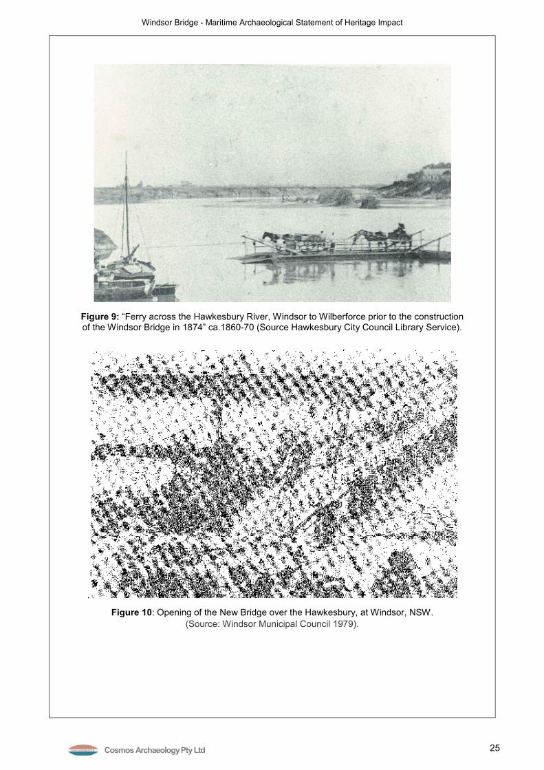
A photograph of the punt crossing in operation before the construction of the bridge in
1874 shows the punt being operated on a cable system (Figure 9).
The first building of a bridge across the Hawkesbury River was completed in 1874.
The bridge crossing was aligned at the foot of Thompson Square, upstream (west) of
the wharf, and was originally constructed as a low level bridge. The construction of the
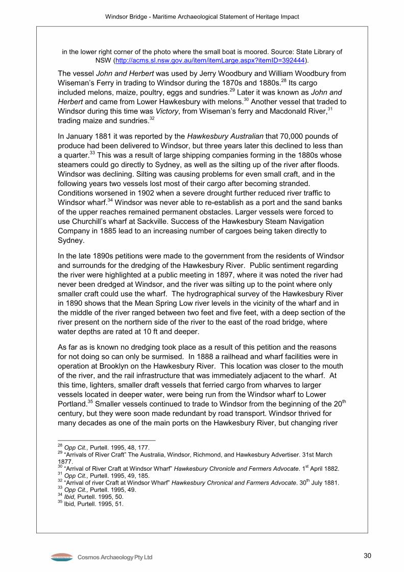
bridge lead to the cessation of the punt service. A photograph of the opening of the
wharf in 1874 shows the bridge crossing, but also shows what is thought to be the punt
(Figure 10 and Figure 11).
22 Sydney Gazette 31 October, 1828.
Windsor Bridge � Maritime Archaeological Statement of Heritage Impact
Cosmos Archaeology Pty Ltd
25
Figure 9: “Ferry across the Hawkesbury River, Windsor to Wilberforce prior to the construction of the Windsor Bridge in 1874” ca.1860�70 (Source Hawkesbury City Council Library Service).
.
Figure 10: Opening of the New Bridge over the Hawkesbury, at Windsor, NSW.
(Source: Windsor Municipal Council 1979).

Windsor Bridge � Maritime Archaeological Statement of Heritage Impact
Cosmos Archaeology Pty Ltd
26
Figure 11: 1874 photograph of the first bridge across the Hawkesbury River at Windsor. The remains of the cable anchor posts of the former punt can be seen to the left of the bridge on the
northern bank of the river (circled in red) (Source Hawkesbury City Council Library Service).
A hydrographical survey of the Hawkesbury River in 1890 includes a detailed survey of
the wharf, showing that the wharf was not rectangular in shape, but had an angled
western end to the wharf that was not previously shown on the earlier plans (Figure
12). By this time the bridge across the Hawkesbury River had been constructed and
the punt crossing likely ceased operation. The design reason for this angle is unclear.
It is possible the wharf was extended or the western end was modified to allow for
additional shallow drafted vessels to berth at the wharf.
As it faced upstream it may have served to deflect water flow around the wharf thereby
reducing the risk of damage to the structure during floods. It is also possible this
section was constructed to allow for shallower draft vessels, such as the punt, to berth
at the wharf and leave the outer edge of the wharf that was in deeper water for larger
draft vessels. The outer edge of the wharf is approximately 80 ft long, which the
landward side of the wharf is approximately 90 ft. The width of the wharf is 20 ft
(Figure 12). The wharf appears on a west�northwest to east�southeast orientation with
a track leading down from the eastern side of Thompson Square.

Windsor Bridge � Maritime Archaeological Statement of Heritage Impact
Cosmos Archaeology Pty Ltd
27
Figure 12: Plan of part of the Hawkesbury River at Windsor (1890). Soundings are shown in
feet and reduced to L.W. Spring Tides. (Source State Archives of NSW X1080� 74/12).
The first photograph to show the early wharf dates between 1874 and 1897. The
photograph is taken from the northern side of the river looking back at the township of
Windsor and the wharf. The angled end of the wharf can clearly be seen, as well as a
vessel docked at the wharf (Figure 13). From the limited information available in this
photograph it appears that the wharf was of a round timber pile construction, with a flat
timber deck. The angled section of the wharf appears to be level and of similar
construction to the remainder of the wharf (Figure 13).

Windsor Bridge � Maritime Archaeological Statement of Heritage Impact
Cosmos Archaeology Pty Ltd
28
Figure 13: Part of an undated panorama showing Thompson Square in the later part of
the nineteenth century. The wharf can be seen to the left of the bridge in this photograph. Remains of the cable system associated with the former crossing can be seen in the far right of
the image. ML SPF after Biosis Research (March 2012).
In 1897 the bridge crossing the Hawkesbury River at Windsor was modified and raised
on the same alignment as the original. This was done to repair the original bridge and
to raise it so it would not to be easily cut off by rising flood waters. For the raising of
the bridge, a temporary bridge was built across the river. Little is known about the
location of this bridge; however, a description of the works for the raising of the bridge
provides an insight into the temporary bridge. The article in the Windsor and Richmond
Gazette in April 1897 states that:
“The construction of a temporary bridge was commenced on September 9, 1896, this bridge to carry traffic during alterations to permanent bridge. The temporary bridge, which was 460 feet long, was completed and opened in six weeks.”23
Given the location of the wharf in relation to the original bridge, it is possible that the
temporary bridge was placed upstream, on the western side, of the bridge. A concept
design of the new bridge at Windsor shows a “temporary bridge” located on the
upstream, western, side of the current bridge (Figure 14). This design was not
followed; however, the concept plan does show the potential plan to put the temporary
bridge on the upstream side of the bridge.
A temporary bridge across the river would have been built close to the alignment of the
first bridge to use the road approaches to and from the bridge. The limited space
between the southern end of the bridge and the wharf may have made it difficult to
accommodate a temporary bridge.
In 1880�1881 there were at least 12 vessels operating at Windsor from the Colo and
Macdonald Rivers, Wisemans Ferry, Webbs Creek and Lower Hawkesbury.24 The
paddle�steamer Alma, 28 tons gross, was built in 1855 in Balmain and made its first trip
23
Windsor and Richmond Gazette, 11 April 1897 p:6 24
Opp Cit., Purtell. 1995, 49.

Windsor Bridge � Maritime Archaeological Statement of Heritage Impact
Cosmos Archaeology Pty Ltd
29
to Windsor in 1881.25 Alma was the first vessel for the new ‘Balmain Steam Ferry &
Tug Company’ and was described as ‘a very smart little steamboat’, later being used
for trade by John Jurd.26 The vessel was adapted to carry horses and carriages plus
80 passengers. It was sold in 1886 to J. G. Barden who used its machinery to build the
St Albans, which sunk in deep water. Although Donald Roberston bought the vessel
and attempted to re�float it, there are no records of the steamer being salvaged.27
Figure 14: Proposed plan for the new (upgraded) bridge across the Hawkesbury River at
Windsor showing a proposed temporary bridge located on the upstream side of the existing
bridge (Source Crown Plan 80/385).
Figure 15: Photograph of the Windsor Bridge from the southern side of the Hawkesbury River
dated between 1874 and 1896. Piles or mooring posts associated with the wharf can be seen
25
Opp Cit., Purtell. 1995, 60. 26
Ibid, 168. 27
Ibid, 60.
Windsor Bridge � Maritime Archaeological Statement of Heritage Impact
Cosmos Archaeology Pty Ltd
30
in the lower right corner of the photo where the small boat is moored. Source: State Library of
NSW (http://acms.sl.nsw.gov.au/item/itemLarge.aspx?itemID=392444).
The vessel John and Herbert was used by Jerry Woodbury and William Woodbury from
Wiseman’s Ferry in trading to Windsor during the 1870s and 1880s.28 Its cargo
included melons, maize, poultry, eggs and sundries.29 Later it was known as John and
Herbert and came from Lower Hawkesbury with melons.30 Another vessel that traded to
Windsor during this time was Victory, from Wiseman’s ferry and Macdonald River,31
trading maize and sundries.32
In January 1881 it was reported by the Hawkesbury Australian that 70,000 pounds of
produce had been delivered to Windsor, but three years later this declined to less than
a quarter.33 This was a result of large shipping companies forming in the 1880s whose
steamers could go directly to Sydney, as well as the silting up of the river after floods.
Windsor was declining. Silting was causing problems for even small craft, and in the
following years two vessels lost most of their cargo after becoming stranded.
Conditions worsened in 1902 when a severe drought further reduced river traffic to
Windsor wharf.34 Windsor was never able to re�establish as a port and the sand banks
of the upper reaches remained permanent obstacles. Larger vessels were forced to
use Churchill’s wharf at Sackville. Success of the Hawkesbury Steam Navigation
Company in 1885 lead to an increasing number of cargoes being taken directly to
Sydney.
In the late 1890s petitions were made to the government from the residents of Windsor
and surrounds for the dredging of the Hawkesbury River. Public sentiment regarding
the river were highlighted at a public meeting in 1897, where it was noted the river had
never been dredged at Windsor, and the river was silting up to the point where only
smaller craft could use the wharf. The hydrographical survey of the Hawkesbury River
in 1890 shows that the Mean Spring Low river levels in the vicinity of the wharf and in
the middle of the river ranged between two feet and five feet, with a deep section of the
river present on the northern side of the river to the east of the road bridge, where
water depths are rated at 10 ft and deeper.
As far as is known no dredging took place as a result of this petition and the reasons
for not doing so can only be surmised. In 1888 a railhead and wharf facilities were in
operation at Brooklyn on the Hawkesbury River. This location was closer to the mouth
of the river, and the rail infrastructure that was immediately adjacent to the wharf. At
this time, lighters, smaller draft vessels that ferried cargo from wharves to larger
vessels located in deeper water, were being run from the Windsor wharf to Lower
Portland.35 Smaller vessels continued to trade to Windsor from the beginning of the 20th
century, but they were soon made redundant by road transport. Windsor thrived for
many decades as one of the main ports on the Hawkesbury River, but changing river
28
Opp Cit., Purtell. 1995, 48, 177. 29
“Arrivals of River Craft” The Australia, Windsor, Richmond, and Hawkesbury Advertiser. 31st March 1877. 30
“Arrival of River Craft at Windsor Wharf” Hawkesbury Chronicle and Fermers Advocate. 1st April 1882.
31 Opp Cit., Purtell. 1995, 49, 185.
32 “Arrival of river Craft at Windsor Wharf” Hawkesbury Chronical and Farmers Advocate. 30
th July 1881.
33 Opp Cit., Purtell. 1995, 49.
34 Ibid, Purtell. 1995, 50.
35 Ibid, Purtell. 1995, 51.

Windsor Bridge � Maritime Archaeological Statement of Heritage Impact
Cosmos Archaeology Pty Ltd
31
conditions and easier methods of transport inevitably lead to the relinquishment of
trading.36 It is very likely therefore by the late 19th century, the role of Windsor as a
serious commercial port had become redundant.
Three later photographs dating from between ca.1890 to ca.1905 show the wharf from
a closer vantage point, showing the angled section of the wharf having been removed,
or degraded and collapsed, with only the rectangular section of the wharf remaining
(Figure 16 and Figure 17). In both photographs the deck of the wharf appears to be in
a degraded state, with sections of the decking either buckled or possibly missing in
places. The third photograph was taken on the wharf looking along it (
Figure 19). In the photograph the outer end of the wharf can be seen, including whaler
bracing. The distance between the piles is difficult to determine from the photograph,
however, from the close proximity of the whaling braces (attached between rows of
piles on a wharf), the piles appear to be placed very close together.
The date for the removal of the wharf is not known. From documentary evidence, the
wharf appears in photographs of Windsor in 1935, and possibly in the first 1947 aerial
photograph of Windsor; however, the wharf does not appear in the 1955 aerial
photograph (Figure 20 to Figure 22). It is thought that the wharf was left to disintegrate
and may have been collapsed gradually until a flood washed loose and exposed
remains of the wharf downstream.
Summary
• A wharf was first constructed at the initial settlement at Windsor in 1795.
• The wharf supplied the early store and military garrison and also provided
transportation for crops from the surrounding farms.
• A second wharf was built at Windsor in ca.1814 and repaired in 1820 under the
direction of Governor Macquarie.
• A private punt service also started in 1815 using the wharf as the southern
landing.
• In 1832 the punt was taken over and operated by the Government.
• In c.1835 the location of the punt moved upstream and a cabling system was
installed for the crossing.
• The bridge across the Hawkesbury River was built in 1874 with the punt service
ceasing soon after.
• A temporary bridge was constructed in 1896 for the raising of the main bridge
across the Hawkesbury River.
• The temporary bridge was built in six weeks, although, no other details relating
to the location of the bridge is known. It is believed to be located on the
upstream side of the current bridge.
• The second wharf was present on the site until the late 1930s or early 1940s.
36
Austral Archaeology August 2011: p.33.

Windsor Bridge � Maritime Archaeological Statement of Heritage Impact
Cosmos Archaeology Pty Ltd
32
Figure 16: The wharf beside the Windsor Bridge, not dated. Reproduced in Bowd, D. G., Up the Windsor Road from Baulkham Hills, Library of Australian History, Sydney, 1986.
Figure 17: The wharf beside the Windsor Bridge (no date). (Source: Mitchell Library Small
Picture File – Windsor).

Windsor Bridge � Maritime Archaeological Statement of Heritage Impact
Cosmos Archaeology Pty Ltd
33
Figure 18: Zoomed image of the wharf beside the Windsor Bridge (no Date). (Source: Mitchell Library Small Picture File – Windsor).
Figure 19: “Wharf at Windsor on the Hawkesbury River near Windsor Bridge” (ca.1890 to ca.1900). The photograph shows some of the below deck components of the wharf, including
the closely spaced piles (Source: Hawkesbury City Council Library Service).

Windsor Bridge � Maritime Archaeological Statement of Heritage Impact
Cosmos Archaeology Pty Ltd
34
Figure 20: Zoomed section of “Bridge Across the Hawkesbury River, Windsor, New South Wales, ca. 1935.” The ca.1814 wharf can be seen clearly still present on the site
(Source National Library of Australia http://nla.gov.au/nla.pic�vn4655530).
Figure 21: 1947 aerial photograph of Windsor showing the location of the second wharf (red arrow).

Windsor Bridge � Maritime Archaeological Statement of Heritage Impact
Cosmos Archaeology Pty Ltd
35
Figure 22: 1955 aerial photograph of Windsor showing the location of the second wharf
(red arrow).
Figure 23: Flood damage after the motor boat regatta, Windsor, Hawkesbury River, NSW, 1949 (Source NLA http://nla.gov.au/nla.pic�vn4654154).


