33
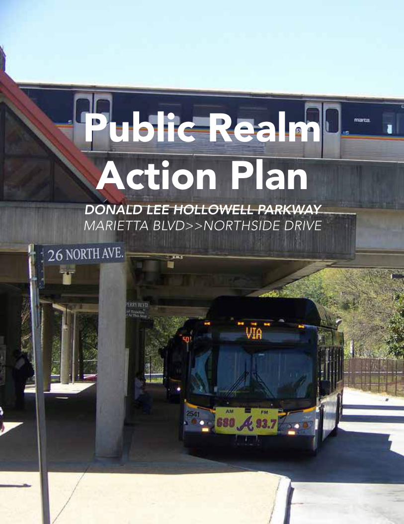
Public Realm Action Plan DONALD LEE HOLLOWELL PARKWAY MARIETTA BLVD>>NORTHSIDE DRIVE
| Date post: | 25-May-2018 |
| Category: |
Documents |
| Upload: | nguyentuong |
| View: | 220 times |
| Download: | 0 times |
Public Realm Action Plan
DONALD LEE HOLLOWELL PARKWAYMARIETTA BLVD>>NORTHSIDE DRIVE
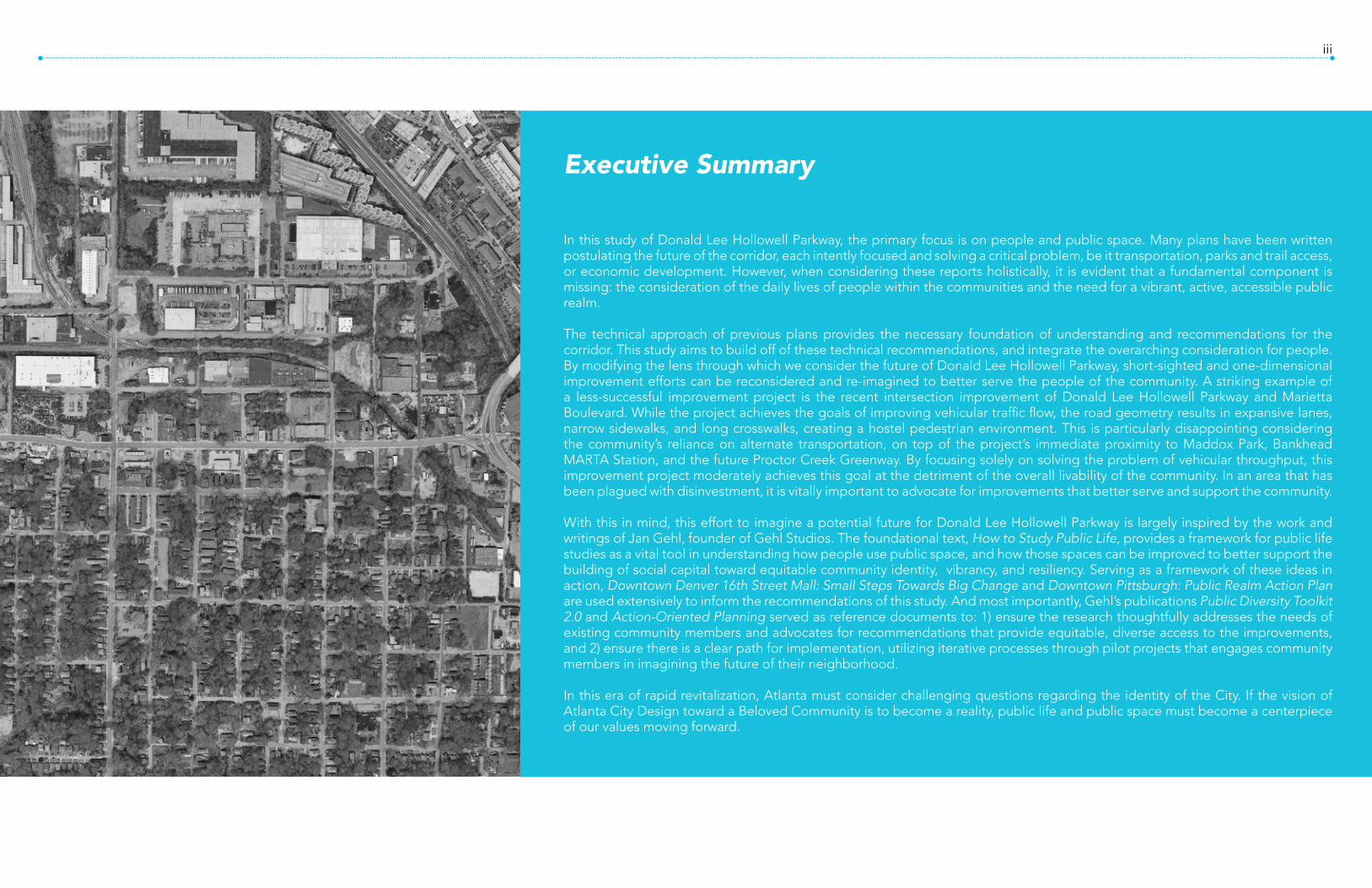
iii
Executive Summary
In this study of Donald Lee Hollowell Parkway, the primary focus is on people and public space. Many plans have been written postulating the future of the corridor, each intently focused and solving a critical problem, be it transportation, parks and trail access, or economic development. However, when considering these reports holistically, it is evident that a fundamental component is missing: the consideration of the daily lives of people within the communities and the need for a vibrant, active, accessible public realm.
The technical approach of previous plans provides the necessary foundation of understanding and recommendations for the corridor. This study aims to build off of these technical recommendations, and integrate the overarching consideration for people. By modifying the lens through which we consider the future of Donald Lee Hollowell Parkway, short-sighted and one-dimensional improvement efforts can be reconsidered and re-imagined to better serve the people of the community. A striking example of a less-successful improvement project is the recent intersection improvement of Donald Lee Hollowell Parkway and Marietta Boulevard. While the project achieves the goals of improving vehicular traffic flow, the road geometry results in expansive lanes, narrow sidewalks, and long crosswalks, creating a hostel pedestrian environment. This is particularly disappointing considering the community’s reliance on alternate transportation, on top of the project’s immediate proximity to Maddox Park, Bankhead MARTA Station, and the future Proctor Creek Greenway. By focusing solely on solving the problem of vehicular throughput, this improvement project moderately achieves this goal at the detriment of the overall livability of the community. In an area that has been plagued with disinvestment, it is vitally important to advocate for improvements that better serve and support the community.
With this in mind, this effort to imagine a potential future for Donald Lee Hollowell Parkway is largely inspired by the work and writings of Jan Gehl, founder of Gehl Studios. The foundational text, How to Study Public Life, provides a framework for public life studies as a vital tool in understanding how people use public space, and how those spaces can be improved to better support the building of social capital toward equitable community identity, vibrancy, and resiliency. Serving as a framework of these ideas in action, Downtown Denver 16th Street Mall: Small Steps Towards Big Change and Downtown Pittsburgh: Public Realm Action Plan are used extensively to inform the recommendations of this study. And most importantly, Gehl’s publications Public Diversity Toolkit 2.0 and Action-Oriented Planning served as reference documents to: 1) ensure the research thoughtfully addresses the needs of existing community members and advocates for recommendations that provide equitable, diverse access to the improvements, and 2) ensure there is a clear path for implementation, utilizing iterative processes through pilot projects that engages community members in imagining the future of their neighborhood.
In this era of rapid revitalization, Atlanta must consider challenging questions regarding the identity of the City. If the vision of Atlanta City Design toward a Beloved Community is to become a reality, public life and public space must become a centerpiece of our values moving forward.

Contents
1 // Introduction2 // Opportunities + Processes3 // Guiding Principles Provide a series of experiences Encourage lively edges Create an integrated network of places Support surrounding neighborhoods Support a network of investment Continue to evolve
4 // Moving Forward Action-oriented planning Pilot Project 1: Route Revitalization Pilot Project 2: Place Activation Pilot Project 3: Innovative Policy-making
5 // Data Appendix

Introduction1
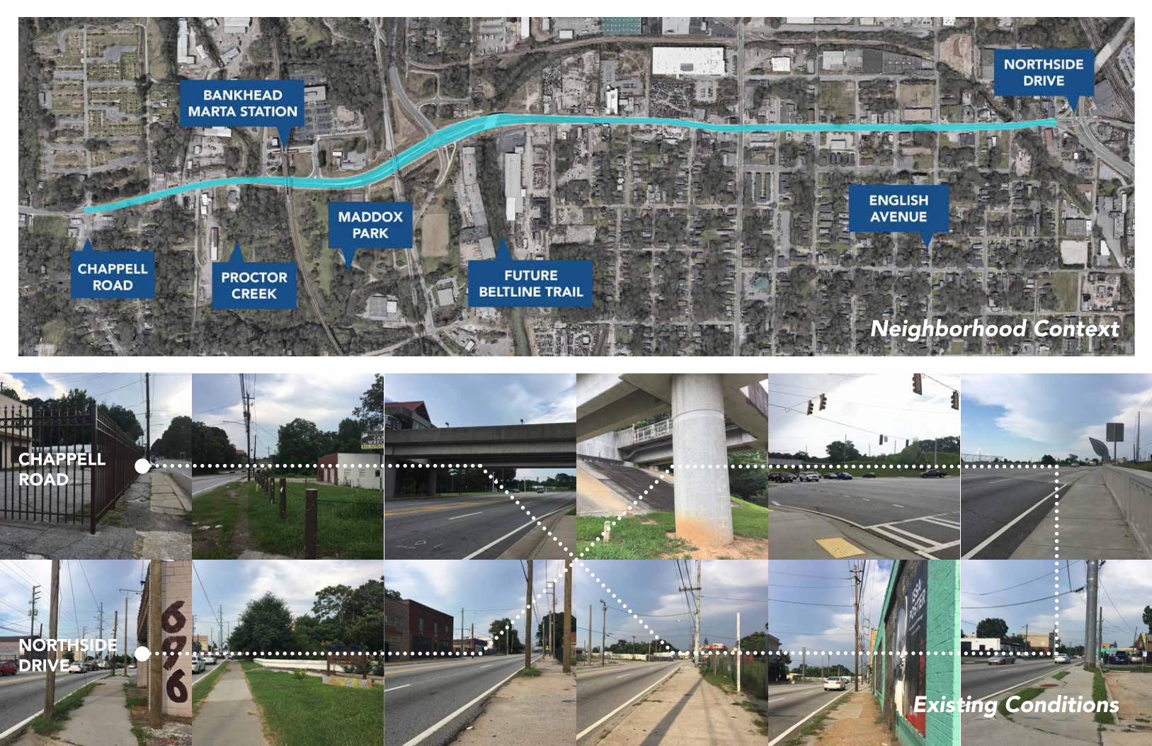
CHAPPELL ROAD
NORTHSIDEDRIVE
Neighborhood Context
Existing Conditions

5Introduction
Existing Conditions Analysis
Pedestrian + Bike Amenities
Bus Stops
Parks +Public Spaces
BIKE LA
NES
PROCTOR C
REEK
GREENWAY
MADDOX PA
RK
FUTU
RE BELT
LINE
TRAIL
ENGLISH A
VE
COMM
UNITY
GARDEN
SIDEW
ALKS

7Introduction
Data AnalysisDonald Lee Hollowell Parkway
Souce: Social Explorer Tables: ACS 2016 (5-Year Estimates) (SE), ACS 2016 (5-Year Estimates),Social Explorer; U.S. Census Bureau
8,320Total Area Population
2,408.1Population Density/Mile
$24,254Median Household Income
19.9%Households with Income Below the Poverty Line
22.2%Unemployment Rate
$88,166Median Home Value
$863Median Gross Rent
Demographics Housing Tenure Cost Burdened Renters
Commute Patterns
Race + Ethnicity
Housing Occupancy Cost Burdened Owners

9Introduction
Data AnalysisCity of Atlanta
456,378Total Area Population
3,427.5Population Density/Mile
$49,398Median Household Income
18.8%Households with Income Below the Poverty Line
10.4%Unemployment Rate
$222,300Median Home Value
$998Median Gross Rent
Demographics Housing Tenure Cost Burdened Renters Race + Ethnicity
Commute Patterns Housing Occupancy Cost Burdened Owners
Souce: Social Explorer Tables: ACS 2016 (5-Year Estimates) (SE), ACS 2016 (5-Year Estimates),Social Explorer; U.S. Census Bureau

Opportunities + Processes2

13Opportunities + Processes
Prepared for the CITY OF ATLANTA, Bureau of Planning by HDR, INC. TUNNELL-SPANGLER-WALSH & ASSOCIATESMARKETEK, INC.DOVETAIL CONSULTING
CITY OF ATLANTAJanuary 5, 2006
BANKHEAD MARTA STATION TRANSIT AREA LCI STUDY
Planning and Community Development DepartmentOffice of Planning
SUBAREA 9Prepared for
Atlanta BeltLine, Inc.by Pond & Company
Adopted by the Atlanta City Council on March 16, 2009
BeltLine Master PlanPlan Recommendations Report
SUBAREA 10Boone/Hollowell
Plan Recommendation Report
Prepared forAtlanta BeltLine, Inc.
by MACTEC Engineering and Consulting, Inc.with Perkins + Will and Grice and Associates
Adopted by the Atlanta City Council on December 6, 2010
Atlanta BeltLine Master Plan
Donald L. Hollowell Parkway Redevelopment Plan
Presented by
The City of Atlanta Bureau of Planning
November 2003
Previous Plans + Studies
+
+
Current Plans + Studies
District 3: RecapAugust 19| 10AM – 12PMC.A. Scott Recreation Center1565 M.L.K. Jr., Dr. NW
Tim Keane, Commissioner City of Atlanta Department of Planning and Community Development
Charletta Jacks, Director DPCD Office of Zoning and Development
Councilmember Ivory L. Young, Jr.Atlanta City Council District 3
Public Forum
Wednesday, March 22, 2017
Total Area Population Total Area Population
Total Area Population Total Area Population
Total Area Population Total Area Population
Bankhead MARTA LCI D3 Westside Revive
Beltline Subareas 9 + 10 Atlanta City Design
DLH Redevelopment Plan Proctor Creek Greenway

15Opportunities + Processes
Stakeholder MappingNon-Profits:1. Emerald Corridor Foundation2. Atlanta Beltline3. Westside Future Fund4. Westside Communities Alliance5. Friends of English Avenue6. Greater Vine City Opportunities program7. Historic Westside Cultural Arts Council8. West Atlanta Watershed Alliance
Civic Associations / Community Groups:1. Northwest Business Association2. English Ave Neighborhood Assoc.3. Historic Westin Heights / Bankhead Neighborhood Association4. Northwest Community Alliance5. Washington Park Community Club & Neighborhood Association6. Vine City Civic Association7. Proctor Creek Stewardship Council Institutions:1. Atlanta Public Schools2. Georgia Tech (SLS)3. Atlanta Community Improvement Association

17Opportunities + Processes
First Steps
Vision
Next Steps
Data CollectionSmall-scale intervention
Community leadVision for the community that is there now, not for displacementPeople-focused, and people-centric
Large scale planningLarge scale interventions

Guiding Principles3
21Guiding Principles
Guiding Principles Provide a series of experiences Encourage lively edges Create an integrated network of places Support surrounding neighborhoods Support a network of investment Continue to evolve

23Guiding Principles
#1: Provide a series of experiences » Around the clock activation (places to stay) » Streetscape improvement by character of district » Transportation choices » Next Steps to achieve
1. Sign to get community input 2. Test public space projects
#2: Encourage lively edges
#3: Create an integrated network of places
» Active facades – facade improvement project » Activate existing businesses » Encourage new businesses » Next Steps to achieve

25Guiding Principles
#4: Support surrounding neighborhoods
#5: Support a network of investment
#6: Continue to evolve
» Build upon and support existing initiatives, collaborate » Extend network opportunities with public institutions » Create focus on neighborhood participation, “Civic Innovation” projects » Next steps to achieve
» Evidence based decision network » Prototyping method » Implementation plan
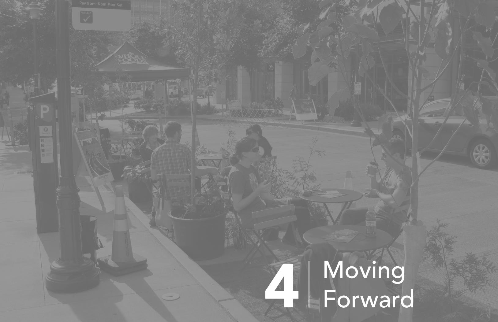
Moving Forward4

29Moving ForwardAction-Oriented Planning
Introduction
Project Typologies
Action-Oriented Planning uses pilot projects as community engagement during the planning process in order to show community members how design decisions will impact the community. The process emphasizes showing improvements rather than telling stakeholders about improvements. This approach to planning is inherently human-scaled, user focused, highly iterative, and multidisciplinary-often leading to increased political buy-in and new perspectives in solving old problems.
Note: Images, text, and concept by Gehl Studio, “Action-Oriented Planning” published March, 2016.
» Regeneration Catalyst: Creating new destinations on vacant sites. » Full-Scale Test: Full-scale project mock-
up, using quicker, less costly, reversible or less intensive physical means. » Demonstration Project: Fully detailed
implementation, illustrating the best practices of a proposed design.
» Process Pilot: Testing new methods of community engagement to build trust, engage stakeholders, and create solidarity. » Insurgent Project: Unsanctioned project
using loopholes and spontaneously claimed space. » Tactical Project: Strategic projects
engaging communities to create change.
Steps to ImplementationStep 1: Define the Project Scope
Clearly define the purpose and focus of the project, and how it will be implemented.
Checklist: » Project focus » Past Lessons » Ease of Implementation » Measure-test-feedback loop definition » Public Impact » Collaboration + Stakeholder interest
Step 2: Set the Project GoalsDetermine the primary 1-5 goals of the project, and the success criteria for reaching those goals.
Sample Goals: » A Street for People » Community Engagement » Shared Civic Spaces
Step 3: Evaluate the Project Impact + Success » Before: Evaluate existing conditions » During: Measure goals and success criteria » After: Evaluate success from different stakeholder perspectives
» Alignment with ongoing projects » Long term perspective » Flexibility + Resilience » Diversity + Inclusiveness » Connectivity + Accessibility » Local Champions identification
» Opportunity + Access » Building Capacity » Longevity
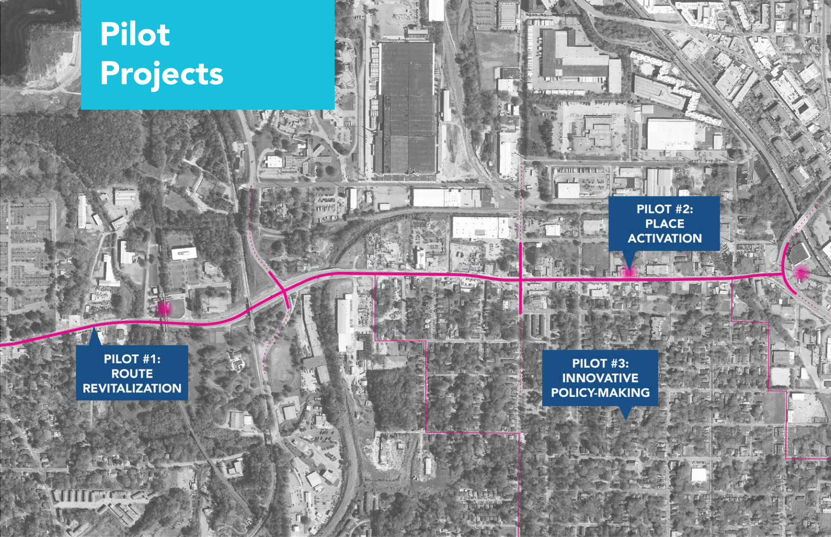
PilotProjects

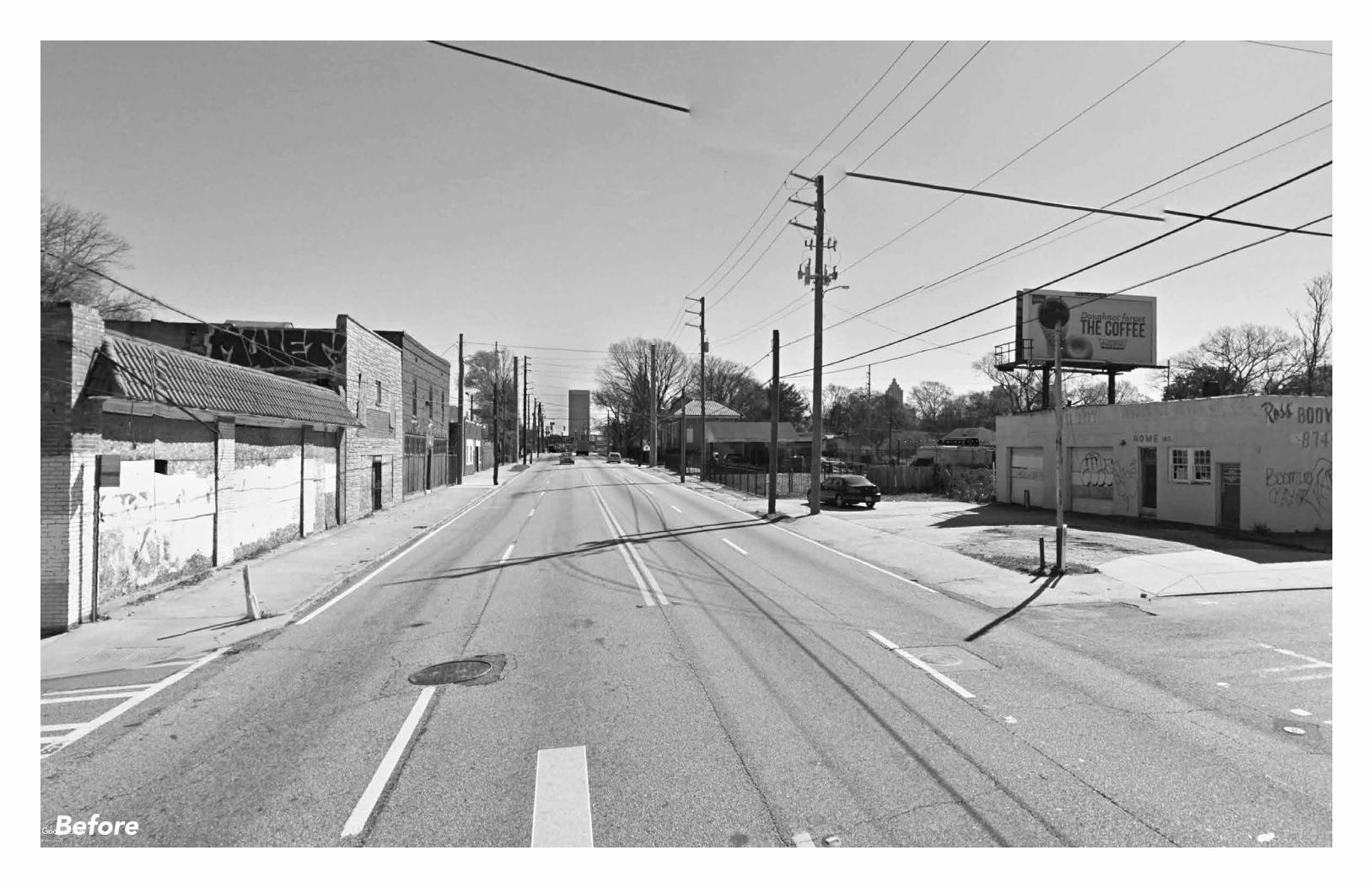
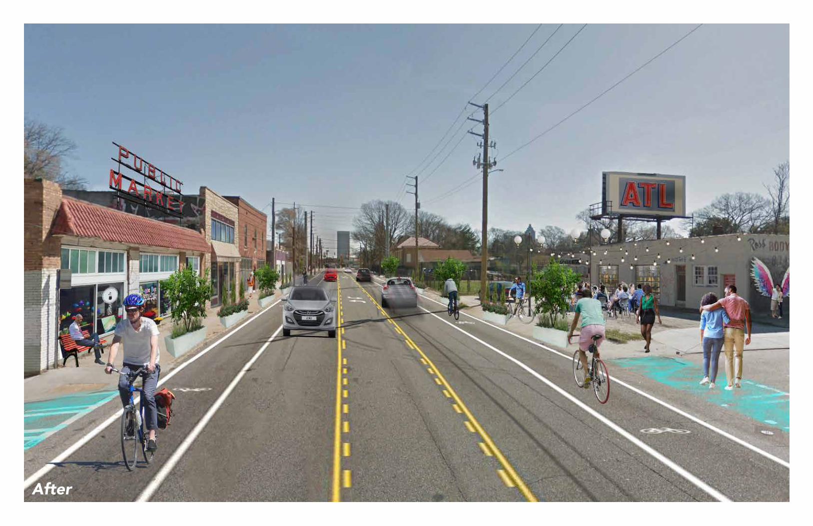
Pilot #1
1 // Route Revitalization Provide a series of experiences Encourage lively edges Create an integrated network of places Support surrounding neighborhoods Support a network of investment Continue to evolve

D
C
B A
Section A
Section B
Before AfterUgitet alignist volupta vendipide nest, sitatiosti torepe volupta eperspeditas nima volorupta nem sa cusciur? Quissi comnimi, con re que quo omniae vendae plaut quat.Nam quam ut quament evendi omnit labo. Et eum eum fugiatiis etur?Mos ut venturit volore et officab orepedis et et di cus iducius minisquate vendelignim volora velecti iscidundem invelest omnimus, con coribus dolorere dis doluptio int ex etus nullupta dolenim aximus
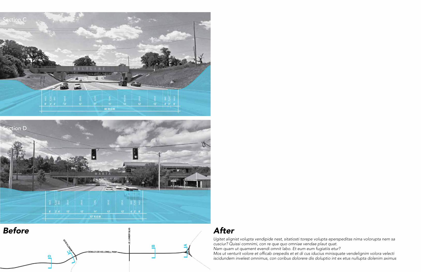
D
C
B A
Section C
Section D
Before AfterUgitet alignist volupta vendipide nest, sitatiosti torepe volupta eperspeditas nima volorupta nem sa cusciur? Quissi comnimi, con re que quo omniae vendae plaut quat.Nam quam ut quament evendi omnit labo. Et eum eum fugiatiis etur?Mos ut venturit volore et officab orepedis et et di cus iducius minisquate vendelignim volora velecti iscidundem invelest omnimus, con coribus dolorere dis doluptio int ex etus nullupta dolenim aximus

Crosswalks +Lighting
Streets forPeople
Seating +Planting
Wayfinding +Markers
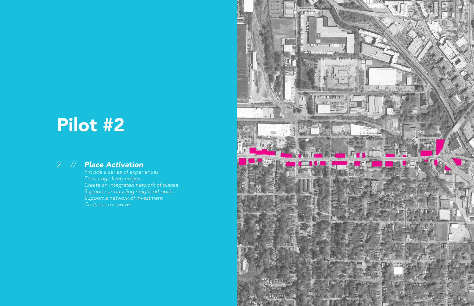
Pilot #2
2 // Place Activation Provide a series of experiences Encourage lively edges Create an integrated network of places Support surrounding neighborhoods Support a network of investment Continue to evolve

Before

After
Before
After

Art +Activation
Pop-UpProgramming
Vendors
Social Spaces+ Furniture
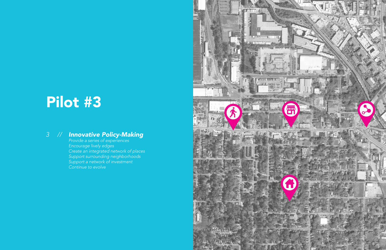
Pilot #3
3 // Innovative Policy-Making Provide a series of experiences Encourage lively edges Create an integrated network of places Support surrounding neighborhoods Support a network of investment Continue to evolve

55Moving ForwardHousing Policy
Social Capital + Engagement
Small Business Economic Development
Access to Transit
» Who is Atlanta building for? Lecture » Affordable housing policies » Anti-displacement measures
» Community engagement mechanisms » Public Life Diversity Toolkit, Gehl » Action-Oriented Planning, Gehl » Planning for People + Communities, not cars + data
» CDFIs » Business Incubator Programs
Walkability + Bikeability
Schools + Community Development
Access to Public Space
» Marjy Stagmeier, Affordable Housing and Schools
» Parks and Trails » Public gathering spaces / plazas

Data Appendix5

59Data Appendix
Data, Maps, + Tables » Sidewalk quality » Bike lanes » Facade quality » Ground floor functions » Vacant property / lots


