public spaces and associated development urban projects 4.1 West Terrace (1) A new public space, the West Terrace, is proposed to the west of station, elevated over tracks. The West Terrace is part of a sequence of spaces running from IMMA to the Phoenix Park, linked by a legible and high quality pedestrian and cycle route. The space will allow vehicular access to lands at the rear of the station and provide a new forecourt to the station addressing land to the west. The West Terrace should be predominantly used by public transport, taxis and private cars East bound traffic is given the option to connect with the terrace from St. John’s Road. Traffic can continue across to Conyngham Road or access the station and station lands. The impact of traffic through the space should be minimised and access to the rear of the station efficient and controlled. Character: • The West Terrace uses the topography of the valley to create the illusion that the terrace is at grade. By taking the level of Conyngham Road and continuing it across the river to the rear of the station and across the tracks, a new datum level is created. • The space should be highly organised and have a civic character appropriate to the forecourt to the national station and gateway to the city. • The West Terrace will lie in the centre of the valley between IMMA and the Wellington monument and will have a panoramic view of both structures and the Liffey Valley to the West. • The West Terrace should be clearly divided into trafficked and pedestrian areas. • The West Terrace will benefit from south-west to west aspect, with an almost unobstructed view to the setting sun. • The southern edge of the space is partially enclosed by the development on the Eircom site on St. John’s Road West. The edge is defined by St. John’s Road (N4) at the lower level. CIE Lands substudy document Associated development: • The west end of the station should be redeveloped with a new elevation onto the West Terrace. From this elevation the central concourse to the east can be accessed and therefore also Heuston Square and the Luas platforms. • The site north of the station is considered suitable for a tall building. A Suggested use is hotel accommodation. • A significant building of relatively low height should be developed to the northwest of the West Terrace. This building is within the protected view between IMMA and the Department of Defence (Gandon building). This building also has prominent frontage onto the space. a. views of Waverley Station and Princes Street Gardens, Edinburgh, Scotland b. Broadgate, Liverpool Street, London c. Santa Justa Station, Seville, Spain [Cruz + Ortiz] d. Attocha Station, Madrid, Spain [Rafael Moneo] a. b. c. d. CIE Lands site sections
Transcript
public spaces and associated developmenturban projects
4.1 West Terrace (1)
A new public space, the West Terrace, is proposed to the west of
station, elevated over tracks. The West Terrace is part of a sequence
of spaces running from IMMA to the Phoenix Park, linked by a legible
and high quality pedestrian and cycle route.
The space will allow vehicular access to lands at the rear of the
station and provide a new forecourt to the station addressing land to
the west. The West Terrace should be predominantly used by public
transport, taxis and private cars
East bound traffic is given the option to connect with the terrace from
St. John’s Road. Traffic can continue across to Conyngham Road or
access the station and station lands.
The impact of traffic through the space should be minimised and
access to the rear of the station efficient and controlled.
Character:
• The West Terrace uses the topography of the valley to create
the illusion that the terrace is at grade. By taking the level of
Conyngham Road and continuing it across the river to the rear
of the station and across the tracks, a new datum level is
created.
• The space should be highly organised and have a civic
character appropriate to the forecourt to the national station
and gateway to the city.
• The West Terrace will lie in the centre of the valley between
IMMA and the Wellington monument and will have a
panoramic view of both structures and the Liffey Valley to the
West.
• The West Terrace should be clearly divided into trafficked and
pedestrian areas.
• The West Terrace will benefit from south-west to west aspect,
with an almost unobstructed view to the setting sun.
• The southern edge of the space is partially enclosed by the
development on the Eircom site on St. John’s Road West. The
edge is defined by St. John’s Road (N4) at the lower level.
CIE Lands substudy document
Associated development:
• The west end of the station should be redeveloped with a
new elevation onto the West Terrace. From this elevation the
central concourse to the east can be accessed and therefore
also Heuston Square and the Luas platforms.
• The site north of the station is considered suitable for a tall
building. A Suggested use is hotel accommodation.
• A significant building of relatively low height should be
developed to the northwest of the West Terrace. This building
is within the protected view between IMMA and the Department
of Defence (Gandon building). This building also has
prominent frontage onto the space.
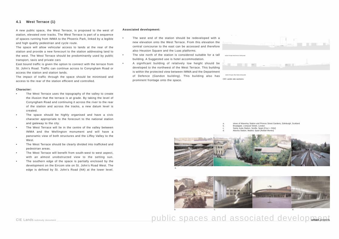
a. views of Waverley Station and Princes Street Gardens, Edinburgh, Scotlandb. Broadgate, Liverpool Street, Londonc. Santa Justa Station, Seville, Spain [Cruz + Ortiz]d. Attocha Station, Madrid, Spain [Rafael Moneo]
a.
b. c. d.
CIE Lands site sections
public spaces and associated developmenturban projects
4.2 Heuston Square (2)
The space to the front of the Headquarters Building of the Great
Western Railway is considered to be in the centre of the Heuston
Gateway. All destinations in the area radiate from this space. Heuston
Square is the main arrival space from the city centre.
Heuston Square has river frontage along the north edge and links
Victoria Quay to the section of Quay north of the station building
(River Terrace). This is identified as a principal pedestrian desire line
and must therefore be appropriately detailed to allow safe and
controlled flow across traffic carriageways and Luas lines.
Heuston Square is the site of the three Luas platforms for Heuston
Station.
The Square provides access to the bridges at the end of the one-way
system on the quays. Traffic must therefore be carefully managed with
pedestrian and cycle paths protected.
Character:
• It is proposed that the space should be an active and central
urban square for the Heuston Gateway.
• The space must provide clear legibility for the entire area. The
views up to IMMA and across to Collins Barracks are important
in terms of orientation.
• The choice of hard landscaping surface should contrast with
the standard materials used throughout the city. The surface
should be of a high quality.
• The square will benefit from excellent views and light due to
the relatively low existing protected structures to the south and
west.
Associated development:
• The Guinness UDV site on Victoria Quay and Heuston Square
opposite the Headquarters Building should be developed with
a high profile building of the highest architectural standards.
General building height should generally be approximately
equivalent to six floors of commercial use.
• Part of the site should be developed as a landmark tall
building with appropriate slenderness and transparency.
• The development of the Caskworks on Steeven’s Lane
provides an opportunity for high-density commercial
development. The northern block will have frontage onto the
Heuston Square and Dr Steevens’ Hospital Park. Again six
floors of commercial or equivalent is proposed.
CIE Lands substudy document
a. b.
c. d. e.
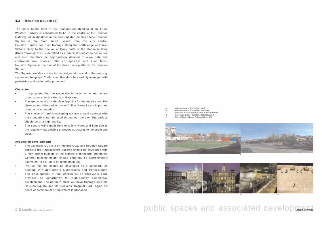
a. existing Heuston Square from southb. existing Heuston Square from north-westc. Place des Terraux, Lyons, France [Christian Drevet]d. Schouwburgplein, Rotterdam, Holland [West 8]e. Place d’Armes, Namur, Belgium [Atelier 4D]
a. b. c. d.
public spaces and associated developmenturban projects
4.3 River Terrace (3)
The proposed access to the station lands from Conyngham Road
frees up the area between the existing station building and the river.
This creates a car-free terrace that marks the transition from the
man-made, urban quay condition to a natural, planted riverside
condition west of Heuston Station.
Character/quality
• The River Terrace should provide external amenity space for
the station services and circulation. Bars and cafes should be
developed along the edge of the station onto the terrace.
• The space will be characterised by the views across and along
the river.
• The movement of passengers from the West Terrace to the
station concourse and Heuston Square might be
accommodated along this space.
• A tall building is proposed to the west end of the River Terrace.
The Terrace will create a lower forecourt to the building.
Associated development
• The redevelopment of the northern edge of the station should
provide restaurant, bar and retail facil it ies.
• The tall building should be accessed from the River Terrace
and West Terrace. This will encourage movement in an east-
west direction through the River Terrace.
• Any development must allow for riverside walkways to
continue on the south bank as far as Clancy barracks.
CIE Lands substudy document
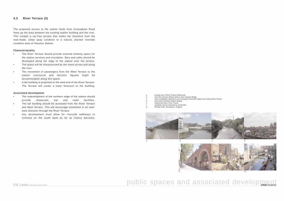
a. existing view of River Terrace looking eastb. view from Heuston Station lands to Sean Heuston Bridgec. view of Wellington Monument and Conyngham Road Bus Depot from existing River Terraced. north side of Heuston Station buildnge. Viaduct des Artes, Paris, Francef. canalside, Borneo Sporenburg, Amsterdamg. Brindley Place, Birmingham, England
e. f. g.
public spaces and associated developmenturban projects
4.4 Heuston Station – Redevelopment of the station and adjoining public spaces (4)
Heuston Station is the transport hub and focal space of the Heuston
Gateway. In order to meet future demands and create an appropriate
environment, the following proposals are put forward:
• redevelopment of station to allow greater capacity and
efficiency
• reorganisation of external urban spaces around the station:
West Terrace
East Square
River Terrace
South Facade
4.5 Conyngham Road Public Space (5)
A large public space is proposed on the Conyngham Road Bus Depot
site. The space is effectively an extension of the West Terrace, acting
as an intermediate space between the West Terrace and Phoenix
Park.
The space should be functional and active. Pedestrian access should
be provided from the space down to the riverside walk on the North
Bank.
Character:
• The space should be active and carefully designed to allow
safe and efficient flow of all modes of transport including
pedestrians.
• The space will be at the same level as Conyngham Road and
allow panoramic views over the river and Heuston Station
lands to The Royal Hospital Kilmainham.
• The detailing, materials and planting should be consistent with
the West Terrace.
Associated development:
• A mix of uses should be developed onto the space
with building lines dictated by the new vehicular bridge and
pedestrian route.
• Building to the west of the space onto the vehicular carriage
ways to be 5 storeys residential and must not interrupt the
‘significant view’ from The Royal Hospital Kilmainham to the
Department of Defence Headquarters.
CIE Lands substudy document
• Building to the east of the space to be 6 storeys commercial
with facade following the line of the pedestrian and cycle track.
A section of this site onto Conyngham Road should have
restricted height to avoid interrupting the ‘significant view’ as
indicated on plan.
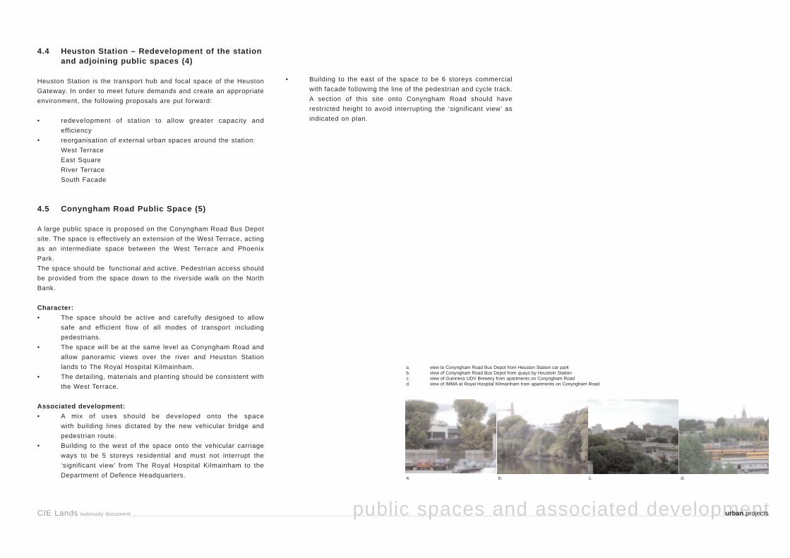
a. view to Conyngham Road Bus Depot from Heuston Station car parkb. view of Conyngham Road Bus Depot from quays by Heustoin Stationc. view of Guinness UDV Brewery from apartments on Conyngham Roadd. view of IMMA at Royal Hospital Kilmainham from apartments on Conyngham Road
a. b. c. d.
building heights and viewsurban projects
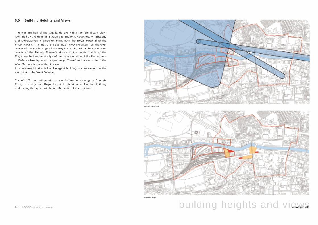
5.0 Building Heights and Views
The western half of the CIE lands are within the ‘significant view’
identified by the Heuston Station and Environs Regeneration Strategy
and Development Framework Plan, from the Royal Hospital to the
Phoenix Park. The lines of the significant view are taken from the west
corner of the north range of the Royal Hospital Kilmainham and east
corner of the Deputy Master’s House to the western side of the
Magazine Fort and east edge of the main elevation of the Department
of Defence Headquarters respectively. Therefore the east side of the
West Terrace is not within the view.
It is proposed that a tall and elegant building is constructed on the
east side of the West Terrace.
The West Terrace will provide a new platform for viewing the Phoenix
Park, west city and Royal Hospital Kilmainham. The tall building
addressing the space will locate the station from a distance.
CIE Lands substudy document
visual connections
high buildings
building heights and viewsurban projects
5.0 Building Heights and Views
CIE Lands substudy document
b. c. d.
f. g. h.
a.
e.
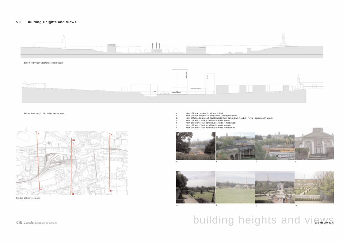
B section through west terrace looking east
B1 section through Liffey Valley looking west
heuston gateway: sections
A
A
B1
B1
B
B
C
C
a. view of Royal Hospital from Phoenix Parkb. view of Royal Hospital rail bridge from Conyngham Roadc. view of full north range of Royal Hospital from Conyngham Road d. Royal Hospital north facadee. view of Phoenix Park from Royal Hospital to westf. view of Phoenix Park from Royal Hospital to north-westg. view of Phoenix Park from Royal Hospital to northh. view of Phoenix Park from Royal Hospital to north-east
connectionsurban projects
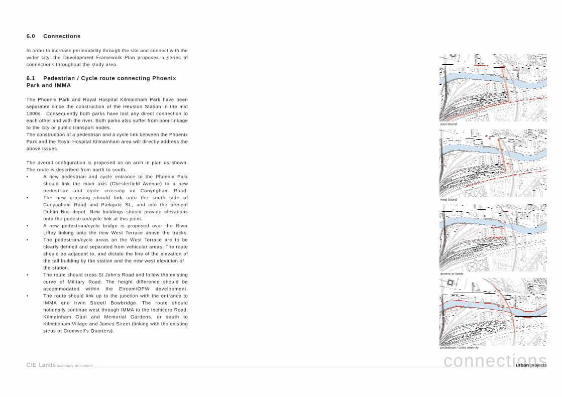
6.0 Connections
In order to increase permeability through the site and connect with the
wider city, the Development Framework Plan proposes a series of
connections throughout the study area.
6.1 Pedestrian / Cycle route connecting PhoenixPark and IMMA
The Phoenix Park and Royal Hospital Kilmainham Park have been
separated since the construction of the Heuston Station in the mid
1800s. Consequently both parks have lost any direct connection to
each other and with the river. Both parks also suffer from poor linkage
to the city or public transport nodes.
The construction of a pedestrian and a cycle link between the Phoenix
Park and the Royal Hospital Kilmainham area will directly address the
above issues.
The overall configuration is proposed as an arch in plan as shown.
The route is described from north to south.
• A new pedestrian and cycle entrance to the Phoenix Park
should link the main axis (Chesterfield Avenue) to a new
pedestrian and cycle crossing on Conyngham Road.
• The new crossing should link onto the south side of
Conyngham Road and Parkgate St., and into the present
Dublin Bus depot. New buildings should provide elevations
onto the pedestrian/cycle link at this point.
• A new pedestrian/cycle bridge is proposed over the River
Liffey linking onto the new West Terrace above the tracks.
• The pedestrian/cycle areas on the West Terrace are to be
clearly defined and separated from vehicular areas. The route
should be adjacent to, and dictate the line of the elevation of
the tall building by the station and the new west elevation of
the station.
• The route should cross St John’s Road and follow the existing
curve of Military Road. The height difference should be
accommodated within the Eircom/OPW development.
• The route should link up to the junction with the entrance to
IMMA and Irwin Street/ Bowbridge. The route should
notionally continue west through IMMA to the Inchicore Road,
Kilmainham Gaol and Memorial Gardens, or south to
Kilmainham Village and James Street (linking with the existing
steps at Cromwell’s Quarters).
CIE Lands substudy document
east bound
west bound
access to lands
pedestrian / cycle amenity
connectionsurban projects
6.2 Pedestrian/cycle route from Victoria Quay to Memorial Gardens
The pedestrian and cycle route from Victoria Quay to Memorial
Gardens / Islandbridge is part of a wider vision for a route on the
South Bank of the river connecting Chapelizod to the Docklands.
The CIE lands make up the largest section of this route. The route
should have 2 distinct characters through the CIE lands; the River
Terrace at the station and a Riverside Walk along the south bank of
the river. The River Terrace is described in section 4.3.
The new Riverside Walk should run below the new bridges through
the area to the existing rail bridge. The route should respond to the
more ‘natural’ condition of the river in this area, and provide a
relatively secluded amenity from the station to Clancy Barracks.
6.3 Eastbound traffic: St Johns Road (N4) to Conyngham Road
Traffic from the N4 eastbound currently travels along St. John’s Road,
past the south façade and across the east façade of the station and
the Frank Sherwin Bridge to the North Quays.
It is proposed to disperse the traffic at a number of points to reduce
loading around the station, across Heuston Square and on the North
Quays.
This is to be achieved by highlighting three locations for reaching the
northside at:
South Circular Road
West Terrace
Heuston Square
A new eastbound traffic ramp from St John’s Road to the West Terrace
is proposed. The road should continue into a new bridge across the
river and onto Conyngham Road.
6.4 Clancy Barracks to Heuston Station Lands
At present Clancy Barracks and the Heuston Station Lands are cut off
from each other and the general network of the city.When Heuston
Station Lands are developed, it is proposed that a tunnel vehicular
link is created using the height difference of the sites at the railway
line. It is proposed that the Heuston Station Lands should be
accessed from the new West Terrace. These links will help integrate
both sites into the city fabric and increase accessibility.
Adequate provision should be made for pedestrians and cyclists.
CIE Lands substudy document
6.5 Clancy Barracks / Heuston Station Lands to Phoenix Park
Despite their proximity, Clancy Barricks and the Heuston Station
Lands are relatively unconnected to the Phoenix Park. Where Sarah
Bridge in the west and the proposed new bridge onto the West Terrace
both provide north-south linkage. There is still an area that is not
easily accessible from the park. However an existing iron railway
bridge on the Phoenix Park line provides the opportunity for a
pedestrian and cycle link, 'hanging' off the existing structure.
This considerably improves the amenity provision to the Clancy
Barricks and Heuston Station Lands, and provides direct linkage to
major public transport services on Conyngham Road
6.6 Public Transport Connections: Bus
The existing bus routes through the area should be maintained and
increased. Buses should stop at various points in close proximity to
the station and associated public spaces.
Buses on Conyngham Road / Parkgate Street should have the option
of a station drop-off on the West Terrace / Conyngham Road bus
depot site or by the Hickeys site.
The no. 90 bus running between Connolly station, the Quays and
Heuston should have a dedicated lane allowing a right turn into
Heuston Square, so relating the stop to the Luas.
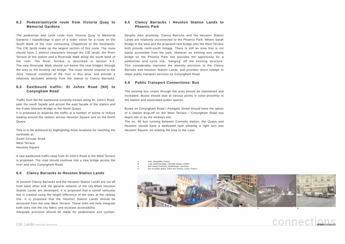
a. tram, Montpelier, Franceb. Luas, photomontage, Connolly Station, Dublinc. train station forecourt, Nordhausen, Germanyd. bus on public space, Place des Terraux, Lyons, France
a. c. d.b.
connectionsurban projects
6.7 Public Transport Connections: LUAS
The Luas stop on Heuston Square is on the Luas Line A, due for
completion in 2003. The line runs between Tallaght and Abbey Street,
with proposals to extend to
6.8 Public Transport Connections: Taxis
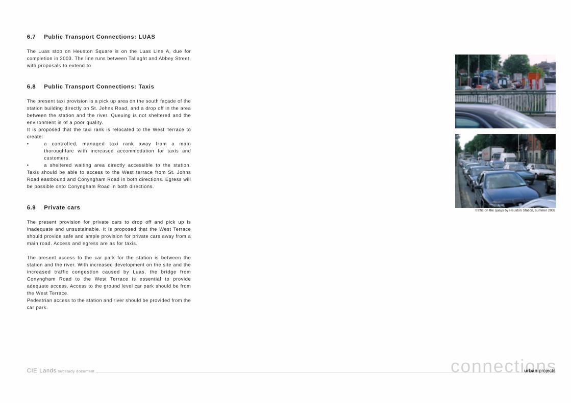
The present taxi provision is a pick up area on the south façade of the
station building directly on St. Johns Road, and a drop off in the area
between the station and the river. Queuing is not sheltered and the
environment is of a poor quality.
It is proposed that the taxi rank is relocated to the West Terrace to
create:
• a controlled, managed taxi rank away from a main
thoroughfare with increased accommodation for taxis and
customers.
• a sheltered waiting area directly accessible to the station.
Taxis should be able to access to the West terrace from St. Johns
Road eastbound and Conyngham Road in both directions. Egress will
be possible onto Conyngham Road in both directions.
6.9 Private cars
The present provision for private cars to drop off and pick up is
inadequate and unsustainable. It is proposed that the West Terrace
should provide safe and ample provision for private cars away from a
main road. Access and egress are as for taxis.
The present access to the car park for the station is between the
station and the river. With increased development on the site and the
increased traffic congestion caused by Luas, the bridge from
Conyngham Road to the West Terrace is essential to provide
adequate access. Access to the ground level car park should be from
the West Terrace.
Pedestrian access to the station and river should be provided from the
car park.
CIE Lands substudy document
traffic on the quays by Heuston Station, summer 2002
sustainability strategyurban projects
7.0 Sustainability Strategy
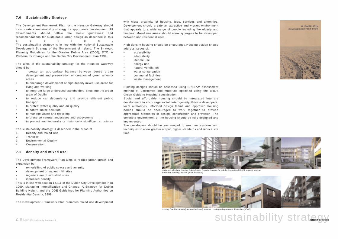
The Development Framework Plan for the Heuston Gateway shouldincorporate a sustainability strategy for appropriate development. Alldevelopments should follow the basic guidelines andrecommendations for sustainable urban design as described in thiss e c t i o n .The sustainability strategy is in line with the National SustainableDevelopment Strategy of the Government of Ireland, The StrategicPlanning Guidelines for the Greater Dublin Area (2000), DTO: APlatform for Change and the Dublin City Development Plan 1999.
The aims of the sustainability strategy for the Heuston Gatewayshould be:• create an appropriate balance between dense urban
development and preservation or creation of green amenity areas
• to encourage development of high density mixed use areas forliving and working
• to integrate large underused stakeholders’ sites into the urbangrain of Dublin
• to reduce car dependency and provide efficient public transport
• to protect water quality and air quality • to control noise pollution• to manage waste and recycling• to preserve natural landscapes and ecosystems• to protect architecturally or historically significant structures
The sustainability strategy is described in the areas of1. Density and Mixed Use2. Transport3. Environmental Quality4. Conservation
7.1 density and mixed use
The Development Framework Plan aims to reduce urban sprawl andexpansion by:• remodelling of public spaces and amenity• development of vacant infill sites• regeneration of industrial sites• increased densityThis is in line with section 14.1.1 of the Dublin City Development Plan1999, Managing Intensification and Change: A Strategy for DublinBuilding Height, and the DOE Guidelines for Planning Authorities onResidential Density, 1999.
The Development Framework Plan promotes mixed use development
CIE Lands substudy document
with close proximity of housing, jobs, services and amenities.Development should create an attractive and vibrant environmentthat appeals to a wide range of people including the elderly andfamilies. Mixed use areas should allow synergies to be developedbetween non residential uses.
High density housing should be encouraged.Housing design shouldaddress issues of:• accessibility• adaptability• lifetime use• energy use• natural ventilation• water conservation• communal facilities • waste management
Building designs should be assessed using BREEAM assessmentmethod of EcoHomes and materials specified using the BRE’sGreen Guide to Housing Specification.Social and affordable housing should be integrated into the development to encourage social heterogeneity. Private developers,local authorities, informed design teams and approved housing bodies should be encouraged to work together to provide appropriate standards in design, construction and provision. Thecomplete environment of the housing should be fully designed andimplemented.The developers should be encouraged to use new systems and techniques to allow greater output, higher standards and reduce sitetime.
social and affordable housing, Dublin [Urban Projects]; housing for elderly, Amsterdam [KCAP]; terraced housing,Rotterdam; housing, Helsinki [Arrak Architects]
housing, Dornbirn, Austria [Herman Kaufmann]; terraced housing and apartments, Rotterdam [KCAP]
The strategy for maintaining a high quality and sustainable environment in the Heuston Gateway is described in terms of energymanagement, water management and green spaces.
7.3.1 energy managementThe developments in the Heuston Gateway should aim to reduceenergy consumption by:• high density development• site design orientation to ensure optimum passive solar gain• use of a rational energy supply and efficient use• high levels of insulation and thermal capacity in building
fabric
Proposals for the Heuston Station lands should apply for grants andaward schemes such as the House of Tomorrow Research,Development and Demonstration Programme (RD&D). This programme is administered by the Irish Energy Centre under theEconomic and Social Infrastructure Operational Programme of theNational Development Plan. Proposals of a significant scale areencouraged. Model projects for new build, refurbishment or retrofit ofhousing, demonstrating superior energy design and technologyimplementation in homes or groups of homes under real operatingconditions with the potential for market influence and replication aresuitable for consideration in this scheme.
7.3.2 water managementGroundwater and surface water should be protected and waste waterminimized.Diverting surface water to reservoirs within green spaces can havethe following positive effects:• improvement in air quality by helping evaporation and
therefore increasing air humidity• improvement in microclimate• aiding slow soaking and restoration of natural water table• improvement in social and visual amenity
Flooding risk should be minimized by retaining permeable groundareas and improving surface drainage.It is essential to avoid loss of soil permeability by:• maximising areas of green roofs• use of permeable surfaces in car parks• promotion of grassed areas in courtyards
Rainwater collection can be an economical solution to applicationssuch as toilet flushing, washing machines, cleaning and production
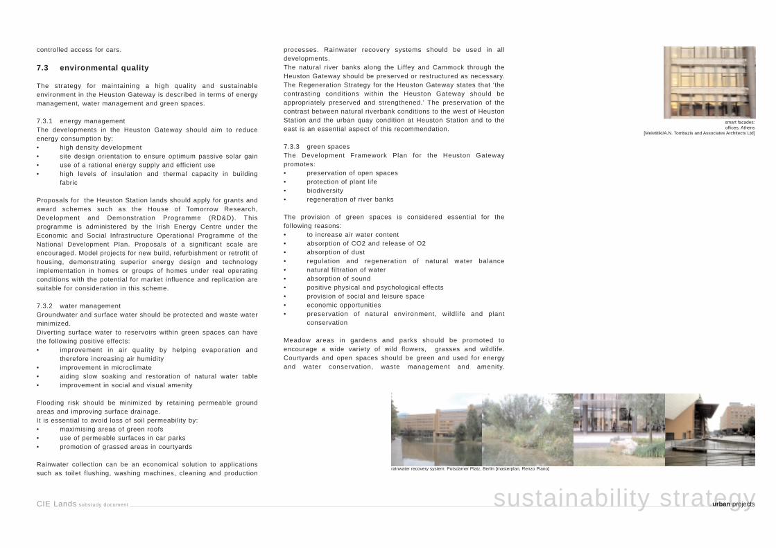
processes. Rainwater recovery systems should be used in all developments. The natural river banks along the Liffey and Cammock through theHeuston Gateway should be preserved or restructured as necessary.The Regeneration Strategy for the Heuston Gateway states that ‘thecontrasting conditions within the Heuston Gateway should beappropriately preserved and strengthened.’ The preservation of thecontrast between natural riverbank conditions to the west of HeustonStation and the urban quay condition at Heuston Station and to theeast is an essential aspect of this recommendation.
7.3.3 green spacesThe Development Framework Plan for the Heuston Gatewaypromotes:• preservation of open spaces• protection of plant life• biodiversity• regeneration of river banks
The provision of green spaces is considered essential for the following reasons:• to increase air water content• absorption of CO2 and release of O2• absorption of dust• regulation and regeneration of natural water balance• natural filtration of water• absorption of sound • positive physical and psychological effects• provision of social and leisure space• economic opportunities• preservation of natural environment, wildlife and plant
conservation
Meadow areas in gardens and parks should be promoted to encourage a wide variety of wild flowers, grasses and wildlife.Courtyards and open spaces should be green and used for energyand water conservation, waste management and amenity.
smart facades:offices, Athens
[Meletitiki/A.N. Tombazis and Associates Architects Ltd]
rainwater recovery system: Potsdamer Platz, Berlin [masterplan, Renzo Piano]
sustainability strategyurban projects
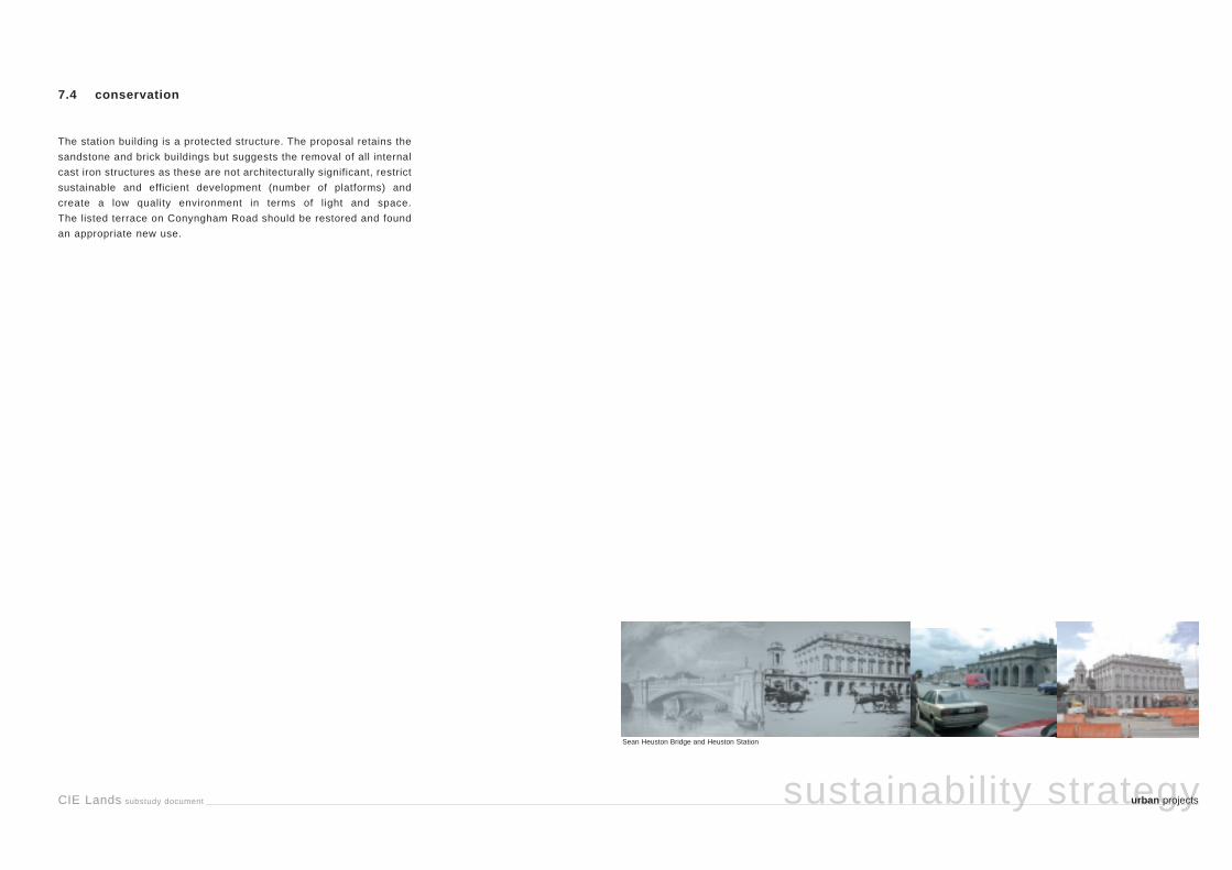
7.4 conservation
The station building is a protected structure. The proposal retains the
sandstone and brick buildings but suggests the removal of all internal
cast iron structures as these are not architecturally significant, restrict
sustainable and efficient development (number of platforms) and
create a low quality environment in terms of light and space.
The listed terrace on Conyngham Road should be restored and found