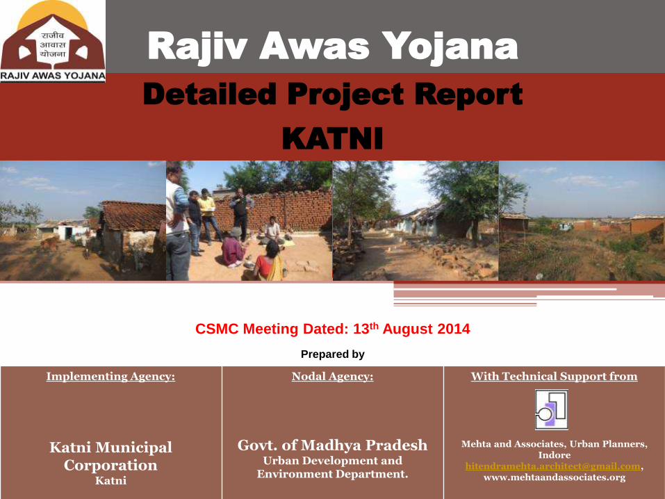
Implementing Agency: Katni Municipal Corporation Katni Nodal Agency: Govt. of Madhya Pradesh Urban Development and Environment Department. With Technical Support from Mehta and Associates, Urban Planners, Indore [email protected], www.mehtaandassociates.org Rajiv Awas Yojana Detailed Project Report KATNI Prepared by CSMC Meeting Dated: 13 th August 2014
6 Proposed Built up Area for Community Hall- (Sq.M) 169.50
7 Proposed Built up Area for Commercial- GF (Sq.M) 94.76
8 Total built up Area on all floors (Sq.M) 5962.26
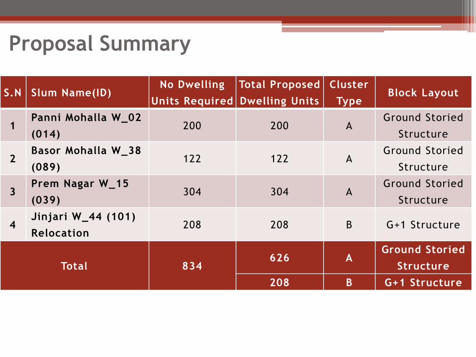
9 Total No .of Dwelling Units 200
10 Density (Units/Ha) 79 DU/Ha
11 FAR Consumed 0.24
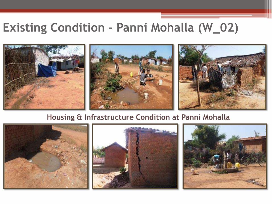
Proposed Layout – Panni Mohalla (W_02)
KEY PLAN
LAYOUT PLAN
Bird’s Eye View - Layout
Panni Mohalla
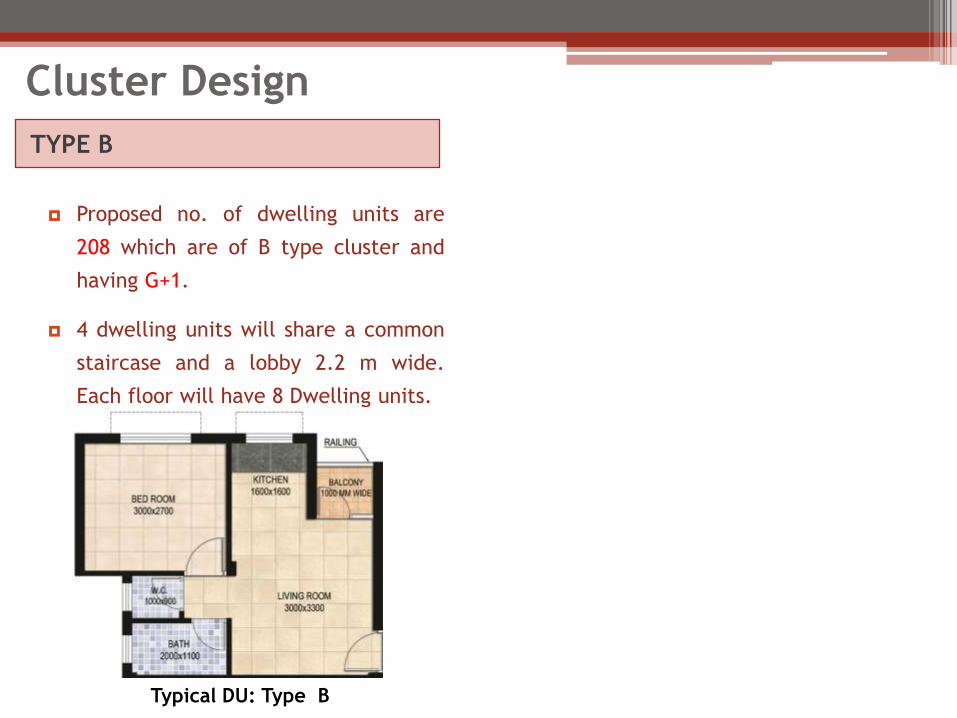
TYPE A
Proposed no. of dwelling units are 200
which are of A type cluster and having
Ground Storied Structure.
Typical DU: Type A
Dwelling Unit Design
Dwelling Unit A Type (Sq.M)
Carpet Area 26.61
Built-up Area 28.49
• Dwelling Unit Design
▫ The size of dwelling units of Type A is Carpet
Area 26.61 Sqm, and built up area of 28.49 Sqm
• The dwelling units will be provided with
▫ Two habitable rooms which include one Living
Room and one bed room.
▫ Cooking Alcove
▫ Balcony
▫ Individual toilet will opening in the Hall.
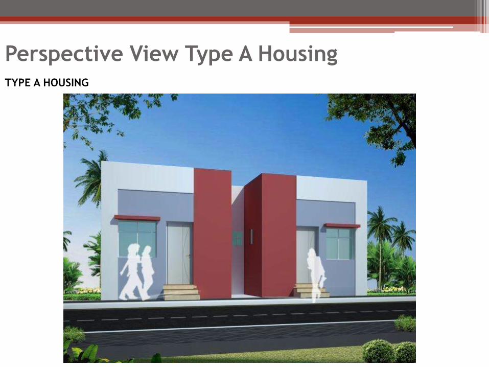
Perspective View Type A Housing TYPE A HOUSING
Details of Proposal in Slums
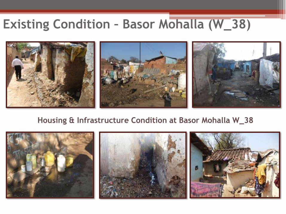
Basor Mohalla (W_38)
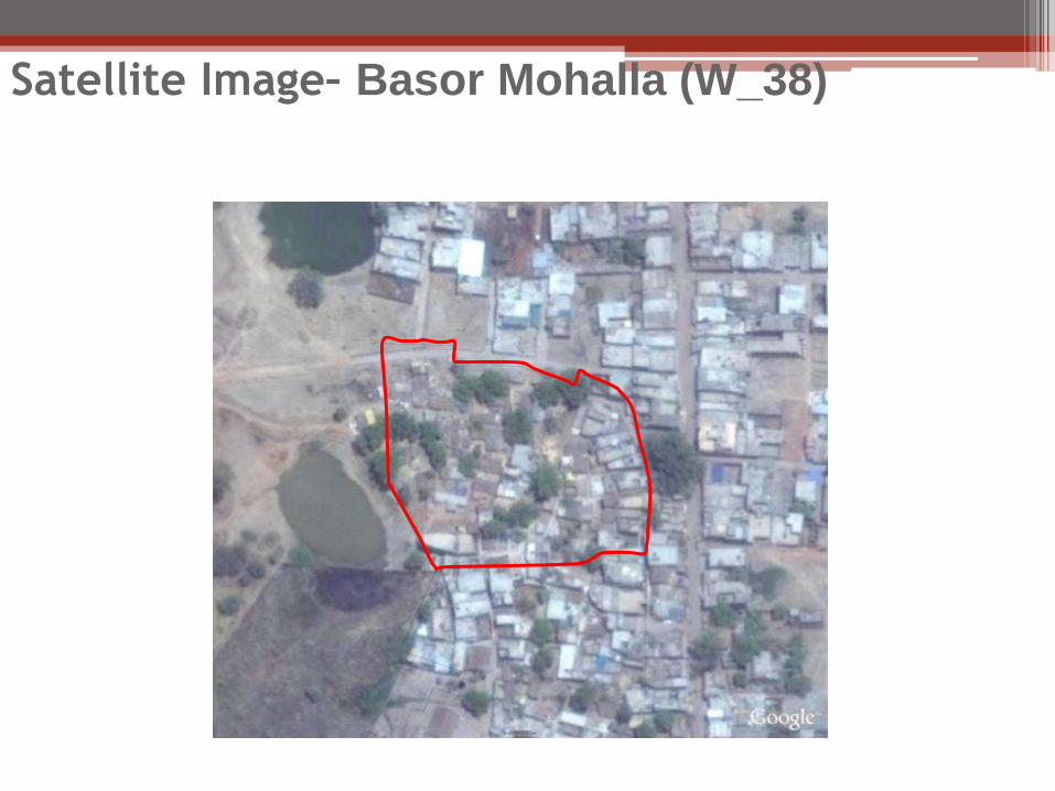
Satellite Image– Basor Mohalla (W_38)
Location– Basor Mohalla (W_38)
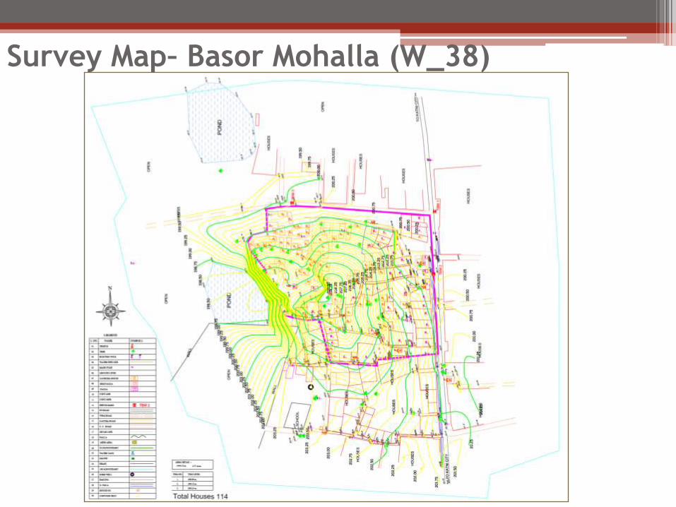
Survey Map– Basor Mohalla (W_38)
Housing & Infrastructure Condition at Basor Mohalla W_38
Existing Condition – Basor Mohalla (W_38)
1 Slum Code 089
2 Ward number Ward No. 38
3 Age of slum 40-45 years
4 Status of the slum Notified
5 H.H. in the slum 114
(Pucca 45,
Semi-Pucca 4,
Kaccha 65)
6 Total Population in the slum 490
7 Area of the slum 1.36 Ha
8 Approach Road Cement concrete Road
9 Inner Road Kaccha
Basic Information – Basor Mohalla (W_38)
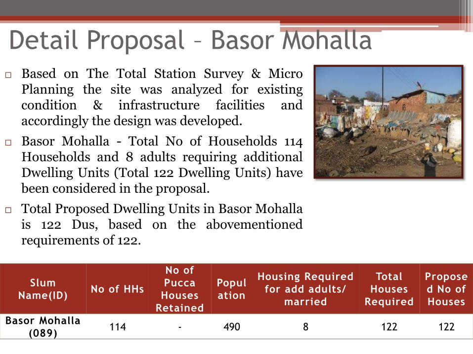
Based on The Total Station Survey & Micro Planning the site was analyzed for existing condition & infrastructure facilities and accordingly the design was developed.
Basor Mohalla - Total No of Households 114 Households and 8 adults requiring additional Dwelling Units (Total 122 Dwelling Units) have been considered in the proposal.
Total Proposed Dwelling Units in Basor Mohalla is 122 Dus, based on the abovementioned requirements of 122.
Slum
Name(ID) No of HHs
No of
Pucca
Houses
Retained
Popul
ation
Housing Required
for add adults/
married
Total
Houses
Required
Propose
d No of
Houses
Basor Mohalla
(089) 114 - 490 8 122 122
Detail Proposal – Basor Mohalla
The Net Planning area of Basor Mohalla is 13565.76 Sq M of which 4476.70 Sq M that is 33 % area was proposed for ground coverage .
S.N Factors considered Basor Mohalla (089)
1 Total land Area (Sq.M) 14441.93
2 Area Under River Buffer (Sq.M) 0.00
3 Area under Railway Buffer 0.00
4 Net Planning Area (Sq.M) 13565.76
5 Permissible Ground Coverage (33%)(Sq.M) 4476.71
6 Proposed Ground Coverage (Sq.M) 3714.88
7 Area on Ground Floor (Sq.M) 3481.88
11 Proposed Built up Area for Community Hall- GF (Sq.M)
169.5
12 Proposed No. of Convenient Shops 4
13 Total built up Area on all floors (Sq.M) 3714.88
14 Total No.of Units 122
15 Density (units/ha) 90 DU/Ha
Details of Redevelopment Proposal
Proposed Layout- Basor Mohalla
TYPE A
Proposed no. of dwelling units are 122
which are of A type cluster and having
Ground Storied Structure.
Typical DU: Type A
Dwelling Unit Design
Dwelling Unit A Type (Sq.M)
Carpet Area 26.61
Built-up Area 28.49
• Dwelling Unit Design
▫ The size of dwelling units of Type A is Carpet
Area 26.61 Sqm, and built up area of 28.49 Sqm
• The dwelling units will be provided with
▫ Two habitable rooms which include one Living
Room and one bed room.
▫ Cooking Alcove
▫ Balcony
▫ Individual toilet will opening in the Hall.
Perspective View Type A Housing TYPE A HOUSING
Details of Proposal in Slums
Prem Nagar (W_39)
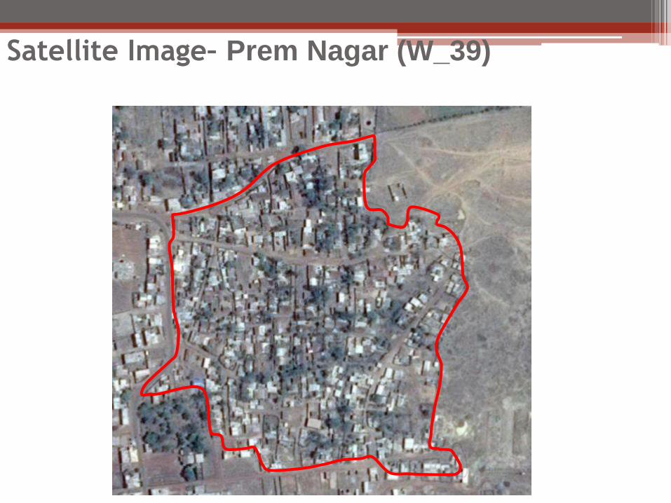
Satellite Image– Prem Nagar (W_39)
Prem Nagar
Location– Prem Nagar (W_39)
Survey Map– Prem Nagar (W_39)
Housing & Infrastructure Condition at Prem Nagar
Existing Condition – Prem Nagar (W_15)
1 Slum Code 039
2 Ward number Ward No. 15
3 Age of slum 40-45 years
4 Status of the slum Notified
5 H.H. in the slum 262
(Pucca 130,
Semi-Pucca 22,
Kaccha 110)
6 Total Population in the slum 1049
7 Area of the slum 3.65 Ha
8 Approach Road Cement concrete Road
9 Inner Road Kaccha
Basic Information – Prem Nagar Slum
Demography Information
Additional Adult Population 42
Net Residential Density(HH/Ha) 71.78 HHs per Ha
Household Size 4.00
Number of Literates 48.32 % of population are literates
Socio-Economic Information
Caste (HH) General SC/ST OBC
73 122 66
Major Livelihood Daily Laborers
Livelihood Salaried Self employed Agriculture
Casual
Labor Others
0 0 9 161 92
0 0-499 499-999 1000-1999
2000-
2999 3000
18 24 26 36 177
Demographic/ Socio-Economic Profile
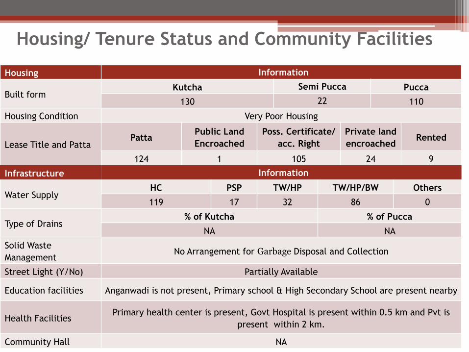
Housing Information
Built form Kutcha Semi Pucca Pucca
130 22 110
Housing Condition Very Poor Housing
Lease Title and Patta Patta
Public Land
Encroached
Poss. Certificate/
acc. Right
Private land
encroached Rented
124 1 105 24 9
Infrastructure Information
Water Supply HC PSP TW/HP TW/HP/BW Others
119 17 32 86 0
Type of Drains % of Kutcha % of Pucca
NA NA
Solid Waste
Management No Arrangement for Garbage Disposal and Collection
Street Light (Y/No) Partially Available
Education facilities Anganwadi is not present, Primary school & High Secondary School are present nearby
Health Facilities Primary health center is present, Govt Hospital is present within 0.5 km and Pvt is
present within 2 km.
Community Hall NA
Housing/ Tenure Status and Community Facilities
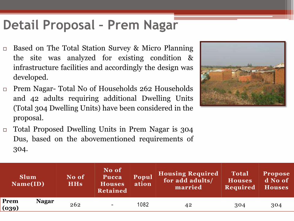
Based on The Total Station Survey & Micro Planning
the site was analyzed for existing condition &
infrastructure facilities and accordingly the design was
developed.
Prem Nagar- Total No of Households 262 Households
and 42 adults requiring additional Dwelling Units
(Total 304 Dwelling Units) have been considered in the
proposal.
Total Proposed Dwelling Units in Prem Nagar is 304
Dus, based on the abovementioned requirements of
304.
Slum Name(ID)
No of HHs
No of Pucca
Houses Retained
Population
Housing Required for add adults/
married
Total Houses
Required
Proposed No of Houses
Prem Nagar (039)
262 - 1082 42 304 304
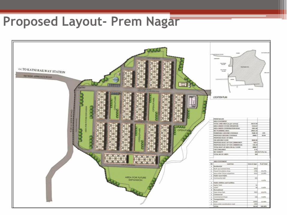
Detail Proposal – Prem Nagar
The Net Planning area of Prem Nagar is 33362.05 Sq M of which 11009.48 Sq M that is 33 % area was proposed for ground coverage .