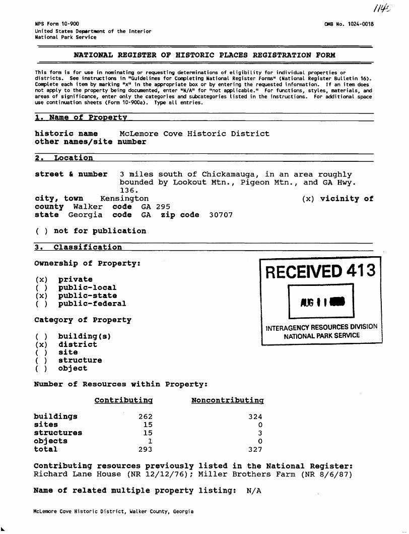
NFS Form 10-900 United States Department of the Interior National Park Service 0MB No. 1024-0018 NATIONAL REGISTER OF HISTORIC PLACES REGISTRATION FORM This form is for use in nominating or requesting determinations of eligibility for individual properties or districts. See instructions in "Guidelines for Completing National Register Forms'* (National Register Bulletin 16). Complete each item by marking "x" in the appropriate box or by entering the requested information. If an item does not apply to the property being documented, enter "N/A" for "not applicable." For functions, styles, materials, and areas of significance, enter only the categories and subcategories listed in the instructions. For additional space use continuation sheets (Form 10-900a). Type all entries. 1. Name of Property historic name McLemore Cove Historic District other names/site number 2. Location street & number 3 miles south of Chickamauga, in an area roughly bounded by Lookout Mtn., Pigeon Mtn., and GA Hwy. 136. city, town Kensington (x) vicinity of county Walker code GA 295 state Georgia code GA zip code 30707 ( ) not for publication 3. Classification ' ^~~~ Ownership of Property: (x) private ( ) public-local (x) public-state ( ) public-federal Category of Property ( ) building(s) (x) district ( ) site ( ) structure ( ) object Number of Resources within Property: Contributing Noncontributincr RECEIVED 413 AfitI INTERAGENCY RESOURCES DIVISION NATIONAL PARK SERVICE buildings sites structures objects total 262 15 15 1 293 324 0 3 0 327 Contributing resources previously listed in the National Register: Richard Lane House (NR 12/12/76); Miller Brothers Farm (NR 8/6/87) Name of related multiple property listing: N/A McLemore Cove Historic District, Walker County, Georgia
Transcript
NFS Form 10-900United States Department of the InteriorNational Park Service
0MB No. 1024-0018
NATIONAL REGISTER OF HISTORIC PLACES REGISTRATION FORM
This form is for use in nominating or requesting determinations of eligibility for individual properties or districts. See instructions in "Guidelines for Completing National Register Forms'* (National Register Bulletin 16). Complete each item by marking "x" in the appropriate box or by entering the requested information. If an item does not apply to the property being documented, enter "N/A" for "not applicable." For functions, styles, materials, and areas of significance, enter only the categories and subcategories listed in the instructions. For additional space use continuation sheets (Form 10-900a). Type all entries.
1. Name of Property
historic name McLemore Cove Historic District other names/site number
2. Location
street & number 3 miles south of Chickamauga, in an area roughlybounded by Lookout Mtn., Pigeon Mtn., and GA Hwy. 136.
city, town Kensington (x) vicinity ofcounty Walker code GA 295state Georgia code GA zip code 30707
INTERAGENCY RESOURCES DIVISION NATIONAL PARK SERVICE
buildingssitesstructuresobjectstotal
26215151
293
324030
327
Contributing resources previously listed in the National Register:Richard Lane House (NR 12/12/76); Miller Brothers Farm (NR 8/6/87)
Name of related multiple property listing: N/A
McLemore Cove Historic District, Walker County, Georgia
4. State/Federal Agency Certification
As the designated authority under the National Historic Preservation Act of 1966, as amended. I hereby certify that this nomination meets the documentation standards for registering properties in the National Register of Historic Places and Beets the procedural and professional requirements set forth in 36 CFR Part 60. In ay opinion, the property Meets the National Register criteria. ( ) See continuation sheet.
S~\
Da73 7/We* f f
Elizabeth AT LyonState Historic Preservation Officer,Georgia Department of Natural Resources
In ay opinion, the property ( ) meets ( ) does not meet the National Register criteria. ( ) See continuation sheet.
Signature of commenting or other official Date
State or Federal agency or bureau
5. National Park Service Certification
I, hereby, certify that this property is:
Tb^entered in the National Register
( ) determined eligible for the National Register
( ) determined not eligible for the National Register
( > removed from the National Register
( ) other, explain:
( ) see continuation sheetSignature, Keeper of the National Register Date
McLemore Cove Historic District, Ualker County, Georgia
Late Victorian: Gothic; Queen AnneOther: I-House; Plantation Plain; Central Hallway Cottage; Gabled Ell Cottage; Bungalow; Queen Anne Cottage; Saddlebag; Double-Pen; New South Cottage; Folk Victorian; Hall-Parlor; Temple Front Cottage
Materials:
foundation Brick, Stone walls Wood, Brick roof Asphalt, Metal other
Description of present and historic physical appearance:
McLemore Cove is located in Walker County, in what is called the Valley and Ridge and Cumberland Plateau Physiographic Provinces of northwest Georgia. The Cove valley is part of a broad belt of unmetamorphosed sedimentary rock that through erosion has formed into a series of parallel ridges and valleys. The portions of Lookout Mountain and Pigeon Mountain are part of the Cumberland Plateau and are relatively flat topped and composed of sandstone and limestone. Unusual boulder formations have been formed from the millions of years of sculpting by wind and water. An extensive system of caves is also found in this region.
McLemore Cove Historic District, Walker County, Georgia 3
NPS Form 10-900-a
United States Department of the Interior National Park Service
National Register of Historic Places Continuation Sheet
Section 7
RECEIVEO44No.-VI 024-0018
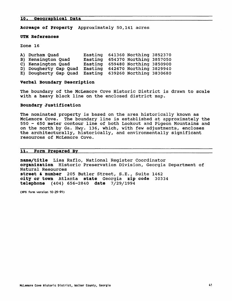
WJGI IB94
The McLemore Cove Historic District forms a roughly 50,141 acre triangular-shaped area containing the irregular-shaped valley of McLemore Cove between the ridge lines of Lookout Mountain to the west and Pigeon Mountain on the east. The range in elevation for both mountains is between 1800 and 2000 feet above sea level. The district is approximately three miles south of Chickamauga, Georgia.
McLemore Cove Historic District is characterized by a generally mountainous terrain featuring small hills that punctuate the farming area of the Cove. The settlement patterns tend to follow the edges of the valley or cove; the floodplains were reserved for agriculture, while the steeper slopes were unsuitable for development and are hardwood forests.
McLemore Cove is a long, V-shaped stretch of valley land, with a northeast-southwest orientation. In literal terms the valley stretches a distance of approximately 15 miles from the Pond Spring and Cooper Heights communities to the north, to the former Dougherty Farms, now Mountain Cove Farms, located at the southern tip of the district. Several creeks (W. Chickamauga, Hogjowl, Mud, Voiles, and Mill) run through the valley creating a diversified, gently rolling valley floor punctuated by several hills and intruding peninsulas of higher ground extending from the flanking hillsides.
There is a gradual change in the natural environment from the south end of the Cove to the north. Roland, Harp, and Shankle are three major ridge lines within the district. Roland and Harp define Back Valley at the foot of Lookout Mountain and Shankle defines Hogjowl Valley at the southeastern end of the Cove, near Dougherty Gap. Because of the three ridge lines, the southern end is a clearly defined "cove" that widens to an ever-broadening valley to flatter topography at the northern district boundary north of Pond Springs.
Roads through the district are parallel to the ridge lines and basically follow former trade routes. West Cove Road and a section of State Highway 193 parallel the western side of the district while State Highway 341 and Hog Jowl Road parallel the eastern side. Lookout Mountain Scenic Highway (Ga. Hwy 136) runs along the northern portion of the historic district.
Topographically and visually bounded, the Cove contains a pronounced concentration of historic resources. The Cove is named after a prominent Cherokee/Scottish family who settled in the area during the 1820s. The 1832 Land Lottery opened the area to white settlement. The Cove also played an active role during the Civil War in the events leading up to the Battle at Chickamauga. The area developed a few small linear and crossroads communities with further growth occurring
McLemore Cove Historic District, Walker County, Georgia
NPS Form 10-900-a 0MB Approved No. 1024-0018
United States Department of the Interior National Park Service
National Register of Historic Places Continuation Sheet
Section 7
when the Chattanooga Southern Railroad was established in 1887. Industry also developed at Estelle during the early 20th-century with the mining of iron ore.
The district contains excellent examples of late 19th-century and early 20th-century farmsteads with a wide range of architectural types of farm houses, agricultural outbuildings, and fields. Large farmland tracts are found throughout the Cove area while the north central section of the district is defined by several hills and smaller farm tracts historically settled by a small population of African- Americans. Overall the area contains a high degree of historic integrity and remains fairly intact except for a few areas of recent development.
The district contains a c. 1840s log school, historic churches, cemeteries, community stores, water towers, landscape features, iron ore mining tipples, concrete stringer bridges, a railroad tunnel, and various historic archaeological sites. Still relatively agricultural in nature, the district contains outstanding rural vistas and is one of the most intact rural landscapes remaining in the state.
Two historic properties within the district are already listed on National Register: The c.1855-1859, Gothic Revival style Richard Lane House listed 12/12/76 and the Neoclassical Revival style Miller Brothers Farm (former Kensington Hotel) listed 8/6/87.
Natural Environment
Pigeon Mountain/The Pocket
Part of the Cumberland Plateau, Pigeon Mountain was named for the passenger pigeon, which in the 1800's roosted in this area by the thousands. The western side of the mountain forms the eastern boundary of the historic district. The mountain contains rare and exceptional natural resources as well as potential for historical and archeological resources. Caves and unusual sandstone rock formations are also found in this area. During the early 20th-century, approximately 30 families lived on the mountain. However, during the 1930s, the water table dropped and all the wells went dry forcing the families to abandon their homes. In 1969, the Georgia Department of Natural Resources began leasing the area in an effort to study and protect the natural environment. Now owned by the State of Georgia, the area includes more than 13,000 acres and is managed as the Pigeon Mountain Wildlife Management Area, a portion of which is included in this historic district.
The mountain also contains an area known as "The Pocket." Located in the northwest section of the mountain, this area contains several rare
McLemore Cove Historic District, Walker County, Georgia 5
NPS Form 10-900-a 0MB Approved No. 1024-0018
United States Department of the Interior National Park Service
National Register of Historic Places Continuation Sheet
Section 7
plant species. This "pocket" is a small patch of mesic hardwood forest in which grow at least eleven significant species found nowhere else in Georgia. Examples of some of these uncommon plants include bent trillium, nodding spurge, lance-leaf trillium, wild hyacinth, celandine poppy, Ohio buckeye, log fern, Virginia bluebells, hairy mock-orange, and blue ash. The Pocket is considered one of the most remarkable botanical areas in northwest Georgia.
Lookout Mountain
Lookout Mountain is the southernmost extension of the Cumberland Plateau and extends for approximately 100 miles through the states of Tennessee, Georgia, and Alabama. A portion of the eastern side of Lookout Mountain forms the western boundary of the historic district. The mountain is known as one of the world's richest cave regions.
Landscape Characteristics
The district is still very rural in nature with a variety of active farms. Because of the hilly topography, field patterns are also irregularly-shaped and tend to follow streamlines or the hillside terrain. Large open areas used for pasture land and fields of corn are prominent agricultural features (photographs 1, 2). Because of the limestone soil, red cedars grow profusely throughout the Cove, particularly along West Cove Road, hence the name of one community, Cedar Grove. Limestone quarries were once located throughout the region and use of limestone is a predominant landscape feature for foundations, chimneys, and walls. Simple concrete stringer bridges are also found at several creek crossings.
Domestic outbuildings are usually arranged in clusters to the rear of a farmhouse, whereas barns and corneribs are located at some distance from the house. A dirt road usually leads to the house from the main road. Most dwellings are located close to the roads. Field patterns are dependant on elevation. Dirt or gravel drives connect farmhouses and clusters of farm buildings to the main roads. Many houses are built on higher elevations affording views of the surrounding countryside. Where the terrain is relatively level, it was cultivated. Steep slope areas have been and continue to remain woodlands. There were a few uses of agricultural fences. Into the early 20th-century, cattle were allowed to range on the surrounding mountains. Stream beds, shrub lines, and fences delineate field patterns. Today, wire-and-post, wooden pole, and plank fences enclose pasture and cropland. Adding to the picturesque quality of the district are the weather-beaten barns, fence rows, and tracts of pasture land, cultural features often seen in the landscape (photographs 7, 8, 9, 39, 43, 48, 49, 51, 56, 57, 69).
McLemore Cove Historic District, Walker County, Georgia
NFS Form 10-900-a 0MB Approved No. 1024-0018
United States Department of the Interior National Park Service
National Register of Historic Places Continuation Sheet
Section 7
The "landscape of work" is among Georgia's earliest and most basic forms of historic residential landscaping. It is evident in most of the historic farms in this district, with the smokehouse, granary, and kitchen garden in close proximity to the main house. This landscaping brought a sense of order, neatness, and efficiency to the working environment of the farm (photographs 26, 68, 98).
Examples of early 20th-century landscaping is also found in the district. Front yards generally include small open lawn with trees, flower beds, and with a variety of shrubs planted close to the house (photographs 19, 73, 105).
Farm Layouts
The majority of buildings in the Cove are residential or farm-related. Farm buildings make up the largest number of structures, with most examples dating from the late 19th and early 20th centuries. Historically, farms averaged between 300 - 400 acres.
Farms are dispersed throughout the Cove with denser development at crossroad settlements. Farmsteads tend to be located close to the major roads with wider dispersement along back roads. Agricultural fields are located closer to the farm complex with pasture areas located further back and partially up the side of mountains, known as "cow grazing lines". The layout of the farm complex is also varied. Because of the mild climate, farm layout was more for convenience and not out of necessity. Farm outbuildings are grouped and in proximity to the main farmhouse, but with no clear pattern of layout.
Agricultural Buildings
Like most of the southeast region, crib barns are the common barn type found in McLemore Cove. These barns generally date from the 1880s through the 1930s. Composed of one, two, four, or six (transverse) cribs, the barns are often subdivided by aisles. Built for functional use, the barns are utilitarian in design with post-and-beam interior supports and stone foundations. Construction materials include log, pole, and sawn lumber. The large crib barns feature large gable, gambrel, or broken pitch gable roofs, lattice vents to ventilate the hay loft, and often a hay bonnet to protect the loft opening. These barns were mainly used for storing equipment, stalls for larger animals, and a hayloft (photographs 7, 9, 30, 43, 54, 56, 64, 67, 94, 96). Smaller ancillary buildings include smokehouses, chicken coops, granaries, corncribs, milkhouses, and apiaries (photographs 28, 29, 32, 59, 68, 74). Some farm complexes have commissaries (photograph 5). Often simple pens for sheltering smaller farm animals were open sheds. Because of the insubstantial construction of these sheds, not many have survived. Although tobacco was not a major crop in the
McLemore Cove Historic District, Walker County, Georgia 7
NPS Form 10-900-a 0MB Approved No. 1024-0018
United States Department of the Interior National Park Service
National Register of Historic Places Continuation Sheet
Section 7
Cove, there is an example of a large tobacco barn in the district (photograph 18). Historic structures remaining on some farms include wellhouses and silos.
Farm Complexes
The Cove contains excellent examples of intact farm complexes. The James W. Coulter Farm is located in the central section of the district located at the crossroads of W. Cove Road and Highway 193. The two-story, frame house was constructed in the 1850s. Originally built as a dogtrot, the opening was enclosed during the early 20th century. The Coulter Farm is one of Georgia's Centennial Farms and has been actively farmed since 1874. The farm complex contains several historic buildings randomly grouped behind and to the rear of the main house (Exhibit A). These buildings range from a store used before the Civil War to a c. 1915 milkhouse and several barns (photographs 26 - 33). A historic roadway used during the Civil War is also located on the property.
The Dougherty Farm (currently Mountain Cove Farms) is one of the largest farms in the district. Located at the southern end of the Cove, this 11,500 acre farm contains several historic buildings including a 19th-century house with stone additions, an early 20th- century commissary, and 1940s worker housing. This farm was one of the largest row crop farms in the area and is now a cattle farm. The vast field and pasture areas of this farm are still intact and provide some of the most outstanding vistas in the Cove (photographs 1-5).
The Wardlaw-Kilgore Farm (currently Grant Farm) is located at the northern section of the district along the Lookout Mountain Scenic Highway (Ga. Hwy 136). The late 19th-century farmhouse is an example of a gable-ell type cottage with gable and porch ornamentation. Agricultural outbuildings include a corn crib, a couple gable front barns one with a wide overhang, and a large gambrel roof barn (Exhibit B - Photographs 66-69).
Building Types
Historic houses in the district are located primarily along the major roads. Most of the houses are wood-framed with wood finishes and detailing and range in date from the 1850s to the 1940s. Many of the buildings are constructed with limestone foundations. Stone retaining walls are also common landscape features (photograph 20). The majority are vernacular farmhouses with little stylistic detailing and prominent porches.
There is one historic brick house in the district, the J. C. Morgan House constructed in 1884 by local brick mason George Cornish.
HcLemore Cove Historic District, Walker County, Georgia 8
NPS Form 10-900-a 0MB Approved No. 1024-0018
United States Department of the Interior National Park Service
National Register of Historic Places Continuation Sheet
Section 7
Originally built as a dog-trot, the 1 1/2 story building features common bond brickwork, gable end chimneys with brick corbeling, cornice returns, and segmentally arched windows. Windows on the side facades retain stone lintels (photograph 25).
The Ryan-Phillips House, a c. 1850s I-house, is one of the first frame houses built in the Cove. This two-story house is located on Prick's Gap Road and features a side gable tin roof, brick end chimneys and a one-story, full front porch.
The Martin Davis House constructed in the 1850s (also known as the Widow Davis House) is located at Davis Crossroads at the crossroads of Ga. Hwy 341 and Ga. Hwy 193. Originally a dogtrot, the center section was enclosed c. 1902. A stone addition was added in 1884. A log smoke house remains at the rear of house. The front yard of the house is formally landscaped with boxwood hedges as foundation plantings. Cedar trees are also symmetrically placed. During the Civil War, the Martin-Davis House served as headquarters for U.S. General James Negley (September 1863) before the Battle of Chickamauga (photographs 73-76).
The Jefferson Coulter House is located near the intersection of Hog Jowl Road and West Cove Road. The house is a two-story, central hallway house with gable front additions. The building features Folk Victorian style detailing with a front bay window, and decorative balcony spindlework and balusters. Various historic agricultural outbuildings also remain. The yard is landscaped with boxwoods around the foundation and mature hardwoods in the front yard. Several planting beds are also evident (photograph 105).
The two-story, 1891 Davis-McAdoo-Whitlow House is located in the community of Kensington. It is one of the few remaining houses in Kensington and was constructed during the boom period of the 1890s when the Chattanooga Southern Railroad came through and spurred development. The house is an excellent example of the Folk Victorian style with a two-story full front porch with spindlework and ornamental balusters. The front projecting gable features decorative brackets and fishscale siding (photograph 50).
Other farmhouses which reflect a variety of architectural types include the Owens-Clarkson Farm a c. 1886 central hallway cottage with Folk Victorian style detailing (photograph 10). The Hise House is an example of the Plantation Plain type with a two-story main block, a one-story rear ell, and a one-story front porch (photograph 95). The Andrews House is an example of an I-house type and features a two- story main block (photograph 92). The Hasty House is a two-story, frame Queen Anne type house with a projecting gable and asymmetrical floor plan (photograph 65). The district also contains examples of
McLemore Cove Historic District, Walker County, Georgia 9
DIPS Form 10-900-a 0MB Approved No. 1024-0018
United States Department of the Interior National Park Service
National Register of Historic Places Continuation Sheet
Section 7
New South cottage, double-pen, temple-front cottage, hall-parlor, and bungalow types (photographs 44, 48, 61, 63, 93).
The former Payne's Chapel Methodist parsonage located next to the James W. Coulter farm is an example of a saddlebag type house with a central chimney. The building also features board-and-batten sidingand was constructed in 1887 (photograph 34). *
Schools
The one-room, log, c. 1840s Coulter School (named after Jefferson Coulter) is one of the oldest remaining buildings in the district. Later called the Oak Hill School, the building is located along West Cove Road, south of Cedar Grove, and features hand-hewn logs with 1/2 dovetail notching (photograph 6).
The Pleasant Grove School is a historic African-American school located in the northwest section of the district. Constructed c. 1931, the frame, two-room building exhibits gable brackets and vents, exposed rafters, a metal gable roof, a brick chimney, and a gabled front entrance (photograph 47). The building is now used as a kitchen for the Pleasant Grove Baptist Church. The current church building dates from c. 1955.
Communities
The community types represented within the Cove are "crossroad," "linear," and "railroad" communities. The housing settlement patterns in most of these areas are denser than those of the surrounding rural areas. Almost all of the communities had at one time post offices, stores, churches, depots, and schools, although many of these historic resources are gone. What remains is mostly residential settlement.
Cedar Grove
The community of Cedar Grove is a crossroads community located at the intersection of West Cove, Capt. Wood, and Crow Gap Roads in the southwest section of the district. During the 19th-century, settlement was encouraged in this area because of several paths which converged here from Pigeon Mountain and Lookout Mountain. Besides historic residential buildings, Cedar Grove retains its historic churches, stores, and a historic marker (photographs 20 - 24). A brick springhouse remains near the intersection of West Cove Road and Crow Gap Road. The community also contains two nonhistoric buildings, the former Cedar Grove School constructed in 1951, and a new fire station.
McLemore Cove Historic District, Walker County, Georgia 10
NPS Form 10-900-a 0MB Approved No. 1024-0018
United States Department of the Interior National Park Service
National Register of Historic Places Continuation Sheet
Section 7
The 1923 Cedar Grove Church features a simple gable front with a central steeple (photograph 13). The 1929 Antioch Baptist features a temple front with square columns. Historic cemeteries remain for both churches and date from the mid-19th century (photographs 14, 15). Stacked stone graves are found at both cemeteries. During the Civil War, an encampment of Union troops was at the former Cedar Grove Methodist Church next to the Cedar Grove Cemetery. Two early 20th- century commercial buildings remain. The Cedar Grove Grocery and the Shankle Store are both located near the crossroads. Both buildings are simple, one-story, clapboard, gable front stores (photographs 22, 24).
In 1936, the Daughters of the American Revolution (DAR) erected a stone monument to John McLemore who served in the Battle of 1812 (photograph 21). The Cove was named after John and his brother Robert, who were sons of a Scottish trader and a Cherokee mother.
Kensington
Kensington is an example of a railroad type community. During the 1890s, Kensington developed as a boom town with the completion of the Chattanooga Southern Railroad (later called the Tennessee-Alabama- Georgia Railroad) and went from Chattanooga, TN to Gadsden, AL. The town was developed by the Kensington Land Company, a group of investors who came from Kensington, PA. To encourage development, the town was laid out using a grid pattern. Sixty-foot wide streets were planned, a five-story hotel was built and the town soon boosted a depot, stores, a post office, a cotton mill, an electric plant and 40 houses. A fire in 1892 destroyed the mill and electric plant and the 1893 Depression put an end to further development. Unfortunately, very little remains today of Kensington. The former Kensington Hotel (Miller Brothers Farm) is already listed on the National Register (1987). The Davis-McAdoo-Whitlow House is one of the few remaining residential buildings in Kensington (photograph 50). A metal building used by the cotton mill now serves as a barn. A portion of the railroad tracks remains, now owned by Norfolk Southern Railroad. Two nonhistoric industries are located in Kensington, the Reichhold Chemical Company and the former E.T. Barwick Carpet Mills; both were constructed in the area during the 1960s. A nonhistoric fire station is located in the former commercial section of Kensington.
Hiniard's (or Hinnard's) Crossroads/Bailey's Crossroads/Coulter's Crossroads/Cassandra v
The intersection of West Cove Roa4 and Ga Hwy 193, was called Hiniard's Crossroads during the 1840s-1850s, named after William Hiniard who was the first postmaster. During the Civil War, the area was called Bailey's Crossroads. Union soldiers were reported to have
McLemore Cove Historic District, Walker County, Georgia 11
NPS Form 10-900-a 0MB Approved No. 1024-0018
United States Department of the Interior National Park Service
National Register of Historic Places Continuation Sheet
Section 7
camped in this area. After 1874, the area was called Coulter's Crossroads. The James W. Coulter farm is currently located at this intersection. A pre-Civil War store and an old roadbed remains on the Coulter property. Several historic houses also remain in the area, including the former Payne's Chapel Methodist church parsonage (photographs 26-34) .
During the late 19th-century, the name of the crossroads was changed yet again. Payne's Chapel was originally located near the crossroads. The chapel's pastor, Dr. Amos Thornburg, suggested the name be changed to "Cassandra" after the ship which brought him to America from England. In 1890, the few businesses that had developed, plus the town name, moved one mile north to take advantage of the newly completed Chattanooga Southern Railroad. However, Cassandra never developed extensively and today only a few residential buildings remain from this time period.
Cooper Heights
Cooper Heights is a crossroads community in the northwest section of the district. Located at the crossroads of West Cove Road and Lookout Mountain Scenic Highway (Ga. Hwy 136), Cooper Heights also grew when the railroad came through in 1890. Examples of early 20th-century bungalow type houses and a double-pen storage building remain in Cooper Heights (photographs 44-46). Two nonhistoric convenience stores are located at the crossroads.
Pond Springs
The linear type community of Pond Springs is located in the northeast section of the district along Ga. Hwy 341. Old Bethel Church Road intersects just north of the community. The area contains good examples of vernacular mid-19th century to early 20th-century buildings. The c. 1850 Henderson House (photograph 62) and the Owings House (photograph 61) are located along Old Bethel Road as well as the Owings and Bailey family cemeteries. Horseshoe Cave is also located near Pond Springs. A nonhistoric convenience store is along the main road.
At the intersection of Ga Hwy 341 and Kensington Road just south of the community is the Cove Methodist Church. Constructed in 1896, the Cove Church is an excellent example of the Folk Victorian style of architecture. The one-story, wood framed building features a gable front entrance, decorative brackets, stained glass, press metal steeple, and a beaded board interior. Large oak and cedar trees are located on the property. Behind the church is the historic cemetery (photograph 60). Across the street from the church is Arcadia Farm, a
McLemore Cove Historic District, Walker County, Georgia 12
NFS Form 10-900-a 0MB Approved No. 1024-0018
United States Department of the Interior National Park Service
National Register of Historic Places Continuation Sheet
Section 7
large dairy farm with a gambrel roof barn, silos, several outbuildings, and pastureland.
Davis Crossroads/Shaw/Estelle
The crossroad area called Davis Crossroads or Shaw is located at the intersection of Ga. Hwy 341 and Ga. Hwy 193. The former community of Estelle is located approximately one mile east on Ga. Hwy 193. The c. 1850s Martin Davis House (Widow Davis House) is located at the crossroads. The area is significant for the role it played during the Civil War with the skirmish at Davis Crossroads in September of 1863. The smokehouse behind the house retains several bullet holes. The house was used for headquarters by U.S. General James Negley (photographs 72-76). The crossroad area was never extensively developed but rather occurred down the road in the community of Estelle. Today, Davis Crossroads contains a few historic residential buildings and a nonhistoric store.
Estelle
During the late 19th-century, the Shaw family owned much of the surrounding land in the area. The town of Estelle is named after Estelle Shaw. A post office was established in 1883, with Avery H. Shaw serving as the first postmaster.
The community of Estelle grew during the late 19th-century due to its location along the railroad line. A major iron ore mining industry also developed at this time and was active until 1924. The Chattanooga Iron and Coal Corporation began operation c. 1897. Mining tipples, a six mile railroad, a crusher, scale house, and wash houses were all part of this mining operation. During this time period a commissary, 175 houses, businesses and two schools were located here. During the 1920s, the mining operation became unprofitable since the ore became more difficult to dig. The mining operation closed in 1924. The population declined and the commercial and residential buildings either burned or were sold for wood.
The Estelle Cemetery and the Chattanooga Southern Railroad bed remain as remanents of the community (photographs 77, 78). The iron ore mining property is now part of the Pigeon Mountain Wildlife Management Area and contains various ruins including concrete tipples from the mining operation (photographs 79-88). Further east of Estelle is a historic structure, the Chattanooga Southern Railroad tunnel at Dug Gap. The 1890s tunnel is approximately 2000' in length.
McLemore Cove Historic District, Walker County, Georgia 13
NPS Form 10-900-a 0MB Approved No. 1024-0018
United States Department of the Interior National Park Service
National Register of Historic Places Continuation Sheet
Section 7
Cemeteries
The historic district contains several historic church, community, and family cemeteries. Common landscaping features found in most of the cemeteries are large hardwood and cedar trees, some decorative iron fencing, limestone walls, and a few elaborate but mostly simple headstones. One of the more unusual aspects to the cemeteries in the Cove is the use of stacked limestone graves. Coulter and Cedar Grove Cemeteries contains examples of stacked stone graves (photographs 15, 36). Nothing is known about these unusual stacked stone graves except the fact that limestone was readily available in the area. Several small family cemeteries such as Porter, Bailey, Harding, and Anderson are found throughout the district. The western side of Garmany Cemetery is the historic African-American cemetery located along Ga. Hwy 136. Landscaping features include mature oak and cedar trees and simple stone markers.
Archaeological Resources - Prehistoric
A 1986 reconnaissance level survey of an area in Back Valley between Lookout Mountain and Harp and Roland Ridges found a diversity of site types and time periods. The report concluded:
"that this area was extensively utilized throughout the Archaic and Woodland periods. Archaic use was probably based in habitation camps and they probably maintained those locations for relatively long periods of time. Woodland use probably involved revisiting certain locations for specialized activities. Both occupations would have had brief hunting camps... Since raw material is so plentiful... expedient tool manufacture and use may be common... All aspects of tool manufacturing were evident on sites surveyed. There are extensive chert deposits which were used by the aboriginal population!" (Cedar Grove Alternative)
The Cedar Grove Alternative study recorded sixty-eight prehistoric sites in the Back Valley area. About two-thirds of the sites require additional work to determine National Register eligibility and three sites were described as."the kinds of sites...which could offer much more information with little additional work."
Contributing/Noncontributing Properties
Overall the area retains a sufficient level of integrity to qualify as a single historic rural district. The generally unobstructed vistas of the historic landscape of the Cove and mountain regions is the key factor that ties the district together and creates a unified cultural landscape. Also contributing to the "sense of district" are the
McLemore Cove Historic District, Walker County, Georgia 14
NPS Form 10-900-a 0MB Approved No. 1024-0018
United States Department of the Interior National Park Service
National Register of Historic Places Continuation Sheet
Section 7
relationships between natural terrain and historic settlement patterns and the relationships among the various historic communities and farmsteads.
Historic buildings such as farms houses, farm outbuildings, commercial buildings, churches, schools; structures such as bridges, water towers; sites such as mining ruins, and objects, such as the John McLemore marker are all considered contributing resources to the historic district. Due to the enormity of the district, not all of the smaller contributing outbuildings such as corn cribs, smokehouses, and sheds were marked on the district map.
Nonhistoric properties in the district are either buildings that are not yet 50 years old or historic buildings that have lost their integrity due to nonhistoric alterations or additions. Examples of nonhistoric buildings include metal Butler buildings used for agricultural purposes, the former E. T. Barwick Carpet Mills, the Reichhold Chemical Company, various mobile homes, and brick ranch type houses constructed from the 1960s to the present. Nonhistoric concrete bridges are noncontributing structures. Noncontributing resources are marked with an "X" on the district map.
McLemore Cove Historic District, Walker County, Georgia 15
8. Statement of significance
Certifying official has considered the significance of this property in relation to other properties:
( ) nationally (x) statewide ( ) locally
Applicable National Register Criteria:
(x) A ( ) B (x) C ( ) D
Criteria Considerations (Exceptions) : (x) N/A
Areas of Significance (enter categories from instructions)
Arch i t ec tur eAgricultureCommerceEducationIndustryLandscape ArchitectureMilitary HistoryReligionTransport at i on/ Commun i ty Deve 1 opmen tArchaeology - Prehistoric/Historic
Period of Significance:
1832-1944
Significant Dates:
183218631890
Significant Person(s):
n/a
Cultural Affiliation:
n/a
Architect (s) /Builder (s) :%
George Cornish - Brick Mason (J. C. Morgan House) John B. Bell - Brick Mason (Cedar Grove springhouse)
McLemore Cove Historic District, Walker County, Georgia 16
NPS Form 10-900-a 0MB Approved No. 1024-0018 United States Department of the Interior National Park Service
National Register of Historic Places Continuation Sheet
Section 8
Significance of property, justification of criteria, criteria considerations, and areas and periods of significance noted above:
Narrative statement of significance (areas of significance)
The McLemore Cove Historic District is significant as a geographically well-defined rural area reflecting the patterns of agricultural and rural development in Northwest Georgia for more than a century.
In architecture the district is significant for providing good examples of typical rural mid-19th to early 20th-century architectural building types in northwest Georgia. These structures represent and document typical building forms, materials and technologies associated with this time and region. Residential building types and styles are defined in documentation from the Office of Historic Preservation's Georgia's Living Places. Architectural styles include Gothic Revival, Neoclassical Revival, and Folk Victorian. House types include I- house, plantation plain, central hallway cottage, dogtrot, gabled ell cottage, bungalow, and Queen Anne cottage. Wood-framed construction, with weatherboard siding and simple front porches is almost ubiquitous. The area contains a wide variety of agricultural outbuildings and structures ranging from large gabled roofed barns and gambrel roof barns to smaller pole barns, chicken coops, smokehouses, sheds, outhouses, silos, bridges, and water towers. Building materials include hand-hewn logs, poles, sawn lumber, brick, and stone. The district also contains examples of late 19th-century and early 20th-century vernacular designs used for commercial and religious properties. The extant architecture represents the spectrum of styles, types, materials, and construction methods that characterize a rural area in northwest Georgia for over 100 years.
The district is significant in agriculture for the extensive collection of agricultural outbuildings and surrounding agricultural fields, many of which are still actively used. Historically and currently, large open areas used for pastureland, or fields of corn or wheat are prominent agricultural features. Fields defined by historic shrub lines, forest edges, and creeks are still evident. Historically, the major crops included corn and wheat, with some dairy, chicken, tobacco, and cotton farming, representative of the diversified farming of this region of the state. Farmers were also active in "corn clubs" during the early 20th-century and several farmers received national recognition for their corn production. The James W. Coulter Farm is a 1994 Georgia Centennial Heritage Farm Award recipient having been an active farm since 1874. The, farm currently raises cattle and hay. Before the Civil War, small scale, self- sufficient farms were typical of the Cove, as elsewhere in the region. Wheat, Indian corn, other grains, some cotton,*and livestock were
McLemore Cove Historic District, Walker County, Georgia 17
NPS Form 10-900-a 0MB Approved No. 1024-0018 United States Department of the Interior National Park Service
National Register of Historic Places Continuation Sheet
Section 8
principal products up into the 20th century. Beef cattle farming was introduced in the 1930s and today is predominant in the Cove. Farming continues to be a major component in the economic viability of the area.
In commerce the district is significant for the remaining one-story, rural stores which served the various communities of the Cove. These buildings are good examples of rural type stores that are one-story, gable front stores and reflect the type of commercial business found in rural areas that served the needs of the surrounding community. The Cedar Grove store, the Shankle store, and Bailey's Crossroad store are simple, wood-frame buildings. The Dougherty Farm store is constructed of stone.
In education the district is significant for the c. 1840s Coulter, (later Oak Hill) log school building. The Coulter school is one of the oldest properties located in the district and was used until the 1920s, when the Cedar Grove schools consolidated. The Pleasant Grove School is a historic African-American school located in the northwest section of the district. Constructed c. 1931, the frame, two-room, one-story building exhibits gable brackets and vents, exposed rafters, a metal gable roof, a brick chimney, and a gabled front entrance. This building represents one of the few remaining historic African- American resources in the district.
The district is significant in industry for the concrete ruins that remain from the former Chattanooga Iron & Coal Corp. The company was in operation for nearly 40 years. Mining tipples, a six-mile railroad, a crusher, scale house, and wash houses were all part of this mining operation. The industry was largely responsible for the growth, development, and decline of the community of Estelle. Extensive ruins remain from this operation.
In landscape architecture the district is significant for its overall rural landscape, and agricultural and domestic landscapes, including cemeteries. The natural landscape of McLemore Cove serves as both a setting and a container for settlement and development. The resultant pattern of settlement, with the open valley floor reserved for agriculture, the valley edges and other points of higher ground used for development, and the steeper, higher ground around the valley held largely in reserve to physically and visually close the valley, is characteristic of settlement and development in the mountain valleys of north Georgia and is strikingly different from the more evenly dispersed settlement and development patterns elsewhere in the state. The district is also significant for its several examples of landscape gardening which reflect prevailing trends and practices in the 19th and early 20th centuries. The "landscape of work" and examples of early 20th-century landscaping types also remain extant. Common
McLemore Cove Historic District, Walker County, Georgia 18
NPS Form 10-900-a 0MB Approved No. 1024-0018 United States Department of the Interior National Park Service
National Register of Historic Places Continuation Sheet
Section 8
elements used in the landscape are limestone for foundations, and retaining walls, and the use of Cedar trees, planted in cemeteries as well as in residential settings. Stacked stone graves, some cast-iron fencing, and cut stone grave markers are also found in cemetery landscaping. Finally the district is significant for the way in which the floodplain fields have taken on a character and appearance that reflect traditional agricultural practices and rural land ownership patterns. Remaining fences and creek boundaries bestow a pronounced and irregular geometric pattern to the softly contoured valley floor. This pattern is characteristic of agricultural subdivision in many mountain valleys in Georgia, and it is strikingly different from the more open arrangement of larger fields in the less hilly areas of the state.
Under military history the area is significant for the military activities of both Union and Confederate troops preceding the Battle of Chickamauga in 1863. The Martin Davis House was also used as headquarters by U.S. General James Negley. Saltpeter was mined for the Nitre Bureau of the Confederacy from Shook Cave on Lookout Mountain from April, 1862 to the fall of 1863. During this time, Confederate General Bragg, entrenched at Chattanooga, was anticipating movement by Union General Rosencrans and posted Confederate troops "on every pass on Lookout and Pigeon Mountains," while moving his headquarters to LaFayette. A large division of Rosencrans' army crossed Lookout Mountain through Stephens Gap and Dougherty Gap into McLemore Cove. An estimated 15,000 Union troops were encamped in the Cove for the next several days. Union soldiers were camped at the original Cedar Grove Methodist Church and at Bailey's Crossroads.
The district is significant in religion for the remaining historic churches, and their related cemeteries. The Cove Methodist Church in Ponds Springs is the oldest church building in the district. Constructed in 1896, it is an excellent example of Folk Victorian style architecture. Cedar Grove Methodist and the Antioch Baptist Church are examples of early 20th-century church buildings. Beside historic church cemeteries, several family and communities cemeteries also remain throughout the Cove.
The district is significant in transportation/community development for the influence the Chattanooga Southern Railroad (later called the Tennessee-Alabama-Georgia "TAG" Railroad) had on community development in the area. During the 1890s, the town of Kensington developed and soon boosted a five-story hotel, sixty-foot wide streets, stores, houses, and a depot. The area's transportation history is represented by the presence of the remaining railroad bed and the tunnel at Dug Gap. The Cove also contains examples of the "railroad," "linear," and "crossroad" type communities as defined by Historic Community Types in Georgia.
McLemore Cove Historic District, Walker County, Georgia 19
NPS Form 10-900-a 0MB Approved No. 1024-0018 United States Department of the Interior National Park Service
National Register of Historic Places Continuation Sheet
Section 8
In archaeology the district is significant for the various known sites of Cherokee Indian occupation and early 19th-century white settlements, for sites related to Civil War activities and the early 20th-century mining related sites of the former Chattanooga Iron & Coal Corp. The potential is high for yielding further archaeological information about the role of this area in Georgia's development from prehistoric settlements to the 1940s.
The significance of the known and assumed archaeological resources of the Cove is primarily one of potential to yield knowledge. Even in the context of an archaeologically demonstrated continuum of long cultural occupation of the valley, little is known of the prehistory and early history of white settlement in the area. As no systematic survey of the Cove has been reported and no recent excavations undertaken, current archaeological knowledge—resulting mostly from analysis of surface collections—must be considered in terms of representing the Cove's potential.
National Register Criteria
The McLemore Cove Historic District is eligible under Criterion A for its significance in the agricultural, commercial, developmental, industrial, and transportation history of McLemore Cove.
The district also contains visible and extensive ruins of the iron ore mining operation constructed during the late 19th-century which illustrate the type of design, materials, workmanship, and association of a former industrial complex.
The district is also eligible under Criterion C for its concentration of intact, historic residential, commercial, religious, and agricultural buildings representative of mid-19th to early 20th- century architectural types and styles. The district contains examples of commonly used simple concrete stringer bridges, steel water towers, and tile silos which illustrate the type of early 20th- century engineering designs. In landscaping, the district contains representative examples of various landscaping types from one of the oldest types, the landscape of work, to examples of early 20th-century formal type landscaping with foundation plantings to the overall natural rural landscape of the region.
Notes on Archaeology
Because of the district's age and pattern of development, the potential is high for significant archaeological findings. However,
McLemore Cove Historic District, Walker County, Georgia 20
NPS Form 10-900-a 0MB Approved No. 1024-0018 United States Department of the Interior National Park Service
National Register of Historic Places Continuation Sheet
Section 8
since so little archaeological investigation has been done, it is not possible to fully assess archaeological potential at this time. The district has the potential to yield important information about the prehistory and history of the Native American occupation of the area before the Cherokee Removal in the 1830s. This potential is supported strongly by the number of Cherokee Valuations recorded at that time, through written and oral history, and through the preliminary archaeological testing done in 1986 in one section of the Cove near Cedar Grove. Known as the Cedar Grove Alternative, the report indicating various potential sites, however, all need further testing to determine eligibility.
The district also contains the potential to yield information concerning Civil War activities occurring during the fall of 1863 before the Battle of Chickamauga.
The district contains the potential of yielding information about 19th-century and early 20th-century farmsteads, tenant houses, and farming practices of known sites of now demolished farm buildings.
Period of significance (justification)
1832 - land lottery opened the area to white settlement1944 - 50 year cut-off (continuous settlement and use of the Cove)
Contributing/Noncontributing Resources (explanation, if necessary)F
324 Buildings (houses, .industrial buildings, mobile homes) 3 Structures (new bridges)
Contributing/Noncontributing Properties
Overall the area retains a sufficient level of integrity to qualify as a single historic rural district. The generally unobstructed vistas of the historic landscape of the Cove and mountain regions is the key
McLemore Cove Historic District, Walker County, Georgia 21
NPS Form 10-900-a . 0MB Approved No. 1024-0018 United States Department of the Interior National Park Service
National Register of Historic Places Continuation Sheet
Section 8
factor that ties the district together and creates a unified cultural landscape. Also contributing to the "sense of district" are the relationships between natural terrain and historic settlement patterns and the relationships among the various historic communities and farmsteads.
Historic buildings such as farms houses, farm outbuildings, commercial buildings, churches, schools; structures such as bridges, water towers; sites such as mining ruins, and objects, such as the John McLemore marker are all considered contributing resources to the historic district. Due to the enormity of the district, not all of the smaller contributing outbuildings such as corn cribs, smokehouses, and sheds were marked on the district map.
Nonhistoric properties in the district are either buildings that are not yet 50 years old or historic buildings that have lost their integrity due to nonhistoric alterations or additions. Examples of nonhistoric buildings include metal Butler buildings used for agricultural purposes, the former Barwick Carpet Mills, the Reichhold Chemical Company, various mobile homes, and brick ranch type houses constructed from the 1960s to the present. Nonhistoric concrete bridges are noncontributing structures. Noncontributing resources are marked with an "X" on the district map.
Because of its geography, abundant natural resources, and location, McLemore Cove has been an inviting place to settle from prehistory into modern times.
The Cove is sheltered by Lookout Mountain and 'its spur, Pigeon Mountain, and there are several gaps offering access through the mountains into the Cove. There are iron, lead, limestone, coal, and chert deposits on the cliffs surrounding the Cove, as well as several natural springs and a network of creeks and branches within the Cove.
Native American Occupation
Historic Native American occupation of McLemore Cove included the Creeks and Cherokees. Early white settlers reported a number of Indian trails. One trail branched off a major Indian trail into Alabama and entered the Cove over Pigeon Mountain near Blue Bird Gap. An important trail ran the entire length of the Cove and proceeded north to the Tennessee River at Ross's Landing. This may have been
McLemore Cove Historic District, Walker County, Georgia 22
NFS Form 10-900-a 0MB Approved No. 1024-0018 United States Department of the Interior National Park Service
National Register of Historic Places Continuation Sheet
Section 8
the same trail that entered the Cove at Dougherty Gap, ran east of Cedar Grove, west of Davis Crossroads, and east of Cooper Heights.
There are also a number of local stories about American Indian occupation of the Cove. Many are recorded in History of Walker County, by James Alfred Sartain. "Chief Blue Bird lived near a large spring at the foot of Pigeon Mountain near Blue Bird Gap. Some few miles north of Trickum [later known as Cedar Grove] near the Akins place is an old Indian graveyard," site of an Indian settlement. "Also, there was an Indian settlement at Horseshoe Cave, near Pond Spring, where Indians had some clearings and cultivated some patches, raising corn, beans, squashes, etc." Sartain continues, there was a "tradition that Indians had a lead mine in that vicinity where they mined that metal in quantity. Another settlement of Indians was located two miles north of Trickum [present-day Cedar Grove] where there are numerous old graves, and where...there was seen corn, or maize, growing by some white people who visited the Cove in 1820-the only corn seen in that section at that time." The Indians called the Chickamauga the "river of death" because of a fatal epidemic that broke out along the creek.
One of the earliest accounts of McLemore Cove is found in the journal of Major John Norton, who traveled through the Cove around 1816. He described the Cove as the "Valley of Chicamauga", which was "watered by a stream of the same name, about twenty yards wide, and is bounded by a ridge of Mountains on each side: it contains many small villages and is in some places more than twelve miles wide. The soil is generally fertile." Norton described "arriving at the house of the worthy old gentleman," a Cherokee who "had been forty years in the county and spoke the language perfectly." Later in his journal, Norton described traveling "up the valley of Chicamauga, passing through several small villages" before arriving at the house of "McClamore."
The Cove was named for a well-known Scottish family that settled there. Robert and John McLemore were sons of a Cherokee mother and a Scottish father. Their father, who was a trader, came to the Cherokee Nation before 1760. Both Robert and John figured prominently in Cherokee history. Chief John McLemore participated in the War of 1812 and a DAR marker was erected at Cedar Grove in 1936 in his memory.
After the Treaty of 1817, John McLemore joined the western migration and was a member of the delegation that protested a boundary of the Arkansas settlement.
Under the Treaty of 1819, Robert McLemore was entitled to 640 acres on Battle Creek in Marion, Tennessee. The attitude of his neighbors, however, caused Robert, several of his children, and some of his
McLemore Cove Historic District, Walker County, Georgia 23
NPS Form 10-900-a 0MB Approved No. 1024-0018 United States Department of the Interior National Park Service
National Register of Historic Places Continuation Sheet
Section 8
neighbors to move to the east side of Lookout Mountain, into the Cove, where most of them remained until Cherokee Removal in 1838.
A letter published in the Walker County Messenger in 1915 provides a vivid description of Cherokee life in the Cove before widespread white settlement. The Messenger reported that the letter had been written to that newspaper in July, 1884 by a John McLemore.
"I was born in North Georgia in what is called McLemore's Cove some twenty miles from where Chief Ross lived. We were surrounded by mountains which were full of game of most all kinds, such as deer, turkey, bear, panther, and wolves. The country in that day was very fine for raising hogs, as I have seen chestnuts and acorns lay on the ground the year round. The wolves gave us a great deal of trouble. We had to house our hogs every night. We raised but very little corn in those days. We would market our furs on the Tennessee River, at a place called the Shoals. There we would buy our lead and powder.
"In 1820, an uncle of mine, Charlie Fifekiller, found a lead mine on Cheateega Creek. The English of this creek is Chicken Creek. This mine was found about one mile south of what we call Horse Foot Cave. This cave was rather a mystery; the prints of horses feet were in the rocks, as if they had been as soft as mud. I guess your people have found it long ago; as white people generally find everything there is money in.
"When we began to get our lead at this place we quit buying from the Shoals. The captain of the boat we traded with soon noticed this and began to make inquiries as to where we got our lead. When we told him, he made some inquiries as to how we got it out. After telling him this, he began to make us propositions to furnish us tools, and give us instructions how to work,x and for us to bring him the lead and he would pay us for our part. We worked at it slowly for most two years, when the vein of lead kept getting so deep in the rock we could not make much headway at the mining business. When our backer offered to furnish us a white man that understood the business, we accepted his propositions and he sent a man with us with drills and powder to open up the mine. We went to work thundering in the ground, when to our surprise about seventy- five of our tribe came upon us very mad saying we would have white people all over the county soon. They took our white man away from us and put all the tools in the hole we hadrmade and then covered them over with rocks. They gave us orders to leave the country soon. All that had families took them and came west. We got to Arkansas in 1826. I never learned what they did with the white man. I am now seventy-nine years old and the crave of my life is to see my old native hunting ground before I die."
McLemore Cove Historic District, Walker County, Georgia , 24
NPS Form 10-900-a 0MB Approved No. 1024-0018 United States Department of the Interior National Park Service
National Register of Historic Places Continuation Sheet
Section 8
It is not clear which John McLemore this is, but he was part of the family for which the Cove was named. The lead mine he refers to was probably located south of what is now called Horseshoe Cave, near Pond Spring.
As pressure for Cherokee removal grew, a series of surveys began to document their holdings. The 1832 Georgia Cherokee Land Lottery showed Indian improvements on the following Cove land lot numbers: 135, 140, 148, 149, 150, 169, 181, 183, and 216.
The 1835 Cherokee Federal Census indicated a "substantial population of Cherokees living along Chickamauga Creek." There were sixteen households, totaling 125 individuals, and two slaves. A "McLemore, Sr." was listed with eleven family members. Three family members were farmers. Two family members read English, six read Cherokee, two were weavers, and six were spinners. Four sons, Tom, Eagle, Partridge Nose, and Benjamin, lived near McLemore, Sr. and each headed a household.
The 1836 Cherokee evaluations were made to establish reimbursement costs for Cherokee property. Several Cherokees were listed in McLemore Cove on "Chiakamauga Waters." Partridge Nose, or George McLemore, was listed as having the following property with a total valuation of $891.50: a 24' x 20' one and one-half story hewn log house with a piazza and two end chimneys, a 12' x 14' cookhouse, a lumber house, corn crib, stable, 68 apple trees, and 108 peach trees. The 1836 Valuations also showed that the Cherokees had cleared 226 acres in the Cove, not including small enclosed acreage and garden plots. They owned 696 peach trees, valued at seventy-five cents each, and 126 apple trees.
Cherokee Removal to Civil War (1830s-1861)
At the time of Cherokee removal, the Cove "was covered by as fine a forest of white oak, red oak, poplar, and pine as could be found in Georgia." Pigeon Mountain had such an abundance of acorns and chestnuts that it was a feeding place for pigeons which gathered in such numbers that they broke the limbs from trees and obscured the sun with their sheer numbers." (Sartain).
Cherokee land was distributed through the 1832 Land Lottery. Veterans and many ordinary citizens of the Revolution, Indian Wars, and the War of 1812 or their widows or orphans were eligible. Many drew blanks and many who drew lands never claimed them. Unclaimed lands were left and squatters eventually claimed title to those lands by prescription. All lands were eventually granted by the state, some by auction.
McLemore Cove Historic District, Walker County, Georgia 25
NPS Form 10-900-a 0MB Approved No. 1024-0018 United States Department of the Interior National Park Service
National Register of Historic Places Continuation Sheet
Section 8
"Many men of means" came into Walker County and bought settlers' claims, accumulating large land holdings. Colonel William Dougherty, a wealthy lawyer from Athens, acquired large amounts of land in the Cove in this way. Dougherty bought all of the valley land from the gap (named in his honor) at the head of the Cove to Cedar Grove, except for a lot owned by Jefferson Coulter. Dougherty later sold land to settlers coming into the Cove, reserving for himself the extensive farm in the head of the Cove." (Sartain). Dougherty's two- story stone house still stands at the head of the Cove, and the property is still part of one of the largest land holdings in the Cove.
The area began a period of continual settlement and growth. Families settling in the Cove during this period included Ransoms, Reeds, Andrews, Crows, Connollys, Hunters, Coulters, and Hises (Sartain). At least three of those families still have descendants living in the Cove. A number of small communities grew up as churches, post offices, and schools were established.
According to the 1840 Census, there were nine primary schools, in the Cove, with 172 pupils, and one college, at Cedar Grove, with fifteen pupils.
The first post office in the Cove was established at Prick's Gap in 1846. The post office was located on John Prick's farm on Back Valley Road, at the foot of Lookout Mountain. The next post office in the Cove was established at Pond Spring in 1851, followed by post offices at Hiniard's Crossroads, and Cedar Grove, both in 1855. Not one of the post office buildings remains.
In 1851, the Cedar Grove Methodist Church was organized and during the 1850s, annual camp meetings were held at the church. The meetings were attended by the local people as well as many from Tennessee, especially Sequatchie Valley. The "old gospel fhreachers... used to preach with such conviction and power that often not a dry eye might be seen in the audience." (Sartain). The current Cedar Grove Church was constructed in 1923.
Also during the 1850s, there was a Methodist preacher named Wesley Thurmond who "boarded among his patrons, staying about a week with each family in his school. He taught at Payne's Chapel school house, near the Coulter place." (Sartain).
As settlement continued, small scale industry was introduced into the Cove. "Around 1850, or soon thereafter, there was in operation near Hiniard's Cross Roads, or somewhat farther west from that place and nearer the base of Lookout Mountain, a plant for the manufacture of wool rolls." (Sartain). A race or channel was built to carry water
McLemore Cove Historic District, Walker County, Georgia 26
NPS Form 10-900-a 0MB Approved No. 1024-0018 United States Department of the Interior National Park Service
National Register of Historic Places Continuation Sheet
Section 8
from Frick's Cave to an overshoot wheel. People from all over Walker County carried wool to the plant where it was washed, cleaned, dried, and carded. Wool was processed into bats and then rolls and bundles, which were ready for spinning into thread, and, ultimately, cloth. "During the summer and autumn months this was a very busy place with people from far and near preparing for the winter." (Sartain). The wool plant has been demolished.
During this time, Jesse Stephens ran what was "probably the first cotton gin ever operated in the county." (Sartain). The gin (no longer standing) was located at the foot of Stephens Gap (in Lookout Mountain), about four miles west of present day Kensington. It was open to the public and run by horsepower. At the time, "little or no cotton" was raised as a cash crop and cotton was just beginning to be used locally for homemade thread, cloth, and clothing.
The decade prior to the Civil War did not focus exclusively on work and religion. At the time "there was in almost every part of the community [Walker County] a race track." There were several of these in various parts of the Cove. "The track was, generally, about a quarter of a mile in length. The farm horses were used for racing." (Sartain). At about the same time there was a blacksmith shop west of Chickamauga Creek and south of present day Kensington near the old Wallin Place. There was a "doggery" or whiskey shop nearby which was the center for "gathering of the rougher elements of the community, especially on Saturdays." (Sartain).
Cooper Gap Road was surveyed up the side of Lookout Mountain in 1855 and in 1860, on the eve of the Civil War, 628 families lived in the Cove.
Civil War (1861-1865)
McLemore Cove was a prosperous farming area before the Civil War began and the war had a serious impact on the Cove. "When the Civil War came to Georgia in 1861, Walker County residents found themselves with a divided loyalty." The "vast majority of the county's population" voted to remain in the Union, but "once secession was a fact, most of the county's citizens supported the newly formed Confederate States of America...there remained [however] a considerable number of people who continued to support the Union cause throughout the war." (Walker County History).
The full brunt of the war reached McLemore Cove in the fall of 1863. After a bloody encounter in Murfreesboro, Tennessee, Confederate General Bragg had retreated toward Chattanooga with Union General William S. Rosencrans in pursuit.
McLemore Cove Historic District, Walker County, Georgia 27
NPS Form 10-900-a 0MB Approved No. 1024-0018 United States Department of the Interior National Park Service
National Register of Historic Places Continuation Sheet
Section 8
Bragg entrenched himself in Chattanooga while Rosencrans planned to drive the Confederates out or capture them by surrounding the city. Rosencrans took great pains to deceive Bragg about Union troops' location and movement. Bragg, however, anticipated federal movement and sent troops to protect the ridges and mountains surrounding Chattanooga. Confederate soldiers were posted on "every pass on Lookout and Pigeon Mountains."
Bragg would not allow his troops to be trapped in Chattanooga, cut off from rail supply lines and communication to Atlanta. Therefore, he left Chattanooga on September 8 and moved south to LaFayette, where he established headquarters and carefully planned his strategy.
In the meantime, a "large division of Rosencrans' army had succeeded in crossing Lookout Mountain by way of Stevens' [Stephens] and Dougherty's Gaps. In this way, it is said that probably 15,000 Union soldiers were encamped for some days in McLemore's Cove. The reports of officers of Union troops* and their activities in the cove during the several days immediately proceeding the great battle [of Chickamauga] name almost every pass, road, cross-road, church, village, and stream in that valley as well as many homes of citizens. Serious skirmishes were fought at Stevens' [Stephens] Gap, Dug Gap, Davis Cross Roads and at other points." (Sartain).
Bragg had originally intended to attack the enemy before great numbers of their troops assembled and to overcome forces "piecemeal." To this end he had made an effort to crush the forces in the Cove while the main envoy of the army was at or near Chattanooga. He did not move quickly enough. On September 17, the same day Bragg left LaFayette, a large force of Union soldiers entered the Cove through Dougherty Gap and camped at Cedar Grove Methodist Church.
Bragg had "sent General Hill and General Hindman with heavy forces to Davis' Cross Roads to meet and crush the force of Union soldiers there, estimated to be about 5000 strong." (Sartain). The plan failed when Hill did not arrive in time to support Hindman.
By the 18th, Union forces streamed out of the Cove in such numbers that "the road seemed to have turned blue." (Sartain). Northern and Southern forces kept re-aligning until their confrontation at theBattle of Chickamauga, September 19-20, 1863.
•Had Bragg's original plan worked, "there would have been an important action at that place [McLemore Cove] and it is probable that there would have been no great Chickamauga battle." In his account of the battle, Chickamauga, Glenn Tucker stated that "in McLemore Cove one of the Confederacy's greatest opportunities was cast away." (Sartain).
McLemore Cove Historic District, Walker County, Georgia 28
NFS Form 10-900-a 0MB Approved No. 1024-0018 United States Department of the Interior National Park Service
National Register of Historic Places Continuation Sheet
Section 8
Saltpeter had been mined for the Nitre Bureau of the Confederacy at Shook Cave on John Prick's farm (in Back Valley) from the spring of 1862 until the fall of 1863 when residents of the Cove were caught in the action leading up to Chickamauga. Union troops reportedly "came in and robbed and carried off corn, wheat, hogs, horses, chickens, turkeys, etc." Jesse Wallin, an elderly Cedar Grove resident, was reimbursed $263 for hogs, sheep, a mare, potatoes, and dry corn. Wallin owned a 78 acre farm and testified that "there was a great deal of property taken throughout the county about the same time." (Sartain).
During the latter part of the War, especially after Chickamauga, three separate bands of renegades operated in northwest Georgia and the surrounding area. One band, led by Sam Roberts, operated out of the Cove. One resident described how her home in the Cove had been looted. All that remained of her carefully stored furniture, household goods, and library was "an almanac."
Postbellum Recovery (1865-1890)
Following the close of the Civil War, and for some twenty-five or thirty years, there was an almost continuous exodus of Walker County residents emigrating westward. During the seventies and eighties, especially, many people left the county each fall seeking new homes beyond the Mississippi River. The county paper during the fall and winter months "was filled... with notices of sales, both of lands and personal property, and of families leaving for the west." (Walker County History).
Yet "the men who did the most for the cove came in immediately before, and soon after the war. These came from Virginia, the Carolinas, Tennessee, and other Georgia counties as well as from other parts of Walker County. Few of these settlers had any worldly possessions when they arrived." (Sartain).
The slave population of Walker County and McLemore Cove had never been large. After the Civil War, and into the present there remains a small black population. The 1860 Slave Schedule for Walker County indicated there were 121 males and 136 females in the upper Cove. On the 1870 Walker County Census there were about 250 blacks in McLemore Cove. Before the Civil War, blacks attended the white churches. In the Coosa Baptist Association Minutes of October 7, 1854, Antioch Baptist Church in Cedar Grove had 6 black and 68 white members. In 1867, Antioch had 3 black and 92 white members.
Throughout the early 1900's, many blacks were sharecroppers on farms throughout the Cove. Most of them owned homes and had small farms in a section of the Cove between Kensington and Cooper Heights. Also
McLemore Cove Historic District, Walker County, Georgia 29
NFS Form 10-900-a 0MB Approved No. 1024-0018 United States Department of the Interior National Park Service
National Register of Historic Places Continuation Sheet
Section 8
located in this section is the Pleasant Grove Baptist Church, organized in 1892. The current church building dates from c. 1955. Next to the church is a c. 1931 school building, now owned and used as a kitchen by the church. The school is one of the few remaining historic black resources in the Cove.
In 1869, St. Mary's Institute was constructed in Cedar Grove and the St. Maries Masonic Lodge No. 263 met upstairs in the two-story, brick building. Both the school and the lodge moved to Cassandra during the late 19th century. The lodge changed its name to "A.I. Leet Lodge No. 266." Only the cornerstone remains from the Cedar Grove building.
For a number of years, Captain John Y. Wood, for whom a road in the Cove is named, taught the only high school in the county. He taught in the Cove for over a quarter of a century and many of his pupils traveled from a distance to be taught by Captain Wood. His pupils included a number of successful professionals and businessmen. An 1876-77 directory listed Cedar Grove's population at 150. At the time there were three general stores, three blacksmiths, a photographer, a gristmill, two sawmills, two tanners, a doctor, a carpenter, and a mason in the settlement. As late as the 1870s, many people referred to the low lands along Chickamauga Creek as "unhealthy" and shunned the fertile lands there for less desirable lands. Bowers Gap trail was made into a road up Lookout Mountain in 1888.
At Pond Spring, the Cove Methodist Church was organized in 1870 and the current church building is the oldest church building in the Cove constructed in 1896.
Cattle continued to range up the side of the mountains and grazed along the mountain tops. James (Jay) Coulter, present owner of property relates how his grandfather and great uncle branded their cattle and took salt to them as they grazed.
Development and The Depression 1890-193Os
As the recovery continued, a second group of post offices opened: Estelle in 1883, Kensington in 1890, Cooper Heights in 1891, Shaw (near Estelle) in 1892, McLemore (or Dougherty Gap) in 1897, and Hise in 1899. Not one of these post office buildings remains.
The Chattanooga Southern Railroad was incorporated in 1887 and construction of the 91 mile rail was completed in 1890. The name was changed to the Tennessee-Alabama-Georgia Railroad (TAG) around c. 1907. The completion of the railroad spurred growth in the Cove. Existing settlements grew or moved to be nearer to the railroad and new settlements were formed and developed. Two maps, an 1892 United States Geological Survey map, and Sam Street's 1893 "Map of Walker
McLemore Cove Historic District, Walker County, Georgia 30
NPS Form 10-900-a 0MB Approved No. 1024-0018 United States Department of the Interior National Park Service
National Register of Historic Places Continuation Sheet
Section 8
County," showed the extent of growth and development in the Cove at the time. Street's map shows the settlements of Pond Spring, Estelle, Shaw, Cooper Heights, Cedar Grove, and Cassandra, along with the iron mines and the railroad tunnel at Dug Gap through Pigeon Mountain. Ruins from the iron mines and the railroad tunnel remain.
The area previously known as Prick's Gap began to grow. A 1891 Walker County Messenger newspaper article stated, "With the new depot and other new buildings, it "was assuming the appearance of a town." After 1892, the town was known as Cooper Heights, named after a Civil War hero, Capt. Eliphalet Cooper.
Kensington Land Company was organized by the same investors who backed the railroad. The company was organized in 1890 and an industrial based community was planned for the 1600-acre site. Five hundred acres were platted and surveyed. Forty cottages and sixty-foot wide streets were built. The five-story, 152-room Kensington Hotel was constructed and Kensington Iron and Coal Company was formed. A waterworks, electric light plant, depot, drugstore, foundry machine shop, livery stable, axe handle factory and cotton mill were built. One of the mills and the electric plant burned in 1892 and the venture went into receivership after the Panic of 1892. The axe handle factory moved in 1896. The hotel opened only during summer-months. The community survived, however, and by 1900, Kensington School, a Masonic Lodge, and a Methodist church were built.
Currently the only remaining buildings left from the historic town of Kensington are the hotel, a few houses, and a metal building from the cotton mill converted to a barn and located on the present day Andrews Hereford Farm. The hotel, remodeled as a summer home in 1915, is now known as the Miller Brothers Farm and is listed individually in the National Register (8/6/87).
Cassandra, formerly known as Coulter's Crossroads, moved approximately one mile north to the railroad line in 1890. Lots were laid out in 1893 and by 1895 the settlement had a schoolhouse, depot, section houses, and creamery. St. Mary's Institute and the Masonic Lodge moved there from Cedar Grove. A butter and cheese factory was organized in 1894, but local investors lost heavily a short time later. None of these buildings remains today.
By 1915, there were school districts at Oak Hill, Antioch, New Prospect, Liberty, Kensington, Pond Spring, and Estelle. There was a local tax levied in the Kensington district to support the public schools. In 1921, Cedar Grove school was built as Walker County's first consolidated school. Public school transportation for whites began the same year when two trucks were purchased to bring students
McLemore Cove Historic District, Walker County, Georgia 31
NPS Form 10-900-a 0MB Approved No. 1024-0018 United States Department of the Interior National Park Service
National Register of Historic Places Continuation Sheet
Section 8
to the new school. The 1951 Cedar Grove school was closed June 6, 1985 due to drop in enrollment.
At Estelle, increased rail access spurred the growth of iron ore mining. The Chattanooga Iron and Coal Corporation was formed in 1897. At the peak of operation, 235 men were employed and the property consisted of 4600 acres. There were 175 houses for workers; a commissary; two schools; a doctor; machine, blacksmith, and carpenter shops, sawmill, and six mile narrow gauge "dinky" railroad.
Information from the October, 1920 booklet, The Cupola, a monthly publication for the employees of iron products corporation, describes the Estelle mining operation:
ESTELLE
"Production of ore at Estelle commensurates with the manufacture of coke at Dunlap and to the same degree as the manufacture of coke, so has the mining of ore been influenced by the rapid growth of the iron and steel industry.
"In 1917, America lead the world in the production of iron ores by mining 75,324,000 tons, which with 900,000 imported tons were consumed in the United States, minus a negligible amount exported. The 1917 production was 39,382,715 tons more than Germany, ranking second, and 53,406,000 tons more than France, ranking third.
"The given figures are of all classes of iron ores including both red and brown. Brown ores are found in clay deposits and are washed, as at The Corporations Freidman, Alabama mine, to remove the clay and also gravel. More than 90% of the ores mined and used in the United States, have been from one class, the red hematite (derived from the Greek word for blood) mined by The Corporation at Valley View, Alabama and Estelle.
"Estelle, if its recent progress is taken as an indication of future successes, will contribute its share of the even greater production of iron ores necessary to meet an increasing demand that will reach, it has been established, 150,000,000 tons in 1930!
"From the same Chattanooga railroad station, where the Dunlap train leaves, the Estelle train also leaves and crosses the Tennessee state line, two miles south of Chattanooga and continues south parallel to the Alabama state line for twenty-five miles thru Georgia to Estelle, via the TAG Route as the Tennessee, Alabama & Georgia R.R. is known.
McLemore Cove Historic District, Walker County, Georgia 32
NPS Form 10-900-a 0MB Approved No. 1024-0018 United States Department of the Interior National Park Service
National Register of Historic Places Continuation Sheet
Section 8
"In close proximity to the Estelle station is the commissary which, like Dunlap's, is directed by General Store Manager, J.M. Reid at Chattanooga and managed at Estelle by Mr. A.W. Thaxton. The Commissary, complete in every detail, also houses the office personnel consisting of Mr. J.J. Thyan, Chief Clerk, Mr. B.P. Tanner, Supply Clerk, Miss Grace Styles, Asst. Chief Clerk and L.B. McWilliams, Time-keeper.
"The Commissary is located at the railroad side of a large level space that extends from the railroad on the east to the base of the mountain on the west side of the level. This mountain is of the Cumberland Range and in the vicinity of Estelle is known as Pigeon Mountain. Grouped on this ideal spot, are the greater part of Estelle's buildings, which include one hundred and seventy-five houses for the personnel of two hundred and thirty men, and their families. Also two schools giving a compete course of study to one hundred and fifty white children in one, and forty colored children
- in the other. Both schools are maintained jointly by the County and the men at Estelle who subscribe 70% of the maintenance cost and who also retain a physician, Dr. J.P. Wood, at Estelle for medical attention when necessary.
"Of the industrial buildings, the first from the Commissary is the mule stable, in charge of A. Wallin and Mr. John Hoffman, who is also Estelle's Deputy Sheriff. Consistent with the resourcefulness evident in numerous forms of manner at all The Corporation mines, all the hay necessary'for the thirty Estelle mules is grown right on the property.
"The remaining industrial buildings, each an important factor in Estelle successes, are the Blacksmith and Machine Shop, under Master Mechanic Frank Sullivan, who supervises the maintenance of all equipment except cars, which are built and repaired in the Carpenter Shop in charge of Mr. E. H. Smith. W.A. Ross does the house repairing.
"In this same group of buildings are two wash and locker houses, a galvanized iron building housing the steam plant, a saw mill which cuts timber taken off the property for use in building cars and for shoring in the mines, and a supply house. All supplies received from the well stocked supply house are covered by requisitions which are checked against a perpetual inventory and permits the issuing of a daily cost sheet. The interior of the supply house in addition to being in a proper state of orderliness is above the average in appearance.
"The distinction of being one of the few fair sex who are actively engaged in the operation of mines, is Miss Nellie Wallin. Miss
McLemore Cove Historic District, Walker County, Georgia 33
NPS Form 10-900-a 0MB Approved No. 1024-0018 United States Department of the Interior National Park Service
National Register of Historic Places Continuation Sheet
Section 8
Wallin manipulates the scales weighing the cars of ore, when received at the crusher, which is operated under the direction of Foreman H.R. Hise.
"Three grades of red ore are mined at Estelle, soft, semi-hard and hard. The reducing in size and cleaning of the two last mentioned grades is accomplished by the crusher, located a short distance up the mountain, above and opposite the group of buildings previously described. The crushed ore is passed by a metal belt conveyor to a chute that passes the ore into railroad cars for shipment. Pieces of slate are removed by hand from the ore while being conveyed and then dumped on a large refuse pile next to the tipple in front of the crusher.
"The least of ore mines, particularly in the South, always seem to be situated in the midst of surroundings abundant with the beautiful gifts of nature and to nature, of course the mines owe too, their very existence. Estelle, being far from the least of ore mines anywhere, seems to have been exuberantly endowed as the country unfolds itself to the observer, making a trip on the six mile railway starting at the crusher.
"Before the railway turns abruptly and heads up the mountain, it passes a tipple from which the soft ore, not necessary to crush, is directly loaded into cars for shipment. The railway then continues over the first of several trestles and passes in rapid succession, the tipples and spurs leading to the mines on both sides of the railway. Some of the mines have been abandoned, others are being worked, while others have yet to be opened. Of the eleven mines being worked, two are practically new and three are being robbed and will soon be abandoned. The remaining six mines are being worked to an ultimate average depth of nine hundred feet and four of them are being mined by the drift or straightaway method.
"This method of mining is that employed when a deposit of ore can be reached thru the side of a hill by an incline or drift starting at the bottom and continuing up thru the deposit. The ore as removed from the sides of the drift is loaded into one ton cars that run by gravity to the mine entrance, thence to the tipple and dumped into 10 and 20 ton monitor cars; taken by dinky engines to the crusher.
"The two other mines are worked by the slope method and as the title of the method indicates the deposit is reached by a slope extending from the top thru the deposit to the bottom, the cars being hauled up the slope by a hoist engine.
McLemore Cove Historic District, Walker County, Georgia 34
NPS Form 10-900-a 0MB Approved No. 1024-0018 United States Department of the Interior National Park Service
National Register of Historic Places Continuation Sheet
Section 8
"Frequently small deposits of soft ore are encountered that do not warrant the mining methods just described by being located too far under the surface of a hill to be reached by stripping or removing the overburden of earth on tip of the deposit. A method is then employed that appears primitive but is really the best under the circumstances. An opening about thirty inches high, is made thru the side of the hill and a miner literally burrows his way thru the opening and laying on his side works the deposit until all its ore is won.
"Many of these odd looking openings that convey impressions of all kinds, but that they lead into ore deposits, are passed on both sides of the railway as are the tipples, each marking a drift or slope mine.
"Hard ores are mined by blasting, hand propelled ratchet drills or air drills. The last mentioned are driven by compressed air generated in the compressor plant located at the 1 1/2 Mile Post of the Railway.
"Before the compressor plant is reached, a colony of fifty houses is passed and in the opposite direction from the plant is obtained a first view of High Point and Pigeon Mt., Georgia, a truly descriptive title for the highest point in Georgia and the end of the railway. As the railway continues its climb to High Point, it passes thru seven tunnels and nearing the end, the country is so dense with foliage that some of the tipples are completely hidden from view until they are reached.
"After a short steep climb from the end of the railway to the sides of Pigeon Mt., a crew of miners are found with mule-drawn scrapers mining or stripping ores in the same manner as at the brown ore mines.
"The extent of mining at Estelle has included the winning of surface ores for a length of six miles, in a manner that reflects much credit upon the entire Estelle personnel headed by Mr. C.O. Dietz, Superintendent, Geo. Shaw, Estelle Postmaster and Trustee for Estelle district, M.J.M. Lowe, Assistant, Mr. Lee Frey, Foreman of hard ore mining and Mr. Charles Steele, Foreman, soft ore mining. Mr. C.O. Dietz, G.W. Shaw and F.W. Shaw are also Trustees for Estelle District.
"A limestone quarry three hundred feet long and with a ninety foot face is beyond High Point at a distance of ten miles from the start of the railway. The quarry has not been worked since 1906, but has not been abandoned, and will again be operated at some future time.
McLemore Cove Historic District, Walker County, Georgia 35
NPS Form 10-900-a OM8 Approved No. 1024-0018 United States Department of the Interior National Park Service
National Register of Historic Places Continuation Sheet
Section 8
"Returning on the railway, which is maintained under the supervision of General Track Foreman W.L. McCullough, additional facts of interest are noted that have yet to be related. Several mountain springs are passed where the miners generally lunch, their coffee colored countenances and clothes testifying to the qualities of red ore for the manufacture of paint to which use are put small amounts of Estelle ore.
"Two overturned cars at the foot of the railway embankment reveal that wrecks will occur even in the face of utmost care and precaution. Fields of cotton, peas, corn and hay cover fifty-four of the acres passed by the railway, which will yield despite a late planting, 3 to 5 bales of cotton, fifteen hundred bushels of corn and almost one hundred tons of hay. The planting, cultivation and harvesting of these crops, is supervised by Mr. Dietz and an additional one hundred and ten acres are being farmed on shares on The Corporation property.
"Another railway will some day be Estelle's when the seven openings to soft and semi-hard deposits back of Mr. Dietz's residence and across the TAG railroad are mined. Even when this has been done, there will be vast spaces on the total four thousand, six hundred and forty-seven acres of Estelle property still providing, as it does now, countless secluded nooks in the mountains of the kind that are conducive to the successful operation of the stills.
"Recognition of this fact by "moonshiners" in the vicinity surrounding Estelle was not the only reason for several of them locating on The Corporation property, another being found in the Georgia law decreeing that when discovered, a still is not only confiscated but also the property where it is located when both still and property are owned by the operator. Without a doubt, the second reason was the principal one for the preference shown The Corporation property.
"That "the best of plans go wrong" was proven true to the chagrin of the "moonshiners" when shortly after his arrival at Estelle in March 1920, Mr. Dietz rid the property of the "moonshiners" who have yet to return.
"The management of operations such as conducted at Estelle, Dunlap and other mines of The Corporation to be successful has to cope with many varied and unusual matters that are never identified with many other industrial enterprises.
"With the subject of the preceding paragraph, farming, the purchase and care of mules, the geological problems, and the maintenance of railroads and other mechanical equipment being but a very few of
McLemore Cove Historic District, Walker County, Georgia 36
NFS Form 10-900-a 0MB Approved No. 1024-0018 United States Department of the Interior National Park Service
National Register of Historic Places Continuation Sheet
Section 8
each day's problems, it is readily perceived without much „ imagination that the management must have an extensive knowledge of and considerable experience with many things."
The Estelle mines closed in 1924, putting a number of men out of work. Mining became unprofitable since the ore became too deep to obtain. The post office at Shaw moved to Kensington in 1929. After the mining company ceased operation, buildings either burned or were torn down for lumber. In 1949, an attempt was made to mine the area again, but failed because of the difficulty in reaching the ore. In the 1970s, the area became the Pigeon Mountain Wildlife Management Area and is now owned by the State of Georgia.
Agriculture
Agriculture was the major source of income for the residents of McLemore Cove. An 1898-1899 farmers' gazetteer (Georgia Directory Company, 1898-1899) listed Cove farmers, the number of acres they farmed, and their Tax Digest assessed property value. C. Dougherty had the largest land holdings in the Cedar Grove section, with 4240 acres, valued at $10,000-$20,000. The remaining Cedar Grove farms averaged 300-400 acres.
The James W. Coulter Farm has been actively farmed since 1874 and is one of Georgia's Centennial Heritage Farms. The 1870 Census records the farm as having 140 acres of improved land, 135 acres of unimproved land, 2 horses, 3 cows, 2 oxen, 2 cattle, 36 swine. 384 bushels of wheat were produced, 600 bushels of Indian corn, 120 bushels of oats, and 50 bushels of Irish potatoes. Currently the farm raises cattle and hay.
Wheat had been one of the principal crops in Walker County until around the turn of the century. During the 1880's there were a number of prosperous wheat farmers in the Cove. Crops were rotated. "Generally speaking, the four year rotation cycle of crops was about as follows: corn, wheat, clover, pasture." (Sartain).
Corn, however, became "perhaps the most important crop raised" in the county. Jesse Mercer Shaw, one of the mine owners at the Shaw mine, developed the Shaw variety of corn, which won many prizes, including first prize at the Chicago World's Fair in 1892. "Every farmer, large and small," raised some and "immense fields were worked with mules by tenants and workhands." (Sartain). During the first decade of the 20th-century, "corn clubs" were organized throughout Walker County to teach future farmers that "a few acres of well-prepared, fertilized, and cultivated" farmland would produce at least twice the amount produced by the "old, haphazard hit-or-miss method... For a number of
McLemore Cove Historic District, Walker County, Georgia 37
NPS Form 10-900-a 0MB Approved No. 1024-0018 United States Department of the Interior National Park Service
National Register of Historic Places Continuation Sheet
Section 8
years, Dr. Crowder's boys in the cove won considerable notoriety as well as many valuable prizes by producing very fine crops of corn, reaching often above a hundred bushels to the acre." (Sartain).
The Edward Fowler Disc Company was organized at Cedar Grove in 1908. The company owned the patent to the Fowler wheel disc plow. But "probably the most important invention to emerge from this shop was the Fowler scrape", an aid to farmers (Sartain). Nothing remains of the Fowler Company building.
According to the census, the population in Cedar Grove, Pond Spring, and Kensington militia districts had grown to approximately 2,830 by 1910. Farmers and sharecroppers grew corn, cotton, and potatoes and maintained gardens and orchards. They also raised chickens, hogs, cows, and mules.
Farming continued, but changed over time. Jim Andrews' beef cattle farm began operation in 1929. By 1943, the beef cattle business had grown to such an extent that the North Georgia Hereford Association organized in the Cove. Frank Shaw, and J. A. Andrews were local members whose families were among early Cove settlers. There were other members from Hamilton County, Tennessee as well.
1940s - Present Day
After World War II local schools and post offices began consolidating. Cooper Heights post office closed in 1951, and Cassandra's and Cedar Grove's post offices were absorbed by the Kensington office in the early 1950s. Not one of the post office buildings remains.
By the 1960s, some farms began consolidating, creating larger agricultural tracts. Industry started coming into the Cove. The E. T. Barwick Carpet Mills, and Reichhold, Inc. established plants near Kensington. More Cove residents were commuting to jobs outside the Cove as well.
Southern Railway purchased the TAG Railroad in 1971. In 1980, the middle section of the rail line (near Estelle) was abandoned. The remaining portion from Kensington to Chattanooga is now owned by Norfolk Southern.
The natural resources of the area around the Cove were formally recognized and protected when the Zahnd Wildlife Area (on the eastern side of Lookout Mountain) and the Pigeon Mountain Wildlife Area were created on opposite sides of the Cove.
In 1985, a plan by Oglethorpe Power to build a 2,100 acre hydroelectric plant in Back Valley galvanized residents to begin
McLemore Cove Historic District, Walker County, Georgia 38
NPS Form 10-900-aUnited States Department of the InteriorNational Park Service
National Register of Historic Places Continuation Sheet
Section 8
OMB Approved No. 1024-0018
preserving the historic resources of the Cove. The residents organized the McLemore Cove Preservation Society and the hydro plan was defeated. The nomination of the McLemore Cove Historic District to the National Register is a direct result of the resident's interest in documenting and preserving the Cove's historic heritage.
There is a strong sense of stewardship among Cove residents, many of whom are direct descendants of early Cove settlers. Agriculture continues to play an important role in the Cove although farms are much larger than they had been in earlier times. In 1990, there were at least thirteen beef cattle farms, nine dairy farms, and five chicken farms operating in the Cove and an estimated 600 families living in the area.
McLemore Cove Historic District, Walker County, Georgia 39
9. Maior Bibliographic References
Brown, Fred and Jones, Nell. The Georgia Conservancy's Guide to the North Georgia Mountains Second Edition. Atlanta, Georgia: Longstreet Press, 1990.
Coulter, Vera; Hetzler, Doris; and Houston, Katherine. "McLemore Cove Historic District." Historic District Information Form, April 13, 1992. On file at the Historic Preservation Division, Department of Natural Resources, Atlanta, Georgia.
Georgia Department of Natural Resources, Office of HistoricPreservation. Georgia's Living Places: Historic Houses in Their Landscaped Settings 1991.
Roth, Darlene. Historic Community Types in Georgia A report funded by the Historic Preservation Section, Georgia Department of Natural Resources. 1989.
Sartain, James Alfred. History of Walker County. Georgia Vol. 1. Dalton, Georgia: The A. M. Showalter Company., 1932.
Southern Archeological Services, Inc. Qglethorpe Power Corporation Pumped Storage Hydroelectric Facility Site Evaluations Prefeasibility Report; Historical/Archaeological Resources Cedar Grove Alternative 1986.
Walker County Georgia Heritage 1833-1983. Walker County HistoryCommittee and The Walker County Historical Society, Lafayette, Ga. Taylor Publishing Co., Dallas, TX. 1984.
Previous documentation on file (NFS): (x) N/A
( ) preliminary determination of individual listing (36 CFR 67)has been requested
( ) previously listed in the National Register( ) previously determined eligible by the National Register( ) designated a National Historic Landmark( ) recorded by Historic American Buildings Survey #( ) recorded by Historic American Engineering Record #
Primary location of additional data:
(x) State historic preservation office( ) Other State Agency( ) Federal agency( ) Local government( ) University( ) Other, Specify Repository:
Georgia Historic Resources Survey Number (if assigned):
N/A
McLemore Cove Historic District, Walker County, Georgia 40
10. Geographical Data
Acreage of Property Approximately 50,141 acres
UTM References
Zone 16
A) Durham Quad EastingB) Kensington Quad EastingC) Kensington Quad EastingD) Dougherty Gap Quad EastingE) Dougherty Gap Quad Easting
The boundary of the McLemore Cove Historic District is drawn to scale with a heavy black line on the enclosed district map.
Boundary Justification
The nominated property is based on the area historically known as McLemore Cove. The boundary line is established at approximately the 550 - 650 meter contour line of both Lookout and Pigeon Mountains and on the north by Ga. Hwy. 136, which, with few adjustments, encloses the architecturally, historically, and environmentally significant resources of McLemore Cove.
11. Form Prepared By____________________________________
name/title Lisa Raflo, National Register Coordinatororganization Historic Preservation Division, Georgia Department ofNatural Resourcesstreet & number 205 Butler Street, S.E., Suite 1462city or town Atlanta state Georgia zip code 30334telephone (404) 656-2840 date 7/29/1994
(HPS form version 10-29-91)
McLemore Cove Historic District, Walker County, Georgia 41
NFS Form 10-900-a 0MB Approved No. 1024-0018
United States Department of the Interior National Park Service
National Register of Historic Places Continuation Sheet
Photographs
Name of Property: McLemore Cove Historic DistrictCity or Vicinity: KensingtonCounty: WalkerState: GeorgiaPhotographer: James R. LockhartNegative Filed: Georgia Department of Natural ResourcesDate Photographed: March 1994
Description of Photograph(s):
1 of 107. Southern end of McLemore Cove; photographer facing north.
2 of 107. Southern end of Cove showing Dougherty Farm (Mountain Cove Farms); photographer facing northeast.
3 of 107. Dougherty Farm worker housing; photographer facing northwest.
4 of 107. Dougherty House, along Dougherty Gap Road; photographer facing west.
5 of 107. Dougherty Commissary along Dougherty Gap Rpad; photographer facing NW.
6 of 107. Jefferson Coulter School (later called Oak Hill School) c. 1840s, along West Cove Road; photographer facing north.
7 of 107. Gambrel roof barn along West Cove Road; photographer facing north.
8 of 107. Thurman-Underwood House (1887) on West Cove Road; photographer facing NW.
9 of 107. Owens-Clarkson Farm (currently Cross Dairy Farm) on West Cove Road; photographer facing NE.
10 of 107. Owens-Clarkson House, c.1886, central hallway type, Folk Victorian porch detailing, on West Cove Road; photographer facing NE.
11 of 107. Shankle Farm House, c. 1880s, central hallway type, along West Cove Road; photographer facing west.
12 of 107. Shankle Farm outbuildings along West Cove Road; photographer facing northwest.
McLemore Cove Historic District, Walker County, Georgia 42
NPS Form 10-900-a 0MB Approved No. 1024-0018
United States Department of the Interior National Park Service
National Register of Historic Places Continuation Sheet
Photographs
13 of 107. Cedar Grove Methodist Church, 1923, along West Cove Road; photographer facing northeast.
14 of 107. Cedar Grove Cemetery, along South Cedar Lane; photographer facing southwest.
15 of 107. Cedar Grove Cemetery, stacked stone graves, along South Cedar Lane; photographer facing northwest.
Photographs 16 - 18 referred to Exhibit C_for photo key of the Evatt Farm.
16 of 107. Bele Evatt Farm, central hallway type with pent gable roof, along South Cedar Lane; photographer facing north.
17 of 107. Double crib pole barn on Evatt Farm; photographer facing northeast.
18 of 107. Tobacco barn with broken pitch gable roof on Evatt Farm; photographer facing north.
19 of 107. Bell House, 1 1/2 story, central hallway type, along West Cove Road; photographer facing northwest.
i20 of 107. c. 1925 Byron Kell House with limestone retaining wall, in Cedar Grove; photographer facing northwest.
21 of 107. 1936 DAR marker honoring Chief John McLemore, in Cedar Grove; photographer facing west.
22 of 107. Cedar Grove Store (originally Camp's Grocery) at the crossroads; photographer facing northwest.
23 of 107. Bell-Shankle House along Crow Gap Road; photographer facing north.
24 of 107. Shankle's Store along West Cove Road; photographer facing northwest.
25 of 107. J. C. Morgan House, c. 1884, constructed by George Cornish; photographer facing north.
McLemore Cove Historic District, Walker County, Georgia 43
NPS Form 10-900-a 0MB Approved No. 1024-0018
United States Department of the Interior National Park Service
National Register of Historic Places Continuation Sheet
Photographs
Photographs 26-33 referred to Exhibit A_for photo key of the Coulter Farm.
26 of 107. James (Jay) W. Coulter Farm, c. 1850s, two-story I-house type, intersection of West Cove Road and Ga. Hwy. 193; photographer facing northwest.
27 of 107. Bailey's Crossroads Store, located on the Coulter Farm; photographer facing north.
28 of 107. Smokehouse on Coulter Farm; photographer facing east.
29 of 107. c. 1893 log crib on Coulter Farm; photographer facing northeast.
30 of 107. c. 1893 gable roof barn, Coulter Farm; photographer facing north.
31 of 107. Barn and crib on Coulter Farm; photographer facing north.
32 of 107. Crib barn on Coulter Farm; photographer facing north.
33 of 107. Sawmill on Coulter Farm; photographer facing northeast.
34 of 107. 1887 Methodist parsonage, saddlebag type, located on Ga. Hwy. 193; photographer facing northwest.
35 of 107. Coulter Cemetery, cast-iron fencing, Cedar trees, on Ga. Hwy 193; photographer facing northwest.
36 of 107. Coulter Cemetery, stacked stone grave; photographer facing northwest.
37 of 107. Stephens House at corner of Harold Stephens Road and Ga. Hwy. 193; photographer facing northwest.
38 of 107. William Shaw House, central hallway type, on Back Valley Road; photographer facing northwest.
39 of 107. View of farm on Stephens Gap Road; photographer facing northwest.
Photographs 40 - 43 referred to Exhibit D for photo key of the Leath Farm.
40 of 107. Jerry Leath House, c. 1902, Georgian cottage with hipped roof, on Durham Road; photographer facing north.
McLemore Cove Historic District, Walker County, Georgia 44
NPS Form 10-900-a 0MB Approved No. 1024-0018
United States Department of the Interior National Park Service
National Register of Historic Places Continuation Sheet
Photographs
41 of 107. Stone wall on Leath Farm; photographer facing northwest.
42 of 107. Sheds on Leath Farm; photographer facing northeast.
43 of 107. Transverse crib barn with side sheds on Leath Farm; photographer facing northeast.
44 of 107. Wm. D. Shook House, bungalow type, in Cooper Heights; photographer facing northwest.
45 of 107. Singletary House in Cooper Heights; photographer facing northeast.
46 of 107. Double-pen storage building in Cooper Heights; photographer facing northeast.
47 of 107. c. 1931 Pleasant Grove School located on Southern Rd. ; photographer facing north.
48 of 107. May Davis House, double-pen type, on Southern Rd.; photographer facing northwest.
49 of 107. View of Kensington area, former Kensington Hotel in background; photographer facing northwest.
50 of 107. c. 1891 Davis-McAdoo-Whitlow House, Folk Victorian style, in Kensington; photographer west.
51 of 107. Vista of area around Kensington; photographer facing west.
52 of 107. Formerly part of Miller Bros. Farm (currently owned by Andrews), variation on a saddlebag type, south end of Kensington Road and Ga. Hwy. 193; photographer facing northwest.
53 of 107. Formerly part of Miller Bros. Farm; photographer facing west.
54 of 107. Large gambrel roof barn oh former Miller Bros. Farm; photographer facing north.
55 of 107. Vista of Kensington area, watertower; photographer facing northeast.
56 of 107. Samuel Parks Hall Farm, gable roof, transverse crib barn with hay bonnet, north of Kensington; photographer facing northwest.
McLemore Cove Historic District, Walker County, Georgia 45
NFS Form 10-900-a 0MB Approved No. 1024-0018
United States Department of the Interior National Park Service
National Register of Historic Places Continuation Sheet
Photographs
57 of 107. Vista of area; photographer facing west.
58 of 107. Water tower and pond on farm; photographer facing southwest.
59 of 107. Log corn crib on Kensington Road; photographer facing northwest.
60 of 107. 1896 Cove Methodist Church, Folk Victorian style, near Pond Springs; photographer facing northwest.
61 of 107. Owings House on Old Bethel Road, central hallway type; photographer facing southwest.
62 of 107. c. 1850s Henderson House, Old Bethel Road; photographer facing northeast.
63 of 107. Goodson House, Queen Anne cottage type, south of Cove Methodist Church; photographer facing northwest.
64 of 107. Transverse crib barn, gable roof, along Ga. Hwy. 341; photographer facing north.
65 of 107. Two-story Hasty House, Queen Anne type house; photographer facing north.
Photographs 66-68 referred to Exhibit B_for photo key of the Wardlaw-Kilgore Farm.
66 of 107. Wardlaw-Kilgore Farm (currently Grant Farm), gabled ell cottage type, along Ga. Hwy. 136; photographer facing southwest.
67 of 107. Large gambrel roof barn on Wardlaw-Kilgore Farm, along Ga. Hwy. 136; photographer facing southwest.
68 of 107. Farm outbuildings; photographer facing west.
69 of 107. Field area, Wardlaw-Kilgore Farm; photographer facing west.
70 of 107. W. A. Baker House (current owner Mahan), located on Ga. Hwy 136; photographer facing north.
71 of 107. New South cottage type house on Ga. Hwy 341 south of Ga. Hwy 136; photographer facing north.
McLemore Cove Historic District, Walker County, Georgia 46
NFS Form 10-900-a 0MB Approved No. 1024-0018
United States Department of the Interior National Park Service
National Register of Historic Places Continuation Sheet
Photographs
72 of 107. Davis Cemetery, stone fencing, near Davis Crossroads; photographer facing northeast.
73 of 107. 1850s Martin Davis House at Davis Crossroads (Shaw), (current owner Frank Shaw, Jr.); photographer facing west.
74 of 107. Smokehouse behind Martin Davis House; photographer facing north.
75 of 107. Vista behind Martin Davis House; photographer facing west.
76 of 107. Vista of Davis Crossroads from Ga. Hwy 193; photographer facing west.
77 of 107. Estelle cemetery, cast-iron fencing; photographer facing north.
78 of 107. Chattanooga Southern Railroad bed near Estelle; photographer facing northwest.
Photographs 79-88 referred to Exhibit E for photo key of the former Chattanooga Iron and Coal Corporation ruins.
79 of 107. Mining tipple "A" from former Chattanooga Iron and Coal Corp., in Estelle; photographer facing south.
80 of 107. Brick and concrete rubble from mining operation; photographer facing northwest.
81 of 107. Concrete mining tipple "A"; photographer facing northwest.
82 of 107. Concrete foundations; photographer facing northwest.
83 of 107. Concrete mining tipple "B" from former Chattanooga Iron and Coal Corporation, in Estelle; photographer facing east.