38
APPENDIX 9 ETHNOGRAPHIC AND ARCHAEOLOGY ASSESSMENTS 9A: ETHNOGRAPHIC ASSESSMENT 9B: ARCHAEOLOGY ASSESSMENT
APPENDIX 9
ETHNOGRAPHIC AND ARCHAEOLOGY ASSESSMENTS
9A: ETHNOGRAPHIC ASSESSMENT
9B: ARCHAEOLOGY ASSESSMENT

APPENDIX 9A
ETHNOGRAPHIC ASSESSMENT

Ethnosciences ABN 47 065 099 228
Ethnography, Heritage & Cultural Interpretation
PO Box 121, MELVILLE WA 6956
Phone (08) 9339 8431; Mobile: 0419957140
Email: [email protected]
Report of an Ethnographic Survey of Doral’s Yalyalup Project near Busselton, Western Australia
Prepared for Doral Mineral Sands
Edward M. McDonald & Tania Phillips
January 2020

Ethnosciences ABN 47 065 099 228
Aboriginal Heritage
PO Box 121, MELVILLE WA 6956
Phone (08) 9339 8431; Mobile: 0419957140
Email: [email protected]
Disclaimer
The results, conclusions and recommendations contained within this report are based on information available at the time of its preparation. Whilst every effort has been made to ensure that all relevant data has been collated, the author can take no responsibility for omissions and/or inconsistencies that may result from information becoming available subsequent to the report’s completion.
© Ethnosciences, Doral Mineral Sands Pty Ltd and South West Boojarah #2 (WC06/4) Claimants 2012
Ethnosciences ABN 47 065 099 228
Aboriginal Heritage
13 Baal Street, PALMYRA WA 6157
PO Box 121, MELVILLE WA 6956
Phone (08) 9339 8431; Mobile: 0419957140
Email: [email protected]
Abbreviations
ACMC: Aboriginal Cultural Material Committee
AHA: Aboriginal Heritage Act 1972
AHIS: Aboriginal Heritage Inquiry System
DPLH: Department of Planning Lands and Heritage
Doral: Doral Mineral Sands Pty Ltd
EST: Ethnographic survey team
NSHA: Noongar Standard Heritage Agreement
SWALSC: South West Aboriginal Land and Sea Council
SWB: South West Boojarah #2 (WC06/4) Native title claim
Acknowledgements
Wayne Webb (SWB)
Jack Hill (SWB)
Tim Kumanjii Harris (SWB)
Pearl Councillor (SWB)
Franklyn Nannup (SWB)
Mark Blurton (SWB)
Barry Peel (SWB)
Julie Edwards (Doral)
Craig Bovell (Doral)
Peter Nettleton (SWALSC)

Ethnosciences ABN 47 065 099 228
Aboriginal Heritage
PO Box 121, MELVILLE WA 6956
Phone (08) 9339 8431; Mobile: 0419957140
Email: [email protected]
i
Summary & Recommendations
Doral Mineral Sands Pty Ltd (Doral) commissioned Ethnosciences in 2017 to
undertake a desktop study of its proposed Yalyalup mineral sands project area. The
desktop study was undated in 2019 to include an access corridor across the Abba River
to the Ludlow-Hithergreen Road.
The Abba River (DPLH 17354) was the only Aboriginal site identified in the study area,
which also did not contain any ‘Other Heritage Places’.
Doral entered into a Noongar Standard Heritage Agreement with SWALSC, on behalf
of the SWB claimants within whose native title claim (South West Boojarah #2
WC06/4) the survey area is wholly located.
Ethnosciences was then commissioned by Doral to undertake a field heritage
investigation. Snappy Gum conducted archaeological survey of the project area, behalf
of Ethnosciences. The archaeological survey did not record any archaeological sites
with the project area. However, thirty-three (33) isolated artefacts were recorded (Cue
& Hovingh, 2019).
SWALSC then provided a list of eight SWB consultants nominated for the
ethnographic survey, which Edward McDonald and Tania Phillips of Ethnosciences
conducted on November 28, 2019 with seven of those nominated or their proxies. A
site identification methodology was used for the survey. Following a short briefing
session on Busselton provided by the EST inspected the Yalyalup project area by
vehicle, stopping at various vantage points to view the land and discuss the proposed
project and the results of the archaeological survey. Particular attention was paid to
the location of the proposed crossing of the Abba River (DPLH 17354), which was the
only ethnographic site with the project area identified during the field survey.

Ethnosciences ABN 47 065 099 228
Aboriginal Heritage
PO Box 121, MELVILLE WA 6956
Phone (08) 9339 8431; Mobile: 0419957140
Email: [email protected]
ii
The SWB consultants were supportive of and did not raise any objections to Doral’s
mine development and rehabilitation plans. In particular they expressed their
satisfaction with the proposed location for the access corridor crossing of the Abba
River.
They noted their satisfaction with the results of the archaeological survey and agreed
that archaeological monitoring should be restricted to areas of archaeological
potential, especially the location of the proposed Abba River crossing. They requested,
however, that any archaeological material that is to be disturbed is salvaged and
suitable stored.
A number of SWB consultants raised questions regarding the economic benefits that
might flow from the development to the Nyungar community and expressed the hope
that the project would provide employment opportunities for local Nyungars.
Recommendations
1. It is recommended that Doral’s planned Yalyalup development proceed.
2. It is also recommended that that areas of archaeological potential are
monitored during the removal of the topsoil and that any archaeological material
discovered is salvaged and suitable stored.
3. It is further recommended that Doral consult SWALSC regarding Nyungar
employment opportunities and benefits that might flow to the community from the
Yalyalup project.

Ethnosciences ABN 47 065 099 228
Aboriginal Heritage
PO Box 121, MELVILLE WA 6956
Phone (08) 9339 8431; Mobile: 0419957140
Email: [email protected]
iii
Table of Contents
Summary & Recommendations ............................................................................................. i
Introduction ............................................................................................................................. 1
Ethnographic Survey Methods ............................................................................................. 1
Ethnographic Background ...................................................................................................10
Ethnographic Survey Results ...............................................................................................17
Desktop Results .................................................................................................................17
Results of the Ethnographic Field Survey ......................................................................17
Consultation Regarding Archaeological Findings ........................................................18
Conclusions ............................................................................................................................20
Recommendations .............................................................................................................21
References ...............................................................................................................................22
List of Figures
Figure 1: The Yalyalup Project area showing Registered Aboriginal Sites and ‘Other Heritage Places’ in the vicinity ( Source: McDonald & Coldrick 2017) ................ 3
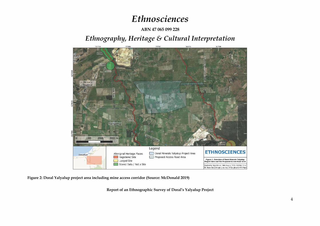
Figure 2: Doral Yalyalup project area including mine access corridor (Source: McDonald 2019) .............................................................................................................. 4
Figure 3: Doral’s Yalyalup project area showing the intersection of the mine access corridor with the Abba River (ID 17354) ) (Source: McDonald 2019) ................... 5
Figure 4: South-West Tribal Boundaries after Berndt 1979 .............................................16
Figure 5: Detail of area selected for the Abba River crossing for Doral’s proposed Yalyalup Mineral Sands Mine (Source: Doral) ..........................................................18

Ethnosciences ABN 47 065 099 228
Aboriginal Heritage
PO Box 121, MELVILLE WA 6956
Phone (08) 9339 8431; Mobile: 0419957140
Email: [email protected]
iv
List of Plates
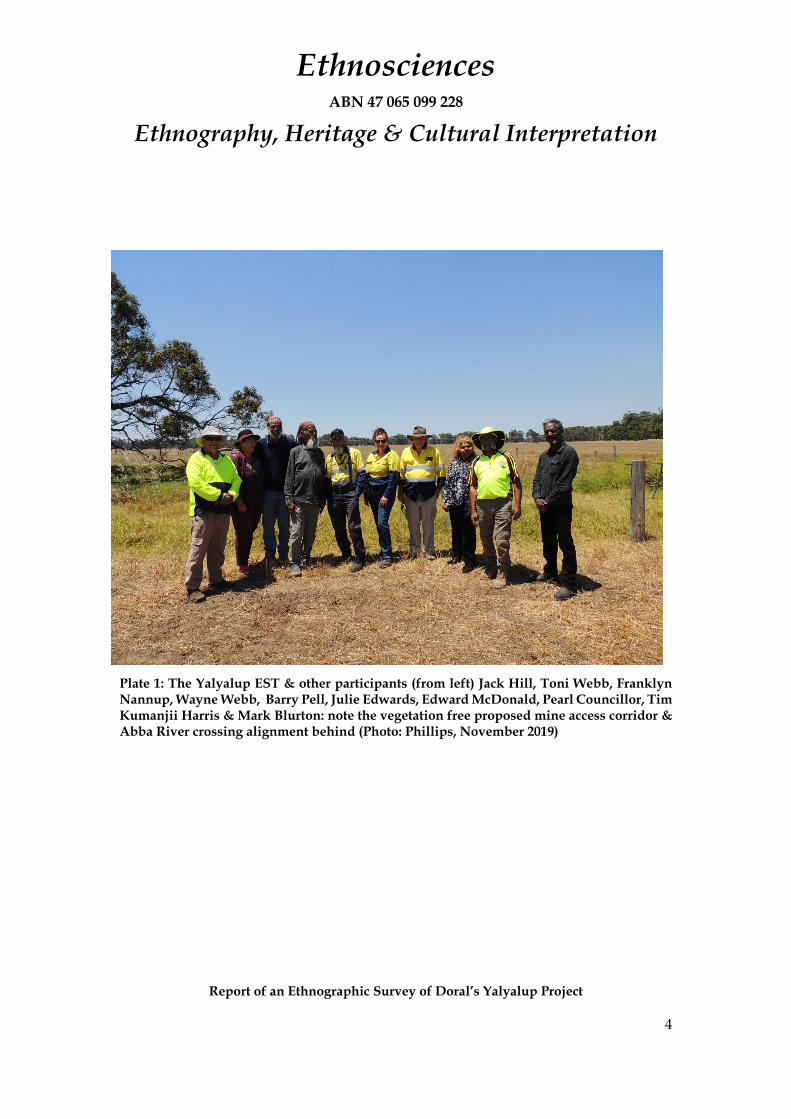
Plate 1: The Yalyalup EST & other participants (from left) Jack Hill, Toni Webb, Franklyn Nannup, Wayne Webb, Barry Pell, Julie Edwards, Edward McDonald, Pearl Councillor, Tim Kumanjii Harris & Mark Blurton: note the vegetation free proposed mine access corridor & Abba River crossing alignment behind (Photo: Phillips, November 2019) .............................................................................................. 4
Plate 2: The proposed mine access corridor & Abba River crossing location, looking east towards the Ludlow-Hithergreen Road (Photo: Phillips, November 2019) ... 5
Plate 3: Wayne Webb (pointing) describes the Yalaylup Project area landform and the results of the archaeological survey to Mark Blurton, Jack Hill and Barry Peel (Photo: McDonald, November 2019) ........................................................................... 6
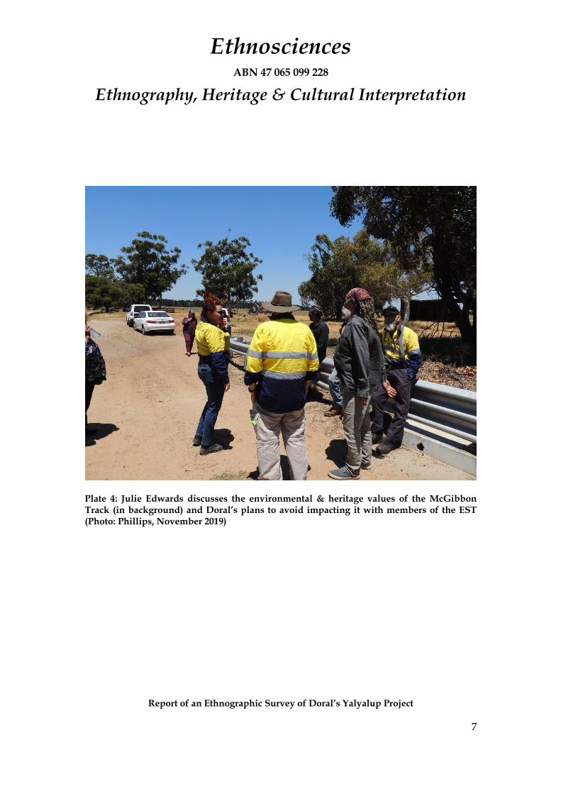
Plate 4: Julie Edwards discusses the environmental & heritage values of the McGibbon Track (in background) and Doral’s plans to avoid impacting it with members of the EST (Photo: Phillips, November 2019) ................................................................. 7
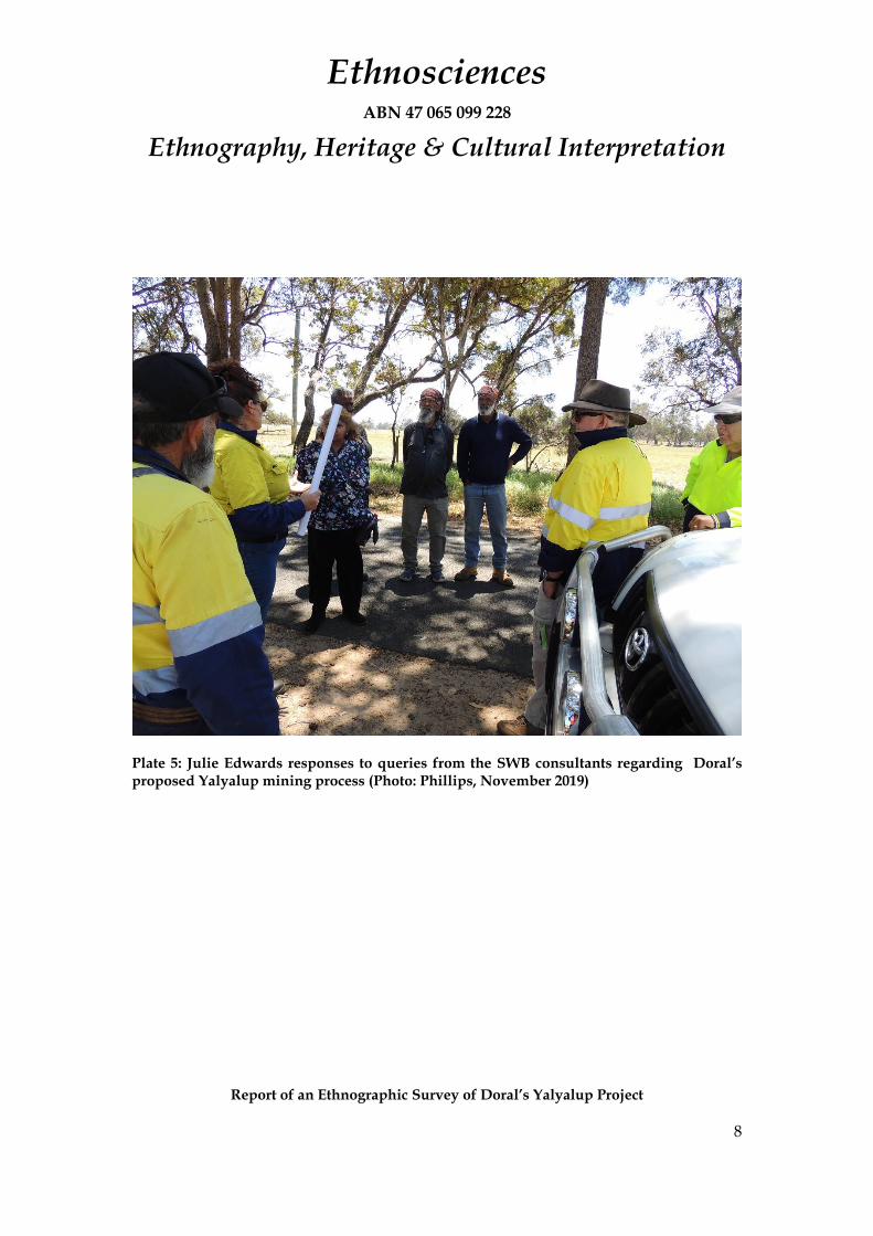
Plate 5: Julie Edwards responses to queries from the SWB consultants regarding Doral’s proposed Yalyalup mining process (Photo: Phillips, November 2019) .... 8
Plate 6: Jack Hill queries Julie Edwards about aspects of Doral’s mine development proposals while Franklyn Nannup and Tania Phillips listen on (Photo: McDonald, November 2019) .............................................................................................................. 9

Ethnosciences ABN 47 065 099 228
Ethnography, Heritage & Cultural Interpretation
Report of an Ethnographic Survey of Doral’s Yalyalup Project
1
Introduction
In June 2017, Ethnosciences was commissioned by Doral Mineral Sands Pty Ltd (Doral)
to undertake a desktop Aboriginal heritage survey of the Yalyalup Project Area which
is located approximately 8.5km southeast of Busselton (Figure 1) and is located wholly
within the South West Boojarah #2 (WC06/4) (SWB) native title claim, which is
represented by the South West Aboriginal Land and Sea Council (SWALSC). Doral
plans to mine the Yalyalup project area for mineral sands (Figure 1).
The objectives of the 2017 desktop survey were (a) identify any known Aboriginal
heritage issues that may affect the proposed Yalyalup mine development; and (b)
make recommendations for any further research and/or consultation that may be
required to meet the requirements of the Aboriginal Heritage Act 1972 (AHA). The
desktop found that there are no Registered Aboriginal Sites or ‘Other Heritage Places’
currently listed within or in close proximity to the proposed Yalyalup Project Area
(Figure 1). However, there are a number of ethnographic sites recorded in the
surrounding area, including the Sabina River (DPLH 17353) and Abba River (DPLH
17354), as well as a number of archaeological sites (McDonald and Coldrick 2017). The
desktop study recommended that ethnographic and archaeological surveys of the
project area were undertake with the participation of the SWB native title claimants.
In August 2019, Doral requested that Ethnosciences examine an additional area not
included in the original Development Envelope for which Doral now need to apply
for an amendment under the EP Act. This area is for a proposed mine access corridor,
which would cross the Abba River (Figure 2). The updated desktop study found that
the Abba River (DPLH 17354), a registered Aboriginal site, was intersected by the
proposed mine access corridor (McDonald 2019) (Figure 3).
Doral, which had entered into Noongar Standard Heritage Agreement (NSHA) with
SWALSC and SWB, commissioned Ethnosciences to undertake ethnographic and
archaeological surveys of the Yalyalup project area on November 5, 2019

Ethnosciences ABN 47 065 099 228
Ethnography, Heritage & Cultural Interpretation
Report of an Ethnographic Survey of Doral’s Yalyalup Project
2
Ethnosciences subcontracted Snappy Gum Heritage Services (Snappy Gum) to
undertake the archaeological survey, which was conducted November 18 to 21, 2019.
The results of the archaeological survey are presented under a separate cover (Snappy
Gum in prep). The ethnographic survey was conducted Edward McDonald and Tania
Phillips of Ethnosciences on November 28, 2019.

Ethnosciences ABN 47 065 099 228
Ethnography, Heritage & Cultural Interpretation
Report of an Ethnographic Survey of Doral’s Yalyalup Project
3
Figure 1: The Yalyalup Project area showing Registered Aboriginal Sites and ‘Other Heritage Places’ in the vicinity ( Source: McDonald & Coldrick 2017)
Ethnosciences ABN 47 065 099 228
Ethnography, Heritage & Cultural Interpretation
Report of an Ethnographic Survey of Doral’s Yalyalup Project
4
Figure 2: Doral Yalyalup project area including mine access corridor (Source: McDonald 2019)

Ethnosciences ABN 47 065 099 228
Ethnography, Heritage & Cultural Interpretation
Report of an Ethnographic Survey of Doral’s Yalyalup Project
5
Figure 3: Doral’s Yalyalup project area showing the intersection of the mine access corridor with the Abba River (ID 17354) ) (Source: McDonald 2019)

Ethnosciences ABN 47 065 099 228
Ethnography, Heritage & Cultural Interpretation
Report of an Ethnographic Survey of Doral’s Yalyalup Project
1
Ethnographic Survey Methods
The ethnographic survey was conducted in the following stages:
❖ Desktop research;
❖ Preliminary consultation with the SWB Aboriginal consultants nominated by SWALAC & the SWB Working Party;
❖ Site inspections with the SWB Aboriginal consultants;
❖ Consultation regarding the results of the archaeological survey; and
❖ Report preparation.
As noted, McDonald and Coldrick undertook the desktop research in 2017 which
McDonald updated in 2019 (McDonald and Coldrick 2017 and McDonald 2019). The
desktop studies included an examination of the Register of Aboriginal Sites using the
online Aboriginal Heritage Inquiry System (AHIS) operated by the Department of
Planning Lands and Heritage (DPLH). A review of previous published and
unpublished ethnohistorical and ethnographic material, including previous heritage
reports was also undertaken and particularly of survey of other mineral sands (for
example, Goode 2003, McDonald, Hales and Associates 2002; McDonald 2007, 2012 &
2018 and McDonald and Coldrick 2010 and 2011). These also include several
broadscale ethnographic studies, such as McDonald, Hales & Associates (1994) and
CSR, Edith Cowan University and McDonald, Hales & Associates (1997).
The SWB Working Party through SWALAC provided a list of eight (8) Aboriginal
consultants to Doral in October 2019. When contacted about the planned ethnographic
survey, one was reported that she was not available because of family commitments.
Another of those nominated was not available because of work commitments. Another
member of the family was nominated to take his place. Mrs Van Leeuwin of the Harris
Family native Title claim (WC1996/041). was nominated to participate in the survey.
However, members of her family insisted that she not be contacted as she is elderly
and has been infirm for some years. Her nephew, Mark Blurton, was nominated by

Ethnosciences ABN 47 065 099 228
Ethnography, Heritage & Cultural Interpretation
Report of an Ethnographic Survey of Doral’s Yalyalup Project
2
senior family members as her proxy. Mr Barry Pell proxied for Kelton Pell who was
unable to participate because of work commitments.
The ethnographic field survey was undertaken on November 28, 2019 with seven SWB
consultants comprising the ethnographic survey team (EST):
❖ Wayne Webb
❖ Jack Hill
❖ Tim Kumanjii Harris
❖ Pearl Councillor
❖ Franklyn Nannup
❖ Mark Blurton
❖ Barry Peel
McDonald conducted the ethnographic field survey with the assistance of Ms Tania
Phillips using a site identification methodology. The ethnographic survey team was
assisted in the field by Ms Julie Edwards (Environmental Advisor, Doral Mineral
Sands) (Plate 1). The survey commenced in Busselton with a quick overview by Ms
Edwards of the proposed mine development. The EST then proceeded to the Yalyalup
mine development area, stopping at various vantage points to inspect the land, with
particular attention been paid to the location of the proposed Abba River crossing
(Plate 2). At various stops Ms Edwards discussed various aspects of the mining process
and the rehabilitation of the land when mining was complete. She responded to the
range of queries raised by the SWB consultants regarding such matters the land to be
impacted, the mining and ore treatment processes, the stages of mining and the
rehabilitation processes and requirements, as well as the nature of the planned impacts
on the Abba River. Ms Edwards explained that it was a continuous process of mining
and rehabilitation, as soon as one section was mined rehabilitation commenced and
the sands that remained after the processing of the mineral sands were returned to the
areas they came from. Mr Wayne Webb, who had assisted Snappy Gum with the
archaeological survey, furnished the EST members with a summary of the results of

Ethnosciences ABN 47 065 099 228
Ethnography, Heritage & Cultural Interpretation
Report of an Ethnographic Survey of Doral’s Yalyalup Project
3
the archaeological survey and discussed how the results related to the landform. Mrs
Toni Webb who have also participated in the archaeologic al survey, accompanied her
husband Wayne and added information as required (see Plates 3-6).
Ethnosciences ABN 47 065 099 228
Ethnography, Heritage & Cultural Interpretation
Report of an Ethnographic Survey of Doral’s Yalyalup Project
4
Plate 1: The Yalyalup EST & other participants (from left) Jack Hill, Toni Webb, Franklyn Nannup, Wayne Webb, Barry Pell, Julie Edwards, Edward McDonald, Pearl Councillor, Tim Kumanjii Harris & Mark Blurton: note the vegetation free proposed mine access corridor & Abba River crossing alignment behind (Photo: Phillips, November 2019)

Ethnosciences ABN 47 065 099 228
Ethnography, Heritage & Cultural Interpretation
Report of an Ethnographic Survey of Doral’s Yalyalup Project
5
Plate 2: The proposed mine access corridor & Abba River crossing location, looking east towards the Ludlow-Hithergreen Road (Photo: Phillips, November 2019)

Ethnosciences ABN 47 065 099 228
Ethnography, Heritage & Cultural Interpretation
Report of an Ethnographic Survey of Doral’s Yalyalup Project
6
Plate 3: Wayne Webb (pointing) describes the Yalaylup Project area landform and the results of the archaeological survey to Mark Blurton, Jack Hill and Barry Peel (Photo: McDonald, November 2019)
Ethnosciences ABN 47 065 099 228
Ethnography, Heritage & Cultural Interpretation
Report of an Ethnographic Survey of Doral’s Yalyalup Project
7
Plate 4: Julie Edwards discusses the environmental & heritage values of the McGibbon Track (in background) and Doral’s plans to avoid impacting it with members of the EST (Photo: Phillips, November 2019)
Ethnosciences ABN 47 065 099 228
Ethnography, Heritage & Cultural Interpretation
Report of an Ethnographic Survey of Doral’s Yalyalup Project
8
Plate 5: Julie Edwards responses to queries from the SWB consultants regarding Doral’s proposed Yalyalup mining process (Photo: Phillips, November 2019)

Ethnosciences ABN 47 065 099 228
Ethnography, Heritage & Cultural Interpretation
Report of an Ethnographic Survey of Doral’s Yalyalup Project
9
Plate 6: Jack Hill queries Julie Edwards about aspects of Doral’s mine development proposals while Franklyn Nannup and Tania Phillips listen on (Photo: McDonald, November 2019)

Ethnosciences ABN 47 065 099 228
Ethnography, Heritage & Cultural Interpretation
Report of an Ethnographic Survey of Doral’s Yalyalup Project
10
Ethnographic Background
Daisy Bates (1985, 1992 and n.d.) was the first researcher to systematically collect
information regarding the social organisation, language and customs of the
indigenous people of the Southwest region of Western Australia.
Bates (1985:39) referred to the Aboriginal people occupying the Southwest from
around Jurien Bay in the north to a point just east of Esperance as the ‘Bibbulmun
Nation’. She reports that the Bibbulmun were comprised of a number of local
groupings with similar customs and beliefs though regional differences, including
forms of descent and dialect, were evident (Bates 1985:46–54). According to Bates
(1985:54), the Bibbulmun who traditionally occupied the Busselton area were known
as the Dunan Wongi after the name of their local dialect.
Later researchers, however, provide a different perspective to that of Bates. Berndt
(1979), following Tindale (1974), for example, suggested that at the time of British
colonisation the Southwest was occupied by thirteen ‘tribes’ or socio-dialectal groups
that formed a discrete socio-cultural bloc similar to what Bates referred to as the
‘Bibbulmun Nation’. Tindale (1974) and Berndt (1979) reported that the groups
occupying the region in which the study area is located were the Wardandi ‘tribe’ or
socio-dialectal group (see Figure 4). Tindale (1974:259) described the Wardandi
territory as:
From Bunbury to Cape Leeuwin, chiefly along the coast; at Geographe Bay, the vicinity of Nannup and Busselton. According to one informant, the tribal name is linked with the [`wardan’] or crow, but the name given in vocabularies for crow is [`kwa:kum’]. They were also called the “seacoast people,” and the detailed Nina Layman MS gives “werdandie” also “wartine” as meaning “the sea”. In yet another version it is the derivative of the negative term.
Bates (1985:47) also had reported that the Bibbulmun around the Busselton area were
called Waddarn-di, or sea people; however, she commented that this term referred to

Ethnosciences ABN 47 065 099 228
Ethnography, Heritage & Cultural Interpretation
Report of an Ethnographic Survey of Doral’s Yalyalup Project
11
all coastal people, including the groups stretching from Esperance to Bunbury and
beyond.1
Bates’ unpublished notes (for example, n.d. Section II Geographical Distribution)
suggest that a number of important camping places associated with an initiates’
(beedawong or moolyeet) trail were located in the Busselton area including in the vicinity
of the Abba River (see also Bates 1985). Bates’ list begins with the Porongorups and
runs west to Augusta, then follows the coast to Perth and finally ends at Karboordup
near where the Perth Town Hall is located. Hammond (1933:19) also refers to a bidi or
pathway linking Perth to the Southwest that probably would have encompassed these
and other campsites.
Bates (n.d.) lists a cluster of camps in the Busselton area, though the exact location of
many of these places is unknown. These camps, in the order listed by Bates (comments
in parentheses are Bates’ own), include:
❖ Ngamboornup (Broadwater);
❖ Win’in’up (winnaitch);2
❖ Yoonderup (Busselton River);
❖ Kelgalup or Kel’al’up (Butter factory);
❖ Kooneengoonderup (Estuary);
❖ Beerdalup;
❖ Kwarreedup;
❖ Ken’yee’dup;
1 The term Waddarn-di/Wardandi in this sense is an example of what Sutton (2003:74–75) would refer to as ‘environmental identity names’ and not a language group name. Bates (1985:47) also reports that people who lived along rivers in the Southwest were referred to as ‘Bilgur’; estuary people as ‘Darbulung’; and hill people as ‘Buyun-gur’. Sutton (2003) discusses how ‘tribal’ names identified by Tindale (1974) whose provenance might be somewhat doubtful have now been adopted by Aboriginal groups. McDonald and Christensen (n.d.) have questioned the basis of Tindale’s, and particularly Berndt’s, analyses.
2 Bates glosses ‘winnaitch’ as “avoided” or “sacred”. An examination of Bates’ unpublished manuscripts indicates that Win’in’up is located between the road and the old railway bridge in Busselton on the Vasse River.

Ethnosciences ABN 47 065 099 228
Ethnography, Heritage & Cultural Interpretation
Report of an Ethnographic Survey of Doral’s Yalyalup Project
12
❖ Woojoolgup;
❖ Kweejerdup;
❖ Joorgadup or Joorak guttuk (on the Abba River); and
❖ Wannerdup or Menbinup. 3
It has not been possible, to date, to positively identify Joorgadup/Joorak guttuk or its
location on the Abba River. It needs to be stressed that there are often major difficulties
in clearly identifying some of the places listed by Bates (see McDonald, Hales &
Associates 1999; McDonald and Venz n.d.). First is the nature of Aboriginal
placenames themselves where a number of places may be known by the same or
similar names. For example, in the Southwest there were a number of places recorded
by Bates called Walyalyup (place of the Eaglehawk) or other dialectal variants of that
name. Second is the use of names and reference points by Bates herself. She is far from
consistent in her use of names and dialectal variations of names. She also frequently
uses different (English language) reference points to situate an Aboriginal placename.
As a consequence of these problems, we must be cautious in applying a placename
listed by Bates to a precise location in the context of heritage surveys, particularly in
the absence of detailed information. Nevertheless, it appears likely that there were a
number of camps located in the vicinity of the study area that were associated with the
‘moolyeet trail’.4
3 Possibly refers to Wonnerup. We are currently unable to identify the location of Joorgadup/Joorak guttuk on the Abba River but likely to be in the vicinity of Wonnerup Estuary as it would roughly be in line with the other ‘camps’. The suffix ‘up’ in Joorgadup refers to ‘place of’ and ‘guttuk’ is to have or possess. Wayne Webb (pers comm. December 2019) is of the view that the stem ‘Joorgad/Joorak’ may derive from the word ‘jooroot’ meaning track (see also Bindon and Chadwick 1992)
4 However, it is not clear that in pre-colonial times the ‘moolyeet trail’ had the status of a single integrated route as is now is generally attributed to it (e.g. Vinnicombe 1989) as Bates (1985) herself seems to raise doubts about it. She notes (1985:51–52), for example, that one of her informants travelled from Busselton to Albany with initiates after colonisation but notes, “whether this was due to the facilities afforded by white settlement, and the greater ease with which long journeys could be accomplished under white protection cannot be definitely ascertained.” McDonald and Venz (n.d.) provide a more detailed discussion of this issue.
Ethnosciences ABN 47 065 099 228
Ethnography, Heritage & Cultural Interpretation
Report of an Ethnographic Survey of Doral’s Yalyalup Project
13
Hallam (1975), Ward (1981:18) and Gibbs (1987) provide detail of various aspects of
the traditional economic and social life of Nyungars in the area. Ward (1981:18) has
compiled ethnohistorical research which indicates that the Vasse, Wonnerup and
Leschenault Inlets, together with the numerous rivers and other waterways in the area,
were particularly important places, both economically and socially, prolific in fish,
waterfowl and other resources. A number of mungah/mungar (fish traps) were
located in various rivers and estuaries throughout the Southwest. At least two were
located in the environs of Busselton, one on the Vasse River and another on the Abba
River (see Ward 1981; Gibbs 1987; McDonald, Hales & Associates 1995). The former
was observed by John Bussell who wrote in 1833 of ‘snares for fish’ built by Nyungars
in the shallows at the mouth of the Vasse River (cited in Ward 1981:30). Groups of
more than 200 Nyungars were recorded at the fish trap at Wonnerup on the Abba
River (Gibbs 1987). George Layman also noted that during the month of September
Nyungars were numerous along the estuary “and have frequently been seen, in
numbers of one hundred” (Layman Acc. No. 36, cited in Collard 1994). Thus, the
research indicates that the rich habitat of the Busselton region allowed for large
gatherings of Aborigines during seasonal availability of certain foods. When food
resources became limited at various times of the year, there is some evidence to
suggest that Nyungars dispersed in smaller family groups over their range (Hallam
1981; Ward 1981).
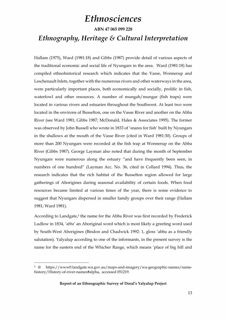
According to Landgate,5 the name for the Abba River was first recorded by Frederick
Ludlow in 1834, ‘abba’ an Aboriginal word which is most likely a greeting word used
by South-West Aborigines (Bindon and Chadwick 1992: 1, gloss ‘abba as a friendly
salutation). Yalyalup according to one of the informants, in the present survey is the
name for the eastern end of the Whicher Range, which means ‘place of big hill and
5 @ https://www0.landgate.wa.gov.au/maps-and-imagery/wa-geographic-names/name-history/History-of-river-names#alpha, accessed 051219.

Ethnosciences ABN 47 065 099 228
Ethnography, Heritage & Cultural Interpretation
Report of an Ethnographic Survey of Doral’s Yalyalup Project
14
caves’. According to an entry on Wikipedia, Yalyalup means "place of many holes"
with "yal", being the Wardandi word for "large hole". 6
Shann (1978) and Jennings (1983; 1999) document various aspects of Nyungar-
European relations during the colonial period in the Busselton area. Initially contact
between Europeans and the local Nyungar population was relatively peaceful,
however, as Nyungars realised they were losing control of their land and resources
relations between them and the `Wadjellas’ [white fellas] deteriorated. As Collard
(1994:58) points out, there was conflict in the perceptions of property between
Aborigines and Europeans:
The Wedjela regarded their sheep, cattle and crops as private property and were incensed when this property was stolen, at the same time, however, they regarded the wild life as public property to be hunted at will. The Nyungar, on the other hand, had areas for hunting and gathering vested in specific families and these families also felt justifiably angry when property and territorial rights were violated.
Conflict between the colonists and the local Aborigines was often intense amounting
at times to what Jennings (1983) has described as a state of war or insurrection. The
spearing of George Layman and resultant reprisals against the Aborigines, which
resulted in the Minninup massacre, highlight these tensions (see Jennings 1983: 181-
199; see also Shann 1978 and White 2017).
Following this period of conflict Aboriginal people adapted to colonial conditions and
local Nyungars were variously employed in the pastoral, farming and forest
industries. Reports from Aboriginal consultants of agricultural employment in and
around the Busselton townsite are documented in previous surveys (Hovingh and
Jarvis 1996: 24; McDonald, Hales and Associates 1994: 13). The nature of work
available was seasonal and those Nyungars employed by farmers were expected to
fend for themselves in the off season by accessing traditional sources of food. As such
6 @ https://en.wikipedia.org/wiki/Yalyalup,_Western_Australia accessed 051219

Ethnosciences ABN 47 065 099 228
Ethnography, Heritage & Cultural Interpretation
Report of an Ethnographic Survey of Doral’s Yalyalup Project
15
Aboriginal people set up fringe camps on the outskirts of towns and on certain pastoral
properties. Research by McDonald, Hales and Associates and other researchers in the
Busselton area has shown that a number of fringe camps in and around the Busselton
townsite were occupied as late as the 1960s by Nyungars. One such formerly utilised
a fringe camp which has been previously recorded (Site ID 15,085) is located a short
distance from the Busselton Airport to the west of the present survey area.

Ethnosciences ABN 47 065 099 228
Ethnography, Heritage & Cultural Interpretation
Report of an Ethnographic Survey of Doral’s Yalyalup Project
16
Figure 4: South-West Tribal Boundaries after Berndt 1979

Ethnosciences ABN 47 065 099 228
Ethnography, Heritage & Cultural Interpretation
Report of an Ethnographic Survey of Doral’s Yalyalup Project
17
Ethnographic Survey Results
Desktop Results
The search of the AHIS reveals that the Abba River (DPLH 17354) is the only registered
Aboriginal site within the proposed Yalyalup project area, including the mine access
corridor. No ethnographic ‘Other Heritage Places’ (OHPs) were identified within the
project area and the desktop review did not identify any other heritage values in the
study area (McDonald & Coldrick 2017 and McDonald 2019).
While several broad scale surveys have encompassed the proposed Yalyalup project
area, for example, McDonald, Hales & Associates (1994) and CSR, Edith Cowan
University and McDonald, Hales & Associates (1997), the AHIS does not reveal any
previous targeted surveys of the present study area. No ethnographic sites were
reported in the Yalyalup area in either of these earlier broadscale studies.
Results of the Ethnographic Field Survey
With the exception of the Abba River (DPLH 17354) no other ethnographic sites were
reported by the EST in Doral’s Yalyalup survey area.
The Abba River, as noted, is located in the mine access corridor and a crossing will
have to be constructed on the river. Ms Edwards noted that the Ludlow-Hithergreen
Road had been selected as the appropriate access to and from the Yalyalup mine, as it
was already designed to carried heavy vehicles. She stressed that the area selected for
the crossing to provide access from the mine sites to the Ludlow-Hithergreen Road is
presently free of riverine vegetation and no clearing would be required (see Plate 2
above; see also Figure 5 below). The SWB consultants agreed that this was the best
location for the mine access road. Ms Edwards also reported that Doral hoped to cross
the river using culverts in order to minimise impacts on the river but that they would
be guided by the environmental conditions that would be established for the project.
The SWB Aboriginal consultants raised a number of questions regarding

Ethnosciences ABN 47 065 099 228
Ethnography, Heritage & Cultural Interpretation
Report of an Ethnographic Survey of Doral’s Yalyalup Project
18
environmental impacts which Ms Edwards addressed by outlining the sorts of
environmental controls that would be in place and addressed a number of issues
including dewatering and run-off and management of topsoil and waste.
A number of the SWB consultants raised a number of strictly non-heritage issues, such
as the benefits that might flow to the Nyungar community from the mine
development. They also expressed the hope that the project would provide
employment opportunities for local Nyungars. It was suggested to them that this was
a matter that SWLASC and the SWB Working Party could raise directly with Doral.
Figure 5: Detail of area selected for the Abba River crossing for Doral’s proposed Yalyalup Mineral Sands Mine (Source: Doral)

Ethnosciences ABN 47 065 099 228
Ethnography, Heritage & Cultural Interpretation
Report of an Ethnographic Survey of Doral’s Yalyalup Project
19
Consultation Regarding Archaeological Findings
As noted above, the archaeological survey was conducted by Snappy Gum between
November 18 to 21, 2019, with a team comprising archaeologists Kellie Cue (Senior
Archaeologist) and Tessa Woods and archaeological assistants, Wayne Webb and Toni
Webb. Ryan Hovingh, the Managing Director of Snappy Gum also assisted on
November 20.
The archaeological survey did not discover any Aboriginal archaeological sites within
the survey area. However, thirty-three (33) isolated artefacts were recorded, the vast
majority of which ware quartz flakes, core fragments or debris, with a few fossiliferous
chert flakes also identified. The isolated artefacts were found on top of fine white sands
in small areas were vegetation was entirely absent and primarily in pushed-up earth
around dams and deflations in the vicinity of the Abba River (Cue & Hovingh, 2019).
Mr Webb described the survey process and outcomes to the other members of the EST,
noting that the area had a very low archaeological potential as most it was extremely
low-lying and swampy before being drained by famers. As a result, it was the not
suitable for traditional camping and therefore there would be unlikely to be
archaeological sites in the area. Members of the EST expressed their satisfaction with
the results of the archaeological survey, noting that if Wayne Webb conducted the
survey it must be right.
Mr Webb reported that as most of the area had such a low archaeological potential
there was little point in monitoring ground disturbance apart of the locations where
they had found the isolated artefacts and particularly oi the vicinity of the Abba River,
where the access corridor would be constructed which would include a river crossing.
Other members of the EST concurred with his assessment. They, however, did request
that any archaeological material that is to be disturbed is salvaged and suitably stored.

Ethnosciences ABN 47 065 099 228
Ethnography, Heritage & Cultural Interpretation
Report of an Ethnographic Survey of Doral’s Yalyalup Project
20
Conclusions
This report presents the findings of an ethnographic survey undertaken by
Ethnosciences for Doral’s Yalyalup mineral sands project. A desktop study was
initially undertaken in 2017 and updated in 2019 to include an access corridor.
Ethnosciences was then commissioned to undertake a field heritage investigation.
Snappy Gum conducted archaeological survey of the project area, on behalf of
Ethnosciences with the assistance of Wayne and Toni Webb. The results of which are
reported under a separate cover (Cue & Hovingh, 2019), suffice it to say, that no
archaeological sites were recorded. However, 33 isolated artefacts were identified.
Doral entered into a NSHA with SWALSC, on behalf of the SWB claimants. SWALSC
then provided a list of eight SWB consultants nominated for the ethnographic survey,
which was conducted on November 28, 2019 with seven of those nominated or their
proxies. A site identification methodology was used and following a short briefing
session on Busselton the EST inspected the Yalyalup project area by vehicle, stopping
at various vantage points to view the land and discuss the proposed project and the
results of the archaeological survey. Particular attention was paid to the location of the
proposed crossing of the Abba River (DPLH 17354), which was the only ethnographic
site identified during the desktop and field survey.
The SWB consultants were supportive of Doral’s mine development and rehabilitation
plans and particularly of the proposed location for the access corridor crossing of the
Abba River. They were satisfied with the results of the archaeological survey and
agreed that archaeological monitoring should be restricted to areas of archaeological
potential, especially the location of the proposed Abba River crossing. They requested,
however, that any archaeological material that is to be disturbed is salvaged and
suitable stored.

Ethnosciences ABN 47 065 099 228
Ethnography, Heritage & Cultural Interpretation
Report of an Ethnographic Survey of Doral’s Yalyalup Project
21
A number of SWB consultants raised questions regarding the economic benefits that
might flow from the development to the Nyungar community and expressed the hope
that the project would provide employment opportunities for local Nyungars.
Recommendations
1. It is recommended that Doral’s planned Yalyalup development proceed.
2. It is also recommended that that areas of archaeological potential are monitored during the removal of the topsoil and that any archaeological material discovered is salvaged and suitable stored.
3. It is further recommended that Doral consult SWALSC regarding Nyungar employment opportunities and benefits that might flow to the community from the Yalyalup project.

Ethnosciences ABN 47 065 099 228
Ethnography, Heritage & Cultural Interpretation
Report of an Ethnographic Survey of Doral’s Yalyalup Project
22
References
Bates, D. (1985) The Native Tribes of Western Australia. I. White (ed.) National Library of Australia, Canberra.
Bates, D. (1992) Aboriginal Perth: Bibbulmun Biographies and Legends. P. J. Bridge (ed.) Hesperian Press. Victoria Park. First published 1925.
Bates, D. (n.d.) Section II (Geographical), Daisy Bates Collection, State Archives ACC 1212A.
Berndt, R. M. (1979) ‘Aborigines of the Southwest’ in R. M. & C. H. Berndt (eds.) Aborigines of the West. University of Western Australia Press, Nedlands, pp. 81–89.
Bindon, P. & Chadwick, R. (1992) A Nyoongar Wordlist from the South-West of Western Australia. Perth: Anthropology Department, Western Australian Museum.
Collard, L. (1994) A Nyungar Interpretation of Ellensbrook and Wonnerup Homesteads. Elizabeth Cowan University, National Trust of Australia, Mt Lawley.
CSR, Edith Cowan University and McDonald, Hales & Associates (1997) Western Australia Regional Forest Agreement: Aboriginal Consultation Project Report, Volume 2 (National Estate Component). Unpublished report prepared for The Regional Forest Agreement Steering Committee.
Cue, K. & Hovingh, R. (2019) Report on the Site Identification Archaeological Survey of the Yalyalup Mineral Sands Project survey area, east of Busselton, Western Australia – November 2019. Unpublished report prepared for the South West Boojarah People and Doral Mineral Sands Pty Ltd on behalf of Ethnosciences,
Gibbs, M. (1987) Aboriginal Gatherings in the West Coastal Region of Southwest Western Australia: an Ethnohistorical Study. Unpublished Honours thesis at the University of Western Australia, Nedlands.
Goode, B. (2003) An Addendum to a Desktop Preliminary Aboriginal Heritage Survey for Water Corporation’s Proposed Development of the Yarragadee Aquifer Extending to the Blackwood Groundwater Area.
Hallam, S. J. (1975) Fire and Hearth: a Study of Aboriginal Usage and European Usurpation in Southwestern Australia. Canberra: Australian Institute of Aboriginal Studies.
Hammond, J. E. (1933) Winjan’s People: the Story of the Southwest Australian Aboriginals. Perth: Imperial Printing.
Hovingh, R. and Jarvis, A. 1996 Report of an Aboriginal Heritage Survey of the Broadwater Development, Busselton Western Australia. Unpublished report prepared for Markham and Heath. McDonald, Hales and Associates, West Perth.

Ethnosciences ABN 47 065 099 228
Ethnography, Heritage & Cultural Interpretation
Report of an Ethnographic Survey of Doral’s Yalyalup Project
23
Jennings, R. (1983) Busselton “…outstation on the Vasse” 1830–1850. The Shire of Busselton, Western Australia.
Jennings, R. (1983) Busselton: “A Place to Remember” 1850-1914. The Shire of Busselton, Western Australia.
McDonald, E. M. (2007) Revised Report of an Ethnographic Survey of the Proposed Tutunup Mineral Sands Exploration Program (E70/2492), near Busselton, Western Australia. Unpublished report prepared by Ethnosciences for Iluka Resources Ltd on behalf of Kellie Hill Consulting.
McDonald, E. M. (2012) Report of an Ethnographic Survey of Doral’s Yoongarillup Resource Zones, Yoongarillup, near Busselton, Western Australia. Unpublished report prepared by Ethnosciences for Doral Mineral Sands.
McDonald, E. M. (2018) Report of an Ethnographic Survey of the Aboriginal Heritage Values of the Wonnerup North Mineral Sands Project near Busselton, Western Australia. Unpublished report prepared by ethnosciences for Cristal Mining Australia.
McDonald, E.M. (2019) Addendum to Report of a Desktop Aboriginal Heritage Assessment of Doral’s Yalyalup Project Area near Busselton, Western Australia (July 2017). Unpublished report prepared for Doral Mineral Sands Pty Ltd
McDonald, E. M. (with B. Coldrick) (2010) Report of an Aboriginal Consultation in Relation to a Proposed Mineral Sands Mine, Loc 7 and Loc 3819 (M70/785), Wonnerup, near Capel, Western Australia. Unpublished report prepared by Ethnosciences for Bemax Resources, Incorporating Cable Sands.
McDonald, E. M. (with B. Coldrick) (2011 )Report of an Aboriginal Consultation in relation to a proposed Mineral Sands Mine, Lot 100 Wonnerup South Road, Wonnerup, Western Australia. Unpublished report prepared by Ethnosciences for Bemax Resources, Incorporating Cable Sands.
McDonald, E.M. & Coldrick, B. (2017) Report of a Desktop Aboriginal Heritage Assessment of Doral’s Yalyalup Project Area near Busselton, Western Australia.
McDonald, E. M. & Christensen, W. (n.d.) ‘B[u]rndt Recipes – A Pinch of Daisy Bates, a Large Dollop of Radcliffe-Brown, Carefully Overlaid with a Fine Mesh of Tindale: Notes on the Social Organisation of Some Western Australian Tribes.’ Paper read at the Anthropological Society of Western Australia meeting, October 1999.
McDonald, E. M. & Venz, T. (n.d.) Trails and Sites: Daisy Bates’ Ethnography and the Problems of Identifying Places of Aboriginal Heritage Values in the Southwest of Western Australia. Paper delivered at Ireland’s Heritage Conference, Castlebar, Co. Mayo, October 2002.

Ethnosciences ABN 47 065 099 228
Ethnography, Heritage & Cultural Interpretation
Report of an Ethnographic Survey of Doral’s Yalyalup Project
24
McDonald, Hales & Associates (1994) National Estates Grants Programme Aboriginal Sites in the Lower South-west Heritage Study. Unpublished report prepared by McDonald, Hales & Associates for Gnuraren Aboriginal Progress Association.
McDonald, Hales & Associates (2002) Report of an Aboriginal Heritage Survey Proposed Tutunup Titanium Mineral Mine Near Capel, Western Australia. Unpublished report for Cable Sands (WA) Pty Ltd.
Shann, E. O. G. (1978) Cattle Chosen. Nedlands: University of Western Australia Press.
Sutton, P. (2003) Native Title in Australia: an Ethnographic Perspective. Cambridge: Cambridge University Press.
Tindale, N. B. (1974) Aboriginal Tribes of Australia. Canberra: Australian National University Press.
Ward, K. (1981) ‘Gone Fishing’: Patterns of Aboriginal Subsistence around Geographe Bay. Unpublished BA (Hons) Thesis, University of Western Australia, Department of Anthropology.
White, J. (2017) 'Paper talk', Testimony and Forgetting in South-West Western Australia', Journal of the Association for the Study of Australian Literature 17 (1): 1-13.
Vinnicombe, P. (1989) Goonininup: an historical perspective of land use and associations in the old Swan Brewery area. Perth: Western Australian Museum.


![Ethnographic methods[second edition] - Loughborough … · Ethnographic methods ... field of qualitative methods, ... adapting ethnographic methods in diverse settings, and on teaching](https://static.documents.pub/doc/80x56/5ad54cca7f8b9a075a8cba46/ethnographic-methodssecond-edition-loughborough-methods-field-of-qualitative.jpg)


