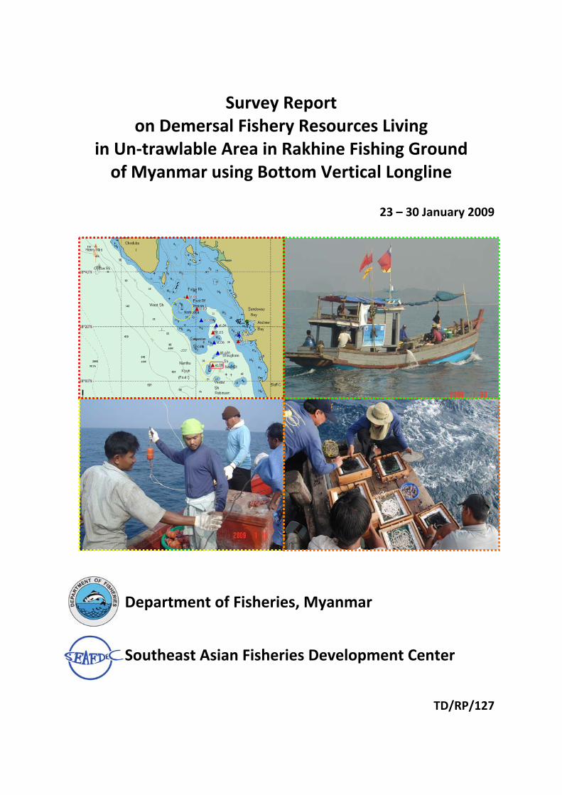
Survey Report on Demersal Fishery Resources Living in Un‐trawlable Area in Rakhine Fishing Ground of Myanmar using Bottom Vertical Longline 23 – 30 January 2009 Department of Fisheries, Myanmar Southeast Asian Fisheries Development Center TD/RP/127
Transcript
Survey Report
on Demersal Fishery Resources Living in Un‐trawlable Area in Rakhine Fishing Ground of Myanmar using Bottom Vertical Longline
23 – 30 January 2009
Department of Fisheries, Myanmar
Southeast Asian Fisheries Development Center
TD/RP/127
Survey Report on Demersal Fishery Resources Living in Un‐trawlable Area in Rakhine Fishing Ground of Myanmar by Bottom Vertical Longline
Background: Since 2006, SEAFDEC had conducted Demersal Fishery Resources Living in Un‐trawlable Fishing Grounds in Southeast Asian Waters using MV.SEAFDEC2 and using other research vessels in collaboration with the Member Countries. This aims to evaluate on the potential resources of economically important species in the un‐trawl able areas. The survey areas will be focused in the EEZ of member countries and/or trans‐bordering areas particularly in the un‐trawlable fishing grounds.
Rakhine fishing ground of Myanmar is one of the target survey areas where still lacking information considering an un‐trawlable fishing area. It characteristic is a narrow continental shelf with the rocky area. It is therefore not suitable for trawling but there is still a possibility for other fishing gear such as bottom vertical longline. It is envisaged that the survey result will be analyzed together with the data collected from other un‐trawlable areas in the region.
Objectives:
1. To investigate the potential resources of some economically important species on the un‐trawlable ground at the Rakhine fishing ground of Myanmar using bottom longline; and
2. To introduce and carry out trial of the appropriated/ responsible fishing gears and practices for harvesting of fisheries resources on the un‐trawl able grounds.
All fishing gear were transfer from Ranong province to Yangon by favor of Siam Jonathan Co,Ltd.
Type of bait: Squid Immersion time: 2 hours No. of station: 10 stations Survey area: Rocky area of Rakhine fishing ground (Fig. 4, table 1) Topography survey: Portable echo sounder Fishing vessel: 2 Local fishing boat, Personal on board of each fishing boat included 1
DoF staff, 3 SEAFDEC staffs, 3 fishermen and 2 crews. Period: 25 ‐ 30 January 2009 Fishing port: Thanwe
Participants: From SEAFDEC/TD 1. Ms. Penchan Laongmanee Coordinator 2. Mr. Sayan Promjinda Team member 3. Mr. Narong Ruandsivakul Team member 4. Mr. Nakaret Yasook Team member 5. Mr. Aussawin Buachuay Team member 6. Mr. Suchart Kitsamut Team member 7. Mr. Tana Rangjoy Team member From Department of Fisheries, Myanmar
1. Mr. Mr. Khin Maung Soe Coordinator 2. Mr. Aung Tae Oo Taxonomist 3. Mr. Min Khine Team member (on board fishing boat) 4. Mr. Kyaw Naing Htwe Team member (on board fishing boat)
Local fishermen 10 local fishermen join on board rental boat
Figure 1 Diagram of bottom vertical longline
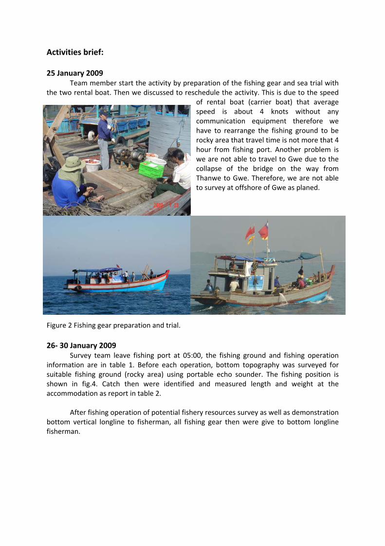
Activities brief: 25 January 2009
Team member start the activity by preparation of the fishing gear and sea trial with the two rental boat. Then we discussed to reschedule the activity. This is due to the speed
of rental boat (carrier boat) that average speed is about 4 knots without any communication equipment therefore we have to rearrange the fishing ground to be rocky area that travel time is not more that 4 hour from fishing port. Another problem is we are not able to travel to Gwe due to the collapse of the bridge on the way from Thanwe to Gwe. Therefore, we are not able to survey at offshore of Gwe as planed.
Figure 2 Fishing gear preparation and trial. 26‐ 30 January 2009
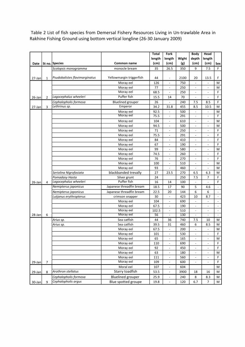
Survey team leave fishing port at 05:00, the fishing ground and fishing operation information are in table 1. Before each operation, bottom topography was surveyed for suitable fishing ground (rocky area) using portable echo sounder. The fishing position is shown in fig.4. Catch then were identified and measured length and weight at the accommodation as report in table 2.
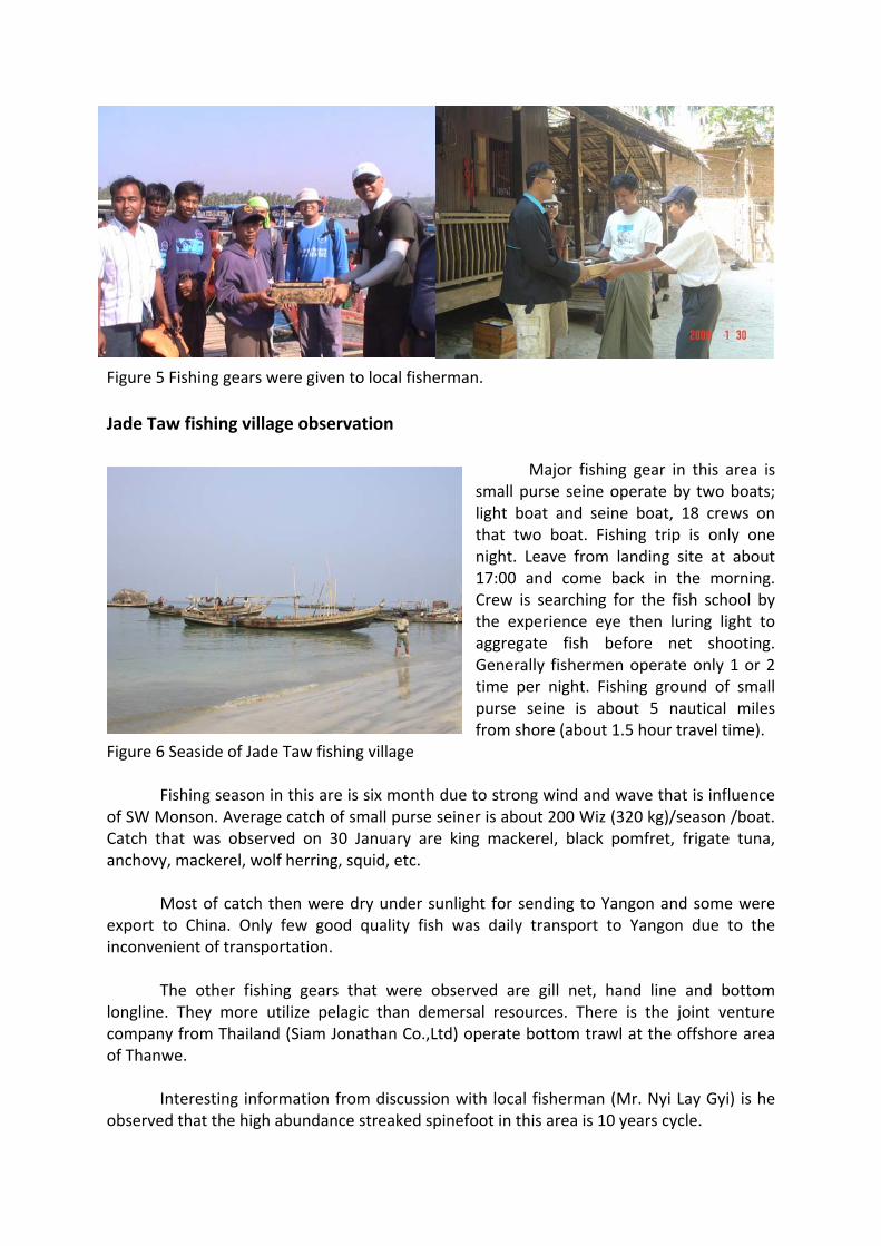
After fishing operation of potential fishery resources survey as well as demonstration
bottom vertical longline to fisherman, all fishing gear then were give to bottom longline fisherman.
Table 1 Partial information of fishing operation for Demersal Fishery Resources Living in Un‐trawlable Area in Rakhine Fishing Ground of Myanmar by Bottom Vertical Longline St. Number Immersion Sea depth Total cath Total catch Hook rate CPUEno. of hook time ( m ) (number) weight(kg) ( % ) pcs./ 1000 hook
1 27‐Jan‐09 Time 1015 Time 1107 Time 1200 Time 1330 396 2 hrs. 32 2 2.45 0.51 5.05Lat 18o30'.87 N Lat 18o30'.90 N Lat Lat 4 minuteLong 093o50'.47 E Long 093o49'.53 E Long Long
2 26‐Jan‐09 Time 1007 Time 1100 Time 1211 Time 1319 378 2 hrs. 8‐16 4 1.32 1.06 10.58
Lat 18o30'.81 N Lat 18o31'.56 N Lat Lat 11 minuteLong 093o56'.47 E Long 093o55'.96 E Long Long
3 27‐Jan‐09 Time 0940 Time 1005 Time 1113 Time 1205 360 1 hrs. 25.7‐26.5 2 0.70 0.56 5.56
Lat 18o22'.29 N Lat 18o22'.29 N Lat 18o22'.28 N Lat 18o23'.13 N 32 minuteLong 094o02'.16 E Long 094o02'.16 E Long 094o02'.18 E Long 094o02'.07
4 26‐Jan‐09 Time 0952 Time 1021 Time 1237 Time 1335 396 3 hrs. 37.2 ‐ 37.6 16 5.74 4.04 40.40Lat 18o20'.42 N Lat 18o21'.14 N Lat 18o20'.42 N Lat 18o25'.30 NLong 094o08'.22 E Long 094o07'.56 E Long 094o08'.12 E Long 094o07'.40
5 28_Jan‐09 Time 0800 Time 0834 Time 1008 Time 1055 360 2 hrs. 37‐38 0 0.00 0.00 0.00Lat 18o17'.92 N Lat 18o17'.10 N Lat Lat 14 minuteLong 094o06'.83 E Long 094o06'.94 E Long Long
6 28‐Jan‐09 Time 0857 Time 0925 Time 1035 Time 1125 378 1 hrs. 38.2 ‐ 39.0 7 2.18 1.85 18.52Lat 18o14'.13 N Lat 18o14'.90 N Lat 18o14'.14 N Lat 18o14'.85 N 49 minuteLong 094o07'.36 E Long 094o06'.96 E Long 094o07'.36 E Long 094o06'.97
7 29‐Jan‐09 Time 0820 Time 0843 Time 0940 Time 1030 366 1 hrs. 40 ‐40.2 10 4.58 2.73 27.32Lat 18o10'.34 N Lat 18o11'.12 N Lat 18o10'.40 N Lat 18o11'.11 N 34 minuteLong 094o08'.83 E Long 094o08'.61 E Long 094o08'.87 E Long 094o08'.67
8 29‐Jan‐09 Time 0837 Time 0910 Time 1000 Time 1040 270 1 hrs. 38‐45 2 4.50 0.74 7.41Lat 18o05'.76 N Lat 18o05'.25 N Lat Lat 26 minuteLong 094o06'.84 E Long 094o07'.38 E Long Long
9 30‐Jan‐09 Time 0706 Time 0729 Time 0840 Time 0930 378 1 hrs. 16.2‐22.7 2 0.36 0.53 5.29Lat 18o16'.97 N Lat 18o17'.44 N Lat 18o17'.01 N Lat 18o17'.54 N 48 minuteLong 094o17'.32 E Long 094o16'.56 E Long 094o17'.29 E Long 094o16'.63
10 30‐Jan‐09 Time 0700 Time 0718 Time 0830 Time 0000 270 1 hrs. 15‐18 0 0.00 0.00 0.00Lat 18o14'.65 N Lat 18o14'.68 N Lat Lat 38 minuteLong 094o16'.97 E Long 094o17'.61 E Long Long
Total 3,552 45 21.82 1.27 12.67
HaulingStart FinishDate Start Finish
Shooting
Date St no. Species Common name
Total length (cm)
Fork length (cm)
Wight (g)
Body depth (cm)
Head length (cm) Sex
Scolopsis monogramma monocle bream 35 26.5 350 9 7.5 F
Psudobalistes flavimarginatus Yellowmargin triggerfish 44 ‐ 2100 20 13.5 FMoray eel 126 ‐ 750 ‐ ‐ MMoray eel 77 ‐ 250 ‐ ‐ MMoray eel 68.5 ‐ 250 ‐ ‐ F
Moray eel 104 ‐ 690 ‐ ‐ ‐Moray eel 67.5 ‐ 190 ‐ ‐ ‐Moray eel 102.5 ‐ 510 ‐ ‐ ‐Moray eel 56 ‐ 130 ‐ ‐ ‐
Arius sp. Sea catfish 44 36 740 7.5 10 MArius sp. Sea catfish 39.5 31 460 6 8.5 M
Moray eel 67.5 ‐ 200 ‐ ‐ MMoray eel 101 ‐ 530 ‐ ‐ FMoray eel 65 ‐ 165 ‐ ‐ MMoray eel 110 ‐ 690 ‐ ‐ FMoray eel 92 ‐ 450 ‐ ‐ FMoray eel 63 ‐ 180 ‐ ‐ MMoray eel 111 ‐ 560 ‐ ‐ FMoray eel 109 ‐ 600 ‐ ‐ FMoral eel 107 ‐ 604 M
Arothron stellatus Starry toadfish 53.5 ‐ 3900 18 16 M
Cephalopholis formosa Bluelined grouper 25.9 ‐ 240 8 8.3 MCephalopholis argus Blue spotted groupe 19.8 ‐ 120 6.7 7 M
28‐Jan 6
27‐Jan 3
26‐Jan 4
27‐Jan 1
26‐Jan 2
30‐Jan 9
29‐Jan
29‐Jan 8
7
Table 2 List of fish species from Demersal Fishery Resources Living in Un‐trawlable Area in Rakhine Fishing Ground using bottom vertical longline (26‐30 January 2009)
Figure 3 Bottom Vertical Longline operation and fish identification and measurement activity during 26‐30 January 2009. Figure 4 Fishing position map (red and blue triangle is position of boat No. 1 and 2, respectively)
Figure 5 Fishing gears were given to local fisherman. Jade Taw fishing village observation
Major fishing gear in this area is small purse seine operate by two boats; light boat and seine boat, 18 crews on that two boat. Fishing trip is only one night. Leave from landing site at about 17:00 and come back in the morning. Crew is searching for the fish school by the experience eye then luring light to aggregate fish before net shooting. Generally fishermen operate only 1 or 2 time per night. Fishing ground of small purse seine is about 5 nautical miles from shore (about 1.5 hour travel time).
Figure 6 Seaside of Jade Taw fishing village Fishing season in this are is six month due to strong wind and wave that is influence
of SW Monson. Average catch of small purse seiner is about 200 Wiz (320 kg)/season /boat. Catch that was observed on 30 January are king mackerel, black pomfret, frigate tuna, anchovy, mackerel, wolf herring, squid, etc.
Most of catch then were dry under sunlight for sending to Yangon and some were export to China. Only few good quality fish was daily transport to Yangon due to the inconvenient of transportation.
The other fishing gears that were observed are gill net, hand line and bottom longline. They more utilize pelagic than demersal resources. There is the joint venture company from Thailand (Siam Jonathan Co.,Ltd) operate bottom trawl at the offshore area of Thanwe.
Interesting information from discussion with local fisherman (Mr. Nyi Lay Gyi) is he observed that the high abundance streaked spinefoot in this area is 10 years cycle.
Figure 7 Fishing activities along Jade Taw fishing village beach
Figure 8 Scolopsis monogramma (Cuvier, 1830), monocle bream from st. no.1, TL 35 cm,
W 350 g
Figure 9 Nemipterus japonicus (Bloch, 1791), Japanses threadfin bream from st. no. 6,
TL 22.5 cm, W 90 g
Figure 10 Lethrinus sp. , Emperor from st. no. 3, TL 34.2 cm, W 455 g
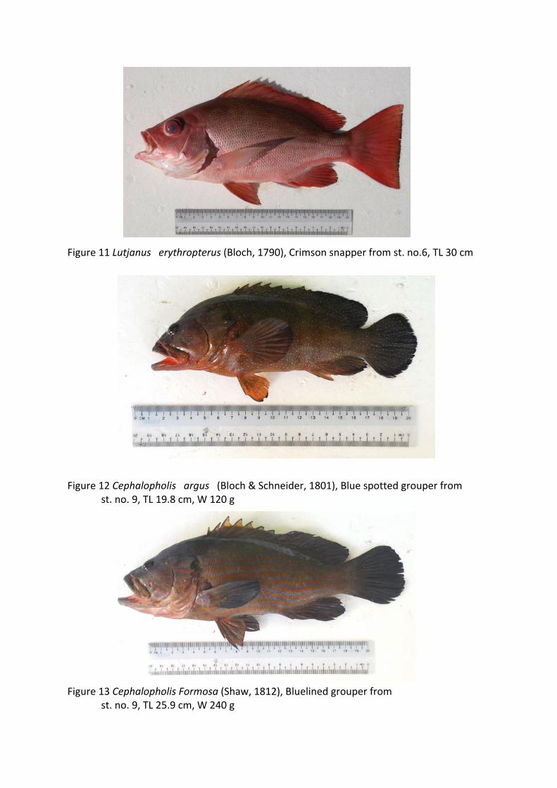
Figure 11 Lutjanus erythropterus (Bloch, 1790), Crimson snapper from st. no.6, TL 30 cm Figure 12 Cephalopholis argus (Bloch & Schneider, 1801), Blue spotted grouper from
st. no. 9, TL 19.8 cm, W 120 g Figure 13 Cephalopholis Formosa (Shaw, 1812), Bluelined grouper from
st. no. 9, TL 25.9 cm, W 240 g
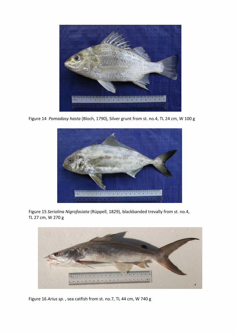
Figure 14 Pomadasy hasta (Bloch, 1790), Silver grunt from st. no.4, TL 24 cm, W 100 g Figure 15 Seriolina Nigrofasiata (Rüppell, 1829), blackbanded trevally from st. no.4, TL 27 cm, W 270 g
Figure 16 Arius sp. , sea catfish from st. no.7, TL 44 cm, W 740 g
Figure 17 Psudobalistes flavimarginatus (Rüppell, 1829) ,Yellowmargin triggerfish from st.
no.1, TL 44 cm, W 2.1 kg Figure 18 Lagocephalus wheeleri (Abe, Tabeta & Kitahama, 1984), puffer fish from st. no. 2 ,
TL 15.5 cm, W 70 g
Figure 19 Arothron stellatus (Bloch & Schneider, 1801), Starry toadfish from st. no. 8 , TL 53.5 cm, W 3.9 kg
Figure 20 Moray eel from st. no. 2 , TL 68.5 cm, W 250 g Figure 21 Moray eel from st. no. 2, TL 126 cm, W 750 g