6. Canyoing Crystal clear waters. Manuel García. PANGEA CENTRAL C anyoing consists of travelling through a river bed in a rugged area using a variety of techniques of other sports such as hiking, swimming and caving. High water flow, hypothermia, difficult obstacles and steep descents, where abseiling is required, might entail a significant risk and it is probably one of the most hazardous sport you can practise in the Serranía de Ronda. Therefore, appropriate equipment and a weather check for rainfall ensuring it is not a heavy rain period are a must and it is also recommended to practise it in groups. ACTIVE TOURISM 106 GUÍA DE ACTIVE TOURISM DE LA SERRANÍA DE RONDA
Transcript
6.Canyoing
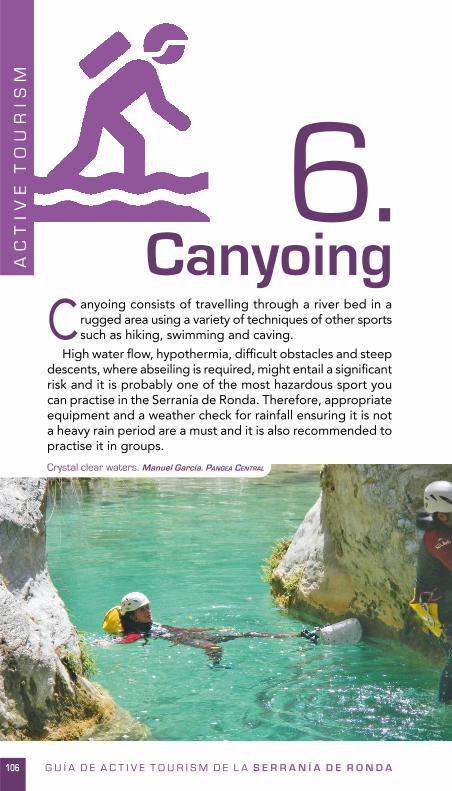
Crystal clear waters. Manuel García. PANGEA CENTRAL
Canyoing consists of travelling through a river bed in a rugged area using a variety of techniques of other sports such as hiking, swimming and caving.
High water fl ow, hypothermia, diffi cult obstacles and steep descents, where abseiling is required, might entail a signifi cant risk and it is probably one of the most hazardous sport you can practise in the Serranía de Ronda. Therefore, appropriate equipment and a weather check for rainfall ensuring it is not a heavy rain period are a must and it is also recommended to practise it in groups.
AC
TIV
E T
OU
RIS
M
106 G U Í A D E A C T I V E T O U R I S M D E L A S E R R A N Í A D E R O N D A
G U I D E : A C T I V E T O U R I S M I N T H E S E R R A N Í A D E R O N D A 107
AC
TI
VE
TO
UR
IS
M6 . C A N Y O I N G
Thanks to a land with steep descents, you can enjoy superb canyons. The water produces a characteristic erosion in river beds, carving deep canyons or gorges with a round shape.
All necessary conditions for excellent canyons are gathered in the Serranía de Ronda and the most well-known is El Cañón de las Buitreras (Vulture’s canyon), considered as Andalusia’s Natural Monument by the Regional Government of Andalusia.
The canyons that you can enjoy in the Serranía de Ronda are the following. For further information about them, see the corresponding information sheet.
1. Cañón de las Buitreras
2. Tajo de Ronda
3. Sima del Diablo
4. Arroyo Majales
5. Garganta Verde
6. Río Grande o Zarzalones
• Wetsuit • Neoprene socks and gloves • Special harness • Lanyard and locking carabiners • Descender • Helmet • Static rope • Torch/ Headlamp • First-aid kid • Mobile phone • Waterproof container • Food • Water
• Sierra de las Nieves: simas, cuevas y barrancos. Manuel J. Guerrero Sánchez. Editorial La Serranía 2004.
Refreshing experience. Manuel García. PANGEA CENTRAL
107
AC
TI
VE
TO
UR
IS
M
REQUIRED EQUIPMENT
BOOKS
108 G U I D E : A C T I V E T O U R I S M I N T H E S E R R A N Í A D E R O N D A
AC
TI
VE
TO
UR
IS
M6 . C A N Y O I N G
Link to the complete guide Guía Rebufos, with technical information of the canyons in the Serranía de Ronda.http://es.scribd.com/doc/118231491/Guia-Rebufos-2011
Link to the webpage actionman4x4.com, specialised in some extreme sports. Have a look at the information sheets of the canyons in the Serranía de Ronda.http://www.actionman4x4.com/canonesybarrancos/canonesybarrancos.htm
Barranquismo.net is a useful browser for canyons. You will fi nd out most of the canyons in the province of Málaga.http://www.barranquismo.net/BD/buscador.php?buscando=M%C1LAGA.%20ESPA%D1A
Spanish Facebook group for canyoners called Descenso de Barrancos. They will help you out with all your doubts.https://www.facebook.com/groups/168769827431/
✓ Remember that water levels can rise quickly and violently in canyons. Check on the most up -to-date information before practising this sport.
✓ When planning the canyon, it is important to consider the experience of the participants and the overall group to calculate the estimated time.
✓ Relying on local companies will guarantee thrilling experiences. ✓ Please, respect the signs. ✓ Take all litter home and respect nature. ✓ In summertime, there is a high risk of fi re. Do not set any fi re.✓ Livestock farming is a vital economic activity in the Serranía
de Ronda. Therefore, you are asked to take due care to close gates and respect livestock.
TO FIND OUT MORE
SPECIALISED COMPANIES
ATTENTION
G U I D E : A C T I V E T O U R I S M I N T H E S E R R A N Í A D E R O N D A 109
AC
TI
VE
TO
UR
IS
M6 . C A N Y O I N G
Canyoing. Pangea Central
109
AC
TI
VE
TO
UR
IS
M
6 . C A N Y O I N G : A r r o y o M A J A L E S
110 G U I D E : A C T I V E T O U R I S M I N T H E S E R R A N Í A D E R O N D A
AC
TI
VE
TO
UR
IS
M
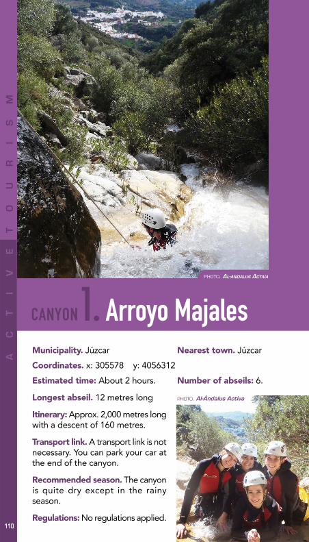
1. Arroyo Majales
PHOTO. AL-ANDALUS ACTIVA
Municipality. Júzcar Nearest town. Júzcar
Coordinates. x: 305578 y: 4056312
Estimated time: About 2 hours. Number of abseils: 6.
Longest abseil. 12 metres long
Itinerary: Approx. 2,000 metres long with a descent of 160 metres.
Transport link. A transport link is not necessary. You can park your car at the end of the canyon.
Recommended season. The canyon is quite dry except in the rainy season.
Regulations: No regulations applied.
CANYON
110
AC
TI
VE
TO
UR
IS
M
6 . C A N Y O I N G : A r r o y o M A J A L E S
G U I D E : A C T I V E T O U R I S M I N T H E S E R R A N Í A D E R O N D A 111
AC
TI
VE
TO
UR
IS
M
Brief review. It is considered ideal for amateurs as it is a very interesting, easy and opened canyon, which allows you to leave at any time. It also boasts outstanding views and a great variety of abseils. A long wetsuit is not necessary in hot season although wetsuit trousers should be worn.
112 G U I D E : A C T I V E T O U R I S M I N T H E S E R R A N Í A D E R O N D A
AC
TI
VE
TO
UR
IS
M
2. Cañón de las BuitrerasMunicipality. Cortes de la Frontera Nearest town. El Colmenar
Coordinates. x: 287921 y: 4048880
Estimated time: About 5 hours. Number of abseils: 4.
Longest abseil. 10 metres long
Itinerary: Approx. 1,600 metres long with a descent of 80 metres.
Transport link. It is not completely necessary a transport link although you can drive your car and park it in the electricity power station. You will then walk less than fi ve kilometres along the path GR-141 towards the bridge Puente de los Alemanes.
Recommended season. Summer and autumn before the rainy season.
CANYON
112
(Estación de Gaucín)AC
TI
VE
TO
UR
IS
M
PHOTO. AL-ANDALUS ACTIVA
6. CANYOING : Cañón de las BUITRERAS
G U I D E : A C T I V E T O U R I S M I N T H E S E R R A N Í A D E R O N D A 113
AC
TI
VE
TO
UR
IS
M
Regulations: It is important to obtain the previous permission from the Andalucian Department of the Environment. It is being discussed to turn it into a public canyon but it is not confi rmed yet. Regardless of what it is written in many other guides, it is completely forbidden, under severe penalty, to walk along the railway.
Brief review. It is doubtless the most important canyon in this area and it clearly stands out in Andalusia. It is a long distance watercourse canyon with narrow stretches and some siphons. It will be a unique experience if the water level is the appropriate but if it rises it could become extremely hazardous. A long wetsuit is required even in summer.
114 G U I D E : A C T I V E T O U R I S M I N T H E S E R R A N Í A D E R O N D A
AC
TI
VE
TO
UR
IS
M
3. Garganta VerdeMunicipality. Zahara de la Sierra (province of Cadiz)
Nearest town. Zahara de la Sierra
Coordinates. x: 285621 y: 4076902
Number of abseils: 5.
Longest abseil. 10 metres
Itinerary: Approx. 2,500 metres long with a descent of 180 metres.
Transport link. A transport link is necessary.
Recommended season. During all seasons it is accessible, but especially after the rainy season.
CANYON
114
Estimated time: About 4 relaxed hours.
AC
TI
VE
TO
UR
IS
M
PHOTO. Carlos Guerrero
6 . C A N Y O I N G : G a r g a n t a V E R D E
G U I D E : A C T I V E T O U R I S M I N T H E S E R R A N Í A D E R O N D A 115
AC
TI
VE
TO
UR
IS
M
Regulations: It is important to obtain the previous permission from the Andalucian Department of the Environment.
Brief review. This canyon is the most popular one in Cadiz. It is mainly based on a watercourse, although it depends on the water level. You will fi nd short and easy abseils and a largely easy course which becomes ideal for amateurs. Be aware that the fi rst stretch is normally dry.
116 G U I D E : A C T I V E T O U R I S M I N T H E S E R R A N Í A D E R O N D A
AC
TI
VE
TO
UR
IS
M
4.Zarzalones Inferior
Municipality. Yunquera Nearest town. Yunquera
Coordinates. x: 327639 y: 4065696
Estimated time: About 3 hours.
Number of abseils: 3.
Longest abseil. 27 metres, although it can be avoided if you walk along the handrail.
Itinerary: Approx. 1,000 metres long with a descent of 50 metres.
Transport link. A transport link is not necessary.
Recommended season. All seasons.
Regulations: No existe Regulations.
CANYON
116
AC
TI
VE
TO
UR
IS
M
PHOTO. Salvador Moreno
6. CANYOING: Río GRANDE o ZARZALONES inferior
G U I D E : A C T I V E T O U R I S M I N T H E S E R R A N Í A D E R O N D A 117
AC
TI
VE
TO
UR
IS
M
Brief review. This canyon is ideal for amateurs. It keeps a constant water level during the whole year thanks to an upwelling placed some metres above the end. You will enjoy a great range of abseils, slides, narrow stretches, jumps… A long wetsuit is required even in summer.
118 G U I D E : A C T I V E T O U R I S M I N T H E S E R R A N Í A D E R O N D A
AC
TI
VE
TO
UR
IS
M
5. Sima del DiabloMunicipality. Júzcar Nearest town. Júzcar
Coordinates. x: 305877 y: 4055000
Estimated time: From 2-3 hours including the last stretch along the river Río Genal.
Number of abseils: 3.
Longest abseil. 10 metres.
Itinerary: Approx. 1,500 metres.
Transport link. A transport link is necessary otherwise you will need to walk uphill for 30 minutes.
Recommended season. All seasons except when water level rises after a downpour.
Regulations: Any regulations applied.
CANYON
118
AC
TI
VE
TO
UR
IS
M
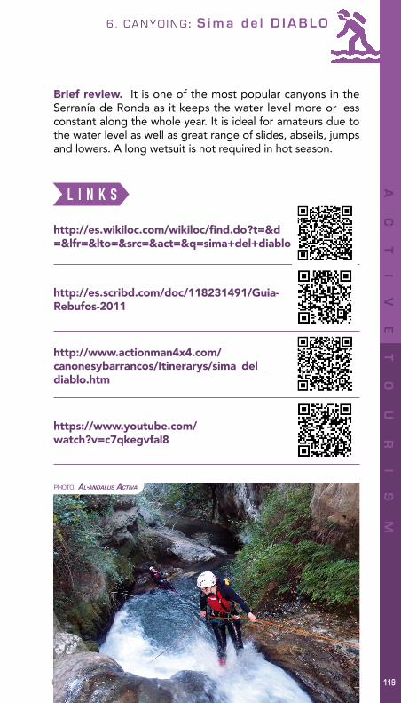
PHOTO. AL-ANDALUS ACTIVA
6 . C A N Y O I N G : S i m a d e l D I A B L O
G U I D E : A C T I V E T O U R I S M I N T H E S E R R A N Í A D E R O N D A 119
AC
TI
VE
TO
UR
IS
M
Brief review. It is one of the most popular canyons in the Serranía de Ronda as it keeps the water level more or less constant along the whole year. It is ideal for amateurs due to the water level as well as great range of slides, abseils, jumps and lowers. A long wetsuit is not required in hot season.
120 G U I D E : A C T I V E T O U R I S M I N T H E S E R R A N Í A D E R O N D A
AC
TI
VE
TO
UR
IS
M
6. Tajo de Ronda
PHOTO. Manuel García. PANGEA CENTRAL
Municipality. Ronda Nearest town. Ronda
Coordinates. x: 307007 y: 4068327
Estimated time: About 2 hours. Number of abseils: 2.
Longest abseil. 35 metres long.
Itinerary: Approx. 600 metres long.
Transport link. It is not completely necessary a transport link. You could get by car to the ancient mill Molinos del Tajo and you will need to walk from there to the canyon (20 mins).
Recommended season. All seasons depending on the water level
Regulations: Any regulations applied.
CANYON
120
AC
TI
VE
TO
UR
IS
M
6 . C A N Y O I N G : T a j o d e R O N D A
G U I D E : A C T I V E T O U R I S M I N T H E S E R R A N Í A D E R O N D A 121
AC
TI
VE
TO
UR
IS
M
Brief review. This is a short distance canyon which is located in an astonishing and unique spot, the gorge Tajo de Ronda, in the city centre. The fi rst abseil is exceptional as it is found just under the bridge Puente Nuevo.
It consists of an entertaining descent with two main abseils which could become risky when water level rises. It is not necessary to wear long wetsuit in summer although thermal clothing is required.
G U I D E : A C T I V E T O U R I S M I N T H E S E R R A N Í A D E R O N D ALong-distance trail (GR) Ronda Cartográfica24
HO
W
TO
U
SE
T
HE
G
UI
DE
25
HO
W
TO
U
SE
T
HE
G
UI
DE
G U I D E : A C T I V E T O U R I S M I N T H E S E R R A N Í A D E R O N D A
The Serranía de Ronda is a great place for active tourism with a wealth of possibilities within your reach. This guide delves into fourteen of the main activities and each of
them has a different icon and colour to make searching easier.Each pursuit is divided into different sections to organise
the wide range of information offered. These sections are:
• DEFINITION. It consists of a general description of the activity as well as the most interesting tourist attractions and resources available in the Serranía de Ronda to practise it. It is been considered convenient to include an information sheet
How to use the guideDavid Barrera
26
HO
W
TO
U
SE
T
HE
G
UI
DE
G U I D E : A C T I V E T O U R I S M I N T H E S E R R A N Í A D E R O N D A
for some activities such as Iron Way, climbing, canyoning and the network of viewpoints with extra details. All the other pursuits have been considered as a whole.
• REQUIRED EQUIPMENT. It has been specifi ed compulsory equipment for a personal protection and technical requirements to practise the activity. If you decided to rely on a specialised company, it will provide the necessary equipment.
• TO FIND OUT MORE. It is a section with a wide variety of essential bibliography about the activity in the Serranía de Ronda as well as with links to specialised web pages to fi nd out more information.
• VIDEOS. It is a collection of links to check out institutional and private videos which will show you the different experiences you can live in the Serranía de Ronda before plunging into it.
• SPECIALISED COMPANIES. It is a full list of specialised companies focused in active tourism.
• ATENTION. It is a summary of rules and advices which need to be taken. They could be general rules, like litter collection, or more specifi c advices, as checking on the weather forecast before practising canyoning.
Cherry Blossom. Felipe Crespo
27
HO
W
TO
U
SE
T
HE
G
UI
DE
G U I D E : A C T I V E T O U R I S M I N T H E S E R R A N Í A D E R O N D A
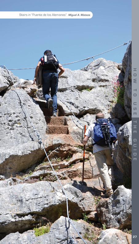
Stairs in “Puente de los Alemanes”. Miguel A. Mateos