54
RHC Technical Assistance Call May 10, 2006 Presented By: Bill Finerfrock Executive Director National Association of Rural Health Clinics 202-543-0348 [email protected]
| Date post: | 12-Jan-2016 |
| Category: |
Documents |
| Upload: | christine-beatrice-chapman |
| View: | 213 times |
| Download: | 0 times |
RHC Technical Assistance Call
May 10, 2006
Presented By:
Bill Finerfrock
Executive Director
National Association of
Rural Health Clinics
202-543-0348

You are encouraged to download a copy of the
following document from the NARHC website:
www.narhc.org/uploads/pdf/RHCmanual1.pdf
Visit our homepage to see what else is available:
www.narhc.org

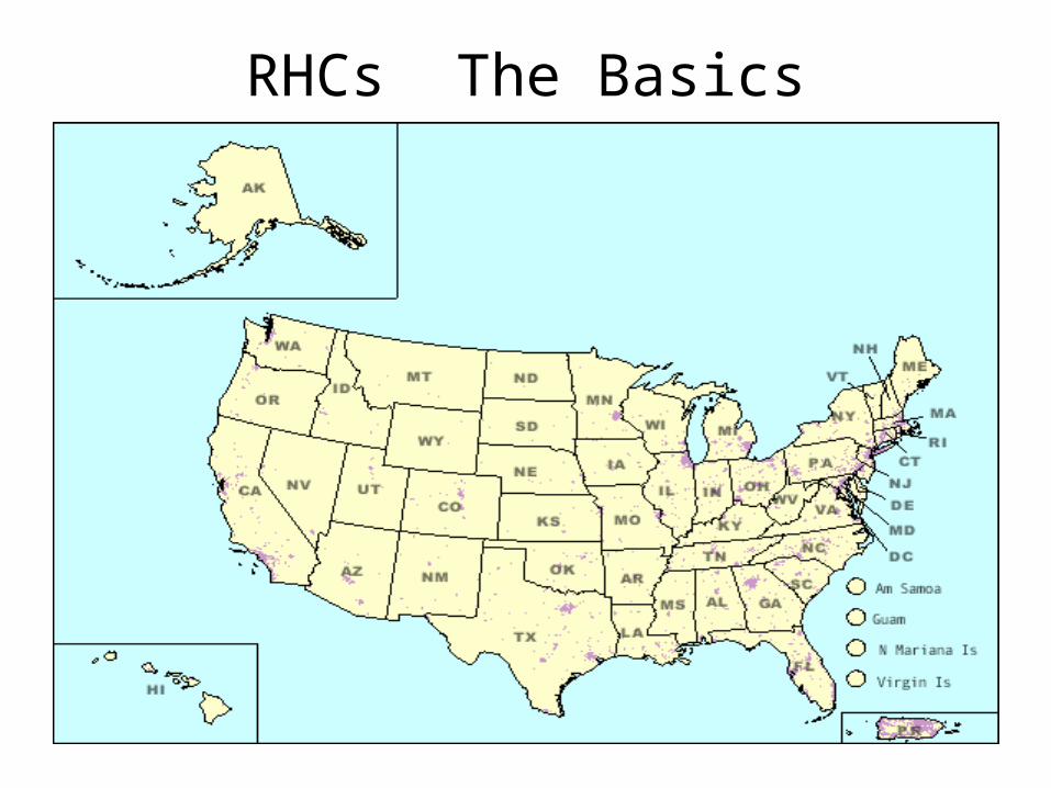
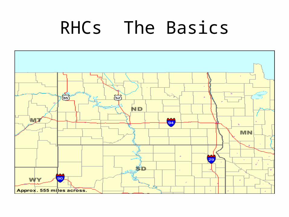
RHCs The Basics
Rural Health Clinics must be located in
areas that are CURRENTLY designated as
underserved AND “an area that is NOT an
urbanized area (as defined by the Bureau of
the Census)
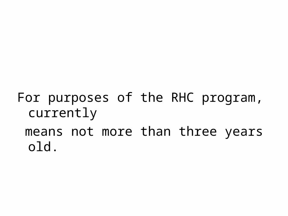
For purposes of the RHC program, currently
means not more than three years old.

RHCs The BasicsUrbanized area
(UA) An area consisting of a central place(s) and adjacent territory with a general Population density of at least 1,000 people per square mile of land area that together have a minimum residential population of at least 50,000 people.
The Census Bureau uses published criteria to determine the qualification and boundaries of UAs. A densely settled area that has a census population of at least 50,000. At least 35,000 people in an urbanized area (UA)a must live in territory that is not part of one or more military reservations, or it is classified as an urban cluster. A UA generally consists of a geographic core of block groups or blocks that have a population density of at least 1,000 people per square mile, and adjacent block groups and blocks with at least 500 people per square mile. A UA may consist of all or part of one or more incorporated places and/or census designated places, and may include area adjacent to the place(s).
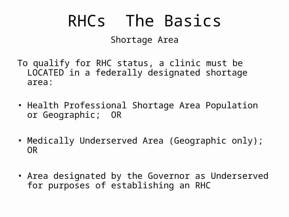
RHCs The BasicsShortage Area
To qualify for RHC status, a clinic must be LOCATED in a federally designated shortage area:
• Health Professional Shortage Area Population or Geographic; OR
• Medically Underserved Area (Geographic only); OR
• Area designated by the Governor as Underserved for purposes of establishing an RHC

RHCs The Basics
How do I find out if my community is
underserved AND in a non-urbanized area?
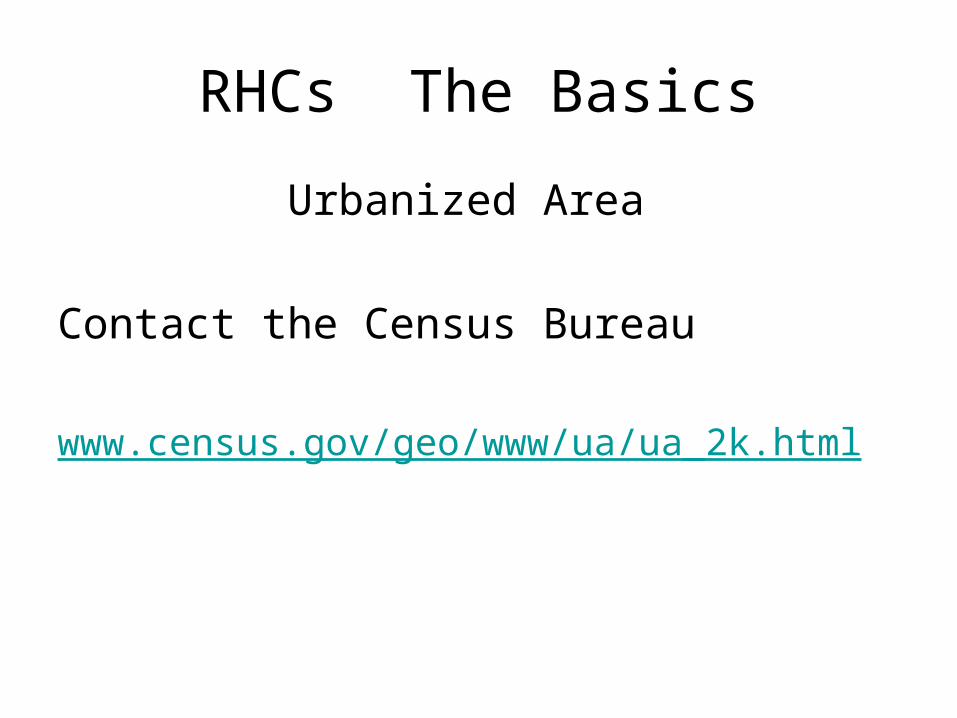
RHCs The Basics
Urbanized Area
Contact the Census Bureau
www.census.gov/geo/www/ua/ua_2k.html

Census 2000 Urban and Rural Classification
Welcome to the U.S. Census Bureau's Urban and Rural Classification Web page. At this site you will be able to locate information about the Census 2000 urban and rural delineations and to review the criteria the Census Bureau used to delineate urban and rural areas based on the results of Census 2000.
The Census Bureau identifies and tabulates data for the urban and rural populations and their associated areas solely for the presentation and comparison of census statistical data. If a federal, state, local, or tribal agency uses these urban and rural criteria in a nonstatistical program, it is that agency's responsibility to ensure that the results are appropriate for such use. It also is that agency's responsibility to ensure that it has provided the necessary tools for use in that agency's programs.
The Census Bureau will be glad to answer questions about the Census 2000 urban and rural criteria and products. However, the Census Bureau is not qualified to provide information or assistance to users concerning the uses of urban and/or rural data in the programs of other agencies, nor does it have the resources to perform research to determine whether or not a locality or specific address is inside or outside an urbanized area or urban cluster.
Locating Urbanized Area and Urban
Cluster Boundaries
Information about products, including
TIGER/Line files, boundary files and maps,
available to assist data users in locating
Urbanized Area and Urban Cluster
boundaries.

RHCs The Basics
www.census.gov/geo/www/ua/uaucbndy.html

Locating Urbanized area and Urban Cluster Boundaries
There are several products available to assist data users in locating Urbanized Area and Urban Cluster boundaries. The Census Bureau will be glad to answer questions about the products listed below. However, the Census Bureau does not have the resources to perform research to determine whether or not a locality or specific address is inside or outside an urbanized area or urban cluster.
American FactFinder online mapping and data dissemination tool.
This application shows the uncorrected UA and UC boundaries as reported in the May 1, 2002 Federal Register notice, and do not reflect those that were reported in the August 23, 2002 or November 20, 2002 Federal Register notices. Data are available for the uncorrected Urbanized Areas and Urban Clusters in Census 2000 Summary File 3 and in the Final National Census 2000 SF1. Use the Reference Maps feature to display the boundaries for these uncorrected entities.

Urban Area Maps (Census 2000)
These maps illustrate the uncorrected boundaries and extent of the Census 2000 UAs and UCs. These maps are available in PDF format for viewing and downloading from the Census Bureau's Map Products Web page. These maps represent the UAs and UCs as reported in the May 1, 2002 Federal Register and do not reflect the corrections that were reported in the August 23, 2002 or November 20, 2002 Federal Register notices. (The Census Bureau will produce corrected maps for affected urban areas at a later date.) Paper copies of these maps are available for purchase from the Census Bureau's Customer Service Center (301-763-4636).
RHCs The Basics
RHCs The Basics

RHCs The Basics

RHCs The Basics

Lists of Urbanized Areas and Urban Clusters
The Census Bureau has prepared the following four files that list the Census 2000 UAs and UCs, their populations, population densities (square miles) and land area measurements (in square meters):
• Alphabetically-sorted list of UAs • Alphabetically-sorted list of UCs • State-sorted list of UAs that shows the portion of
the UA's population within the specified state for UAs that extend into two or more states

RHCs The Basics
North Dakota
• Bismarck, ND
• Fargo, ND--MN 106577(PT)
• Grand Forks, ND--MN 49229(PT)

RHCs The Basics
Shortage Area Designations
• Health Professional Shortage Area; OR
• Medically Underserved Area; OR
• Governor’s designated Area
RHCs The Basics
Health Professional Shortage Areas (HPSA)_
Area can be either a geographic HPSA OR
a population HPSA designation.
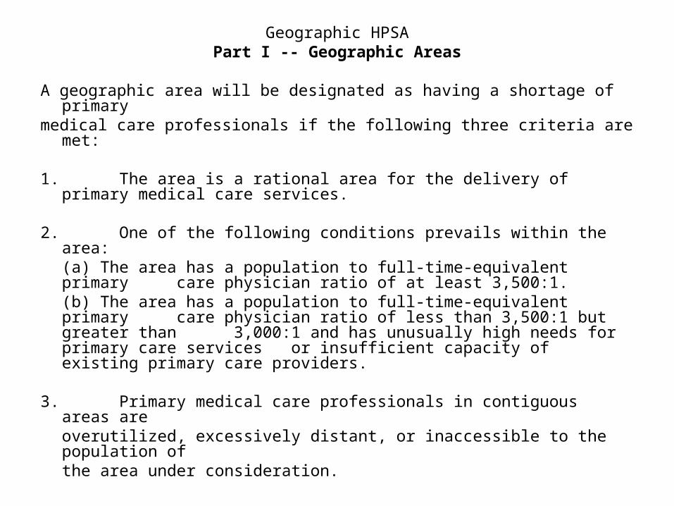
Geographic HPSAPart I ‑‑ Geographic Areas
A geographic area will be designated as having a shortage of primary medical care professionals if the following three criteria are met:
1. The area is a rational area for the delivery of primary medical care services.
2. One of the following conditions prevails within the area:(a) The area has a population to full‑time‑equivalent primary care physician ratio of at least 3,500:1.(b) The area has a population to full‑time‑equivalent primary care physician ratio of less than 3,500:1 but greater than 3,000:1 and has unusually high needs for primary care
services or insufficient capacity of existing primary care providers.
3. Primary medical care professionals in contiguous areas are overutilized, excessively distant, or inaccessible to the population of the area under consideration.
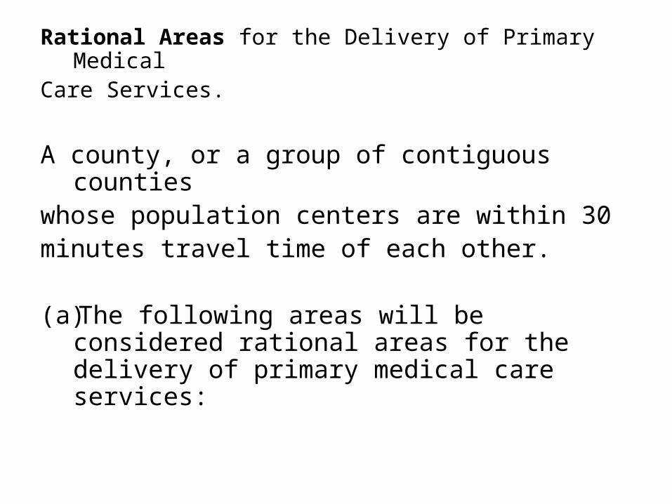
Rational Areas for the Delivery of Primary Medical Care Services.
A county, or a group of contiguous counties whose population centers are within 30 minutes travel time of each other.
(a)The following areas will be considered rational areas for the delivery of primary medical care services:
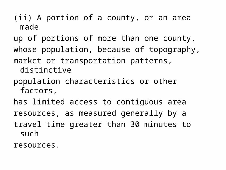
(ii) A portion of a county, or an area made
up of portions of more than one county,
whose population, because of topography,
market or transportation patterns, distinctive
population characteristics or other factors,
has limited access to contiguous area
resources, as measured generally by a
travel time greater than 30 minutes to such
resources.
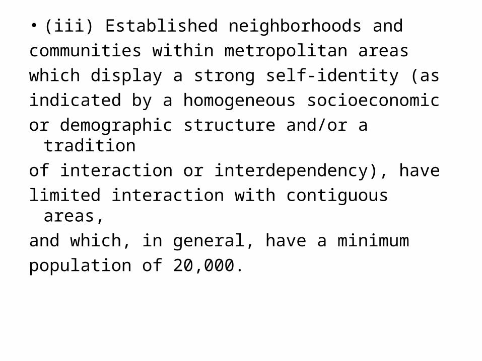
• (iii) Established neighborhoods and
communities within metropolitan areas
which display a strong self‑identity (as
indicated by a homogeneous socioeconomic
or demographic structure and/or a tradition
of interaction or interdependency), have
limited interaction with contiguous areas,
and which, in general, have a minimum
population of 20,000.

The following distances will be used as
guidelines in determining distances
corresponding to 30 minutes travel time:
(i) Under normal conditions with primary roads available: 20 miles.
(ii) In mountainous terrain or in areas with only secondary roads available: 15 miles.
(iii) In flat terrain or in areas connected by interstate highways: 25 miles.
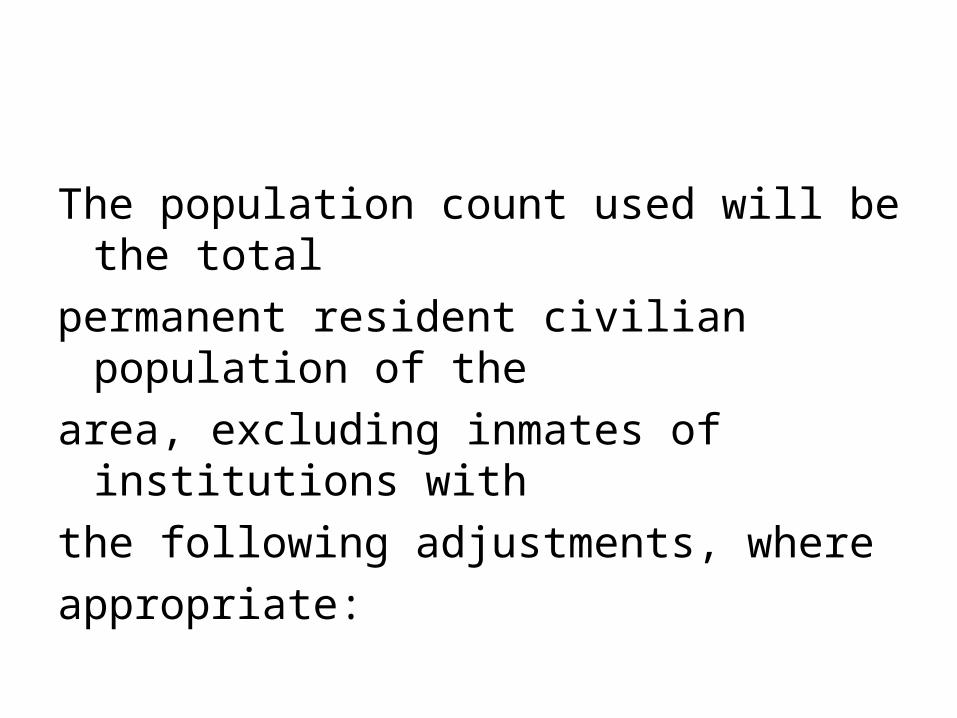
The population count used will be the total
permanent resident civilian population of the
area, excluding inmates of institutions with
the following adjustments, where
appropriate:
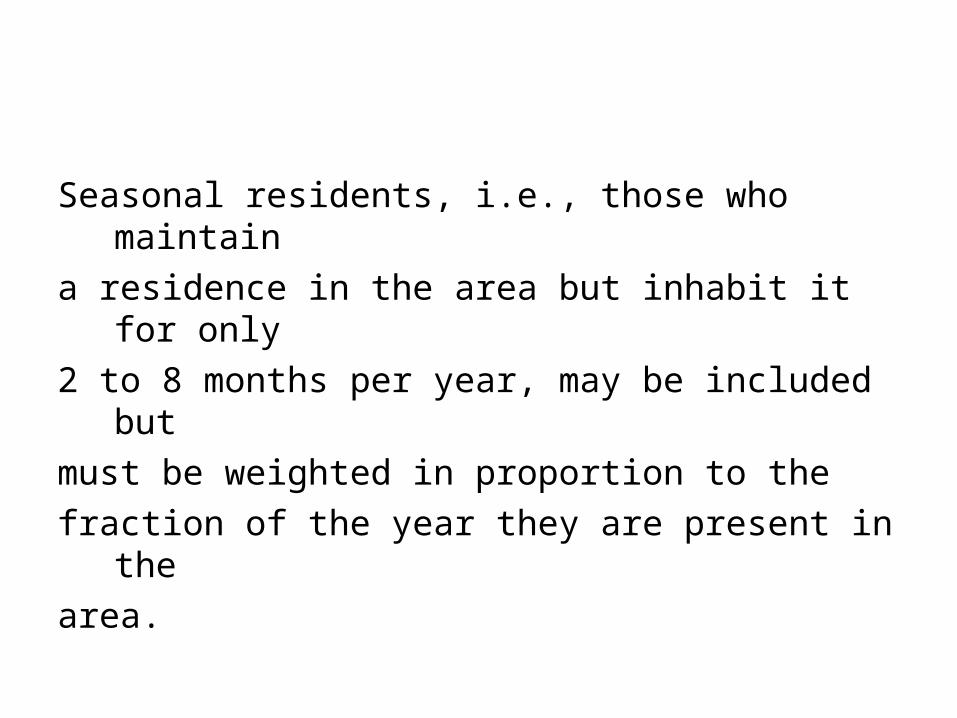
Seasonal residents, i.e., those who maintain
a residence in the area but inhabit it for only
2 to 8 months per year, may be included but
must be weighted in proportion to the
fraction of the year they are present in the
area.
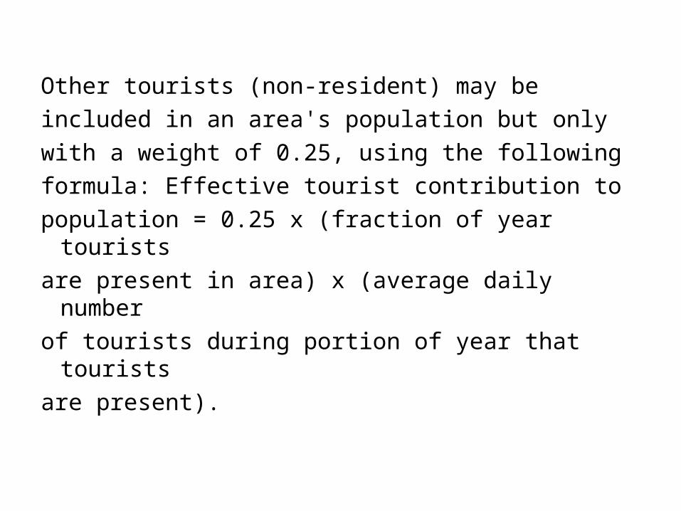
Other tourists (non‑resident) may be
included in an area's population but only
with a weight of 0.25, using the following
formula: Effective tourist contribution to
population = 0.25 x (fraction of year tourists
are present in area) x (average daily number
of tourists during portion of year that tourists
are present).

Migratory workers and their families may be
included in an area's population, using the
following formula: Effective migrant
contribution to population = (fraction of year
migrants are present in area) x (average
daily number of migrants during portion of
year that migrants are present).

Counting of Primary Care Practitioners
All non‑Federal doctors of medicine (M.D.) and doctors of osteopathy (D.O.) providing direct patient care who practiceprincipally in one of the four primary care specialities ‑‑ general or family practice, general internal medicine, pediatrics, and obstetrics and gynecology ‑‑ will be counted.
Those physicians engaged solely in administration,research, and teaching will be excluded. Adjustments for the following factors will be made in computing the number of full‑time‑equivalent (FTE) primary care physicians:

• Interns and residents will be counted as 0.1 full‑time equivalent (FTE) physicians.
• Graduates of foreign medical schools who are not citizens or lawful permanent residents of the United States will be excluded from physician counts.
• Those graduates of foreign medical schools who are citizens or lawful permanent residents of the United States, but do not have unrestricted licenses to practice medicine, will be counted as 0.5 FTE physicians.
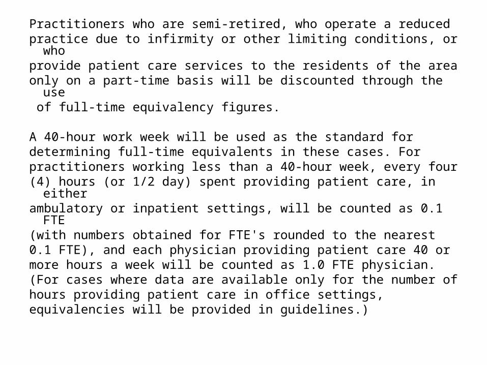
Practitioners who are semi‑retired, who operate a reduced practice due to infirmity or other limiting conditions, or who provide patient care services to the residents of the area only on a part‑time basis will be discounted through the use of full‑time equivalency figures.
A 40‑hour work week will be used as the standard for determining full‑time equivalents in these cases. For practitioners working less than a 40‑hour week, every four (4) hours (or 1/2 day) spent providing patient care, in either ambulatory or inpatient settings, will be counted as 0.1 FTE (with numbers obtained for FTE's rounded to the nearest 0.1 FTE), and each physician providing patient care 40 or more hours a week will be counted as 1.0 FTE physician. (For cases where data are available only for the number of hours providing patient care in office settings, equivalencies will be provided in guidelines.)

In some cases, physicians located within an
area may not be accessible to the
population of the area under consideration.
Allowances for physicians with restricted
practices can be made, on a case‑by‑case
basis.

Part II ‑‑ Population Groups
In general, specific population groups within
particular geographic areas will be
designated as having a shortage of primary
medical care professional(s) if the criteria
are met.
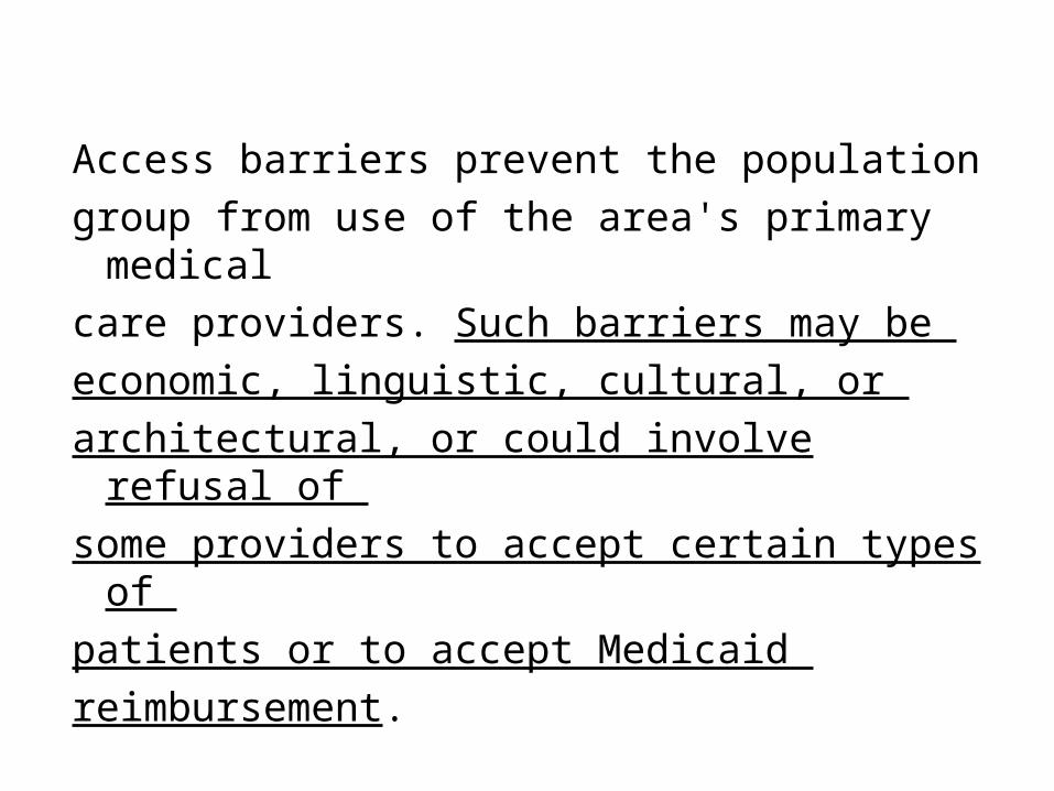
Access barriers prevent the population
group from use of the area's primary medical
care providers. Such barriers may be
economic, linguistic, cultural, or
architectural, or could involve refusal of
some providers to accept certain types of
patients or to accept Medicaid
reimbursement.

MUA Designation
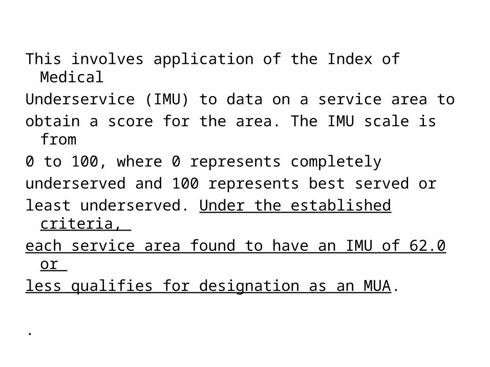
This involves application of the Index of Medical
Underservice (IMU) to data on a service area to
obtain a score for the area. The IMU scale is from
0 to 100, where 0 represents completely
underserved and 100 represents best served or
least underserved. Under the established criteria,
each service area found to have an IMU of 62.0 or
less qualifies for designation as an MUA.
.

The IMU involves four variables ‑
* ratio of primary medical care physicians per 1,000 population,
* infant mortality rate,
* percentage of the population with incomes below the poverty level, and
* percentage of the population age 65 or over.
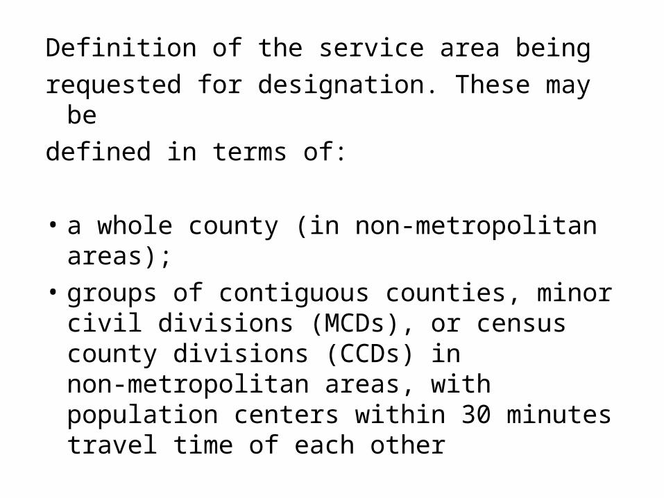
Definition of the service area being
requested for designation. These may be
defined in terms of:
• a whole county (in non‑metropolitan areas);
• groups of contiguous counties, minor civil divisions (MCDs), or census county divisions (CCDs) in non‑metropolitan areas, with population centers within 30 minutes travel time of each other
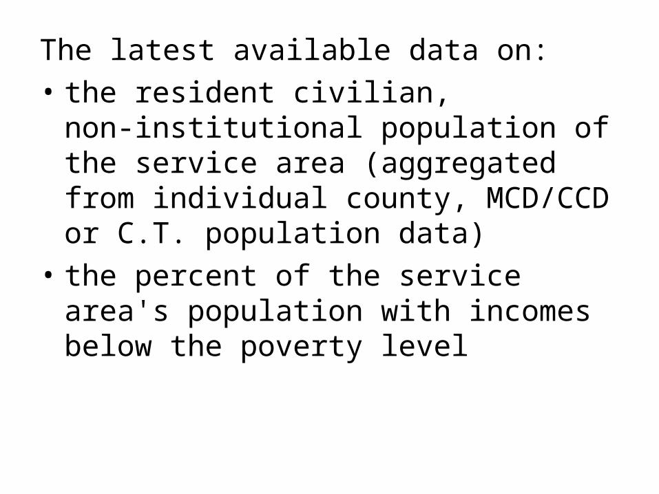
The latest available data on:
• the resident civilian, non‑institutional population of the service area (aggregated from individual county, MCD/CCD or C.T. population data)
• the percent of the service area's population with incomes below the poverty level

• the percent of the service area's population age 65 and over
• the infant mortality rate (IMR) for the service area, or for the county or subcounty area which includes it. The latest five‑year average should be used to ensure statistical significance.
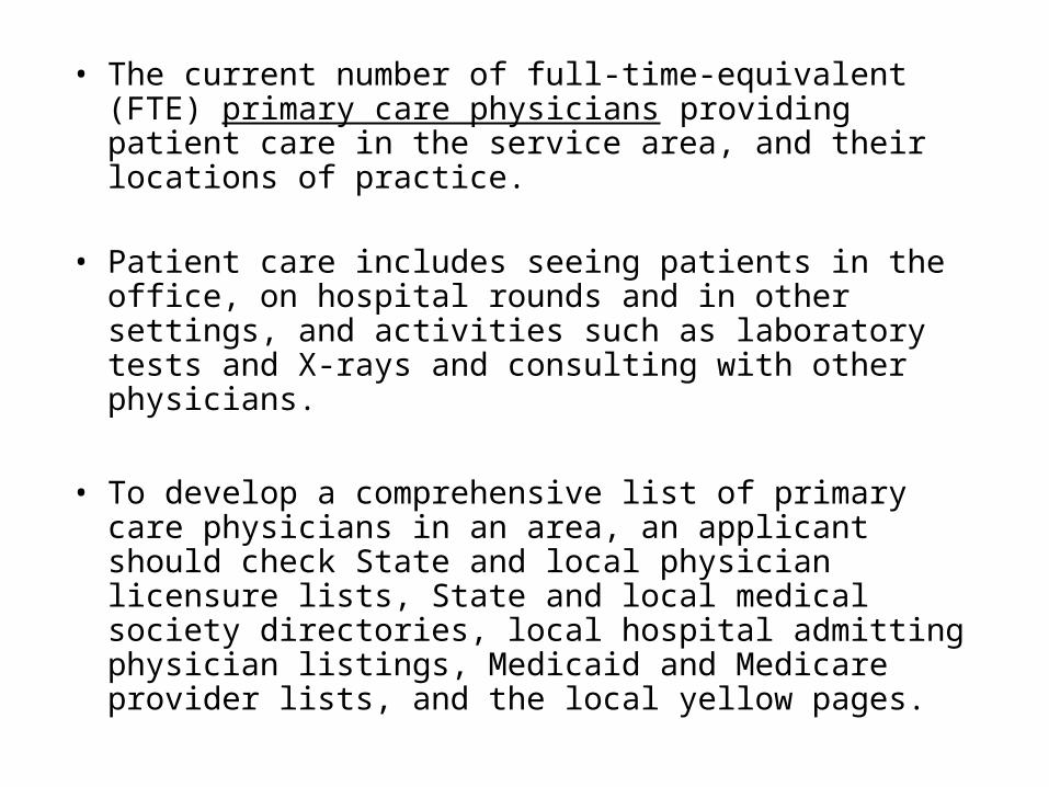
• The current number of full‑time‑equivalent (FTE) primary care physicians providing patient care in the service area, and their locations of practice.
• Patient care includes seeing patients in the office, on hospital rounds and in other settings, and activities such as laboratory tests and X‑rays and consulting with other physicians.
• To develop a comprehensive list of primary care physicians in an area, an applicant should check State and local physician licensure lists, State and local medical society directories, local hospital admitting physician listings, Medicaid and Medicare provider lists, and the local yellow pages.
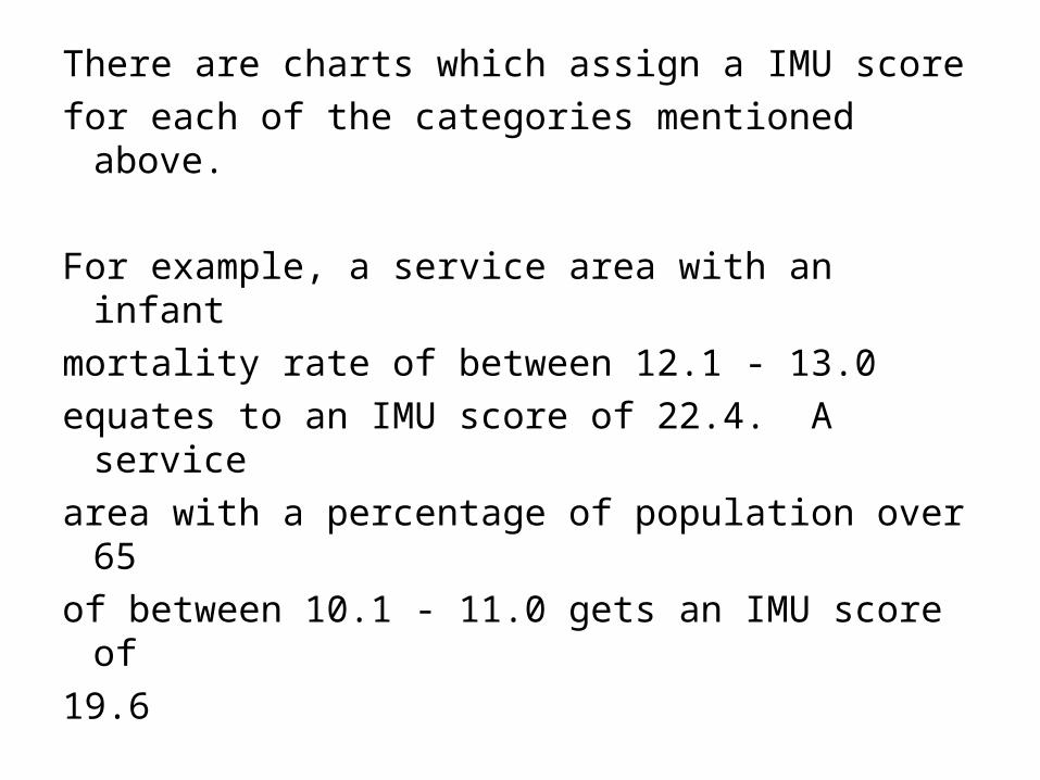
There are charts which assign a IMU score
for each of the categories mentioned above.
For example, a service area with an infant
mortality rate of between 12.1 ‑ 13.0
equates to an IMU score of 22.4. A service
area with a percentage of population over 65
of between 10.1 ‑ 11.0 gets an IMU score of
19.6
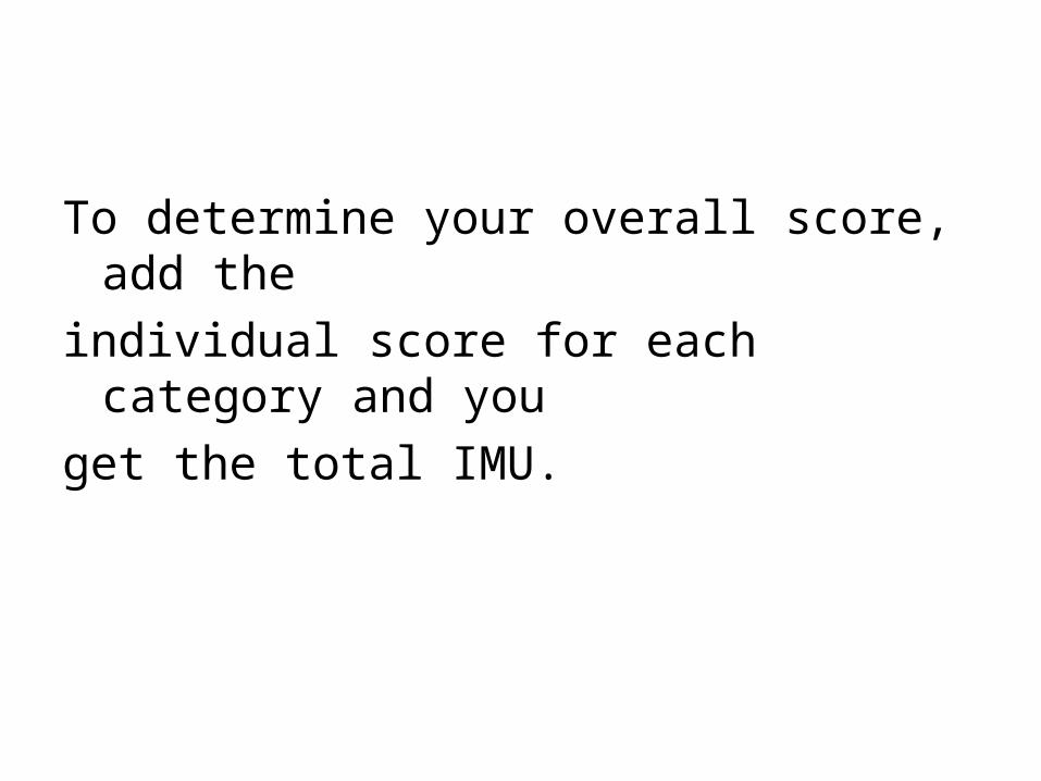
To determine your overall score, add the
individual score for each category and you
get the total IMU.
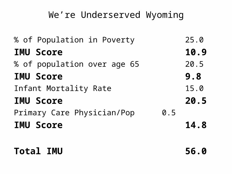
We’re Underserved Wyoming
% of Population in Poverty 25.0
IMU Score 10.9% of population over age 65 20.5
IMU Score 9.8Infant Mortality Rate 15.0
IMU Score 20.5Primary Care Physician/Pop 0.5
IMU Score 14.8
Total IMU 56.0

Based upon an IMU score of 56, We’re
Underserved Wyoming would qualify as a
Medically Underserved Area.
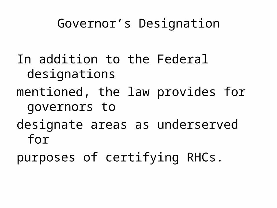
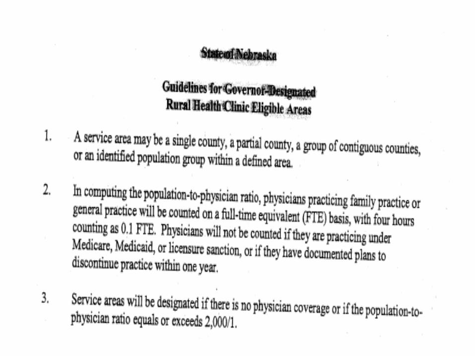
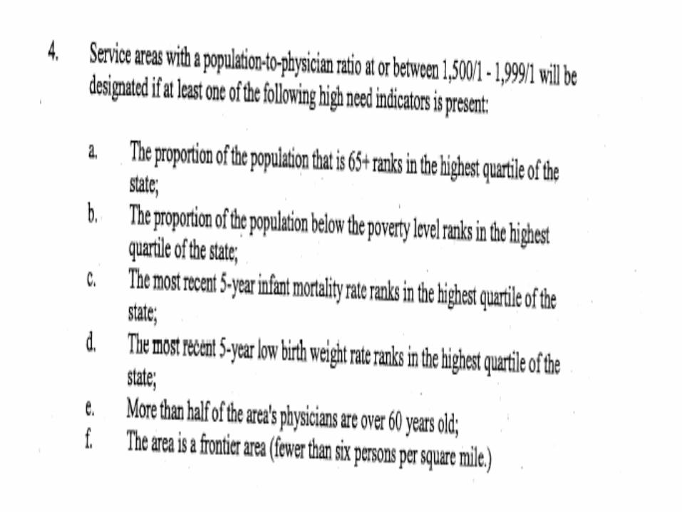
Governor’s Designation
In addition to the Federal designations
mentioned, the law provides for governors to
designate areas as underserved for
purposes of certifying RHCs.

Iowa
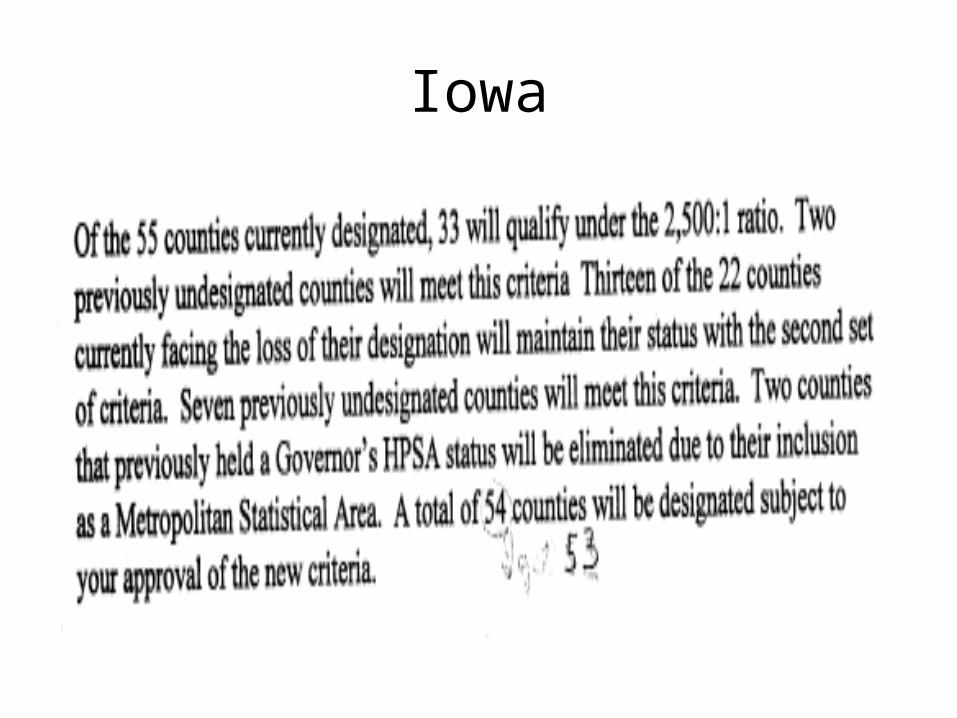
Iowa

Questions?

![Bibliography - Springer978-3-0348-0078-5/1.pdf · Bibliography [1] M.AblowitzandA.S.Fokas. Complex variables. IntroductionandApplica-tions. Cambridgetextsinmathematics.CambridgeUniversityPress,1997.](https://static.documents.pub/doc/80x56/5b8fdecd09d3f2b01e8d1c80/bibliography-springer-978-3-0348-0078-51pdf-bibliography-1-mablowitzandasfokas.jpg)


