48
RICHMOND BRIDGE AND APPROACHES CONGESTION STUDY Community issues report September 2012 RMS 12.280 ISBN 978-1-922041-17-3

RICHMOND BRIDGE AND APPROACHES CONGESTION STUDY
Community issues report
September 2012
RMS 12.280 ISBN 978-1-922041-17-3

2
Table of Contents 1. Introduction ............................................................................................................................ 3 2. Community involvement ....................................................................................................... 4
2.1. Presentation of the short-term options and discussion of the long-term strategic approach .............................................................................................................................. 5
2.2. Community submissions .......................................................................................... 6 3. Community comments on short-term traffic congestion measures................................. 7
3.1. Bells Line of Road/Grose Vale Road (North Richmond) .......................................... 7 3.1.1. Right-hand turn comments ............................................................................... 7 3.1.2. Left-hand turn comments ................................................................................. 8 3.1.3. Multiple or merging lanes ................................................................................. 8 3.1.4. Bus stops.......................................................................................................... 8 3.1.5. Parking and clearways ..................................................................................... 9 3.1.6. Roundabouts .................................................................................................... 9 3.1.7. One way systems ............................................................................................. 9 3.1.8. General comments ........................................................................................... 9
3.2. Kurrajong Road/Yarramundi Lane/Old Kurrajong Road Intersection ..................... 10 3.2.1. Kurrajong Road and Old Kurrajong Road east side ....................................... 10 3.2.2. Kurrajong Road and Old Kurrajong Road west side ...................................... 10 3.2.3. Multiple or merging lanes ............................................................................... 11 3.2.4. Roundabouts .................................................................................................. 11 3.2.5. Speed Limits................................................................................................... 11
3.3. Kurrajong Road/Bosworth Street Intersection and related streets ......................... 11 3.3.1. Parking and clearways ................................................................................... 12 3.3.2. One way systems ........................................................................................... 12
3.4. General comments on congestion study options A-H ............................................ 12 3.5. Traffic figures ......................................................................................................... 14 3.6. Traffic Lights........................................................................................................... 15 3.7. Education campaigns/signage ............................................................................... 15 3.8. Project timing and implementation ......................................................................... 15 3.9. Roads and Maritime Services response on short-term improvements................... 16
4. Community comments on long-term traffic congestion improvements ........................ 16 4.1. Flooding ................................................................................................................. 16 4.2. Bypass/bridge ........................................................................................................ 16
4.2.1. Bypass............................................................................................................ 16 4.2.2. Enhancements to existing bridges and/or new bridges.................................. 17
4.3. Overpass/Underpass ............................................................................................. 17 4.4. Road upgrades or new expressways ..................................................................... 17 4.5. Land use and development.................................................................................... 18
5. Safety .................................................................................................................................... 18 5.1.1. Motorists......................................................................................................... 18 5.1.2. Pedestrians and cyclists................................................................................. 18
6. Public Transport .................................................................................................................. 19 6.1. Roads and Maritime Services response on public transport .................................. 19
7. Continued consultation....................................................................................................... 19 7.1. RMS response to comments on community consultation ...................................... 20
7.1.1. Information display session – one-on-one discussions .................................. 20 7.1.2. Community updates and meetings................................................................. 20
8. Conclusion ........................................................................................................................... 20 9. Appendix A – Feedback Form ............................................................................................ 21 10. Appendix B – Presentation given at the 24 July 2012 community workshop................ 24

3
1. Introduction In April 2011 the Federal Department of Infrastructure and Transport allocated $2 million to carry out planning and investigation work into alleviating traffic congestion on Richmond Bridge and adjoining approach roads between Richmond and North Richmond areas. The Roads and Maritime Services (RMS) is currently investigating options to improve traffic flow through: Analysing the current traffic condition in order to identify potential solutions Investigating the structural suitability of the existing Richmond Bridge for an upgrade Developing strategic options for upgrading Richmond Bridge and its road approaches
between Richmond and North Richmond. A crucial part of the project is to understand the perspectives of the Richmond community and stakeholder groups. This Community Issues Report provides a summary of initial community input provided through a community workshop and a community submissions process, during which 56 written submissions were received. Issues raised at the workshop and through written submissions will be used to inform the short-term and long-term improvements to alleviate traffic congestion. Ongoing consultation activities, as outlined in the ‘Community Involvement Plan for Richmond Bridge and approaches congestion study July 2012’ (the CIP), will take place throughout the preparation of the environmental impact statement and the concept design to provide the community with an opportunity for continued involvement. Broad themes emerging from the consultation to date are summarised as: 1. Most respondents favoured a total bypass and a second river crossing to address long term
traffic congestion. 2. Respondents indicated support for banning right turns out of Old Kurrajong Road into
Kurrajong Road at a minimum during peak hours. There was also support expressed for preventing motorists crossing Kurrajong Road from Yarramundi Lane to Old Kurrajong Road. This is the site of a fatal accident and many submissions refer to the dangerous behaviour of motorists at this intersection in peak times. Subject to further consultation with Council, community members suggest that this could be addressed almost immediately with appropriate signage and a local police campaigns.
3. A number of submissions noted improvements in recent changes to light phases but the potential for further adjustment to prevent delays. There is scope to evaluate whether further improvements can be made to light phasing in the short term.
4. Clearway conditions are suggested by a number of submission writers on both sides of Bells Line of Road. This would require further consultation with local businesses and residents.
5. There was broad support amongst respondents allowing alternative routes to Bells Line of Road and Kurrajong Road where it will not compromise safety and traffic flow. Specifically, allowing an alternative route via Yarramundi Lane and Inalls Lane has broad support. However, it appears that this would only be supported by Hawkesbury Council if a safety audit and potentially additional maintenance funding can be provided. Further consultation with Council and local residents is required.
6. A number of submissions suggest a roundabout at the intersection of Grose Vale Road and Bells Line of Road.
7. Several submissions indicated that facilities for public transport and cycling could be improved with a resultant reduction in car travel and congestion. The infrequency of bus transport was noted as a key concern. A reduction in traffic during school holidays indicates that measures to improve access to public transport for students could reduce congestion.

4
8. Respondents expressed concerns about the timing of further development relative to road and transport improvement works.
9. While only four written submissions noted support for Option H, comments made in regard to the relevant intersections demonstrates there is broad support for this option but with modifications. There are some strong localised concerns about particular elements of the options and these are discussed later in this report.
2. Community involvement In July 2012 the CIP was prepared and published on the RMS road projects website (www.rta.nsw.gov.au/roadprojects) to ensure the Richmond Bridge and approaches congestion study is developed through extensive consultation with local communities and stakeholders. A crucial part of the consultation process is to understand the perspectives of the local community and stakeholder groups, including their: Values and vision for the future planning and development of Richmond and its environs. Short-term solutions to improve traffic flow at Richmond Bridge and adjoining approach
roads for the Richmond/North Richmond areas. Long-term strategies for Richmond Bridge and adjoining approach roads for the Richmond
and North Richmond areas. In July 2012 interviews with members of organisations and associations local to the area were carried out to capture local perspectives of how traffic operates in the area, as well as understanding local views on broader issues, values and vision for the area. One or more individuals associated with the following groups were interviewed: North Richmond District Community Action Association North Richmond Public School Kurrajong Comelroy Historical Society North Richmond Community Centre Hawkesbury Chamber of Commerce (incorporating Richmond and North Richmond) Kurrajong/North Richmond Rotary Club Hannagroup RAAF Hawkesbury Hospital Hawkesbury Local Area Command Lower Nepean/Hawkesbury Water Users Association (commercial farmers) Westbus The objective of the interviews was to obtain a snapshot of local concerns and opinion, rather than organisations’ endorsed views or position statements, to inform ongoing consultation activities. The questions asked during this initial consultation were also used to inform the community workshop held on 24 July 2012. This report summarises the community feedback received during the community workshop (which had 83 registered attendees) and the 56 community written submissions received between 24 July 2012 and 15 August 2012. While the submission closure date was advertised as 31 July 2012, submissions received up to 15 August 2012 have been considered in this report. Submissions sent post this date will be considered in future consultation phases. Attached to this report is a copy of the community workshop presentation labelled as Appendix A and a copy of the community feedback form labelled as Appendix B.

5
2.1. Presentation of the short-term options and discussion of the long-term strategic approach
At the community workshop, project team members presented an overview of the Richmond Bridge and Approaches Congestion Study Stage 1 (the Congestion Study). This study was published on the RMS project website in early July. The overview included a presentation on eight short-term improvement options (Options A-H) that are detailed in the Congestion Study report and summarised as follows: A. Option A addresses the key intersections of Kurrajong Road, Yarramundi Lane and Old
Kurrajong Road. It proposes an eastbound right turn ban from Kurrajong Road into Yarramundi Lane [Old Kurrajong Road] during morning and afternoon peak periods.
B. Option B is similar to Option A with the design affecting the key intersections of Kurrajong
Road, Yarramundi Lane and Old Kurrajong Road. It proposes an eastbound right turn ban into Yarramundi Lane [Old Kurrajong Road] during morning and afternoon peak periods and an eastbound left turn ban from Kurrajong Road to Old Kurrajong Road during morning and afternoon peak periods.
C. Option C is a variation to Option A with the design affecting the key intersections of Kurrajong Road, Yarramundi Lane and Old Kurrajong Road as well as the intersection of Kurrajong Road and Bosworth Street. It proposes an eastbound exclusive right turn bay from Kurrajong Road to Bosworth Street. A westbound right turn ban from March Street into Bosworth Street is also proposed.
D. The design of Option D affects the key intersection of Bells Line of Road and Grose Vale
Road. It proposes a shared through/left turn lane on Bells Line of Road replacing the existing left turn lane on the eastern approach. As well as, an additional westbound short through lane to Bells Line of Road, west of Grose Vale Road. This option allows for all movements at the intersections and may require some widening work.
E. The design of Option E is a modification of Option D and affects the key intersection of Bells
Line of Road and Grose Vale Road. It proposes a shared through/left turn lane on Bells Line of Road replacing the existing left turn lane on the eastern approach. An additional westbound short through lane on Bells Line of Road, west of Grose Vale Road is proposed. It also prohibits on-street parking during morning and afternoon peak periods on the southern side of Bells Line of Road between Pitt Lane and Grose Vale Road. It introduces an eastbound right turn ban from Bells Line of Road into Grose Vale Road and conversion of the existing eastbound right turn bay to a second westbound through lane. This option tries to avoid the need for widening at the intersection by banning the eastbound right turn movement.
F. The design of Option F is a modification to Option E affecting the key intersection of Bells
Line of Road and Grose Vale Road as well as the intersection of Kurrajong Road, Yarramundi Lane and Old Kurrajong Road. It proposes the same changes as Option E in addition to an eastbound exclusive right turn bay from Kurrajong Road into Yarramundi Lane [Old Kurrajong Road].
G. The design of Option G is a combination of Option C and E with modifications. It affects the
key intersection of Kurrajong Road, Yarramundi Lane and Old Kurrajong Road as well as the junction between Kurrajong Road and Bosworth Street and the intersection of Bells Line of Road and Grose Vale Road. It proposes the same changes as Option C and E in addition to an eastbound right turn ban into Yarramundi Lane [Old Kurrajong Road] during morning and afternoon peak periods. A left turn slip lane out of Yarramundi Lane [Old Kurrajong Road] with an acceleration lane on Kurrajong Road (westbound direction). It also proposes an eastbound merge kerb side lane extension (east of Grose Vale Road intersection).
H. The design of Option H affects the key intersections of Kurrajong Road/Yarramundi Lane
and Old Kurrajong Road as well as the intersection of Bells Line of Road and Grose Vale

6
Road. It proposes the same changes as Option G as well as an eastbound exclusive right turn bay from Kurrajong Road to Yarramundi Lane [Old Kurrajong Road] and a left turn slip lane out of Yarramundi Lane [Old Kurrajong Road] with an acceleration lane onto Kurrajong Road (westbound direction).
The presentation of the short-term options, including questions and answers, was followed by a brief overview of the long-term project approach, including community consultation to gain input into the development of up to four options to be considered along the existing corridor. Long-term concept designs will be developed and presented to the community in September to gain further community input to assist with the development of a preferred long-term option. A table facilitation session followed the presentation, to provide the community with an opportunity to discuss their views further and was guided by five questions: 1. In addition to the options shown in the short-term presentation, are there other options for
improving traffic flow that could be considered and why? 2. Of the short-term options presented, including new suggestions made in response to
question one, please suggest your top three options. 3. What do you think are the most important issues when planning long-term measures
(implemented after 2021) to improve traffic flow at Richmond Bridge and approach roads from the Richmond/North Richmond areas?
4. What are the areas to avoid and why? A map is provided if you would like to illustrate your suggestion(s).
5. What are the areas that should be considered and why? A map is provided if you would like to illustrate you suggestion(s).
The community provided broad ranging feedback with valuable local knowledge as presented in this report. Some community members provided specific feedback on the options and others highlighted important street or site based concerns.
2.2. Community submissions
In addition to input provided by over 80 attendees at the community workshop, 56 written responses were received by RMS during the July 2012 consultation period and included submissions from people who identified themselves as: Local residents Local business owners Bus commuters Pedestrians and cyclists Other road users Hawkesbury City Council Hawkesbury Environment Network Inc. Community Bank UBTSC (not an abbreviation) Submissions received have not been reported verbatim, but summarised and collated for reporting purposes. These summaries document the issues raised and solutions suggested by community members. Where similar comments were made by more than one individual or organisation an indication of the number of comments made is provided. Community members provided feedback on short-term and long-term issues and solutions and these have generally been reported on under those separate timeframes. However, where community members have suggested the same solutions, such as options for improving intersection congestion or adjusting traffic light phasing, under both short term and long term timeframes, they have been grouped into intersection categories or a solution option.

7
3. Community comments on short-term traffic congestion measures This section outlines the community comments on the short-term strategy to reduce traffic congestion in the Richmond and North Richmond area. Community issues and suggested solutions are categorised based on comments made in relation to the three key intersections (and related streets) of: 1. Bells Line of Road and Grose Vale Road 2. Kurrajong Road, Yarramundi Lane, and Old Kurrajong Road 3. Kurrajong Road and Bosworth Street
Five written submissions provided specific feedback on the options. However, comments on the intersections addressed by the eight options were received along with comments on: Traffic figures in the Richmond Bridge and approaches congestion study Traffic lights Parking and clearways Bus stops and roundabouts Education campaigns Project timing and implementation Safety and public transport Safety and public transport issues were raised for both short term and long term improvements and are addressed under separate sections within the report. Some submissions also made specific comments on the three intersections under long-term solutions. However, all comments on the intersections have been grouped under short-term solutions, as many of the comments were similar in nature and under consideration for short term implementation.
3.1. Bells Line of Road/Grose Vale Road (North Richmond)
Around a third of the written submissions support the relocation of both bus stops near the intersection of Grose Vale Road and Bells Line of Road and the implementation of clearways, such as no parking on main streets during morning and afternoon peak periods. These recommendations were also raised at the community workshop held on 24 July 2012. Other suggestions include: Right-hand turn improvements, such as extending the right turn lane from Bells Line of
Road to Terrace Road to improve traffic flow. Left-hand turn improvements, such as creating a left turn anytime lane from Grose Vale
Road into Bells Line of Road. Introducing multiple and merging lanes. Building roundabouts.
3.1.1. Right-hand turn comments
Issues and recommendations include: Extend the right turn lane from Bells Line of Road onto Terrace Road. Allow right-hand turn from Bells Line of Road into Grose Vale Road. One submission added
that the small right-hand turn lane into Charles Street also must stay and others were generally concerned that a ban would see an increase in traffic use of alternate routes, such as Charles Street, Pitt Lane and other streets.
Ban right-hand turn eastbound from Bells Line of Road into Gross Vale Road. Implement a raised centre line, of kerb height or greater, on the westbound right lane into
Terrace Road to prevent vehicles crossing the wrong side of the road to access the “turn right lane”.

8
Close Bells Line of Road entrance into shopping centre. Close the service road into Bells Line of Road for the post office. Review the proposal of a no right turn from Bells Line of Road into Grose Vale Road at
Charles Street as this will create another ‘rat run’ and will shift congestion. Remove right turn lane into Grose Vale Road from Bells Line of Road (eastbound) during
peak hours to allow room for two westbound lanes. Close right-hand turn into Grose Vale Road. Allow for right-hand turn lane westbound along Bells Line of Road into Crooked Lane. Implement a no right-hand turn from Charles Street into Bells Line of Road during the
morning and afternoon peak times and allow left-hand turns to occur more easily from Charles Street (to local high school).
A turn right at Pitt Lane would hold up traffic on Bells Line of Road where the traffic is currently more congested.
3.1.2. Left-hand turn comments
Issues and recommendations include: Make the left turn only lane on Bells Line of Road into Grose Vale Road a straight through
lane, to allow vehicles to bypass right turn traffic. Create a left turn anytime lane from Grose Vale Road into Bells Line of Road. Install a ‘Left turn permitted on red after stopping’ sign on Bells Line of Road facing Terrace
Road. Implement a left turn lane from Bells Line of Road into Terrace Road. Implement a left turn lane from Terrace Road into Bells Line of Road.
3.1.3. Multiple or merging lanes
Issues and recommendations include: Implement a two lane turn at the lights at Grose Vale Road and Bells Line of Road. For the evening peak, make Bells Line of Road two lanes westbound directly after the North
Richmond Bridge all the way to the traffic lights at Grose Vale Road. Make this a 3-7pm clearway. The existing westbound lane can continue through the lights. The left lane can turn left into Grose Vale Road as well as continuing west through traffic lights and merging back into one lane prior to the United Service Station, as it did prior to the intersection upgrade some years ago.
From the traffic island adjacent to Coles car park exit on Bells Line of Road (westbound), use contra flow traffic dividers to make a third lane west linking in to the existing right turn lane into Terrace Road. Use this in conjunction with a 3-7pm peak clearway to increase right turn capacity into Terrace Road by approximately 150 metres.
Widen Bells Line of Road between Richmond Bridge and Yarramundi Road to create a bypass lane for right turn traffic into Yarramundi Road.
West of Grose Vale Road should be widened to four lanes at least up to Redbank Creek through to the narrow bridge.
Three lanes from Grose Vale Road and Terrace Road intersection, all way down to Richmond Bridge.
Use the service road as an extra lane after Terrace Road. A left merging lane up to Richmond would keep traffic moving, but may not solve the
problem. Introduce a longer merge lane turning out of Grose Vale Road eastbound.
3.1.4. Bus stops
Issues and recommendations include: Relocate both bus stops near the intersection of Grose Vale Road and Bells Line of Road. Allow the school bus to stop outside shopping centre but not cars.

9
Removal of the bus stop opposite the Post Office at North Richmond poses a problem. Bus services to and from Richmond should be supported so it is important to find an alternative site. If it is relocated in the service road in front of the post office this will remove parking.
3.1.5. Parking and clearways
Issues and recommendations include: Install a clearway between Richmond Bridge and Grose Vale Road in peak traffic periods.
One comment added ‘buses excepted’. Implement no parking on Bells Line of Road, particularly between Pitt Lane and Grose Vale
Road during morning and afternoon peak periods. Clearways on approaches at North Richmond. Need more parking in study area. Remove parking. Extend no parking during the morning and afternoon peak times between William Street and
Bells Line of Road. Keep parking in Riverview Street for residents. Westbound parking bans should not be restricted to morning and afternoon peak periods
but made permanent, as adequate off-road parking is available. Bells Line of Road at North Richmond should be a clearway at all times.
Pitt Lane and Riverview Street – parking should be banned at least on one side of the road. No parking on Bells Line Road peak hour, extra lanes near Kurrajong Road and Grose Vale
Roads, use a service road for bus stop near post office. Clear ways from Richmond to North Richmond. Merging lanes at the cross section of Old
Kurrajong Road plus a no right-hand turn from Old Kurrajong Road going west to North Richmond.
3.1.6. Roundabouts
Issues and recommendations include: Remove traffic lights at Bells Line of Road and Grose Vale Road and a create roundabout. Construct a roundabout at Terrace Road and Beaumont Avenue. Large scale roundabout at North Richmond looks like a very good option.
3.1.7. One way systems
A ‘liquid flow free flow turnabout’ in North Richmond with modifications to local roads to achieve free flow traffic.
3.1.8. General comments
Issues and recommendations include: Implement traffic improvements at Grose Vale Road and Bosworth Avenue first and then
assess those improvements before fixing Yarramundi Lane/Old Kurrajong Road. Consideration be given to the large number of school buses on Grose Vale Road in the
morning peak, a dedicated area to move the vehicles should be sought in the area behind the school and industrial units where these vehicles are “off road” for loading and unloading of school children.
It would be good if Bells Line of Road could be upgraded to accommodate B-Doubles and if it could be integrated into the M7.
Close off Bells Line Road between Grose Vale Road and Pitt Lane to centralise the business district and focus the main through traffic around the back of Hanna Park.
If the section of road from Grose Vale Road to Bosworth Street was magically converted to super highway it would not resolve the problem. It would simply strangle the town of Richmond.

10
Concern Charles Street will be the only access to Grose Vale Road and the shopping centre for eastbound traffic, which is problematic as Charles Street is narrow and used for car parking and as a school bus route. Therefore, parking restrictions should be considered.
Adequate signage and lighting should be provided at the Bells Line of Road into Gross Vale Road junction and Charles Street as both are very badly lit and the turn consequently very easy to miss at night.
Introduce permanent or timed right-hand turning restrictions at key points along the study area.
3.2. Kurrajong Road/Yarramundi Lane/Old Kurrajong Road Intersection
There is strong support for preventing right-hand turns out of Old Kurrajong Road into Kurrajong Road (near the Windsor Polo Club) and moderate support for preventing this manoeuvre only during peak times. Comments are also made on maintaining the left turn out of Old Kurrajong Road west into Kurrajong Road but there is some opposition to it as well. There is acceptance that the right turn from Kurrajong Road to Old Kurrajong Road west relieves traffic congestion at times but a longer right turn lane is suggested by respondents who support maintaining this option. A right-hand turn lane for eastbound traffic coming from North Richmond to Richmond from Kurrajong Road into Old Kurrajong Road is supported by 10 written submissions. The manoeuvres from Old Kurrajong west to east and right turns from Old Kurrajong west into Kurrajong Road are not supported. A single respondent does not support right-hand turns from Inalls Lane into Old Kurrajong Road [Yarramundi Lane]. Five written submissions support installing a roundabout at the intersection of Kurrajong Road and Old Kurrajong Road. Interpretation of comments has been made in some cases, such as where community members have used local site references like the ‘right-hand turn at the Polo Club’, it is taken to mean the right-hand turn out of Old Kurrajong Road into Kurrajong Road. Community members have also used their understanding of the name of the local road and the actual road name, as indicated on road maps, is clarified in brackets.
3.2.1. Kurrajong Road and Old Kurrajong Road east side
Issues and recommendations include: Ban the right-hand turn from Old Kurrajong Road into Kurrajong Road (near Windsor Polo
Club). One submission noted ‘in the evening only’. Hawkesbury City Council also supports this recommendation.
Prevent right-hand turn from Old Kurrajong Road to Kurrajong Road at peak times.
3.2.2. Kurrajong Road and Old Kurrajong Road west side
These comments concern turns to and from Old Kurrajong Road west (sometimes referred to as Yarramundi Lane and Inalls Lane) to Kurrajong Road (sometimes referred to as Bells Line of Road). Issues and recommendations include: Implement a right-hand turn lane, for traffic coming from North Richmond to Richmond, to
be able to turn into Old Kurrajong Road heading towards Yarramundi Lane. One comment noted immediate implementation is needed. Others noted this would also relieve right-hand turning traffic closer to Bosworth Street.
Install a dedicated right turn lane into Yarramundi Lane [Old Kurrajong Road west] off Bells Line of Road [Kurrajong Road] in the morning period only.

11
Consider a no right hand turn from Bells Line of Road [Kurrajong Road] into Yarramundi Lane [Old Kurrajong Road] in peak times. One comment notes an evening ban only.
Close the intersection. Improve the right-hand turn from Old Kurrajong Road [Yarramundi Lane] into Inalls Lane
(eastbound). Implement a no right-hand turn from Yarramundi Lane [Old Kurrajong Road] into Bells Line
of Road [Kurrajong Road]. One comment noted to ‘ban intersection at this crossing’. Implement a right-hand turn from Yarramundi Lane [Old Kurrajong Road] into Bells Line of
Road [Kurrajong Road]. Install a no right turn at the Inalls Lane and Old Kurrajong [Yarramundi Lane] intersection.
There should be a left turn only, as well as implementing a simple median strip in the middle of the intersection.
Ban the left-hand turn out of Yarramundi Lane [Old Kurrajong Road)] into Kurrajong Road during the PM peak (Hawkesbury City Council).
Close Yarramundi Lane. Make Old Kurrajong Road up to Yarramundi Lane (Colo Soccer Football Club) one way
only. Will still be able to turn right off Kurrajong Road, from North Richmond, but no exit onto Kurrajong Road.
3.2.3. Multiple or merging lanes
Issues and recommendations include: Build slip/filter lanes for Yarramundi Lane [Old Kurrajong Road] into Kurrajong Road. One
comment specified left-hand turn lane. Do not implement a left turn slip lane out of Yarramundi Lane with an acceleration lane on
Kurrajong Road (westbound direction). Add a merging lane on Kurrajong Road, of sufficient length, to allow vehicles to merge
smoothly. Widen Kurrajong Road for a dedicated right turn lane at Old Kurrajong Road, to make
through traffic to Richmond flow uninterrupted. Kurrajong Road should have four lanes on the western side of the intersection of Kurrajong
Road and Old Kurrajong Road to allow west bound vehicles from Old Kurrajong Road to merge onto Kurrajong Road and also allow east bound vehicles to turn right from Kurrajong Road onto Old Kurrajong Road.
Consider widening the roads from Yarramundi Lane to Richmond Bridge to create two lanes in order to allow traffic merge onto Bells Line of Road [Kurrajong Road] from Yarramundi Lane [Old Kurrajong Road] in peak traffic times.
3.2.4. Roundabouts
Five written submissions recommend the installation of a roundabout at the junction of Yarramundi Lane [Kurrajong Road] and Old Kurrajong Road, this would enable traffic to move freely.
One submission recommends the traffic lights at the intersections of Lennox Street/Page Street and Bourke Street and Lennox Street/Blacktown Road should be replaced with standard mini roundabouts.
3.2.5. Speed Limits
Issues and recommendations include: Reduce the speed on Kurrajong Road to 60km/h during peak times. Keep the speed limit to 80km/h until the current 60km/h sign appears just after the crossing
at Kurrajong and Old Kurrajong Road.
3.3. Kurrajong Road/Bosworth Street Intersection and related streets
Issues and recommendations include:

12
Consider providing a no right-hand turn at intersection of March Street and East Market
Street. Hawkesbury City Council noted there are currently turning manoeuvre issues at the
intersection of East Market Street and March Street (extension of Kurrajong Road) and improvements to traffic flow at this intersection could be provided by allowing the kerb lane to be left turn and through, providing a green right turn arrow from March Street into East Market Street or banning the right turn from March Street into East Market Street.
[Coming from North Richmond along Kurrajong Road] Right turn bay at Bosworth and March Street into Castlereagh Road.
Introduce right-hand turning restriction west bound at the corner of Chapel Street and Kurrajong Road. Timed or permanent.
Close Chapel Street access to March Street.
3.3.1. Parking and clearways
Issues and recommendations include: Hawkesbury City Council noted that it is clear that improvements are required at the
intersection of Bosworth Street and Kurrajong Road as outlined in the Study which in the short-term could result in removing all parking for both the AM and PM peak between Chapel Street and East Market Street.
Clearways on approaches between Bosworth and Chapel Streets in Richmond. Make AM and PM peak time clearway conditions from Bourke Street (East Richmond) along
March Street, Kurrajong Road, and Bells Line of Road to Charles Street (North Richmond) and the south eastern side of Pitt Lane (North Richmond).
3.3.2. One way systems
Implement a ‘figure 8 one way system with 4-way diamond intersection and 3-way half diamond intersections’, incorporating Bosworth Street, Lennox Street, Kurrajong Road/March Street, West Market Street, Windsor Street, Bourke Street.
3.4. General comments on congestion study options A-H
Many of the comments made on the congestion study options A-H that made reference to specific issues or solutions related to the three intersections have been consolidated under those headings. General comments made on the options are provided following: Option A Not supported as it moves the problem elsewhere. This option adds a lot of time to the journey for those travelling to Penrith, which was
evident during the closure of Yarramundi Lane during road resurfacing work. Option B Not supported as it moves the problem elsewhere. This option adds a lot of time to the journey for those travelling to Penrith, which was
evident during the closure of Yarramundi Lane during road resurfacing work.
Option C
Option C is not supported as it moves the problem elsewhere. Option C adds a lot of time to the journey for those travelling to Penrith, which was evident
during the closure of Yarramundi Lane during road resurfacing work.
13
Option D
Option D was in place a few years ago and caused traffic merging issues and traffic cutting up the inside lane.
Option E
Option E is not safe as the traffic would increase around the Richmond North Public School, although the risks may be reduced outside of school hours.
The safest route is to turn into Grose Vale Road. Option E was in place a few years ago and caused traffic merging issues and traffic cutting
up the inside lane.
Option F
No general comments made and specific comments on right turns are listed under the relevant intersection.
Option G
No general comments made and specific comments on the left turn slip lane, bus stop and parking are listed under the relevant intersection.
Option H
Of the written submissions that made specific reference to the options, Option H was supported over the other short-term options presented. However, at the community workshop and in the written submissions there is strong support for modifications to Option H. General comments on Option H include: Consider a road safety audit to ascertain the viability of Option H. Support for Option H as outlined in the presentation. Uncertainty on how an acceleration lane would help. Provides improvement to all three of the main choke points at Grose Vale Road/Bells Line
of Road, Yarramundi Lane/Kurrajong Road and Bosworth Street/Kurrajong Road. Implement Option H now and eventually an overpass at the Grose Vale Road intersection,
plus duplicating the bridge to cater for future traffic volumes. Option H if it is best on modelling but stop any further housing development until a long term
solution, such as a bypass is implemented. Hawkesbury City Council noted that:
o Improvement works outlined in Option H, could see traffic numbers increase to over double and traffic should be contained within the State road network of Kurrajong Road, Bosworth Street and Castlereagh Road.
o Yarramundi Lane (Old Kurrajong Road) is similar to a local road with a maximum environmental capacity in the order of 300 vehicles an hour and is currently beyond capacity. The road reserve for the majority of this section is only 10 metres wide and should not be considered as a de-facto State road. Consider widening and upgrading this road with funding provided to further maintain it. A road safety audit will need to be undertaken for Yarramundi Lane to ascertain its viability [for continued use as an alternative to Kurrajong Road].
o No improvement in the level of service for traffic on Grose Vale Road in the mornings is predicted in the Congestion Study at any stage. The doubling in size of North Richmond is almost all planned to feed into Grose Vale Road presenting a critical problem.
o The outcomes from Option H relating to the intersection of Kurrajong Road/Yarramundi Lane/Old Kurrajong Road whilst potentially improving capacity and safety on Kurrajong Road, does so at the expense of the physical, environmental and

14
safety of Yarramundi Lane and the feeder local road network. If this option is pursued, then these issues must be addressed.
3.5. Traffic figures
The accuracy of the traffic figures was questioned by a number of community members and the Hawkesbury City Council. Hawkesbury City Council commented that: Section 4.1 of The Study (dot point 5) makes reference to the “Penrith bound traffic” turning
into Yarramundi Lane and not travelling further to the intersection of Kurrajong Road and Bosworth Street. There is anecdotal evidence that some of the traffic turning right at Yarramundi Lane has a destination of either Richmond or travelling towards Windsor/Blacktown, using Yarramundi Lane/Inalls Lane/Southee Road as a rat-run. The Study data could be further enhanced by undertaking an Origin/Destination Study for some of these critical movements.
The peak hour traffic volumes outlined in Table 4.4 in the study clearly demonstrate that the State road traffic is not following the State road network. State road traffic should be contained within its own road network and not diverted into the Local road network.
Community issues and recommendations include: The Richmond Bridge and approaches congestion study is deficient in not examining the
impact of proposed changes on the local road network. Documenting the increase in vehicle numbers without studying the suitability of roads to cope and identifying possible changes, road signage, one way traffic possibilities or pedestrian safety is a serious deficiency.
The Richmond Bridge and approaches congestion study on traffic growth is totally incorrect in that it has failed to take into account three points: o The accelerated rate of increase in traffic volumes over the last three years. The
manipulating of the numbers by a smoothing exercise involving averaging the increase over different periods is invalid and does not eliminate the fact that traffic is increasing at a rate eight times that of earlier years. Nothing has happened to slow the increase in rate and much has happened to accelerate it further.
o No allowance has been made for the nursing home and aged care facility currently under construction, which alone could provide traffic flows which exceed bridge capacity within five years.
o No allowance has been made for the rezoning and development applications already lodged with Council and forwarded to Gateway.
It is questioned if the Richmond Bridge and approaches congestion study took into account all the traffic merging at Richmond from Blacktown Road, Windsor Road and Castlereagh Road onto Kurrajong Road and then Bells Line of Road.
No observations appear to have been made of the length of the queue along Bells Line of Road west of the lights, which often in the mornings extends to Colo High School and beyond.
Traffic figures need to consider other side streets such as Windsor Street, March Street, Market Place (shopping centre), and Bourke Street (at McDonalds).
Review traffic monitoring and reassess traffic forecasting. No detailed analysis of traffic movement in the local roads appears to have been done by the
congestion study. The study seems to have only concentrated on one stretch of main road and has not taken into account - Charles Street/Bells Line of Road, Redbank Road/Bells Line of Road and Crooked Lane/Bells Line of Road.
Crash data appears to be taken as a fact but figures seem high, particularly when there would be a high incidence of non-reporting of minor incidents not involving injury
A one day visit over the prolonged study period was inadequate to observe all traffic flow issues and led to some inaccurate assumptions: o Evening peak delays to through westbound traffic caused by left turning vehicles is
noted. Not reported was the blocked through lane encourages right turning traffic to cross the double centre and queues in the eastbound lane.

15
o It is assumed that morning eastbound traffic turning right on to Old Kurrajong Road is headed from Penrith when much is headed for the Motorway via the Driftway and Richmond Road.
o The use of Pitt Lane and Riverview Street is noted without mention of the danger caused by reversing trucks, parked cars, day-care pick up activities etc. Further visit sites are required.
The traffic survey SIDRA results are strange as they show a current delay of 39 seconds at the Grose Vale Road/Bells Lind of Road junction reducing to 36 seconds after proposed improvement. A 39 second delay bears no relation to real life experiences.
Concerns that there is a limited scoping study that does not seem to look at traffic inputs and outputs in a wider context than just the town of Richmond.
3.6. Traffic Lights
Modification of traffic light phasing has strong support with around a third of written submissions seeking consideration of changes to phasing and at the community workshop, community members raised this as a solution to improve traffic flow. Some respondents suggested removing traffic lights or altering the priority given to particular traffic in peak times. Community recommendations include: Phase the traffic lights during peak times to reduce the congestion along Bells Line of Road
and Kurrajong Road. One comment noted to ‘give priority to vehicles travelling west. Phase the traffic lights at the intersection of Bells Line of Road and Grose Vale Road. Remove the traffic lights at North Richmond and Richmond. Traffic light cycle needs to consider traffic peaks. North Richmond lights need immediate attention. Allow the long line of cars (5kms eastbound AM) to move through faster at lights. Figure 5.2 in the Congestion Study indicates reasonable morning speeds eastbound, once
traffic is past the Grose Vale Road lights, indicating the prospect of substantial improvements if issues can be resolved at the lights.
Proposal for Bosworth Street lights is endorsed but believe increased traffic will mean the 5-10 year proposals need to be effected in the first five years.
Give priority traffic light sequence to Kurrajong Road traffic for 20 minutes at about 4.30 and 5.30 in the afternoon. Tell local residents that this will be the case and they should avoid the intersection of Bells Line of Road and Grose Vale Road at this time.
3.7. Education campaigns/signage
Respondents identified scope for educating drivers to avoid poor driver behaviour with the aim of a positive impact on traffic flow. Community recommendations include: Education on road rules and driver behaviour. Topics suggested include turning right into a
two lane road and the fines associated with blocking traffic and correct merging technique. Install permanent road signs on Kurrajong Road communicating the fines and loss of points
for blocking traffic. Police patrols to enforce rules. Improve student safety on school buses so that fewer parents are on the roads in the
afternoons to pick up their children. Clear signage for the direction of the cycle path around Kurrajong Road (parallel to Bells
Line of Road).
3.8. Project timing and implementation
Some respondents expressed concern that short-term options would have limited or no benefit. Others wanted the improvements brought forward. Issues and recommendations include: Concern that short-term options are not future proof.

16
Short-term options are a waste. Stop development then investigate. Apart from the Yarramundi Lane intersection the 0-5 year items on Table 7.16 of the
Congestion Study should be completed within one year or less. The 5-10 year option for Bosworth Street will need to be brought forward to 0-5 years because of the underestimate of the rate of increase in traffic growth.
Nothing RMS does will alter the congestion presently experienced as it will increase as development occurs.
3.9. Roads and Maritime Services response on short-term improvements
RMS is considering the community feedback and will respond to issues as part of its technical review and recommendations on short-term improvements in late 2012.
4. Community comments on long-term traffic congestion improvements
This section outlines the comments made by the community on the long-term strategy to reduce traffic congestion in the Richmond and North Richmond area. Community issues and suggested solutions are categorised as follows: Flooding Bypass/bridge Underpass Land use and development. One respondent also commented that there is a need to consider whether any traffic improvements will be efficient from a financial standpoint.
4.1. Flooding
It is recognised that flooding is a key issue for the Richmond and North Richmond community – this was reflected in comments made by the community at the workshop and in written submissions. Many of the written submissions on long-term solutions have noted the need for flood free solutions and for the need to consider flood data in the development of the long-term concept designs.
4.2. Bypass/bridge
Of the 56 written submissions received, 55 submissions made specific comments on bypass or bridge options, with particular reference to making the solutions flood free. At the community workshop every table noted support of a bypass option. Respondents were generally in favour of an additional river crossing. Some commented about the location, others about the timing and others about related road upgrades. Two written submissions also expressed that a bypass should be fast tracked.
4.2.1. Bypass
Flood free bridge bypassing Windsor, Richmond and North Richmond. Flood free bridge bypassing Richmond and North Richmond. We need a complete flood free bypass. Build a bypass at Windsor, rather than the current option 1 for a new Windsor Bridge. The
bypass would need to run from McGraths Hill, across the floodplain and emerge on Putty/Wilberforce Road near or above King Road. The current Windsor Bridge should be repaired and kept for local and tourist traffic.

17
A bypass of Richmond and North Richmond could be the catalyst for further unwelcome residential development and a loss of social and environmental amenity, particularly of Redbank Creek, Navua Reserve, Hawkesbury River, farmland and sporting fields.
One respondent provided a detailed submission with six options summarised as: o Option 1 – off ramp from Richmond Bridge and raised roadway over Bells Line of
Road and through Hanna Park crossing over Terrace Road and back onto Bells Line of Road.
o Option 2 – raised roadway for bypass traffic and flood free access from Kurrajong Road over Hawkesbury River to link to North Richmond bypass.
o Option 3 – raised roadway for bypass traffic and flood free access from Inalls Lane/Southee Road, across the Polo grounds to Richmond Bridge and through Hanna Park and over Terrace Road and back onto Bells Line of Road.
o Option 4 - raised roadway for bypass traffic and flood free access from Inalls Lane/Southee Road running in line with Drift Road to Kurrajong Road to Richmond Bridge and through Hanna Park and over Terrace Road and back onto Bells Line of Road near Crooked Lane.
o Option 5 – new road from the intersection of Southee Road and Castlereagh Road to Blacktown Road along two alternative new roads. One running at the back of Orchard Road and one in the opposite direction and through the University of Western Sydney campus.
o Option 6 – connect Blacktown Road to Hawkesbury Valley Way between Richmond Golf course and Hawkesbury Show Ground.
4.2.2. Enhancements to existing bridges and/or new bridges
Duplicate bridge and have each bridge two lanes one way. Raise the level of the Yarramundi Bridge [Springwood Road crossing] to above maximum
flood height. Add a two lane bridge to the downstream side of the existing bridge [Richmond Bridge]. New bridge upstream of the existing Richmond Bridge. Create a second bridge from Castlereagh Road to Grose Vale Road (including upgrading
The Driftway). Provide a second bridge over the Grove River at Yarramundi Reserve so as to connect
Springwood Road and Grove River Road to relieve traffic flow from Bowen Mountain and Grose Vale areas.
Develop a bridge through to Springwood Road from Nauva Reserve, Grose Vale. No bridge at Navua Reserve please. One respondent queried how a new bridge would relieve congestion at Windsor. Develop a bridge at the Grose River. Extend Beaumont Avenue through the park to north side of bridge and allow for future
second bridge beside existing bridge to make two lanes to Richmond and create existing bridge two lanes to North Richmond.
Construct a new bridge to stop after Yarramundi Lane.
4.3. Overpass/Underpass
Construct an underpass at the west side of Richmond Bridge for Terrace Road traffic. Construct an underpass at Grose Vale Road and Terrace Road. Leave the intersection as it is currently and create an underpass for through traffic on Bells
Line of Road. Consider an overpass/underpass option at North Richmond lights. Overpass at the Grose Vale Road intersection, plus duplicating the bridge to cater for future
traffic volumes. Widen the Bells Line of Road/Grose Vale Road intersection in the east-west direction to
make it feasible to build an east-west bridge over the intersection.
4.4. Road upgrades or new expressways
Include an expressway to the west.

18
Dual carriageway between Richmond and North Richmond. Richmond /Blacktown road upgrade from the M7. Upgrade Bells Line of Road. Four lanes on Kurrajong Road and Bells Line of Road. Kurrajong Road would have to be elevated above flood level from the vicinity of Chapel
Street in Richmond to the River for flood free access.
4.5. Land use and development
Land use and development were raised as key contributors to traffic congestion in around one third of the written submissions and it was a key issue flagged at the community workshop. There is strong support for preventing further development until the traffic congestion improvements are implemented. The community recommends: Prevention of developments west of the river that generate traffic. No development to proceed until a long-term solution is provided (i.e. a bypass or light rail). Developments need to consider the demand and placement for a third flood free
Hawkesbury River crossing. Concern about the North Richmond Joint Venture Project (NRJVP).
o The Peel Dairy Development would increase the two peak-hour curves above the point of saturation. This development alone will require an enhanced access between the east and the west of the Hawkesbury River.
o The NRJVP will produce more than 2000 extra bridge crossings in each direction per day, mostly during morning and afternoon peak periods.
o Any short-term solutions will be a waste of time if an extra 1000 to 2000 cars are forced through the Terrace Road and Bells Line of Road intersection as a result of the proposed Redbank subdivision.
Keep the rural and village areas west of the river intact (do not introduce major traffic routes through these places).
Any development must minimise the impact on residents as much as possible (any that are affected should be generously compensated) and minimise the impact on environment.
Concern over potentially losing the unique character of the area if major upgrade works were to occur.
5. Safety Safety was raised as an issue in around a third of submissions as a major factor to consider in the development of traffic solutions and these concerns are raised in comments under the intersection categories and more general comments provided in this section. Safety concerns are particularly in relation to motorist, pedestrians and cyclists.
5.1.1. Motorists
Submission writers recall many accidents and a fatality at the right hand turn from Old Kurrajong Road into Bells Line of Road [Kurrajong Road], near the polo fields.
Need to consider emergency vehicle access. Through traffic should be kept off local roads, including Bilpin, to make the area safer for
locals and tourists. The intersection of Chapel Street and Bells Line of Road is very dangerous. Nursing
home/retirement village visitors and staff are often trapped trying to exit. A roundabout or lights would help.
5.1.2. Pedestrians and cyclists
Pedestrian and cyclist issues included: The cycle lanes on the Richmond Bridge are inadequate and pose significant safety risk.

19
Consider pedestrian and cyclist safety in any further development. No off-road pedestrian path between Richmond and North Richmond. No safe pedestrian access between the shopping centre and the post office and east bound
bus stops without the unreasonable walk to the lights, which are impossible for those with a disability.
Maintenance is required for the cycle and pedestrian access point on the east side of the Richmond Bridge. The roadway edges need a sweep as there is plenty of stone and glass from previous accidents between Richmond and North Richmond. Scheduled sweeping would be useful. Also, the cycle/pedestrian access point on the east side of the bridge needs tidying as there is fallen vegetation and weeds on the path to Old Kurrajong Road.
The current cycle lanes are inadequate across Richmond Bridge and any modification to the Bridge and approaching lanes or at the intersections will need to consider cyclist safety.
6. Public Transport Nine respondents identified public transport as being a key concern. Additional car trips to transport school students, lack of a bus subsidy for student travel and infrequent bus services were highlighted in responses. Issues raised included: Suggestion to review transport activity and all forms of transport including light rail, buses,
car-pooling and sharing in the study area. Car usage by parents taking children to school instead of using public transport seems to
have increased significantly. Invest more in public transport, e.g. new rail links, duplicate line to Richmond, undertake
study of light rail from Richmond to Campbelltown via Penrith, more bus links to Penrith and throughout Hawkesbury area.
Transport initiatives particularly flood impacted ones will have to balance financial effectiveness (economy) and whether significant road constructions is worthwhile given the possibility for reduced development due to flood levels (AHD) with need for road improvements to reduce existing congestion or State Government and local Council imposed residential development and the resulting increased congestion of traffic.
A rail link is needed to extend the line from Richmond to at least Kurrajong. There is a lack of buses or taxis in the afternoon/evening and people rely on vehicles or
pick-ups from family. Expressway to western NSW or a very fast train system to open up the benefits of the
country tourism. Development of country regional centres and decentralise population settlements to ease the burden off Sydney residents.
6.1. Roads and Maritime Services response on public transport
Some of the public transport issues are beyond the control of RMS but there is scope to work constructively with Transport for NSW and Hawkesbury City Council and local schools to investigate solutions. Management of demand and reduction in car trips could relieve congestion in the period before the bridge is duplicated.
7. Continued consultation At the community workshop on 24 July, community members noted they were happy with an opportunity to provide their input and listen to the views of other community members in an open forum. Some community members noted they would prefer an opportunity to speak to the project team one-on-one as they found it difficult to present their views in a round table situation, particularly given there were over 80 community members who attended the workshop. Comments on the consultation process made through written submissions include the need to:

20
Involve the local community at the beginning of the decision-making process and involve the community in the development of the congestion study and before final decisions are made and action is taken for improvement in the area.
Listen to the people that actually live in the area rather than spend budget on a survey. Look at solutions that have worked in similar conditions/situations. Make presentations and the delivery of information clearer, including simple definitions of
technical terms, such as what the term ‘saturation’ means in the congestion study. Ensure presentations address the community concerns, such as flooding and safety
(including pedestrians and cyclists) as a key issues.
7.1. RMS response to comments on community consultation
Community involvement will continue in accordance with the Community Involvement Plan for the project, which is reviewed and updated as a response to community feedback. A number of new issues and recommendations have been made by stakeholders and further consultation will take place in relation to the short-term and long-term improvements. Upcoming community involvement activities include:
7.1.1. Information display session – one-on-one discussions
In response to the community feedback on the need for more one-on-one discussion opportunities, the community will be invited to an information display period of the short and long-term options identified by the project team. The display period will be attended by the project team, which will enable community members to raise any concerns or questions.
7.1.2. Community updates and meetings
Community updates and meetings with individuals and groups will continue to keep the community informed and assist with community involvement. All relevant information and updates will also be available through the RMS project website.
8. Conclusion The Richmond and North Richmond communities provided broad ranging feedback with valuable local knowledge that will be used to further inform the development of short-term and long-term options to reduce traffic congestion on Richmond Bridge and its approach roads between these two communities. Evidenced by the community consultation to date, there is strong support for the implementation of traffic improvements to the three key intersections (and surrounding streets) of Bells Line of Road and Grose Vale Road, Kurrajong Road, Yarramundi Lane, and Old Kurrajong Road and Kurrajong Road and Bosworth Street. Option H, as presented in the Congestion Study, may be supported more broadly if modifications are made to the option as suggested by community members and the Hawkesbury City Council in this report. While there is strong support for bypass options, the scope of this project is for long-term strategy to reduce traffic congestion in the Richmond and North Richmond area within the existing bridge and road corridor. Ongoing consultation will take place to ensure continued community involvement in the development of the preferred short-term and long-term options.

21
9. Appendix A – Feedback Form

JULY 2012
Feedback form – community workshop (We would appreciate if you would fill in this feedback form and leave in the box provided at the door or hand it to one of the project team members)
Workshop name: Richmond Bridge and approaches congestion study
Workshop date: Tuesday, 24 July 2012
Workshop location: North Richmond Public School
Please return your comments to us by Tuesday 31 July 2012
Contact details Name: _____________________________________________________________________
Address: ___________________________________________________________________
Email: _____________________________________________________________________
Contact Number: ____________________________________________________________
Please tick here if you would like to receive further information.
To allow us to effectively collate your feedback, please tick one or more of the boxes below that describes you best.
Local resident Local business owner Bus commuter
Other road user Government agency Community group
Pedestrian/cyclist Transport group
Other (please specify) _______________________________________________________________
What do you think should be done to reduce traffic congestion at Richmond Bridge and its approaching roads?
________________________________________________________

2
________________________________________________________
________________________________________________________
________________________________________________________
________________________________________________________
What do you think RMS should focus on first to improve local traffic congestion?
________________________________________________________
________________________________________________________
________________________________________________________
________________________________________________________
________________________________________________________
________________________________________________________
What do you see as long-term opportunities for traffic improvements for the area?
________________________________________________________
________________________________________________________
________________________________________________________
________________________________________________________
________________________________________________________
________________________________________________________
Thank you for your feedback
If you have any further comments, please do not hesitate to email the project team at [email protected] or write to RMS, PO Box 973, Parramatta NSW 2124.
For more information regarding the project, please visit www.rms.nsw.gov.au/roadprojects/richmondbridge
© Roads and Maritime Services Privacy: The Roads and Maritime Services (RMS) is subject to the Privacy and Personal Information Protection Act 1998 (“PPIP Act”) which requires that we comply with the Information Privacy Principles set out in the PPIP Act. All information in correspondence is collected for the sole purpose of assisting in the development of the short and long term strategies for Richmond Bridge and adjoining approach roads. The information received, including names and addresses of respondents, may be published in subsequent documents unless a clear indication is given in the correspondence that all or part of that information is not published. Otherwise RMS will only disclose your personal information, without your consent, if authorised by the law. Your personal information will be held by RMS at 27 Argyle Street, Parramatta NSW 2150. You have the right to access and correct the information if you believe that it is incorrect.

24
10. Appendix B – Presentation given at the 24 July 2012 community workshop
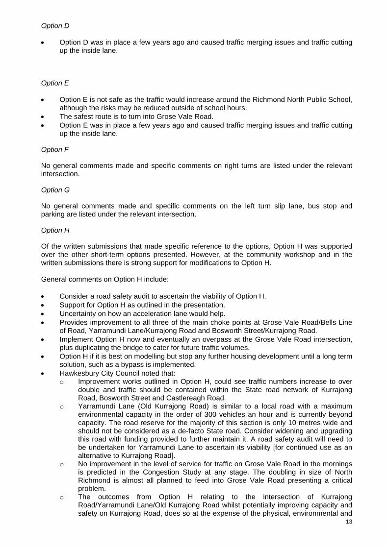
Richmond Bridge and approaches Congestion study Community Consultation Workshop 24 July 2012
Richmond Bridge and Approaches Congestion Study
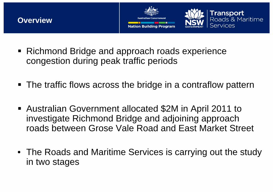
Overview
Richmond Bridge and approach roads experience congestion during peak traffic periods
The traffic flows across the bridge in a contraflow pattern
Australian Government allocated $2M in April 2011 to investigate Richmond Bridge and adjoining approach roads between Grose Vale Road and East Market Street
• The Roads and Maritime Services is carrying out the study in two stages

Analyse the cause of current congestion
Identify short-term improvements to ease the current traffic congestion
Examine the structural suitability of Richmond Bridge for upgrading
Reserve a road corridor between Richmond and North Richmond suitable for future traffic needs.
Objectives

Overview
Stage 1
• Traffic analysis of the congestion
• Preliminary investigation regarding structural suitability of the bridge
• Short-term solutions to congestion

Overview
Stage 2
• Strategic options for upgrading Richmond bridge and approaches
• Reservation of a road corridor for long-term traffic needs

Bridge
Preliminary assessment of the existing bridge
• Richmond bridge was constructed in1905
• Structural inspection was carried out by RMS in October 2011
• Bridge is suitable for current traffic load requirement
• Bridge is not suitable for adding an additional lane
• Any bridge widening should be carried out as an independent structure.

Process
Investigations into local area – stakeholder consultations and traffic investigations
Community Consultation – review of short-term options
and discussion about the long-term optionsWe are
here
Stakeholder and community consultation to confirm:
•Preferred short-term options
•Long-term options to reserve a corridor
Announcement of preferred short-term option
Announcement of future long-term road corridor

Scope of stage 1 study
• Traffic analysis of the congestion
• Identify and examine short-term solutions to congestion

Traffic on Richmond Bridge
CapacityRange
0
200
400
600
800
1,000
1,200
1,400
1,600
0:00
1:00
2:00
3:00
4:00
5:00
6:00
7:00
8:00
9:00
10:0
0
11:0
0
12:0
0
13:0
0
14:0
0
15:0
0
16:0
0
17:0
0
18:0
0
19:0
0
20:0
0
21:0
0
22:0
0
23:0
0
Vehi
cle P
er H
our
Time
Average Weekday Traffic 2011EastboundWestbound
CapacityRange
CapacityRange
Average Weekday
Average Weekend
Bridge Traffic Close to Saturation Level.
Weekend peak is just 18% lower than commuter peak.

Key issues
• Two-lane road is approaching saturation levels during peak hour
• Three intersections acting as pinch points
• The three pinch points are:1. Grose Vale
Road/Bells Line of Road/Terrace Road intersection
2. Yarramundi Lane/Kurrajong Road/Old Kurrajong Road intersection3. Bosworth Street/Kurrajong Road/March Street intersection
1
2
3

Congestion - morning peak
1
2
3Yarra
mundi Lane
Eastbound traffic turning right into Yarramundi Lane blocking Bridge traffic

Through traffic occasionally backs up over Bridge due to the obstruction at Yarramundi Lane intersection
Modelling snapshot am peak on Richmond Bridge

Queuing on Grose Vale Road
Modelling snapshot am peak at Grose Vale intersection

Congestion – pm peak
Left turn out of Yarramundi Lane slows down BLoR west bound traffic
1
2
3Yarramundi L
ane

Congestion – pm peak Grose Vale Road intersection
• Through traffic on BLoR blocks the turning lanes traffic.
• Rat run via Pitt Lane
1
2
3
Grose V
ale
Road
Pitt Lane

Modelling snapshot pm peak on Kurrajong Road
Congestion of westbound traffic due to forced left turn merge atYarramundi Lane intersection.

Description of OptionsA and B
Options A and B are similar
2
A BAN RIGHT TURN
B BAN RIGHT TURN AND LEFT TURN
BAN
BAN
BAN
Yarramundi L
ane
Castlereagh Road
1
3

Description of Option C
Option C is a modification to Option A
2
3
C BAN RIGHT TURN
BAN
Yarramundi L
ane
Castlereagh Road
C BAN WESTBOUND RIGHT TURN ADDITIONAL EASTBOUND RIGHT TURN BAY
1

Description of OptionsD and E
• Options D and E are similar
• Option E assumes additional right turn ban
1
D ADDITIONAL WESTBOUND SHORT THROUGH LANE
E ADDITIONAL WESTBOUND SHORT THROUGH LANE BAN RIGHT TURN
BAN
Grose V
ale
Road
Yarramundi L
ane
2
3

Description of Option F
Option F is a further modification to Option E
2
1
F
ADDITIONAL WESTBOUND SHORT THROUGH LANE BAN RIGHT TURN
BAN
Grose V
ale
Road
F ADDITIONAL RIGHT TURN BAY
Yarramundi L
ane
3

Description of Option G
Combination of Options C and E
2
1
Grose V
ale
Road
Yarramundi L
ane
3
C BAN WESTBOUND RIGHTTURN ADDITIONAL EASTBOUNDRIGHT TURN BAY
C BAN RIGHT TURN
BAN
E ADDITIONAL WESTBOUND SHORT THROUGH LANE BAN RIGHT TURN
BAN
• Additional WB merge extension BLoR
• Left turn slip lane out of Yarramundi

Description of option H
Further modification to Options E and F
2
1
Grose V
ale
Road
Yarramundi L
ane
3E ADDITIONAL WESTBOUND
SHORT THROUGH LANE BAN RIGHT TURN
BAN
• Option H allows for a right turn bay on BLoR
• Additional WB merge extension on the BLoR
• Left turn slip lane out of Yarramundi F ADDITIONAL RIGHT TURN
BAY
• Ban on street parking in peak periods on Kurrajong Rd between Chapel and Bosworth St.
• Ban on street parking in peak periods on Bells Line of Road between Pitt Lane and Grose Vale Road.

Community feedback from this workshop will assist in the development of long-term options
Up to four options will be considered along the existing corridor
Strategic concept designs will be developed and presented to the community for comment
These comments will be considered and will assist in developing a preferred option
Stage 2 – Long-term solutions

Stage 2 – Process
Initial feedback from community for long-term options
Strategic concept design development
Community workshops for options input and feedback
Consideration of feedback and development of a preferred option


