7/20/2021 1 Rip Currents & High Surf In West Central & Southwest Florida Presented by: Tony Hurt What is a rip current? A “Rip Current” is defined as a relatively small-scale surf-zone current moving away from the beach. Rip currents form at low spots or breaks in the sandbars as waves disperse along the beach causing water to become trapped between the beach and a sandbar, or other structures like jetties or piers. (surf zone: tidal area of beach thru the breaking waves)
Transcript
7/20/2021
1
Rip Currents & High Surf
In West Central &Southwest Florida
Presented by: Tony Hurt
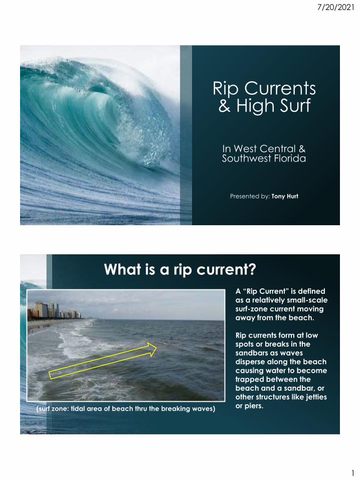
What is a rip current?
A “Rip Current” is defined as a relatively small-scale surf-zone current moving away from the beach.
Rip currents form at low spots or breaks in the sandbars as waves disperse along the beach causing water to become trapped between the beach and a sandbar, or other structures like jetties or piers. (surf zone: tidal area of beach thru the breaking waves)
7/20/2021
2
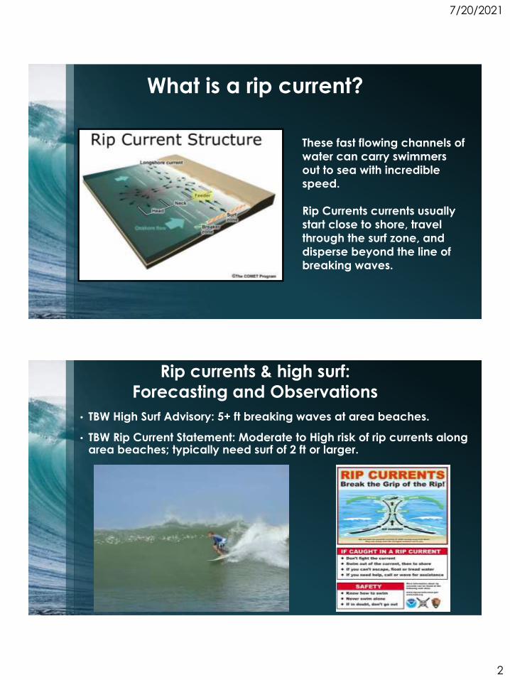
These fast flowing channels of
water can carry swimmers
out to sea with incredible
speed.
Rip Currents currents usually
start close to shore, travel
through the surf zone, and
disperse beyond the line of
breaking waves.
What is a rip current?
• TBW High Surf Advisory: 5+ ft breaking waves at area beaches.
• TBW Rip Current Statement: Moderate to High risk of rip currents along area beaches; typically need surf of 2 ft or larger.
Rip currents & high surf:
Forecasting and Observations
7/20/2021
3
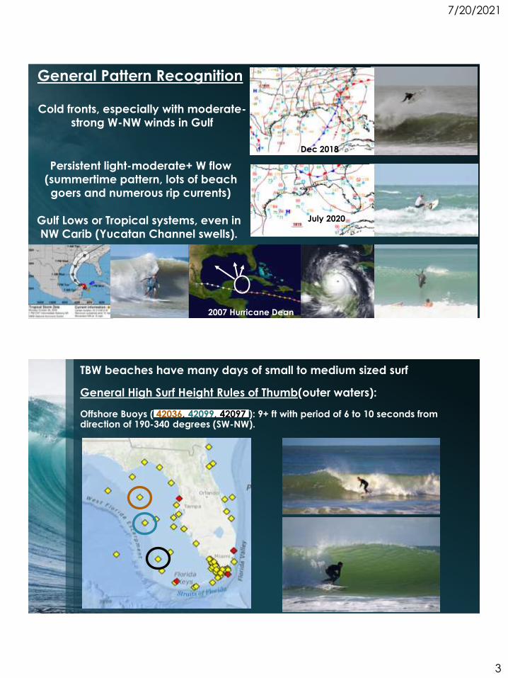
General Pattern Recognition
Cold fronts, especially with moderate-
strong W-NW winds in Gulf
Persistent light-moderate+ W flow
(summertime pattern, lots of beach
goers and numerous rip currents)
Gulf Lows or Tropical systems, even in
NW Carib (Yucatan Channel swells).
2007 Hurricane Dean
July 2020
Dec 2018
TBW beaches have many days of small to medium sized surf
General High Surf Height Rules of Thumb(outer waters):
Offshore Buoys ( 42036, 42099, 42097 ): 9+ ft with period of 6 to 10 seconds from direction of 190-340 degrees (SW-NW).
7/20/2021
4
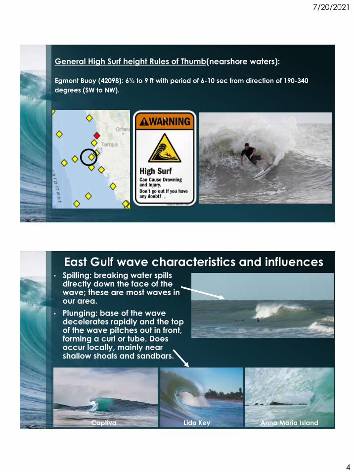
General High Surf height Rules of Thumb(nearshore waters):
Egmont Buoy (42098): 6½ to 9 ft with period of 6-10 sec from direction of 190-340
degrees (SW to NW).
East Gulf wave characteristics and influences • Spilling: breaking water spills
directly down the face of the wave; these are most waves in our area.
Captiva Lido Key Anna Maria Island
• Plunging: base of the wave decelerates rapidly and the top of the wave pitches out in front, forming a curl or tube. Does occur locally, mainly near shallow shoals and sandbars.
7/20/2021
5
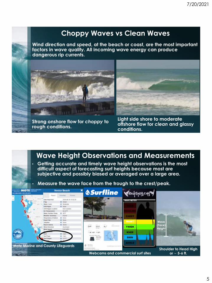
Choppy Waves vs Clean Waves
Wind direction and speed, at the beach or coast, are the most important factors in wave quality. All incoming wave energy can produce dangerous rip currents.
Strong onshore flow for choppy to rough conditions.
Light side shore to moderate offshore flow for clean and glassy conditions.
Wave Height Observations and Measurements• Getting accurate and timely wave height observations is the most
difficult aspect of forecasting surf heights because most are subjective and possibly biased or averaged over a large area.
Mote Marine and County Lifeguards
Webcams and commercial surf sites
Wave
(Face)
Height
Shoulder to Head High or ~ 5-6 ft.
• Measure the wave face from the trough to the crest/peak.
7/20/2021
6
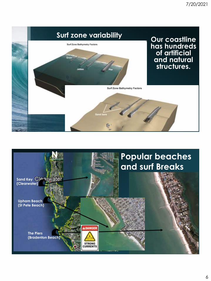
Surf zone variability Our coastline has hundreds
of artificial and natural structures.
The Piers
(Bradenton Beach)
Sand Key
(Clearwater)
Upham Beach
(St Pete Beach)
Popular beaches and surf Breaks
N
7/20/2021
7
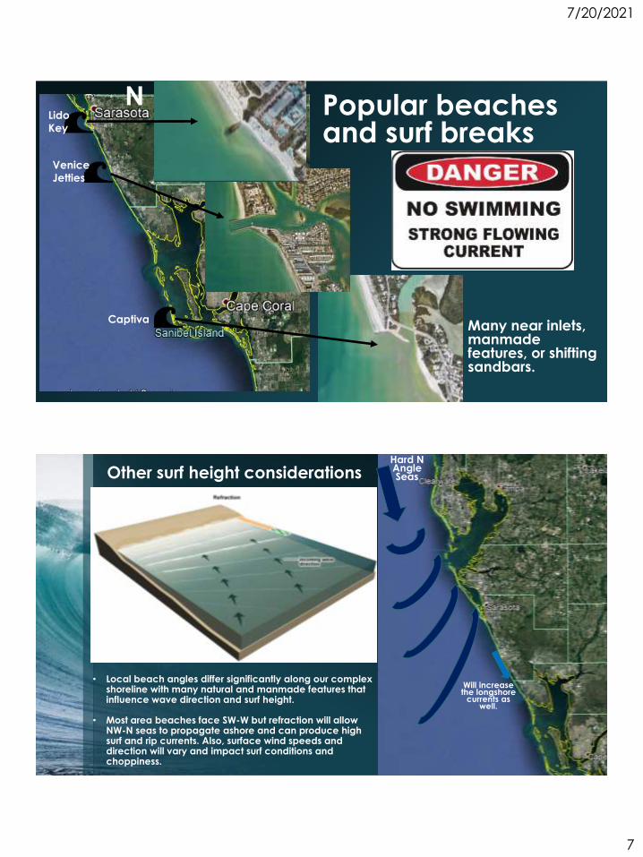
Popular beaches and surf breaks
Lido
Key
Venice
Jetties
CaptivaMany near inlets, manmade features, or shifting sandbars.
N
Other surf height considerations
• Local beach angles differ significantly along our complex shoreline with many natural and manmade features that influence wave direction and surf height.
• Most area beaches face SW-W but refraction will allow NW-N seas to propagate ashore and can produce high surf and rip currents. Also, surface wind speeds and direction will vary and impact surf conditions and choppiness.
Will increase the longshore
currents as well.
Hard N Angle Seas
7/20/2021
8
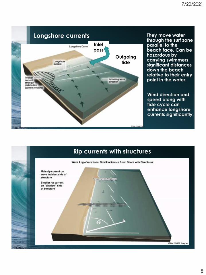
They move water through the surf zone parallel to the beach face. Can be hazardous by carrying swimmers significant distances down the beach relative to their entry point in the water.
Longshore currents
Wind direction and speed along with tide cycle can enhance longshore currents significantly.
Inlet
passIncoming
tideOutgoing
tide
Rip currents with structures
7/20/2021
9
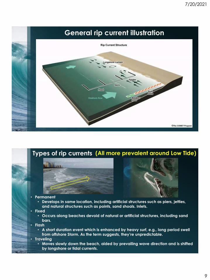
General rip current illustration
Types of rip currents
• Permanent
• Develops in same location, including artificial structures such as piers, jetties,
and natural structures such as points, sand shoals. Inlets.
• Fixed
• Occurs along beaches devoid of natural or artificial structures, including sand
bars.
• Flash
• A short duration event which is enhanced by heavy surf, e.g., long period swell
from offshore Storm. As the term suggests, they’re unpredictable.
• Traveling
• Moves slowly down the beach, aided by prevailing wave direction and is shifted
by longshore or tidal currents.
(All more prevalent around Low Tide)
7/20/2021
10
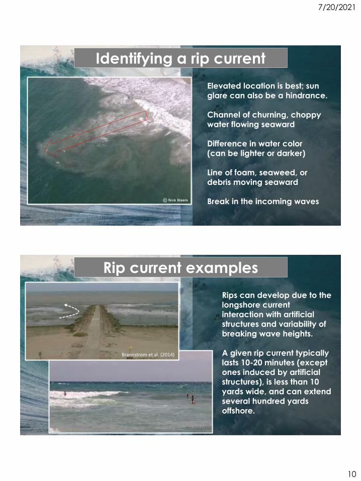
Elevated location is best; sun
glare can also be a hindrance.
Channel of churning, choppy
water flowing seaward
Difference in water color
(can be lighter or darker)
Line of foam, seaweed, or
debris moving seaward
Break in the incoming waves
Identifying a rip current
Rip current examples
Rips can develop due to the
longshore current
interaction with artificial
structures and variability of
breaking wave heights.
A given rip current typically
lasts 10-20 minutes (except
ones induced by artificial
structures), is less than 10
yards wide, and can extend
several hundred yards
offshore.
Brannstrom et al. (2014)
7/20/2021
11
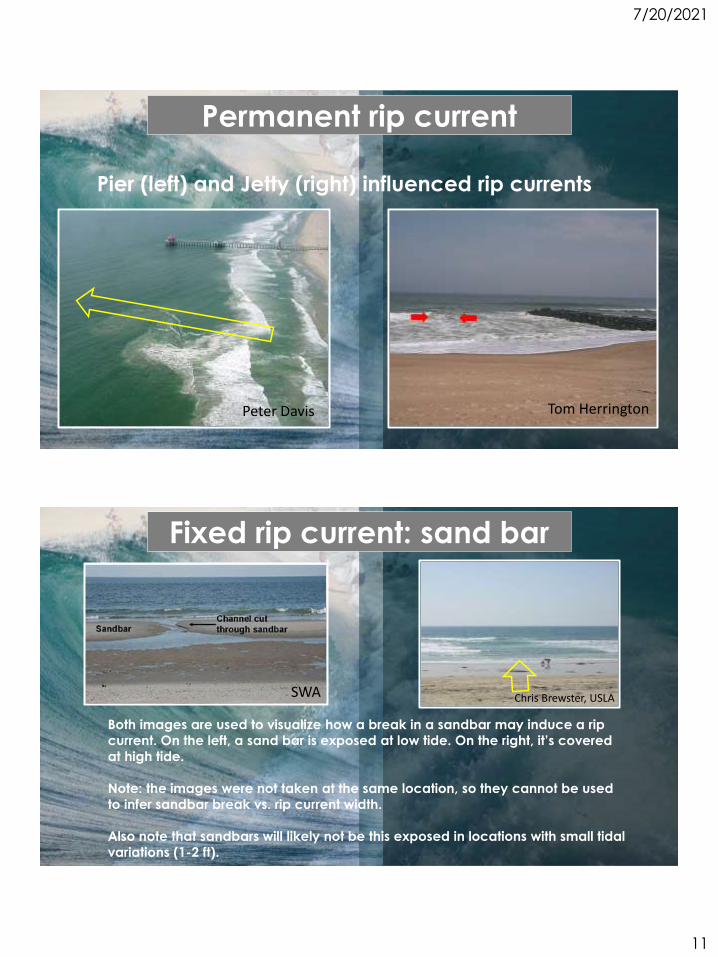
Pier (left) and Jetty (right) influenced rip currents
Peter Davis Tom Herrington
Permanent rip current
SWA Chris Brewster, USLA
Both images are used to visualize how a break in a sandbar may induce a rip
current. On the left, a sand bar is exposed at low tide. On the right, it’s covered
at high tide.
Note: the images were not taken at the same location, so they cannot be used
to infer sandbar break vs. rip current width.
Also note that sandbars will likely not be this exposed in locations with small tidal
variations (1-2 ft).
Fixed rip current: sand bar
7/20/2021
12
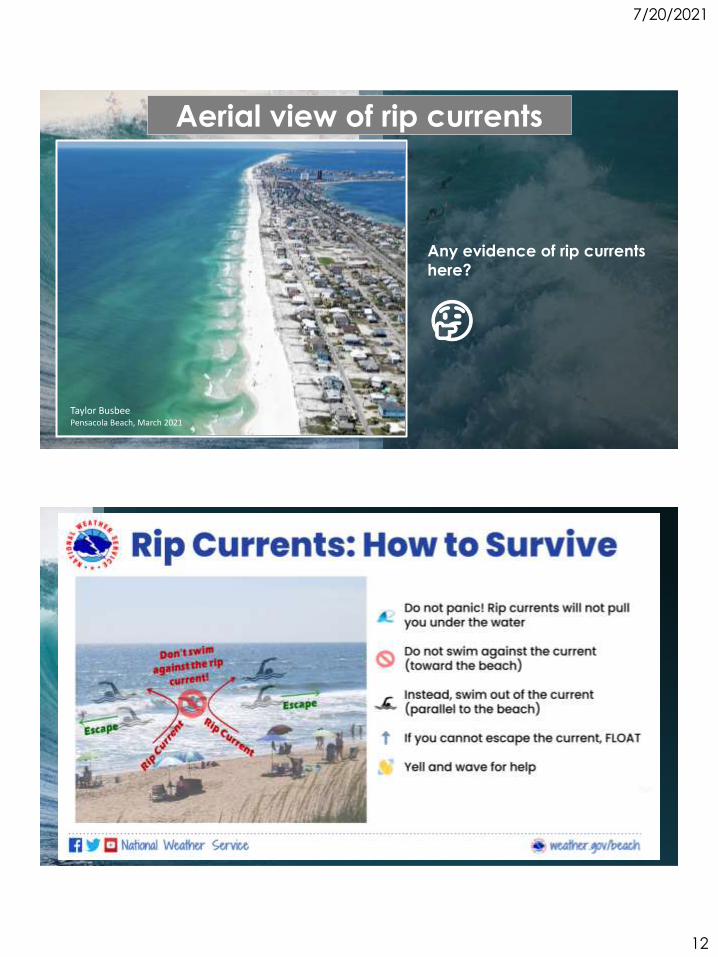
Any evidence of rip currents
here?
🤔
Aerial view of rip currents
Taylor BusbeePensacola Beach, March 2021
7/20/2021
13
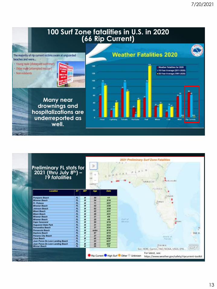
100 Surf Zone fatalities in U.S. in 2020(66 Rip Current)
Many near drownings and
hospitalizations are underreported as
well.
Preliminary FL stats for 2021 (thru July 8th) –
19 fatalities
For latest, see:https://www.weather.gov/safety/ripcurrent-toolkit
7/20/2021
14
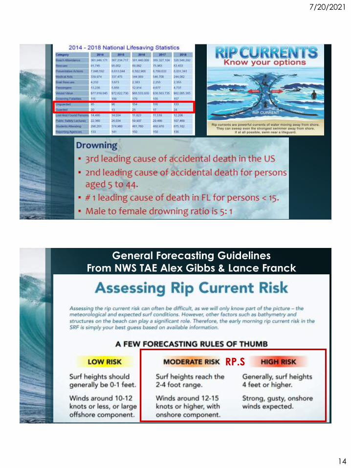
General Forecasting Guidelines
From NWS TAE Alex Gibbs & Lance Franck
RP.S
7/20/2021
15
northwest)
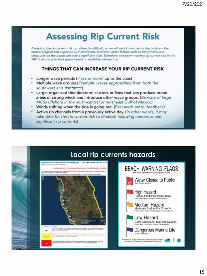
Local rip currents hazardshttps://www.weather.gov/beach/tbw
7/20/2021
16
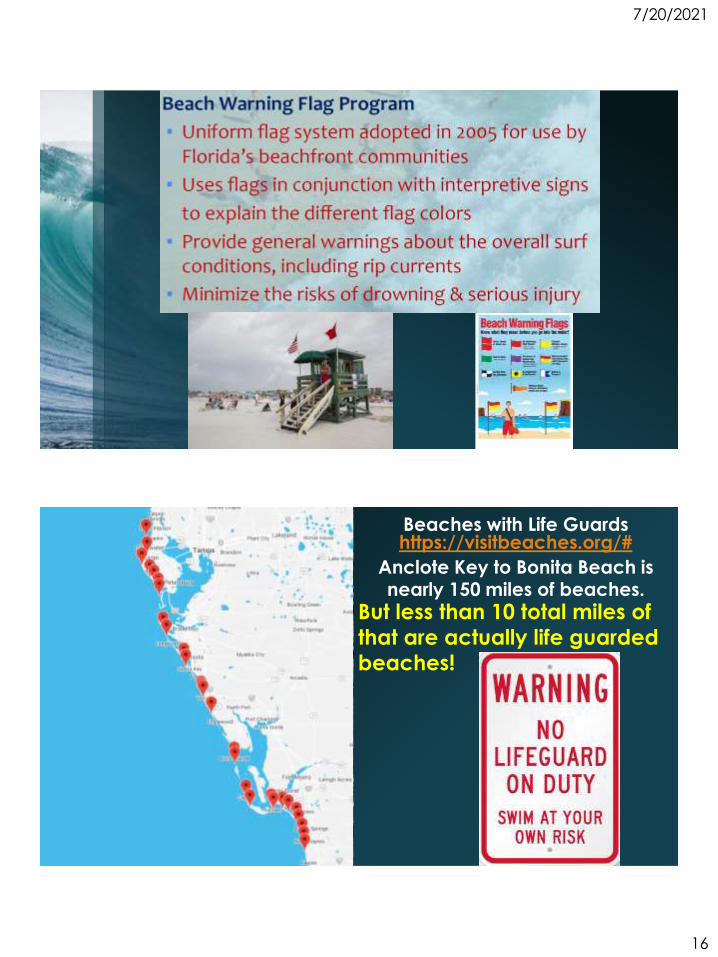
Beaches with Life Guards https://visitbeaches.org/#
Anclote Key to Bonita Beach is nearly 150 miles of beaches.