12
Risk Assessment Public Safety Geoscience Program – Earth Sciences Sector Centre for Natural Hazards Research Nicky Hastings, Bert Struik, Murray Journeay, Malaika Ulmi
| Date post: | 31-Dec-2015 |
| Category: |
Documents |
| Upload: | alannah-parks |
| View: | 217 times |
| Download: | 0 times |

Risk AssessmentPublic Safety Geoscience Program – Earth Sciences
Sector
Centre for Natural Hazards Research
Nicky Hastings, Bert Struik, Murray Journeay, Malaika Ulmi
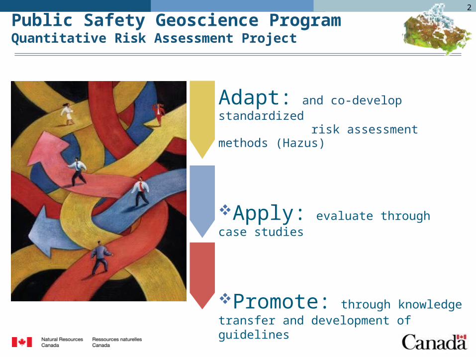
Adapt: and co-develop standardized risk assessment methods (Hazus)
Apply: evaluate through case studies
Promote: through knowledge transfer and development of guidelines
Public Safety Geoscience ProgramQuantitative Risk Assessment Project
2
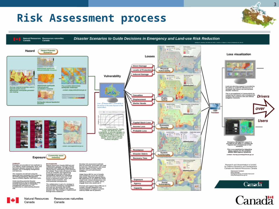
Risk Assessment process3
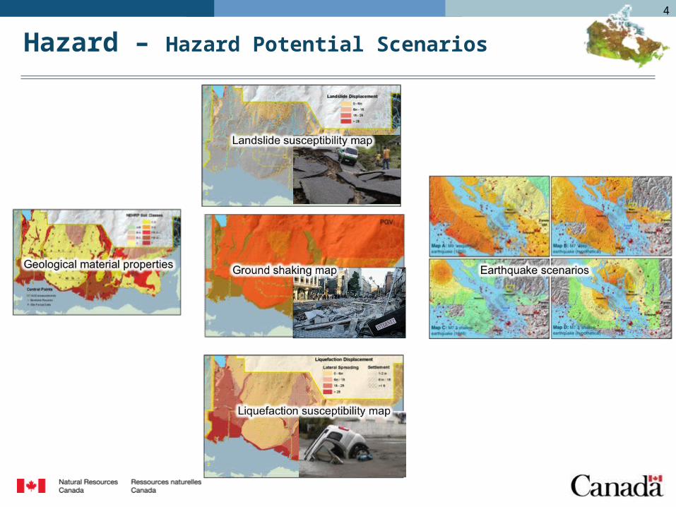
Hazard – Hazard Potential Scenarios
4
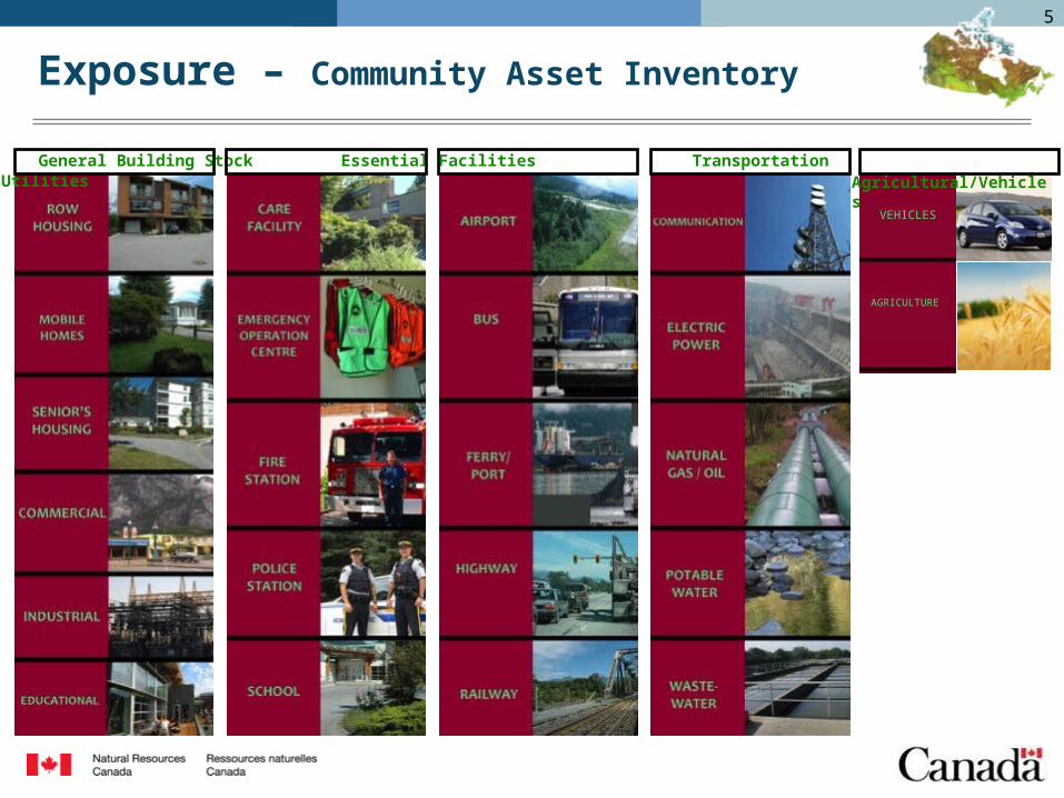
Exposure – Community Asset Inventory
General Building Stock Essential Facilities Transportation Utilities
AGRICULTURE
VEHICLES
Agricultural/Vehicles
5

Vulnerability
Damage Functionality
HAZUS is a powerful risk assessment software for analyzing potential losses from earthquake, hurricane wind, flood, storm surge, tsunami.
6
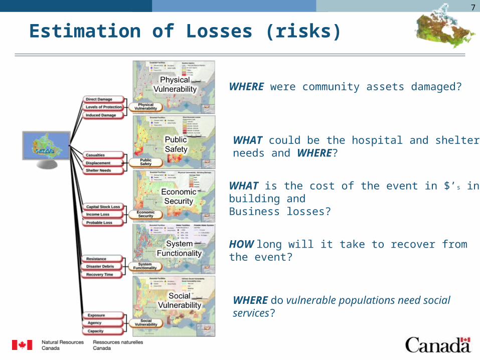
Estimation of Losses (risks)
WHERE were community assets damaged?
WHAT could be the hospital and shelter needs and WHERE?
WHAT is the cost of the event in $’s in building and Business losses?
HOW long will it take to recover from the event?
WHERE do vulnerable populations need social services?
7

Loss visualization tools for Risk Decision makers
Please approve my
development permit to build
a house
Please approve my
development permit to build
a house
Please show me where to focus my emergency response and social services
Please show me where to focus my emergency response and social services
Compare loss alternatives
Visualize losses in Emergency Management tool
Permitting officersand land use plannersdevelop and use risk profiles to recommendsafe development
Emergency ManagersAnd support staff Develop and interpretLoss models to guide response
8
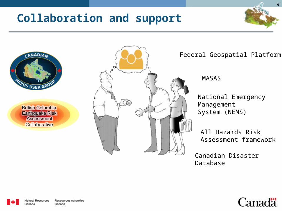
Collaboration and support
Federal Geospatial Platform
National Emergency Management System (NEMS)
MASAS
All Hazards Risk Assessment framework
Canadian Disaster Database
9

example of geospatial portals…http://fema.maps.arcgis.com/home/
10

Washington state seismic catalogshttps://fortress.wa.gov/dnr/seismicscenarios/
11

Questions?
Nicky HastingsNicky HastingsNatural Resources CanadaNatural Resources Canada605 Robson St, 605 Robson St, Vancouver, BCVancouver, [email protected]
12


![[Dirk J. Struik] Lectures on Classical Differentia(BookZZ.org)](https://static.documents.pub/doc/80x56/55cf8f9b550346703b9defd7/dirk-j-struik-lectures-on-classical-differentiabookzzorg.jpg)


