31
Risk MAP Early Demonstration Projects in Region II 2011 Association of State Floodplain Managers May 17, 2011 Louisville, KY
| Date post: | 01-Jan-2016 |
| Category: |
Documents |
| Upload: | wilfred-mckinney |
| View: | 214 times |
| Download: | 0 times |

Risk MAP Early Demonstration Projects in Region II2011 Association of State Floodplain ManagersMay 17, 2011Louisville, KY
2
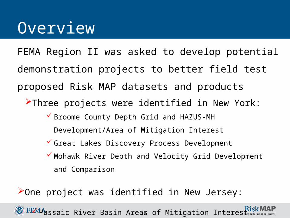
OverviewFEMA Region II was asked to develop potential
demonstration projects to better field test proposed Risk
MAP datasets and products
Three projects were identified in New York: Broome County Depth Grid and HAZUS-MH Development/Area of
Mitigation Interest
Great Lakes Discovery Process Development
Mohawk River Depth and Velocity Grid Development and Comparison
One project was identified in New Jersey:
Passaic River Basin Areas of Mitigation Interest

3
Flood Risk Datasets and Products
Changes Since Last FIRM Data Areas of Mitigation Interest
Flood Risk ReportFlood Risk Map
Ad-Hoc Flood Risk Analyses
Flood RiskDatabase
Flood Risk Assessment Data Flood Depth & Analysis Grids

4
Mitigation Planning is KeyHazard Mitigation Planning is part of the overall planning for any community – Comprehensive, economic development, infrastructure, mitigation and emergency planning are all facets of the same process.
Flood
Reduction
Initiate Plan
Identify Hazards
Adopt Plan
Develop Action Plans
Assess Risks
Implement Plan
Update Plan
Create Mitigation Strategy
Hazard Mitigation
Planning Cycle

Broome County, NY
6
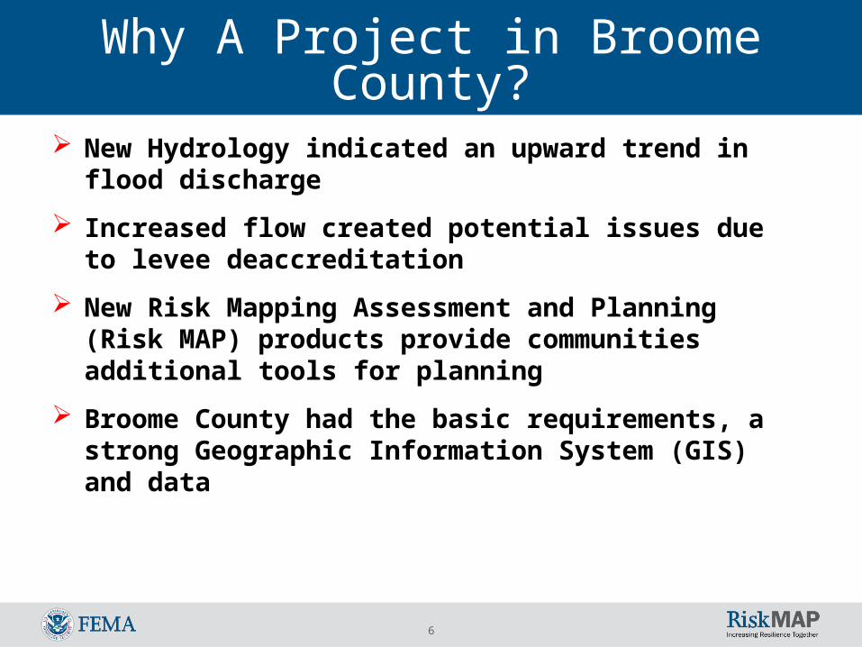
Why A Project in Broome County?
New Hydrology indicated an upward trend in flood discharge
Increased flow created potential issues due to levee deaccreditation
New Risk Mapping Assessment and Planning (Risk MAP) products provide communities additional tools for planning
Broome County had the basic requirements, a strong Geographic Information System (GIS) and data
7
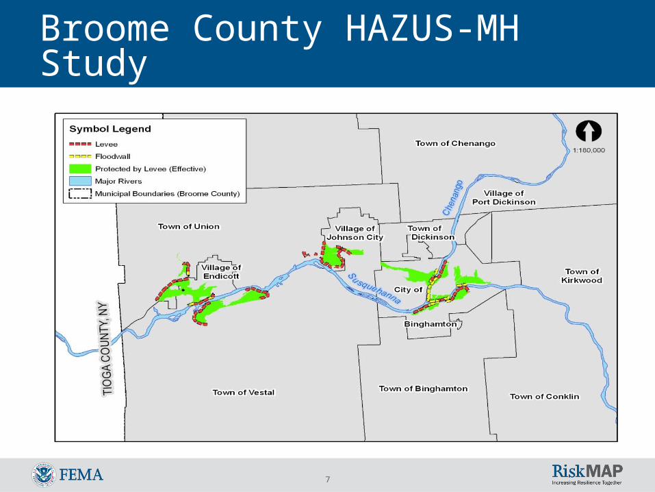
Broome County HAZUS-MH Study

8
Field Data Acquisition -Enhanced
First floor elevation
Building Type – residential, commercial, critical facilities
Basement or not
Enhanced HAZUS Level 2

9
Depth Grid Analysis
10
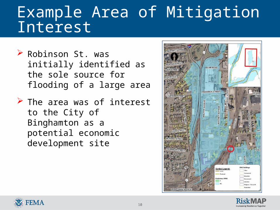
Example Area of Mitigation Interest
Robinson St. was initially identified as the sole source for flooding of a large area
The area was of interest to the City of Binghamton as a potential economic development site

11
Example: Area of Mitigation Interest

12
Example: Area of Mitigation Interest

13
Flood Control Structures at the Underpasses
Property Protection Measures
Site Specific Structural Protection
Flood Insurance
Combinations of above methods
No Action
Example: Area of Mitigation Interest

14
Mohawk RiverStudy area including: Village of Fonda and Village of Fort
Plain located within Montgomery County, New York.
State, local, and tribal officials can use the summary information provided in a Flood Risk Report, in conjunction with the data in the Flood Risk Database, to:
Update
Local hazard mitigation plansCommunity comprehensive plansEmergency operations and response plans
Develop hazard mitigation projects Communicate flood risk Guide modifications of development standards

15
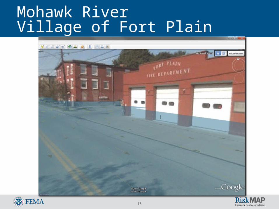
Mohawk RiverVillage of Fort Plain Project Area

16
Mohawk RiverVillage of Fort Plain
Hydrodynamic and hydrostatic forces computed for apartment building
Hydrodynamic and hydrostatic forces computed for the fire/police station

17
Mohawk RiverVillage of Fort Plain
Velocity vectors and magnitudes computed for Apartment building
Velocity vectors and magnitudes computed for Fire / Police station
18
Mohawk RiverVillage of Fort Plain
Passaic River Basin Areas of Mitigation Interest Early Demonstration Project
(New Jersey)

20
Project Scope
Early Demonstration Project -Combines a detailed Analysis of one
Area of Mitigation Interest (AoMI)
with Mitigation Planning Technical
Assistance

21
Mitigation Planning Technical Assistance
PurposeEnsure all Risk MAP projects receive
sufficient technical assistance to enable the community, and thus FEMA, to meet the goals of Risk MAP
22
Scope Overview Present current information and recommendations
for mitigating high-risk floodprone structures Includes Repetitive Loss and Severe Repetitive Loss
Properties in: Fairfield Little Falls Lincoln Park Pequannock Pompton Lake
Uses National Flood Mitigation Data Collection Tool (National Tool) • Collects property-specific data for floodprone properties• Validates and stores detailed risk information for structures
Develop appropriate mitigation recommendations at both the community mitigation planning level as well as at the structural or project specific level

23
Task 1 – Preliminary Data Collection, Prioritization, and Kick Off MeetingData Collection
Claims history and policy informationProperty characteristics
Value Standardized address
Flood Insurance Rate Map InformationMitigation actions takenTopographic dataGeo-coded property locations (X and Y coordinates)
Prioritization based budgetAll SRL, RL with $50k or more, clusteringTotal of 650 structures
24
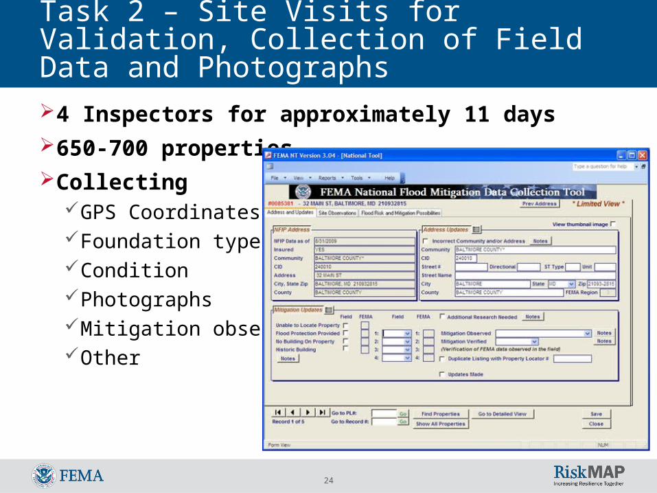
Task 2 – Site Visits for Validation, Collection of Field Data and Photographs4 Inspectors for approximately 11 days650-700 propertiesCollecting
GPS CoordinatesFoundation typeConditionPhotographsMitigation observedOther
25
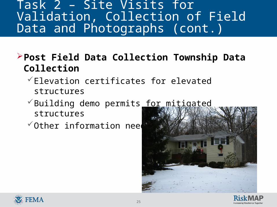
Task 2 – Site Visits for Validation, Collection of Field Data and Photographs (cont.)
Post Field Data Collection Township Data CollectionElevation certificates for elevated structuresBuilding demo permits for mitigated structuresOther information needed to fill gaps

26
Task 3 – Develop Specific Recommendations for Mitigation
Evaluate standard mitigation options for each property validated in the National Tool using FEMA 551
Generate worksheets and rank mitigation measures for each property
Considers drainage improvements, barriers, wet and dry-floodproofing, elevation, relocation, and acquisition
Considers relative cost, human intervention, and annual maintenance
Consider project type as it relates typically to NEPA compliance
Deliverable – community specific report listing properties by community with maps – explanation of how options were evaluated – recommendations for cost-effective mitigation

27
Task 4 – Develop community-level recommendations for mitigation plan updates or improvements
Obtain and review most recent plansConsult NJ State Hazard Mitigation PlanDevelop community level planning
recommendations addressing how the communities could use the project information to improve their plans and to obtain HMA grant assistance

28
Areas of Mitigation InterestMitigation Planning Linkages
Risk Assessment Product Mitigation Planning Requirement
Areas of Interest 44 CFR Part 201(d)(3), revise plans to reflect changes44 CFR Part 201.6(c)(2)(i), profiling hazards44 CFR Part 201.6(c)(2), risk assessment44 CFR Part 201.6(c)(3), developing mitigation strategies
There are several required areas for mitigation plans for which Areas or Mitigation Interest might be helpful:

29
Desired OutcomeCommunities will use the instructional report to conduct similar research for remaining properties
Communities will use the data to: Update their mitigation plans
Hazard Profiles Quantitative Risk Assessment Mitigation Strategy Development
Prioritize projects Develop project applicationsTake action to reduce losses!!!

30
EDP Lessons Learned It sounds repetitive but close, direct , and constant
communication with communities and stakeholders is paramount for the success of Risk MAP projects.• It helps in stakeholder understanding Risk MAP vision.
The products were overall, very well received by communities• It creates trust and a sense of partnership
The stakeholders can better understand and accept the limitations of the program as much as the benefits.
The communities are planning on using the data in a variety of ways• It opens the vaults of knowledge and information from
communities to contractors The stakeholder's knowledge of the local areas and specialized
datasets were CRITICAL for producing the products.
31
Questions?
Alan Springett – FEMA Region II
(212) 680-8557
Jean Huang – Dewberry
(703) 849-0264
Scott Choquette – Dewberry
(860) 508-4261


