154
of the Broward County Comprehensive Plan Broward County Planning Council Broward County Board of County Commissioners BROWARD COUNTY LAND USE PLAN

of the Broward County Comprehensive Plan
Broward County Planning Council
Broward County Board of County Commissioners
BROWARD COUNTY
LAND USE PLAN

BrowardNext → 2017 BROWARD COUNTY LAND USE PLAN
BROWARD COUNTY BOARD OF COUNTY COMMISSIONERS
Mayor Barbara Sharief Vice Mayor Beam Furr
Commissioner Nan Rich Commissioner Mark D. Bogen Commissioner Michael Udine Commissioner Chip LaMarca Commissioner Steve Geller
Commissioner Tim Ryan Commissioner Dale V.C. Holness
BROWARD COUNTY PLANNING COUNCIL
Mayor Daniel J. Stermer, Chair City of Weston
Mr. Thomas H. DiGiorgio, Jr., Vice Chair Ms. Patricia Good, Secretary
School Board Member Mr. Brion Blackwelder
Commissioner Richard S. Blattner City of Hollywood
Commissioner Felicia Brunson City of West Park
Commissioner Angelo Castillo City of Pembroke Pines
Mayor Bill Ganz City of Deerfield Beach
Commissioner Michelle J. Gomez City of Tamarac
Ms. Mary D. Graham Mr. Richard Grosso Mr. David Rosenof
Mr. Richard Rosenzweig Mayor Michael J. Ryan
City of Sunrise Mayor Jack Seiler
City of Fort Lauderdale Commissioner Michael Udine
Broward County Commissioner Beverly Williams
City of Lauderdale Lakes
BROWARD COUNTY PLANNING COUNCIL STAFF
Barbara Blake Boy Executive Director
Andrew S. Maurodis, Esq. Legal Counsel
Deanne D. Von Stetina Director of Planning
Peter M. Schwarz Planning Section Supervisor
Dawn B. Teetsel Senior Planner
Kim Rudominer Planner
Kenneth Wenning Planner
Deoraj Ramsaran Planner Trainee
Terry L. Rice Administrative Assistant
Sharon W. Walker Office Support Specialist
Original Adoption: April 25, 2017 Effective Date: September 28, 2017

i
BrowardNext → 2017 BROWARD COUNTY LAND USE PLAN
TABLE OF CONTENTS
INTRODUCTION .................................................................................................................vi
SECTION 1: HIGHLIGHTED REGIONAL ISSUES .................................................................................viii
SECTION 2: POLICIES ..............................................................................................................................1
General ...................................................................................................................................1 Residential ..............................................................................................................................1 Commerce ..............................................................................................................................2 Activity Centers ......................................................................................................................2 Parks/Conservation ................................................................................................................6 Urban Agriculture ..................................................................................................................7 Port .........................................................................................................................................8 Airport ....................................................................................................................................8 Mining ....................................................................................................................................8 Compatibility ..........................................................................................................................9 Public Facilities and Services ..................................................................................................10 Disaster Planning and Post-Disaster Redevelopment ...........................................................11
Platting and Land Development Code ...................................................................................12
Transportation Concurrency and Impact Fees ......................................................................13

ii
Public School Concurrency .....................................................................................................14 Affordable Housing ................................................................................................................15 Affordable Housing Bonus Density ........................................................................................16 Transportation Rights-of-Way/Trafficways Plan ...................................................................18 Transportation Multi-Modal Levels of Service ......................................................................19 Complete Streets ...................................................................................................................19 Smart Growth .........................................................................................................................20 Climate Resiliency, Adaptation Action Areas and Priority Planning Areas ............................22 Wetlands ................................................................................................................................23 Environmentally Sensitive Lands ...........................................................................................24 Water Resources Management .............................................................................................24 Air Quality ..............................................................................................................................25
Wellfields ...............................................................................................................................25 Beaches and Rivers ................................................................................................................25 Sea Turtle Lighting .................................................................................................................26 Greenways and Trails .............................................................................................................26 Historic and Archaeological Resources ..................................................................................26 Community Redevelopment Areas ........................................................................................27 Intergovernmental Coordination ...........................................................................................27 Planning Council Recertification Requirements ....................................................................27 Transfer of Development Rights ............................................................................................27 Redevelopment Units ............................................................................................................28

iii
Environmental Justice ............................................................................................................30
DEFINITIONS .......................................................................................................................1
PERMITTED USES ..............................................................................................................1
Activity Center Use ................................................................................................................1 Agricultural Use ......................................................................................................................24 Commerce Use .......................................................................................................................25 Commercial Recreation Use...................................................................................................26 Community Use ......................................................................................................................27 Conservation Use ...................................................................................................................28 Electrical Generation Facilities Use ........................................................................................30 Mining Use .............................................................................................................................30 Recreation and Open Space Use ............................................................................................30 Residential Use .......................................................................................................................32 Rural Estates ..........................................................................................................................36
Rural Ranches .........................................................................................................................36 Transportation Use ................................................................................................................37 Communication Facilities .......................................................................................................38
Special Residential Facilities ..................................................................................................39
IMPLEMENTATION REQUIREMENTS AND PROCEDURES ......................................1
COMMUNITY AND REGIONAL PARKS ...................................................................................1 Community Parks ...................................................................................................................1 Regional Parks ........................................................................................................................3

iv
IMPLEMENTATION REGULATIONS AND PROCEDURES ........................................................4
Development Review Requirements .....................................................................................4 Procedures for Certification of Local Land Use Plans ............................................................4 Broward County Land Use Plan Amendment Procedures .....................................................7 Local Land Development Regulations and Procedures .........................................................7 Procedures for Formal Interpretations of the Broward County Land Use Plan ....................8 Monitoring and Enforcement Procedures for the Broward County Land Use Plan ..............9 Criteria and Procedures for Environmentally Sensitive Lands and Local Areas of Particular Concern ..................................................................................................................................9 Legal Actions Involving the Broward County Land Use Plan .................................................11 Criteria for Designating Adaptation Action Areas of Regional Significance ..........................12
SECTION 3: RECOMMENDED PRACTICES .........................................................................................1
Residential ..............................................................................................................................1 Commerce/Economic Development ......................................................................................1 Environmental ........................................................................................................................1 Public Facilities and Services ..................................................................................................3 Transportation .......................................................................................................................3 Smart Growth/Complete Streets ...........................................................................................4 Historic and Archaeological Resources ..................................................................................5

vi
BrowardNext → 2017 BROWARD COUNTY LAND USE PLAN
INTRODUCTION
Countywide Planning - Moving Forward The Broward County Land Use Plan was established during the 1970s and 1980s when much of the County was undeveloped and unincorporated. The initial Broward County Land Use Plan (BCLUP) was adopted in 1977 and the subsequent BCLUP in 1989. Low-density, suburban development with a focus on auto-oriented design were the predominant premises of these plans. The 1989 BCLUP was amended piecemeal scores of times through the years to better reflect current planning strategies and address economic market forces. On April 22, 2014, the Broward County Commission initiated a comprehensive evaluation and update of the Broward County Land Use Plan, as a joint undertaking by the Broward County Planning Council and County Planning staffs, in coordination with municipalities and affected and interested stakeholders. The Broward County Planning Council took actions at its April 24 and May 22, 2014, meetings to affirm its support and participation in the evaluation and update. The effort was branded “BrowardNext.” BrowardNext sought to comprehensively update the County’s land use planning program within the context of meeting the challenges of Broward County's future and anticipated population growth of 235,000 new residents by the Year 2040. This update reorients the BCLUP to setting regional priorities and parameters, e.g., transit and mobility, affordable housing, climate resilience and adaptation, regional economic development, environmental protection, enhancement and protection of recreation and open space areas, and disaster preparedness. In addition, the result is a renewed land use planning and policy relationship between the County and its municipalities, to better ensure the County’s focus on sustainable regional policies and enabling municipalities to have appropriate and effective planning tools for the future. For the Broward County Land Use Plan, as per the County Charter, the Broward County Planning Council serves as the coordinating agency, but the multiparty evaluation resulting in the new Plan fully engaged County staff as active participants, and was structured to include diverse and significant participation during the evaluation process. Full representation and participation from municipalities and their staffs were a vital component. Between August 2014 and August 2016, Planning Council and County staffs participated in over 80 public workshops, outreach efforts and presentations. Email communications were regularly provided to a contact list of approximately 1,500 residents, elected officials, engaged organizations, and municipalities. The BrowardNext Broward County Land Use Plan is the culmination of an extensive outreach and communication effort.

vii
Relationship of the Broward County Land Use Plan to the Local Government Land Use Plans within Broward County Under Florida Statutes, Chapter 163, each local government is required to prepare a land use plan element for its jurisdiction, which will be more definitive to meet specific local needs; however, this local land use element must be consistent with the Broward County Land Use Plan under the Broward County Charter. In order to determine the consistency, local governments must submit their land use plans, which have been prepared in conformance with the Florida Statute, to the Council for certification review. If the Council finds the local plan to be in substantial conformity to the Broward County Land Use Plan, the local land use plan will be certified by the Planning Council and become the land use guide for that jurisdiction with full force and effect of law under the Charter when adopted by the local governmental unit in conformance with the State Act. Unless otherwise noted, municipal plans may always be more restrictive than the County Plan. Local jurisdictions must submit their own land use plans to the Council to be reviewed for (re)certification. If the Council determines the local land use plan is in substantial conformity with the County Land Use Plan, the Council will certify the local plan. A detailed explanation of (re)certification is found in the Plan Implementation Requirements Section of this plan. The preparation of other required or optional elements of the comprehensive plans for each of the local jurisdictions is the responsibility of that jurisdiction.

HIGHLIGHTED REGIONAL ISSUES
SECTION 1:

viii
BrowardNext → 2017 BROWARD COUNTY LAND USE PLAN
SECTION 1: HIGHLIGHTED REGIONAL ISSUES The 2017 Broward County Land Use Plan, BrowardNext, recognizes the importance of regionalism and focuses on regional policy issues. As the content of the updated Plan was developed, the following visions were prioritized:
Climate Change Resilience;
Targeted Redevelopment;
Multi-Modal;
World-Class Natural Resource Protection and Enhancement;
Affordable Housing;
Disaster Planning and Post-Disaster Redevelopment; and
Renewed Intergovernmental Partnership. Each of the referenced visions includes between three (3) and six (6) Strategies with additional implementation strategies. The concept of the Highlighted Regional Issues section is that any individual reading this document can understand what is important to the future of Broward County and its residents in the realm of countywide land use planning.

HIGHLIGHTED REGIONAL ISSUES
JUNE 2017

Climate Change Resilience Vision 3
Targeted Redevelopment Vision 8
Multi-Modal Vision 12
World-Class Natural Resource
Protection and Enhancement Vision 16
Affordable Housing Vision 22
Disaster Planning and
Post-Disaster Redevelopment Vision 26
Renewed Intergovernmental Partnership Vision 31

CLIMATE CHANGE
RESIL IENCE VIS ION
Southeast Florida is one of the most vulnerable
regions in the United States to the impacts of
climate change. Critical action to adapt to the
consequences of climate change must occur at
the local level through regionally coordinated
planning and investments. Broward County has
been active in prioritizing efforts to investigate
vulnerabilities, improve climate preparedness
and identify strategies to increase resilience to
extreme weather. Working with the 4-County
Southeast Florida Climate Change Compact,
Broward County has contributed to the
development of a Regional Climate Action Plan,
a unified regional sea level rise projection, and
vulnerability assessments focused on
infrastructure, public health, and natural systems.
Independently, the County has developed its
own Climate Change Action Plan, and convenes
both a countywide Climate Change Task Force
and a Government Operations Work Group to
assist in implementing priority actions necessary
for climate change preparedness and emissions
reductions needed to mitigate future warming
and the potential for severe climate disruptions.
As a community, we need to be aware of the
local impacts of climate change, to understand
the vulnerabilities of social systems, natural
resources and infrastructure, and to work to
develop and implement strategies to adapt and
increase our resilience with the goal of reducing
risk, avoiding economic losses, and improving
community livability and the quality of our
natural systems.

Highlighted Regional Issues | 4
STRATEGY CCR-1: Mitigate the effects of climate change by reducing
greenhouse gas emissions by 2% per year.
Reduction of heat-trapping greenhouse gas (GHG) emissions which cause global
temperature rise is necessary to slow and limit the effects of climate change. According to
the 2012 Broward County GHG Emissions Inventory, the main source of GHG emissions in
Broward County is burning fossil fuels for electricity and transportation. In order to reduce
emissions, energy sources must be diversified to include clean renewable energy for
electricity and alternative fuels for transportation and the amount of energy consumed in
buildings and for transportation must be reduced. The County must pursue regional
strategies and participate in and support local efforts to increase energy efficiency and the
use of renewables in order to reduce GHG emissions and mitigate the effects of climate
change.
Broward County shall promote sustainable energy consumption through efficiency and
conservation efforts, expand renewable and alternative energy accessibility, and create
incentive programs to encourage the behavioral and operational transition to cleaner
energy sources.
Implementation strategies include:
Implementing strategies from the Renewable Energy Action Plan, Community
Energy Action Plan and the Climate Change Action Plan.
Implementing the Electric Vehicle Infrastructure Strategy which includes
pursuing municipal and public-private partnerships in order to develop an
infrastructure network that provides public access to alternative fuels and EV
charging.
Reducing energy intensity of county buildings by at least 20% by 2025 through
the Better Buildings Challenge and energy retrofits.
Integrating transportation and land use decisions with emphasis on multi-modal
transportation.
Increasing the abundance of renewable energy projects, investments, and
infrastructure across the County consistent with the County’s support for a 20%
renewable energy portfolio by 2030 through public-private partnerships,
encouraging financing options and County investment in solar projects.

Highlighted Regional Issues | 5
Decreasing fuel consumption by 10% by 2020 by improving and integrating
multi-modal transportation and land uses that encourage a reduction in single
occupancy vehicle trips and GHG emissions, encourage an increase in walking,
bicycling and transit trips and provide affordable housing proximate to urban
work centers and transit.
STRATEGY CCR-2: Increase the resilience of our community to the
effects of climate change. Climate change, including sea level rise and severe storms, has the potential to
fundamentally impact Broward County’s beaches, coastal and inland communities, water
supplies, natural systems, critical infrastructure and its economic core. An increase of 3 to 5
inches of sea level rise is expected locally by 2030 and up to 2 feet by 2060. As a
community we need to plan and prepare for the impacts of sea level rise and other climate
impacts and invest in resilient critical infrastructure, to sustain commerce, services, and
natural resources vital to the health of our community and economy. Broward County shall
consider and prepare for the following impacts in the planning and design of projects and
operations of community services: severe tropical storms, temperature extremes, severe
wet and dry seasons, sea level rise along the coast leading to coastal and inland flooding
and rising groundwater levels, increased coastal erosion and increased stress and pressure
on natural systems.
Implementation strategies include:
Requiring all land use and planning decisions within the Priority Planning Areas to
consider and effectively address future climate predictions for a 50-year planning
horizon, including 2 feet of sea level rise.
Designating Adaptation Action Areas to identify areas vulnerable to coastal
flooding, implement adaptation policies, and enhance and prioritize the funding of
infrastructure adaptation projects.
Applying the unified sea level rise projection for Southeast Florida when considering
land use (including areas of potential population growth, natural system restoration,
and infrastructure adaptation) and long-term functionality of appurtenant
infrastructure, especially water management, drainage, water supply and water
treatment systems, both coastal and inland.

Highlighted Regional Issues | 6
Delineating anticipated habitat transition zones from climate impacted areas and
expand zones through land use changes to protect environmentally-sensitive
greenways and reserves for migrating species.
Furthering the integration of green infrastructure and natural systems into the
urban environment to increase resilience to future climate change impacts.
Preserving and protecting the County’s natural shoreline with an emphasis on the
expansion and preservation of sand dunes, protection of beaches from armoring
and the encroachment of development, and conservation of our coral reefs.
In coordination with municipalities, adopting land use regulations to limit
development and redevelopment in areas particularly vulnerable to flooding due to
sea level rise, stormwater inundation, and other impacts of climate change.
Using a green infrastructure map series to achieve community equity in the
integrated use of green infrastructure as part of community resiliency strategies,
including tree canopy coverage, presence of solar projects infrastructure, access to
fresh food, etc.
STRATEGY CCR-3: Maintain adequate water supply through efficiency
and conservation efforts and increase resilience of natural systems
through water resource management. Saltwater intrusion has contaminated the coastal edge of the Biscayne Aquifer that is the
primary source of drinking water in Broward County. While a number of factors have
contributed to the inland migration of the saltwater front, sea level rise has accelerated the
rate of intrusion and is predicted to drive the front further inland in the coming decades.
Saltwater intrusion is anticipated to reduce coastal wellfield capacity 40% by 2060. Broward
County shall preserve, protect and enhance the sustainability of County water resources.
Implementation strategies include:
Ensuring existing water resources are protected and remain available through
conservation and sustainable management, especially improved surface water
storage, redistribution and aquifer recharge.

Highlighted Regional Issues | 7
Preserving capacity by diversifying source alternatives, with an emphasis on the
expansion of reclaimed water projects, systems, and infrastructure.
Preserving green space and consideration of land use in areas of potential
regionalization and relocation of wellfields.
Balancing the water needs of public consumers and natural systems. Affording
space for surface water storage to accommodate projected rainfall, tidal
flooding and sea level and groundwater level rise.
Supporting regional water supply and conservation projects such as the C-51
reservoir project and the expansion of a countywide water reuse network.
Supporting policy and implementation guidelines for the outlined
strategies are included in Sections 2 and/or 3 of the Broward County
Land Use Plan, and, as may be appropriate, the County’s
Comprehensive Plan.

TARGETED
REDEVELOPMENT
VIS ION
Broward County's “developable” area, consisting of
approximately 431 square miles of the eastern
portion of the County, can be characterized as
essentially built-out. This built-out character
physically constrains the ability to accommodate an
approximate 235,000 new residents expected by the
year 2040, and also the desire to enhance the
County’s economic base. To accommodate new
population and economic activity, Broward County
endorses a strategic approach to direct growth to
areas which maximize the efficient use of land and
create places to shop, work and play. Broward
County supports a development strategy which
promotes the principles of “Smart Growth,” which
seeks to maintain and create desirable communities
and neighborhoods for Broward County residents,
visitors and economic interests, including quality
housing for all, integrated with excellent public
facilities, recreational opportunities and open space
areas, and which preserves and conserves natural
resources.

Highlighted Regional Issues | 9
STRATEGY TR-1: Prioritize new development and redevelopment to
existing and planned downtowns and major transit corridors and transit
hubs.
Broward County must efficiently accommodate population and economic growth, while
also recognizing and protecting areas which currently display characteristics, such as rural
and estate communities and established single-family neighborhoods, which may not be
appropriate to support additional growth and development. Broward County supports new
development and redevelopment activities within established and planned “activity
centers,” such as municipal downtowns, and established and planned “transit oriented”
corridors and hubs, as long as such areas have sufficient public facilities and services to
serve the area, and a mixed-use character which supports a high quality live, work and play
community for residents and businesses, including viable multi-modal transportation
choices, a range of housing choices (including affordable housing), green spaces and
recreational amenities, community gathering spots, and a variety of services and
establishments to support life and business activities.
Implementation strategies include:
Broward County Land Use Plan amendments for appropriately located “activity
center,” such as downtowns and transit corridors and hubs shall be given
preference when considering new or redevelopment proposals.
Within established and planned “activity centers,” Broward County shall utilize
multi-modal levels of service standards, and take all committed and funded modes
of transportation fully into account when considering development proposals.
To facilitate the availability of affordable housing in proximity to public facilities,
services, amenities, and economic opportunities, the County’s “Affordable Housing
Density Bonus Program” shall be structured to target established and planned
“activity centers,” such as downtowns and transit corridors and hubs.
STRATEGY TR-2: Support incentives to remove blight within
Community Redevelopment Areas (CRA’s) and similar areas.
Currently, fourteen Broward County jurisdictions contain “Community Redevelopment
Areas,” or CRA’s, which have been characterized by blighted conditions, such as the

Highlighted Regional Issues | 10
presence of substandard or inadequate structures, a shortage of affordable housing,
inadequate infrastructure, and insufficient transportation services and infrastructure.
Many CRA’s within Broward County receive “tax increment financing,” or “TIF’s” where any
future increases in property values are set aside to support economic development
projects within the CRA. However, Broward County’s existing CRA TIF’s will be expiring
starting in 2019, and at that time, the County will again receive funds previously sent to the
CRA. However, the need for funding quality redevelopment throughout the County will
remain.
Implementation strategies include:
Broward County is committed to continuing and expanding its current “Broward
Redevelopment Program” (BRP) program to offer resources to CRA’s, or similar
blighted areas, with a focus on high quality, viable, projects which will provide jobs,
enhance support infrastructure to attract redevelopment and/or result in affordable
housing stock.
Priority for BRP program funding will be given to projects which demonstrate
furtherance of one or more of the County’s “Highlighted Regional Issues and
Strategies,” including targeted redevelopment, multi-modal transportation,
affordable housing, climate resiliency, natural resource protection and
enhancement, and disaster prevention.
STRATEGY TR-3: Municipal development and adoption of transfer of
development rights programs.
“Transfer of Development Rights” programs, or TDR, are utilized in many communities
throughout the United States. Generally, TDR programs involve the removal of the right to
develop unbuilt permitted uses from land in a defined “sending zone,” and transfer such
permitted development rights to land in a defined “receiving zone,” which permits the use.
TDR programs are often used to promote a public purpose, such as, but not limited to,
preserving open space, farmland, or historic preservation, and also to direct development
to achieve a public policy. Transfer of Development Rights programs, to be successful,
requires a market condition that creates a demand for the rights to be sold. Such
programs may require establishing a “TDR bank” to accommodate the demand. In this
light, municipalities in Broward County may adopt Transfer of Development Rights
programs.

Highlighted Regional Issues | 11
Implementation strategies include:
Municipal TDR programs must identify an overall plan or strategy that would further
a public purpose, such as enabling the creation of significant public or private open
space areas or corridors, protect environmentally sensitive lands, historic resources,
or areas identified as appropriate for climate resiliency strategies (such as “Priority
Planning Areas”), and direct development to more suitable areas such as
established and planned “activity centers,” such as downtowns and transit corridors
and hubs, and/or redevelopment areas.
Supporting policy and implementation guidelines for the outlined
strategies are included in Sections 2 and/or 3 of the Broward County
Land Use Plan, and, as may be appropriate, the County’s
Comprehensive Plan.

MULTI -MODAL
VIS ION
The predominant development pattern
in Broward County has historically
been a suburban model with a focus
on auto-oriented, low-density,
separated land use, and sprawling
development. Today, however,
Broward County's urbanized
"developable" area, consisting of
approximately 431 square miles of the
eastern portion of the County, can be
characterized as essentially built-out.
This built-out character physically and
fiscally constrains the ability to increase
roadway capacity through the
construction of additional travel lanes
for automobiles. However, Broward
County expects to add approximately
235,000 new residents by the year
2040 and strives to enhance its
economic base. In this light, the
County is committed to support a full
range of multi-modal transportation
options, in coordination with
municipalities and partner agencies,
aligned with emerging land use
patterns necessary to safely and
adequately serve the County's current
and future residents, businesses and
visitors and strengthen the local
economy.

Highlighted Regional Issues | 13
STRATEGY MM-1: Make the best use of the regional transportation
network to move people, goods and services safely and efficiently while
incorporating and promoting Complete Streets principles where
appropriate in a context sensitive manner.
“Complete Streets” are roadways designed and constructed for all modes of transportation
– automobiles, buses, bicycles, pedestrians, and freight vehicles, and for all users,
regardless of age or ability. Complete Streets enhance the community’s quality of life,
results in positive health benefits, and have a positive impact on the economy. Broward
County’s transportation network is largely defined and the ability to add new links and
lanes for cars is limited. The County must utilize the existing and planned regional
transportation network to move people, goods and services safely and efficiently, making
use of all modes of transportation, including pedestrian, bicycle and transit.
Broward County shall promote, accommodate, and construct Complete Streets features
throughout the County, consistent with the County’s jurisdictional responsibilities, and in a
“context sensitive” fashion (e.g. consideration of the surrounding area, the primary existing
and planned function of the roadway, including the prevalence of freight traffic and
safety).
Implementation strategies include:
Accommodating Complete Streets features and technology into County-maintained
roadways where practical, context sensitive, and financially feasible, and capitalize on
intergovernmental coordination and technical assistance opportunities to identify and
achieve efficient interconnected multi-modal networks throughout the County.
Supporting municipal, metropolitan planning organization, and state Complete Streets
projects, including technical and financial support when available.
STRATEGY MM-2: Recognize and address the transportation and
housing connection.
The two biggest household expenses are housing costs (i.e. mortgages or rents, insurance
and property taxes) and transportation costs (i.e. car payments, fuel, insurance and
maintenance costs). The nationally recognized “Housing and Transportation Affordability
Index” (H + T Index) offers a benchmark that no more than 45% of household costs should
be consumed by housing and transportation. As of 2015, Broward County's housing and

Highlighted Regional Issues | 14
transportation cost index stood at 65%, which makes Broward County one of the most
expensive in the nation for combined housing and transportation costs. Broward County is
committed to recognizing and addressing the transportation and housing connection in
redevelopment proposals to help reduce these costs.
Broward County shall support strategically directing new growth and redevelopment to
mixed use activity areas such as downtowns and along major corridors which offer multi-
modal connections and cost effective infrastructure investments to accommodate full
access to housing, jobs, local businesses, and community services.
Implementation strategies include:
Promote and support redevelopment and mixed use opportunities within and along
major transportation hubs and corridors;
Support residential affordable housing bonus densities within and along major
transportation corridors, stations, and redevelopment areas.
STRATEGY MM-3: Promote and support a sustainable funding source
for countywide transit and mobility needs.
The built-out character of the County’s developable land constrains its ability to increase
roadway capacity through the construction of additional travel lanes. To accommodate
future growth and urban land use patterns, Broward County supports a sustainable
funding source to improve access and mobility for its residents, businesses and visitors.
Broward County supports a sustainable funding source to accommodate the operation
and expansion of the County-wide transit system.
Implementation strategies include:
Identification, support and approval of sustainable transit and mobility funding
sources.
Identify and adopt minimum acceptable standards for the quality and quantity of
transit and multi-modal services.
Promote mixed use development along major transit corridors.
Highlighted Regional Issues | 15
The creation of additional capacity for other types of mobility by better utilization of
existing rights-of-way, including transit, pedestrians and bicycles.
STRATEGY MM-4: Identify and implement a multi-modal level of
service standard for redevelopment proposals.
The projected impact to the regional transportation network is one of the primary review
and analysis tools in determining the effects of a proposed development. This review and
analysis has traditionally been based on the estimated impacts on the regional
transportation network resulting from automobiles. Broward County supports and is
committed to an analysis that takes alternative modes of transportation and mobility
options fully into account.
Broward County shall develop and utilize a multi-modal capacity and impact measure to
analyze and evaluate (re)development proposals, including those that require a Broward
County Land Use Plan amendment.
Implementation strategies include:
Develop and utilize a level of service standard, including consideration of accessibility-
related performance, which fully recognizes existing and planned alternate modes of
transportation within recognized mixed use activity centers such as downtowns,
redevelopment areas and along major transportation corridors.
Supporting policy and implementation guidelines for the outlined
strategies are included in Sections 2 and/or 3 of the Broward County
Land Use Plan, and, as may be appropriate, the County’s
Comprehensive Plan.

WORLD-CLASS NATURAL
RESOURCE PROTECTION
& ENHANCEMENT VIS ION Broward County recognizes its unique natural
resources, including its exceptional water bodies,
coastlines, open spaces, flora and fauna, and
historical, archaeological and paleontological
resources. In appreciation of these assets and
recognition of their sensitivity, the County
continues to be committed to the protection,
enhancement and wise use of the environment.
Broward County has long maintained its priority
to preserve and conserve the environment,
understanding it is essential for maintaining
community sustainability, as well as being an
important economic generator and enhancing
the safety, enjoyment and education of residents
and visitors alike. As Broward County anticipates
approximately 235,000 new residents by the year
2040, it is vital for the County to continue to
persevere in its commitment to protect and
enhance its natural resources. In this light,
Broward County strives, in partnership with its
municipalities and other stakeholders, to be at
the fore of natural resource protection and
enhancement best practices, remaining dedicated
to strengthening its policies and commitments in
the region to protect and conserve natural
resources, including the emerging importance of
food systems planning.

Highlighted Regional Issues | 17
STRATEGY EP-1: Protect and enhance the shoreline and natural
waterways of Broward County.
Tourism is vital to Broward County’s economy and Broward’s beaches and waterway
systems lure millions of visitors here year after year. Beaches also protect public and
private property and provide marine habitats on and along the barrier island. However,
these beautiful beaches can be compromised by tropical storms and hurricanes, as well as
by tides, wave action and natural sand flow. Broward County must protect and maintain
this critical environmental and economic resource through beach re-nourishment projects,
the creation and enhancement of shoreline vegetation and dunes and sediment
management plans.
Implementation strategies include:
Protect and restore beaches through the use of dunes and vegetation, elevated
walkways and conservation easements.
Require public access to beaches and waterways.
Designate “Adaptation Action Areas” to identify areas vulnerable to sea level rise,
flooding and storm surge and create mitigation strategies to reduce these risks and
increase community resiliency.
Protect and enhance sea turtle nesting areas and require the installation of sea
turtle-friendly lighting in such areas.
Protect and restore the County’s natural ocean reef system.
STRATEGY EP-2: Create a countywide water management/flood
protection plan.
Broward County is in a unique location of the country, with the Atlantic Ocean along its
entire eastern border and over 790 square miles of water conservation and recharge areas
within its western limits. This unique location presents both problems and opportunities in
regards to water supply and management. Broward County must protect, manage and
enhance its water recharge areas, surface waters, groundwater and potable water wellfields
and zones of influence, while also preparing for seasonal flooding and sea level rise. In this
regard, wetlands can play a vital role in improving the County’s water quality and in
providing natural areas for storing floodwaters and maintaining surface water flow.

Highlighted Regional Issues | 18
Wetlands function as natural sponges which trap and slowly release water. Wetlands also
function as primary fish and wildlife habitats by providing food, water and shelter for a
wide variety of plant and animal species.
Implementation strategies include:
Implement a countywide water management plan, in coordination with local water
management plans, which includes both groundwater and surface water.
Preserve, enhance and create surface waters and minimize direct discharge into
such bodies of water through innovative pre-treatment methods.
Preserve the County’s groundwater quality through the provision of drainage and
stormwater management systems, minimization of surface water run-off,
minimization of soil erosion and prevention of salt water intrusion.
Consider minimum floor elevations for structures and minimum crown elevations
for roads based on projected conditions from sea level rise.
Protect the functional value of wetlands, hydric soils and vegetative communities
within Broward County.
STRATEGY EP-3: Preserve and protect Broward County’s natural
environment through County and local environmental regulatory
programs and well-planned patterns of growth and development.
At the foundation of a healthy environment is an ecosystem with uncontaminated soil and
pure air. Because of the clear connection between a healthy environment and the
preservation of public health, safety and general welfare, Broward County established
regulatory programs to protect the purity of our natural resources and to protect humans,
plants and wildlife. Human activities associated with the County’s tremendous growth
carries the potential for the contamination of our natural environment, making the
reasonable control and regulation of the activities that could threaten the quality and
purity of these resources of paramount importance.

Highlighted Regional Issues | 19
Implementation strategies include:
Continue to utilize the County’s Environmental Assessment and Remediation
Program to ensure that contaminated sites are properly remediated and
maintained.
Continue to implement the County’s Hazardous Materials Licensing and
Compliance Assistance Program to prevent discharges of regulated hazardous
materials into soil, groundwater and surface waters.
Continue to fulfill the goals of the County’s Air Monitoring and Air Quality Program
to prevent and control emissions from commercial and industrial air pollution
sources through regulation and compliance assistance.
Promote the use of alternative modes of transportation and alternative fuels to
reduce the negative impacts of exhaust fumes on air quality.
Acquire, protect, preserve and enhance Local Areas of Particular Concern.
Preserve and enhance Broward County’s tree canopy and encourage the use of
native vegetation for all new development.
Continue to eliminate invasive exotic vegetation.
STRATEGY EP-4: Provide recreation and open space areas which serve
the diverse interests of both residents and visitors and that are
compatible with the tropical and resort character of Broward County.
Recreation and open space areas are a critical part of the high quality of life Broward
County wants to offer to its residents. These areas not only provide places for sports and
activities, which help to promote healthy lifestyles for all age groups, but also provide
places for people to relax and enjoy nature, which improves their mental health as well.
Open space areas also promote a sustainable environment by providing natural habitats
for various species of wildlife and vegetation. The County’s recreation and open space
system builds a sense of place, making our community a more attractive place to live and
work, thereby increasing the County’s economic health. Broward County should protect
and enhance its remaining recreation, open space and conservation areas to promote
healthy residents, a robust economy and a sustainable environment.
Highlighted Regional Issues | 20
Implementation strategies include:
Continue to require a minimum of three (3) acres of local parks and three (3) acres
of regional parks for every 1,000 existing and projected permanent residents.
Encourage the preservation of existing public and private open space areas,
including golf courses.
Provide for an interconnected, countywide system of greenways, bikeways,
blueways and equestrian and nature trails.
Identify, conserve and protect all water conservation and natural reservation areas
within Broward County.
STRATEGY EP-5: Protect Broward County’s historical, archaeological
and paleontological resources.
It is vitally important to realize that the protection, enhancement, and perpetuation of
historic, archaeological, and paleontological resources represent distinctive elements of
Broward County's unique history. Broward County promotes and supports historic
preservation through the enforcement of its historic preservation ordinance, which
mandates that the County seek Certified Local Government (CLG) status, including:
establishing a historic preservation board; maintaining and updating the historic site
surveys; enforcing the state and local preservation laws; and providing opportunities for
public participation in historic preservation activities. The County will also pursue actions to
educate and advocate for the preservation of the County’s cultural resources.
Implementation strategies Include:
Enhance the County’s programs to designate and protect historic,
archaeological and paleontological resources.
Promote intergovernmental coordination and cooperation between the County,
its municipalities, other CLGs and state and federal agencies.
Promote adaptive reuse and conservation of historic, archaeological, and
paleontological resources as a means for economic revitalization,
redevelopment, and sustainable growth.
Highlighted Regional Issues | 21
STRATEGY EP-6: Prioritize and support the food system planning
efforts of Broward County and its municipalities.
Food system planning is the collaborative planning process of developing and
implementing local and regional land use, economic development, public health and
environmental goals, programs and policies to promote: sustainable agriculture and food
production practices, community food security, physical and economic access to healthy
food and reduction of food-related waste. It is considered an important part of sustainable
and resilient development by communities around the world, and Broward County seeks
to advocate food system planning throughout the region. Understanding that our
population will continue to grow, it is important for Broward County and its local
governments to advocate food system planning for the overall health and well-being of
our communities.
Implementation strategies include:
Support and encourage municipalities to provide farm-to-table opportunities
throughout Broward County.
Permit urban agriculture activities in all land use categories of the BCLUP, while also
ensuring that protection and promotion of rural agriculture activities remain a
priority.
Update the Best Practices for Food System Planning at least bi-annually to ensure
the information is reflective of current practices and technology.
Supporting policy and implementation guidelines for the outlined
strategies are included in Sections 2 and/or 3 of the Broward County
Land Use Plan, and, as may be appropriate, the County’s
Comprehensive Plan.
AFFORDABLE
HOUSING VIS ION
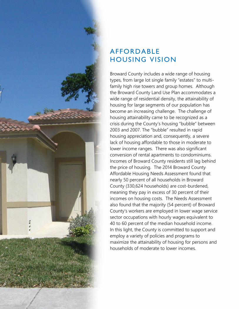
Broward County includes a wide range of housing
types, from large lot single family “estates” to multi-
family high rise towers and group homes. Although
the Broward County Land Use Plan accommodates a
wide range of residential density, the attainability of
housing for large segments of our population has
become an increasing challenge. The challenge of
housing attainability came to be recognized as a
crisis during the County’s housing “bubble” between
2003 and 2007. The “bubble” resulted in rapid
housing appreciation and, consequently, a severe
lack of housing affordable to those in moderate to
lower income ranges. There was also significant
conversion of rental apartments to condominiums.
Incomes of Broward County residents still lag behind
the price of housing. The 2014 Broward County
Affordable Housing Needs Assessment found that
nearly 50 percent of all households in Broward
County (330,624 households) are cost-burdened,
meaning they pay in excess of 30 percent of their
incomes on housing costs. The Needs Assessment
also found that the majority (54 percent) of Broward
County‘s workers are employed in lower wage service
sector occupations with hourly wages equivalent to
40 to 60 percent of the median household income.
In this light, the County is committed to support and
employ a variety of policies and programs to
maximize the attainability of housing for persons and
households of moderate to lower incomes.

Highlighted Regional Issues | 23
STRATEGY AH-1: Support sustainable funding sources to develop
and/or rehabilitate affordable housing.
Affordable housing is generally defined as housing that is affordable to households that
earn 120% or less of median area-wide income. Due in part to the County’s “built-out”
character, resulting in higher land costs, and a workforce significantly employed in the
lower wage service sector, the traditional ability of the private market to supply affordable
housing has become challenging. In this light, funding strategies to produce affordable
housing has increasingly included governmental agencies, as well as non-profits.
Implementation strategies include:
Identification, support and approval of sustainable countywide and local affordable
housing funding sources.
Broward County shall continue to support full State-level funding to help address
affordable housing needs and implementing a needs-based system to fund such
housing projects and programs. The County also supports State legislation to
provide a “local documentary stamp tax” program dedicated to affordable housing.
Investigate a comprehensive public land banking program, in coordination with
municipalities and other stakeholders, for affordable housing.
STRATEGY AH-2: Support private, non-profit, and governmental
sector development of housing which utilizes construction techniques
affording significant costs savings, while meeting the Florida Building
Codes, including resiliency to hurricane-level storms.
Modern manufactured/modular/prefabricated construction techniques may afford
significant savings for housing costs in comparison to traditional techniques used in south
Florida, such as concrete block construction. Such housing units may have an appearance
and safety features generally no different than units constructed using more common
methods, and may include a variety of density types, including multi-family.
Implementation strategies include:
Broward County will not enact regulations or policies inhibiting the placement of
safe housing that may afford significant cost savings in comparison to traditional

Highlighted Regional Issues | 24
techniques used in south Florida, and encourage municipalities to include such
housing within their jurisdictions.
Broward County will seek opportunities to support or fund the development of
housing that may afford significant cost savings in comparison to traditional
techniques used in south Florida via its affordable housing funding programs and
initiatives, or in partnership with other agencies and jurisdictions.
STRATEGY AH-3: The Broward County Land Use Plan shall include an
Affordable Housing Density Bonus Program, including promoting a
supply of smaller, traditionally affordable units, such as efficiency/studio
occupancy units.
Many jurisdictions throughout the United States have adopted a “density bonus” program
as an incentive for developers to construct new affordable housing units. In such
programs, a developer obtains the ability to construct additional “market rate” units in
exchange for including “affordable” units.
Implementation strategies include:
The affordable housing bonus for market rate units may be higher if the developer
commits to including “very-low” or “low” income housing units, in comparison to
constructing “moderate” income units.
Bonuses may also be higher if the affordable units are located in areas preferred for
(re)development near transit and rail stations, or are part of projects which will
further additional land use plan priorities.
Bonus affordable housing units will be restricted to remain such for a defined
period in exchange for the bonus market rate units.
Smaller “efficiency” or “studio” units, which have often served a demand for
affordable units, will be addressed as part of a “bonus density” program.
STRATEGY AH-4: Municipalities should adopt a comprehensive
strategy to ensure a sufficient supply of affordable housing to help meet
the needs of our population and economy.

Highlighted Regional Issues | 25
Ensuring a supply of affordable housing to meet the current and future needs of Broward
County’s residents and economy is in the best interests of all, including municipalities.
Municipalities which seek County approval of additional residential density should adopt a
comprehensive strategy to ensure a sufficient supply of affordable housing.
Implementation strategies include:
Amendments to the Broward County Land Use Plan which propose new residential
units should not be adopted unless the municipality has an affordable housing
strategy that has been approved by the municipality and the Broward County
Planning Council.
A municipal affordable housing strategy shall be based on existing housing supply,
considering very-low, low, and moderate income households.
To receive Planning Council approval, a municipal affordable housing strategy must
demonstrate that the municipality has enacted policies and cost feasible programs
which will reasonably address needed affordable housing supply in consideration of
the municipality’s population and future land uses.
Supporting policy and implementation guidelines for the outlined
strategies are included in Sections 2 and/or 3 of the Broward County
Land Use Plan, and, as may be appropriate, the County’s
Comprehensive Plan.

DISASTER PLANNING
AND POST-DISASTER
REDEVELOPMENT VIS ION
Hurricanes, tornadoes, extreme heat, floods, fires, storm
surge and other natural or man-made disasters may
threaten the safety of Broward County's residents,
visitors and property. South Florida is most vulnerable to
the threat of hurricanes and storm surge. Hurricane
season begins on June 1 and ends on November 30, but
planning and preparation are year-round activities.
Broward County must work to protect over 1.8 million
permanent residents, 14.3 million annual visitors, billions
of dollars in tangible properties, 23 miles of beaches, as
well as over 150,000 coastal residents and mobile home
occupants living in mandatory evacuation zones.
Accommodations should also be made to ensure the
protection of Broward’s vulnerable population groups
such as the homeless, the elderly and the physically
challenged. Broward County’s goal is to reduce or
eliminate the long-term risk to life and property from
hazardous events. Broward County and its
municipalities, in coordination with partner agencies,
should put in place a post-disaster recovery and
redevelopment strategy to ease the rebuilding process
and remove potential obstacles that would support a
sustainable community after a major disaster. Further,
the county should evaluate properties that have a
history of repetitive loss for possible purchase and
conversion to open space. In addition, a dune and
shoreline vegetation management plan should be
investigated to help break the destructive waves and
storm surge that accompany a hurricane.

Highlighted Regional Issues | 27
STRATEGY DP-1: Develop and implement a Countywide Long-Term
Recovery and Redevelopment Strategy.
Broward County must establish an orderly and efficient process for reviewing private and
public redevelopment proposals to restore the economic and social viability of the
community after a natural or man-made disaster. Broward County currently implements its
Enhanced Local Mitigation Strategy (ELMS), which is a framework for integrating the
County’s hazard mitigation efforts into the core civic business processes by forming
partnerships with agencies in emergency and risk management, insurance, government,
climate change and the business community before, during and after a disaster. The
County’s Long-Term Recovery and Redevelopment Strategy will focus on re-building after
a disaster in a manner that will strengthen properties and infrastructure to withstand any
future storm occurrences.
Implementation strategies include:
Develop a Long-Term Recovery and Redevelopment Strategy.
Continue to update the County’s Enhanced Local Mitigation Strategy (ELMS).
Replace the Coastal High-Hazard Area with a “Coastal Storm Area” on Broward
County’s Floodplains, Flood Prone Areas and Coastal High-Hazard Area Map of the
Natural Resource Map Series.
Protect the County’s shoreline through enhanced shoreline vegetation and beach
re-nourishment projects in partnership with adjoining municipalities.
STRATEGY DP-2: Support incentives to purchase and/or redevelop
Repetitive Loss Properties to reduce future property damages and
losses.
A “repetitive loss property” is an insurable property where the National Flood Insurance
Program has paid at least two (2) claims of more than $1,000 within 10 years. There are
over 700 such properties in Broward County, in every municipality except Sea Ranch Lakes.
Broward County and its municipalities should strive to reduce the number of repetitive loss
properties.

Highlighted Regional Issues | 28
Implementation strategies include:
Limit public funds for infrastructure expansion or improvements within the Coastal
High-Hazard Area unless they are necessary to enhance hurricane evacuation
clearance times or to mitigate the effects of sea level rise.
Utilize public funds to purchase repetitive loss properties.
Elevate and/or strengthen critical facilities, such as hospitals, police and fire stations
and schools, which are located in at-risk areas.
STRATEGY DP-3: Maintain and update the County’s Disaster Housing
Strategy.
The disaster housing strategy will help retain Broward County’s population and offer hope
to survivors when their homes and communities have been destroyed. The strategy details
a framework for providing safe, sanitary, functional and accessible temporary housing
options for displaced residents in order to expedite long-term recovery after a disaster.
Within the broader recovery framework, this strategy primarily addresses the interim
housing solutions for residents.
Implementation strategies include:
Utilize county and municipal recreation and open space areas to locate temporary
housing options for residents whose homes are destroyed due to a hazardous
event.
Partner with local motel and hotel owners for additional temporary housing
opportunities.
STRATEGY DP-4: Manufactured and modular housing that meets the
requirements of the Florida Building Code should be permitted within
Broward County.
In 2015 there were 19,450 mobile homes in Broward County. Most mobile homes currently
located in Broward County are unsafe for occupancy during a storm or fire. Mobile homes
require mandatory evacuation for any level of hurricane. However, manufactured or
modular housing, which are pre-fabricated and assembled in a factory and then
transported to a development site, can be built to Florida Building Code standards. These
types of homes are less expensive and faster to build and can be a safe place to stay
during a hurricane event.

Highlighted Regional Issues | 29
Implementation strategies include:
Develop programs to reduce the number of mobile homes within Broward County
that do not meet current building code standards.
Encourage the construction of manufactured and modular housing which does
meet current building code standards, including wind load.
Encourage local governments to incentivize the redevelopment of current mobile
home park sites through the use of less restrictive land development regulations.
STRATEGY DP-5: Residential densities within the mandatory
hurricane evacuation zones shall not negatively impact the hurricane
evacuation clearance standards.
A key to keeping residents and visitors safe during a natural disaster is to evacuate people
most at-risk and locate them to a safer place to “ride out the storm” such as a relative or
friends house or a designated hurricane shelter. Mandatory evacuation zones for Category
1 and 2 hurricanes are all areas located east of the Intracoastal Waterway. All areas east of
Federal Highway/U.S. 1 must be evacuated for a Category 3 storm or higher. In addition, all
mobile homes, regardless of their location, must be evacuated. Broward County maintains
hurricane evacuation clearance times and shelter capacities, which should not be reduced
due to additional residential development within the mandatory evacuation areas.
Implementation strategies include:
Discourage land use plan amendments which propose residential or hotel uses
within hurricane evacuation zones that negatively impact hurricane evacuation
clearance times and emergency shelter capacities.
Establish a methodology to estimate the short- and long-range planning horizon
impacts of proposed residential uses within hurricane evacuation zones on
hurricane evacuation clearance times and emergency shelter capacities.
Update Broward County’s Coastal Hurricane Evacuation Plan (CHEP) to reflect new
techniques or programs which have improved evacuation times.
Update the South Florida Regional Planning Council’s Regional Hurricane
Evacuation Model Traffic Study.

Highlighted Regional Issues | 30
Supporting policy and implementation guidelines for the outlined
strategies are included in Sections 2 and/or 3 of the Broward County
Land Use Plan, and, as may be appropriate, the County’s
Comprehensive Plan.

RENEWED
INTERGOVERNMENTAL
PARTNERSHIP VIS ION
In 1975, Broward County voters approved the Broward County
Charter and established the Broward County Planning Council
with the responsibility of preparing a County-wide land use
plan under the jurisdiction of the Broward County Board of
County Commissioners. The Charter requires that all municipal
land use plans conform to the Broward County Land Use Plan.
The first Broward County Land Use Plan was adopted in 1977,
in close coordination with municipalities. The 1977 Plan, and a
subsequent update in 1989, both reflected a “suburban”
model, with an auto-oriented, separated use, lower density
and intensity land use pattern spreading westward to the
Everglades.
The Broward County Land Use Plan was updated scores of
times over the years to adjust policy and the land use plan
map. However, the foundation and mechanics of the Plan
adopted in the 1970’s and 1980’s remained, and the new
challenges that have already arisen during the early part of
the 21st century and which are anticipated were not
adequately addressed by the previous Plan model. One of
those challenges involves intergovernmental coordination and
cooperation.
To be effective, it is essential that the Broward County Land
Use Plan be structured to maximize support and cooperation
from Broward’s municipalities and other stakeholders. As
such, an intent of the 2017 Plan is to orient the Broward
County Land Use Plan to focus on and effectively address
County-wide and regional policy priorities, and enable
municipalities to efficiently and effectively address local
planning issues.

Highlighted Regional Issues | 32
STRATEGY IG-1: The Broward County Land Use Plan, including its
review and approval process, will be streamlined to enhance focus on
regional planning issues.
The Broward County Land Use Plan (BCLUP) map identifies a designated land use for every
parcel in Broward County. The 2017 BCLUP map consolidates land use classifications to
better reflect its function as a county-wide or “regional” plan. The BCLUP will also be used
as a tool to promote (re)development in mixed use “activity centers” in downtowns,
approved redevelopment areas, and along and within major transportation corridors and
hubs. Municipal land use plans will be enabled to address the local land use vision and
form.
Implementation strategies include:
Reduce and periodically review the number and types of BCLUP land use plan
categories.
Expand and periodically review land use plan category permitted uses.
Streamline and periodically review the Broward County Planning Council
certification/recertification process.
Streamline and periodically review the Broward County Land Use Plan amendment
requirements, including recommending that the current Broward County Charter
requirement for two Planning Council public hearings for each land use plan
amendment be revisited.
STRATEGY IG-2: Enable municipalities to modify their land use plans
to address municipal-level issues without the need for County approval.
Historically, the Broward County Land Use Plan permitted municipalities to rearrange land
uses to address municipal-level land use planning issues without the need for County
Commission approval through the “Flexibility Zone” and “Flexibility Rules” concept. Over
time, the use of “flex” created an unbalanced playing field within and between
municipalities. As the purpose of “flex” is to permit efficient municipal level adjustment of
land use plans to address municipal-level planning issues, the intent and need remains
valid. In this light, the Broward County Land Use Plan will continue to allow municipalities

Highlighted Regional Issues | 33
to rearrange land uses to address municipal-level land use planning issues without the
need for County Commission approval.
Implementation strategies include:
Eliminate “Flexibility Zones” and maintain municipal flexibility.
Reform and replace as appropriate the “Flexibility Rules” and requirements for
BCLUP amendments to clearly delineate the thresholds between municipal-level
planning issues and County-level planning issues.
Permit municipalities to adopt “Transfer of Development Rights” programs that
identify an overall plan or strategy that would further a public purpose, such as
enabling the creation of significant public or private open and green spaces and
corridors, protect environmentally sensitive lands, historic resources, or areas
identified as subject to significant climate change impacts (such as “Priority Planning
Areas”), and direct new development to more suitable areas such as designated
“activity centers,” including downtowns, transit oriented corridors or hubs, and/or
approved redevelopment areas. Municipal TDR programs must meet the BCLUP
minimum criteria.
STRATEGY IG- 3: Maintain and enforce an effective and efficient
countywide development and environmental review and enforcement
programs.
Broward County has a robust growth management system to support Countywide, as well
as State-mandated, priorities to protect our fragile natural resources and provide for safe
and adequate public services and facilities. The County’s program has evolved over the
years to add new and drop old priorities. The evolution of growth management priorities
has not always resulted in revised codes and programs reflecting maximized effectiveness
and efficiency. For example, the countywide plat review process has been used to
accomplish many county and state growth management requirements. But, more recently,
implementation has shifted to focus on the building permit stage, rather than the plat
review and approval process. Therefore, the County is committed to regular thorough
reviews and updates of its development and environmental review programs, including the
County Land Use Plan platting requirements and County Land Development Code plat
review process. The goal of such reviews and updates will be to ensure that programs
reflect an efficient process and which continue to protect our fragile natural resources and
provide for safe and adequate public services and facilities.

Highlighted Regional Issues | 34
Implementation strategies include:
Review and revise as appropriate the County Land Use Plan platting
requirements.
Consult with the County Charter Review Commission to review and consider
potential amendments to the Charter’s platting requirements.
Review and revise the County Land Development Code to streamline
procedures.
Supporting policy and implementation guidelines for the outlined
strategies are included in Sections 2 and/or 3 of the Broward County
Land Use Plan, and, as may be appropriate, the County’s
Comprehensive Plan.

POLICIES
DEFINITIONS
PERMITTED USES
& IMPLEMENTATION
SECTION 2:

Policies │ 1
BrowardNext → 2017 BROWARD COUNTY LAND USE PLAN
SECTION 2: POLICIES
GENERAL POLICY 2.1.1 Broward County shall maintain a balanced Land Use Plan to implement a regional vision including the provision of essential public services and facilities, as well as enhanced sustainability and livability. POLICY 2.1.2 The land use categories depicted on the Broward County Land Use Plan Map are intended to protect established residential areas and encourage economic development and redevelopment. POLICY 2.1.3 The Broward County Planning Council shall review the Broward County Land Use Plan at least every seven (7) years, including considerable public outreach and participation.
RESIDENTIAL POLICY 2.2.1 Residential areas shall be designated on the Broward County Land Use Plan Map consistent with those categories identified within the Residential Permitted Uses subsection of the Broward County Land Use Plan. The categories indicate the maximum number of dwelling units per gross acre permitted by the Broward County Land Use Plan. POLICY 2.2.2 Establish flexibility within the Broward County Land Use Plan in order to facilitate the arrangement of densities and intensities, and allow local governments and the private sector to respond to changing conditions. POLICY 2.2.3 Local certified land use plans may rearrange the residential densities shown on the Broward County Land Use Plan Map utilizing “flexibility units” and/or “redevelopment units” in accordance with this Plan and the rules established within the “Administrative Rules Document: Broward County Land Use Plan.” POLICY 2.2.4 Allocations of Flexibility Units shall be subject to the following restrictions: Within areas east of the Intracoastal Waterway, in no instance shall allocations of Flexibility Units result in a residential density greater than twenty-five (25) dwelling units per gross acre for the residentially designated parcel or portion of a non-residentially designated parcel to be developed with residential use, or exceed one hundred percent (100%) of the maximum number of dwelling units indicated for the parcel by the local land use plan map, whichever resulting residential density is less.

Policies │ 2
POLICY 2.2.5 A studio housing unit or efficiency housing unit, no greater than 500 square feet in size may be counted by the local government as 0.5 dwelling units for residential density calculations. POLICY 2.2.6 By 2020, Broward County and the Planning Council shall examine Broward County Land Use Plan text “Residential” density classifications and make a recommendation regarding streamlining the densities and ranges.
COMMERCE
POLICY 2.3.1 Local governments shall employ their local land use plans, zoning ordinances and land development codes to establish differing intensities of commerce development compatible with adjacent and surrounding land uses, including but not limited to lands designated “Commercial,” “Industrial” or similar designations by the local land use plan. POLICY 2.3.2 Local governments shall employ their local land use plans and development regulations to establish appropriate intensity standards for non-residential future land use categories compatible with adjacent existing and future land uses. POLICY 2.3.3 To allow both the public and private sectors to respond to changing conditions and permit the appropriate location of neighborhood commercial uses within or adjacent to established residential neighborhoods, the Broward County Land Use Plan shall permit up to 5% of the area designated residential within a local government to be used for neighborhood commercial uses as identified and in accordance with this Plan and the rules established within the “Administrative Rules Document: Broward County Land Use Plan.” POLICY 2.3.4 Local certified land use plans may decrease by 20 percent the lands designated “Commerce” on the Broward County Land Use Plan Map for residential use in accordance with the rules established within the “Administrative Rules Document: Broward County Land Use Plan” and the Chapter 163, Florida Statutes plan adoption and amendment process.
ACTIVITY CENTERS
POLICY 2.4.1 Permitted residential densities and hotel rooms within areas designated “Activity Center” on the Broward County Land Use Plan (except for any “Activity Center” located east of the Intracoastal Waterway) may be increased by 20% or 500 dwelling units and/or hotel rooms, whichever is less, no earlier than every five (5) years via a local land use plan amendment and recertification by the Broward County Planning Council, and/or permitted non-residential intensities within areas designated “Activity Center” on the Broward County Land Use Plan may be increased by 20% or 200,000 square feet, whichever is less, every five (5) years via a local land use plan amendment and recertification by the Broward County Planning Council, subject to the following:

Policies │ 3
a. The local government must document that no more than 10% of permitted residential units and/or non-residential intensities proposed for increase are available for allocation at the time the local land use plan amendment is considered by the local government at a hearing.
b. “Every five (5) years” means starting from the date the 2017 Broward County Land Use Plan is effective for “Activity Centers” included in that Plan, or when a new or revised “Activity Center” is adopted by the County Commission and is effective.
c. An application for a Broward County Land Use Plan amendment may be submitted at any time for “Activity Center” proposals which would exceed the above referenced residential and non-residential density/intensity increases.
d. The local land use plan shall include policies addressing the affordable/workforce housing needs of “Activity Centers.”
e. The local land use plan shall demonstrate sufficient capacity for public facilities and
services, including coordination with public schools. POLICY 2.4.2 Local governments may propose a specific area for designation on the Broward County Land Use Plan as an Activity Center. The municipality shall include within their land use element policies that ensure the proposed Activity Center will support the location of uses in a manner oriented around the five-minute (i.e. quarter-mile) walk and/or within approximately quarter-mile on either side of a transit corridor. Multiple nodes of activity oriented around the five-minute (i.e. quarter-mile) walk or transit corridor may be included within one Activity Center. The municipality shall include within their land use element policies that ensure that the proposed Activity Center will support the location of uses and internal circulation such that pedestrian mobility is a priority. All land uses in an Activity Center shall be directly accessed via pedestrian ways, and accessible to existing or future alternate public transportation modes, including bicycle and transit. POLICY 2.4.3 Residential use is required as a principal component within an Activity Center. Maximum residential density must be specified by the local government, and must be described in the permitted uses section of the Broward County Land Use Plan. Residential densities may be specified either as units per gross acre in geographically designated areas and/or as a maximum number of permitted units (e.g. pool of units in the Activity Center). POLICY 2.4.4 At least two non-residential uses must be permitted in the Activity Center as a principal use: e.g. retail, office, restaurants and personal services, hotel/motel, light industrial (including “live work” buildings), research business, civic and institutional. POLICY 2.4.5 Minimum and Maximum FAR (Floor Area Ratio) for non-residential uses within an Activity Center must be specified by the local government and described in the permitted uses section of the Broward County Land Use Plan. Minimum non-residential FARs (Gross) of 2 are encouraged. Non-residential intensities may vary along transit corridors and may be specified at

Policies │ 4
the option of the local government, either as a maximum FAR in geographically designated areas and/or as an overall maximum square footage by use [e.g. pool of square footage by permitted use (retail, office etc.) or land use category (commercial)]. POLICY 2.4.6 For proposed new or revised Activity Centers, Broward County shall, to address new proposed dwelling units and impacts, coordinate and cooperate in assisting municipalities to identify existing and proposed policies, methods and programs to achieve and/or maintain a sufficient supply of affordable housing to serve such areas. POLICY 2.4.7 Local governments shall consider community needs for affordable housing when proposing an Activity Center and include within their local land use element policies which encourage affordable housing opportunities, through various mechanisms such as the direction of public housing program funds into the Activity Center, reduced lot size for dwelling units, construction of zero lot line and cluster housing, vertical integration of residential units with non-residential uses, the allowance of accessory dwelling units, or through other mechanisms proven effective in increasing the affordable housing stock. To promote Activity Centers which propose to include “low income” housing as a viable component, Broward County shall support all reasonable means and methods to mitigate potential negative impacts to public facilities and services which may result from the amendment. POLICY 2.4.8 Local governments shall include within their local land use element policies that promote the preservation, rehabilitation and use of historic buildings within a proposed Activity Center. POLICY 2.4.9 Local land use elements shall require design guidelines that incorporate pedestrian and bicycle paths and greenways to accomplish fully-connected routes to all destinations within the Activity Center. The paths should be spatially defined by buildings, trees and lighting, and should incorporate designs which discourage high speed traffic. POLICY 2.4.10 To reduce reliance on automobile travel, local governments shall ensure convenient access to high use mass transit stops or multi-modal facilities within a proposed Activity Center. POLICY 2.4.11 Local governments shall include within their local land use element policies that encourage internal transit systems to serve the residents and employees within the proposed Activity Center (e.g. trolley, community transit services). Transit shelters should be incorporated in the local design guidelines to provide safe and comfortable service and to encourage transit usage. POLICY 2.4.12 In consideration of non-residential land uses in areas proposed for designation as an Activity Center, the impact analysis for the designation in the Broward County Land Use Plan may be based on the amount of non-residential development which could be permitted as per the intensity standards of the effective local government land use element, rather than the alternative 10,000 square feet per gross acre standard utilized for non-residential impact analysis.

Policies │ 5
POLICY 2.4.13 Local land use element policies must include guiding principles for municipal design guidelines to adequately address the transition to adjacent residential development and to promote connectivity to transit stations and stops. POLICY 2.4.14 Park land, public plazas, urban open space or green space/pocket park uses that are accessible to the public must be provided as an integrated component within a proposed Activity Center. POLICY 2.4.15 The municipality shall include within their land use element policies that ensure that areas designated as Activity Centers include design features that promote and enhance pedestrian mobility, including connectivity to transit stops and stations, based on the following characteristics:
Integrated transit stop with shelter, or station (within the area).
Wide (5 feet shall be the minimum consistent with ADA requirements) pedestrian and bicycle paths that minimize conflicts with motorized traffic and are adequately landscaped, shaded and provide opportunities for shelter from the elements.
Buildings should front the street (zero or minimal setbacks are encouraged).
Vehicle parking strategies that encourage and support transit usage (such as parking that does not front the street, shared parking, parking structures, and/or reduced parking ratios).
Streets (internal and adjacent to the area) should be designed to discourage isolation and provide connectivity (such as streets in the grid pattern).
POLICY 2.4.16 Local plan policies must include requirements for internal pedestrian and transit amenities to serve the residents and employees within the area designated as an Activity Center (such as seating on benches or planter ledges, shade, light fixtures, trash receptacles, information kiosks, bicycle parking) or other amenities that could be incorporated into adjacent publicly accessible areas and plaza (such as clocks, fountains, sculpture, drinking fountains, banners, flags and food and refreshment vendor areas.) POLICY 2.4.17 The intent of the required design features is to provide guidelines for municipal implementation of the Activity Center land use category. Municipalities are encouraged to use some or all of the above design elements, or to develop other design strategies, which accomplish the goals of using design elements to enhance pedestrian and transit mobility. County review of applications seeking the Activity Center land use category designations will only determine whether the municipality has adopted, through plan policies, a cohesive set of implementation strategies to accomplish the design strategies sought, and will not seek to require a specific design approach or a fixed set of design approaches as a requirement for County approval of the land use designation sought.

Policies │ 6
POLICY 2.4.18 Municipalities which propose an Activity Center designation shall include policies within their land use element which establish design guidelines for mixed use within their land development codes. Policies should promote an urban form which creates well integrated land use combinations, balances intensity and density, and promotes the safe, interconnectivity of vehicular, pedestrian and other non-motorized movement. Policies should integrate the public realm, through open space, urban public plazas and/or recreational areas. POLICY 2.4.19 Municipalities which propose an Activity Center designation shall include policies within their land use element which establish appropriate design standards, within their land development codes, to ensure a mixed use development is compatible with adjacent land uses and adjacent adopted Future Land Use designations. POLICY 2.4.20 An interlocal agreement between the municipality and Broward County must be executed no later than six months from the effective date of the adoption of an Activity Center which provides that monitoring of development activity and enforcement of permitted land use densities and intensities shall be the responsibility of the affected municipality.
PARKS/CONSERVATION
POLICY 2.5.1 Local governments shall provide for a minimum of three (3) acres of Community level parks for every 1,000 existing and projected permanent residents. The acreage that may be used to meet this requirement is listed in the “Community and Regional Parks” subsection of the Plan Implementation Requirements section of the Broward County Land Use Plan. POLICY 2.5.2 The Broward County Board of County Commissioners shall provide for a minimum of three (3) acres of Regional level parks for every 1,000 existing and projected permanent Broward County residents. The acreage that may be used to meet this requirement is listed in the “Community and Regional Parks” subsection of the Plan Implementation Requirements section of the Broward County Land Use Plan. POLICY 2.5.3 The Broward County Planning Council shall publish on its website each municipality’s “Community” parks inventory list, and links to municipal parks and county parks websites. Municipalities should also publish on their website, or equivalent method of communication, the municipal “Community” parks inventory list. POLICY 2.5.4 Broward County shall strongly encourage the preservation of open space areas. Amendments to the Broward County Land Use Plan which would result in the loss of open space shall be strongly discouraged and be required to address how open space and recreation needs of the existing and projected residents of the community will be met, including how the negative impacts of the loss of open space on surrounding neighborhoods will be minimized or mitigated.

Policies │ 7
POLICY 2.5.5 Amendments to the Broward County Land Use Plan containing golf courses, including closed golf courses, shall address the following:
a. The impact of the loss of open space on the surrounding residential areas. The loss of open space must be mitigated through provision of parks and open space to serve the surrounding neighborhood.
b. Management of storm water retention taking into account the extent to which the golf
course provided storm water retention for the surrounding development and how this will be mitigated, along with any additional storm water impacts created by the new development.
c. Minimization of the impact on natural resources including wetlands, lakes, aquifer
recharge areas and the tree canopy, including any historic trees on the site.
d. Mitigation of environmental contamination. The level of environmental contamination must be determined by conducting a Phase 1 environmental assessment. A Phase 2 environmental assessment may be required based upon the findings of the Phase 1 assessment.
e. Integration of the proposed development with the surrounding areas including how the
development will tie into the existing neighborhoods through roads, sidewalks, parks/open space and greenways.
POLICY 2.5.6 No new solid-fill transportation facilities or similar structures shall be permitted within Broward County’s identified water conservation areas without provisions for maintaining the freshwater sheet flow. POLICY 2.5.7 Natural reservations identified in the Conservation Permitted Uses of the Broward County Land Use Plan shall be designated for conservation use on the Broward County Land Use Plan Map for the purpose of protecting publicly owned sanctuaries, preserves, archaeological or historic sites, open space, natural areas, ecological communities and designated wildlife management areas.
URBAN AGRICULTURE POLICY 2.6.1 Broward County shall support and encourage municipalities to provide farm-to-table opportunities throughout Broward County. POLICY 2.6.2 The Broward County Land Use Plan shall encourage local governments to permit appropriate and compatible urban agriculture activities in all land use categories of the Broward County Land Use Plan, except “Conservation” and “Recreation and Open Space,” while also ensuring that protection and promotion of rural agriculture activities remain a priority.

Policies │ 8
PORT POLICY 2.7.1 Port Everglades shall be developed in a manner which is sensitive to marine and other natural resources, consistent with the goals, objectives and policies of the Port Everglades Master Plan. POLICY 2.7.2 The Broward County Planning Council shall coordinate with the Port Everglades Department, the Broward County Environmental Protection and Growth Management Department and the Cities of Fort Lauderdale, Dania Beach and Hollywood to ensure compatibility between the Port Everglades Master/Vision Plan, the Broward County Land Use Plan and local land use plans.
AIRPORT POLICY 2.8.1 Existing airports and lands committed for airport use shall be designated under the Transportation land use category as defined within the Permitted Uses subsection of the Plan Implementation Requirements Section of the Broward County Land Use Plan, and should not be converted to other uses unless adequate replacement sites and facilities have been provided. POLICY 2.8.2 Within areas surrounding existing or committed airports/heliports, Broward County’s local governments shall not issue development orders for land uses or structures that are incompatible with airport/heliport uses, pursuant to the Development Review Requirements subsection of the Plan Implementation Requirements section of the Broward County Land Use Plan. POLICY 2.8.3 The recommendations of adopted Part 150 Study Technical Reports shall be taken under consideration during land use decisions affecting airports/heliports and their adjacent areas. POLICY 2.8.4 Broward County’s local governments shall protect from obstruction Federal Aviation Administration approved and locally adopted aircraft air corridors.
MINING POLICY 2.9.1 Broward County shall ensure that mining operations are compatible with existing surrounding land uses and consistent with the Broward County Land Use Plan’s policies regarding protection of natural resources including environmentally sensitive lands and water resource quality and quantity. POLICY 2.9.2 Local land development regulations shall require protective measures such as restrictions regarding blasting, noise, and air quality as well as fencing during excavation and shall provide that slopes be maintained after excavation of mining pits to provide for shallow water aquatic habitat, in order to protect the health, safety and welfare of Broward County’s residents.

Policies │ 9
POLICY 2.9.3 Broward County continues to oppose the use of hydraulic fracturing, acid fracturing, and any form of extreme well stimulation for the purposes of resource extraction.
COMPATIBILITY POLICY 2.10.1 Local government utilization of the Broward County Land Use Plan “Flexibility Rules” shall be subject to a determination by the Broward County Commission that such allocation is compatible with adjacent land uses, and that impacts on public school facilities have been adequately considered, in the following instances:
a. Allocations to sites east of the Intracoastal Waterway which impact access to public beaches.
b. Allocations to sites which are contiguous to a municipality upon request of the contiguous municipality.
c. Allocations to sites which are adjacent to an Environmentally Sensitive Land, as defined within the Broward County Comprehensive Plan, or a Broward County or regional park, including sites which are attached, located within 500 feet, or separated only by streets and highways, canals and rivers or easements, upon request of the Broward County Commission.
Additional rules and procedures for the processing of County Commission compatibility reviews shall be included in the Planning Council’s administrative rules.
Allocations of “Flexibility Units” and “Redevelopment Units” shall be subject to the following restriction: Within areas east of the Intracoastal Waterway, in no instance shall allocations of “Flexibility Units” or “Redevelopment Units” result in a residential density greater than twenty-five (25) dwelling units per gross acre for the residentially designated parcel or portion of a non-residentially designated parcel to be developed with residential use, or exceed one hundred percent (100%) of the maximum number of dwelling units indicated for the parcel by the local land use plan map, whichever resulting residential density is less.
POLICY 2.10.2 The compatibility of existing and future land uses shall be a primary consideration in the review and approval of amendments to the Broward County and local land use plans. It is recognized that approved redevelopment plans aimed at eliminating or reducing blighted and deteriorating areas may appropriately promote the introduction of land use patterns in variance from existing land use patterns. POLICY 2.10.3 In order to prevent future incompatible land uses, the established character of predominately developed areas shall be a primary consideration when amendments to the Broward County Land Use Plan are proposed.

Policies │ 10
PUBLIC FACILITIES AND SERVICES Potable Water and Sanitary Sewer POLICY 2.11.1 Broward County shall maintain regulations requiring new development to be serviced by centralized water and wastewater systems, where necessary, to protect the health, safety, and welfare of Broward County’s residents.
POLICY 2.11.2 In considering amendments to the Broward County Land Use Plan, analysis regarding the availability of potable water supply shall include a determination of whether such supply will be available as per the applicable adopted 10-Year Water Supply Facilities Work Plan and Capital Improvements Element. POLICY 2.11.3 Broward County, in coordination with its municipalities, shall pursue the establishment of mandatory reuse zones in order to require the use of reclaimed water for irrigation, when source water is available, with the goal of reducing demands on the Biscayne Aquifer.
POLICY 2.11.4 The availability of sanitary sewer service, or plans to extend or provide such service within a financially feasible capital plan, adopted by a local government, shall be a primary consideration when amendments to the Broward County Land Use Plan for increased densities and intensities are proposed.
POLICY 2.11.5 New septic tank systems shall only be permitted when the Florida Department of Health and Rehabilitative Services determines they are consistent with Broward County’s Water, Sanitary Sewer and Septic Tank Ordinance and with the requirements of the Florida Statutes and the Florida Administrative Code.
POLICY 2.11.6 Local governments shall, when it is determined to be practical and financially feasible, require land uses currently on septic systems to be connected to central wastewater treatment facilities, with priority given to those land uses in proximity to surface waters.
POLICY 2.11.7 Facilities which service live-aboard boats shall provide for sewage pumpage facilities and/or other improvements which promote environmental compatibility with marine resources consistent with local, state and federal law. Solid Waste POLICY 2.11.8 Landfills and resource recovery facilities shall be planned to minimize impacts on adjacent existing or planned uses. Electrical Generation Facilities
POLICY 2.11.9 Broward County shall encourage power generation facilities and power transmission infrastructure be sited and designed in a manner which takes into consideration impacts from climate change, including increasing winds, storm surge, ambient temperatures and sea level rise.

Policies │ 11
POLICY 2.11.10 Broward County shall coordinate land use plan amendment proposals to designate sites to the Electrical Generation Facility land use category with the Florida Electrical Power Plant Siting Act, as amended, and ensure such amendments are consistent with the Act.
DISASTER PLANNING AND POST-DISASTER REDEVELOPMENT POLICY 2.12.1 Develop and implement post-disaster redevelopment and hazard mitigation land use controls and development regulations including strong preventive measures, to protect the health, safety and welfare of Broward County’s current and future residents. POLICY 2.12.2 Broward County, in coordination with its local governments, shall adopt a countywide long-term recovery and redevelopment strategy which focuses on immediate recovery needs and establishes an orderly process for reviewing private and public redevelopment proposals to restore the economic and social viability of the community in a timely fashion. POLICY 2.12.3 Broward County’s long-term recovery and redevelopment strategy shall inventory hazard prone properties, including repetitive loss properties, and utilize public funds to purchase such properties to reduce future property damages and losses. POLICY 2.12.4 Broward County shall, by December 31, 2017, work with municipalities and affected parties to identify and designate a “Coastal Storm Area” on the County’s Natural Resource Map Series which shall depict the Coastal High Hazard Area, as defined by state statutes, all properties directly connected to the mainland by bridges and all low-lying properties that have restricted evacuation and emergency access. POLICY 2.12.5 Broward County shall limit public funding within the identified “Coastal Storm Area,” unless infrastructure improvements are necessary to repair or update existing infrastructure or enhance hurricane evacuation clearance times or emergency shelter capacities, or to mitigate the effects of storm surge flooding or sea level rise. POLICY 2.12.6 Broward County shall encourage the utilization of park and open space land to locate temporary housing for those visitors and residents who have been displaced by man-made or natural disasters. POLICY 2.12.7 Broward County shall encourage and incentivize the transition of mobile homes to affordable housing options such as manufactured and modular housing which meet or exceed current building code standards. POLICY 2.12.8 Broward County shall discourage land use plan amendments which negatively impact hurricane evacuation clearance times and/or emergency shelter capacities.

Policies │ 12
PLATTING AND LAND DEVELOPMENT CODE POLICY 2.13.1 No unit of local government may grant an application for a building permit for the construction of a principal building on a parcel of land unless a plat including the parcel or parcels of land has been approved by the Broward County Commission and recorded in the official records of Broward County subsequent to June 4, 1953. This section will not apply to an application for a building permit which meets any of the following criteria:
(1) construction of two or fewer residential dwelling units. Applications for two or fewer residential dwelling units on property under the same ownership, within 500 feet of property exempted within the past twelve (12) months, shall not be exempt.
(2) construction on any multi-family or non-residential lot or parcel which is less than ten (10)
acres in size and the majority of which is specifically delineated on a plat recorded on or before June 4, 1953;
(3) the building permit may be issued for a parcel of land for which plat approval has been
given by the Board of County Commissioners although the plat has not yet been recorded, provided such authorization is granted in an agreement among the developer, the affected unit of local government and the County. Such agreements shall at a minimum require compliance with the applicable provisions of plat approval and shall prohibit the issuance of a certificate of occupancy until the plat is recorded. The municipality and county shall be required to make a finding that facilities and services will be available at the adopted level of service standards concurrent with the issuance of the building permit; or
(4) a building permit may be issued for an essential governmental facility after preliminary
plat review where the Broward County Commission finds that immediate construction of the governmental facility is essential to the health, safety, or welfare of the public and where the Board determines that public facilities and services will be available at the adopted level of service standards concurrent with the impact of the development of the governmental facility. Such a finding shall be made in a resolution if Broward County is the government seeking to construct the facility and issue the permit; and by agreement with the affected units of local government in other circumstances. A certificate of occupancy shall not be issued until the plat is recorded. Provided that in addition to meeting the above criteria, the issuance of the building permit shall be subject to all of the following:
(1) compliance with the applicable land development regulations; and
(2) any land within the lot or parcel which is necessary to comply with the Broward County Trafficways Plan has been conveyed to the public by deed or grant of easement.

Policies │ 13
The Broward County Board of County Commissioners shall not approve for recordation in the Official Records any plat of lands that is not in compliance with the Broward County Land Use Plan or with a certified local land use plan.
POLICY 2.13.2 Development permits granted by local governments within Broward County shall be consistent with this plan. POLICY 2.13.3 Continue to enforce the countywide platting requirements of the Broward County Charter and ensure that land development within Broward County meets the minimum standards of the Broward County Land Development Code. Further, local jurisdictions shall adopt land development regulations that require platting at least in those circumstances where this plan requires platting; and such regulations may establish additional standards, procedures, and requirements as may be necessary to regulate and control the platting of lands within their boundaries.
TRANSPORTATION CONCURRENCY AND IMPACT FEES POLICY 2.14.1 Broward County will continue, through the criteria established within the Broward County Land Development Code, to provide a transportation concurrency fee credit for new development located in proximity to transit stops. POLICY 2.14.2 To maintain those level of service standards identified within the Broward County Comprehensive Plan and local comprehensive plans, Broward County shall, prior to final action on amendments to the Broward County Land Use Plan, determine whether adequate public facilities and services will be available when needed to serve the proposed development. POLICY 2.14.3 Prior to plat approval, Broward County and/or the appropriate local government shall ensure that the public facilities and services necessary to meet the level of service standards established within the Broward County Comprehensive Plan and affected municipal comprehensive plan will be available to serve new development. POLICY 2.14.4 In order to ensure that land development contributes a proportionate share of the cost of public facilities and services, Broward County shall continue to implement the improvement, dedication and impact fee requirements contained within the Broward County Land Development Code, as amended. POLICY 2.14.5 For those portions of the regional roadway network within their respective jurisdictions, local governments within Broward County shall adopt levels of service and concurrency management systems consistent with the Broward County Transportation Element. POLICY 2.14.6 Broward County and its local governments shall utilize the highway capacity methodology endorsed by the Broward Metropolitan Planning Organization and approved by the Broward County Board of County Commissioners to determine the capacities and levels of service on the regional roadway network.

Policies │ 14
POLICY 2.14.7 Broward County and its local governments shall consider the individual and cumulative impacts of land use plan amendments on the existing and planned transportation facilities within the County. POLICY 2.14.8 No municipal government shall accept a building permit application, nor issue a building permit, unless the applicant presents evidence from Broward County either that the impact of the proposed development on the regional transportation network has been mitigated by payment of road impact fees or transit impact fees, based on the appropriate provisions of the Broward County Land Development Code, or that no such payment is due. The County Commission may adopt land development regulations which exempt from this requirement categories of building permits that clearly do not create additional transportation impacts. POLICY 2.14.9 The impact analysis for proposed amendments to the Broward County Land Use Plan shall continue to consider as significant those regional roadway segments that are projected to experience, as a result of the net effect from the proposed amendment, an impact of three percent (3%) or greater than the p.m. peak hour level of service capacity for those regional roadway segments. POLICY 2.14.10 Broward County shall continue to support and link local and state infrastructure investments to better coordinate multi-modal transportation and mixed land uses, which encourage a reduction in vehicle miles traveled and in greenhouse gas emissions, improved energy efficiency, affordable housing proximate to urban work centers, and progress toward other sustainability and quality of life measures.
PUBLIC SCHOOL CONCURRENCY POLICY 2.15.1 Local governments shall implement development review procedures to assure that facilities and services meet established countywide and municipal level of service standards and are available consistent with concurrency requirements and Section 163.3180 Florida Statutes (1993). POLICY 2.15.2 Broward County and its local governments shall determine the consistency of land use plan amendments with their Public School Facilities Elements. The consistency finding shall address whether sufficient capacity is available, or anticipated within the short or long range planning horizon of their Elements, to accommodate the projected student impact of proposed amendments. As provided for within the Amended Interlocal Agreement for Public School Facilities Planning (ILA), the School Board of Broward County shall advise the County and local governments regarding the projected student impact of amendments and the availability of capacity at impacted schools. POLICY 2.15.3 Broward County, based upon studies and recommendations provided by the School Board of Broward County, shall implement school impact fee provisions within the Broward County Land Development Code, and review and revise the school impact fees at least every three years, to require new residential development to pay its fair share of the cost of land acquisition and construction for new public elementary and secondary school facilities.

Policies │ 15
No municipal government shall accept a building permit application, nor issue a building permit, for new or additional residential units, unless the applicant presents evidence from Broward County that the impact of the proposed development on public educational sites and facilities has been mitigated by payment of school impact fees, based on the fee schedule and accompanying provisions of the Broward County Land Development Code. Alternative methods of mitigation for school impacts may only be approved via a recorded agreement among the property owner(s), Broward County, and/or the applicable local government(s) and the School Board of Broward County. POLICY 2.15.4 Broward County, its local governments and the School Board of Broward County shall coordinate through the processes and procedures identified in the ILA to ensure collaborative planning and decision making on population projections and public school siting and to accomplish coordination between the adopted local comprehensive plans and the School Board’s District Educational Facilities Plan. POLICY 2.15.5 The Broward County Planning Council will coordinate with the Broward County School Board and area colleges and universities to meet educational needs relevant to regional and local planning and growth management.
AFFORDABLE HOUSING POLICY 2.16.1 Local governments, except for municipalities with planned populations of less than 15,000 shall establish programs to provide, encourage, or enable, low and moderate income housing to meet the needs of Broward County’s existing and future residential population and economic activities. POLICY 2.16.2 For amendments which propose to add 100 or more residential dwelling units to the existing densities approved by the BCLUP, Broward County and affected municipalities shall coordinate and cooperate to implement the affected municipality’s chosen policies, methods and programs to achieve and/or maintain a sufficient supply of affordable housing. In addressing amendments which proposed to add 100 or more residential dwelling units to the existing densities approved by the BCLUP, the municipality, without limitation, may include consideration and implementation of the following affordable housing strategies:
a. programs and policies involving mechanisms such as, but not limited to, impact fees, in-lieu fees, and/or public funds, in which the municipality, and/or Broward County, and/or other appropriate agencies/entities (including, but not limited to, major employers), provide for the construction or supply of affordable housing;
b. programs and policies involving mechanisms such as, but not limited to, impact fees, in-lieu fees, and/or public funds, in which the municipality, and/or Broward County, and/or other appropriate agencies/entities (including, but not limited to, major employers), provide funding to facilitate the affordable purchase or renting of housing;

Policies │ 16
c. programs and policies in which the municipality, and/or Broward County, and/or other appropriate agencies, facilitate the maintenance of the existing supply of affordable housing stock, if any;
d. property tax abatement programs aimed at preserving or creating affordable housing;
e. streamlined and reduced-cost permitting procedures for affordable housing;
f. specific minimum set-aside requirements for new affordable housing construction;
g. use of appropriate existing public lands, or public land-banking, to facilitate an affordable housing supply;
h. programs and policies to facilitate the development and use of municipal and/or Broward County affordable housing density bonus provisions;
i. land development regulations which promote the availability of affordable housing such as reduced lot size and floor area for dwelling units, construction of zero lot line and cluster housing, vertical integration of residential units with non-residential uses, and the allowance of accessory dwelling units;
j. the existing supply of affordable housing. The affected municipality shall demonstrate compliance with this Policy at the time of the County’s consideration of the applicable land use plan amendment, by establishing that the municipality has implemented or ensured adoption of appropriate policy and program measures to implement the affected municipality’s chosen policies, methods and programs to achieve and/or maintain a sufficient supply of affordable housing. The local government shall estimate its supply of affordable housing utilizing the data and methodology referenced within the “Administrative Rules Document: Broward County Land Use Plan.” For the purposes of this Policy, the term “affordable housing” shall include the meaning as defined by the BCLUP. The median annual income estimate should be updated at least yearly.
AFFORDABLE HOUSING BONUS DENSITY
POLICY 2.16.3
(1) Bonus residential density may be allocated to facilitate the development of affordable housing for persons within the following income categories as defined in the Broward County Land Use Plan: - Moderate-income persons having a total annual anticipated income for the
household that does not exceed 120 percent of the median annual income adjusted for family size for households within the county.*

Policies │ 17
- Very Low and Low income persons having a total annual anticipated income for the household that does not exceed 80 percent of the median annual income adjusted for family size for households within the county.*
*While occupying a rental unit, annual anticipated gross income may increase to an amount not to exceed 140 percent of the applicable median income adjusted for family size.
(2) Bonus Formulas
Moderate-income: two (2) bonus “market rate” units per every one (1) “moderate-income” unit (including areas east of the Intracoastal Waterway), except the bonus may be up to four (4) “market rate” units per every one (1) “moderate-income” unit for a project located within an “Activity Center” designated on the Broward County Land Use Plan, or projects located within ½ mile of a rail station or ¼ mile of limited transit stop defined as no fewer than 5 buses or similar transit vehicles passing by in one hour (not including areas east of the Intracoastal Waterway). Very-Low to Low-income: Four (4) bonus “market rate” units per every one (1) “very-low or low-income” unit (including areas east of the Intracoastal Waterway), except the bonus may be up to six (6) “market rate” units per every one (1) “very-low or low-income” unit for a project located within an “Activity Center” designated on the Broward County Land Use Plan, or projects located within ½ mile of a rail station or ¼ mile of limited transit stop defined as no fewer than 5 buses or similar transit vehicles passing by in one hour (not including areas east of the Intracoastal Waterway).
(3) Affordable housing density bonuses are conditioned on the developer or purchaser
providing, in a manner acceptable to the affected unit of local government, guarantees, as a minimum, through the use of restrictive covenants, that the affordability of the bonus units for the affordable income groups described above will be maintained for a period of at least fifteen (15) years for rental housing and at least fifteen (15) years for owner-occupied housing.
(4) The total number of bonus affordable and bonus market rate units may not exceed 50%
of the maximum number of dwelling units indicated for the parcel by the local land use plan map. However, for “very-low or low-income” units, the total number of bonus affordable and bonus market rate units may not exceed 100% of the maximum number of dwelling units indicated for the parcel by the local land use plan map. For parcels designated “Commercial” or “Employment Center” or similar designation on the local land use plan map, these percentages shall not be applicable.
(5) At the time of allocation of bonus density, the applicable local government must make a
finding that adequate public facilities and services are in place, or will be in place with completion of project construction, to accommodate all bonus market rate and affordable units.

Policies │ 18
(6) Allocations of bonus residential density does not require an amendment to the Broward County Land Use Plan or local land use plan.
(7) Units of local government may utilize the Bonus Density provisions regardless of whether
such provisions are incorporated within their certified local land use elements.
(8) By January 31 of each year, an official of each local government shall transmit to the Planning Council an annual report providing tables reflecting bonus density units allocated.
(9) Bonus “affordable” unit and bonus “market rate” unit construction is subject to the following, as enforced by the applicable local government:
a. One hundred percent (100%) of bonus “affordable” units must receive certificates of
occupancy before the final fifty percent (50%) of bonus “market rate” units receive their certificate of occupancy; or
The local government must require that bonus “affordable” units are available before or concurrently with bonus “market rate” units.
TRANSPORTATION RIGHTS-OF-WAY/TRAFFICWAYS PLAN POLICY 2.17.1 Local plans shall contain a policy that forms the basis for access control regulations for the protection of the regional roadway network and Broward County Trafficways Plan. POLICY 2.17.2 In order to ensure that the rights-of-way necessary to accommodate all modes of Broward County’s future transportation needs are available, Broward County shall implement the Broward County Trafficways Plan. POLICY 2.17.3 Rules for the implementation of the Broward County Trafficways Plan shall be contained within the “Documentation of the Broward County Trafficways Plan.” POLICY 2.17.4 At the time of plat recordation rights-of-way shall be conveyed to the public by deed or easement sufficient to address the impact of development on transportation needs and to meet the requirements of the Broward County Trafficways Plan. POLICY 2.17.5 Local governments shall adopt and implement land development regulations to provide for the reservation and acquisition of rights-of-way sufficient to meet the requirements of the Broward County Trafficways Plan. POLICY 2.17.6 In order to protect the transportation corridors identified on the Broward County Trafficways Plan, local governments shall require that development is set back from identified rights-of-way when issuing development orders while providing an administrative relief process to ensure such set back does not deny all beneficial use of the property proposed for development.

Policies │ 19
TRANSPORTATION MULTI-MODAL LEVELS OF SERVICE POLICY 2.18.1 For Land Use Plan amendments, transportation impacts from development within designated or proposed and eligible “Activity Centers,” or municipal and county approved community redevelopment areas, may be analyzed utilizing an Institute of Transportation Engineers (ITE) “urban infill area – person trip methodology.” POLICY 2.18.2 By 2018, Broward County and the Broward County Planning Council shall study and recommend integrated levels of service standards for bicycle, transit, and pedestrian facilities and services within, at a minimum, designated or proposed and eligible “Activity Centers,” or municipal and county approved community redevelopment areas. If a proposed development fails to meet levels of service standards for automobile roadway capacity in such areas, the proposed development may be recommended for approval if levels of service for bicycle, transit, and pedestrian facilities and services are acceptable after considering effects from the proposed development.
COMPLETE STREETS POLICY 2.19.1 Broward County shall promote and encourage (re)development, and shall implement to the maximum extent feasible for those (re)development projects and lands owned by the County or within unincorporated areas, to take advantage of compact building design to preserve more open space, support a complete range of transportation choices, make public transportation viable, reduce public infrastructure cost and improve the health condition of residents and the wider community, in a manner generally consistent with the Broward Complete Streets Guidelines, or equivalent principles. POLICY 2.19.2 Broward County shall promote and encourage (re)development, and shall implement to the maximum extent feasible for those (re)development projects and lands owned by the County or within unincorporated areas, the creation of walkable sites, neighborhoods and community designs that are accessible to and address the needs of all users and support healthy lifestyles using public venues, inclusive of all modes of transportation in a manner generally consistent with the Broward Complete Streets Guidelines, or equivalent principles. POLICY 2.19.3 To identify multi-modal transportation systems consistent with the Broward Complete Streets Guidelines, Broward County and its local governments should utilize the “Context Sensitive Corridor” Broward County Trafficways Plan designation to provide for the reservation or acquisition of rights-of-way necessary for mass transit, bicycle and pedestrian facilities and services within their land development regulations. POLICY 2.19.4 Additional policies and criteria which guide Broward County’s implementation of Complete Streets are adopted as part of the Broward County Transportation Element.

Policies │ 20
SMART GROWTH POLICY 2.20.1 Adopt, implement and encourage land use provisions which promote the principles of the “Smart Growth” initiative seeking to maintain and create desirable and efficient communities for Broward County residents, visitors and economic interests including quality housing for all, integrated with excellent and sufficient public facilities and services, recreational opportunities and open space areas, and which maximizes preservation and conservation of natural resources. POLICY 2.20.2 Provide a range of housing opportunities and choices, including those in the “medium” to “high” densities where compatible with the physical location and services needs of residents in all age and income groups. POLICY 2.20.3 Broward County shall promote and encourage, and shall implement to the maximum extent feasible for those (re)development projects and lands owned by the County or within unincorporated areas, an increased efficiency of utilizing water and energy resources to reduce the consumption of water and fossil fuel energy and the production of waste materials via techniques such as efficient design, renewable energy, efficient equipment and green infrastructure management systems. POLICY 2.20.4 Broward County shall promote and encourage, and shall implement to the maximum extent feasible where appropriate for those (re)development projects and lands owned by the County or within unincorporated areas, the preservation and creation of open space, areas of natural beauty, community gardens and similar uses, designed on an urban scale and suitable for an urban mixed use neighborhood, for perpetual public use. POLICY 2.20.5 Broward County shall promote and encourage, and shall implement to the maximum extent feasible for those (re)development projects and lands owned by the County or within unincorporated areas, the creation of distinctive buildings and neighborhoods with a strong sense of place that will give residents the satisfaction of living in a unique and desirable neighborhood. POLICY 2.20.6 Broward County shall promote and encourage, and shall implement to the maximum extent feasible for those (re)development projects and lands owned by the County or within unincorporated areas, mixed land uses serviced by a variety of transportation modes within an integrated transportation network, and link intensive development to existing or planned pedestrian, bicycle and public transportation nodes or corridors. POLICY 2.20.7 Broward County shall promote and encourage, and shall implement to the maximum extent feasible for those (re)development projects and lands owned by the County or within unincorporated areas, the creation of walkable sites, neighborhoods and community designs that are accessible to and address the needs of all users and support healthy lifestyles using public venues, inclusive of all modes of transportation in a manner generally consistent with the Broward Complete Streets Guidelines, or equivalent principles.

Policies │ 21
POLICY 2.20.8 Broward County shall promote, encourage, and endeavor to make development decisions more predictable, timely and cost effective via county and in support of applicable local government plans and regulations consistent with a “smart growth” vision and to attract high quality development. POLICY 2.20.9 Broward County shall promote and encourage community and stakeholder collaboration using innovative methods of involving residents in visioning and planning for new development. POLICY 2.20.10 Broward County and the Broward County Planning Council shall promote and serve as a means for regional collaboration between public and stakeholder organizations on common issues or resources and fiscal sustainability affecting smart growth initiatives, plans, policy formulation and implementation. POLICY 2.20.11 Broward County shall promote and encourage, and shall implement to the maximum extent feasible for those (re)development projects and lands owned by the County or within unincorporated areas, the direction of (re)development towards existing communities to capitalize on the availability and economies of existing infrastructure, the need for select neighborhood and commercial revitalization and the public need to maximize its tax base of property. POLICY 2.20.12 Broward County shall promote and encourage, and shall implement to the maximum extent feasible for those (re)development projects and lands owned by the County or within unincorporated areas, to take advantage of compact building design to preserve more open space, support a complete range of transportation choices, make public transportation viable, reduce public infrastructure cost and improve the health condition of residents and the wider community, in a manner generally consistent with the Broward Complete Streets Guidelines, or equivalent principles. POLICY 2.20.13 Adopt, implement and encourage provisions, incentives and methods to reduce future per capita use of natural and non-renewable resources such as water and fossil-fuel energy, and reduce the production of potentially harmful waste materials. POLICY 2.20.14 Broward County shall promote and encourage, and shall implement to the maximum extent feasible for those (re)development projects and lands owned by the County or within unincorporated areas, the use of the “NatureScape Broward” program, and “Florida Friendly” landscaping, to create, and maintain attractive, low maintenance, low impact, healthy landscapes that reflect and help protect Broward’s natural resources. POLICY 2.20.15 Broward County shall continue to promote and encourage, and shall implement to the maximum extent feasible for the operation of County government and those (re)development projects and lands owned by the County or within unincorporated areas, the utilization of environmentally friendly and energy efficient principles and methods consistent with programs such as the United States Green Building Council Leadership in Energy and Environmental Design (LEED) and Florida Green Building Coalition which may generally include the following:

Policies │ 22
(1) Community/Neighborhood – use of compact building design; energy efficient street lighting; energy efficient automobiles/transit.
(2) Lot Choice – priority use of small properties in urban areas; use of “brownfield” lands that can be cleaned; use of lands close to sewer and power lines, mass transit or green space.
(3) Site Choice – re-create or preserve wildlife habitat or shelter, replant or donate
vegetation, use cleared material for mulch or landscaping or stabilizing soil, or save or reuse topsoil.
(4) Water Efficiency/Conservation – use of very efficient clothes washers, low-flow toilets or waterless urinals; use of reclaimed water; innovative irrigation or drought tolerant plants; use of rain gardens, bioswales and cisterns.
(5) Energy Efficiency/Conservation – use of light-colored exterior walls; buildings shaded on the east and west by trees; properly sized air-conditioners; use of ceiling fans; energy efficient appliances and indoor lighting; efficient well-pumping; use of alternate electrical grids, and/or use of wind/solar/natural gas energy.
(6) Materials – use of building materials with recycled content; ecofriendly insulation; lumber from sustainable sources; or locally produced materials. 7. Health – use of detached garage; carbon monoxide alarm; central dehumidification systems; energy efficient bathroom exhaust fans with timer; humidistat; whole house filtration.
POLICY 2.20.16 Broward County shall pursue strategies to diversify energy sources in order to reduce greenhouse gas emissions within Florida. POLICY 2.20.17 Broward County shall develop and adopt regulations to eliminate invasive exotic vegetation while encouraging the use of native vegetation, including maintaining a list of plant species which require minimal watering and fertilization.
CLIMATE RESILIENCY, ADAPTATION ACTION AREAS AND PRIORITY PLANNING AREAS POLICY 2.21.1 Broward County shall evaluate plan amendments within Priority Planning Areas for Sea Level Rise and strongly discourage those amendments which would place additional residential and non-residential development at risk of flooding from sea level rise. In review of such amendments, the County shall consider: a. Sea level rise/flood protection mitigation strategies and requirements included within local comprehensive plans and/or development regulations; or b. Flood protection improvements committed to by amendment applicants, which would mitigate or enhance flood protection and adaptation from rising sea levels.

Policies │ 23
POLICY 2.21.2 Broward County shall, in coordination with its local municipalities and other affected agencies, designate Adaptation Action Areas (AAAs), per Florida State Law, in order to: a. Identify areas of regional significance that are vulnerable to the impacts of rising sea level; b. Identify and implement adaptation policies to increase community resilience; and c. Enhance the funding potential of infrastructure adaptation projects. POLICY 2.21.3 Broward County shall update climate related policies and maps, including the Priority Planning Areas for Sea Level Rise Map, in the Land Use Plan with best available data, every 5 years or as available, including findings of the Broward County and USGS Joint Climate Change Inundation Modeling effort, which seeks to achieve a better understanding of the impacts of climate change and rising sea level on the County’s water supplies, drainage and flood control systems. POLICY 2.21.4 Broward County shall work cooperatively with local governments and transportation agencies to identify and evaluate transportation infrastructure at risk and help coordinate adaptation efforts for infrastructure immediately landward of coastal high hazard areas, in order to ensure functional access to emergency evacuation routes for coastal populations. POLICY 2.21.5 Broward County shall, prior to approving land use plan amendments in the areas prone to flooding and/or the impacts of sea level rise, as identified on the Flood Plains, Flood Prone Areas, and Coastal High Hazard Areas Map and the Priority Planning Areas for Sea Level Rise Map, respectively, determine that the subsequent development will be served by adequate storm water management and drainage facilities, not adversely affect groundwater quality or environmentally sensitive lands and not increase saltwater intrusion or area-wide flooding. POLICY 2.21.6 Broward County shall support the goals and will, to the maximum extent feasible, implement, in coordination with affected stakeholders, the recommended actions of the Climate Action Plan, as approved by the Broward County Climate Change Task Force, and adopted by the Broward County Board of County Commissioners.
WETLANDS POLICY 2.22.1 The Broward County Environmental Protection and Growth Management Department shall protect the functional values of wetlands within Broward County through mechanisms such as its Environmental Resource License requirements. POLICY 2.22.2 Broward County and its local governments shall consider the impacts of land use plan amendments on wetland resources and minimize those impacts to the maximum extent practicable. POLICY 2.22.3 Broward County shall bi-annually update the Generalized Wetlands Map of the Broward County Land Use Plan to recognize Environmental Resource Licenses issued by the Broward County Environmental Protection and Growth Management Department and establishment of specific wetland mitigation areas.

Policies │ 24
ENVIRONMENTALLY SENSITIVE LANDS POLICY 2.23.1 Natural resources that have been found to comply with the definition of Local Areas of Particular Concern have been identified on a Map of Local Areas of Particular Concern within the Future Broward County Land Use Map Series. POLICY 2.23.2 Local Areas of Particular Concern are declared to be environmentally sensitive lands and upon adoption of this plan shall be subject to the provisions of the Broward County Land Development Code regarding environmentally sensitive lands. POLICY 2.23.3 Broward County shall implement strategies for the protection of Local Areas of Particular Concern and other environmentally sensitive lands such as: acquisition by public or private organizations; establishment of a County trust fund for acquisition; adoption of innovative land development regulations; conservation easements; transfer of development rights; deed restrictions; and restrictive covenants. POLICY 2.23.4 By 2019, Broward County shall work with Broward’s municipalities and interested stakeholders to study and recommend incentives to preserve designated environmentally sensitive lands that are privately controlled.
WATER RESOURCES MANAGEMENT POLICY 2.24.1 Local land development codes and regulations shall provide for the protection and creation of surface waters in conformance with State and South Florida Water Management District policies. POLICY 2.24.2 New development adjacent to or in the vicinity of surface waters shall be designed so as to minimize the direct discharge of stormwater runoff into such bodies of water. POLICY 2.24.3 Designate and protect Broward County west of Levees 33, 35A, 36, L-37 and L-35 for Conservation Use in order to promote groundwater recharge and prevent salt water intrusion. POLICY 2.24.4 To minimize soil erosion on new construction sites, the land development codes and regulations of all local government entities shall require treatments and other measures consistent with Chapter 27 of the Broward County Code. POLICY 2.24.5 In order to enhance water management and community resiliency, Broward County shall support the integration of “green infrastructure” into the built urban environment. POLICY 2.24.6 Broward County shall participate in and support regional water supply and conservation projects, including the C-51 reservoir project in Palm Beach County.

Policies │ 25
AIR QUALITY POLICY 2.25.1 Broward County and its local governments shall review all proposed development with respect to the potential for related impacts to the regional air quality, negative impacts eliminated or effectively mitigated.
WELLFIELDS POLICY 2.26.1 Broward County shall maintain and protect the functions of the County’s ground water recharge of the surficial aquifer system to improve and protect water supply, abate saltwater intrusion, and preserve or enhance environmental systems. This will be accomplished through water resource modeling and planning, and the implementation of existing regulations concerning wellfield protection, surface water permitting, water resource management, and hazardous materials facilities licensing and through regulations and policies developed as the result of water resource management studies, including but not limited to the South Florida Water Management District Lower East Coast Water Supply Plan and the U.S. Army Corps of Engineers Restudy of the Central Southern Florida Flood Control Project. POLICY 2.26.2 In order to protect its existing and future potable water supply, Broward County shall continue to implement its Potable Water Supply Wellfield Protection Ordinance, as amended. POLICY 2.26.3 Amendments to the Broward County Land Use Plan Map proposing land use categories which permit industrial uses shall be discouraged, to the greatest extent feasible, within wellfield protection zones of influence as identified by the Potable Water Supply Wellfield Protection Ordinance of Broward County.
BEACHES AND RIVERS POLICY 2.27.1 Land development codes and regulations shall require the protection and/or restoration of beaches, particularly dunes and vegetation, including dune construction, through techniques such as conservation easements, vegetation, elevated walkways, and clustering of development. POLICY 2.27.2 Priority shall be given to water-dependent uses such as marinas and public access to waterways, in decisions affecting waterfront property. POLICY 2.27.3 The Broward County Land Use Plan and local land use plans shall give priority to protecting public beach access sites. POLICY 2.27.4 Broward County and its local governments shall provide for the protection of marine habitat and water quality of Broward County’s coastal waters, including the protection of natural and artificial reefs.

Policies │ 26
POLICY 2.27.5 Broward County, in cooperation with its coastal municipalities, shall develop a comprehensive beach management and maintenance plan to address activities including dune and vegetation management, beach nourishment, and sand by-passing. The plan shall include consideration of climate change impacts on these efforts.
SEA TURTLE LIGHTING POLICY 2.28.1 In order to protect and enhance sea turtle nesting, coastal municipalities, in coordination with the Sea Turtle Conservation Program of the Broward County Environmental Protection and Growth Management Department, shall prepare and adopt land development regulations consistent with state and federal guidelines. Each coastal municipality shall also, through ordinance, adopt regulations to control beachfront lighting. Those regulations shall be consistent with Chapter 62B-55 (FAC) Model Ordinance for Marine Turtle Protection and they shall additionally be in compliance with Lighting/Development Categories as outlined in the Broward County Technical Report 97-06 Broward County Beach Lighting Management Plan.
GREENWAYS AND TRAILS POLICY 2.29.1 Broward County shall map existing and potential greenways and trails of countywide significance and incorporate the map into the Natural Resource Map Series of the Broward County Land Use Plan. POLICY 2.29.2 Broward County’s greenways and trails shall link neighborhoods with park and recreation facilities, beaches, conservation areas, schools and other public buildings, cultural and historic sites, business areas and multi-modal transportation facilities, in a manner generally consistent with the Broward Complete Streets Guidelines, or equivalent principles. POLICY 2.29.3 Broward County’s greenways and trails shall be designed to include restoration and enhancement of native ecological systems, including enhancement of the tree canopy, and provide opportunities for environmental education. POLICY 2.29.4 Broward County shall prioritize the development of greenways and trails and prepare detailed plans for the highest priority corridors.
HISTORIC AND ARCHAEOLOGICAL RESOURCES POLICY 2.30.1 The Broward County Land Use Plan and local land use plans shall map and maintain a current list of historically, architecturally and archaeologically significant properties and address the protection of these historic resources. POLICY 2.30.2 Broward County and its local governments shall consider the impacts of land use plan amendments on historic, archeological and paleontological resources.

Policies │ 27
COMMUNITY REDEVELOPMENT AREAS POLICY 2.31.1 Broward County will continue to fund the Broward Redevelopment Program (BRP) to provide funding for economic development, affordable housing, and job creation projects in defined redevelopment areas which have demonstrated blighting conditions, higher unemployment rates and lower property value growth than those of the municipality which the project is located or the County. The evaluation of BRP applications will award extra points to projects which demonstrate furtherance of one or more of the Broward County Land Use Plan’s “Highlighted Regional Issues and Strategies,” including targeted redevelopment, multi-modal transportation, affordable housing, climate resiliency, natural resource protection and enhancement, and disaster prevention.
INTERGOVERNMENTAL COORDINATION POLICY 2.32.1 The Broward County Planning Council, as the Countywide Local Planning Agency (LPA), shall continue to use the Chapter 163, Florida Statutes local comprehensive plan review process as a means of ensuring coordination among the Broward County Land Use Plan, the State of Florida Comprehensive Plan, the Regional Plan for South Florida and the comprehensive plans of adjacent counties.
PLANNING COUNCIL RECERTIFICATION REQUIREMENTS POLICY 2.33.1 The Broward County Planning Council shall continue to administer the certification and recertification process established within the Broward County Charter to ensure the land use plans of Broward County’s local governments are in substantial conformity with the Broward County Land Use Plan and implement the procedures identified within the “Administrative Rules Document: Broward County Land Use Plan.” POLICY 2.33.2 The Broward County Land Use Plan shall further the consistency and compatibility among the land use plans of Broward County’s local governments through the Broward County Planning Council’s certification and recertification process. POLICY 2.33.3 The land use plans and plan amendments of Broward County’s local governments shall successfully complete the Chapter 163, Florida Statutes local comprehensive plan review process prior to their certification or recertification by the Broward County Planning Council.
TRANSFER OF DEVELOPMENT RIGHTS POLICY 2.34.1 Municipalities may adopt “Transfer of Development Rights” (TDR) programs within their jurisdictions, or, with other Broward County local governments pursuant to a legally binding agreement. At a minimum, a TDR program must include the following:

Policies │ 28
1. Any TDR “receiving area” must be identified and designated in advance of any action to transfer rights from a TDR “sending area.”
2. Broward County’s barrier island (i.e. land east of the Intracoastal Waterway) is not eligible
to be a TDR “receiving area,” unless the associated “sending area” is from within the barrier island and meets all other criteria of this policy.
3. A TDR “sending area” must further a public purpose, such as, but not limited to, enabling
the creation of significant public or private open space areas or corridors, protect environmentally sensitive lands, historic/archaeological resources, or areas identified as appropriate for climate resiliency strategies (e.g. “repetitive loss” properties, “Priority Planning Areas,” or “Adaptation Action Areas”)
4. A TDR program must ensure that any “sending area” properties which utilize the program
do not have any legal residual development rights that are not consistent with the stated public purpose to be furthered by the TDR program.
5. A municipal TDR program must ensure that “sending area” properties which utilize the
program are properly managed and maintained after development rights have been transferred.
6. A TDR “receiving area” must be, by the applicable municipality, suitable and preferred for
growth and redevelopment and be within areas such as “activity centers,” designated on the Broward County Land Use Plan, and/or identified redevelopment areas approved by Broward County.
7. Prior to TDR allocations to a property within a designated “receiving area,” municipalities
must demonstrate that resulting development will address the following: - be compatible with adjacent existing and planned land uses; - public facilities and services (e.g. potable water, sanitary sewer, solid waste,
transportation, etc.) will be adequate, consistent with adopted level of service standards;
- meet applicable storm evacuation standards - not negatively impact environmental and historic resources.
8. The chief elected official and municipal manager, or equivalent, of municipalities and
unincorporated areas located within 1000 feet of a proposed TDR “receiving area” must be notified in writing at least 30 days prior to the first hearing and 30 days prior to any adoption hearing.
REDEVELOPMENT UNITS POLICY 2.35.1 “Redevelopment Units” are defined as additional permitted dwelling units equal to three percent (3%) of the total number of dwelling units as established by the adoption of the 2017 BrowardNext Broward County Land Use Plan. Municipalities that have fewer than 250 combined “flexibility units” or “redevelopment units” may apply to the Broward County Planning

Policies │ 29
Council for the allocation of “redevelopment units” in allocations of 500 dwelling units, or 10% of the number of dwelling units permitted by the certified municipal land use plan, whichever number is less, subject to the following:
Demonstrate sufficient capacity for impacts to public facilities and services, including public schools.
The Planning Council and County Commission shall hold one public hearing with “due public notice” to approve the allocation.
The number of units per application may be increased to 750, or 15% of the number of dwelling units permitted by the certified municipal land use plan, whichever number is less, if the municipality demonstrates a commitment for at least 10% very-low or low affordable housing, with a legally enforceable mechanism for a minimum period of 15 years.
For subsequent municipal requests for “redevelopment units” after the first allotment, the Planning Council may consider the number of additional dwelling units at one public hearing with “due public notice” at such time that 5% or fewer “redevelopment units” remain, subject to a review of a report regarding the status of the previously allocated units as prepared by the requesting municipality.
Criteria:
The municipality shall identify areas which are appropriate and not appropriate for allocations of “redevelopment units” consistent with an adopted municipal plan or plans, such as comprehensive plans, redevelopment plans, vision plans, or similar plans that have been the subject of municipal public participation and input.
For site specific allocations, the municipality shall ensure compatibility of land uses and demonstrate sufficient capacity for impacts to public facilities and services.
The municipality shall ensure compliance with Broward County Land Use Plan policies regarding affordable housing.
“Redevelopment Units” are not applicable to areas east of the Intracoastal Waterway.
Municipal site specific allocations will remain subject to the “compatibility review” requirements of the BCLUP. In addition, site specific allocations of greater than 150 units for a project or combined project may also be subject to a County Commission compatibility review, except allocations within a designated “activity center” or “redevelopment areas,” or within a ¼ mile of a limited transit stop, shall not be subject to such review.
Allocations are eligible to lands designated “Activity Center,” “Commerce” and “Residential” on the Broward County Land Use Plan.

Policies │ 30
The maximum number of combined “flexibility units” and “redevelopment units” within a municipality shall not exceed 5,000. For those municipalities which have more than 5,000 “flexibility” and “reserve” units per their certified plan as of the adoption date of the 2017 BrowardNext Broward County Land Use Plan, at such time a municipality assigns 5,000 dwelling units from the municipal pool, the municipality may request the Planning Council approve an additional allocation of up to 5,000 dwelling units per allocation, if the municipality can demonstrate that such dwelling units would be available via the Broward County Land Use Plan’s definitions regarding the calculation for such units and the certified municipal table.
Municipal site specific allocations in areas designated within Priority Planning Areas for Sea Level Rise shall consider: a. Sea level rise/flood protection mitigation strategies and requirements included within local comprehensive plans and/or development regulations; or b. Flood protection improvements committed to by amendment applicants, which would mitigate or enhance flood protection and adaptation from rising sea levels.
ENVIRONMENTAL JUSTICE POLICY 2.36.1 For local and regional land use policy and public infrastructure and services decisions, local governments and agencies should ensure environmental justice when considering the impacts to vulnerable populations, including but not limited to, the economically disadvantaged, racial and ethnic minorities, the uninsured, low-income children, the elderly, the homeless and those with chronic health conditions, including severe mental illness. POLICY 2.36.2 The Broward County Planning Council and Broward County shall, by 2019, work with Broward County municipalities, partner agencies, stakeholders, and interested parties who make and are affected by land use policy and public infrastructure and services decisions, and issue model guidelines, methods, and tools to advance environmental justice.

Definitions │ 1
BrowardNext → 2017 BROWARD COUNTY LAND USE PLAN
SECTION 2: DEFINITIONS ACCESSORY USE - means a use naturally and customarily incidental, subservient or subordinate to the principal use. ACCOMMODATIONS - means any apartment, condominium or cooperative unit, cabin, lodge, hotel or motel room, campground, or other private or commercial structure which is situated on real property and designed for occupancy or use by one or more individuals. ADAPTATION ACTION AREAS - means a designation in the coastal management element of a local government’s comprehensive plan which identifies one or more areas that experience coastal flooding due to extreme high tides and storm surge, and that are vulnerable to the related impacts of rising sea levels for the purpose of prioritizing funding for infrastructure needs and adaptation planning. ADJACENT - means next to or adjoining. Having a common side or point. ADMINISTRATIVE RULES DOCUMENT - means a publication containing rules, guidelines, procedures, and methodologies reviewed, revised, adopted and amended by the Broward County Planning Council and Board of County Commissioners for the purpose of providing assistance and guidance to local governments and providing direction to Council staff in implementing the Broward County Land Use Plan. AFFECTED PERSONS - includes the affected local government; persons owning property, residing, or owning or operating a business within the boundaries of the local government whose plan is the subject of the review; and adjoining local governments that can demonstrate that adoption of the plan as proposed would produce substantial impacts on the increased need for publicly funded infrastructure or substantial impacts on areas designated for protection or special treatment within their jurisdictions. Each person, other than an adjoining local government, in order to qualify under this definition, shall also have submitted oral or written objections during the local government review and adoption proceedings. AFFORDABLE HOUSING - means housing for which monthly rents or monthly mortgage payments (including taxes and insurance) do not exceed 30 percent of an amount representing the percentage (very low = 50%; low = 80%; moderate = 120%) of the median income limits adjusted for family size for the households. AGRICULTURAL USES - means activities within land areas which are predominantly used for the cultivation of crops and livestock including: cropland; pastureland; orchards; vineyards; nurseries; ornamental horticulture areas; groves; confined feeding operations; specialty farms; and silviculture areas.

Definitions │ 2
AMENDMENT - means any change to an adopted comprehensive plan except for corrections, updates and modifications of the capital improvements element concerning costs, revenue services, acceptance of facilities or facility construction dates consistent with the plan as provided in Subsection 163.3177(3)(b), Florida Statutes, and corrections, updates or modifications of current costs in other elements, as provided in Section 163.3187(2), Florida Statutes. ANNEXATION - means the adding of real property to the boundaries of an incorporated municipality, such addition making such real property in every way a part of the municipality. ARTERIAL ROAD - means a roadway providing service which is relatively continuous and of relatively high traffic volume, long trip length, and high operating speed. In addition, every United States numbered highway is an arterial road. BEACH - means the zone of unconsolidated material that extends landward from the mean low water line to the place where there is marked change in material or physiographic form, or to line of permanent vegetation, usually the affective limit of storm waves. “Beach,” as used in the coastal management element requirements, is limited to oceanic and estuarine shorelines. BICYCLE AND PEDESTRIAN WAYS - means any road, path or way which is open to bicycle travel and traffic afoot and from which motor vehicles are excluded. BROWARD COMPLETE STREETS GUIDELINES - means a document endorsed by the Broward Metropolitan Planning Organization in July, 2012, which is based on the Los Angeles County Design Manual for Living Streets. BROWARD COUNTY COASTAL AREA - means the land and water eastward of U.S. 1/Federal Highway to the Atlantic Ocean. BROWARD COUNTY LAND USE PLAN - means the future land use plan element for all of Broward County adopted by the Broward County Commission in conformance with the requirements of the Broward County Charter. BROWARD COUNTY TRAFFICWAYS PLAN - means the plan promulgated by the Broward County Planning Council pursuant to Chapter 59-1154, Laws of Florida, as amended, and the Broward County Charter, which depicts a network of Trafficways for Broward County (also known as the Broward County Planning Council Trafficways Plan). BUILDING - means any structure having a roof and used or built for the shelter or enclosure of persons, animals, chattels, or property of any kind. BUILDING PERMIT - means:
(1) Any permit for the erection or construction of a new building required by Section 301.1 of the South Florida Building Code, 1984, Broward Edition, as amended.
(2) Any permit for an addition to an existing building which would: a. create one or more additional dwelling units, or b. involve a change in the occupancy of a building as described in Section 104.7 of
the South Florida Building Code, 1984, Broward Edition, as amended.

Definitions │ 3
(3) Any permit which would be required for the nonresidential operations included in Section 301.1(a) of the South Florida Building Code, 1984, Broward Edition, as amended.
CAPITAL IMPROVEMENT - means physical assets constructed or purchased to provide, improve or replace a public facility and which are large scale and high in cost. The cost of a capital improvement is generally nonrecurring and may require multi-year financing. For the purpose of this rule, physical assets which have been identified as existing or projected needs in the individual comprehensive plan elements shall be considered capital improvements. CERTIFIED LAND USE PLAN - means a local land use plan which has been certified by the Broward County Planning Council as being in substantial conformity with the Broward County Land Use Plan and which has been adopted by a unit of local government in conformance with the requirements of the Local Government Comprehensive Planning and Land Development Regulation Act. CERTIFIED LOCAL GOVERNMENT - means municipal and county governments which have made historic preservation a public policy through the passage of a historic preservation ordinance, making them eligible for federally-funded small matching historic preservation grants to assist their historic preservation programs. CLIMATE CHANGE - means a change in global or regional climate patterns, in particular a change apparent from the mid to late 20th century onwards and attributed largely to the increased levels of atmospheric carbon dioxide produced by the use of fossil fuels. COASTAL CONSTRUCTION CONTROL LINE - means the line established by the Florida Department of Natural Resources after a determination, through comprehensive engineering study and topographic survey, that the establishment of such control line is necessary for the protection of upland properties and the control of beach erosion, pursuant to Section 161.053, Florida Statutes. COASTAL STORM AREA - means all properties connected to mainland by bridges and/or low-lying properties that have restricted evacuation and emergency access. COLLECTOR ROAD - means a roadway providing service which is of relatively moderate traffic volume, moderate trip length, and moderate operating speed. Collector roads collect and distribute traffic between local roads or arterial roads. COMMERCIAL USES - means activities within land areas which are predominantly connected with the sale, rental and distribution of products, or performance of services. COMMUNITY CULTURAL FACILITY - means a facility that is readily accessible to all segments of the community for cultural activities (performing, visual and literary arts). The center should include classroom and workshop space, exhibit and performance space and cultural programming by professional artists for all age groups.

Definitions │ 4
COMMUNITY PARK - means acreage listed in the “Community and Regional Parks” subsection of the Plan Implementation Requirements Section of the Broward County Land Use Plan that is utilized by local governments to meet the community level parks requirement of the Broward County Land Use Plan. COMPATIBILTY - means a condition in which land uses or conditions can coexist in relative proximity to each other in a stable fashion over time such that no use or condition is unduly negatively impacted directly or indirectly by another use or condition. COMPLETE STREET - means a street where the entire right-of-way is planned, designed, and operated for all modes of transportation and all users regardless of age or ability. Pedestrians, bicyclists, transit riders, and motorists of all ages and abilities must be able to safely move along and across a Complete Street. Complete Streets make it easy to cross the street, walk to shops, catch the bus, bike to work, and enjoy many other healthy activities. COMPREHENSIVE PLAN - means a plan that meets the requirements of Sections 163.3177 and 163.3178, Florida Statutes. CONCURRENCY - means public facilities and services needed to support development shall be available consistent with concurrency requirements as per Section 163.3180, Florida Statutes (1993). CONCURRENCY MANAGEMENT SYSTEM - means the provisions in the local government comprehensive plan including implementation regulations, encompassing the restrictions, methods, resources, timing and solutions intended to be compatible with and further compliance with the statutory requirement to provide public facilities and services needed to support development consistent with concurrency requirements and Section 163.3180, Florida Statutes (1993). CONDO-HOTEL - means hotel units that function in the same manner as a conventional hotel, with the exception that units may be purchased and accessed by the owner a minority of days per year. The units must be available to hotel guests a majority of days per year. CONSERVATION USES - means activities within land areas designated for the purpose of conserving or protecting natural resources or environmental quality and includes areas designated for such purposes as flood control, protection of quality or quantity of groundwater or surface water, floodplain management, fisheries management, or protection of vegetative communities or wildlife habitats. CONSISTENT - means compatible with and furthers. Compatible with - means not in conflict with. Furthers - means to take action in the direction of realizing the goals and policies. As applied to the local plan, a local plan shall be consistent with the state plan and the regional plan. CONTEXT SENSITIVE ROADWAYS - means roadways that are planned and developed with improvements that are considerate of the character and environment of the corridor and the surrounding neighborhood, are responsive to multiple transportation modes, and maintain safety and mobility.

Definitions │ 5
CONTIGUOUS - means touching or adjacent. COUNTY COMMISSION - means the Board of County Commissioners of Broward County. DASHED-LINE AREA - means an area on the Future Broward County Land Use Plan Map (Series) bordered by a dashed line and designated as having a particular maximum overall density of dwelling units for all land and land uses within the area, and/or a particular total number of dwelling units permitted within the area. DEVELOPER - means any person, including a governmental agency, undertaking any development. DEVELOPMENT - The term “development” means: The carrying out of any building activity or mining operation, the making of any material change in the use or appearance of any structure or land, or the dividing of land into two or more parcels. The following activities or uses shall be taken for the purposes of this chapter to involve “development,” as defined in this section:
A reconstruction, alteration of the size, or material change in the external appearance of a structure on land. A change in the intensity of use of land, such as an increase in the number of dwelling units in a structure or on land or a material increase in the number of businesses, manufacturing establishments, offices, or dwelling units in a structure or on land.
Alteration of a shore or bank of a seacoast, river, stream, lake, pond, or canal, including any “coastal construction” as defined in Section 161.021, Florida Statutes. Commencement of drilling, except to obtain soil samples, mining, or excavation on a parcel of land.
Demolition of a structure.
Clearing of land as an adjunct of construction.
Deposit of refuse, solid or liquid waste, or fill on a parcel of land.
The following operations or uses shall not be taken for the purpose of this chapter to involve “development” as defined herein:
Work by a highway or road agency or railroad company for the maintenance or improvement of a road or railroad tract, if the work is carried out on land within the boundaries of the right-of-way.
Work by any utility and other persons engaged in the distribution or transmission of gas or water, for the purpose of inspecting, repairing, renewing, or constructing on established rights-of-way any sewers, mains, pipes, cables, utility tunnels, powerlines, towers, poles, tracks, or the like.
Work for the maintenance, renewal, improvement, or alteration of any structure, if the work affects only the interior or the color of the structure or the decoration of the exterior of the structure.
The use of any structure or land devoted to dwelling uses or any purpose customarily incidental to enjoyment of the dwelling.
The use of any land for the purpose of growing plants, crops, trees, and other agricultural or forestry products; raising livestock; or for other agricultural purposes.

Definitions │ 6
A change in use of land or structure from a use within a class specified in an ordinance or rule to another use in the same class.
A change in the ownership or form of ownership of any parcel or structure.
The creation or termination of rights of access, apiarian rights, easements, covenants concerning development of land, or other rights in land.
“Development,” as designated in an ordinance, rule, or development rule includes all other development customarily associated with it unless otherwise specified. When appropriate to the context, “development” refers to the act of developing to the result of development. Reference to any specific operation is not intended to mean that the operation or activity, when part of other operations or activities, is not development. Reference to particular operations is not intended to limit the generality of subsection (1).
DEVELOPMENT ORDER - means any order granting, denying, or granting with conditions an application for a development permit. DEVELOPMENT PERMIT - includes any building permit, zoning permit, plat approval, or rezoning, certification, variance, or other action having the effect of permitting development. DISASTER - means a sudden event, such as an accident or a natural catastrophe, that causes great damage or loss of life. DRAINAGE FACILITIES - means a system of man-made structures designed to collect, convey, hold, divert or discharge storm water, and includes storm water sewers, canals, detention structures, and retention structures. DUNE - means a mound or ridge of loose sediments, usually sand-sized sediments, lying landward of the beach and extending inland to the landward toe of the dune which intercepts the 100-year storm surge. DWELLING UNIT - means a house, apartment, or condominium unit, trailer, group of rooms, or a single room intended for occupancy as separate living quarter with direct access from the outside of the building or through a common hall and with complete kitchen facilities for the exclusive use of the occupants, including rental units contained in a multi-unit structure or complex which are licensed by the State Department of Business Regulation, Division of Hotels and Restaurants, as “apartments,” “rental condominiums” and “retirement housing” or live aboard vessels located in multi-family “Residential” designated areas which are required to hookup to marine sanitation systems. EASEMENT - means any strip of land created by a sub divider for public or private utilities, drainage, sanitation, or other specified uses having limitations, the title to which shall remain in the name of the property owner, subject to the right of use designated in the reservation of the servitude. ECOLOGICAL COMMUNITY - means a distinctive combination of two or more ecologically related species, living together and interacting with each other in a characteristic natural habitat.

Definitions │ 7
EDUCATIONAL USES - means activities and facilities of public or private primary or secondary schools, vocational and technical schools, and colleges and universities licensed by the Florida Department of Education, including the areas of buildings, campus open space, dormitories, recreational facilities or parking. EFFICIENCY HOUSING UNIT - means a one-room apartment with a private bathroom. It may or may not have a closet. The one room is usually larger than a standard apartment bedroom, since it needs to have separate areas for sleeping, eating and living, and also for a small kitchen (usually referred to as a kitchenette). ENVIRONMENTAL JUSTICE - means the fair treatment and meaningful involvement of all people regardless of race, color, national origin or income with respect to development to avoid, minimize, or mitigate disproportionately high and adverse human health and environmental effects, including interrelated social and economic effects, on vulnerable populations. ENVIRONMENTALLY SENSITIVE LAND - means those areas containing Natural Resources, as depicted in the Natural Resource Map Series of the Broward County Land Use Plan, which have been determined to be environmentally sensitive by the Broward County Board of County Commissioners. The criteria for designation of Environmentally Sensitive Lands are contained within the Plan Implementation Requirements section of the Broward County Land Use Plan. Policies which ensure the protection of Environmentally Sensitive Lands are contained within the Broward County Land Use Plan. ESTUARY - means a semi-enclosed, naturally existing coastal body of water in which saltwater is naturally diluted by freshwater and which has an open connection with oceanic waters. “Estuaries” include bays, lagoons, sounds and tidal streams. EVACUATION ROUTES - means routes designated by county emergency management authorities or the regional evacuation plan, for the movement of persons to safety, in the event of a hurricane. FABRICATION AND ASSEMBLY - means the manufacturing from standardized parts of a distinct object differing from the individual components involving materials with form and substance (as opposed to liquid or gas), with a physical, as opposed to chemical, mating or joining of the individual parts. FLEXIBILITY UNITS - shall equal the difference between the number of dwelling units permitted within a flexibility zone by the Broward County Land Use Plan and the number of dwelling units permitted within the local government’s certified future land use plan map, plus additional remaining permitted dwelling units, fixed at the adoption date of the 2017 Broward County Land Use Plan and formerly defined as “Reserve Units” which were equal to two percent (2%) of the total number of dwelling units permitted by the local government’s certified future land use plan map. FLEXIBILITY ZONE - corresponds to the municipal boundaries upon the adoption of BrowardNext.

Definitions │ 8
FLOODPLAINS - means areas inundated during an identified flood event or identified by the National Flood Insurance Program as A Zone or V Zone on Flood Insurance Rate Maps or Flood Hazard Boundary Maps. FLOOR AREA - generally means the total square footage of all floors measured to the outside surface of the building or portion of the building. This may include hallways, stairways, elevators, storage and mechanical rooms whether internal or external to the structure. Floor area may also be limited to what is considered leasable space. The specific definitions are determined by local government land use plans and local land development regulations. FLOOR AREA RATIO (FAR) - means the square footage of the floor area of a building divided by the square footage of the lot (net site area) on which the building is located. Figure 1, illustrates how a FAR of 1.0 can be calculated. The first example is a one story building covering the entire lot; the second is a two story building covering 50% of the lot and the third, a four story building covering 25% of the lot.
Figure 2 illustrates how a lot with FAR of 0.5 can be calculated. The building is limited to 50% of the square footage of the lot (net site area). The first example is a one story building covering 50% of the lot; the second is a two story building covering 25% of the lot. The illustrations above represent a net site area of 39,204 square feet of floor area (0.9 gross acres) a FAR of 1.0 will allow a 39,204 square foot building. If the same lot has a 0.5 FAR, then it will yield a building of 19,602 square feet. FRESHWATER MARSH - means a wetland having more than 25 percent vegetative cover by terrestrial herbs, but 40 percent or less cover by woody plants, occasionally or regularly flooded by fresh water (e.g., sawgrass). FRESHWATER SWAMP - means a wetland having more than 40 percent cover by woody plans and that is occasionally or regularly flooded by freshwater (e.g., cypress swamp).

Definitions │ 9
FUTURE BROWARD COUNTY LAND USE PLAN MAP (SERIES) - means the series of maps adopted by the Broward County Board of County Commissioners as part of the Broward County Land Use Plan. These include the Broward County Land Use Plan Map, Historic District and Historically Significant Properties Map, Natural Resources Map Series-Eastern Broward County and Natural Resources Map Series-Western Broward County. GREENHOUSE GAS EMISSIONS - means any of the atmospheric gases that contribute to the greenhouse effect by absorbing infrared radiation produced by solar warming of the Earth’s surface. They include carbon dioxide (CO2), methane (CH4), nitrous oxide (NO2), and water vapor. GROSS ACRE - means the total number of acres in an area, including acreage used or proposed for streets, lakes, waterways. GROUP HOME - means a facility which provides a living environment for unrelated residents who operate as the functional equivalent of a family, including such supervision and care as may be necessary to meet the physical, emotional and social needs of the residents. Adult Congregate Living Facilities comparable in size to group homes are included in this definition. It shall not include rooming or boarding homes, clubs, fraternities, sororities, monasteries or convents, hotels, residential treatment facilities, nursing homes, or emergency shelters. HAMMOCK - means a dense growth of broad-leaved trees on a slight elevation; not considered wet enough to be a swamp. HAZARDOUS WASTE - means solid waste, or a combination of solid wastes, which, because of its quantity, concentration, or physical, chemical, or infectious characteristics, may cause, or significantly contribute to, an increase in mortality or an increase in serious irreversible or incapacitating reversible illness or may pose a substantial present or potential hazard to human health or the environment when improperly transported, disposed of, stored, treated or otherwise managed. HISTORIC RESOURCES - means all areas, districts or sites containing properties listed on the Florida Master Site File, the National Register of Historic Places, or designated by a local government as historically, architecturally, or archaeologically significant. HISTORIC TREES - includes trees designated by the Broward County Board of County Commission pursuant to Chapter 27 of the Broward County Code which are (1) located on historically significant property and related to an historic event; (2) uniquely related to the heritage of Broward County; or (3) at least seventy-five (75) years old. Requests for designation can be made by State, County, Municipality, Historical Preservation Group, or by the Property Owner. Removal of a tree designated as “Historic” requires the approval of the County Commission. (Chapter 27-412 Broward County Code) HURRICANE SHELTER - means a structure designated by local officials as a place of safe refuge during a storm or hurricane.

Definitions │ 10
HURRICANE VULNERABILITY ZONE (also “areas subject to coastal flooding”) - means the areas delineated by the regional or local hurricane evacuation plan as requiring evacuation. The hurricane vulnerability zone shall include areas requiring evacuation in the event of a 100-year storm or Category 3 storm event. IMPROVEMENTS - may include, but are not limited to, street pavements, curbs and gutters, sidewalks, alley pavements, walkway pavements, water mains, sanitary sewers, storm sewers or drains, street names, signs, landscaping, permanent reference monuments, permanent control points, or any other improvement required by a governing body. INDUSTRIAL USES - means the activities within land areas predominantly connected with manufacturing, assembly, processing, or storage of products. INFRASTRUCTURE - means those man-made structures which serve the common needs of the population, such as: sewage disposal systems; potable water systems; potable water wells serving a system; solid waste disposal sites or retention areas; storm water systems; utilities; piers; docks; wharves; breakwaters; bulkheads; seawalls; bulwarks; revetments; causeways; marinas; navigation channels; bridges; and roadways. LAKE - means a natural depression fed by one or more streams and from which a stream may flow; occurs due to widening or natural blockage of a river or stream or occurs in an isolated natural depression that is not part of a surface river or stream; usually too deep to permit the growth of rooted plants from shore to shore. LAND - means the earth, water, and air above, below, or on the surface, and includes any improvements or structures customarily regarded as land. LAND DEVELOPMENT CODE - means the various types of regulations for the development of land within the jurisdiction of a unit of local government when combined into a single document. LAND DEVELOPMENT REGULATION - means ordinances enacted by governing bodies for the regulation of any aspect of development and includes any local government zoning, rezoning, subdivision, building construction, or sign regulations or any other regulations controlling the development of land. LAND USE - means the development that has occurred on the land, the development that is proposed by a developer on the land, or the use that is permitted or permissible on the land under an adopted comprehensive plan or element or portion thereof, land development regulations, or a land development code, as the context may indicate. LEVEL OF SERVICE - means an indicator of the extent or degree of service provided by, or proposed to be provided by a facility based on and related to the operational characteristics of the facility. Level of service shall indicate the capacity per unit of demand for each public facility.

Definitions │ 11
LIGHT MANUFACTURING - means a use engaged in the manufacture, predominantly from previously prepared materials, of finished products or parts, including processing, fabrication, assembly, treatment, packaging, incidental storage, sales, and distribution of such products, but excluding basic industrial processing. LIMITED ACCESS FACILITY - means a roadway especially designed for through traffic, and over, from, or to which owners or occupants of abutting land or other persons have no greater than a limited right or easement of access. LIVE-ABOARD VESSEL - means any vessel which is a habitable vessel on which habitation is occurring and which is used as a person’s primary legal residence or temporary or seasonal residence even though it is not used solely as a residence but is also used for other purposes. A person’s primary legal residence is a vessel where a person is presently living with the present intention of making it his or her permanent abode. A temporary or seasonal residence means habitation aboard a floating home or a vessel occupied by one (1) or more persons, while the home or vessel is moored or docked. Habitable vessel means a vessel that is equipped with an on-board toilet. The term live-aboard vessel shall not include commercial fishing boats. Nothing within this definition shall be construed to prohibit or regulate the anchorage of non-live aboard vessels engaged in the exercise of rights of navigation. LOCAL AREA OF PARTICULAR CONCERN - means an area designated on the Natural Resource Map Series of the Broward County Land Use Plan which has been declared to be environmentally sensitive. Those areas are subject to environmental impact report provisions of the Broward County Land Development Code and the criteria for Local Areas of Particular Concern are contained in this Plan. LOCAL GOVERNMENT - means a unit of government or any officially designated public agency or authority of a unit of government with less than statewide jurisdiction, or any officially designated public agency or authority of such a government. The term includes a county, an incorporated municipality, a consolidated city-county government, a metropolitan planning organization, an expressway or transportation authority, a turnpike project, a regional planning council, or a school board or other special district. LOCAL PLANNING AGENCY - means the agency designated to prepare the comprehensive plan required by ch. 163, Florida Statutes. LOCAL ROAD - means a roadway providing service which is of relatively low traffic volume, short average trip length or minimal through traffic movements, and high volume land access for abutting property. LOT - includes tract or parcel - means the least fractional part of subdivided lands having limited fixed boundaries, and an assigned number, letter, or other name through which it may be identified. LOW INCOME FAMILIES - means “lower income families” as defined under the Section 8 Assisted Housing Program, or families whose annual income does not exceed 80 percent of the median income for the area. The term “families” includes “households.”

Definitions │ 12
LOW-INCOME PERSON - means one or more natural persons or a family, not including students, that has a total annual anticipated income for the household that does not exceed 80 percent of the median annual income adjusted for family size for the county. While occupying a rental unit, a Low Income Person’s annual anticipated gross income may increase to an amount not to exceed 140 percent of 80 percent of the applicable median income adjusted for family size. MAJOR TRIP GENERATORS OR ATTRACTORS - means concentrated areas of intense land use or activity that produces or attracts a significant number of local trip ends. MANUFACTURED HOUSING - means prefabricated houses that are constructed in a factory and then assembled at the building site in modular sections. MARINE HABITAT - means areas where living marine resources naturally occur, such as mangroves, seagrass beds, algae beds, salt marshes, transitional wetlands, marine wetlands, rocky shore communities, hard bottom communities, oyster bars or flats, mud flats, coral reefs, worm reefs, artificial reefs, offshore springs, nearshore mineral deposits, and offshore sand deposits. MARINE RESOURCES - means living oceanic or estuarine plants or animals, such as mangroves, seagrasses, algae, coral reefs, and living marine habitat; fish, shellfish, crustacea and fisheries; and sea turtles and marine mammals. MARINE WETLANDS - means areas with a water regime determined primarily by tides and the dominant vegetation is salt tolerant plant species including those species listed in Subsection 17- 4.02(17), Florida Administrative Code, “Submerged Marine Species.” MASS TRANSIT - means passenger services provided by public, private or non-profit entities such as the following surface transit modes: commuter rail, rail rapid transit, light rail transit, light guideway transit, express bus, and local fixed route bus. MEAN HIGH WATER - means the average height of the high waters over a 19-year period. For shorter periods of observation, “mean high water” means the average height of the high waters after corrections are applied to eliminate known variations and to reduce the result to the equivalent of a mean 19-year value. MEAN HIGH WATER LINE - means the intersection of the tidal plane of mean high water with the shore. MEAN LOW WATER - means the average height of the low waters over a 19-year period. For shorter periods of observation, “mean low water” means the average height of low waters after corrections are applied to eliminate known variations and to reduce the result to the equivalent of mean 19-year value. MEAN LOW-WATER LINE - means the intersection of the tidal plane of mean low water with the shore.
Definitions │ 13
MINERALS - means all solid minerals, including clay, gravel, phosphate rock, lime, shells (excluding live shellfish), stone, sand, heavy minerals, and any rare earths, which are contained in the soils or waters of the state. MINING - means the removal of minerals from their site solely for commercial purposes which may include crushing, batching, mixing and forming of mined materials. MOBILE HOME - means a structure, transportable in one or more sections, which, in the traveling mode, is eight body feet or more in width, and which is built on a metal frame and designed to be used as a dwelling with or without a permanent foundation when connected to the required utilities, and includes the plumbing, heating, air conditioning and electrical systems contained herein. If fabricated after June 15, 1976, each section bears a U.S. Department of Housing and Urban Development label certifying that it is built in compliance with the federal Manufactured Home Construction and Safety Standards. MODERATE-INCOME PERSON - means one or more natural persons or a family, not including students, that has a total annual anticipated income for the household that does not exceed 120 percent of the median annual income adjusted for family size for households within the county. While occupying a rental unit, a Moderate Income Person’s annual anticipated gross income may increase to an amount not to exceed 140 percent of 120 percent of the applicable median income adjusted for family size. MUNICIPALITY - means any incorporated city, town, or village. NATURAL RESERVATIONS - means areas designated for conservation purposes, and operated by agreement with or managed by a federal, state, regional or local government or non-profit agency such as: national parks, state parks, lands purchased under the Save Our Coast, Conservation and Recreation Lands or Save Our Rivers programs, sanctuaries, preserves, monuments, archaeological sites, historic sites, wildlife management areas, national seashores, and Outstanding Florida Waters. NATURAL RESOURCES - means those natural resources identified in Section 9J-5.006(4)(b) Florida Administrative Code: existing and planned water wells and cones of influence; beaches and shores, including estuarine systems; rivers, bays, lakes, floodplains, and harbors; wetlands; minerals and soils. NEIGHBORHOOD PARK - means a park which serves the population of a neighborhood and is generally accessible by bicycle or pedestrian ways. NET SITE AREA - means the entire acreage of the site located inside the parcel boundary. OCEAN WATERS - means waters of the Atlantic Ocean, Gulf of Mexico, or Straits of Florida, but does not include bays, lagoons, or harbors. OPEN SPACES - means undeveloped lands suitable for passive recreation or conservation uses.
Definitions │ 14
PARCEL OF LAND - means any quantity of land capable of being described with such definiteness that its location and boundaries may be established, which is designated by its owner or developer as land to be used or developed as a unit or which has been used or developed as a unit. PARK - means a community or regional park. PERSON - means an individual, corporation, governmental agency, business trust, estate, trust, partnership, association, two or more persons having a joint or common interest, or any other legal entity. PHASE 1 ENVIRONMENTAL ASSESSMENT - means a thorough evaluation of the present and past uses and environmental condition of a property. It includes a database search, review of property history, site inspection and comprehensive report (no collection of physical samples). PHASE 2 ENVIRONMENTAL ASSESSMENT - a thorough evaluation and report of the present environmental condition of a property based on physical samples used for various evaluations. This may include evaluation of soil, ground water, underground tanks, and material samples that can be used to check for asbestos, lead, hazardous chemicals and biological agents, such as bird droppings, mold and bacteria. PLANNING COUNCIL - means the Broward County Planning Council. PLAT - means a map or delineated representation of the subdivision of lands, being a complete exact representation of the subdivision and other information in compliance with the requirement of all applicable sections of this chapter and of any local ordinances, and may include the terms “replat,” “amended Plat,” or “revised Plat.” POLICY - means the way in which programs and activities are conducted to achieve an identified goal. POLLUTION - is the presence in the outdoor atmosphere, ground or water of any substances, contaminants, noise, or man-made or man-induced alteration of the chemical, physical, biological, or radiological integrity of air or water, in quantities or at levels which are or may be potentially harmful or injurious to human health or welfare, animal or plant life, or property, or unreasonably interfere with the enjoyment of life or property. POND - means a small, quiet body of standing water, usually sufficiently shallow to permit the potential growth of rooted plants from shore to shore. PORT FACILITY - means harbor or shipping improvements used predominantly for commercial purposes including channels, turning basins, jetties, breakwaters, landings, wharves, docks, markets, structures, buildings, piers, storage facilities, plazas, anchorages, utilities, bridges, tunnels, roads, causeways, and all other property or facilities necessary or useful in connection with commercial shipping.

Definitions │ 15
POTABLE WATER FACILITIES - means a system of structures designed to collect, treat, or distribute potable water, and includes water wells, treatment plants, reservoirs, and distribution mains. PRINCIPAL BUILDING - means a building which is occupied by, or devoted to, a principal use or an addition to an existing principal building which is larger than the original existing building. In determining whether a building is of primary importance, the use of the entire parcel shall be considered. There may be more than one principal building on a parcel. PRINCIPAL USE - means the primary or main use of a parcel of land as distinguished from an accessory use. There may be more than one principal or main use on a parcel of land. PUBLIC ACCESS - means the ability of the public to physically enter or use recreation sites including beaches and shores. PUBLIC FACILITIES - means major capital improvements, including, but not limited to, transportation, sanitary sewer, solid waste, drainage, potable water, educational, parks and recreational, and health systems and facilities. PUBLIC NOTICE OR DUE PUBLIC NOTICE as used in connection with the phrase “public hearing” or “hearing to be held after due public notice” - means publication of notice of the time, place, and purpose of such hearing in a newspaper of general circulation in the area not less than 7 days prior to the date of the hearing. PUBLIC RECREATION SITES - means sites owned or leased on a long-term basis by a federal, state, regional or local government agency for purposes of recreational use. PUBLIC UTILITY - includes any public or private utility, such as, but not limited to, storm drainage, sanitary sewers, electric power, water service, gas service, or telephone line, whether underground or overhead. RECERTIFICATION - means a local land use plan which has previously been certified by the Broward County Planning Council, but because of amendments, decertification, or amendment to the Broward County Land Use Plan, is no longer in conformity, and must be recertified by the Broward County Planning Council as being in substantial conformity with the Broward County Land Use Plan. RECREATION - means the pursuit of leisure time activities occurring in an indoor or outdoor setting. RECREATION FACILITY - means a component of a recreation site used by the public such as a trail, court, athletic field or swimming pool. RECREATIONAL USES - means activities within areas where recreation occurs.

Definitions │ 16
RECREATIONAL VEHICLE PARK - means a place set aside and offered by a person or public body, for either direct or indirect remuneration of the owners, lessor or operator of such place, for the parking and accommodation of six or more recreational vehicles (as defined in Section 320.01(1)(b), Florida Statutes) or tents utilized for sleeping or eating; and the term also includes buildings and sites set aside for group camping and similar recreational facilities. REDEVELOPMENT UNITS - means additional permitted dwelling units equal to three percent (3%) of the total number of dwelling units as established by the adoption of the 2017 BrowardNext Broward County Land Use Plan. REGIONAL PARK - means acreage listed in the “Community and Regional Parks” subsection of the Plan Implementation Requirements Section of the Broward County Land Use Plan that is utilized by the Broward County Board of County Commissioners to meet the regional level parks requirement of the Broward County Land Use Plan. REGIONAL TRANSPORTATION NETWORK - means the facilities contained within the Broward Metropolitan Planning Organization’s adopted long range Highway Network, except for those roads functionally classified as city collector roads, but not excluding other modes and networks such as corridors, transit, greenways and freight. REGIONAL SHOPPING CENTER - means a shopping center which typically ranges from approximately 300,000 square feet to 1,000,000 square feet or more of gross leasable area and provides a full range of shopping goods, general merchandise, apparel, furniture and home furnishings. Such center is usually built around a full-line department store as the major drawing power. Regional shopping centers are approximately 30 acres in size or larger and generally require a minimum market support population in excess of 150,000 people and a trade area extending 10 to 15 miles or more modified by such factors as competitive facilities and travel time over access highways. REMNANT NATURAL RIVER - means a naturally occurring watercourse or riverine system, or a portion or segment thereof, whose channel has remained unaltered over time as evidenced by historical surveys or other appropriate documentation. Examples of remnant natural rivers in Broward County include portions of the following: South Fork of the Middle River, North Fork of the New River, New River, Tarpon Creek, South Fork of the New River and Whiskey Creek. REPETITIVE LOSS PROPERTY - means any insurable property for which two or more claims of more than $1,000 were paid by the National Flood Insurance Program (NFIP) within any rolling ten-year period, since 1978. RESIDENT POPULATION - means inhabitants counted in the same manner utilized by the United States Bureau of the Census, in the category of total population. Resident population does not include seasonal population. RESIDENTIAL USES - means activities within land areas used predominantly for housing.

Definitions │ 17
RESEARCH LABORATORY - means an establishment or other facility for carrying on investigation in the natural, physical, or social sciences, which may include engineering and product development. RIGHT-OF-WAY - means land dedicated, deeded, used, or to be used for a street, alley, walkway, boulevard, drainage facility, access or ingress and egress, or other purpose by the public, certain designated individuals, or governing bodies. ROADWAY CAPACITY - means the maximum volume of traffic which can be accommodated on a roadway at a given level of service. ROADWAY FUNCTIONAL CLASSIFICATION - means the assignment of roads into categories according to the character of service they provide in relation to the total road network. Basic functional categories include limited access facilities, arterial roads, and collector roads, which may be subcategorized into principal, major or minor levels. Those levels may be further grouped into urban and rural categories. RURAL CHARACTER - means an area that is characterized by natural, agricultural, equestrian, pastoral or rustic uses. RURAL PURPOSES - means that land is used as a resource for agricultural, equestrian, managed forests or mining uses, or maintained in a natural state as wetlands, fields or forests. SALTWATER MARSH - means a wetland having saline (including brackish) soils with 40 percent or less cover by woody plants and 25 percent or more cover by terrestrial herbs that is occasionally or regularly flooded by brackish or saline water (e.g., smooth cordgrass marshes). SALTWATER SWAMP - means a wetland having saline (including brackish) soils with 40 percent or more cover by woody plants and occasionally or regularly flooded by brackish or saline water (e.g., mangrove swamps). SANITARY SEWER FACILITIES - means structures or systems designed for the collection, transmission, treatment, or disposal of sewage and includes trunk mains, interceptors, treatment plants and disposal systems. SEASONAL POPULATION - means part-time inhabitants who utilize, or may be expected to utilize, public facilities or services, but are not residents. Seasonal population shall include tourists, migrant farmworkers, and other short-term and long-term visitors. SEPTIC TANK - means an on-site sewage disposal system, consisting of a watertight receptacle constructed to promote separation of solid and liquid components of wastewater, to provide limited digestion of organic matter, to store solids, and to allow clarified liquid to discharge for further treatment and disposal in a soil absorption system. SHORELINE OR SHORE - means the interface of land and water and, as used in the coastal management element requirements, is limited to oceanic and estuarine interfaces.

Definitions │ 18
SOLID WASTE - means sludge from a waste treatment works, water supply treatment plant, or air pollution control facility or garbage, rubbish, refuse, or other discarded material, including solid, liquid, semisolid, or contained gaseous material resulting from domestic, industrial, commercial, mining, agricultural, or governmental operations. SOLID WASTE FACILITIES - means structures or systems designed for the collection, processing or disposal of solid wastes, including hazardous wastes, and includes transfer stations, processing plants, recycling plants, and disposal systems. SOLID WASTE PROCESSING PLANT - means a facility for incineration, resource recovery, or recycling of solid waste prior to its final disposal. STATE COMPREHENSIVE PLAN - means the goals and policies contained within the state comprehensive plan, Section 187.201, Florida Statutes. STORMWATER - means the flow of water which results from a rainfall event. STREET - includes any access way such as a street, road, lane, highway, avenue, boulevard, alley, parkway, viaduct, circle, court, terrace, place, or cul-de-sac, and also includes all of the land lying between the right-of-way lines as delineated on a plat showing such streets, whether improved or unimproved, but shall not include those access ways such as easements and rights of-way intended solely for limited utility purposes, such as for electric power lines, gas lines, telephone lines, water lines, drainage and sanitary sewers, and easements of ingress and egress. STRUCTURE - means anything constructed, installed or portable, the use of which requires a location on a parcel of land. It includes a movable structure while it is located on land which can be used for housing, business, commercial, agricultural, or office purposes either temporarily or permanently. “Structure” also includes fences, billboards, swimming pools, poles, pipelines, transmission lines, tracks, and advertising signs. STUDIO HOUSING UNIT - also known as a studio flat, means a self-contained apartment, or efficiency apartment, a studio housing unit is a small apartment which combines living room, bedroom, and kitchenette into a single room. SUBDIVISION - means the platting of real property into two or more lots, parcels, tracts, tiers, blocks, sites, units, or any other division of land; and includes establishment of new streets and alleys, additions, and resubdivisions; and, when appropriate to the context, relates to the process of subdividing or to the lands or area subdivided. SUBSTANTIAL CONFORMITY - refers to the Broward County Charter requirement contained in Article VIII, Section 8.05 D & E that local governmental future land use plans shall be materially and pertinently compatible with and further the Broward County Land Use Plan in order to be certified or recertified.

Definitions │ 19
SURFACE WATERS - means lakes or ponds excavated to generate fill material for a development and/or to provide recreational and aesthetic amenities. Other water upon the surface of the earth, contained in bounds created naturally or diffused, including water from natural springs, is defined as “lake,” “pond” or “stream.” THREATENED SPECIES - means any species of fish and wildlife naturally occurring in Florida which may not be in immediate danger of extinction, but which exists in such small populations as to become endangered if it is subjected to increased stress as a result of further modification to its environment. TIDE - means the periodic rising and falling of the waters of the earth that result from the gravitational attraction of the moon and the sun acting upon the rotating earth. TIME-SHARE PERIOD - means that period of time when a purchaser of a time-share plan is entitled to the possession and use of the accommodations or facilities, or both, of a time-share plan. TIME-SHARE PLAN - means any arrangement, plan, scheme, or similar device, other than an exchange program, whether by membership, agreement, tenancy in common, sale, lease, deed, rental agreement, license, or right-to-use agreement or by any other means, whereby a purchaser, in exchange for a consideration, receives ownership rights in or a right to use accommodations or facilities, or both, for a period of time less than a full year during any given year, but not necessarily for consecutive years and which extends for a period of more than 3 years. TIME-SHARE PROPERTY - means one or more time-share units subject to the same time-share instrument, together with any other property or rights to property appurtenant to those units. TIME-SHARE UNIT - means an accommodation of a time-share plan which is divided into time-share periods. TOURIST UNIT - a house, an apartment, a group of rooms or a single room occupied or intended for occupancy as a separate living quarter which is licensed, or intended for license as a “hotel” or “motel” by the State Department of Business Regulation, Division of Hotels and Restaurants. TRANSFER OF DEVELOPMENT RIGHTS - means a voluntary market based technique which seeks to preserve landowners’ asset value by moving the right to build from a location where development is discouraged (e.g., for environmental reasons) to a location where development is encouraged. URBAN AGRICULTURE - means urban agriculture or urban farming is the practice of cultivating, processing, and distributing food in or around a village, town, or city. Urban agriculture can also involve animal husbandry, aquaculture, agroforestry, urban beekeeping, and horticulture. URBAN CHARACTER - means an area used intensively for residential, urban recreational, commercial, industrial, institutional, or governmental purposes or an area undergoing development for any of these purposes.

Definitions │ 20
VERY LOW-INCOME PERSON - means one or more natural persons or a family, not including students, that has a total annual anticipated income for the household that does not exceed 50 percent of the median annual income adjusted for family size for households within the county. While occupying a rental unit, a Very Low-Income Person’s annual anticipated gross income may increase to an amount not to exceed 140 percent of 50 percent of the applicable median income adjusted for family size. VESTED RIGHTS - means rights which have so completely and definitely accrued to or settled in a person, which it is right and equitable that government should recognize and protect, as being lawful in themselves, and settled according to then current law. WATER CONSERVATION AREA - means designated Conservation areas on the Future Broward County Land Use Plan Map (Series) including reserve water supply areas such as the 790 square miles of Broward County west of Levees 33, 35A, 36, L-37 and L-35 and includes the natural reservations. WATER-DEPENDENT USES - means activities which can be carried out only on, in or adjacent to water areas because the use requires access to the water body for: waterborne transportation including ports or marinas; recreation; electrical generating facilities; or water supply. WATER RECHARGE AREAS - means land or water areas through which groundwater is replenished. WATER-RELATED USES - means activities which are not directly dependent upon access to a water body, but which provide goods and services that are directly associated with water dependent or waterway uses. WATER-WELLS - means wells excavated, drilled, dug, or driven for the supply of industrial, agricultural or potable water for general public consumption. WETLANDS - shall mean those areas which are inundated by water, with sufficient frequency to support, and normally do support an assemblage of organisms that is adapted to saturated or seasonally saturated soil conditions for growth and reproduction including, but not necessarily limited to, swamps, marshes, bogs, sloughs, potholes, wet meadows, river flood plains, mud flats and wet prairies. WORKFORCE-INCOME PERSON - means one or more natural persons or a family, not including students, that has a total annual anticipated income for the household that does not exceed 140 percent of the median annual income adjusted for family size for households within the county. While occupying a rental unit, a Workforce-Income Person’s annual anticipated gross income may increase to an amount not to exceed 140 percent of 140 percent of the applicable median income adjusted for family size.

Permitted Uses │ 1
BrowardNext → 2017 BROWARD COUNTY LAND USE PLAN
SECTION 2: PERMITTED USES This section identifies those uses permitted in the future land use categories established within the Broward County Land Use Plan. Local government zoning as to permitted uses and densities must be in compliance with these permitted uses and the Future Broward County Land Use Plan Map (Series) designation. Local government zoning as to permitted uses which is in compliance with a certified land use plan shall be in compliance with the Broward County Land Use Plan. A certified local land use plan and land development regulations adopted by a local government may prohibit or restrict any of the land uses permitted within any land use category in the Broward County Land Use Plan. Areas designated on the Future Broward County Land Use Plan Map (Series) for particular uses are approximate. The exact boundaries for zoning will be determined by the local government within the reasonable limits of the designation on the map. Local governments will determine those uses which will be permitted, allowed by special exceptions or not permitted from those uses listed below. ACTIVITY CENTER USE The areas designated for activity center use on the Future Broward County Land Use Plan Map (Series) are intended to facilitate a balanced and interconnected mix of land uses, encourage mass transit, and non-motorized transportation, reduce the need for automobile travel, provide incentives for quality development and give definition to the urban form. Development patterns shall generally reflect planning and design principles that support mixed-use development to integrate housing, employment, retail, recreation and local and regional community facilities with a primary orientation toward a multi-modal transportation system. Recognizing the importance of a multi-modal transportation system, the geographical area of an Activity Center must be served by regional and neighborhood transit stations along existing and planned high performance transit service corridors as designated in the Broward County Comprehensive Plan Transportation Element, the Broward County Transit Master Plan and Broward County Metropolitan Planning Organization’s (MPO) Long Range Transportation Plan, Broward County Transit Development Plan, or local adopted financially feasible transportation or transit plan. Municipal land use designations that are under the umbrella of activity center include Local Activity Center, Regional Activity Center, Transit Oriented Corridor, Transit Oriented Development and Mixed-Use Residential.
Permitted Uses │ 2
For an area to qualify as an Activity Center, the following criteria must be met:
Substantial housing opportunities must be a component of any Activity Center (AC).
At least two non-residential uses must be permitted.
Affordable housing needs of the AC must be addressed within the local land use plan.
Park land and/or open space that is open to the public must be included as a functional
component.
Convenient access to mass transit and/or multi-modal facilities must be ensured.
The development of key intersections or major transit stops to create nodes of development
should be promoted.
Pedestrian circulation between non-residential activity nodes and residential to non-
residential activity nodes should be based, at a maximum, on a 10 minute or half-mile walk.
Minimum and maximum FAR (Floor Area Ratio) for non-residential uses must be specified by
the local government in the local land use plan.
An inter-local agreement between the municipality and County for monitoring development
activity must be executed no later than 6 months after the effective date of adoption.
Prior to submitting an AC amendment, the municipality shall ensure that the proposal has
been subject to a broad public participation process, including explanatory information
concerning the AC category and a description of potential effects on individual property rights
to property owners within and surrounding the AC amendment area. Examples of a broad
public participation process may include, but not be limited to: mailed notices to affected
property owners, advertised public workshops, and meetings targeting all stakeholders. Please note that all existing Local Activity Centers, Regional Activity Centers, Transit Oriented Corridors and Transit Oriented Development permitted uses remain in effect. Activity Centers are listed below in alphabetical order. The following areas have been designated as Activity Centers within the Broward County Land Use Plan: Coconut Creek MainStreet Activity Center Acreage: Approximately 500 acres General Location: Bound on the north by Wiles Road, on the south by Sample Road, on the east by Lyons Road and on the west by State Road 7/U.S. 441.

Permitted Uses │ 3
Density and Intensity of Land Uses:
Residential Land Uses: 6,450 multi-family dwelling units
Commercial Land Uses: 3,300,000 square feet
Office Land Uses: 1,094,500 square feet
Community Facilities Land Uses: 303,000 square feet
Hotel: 1,300 rooms
Conservation: 14.7 acres minimum
Recreation and Open Space Land Uses: 5.0 acres minimum
Coral Springs Downtown Activity Center Acreage: Approximately 138.1 acres General Location: South of Northwest 35 Street and Broken Woods Drive, north of Northwest 31 Court, west of Northwest 90 Avenue, and east of Northwest 99 Way; bisected by University Drive and Sample Road. Density and Intensity of Land Uses:
The total impact of development growth will generate no more than 2,802 vehicle trips at the
P.M. peak hour*
Residential Land Uses: 2,400 high-rise† dwelling units
Commercial Land Uses: 1,200,000 square feet
Office Land Uses: 2,000,000 square feet
Library: 72,000 square feet
School: 1,600 students
Government Office: 100,000 square feet
Hotel: 750 rooms
Movie Theater: 80,000 square feet
Recreation and Open Space Land Uses: 3.0 acres minimum Remarks: *Per Institute of Transportation Engineers (ITE) traffic generation equations.
Dania Beach Activity Center Acreage: Approximately 1,344.0 acres General Location: Located east of Interstate 95, between Griffin Road and Sheridan Street. Density and Intensity of Land Uses:*
Residential Land Uses: 7,818 dwelling units**
Hotel: 640 rooms
Commercial Land Uses: 294.0 acres plus an additional 500,000 square feet
Industrial Land Uses: 247.5 acres
Employment Center Land Uses: 74.5 acres
Parks and Recreation Land Uses: 40.5 acres minimum

Permitted Uses │ 4
Community Facilities Land Uses: 36.2 acres maximum
Transportation Land Uses: 6.5 acres
Conservation Land Uses: 2.6 acres minimum
Utilities Land Uses: 2.5 acres maximum
Remarks: Chapter 163 Community Redevelopment Area, provides access to Fort Lauderdale-Hollywood International Airport and Port Everglades, and is located around the proposed FEC commuter rail alignment. *Acreage for non-residential land uses will be assigned on a gross acreage basis to all lands included within the development parcel needed to comply with on-site land development requirements, such as, but not limited to, building footprint, setbacks, parking, outdoor pedestrian circulation, landscaping, drainage, etc. Within mixed use projects, acreage shall be assigned according to the portion of floor area associated with each use (e.g. if 50 percent of the floor area is used for A, then 50 percent of the gross acreage of the development parcel will be assigned to A). **Consisting of 2,348 single-family units, 286 duplexes, 2,047 townhouse units, 972 garden apartment units and 2,165 high-rise units†. Dwelling units from any given category (ex. single-family, townhouse, etc.) may be substituted for dwelling units of another category provided that the substitution results in the same or lesser student generation using the County’s adopted student generation rates. No more than 3,867 dwelling units shall be located east of U.S. 1 in Traffic Evacuation Zone 16, as per the Broward County Hurricane Evacuation Study, 2001. Prior to the issuance of any building permit of development, the City will consult with the appropriate water supplier to ensure that adequate water supplies to serve the new development will be available no later than the anticipated date of the certificate of occupancy. Any determination that adequate water supplies will be available will require the demonstration that a consumptive use permit has been issued to the City with sufficient allocation available to serve the new development, given all other existing commitments for that allocation. The “sufficient allocation” in the Consumptive Use Permit (CUP) shall be defined consistent with the permit’s limiting conditions as they exist at the time of building permit issuance. Permitted projects may be issued a Certificate of Occupancy only upon demonstration by the City that adequate water supply exists within the City’s current legal allocation.
Davie Activity Center I Acreage: Approximately 2,244 acres General Location: Between University Drive and Florida’s Turnpike, south of State Road 84 and north of Griffin Road. Density and Intensity of Land Uses:
Residential Land Uses: 11,903* dwelling units

Permitted Uses │ 5
(3,174 of the 11,903 units are additional dwelling units permitted by Broward County Land
Use Plan (BCLUP) amendment PCT 10-6. These units are prohibited in areas that fall within
the Airport’s 60 DNL noise contour per the Runway 9R/27L Environmental Impact Statement,
December 2008 2020 Blb. These units are restricted to the following unit types: 2,150 mid-
rise, 489 high rise, 300 garden apartments, 150 townhouse/duplex/villa and 85 single family
homes).
Commercial Land Uses: 3,532,528 square feet
Industrial Land Uses: 7,629,000 square feet
Community Facilities Land Uses: 12,388,500 square feet
Recreation and Open Space: 13 acres minimum (Wes Griffin Park is restricted to
Recreation/Open Space Use) Remarks: *Except upon a separate action by Town Council with super-majority vote, the number of maximum residential units shall be phased as follows:
9,787 prior to the year 2013 10,845 prior to the year 2015 11,903 prior to the year 2017
1. The Regional Activity Center land use designation shall promote and encourage large-scale development and re-development as well as small parcel infill development and redevelopment that facilitates a coordinated and balanced mix of land uses, providing for: educational facilities; a wide selection of housing types for all income levels; shopping opportunities to meet the basic and expanded needs of students, residents, employees and visitors; research, training and other educational support uses; recreation; and employment opportunities including the use of mixed residential/nonresidential uses.
2. All industrial development within wellfield zones of influence shall comply with the
appropriate wellfield protection standards of Chapter 27, Article XIII, of the Broward County Code.
3. Site is a center of regional education and employment activity.
Davie Activity Center II Acreage: Approximately 903.7 acres General Location: South side of Interstate 595 between State Road 7/U.S. 441 and Florida’s Turnpike. Density and Intensity of Land Uses:
Residential Land Uses: 6,438 dwelling units*
Industrial/Flex Land Uses: 3,600,000 square feet
Office Land Uses: 1,700,000 square feet
Commercial Land Uses: 600,000 square feet
Hotel: 750 rooms

Permitted Uses │ 6
Open Space: 120 acres minimum**
Remarks: *Consisting of 1,800 high-rise dwelling units, 2,650 mid-rise dwelling units, 1,250 garden apartments and 500 townhouse dwelling units (228 mobile homes currently exist). At least 15 percent of the residential units shall be provided as affordable as defined in Article 8 of the Broward County Land Use Plan, and the affordability of the units shall be maintained for a period of 15 years. No development plan for this project shall be approved unless a declaration of restrictive covenants, a plat note or other form of enforceable restriction acceptable to the Town is included therein which provides assurance that this affordable housing requirement will be met. **Open space shall include but not be limited to parks and open space, stormwater retention ponds, drainage easements, landscaped areas and other pervious areas fulfilling the goal of water recharge into the aquifer.
Deerfield Beach Pioneer Grove Activity Center Acreage: Approximately 119.7 acres General Location: Generally located on the east side of the Dixie Highway/FEC Railroad corridor, between the Hillsboro Canal and one-half block south of Southeast 5 Court. Density and Intensity of Land Uses*:
Residential Land Uses: 2,150 multi-family dwelling units
Commercial Land Uses: 215,000 square feet
Community Facilities Land Uses: 169,000 square feet
Recreation and Open Space: 14.2 acres (minimum)
Remarks:
*Existing industrial uses as of March 14, 2017, may continue as non-conforming uses and may
expand, to the extent permitted by the City’s zoning regulations, within the parcel(s) upon
which the existing development is located. Deerfield Beach Station Activity Center Acreage: Approximately 8.8 acres General Location: On the south side of Hillsboro Boulevard, between the C.S.X. Railroad and Southwest 12 Avenue. Density and Intensity of Land Uses:
Residential Land Uses: 654 high-rise† dwelling units*
Commercial Land Uses: 29,525 square feet
Office Uses: 36,000 square feet
Hotel: 200 rooms

Permitted Uses │ 7
Canopies and Overhangs allowing Outdoor Commercial Uses: 14,000 square feet
Remarks: *At least 15 percent of the residential units constructed must be affordable as defined in Article 8 of the Administrative Rules Document: Broward County Land Use Plan, and the affordability of the units shall be maintained for the period of time required in such article. No development plan for this project shall be approved unless a declaration of restrictive covenants, a plat note or other form of enforceable restriction acceptable to the City is included therein which provides assurance that this affordable housing requirement will be met.
Fort Lauderdale Central Beach Activity Center Acreage: Approximately 220 acres General Location: South of Sunrise Boulevard, north of Holiday Drive, between the Atlantic Ocean and the Intracoastal Waterway. Density and Intensity of Land Uses:
Development shall be consistent with the Fort Lauderdale Beach Action Plan, as approved by
the Broward County Commission, which restricts development growth to the equivalent of
no more than 3,220 peak hour traffic trips. Peak hour trip generation rates are based on the
Institute of Transportation Engineers Trip Generation Manual, Fourth Edition.
The Bonnet House natural reservation shall be restricted to Conservation land uses.
List of Permitted Uses:
Residential Land Uses (maximum of 5,500 dwelling units)
Commercial Land Uses
Recreation and Open Space Land Uses
Community Facilities Land Uses
Remarks: All development shall be consistent with the Fort Lauderdale Beach Action Plan Site is a center of regional tourist activity.
Fort Lauderdale Downtown Activity Center Acreage: Approximately 710 acres General Location: South of Sunrise Boulevard, north of Davie Boulevard, between U.S. 1/Federal Highway and Northwest 7 Avenue. Density and Intensity of Land Uses:
Residential Land Uses: 13,100 dwelling units1
(1,200 of the 8,000 additional dwelling units permitted by Broward County Land Use Plan
(BCLUP) amendment PCT 05-3 (450 dwelling units) and PCT 15-1 (750 dwelling units) are
restricted to “affordable housing” as defined by the BCLUP)

Permitted Uses │ 8
Commercial Land Uses: no specified limit
Industrial Land Uses: no specified limit
Transportation Land Uses: no specified limit
Recreation and Open Space: 8.5 acres minimum (exclusive of easement areas and rights-of-
way, Flagler Heights Park, Florence Hardy Park and Southside School sites are restricted to
Recreation/Open Space use.)
Remarks: 1The City will be granted three (3) additional density bonus market rate units for every one (1) “very low” (up to 50% of the median income limits adjusted for family size for the households) or “low” (up to 80% of the median income limits adjusted for family size for the households) affordable dwelling unit that is constructed for a maximum of an additional 750 market rate dwelling units as defined and restricted by Article 8 of Administrative Rules Document: Broward County Land Use Plan.
Site has direct access to a Tri-County Commuter Rail Station and a Broward County Mass Transit Station.
Fort Lauderdale Northwest Activity Center Acreage: Approximately 1,093 acres General Location: Located between Northwest 27 Avenue and U.S. 1/Federal Highway, south of Sunrise Boulevard and north of Broward Boulevard. Density and Intensity of Land Uses:
Residential Land Uses: 10,900 dwelling units
Commercial Land Uses: 13,500,000 square feet
Industrial Land Uses: 4,500,000 square feet
Community Facilities Land Uses: 1,500,000 square feet
Utilities Land Uses: 500,000 square feet
Recreation and Open Space: 11.5 acres minimum
Conservation: 1.97 acres minimum (Exclusive of easement areas and rights-of-way, North
Fork Riverfront Park is restricted to Conservation use.) Remarks: Site is a designated Chapter 163 Redevelopment Area and has direct access to a Tri-County Commuter Rail Station and a Broward County Mass Transit Station.
Fort Lauderdale South Activity Center Acreage: Approximately 270.1 acres General Location: Located between Southwest 4 Avenue and U.S. 1/Federal Highway, south of Southwest/Southeast 10 Street and north of State Road 84.

Permitted Uses │ 9
Density and Intensity of Land Uses:
Residential Land Uses: 253 dwelling units
Commercial Land Uses: 6,000,000 square feet
Office Park Land Uses: 4,000,000 square feet
Community Facilities Land Uses: 1,000,000 square feet
Recreation and Open Space: 11.5 acres minimum Hallandale Beach Activity Center Acreage: Approximately 637.6 acres General Location: The site is generally located east of Interstate 95, between Pembroke Road and Southwest 11 Street (Broward/Miami-Dade County Line). Density and Intensity of Land Uses 1:
Residential Land Uses: 4,241 dwelling units 2
Commercial Land Uses: 234.86 gross acres
Commercial Recreation Land Uses: 49.03 gross acres
Community Facilities Land Uses: 22.47 gross acres
Recreation & Open Space: 19.56 gross acres minimum 3, 4
Industrial Land Uses: 13.31 gross acres
Employment Center-High Land Uses: 4.42 gross acres
Remarks: 1. Acreage for non-residential land uses will be assigned on a gross acreage basis to all lands
included within the development parcel needed to comply with on-site land development requirements, such as, but not limited to, building footprint, setbacks, parking, outdoor pedestrian circulation, landscaping, drainage, etc. Within mixed use projects, acreage shall be assigned according to the proportion of floor area associated with each use (e.g. if 50 percent of the floor area is used for A, then 50 percent of the gross acreage of the development parcel will be assigned to A).
2. Consisting of 550 single-family units, 491 duplexes, 1,200 townhomes, 1,000 garden
apartments, and 1,000 mid-rise apartments. Dwelling units from any given category (ex: single-family, townhomes, etc.) may be substituted for dwelling units of another category provided that the substitution results in the same or lesser student generation using the County’s adopted student generation rates. Residential development east of U.S. 1 shall be limited to the number of units currently permitted by the Broward County Land Use Plan.
3. Resolution 2009-09 (adopted May 6, 2009) of the City of Hallandale Beach dedicates
Foster Park to the public for twenty-five (25) years as an outdoor recreation area because funding was provided through the Florida Recreation Development Assistance program (FDRAP). Additionally, if any other existing park acreage in the RAC is replaced, such replacement lands and facilities shall serve the same neighborhoods in an equivalent or improved capacity.

Permitted Uses │ 10
4. Park acreage includes the 0.4175 acres of the Foster Park Addition. Acquisition of the site
was accommodated through the Broward County Safe Parks and Land Preservation Bond Program.
Hallandale Beach Gulfstream Park Activity Center Acreage: Approximately 65.5 acres General Location: East side of U.S.1/Federal Highway, south of Hallandale Beach Boulevard. Density and Intensity of Land Uses:
Residential Land Uses: 1,500 high-rise† dwelling units
Commercial Land Uses: 750,000 square feet
Office Land Uses: 140,000 square feet
Movie Cinema: 2,500 seats
Hotel: 500 rooms
Recreation and Open Space: 1.2 acres minimum
Commercial Recreation: 580 maximum number of p.m. peak hour trips through trade-offs
with other uses Hollywood Activity Center Acreage: Approximately 40.4 acres General Location: East side of the C.S.X. Railroad, between Sheridan Street and Taft Street. Density and Intensity of Land Uses:
Commercial Land Uses: 300,000 square feet
Office Land Uses: 299,000 square feet
High-rise† Residential Land Uses: 550 dwelling units
Multi-Family Residential Land Uses: 500 dwelling units
Hotel: 150 rooms
Transportation Uses: (Parking for Tri-Rail Station) 280,000 square feet, 793 spaces (minimum) Remarks:
1. Sheridan Stationside Village is directly served by a Tri-Rail Station.
2. Pursuant to Agreement between Stationside Village Associates and FDOT, 793 parking spaces are obligated for the Tri-Rail Station.
3. The non-residential FAR is 0.218.
4. Prior to the issuance of building permits for more than 500 residential units, a minimum of 100,000 square feet of commercial (retail and/or office) square footage must be under construction.

Permitted Uses │ 11
5. Public park/Oak Hammock: Minimum 6 acres.
6. At least 20% of the total dwelling units (210 dwelling units) must be “workforce-income” affordable housing as defined in Section 420.5095, Florida Statutes, for those persons having a total anticipated income for the household that is not more than 140% of the area median income, adjusted for household size.
Hollywood Downtown Activity Center Acreage: Approximately 1,486 acres General Location: Generally located south of Sheridan Street, east of Interstate 95, west of South 17 Avenue and north of Pembroke Road. Density and Intensity of Land Uses:
Residential Land Uses: 15,100 dwelling units
Commercial Land Uses: 3,280,000 square feet
Office Land Uses: 1,500,000 square feet
Community Facilities: 390,000 square feet
Open Space/Recreation: 47.3 acres
Remarks: The referenced Open Space/Recreation uses shall preserve those open space and recreation land uses existing within the RAC designated area at the time of the effective date of Broward County Land Use Plan amendment PC 05-1/PCT 05-1: September 6, 2005. The Office and Commercial intensities listed above shall be convertible from Office to Commercial (or vice versa) based on equivalence of traffic impacts (peak hour) as calculated by the current edition of the ITE Traffic Generation Manual. Conversions from Office to Commercial (or vice versa) shall be implemented administratively by the City, and shall be reported at least annually to the Broward County Planning Council as part of the City’s RAC monitoring obligations. The total number of PM peak hour trips generated (as calculated by the current edition of the ITE Traffic Generation Manual) will not exceed 8,026 peak hour trips. The City shall within one year adopt land development regulations that shall protect residential areas. These land development regulations will require City Commission approval of any development proposals on residentially zoned lands located inside the RAC area which seeks either:
i. To increase residential density above that permitted under the applicable property’s zoned density; or
ii. To introduce a non-residential use into a residentially zoned area.

Permitted Uses │ 12
The purpose and intent of these land development regulations shall be to protect established residential neighborhoods adjacent to the RAC area, while allowing appropriate redevelopment to take place. Development within the RAC designated area shall conform to the City’s City-Wide Master Plan, as adopted into this Comprehensive Plan. The City shall complete the studies which are intended to yield further design guidelines for the Hollywood Boulevard, US 1 and Dixie Highway corridors within the RAC designated area. The City shall implement the design studies’ recommendations, as appropriate, through either land use plan amendments, amendments to land development regulations, or both.
Hollywood State Road 7/U.S. 441 Activity Center Acreage: Approximately 980.3 acres General Location: Located along both sides of State Road 7/U.S. 441 between the northern and southern City of Hollywood boundaries. Density and Intensity of Land Uses:
Commercial Land Uses: 15,000,000 square feet
Office Uses: 2,000,000 square feet
Community Facilities: 1,000,000 square feet
Industrial Land Uses: 1,000,000 square feet
Hotel: 2,500 rooms
Residential* 5,309 dwelling units consisting of: 2,400 single family homes, 2,400 townhomes
and 509 garden apartments.
Remarks: *Dwelling units from any given category (ex: single family, townhomes, etc.) may be substituted for dwelling units of another category provided that the substitution results in the same or lesser student generation using the County’s adopted student generation rates. No new residential development shall be constructed in the TOC within the 60+ Ldn contour located north of Griffin Road.
Lauderdale Lakes Downtown Activity Center Acreage: Approximately 140 acres General Location: East of Northwest 43 Avenue, south of Northwest 36 Street, west of Northwest 35 Avenue and north of Northwest 29 Street. Density and Intensity of Land Uses:
Residential Land Uses: 3,000 dwelling units*
Commercial Land Uses: 500,000 square feet
Hotel: 300 rooms
Community Facilities Land Uses: 50,000 square feet
Recreation and Open Space: 5.0 acres minimum

Permitted Uses │ 13
Remarks: *Consisting of 1,500 high rise† dwelling units, 500 garden apartments and 1,000 townhouses. The City shall not issue residential building permits until the execution and implementation of a legally enforceable mechanism, such as a tri-party interlocal agreement, regarding a student station fee. Additional high rise units may be substituted for garden and/or townhouse units provided that (i) not more than 3,000 total units are developed in the LAC and (ii) any such substitution is approved by the City Commission.
Lauderhill State Road 7/U.S. 441 Activity Center Acreage: Approximately 483.7 acres General Location: West of State Road 7/U.S. 441 between Northwest 29 Avenue and Sunrise Boulevard and east of State Road 7/U.S. 441 between Northwest 19 Street and Sunrise Boulevard. Density and Intensity of Land Uses:
Residential Land Uses: 6,262 dwelling units
Commercial Land Uses: 5,229,208 square feet
Industrial Land Uses: 1,491,908 square feet
Recreation and Open Space: 128.8 acres minimum Margate Activity Center Acreage: Approximately 1,184.3 acres General Location: South of Sample Road and approximately ½ mile north of Cypress Creek Road, bisected by State Road 7/U.S. 441. Density and Intensity of Land Uses:
Commercial Land Uses: 4,454,894 square feet
Industrial Land Uses: 1,830,884 square feet
Office Land Uses: 1,371,159 square feet
Residential Land Uses: 3,565 dwelling units*
Hotel: 555 rooms
Recreation and Open Space: 35 acres (minimum) Remarks: *At least 15 percent (277 dwelling units) of the 1,849 additional, unbuilt residential units shall be provided as affordable as defined in Article 8 of the Broward County Land Use Plan, and the affordability of the units shall be maintained for the period of time required in such article. No development plan for this project shall be approved unless a declaration of restrictive covenants, a plat note or other form of enforceable restriction acceptable to the City is included therein which provides assurance that this affordable housing requirement will be met.

Permitted Uses │ 14
Miramar Activity Center I Acreage: Approximately 2,205 acres General Location: North of Bass Creek Road between Palm Avenue and Flamingo Road. Density and Intensity of Land Uses:
Residential Land: Uses 8,710 dwelling units
Retail Land Uses: 1,836,400 square feet
Office Land Uses: 1,500,000 square feet
Industrial Land Uses: 10,500,000 square feet
Municipal Facility Land Uses: 200,000 square feet
Remarks: This area is the subject of an Areawide Development of Regional Impact.
Miramar Activity Center II Acreage: Approximately 439.7 acres General Location: Located east of Southwest 66 Avenue and bound on the north by Pembroke Road, on the east by State Road 7/U.S. 441, and on the south by County Line Road. Density and Intensity of Land Uses:
Residential Land Uses: 3,406 dwelling units*
Office Land Uses: 2,500,000 square feet
Commercial Land Uses: 2,500,000 square feet
Hotel: 250 rooms
Parks: 61.31 acres minimum** Remarks: *Consisting of 1,883 mid-rise units, 659 (3-bedroom) townhouse units, 623 single-family units, 209 (2-bedroom) garden apartment units, and 32 mobile homes. **Park acreage includes Snake Warrior’s Island Park (55 acres), Miramar Athletic Park (5.71 acres), and the City’s proposed Miramar Athletic Park Addition (0.6 acres). Acquisition of the Miramar Athletic Park Addition site was accommodated through the Broward County Safe Parks and Land Preservation Bond Program.
Oakland Park Activity Center Acreage: Approximately 148.2 acres General Location: South of Northeast 42 Street, north of Oakland Park Boulevard, west of Northeast 13 Avenue and east of Northeast 10 Avenue. Density and Intensity of Land Uses:
Residential Land Uses: 1,800 dwelling units*

Permitted Uses │ 15
Commercial Land Uses: 400,000 square feet
Office Land Uses: 125,000 square feet
Community Facilities Land Uses: 100,000 square feet
Employment Center (High) Land Uses: 200,000 square feet
Recreation and Open Space Land Uses: 5.47 acres minimum (Includes the City’s proposed Downtown Park located in the 3900 block of North Dixie Highway that consists of 3.21 acres. Acquisition of the recreation and open space site was accommodated through the Broward County Safe Parks and Land Preservation Bond Program.) Remarks: *Consisting of 80 single-family homes, 120 duplex, 700 villas, 500 townhomes and 400 garden apartments. High-rise† units may be substituted for the above units, if approved by the City Commission.
Pembroke Pines Activity Center Acreage: Approximately 164.6 acres General Location: Bound on the north by Pines Boulevard, on the east by Palm Avenue and on the south by Washington Street. Density and Intensity of Land Uses:
Residential Land Uses: 2,215 dwelling units*
Commercial Land Uses: 358,000 square feet***
Office Land Uses: 120,000 square feet***
Industrial Land Uses: 80,000 square feet
Hotel: 350 rooms
Recreation and Open Space Land Uses: 2.5 acres minimum Remarks: *Consisting of 701 mid-rise and/or high-rise† dwelling units (of which 276 of these dwelling units would be affordable housing units**), 275 townhouse dwelling units and 1,239 multi-family dwelling units (of which 49 of these dwelling units would be affordable housing units**). **For the purposes of the Pembroke Pines RAC, “Affordable Housing” shall mean housing for which monthly rents or monthly mortgage payments (including taxes and insurance) do not exceed 30 percent of an amount representing 120% of the median incomes adjusted for family size for all households within the City of Pembroke Pines; including “Workforce Housing” as adopted and defined in the Broward County Land Use Plan. ***The Office and Commercial intensities listed above shall be convertible for Office to Commercial (or vice versa) based on equivalence of traffic impacts (peak hour) as calculated by the current edition of the ITE Traffic Generation Manual. Conversions from Office to Commercial (or vice versa) shall be implemented administratively by the City, and shall be

Permitted Uses │ 16
reported at least annually to the Broward County Planning Council as part of the City’s AC monitoring obligations. The total number of PM peak hour trips generated (as calculated by the 9th Edition of the ITE Traffic Generation Manual) will not exceed 1,507 peak hour trips. Site is a center of governmental employment activity.
Plantation State Road 7/U.S. 441 Activity Center Acreage: Approximately 345.8 acres General Location: South of the northern municipal boundary (approximately one block north of Sunrise Boulevard) to north of the southern municipal boundary (Davie Boulevard/Peters Road), west of the eastern municipal boundary and east of Northwest 43 Avenue. Density and Intensity of Land Uses:
Residential Land Uses: 1,960 dwelling units*
Commercial Land Uses: 3,147,000 square feet
Community Facilities Land Uses: 10.62 acres maximum
Recreation and Open Space Land Uses: 3.64 acres minimum
Remarks: *Consisting of 737 high rise† dwelling units, 853 garden apartments and 370 townhouses.
Pompano Beach Downtown Activity Center Acreage: Approximately 272.8 acres General Location: Generally bound on the north by Northwest 6 Street/Northwest 6 Court, on the south by Atlantic Boulevard/Southwest 2 Street, on the east by Northeast 5 Avenue, and on the west by Northwest 10 Avenue. Density and Intensity of Land Uses:
Residential Land Uses: 1,368 dwelling units*
Commercial Land Uses: 4,387,220 square feet
Office Land Uses: 2,835,557 square feet
Community Facilities: 1,459,260 square feet
Utilities: 95,832 square feet
Hotel: 300 rooms
Recreation and Open Space: 2.1 acres (minimum)** Remarks: *Consisting of 143 single-family dwelling units, 236 townhomes and 989 multi-family dwelling units. **If any existing park acreage in the TOC is replaced, such replacement lands and facilities shall serve the same neighborhoods in an equivalent or improved capacity.

Permitted Uses │ 17
Design principles and procedures will apply to all development and redevelopment within the boundaries of the proposed DP-TOC, as follows: Guiding Design Principles and Procedures: All Applicants with development proposals in the DP-TOC will be required to attend a mandatory pre-design workshop with the CRA and City Urban Designers prior to Site Plan or Master Plan submittal for official review. Ensuring compatibility with adjacent properties in regard to both zoning designation and existing development will be the focus of the preliminary design meeting. In all cases, the best approach to respecting and designing for the existing context and optimizing compatibility with adjacent properties will be identified. Guiding principles will include specific focus on the following:
Land Use Compatibility: (1) Compatibility of adjacent uses by incorporating berms, fences, walls or other
appropriate edge treatments along with building design elements that respect existing development.
(2) Building setbacks that increase compatibility between proposed and existing development.
(3) Service areas that do not impact adjacent residential development. (4) All land uses, including institutional and utility uses, must be designed to be
compatible with adjacent properties.
Connectivity: (5) Pedestrian connectivity which results in sidewalks that connect to an adjacent
sidewalk or street crosswalk and do not dead-end at property lines. (6) Incorporation of the principles of Complete Streets, subject to the limitations of right-
of-way.
Historic Resources: (7) Protection of designated historic resources including buildings and historic and
specimen trees.
Affordable Housing: (8) All new residential construction in the DP-TOC will be required to implement the city’s
policies, methods and programs to achieve and/or maintain a sufficient supply of affordable housing in the DP-TOC using 15% of the total units proposed in that development as the “base” upon which the affordable housing implementation strategy will be applied.
The City may apply to new housing projects, without limitation, one or a combination of the following affordable housing strategies:
a. a specific set-aside of all or a portion of the 15% base units as vertically integrated affordable housing;
b. contribute, through in-lieu-of fees multiplied by the number of base units (15% of total units proposed in the project):
Permitted Uses │ 18
to programs that facilitate the purchase or renting of the existing affordable housing stock;
to programs which facilitate the maintenance of the existing supply of affordable housing;
to programs which facilitate the use of existing public lands, or public land-banking, to facilitate an affordable housing supply;
to other programs or initiatives designed and implemented by the city to address specific affordable housing market needs and challenges in the DP-TOC that may arise including but not limited to, strategies that reduce the cost of housing production; promote affordable housing development; prevent displacement; and promote transit amongst low income populations.
Pompano Beach East Activity Center Acreage: Approximately 279.4 acres General Location: On both sides of Atlantic Boulevard, between Cypress Road and the Intracoastal Waterway, and on both sides of Federal Highway, between Southeast 5 Court and Northeast 8 Street. Density and Intensity of Land Uses:
Residential Land Uses: 86 unrestricted dwelling units and 3,632 multi-family dwelling units
Commercial Land Uses: 7,000,000 square feet
Community Facilities Land Uses: 5.0 acres
Recreation and Open Space: 5.5 acres (minimum)
New Educational Facilities will not be permitted uses in those areas restricted for such uses
based on regulations associated with the Airpark runway 15/33.
Remarks: Design principles and procedures will apply to all development and redevelopment within the boundaries of the proposed ETOC, as follows: Guiding Design Principles and Procedures: All Applicants with development proposals in the ETOC will be required to attend a mandatory pre-design workshop with staff prior to Site Plan submittal for official review. Ensuring compatibility with adjacent properties in regard to both zoning designation and existing development will be the focus of the pre-application conference. In all cases, the best approach to respecting and designing for the existing context and optimizing compatibility with adjacent properties will be identified. Guiding principles will include specific focus on the following:
Land Use Compatibility: (1) Compatibility of adjacent uses by incorporating appropriate edge treatments along
with building design elements that respect existing development but do not impede safe and efficient pedestrian access.

Permitted Uses │ 19
(2) Building setbacks that increase compatibility between proposed and existing
development and FAA height limits, if applicable. (3) Service areas that do not impact adjacent residential development. (4) All land uses, including educational, institutional and utility uses, must be designed to
be compatible with adjacent properties and Airpark protection regulations. Connectivity: (5) Pedestrian connectivity which results in sidewalks that connect to an adjacent
sidewalk or street crosswalk and do not dead-end at property lines. (6) Incorporation of the principles of Complete Streets, subject to the limitations of right-
of-way. Historic Resources: (7) Protection of designated historic resources. Affordable Housing: (8) The ETOC land use plan amendment created 2,334 new residential units and a
minimum of 15% of those units (350 units) are required to be affordable or to contribute to the implementation of the city’s policies, methods and programs to achieve and/or maintain a sufficient supply of affordable housing in the City. The City may apply to new housing projects one or a combination of the following affordable housing strategies, without limitation:
a. Each residential development may be required to set aside a minimum of 15% of their proposed units as affordable housing to provide all or a portion of the required 350 affordable housing units as vertically integrated affordable housing; or
b. Until such time as all 350 affordable housing units have been provided, each residential development shall contribute in-lieu-of fees per City Ordinance 2014-19, as may be amended from time-to-time.
These funds will be used to promote one or more of the following:
Programs that facilitate the purchase or renting of the existing affordable housing stock;
Programs which h facilitate the maintenance of the existing supply of affordable housing;
Programs which facilitate the use of existing public lands, or public land-banking, to facilitate an affordable housing supply;
Other programs or initiatives designed and implemented by the City to address specific affordable housing market needs and challenges in the City that may arise, including but not limited to, strategies that reduce the cost of housing production; promote affordable housing development; prevent displacement; prevent homelessness; promote economic development; and promote transit amongst low-income populations.

Permitted Uses │ 20
Pompano Beach John Knox Village Activity Center Acreage: Approximately 69.7 acres General Location: Generally located south of Southwest 3 Street, west of South Dixie Highway, east of Interstate 95 and north of Southwest 6 Court. Density and Intensity of Land Uses:
Residential Land Uses: 1,224 dwelling units*
Commercial Land Uses: 70,000 square feet
Recreation and Open Space Land Uses: 4.28 acres minimum Remarks: *Consisting of 674 high rise† units, 247 assisted dwelling unit equivalents, 216 villas and 87 garden apartments.
Pompano Beach North Activity Center Acreage: Approximately 169.0 acres General Location: South of Atlantic Boulevard between Powerline Road and the Seaboard Coastline Railroad. The Pompano Park North Regional Activity Center consists of that portion of the Arvida/Pompano Park Development of Regional Impact (DRI) located north of Race Track Road. The RAC is located south of Atlantic Boulevard and north of Race Track Road, between Powerline Road and the CSX Railroad and comprises approximately 169 gross acres. The area encompassed by the RAC must be zoned in a mixed zoning district that limits the density and intensity of land uses to the following: Density and Intensity of Land Uses:
Office Land Uses: 248,867 square feet
Industrial Land Uses: 1,013,250 square feet
Commercial Land Uses: 301,273 square feet Pompano Beach South Activity Center Acreage: Approximately 230.0 acres General Location: Located on the east side of Powerline Road, between Southwest 3 Street and North Cypress Bend Drive. The Pompano Park South Regional Activity Center consisting of the Pompano Park racetrack, casino, and adjacent property. The RAC is located south of Race Track Road, between Powerline Road and the CSX Railroad, and comprises approximately 230 gross acres. The area encompassed by the RAC must be zoned in a mixed-use zoning district that limits the density and intensity of the land uses to the following:

Permitted Uses │ 21
Density and Intensity of Land Uses*:
Residential Land Uses: 43 acres consisting of 1,050 mid-rise apartment units, 250 garden
apartment units
Commercial Recreation Land Uses: 135 acres
Commercial Land Uses: 27 acres
Office Land Uses: 26 acres Remarks: *The Residential uses will consist of stand-alone residential as well as residential units as part of a mixed-use Commercial and Office development within the Commercial and Office designations. Residential unit types may be re-allocated subject to a voluntary mitigation agreement with the Broward County School Board in the event of inadequate student capacity, and provided that the total number of residential units shall remain at 1,300. Acreage for non-residential land uses will be assigned on a gross acreage basis to all lands included within the development parcel needed to comply with on-site land development requirements, such as, but not limited to, building footprint, setbacks, parking, outdoor pedestrian circulation, landscaping, drainage, etc. Within mixed use projects, acreage shall be assigned according to the proportion of floor area associated with each use (e.g. if 50 percent of the floor area is used for A, then 50 percent of the gross acreage of the development parcel will be assigned to A).
Sunrise Metropica Activity Center Acreage: Approximately 92.2 acres General Location: North side of Sunrise Boulevard, along both sides of Northwest 136 Avenue. Density and Intensity of Land Uses:
Commercial Land Uses: 485,000 square feet
Office Land Uses: 785,000 square feet
High-Rise† Residential Land Uses: 2,500 dwelling units
Townhouse Residential Land Uses: 300 dwelling units Sunrise Westerra Activity Center Acreage: Approximately 100.4 acres General Location: Southwest corner of Sunrise Boulevard and Northwest 136 Avenue. Density and Intensity of Land Uses:
Residential Land Uses: 1,750 dwelling units*
Office Land Uses: 1,615,000 square feet
Commercial Land Uses: 285,000 square feet
Industrial Land Uses: 140,000 square feet
Hotel: 300 rooms
Recreation and Open Space: 5 acres minimum

Permitted Uses │ 22
Remarks: *Consisting of 1,650 high-rise dwelling units and 100 townhouse dwelling units.
Tamarac Activity Center Acreage: Approximately 133.57 acres General Location: Located on the north side of West Commercial Boulevard, between University Drive and Northwest 94 Avenue. Density and Intensity of Land Uses*:
Residential Land Uses: 1,875 dwelling units**
Non-Residential Land Uses:
Commercial: 122.4 acres (maximum)
Community Facilities: 7.96 acres (minimum)
Recreation and Open Space: 3.21 acres (minimum) *** Remarks: * Acreage for non-residential land uses will be assigned on a gross acreage basis to all lands included within the development parcel needed to comply with on-site land development requirements, such as, but not limited to, building footprint, setbacks, parking, outdoor pedestrian circulation, landscaping, drainage, etc. Within mixed use projects, acreage shall be assigned according to the proportion of floor area associated with each use (e.g. if 50 percent of the floor area is used for A, then 50 percent of the gross acreage of the development parcel will be assigned to A). ** The assumed dwelling unit breakdown is as follows: 300 townhouses, 700 garden apartments, and 875 mid-rise apartments, however, dwelling units from any given category (ex: townhouse, garden apartment, etc.) may be substituted for dwelling units of another type provided that the substitution results in the same or lesser student generation using the county’s adopted student generation rates. *** Park acreage includes Swim Central Park Addition. Acquisition of the Swim Central Park Addition site was accommodated through the Broward County Safe Parks and Land Preservation Bond Program.
West Park State Road 7/U.S. 441 Activity Center Acreage: Approximately 88.0 acres
General Location: East of State Road 7/U.S. 441 between Pembroke Road and Southwest 41 Street (the Broward/Miami-Dade County Line).
Density and Intensity of Land Uses:
Residential Land Uses: 1,500 dwelling units*
Commercial Land Uses: 500,000 square feet
Office Land Uses: 575,000 square feet

Permitted Uses │ 23
Hotel: 200 rooms Remarks: *Consisting of 1,000 high-rise† dwelling units, 450 garden apartment dwelling units and 50 townhouse dwelling units.
Wilton Manors Activity Center Acreage: Approximately 114.2 acres General Location: Generally located between Northeast 11 Avenue and Northeast 15/16 Avenue, and between the South Fork of the Middle River and the North Fork of the Middle River. Density and Intensity of Land Uses:
Residential Land Uses: 519 dwelling units*
Hotel: 172 rooms
Commercial Land Uses: 538,200 square feet
Industrial Land Uses: 71,600 square feet
Transportation: 7.8 acres
Recreation and Open Space: 6.9 acres (minimum)**
Remarks: *Consisting of 279 high-rise units, 30 single-family units, 44 townhouse units, 72 garden apartments, 84 duplexes and 10 studios. **Park acreage includes Colohatchee Park.
† Note: High-rise units are defined as four (4) stories or more, consistent with the effective Broward County Land Development Code definition at the time of the adoption of the Broward County Land Use Plan amendment.

Permitted Uses │ 24
AGRICULTURAL USE Agricultural areas are designated on the Future Broward County Land Use Plan Map (Series) to promote agriculture and agricultural related uses. Residential development may occur within specific limits. The permitted uses in areas designated agriculture are as follows, as deemed appropriate by the local jurisdiction:
1. Agricultural and related uses may be broadly defined by the local government to include the following: cultivation of crops, groves, thoroughbred and pleasure horse ranches, fish breeding areas, tree and plant nurseries, cattle ranches, and other similar activities.
2. Communication facilities. 3. Community facilities such as, but not limited to, schools, day care centers, religious
institutions, clinics, governmental administration, police and fire facilities, libraries and civic centers not to exceed twenty (20) acres in size. Parcels zoned or otherwise approved for community facility uses consistent with existing local regulations and permits as of December 14, 1999, (the adoption date of the text amendment), and thereafter with extended, amended, renewed regulations and permits, may be developed for such uses pursuant to such regulations and permits. Community facilities parcels shall be separated by a minimum of 1,000 feet and shall be contiguous to a limited access/controlled facility or an arterial facility as designated on the Broward County Trafficways Plan.
4. Mining operations consistent with existing local regulations and permits as of December
31, 1993, and thereafter with extended, amended or renewed permits (including permits granted as a result of a reapplication that was filed prior to expiration of the existing permit) may continue pursuant to such permits and regulations.
5. Public utilities such as, but not limited to, water and wastewater treatment plants,
pumping stations, electrical substations and electric lines and drainage facilities and structures, excluding electrical power plants.
6. Recreation and open space uses, such as passive and active recreational uses, cemeteries
and outdoor cultural, educational and civic facilities. 7. Residential uses at a maximum of one (1) dwelling unit per two (2) net acres or greater or
one (1) dwelling unit per two and one-half (2 1/2) gross acres or greater. Land submerged by water during the majority of the year shall not count as part of the two (2) net acres, unless the submerged land is a pond entirely confined within the parcel.
8. Clustering of dwelling units may be permitted if the following conditions are met:
a. the parcel is developed under a unified development plan;
b. the areas from which density is transferred are relinquished of all future development rights; and

Permitted Uses │ 25
c. the arrangement of clustered dwelling units is in conformance with locally established development standards.
9. Special Residential Facility Category (1) and (2), subject to the requirements of this land
use category for the location of one (1) dwelling unit. 10. Transportation facilities.
COMMERCE USE The areas designated for commerce use on the Future Broward County Land Use Plan Map (Series), provide land area for commercial, employment center, industrial and office park enterprises which support the resident and tourist populations of Broward County. Accordingly, municipal land use designations that are under the umbrella of commerce include Commercial, Employment Center, Industrial and Office Park. The permitted uses in areas designated commerce are as follows, as deemed appropriate by the local jurisdiction:
1. Commercial uses, such as hotels, restaurants, retail, financial institutions, personal services, new/used automobile, truck, motorcycle, boat and trailer display, sales, and service, printing plants, trade shops, motion picture studios, ice houses, propane gas sales and repair, and salvage yards.
2. Commercial recreation uses, such as outdoor and indoor recreation facilities, active
recreation complexes, marinas and stadiums.
3. Communication facilities.
4. Community facilities, such as educational, religious, hospitals, governmental administration, fire and police stations, civic centers, libraries, nursing homes, correctional facilities, courts and cemeteries.
5. Employment uses, such as offices for administrative, professional, research and business
purposes.
6. Industrial uses, if determined by the local government as compatible with surrounding planned land uses, such as manufacturing, wholesaling, storage, warehouse, research facilities, laboratories and businesses, and medical or dental laboratories.
7. Mining, if determined by the local government as compatible with surrounding planned
land uses.
8. Non-residential Agricultural uses.

Permitted Uses │ 26
9. Recreation and open space uses, such as passive and active recreational uses, boat ramps/docks, camping grounds and facilities, golf courses intended to remain as open space.
10. Recreational vehicle park sites at a maximum density of ten (10) sites per gross acre if
permanent location of recreational vehicles on the site is permitted by the local land development regulations, or twenty (20) sites per gross acre if such permanent location is prohibited by the local land development regulations.
11. Residential uses, up to 10 acres (up to 20 acres for projects that include a minimum of
15% affordable housing restricted to such use for a minimum of 15 years), except for areas east of the Intracoastal Waterway, are permitted via local government allocation of “flexibility units” and/or “redevelopment units,” provided that total residential uses do not exceed 10% of the land area designated “Commerce” within the municipality.
12. Residential units within the same structure as commerce uses for the owner, manager or
caretaker of the commerce uses are permitted.
13. Special Residential Facilities Category (1), (2) and (3) as defined in the Special Residential Facilities Permitted Uses subsection of the Plan Implementation Requirements section of the Broward County Land Use Plan.
14. Transportation facilities.
15. Utilities, excluding electrical power plants.
Municipalities shall further define the permitted uses and development intensities of their land use designations that are within the umbrella BCLUP “Commerce” land use designation within their local land use plans, zoning ordinances and land development codes. Local governments shall employ their local land use plans, zoning ordinances and land development codes to establish differing intensities of permitted commerce development that is compatible with adjacent and surrounding land uses. COMMERCIAL RECREATION USE Commercial Recreation areas are designated on the Future Broward County Land Use Plan Map (Series) to accommodate major public and private commercial recreation facilities which offer recreational opportunities to the residents and tourists of Broward County. Although some of these facilities operate as an adjunct to or an integral part of other types of development, most of these facilities were conceived as profit-making enterprises. Commercial recreation ventures in Broward County can be divided into two categories; golf courses and commercial recreation associated with structures and/or indoor facilities.

Permitted Uses │ 27
The permitted uses in areas designated commercial recreation are as follows, as deemed appropriate by the local jurisdiction:
1. Active and passive recreation uses, such as nature centers and trails, picnic areas, playgrounds and athletic fields.
2. Hotels, motels and similar lodging ancillary to the primary commercial recreation use.
3. Outdoor and indoor recreation facilities, such as active recreation complexes, marinas,
stadiums, jai-alai frontons, bowling alleys, golf courses, and dog and horse racing facilities.
4. Recreational vehicle sites at a maximum density of ten (10) sites per gross acre if permanent location of recreational vehicles on the site is permitted by the local land development regulations, or twenty (20) sites per gross acre if such location is prohibited by the local land development regulations; subject to the allocation by the local government of available flexibility or reserve units.
5. Accessory facilities, including outdoor and indoor recreation facilities, that are
determined by the local government to be an integral part of and supportive to the primary recreation facility (excluding residential uses).
COMMUNITY USE The areas designated for community use on the Future Broward County Land Use Plan Map (Series), ensure the availability of land necessary to provide for a full range of regional and community facilities and utilities to meet the current and future needs of Broward County. Municipal land use designations that are under the umbrella of community use include Community Facilities and Utilities. The following uses may be permitted in the areas designated community use, as long as the location of these uses is deemed appropriate and compatible with surrounding planned land uses by the local government:
1. Communication facilities.
2. Community facilities, such as educational, hospitals, governmental, religious, civic, cultural, judicial, and correctional facilities.
3. Non-residential agricultural uses.
4. Other uses determined to be ancillary to the civic and utilities uses described above.
5. Recreation and open space uses, such as passive and active recreational uses, boat
ramps/docks, camping grounds and facilities, golf courses intended to remain as open space.

Permitted Uses │ 28
6. Special Residential Facilities Category (1), (2) and (3) as defined in the Special Residential Facilities Permitted Uses subsection of the Plan Implementation Requirements section of the Broward County Land Use Plan.
7. Utilities, such as water and wastewater treatment plants, pumping stations, electrical
substations, solid waste disposal and transfer stations, excluding electrical power plants.
8. Community uses are also allowed in areas designated residential, commerce, activity center and agricultural.
CONSERVATION USE Conservation areas are designated on the Future Broward County Land Use Plan Map (Series) to protect major reserve water supply areas and natural reservations. Natural Reservations Natural Reservations are designated for Conservation use on the Future Broward County Land Use Plan Map (Series) and include public lands which are conservation areas operated by contractual agreement with or managed by a federal, state, regional, local government or non-profit agencies. Natural Reservations that are designated for Conservation use on the Future Broward County Land Use Plan Map (Series) include:
a. Birch State Park (historic dunes area, coastal dune lakes, coastal hammock and mangrove area)
b. Bonnet House (mangrove and coastal strand hammock areas) c. Deerfield Island (mangrove area) d. Easterlin County Park (nature trail area) e. Fern Forest Nature Center f. Hacienda Flores (mitigation area) g. North Beach Park (conservation easement) h. Pond Apple Slough i. Secret Woods Nature Center j. Snyder Park (tropical hardwood hammock area) k. Tivoli Sand Pine l. Tradewinds South (cypress area) m. Treetops Park (hammock area) n. West Lake County Park (mangrove areas)
The permitted uses in areas designated Conservation - Natural Reservation are as follows, as deemed appropriate by the local jurisdiction:
1. Passive outdoor recreational uses such as wildlife sanctuaries and feeding stations, nature centers and trails, outdoor research stations and walkways.

Permitted Uses │ 29
2. Uses which do not impair the natural environment or disturb the natural ecosystem of the area and which are not in conflict with any applicable contractual agreement or management policies of the federal, state, regional, county, municipal or non-profit agency which manages the Natural Reservation.
Reserve Water Supply Areas The major reserve water supply areas include, but are not limited to, the 790 square miles of Broward County west of Levees 33, 35A, 36, L-37 and L-35. All uses, other than active outdoor recreation uses described below, in the Reserve Water Supply Areas shall be subject to authorization by the South Florida Water Management District, as set forth in applicable laws, rules and regulations. The permitted uses in areas designated Conservation - Reserve Water Supply Areas are as follows, as deemed appropriate by the local jurisdiction:
1. Active outdoor recreation uses such as hunting, fishing, boating, air boating and off road vehicles, pursuant to State and Federal regulations.
2. Construction and operation of water quality treatment facilities and areas and ancillary
facilities. These may range from passive biological treatment to technologically intense forms of treatment including, but not limited to, chemical treatment/filtration facilities. Areas required to provide surge basins to hold water awaiting treatment are also allowed.
3. Boat ramps and docks and camping facilities.
4. Passive outdoor recreational uses such as wildlife sanctuaries and feeding stations, nature
centers and trails, outdoor research stations and walkways.
5. State and Federal Indian Reservations, including the Miccosukee leased area.
6. Structures designed to promote the storage of water underground, which may include aquifer storage and recovery systems, pumps designed to promote groundwater recharge, and seepage management features, which may include curtain wall or other types of technology.
7. Structures such as dikes, berms, levees, canals, ditches, locks, gates, pumping stations,
fire towers, monitoring and telecommunications facilities used for flood control, drainage, water quality preservation/ enhancement, environmental protection and restoration, wetlands mitigation, mosquito control, fire control and the storage and conservation of water, notwithstanding ancillary impacts to the immediate area where construction and operational impacts will occur.
8. Surface impoundments that store water at depths not to exceed 12 feet.
9. Utilities, transportation and communications facilities, specifically excluding hazardous
liquid pipelines and electrical power plants, which do not impair the natural environment

Permitted Uses │ 30
or disturb the natural ecosystem of the area and which are not in conflict with applicable water management and wildlife protection policies of local, state and federal agencies.
ELECTRICAL GENERATION FACILITIES USE Electrical Generation Facilities Uses are designated on the Future Broward County Land Use Plan Map (Series) to ensure the availability of land for electrical power plants and associated ancillary uses are adequate to meet the current and future needs of Broward County’s population. The permitted uses in areas designated electrical generation facilities are as follows, as deemed appropriate by the local jurisdiction:
1. Electrical power plants as defined in Section 2: Definitions.
2. Other uses determined to be ancillary to the primary uses.
3. Recreation and open space uses may also be permitted as long as the location of the uses does not preclude or adversely affect the future use of the surrounding areas for electrical generation facilities.
MINING USE Mining uses are designated on the future Broward County Land Use Plan Map (Series) to identify mining uses in order to ensure that mining operations are compatible with existing surrounding and planned land uses. The permitted uses in areas designated mining are as follows, as deemed appropriate by the local jurisdiction:
1. Communication facilities and easements.
2. Community facilities, such as, educational, hospitals, governmental, religious, civic, cultural, judicial, and correctional facilities.
3. Utilities, excluding electrical power plants.
4. Mining, including crushing, batching, mixing and forming of mined materials.
5. Transportation facilities and easements.
RECREATION AND OPEN SPACE USE The primary intent of the recreation and open space category is to accommodate recreation and open space uses identified within county-wide and local comprehensive plans to serve public recreation needs. In general, land uses within this category are low intensity in character with a
Permitted Uses │ 31
minimum of impervious surface coverage and retain as much natural vegetation and landscape as possible. Areas designated as recreation and open space on the Future Broward County Land Use Plan Map (Series) include existing public and private park sites over five (5) acres, existing cemetery sites, and golf courses intended to remain as permanent open space. The permitted uses in areas designated recreation and open space are as follows, as deemed appropriate by the local jurisdiction:
1. Active recreational uses, including, but not limited to: tennis courts, playgrounds, swimming pools, athletic fields and courts, beaches and bikeways.
2. Passive recreational uses, including, but not limited to: nature centers and trails, scenic
areas, wildlife sanctuaries and feeding stations, aquatic preserves, and picnic areas.
3. Boat ramps and docks.
4. Camping grounds and facilities.
5. Cemeteries.
6. Civic and cultural buildings may be permitted if they are ancillary to the primary recreation use of the site.
7. Community facilities and utility uses, up to five (5) acres, provided that the:
a. Community facility and/or utility uses are publicly owned and intended to serve a public purpose to promote health, safety and welfare;
b. The local government can demonstrate that it will continue to meet the minimum open space requirement of 3 acres per 1,000 existing and projected permanent residents;
c. The proposed community facility or utility use is limited to no more than 5 acres and the municipality must demonstrate that sufficient and functional open space serving the area residents will be retained.
8. Concessions only when accessory to the above uses. Examples of such concessions are
refreshment stands, pro shops, souvenir shops and rental facilities.
9. Golf courses which are intended to remain as permanent open space.
10. Outdoor cultural, educational and civic facilities, including, but not limited to: animal exhibits, habitats, bandshells and outdoor classrooms.

Permitted Uses │ 32
RESIDENTIAL USE The areas designated for residential use on the Future Broward County Land Use Map (Series) are intended primarily for dwellings, but other land uses related to a residential environment, including neighborhood shopping centers, neighborhood parks and schools may also be appropriate therein. The permitted uses in areas designated residential are as follows, as deemed appropriate by the local jurisdiction:
1. Dwelling units, subject to the density limits for a parcel as designated on the Future Broward County Land Use Plan Map (Series) or certified local land use plan map and as explained in the following subsection entitled “Residential Density.”
2. Agriculture.
3. Communication facilities.
4. Community facilities designed to serve the residential area such as schools, day care
centers, churches, clinics, nursing homes, rehabilitation centers, governmental administration, police and fire protection facilities, libraries and civic centers.
5. Home occupations and other uses accessory to a dwelling unit.
6. Hotels, motels and similar lodging. The maximum number of hotel, motel or similar lodging units permitted on any parcel designated for residential use is double the maximum number of dwelling units permitted by the land use plan map designation.
7. Parks, golf courses and other outdoor recreational facilities, and recreational, civic, or
other cultural buildings ancillary to the primary outdoor recreational use of the site.
8. Public utilities, including water and wastewater treatment plants, pumping stations, power plant substations and transmission facilities and solid waste disposal and transfer stations, excluding landfills and electrical power plants.
9. Offices and/or neighborhood retail sales of merchandise or services, subject to the
following:
a. No more than a total of 5% of the area designated for residential use on the Future Broward County Land Use Plan Map (Series) within a municipality may be used for offices and/or neighborhood retail sales of merchandise or services.
b. No such contiguous area may exceed 10 acres;
c. Must be separated by at least 500 feet.

Permitted Uses │ 33
d. Regardless of the constraints above, space within residential buildings in areas designated for Medium-High (25) Residential or higher density may be used for offices and/or retail sales of merchandise or services, as long as no more than 50% of the floor area is used for said purposes.
e. Regardless of the constraints above, space within residential buildings in areas
designated for Medium (16) Residential density may be used for offices, as long as
no more than 50% of the floor area is used for offices.
10. Recreational vehicle park sites in the Low-Medium (10), Medium (16), Medium-High (25) and High (50) Residential density ranges. The maximum number of recreational vehicle park sites permitted is:
a. Equal to the maximum number of dwelling units designated for that parcel on the land use plan map if the local land development regulations allow permanent location of recreational vehicles on the sites; or
b. Double the maximum number of dwelling units designated for that parcel on the land use plan map if the local land development regulations prohibit permanent location of recreational vehicles on the sites.
11. Special Residential Facilities; subject to: meeting one of the Category definitions as
contained in the Special Residential Facilities Permitted Uses subsection of the Plan Implementation Requirements section of the Broward County Land Use Plan; meeting density provisions by Category type stated below; and the limitations as expressed by the certified land use plan map; and if applicable, the provisions regarding the use and allocation of reserve units, flexibility units or bonus sleeping rooms as contained in the “Administrative Rules Document: Broward County Land Use Plan.”
Density Provisions:
a. Special Residential Facility Category (1) development shall count as one (1) dwelling unit each.
b. Special Residential Facility Category (2) development shall count as two (2) dwelling units each.
c. Special Residential Facility Category (3) development shall count as one (1) dwelling unit per every two (2) sleeping rooms regardless of the number of kitchens or baths.
Residential Density
a. Density Standards Residential areas are shown on the Future Broward County Land Use Map (Series) according to eight ranges of density:
The Estate (1) Residential category permits up to one (1) dwelling unit per gross acre.

Permitted Uses │ 34
The Low (2) Residential category permits up to two (2) dwelling units per gross acre.
The Low (3) Residential category permits up to three (3) dwelling units per gross acre.
The Low (5) Residential category permits up to five (5) dwelling units per gross acre.
The Low-Medium (10) Residential category permits up to ten (10) dwelling units per gross acre.
The Medium (16) Residential category permits up to sixteen (16) dwelling units per gross acre.
The Medium-High (25) Residential category permits up to twenty-five (25) dwelling units per gross acre.
The High (50) Residential category permits up to fifty (50) dwelling units per gross acre.
Other land use categories and land uses are subject to density standards as follows:
Residential development within the Agricultural land use category is subject to the density standards and provisions contained within the Agricultural Permitted Uses subsection of the Plan Implementation Requirements section of this plan.
Special Residential Facilities are subject to the density standards contained within applicable land use categories in the Permitted Uses subsection of the Plan Implementation Requirements section of this plan.
Recreational vehicle sites are subject to the density standards contained within applicable land use categories in the Permitted Uses subsection of the Plan Implementation Requirements section of this plan.
Hotels, motels and similar lodging are subject to the density standards contained within applicable land use categories in the Permitted Uses subsection of the Plan Implementation Requirements section of this plan.
b. Density Calculation
All references to density within the Broward County Land Use Plan mean gross density. Gross density means the number of dwelling units existing or proposed within an area, divided by the gross acreage of the area. Gross acreage means the total number of acres in an area, including acreage used or proposed for streets, lakes, waterways, and other proposed land uses permitted in residential areas by the Broward County Land Use Plan. Any existing live-aboard vessels which conformed to the regulations in effect when such vessels were included within the definition of “dwelling unit,” that become nonconforming by the enactment of Text Amendment PCT 98-5 shall be removed or

Permitted Uses │ 35
discontinued as a dwelling unit within five (5) years of the effective date of Text Amendment PCT 98-5. (Effective Date: September 7, 1998)
Calculations of acreage covered by different land use categories on the Future Broward County Land Use Plan Map (Series) will necessarily be approximate, due to the scale of the map. Where edges of land use categories are close to property lines, streets, transmission lines or other existing lines, edges should be construed to follow those lines. A lake or canal should be construed as having been assigned the same land use category as that assigned to adjacent unsubmerged land. The Intracoastal Waterway, North and South Lakes in Hollywood, Sylvan Lake, Lake Santa Barbara, New River, Middle River, and the rivers and canals of the primary drainage system as identified within this plan shall not, however, be construed as having credit toward residential density.
c. Arrangement of Dwelling Units
Any arrangement of dwelling units on a parcel of land designated for residential use is compatible with the Broward County Land Use Plan as long as the maximum number of dwelling units permitted within the parcel is not exceeded. For example, the Broward County Land Use Plan does not regulate whether a developer uses 100 acres of land designated for Low (5) Residential density to build 500 single family homes or whether the same 100 acres are used to build a 500 unit high-rise structure, with the balance of the land maintained as permanent open space. The distribution of units will be determined by local zoning and land development regulations.
d. Dashed-Line Areas
Selected Developments of Regional Impact, planned unit developments and partially completed large scale developments, are identified on the Future Broward County Land Use Plan Map (Series) by dashed lines circumscribing their edges. For each of these areas, the maximum overall density in dwelling units per acre is the number which appears in the circle inside the dashed line. That number can be multiplied by the number of acres inside the dashed line, including areas not designated for residential use, to ascertain the maximum number of dwelling units allowable within the dashed line. The dwelling units that are permitted within areas circumscribed by a dashed line may only be applied within the boundaries of the circumscribed area and may not be transferred. Additional dashed-line areas may be designated on the Future Broward County Land Use Plan Map (Series) through amendments to the plan consistent with the provisions of this section.
e. Redevelopment in Coastal High Hazard Area
Local certified land use plans may permit the redevelopment of residentially designated areas, including existing hotel uses, located within the coastal high hazard area which were subject to past decreases in density resulting from the adoption of the 1977 or 1989 Broward County Land Use Plan. Such redevelopment shall be limited to the actual built density/intensity (number of dwelling units and building square footage) and meet all public safety codes in effect at the time of redevelopment including building code, flood elevation and hurricane evacuation standards. Building square footage may be increased by one percent for every two percent reduction in the number of dwelling units subject

Permitted Uses │ 36
to local land development regulations addressing building bulk, shadow and form. Local certified land use plans shall also comply with the natural resource protection policies addressing the protection of beaches, rivers and marine resources enumerated within the Broward County Land Use Plan.
RURAL ESTATES Areas are designated Rural Estates on the Future Broward County Land Use Plan Map (Series) to protect the semi-rural character and lifestyle of existing low density residential estate areas. Rural estate areas are characterized by residential estates, horse ranches and related agricultural uses. The maximum permitted density within this category is one unit per acre. Limited community facility and utility uses are permitted for the purposes of serving the rural estate communities. Application of flexibility/reserve units and commercial flexibility is not permitted within areas designated Rural Estates. The permitted uses in areas designated rural estates are as follows, as deemed appropriate by the local jurisdiction:
1. Dwelling units at a maximum of one unit per gross acre with no clustering permitted.
2. Agricultural uses including cultivation of crops, groves, thoroughbred and pleasure horse ranches, private game preserves, fish breeding areas, tree and plant nurseries, cattle ranches and similar activities.
3. Cemeteries.
4. Community facilities designed to serve the residential area limited to schools, day care centers, churches, clinics, governmental administration, police and fire protection facilities, libraries and civic centers not to exceed five acres in size. Notwithstanding the aforesaid, public schools shall not be subject to the five (5) acre restriction.
5. Home occupations and other uses accessory to a dwelling unit.
6. Open space and recreation uses designed to serve the residential area.
7. Public utilities limited to water and wastewater treatment plants, pumping stations,
telecommunications facilities, electrical substations and transmission lines and drainage facilities and structures.
RURAL RANCHES Areas are designated Rural Ranches on the Future Broward County Land Use Plan Map (Series) to protect the semi-rural character and lifestyle of existing low density rural ranch areas. Rural ranch areas are characterized by residential estates, horse ranches and related agricultural uses. The maximum permitted density within this category is one unit per two and one-half gross acres or one unit per two net acres. Limited community facility and utility uses are permitted for the

Permitted Uses │ 37
purposes of serving the rural ranch communities. Application of flexibility/reserve units and commercial flexibility is not permitted within areas designated Rural Ranches. The permitted uses in areas designated rural ranches are as follows, as deemed appropriate by the local jurisdiction:
1. A maximum of one unit per two and one-half gross acres or one unit per two net acres with no clustering permitted.
2. Agricultural uses including cultivation of crops, groves, thoroughbred and pleasure horse
ranches, private game preserves, fish breeding areas, tree and plant nurseries, cattle ranches and similar activities.
3. Cemeteries.
4. Community facilities designed to serve the residential area limited to schools, daycare
centers, churches, clinics, governmental administration, police and fire protection facilities, libraries and civic centers not to exceed five acres in size. Notwithstanding the aforesaid, public schools shall not be subject to the five (5) acre restriction.
5. Home occupations and other uses accessory to a dwelling unit.
6. Open space and recreation uses designed to serve the residential area.
7. Public utilities limited to water and wastewater treatment plants, pumping stations, telecommunications facilities, electrical substations and electric lines and drainage facilities and structures.
TRANSPORTATION USE Existing airports, Port Everglades, and existing and proposed expressways are designated transportation on the Future Broward County Land Use Plan Map (Series). Those uses permitted in areas designated transportation are as follows: Port Everglades Transportation Area Shipping, warehousing and, with the exception of residential uses, all other uses which may be permitted by the Broward County Board of County Commissioners which are consistent with tourism, international trade, and maritime commerce. Air Transportation Areas Airports and related facilities designed primarily to serve the needs of airport users and airport employees, airport and aircraft operation and maintenance facilities, cargo distribution terminals, transit warehousing, other compatible uses, and those land uses, except permanent residences, permitted in the recreation and open space, commercial recreation and agricultural land use categories.

Permitted Uses │ 38
Expressways Uses of an impermanent nature such as agriculture, nurseries, grazing, non-required parking, open storage and parks are permitted in proposed expressways. Such provisions are intended to provide owners of property within proposed expressways with limited uses that do not interfere with the long term public goal of acquiring rights-of-way for expressway purposes. No principal building may be permitted, nor may any land use which impedes the future construction of an expressway be allowed. Proposed expressways shall have an underlying residential land use designation unless bordered on both sides by non-residential land use designations. The underlying density credited to the expressway shall be equal to the density of the adjacent residential land use designation. In cases where the proposed expressway is bordered by residential land use designations of different densities, the adjacent density shall apply up to the mid-point of the right-of-way. Residential units may not be constructed within the proposed expressway. However, the densities accruing to the proposed expressway may be transferred to adjacent parcels if the owner dedicates the right-of-way to a governmental agency for expressway uses. If a formal determination has been made by the Broward County Board of County Commissioners that the proposed expressway will not be constructed, the land uses permitted within the expressway corridor shall be those permitted by the adjacent land use designation as determined by the appropriate local government through the Planning Council (re)certification process. ****************************************************************************** COMMUNICATION FACILITIES Communication facilities such as television and radio stations and relay structures and telephone facilities are not specifically designated on the Future Broward County Land Use Plan Map (Series) as a separate category. Such facilities may be permitted in areas designated under the following categories:
1. Activity Center
2. Agricultural
3. Commerce
4. Community
5. Mining
6. Residential
7. Rural Estates
8. Rural Ranches

Permitted Uses │ 39
SPECIAL RESIDENTIAL FACILITIES The Broward County Land Use Plan defines categories of Special Residential Facilities, in accordance with Broward County Ordinance 85-92, for the purpose of determining permitted locations and density standards. Special Residential Facilities development such as group homes and foster care facilities are defined by category type below and are subject, when applicable, to the Special Residential Facilities provisions and allocation of reserve, flexibility, or bonus sleeping rooms as contained in the “Administrative Rules Document: Broward County Land Use Plan.” In order to facilitate implementation of this section, each local government may permit a maximum of one hundred (100) “bonus” sleeping rooms, consistent with Broward County Ordinance 85-92, that are permanently dedicated to Special Residential use without allocating density. Special residential facilities are not specifically designated on the Future Broward County Land Use Plan Map (Series) as a separate land use category. Special residential facilities are permitted within limitations as stated in the Permitted Uses section of this plan in the following land use categories:
1. Agricultural
2. Commerce
3. Community
4. Residential Broward County does not encourage local governments to locate special residential facilities in commercial, office park or community facilities areas. Special residential facilities should be integrated into residential neighborhoods. However, due to the need to locate special residential facilities, the Broward County Land Use Plan recognizes that, in some instances, local governments may have need to allocate special residential facilities in these areas. Definitions of Special Residential Facilities Categories: SPECIAL RESIDENTIAL FACILITY, CATEGORY (1) - means a housing facility which is licensed by the State of Florida for no more than eight (8) individuals who require treatment, care, rehabilitation or education. The facility is usually referred to as a group home. This includes individuals who are elderly, dependent children, physically disabled, developmentally disabled or individuals not overtly of harm to themselves or others. The facility provides a family living environment including supervision and care necessary to meet the physical, emotional and social needs of the individuals. It may or may not provide education or training. There may be more than one kitchen within the housing facility. There may be more than one Special Residential Facility Category (1) development on a parcel. SPECIAL RESIDENTIAL FACILITY, CATEGORY (2) - means a housing facility which is licensed by the State of Florida for nine (9) to sixteen (16) non-elderly individuals who require treatment, care, rehabilitation or education. This includes individuals who are dependent children, physically disabled, developmentally disabled or individuals not overtly of harm to themselves or others. The facility provides a family living environment including supervision and care necessary to meet

Permitted Uses │ 40
the physical, emotional and social needs of the individuals. It may or may not provide education or training. There may be more than one kitchen within the housing facility. There may be more than one Special Residential Facility Category (2) development on a parcel. SPECIAL RESIDENTIAL FACILITY, CATEGORY (3) – means (a) Any housing facility licensed by the State of Florida for more than sixteen (16) non-elderly individuals who require treatment, care, rehabilitation or education. This includes individuals who are dependent children, physically disabled, developmentally disabled or individuals not overtly of harm to themselves or others; or (b) Any housing facility licensed by the State of Florida for more than eight (8) unrelated elderly individuals; or (c) Governmentally subsidized housing facilities entirely devoted to care of the elderly, dependent children, the physically handicapped, developmentally disabled or individuals not overtly of harm to themselves or others; or (d) Any not-for-profit housing facility for unrelated elderly individuals; or (e) Any housing facility which provides a life-care environment. A life-care environment shall include, but is not limited to, creation of a life estate in the facility itself and provision of off-site or on-site medical care.

Implementation Requirements and Procedures │ 1
BrowardNext → 2017 BROWARD COUNTY LAND USE PLAN SECTION 2: IMPLEMENTATION REQUIREMENTS AND PROCEDURES
COMMUNITY AND REGIONAL PARKS The Community and Regional Parks requirements of the Broward County Land Use Plan are based upon those standards recommended within the Open Space Study, 1975 which were mandatory requirements of the 1977 Broward County Land Use Plan. The updated Broward County Land Use Plan incorporates the Community and Regional parks standards in order to achieve a diversified and balanced parks and recreation system and establish consistent treatment for park facilities throughout Broward County. Local governments within Broward County are required to provide for a minimum of three (3) acres of Community level parks for every 1,000 existing and projected permanent residents within their jurisdiction. The Broward County Board of County Commissioners is required to provide for a minimum of three (3) acres of Regional level parks for every 1,000 existing and projected permanent residents. The acreage that may be used to meet the Community and Regional Parks requirements is as follows: 1. COMMUNITY PARKS
a. All park and open space acreage that is owned by the local government and zoned and/or
utilized for open space or recreation use, and which is accessible to the public on a regular or continuous basis for the purpose in which it is intended. For additional acreage to be eligible to count towards the “community park” requirement for existing residents, conspicuous signage indicating that the acreage is accessible to the public, including identification of safe access point(s), shall be required. Otherwise, such acreage shall be prohibited from counting as a municipal “community park.” Further, any additional waterway or water body that is counted as a municipal “community park” must have sufficient safe public access from the landward side along the shoreline of the waterway/water body within the subject municipality. A waterway/water body with safe public access from a bordering municipality may be counted as a “Community” park for the municipality in which it is located as long as such waterway/water body is readily accessible for use by residents of the host municipality and the public for the recreation or environmental purpose intended. It is recognized that there may be several recreational/environmental purposes for a waterway/water body, and such may have different recreational/environmental purposes at different access points.
b. Recreational acreage that is part of the educational facilities of the Broward County School
Board and is either leased by the local government for public recreational purposes or made

Implementation Requirements and Procedures │ 2
available to the public by other agreement with the Broward County School Board. Since the School Board may, at some time in the future, choose to terminate the lease or other agreement and/or sell the property, the local land use plan must include provisions for the replacement of the lost recreational land needed to meet the required parks standards within three (3) years.
c. The total area of beaches that are owned by the local government as measured from the high water line.
d. Up to 50% of the total acreage of publicly owned golf courses that are zoned for recreational
use and semi-public golf courses that are either zoned and deed restricted for open space use or zoned and restricted by other development order, such as site plan or subdivision approval, for open space use. However, golf course acreage may satisfy no more than 15% of the total Community Park requirement.
e. Other private recreational acreage or open areas over 0.5 acres that are zoned and deed
restricted for open space use including a mixture of active and passive recreational facilities. Up to 100% of the total acreage may be counted provided the area does not exceed 3 acres/1,000 residents sharing the facilities.
f. Public or private Regional Parks located within municipal jurisdictions limited to 10% of the
total acreage with a maximum of 10 acres per park if owned by a separate jurisdiction or agency.
g. If the purchase of park land was/is a joint venture of Broward County and a local government,
the local government is entitled to its proportionate share of the acreage to apply towards the Community Parks requirements. Acreage which has been used to satisfy the Community Parks requirements under the provisions of f. above may not be counted under these provisions for joint ventures.
h. Former landfill sites shall not be counted towards the Community Parks requirement until
they are properly reclaimed and environmentally sound. i. Acreage designated on the future land use plan map or deed-restricted as “conservation”
may be counted toward the municipal community parks requirement if the “conservation” acreage is owned by or within the jurisdictional responsibility of the municipality. Such “conservation” acreage may, due to a need to protect sensitive natural features and/or habitat, restrict regular or continuous public access but must be made available to the public when appropriate, as to avoiding negatively impacting the natural features and/or habitat in conjunction with an authorized educational or recreational program.
Any person who has questions regarding the validity of the status of any community park site listed on a municipal inventory may contact the Broward County Planning Council which shall then serve to coordinate with the municipality in a timely manner to address the question raised.

Implementation Requirements and Procedures │ 3
2. REGIONAL PARKS a. All publicly owned park acreage except that acreage used to help meet the Community Parks
requirements of the Broward County Land Use Plan. b. The total area of beaches that are in public ownership other than municipally owned public
beaches. c. Up to 50% of the total acreage of publicly owned golf courses that are either zoned and
restricted by other development order, such as site plan or subdivision approval, for open space use. However, golf course acreage may satisfy no more than 15% of the total Regional Parks requirement.
d. If the purchase park land was/is a joint venture of Broward County and a local government,
Broward County is entitled to its proportionate share of the acreage to apply towards the Regional Parks requirements.
e. Former landfill sites shall not be counted towards the Regional Parks requirement until they
are properly reclaimed and environmentally sound.

Implementation Requirements and Procedures │ 4
IMPLEMENTATION REGULATIONS AND PROCEDURES
1. DEVELOPMENT REVIEW REQUIREMENTS
A local government may grant an application for a development permit consistent with the Broward County Land Use Plan or a certified local land use plan when it has determined that the following requirements are met:
a. Traffic circulation, transit, parks and recreation, drainage and flood protection, potable
water, solid waste, sanitary sewer public facilities and services and public schools will be available to meet established level of service standards, consistent with Chapter 163.3180, Florida Statutes, and the concurrency management policies of the Broward County Land Use Plan.
b. Local streets and roads will provide safe, adequate access between buildings within the
proposed development and the trafficways identified on the Broward County Trafficways Plan prior to occupancy.
c. Fire protection service will be adequate to protect people and property in the proposed
development. d. Police protection service will be adequate to protect people and property in the proposed
development. e. School sites and school buildings will be adequate to serve the proposed development. f. Development does not include a structure, or alteration thereof, that is subject to the
notice requirements of Federal Aviation Regulations (FAR), Part 77, Subpart B, unless the Federal Aviation Administration issues, or has issued within the previous ninety (90) days, a written acknowledgment that said structure or alteration would not constitute a hazard to air navigation and does not require increases to minimum instrument flight altitudes within a terminal area, increases to minimum obstruction clearance altitudes, or any other operational modifications at any existing airport or heliport or any planned or proposed airport as described in FAR Part 77.21(c)(2).
2. PROCEDURES FOR CERTIFICATION OF LOCAL LAND USE PLANS
a. Each local government within Broward County may prepare, in conformance with the
requirements of the Broward County Land Use Plan and the Florida Local Government Comprehensive Planning and Land Development Regulation Act, a local land use plan for submittal to the Broward County Planning Council. The local land use plan shall be certified by the Broward County Planning Council prior to its final adoption by a local government.
b. Pursuant to the Broward County Charter, and consistent with the Broward County Land
Use Plan:
Implementation Requirements and Procedures │ 5
(1) The Broward County Planning Council shall adopt, within its “Administrative Rules
Document,” rules and regulations as may be necessary to provide for the certification, decertification and re-certification of local land use plans.
(2) The Broward County Planning Council shall adopt, within its “Administrative Rules
Document,” rules and regulations after approval by the Broward County Commission as may be necessary to provide for:
(a) The certification of density transfers. (b) The receipt of data pertaining to development permits granted by local
governments and land development regulations adopted by local governments. (c) Other matters pertinent to the goals, objectives, policies and requirements of the
Broward County Land Use Plan.
c. Every local land use plan submitted for review and certification by the Broward County Planning Council shall include the following:
(1) A land use plan map, drawn to scale, with legend reflecting proposed land uses and
residential densities; (2) Goals, objectives and policies consistent with and furthering those contained within
the Broward County Land Use Plan; (3) Implementation provisions which establish a land use and density classification
system including a detailed listing of permitted land uses and densities allowed within each local land use classification.
(a) A land use permitted within a land use category by the Broward County Land Use
Plan may be prohibited or limited by a local land use plan. (b) A local land use plan may propose other permitted land uses and land use
categories not specifically identified within the Broward County Land Use Plan, if consistent with the policies and requirements of the Broward County Land Use Plan;
(4) (a) A listing of Community level parks acreage counted by the local government to
fulfill the parks requirements and consistent with the “Regional and Community Parks” subsections of this Plan;
(b) The local land use plan map shall reflect, conceptually or at specific locations,
existing and proposed park and recreational facility sites of sufficient size and quantity to provide Community level parks acreage consistent with the requirements of this plan;

Implementation Requirements and Procedures │ 6
(5) Other implementation provisions consistent with the policies and requirements of the Broward County Land Use Plan which will implement the local land use plan.
d. The Broward County Planning Council shall certify each local land use plan which is in
substantial conformity with the Broward County Land Use Plan. A local land use plan shall be certified by the Broward County Planning Council when it finds that:
(1) The maximum number of dwelling units permitted in the municipality by the local land
use plan does not exceed the maximum number of dwelling units permitted by the Broward County Land Use Plan and that residential densities are distributed in a manner consistent with the policies of the Broward County Land Use Plan. The local government shall demonstrate to the Broward County Planning Council that the distribution of land uses by the local land use plan does not result in an increase in the number of permitted dwelling units as compared to the number of dwelling units permitted by the Broward County Land Use Plan;
(2) The arrangement of land uses on the local land use plan map bears a reasonable
relationship to the arrangement of land uses on the Broward County Land Use Plan Map and permitted uses fall within the parameters for permitted uses established by the Broward County Land Use Plan;
(3) The goals, objectives and policies of the local land use plan are consistent with and
further those of the Broward County Land Use Plan; (4) The implementation provisions meet or exceed the requirements of the Broward
County Land Use Plan.
e. Each local government is encouraged to develop innovative methods to regulate the development of land through its local land use plan and other land development regulations which may be proposed within its local land use plan. During the certification process, the Broward County Planning Council shall review and may approve such innovative methods which are consistent with the policies of the Broward County Land Use Plan and are in substantial conformity with the Broward County Land Use Plan.
f. Each local government shall comply with Section 8.05 of the Broward County Charter and
shall make every reasonable effort to prepare a local land use plan which will be in substantial conformity with the Broward County Land Use Plan. If the Broward County Planning Council determines that a local land use plan includes proposed land uses which are not in conformity with the Broward County Land Use Plan, then it shall not certify the local land use plan unless the Broward County Commission:
(1) Determines, within sixty days after receipt of a written request by a local government,
that the proposed land uses which are not in substantial conformity with the Broward County Land Use Plan must be permitted in order for the local government to comply with Section 8.05 of the Broward County Charter, or

Implementation Requirements and Procedures │ 7
(2) Finds that a final judicial decision has been rendered which requires a local government to permit the proposed land uses. The Broward County Commission shall make its finding at the request of any party to the litigation after the Broward County Commission has given at least thirty days notice by certified mail to all other parties to the litigation, or
(3) Adopts an amendment to the Broward County Land Use Plan which brings the
proposed land uses into substantial conformity to the Broward County Land Use Plan. 3. BROWARD COUNTY LAND USE PLAN AMENDMENT PROCEDURES
a. The Broward County Land Use Plan may be amended by the Broward County Commission
in the manner provided by the Broward County Charter and Florida Local Government Comprehensive Planning and Land Development Regulation Act.
b. The Broward County Planning Council shall adopt, within its “Administrative Rules
Document,” rules and regulations as may be necessary to provide for the consideration of proposals for the amendments to the Broward County Land Use Plan and the submittal of recommendations and proposals to the Broward County Commission.
4. LOCAL LAND DEVELOPMENT REGULATIONS AND PROCEDURES
a. The Broward County Land Use Plan shall be implemented by adoption and enforcement
of appropriate local regulations on the development of lands and waters within the jurisdiction of the local government.
b. No public or private development may be permitted except in compliance with the
Broward County Land Use Plan or certified local land use plan. c. A local government which does not have a land use plan certified by the Broward County
Planning Council:
(1) May grant an application for a development permit, provided:
(a) The proposed development would be consistent with the Broward County Land Use Plan, and
(b) The proposed development would be in compliance with local land development
regulations, and (c) The development permit is granted in compliance with the “Development Review
Requirements” subsection of this plan or with local land development regulations which meet or exceed the requirements of said subsection.
(2) May adopt land development regulations, a land development code, or amendments
thereto which are consistent with the Broward County Land Use Plan.
Implementation Requirements and Procedures │ 8
(3) Shall transmit to the Broward County Planning Council for review, no less than forty-five days prior to adoption, a copy of all proposed land development regulations, a land development code, or amendments thereto, and notice of all proposed changes of zoning districts.
d. A local government which does have a land use plan certified by the Broward County
Planning Council and is effective:
(1) May grant an application for a development permit provided:
(a) The proposed development would be consistent with the applicable certified land use plan, and
(b) The proposed development would be in compliance with local land development
regulations, and (c) The development permit is granted in compliance with the “Development Review
Requirements” subsection of this plan or with local land development regulations which meet or exceed the requirements of said subsection.
(d) May adopt land development regulations, a land development code or
amendments thereto, and amend zoning districts consistent with its certified land use plan.
5. PROCEDURES FOR FORMAL INTERPRETATIONS OF THE BROWARD COUNTY LAND USE PLAN
The Broward County Planning Council shall assist local governments with matters of interpretation of the Broward County Land Use Plan. Whenever a question of interpretation has not been resolved on an informal basis, the governing body of a local government may request in writing that the Broward County Planning Council issue a letter of interpretation on the matter. Upon receipt of a letter of interpretation from the Broward County Planning Council, the governing body of a local government may request in writing that the Broward County Commission review such letter on any subject outside the scope of the Broward County Planning Council's adopted rules and regulations regarding certification of local land use plans and Broward County Land Use Plan amendment processing and recommendation procedures or matters as contained within this plan regarding Section 8.05 of the Broward County Charter.
The Broward County Commission, within thirty (30) days after receipt of the request, shall review and either approve or approve with modifications, the Broward County Planning Council's letter of interpretation which shall then be binding on the Broward County Commission, on the Broward County Planning Council, on the local government and on any property owner given written notice and an opportunity to be heard on the matter. A written request to the Broward County Planning Council or the Broward County Commission pursuant to this section must contain the following information:

Implementation Requirements and Procedures │ 9
(a) A statement of the question(s). (b) A statement of the facts necessary to answer the question(s). (c) A statement of the position of the local government on the matter.
6. MONITORING AND ENFORCEMENT PROCEDURES FOR THE BROWARD COUNTY LAND USE
PLAN a. Local government shall prepare and transmit to the Broward County Planning Council the
information listed below within the time periods specified. This information is for the purposes of monitoring compliance with the Broward County Land Use Plan and for maintaining current, countywide records of land development activities on which to base future planning. Information shall be transmitted in a format to be prescribed by the Broward County Planning Council.
(1) A yearly summary regarding allocation of acreage proposed for commercial or
residential uses within lands designated Residential, Activity Center, or Commerce utilizing the “flexibility” provisions of the Broward County Land Use Plan, if certified within the local land use plan.
b. Upon determination by the Broward County Commission that a local government has
granted development permits or permitted uses which are inconsistent with the requirements of the Broward County Land Use Plan, or fails to act in substantial compliance with the Broward County Land Use Plan, the Broward County Commission shall take such actions as may be necessary and proper to enforce the requirements of the Broward County Land Use Plan.
7. CRITERIA AND PROCEDURES FOR ENVIRONMENTALLY SENSITIVE LANDS AND LOCAL AREAS
OF PARTICULAR CONCERN Broward County will conduct a review of all Natural Resources as defined in the text and depicted on the Natural Resource Map Series of the Broward County Land Use Plan. The review will determine whether such lands are environmentally sensitive and shall provide the basis for the regulation of those lands found to be environmentally sensitive as is required by Section 163.3202, Florida Statutes. The Broward County Commission shall conduct a review of the following maps and, utilizing the criteria enumerated herein or utilizing additional alternative criteria review and approved by the County Commission, make a determination as to whether the designation and regulation of additional Environmentally Sensitive Lands is appropriate:
a. Existing and Planned Potable Water Wells and Zones of Influence
b. Wetlands

Implementation Requirements and Procedures │ 10
c. Flood Plains, Flood Prone Areas and Coastal Storm Area
d. Mineral Resources
e. Beaches and Shores, including, Rivers, Bays, Harbors, Canals, Major Lakes, Estuarine System and Dredge Spoil Disposal Sites
f. Soils
g. Local Areas of Particular Concern
Local Areas of Particular Concern (LAPCs) may be designated in six categories according to the types of resources present. Unless otherwise indicated, LAPCs must have one or more of the characteristics for the respective category.
1. Marine Resource Category
Coastal areas of unique, scarce, fragile, or vulnerable natural habitat, physical features and scenic importance, or; coastal areas of high natural productivity or essential habitat for fish, wildlife, and the various trophic levels in the food web critical to their well-being, or; coastal areas of substantial recreational value and/or potential, or; areas needed to protect, maintain, or replenish coastal flood plains, coral and other reefs, beaches, offshore sand deposits and mangrove stands.
2. Natural Landforms and Features Category
A geological, hydrological, or physiographical feature confined to a small area of Broward County and considered quite rare locally or regionally, or; a representative natural ecosystem and/or its units existing in a few isolated locations, but extirpated from most of the county.
3. Native Vegetative Communities Category
(a) A Local Area of Particular Concern (Native Vegetative Communities Category) is an area which shows a predominance of native vegetation associated with one or more of the following ecological communities: Beach and Dune Community; Coastal Strand Forest Community; Mangrove Community (Saltwater Swamp); Scrub Community; Pine Flatwoods Community; High Hammock Community; Low Hammock Community; Cypress Wetland Community (Freshwater Swamp); Ever-glades Community (Freshwater Marsh).
(b) In addition, a Local Area of Particular Concern (Native Vegetative Communities
Category) must satisfy at least three of the following criteria:
i. Uniqueness - The site contains a significant sample of rare or endangered species, or, the site is among a small number of sites in Broward County representing a particular ecological community.
ii. Diversity - A significant sample of two or more ecological communities are

Implementation Requirements and Procedures │ 11
contained within the site. iii. Low Level of Exotic Invasion - The degree and nature of exotic invasion on the
site is such that it can be easily managed or mitigated. iv. Potential for Protection -Ownership patterns, development status and other
factors make the resources of a site likely to be successfully protected. v. Geography - The site has proximity to other resources which would heighten
its value as a LAPC (e.g., other ESLs, public parks, waterfront).
4. Wildlife Category Existing wildlife refuges, reserves, and sanctuaries, or; known habitats of rare, threatened, or endangered species or species of special concern, or; major wildlife intensive use areas such as well-developed hammock communities, highly productive coastal tidelands, and mangroves, or; areas used for scientific study and research on wildlife.
5. Economic Resource Category
Existing ports, marinas, piers, energy resources, and artificial reefs, or; areas noted for specific study and research concerning economic development.
6. Cultural Resource Category
Sites designated on the National Register of Historic Places or on the Florida Master Site File, or; sites related to the general development of the local area, region, or State, or; buildings which are significant examples of the architectural design of their period, or; sites associated with the life/lives of important person(s), or social, political, cultural, or economic movements or with historical events, or; archaeological sites which have yielded useful information on the area's past.
8. LEGAL ACTIONS INVOLVING THE BROWARD COUNTY LAND USE PLAN
a. (1) In any legal action challenging the Broward County Land Use Plan or any legal action
challenging any decision of any governmental agency made pursuant to provisions of the Broward County Land Use Plan, Broward County shall be served with a copy of the Complaint and be entitled to be heard.
(2) In any legal action challenging any certified land use plan or any legal action
challenging any decision of any governmental agency made pursuant to provisions of any certified land use plan, Broward County shall be served with a copy of the Complaint and be entitled to be heard.
b. In any legal action, challenging or affecting land development regulations, the unit of local
government shall notice Broward County and provide copies of any papers served in connection therewith.

Implementation Requirements and Procedures │ 12
9. CRITERIA FOR DESIGNATING ADAPTATION ACTION AREAS OF REGIONAL SIGNIFICANCE As consistent with the Broward County Land Use Plan, Adaptation Action Areas may be designated by a local government in order to identify areas vulnerable to sea level rise, enhance the funding potential of infrastructure adaptation projects and implement policies for adaptation. To be eligible for Adaptation Action Area of Regional Significance designation, the applicant must clearly detail how vulnerabilities identified in the proposed Adaptation Action Area will be exacerbated by climate change or sea level rise within a 50-year planning horizon. In addition, the proposed Adaptation Action Area must meet at least one (1) of the following criteria:
a. Areas which experience tidal or coastal flooding;
b. Areas which have a hydrologic connection to coastal waters; c. Locations which are within areas designated as evacuation zones for storm surge; d. Areas vulnerable to flash floods and severe storm water runoff or coastal erosion; or e. Areas vulnerable to other predicted impacts of climate change and sea level rise
where management strategies, infrastructure investments and planning decisions can help to mitigate the magnitude or severity of future climate impacts.
Local governments may apply for county designation of an Adaptation Action Area of Regional Significance within the Broward County Land Use Plan if the identified problem(s) conform(s) with one or more of the criteria identified above, or additional demonstration of climate vulnerability is provided. In addition, proposed adaptation strategies for the designated area should demonstrate investments and benefits of regional significance. The Unified Sea Level Rise Projection for Southeast Florida and the Broward County Priority Planning Area Map may serve as reference materials in review of the request. Notice submitted to the Planning Council should include:
a. The geographical area under consideration;
b. Documentation of the issue(s) or vulnerability of the area;
c. A description of strategies, policy and/or infrastructure improvements proposed; and
d. Explanation of how these solutions will reduce risk and increase the area’s resilience
to climate impacts.
County staff will review and issue a joint recommendation pertaining to the requested Adaptation Action Area of Regional Significance designation. No fee will be charged for review of the proposed Adaptation Action Area designations. The Broward County Commission or

Implementation Requirements and Procedures │ 13
the Broward County Planning Council may also initiate an application for Adaptation Action Area designation. If the Broward County Commission or the Broward County Planning Council will be the applicant for an Adaptation Action Area (AAA) designation, the County or Planning Council staff, as applicable, shall notify, in writing, any municipality in which the proposed AAA is located. Such written notification shall be sent at least 35 days before the first County Commission or Planning Council meeting to consider the AAA designation, and will solicit comment from the municipality. Municipal comments received will be included as part of the AAA report reviewed by the County Commission and Planning Council. Applications may also be submitted for de-designation by the original applicant, the Broward County Planning Council or the Broward County Commission, based on adaptation investments, reduction of vulnerability, changes in community priorities, cost-benefit considerations, changes in land use, or other environmental, economic or social considerations which support de-designation. Areas designated by the County as Adaptation Action Areas of Regional Significance will be added to the Broward County Priority Planning Areas for Sea Level Rise Map as part of the Broward County Land Use Plan.
Ref No. on SLR
Map
AAA Name Applicant Qualifying Criteria Met
Strategies Proposed
Expected Benefits
1 Port Everglades Sand Bypass Project Area
Broward County
c) Storm Surge d) Coastal Erosion e) Sea Level Rise
-Sand bypass at Port Everglades -Beach renourishment -Shoreline management
-Protection of critical infrastructure -Protection of public and private property -Preservation of habitat for threatened and endangered species -Reduced shoaling in the navigation channel -Maintenance of recreational opportunities at John U. Lloyd Beach State Park -increased potential of federal permitting and funding support

RECOMMENDED PRACTICES
SECTION 3:

Recommended Practices │ 1
BrowardNext → 2017 BROWARD COUNTY LAND USE PLAN
SECTION 3: RECOMMENDED PRACTICES
RESIDENTIAL POLICY 3.1.1 Special residential facilities should be located within existing and designated residential areas wherever possible; however, they may also be placed in non-residential areas specified within the Permitted Uses subsection of the Plan Implementation Requirements section of this plan, as deemed appropriate by local governments. POLICY 3.1.2 Encourage the retention of agricultural lands and uses through the utilization of financial incentives and creative land development regulations. POLICY 3.1.3 Discourage strongly land use plan amendments to more intensive uses within designated rural estate and rural ranch areas.
COMMERCE/ECONOMIC DEVELOPMENT
POLICY 3.2.1 Broward County should endeavor to expand its economic base through expansion of the industrial and manufacturing sectors of its economy. POLICY 3.2.2 Activities intended to diversify Broward County's economy should not adversely impact the quality of life of the County's permanent, seasonal, or tourist populations. POLICY 3.2.3 Broward County and its local governments should address the integration of tourism in their cultural, historical, archeological and park and recreation plans. POLICY 3.2.4 Local governments should consider effects on the marine industry when making land use policy and decisions, and consider developing incentives for the retention of the same. POLICY 3.2.5 Local governments should consider the identification and elimination of “food deserts” when making land use policy and decisions.
ENVIRONMENTAL POLICY 3.3.1 The preservation and proper maintenance of all significant tree groupings, and specific incentives for the reestablishment or creation of tree canopy should be a primary consideration of infill and redevelopment projects.

Recommended Practices │ 2
POLICY 3.3.2 Innovative public measures, including tax relief techniques, purchase or transfer of development rights and other measures, should be instituted to encourage the retention of existing agricultural lands and uses. POLICY 3.3.3 As of the effective date of this Policy (March 21, 2013), water body and/or waterway acreage added to a community or regional parks inventory may count no more than ten (10) percent of such additional inventory, unless it is actively managed by a government agency for recreation or environmental purposes and greater than 0.5 acres, in which case the entire water body can be counted. POLICY 3.3.4 Natural watercourses and their tributaries should be protected from alteration and preserved in their natural state. POLICY 3.3.5 Encourage the restoration of Broward County’s vegetative communities and hydrologic connections including those hydrologic connections to the Everglades and Big Cypress Swamp. POLICY 3.3.6 Promote the acquisition, retention and management of unique natural areas in order to preserve their environmental, recreational and other public benefits. POLICY 3.3.7 Support land acquisition and management practices which provide a sufficient fresh potable water supply, protect wildlife and natural resources, and provide public access to natural areas. POLICY 3.3.8 The use of former landfill sites for public recreational purposes should be encouraged but not permitted until properly reclaimed and environmentally sound. POLICY 3.3.9 Discourage activities in the vicinity of Local Areas of Particular Concern which would have a detrimental impact upon such areas. POLICY 3.3.10 Encourage local governments to protect natural resources through the implementation of land development regulations and procedures that promote the acquisition, retention and management of such areas. POLICY 3.3.11 Broward County and its local governments should continue to implement the recommendations of the 1986 Study of Water Supply and Selection of Future Wellfield Sites in Broward County, as amended by the Board of County Commissioners. POLICY 3.3.12 Local land development regulations should protect Broward County’s remnant natural rivers by prohibiting new construction, not including the repair or replacement, of bulkheads, revetments and seawalls in such areas, by promoting softened shorelines, riprap and other natural methods to prevent erosion, by requiring the restoration of historic vegetative cover to the areas being restored, and by ensuring that the construction of new docks is compatible with the growth of submerged and littoral vegetation and communities of bottom dwelling organisms.

Recommended Practices │ 3
POLICY 3.3.13 The Broward County Environmental Protection and Growth Management Department and local governments should mitigate the impacts of beach renourishment projects on near shore hard bottom areas through the creation of similar near shore habitat.
PUBLIC FACILITIES AND SERVICES POLICY 3.4.1 Private septic tanks and wells in Broward County should be phased out and replaced with centralized water and wastewater systems, where necessary, to protect the health, safety, and welfare of Broward County's residents. POLICY 3.4.2 Sites for landfills, incinerators, recycling plants, or other major public facilities should be made available, and properly zoned in anticipation of future needs. POLICY 3.4.3 The disposal of solid wastes by sanitary landfill should be environmentally sound and state of the art. POLICY 3.4.4 Local governments should ensure that adequate land is available for police, fire and emergency medical service facilities to serve their current and future residents. POLICY 3.4.5 Local governments, Florida Power and Light Company, developers and landowners should coordinate and cooperate with one another with respect to the utilities route selection and location of electric facilities to ensure the future electrical energy needs of Broward County residents will be served. New electric transmission lines subject to the Florida Transmission Lines Siting Act should be sited in a manner that will consolidate such lines within existing corridors and that new corridors should be planned in coordination with land use plans of local governments. POLICY 3.4.6 Broward County and local redevelopment plans should incorporate provisions for installing electrical distribution lines underground, where appropriate due to groundwater elevations, to minimize electrical service disruptions during natural disasters. POLICY 3.4.7 Planning for the expansion and attraction of institutions of higher learning within Broward County should be encouraged in order to serve the County’s full range of future educational needs.
TRANSPORTATION POLICY 3.5.1 Promote mass transit use and discourage automobile travel by encouraging local governments to locate mixed land uses along major roadway corridors with mass transit facilities. POLICY 3.5.2 Large developments which generate high traffic volumes should be located with direct access to mass transit.

Recommended Practices │ 4
POLICY 3.5.3 Transportation facilities should be planned and located in a manner which minimizes the potential for adverse impacts on adjacent land uses. POLICY 3.5.4 The “Safe Routes” programs and applications, to make schools and parks more accessible for children, including those with disabilities, should be considered and implemented by Broward County’s local governments.
SMART GROWTH/COMPLETE STREETS
POLICY 3.6.1 Encourage local governments to establish and/or expand their pedestrian and bikeway facilities in accordance with the Florida Department of Transportation and the American Association of State Highway Transportation Officials planning and design standards, and coordinate their placement with Broward County, in a manner generally consistent with the Broward Complete Streets Guidelines, or equivalent principles. POLICY 3.6.2 Ample and secure bicycle parking should be incorporated into non-residential and mixed use redevelopments. The bicycle parking should be consistent with the Broward County “End of Trips Facilities Guide.” POLICY 3.6.3 Local governments should include within their development codes and regulations incentives for constructing safe and accessible pedestrian and bicycle facilities, pathways and greenways throughout Broward County, in a manner generally consistent with the Broward Complete Streets Guidelines, or equivalent principles. POLICY 3.6.4 Regional or community libraries, clinics, civic centers, cultural facilities and other public facilities should be located in areas of concentrated activity, such as downtown areas and community or regional shopping centers, in order to allow multi-purpose trips, provide easy access by mass transit and economize on parking areas. POLICY 3.6.5 Development designs should be context-sensitive, and consider existing and planned adjacent land uses. Development projects should be considered both separately and as part of a connected network with integrated pedestrian, bicycle and transit facilities generally consistent with the Broward Complete Streets Guidelines or equivalent principles. POLICY 3.6.6 Transportation facilities and services should be developed inclusive of all modes of transportation in a manner generally consistent with the Broward Complete Streets Guidelines, or equivalent principles, encouraging infill development and promoting the efficient use of urban services. POLICY 3.6.7 Encourage all local governments to include, within their adopted comprehensive plans, policies and standards addressing CPTED principles, such as lighting, street design, natural surveillance, natural access control and territorial reinforcement.

Recommended Practices │ 5
POLICY 3.6.8 Local land use elements and development codes should include design guidelines to promote use of light only where needed thereby limiting excess light and reducing glare and to create a safe and pedestrian scaled lit environment, utilizing Night Friendly Lighting or Dark Sky principles outlined in the Model Lighting Ordinance by International Dark-Sky Association and the Illuminating Engineering Society of North America, or other local resources, for the purpose of creating appropriate outdoor lighting standards that reduce energy use, increase public safety, and protect human health and wildlife.
HISTORIC AND ARCHAEOLOGICAL RESOURCES
POLICY 3.7.1 Local governments with historic resources should implement programs which preserve and/or rehabilitate historic resources through techniques such as historic preservation ordinances, building code provisions and tax incentives. POLICY 3.7.2 Broward County and its local governments should, as appropriate, identify those unique areas which reflect the community’s cultural character and address their preservation through their land use plans and/or land development codes and regulations. POLICY 3.7.3 Historic resources within redevelopment areas should be protected and restored.


![Excitations in relativistic superfluids - Menunpcsm/slides/2nd/Stetina.pdf · [M.G. Alford, S. K. Mallavarapu, A. Schmitt, S. Stetina, PRD87, 065001 (2013)] Stephan Stetina Institute](https://static.documents.pub/doc/80x56/5afa2f6d7f8b9a44658ebc94/excitations-in-relativistic-superfluids-npcsmslides2ndstetinapdfmg-alford.jpg)


