Page 1
1 | P a g e
RSPO NOTIFICATION OF PROPOSED NEW PLANTING
This notification shall be on the RSPO website for 30 days as required by the RSPO
procedures for new plantings (http://www.rspo.org/?q=page/535 ). It has also been posted on
local on-site notice boards.
Date of notification: 27th January 2014
Tick whichever is appropriate
This is a completely new development and stakeholders may submit comments.
√ This is part of an ongoing planting and is meant for notification only.
PT Tebo Indah (PT TI) which majority share held by PT Dendymarker Indahlestari. PT Dendymarker
Indahlestari has been registered as a member of the RSPO (membership number 1-0146-13-000-00).
PT Tebo Indah received licenses (Izin Lokasi) to use land areas of ± 9,112 Ha through Keputusan
Bupati Tebo No: 462 Tahun 2006 dated October 11th 2006. Izin Usaha Perkebunan/ IUP (Operational
Plantation Permit) for this Izin Lokasi were obtain through Keputusan Bupati Tebo No: 376 Tahun
2006 dated August 10th 2006.
COMPANY : PT DENDYMARKER INDAHLESTARI (DMIL)
SUBSIDIARY (If any) : PT TEBO INDAH (subsidiary of PT DMIL)
RSPO Membership Number : 1-0146-13-000-00 (November 6th, 2013)
Location of proposed new planting :
• Company Name : PT TEBO INDAH
• Location : Villages of Mangun Jayo, Tengah Ulu, Teluk Pandak, Semabu,
Kandang, Sungai Keruh, Pelayang, Aburan Batang Tebo, Penapalan, and Muara Kilis, Tebo
Tengah sub-district, Tebo Regency, Jambi Province.
• Geographical location : S 01°30’19.2” and E 102°29’14.9”
• Surrounding Entities : based on HCV Identification Final Report 2013
a. North: Tebo River and Batang Hari River
b. East: Penapalan Desa (village)
c. West: Aburan Desa (village)
d. South: PT SKU (Sinarmas)
• New Planting Area : ± 9,112 ha (Latest location permit in 2006); ± 7,038.06 ha (HGU):
3,380.50 ha (planted since 2008) and ± 2,875.50 ha (proposed new planting areas).
Page 2
2 | P a g e
List of legal documents, regulatory permits and property deeds
The permits that have been obtained by the company are inclusive of Permitted Area (Location
Permit/izin Lokasi), Environment Impact Assessment (AMDAL), Environmental Permit (Izin
Kelayakan Lingkungan) and the Plantation Business Permit (Izin Usaha Perkebunan). The followings
are the list of the licenses and recommendations:
No. Kind of Permit/
Recommendation Approved by No. and Date Ha
1 Approval for
Cultivation Business
Principles in Palm
Oil Plantation
No: HK.350/E5.1256/12.97
15 December 1997
10.500 Ha
60 Ton FFB/ Hours
2 Location Permit Head of Land
Registry Office of
Bungo Tebo
Regency
No: SK.32/ PIL/ 460/ PBT/ 1997
26 December 1997
15.000 Ha
3 LC Permit Head of Level II
Region of Bungo Tebo
No: 525/3215/Perek
21 September 1998
a 4.500 Ha for
Tapah I
4 Location Permit Extension
Head of Land Registry Office of
Bungo Tebo
Regency
No: SK.32-1/ PIL-P/ 460/ PBT/ 1999
8 March 1999
15.000 Ha
5 Recommendation
Permit for Land
Development of
Palm Oil Plantation
Tebo Regent No: 525/ 1141/ Ekonomi
6 July 2000
An area of ± 15.000
6 Recommendation/
technical
consideration for
plantation land availability for PT
Tebo Indah
Ministry of Forestry
and Estate,
Regional Office of
Jambi Province
No: 1591/ Kwl-Iic/ 2000
27 July 2000
The location status
of the area
requested in
accordance with RTRWP-TGHK
including the APL
farming and non-farming cultivation
area, is not from the
forest area
7 Plantation Business
Permit
Minister of
Agriculture
No:
640/Kpts/HK.350/Dj.Bun/VIII/2001
12.000 Ha
60 Ton FFB/ Hours
8 Plantation Business
Permit Extension
Tebo Regent No: 376 Tahun 2006
10 August 2006
8.000 Ha
9 Allotment of
Location Permit
Tebo Regent No: 462 Tahun 2006
11 October 2006
9.112 Ha
10 Committee B
Treatise
The people’s land gained from land clearing is then
submitted to KUD Tujuan Murni, and together as members
of KUD Tujuan Murni they submit the land to PT Tebo
Indah (Deed of Transfer of Land Rights No. 1 dated 8
March 2006) The stated land will be managed by PT Tebo Indah by
sharing 75% to PT Tebo Indah and 25% to KUD members
(Cooperation Agreement No. 2 dated 8 March 2006 in connection to Deed of the Minutes of Meeting No. 1 dated
6 July 2005)
BPN regional office
of Jambi Province
states that the land
being considered to
be approved is 7,038.06 Ha
11 Ownership of HGU
PT Tebo Indah
Head of National
Land Authority
No: 27-HGU-BPN-RI-2009
4 February 2009
7,038.06 Ha
Page 3
3 | P a g e
Figure 1. Location map of PT Tebo Indah in Indonesia
Figure 2. Location map of PT Tebo Indah in Sumatera Island, Indonesia
Page 4
4 | P a g e
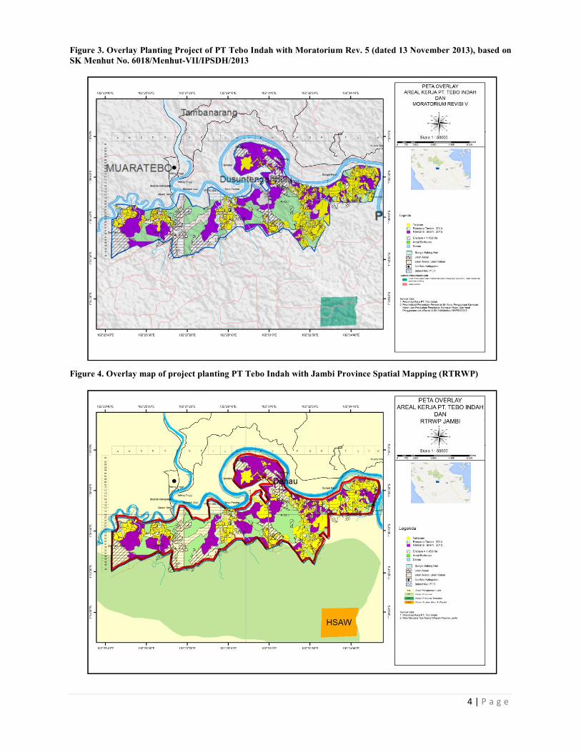
Figure 3. Overlay Planting Project of PT Tebo Indah with Moratorium Rev. 5 (dated 13 November 2013), based on
SK Menhut No. 6018/Menhut-VII/IPSDH/2013
Figure 4. Overlay map of project planting PT Tebo Indah with Jambi Province Spatial Mapping (RTRWP)
Page 5
5 | P a g e
SUMMARY FROM SEI ASSESSMENT:
PT Tebo Indah development plan has incorporated the findings from SEIA (AMDAL) by Pusat
Penelitian Lingkungan Hidup (PPLH) Universitas Jambi and HCV Assessments and Social Impact
Assessments by Sonokeling Akreditas Nusantara as described above when implementing the
operational plans. Management plans for HCV areas and management plans for handling social impact
have been drawn up.
The total area located in HGU of PT Tebo Indah is 7,038.06 Ha. The areas has been planted since
2008 is 3,380.50 Ha, proposed new planting areas is ± 2,875.50 Ha. The HCV management plan has
been developed for these areas ± 264.06 Ha and there is unplantable areas around ± 518.00 Ha.
According the operational management of PT Tebo Indah land development will commence in year
2013.
SEIA Assessor and Their Credential
The Social Impact Assessment of PT TI was carried out on by Pusat Penelitian Lingkungan Hidup
Universitas Jambi. The key consultants conducting these assessments have been accredited and
approved by RSPO. The team members are:
• Ir. Yanuar Fitri, M.Si: Accomplishing master’s degree in Regional and Rural Development in
UNAND. Previously accomplishing the bachelor’s degree in Agriculture Development in UNJA.
Having AMDAL (environmental impact analysis) A and B.
• Ir. Ermadani, M.Sc: Accomplishing master’s degree in Soil sciences in Australia. Previously
accomplishing the bachelor’s degree in the same science in UNPAD. Having basic AMDAL
training certificates.
• Mursalin, S.TP, M.Si: Accomplishing master’s degree in Food Technology in IPB. Previously
accomplishing the bachelor’s degree in Agriculture Products Technology in UNILA.
• Drs. M. Naswir, M.Si: Accomplishing master’s degree in Analytical Chemistry in UNPAD.
Previously accomplishing bachelor’s degree in Chemistry Education in UNJA. Having basic
AMDAL training certificates.
• Ir. Neliyati, M.Si: Accomplishing master’s degree in Agronomy in IPB. Previously
accomplishing bachelor’s degree in the same science in UNJA. Having AMDAL A competence.
• Dr. Ir. Lizawati, M.Si: Accomplishing doctoral degree in Biotechnology in IPB. Previously
accomplishing magister’s and bachelor’s degrees in Agronomy in IPB and UNJA.
• Ir. Nahri Idris, M.Sc: Accomplishing master’s degree in Natural Resource Management in IPB.
Previously accomplishing bachelor’s degree in Husbandry Social and Economy in UNJA. Having
AMDAL A competence.
• Chodidjah Alie, S.Pd, M.Kes: Accomplishing master’s degree in Community Health Science.
Previously accomplishing bachelor’s degree in Counseling Assistance.
• Ir. M. Zuhdi, M.Sc: Accomplishing master’s degree in GIS in the Netherlands. Previously
accomplishing bachelor’s degree in Soil sciences in UNJA. Having basic AMDAL training
certificates.
Page 6
6 | P a g e
The AMDAL documents have been approved based on the Decree of Jambi Governor No.
362/Kep.Gub/BLHD/2009 dated 8 September 2009.
SEIA Assessment Methodology
The method is performed in the collection and analyses of data for PT Tebo Indah are:
a. Identify the potential impact that comes from a description of the activity plan proponent and the
condition of the environment hue. The result of the identification of potential impacts is the
potential impact.
b. Evaluation of all potential impacts that generated hypothetical significant impacts by eliminating
potentially significant impact.
c. Classification and priority hypothetical significant impacts with the intention that the scope and
depth AMDAL studies that produce significant impacts hypothetical priority.
Summary of SEIA Findings
Large and Necessary Effects (Positive)
• The structuring and coaching activities of the conservation areas and the construction of terrace
and planting of covering plants will protect the soil of damages due to erosion that the land
quality/fertility will be maintained and there will no soil particles flown into the river. Therefore
the river will be avoided from turbidity process.
• Fertilization activities and raising of appropriate soil covering plants can improve soil
fertility/quality.
• Changes of work opportunity and business, household earnings, cooperation organization,
accessibility and people’s mobility.
• Procurement of work force creates work opportunities.
Large and Necessary Impacts (Negative)
• Land clearing and preparation will cause the lost of land covering vegetation which causes land
erosion because of rain water particles and surface flow.
• The quality of surface water will decline due to agrochemical residue used in raising activities
including pest and disease control and also weeds. The overuse of fertilizer will also cause the
decline in water quality.
• Changes in the process (social conflice), behavior and people’s perception.
• If plantation business does not operate there will be dissolution in partnership and work
relationship.
Page 7
7 | P a g e
Source of Impact Purpose of Management Method of Management
Geophysican-Chemical
Component
Air quality
1) Transportation and Production Means and
Fresh Fruit Bunch
Surface water quality
1) Clearing and preparation
of lands for plantation,
nurturing of non-yielding
plants (TBM) and
yielding plants (TM).
Quality of ground water
1) Clearing and preparation of land for landscaping,
management of TBM and
TM.
Land Erosion
1) Land clearing and
preparation for plantation.
1) Reducing air pollution level so as not to exceed
the quality standard.
2) Reducing the surface water pollution level so as
not to exceed the threshold of surface water
quality standard Class II.
3) Reducing the level of ground water pollution in
order to not exceed the threshold for ground water (well water) quality standard.
4) Attempting to accelerate land erosion without
exceeding the allowed erosion rate.
Construction until operation stage (technological approach)
1) The vessel used for transportation must already pass emission test. 2) The vessel must travel down the road at limited speed.
3) The roads travelled by the vessel in summer must be sprinkled with
water. 4) Consider layering asphalt on the main road of plantation.
Construction to operation stage (technological approach)
1) Land clearing must be performed gradually in accordance with the
condition and distribution of land area.
2) Planting of legume cover crop (LCC) immediately after the land is
cleared.
3) Usage of fertilizer in accordance with the recommendation, which
includes dosage, frequency and method of fertilizing. 4) Minimizing the usage of agrochemical ingredients to control pets and
disease by applying the integrated and natural pest control system.
5) Maintaining and creating green belt around the river banks and other
conservation areas.
Construction to operation (technological approach)
1) Land clearing is performed gradually in accordance with the respective land area and inclination.
2) Coverage of cleared land with legume cover crop.
3) Balanced usage of organic and chemical fertilizer. 4) Implementation of integrated pest and disease and parasite control
system by minimizing the usage of chemicals.
Construction to operation (technological approach)
1) Land clearing is performed gradually in accordance with the respective
land area and inclination.
2) Coverage of cleared land with legume cover crop.
3) Creation of green belt around the river bank and other conservation
area.
Page 8
8 | P a g e
Land fertility / quality
1) Land clearing and preparation for plantation.
5) Mitigating the reduction of soil quality.
4) Creation of terrace on land with 20-25% of inclination.
Construction to operation (technological approach)
1) Land clearing is performed gradually in accordance with the respective land area and inclination.
2) Coverage of cleared land with legume cover crop.
3) Creation of green belt around the river bank and other conservation area.
4) Balanced usage of organic and chemical fertilizers in accordance with
the recommended method and dosage.
5) Creation of terrace on land with 20-25% inclination.
Biological Components
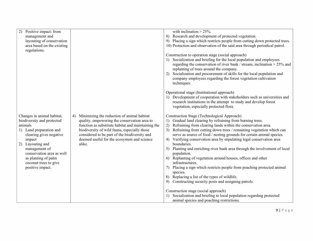
Changes in ecosystem
1) Negative impact: land
preparation and clearing.
2) Positive impact: management and
layouting of conservation
area.
Changes in vegetation
component 1) Negative impacts: from
land clearing and
preparation activities,
which result in reduction /
loss of vegetation
component.
1) Protecting and managing the remaining natural
ecosystem and safeguarding the conservation area
in the activity zone as well as converting the area
into a source of biodiversity.
2) Maintaining the balance of natural plant
biodiversity. 3) Minimizing disturbance, damage and reduction in
protected vegetation species.
Construction stage (technological approach)
1) Gradual land clearing, burning restriction, restriction from clearing land
in a river bank area, production forest area inside the authorization
zone. 2) Soil coverage is performed on cleared lands.
3) Verification of conservation area by stipulating legal boundaries,
conservation of river banks, inclination > 25%.
4) Involving the surrounding population by creating local forest.
5) Construction of security posts, periodical patrol and procurement of
emergency response facilities / infrastructure.
Construction to operation stage (social approach)
1) Development of cooperation with universities and BKSDA in managing
/ layouting conservation area.
Construction stage (technological approach)
1) Not clearing lands in conservation area. 2) Verifying zone by stipulating legal conservation area boundaries.
3) Refraining from cutting down protected trees.
4) Planting or enriching the river bank area.
5) Replanting aroundd houses, offices and other infrastructures.
6) Labeling protected trees.
7) Creating no logging board in conservation areas such as river banks,
Page 9
9 | P a g e
2) Positive impact: from management and
layouting of conservation
area based on the existing regulations.
Changes in animal habitat, biodiversity and protected
animals
1) Land preparation and
clearing gives negative
impact
2) Layouting and
management of
conservation area as well
as planting of palm coconut trees to give
positive impact.
4) Minimizing the reduction of animal habitat quality, empowering the conservation area to
function as substitute habitat and maintaining the
biodiversity of wild fauna, especially those
considered to be part of the biodiversity and
deemed useful for the ecosystem and science
alike.
with inclination > 25%. 8) Research and development of protected vegetation.
9) Placing a sign which restricts people from cutting down protected trees.
10) Protection and observation of the said area through periodical patrol.
Construction to operation stage (social approach)
1) Socialization and briefing for the local population and employees regarding the conservation of river bank / stream, inclination > 25% and
replanting of trees around the company.
2) Socialization and procurement of skills for the local population and
company employees regarding the forest vegetation cultivation
techniques.
Operational stage (Institutional approach)
1) Development of cooperation with stakeholders such as universities and
research institutions in the attempt to study and develop forest vegetation, especially protected flora.
Construction Stage (Technological Approach) 1) Gradual land clearing by refraining from burning trees.
2) Refraining from clearing lands within the conservation area.
3) Refraining from cutting down trees / remaining vegetation which can
serve as source of food / nesting grounds for certain animal species.
4) Verifying conservation area by stipulating legal conservation area
boundaries.
5) Planting and enriching river bank area through the involvement of local
population.
6) Replanting of vegetation around houses, offices and other infrastructures.
7) Placing a sign which restricts people from poaching protected animal
species.
8) Replacing a list of the types of wildlife.
9) Constructing security posts and assigning patrols.
Construction stage (social approach)
1) Socialization and briefing to local population regarding protected
animal species and poaching restrictions.
Page 10
10 | P a g e
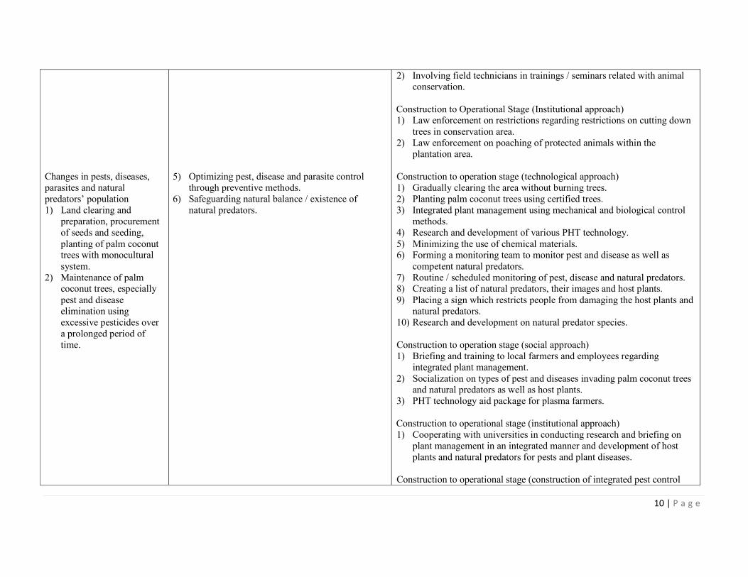
Changes in pests, diseases,
parasites and natural
predators’ population
1) Land clearing and
preparation, procurement
of seeds and seeding,
planting of palm coconut trees with monocultural
system.
2) Maintenance of palm coconut trees, especially
pest and disease
elimination using
excessive pesticides over
a prolonged period of
time.
5) Optimizing pest, disease and parasite control
through preventive methods.
6) Safeguarding natural balance / existence of
natural predators.
2) Involving field technicians in trainings / seminars related with animal conservation.
Construction to Operational Stage (Institutional approach) 1) Law enforcement on restrictions regarding restrictions on cutting down
trees in conservation area.
2) Law enforcement on poaching of protected animals within the plantation area.
Construction to operation stage (technological approach)
1) Gradually clearing the area without burning trees.
2) Planting palm coconut trees using certified trees.
3) Integrated plant management using mechanical and biological control
methods.
4) Research and development of various PHT technology.
5) Minimizing the use of chemical materials. 6) Forming a monitoring team to monitor pest and disease as well as
competent natural predators.
7) Routine / scheduled monitoring of pest, disease and natural predators. 8) Creating a list of natural predators, their images and host plants.
9) Placing a sign which restricts people from damaging the host plants and
natural predators.
10) Research and development on natural predator species.
Construction to operation stage (social approach)
1) Briefing and training to local farmers and employees regarding
integrated plant management.
2) Socialization on types of pest and diseases invading palm coconut trees and natural predators as well as host plants.
3) PHT technology aid package for plasma farmers.
Construction to operational stage (institutional approach)
1) Cooperating with universities in conducting research and briefing on
plant management in an integrated manner and development of host
plants and natural predators for pests and plant diseases.
Construction to operational stage (construction of integrated pest control
Page 11
11 | P a g e
Water organism
1) Negative impact: land clearing and preparation
and plant maintenance.
2) Positive impact: Management of
conservation area and soil
coverage.
7) Protecting water organism biodiversity to
conserve the water ecosystem.
unit at PT Tebo Indah)
Construction to operation stage (technological approach)
1) Land clearing and preparation is performed gradually, without fuel and immediately followed by soil coverage legumes.
2) Refraining from clearing and preparing land in the river bank area.
3) Letting natural plants grow at river banks. 4) Conducting integrated plant management which prioritizes pest, disease
and parasite control without using chemicals.
5) Placing signs which restrict people from fishing in the river using toxic
methods.
6) Monitoring river water organisms.
Construction to operational stage (social approach)
1) Briefing for the local population, employees and plasma farmers
regarding the importance of water organisms and river bank conservation.
2) Briefing and training for plasma farmers and plantation employees
regarding integrated plant management. 3) Conducting briefings and trainings on fishery business.
Operational stage (Institutional approach)
1) Construction of integrated pest control unit at PT Tebo Indah.
2) Conducting research with universities and educational institutions on
environmental management, specifically on pests, diseases and
parasites.
Socioeconomic and cultural component
Demographic changes 1) Procurement of work
force.
1) In order for the demographic changes to occur reasonably and to not disturb the daily lives of
local population as well as minimize potential
conflicts due to employee migrants.
Preconstruction to construction stage (technological approach) 1) Socializing plantation activities to the local population, especially
regarding the recruitment of employees and the possibility of non-local
employees staying in the area.
Preconstruction to operational stage (Social approach)
1) Encouraging and briefing non-local employees on ways to adapt with
Page 12
12 | P a g e
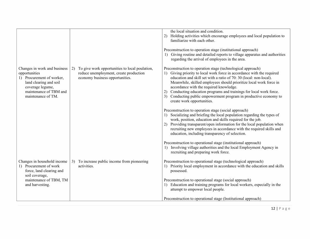
Changes in work and business
opportunities
1) Procurement of worker,
land clearing and soil
coverage legume,
maintenance of TBM and
maintenance of TM.
Changes in household income
1) Procurement of work
force, land clearing and
soil coverage,
maintenance of TBM, TM
and harvesting.
2) To give work opportunities to local poulation,
reduce unemployment, create production
economy business opportunities.
3) To increase public income from pioneering
activities.
the local situation and condition. 2) Holding activities which encourage employees and local population to
familiarize with each other.
Preconstruction to operation stage (institutional approach)
1) Giving routine and detailed reports to village apparatus and authorities
regarding the arrival of employees in the area.
Preconstruction to operation stage (technological approach)
1) Giving priority to local work force in accordance with the required
education and skill set with a ratio of 70: 30 (local: non-local).
Meanwhile, skilled employees should prioritize local work force in
accordance with the required knowledge.
2) Conducting education programs and trainings for local work force.
3) Conducting public empowerment program in productive economy to
create work opportunities.
Preconstruction to operation stage (social approach)
1) Socializing and briefing the local population regarding the types of work, position, education and skills required for the job.
2) Providing transparent/open information for the local population when
recruiting new employees in accordance with the required skills and
education, including transparency of selection.
Preconstruction to operational stage (institutional approach)
1) Involving village authorities and the local Employment Agency in
recruiting and preparing work force.
Preconstruction to operational stage (technological approach)
1) Priority local employment in accordance with the education and skills
possessed.
Preconstruction to operational stage (social approach)
1) Education and training programs for local workers, especially in the
attempt to empower local people.
Preconstruction to operational stage (Institutional approach)
Page 13
13 | P a g e
1) Cooperating with public economic institution / cooperatives and relevant institutions to develop family potentials in order to increase
household income.
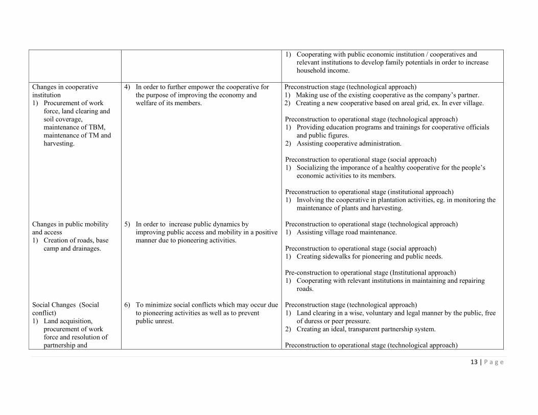
Changes in cooperative
institution 1) Procurement of work
force, land clearing and
soil coverage, maintenance of TBM,
maintenance of TM and
harvesting.
Changes in public mobility
and access
1) Creation of roads, base
camp and drainages.
Social Changes (Social
conflict)
1) Land acquisition,
procurement of work
force and resolution of
partnership and
4) In order to further empower the cooperative for
the purpose of improving the economy and welfare of its members.
5) In order to increase public dynamics by
improving public access and mobility in a positive
manner due to pioneering activities.
6) To minimize social conflicts which may occur due
to pioneering activities as well as to prevent
public unrest.
Preconstruction stage (technological approach)
1) Making use of the existing cooperative as the company’s partner. 2) Creating a new cooperative based on areal grid, ex. In ever village.
Preconstruction to operational stage (technological approach) 1) Providing education programs and trainings for cooperative officials
and public figures.
2) Assisting cooperative administration.
Preconstruction to operational stage (social approach)
1) Socializing the imporance of a healthy cooperative for the people’s
economic activities to its members.
Preconstruction to operational stage (institutional approach) 1) Involving the cooperative in plantation activities, eg. in monitoring the
maintenance of plants and harvesting.
Preconstruction to operational stage (technological approach)
1) Assisting village road maintenance.
Preconstruction to operational stage (social approach) 1) Creating sidewalks for pioneering and public needs.
Pre-construction to operational stage (Institutional approach) 1) Cooperating with relevant institutions in maintaining and repairing
roads.
Preconstruction stage (technological approach)
1) Land clearing in a wise, voluntary and legal manner by the public, free
of duress or peer pressure.
2) Creating an ideal, transparent partnership system.
Preconstruction to operational stage (technological approach)
Page 14
14 | P a g e
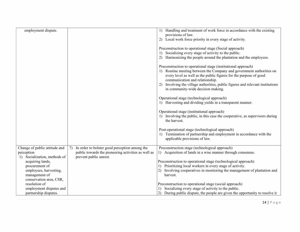
employment dispute.
1) Handling and treatment of work force in accordance with the existing provisions of law.
2) Local work force priority in every stage of activity.
Preconstruction to operational stage (Social approach)
1) Socializing every stage of activity to the public.
2) Harmonizing the people around the plantation and the employees.
Preconstruction to operational stage (institutional approach)
1) Routine meeting between the Company and government authorities on
every level as well as the public figures for the purpose of good
communication and relationship.
2) Involving the village authorities, public figures and relevant institutions
in community-wide decision making.
Operational stage (technological approach) 1) Harvesting and dividing yields in a transparent manner.
Operational stage (institutional approach) 1) Involving the public, in this case the cooperative, as supervisors during
the harvest.
Post-operational stage (technological approach)
1) Termination of partnership and employment in accordance with the
applicable provisions of law.
Change of public attitude and
perception 1) Socialization, methods of
acquiring lands,
procurement of employees, harvesting,
management of
conservation area, CSR,
resolution of
employment disputes and
partnership disputes.
7) In order to bolster good perception among the
public towards the pioneering activities as well as prevent public unrest.
Preconstruction stage (technological approach)
1) Acquisition of lands in a wise manner through consensus.
Preconstruction to operational stage (technological approach)
1) Prioritizing local workers in every stage of activity. 2) Involving cooperatives in monitoring the management of plantation and
harvest.
Preconstruction to operational stage (social approach)
1) Socializing every stage of activity to the public.
2) During public dispute, the people are given the opportunity to resolve it
Page 15
15 | P a g e
on their own, facilitated by village authorities.
Preconstruction to operational stage (institutional approach)
1) Holding activities for the employees and the public to bolster harmony. 2) Routine meeting between the Company and formal / non-formal
government apparatus on every level and the public figures to create
good communication and relationship. 3) Cooperating with public social institutions when holding social
activities.
Construction to operational stage (social approach)
1) Creation of public facilities used by the local population, eg. Roads,
healthcare facilities, schools and social infrastructures.
Post-operational stage (technological approach)
1) Resolution of partnership and employment issues in a proper manner according to the applicable provisions of law.
Changes in natural resources
economy
1) Impact of reduced
economic value of
natural resources is
derived from the land
clearing activities to construct plantations,
whereas positive impact
can be gained from layouting and
management of
conservation area.
8) In order to prevent drastic decrease of natural
resources’ economic value in the area.
Pre-construction to post-operational stage (technological approach)
1) Complying with all provisions and regulations regarding plantation
business and conservation of the environment.
2) Conducting provisions on environmental management and monitoring
plans.
3) Layouting and managing conservation areas in accordance with the
applicable regulations.
Public Healthcare Component
Disease Pattern
1) Mobilization of heavy
equipments, land
1) Preventing work accidents and diseases among
the employees and local population.
Construction to operational stage (technological approach)
1) Implementing optimal work health and safety management for the
Page 16
16 | P a g e
preparation, maintenance of TBM and TM.
Environmental Health
1) Creation of roads, base
camp, drainages, land clearing and preparation
and maintenance of TBM
and TM.
2) Preventing increased density of surface water
pollution level and vectors as well as increasing
work productivity without losing work days due to decreased work environment quality.
workers. 2) Implementing general principles of safety.
3) Attempting promotive and preventive actions.
Construction to operational stage (technological approach)
1) Monitoring ground surface passed by vehicles and immediately patching
potholes that can turn into pool during the rain. 2) Paying attention to the inner space and shape of drainage.
3) Monitoring fishbone duct around the plantation.
4) Cleaning fishbone duct.
5) Monitoring larvae density around the breeding site or adult mosquitoe
population around the location, especially during the rainy season.
6) Controlling vectors using larvae-eating fish as a means of biological
control.
7) Managing surface water quality.
8) Implementing the HSE management in a hollistic manner by taking into account the workers’ rights regarding healthcare and safety.
Page 17
17 | P a g e
SUMMARY FROM HCV ASSESSMENT:
HCV Assessor and Their Credential
The HCV assessment in the HGU Area of PT Tebo Indah by the RSPO accredited assessors.
The HCV assessment conducted from 1st – 6
th November 2013 in the HGU Area and villages
surrounding area was carried by Sonokeling Akreditas Nusantara, located at Komplek Sari
Inten No. 44 RT 02 RW 09, Ciomas Rahayu, Ciomas sub-district, Bogor District, 16610,
West Java. Key consultants from Sonokeling Akreditas Nusantara have been accredited and
approved by RSPO. The team members are:
• Ir. Kresno Dwi Santosa, M.Si (Head of Expert Team in Social Economy and
Culture)
Approved RSPO HCV Assessor.Accomplishing Master of Science in Natural Resource and
Environmental Management, IPB, graduated in 1999.
In 2008 – now, working with Tropenbos International Indonesia Program as Forest
Management Specialist and HCVF Coordinator. In the period he has performed assessment
and training programs of Areas of High Conservation Value in HPH, HTI and Plantation. He
is active in the drafting of Revision in Assessment Guidance of High Conservation Value
Areas in Indonesia (HCVF Toolkit Indonesia) and in various meetings in the context of
HCVF development in Indonesia. February 2003 – 2007, he worked with CIFOR under the
Directorate of Forest and Livelihood Program as Researcher and Project Officer in ITTO PD
39/00 Rev. 3 (F): “Sustainable Collaborative Forest Management: Meeting the Challenges of
Decentralization in the Bulungan Model Forest”. In 2001 – 2003 he worked in BAPPENAS
under the Directorate of Natural Resource and Environment as Project Assistance in the
project of Integrated Biodiversity Strategy and Action Plan (IBSAP)-BSAP TF 023957-IND,
GEF World Bank, which is funded by the Global Environment Facility.
In 1996 – 2001 he worked on his Master’s degree and as a part time researcher in the Study
Center of Coastal and Marina Areas of the IPB Faculty of Fishery. HCVF HTI pre-
assessment of PT Sumalindo Lestari Jaya, Batuputih Site, East Kalimantan. HCVF pre-
assessment of PT Rea Kaltim Plantations, Kutai Kartanegara, East Kalimantan. HCVF HTI
risk rapid assessment of PT RAPP Estate Tasik Belat, Meranti Bay, Kampar Peninsula.
HCVF full assessment of landscape level in Kampar Peninsula, a cooperation with TBI-
APRIL-Research and Development Body of the Forestry. HCVF HTI full assessment of PT
RAPP Estate Tasik Belat, Meranti Bay, Kampar Peninsula. Reviewer of HCVF HTI risk
rapid assessment of PT RAPP Estate Padang Island. Training instructor of HCVF technical
assessment level, a cooperation of TBI-WWF-TNC and INSTIPER.
Since December 2011 he has listed in RSPO as a specialist in Social Economy and Culture
Discipline and as the Head of the Team.
• Yanuar Wicaksono, Amd (Expert in Biodiversity) - Approved RSPO.
Graduated in 2003 from Diploma III Program of Forest Resource Conservation of the Faculty
of Forestry, IPB.
Has worked as a lecturer’s assistance in subjects related with Wild Animals Ecology and
Ecotourism at the Department of Forest Resource Conservation and Ecotourism, Faculty of
Forestry, IPB and at the Ecotourism Diploma Program, IPB. He has also worked as co-
Page 18
18 | P a g e
assistant in various student’s research for final examination in 2002 – 2009.
In 2003 – 2006, he has been active in natural tourism activities, such as in Carita Natural
Tourism Park, Banten; Curug Nangka Forest Tourism, Bogor; Cimanggu Natural Tourism
Park and several forest tourisms in South Bandung, a cooperation of Diploma III Program in
Forest Resource Conservation and Ecotourism and Unit III Jabar-Banten of the General
Company of Perhutani.
Since 2010 – now, he has been active in assessment activities of High Conservation Value
both in forestry (HPH/HTI) and palm oil plantation. Other than being involved in the HCV
assessment team, he has also been active in HCV trainings, both as executor and as manager.
Since December 2011 he has been listed in RSPO as specialist in Biodiversity discipline.
• Ir. Agung Wibawa Anindita (Expert in Social Economy and Culture)
Bachelor of Forestry, majoring in Forest Management – Bogor Institute of Agriculture (IPB),
graduated in January 1994.
Having 15 years of work experience, such as in fields connected with Natural Resource
Management (especially in Forestry, Agriculture and Mining), Environment Management
(environmental impact analysis, UKL and UPL, RKL and RPL implementations, study
baseline) and in SOCIAL, ECONOMY AND CULTURE.
• Catur Wiradityo, S.Hut (Expert in Environmental Services)
Bachelor program in the Department of Forest Resource Conservation and Ecotourism of the
Faculty of Forestry in the Bogor Institute of Agriculture.
1. HCVA Assessment of PT Arrtu Borneo Perkebunan (Green Eagle Group) Palm Oil
Plantation of Ketapang Regency, West Kalimantan. PT Sonokeling Akreditas
Nusantara.
2. HCVA Assessment of PT Arrtu Energie Resources (Green Eagle Group) Palm Oil
Plantation of Ketapang Regency, West Kalimantan. PT Sonokeling Akreditas
Nusantara.
3. HCVA Assessment of PT Arrtu Agro Nusantara (Green Eagle Group) Palm Oil
Plantation of Ketapang Regency, West Kalimantan. PT Sonokeling Akreditas Nusantara.
• Farhan Nahdia, S.Hut (Assistant in Biodiversity)
• Rahmat, Amd (Assistant to GIS and Mapping Expert)
Diploma III in Forestry of the Department of Silviculture, the Bogor Institute of Agriculture.
Has been actively involved in various HCV studies as member of expert team in GIS and
mapping, such as in HCV activities and management in palm oil plantation areas, palm oil
forests, Industrial Forests (HTI), Natural Forests (HPH) and mining.
The HCVA/F activities performed are:
1. Industrial Forests (HTI) and Natural Forests (HPH) companies, namely: PT Korintiga
Page 19
19 | P a g e
Hutani – Korinda Group (Central Kalimantan), PT Arara Abadi (Riau), PT Satria
Perkasa Agung (Riau), PT Riau Abadi Lestari (Riau), PT SPA Serapung (Riau), PT KTH
Sinar Merawang (Riau), PT Wirakarya Sakti (Jambi), PT Finnantara Intiga (Central
Kalimantan), PT Rimba Hutani Mas (Jambi), PT Tebo Multi Agro (Jambi), PT Salaki
Summa Sejahtera (West Sumatera).
2. Palm Oil Plantation Companies, namely: PT Guntung Idaman Nusa (Riau), PT Agro
Palindo Sakti (South Sumatera), PT Agro Muara Rupit (South Sumatera).
3. Coal Mining Company, namely: PT Daya Bumindo Kurnia (Central Kalimantan).
Identification result of HCV PT TI involved public consulting process at 7 November 2013
and Peer Review by a party other than Assessor i.e. Dr. Harnios Arief (approved RSPO HCV
Assessor).
HCV Assessment Methodology
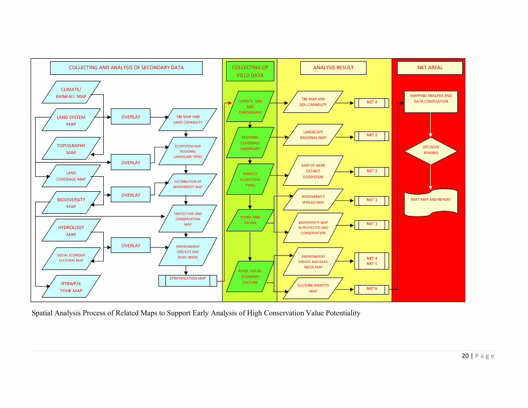
Generally, the identification and analysis activities of HCV 1 – HCV 6 in PT Tebo Indah palm
oil plantation area, with activity stages as are described in Picture 7 and Picture 8.
Identification Process of High Conservation Value of PT Tebo Indah Palm Oil Plantation Area
No NKT
Page 20
20 | P a g e
Spatial Analysis Process of Related Maps to Support Early Analysis of High Conservation Value Potentiality
COLLECTING AND ANALYSIS OF SECONDARY DATA NKT AREAL
CLIMATE/
RAINFALL MAP
LAND SYSTEM
MAP
TOPOGRAPHY
MAP
LAND
COVERAGE MAP
BIODIVERSITY
MAP
HYDROLOGY
MAP
SOCIAL ECONOMY
CULTURAL MAP
RTRWP/K
TGHK MAP
OVERLAY TBE MAP AND
LAND CAPABILITY
OVERLAY
OVERLAY
OVERLAY
ECOSYSTEM AND
REGIONAL
LANDSCAPE TYPES
DISTRIBUTION OF
BIODIVERSITY MAP
PROTECTION AND
CONSERVATION
MAP
ENVIRONMENT
SERVICES AND
BASIC NEEDS
STRATIFICATION MAP
COLLECTING OF
FIELD DATA
CLIMATE, SOIL
AND
TOPOGRAPHY
REGIONAL
COVERING/
LANDSCAPE
FOREST/
ECOSYSTEM
TYPES
FLORA AND
FAUNA
RIVER, SOCIAL
ECONOMY
CULTURE
ANALYSIS RESULT
TBE MAP AND
SOIL CAPABILITY NKT 4
LANDSCAPE
REGIONAL MAP NKT 2
MAP OF NEAR
EXTINCT
ECOSYSTEM
NKT 3
BIODIVERSITY
SPREAD MAP NKT 1
BIODIVERSITY MAP
IN PROTECTED AND
CONSERVATION
NKT 1
ENVIRONMENT
SERVICE AND BASIC
NEEDS MAP
NKT 4
NKT 5
CULTURE IDENTITY
MAP NKT 6
MAPPING ANALYSIS AND
DATA COMPILATION
DECISION
MAKING
KBKT MAP AND REPORT
Page 21
21 | P a g e
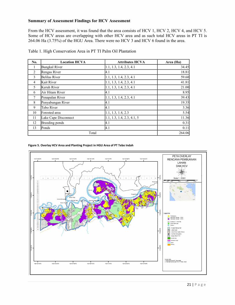
Summary of Assessment Findings for HCV Assessment
From the HCV assessment, it was found that the area consists of HCV 1, HCV 2, HCV 4, and HCV 5.
Some of HCV areas are overlapping with other HCV area and as such total HCV areas in PT TI is
264.06 Ha (3.75%) of the HGU Area. There were no HCV 3 and HCV 6 found in the area.
Table 1. High Conservation Area in PT TI Palm Oil Plantation
No. Location HCVA Attributes HCVA Area (Ha)
1 Bungkal River 1.1, 1.3, 1.4, 2.3, 4.1 34.45
2 Rengas River 4.1 18.81
3 Belilas River 1.1, 1.3, 1.4, 2.3, 4.1 59.60
4 Kait River 1.1, 1.3, 1.4, 2.3, 4.1 41.81
5 Keruh River 1.1, 1.3, 1.4, 2.3, 4.1 21.00
6 Air Hitam River 4.1 8.95
7 Penapalan River 1.1, 1.3, 1.4, 2.3, 4.1 39.43
8 Penyabungan River 4.1 19.35
9 Tebo River 4.1 3.36
10 Forested area 1.1, 1.3, 1.4, 2.3 5.54
11 Lake Cape Disconnect 1.1, 1.3, 1.4, 2.3, 4.1, 5 11.36
12 Breeding ponds 4.1 0.31
13 Ponds 4.1 0.11
Total 264.06
Figure 5. Overlay HCV Area and Planting Project in HGU Area of PT Tebo Indah
Page 22
DOCUMENTATION OF FREE PRIOR AND INFORMED CONSENT
In accordance with RSPO requirements PT
the local community that would be affected by the development of the concession area or land that
proposed for On-Going NPP. The documents are as follows:
1. Under land history on Minutes of Land Use Righ
people’s land gained from land clearing is then submitted to KUD Tujuan Murni, and together
as members of KUD Tujuan Murni they submit the land to PT Tebo Indah (Deed of Transfer
of Land Rights No. 1 dated 8 Marc
2. The stated land will be managed by PT Tebo Indah by sharing 75% to PT Tebo Indah and 25%
to KUD members (Cooperation Agreement No. 2 dated 8 March 2006 in connection to Deed
of the Minutes of Meeting No. 1 dated 6 July 2005)
3. HGU No: 27-HGU-BPN-RI-
indicated that entire communities land has been compensated through FPIC method.
VERIFICATION STATEMENT:
PT TEBO INDAH opted for document audit.
desk study and audit of relevant documents
28th December 2013; and also held
INDAH during the audit. The auditor team are: Y.
and HCV aspect), Trismadi Nurbayuto (Social aspect).
The SEIA (AMDAL) was conducted by the government
HCV assessments were conducted by RSPO
adhered to RSPO New Planting Procedure
comprehensive and professionally carried out
with RSPO Principles and Criteria for new
Mutuagung Lestari
Y. Wisnu Rahmanto
Lead Auditor
27th January 2014
DOCUMENTATION OF FREE PRIOR AND INFORMED CONSENT
In accordance with RSPO requirements PT TI needs to obtain free, prior and informed consent from
the local community that would be affected by the development of the concession area or land that
Going NPP. The documents are as follows:
on Minutes of Land Use Rights Committee-B (HGU Risalah Panitia B), t
people’s land gained from land clearing is then submitted to KUD Tujuan Murni, and together
as members of KUD Tujuan Murni they submit the land to PT Tebo Indah (Deed of Transfer
of Land Rights No. 1 dated 8 March 2006).
The stated land will be managed by PT Tebo Indah by sharing 75% to PT Tebo Indah and 25%
to KUD members (Cooperation Agreement No. 2 dated 8 March 2006 in connection to Deed
of the Minutes of Meeting No. 1 dated 6 July 2005).
-2009, dated 4 February 2009 with size 7,038.06 Ha.
indicated that entire communities land has been compensated through FPIC method.
document audit. Three (3) Mutuagung Lestari auditors have
of relevant documents conducted the audit at their office in Tangerang
held interviews with the management representatives
The auditor team are: Y. Wisnu Rahmanto (Legal aspect), Ardiansyah (SEIA
and HCV aspect), Trismadi Nurbayuto (Social aspect).
conducted by the government-accredited consultant whereas
conducted by RSPO-approved assessors. Therefore PT TEBO INDAH
adhered to RSPO New Planting Procedure. Documentation of the assessments and plans are
carried out in accordance with RSPO requirements
Criteria for new plantings.
Signed on behalf of,
PT TEBO INDAH
John M Hutagalung
Operational Director
27th January 2014
22 | P a g e
needs to obtain free, prior and informed consent from
the local community that would be affected by the development of the concession area or land that
B (HGU Risalah Panitia B), the
people’s land gained from land clearing is then submitted to KUD Tujuan Murni, and together
as members of KUD Tujuan Murni they submit the land to PT Tebo Indah (Deed of Transfer
The stated land will be managed by PT Tebo Indah by sharing 75% to PT Tebo Indah and 25%
to KUD members (Cooperation Agreement No. 2 dated 8 March 2006 in connection to Deed
with size 7,038.06 Ha. This is
indicated that entire communities land has been compensated through FPIC method.
Mutuagung Lestari auditors have conducted
Tangerang from 27th -
the management representatives of PT TEBO
Wisnu Rahmanto (Legal aspect), Ardiansyah (SEIA
whereas the SIA and
TEBO INDAH has
the assessments and plans are
RSPO requirements and comply
PT TEBO INDAH
John M Hutagalung
Operational Director
January 2014