Rural Landscapes of Bath and North East Somerset A Landscape Character Assessment A Landscape Character Assessment A Landscape Character Assessment A Landscape Character Assessment A Landscape Character Assessment Supplementary Planning Guidance PLANNING SERVICES
Transcript
Rural Landscapes of Bath and North East Somerset
A Landscape Character AssessmentA Landscape Character AssessmentA Landscape Character AssessmentA Landscape Character AssessmentA Landscape Character AssessmentSupplementary Planning Guidance
PLAN
NIN
G SERV
ICES
Rural Landscapes of Bath and North East Somersetof Bath and North East Somersetof Bath and North East Somersetof Bath and North East Somersetof Bath and North East Somerset
A Landscape Character AssessmentA Landscape Character AssessmentA Landscape Character AssessmentA Landscape Character AssessmentA Landscape Character Assessment
April 2003April 2003April 2003April 2003April 2003
Supplementary Planning Guidance
Acknowledgements and Attributions
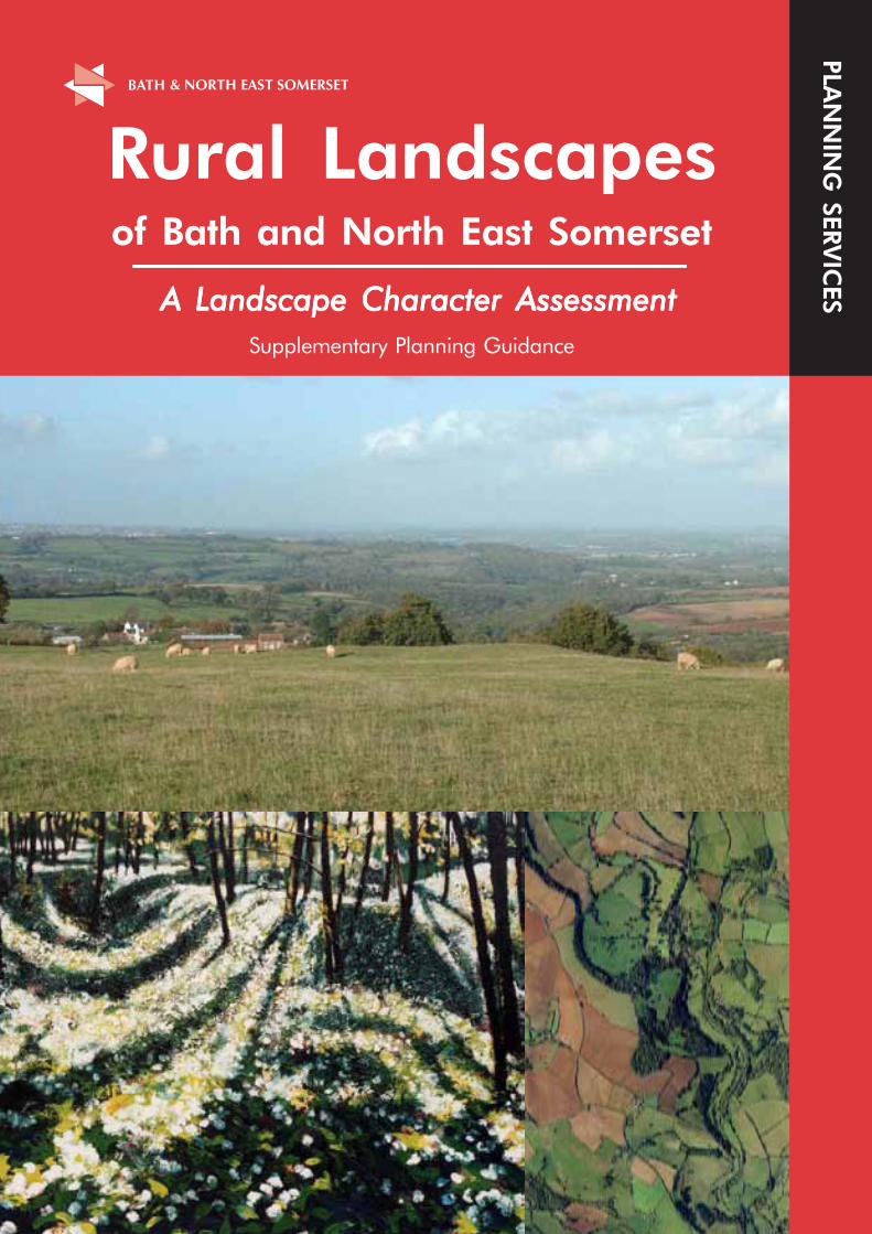
Front cover Untitled view of Cotswold Woodland, by Dominic Thomas,
Chalford, Gloucestershire. 01453 887306
Aerial photograph by UK Perspectives
Chapter 6 - Cultural Perceptions of the Landscape Untitled view of Cotswold Valley by Dominic Thomas
Mural in Saltford Hall by Alan Durman
Film Poster from ‘The Titfield Thunderbolt’ Ealing Films 1952 courtesy of Simon Castens ‘Titfield Thunderbolt’ Bookshop
All photographs in the document by Planning Services, Bath and North East Somerset Council unless stated otherwise
All images are copyright protected by the authors unless otherwise stated
The Ordnance Survey mapping included within this document is provided by Bath and North East Somerset Council under licence from the Ordnance Survey in order to fulfil its public function to make available Council held public domain information. Persons viewing these maps should contact Ordnance Survey copyright for advice where they wish to licence Ordnance Survey mapping/map data for their own use. The OS web site can be found at www.ordsvy.gov.uk
ISBN 1-903602-05-X
BATH & NORTH EAST SOMERSET
Produced by Bath & North East Somerset’s Planning Services, Trimbrisge House, Trim Street, Bath BA1 2DP Published by Bath & North East Somerset’s Linear Way Industries, Dartmouth Avenue, Oldfield Park, Bath BA2 1AS
DP 2609 April 2003
i i
CONTENTS Page
Acknowledgements & Attribution (ii)
Contents (iii)
List of Tables, Maps and Illustrations (iv)
1. Introduction 1
2. Landscape Context 5
3. Physical Influences 9
4. Historical Development of the Landscape 13
5. Ecological/Wildlife Characteristics 17
6. Cultural Perceptions of the Landscape 19
7. The Landscape Character Area Descriptions 22
1 Thrubwell Farm Plateau 23
2 Chew Valley 26
3 Upper Chew and Yeo Valleys 30
4 Mendip Slopes 34
5 Dundry Plateau 38
6 Hinton Blewett and Newton St Loe Plateau Lands 42 7 Hollow Marsh 47 8 Farrington Gurney Farmlands 50
9 Stockwood Vale 53
10 Hicks Gate 56
11 Bickley Wood Gorge 59
12 Cam and Wellow Brook Valleys 62
13 Paulton and Peasedown St John Ridge 66
14 Avon Valley 70
15 Norton Radstock Southern Farmlands 74
16 Cotswolds Plateaux and Valleys 77
17 Hinton Charterhouse and Baggridge Plateaux 81
18 Bathford and Limpley Stoke Valley 84
8. Landscape Change 88
9. Conclusion 91
Glossary 92
References 94
Bibliography 95
Appendix 1 Sample survey form and sketch 96
Appendix 2 Key development plan policies to which this document is 99 Supplementary Planning Guidance
Appendix 3 Detailed Landscape Character Area Maps 101
iii
List of Tables, Maps and Illustrations
Table 1 Character Areas in Relation to the Character of England Map Areas Page 6
Table 2 Summary of Geological Succession within Bath and North East Somerset Page 9
Map 1 Statutory Designations Page 4
Map 2 Geology Page 8
Map 3 Topography and drainage Page 10
Map 4 Landscape Character Areas Page 22
Map 5-22 Detailed Landscape Character Area Maps Appendix 3
Illustration 1 Cotswold View by Dominic Thomas Page 19
Illustration 2 Saltford Hall Mural by Alan Durman Page 20
Illustration 3 Movie Poster for ‘ The Titfield Thunderbolt’ Page 20
i v
1. Introduction 1.1 Scope and Status of Document 1.1.1 This document identifies and describes the component features and characteristics of the landscape within Bath and North East Somerset. This has been done through a landscape character assessment which is the process of dividing up the landscape into parcels of land with common characteristics. These characteristics are many and varied and will be different for each area. They include natural physical influences and human processes but can also include the cultural values that are placed upon an area.
1.1.2 This assessment recognises that development is an integral component of the landscape and is a key influence in contributing to landscape character and local distinctiveness. The design and location of new development is therefore an important factor in enhancing or contributing to landscape character. The assessment, however, excludes the city of Bath and the towns of Keynsham, Midsomer Norton and Radstock at this stage although it is planned to extend the assessment to include these areas in the future. Other settlements have been included in as far as they are part of the landscape but the assessment does not include an assessment of the built form from within the settlements.
1.1.3 Landscape assessment is an important tool in the planning process. It has been promoted by the Countryside Commission (now the Countryside Agency) from the late 1980’s. It has backing from central government in for example Planning Policy Guidance Note 7 1997 (PPG 7)(1), which encourages planning authorities to undertake comprehensive landscape assessments of their areas as part of the local plan process.
1.1.4 This assessment is also intended to be a guide to the landscapes of Bath and North East Somerset for the whole community including schools, developers, local interest groups, environmental bodies, walkers, tourists etc. In these pages is information about the way that the diverse landscapes have formed by natural and human processes, it touches on how each landscape is made up and what elements are most important to each area and culturally how the landscape has been perceived.
1.1.5 This assessment was consulted on between 27 May and 5 July 2002. The responses were analysed and comments were taken into account in the preparation of this document. A statement of the consultation undertaken is available on request. The document was approved as Supplementary Planning Guidance (SPG) to the Development Plan on 17 February 2003. A list of the key development plan policies which this document supplements are listed in Appendix 2. This document is a material consideration which will be taken into account in deciding planning applications. This assessment will be of use to the community as a whole in guiding the activities that impact upon the landscape, whether they are developers, environmental interest groups, landscape managers or individual householders.
1.1.6 This assessment does not seek to label areas as attractive or unattractive, high or low quality. However, all areas have features that contribute to or detract from their character or quality. Many of the features themselves may be in need of improvement so that they might have a more positive impact.
1.1.7 It is planned that this document will be used as a starting point for a number of further studies and guidelines. These may include detailed guidelines focused upon individual character areas or other defined areas or may include guidelines on specific issues. Complementary studies of the urban landscapes would complete the assessment of all the outdoor spaces within the area.
1.1.8 This assessment is a base-line survey of the character and condition of the landscape of the area in 2002. If reviewed on a 5 or 10 year cycle perhaps focusing on key indicators, sample areas or areas where there may be particular issues then a detailed picture of the change in landscape of the area will be built up. This would be most valuable for assessing sustainability, quality of life and biodiversity indicators for the years to come.
1.1.9 Chapter 2 gives the context of this assessment in relation to the national picture and other assessments carried out within and bordering the area. Chapters 3, 4 and 5 of this document give an overview of the physical
1
influences, historical development and nature conservation • Final character areas were reviewed and further habitats across the area as a whole. Chapter 6 draws out fieldwork was carried out to check their some of the perceptions of the area by visitors and local boundaries. residents. These are intended as an introduction to the individual character areas, which are described in detail in • Analysis of the landscape character and analysis chapter 7. Chapter 8 is an analysis of change across the of landscape change with reference to the First area drawing out some of the key issues. Edition Ordnance Survey Maps (surveyed
1.2 Methodology
1.2.1 The assessment was undertaken following the Countryside Commission guidelines published in 1987 and 1993 and the draft guidelines of the Countryside Agency(2-
4). These draft guidelines are based upon the earlier guidelines and have been updated to include the experience of several years practice around the country and to incorporate more fundamental proposals for stakeholder participation. The draft guidelines have formed the basis for new guidance published in 2002(5).
1.2.2 The assessment was undertaken in the following stages: • A desk top study was carried out to define
initial character areas based upon map information about geology, soils, landform, drainage pattern, land use, vegetation, field pattern and settlement pattern. The research also included historical and cultural development and perceptions of the landscape.
• Fieldwork was carried out between 1999 and 2000 to further refine the character areas based upon observations about landform, land use, vegetation, field boundaries, openness, enclosure, scale, visual relationships, features and building materials. An example of the survey form is found in Appendix 1.
1881-1889) and aerial photos taken between 1946 and 1999.
1.2.3 Boundaries have been drawn between character areas as a single clear line following distinct features such as field boundaries. In reality however the change between one character area and another is not always so clear-cut. In most cases the drawn line must be considered to be at the changeover point where the characteristics of one area outweigh those of the next. In essence the lines should be seen as a mid-point of a transition zone rather than a hard and fast cut-off point.
1.3 Aims and Objectives 1.3.1 The landscape is continually evolving. Some changes are planned and some occur incidentally resulting from other decisions. These changes whether gradual or sudden can have significant impacts on both the quality and character of the landscape. This assessment has as its overarching objective the maintenance and enhancement of landscape character and local distinctiveness. A summary of ways it is planned to be used is listed below.
• To aid formulation of planning policies, to inform development control decisions, to contribute to allocation of land for development and to provide a baseline for more detailed assessments such as local community-led assessments and those required to support planning applications and to contribute to environmental impact assessments.
• To guide landscape change such as informing decisions about the location and design of new woodland. One of the most pressing challenges is the change affecting farming. Traditional family farms and their farming practices are under threat and at the same time there is recognition that the countryside offers a wider resource than just for intensive food production. This recognition provides opportunities for giving greater emphasis to other objectives such as habitat enhancement, management for greater species diversity, opportunities for improved access to the countryside, diversified use of farm buildings and developing local produce for local markets.
2
• To contribute to identifying landscape management priorities.
• To provide a baseline for future guidelines on specific issues such as development at the edges of settlements.
• To provide a baseline for monitoring change and the condition of the landscape. The measurement of indicators is under development but includes issues such as biodiversity, tranquillity, heritage and landscape character. While components of the landscape such as hedges, stone walls and ponds can be measured; indicators for protection of the wider landscape are less easily measurable. This character assessment can be seen as contributing to the process of defining and recording local indicators.
3
2. Landscape Context 2.1 Introduction 2.1.1 The area has a rich and diverse range of landscapes. Between the extremes of the high wold of the Cotswold plateau and the flat floodplains of the River Avon there are contrasting small enclosed landscapes of winding lanes, well ‘treed’ hedgerows and scattered small woodlands, and open rolling landscapes of neat square fields with clipped hedges, straight lanes and parcels of woodland. There are modern landscapes constantly changing with the needs of the local population and those where the fields, hedges and lanes have remained the same since before the Norman Conquest. Most landscapes are a combination of old and new.
2.1.2 All of the landscapes of the area are cherished. Some like the Cotswolds and Mendip Hills are recognised as being of national importance and are granted the status of Areas of Outstanding Natural Beauty (AONB). Others though they lack this status and protection are no less loved by those who live, work and play in them. Most of the rural parts of the area are within the Bristol/Bath Green Belt which is an important control in maintaining the open character of these areas. The Forest of Avon is also a significant designation with one of its objectives to increase woodland cover to 30% of its area. Each character area is closely related to the evolution of agriculture, communications, industry and settlement within the landscape. All are living working landscapes and as such they change and develop according to the demands placed upon them.
2.1.3 The city of Bath has international significance as a World Heritage Site in recognition of its architecture, town planning, landscape, archaeological remains and its role in social history. The encircling hills and green valleys
provide a dramatic backdrop and are an integral part of the city which grew up around the river. The landscape both enhances the city and is responsible for shaping it. As a result it is of great significance in contributing to the unique character of the city.
2.2 Assessment Context 2.2.1 This assessment has been undertaken within the context of the Countryside Character Initiative of the Countryside Agency (formerly the Countryside Commission). Their standard methodology has been adopted in order to maintain compatibility with the agency’s work and other assessments. Their work has led to the classification of the whole of the English countryside into 159 separate character areas which together is known as the Character of England map. The Bath and North East Somerset area includes parts of three of the national landscape character areas: the Mendip Hills, the Cotswolds and Bristol, Avon Valleys and Ridges(6). This assessment at the intermediate / local authority scale reflects these distinctions and adds more detail and further subdivision. The only significant variation from the Character of England map occurs with the Paulton and Peasedown St John Ridge and the Cam and Wellow Brook Valleys character areas which both straddle the Cotswolds and Bristol, Avon Valleys and Ridges national map areas.
2.2.2 A total of 18 distinct landscape character areas are identified. These range in size from Bickley Wood Gorge at less than 1sq km to Chew Valley at 67sq km. The variations in size are dictated by the extent of the features and characteristics which make up the character areas. The correlation between the national assessment and this assessment is shown in Table 1.
5
Character ofCharacter ofCharacter ofCharacter ofCharacter of Bath and NorthBath and NorthBath and NorthBath and NorthBath and NorthEnglandEnglandEnglandEnglandEngland East SomersetEast SomersetEast SomersetEast SomersetEast SomersetMap AreasMap AreasMap AreasMap AreasMap Areas Character AreasCharacter AreasCharacter AreasCharacter AreasCharacter Areas
Mendip Hills Mendip Slopes Upper Chew and Yeo Valleys
Cotswolds Cotswolds Plateaux and Valleys
Bathford and Limpley Stoke Valley
Hinton Charterhouse and Baggridge Plateaux
Paulton and Peasedown St John Ridge (part of)
Cam and Wellow Brook Valleys (part of)
Bristol, Paulton and Peasedown Avon Valleys St John Ridge (part of) and Ridges Chew Valley
Norton Radstock Southern Farmlands
Cam and Wellow Brook Valleys (part of)
Hicks Gate
Bickley Wood Gorge
Hinton Blewett and Newton St Loe Plateau Lands
Avon Valley
Farrington Gurney Farmlands
Hollow Marsh
Dundry Plateau
Stockwood Vale
Thrubwell Farm Plateau
TTTTTable 1 Character Areas in Relation to theable 1 Character Areas in Relation to theable 1 Character Areas in Relation to theable 1 Character Areas in Relation to theable 1 Character Areas in Relation to theCharacter of England Map AreasCharacter of England Map AreasCharacter of England Map AreasCharacter of England Map AreasCharacter of England Map Areas
By maintaining compatibility with the Character of England map we are able to provide a view of our landscape that is consistent with the national picture. Comparisons with other landscape assessments are easier and in turn our assessment can support regional and national work. The development of standard national landscape types is currently in progress and therefore landscape types for each character area have not been identified separately in this assessment. This is likely to form part of any future revisions.
2.3 Previous Local Assessments 2.3.1 The area has been assessed, in part or in whole, by no less than five other local landscape assessments. These are listed below. • Avon Landscape Strategy – Avon County
Council (1988) • Cotswold AONB Landscape Assessment
and Environmental Guidelines – Agricultural Development Advisory Service (ADAS) (1994)
• Bristol and Avon Community Forest Plan – Bristol and Avon Community Forest (1995)
• Wansdyke Nature Conservation and Landscape Strategy 1995 – Wildlife Trust for Bristol, Bath and Avon (1995)
• The Mendip Hills AONB – Countryside Commission (1997)
Each of these assessments was undertaken for very specific reasons and none is directly comparable with this assessment.
2.3.2 The Avon County Council assessment specifically focuses upon the selection of high and low quality landscapes for the purpose of enhancement and conservation with an emphasis on areas suitable for tree planting.
2.3.3 The methodology for the Wansdyke Nature Conservation and Landscape Strategy was based upon the Avon landscape assessment and it also included nature conservation. It is the only other assessment that covers the same area as this one. The characterisation created useful distinctions between character areas which are often mirrored in the areas included in this assessment.
2.3.4 The Community Forest assessment is also significant as it was undertaken using the Countryside Commission’s methodology. The character areas are again similar to those identified by this assessment. However it only looks at a small part of the assessment area and again its objectives for landscape management are aimed largely at tree planting as well as enhancing agricultural landscapes.
2.3.5 The Cotswold assessment undertaken by ADAS for the Countryside Commission uses ADAS’s methodology and is very focused towards geophysical distinctions. It deliberately omits historical and archaeological data along with other cultural references. It creates a map of landscape types rather than character areas.
6
2.3.6 The Mendip AONB assessment(1) by Chris Blandford Associates for the Countryside Commission uses up-to-date methodologies and is a useful document but is limited to the south-western part of the area.
2.4 Landscape Character Assessments of the Surrounding Areas. 2.4.1 There are eight local authorities that share a boundary with the area. These are Somerset and Wiltshire County Councils, Mendip, West Wiltshire and North Wiltshire District Councils, and Bristol, South Gloucestershire and North Somerset unitary authorities. Of these only Mendip District Council has completed a comprehensive landscape character assessment(2) though someothers are at various stages of doing so. The Mendip assessment was undertaken by Chris Blandford Associates in 1997 and follows the Countryside Commission’s 1993 Guidelines.
7
3. Physical Influences 3.1 Geology 3.1.1 Geologically the area is significant because it marks the western limit of the typical English lowland landscape characterised by scarps and gently undulating flat topped hills and broad clay valleys. The older formations of Wales and land to the south-west by contrast are characterised by gnarled and rugged scenery all intensely folded and faulted. These older formations are represented, for example, by the Carboniferous Limestone of the Avon Gorge at Clifton which is outside the area and the Mendip Hills, of which only a narrow strip to the far south-west is within the area.
3.1.2 Drift geology of the Quaternary period is represented within the area by alluvium, terrace loams and gravels, and head. Alluvium consists of accumulated river born materials which have been deposited in earlier valley systems. The terrace deposits were laid down at higher levels than the alluvium. The head deposits are locally derived poorly sorted materials from nearby slopes. They can include silty sand, loamy limestone gravel or clayey loams depending on the parent material.
3.1.3 The cover of younger rocks, Triassic Sandstones, and Jurassic Clays (Fuller’s Earth) and Limestones (Oolitic and Lias), largely dictate the characteristics of the geology within Bath and North East Somerset. They are only gently folded or tilted with near horizontal strata which, on the Cotswolds, gives relatively unbroken crestlines. Oolitic Limestone is particularly significant forming the Cotswold Hills. The Oolitic Limestone has been eroded back to the existing scarp slope over geological time revealing the older contorted rocks of the coal measures of the Carboniferous period. In places it survives as outliers such as at the Dundry Hills, The Sleight near Timsbury and Stantonbury.
3.1.4 Lias Clays underlie the Jurassic Limestones. They make a poor foundation and landslips are characteristic for example at Bath and on the Dundry Hill slopes. The Lias Clays lie on top of the Lias Limestone and are exposed in the valley floors of the Cam, Wellow and Newton Brooks. The Lias Limestone gives rise to characteristic plateaux above the underlying Penarth Group clays and shales and Mercia Mudstones of the Triassic period. There is a distinction between the Lower White Lias which was quarried and used
Valley Lake and give rise to the characteristic red soils and generally low relief.
3.1.5 Finally, the oldest formations in the area are the Carboniferous series which through erosion of the younger formations are exposed in two sections of the central area. They are between Hallatrow and Clutton and between Pensford and Compton Dando. The Carboniferous Limestone of the Mendip Hills has been referred to earlier. In the central areas the geology is characterised by sandstones, shales and mudstones banded with coal seams. The coal seams have been economically important to the area and have a strong present day influence on the culture and landscape. Pennant Sandstone which forms part of this series had to be excavated in order to reach the coal measures but was also quarried in its own right as a building material, for example at Temple Cloud.
Geological Strata Geological Period and Age (million years ago)
Alluvium Quaternary (1.8 to present
Terrace Loam and Gravel Head Great Oolite Limestone Fuller’s Earth Inferior Oolite Limestone Jurassic (210-144) Midford Sands Lower Lias Clay White and Blue Lias Limestone Penarth Group Shale and Mudstone
for building to the south of the area and the Blue Lias found above which was quarried around Keynsham and yields numerous fossils including the locally characteristic ammonites. The Triassic formations, including the Mercia Mudstones (formerly referred to as Keuper Marls), make up much of the western area such as around the Chew
9
TTTTTable 2 Summary of Geological Succession withinable 2 Summary of Geological Succession withinable 2 Summary of Geological Succession withinable 2 Summary of Geological Succession withinable 2 Summary of Geological Succession withinBath and North East SomersetBath and North East SomersetBath and North East SomersetBath and North East SomersetBath and North East Somerset
3.1.6 This range and diversity not only helps to characterise different parts of the area but also provides features of significant interest and importance including sites which show special geological sequences, sites which show unique ammonite and bivalve fauna and sites with important fossiliferous Pleistocence gravels. There are currently 11 geological sites of national importance which are designated as Sites of Special Scientific Interest (SSSI) and 47 sites of local importance, which are designated as Regionally Important Geological Sites (RIGS).
3.1.7 No reference to the geology of the area would be complete without reference to William Smith, ‘The Father of English Geology’. Whilst engaged in surveying the Somersetshire Coal Canal in 1792-95 he discovered the principle of stratigraphy; the regular succession of rock strata and their fossils. He created the first geological maps of the area and popularised the term Fuller’s Earth to describe the clay between the top of the Inferior Oolite and the base of the Great Oolite.
3.1.8 Reference should also be made to the hot springs at Bath. Although they are not within the area covered by the assessment they have been a major factor in the development and importance of Bath since and even before Roman times. The hot springs and their influence on development can therefore be seen as an important influence on the landscape character of much of the area covered by this assessment.
3.2 Drainage Pattern 3.2.1 The principal river system is the Avon and its tributaries. The river enters the area from the south-east corner at Freshford and flows northwards through the deep Limpley Stoke Valley before taking a sharp turn to the west near Bathford and Batheaston. It flows westwards through Bath and then north-westwards leaving the area just west of Keynsham. Constrained by geology for much of its journey the River Avon generally has a narrow valley floor through the area. It only widens out to a broader flood plain for a relatively small stretch between Saltford and Keynsham where it passes through softer sands and clays.
3.2.2 A number of tributaries within the area feed into the River Avon. Most of these flow into the river on its southern or western side and have had a pronounced effect on the development of the topography.
3.2.3 The largest tributary is the River Chew which enters the Avon at Keynsham. Next are the Wellow and Cam Brooks which merge at Midford and continue eastwards as the Midford Brook to join the Avon east of Monkton Combe. Other tributaries joining the Avon from
the south are the Newton and Corston Brooks which meet the Avon west of Bath.
3.2.4 Joining the River Avon from the north or east are the Lam Brook, St Catherine’s Brook and the By Brook. Only very short lengths of the By Brook lie within the area.
3.2.5 A very small part of the catchment of the River Yeo, which drains westwards directly to the Severn estuary, lies within the area to the south-west. The Yeo was dammed early in the 20th century to form Blagdon Lake, part of which lies within the area.
3.2.6 There are two other man-made features within the area which contribute to a picture of the drainage pattern. These are Chew Valley Lake and the Kennet and Avon Canal. Chew Valley Lake was created in the 1950’s by the damming of the River Chew at Chew Stoke. The lake is some 3.5km long and 2.5km wide and forms a major feature in the landscape. The Kennet and Avon Canal runs parallel to the River Avon from Freshford where it enters the area and continues through to join the River Avon at Widcombe.
3.3 Topography 3.3.1 The complexity of the underlying geology and the nature of the drainage pattern are the principal determinants of the varied topography within the area. Man has had a smaller but nevertheless distinctive additional influence on the topography through coal mining activities. These have resulted in some significant man-made “hills” such as at Old Mills just to the west of Midsomer Norton.
3.3.2 The topography is characterised by hills and plateaux dissected by river valleys. However this description suggests a simple topography which is far from the case. The hills range from extensive land masses over 200m in height such as the Cotswolds and Mendips through to small, rounded outliers such as Stantonbury Hill and Barrow Hill which rise out of plateau areas at around 180m in height. The plateaux range from the high and exposed tops of the Cotswolds to the lower and rather more undulating Lias Limestone plateau between Newton St Loe and Clutton which averages100-150m in height. The river valleys range from the gentle, shallow-sided Chew south west of Pensford to the steep sided Wellow and Cam. The River Avon, the dominant factor in the drainage pattern, alternates rather incongruously from dramatic gorge-like stretches such as the Limpley Stoke Valley and Hanham Valley to open flood-plain between Keynsham and Saltford.
11
3.3.3 The Valleys The vast majority of the area lies to the south of the River Avon and here the three principal tributaries of the Avon the River Chew and the Cam and Wellow Brooks, flow roughly parallel to each other. They have given a pronounced west to east or south-west to north-easterly grain to the topography. Furthest to the west the River Chew rises in the Mendip Hills and then runs across the soft Mercia Mudstones to form a broad valley narrowing down-stream of Pensford where the underlying rocks are harder. The Cam and Wellow Brooks lie close together and are separated from the River Chew by the Lias Limestone plateau. Both the Cam and Wellow Brooks flow through distinctive steep-sided valleys as they cut through harder Lias and Oolitic Limestones except in their upper reaches where the rocks are softer. To the north of the River Avon its tributaries cut down into the hard Oolitic Limestone of the Cotswolds to form steep-sided valleys generally running north-south.
3.3.4 The Hills and High Plateaux The parts of the Mendips and Cotswolds and, to a lesser extent, Dundry Hill within the area are small parts of rather more extensive hill ranges. Only a very small part of the Mendip Hills lies within the area, a section of steep scarp slope between Ubley and Hinton Blewett, although the prominence of the slope and ridgeline is felt over a much wider area. Slightly more of the Cotswolds lies within the area to the north and east, encircling Bath and again the skyline is prominent from views over a much wider area. Here, however, the scarp slope is less of a feature, whilst the plateau and incised valleys are of greater landscape significance. Dundry Hill is an Oolitic Limestone outlier of the Cotswolds on the south-eastern edge of Bristol, reaching some 210m in height. Again only a very small part of the hill lies within the area to the north-west around Whitchurch, Queen Charlton and Norton Malreward, from where there are some spectacular views over much of the area.
3.3.5 The Rolling Lias Plateaux Much of the central area is Lias Limestone plateau. A much smaller and more isolated part of the area at Nempnett Thrubwell is part of another plateau which extends outside the area westwards to Felton and Lulsgate. The large central plateau area is much lower than the Cotswolds and more gently undulating and the plateau is less continuous in nature. It has some distinctive, rounded hills of Oolitic Limestone rising up out of it and is dissected by a series of valleys.
3.4 Soils 3.4.1 The main soils within the area are described below by reference to the main geological formations from which they are derived.
3.4.2 The main soil type derived from drift deposits of the Quaternary period is clayey with a high organic content. It typically results in poorly drained land and is traditionally under permanent grass used for summer grazing and hay. Within the study area it is found mostly immediately south of Chew Valley Lake and around Hollow Marsh. It also occurs along parts of the Avon Valley.
3.4.3 There are two soil types particularly characteristic of the Jurassic formations. The first are shallow, well drained calcareous soils found on the Lias and Oolitic Limestone plateaux. They are used for cereals and grassland for dairy and stock rearing. The second are slowly permeable calcareous clayey soils. They are found on the slopes and often on locally irregular terrain. They are used for grassland for dairy and stock rearing and also for winter cereals.
3.4.4 There are likewise two particularly characteristic soils on the Triassic formations. The first are the reddish loamy soils found in the area north of the Chew Valley Lake. The soils are used for cereal growing as well as potatoes and sugar beet and grassland. They include much of the highest grade agricultural land in Bath and North East Somerset. The second are the seasonally waterlogged fine loam clayey soils which are also reddish in colour and are found to the south-west of the Chew Valley Lake. The land is used for grassland for dairying and stock rearing as well as for winter cereals.
3.4.5 The two most characteristic soils on the Carboniferous formations are slowly permeable clayey soils and, on the Pennant Sandstone, well drained fine loamy soils such as at Temple Cloud.
12
4. Historical Development of the Landscape 4.1 Introduction 4.1.1 The landscape that we see today is largely the product of three major historical influences, the enclosure of common ‘open’ fields from around the 14th/15th to the late 17th centuries, the growth of settlement, particularly urban, and the consequences of industrialization from the 18th century to the present day. Each of these has played a major part in setting the character of both the physical landscape and our perceptions of it. Although not so obviously influential, these processes, as we shall see, have their origins in much earlier periods.
4.2 Early Origins 4.2.1 Peel away these layers formed largely over the past 2,000 years and the actual physical structure of the region, the hills, plateaux, valleys and slopes have been witness to another set of influences. This physical template was laid down during past ice ages, particularly the last two, the Anglian (around 450,000 years ago) and the Devensian (around 20,000 years ago). During these periods and intervening warm episodes the actions of ice, frost, warm and cold climatic changes had affected the landscape in a variety of ways, not least the formation of our present river systems, particularly the Avon Valley, one of the most dominant features in the region and one which has acted as a gateway for the movement of human populations since approximately 500,000 years ago.
4.2.2 Whilst it is relatively easy to visualize an agricultural landscape of 2,000 years ago, trying to comprehend a landscape of 500,000 years ago is not so easy particularly as many of the animals that inhabited the area such as the scimitar toothed cat are no longer with us. This period saw the arrival of the first humans into the region exemplified by finds from a cave at Westbury-sub-Mendip. Here human remains were found in association with the bones of horse, deer, hyena, rhinoceros and scimitar toothed cat suggesting a very temperate climate. Indeed these animals together with elephant, hippopotamus, bears and cave lions would not have been uncommon in the area; the carnivores feeding on herds of wild cattle, bison, deer and horse, and the environment a mixture of forest and open savanna.
4.2.3 Essentially, the landscape of the region remained natural and the small human population of the time had little impact on the environment until post-glacial times (around 10,000 years ago) when we begin to find
much more evidence of human activity, usually in the form of flint artifacts and the waste from their manufacture which occurs throughout the region. Some particularly interesting collections from possible habitation sites have been located on the hills to the north of Bath at Lansdown and Charmy Down. These Mesolithic hunter gatherer populations lived in small groups and moved within relatively large territories exploiting both animal and plant communities. Organized clearance of natural vegetation began in earnest during the early Neolithic period, around 6,000 years ago when the management of domesticated animals and the growing of food crops such as wheat and barley begins to be recognised in the archaeological record. These first farmers almost certainly co-existed with other human groups who still practiced the more traditional hunting and gathering economy that had dominated human subsistence over the previous 6,000 years. However, to what extent these early farmers manipulated and changed the landscape in the area is difficult to determine and hunting and gathering probably still continued. Evidence from the Somerset Levels prehistoric timber trackways dating to the early Neolithic suggests by this time forest stands were already of varying ages and that the natural ‘wild woods’ of any substance may well be quite rare. Analysis of the timbers used to make up these trackways also indicates a high level of carpentry skill and woodland management. For instance, much of the roundwood derived from coppiced stools.
4.2.4 Settlement sites of this period are extremely rare, the only possible house site, a round timber framed structure about 3m across was excavated at Chew Park Farm in the 1950’s, now beneath the waters of Chew Lake. As the period advances however, new types of monuments are found in the landscape expressing symbolic relationships both between the living and the dead and between the living and their environment. Really good examples of this relationship are found at Stanton Drew and Stony Littleton. At Stanton Drew, the stone circles of the late Neolithic/ early Bronze Age which is a Scheduled Monument of national importance and an associated earlier earth bank and timber enclosure sited by the River Chew are clearly visible from the hills around. There is strong evidence to suggest that this visibility was apparent at the time and that landscape features themselves may have had special significance to these prehistoric human groups. The idea that the dead can ‘watch’ over the living has strong currency in the archaeological literature and the Neolithic long barrow (burial chamber) of Stony Littleton, another Scheduled Monument, is a clear example of this. Located on a ridge overlooking the Cam Valley this impressive prehistoric monument seems deliberately sited to be viewed from surrounding hill-tops and ridges, also implying that these more upland areas had been substantially cleared of scrub and woodland. This positioning of burial places and
13
marking the locations in sustainable and visually impressive ways continues throughout history to the present with the round barrows of later prehistory to the formal cemeteries of Roman and later settlement.
Stony Littleton Long Barrow from the air
4.2.5 Landscapes mean different things to wide ranging hunter gatherers and settled farmers; their territories are very different in size and with crop and animal husbandry comes the necessity for boundaries, initially to separate animal from crop and later to define land ‘ownership’ and it is this factor that has done most to shape the way the landscape template is perceived today. Whilst this process must have originated in the Neolithic, it is not until the late Bronze Age (around 3,000 years ago) that examples can be seen in the landscape today. On the north facing slopes of Bathampton Down, partly preserved within the golf course are the visible remains of a complex system of fields and possible settlement enclosures, part of which, Bathampton Camp, is a Scheduled Monument. This system must once have been very extensive. Similar field systems survive as earthworks on Charmy Down to the north of Bath.
4.2.6 Some existing patterns of land enclosure may have their origins in a much more ancient pattern of landuse and settlement. Nempnett Thrubwell parish contains some particularly intriguing examples to the west of West Town and around Strode Farm in North Somerset. These field enclosures are generally much smaller than the norm and somewhat irregular in shape and associated with deep lanes and hedges containing a high species diversity and they have a clear impact on the character of the landscape. Although dating the origins of these field enclosures is by no means certain and requires the results of detailed study, they may well fossilize a late prehistoric or Roman landscape not dissimilar to those found in Devon and Cornwall in use today.
Durley Hill Roman villa superimposed over aerial photograph of Durley Hill cemetery
4.2.7 The distribution of large Roman buildings in the area, often referred to as villas, gives a clue to the mechanisms by which the agrarian landscape was managed at this period through large estates and tenant farms of varying size and importance. Some archaeological research suggests that many of these estate boundaries may survive today as parish boundaries. This may be particularly true of Wellow, once part of a much larger early medieval administrative area called a Hundred and coinciding with substantial Roman buildings near Wellow village, one of which is designated as a Scheduled Monument.
4.3 Medieval Settlement and Enclosure 4.3.1 Whether the medieval villages themselves originated as Roman settlement is arguable but interestingly, the most common form of medieval settlement in the region is the small hamlet and isolated farmstead rather than the large formal village such as Wellow. Many of these hamlets are either abandoned, as in Pickwick, a Scheduled Monument near Norton Malreward, Eckweek, now under modern housing at Peasedown St John and Barrowmead to the south of Bath, or shrunken as at Baggeridge, Camely and the old part of Dunkerton by All Saints Church . The only extant example of a deserted village is Woodwick in the parish of Freshford surviving now as a complex of earthworks adjacent to the Warminster Road. This village deserted before 1444AD had its own church and parish. The field systems supporting these settlements were by no means all the same and the traditional medieval open fields associated with some villages and hamlets were interspersed with more enclosed landscapes and large areas of open pasture. Enclosure of open and common land was not limited to 18th and 19th century parliamentary enclosure.
14
Excavations of Medieval Farm at Eckweek (courtesy Avon Archaeological Unit)
4.3.2 Late medieval enclosure of open land, usually achieved through local agreement has handed on to us some of the finest hedged pasture landscapes in this part of the south-west, preserving the line of earlier strip-field boundaries and headlands, forming around 30% of the area. This landscape supports significant numbers of species rich hedgerows, a large proportion of which were created from locally derived shrubs growing wild, rather than through nursery plantation more common in later enclosure episodes. Although this historic landscape category is by no means confined to the west of the area, the most interesting and informative examples can be found around Chew Stoke and Hinton Blewett. Land immediately north of Hollow Marsh Lane in the south of Hinton Blewett parish provides an excellent visual demonstration of the processes at work. The lane itself, now an un-surfaced bridleway and footpath, runs below hedged fields within which the earth bank remnants of earlier strip fields can be clearly seen running down the slope. In two locations terracing into the hillside betray the locations of the type of medieval farm referred to earlier and associated with these fields.
Early and later medieval landscapes to the north of Chew Stoke.
4.4 The Growth of Settlement 4.4.1 The second major influence on the landscape, the growth of settlement has already been touched on in relation to changes in the agrarian landscape but it is with the growth of towns and cities that this influence is most apparent, particularly Bath and Keynsham in the Roman and medieval periods and Midsomer Norton and Radstock in the 18th and 19th centuries. The earliest major urban centres such as Cirencester had a major administrative and economic function that transformed the relationship between countryside and settlement, although in the case of Bath this role is rather enigmatic. The existence of the hot springs led to quite a different sort of urban development focused on religion and international tourism, the legacy of which is still with us today. These urban centres supported relatively large populations and acted as regional markets. To facilitate these functions a network of major and minor roads was created linking settlements and isolated farms. Some survive today as major routeways such as the A367 from Bath through to Shepton Mallet, part of the Roman road known as The Fosse Way.
4.4.2 Whilst Bath and Cirencester continued as successful urban centres, other smaller settlements such as Camerton to the west of Peasedown St John did not. Keynsham itself shifted onto higher ground overlooking the Hams, site of a Roman settlement. Keynsham became a successful market town in the medieval period dominated by the Augustinian Abbey. By the 16th century wool was the dominant industry, the demands of which involved the management of large areas of pasture. Associated activity had an impact on the nature of both the countryside and villages. Pensford saw significant growth at this time and became large enough to have its own market. The Chew Valley, particularly from Keynsham to Chew Magna retained a number of large fulling mills, some of which survive today albeit altered and added to in the 18th and 19th centuries. Interestingly, woad, used for dying wool, appears to have been a significant cash crop in the Keynsham area. Mills were established throughout the area for a variety of purposes and are now in various states of preservation and their associated features of leats, weirs, millponds and stream diversions form important features of the landscape.
4.5 Industrialization 4.5.1 In the 1840’s the extent of built up areas in the rural environment probably differed little from the medieval period and it is only with the City of Bath that substantial growth is recognised. Overall, the built up areas represented 2.4% of the area’s landscape more than doubling by the 1880’s to 5% and substantially increasing to 11.6% by the 1950’s. Much of this expansion was connected with the
15
third major influence, industrialization, particularly the growth of coal exploitation in the North Somerset coalfield. Small villages such as Radstock were transformed into major coal production and distribution centres, the legacy of which can be viewed in a number of locations and has had a profound effect on the landscape. The batches (colliery waste tips) associated with coal mining are ever present although the majority have blended neatly into the landscape. An excellent example is the large batch adjacent to the site of Pensford Colliery, visible from all around. This batch is now a significant wildlife and plant habitat. Other industries have also left their mark, glass making at Stanton Wick Farm, the medieval and later fulling mills of the river valleys already mentioned above and the brass mills of the Upper Chew and the Avon such as the surviving Saltford Brass Mill, a Scheduled Monument.
4.5.2 The wealth generated by these industries contributed to the creation of the country estates and landscaped parks of the 18th and 19th centuries all of which have made a significant contribution to the character of the landscape. A notable example, Newton Park, a Capability Brown project is undergoing restoration and conservation. Others, such as Prior Park, associated with the stone mining industry on the outskirts of Bath have already been restored. With these country estates came new tree planting for game rearing purposes and much of our existing woodland is of this time.
4.5.3 The infrastructure required to maintain these industries has also contributed to landscape character. New turnpike roads divided the landscape and major new transport facilities were constructed in the 18th and 19th
centuries. The Somersetshire Coal Canal was constructed between 1795 and 1801 to link the North Somerset coalfields with the Kennet and Avon Canal. The main branch followed the Cam valley from north of Paulton to the Dundas Aqueduct and served the coal fields around Paulton, Timsbury, Camerton and Dunkerton. This continued in use until the end of the 19th century. A second branch which was never completed, was planned to run from the main branch at Midford to Radstock. This was replaced by a tramway and later by the Somerset and Dorset Railway in 1872 which ran until 1966. The main branch of the canal was replaced by a railway which ran from Limpley Stoke to Camerton until 1951. Both railways and the canal have left their mark on the landscape in many places. The Kennet and Avon Canal and a short section of the Somersetshire Coal Canal at Monkton Combe continue in use for leisure. Radstock subsequently became a major communication hub with several major roads and railways converging on this centre of the Somerset coalfield. Movement between London and the West Country benefited from the construction of Brunel’s Great Western Railway, a feature
of the Avon Valley and a major factor in the growth of Bath.
4.5.4 Beyond the obvious continuing growth of settlement throughout the last century the most substantial recent impact on the landscape has been the creation of Chew and Blagdon Lakes and various road improvements such as the by-passes at Peasedown St John, Keynsham and Batheaston providing a visual reminder of the very significant impact such schemes have on landscape character.
Site of Somerset and Dorset Railway near Farrington Gurney.
4.6 Conclusion 4.6.1 Whilst the ancient field systems of Bathampton Down and Nempnett Thrubwell have survived for more than 2,000 years along with prehistoric ritual sites like Stanton Drew and Stony Littleton it is interesting to note how ephemeral many of the surviving parts of the Somersetshire Coal Canal are and how the line of some of the early railways have almost completely vanished. The historic grain of the countryside that does more than just remind us of landscape origins is clearly a very fragile resource and significant elements can disappear almost overnight.
16
5.1
5. Ecological / Wildlife Characteristics
Landscape and wildlife are intimately linked. The underlying influence upon local wildlife is the combination of climate, geology, soils and topography. This controls the broad range of habitat types that can occur in an area. Detailed habitat characteristics are then shaped and refined by land use and land management activities. It is these habitat characteristics that determine the wildlife around us, and which help to shape, structure, and enliven the landscape.
5.2 The richest and ecologically most important habitats are typically those associated with the least intervention and manipulation. These are classified as ‘semi-natural’ habitats and include semi-natural ancient woodlands, broadleaved woodlands, species-rich hedgerows, species-rich grasslands, river corridors, ponds and lakes. These habitats tend to support the highest diversities of native plant and animal species and can be critical to the continued survival and propagation of many rare and scarce species. It is from these habitats that the sound of most bird song, and buzzing insects will be heard, where the fragrance of wild ramsons or honeysuckle will be smelt, where the sights of spring and summer flowers will be seen, and where the freedom of circling buzzards will be felt. So, as well as being ecologically important, these features also help to enliven our landscapes and to make them special.
5.3 At first glance it can appear that the landscape of the area is still a rich wildlife resource, comprising a tapestry of green fields, hedgerows, woodlands and river corridors. Closer inspection however reveals a very poor
and fragmented distribution of good semi-natural habitats. Studies published back in 1990 indicate that only 6% of the area is characterised with semi-natural habitat of high wildlife value. This is quite low compared with the national average and very low compared with the rest of Europe. The semi-natural habitats that do remain are typically small and are often isolated from each other. This tends to reduce their wildlife value and viability since it is harder for most species to survive and flourish in small isolated sites.
5.4 Farming is the main land use and land management activity in the area and so exerts a major influence upon the local ecology and landscape character. As elsewhere, farming here has responded to consumer demands and European subsidies, resulting in the adoption of modern and intensive farming techniques. So fields that were once used to produce hay or were kept as permanent pasture and which sustained a whole variety of wildlife from harebells to barn owls, have been converted to silage or arable crops that often support little wildlife.
Chew Valley Lake Special Protection Area – an internationally important site for migratory birds
5.5 Inorganic fertilisers, herbicides and field drainage systems have been introduced which further reduce wildife interest and habitat quality. Fields have been amalgamated and traditional field boundaries have been removed or are neglected, and changes to traditional grazing regimes have resulted in both over-grazing of some pastures and under-grazing of many hillside pastures. These changes have significantly reduced opportunities for our wildlife to thrive. However, where sensitive farming regimes have been sustained, important areas for wildlife remain and can be particularly important for farmland birds such as yellow hammers, grey partridge and corn bunting which have all suffered declines nationally. The areas around Keynsham, Corston and Marshfield also remain important for a number of rare arable weeds, which have suffered significant declines nationally.
5.6 Farming is not the only influence upon the quality and viability of wildlife habitat. The decline of traditional woodland management has resulted in the reduction and
17
loss of many woodland species, and increased pressures from urbanisation and recreation have taken their toll. The increase in horse and pony paddocks has been particularly significant in some areas where grazing pressures have reduced the natural diversity of grasslands.
5.7 Of the good semi-natural habitats that do remain, the key components include semi-natural ancient woodlands such as Peppershells Wood in Compton Dando, neutral grasslands such as those near North Hill Farm in Chew Stoke, calcareous grasslands of the Cotswolds, some of the river corridors particularly the Avon and its tributaries, the remaining network of ancient species-rich hedgerows such as those at Priston, East Harptree, Compton Dando and Nempnett Thrubwell, the standing waters of Blagdon and Chew Valley Lake and post-industrial sites such as the coal batches of the Somerset coalfields and the stone mines at Combe Down at the edge of Bath. Many of these features are designated as Sites of Nature Conservation Importance (SNCIs), and reflect a great variety of habitat types and landscape characteristics
5.8 A number of these sites are also of national or international importance. The calcareous grasslands make an important contribution to the national calcareous grassland resource, and three different calcareous grasslands are designated as SSSIs. The Combe Down stone mine complex and Monkton Farleigh mines, which includes Brown’s Folly, are of international importance, designated as Candidate Special Areas of Conservation (cSACs). These hibernation sites for Greater and Lesser Horseshoe bats, and the mixed pastoral landscape around the south of Bath provides important feeding grounds and access
routes for the bats. Brown’s Folly is also important as a hibernation site for at least nine other bat species, making it one of the most diverse bat sites in the country.
5.9 Chew Valley Lake is of international importance, designated as a Ramsar site (under the Ramsar Convention) and Special Protection Area (SPA) for migratory birds; and Blagdon Lake is a nationally important wetland site (designated as an SSSI). A number of semi-natural ancient woodlands are of national importance (designated as SSSIs), including Cleaves Wood and Long Dole Wood. There are also key areas of mixed habitats of national importance (designated as SSSIs) including Harptree Combe and Monkswood Valley.
5.10 So the range of landscape features across the area has the potential to support a rich diversity of wildlife. However, the viability and integrity of habitats present depends upon land use and land management, and has been significantly reduced in recent times. The rich habitats that remain are fragile and vulnerable to further change.
Exploring wildlife in the landscape
5.11 Measures are therefore needed to help protect and enhance the habitats and species that remain, and in some areas habitat creation and restoration may be required. The maintenance and creation of habitat links and wildlife corridors will be particularly important. Careful stewardship of all these features is essential if we are to sustain wildlife-rich landscapes into the future.
18
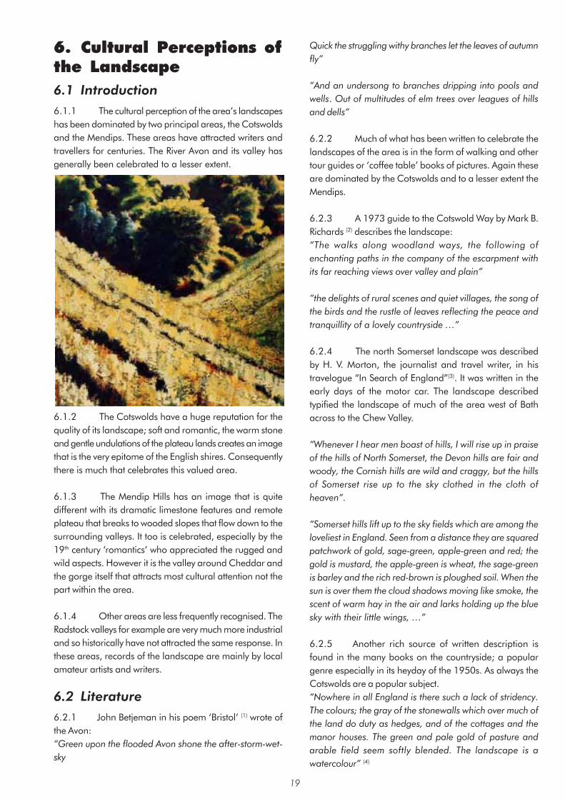
6. Cultural Perceptions of the Landscape 6.1 Introduction 6.1.1 The cultural perception of the area’s landscapes has been dominated by two principal areas, the Cotswolds and the Mendips. These areas have attracted writers and travellers for centuries. The River Avon and its valley has generally been celebrated to a lesser extent.
6.1.2 The Cotswolds have a huge reputation for the quality of its landscape; soft and romantic, the warm stone and gentle undulations of the plateau lands creates an image that is the very epitome of the English shires. Consequently there is much that celebrates this valued area.
6.1.3 The Mendip Hills has an image that is quite different with its dramatic limestone features and remote plateau that breaks to wooded slopes that flow down to the surrounding valleys. It too is celebrated, especially by the 19th century ‘romantics’ who appreciated the rugged and wild aspects. However it is the valley around Cheddar and the gorge itself that attracts most cultural attention not the part within the area.
6.1.4 Other areas are less frequently recognised. The Radstock valleys for example are very much more industrial and so historically have not attracted the same response. In these areas, records of the landscape are mainly by local amateur artists and writers.
6.2 Literature 6.2.1 John Betjeman in his poem ‘Bristol’ (1) wrote of the Avon: “Green upon the flooded Avon shone the after-storm-wet-sky
Quick the struggling withy branches let the leaves of autumn fly”
“And an undersong to branches dripping into pools and wells. Out of multitudes of elm trees over leagues of hills and dells”
6.2.2 Much of what has been written to celebrate the landscapes of the area is in the form of walking and other tour guides or ‘coffee table’ books of pictures. Again these are dominated by the Cotswolds and to a lesser extent the Mendips.
6.2.3 A 1973 guide to the Cotswold Way by Mark B. Richards (2) describes the landscape: “The walks along woodland ways, the following of enchanting paths in the company of the escarpment with its far reaching views over valley and plain”
“the delights of rural scenes and quiet villages, the song of the birds and the rustle of leaves reflecting the peace and tranquillity of a lovely countryside …”
6.2.4 The north Somerset landscape was described by H. V. Morton, the journalist and travel writer, in his travelogue “In Search of England”(3). It was written in the early days of the motor car. The landscape described typified the landscape of much of the area west of Bath across to the Chew Valley.
“Whenever I hear men boast of hills, I will rise up in praise of the hills of North Somerset, the Devon hills are fair and woody, the Cornish hills are wild and craggy, but the hills of Somerset rise up to the sky clothed in the cloth of heaven”.
“Somerset hills lift up to the sky fields which are among the loveliest in England. Seen from a distance they are squared patchwork of gold, sage-green, apple-green and red; the gold is mustard, the apple-green is wheat, the sage-green is barley and the rich red-brown is ploughed soil. When the sun is over them the cloud shadows moving like smoke, the scent of warm hay in the air and larks holding up the blue sky with their little wings, …”
6.2.5 Another rich source of written description is found in the many books on the countryside; a popular genre especially in its heyday of the 1950s. As always the Cotswolds are a popular subject. “Nowhere in all England is there such a lack of stridency. The colours; the gray of the stonewalls which over much of the land do duty as hedges, and of the cottages and the manor houses. The green and pale gold of pasture and arable field seem softly blended. The landscape is a watercolour” (4)
19
6.2.6 There are some poems influenced by the Cotswold countryside. These include Ivor Gurney’s ‘In Flanders Field’ (about a soldier in the trenches of the First World War who is dreaming of the Cotswold countryside) and ‘The High Hills’. Another notable example is Walter Savage Landor’s ‘Widcombe Churchyard’
“The place where soon I think to lie, in its old creviced wall hard by”
6.2.7 A visitor to Combe Hay in the 18th century described the Cam valley landscape as follows.
“Yet bounteous nature here, with lavish hand, Has poured her artless charms o’er hill and dale; Pindaric
Hills, Arcadia all the vale.”
6.3 Art 6.3.1 As with the other cultural activities the Cotswolds and the Mendips are the most celebrated landscapes of the study area. Other parts are recorded by local artists; one notable example is Alan Durman from Saltford. Three of his works are on display in Saltford Community Hall. A large mural, which celebrates the community, shows the landscape as a backdrop to dancing locals. The other two paintings show, in one, the view across Kelston village to Kelston Round Hill, a local landmark, and in the other a typical view of the River Avon.
6.3.2 Somerset has generally been known for its gentle rural scenes, and images have been used in advertising that are typical of the undulating landscape of the Chew Valley. A good example is the 1948 poster for British Rail simply titled ‘Somerset’ painted by Jack Merrion.
6.3.3 The Ealing Comedy ‘The Titfield Thunderbolt’ from 1952 was filmed on location in the Cam Valley. It used the station at Camerton and the old coal railway that ran from Paulton to Dundas Basin taking advantage of the picturesque landscape.
6.4 Music “Cold blows the wind on Costall, In winter, snow and storm, But the heart of England’s in Costall, And the hearts of England’s warm: “(5)
6.4.1 Somerset has a particularly strong tradition for folk music. The great collector of folk music, Cecil Sharp, travelled widely through the west country and collected some of the verses to ‘The Holly and the Ivy’ from West Harptree. Sharp’s collections also formed the basis of Gustav Holst’s ‘Somerset Rhapsody’ and ‘Songs of the West’ as well as Vaughan Williams’ ‘March from Somerset’ in his English Folk Song Suite.
6.4.2 The landscape itself has been an inspiration. Once again this is particularly true of the Cotswolds. Holst, born in Cheltenham, held a deep love of the Cotswold Hills and like Elgar, who famously drew inspirations from the Malverns, used this to great effect in his writings. His Symphony in F ‘The Cotswolds’ (1900) was an early piece that helped establish him as a major composer. Ralph Vaughan Williams was also born in Gloucestershire and again drew upon his early experience of walking in the Cotswold Hills for his Pastoral Symphony and his ‘Cotswold Romance’; a cantata from his opera ‘Hugh the Drover’.
6.4.3 In more recent times composer and performer Peter Gabriel drew inspiration from Solsbury Hill in the song of the same title. The song reflects the mystical nature of the landscape, derived in part from the Iron Age hill fort, and mentions the view towards the city of Bath at night.
“Climbing up on Solsbury Hill I could see the City light Wind was blowing, time stood still “(6)
6.4.4 Acker Bilk is a jazz legend. Born in Pensford in 1929 he became famous in the 1950s and 1960s for his trad jazz hits such as ‘Stranger on the Shore’. His
20
instrumental piece Summer Set reflects his Somerset background. He continues to maintain a house in Pensford but lives in London where he is still much in demand on the jazz circuit. Acker Bilk also played an important part in the growth of the Wurzels as a Somerset music phenomenon. Wurzels songs colourfully depict the agricultural and social details of country living of the area. Songs of particular local significance include ‘When the Common Market comes to Stanton Drew’ and ‘The Chew Magna Cha Cha’.