57
12-13 Nov, 2018 Aguascalientes S-World – global soil map Jetse J. Stoorvogel et al

12-13 Nov, 2018
Aguascalientes
S-World – global soil map
Jetse J. Stoorvogel et al

12-13 Nov, 2018
Aguascalientes
� Background
� The S-world methodology
� Modelling changes in soil resources
� From soil properties to national accounts
� Data quality
� The Mexican application
Overview
2

12-13 Nov, 2018
Aguascalientes
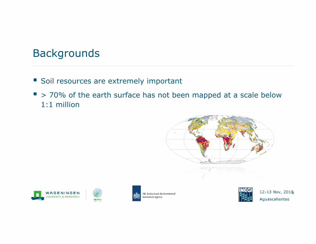
� Soil resources are extremely important
Backgrounds
3
12-13 Nov, 2018
Aguascalientes
� Soil resources are extremely important
� > 70% of the earth surface has not been mapped at a scale below
1:1 million
Backgrounds
4

12-13 Nov, 2018
Aguascalientes
� Soil resources are extremely important
� > 70% of the earth surface has not been mapped at a scale below
1:1 million
� Quantitative insight in soil properties
Backgrounds
5
12-13 Nov, 2018
Aguascalientes
� Soil resources are extremely important
� > 70% of the earth surface has not been mapped at a scale below
1:1 million
� Quantitative insight in soil properties
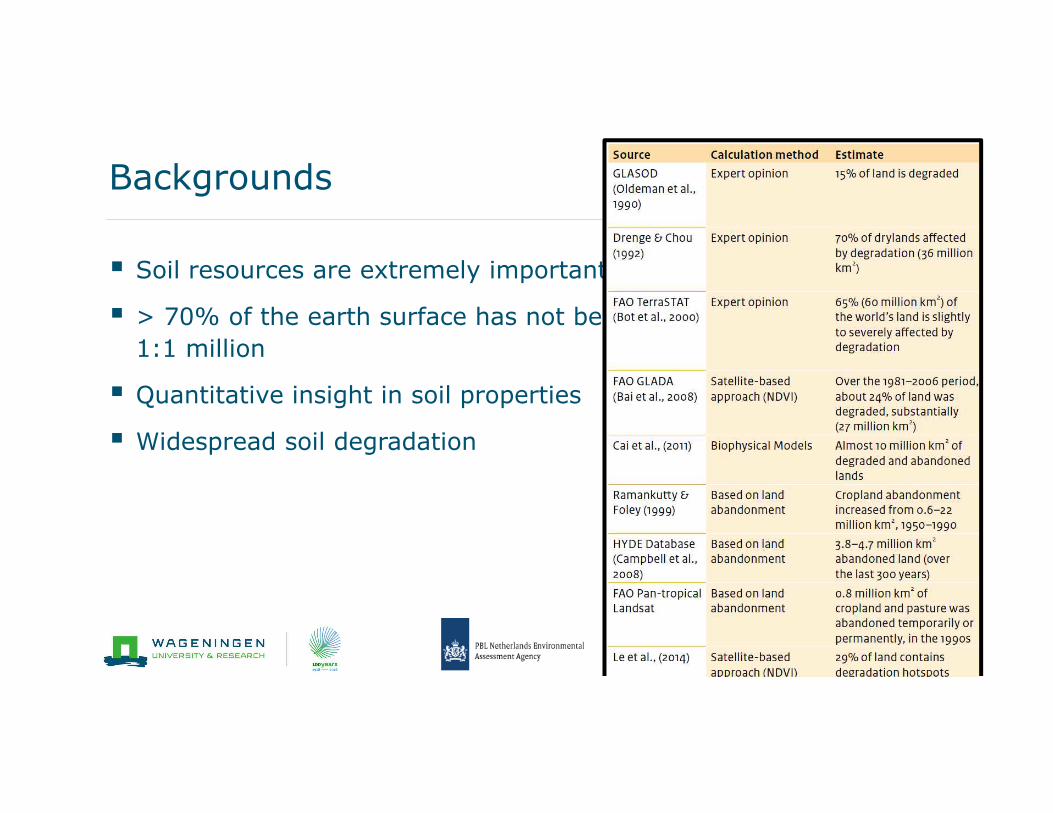
� Widespread soil degradation
Backgrounds
6
12-13 Nov, 2018
Aguascalientes
The challenge
Soil conditions
� Global coverage
� Quantitative
� Consistent
� High resolution
� High quality
� Temporal dynamics
� Based on existing data
12-13 Nov, 2018
Aguascalientes
� Resolution
� Consistency
� Quality
Harmonized World Soil Database

12-13 Nov, 2018
Aguascalientes
The issues - resolution

12-13 Nov, 2018
Aguascalientes
The issues - consistency

12-13 Nov, 2018
Aguascalientes
The issues - Quality
Delineated area
Mapping unit
Soil type(s)
Soil profile
Soil properties

12-13 Nov, 2018
Aguascalientes
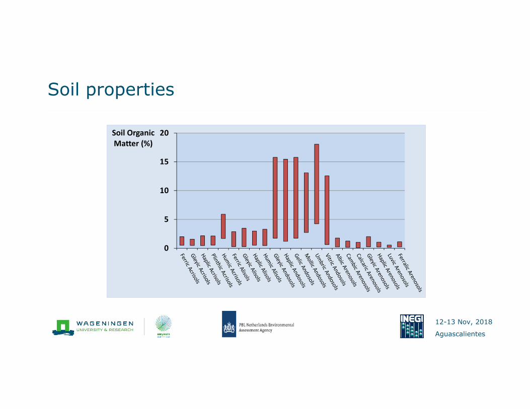
The issues - Quality
0
5
10
15
20Soil Organic
Matter (%)

12-13 Nov, 2018
Aguascalientes
The challenge
Soil conditions
� Global coverage
� Quantitative
� Consistent
� High resolution
� High quality
� Temporal dynamics
� Based on existing data

12-13 Nov, 2018
Aguascalientes
� Background
� The S-world methodology
� Modelling changes in soil resources
� From soil properties to national accounts
� Data quality
� The Mexican application
Overview
14
12-13 Nov, 2018
Aguascalientes
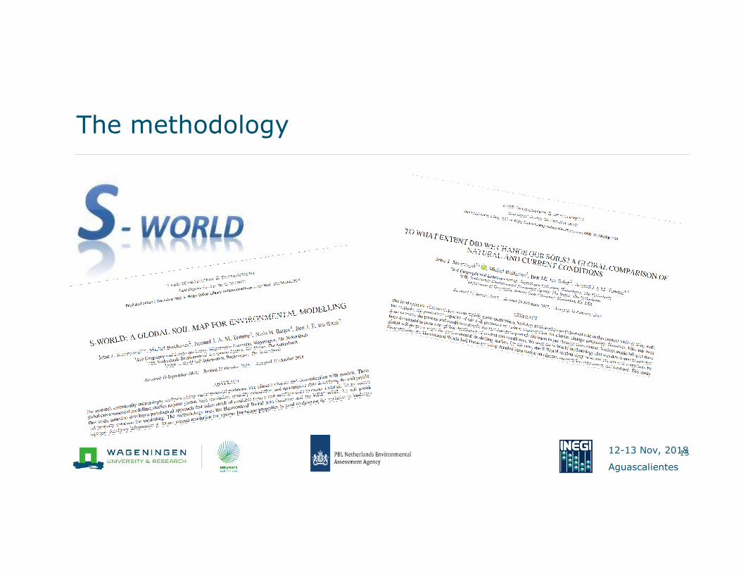
The methodology
15
12-13 Nov, 2018
Aguascalientes
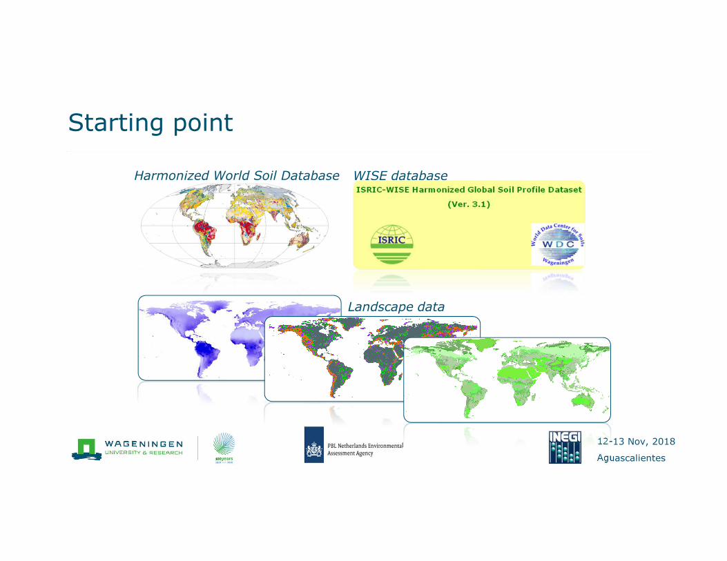
Starting point
Harmonized World Soil Database WISE database
Landscape data

12-13 Nov, 2018
Aguascalientes
S-World
Soil profile database
Soil map
Soil conditions
Landscape data
S-world

12-13 Nov, 2018
Aguascalientes
Step 1: Disaggregating soil associations
Soil association
(60% Cambisol + 40% Vertisol)
Cambisol
Vertisol
12-13 Nov, 2018
Aguascalientes
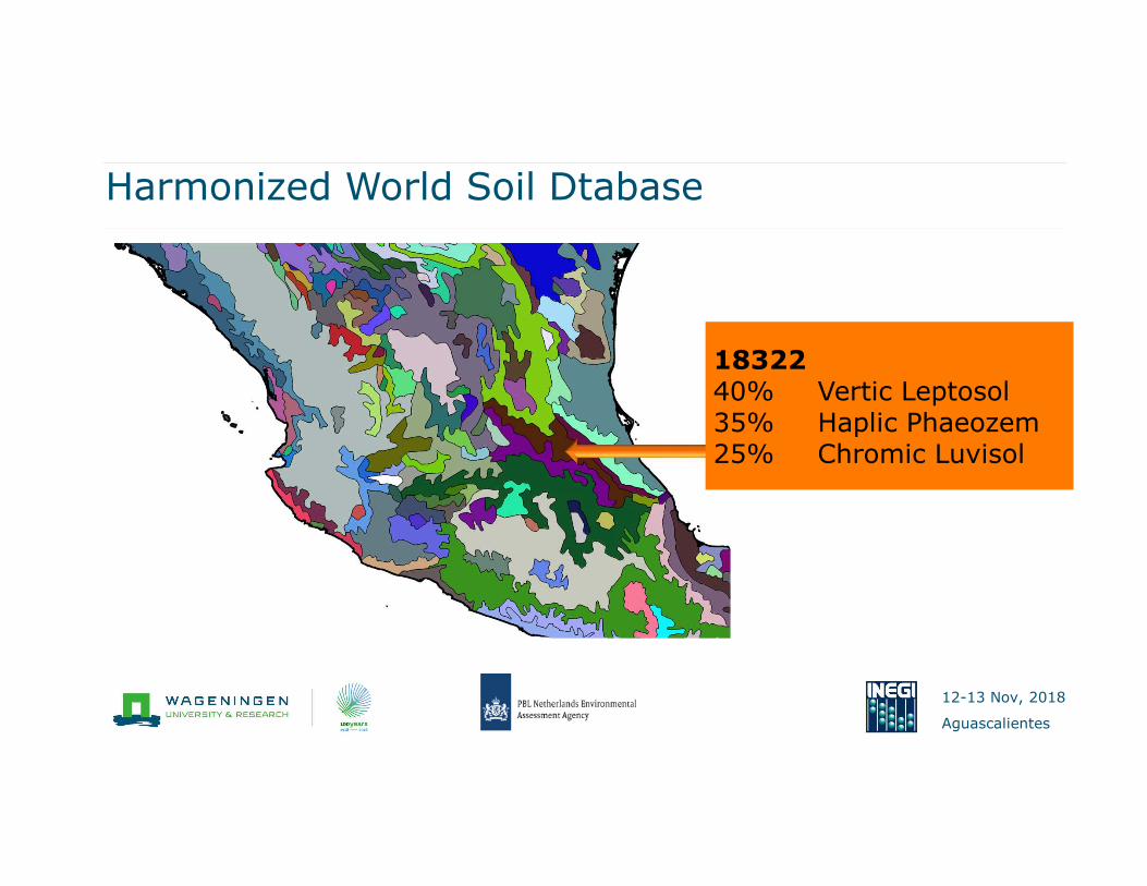
Harmonized World Soil Dtabase
1832240% Vertic Leptosol35% Haplic Phaeozem25% Chromic Luvisol
12-13 Nov, 2018
Aguascalientes
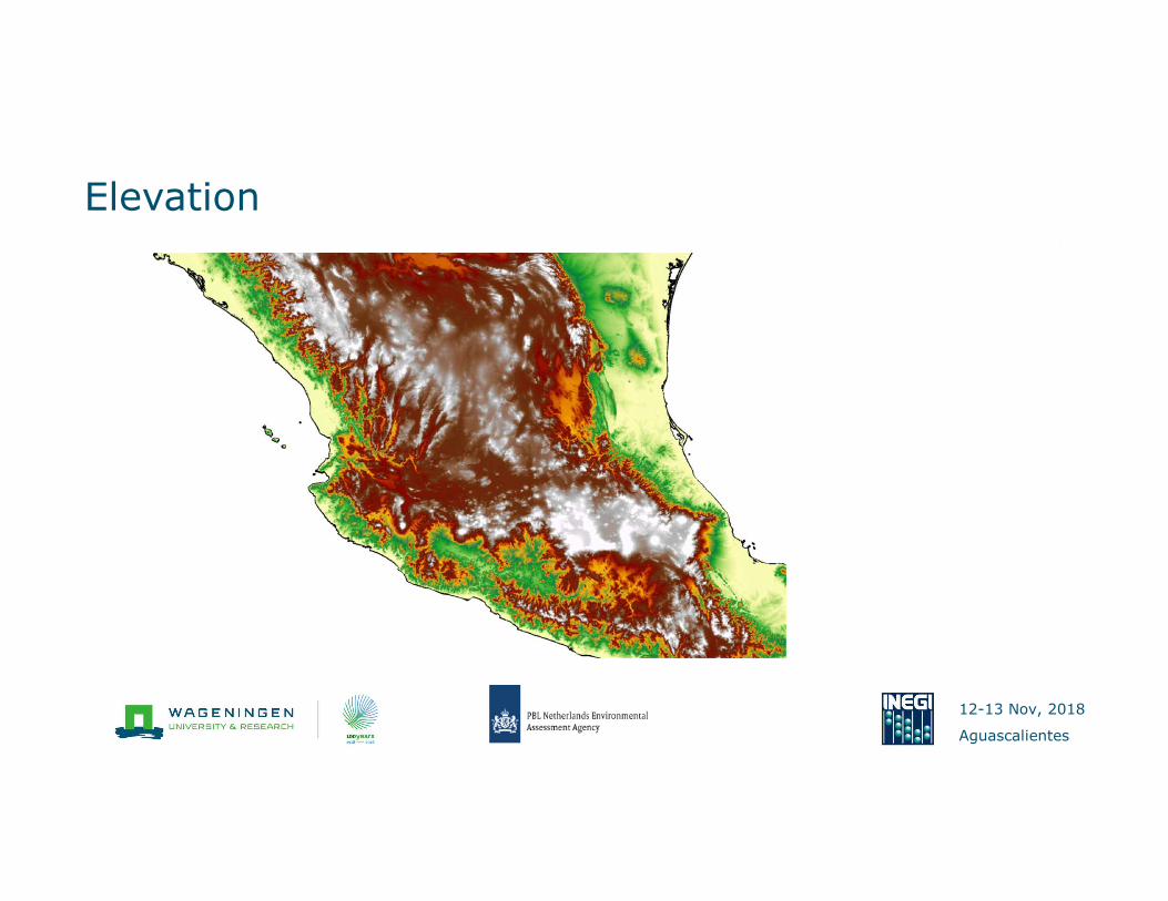
Elevation

12-13 Nov, 2018
Aguascalientes
Disaggregated soil map

12-13 Nov, 2018
Aguascalientes
Step 2: Assigning soil properties
Step 1 Step 2
Soil properties
12-13 Nov, 2018
Aguascalientes
Soil properties
12-13 Nov, 2018
Aguascalientes
Soil properties
0
5
10
15
20Soil Organic
Matter (%)
12-13 Nov, 2018
Aguascalientes
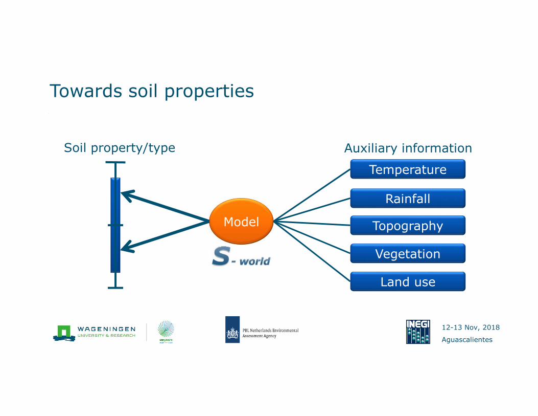
Towards soil properties
Soil property/type Auxiliary information
Temperature
Rainfall
Topography
Vegetation
Land use
Model
12-13 Nov, 2018
Aguascalientes
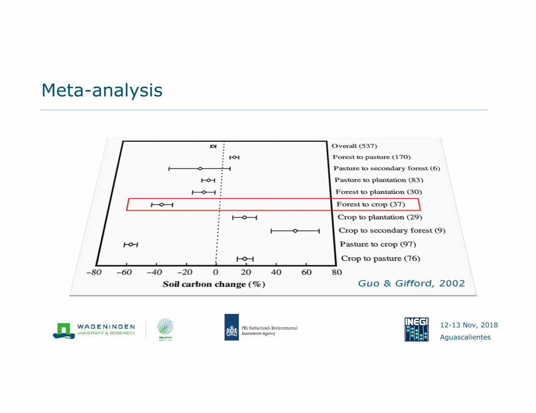
Meta-analysis
12-13 Nov, 2018
Aguascalientes
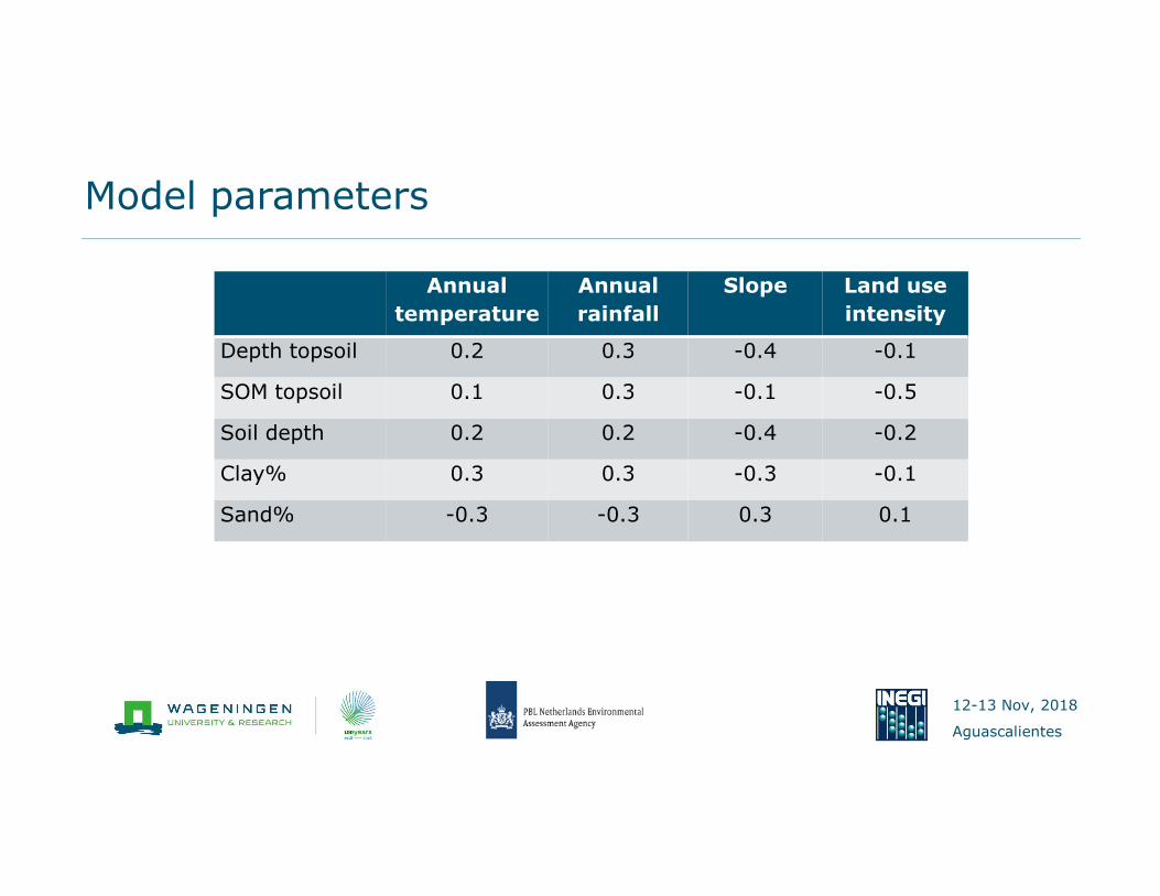
Model parameters
Annual
temperature
Annual
rainfall
Slope Land use
intensity
Depth topsoil 0.2 0.3 -0.4 -0.1
SOM topsoil 0.1 0.3 -0.1 -0.5
Soil depth 0.2 0.2 -0.4 -0.2
Clay% 0.3 0.3 -0.3 -0.1
Sand% -0.3 -0.3 0.3 0.1

12-13 Nov, 2018
Aguascalientes
Global soil property maps
28

12-13 Nov, 2018
Aguascalientes
Global soil property maps
29
Topsoil carbon
0.1%
14%
12-13 Nov, 2018
Aguascalientes
� Background
� The S-world methodology
� Modelling changes in soil resources
� From soil properties to national accounts
� Data quality
� The Mexican application
Overview
30
12-13 Nov, 2018
Aguascalientes
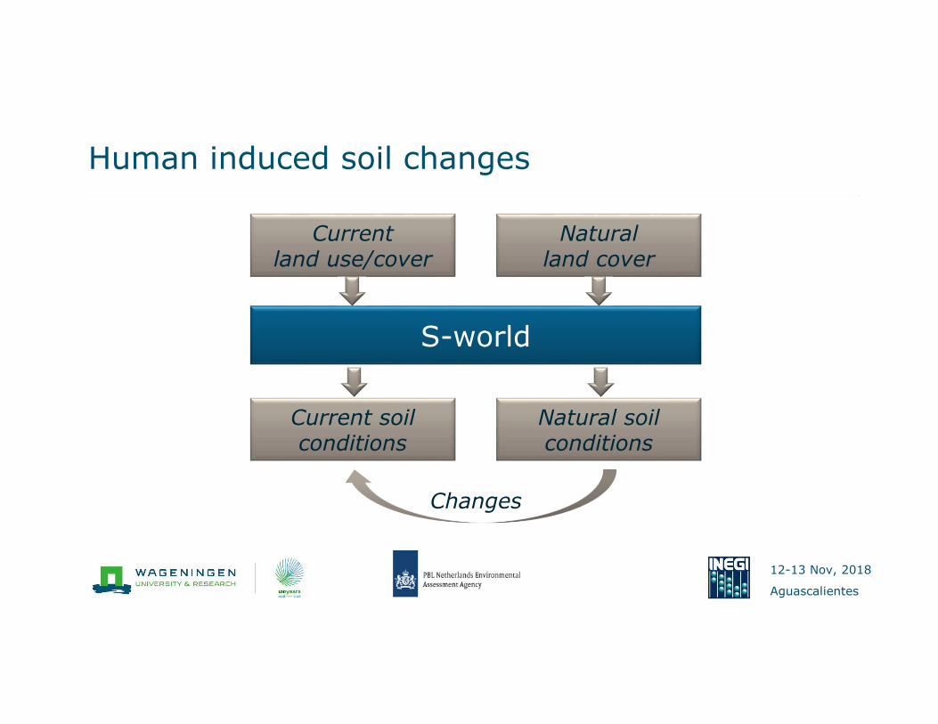
Human induced soil changes
Changes
S-world
Currentland use/cover
Current soil conditions
Natural land cover
Natural soil conditions

12-13 Nov, 2018
Aguascalientes
“Natural” NDVI
CurrentNDVI
Natural areas
Landscape information
Interpolation
Natural NDVI
12-13 Nov, 2018
Aguascalientes
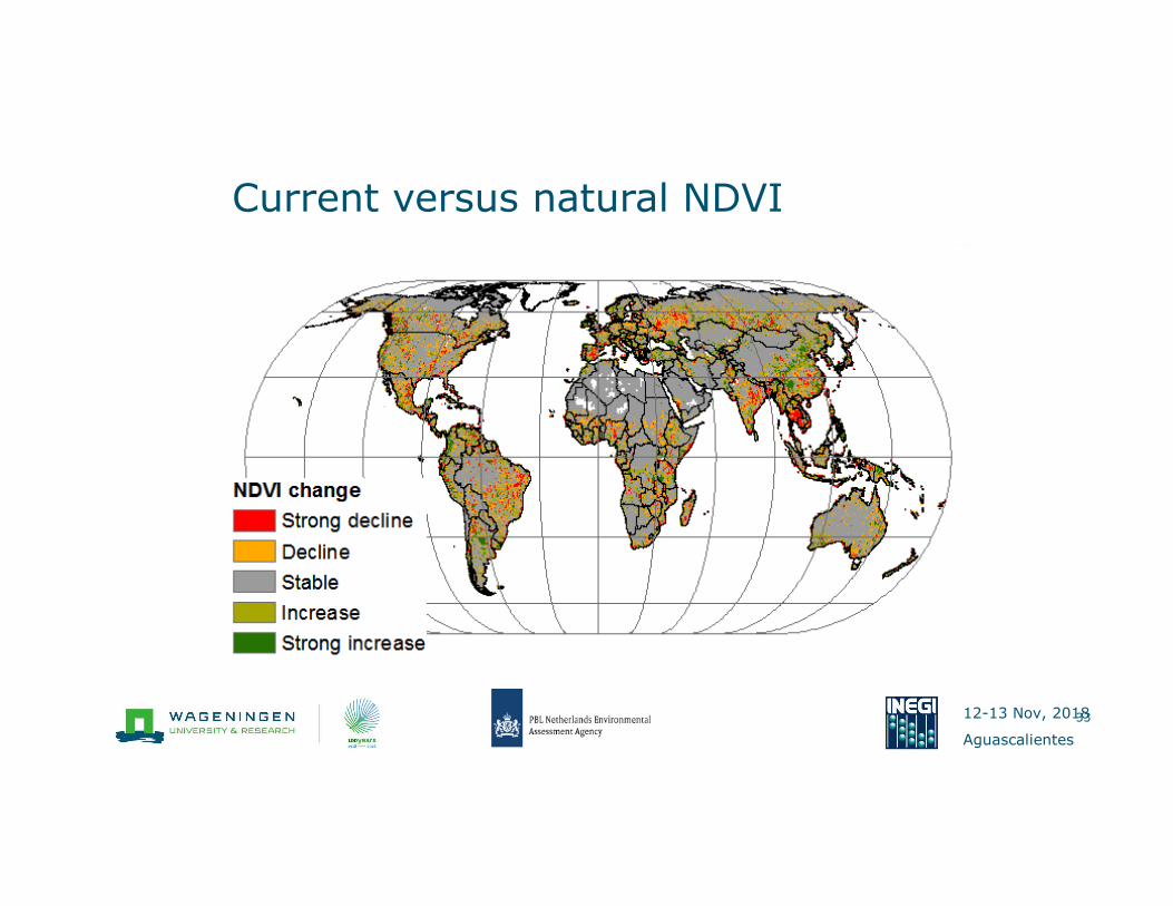
Current versus natural NDVI
33

12-13 Nov, 2018
Aguascalientes
Current versus natural NDVI
34

12-13 Nov, 2018
Aguascalientes
Current versus natural NDVI
35
12-13 Nov, 2018
Aguascalientes
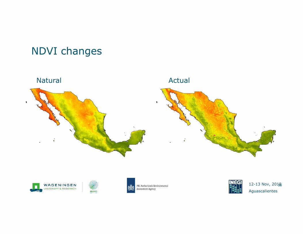
NDVI changes
36
Natural Actual

12-13 Nov, 2018
Aguascalientes
37
Soil Organic Carbon (0-30cm)
< 1.0 %
1.0-1.5 %
1.5-2.0 %
2.0-5.0%
>5.0%
Soil organic Carbon (topsoil)

12-13 Nov, 2018
Aguascalientes
(A net loss of 176 Gt)
Changes in soil organic carbon

12-13 Nov, 2018
Aguascalientes
Changes in topsoil organic carbon
39
0.1%Topsoil carbon
0.1%
14%

12-13 Nov, 2018
Aguascalientes
� Background
� The S-world methodology
� Modelling changes in soil resources
� From soil properties to national accounts
� Data quality
� The Mexican application
Overview
40

12-13 Nov, 2018
Aguascalientes
� Soil organic matter
content
� Clay content
� Sand content
� Soil depth
� pH
From soil properties to ecosystem services
41
� Carbon sequestration
� Water holding capacity
� Infiltration/runoff
� Soil fertility
12-13 Nov, 2018
Aguascalientes
Different levels of properties
42
12-13 Nov, 2018
Aguascalientes
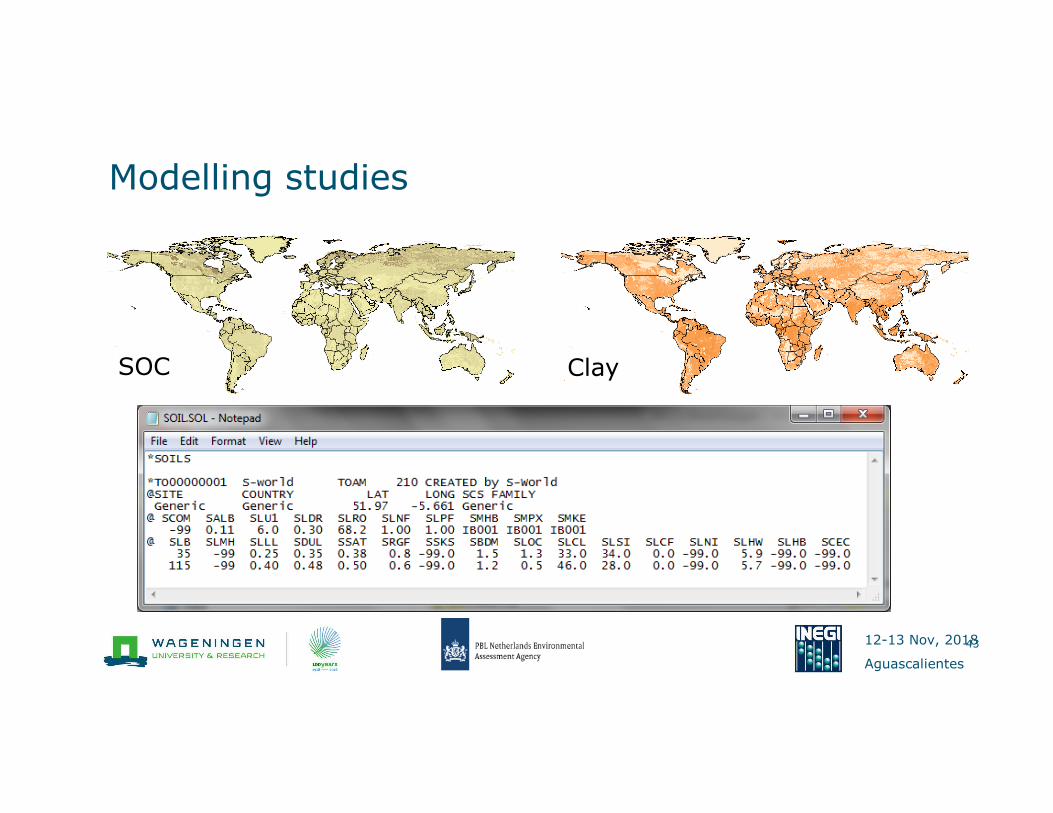
Modelling studies
43
SOC Clay

12-13 Nov, 2018
Aguascalientes
Results

12-13 Nov, 2018
Aguascalientes
Water holding capacity
45
WHC (mm)
30
80
MIN MAX MEAN STD
Aguascalientes 39 81 60 11
Baja California 28 80 53 12
Baja California Sur 32 80 57 9
Campeche 54 81 72 6
Chiapas 47 81 66 6
Chihuahua 29 81 62 10
Coahuila 37 81 65 9
Colima 43 72 67 5
Distrito Federal 45 71 62 8
Durango 29 81 65 10
Guanajuato 33 81 63 8
Guerrero 49 81 65 6
Hidalgo 39 81 66 5
Jalisco 30 81 62 9
México 39 80 64 8
Michoacán 39 81 63 6
Morelos 42 72 64 6
Nayarit 40 81 66 7
Nuevo León 39 81 69 7
Oaxaca 40 81 64 7
Puebla 38 81 65 8
Querétaro 42 81 65 7
Quintana Roo 44 81 77 8
San Luis Potosí 37 81 67 8
Sinaloa 45 81 66 6
Sonora 29 81 63 9
Tabasco 53 74 65 2
Tamaulipas 49 81 64 7
Tlaxcala 43 80 66 7
Veracruz 43 81 65 5
Yucatán 65 81 80 2
Zacatecas 29 81 63 11
12-13 Nov, 2018
Aguascalientes
� Spatial information on soil properties and derived information at a
30arc-sec resolution
� Tabular information per state and municipality
� For current conditions as well as natural conditions
Accounts
46

12-13 Nov, 2018
Aguascalientes
� Background
� The S-world methodology
� Modelling changes in soil resources
� From soil properties to national accounts
� Data quality
� The Mexican application
Overview
47

12-13 Nov, 2018
Aguascalientes
The challenge for the global modeller - data
48
Globcover
Zhe Guo, HarvestChoice
2011 (unpublished).
GLC2000 MODIS Africover

12-13 Nov, 2018
Aguascalientes
S-World
GSDE
HWSDd
IGBP-dis
SoilGrids WISE30d
12-13 Nov, 2018
Aguascalientes
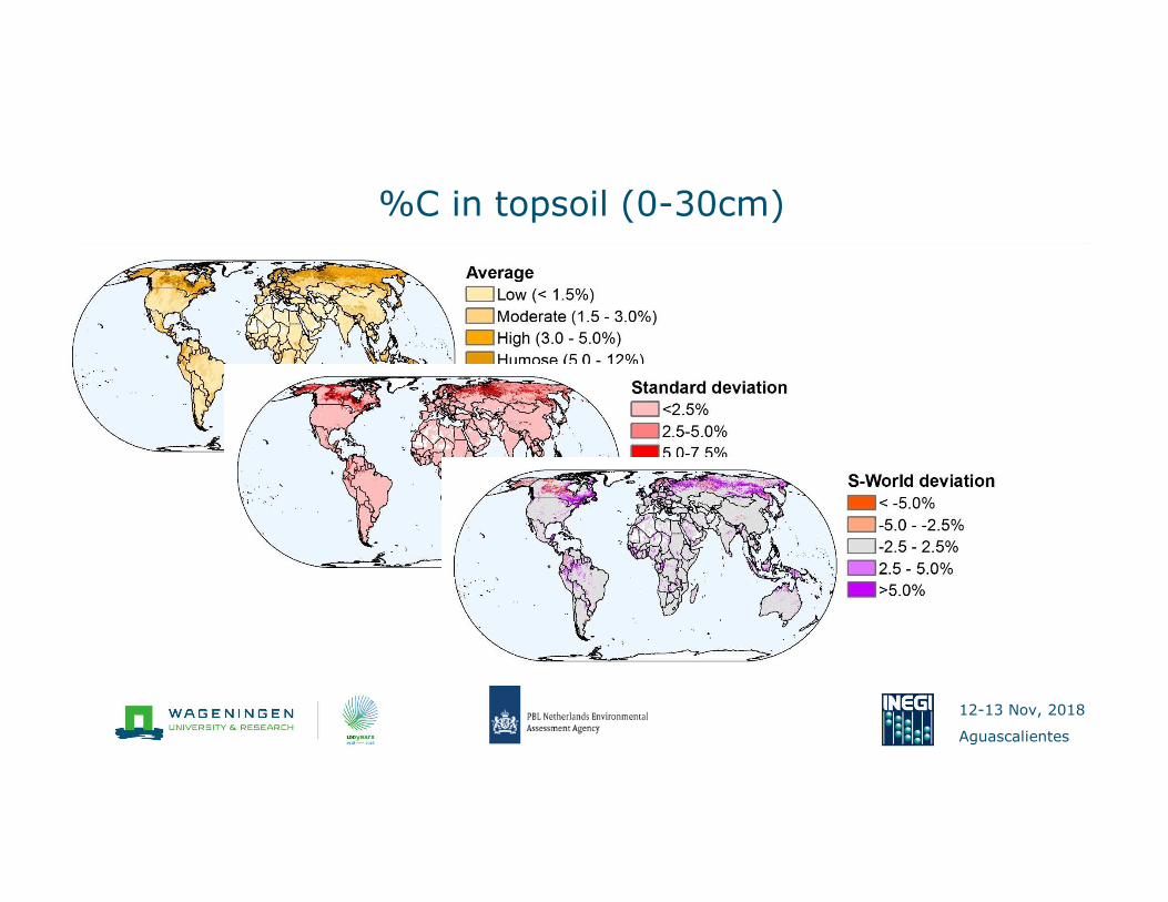
%C in topsoil (0-30cm)
12-13 Nov, 2018
Aguascalientes
� Background
� The S-world methodology
� Modelling changes in soil resources
� From soil properties to national accounts
� Data quality
� The Mexican application
Overview
51

12-13 Nov, 2018
Aguascalientes
The case of Mexico - currently
52
HWSD WISE GlobCov

12-13 Nov, 2018
Aguascalientes
� Soil organic carbon
� Soil texture
� Soil pH
� Soil depth
� Bulk density
� Water holding capacity
� Soil types
Accounts including
53
� Spatial variation at 30
arcsec (1km)
� Current and natural
conditions
� Summary statistics per
state and municipality
12-13 Nov, 2018
Aguascalientes
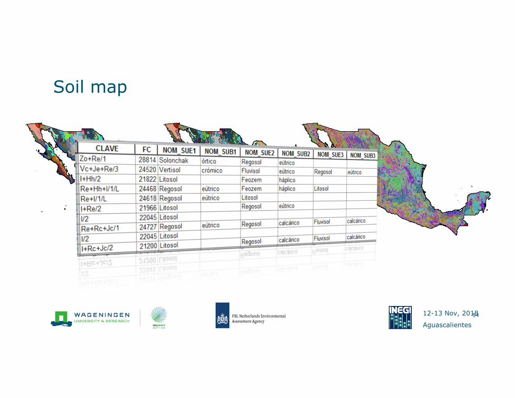
Soil map
54
HWSD LACsoter INEGI
12-13 Nov, 2018
Aguascalientes
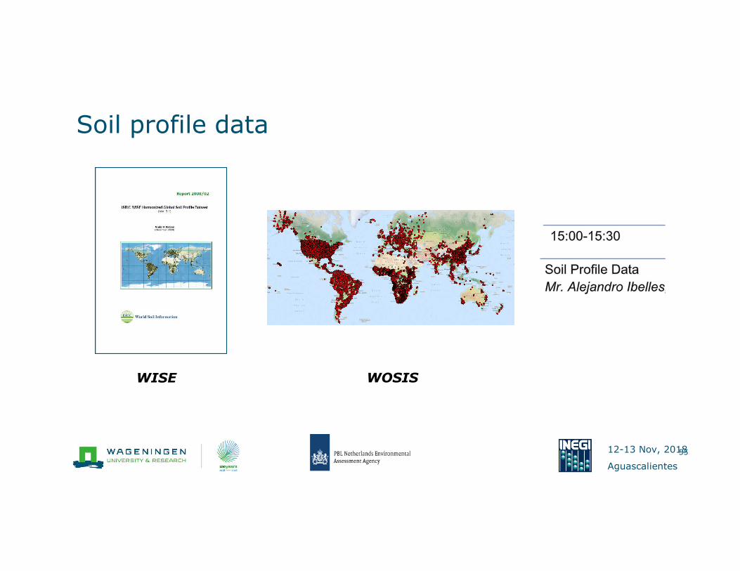
Soil profile data
55
WISE WOSIS
12-13 Nov, 2018
Aguascalientes
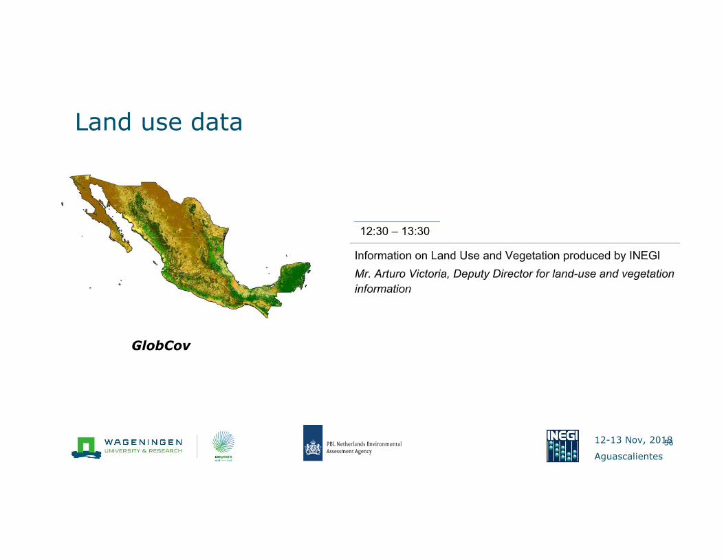
Land use data
56
GlobCov

12-13 Nov, 2018
Aguascalientes
� Use the current S-World
data for soil accounts
� Improve S-World with
Mexican data to get a
specific national accounts.
Future


