20
BookletChart ™ Saipan and Tinian NOAA Chart 81067 A reduced-scale NOAA nautical chart for small boaters When possible, use the full-size NOAA chart for navigation. Included Area
| Date post: | 17-Dec-2018 |
| Category: |
Documents |
| Upload: | nguyenmien |
| View: | 222 times |
| Download: | 0 times |

BookletChart™ Saipan and Tinian NOAA Chart 81067
A reduced-scale NOAA nautical chart for small boaters When possible, use the full-size NOAA chart for navigation.
Included Area

2
Published by the National Oceanic and Atmospheric Administration
National Ocean Service Office of Coast Survey
www.NauticalCharts.NOAA.gov 888-990-NOAA
What are Nautical Charts?
Nautical charts are a fundamental tool of marine navigation. They show water depths, obstructions, buoys, other aids to navigation, and much more. The information is shown in a way that promotes safe and efficient navigation. Chart carriage is mandatory on the commercial ships that carry America’s commerce. They are also used on every Navy and Coast Guard ship, fishing and passenger vessels, and are widely carried by recreational boaters.
What is a BookletChart?
This BookletChart is made to help recreational boaters locate themselves on the water. It has been reduced in scale for convenience, but otherwise contains all the information of the full-scale nautical chart. The bar scales have also been reduced, and are accurate when used to measure distances in this BookletChart. See the Note at the bottom of page 5 for the reduction in scale applied to this chart.
Whenever possible, use the official, full scale NOAA nautical chart for navigation. Nautical chart sales agents are listed on the Internet at http://www.NauticalCharts.NOAA.gov.
This BookletChart does NOT fulfill chart carriage requirements for regulated commercial vessels under Titles 33 and 44 of the Code of Federal Regulations.
Notice to Mariners Correction Status
This BookletChart has been updated for chart corrections published in the U.S. Coast Guard Local Notice to Mariners, the National Geospatial Intelligence Agency Weekly Notice to Mariners, and, where applicable, the Canadian Coast Guard Notice to Mariners. Additional chart corrections have been made by NOAA in advance of their publication in a Notice to Mariners. The last Notices to Mariners applied to this chart are listed in the Note at the bottom of page 7. Coast Pilot excerpts are not being corrected.
For latest Coast Pilot excerpt visit the Office of Coast Survey website at http://www.nauticalcharts.noaa.gov/nsd/searchbychart.php?chart=81067.
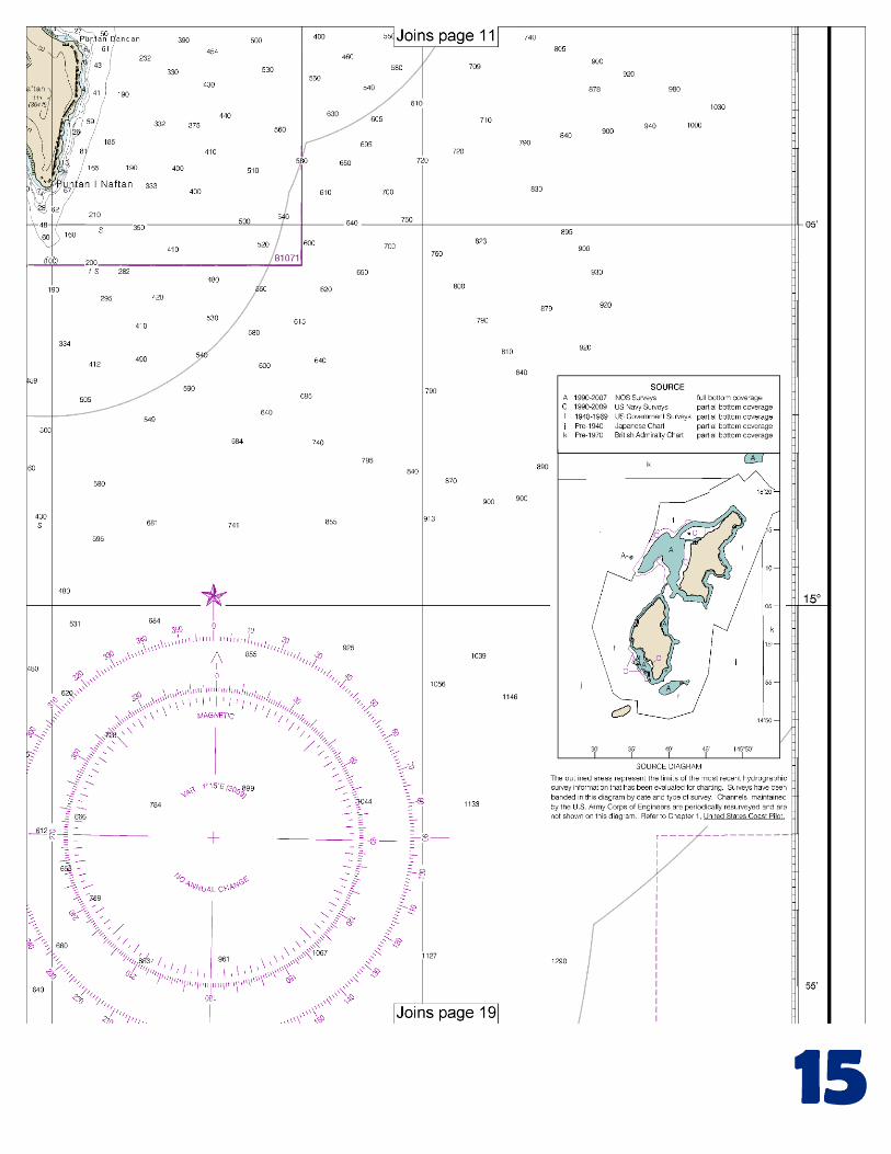
(Selected Excerpts from Coast Pilot) Aguijan Island (14°51'N., 145°33'E.) is about 022°, 42 miles from Rota Island, and it has steep, inaccessible shores. Naftan Rock is about ½ mile southwest of the island’s southwest end. Off-lying banks and dangers.–Esmeralda Bank, about 17 miles northwest of Aguijan Island, has a least depth of about 33 fathoms (60 meters), and can be recognized by the discoloration of the water, which has the appearance of sulphur being emitted. A 30 fathom (54
meters) bank, marked by boiling sulphur, is about 20 miles northwest of Aguijan Island. Banks with greater depths are charted in this vicinity.
A bank, with a depth of 19 fathoms (34 meters) over it, is about 5 miles southwest of Aguijan Island. Tatsumi Reef, centered about 2 miles southeast of the southern end of Tinian Island, is on the northeast side of Tinian Channel. A patch with a depth of 13 fathoms (24 meters) over it is 14 miles west of the north end of Tinian Island. Tinian Island (15°00'N., 145°38'E.) is northeast of Aguijan Island and it is separated from it by Tinian Channel. Tinian Harbor is the name given to the area lying off the southwestern shore of Tinian Island, fronting the town, and including the swept area best shown on the chart. The inner harbor area off Tinian is protected from the sea by a breakwater constructed on the reef that fronts the town. The north end of the breakwater was in ruins (2005). An entrance channel, marked by lighted and unlighted buoys, is entered about ½ mile S of the head of the breakwater and leads NE and NW to a basin off the town of Tinian. In 2007, the controlling depths were 28 feet (8.5 meters) in the entrance channel with lesser depths to 26 feet (7.9 meters) along the edges of the channel, thence 24 feet (7.3 meters) in the basin. A smokestack is about 0.6 mile NNW of the inner harbor in about 14°58'25"N., 145°36'55"E. Anchorages.–Anchorage may be found, in depths of 10 to 20 fathoms (18.3 to 37 meters), sand and coral, good holding ground, off Tinian; however, it is unsafe during the Southwest Monsoon. During westerly winds anchorage may be found in a bay on the northeast side of Tinian Island between Puntan Masalok and Puntan Asiga, in depths of 15 to 25 fathoms (27 to 46 meters); however, this anchorage is reported untenable during strong easterly and northeasterly winds. Explosive anchorages are off the west shore of Tinian Island, off Puntan Diapblo (see 110.239, chapter 2, for limits and regulations.) A security zone is off the west shore of Tinian Island, between Puntan Diapblo and the village of Tinian (see 165.1403, chapter 2, for limits and regulations). Pilotage.–Vessels must obtain permission and acquire a pilot from the authorities at Saipan before entering the harbor. Entering and exiting port is permitted only during daylight hours and “Tinian Port Control” monitors VHF-FM channel 16. Saipan Island (15°10'N., 145°45'E.), the second largest of the Mariana Islands, is northeast of Tinian Island and is separated from it by Saipan Channel. Saipan Channel is deep and clear of known dangers. Saipan Harbor (15°12'N., 145°41'E.), lying on the west side of Saipan Island, includes the outer anchorage, Garapan Anchorage and the inner harbor, Puetton Tanapag. Regulated navigation area.–A security zone has been established in Saipan Harbor. (See 33 CFR 165.1405, chapter 2, for limits/regulations.) Caution.–A sewer outfall extends from a position about 200 yards southwest of the southwest corner of Pier C to a position about 600 yards north-northwest of the northwest corner of the same pier. Unexploded ordnance reported to lie within Anchorage Berth L8. Okino Reef (15°12'41"N., 145°41'48"E.), an isolated shallow area in Garapan Anchorage, has a least depth of 6 feet and is marked by a buoy on the W side. Some mooring buoys and many wrecks are in the harbor. Pilotage.–Pilotage is compulsory; pilots board vessels in the vicinity of Tanapag Harbor Approach Lighted Buoy T.
U.S. Coast Guard Rescue Coordination Center 24 hour Regional Contact for Emergencies
RCC Honolulu Commander 14th CG District (808) 535-3333 Honolulu, HI

G
NOAA’s navigation managers serve as ambassadors to the maritime community. They help identify navigational challenges facing professional and recreational mariners, and provide NOAA resources and information for safe navigation. For additional information, please visit nauticalcharts.noaa.gov/service/navmanagers
To make suggestions or ask questions online, go to nauticalcharts.noaa.gov/inquiry. To report a chart discrepancy, please use ocsdata.ncd.noaa.gov/idrs/discrepancy.aspx.
Lateral System As Seen Entering From Seaward on navigable waters except Western Rivers
PORT SIDE
ODD NUMBERED AIDS
GREEN LIGHT ONLY
FLASHING (2)
PREFERRED CHANNEL
NO NUMBERS – MAY BE LETTERED
PREFERRED CHANNEL TO
STARBOARD
TOPMOST BAND GREEN
PREFERRED CHANNEL
NO NUMBERS – MAY BE LETTERED
PREFERRED CHANNEL
TO PORT
TOPMOST BAND RED
STARBOARD SIDE
EVEN NUMBERED AIDS
RED LIGHT ONLY
FLASHING (2)
FLASHING FLASHING
OCCULTING GREEN LIGHT ONLY RED LIGHT ONLY OCCULTING QUICK FLASHING QUICK FLASHING
ISO COMPOSITE GROUP FLASHING (2+1) COMPOSITE GROUP FLASHING (2+1) ISO
"1"
Fl G 6s
G "9"
Fl G 4s
GR "A"
Fl (2+1) G 6s
RG "B"
Fl (2+1) R 6s
"2"
Fl R 6s
8
R "8"
Fl R 4s
LIGHT
G
C "1"
LIGHTED BUOY
G
"5"
GR
"U"
GR
C "S"
RG
N "C"
RG
"G"
LIGHT
6
R
N "6"
LIGHTED BUOY
R
"2
"
CAN DAYBEACON
CAN NUN NUN
DAYBEACON
For more information on aids to navigation, including those on Western Rivers, please consult the latest USCG Light List for your area.
These volumes are available online at http://www.navcen.uscg.gov
Navigation Managers Area of Responsibility
Northeast
Lt. Meghan McGovern
Northwest and
Pacific Islands
Crescent Moegling
Great Lakes Region
Tom Loeper
Chesapeake and
Delaware Bay
Steve Soherr
California
Jeff Ferguson
[email protected] Mid-Atlantic
Lt. Ryan Wartick
Alaska
Lt. Timothy M. Smith
Western Gulf Coast
Alan Bunn
Central Gulf Coast
Tim Osborn
[email protected] South Florida
Puerto Rico
U.S. Virgin Islands
Michael Henderson
Southeast
Kyle Ward
2
2 C U 5
1


VHF Marine Radio channels for use on the waterways:Channel 6 – Inter-ship safety communications.Channel 9 – Communications between boats and ship-to-coast.Channel 13 – Navigation purposes at bridges, locks, and harbors.Channel 16 – Emergency, distress and safety calls to Coast Guard and others, and to initiate calls to other
vessels. Contact the other vessel, agree to another channel, and then switch.Channel 22A – Calls between the Coast Guard and the public. Severe weather warnings, hazards to navigation and safety warnings are broadcast here.Channels 68, 69, 71, 72 and 78A – Recreational boat channels.
Getting and Giving Help — Signal other boaters using visual distress signals (flares, orange flag, lights, arm signals); whistles; horns; and on your VHF radio. You are required by law to help boaters in trouble. Respond to distress signals, but do not endanger yourself.
EMERGENCY INFORMATION
Distress Call Procedures
• Make sure radio is on.• Select Channel 16.• Press/Hold the transmit button.• Clearly say: “MAYDAY, MAYDAY, MAYDAY.”• Also give: Vessel Name and/or Description;Position and/or Location; Nature of Emergency; Number of People on Board.• Release transmit button.• Wait for 10 seconds — If no responseRepeat MAYDAY call.
HAVE ALL PERSONS PUT ON LIFE JACKETS!
This Booklet chart has been designed for duplex printing (printed on front and back of one sheet). If a duplex option is not available on your printer, you may print each sheet and arrange them back-to-back to allow for the proper layout when viewing.
QR
Quick ReferencesNautical chart related products and information - http://www.nauticalcharts.noaa.gov
Interactive chart catalog - http://www.charts.noaa.gov/InteractiveCatalog/nrnc.shtmlReport a chart discrepancy - http://ocsdata.ncd.noaa.gov/idrs/discrepancy.aspx
Chart and chart related inquiries and comments - http://ocsdata.ncd.noaa.gov/idrs/inquiry.aspx?frompage=ContactUs
Chart updates (LNM and NM corrections) - http://www.nauticalcharts.noaa.gov/mcd/updates/LNM_NM.html
Coast Pilot online - http://www.nauticalcharts.noaa.gov/nsd/cpdownload.htm
Tides and Currents - http://tidesandcurrents.noaa.gov
Marine Forecasts - http://www.nws.noaa.gov/om/marine/home.htm
National Data Buoy Center - http://www.ndbc.noaa.gov/
NowCoast web portal for coastal conditions - http://www.nowcoast.noaa.gov/
National Weather Service - http://www.weather.gov/
National Hurrican Center - http://www.nhc.noaa.gov/
Pacific Tsunami Warning Center - http://ptwc.weather.gov/
Contact Us - http://www.nauticalcharts.noaa.gov/staff/contact.htm
NOAA’s Office of Coast Survey The Nation’s Chartmaker
For the latest news from Coast Survey, follow @NOAAcharts
NOAA Weather Radio All Hazards (NWR) is a nationwide network of radio stations broadcasting continuous weather information directly from the nearest National Weather Service office. NWR broadcasts official Weather Service warnings, watches, forecasts and other hazard information 24 hours a day, 7 days a week. http://www.nws.noaa.gov/nwr/


