FILING INSTRUCTIONS San Gabriel/Verdugo Mountains Scenic San Gabriel/Verdugo Mountains Scenic San Gabriel/Verdugo Mountains Scenic San Gabriel/Verdugo Mountains Scenic Preservation Specific Plan Preservation Specific Plan Preservation Specific Plan Preservation Specific Plan 1. Read ALL instructions carefully . Missing or incomplete materials can cause delays. 2. Before designing the project, review the San Gabriel/Verdugo Mountains Scenic Preservation Specific Plan, which can be found at the Planning Department website: www.lacity.org/PLN or can be purchased at the City Planning Public Counter. 3. Contact City Planning San Gabriel/Verdugo staff by phone to schedule an appointment to review your original submittal before photocopies of additional sets are made. Planning staff are located at 6262 Van Nuys, Suite 351, Van Nuys, CA 91401. For questions and/or additional information contact Claudia Rodriguez (818) 374-5060. 4. All submitted application materials, drawings, plans, etc. should be on 8 ½" x 11", 8 ½" x14", or 11"x17" paper. Oversize plans submitted should be folded down to approximately 8 ½" x 14". Please provide 3 collated copies of the following (including the original copy) : ” *1. San Gabriel/Verdugo Mountains Specific Plan Application Form. ” *2. Master Land Use Permit Application completed and signed by property owner(s) & notarized. If the property is owned by a corporation/company, include a letter on company letterhead stating that the signer has authority to sign. ” *3. Written Narrative describing the nature of the project, addressing the Specific Plan design criteria and guidelines, and presenting findings regarding the project’s consistency with the Specific Plan. ” *4. ZIMAS Map and Parcel Profile Report (can be provided by San Gabriel/Verdugo Staff). ” *5. Vicinity Map with scale and directional arrow, indicating the location of the Project site in relation to nearby streets. (Thomas Guide map is acceptable.) ” *6. Plot/ Site Plan (Follow Los Angeles City Planning Department Plot Plan Instructions). Additionally, show all existing oak trees, fire pits or picnic tables, if any. ” 7. Topographic Survey Superimposed on a topographic map signed by a Civil Engineer or Licensed Surveyor in the State of California, show the following: (a) Existing structures with the lowest elevation within 5 feet of the perimeter of the building and the highest elevation at the peak of the roof ridge. (See the height determination example attached). - 1 -
Transcript
FILING INSTRUCTIONS
San Gabriel/Verdugo Mountains Scenic San Gabriel/Verdugo Mountains Scenic San Gabriel/Verdugo Mountains Scenic San Gabriel/Verdugo Mountains Scenic Preservation Specific PlanPreservation Specific PlanPreservation Specific PlanPreservation Specific Plan
1. Read ALL instructions carefully. Missing or incomplete materials can cause delays.
2. Before designing the project, review the San Gabriel/Verdugo Mountains Scenic PreservationSpecific Plan, which can be found at the Planning Department website: www.lacity.org/PLNor can be purchased at the City Planning Public Counter.
3. Contact City Planning San Gabriel/Verdugo staff by phone to schedule an appointment to
review your original submittal before photocopies of additional sets are made. Planning staffare located at 6262 Van Nuys, Suite 351, Van Nuys, CA 91401. For questions and/oradditional information contact Claudia Rodriguez (818) 374-5060.
4. All submitted application materials, drawings, plans, etc. should be on 8 ½" x 11", 8 ½" x14",or 11"x17" paper. Oversize plans submitted should be folded down to approximately 8 ½"x 14".
Please provide 3 collated copies of the following (including the originalcopy):
” *1. San Gabriel/Verdugo Mountains Specific Plan Application Form.
” *2. Master Land Use Permit Application completed and signed by property owner(s) ¬arized. If the property is owned by a corporation/company, include a letter on companyletterhead stating that the signer has authority to sign.
” *3. Written Narrative describing the nature of the project, addressing the Specific Plan designcriteria and guidelines, and presenting findings regarding the project’s consistency with theSpecific Plan.
” *4. ZIMAS Map and Parcel Profile Report (can be provided by San Gabriel/Verdugo Staff).
” *5. Vicinity Map with scale and directional arrow, indicating the location of the Project site in
relation to nearby streets. (Thomas Guide map is acceptable.)
” *6. Plot/ Site Plan (Follow Los Angeles City Planning Department Plot Plan Instructions).Additionally, show all existing oak trees, fire pits or picnic tables, if any.
” 7. Topographic Survey Superimposed on a topographic map signed by a Civil Engineer or Licensed Surveyor in the
State of California, show the following:
(a) Existing structures with the lowest elevation within 5 feet of the perimeter of the building andthe highest elevation at the peak of the roof ridge. (See the height determination exampleattached).
- 1 -
(b) If the project site is located within 60 vertical feet from any point along the long axis of thecrest of a Prominent Ridgeline, designated on Map No. 2 (shaded areas), provide projectelevations in relation to the highest point of the crestline, with both 60 and 25 vertical feetfrom that point clearly indicated on the survey.
(c) If the project site is located in whole or in part within a Scenic Corridor, the section(s) shallextend to the centerpoint of the Scenic highway adjacent to the project site.
(d) Streams or blueline streams, if any.
” *8. Building Elevations (all facades) with dimensions and building heights, measured per
Department of Building and Safety requirements. Height calculations shall also include thecorresponding elevation points. Additionally, if your property is located within the areas labeledas A and B on Map 2, where Prominent Ridgeline Protection Areas are shown on only one sideof a ridge line, show the elevations in relation to the applicable protected ridge.
” *9. Color photographs and renderings:
(a) Showing the Project site, surrounding areas, and any surrounding buildings with index mapindicating where photos were taken.
(b) Showing the proposed Project as viewed from the Right of Way of all the Scenic Highways
from which the Project may be visible with an index map indicating where photos weretaken. Clearly mark on photographs the location of the Project. If Project is “not visible”,mark and label the feature on the photograph which blocks the project.
(c) Color renderings of the proposed project.
” *10. Grading Plan showing conformance with landform grading, existing elevations, proposed
elevations, proposed drainage system, as well as amounts of cut, fill, export, and/or import (ifapplicable).
” *11. Any information on related discretionary cases (e.g. Conditional Use Permit, ZoneVariance, etc.).
” 12. Landscape Planting Plan prepared by a State licensed Landscape Architect orArchitect.
” 13. Proposed Irrigation Plan.
Additional Materials for Commercial/Industrial Projects:
” 14. Sign Plan. Provide a plan of the sign and specification data sheet, indicate sign type (wallor monument sign etc., number, size, color, illumination, and materials etc.).
” 15. Roof and Screening Materials. Indicate roof material, and screening of roof mountedstructures and equipment.
*Also Applies to Commercial & Industrial Projects
- 2 -
” 16. Fencing. A plan showing the type of fencing, color and materials.
” 17. Projects that require 20 or more surface parking spaces: shall include in siteplan the location of Bicycle racks and Pedestrian Access.
The following materials may be required at the discretion of City Planning
Staff depending on the nature of the application, including, but not limited to
the following:
” 18. Arborist Report by a certified Arborist (required for projects affecting oak trees).
” 19. Geology and Soils Report, as approved by the Los Angeles Department of Building andSafety, for project grading.
” 20. Mailing Labels of Adjacent/Abutting Property Owners, listed on maps (2 copies) with 2
sets of self-adhesive mailing labels and keyed to a vicinity map. Be sure to include the
applicants, owners, and representatives names on the labels.
” 21. The mailing labels should include the following agencies as listed on the
application handout:
• Department of Building & Safety• Neighborhood Council• Council District 2 Office
” 22. “Perjury Statement” certifying the lists’ accuracy to the adjacent property owners list(attached).
Items completed at time of filing:
” 23. Environmental Documentation Confirm with San Gabriel/Verdugo Planning Staff thetype of environmental clearance needed for the project.
” 24. Fees are set by section 19.01 Q of the Los Angeles Municipal code. Checks should be madepayable to the City of Los Angeles. (A copy of the most recent fee schedule can be obtainedat the Planning Public Counter.)
Project Type:� Single family residential� Commercial/Industrial� New Construction � Addition� Structural Alteration/Remodel� Grading� Other: _______________
Project Address: ____________________________________________________________Assessor Parcel Number (APN):_________________________________________________Proposed Project Description: (Describe in detail, including ALL proposed work and dimensions)
*Also Applies to Commercial & Industrial Projects 2
� *1. Property Description: Total Lot Area: _________ sq. ft.
� *2. Property Location: Is the project located in whole or in part in the following areas?
Prominent Ridgeline Protection Area (60 vertical feet from any point along the long axis of the crest of a Prominent Ridgeline that are visible from the ROW of any Scenic Highways listed in the Specific Plan, and shown on Map No. 2 as a shaded area). Yes ___ No ___
Scenic Highway Corridor Viewshed (area extending 500 feet on either side of the centerline of the specified roadways listed in the Specific Plan, and shown on Map No. 1). Yes ___ No ___
� *3. Project Building Height (as defined by the Dept of Building and Safety):
Existing structure(s): ________ ft. Proposed structure(s): ________ ft.
� 4. Grading: How many cubic yards of cut and/or fill is involved?
� 5. Elevation of the crest of the Prominent Ridgeline on the Site: Will the project’s grading or berming alter the elevation of the crest of the
Prominent Ridgeline on the site? Yes ___ No ___ � 6. Oak Trees:
Does the project propose moving or cutting down any oak trees? Yes ___ No ___Number of oaks trees to be cut down _____________Trunk Diameter _____________
� 7. Streams: Does the project site contain any streams or blueline streams? Yes ___ No ___
� 8. Prohibited Plant Materials: Will any of the prohibited plant materials listed on page 13 of the San Gabriel/Verdugo Mountains Scenic Preservation Specific Plan be planted? Yes ___ No ___
� 9. Native Vegetation: Will any native vegetation be removed within any Prominent Ridgeline Protection Area, except for driveways, building footprints and any required equine pad or stable areas, or as necessary to meet fire safety and brush clearance regulations. Yes ___ No ___
� 10. Project Amenities: Will any fire pits, picnic tables, or other similar structures associated with residential lots be located within any Prominent Ridgeline Protection Area that will be visible from the ROW of any of the Scenic Highways? Yes ___ No ___
*Also Applies to Commercial & Industrial Projects 3
Additional Materials for Commercial/ Industrial Projects:
� 11. Will the project have the following:
Exterior Lighting Yes ___ No ___
New Roof and Roof Mounted Structures Yes ___ No ___
Fencing, Gate Materials, and Walls Yes ___ No ___
Landscaping (for new projects visible from the ROW of any of the Scenic Highways) Yes ___ No ___
Landscaped Setbacks Yes ___ No ___
� 12. Surface Parking Existing number of spaces ______________
MASTER LAND USE PERMIT APPLICATION LOS ANGELES CITY PLANNING DEPARTMENT
Planning Staff Use Only
ENV No. Existing Zone District Map
APC Community Plan Council District
Census Tract APN Staff Approval * Date* Approval for Filing by Community Planning or Division of Land Staff, When Applicable
CASE NO. APPLICATION TYPE
(zone change, variance, conditional use, tract/parcel map, specific plan exception, etc.)
1. PROJECT LOCATION AND SIZE
Street Address of Project Zip Code
Legal Description: Lot Block Tract
Lot Dimensions Lot Area (sq. ft.) Total Project Size (sq. ft.)
2. PROJECT DESCRIPTION
Describe what is to be done:
Present Use: Proposed Use:
Plan Check No. (if available) Date Filed:
Check all that apply: � New Construction � Change of Use � Alterations � Demolition
� Commercial � Industrial � Residential
Additions to the building: � Rear � Front � Height � Side Yard
3. ACTION(S) REQUESTED
Describe the requested entitlement which either authorizes actions OR grants a variance:
Code Section from which relief is requested: Code Section which authorizes relief:
Code Section from which relief is requested: Code Section which authorizes relief:
Code Section from which relief is requested: Code Section which authorizes relief:
Code Section from which relief is requested: Code Section which authorizes relief:
List related or pending case numbers relating to this site:
Page 2 of 2
4. SIGNATURES of adjoining or neighboring property owners in support of the request; not required but helpful, especially for projects in single-family residential areas. (Attach sheet, if necessary)
NAME (Print) SIGNATURE ADDRESS KEY # ON MAP
5. OWNER/APPLICANT INFORMATION
Applicant's Name Company
Address: Telephone: ( ) Fax: ( )
Zip: E-mail:
Property Owner's Name (if different than applicant)
Address: Telephone: ( ) Fax: ( )
Zip: E-mail:
Contact Person for project Information
Address: Telephone: ( ) Fax: ( )
Zip: E-mail:
6. APPLICANT’S AFFIDAVIT
Under penalty of perjury the following declarations are made:
a. The undersigned is the owner or lessee if entire site is leased, or authorized agent of the owner with power of attorney or officers of a corporation(submit proof). (NOTE: for zone changes lessee may not sign).
b. The information presented is true and correct to the best of my knowledge.
Signature:
Print:
Date:
Subscribed and sworn before me this (date):
In the County of , State of California
Notary Public
Stamp:
7. ADDITIONAL INFORMATION/FINDINGS
In order for the City to render a determination on your application, additional information may be required. Consult the appropriate "Special Instructions"handout. Provide on attached sheet(s) this additional information using the hand-out as a guide.
NOTE: All applicants are eligible to request a one time, one-year only freeze on fees charged by various City departments in connection with your project.It is advisable only when this application is deemed complete or upon payment of Building and Safety plan check fees. Please ask staff for details or anapplication.
Plot Plans submitted to City Planning Department must comply with the following specifications. Additional materialsor information may be required according to each type of application. Application forms are available on theCity’s web site (go to www.lacity.org/PLN and choose Forms/Procedures) and at the Planning Department PublicCounters, located at 201 N. Figueroa Street, 4th Floor, Los Angeles, CA 90012 (phone: 213-482-7077) and at6262 Van Nuys Boulevard, Room 251, Van Nuys, CA 91401 (phone: 818-374-5050). NOTE: Counter staff will not review or accept an application if it determines that the Plot Plan is not legibleor is otherwise inadequate. Include only information necessary to depict the project and its setting (do not includemechanical drawings). A Plot Plan that does not substantially conform with these instructions, or is unclearor unreadable, will result in an application being deemed incomplete and suspend its processing.
1. Plot Plan shall include all property in the project site or ownership (whichever is larger) unless written permissionhas been obtained from a Public Counter staff supervisor to include an area less than the entire site or ownership.
2. Plot Plan shall include and conform to the following technical requirements:
a. Scale shall be 1/16" = 1' or larger for full size drawings. Plot Plan shall be accurate to within 0.1"b. North shall be shown and oriented towards the top of the pagec. Boundary of Plot Plan shall be shown by a heavy-broken lined. Street Address of sitee. Legal Description of sitef. Names of abutting streetsg. Dimensions shall be provided for all important distances, including:
1) Yards and setbacks, building footprints, other key features (as appropriate)2) Zones, if there is more than one zone on site
3. Plot Plan must clearly and completely show the intent of the project and its uses and their locations on the site.Clearly identify and differentiate the following features (and include dimensions for important distances):
a. Location and uses of all buildings and structures (including walls and fences):1) Existing structures to be demolished2) Existing buildings and structures to remain3) Proposed structures to be constructed or added
b. Requested change or part of project subject to approvalc. Parking areas (including stalls), on-site circulation, and access to the sited. Landscape vs. Hardscape areas where site is not covered by buildings (show qualifying required Open Space)e. Alleys and other public rights-of-way and easementsf. Topography of site (where more than 5-foot elevation difference in slope)g. Parking table (number of existing, required, and proposed parking stalls)h. Open Space table (square feet for required and proposed Open Space, when 6 or more residential units)i. Off-site signs location(s), dimensions, and whether or not sign(s) exists, is to be retained, moved, changed
or removed. (Please be aware of additional notice requirements on sites with off-site signs.
4. Plot Plan shall also be reduced in black ink on standard 8½” x 11" paper, unless Planning Department staffrequires a larger size (including 11" x 17" or larger). Oversize Plot Plans shall be folded to 8½” x 11" size.
5. Other Drawings to accompany Plot Plan (and include number of stories and dimensions for all heights):
a. Elevations of all buildings, structures, walls and fences - if new construction or exterior changeb. Cross-Sections (when appropriate)
6. Show the location, uses, yards/setbacks, and height of buildings and structures on adjoining properties that maybe affected by the requested action.
Elevation InstructionsLos Angeles City Planning Department
Elevations submitted to the City Planning Department must comply with the following specifications. Additional materialsor information may be required according to each type of application. Application forms are available on the LosAngeles City Planning Department’s web site (go to www.lacity.org/PLN and choose Forms/Procedures) and at the CityPlanning Department Public Counters, located at 201 N. Figueroa Street, 4th Floor, Los Angeles CA 90012 (phone: 213-482-7077) and at 6262 Van Nuys Boulevard, Room 251, Van Nuys, CA 91401 (phone: 818-374-5050).
NOTE: Counter staff will not accept an application if the Elevations are not legible or are otherwise inadequate.When reducing full-sized plans, font sizes and dimensions shall be made large enough so they can be read at thereduced size. Elevations that do not substantially conform with these instructions, or that are unclear or unreadable,will result in an application being deemed incomplete and suspend its processing.
” 1. When Elevations are required. Elevations can be required by City Planning Department staff as needed to illustrateand communicate the details of any case. Elevations must accompany the following applications:
” a. New construction projects, including additions;” b. Over height fences - show all dimensions including lighting fixtures, pillars, and gates – indicate materials
used;” c. Commercial Corner and Mini Shopping Centers - show doors, windows, facade mounted signs and building
height; include walls, fences and pole signs - demonstrate the project will meet the transparent windowrequirement of Sec. 12.22.A.23(a)(8);
” d. Building height waivers;” e. Site Plan Review (any project which creates or results in an increase of 50,000 gross square feet or more
of nonresidential floor area, or creates or results in an increase of 50 or more dwelling units or guest rooms,or combination thereof)
” f. Projects requiring review for the following: Design Review Boards, Community Design Overlay Zones,Pedestrian Oriented Districts, Historic Preservation Overlay Districts and Sign Districts;
” g. Billboards, roof signs, off-site signs or pole signs (include height, size, materials, colors, lighting plan and bothsides of two-sided signs);
” h. Wireless sites (including Plan Approvals) showing building, roof and pole mounted antennas, microwave orsatellite dishes, as well as at-grade or roof mounted cables, equipment cabinets, power generators, airconditioners, underground vaults, etc.;
” i. Yard cases where the height of the building must be determined to calculate the yard requirement; and” j. Transitional height cases where the distance from certain residential zones determines the code permitted
height.
” 2. Size and Number of Copies” a. Full size elevations folded to 8½” x 11" size. Must be scaled and include graphic scale.
• Two (2) copies” b. Reduced elevations on 11" x 17" standard paper, folded to 8½” x 11" size. Include graphic scale and be
readable. Please provide appropriate number of copies based on application to one of the following decisionmakers.“ City Planning Commission (CPC)--Fifteen (15) copies“ Area Planning Commission (APC)-- Nine (9) copies“ Zoning Administrator (ZA)-- Four (4) copies“ Deputy Advisory Agency (DAA)-- Four (4) copies“ Director’s Determination (DIR)-- Two (2) copies
” c. Reduced elevations on 8½" x 11" standard paper. Include graphic scale.• Two (2) copies
” 3. Technical Requirements.
Technical issues regarding how the City measures height and all other dimensions are determined by the Departmentof Building and Safety. Contact the Case Managers Unit of the Department of Building and Safety at (213) 482-6864for a preplan check to determine if the dimensions on the project Elevations will meet City standards formeasurement. The additional following requirements also apply:
” a. Scale: the scale shall be 1/16" = 1' or whatever scale produces a readable illustration. The Elevation shallbe consistent with the accompanying Plot Plan and Photo Simulations.
” b. Location: the site address(s) and legal description(s) - including Arb number(s).” c. Labeling: Elevations for all sides of the buildings must be provided and all views and major features must
be labeled, including which side of the project is being illustrated (north, south, east and west elevations,etc.).
” d. Dimensions: Elevations shall be fully dimensioned so that all relevant measurements can be read even ifan Elevation is reproduced at a different scale from the original. Accessory structures shall have the samedimension requirements as the main structure. Include number of stories and dimensions for all heights.Required dimensions include height and width of the following items:“ The lowest elevation within 5 feet of the perimeter of the building;“ The highest elevation for purposes of determining maximum building height as measured per
Department of Building and Safety requirements and as defined by LAMC Section 12.03;“ Height to the highest point of the roof and all roof structures and width of the yards;“ Wireless facilities at ground or roof levels;“ Additions proposed to be attached to a building facade;“ Any screening treatment including existing or proposed landscaping that will be used to screen wireless
equipment or comply with other code requirements;“ Each floor or mezzanine;“ Poles or signs including those attached to the facade or roof. Roof signs, pole signs and billboards must
show both sides;“ Windows and doors for purposes of calculating the percentage of transparent windows or other design
requirements related to fenestration;“ Facade texture, color or material changes for purposes of determining compliance with building
articulation and design standards (for all projects requiring Site Plan Review determinations or findings,or where required by Code or Ordinance);
“ Fences, walls, berms, barriers, including lighting fixtures, pillars, and gates. Fences including gatesneed only show the side viewed from the street or public right of way; and
“ Height and width of porches, decks or other additions attached to or projecting from a structure.
” e. Building Materials: Elevations shall indicate all building material types and colors including any sustainablefeatures of the project. (for all projects requiring Site Plan Review determinations or findings, or whererequired by Code or Ordinance).
CP-7817. (3/14/06)C:\Documents and Settings\MDiaz\Local Settings\Temp\7817.wpd
As a covered entity under Title II of the Americans with Disabilities Act, the City of Los Angeles does not discriminate on the basis of disability and, upon request, will providereasonable accommodation to ensure equal access to its programs, services and activities. For efficient handling of information internally and in the internet, conversion to thisnew format of code related and administrative information bulletins including MGD and RGA that were previously issued will allow flexibility and timely distribution of informationto the public.
Page 1 of 5
DETERMINATION OF THE ZONING “HEIGHT OF A BUILDING OR STRUCTURE”
The City of Los Angeles has many layers of regulation related to the permissible height of buildings andstructures. The regulations may depend on the location of a project, the type of project, slope of the lotor proximity to residential zones. This bulletin provides the general approach that should be used indetermining the permissible height of a building or structure as well as how to correctly establish whatthe height of a building or structure is. A complete set of all regulations on this subject is not feasiblein one document. A careful review of the regulations must be done once the site and the type of projectis known.
I. General Approach to Establishing the Height of a Building or Structure
a. Obtain a topographic map (not a cross-section or building elevation), signed by a licensedCivil Engineer or Licensed Surveyor, with the building or the structure outlined. The useof a topographic map will result in the most accurate determination of the height. Anexample showing a correct and an incorrect method of establishing height is on page three.
b. Determine the “Grade”or “Adjacent Ground Elevation” which is defined as follows:
Grade (Adjacent Ground Elevation) -- is the lowest point of elevation of the finishedsurface of the ground, paving or sidewalk within the area between the building and theproperty line, or when the property line is more than 5 feet from the building, between thebuilding and a line 5 feet from the building. This definition does not apply to any buildingor structure located within the Hillside Ordinance area or in Specific Plan areas such asCentury City North, Century City South and others.
c. Locate the highest point of elevation of the building or structure (including all roof structuressuch as chimneys, stairway towers, etc.). See item (e) of Section 2 (Special Provisions)below regarding allowable projections for roof structures such as fireplaces, antennas, etc.Allowable projections need not be included in the height calculation.
d. The vertical distance between the “Grade” and the “highest point of elevation,” as describedin steps b and c above is the “height of the building or structure.” Note that the ZoningCode definition differs from the Building Code definition and each must be appliedindependently for the corresponding code section under consideration.
II. Special Provisions / Exceptions
Following are some exceptions and special provisions that apply to commonly occurring situations. Since this is not a comprehensive list, consult with a plan check engineer at any of our publicinformation counters for job specific applications.
INFORMATION BULLETIN / PUBLIC - ZONING CODEREFERENCE NO.: Zoning Code 12.03 Effective: 10-29-01DOCUMENT NO. P/ZC 2002-008 Revised:Previously Issued As: None
P/ZC 2002-008
As a covered entity under Title II of the Americans with Disabilities Act, the City of Los Angeles does not discriminate on the basis of disability and, upon request, will providereasonable accommodation to ensure equal access to its programs, services and activities. For efficient handling of information internally and in the internet, conversion to thisnew format of code related and administrative information bulletins including MGD and RGA that were previously issued will allow flexibility and timely distribution of informationto the public.
Page 2 of 5
a. For projects subject to Hillside Ordinance, “Grade” is defined as lower of the natural orfinished grade. When a project is located in any special area (e.g., Specific Plan,Pedestrian Overlay District, Community Design Overlay District, etc.), the “Grade”definition, the height limitation, exceptions, etc. (if different from the general Code) must beapplied appropriately as required by its applicable ordinance. It is always advisable toreview the Specific Plans. Some Specific Plans establish height limits in reference to sealevel, curb level, street level, or other points of reference.
b. If grading is (was) done in conjunction with a Subdivision of five acres or more, then theresulting grade would be considered the “Natural Grade” .
c. Retaining walls cannot be used to raise the “Grade” and increase the allowable height ofthe structure.
d. If the difference between the highest and the lowest grade elevation around the perimeterof the building exceeds 20 vertical feet, then the allowable height may be increased by 12feet (provided the original height limit is not exceeded at any given “section” or “plumb line”of any part of the building). This exception is not allowed for buildings that are subject tothe Hillside Ordinance.
e. Certain roof top features & structures (e.g., antennas, chimneys, stairway towers, elevatortower, etc.) are allowed to exceed the height limit as follows:
... may be erected above the height limit specified in the district in which the property is located if, for each foot such structureexceeds the height limit, an equal setback from the roof perimeter is provided, except that stairways, chimneys and ventilationshafts shall not be required to be set back from the roof perimeter. No portion of any roof structure as provided for above shallexceed the specified height limit by more than five feet, except that where height is limited to seventy-five (75) feet, roof structuresfor the housing of elevators and stairways shall not exceed twenty (20) feet in height, and where height is limited to thirty (30) feetor forty-five (45) feet, such roof structures for the housing of elevators and stairways shall not exceed ten (10) feet in height. Otherthan stairways, chimneys or exhaust ducts, these structures shall not be located within five (5) feet of the perimeter of the roof.Note: Refer to Sec. 12.21A17(c)3 of the Code for a different set of exceptions for projects subject to the Hillside Ordinance.
f. Depressed driveways intended for access from the street to a basement garage and
secondary side or rear access stairwells are not used to establish the “Grade.” Thisinterpretation does not apply to any buildings or structures located within the boundariesof Specific Plans which specifically address height measurement or buildings regulated bythe Hillside Ordinance.
g. Architectural projections which cantilever 5 feet or less from an exterior wall of a buildingare not included as part of definition of the “perimeter of the building” when calculatingheight.
h. Open rooftop guardrails on apartment buildings are not included in the height of a buildingwhen such guardrails are provided around the open space required by code.
P/ZC 2002-008
As a covered entity under Title II of the Americans with Disabilities Act, the City of Los Angeles does not discriminate on the basis of disability and, upon request, will providereasonable accommodation to ensure equal access to its programs, services and activities. For efficient handling of information internally and in the internet, conversion to thisnew format of code related and administrative information bulletins including MGD and RGA that were previously issued will allow flexibility and timely distribution of informationto the public.
Page 3 of 5
HEIGHT DETERMINATION EXAMPLE
Method #1 (correct method using a topographic map)
a. Use the topographic map provided
b. Determine Grade. From the topographic mapprepared by a licensed CE or LS, the lowest elevationwithin 5' of the perimeter of the building is 104'. Thebalcony is an architectural projection that need not beconsidered since it projects less than 5' from theexterior wall.
c. The highest elevation of the building is 155 measuredto the top of the chimney. However, a chimney isallowed to project up to 5'. Therefore the highestpoint of elevation of the building to be used is 153
d. The height is calculated by subtracting 104 (thelowest grade within 5 feet of the perimeter of thebuilding) from 153 (the elevation at the peak of roofridge). The height is therefore 49 feet.
Method #2 (INCORRECT method using a sectionor elevation)
Looking only a section or an elevation, for the samebuilding, often results in an INCORRECT buildingheight of 45 ft. Typically, these architecturalelevations only show an approximation of the truegrade contour and should not be relied upon for anaccurate determination of height.
ELEVATION A
P/ZC 2002-008
As a covered entity under Title II of the Americans with Disabilities Act, the City of Los Angeles does not discriminate on the basis of disability and, upon request, will providereasonable accommodation to ensure equal access to its programs, services and activities. For efficient handling of information internally and in the internet, conversion to thisnew format of code related and administrative information bulletins including MGD and RGA that were previously issued will allow flexibility and timely distribution of informationto the public.
Page 4 of 5
III. Height Limitations
a. Determine the allowable height limit according to the Height District or applicable regulation(e.g., Specific Plan, Hillside Ordinance, etc.). Chart # 1 represents the general codelimitations based only on the Height District and zone designation. This chart can be used todetermine the height limit when the site is not subject to any Specific Plan or any otherOrdinance specific to the site.
Some projects are affected by more than one layer of regulation pertaining to allowableheight. In addition, there are specific regulations depending on the type of development (e.g.,Mini-Shopping Center Development), location (e.g., Hillside Ordinance, Specific Plan, etc.),and/or other site-specific limitations (“Q” or “D” conditions, transitional height, etc.). Due toall these variables, it is suggested that once you have selected a site for development, youseek the assistance of a plan check engineer at any of the Department’s public informationcounters.
Specific Plans are land use ordinances applicable in designated parts of the City. Theyfrequently consist of regulations that prescribe permissible uses, parking requirements,setbacks, allowable height and many other requirements that are different from the generalregulations of the Planning and Zoning Code. Construction projects in these areas frequentlyrequire a discretionary approval by the Director of Planning after scrutiny by a Design ReviewBoard. These ordinances, when applicable, need to be reviewed in detail prior to designinga project.
b. If a project is subject to more than one layer of regulation, the most restrictive will be thegoverning height limit.e.g., Mini-shopping centers are limited to 40 feet; however, if it is located in 1XL district (whichhas a limit of 30 feet), the governing height limit is 30 feet.
P/ZC 2002-008
(a) Requirements for Single Family Dwelling projects may be governed by the Hillside Ordinance.
(b) Portions of buildings on a C or M zoned lot shall not exceed the heights limits set forth belowwhen located within the distances specified from a lot classified in the RW1 Zone or more restrictivezone.
DISTANCE (ft) HEIGHT (ft)0 to 49 2550 to 99 33100 to 199 61
As a covered entity under Title II of the Americans with Disabilities Act, the City of Los Angeles does not discriminate on the basis of disability and, upon request, will providereasonable accommodation to ensure equal access to its programs, services and activities. For efficient handling of information internally and in the internet, conversion to thisnew format of code related and administrative information bulletins including MGD and RGA that were previously issued will allow flexibility and timely distribution of informationto the public.
Page 5 of 5
CHART No. 1 HEIGHT DISTRICTS LIMITATIONS
ZONE 1 1L 1VL 1XL 2 3 4
A1 A2, RE40RZ, RMPRW2, RD& R3
45'(a) 45'(a) 45'(a) 30'(a) 75' for RDand R3; no
limits forother zones
75' for RDand R3; no
limits forother zones
75' for RDand R3; no
limits forother zones
RE11RE15RE20, RA
36' (a) 36' (a) 36' (a) 30' (a)
R1R2 RS, RE9
33' (a) 33' (a) 33' (a) 30' (a)
RU, RW1 30' (a) 30' (a) 30' (a) 30' (a)
PB NONE 75' 45' 30' NONE NONE NONE
R4R5
NONE 75' 45' 30' NONE NONE NONE
C, M(b) NONE 75' 45' 30' 75' for CR;no limits forother zones
75' for CR;no limits forother zones
75' for CR;no limits forother zones
Note: Height limits shown above are measured in feet. See code for other limitations (e.g.,number of stories and/or floor area limits based on the buildable area of the lot, aka “floorarea ratio”).
Landscape Plan InstructionsLos Angeles City Planning Department
Landscape Plans submitted to City Planning Department must comply with the following specifications. Additional materials
or information may be required according to each type of application. Application forms are available on the City’s website (go to www.lacity.org/PLN and choose Forms/Procedures) and at the Planning Department Public Counters, located at201 N. Figueroa Street, 4th Floor, Los Angeles, CA 90012 (phone: 213-482-7077) and at 6262 Van Nuys Boulevard, Room251, Van Nuys, CA 91401 (phone: 818-374-5050).
NOTE: Counter staff will not accept an application if it determines that the Landscape Plan is not legible or is
otherwise inadequate. When reducing full-sized plans, font sizes and dimensions shall be made large enough so they
can be read at the reduced size. Include only information necessary to depict the project and its setting (do not include
mechanical drawings). A Landscape Plan that does not substantially conform with these instructions, or is unclear
or unreadable, will result in an application being deemed incomplete and suspend its processing.
ALL LANDSCAPE PLANS SHALL INCLUDE THE FOLLOWING:
” 1. Boundaries
Landscape Plan shall include entire site or area appropriate for proposed project. If the project is located on only aportion of a larger site, indicate those portions of the site that are not a part of the project.
” 2. Size and Number of Copies: The applicant must submit the appropriate size and number of copies for distribution
to the applicable decision maker and support staff, as follows:
” a. Full size Landscape Plans, folded to 8½” x 11" size. Must be scaled and include graphic scale.
• Two (2) copies
” b. Reduced Landscape Plans on 11"x17" standard paper, folded to 8½” x 11" size. Include graphic scale and
be readable. Please provide appropriate number of copies for distribution to the applicable decision makerand support staff, as follows:“ City Planning Commission (CPC) -- Fifteen (15) copies“ Area Planning Commission (APC) -- Nine (9) copies“ Zoning Administrator (ZA) -- Four (4) copies“ Deputy Advisory Agency (DAA) -- Four (3) copies“ Director’s Determination (DIR) -- Two (2) copies
” c. Reduced Landscape Plans on 8.5"x11" standard paper. Include graphic scale.
• Two (2) copies
” 3. Technical Requirements
” a. Scale: Plans may be drawn to any legible scale appropriate for the project site.
” b. Orientation: North shall be shown and oriented towards the top of the page. True north shall be indicated.
” c. Location: the site address(es) and legal description(s) - including Arb number(s).
” d. Name, address, phone number, and e-mail address shall be listed for the Landscape professional(Landscape Architect, Architect, Landscape Contractor, Landscape Designer --must show appropriate stampand license number if applicable).
” e. Boundary Line: Property Boundary of Plot Plan shall be shown by a heavy-broken line and clearly labeledincluding property dimensions.
” f. Names of abutting streets
” g. Protected Trees(as defined by LAMC 17.02). Identify and label on the plan any of the following SouthernCalifornia native tree species, which measures four inches or more in cumulative diameter, four and one-halffeet above the ground level at the base of the tree: a) Oak tree including Valley Oak (Quercus lobata) andCalifornia Live Oak (Quercus agrifolia), or any other tree of the oak genus indigenous to California butexcluding the Scrub Oak (Quercus dumosa); (b) Southern California Black Walnut (Juglans californica, var.californica); (c) Western Sycamore (Platanus racemosa); (d) California Bay (Umbellularia californica).
” h. Dimensions: Dimensions shall be provided for all important measurements, including: yards, setbacks,building or structure height, building footprints, open space areas, landscape (planting) areas, hardscapeareas, and other key features.
” i. Parking areas, loading areas, driveways, walkways, horsekeeping areas/trails.#” j. Location and uses of all buildings and structures (including walls and fences):
1) Existing structures to be demolished and existing structures to remain
2) Proposed structures to be constructed or added” k. Alleys and other public rights-of-way and easements
” l. Topography of site (where more than 5-foot elevation difference in slope). Plot Plan shall be superimposedon a contour map showing site topography. If the proposed project includes Site Plan Review findings or ifappropriate to the type of discretionary action requested, a certified topographic map shall also be provided.
PRELIMINARY/ CONCEPTUAL LANDSCAPE PLANPreliminary/Conceptual Landscape Plans are required during time of filing a Master Land Use Application for
“significant projects” requiring Planning Commission review. Preliminary/Conceptual Landscape Plans must be
developed into Final Landscape Plans after project approval but prior to the issuance of any building permits if a
Landscape Plan is required as part of a discretionary action. A “significant project” is defined as follows:
” 1. Any Site Plan Review Case” 2. General Plan Amendment Case” 3. Public Benefit Case” 4. Zone Change Case exceeding the threshold*” 5. Conditional Use Case exceeding the threshold*” 6. Specific Plan Exception Case exceeding the threshold*” 7. Variance Case exceeding the threshold*” 8. Other development project or change of use exceeding the threshold*, except not required for adaptive reuse
projects” 9. Project with surface parking lot or above grade parking structure” 10. Tentative Tract Map appeals – Prior to the Planning Commission hearing on tract map appeals, applicants
are advised to provide Advisory Agency staff with project site plans and preliminary/conceptual elevation andlandscape plans.
* Definition of Threshold (modified from Site Plan Review, LAMC Sec. 16.05 C): A development project having anyof the following characteristics:
” a. Results in 50,000 gross square feet or more of nonresidential floor area;
” b. Results in a gross total of 50 or more dwelling units or guest rooms, or combination thereof;
” c. A mixed use project which, for the purpose of this requirement, each 1,000 square feet of nonresidential floorarea is equivalent to one dwelling unit or guest room in combination with the actual number of proposeddwelling units or guest rooms results in a gross total of 50 or more dwelling units or guest rooms. Example:A mixed use project containing 8,600 sq. ft. of retail floor area and 44 dwelling units: (8,600 sq. ft. ÷ 1,000 )+ 44 = 52 dwelling units, requiring filing a preliminary/conceptual landscape plan.
” d. A change of use to a Drive-Through Fast-food Establishment or any change of use to a Fast-food
Establishment, either of which results in a gross total of 500 or more average daily trips as determined by,and using the trip generation factors promulgated by the Department of Transportation.
” e. A change of use other than to a Drive-Through Fast-food Establishment or to a Fast-food
Establishment which results in a gross total of 1,000 or more average daily trips as determined by, and usingthe trip generation factors promulgated by the Department of Transportation.
” 1. Technical Requirements
” a. Landscape Plan: Depict landscape (planting) and hardscape areas where site is not covered by buildingsor structures and any qualifying required Open Space. Landscape Planting Plan shall be in color. At minimum,
depiction of landscape areas should illustrate a concept of plant materials, including but not limited to thefollowing:1) General idea of proposed plants with approximate quantities, size, and location for planting.2) All significant existing trees to be removed or retained (see All Landscape Plans, no. 3.g above: Protected
Trees Ordinance)3) All proposed replacement trees
” b. Open Space Plan and Table: If required for new residential projects of six or more dwelling units (LAMC12.21.G) or as otherwise required by Code/Ordinance provisions, or other discretionary action, provide a
general concept of open space areas and square footage required. Open Space areas shall designateprivate open space, common open space, landscaping of common open space, and recreation rooms (ifprovided). The Open Space Plan and Table can be included as part of the Landscape Plan.
” 2. Other Drawings to accompany Preliminary/ Conceptual Landscape Plan
” a. Tree Report and Grading Plan - if required
” b. Colored building renderings or colored building elevations, showing proposed project in conjunction with
proposed landscaping, shall be submitted for all significant development projects requiring Commissionreview.
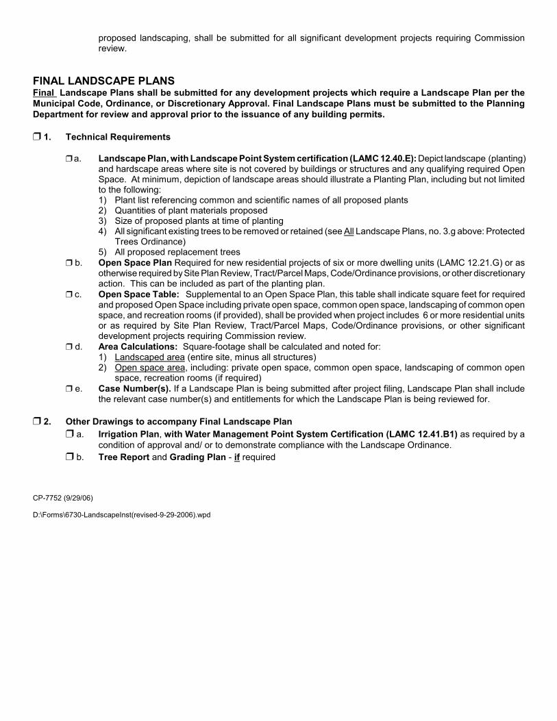
FINAL LANDSCAPE PLANSFinal Landscape Plans shall be submitted for any development projects which require a Landscape Plan per the
Municipal Code, Ordinance, or Discretionary Approval. Final Landscape Plans must be submitted to the Planning
Department for review and approval prior to the issuance of any building permits.
” 1. Technical Requirements
” a. Landscape Plan, with Landscape Point System certification (LAMC 12.40.E): Depict landscape (planting)and hardscape areas where site is not covered by buildings or structures and any qualifying required OpenSpace. At minimum, depiction of landscape areas should illustrate a Planting Plan, including but not limitedto the following:1) Plant list referencing common and scientific names of all proposed plants2) Quantities of plant materials proposed3) Size of proposed plants at time of planting4) All significant existing trees to be removed or retained (see All Landscape Plans, no. 3.g above: Protected
Trees Ordinance)5) All proposed replacement trees
” b. Open Space Plan Required for new residential projects of six or more dwelling units (LAMC 12.21.G) or asotherwise required by Site Plan Review, Tract/Parcel Maps, Code/Ordinance provisions, or other discretionaryaction. This can be included as part of the planting plan.
” c. Open Space Table: Supplemental to an Open Space Plan, this table shall indicate square feet for requiredand proposed Open Space including private open space, common open space, landscaping of common openspace, and recreation rooms (if provided), shall be provided when project includes 6 or more residential unitsor as required by Site Plan Review, Tract/Parcel Maps, Code/Ordinance provisions, or other significantdevelopment projects requiring Commission review.
” d. Area Calculations: Square-footage shall be calculated and noted for:1) Landscaped area (entire site, minus all structures)2) Open space area, including: private open space, common open space, landscaping of common open
space, recreation rooms (if required)
” e. Case Number(s). If a Landscape Plan is being submitted after project filing, Landscape Plan shall includethe relevant case number(s) and entitlements for which the Landscape Plan is being reviewed for.
” 2. Other Drawings to accompany Final Landscape Plan
” a. Irrigation Plan, with Water Management Point System Certification (LAMC 12.41.B1) as required by a
condition of approval and/ or to demonstrate compliance with the Landscape Ordinance.
There are two types of mailings for public hearings; those for ABUTTING OWNERS andfor PROPERTY OWNERS AND OCCUPANTS.
1. Names and addresses of property owners are to be obtained only from the City Clerk’s LandRecords Division, 7th Floor, 201 N. Figueroa Street.
2. The list of persons to be notified for public hearings depends upon the type of applicationfiled but will be either the ABUTTING OWNERS or PROPERTY OWNERS ANDOCCUPANTS lists. Please refer to the instructions for each application to determine whichmailing list is used. In any case if an off-site sign is located on a site for which a hearing isbeing noticed or action taken, the person(s), organization or company that has a legalinterest in, owns or leases the sign shall be notified of the impending hearing or the actiontaken or proposed.
3. BTC is the City’s mailing contractor for public hearing notices only. BTC offers the optionof either preparing the mailing labels from a list of names provided by the applicant, oraccepting labels prepared by the applicant ready for mailing. Refer to the attached samplefor the label format BTC requires. BTC fees are different for each option. Whichever optionis chosen, a copy of the mailing list must be submitted with the application.
Downtown L.A.: Van Nuys:201 N. Los Angeles St., Suite 13A 14540 Sylvan St., Suite ALos Angeles, CA 90012 Van Nuys, CA 91411Tel: (213) 617-9600 Tel: (818) 779-8866Fax: (213) 617-9643 Fax: (818) [email protected][email protected]
Fees: Hours:Labels and mailing....$ 1.45/address 8 AM–12 noon, 1 PM–4 PMAppeals.....................$ 1.25/address Monday–FridayMailing only...............$ 1.10/address Closed all City holidaysSign posting fee........$60.00/sign
4. Mailing labels must be on 8½ x 11-inch sheets of self-adhesive (peel and stick)paper. Labels which require cutting, moistening, etc. or large, oversize labels areNOT acceptable. All labels must be TYPED.
5. Mailing labels for the property owner, applicant, and representative must beinclude in each mailing list and marked accordingly. IF THEY DO NOT HAVE ALABEL, THEY MAY NOT GET NOTIFIED OF THE HEARING.
6. For ABUTTING OWNERS LIST: names and addresses of abutting property ownersinclude owners of properties across the street or alley or having a common cornerwith the subject property. A number next to each name on the list keyed to therequired district map, must be indicated.
7. For PROPERTY OWNERS AND OCCUPANTS LIST: an ownership number mustbe clearly displayed with each name. The mailing labels and ownership numbermust be prepared in accordance with the instructions in the radius map booklet.
EXAMPLE OF PROPERTY OWNERS MAILING LABELS FORMAT
1. Abutting Property OwnerNameAddressCity
2. Abutting Property OwnerNameAddressCity
3. Abutting Property OwnerNameAddressCity
4. Abutting Property OwnerNameAddressCity
5. Abutting Property OwnerNameAddressCity
6. Abutting Property OwnerNameAddressCity
7. Abutting Property OwnerNameAddressCity
8. Abutting Property OwnerNameAddressCity
9. Abutting Property OwnerNameAddressCity
10. Applicant 11. Owner 12. Representative
13. Council Office 14. Design Advisory CommitteeChairperson
15. Neighborhood Council
16. Department ofTransportation
17. Building and Safety
These instructions are for preparing mailing labels for ABUTTING OWNERS only.
1. Names and addresses of property owners are to be obtained from the City Clerk’s Land RecordsDivision, 7th Floor, 201 N. Figueroa Street.
2. Mailing labels must be on 8 ½ x 11-inch sheets of self adhesive (peel and stick) paper (e.g. AveryWhite Address Labels 5160). Labels which require cutting, moistening, etc. or large, oversize labelsare NOT acceptable. All labels must be TYPED.
3. Mailing labels for the property owner, applicant, and representative must be included in each mailinglist and marked accordingly. IF THEY DO NOT HAVE A LABEL, THEY MAY NOT GETNOTIFIED OF THE DETERMINATION.
4. For ABUTTING OWNERS LIST: names and addresses of abutting property owners include ownersof properties across the street or alley or having a common corner with the subject property. Anumber next to each name on the list keyed to the required map, must be indicated.
5. Provide two sets of mailing labels on the self-adhesive mailing label sheets and one copy of the list.
6. Provide the original perjury statement and two copies.N:\COMMPLAN\VALLEY\San Gabriel-Verdugo SP\PP Application pkg\propertyowners.pdf
SAN GABRIEL/VERDUGO MOUNTAINS SCENIC PRESERVATION SPECIFIC PLAN
MAILING ADDRESSES
NEIGHBORHOOD COUNCIL
Sunland Tujunga Neighborhood Council7747 Foothill Boulevard, Room 101Tujunga, CA 91042
COUNCIL OFFICE
2ND DISTRICT: Councilmember Wendy Greuel City Hall 200 N. Spring Street, Rm 480
Los Angeles, CA 9001 Field Office: Councilmember Wendy Greuel 7747 Foothill Blvd. Tujunga, CA 91042
BUILDING & SAFETY: Ron Van Orden, ZoningDept. of Building & Safety6262 Van Nuys Blvd. Ste. 251Los Angeles, CA 91401
The following statement must be signed and attached to the list of ownerships and list of occupantsfor all cases:
I certify that to the best of my knowledge the attached radius map correctly depicts therequired data obtained from records of the Office of the City Engineer, City Clerk and/orDepartment of City Planning of the City of Los Angeles and, where appropriate, the State Divisionof Highways.
I further certify that to the best of my knowledge and under the penalty of perjury, theattached ownership list correctly shows the latest names and addresses on the City Clerk’s recordsas of the following date: ___________________. In certain circumstances, such as in annexationproceedings, where there may be no City Clerk’s records, the records of the County Assessor’sOffice may be accepted.
(signature)
(printed name)I certify that to the best of my knowledge and under the penalty of perjury, the attached
occupants list correctly indicates addresses of the required occupants that fall within the radius asof the following date: .
(signature)
(printed name)
In certain instances, I was unable to notify all occupants; the following indicates whichoccupants I was not able to notify. I understand that the Department of City Planning will determineif reasonable attempts were made to secure these addresses from the information provided below.
** (1) Returned to building on 3 separate occasions(2) Efforts to contact owner or manager without success(3) Contact the owner or manager who refused to provide info.(4) Other: specify
The Department will not accept the application, maps and ownership list which bear a dateof more than 90 days prior to the date the application is accepted for the environmental process.The applicant may be required to update the radius map and ownership list prior to filing theapplication for action by the decision maker.
Los Angeles City Planning DepartmentSUMMARY OF FEES
Section 19.00 et seq, L.A.M.C. Effective July 22, 2007
Type of Application FEE 2% OSS* 6% DS** 7% OS*** TOTAL Comments
ZONE CHANGESingle-Family (ZCH-001) 4,413$ 88 265 309 5,075$
add'l charges 2,239$ 45 134 157 2,575$ Total Fee For Each Additional Block or 5 AcresMulti-Family (ZCH-002) 5,573$ 111 334 390 6,408$ Plus $215 per unit not to exceed $11,011 plus surcharges
add'l charges 2,608$ 52 156 183 2,999$ Total Fee For Each Additional Block or 5 AcresOther Than Residential (ZCH-019) 10,579$ 212 635 741 12,167$
add'l charges 2,179$ 44 131 153 2,507$ Total Fee For Each Additional Block or 5 Acres
HEIGHT DISTRICT (HDT) 1,999$ 40 120 140 2,299$ add'l charges 1,366$ 27 82 96 1,571$ Total Fee For Each Additional Block or 5 Acres
Incident to Zone Change (HIZ) 383$ 8 23 27 441$
ZONE BOUNDARY ADJUSTMENT (ZBA) 3,177$ 64 191 222 3,654$
SPECIFIC PLAN EXCEPTION 3,206$ 64 192 224 3,686$ add'l charges 2,037$ 41 122 143 2,343$ Total Fee For Each Additional Block or 5 Acres
DESIGN REVIEW BOARD (DRB) 989$ 20 59 69 1,137$ add'l charges 416$ 8 25 29 478$ Total Fee For Each Additional Block or 5 Acres
Signs Only (DRS) 267$ 5 16 19 307$ Preliminary Design Review Fees are half the above and not credited toward Full Design Review.
CERTIFICATE OF APPROPRIATENESS (COA) 245$ 5 15 17 282$
DENSITY BONUS (DBO) 3,742$ 75 225 262 4,304$
CONDITIONAL USE-ZA(CUZ)/CPC(CUC) 3,742$ 75 225 262 4,304$ add'l charges 1,035$ 21 62 72 1,190$ Total Fee For Each Additional Block or 5 Acres
On-Site Alcohol Sales, Dancing, Massage (CUB) 5,395$ 108 324 378 6,205$ add'l charges 1,492$ 30 90 104 1,716$ Total Fee For Each Additional Block or 5 Acres
ZONE VARIANCE with hearing (ZVH) 4,899$ 98 294 343 5,634$ add'l charges 1,209$ 24 73 85 1,391$ Total Fee For Each Additional Block or 5 Acres
without hearing 3,065$ 61 184 215 3,525$ add'l charges 1,021$ 20 61 71 1,173$ Total Fee For Each Additional Block or 5 Acres
COMBINATION APPLICATION - Highest applicable fee Plus 1,389$ 28 83 97 1,597$ See Section 19.01V L.A.M.C.
YARD VARIANCE Single-Family (YVH-001) 1,186$ 24 71 83 1,364$ Other than S.F. (YVH-002) 4,498$ 90 270 315 5,173$
add'l charges 2,438$ 49 146 171 2,804$ Total Fee For Each Additional Block or 5 Acres In addition to ZV/CUZ 331$ 7 20 23 381$
SLIGHT MODIFICATION 179$ 4 11 13 207$
Type of Application FEE 2% OSS* 6% DS** 7% OS*** TOTAL Comments
CU EXCEPTION (On-Site) (CUE) 191$ 4 11 13 219$
SHARED PARKING (PAS) 1,665$ 33 100 117 1,915$
HILLSIDE ORDINANCE (HIL) 998$ 20 60 70 1,148$
ARTIST IN RESIDENCE 998$ 20 60 70 1,148$
ADAPTIVE REUSE (ZAD) 998$ 20 60 70 1,148$
FENCE HEIGHT (IFH) 662$ 13 40 46 761$
LANDSCAPE PLAN (LND) 68$ 1 4 5 78$
NON-CONFORMING USES IN A&R ZONES (NUE) 536$ 11 32 38 617$
APPEAL Other Than Applicant 74$ 1 4 5 84$ Applicant 85% of Current Filing Fee + Surcharges
APPROVAL OF PLANS Required byQ,CU,ZV or NC condition (APV) 621$ 12 37 43 713$
Existing Conditional Use or Zone Variance (PLA) 2,292$ 46 138 160 2,636$ Deemed-Approved CU (PAD) 1,067$ 21 64 75 1,227$ On-Site CUB (PAB) 1,394$ 28 84 98 1,604$ Landscape Plan (w/case) (LDA) 141$ 3 8 10 162$
PROJECT PERMIT COMPLIANCE Sec 19.01J1(a) 267$ 5 16 19 307$ Confirm with Community PlanningSec 19.01J1(b) 989$ 20 59 69 1,137$
TIME EXTENSION (All) (EXT) 167$ 3 10 12 192$
SITE PLAN REVIEW (SPR-026) 1,065$ 21 64 75 1,225$ (SPR-027) 1,998$ 40 120 140 2,298$
ENVIRONMENTAL ASSESSMENT (ISD) 769$ 15 46 54 884$ Development SurchargeIn addition, EA filing requires a check made out to County of L.A. for circulating final environment determination. 50$ *** Automated Systems
Maintenance SurchargeRECONSIDERATION OF ENVIRONMENTAL 122$ 2 7 9 140$
CP-7113 (06/26/07) NOTE: MOST PROJECTS INVOLVE MORE THAN ONE FEE AND SURCHARGES ARE APPLIED TO SUBTOTALS AND ROUNDED OFF.