12
Satellite Eyes Slide Show Activity
| Date post: | 22-Dec-2015 |
| Category: |
Documents |
| Upload: | harry-bruce |
| View: | 214 times |
| Download: | 0 times |

Satellite Eyes
Slide Show Activity

Hi kids! Let’s at the Earth with satellite eyes!
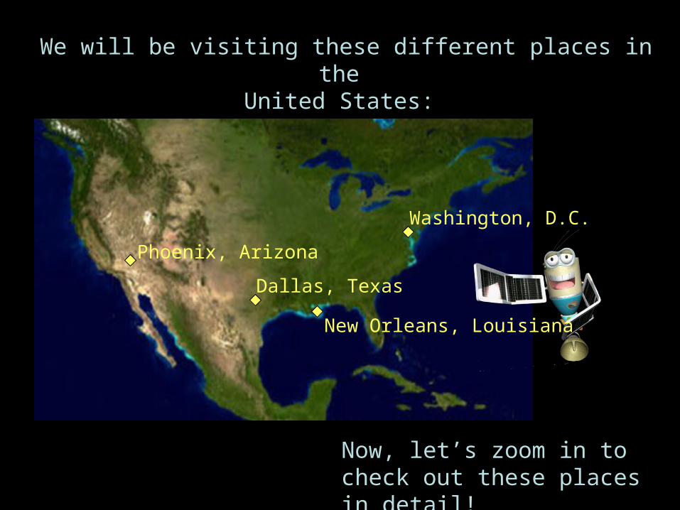
We will be visiting these different places in the United States:
Now, let’s zoom in to check out these places in detail!
Dallas, Texas
New Orleans, Louisiana
Phoenix, Arizona
Washington, D.C.

This is New Orleans, Louisiana. There is an indoor football field in New Orleans called the Super Dome, home of the New Orleans Saints.
Can you see the Super Dome?

Here is a closer satellite view of New Orleans.
Now can you see the Super Dome?
What else can you see?

Here is a view of the Dallas-Fort Worth Airport, in Texas.
What do you see?

Here is a closer satellite view of the airport.Can you see any airplanes?
What can you see?

Here is a satellite view of Phoenix, Arizona.
Can you tell the difference between neighborhoods and mountain parks?

Now we’ve zoomed in to the satellite view of the Squaw Peak area of Phoenix, Arizona.
Now can you tell the difference between neighborhoods and mountain parks? Find the golf course near the bottom.
Why do you think is it so green, but the mountains so brown?

Here is Washington, D.C., our nation’s capital.
Can you see any bridges crossing the Potomac River?

Here is a zoomed in satellite image of the Capitol Building, in downtown
Washington, D.C.
This is what the Capitol looks like from the ground
level!

Photo Credits:
Rangel— U.S. House
Arizona Regional Image Archive/NASA
USGS
NASA
NASA-GSFC Scientific Visualization Studio


