Starting from the Gate 1 car park on Ayliffe Road, St Marys, this walk takes you on a circuit withinShepherds Hill Recreation Park via the Ridge and Viaduct tracks. Shepherds Hill Recreation Park isa vast area of natural bushland adjoining the Waitparinga Reserve to the east and Saddle HillReserve to the north. It contains grey box woodlands on the hillsides and massive ancient gumsalong the Viaduct Creek. The area is a suburban goldmine, rich with native bird and plant life,sweeping views, and things to see and do. The Seaview Loop trail climbs steadily up hills to thesouth, rewarding you with panoramic views of the city, coastline and surrounding areas. This walkis popular with dog walkers and runners. The route is mainly on a wide fire trail, with some steepsections as you head towards the ridge. Let us begin by acknowledging the Traditional Custodiansof the land on which we travel today, and pay our respects to their Elders past and present.
70
100
130
160
190
220
0 m
170
m
340
m
510
m
680
m
860
m
1 km
1.2
km
1.4
km
1.5
km
1.7
km
1.9
km
2.1
km
2.2
km
2.4
km
2.6
km
2.7
km
2.9
km
3.1
km
3.2
km
3.4
km
5.7x
Class 3 of 6Formed track, with some branches and other obstacles
Quality of track Clear and well formed track or trail (2/6)
Gradient Short steep hills (3/6)
Signage Clearly signposted (2/6)
Infrastructure Limited facilities, not all cliffs are fenced (3/6)
Experience Required Some bushwalking experience recommended (3/6)
Weather Weather generally has little impact on safety (2/6)
Getting to the start: From South Road, A2
Turn on to South Road, A13 then drive for 460 mKeep left onto South Road and drive for another 110 mKeep left and drive for another 325 mTurn right and drive for another 55 m
Before you start any journey ensure you;• Tell someone you trust where you are going and what to do if you are late returning• Have adequate equipment, supplies, skills & knowledge to undertake this journey safely• Consider weather forecasts, park/track closures & fire dangers• Can respond to emergencies & call for help at any point• Are healthy and fit enough for this journeyIf not, change plans and stay safe. It is okay to delay and ask people for help.
Getting started: Getting started: Starting from the gravelStarting from the gravelcar park off Ayliffes Road(320 metres eastcar park off Ayliffes Road(320 metres eastof intersection with Shepherds Hill Road),of intersection with Shepherds Hill Road),head towards the metal gate with ahead towards the metal gate with a“GATE:1” sign on it, moving parallel to the“GATE:1” sign on it, moving parallel to theroad. Pass through the gap in the woodenroad. Pass through the gap in the woodenfence next to the gate, and keep left asfence next to the gate, and keep left asyou follow the gravel/dirt fire trail toyou follow the gravel/dirt fire trail tocontinue along Seaview Loop.continue along Seaview Loop.
NN
SS
EE
WW
StartStart..
NN
SS
EE
WW
After another 9 m After another 9 m continue straightcontinue straight,,to head along Viaduct Track.to head along Viaduct Track.
After another 70 m (at the intersection ofAfter another 70 m (at the intersection ofViaduct Track & Danthonia Track) Viaduct Track & Danthonia Track) continuecontinuestraightstraight, to head along Viaduct Track., to head along Viaduct Track.After another 40 m (at the intersection ofAfter another 40 m (at the intersection ofViaduct Track & Viaduct Creek Trail) Viaduct Track & Viaduct Creek Trail) continuecontinuestraightstraight, to head along Viaduct Track., to head along Viaduct Track.
NN
SS
EE WW
After another 45 m After another 45 m continuecontinuestraightstraight, to head along Viaduct Track., to head along Viaduct Track.
After another 90 m After another 90 m continue straightcontinue straight, to head, to headalong Viaduct Track.along Viaduct Track.
After another 60 m (at the intersection ofAfter another 60 m (at the intersection ofViaduct Track & Creek Crossing) Viaduct Track & Creek Crossing) continuecontinuestraightstraight, to head along Viaduct Track., to head along Viaduct Track.
NN
SS
EE
WW
After another 15 m After another 15 m continuecontinuestraightstraight, to head along Viaduct Track., to head along Viaduct Track.
NN
SS
EE
WW
After another 185 m After another 185 m continuecontinuestraightstraight, to head along Viaduct Track., to head along Viaduct Track.
After another 55 m After another 55 m continue straightcontinue straight, to head, to headalong Viaduct Track.along Viaduct Track.
NN
SSEE
WW
After another 40 m (at the intersection After another 40 m (at the intersectionof Ridge Track & Viaduct Track) of Ridge Track & Viaduct Track) veerveerrightright, to head along Ridge Track., to head along Ridge Track.
After another 15 m (at the intersection of RidgeAfter another 15 m (at the intersection of RidgeTrack & Superflow) Track & Superflow) continue straightcontinue straight, to head, to headalong Ridge Track.along Ridge Track.After another 370 m pass a seat (9 m on yourAfter another 370 m pass a seat (9 m on yourright).right).
After another 80 m (at the intersection ofAfter another 80 m (at the intersection ofWalkers Creek Track & Ridge Track) Walkers Creek Track & Ridge Track) continuecontinuestraightstraight, to head along Ridge Track., to head along Ridge Track.After another 35 m After another 35 m continue straightcontinue straight, to head, to headalong Ridge Track.along Ridge Track.
After another 220 m (at the intersection ofAfter another 220 m (at the intersection ofRidge Track & Tech-tonic) Ridge Track & Tech-tonic) continue straightcontinue straight,,to head along Ridge Track.to head along Ridge Track.After another 100 m (at the intersection ofAfter another 100 m (at the intersection ofRidge Track & Switchback) Ridge Track & Switchback) continue straightcontinue straight,,to head along Ridge Track.to head along Ridge Track.After another 95 m (at the intersection of FireAfter another 95 m (at the intersection of FireTrack & Ridge Track) Track & Ridge Track) continue straightcontinue straight, to, tohead along Ridge Track.head along Ridge Track.
NN
SS
EE
WW
After another 170 m After another 170 m continuecontinuestraightstraight, to head along Ridge Track., to head along Ridge Track.
After another 230 m After another 230 m continue straightcontinue straight, to, tohead along Ridge Track.head along Ridge Track.
Start of an optional side tripStart of an optional side trip: An optional little: An optional littleside trip taking you to a creekside spot.side trip taking you to a creekside spot.
NN
SS
EE
WW
To start this optional side trip turn To start this optional side trip turnsharp right here. at the intersection ofsharp right here. at the intersection ofViaduct Track & Ridge Track Viaduct Track & Ridge Track StartStartheading along heading along Viaduct TrackViaduct Track (a vehicle (a vehicletrack).track).
NN
SS
EE
WW
After another 60 m come to the end. After another 60 m come to the end.
Turn around and retrace your steps back the 60Turn around and retrace your steps back the 60m to the main route.m to the main route.
Back at the main route continue straight andBack at the main route continue straight andfollow on from the 2.1 km waypoint.follow on from the 2.1 km waypoint.
After another 195 m (at the intersection ofAfter another 195 m (at the intersection ofViaduct Track & Ridge Track) Viaduct Track & Ridge Track) continuecontinuestraightstraight, to head along Viaduct Track., to head along Viaduct Track.After another 145 m After another 145 m continue straightcontinue straight, to, tohead along Viaduct Track.head along Viaduct Track.
NN
SS
EE
WW After another 160 m After another 160 m continuecontinuestraightstraight, to head along Viaduct Track., to head along Viaduct Track.
After another 115 m pass the water tap (40 mAfter another 115 m pass the water tap (40 mon your right).on your right).
NN
SS
EE
WW
After another 30 m After another 30 m veer rightveer right..
NN
SS
EE
WW
After another 315 m After another 315 m veer leftveer left..
NN
SS
EE
WW
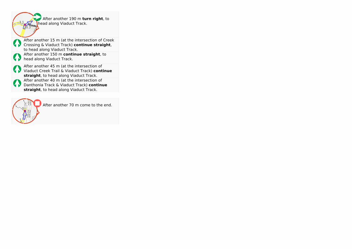
After another 190 m After another 190 m turn rightturn right, to, tohead along Viaduct Track.head along Viaduct Track.
After another 15 m (at the intersection of CreekAfter another 15 m (at the intersection of CreekCrossing & Viaduct Track) Crossing & Viaduct Track) continue straightcontinue straight,,to head along Viaduct Track.to head along Viaduct Track.After another 150 m After another 150 m continue straightcontinue straight, to, tohead along Viaduct Track.head along Viaduct Track.
After another 45 m (at the intersection ofAfter another 45 m (at the intersection ofViaduct Creek Trail & Viaduct Track) Viaduct Creek Trail & Viaduct Track) continuecontinuestraightstraight, to head along Viaduct Track., to head along Viaduct Track.After another 40 m (at the intersection ofAfter another 40 m (at the intersection ofDanthonia Track & Viaduct Track) Danthonia Track & Viaduct Track) continuecontinuestraightstraight, to head along Viaduct Track., to head along Viaduct Track.
NN
SS
EE
WW
After another 70 m come to the end. After another 70 m come to the end.
Powered by TCPDF (www.tcpdf.org)Powered by TCPDF (www.tcpdf.org)


![Welcome! [storage.googleapis.com] IPA Member... · SeaView IPA Member Services (805) 988-5188 memberservices@svipa.com 3 Preventive Health – Keeping You Healthy SeaView IPA provides](https://static.documents.pub/doc/80x56/5e13b8b61e084a0a6836f01d/welcome-ipa-member-seaview-ipa-member-services-805-988-5188-memberservicessvipacom.jpg)


