32
Shine a Light on Research: Use of Holograms for Decision-making
| Date post: | 01-Jul-2018 |
| Category: |
Documents |
| Upload: | hoangnguyet |
| View: | 215 times |
| Download: | 0 times |
Shine a Light on Research:
Use of Holograms for
Decision-making
Agenda
• Introduction to Zebra Imaging Technology
• Value of Hologram
• Application examples
• Prepare and export research from ArcGIS 3D
with Zscape Exporter
• Demonstration of hologram technology
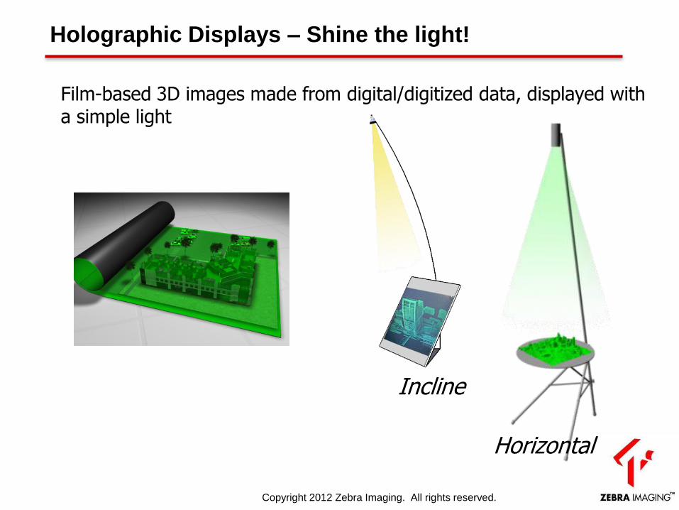
Holographic Displays – Shine the light!
Incline
Horizontal
Film-based 3D images made from digital/digitized data, displayed with a simple light
Copyright 2012 Zebra Imaging. All rights reserved.
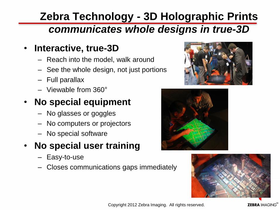
• Interactive, true-3D – Reach into the model, walk around
– See the whole design, not just portions
– Full parallax
– Viewable from 360°
• No special equipment – No glasses or goggles
– No computers or projectors
– No special software
• No special user training – Easy-to-use
– Closes communications gaps immediately
Zebra Technology - 3D Holographic Prints communicates whole designs in true-3D
Copyright 2012 Zebra Imaging. All rights reserved.
Rendering Features
GIS 3D Layers
Digital Elevation Maps (legacy)
• Geo-referenced
• Triangulated meshes
• Various DTED levels
Point-clouds
• Geo-referenced
• Shaded
• Geo-rectified color/textures
• Variable point sizes, shapes
Point-clouds (object-based)
• Detail and edge-enhanced
• Integrated shading
• Texture mapping
Copyright 2012 Zebra Imaging. All rights reserved.
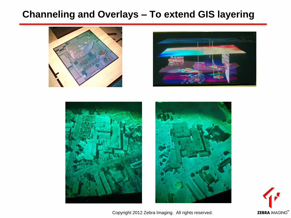
Channeling and Overlays – To extend GIS layering
Copyright 2012 Zebra Imaging. All rights reserved.
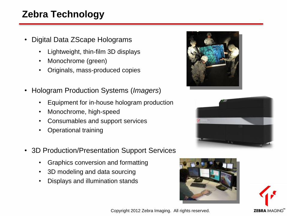
Zebra Technology
• Digital Data ZScape Holograms
• Lightweight, thin-film 3D displays
• Monochrome (green)
• Originals, mass-produced copies
• Hologram Production Systems (Imagers)
• Equipment for in-house hologram production
• Monochrome, high-speed
• Consumables and support services
• Operational training
• 3D Production/Presentation Support Services
• Graphics conversion and formatting
• 3D modeling and data sourcing
• Displays and illumination stands
Copyright 2012 Zebra Imaging. All rights reserved.
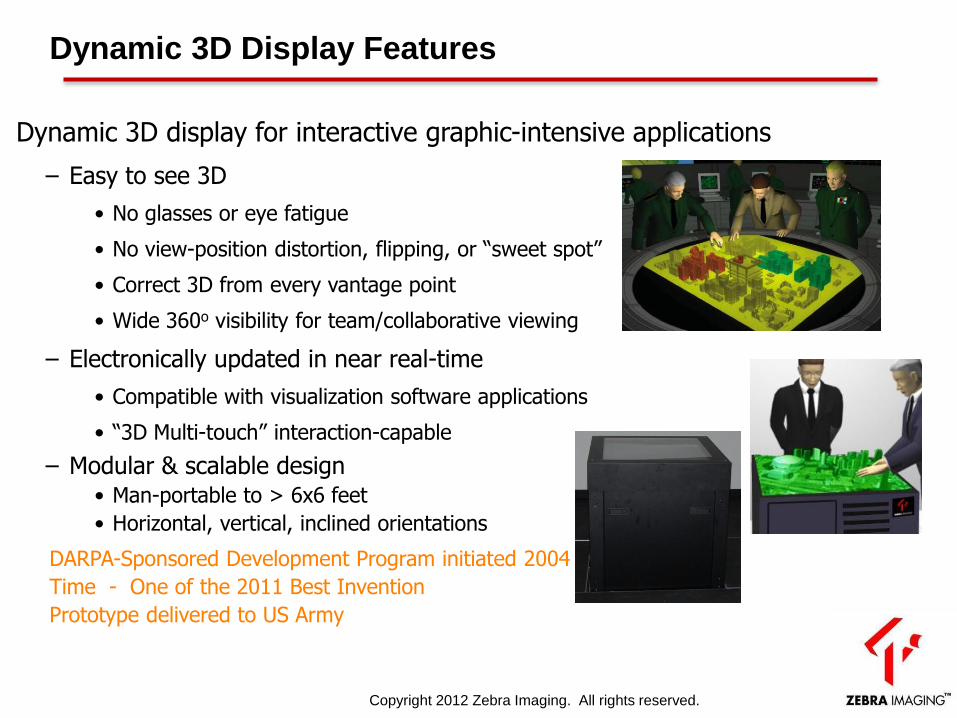
Dynamic 3D display for interactive graphic-intensive applications
– Easy to see 3D
• No glasses or eye fatigue
• No view-position distortion, flipping, or “sweet spot”
• Correct 3D from every vantage point
• Wide 360o visibility for team/collaborative viewing
– Electronically updated in near real-time
• Compatible with visualization software applications
• “3D Multi-touch” interaction-capable
– Modular & scalable design • Man-portable to > 6x6 feet
• Horizontal, vertical, inclined orientations
Dynamic 3D Display Features
DARPA-Sponsored Development Program initiated 2004
Time - One of the 2011 Best Invention
Prototype delivered to US Army
Copyright 2012 Zebra Imaging. All rights reserved.
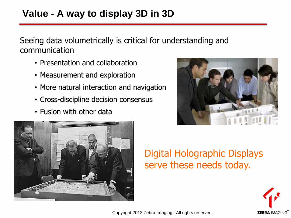
Value - A way to display 3D in 3D
Digital Holographic Displays serve these needs today.
Seeing data volumetrically is critical for understanding and communication
• Presentation and collaboration
• Measurement and exploration
• More natural interaction and navigation
• Cross-discipline decision consensus
• Fusion with other data
Copyright 2012 Zebra Imaging. All rights reserved.
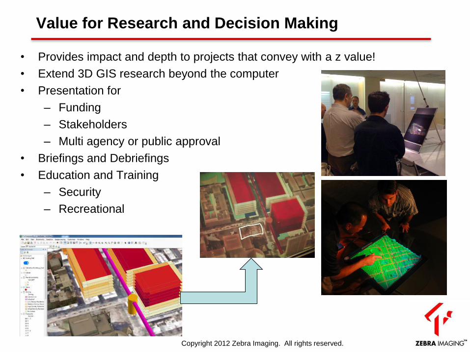
Value for Research and Decision Making
• Provides impact and depth to projects that convey with a z value!
• Extend 3D GIS research beyond the computer
• Presentation for
– Funding
– Stakeholders
– Multi agency or public approval
• Briefings and Debriefings
• Education and Training
– Security
– Recreational
Copyright 2012 Zebra Imaging. All rights reserved.
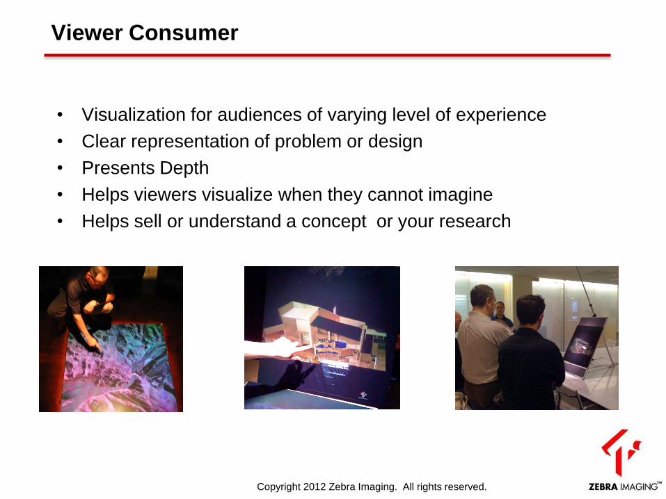
Viewer Consumer
• Visualization for audiences of varying level of experience
• Clear representation of problem or design
• Presents Depth
• Helps viewers visualize when they cannot imagine
• Helps sell or understand a concept or your research
Copyright 2012 Zebra Imaging. All rights reserved.
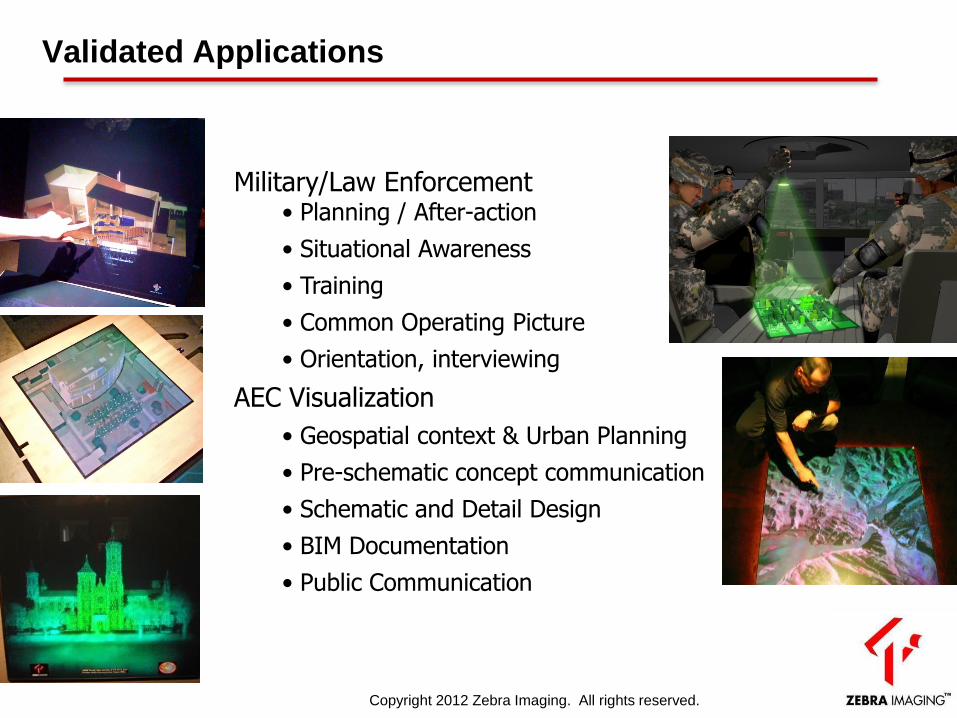
Validated Applications
Military/Law Enforcement • Planning / After-action
• Situational Awareness
• Training
• Common Operating Picture
• Orientation, interviewing
AEC Visualization
• Geospatial context & Urban Planning
• Pre-schematic concept communication
• Schematic and Detail Design
• BIM Documentation
• Public Communication
Copyright 2012 Zebra Imaging. All rights reserved.
Zscape Digital Holographic Print for
Operational Planning
and Situation
Awareness
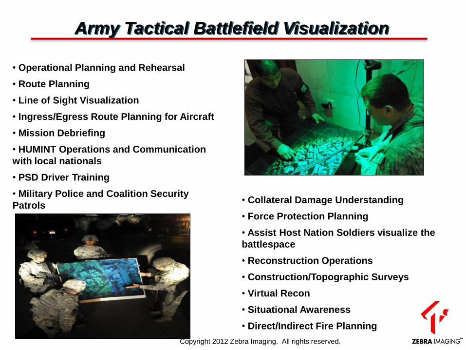
• Operational Planning and Rehearsal
• Route Planning
• Line of Sight Visualization
• Ingress/Egress Route Planning for Aircraft
• Mission Debriefing
• HUMINT Operations and Communication
with local nationals
• PSD Driver Training
• Military Police and Coalition Security
Patrols
• Collateral Damage Understanding
• Force Protection Planning
• Assist Host Nation Soldiers visualize the
battlespace
• Reconstruction Operations
• Construction/Topographic Surveys
• Virtual Recon
• Situational Awareness
• Direct/Indirect Fire Planning
Army Tactical Battlefield Visualization
Copyright 2012 Zebra Imaging. All rights reserved.
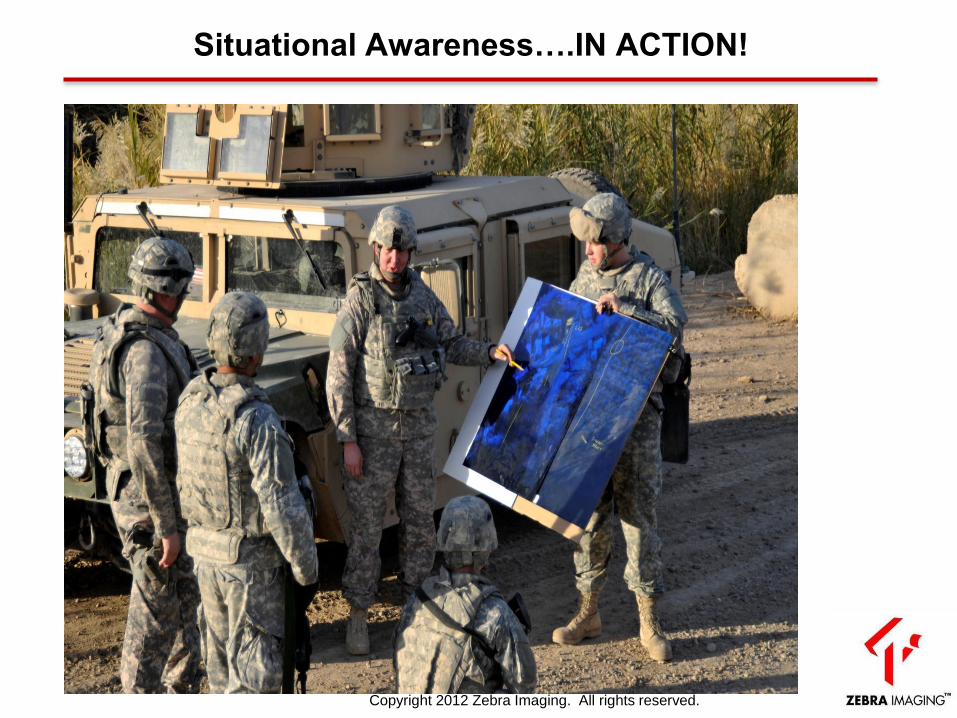
Situational Awareness….IN ACTION!
Copyright 2012 Zebra Imaging. All rights reserved.
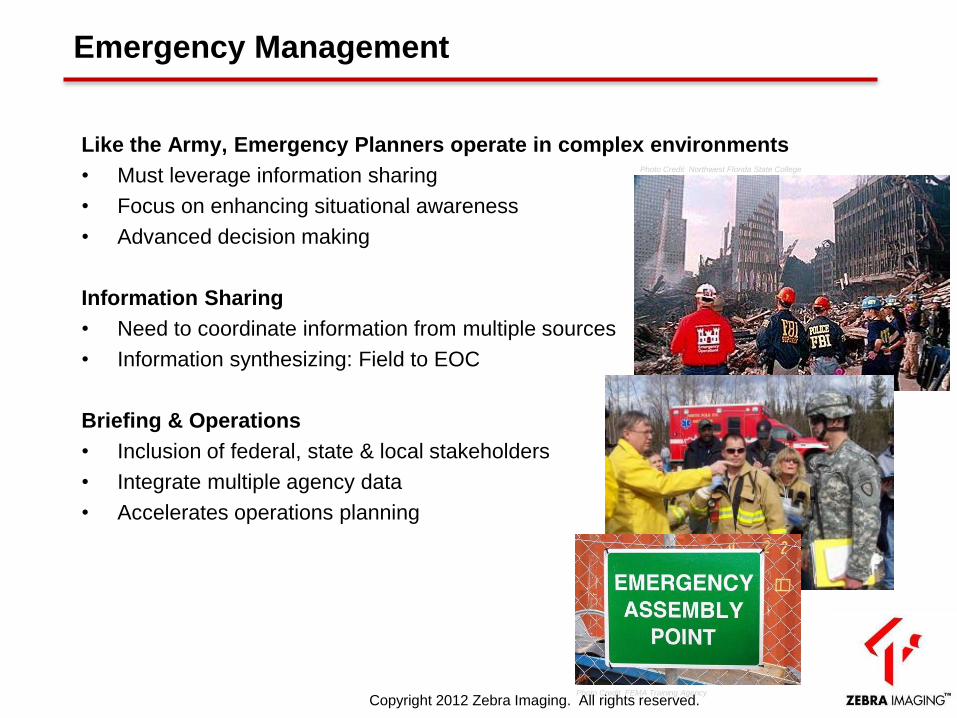
Emergency Management
Like the Army, Emergency Planners operate in complex environments
• Must leverage information sharing
• Focus on enhancing situational awareness
• Advanced decision making
Information Sharing
• Need to coordinate information from multiple sources
• Information synthesizing: Field to EOC
Briefing & Operations
• Inclusion of federal, state & local stakeholders
• Integrate multiple agency data
• Accelerates operations planning
Photo Credit : classesandcareers.com
Photo Credit FEMA Training Agency
Photo Credit Northwest Florida State College
Copyright 2012 Zebra Imaging. All rights reserved.

Zscape Digital Holographic Print for
Presentation and
Understanding
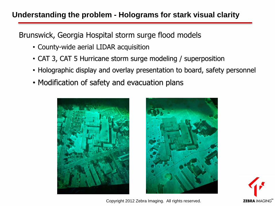
Understanding the problem - Holograms for stark visual clarity
Brunswick, Georgia Hospital storm surge flood models
• County-wide aerial LIDAR acquisition
• CAT 3, CAT 5 Hurricane storm surge modeling / superposition
• Holographic display and overlay presentation to board, safety personnel
• Modification of safety and evacuation plans
Copyright 2012 Zebra Imaging. All rights reserved.
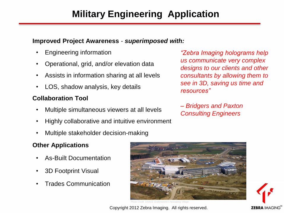
Military Engineering Application
Improved Project Awareness - superimposed with:
• Engineering information
• Operational, grid, and/or elevation data
• Assists in information sharing at all levels
• LOS, shadow analysis, key details
Collaboration Tool
• Multiple simultaneous viewers at all levels
• Highly collaborative and intuitive environment
• Multiple stakeholder decision-making
Other Applications
• As-Built Documentation
• 3D Footprint Visual
• Trades Communication
Photo Credit USACE Grafenwoehr's Netzaberg Village
“Zebra Imaging holograms help
us communicate very complex
designs to our clients and other
consultants by allowing them to
see in 3D, saving us time and
resources”
– Bridgers and Paxton
Consulting Engineers
Copyright 2012 Zebra Imaging. All rights reserved.
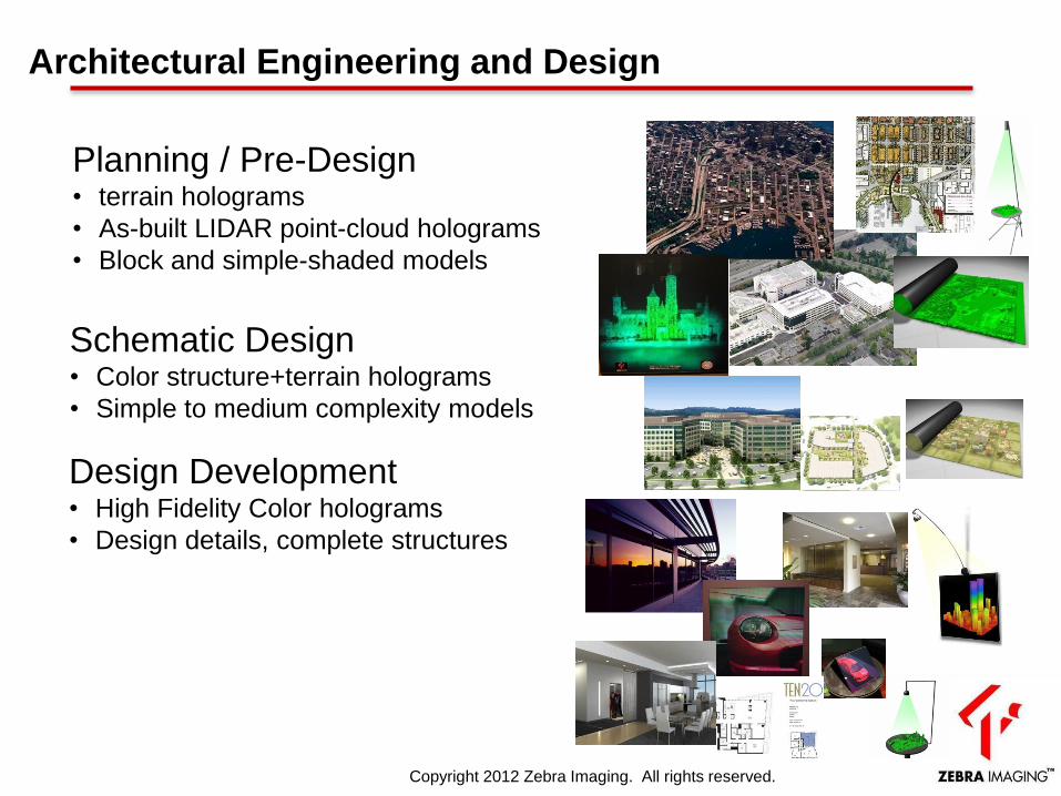
Architectural Engineering and Design
Planning / Pre-Design • terrain holograms
• As-built LIDAR point-cloud holograms
• Block and simple-shaded models
Schematic Design • Color structure+terrain holograms
• Simple to medium complexity models
Design Development • High Fidelity Color holograms
• Design details, complete structures
Copyright 2012 Zebra Imaging. All rights reserved.

Holographic BIM-driven Consensus
LAX-Bradley Terminal Modernization: Baggage Handling Area
• Conveyor system upgrade • Scan called-in late in the project • Project heavy with delays from clashes and interference of systems • Strained relationship between Owner, Architect, GC and Sub-Contractors • 3D scan and model used to indentify and resolve problems with design team.
• Hologram used to relay problems to tradesmen in the field (channeled image as-is to design clashes)
Scan data: Clark-McCarthy / Scott Cedarleaf Joint Venture
LIDAR Scan 3D Modeling
Clashes!
Copyright 2012 Zebra Imaging. All rights reserved.
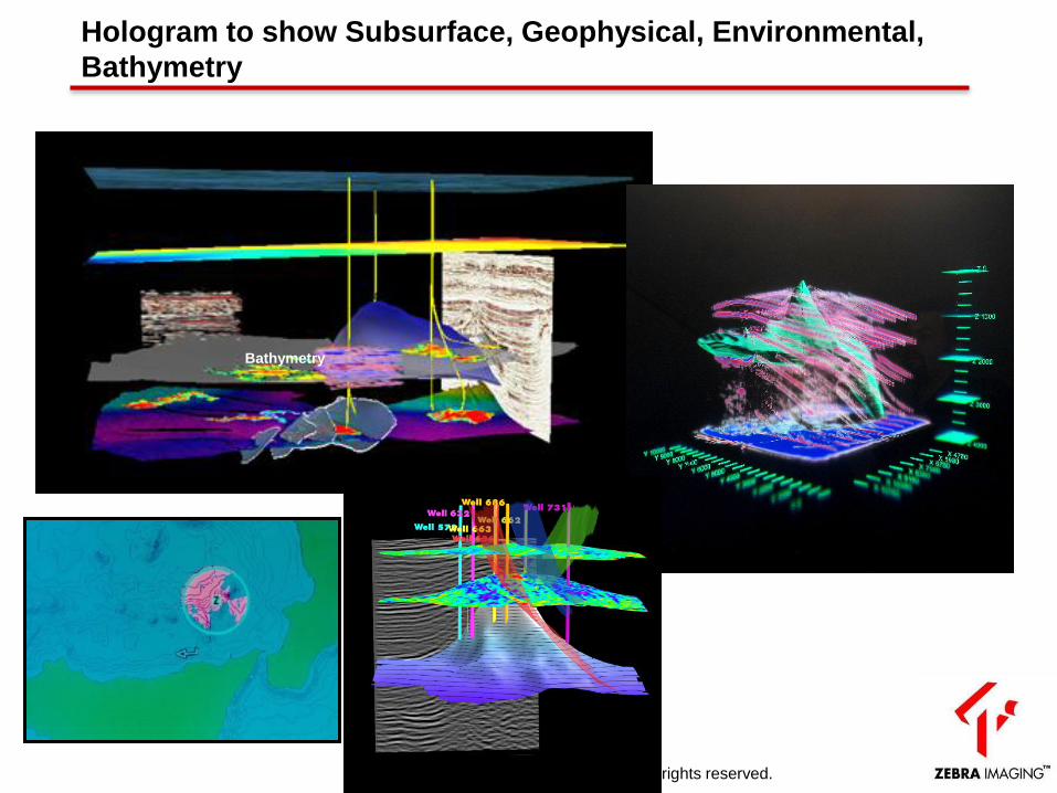
Hologram to show Subsurface, Geophysical, Environmental,
Bathymetry
Bathymetry
Copyright 2012 Zebra Imaging. All rights reserved.
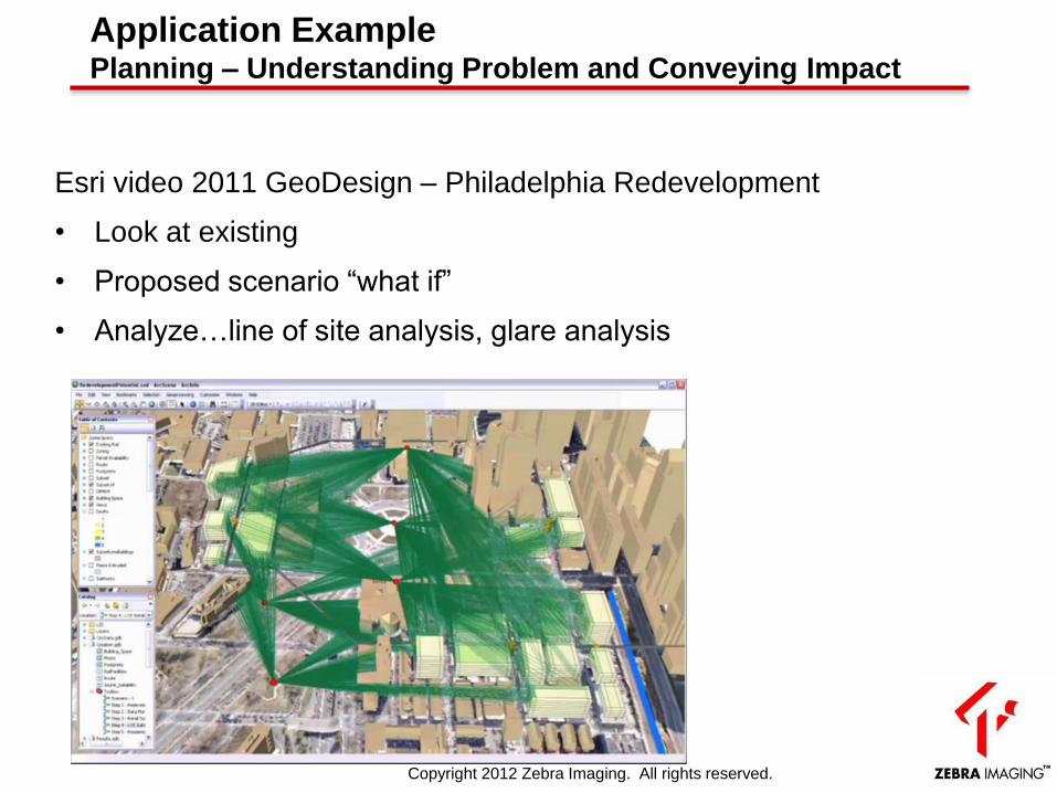
Application Example Planning – Understanding Problem and Conveying Impact
Esri video 2011 GeoDesign – Philadelphia Redevelopment
• Look at existing
• Proposed scenario “what if”
• Analyze…line of site analysis, glare analysis
Copyright 2012 Zebra Imaging. All rights reserved.
Current discussions with various USACE
• Facility Management / BIM
• Land Management & Planning
• Design Alternative Presentations
– Possible joint project with the New England Office
to use hologram for display of the dam
Copyright 2012 Zebra Imaging. All rights reserved.
Making of a hologram from
3D GIS
Zscape Exporter
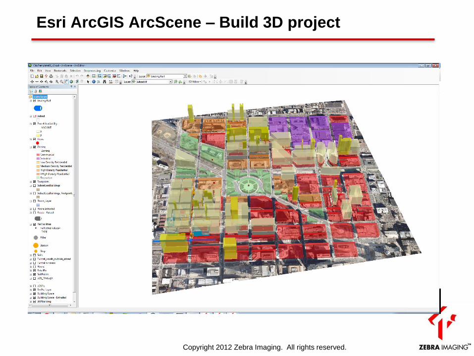
Esri ArcGIS ArcScene – Build 3D project
Copyright 2012 Zebra Imaging. All rights reserved.
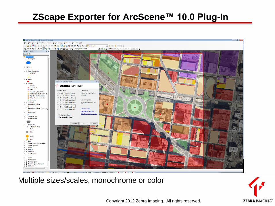
Multiple sizes/scales, monochrome or color
ZScape Exporter for ArcScene™ 10.0 Plug-In
Copyright 2012 Zebra Imaging. All rights reserved.
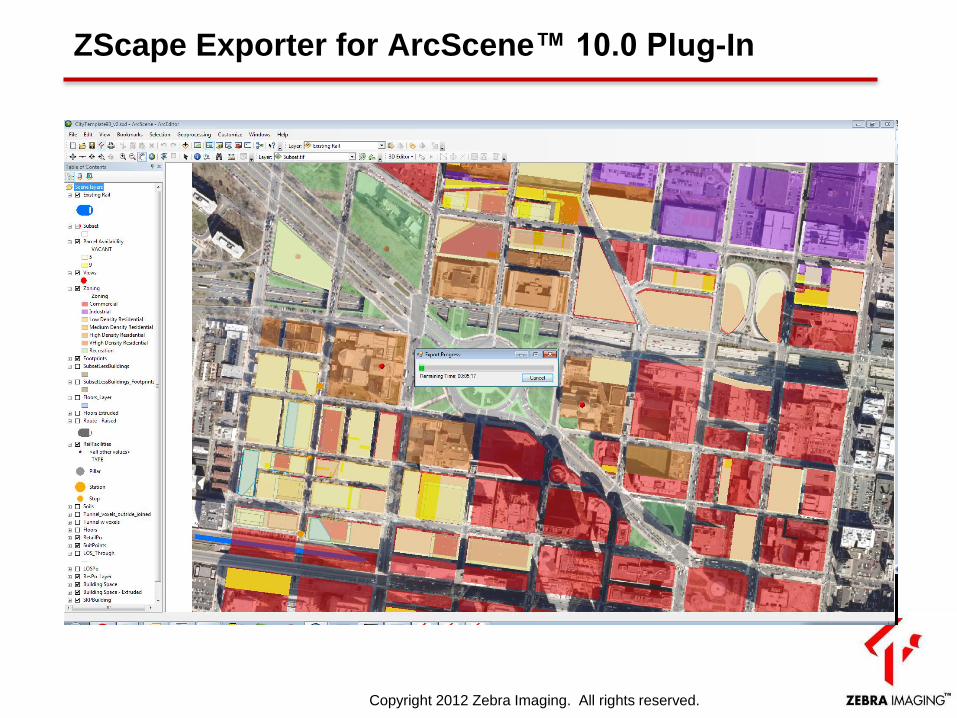
ZScape Exporter for ArcScene™ 10.0 Plug-In
Copyright 2012 Zebra Imaging. All rights reserved.
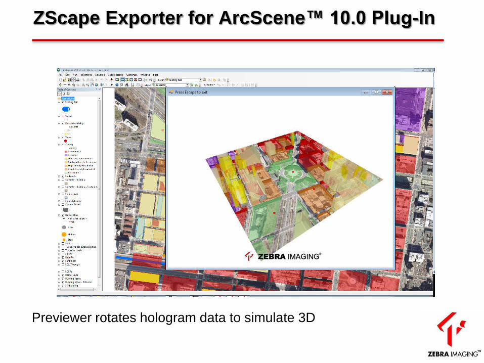
Previewer rotates hologram data to simulate 3D
ZScape Exporter for ArcScene™ 10.0 Plug-In

Video
Demonstration of Zscape
Holograms