26
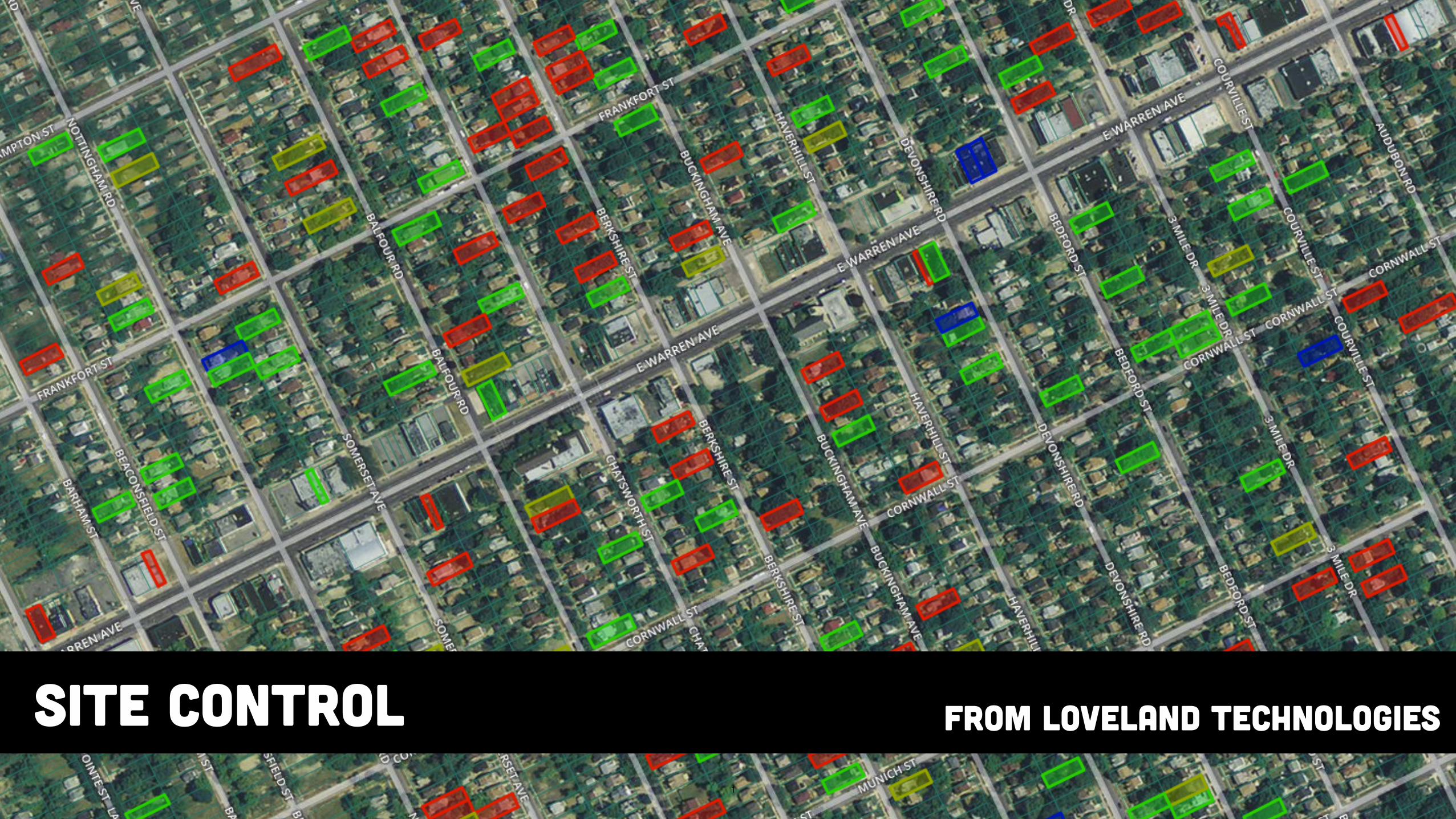
1 Site Control From loveland technologies
| Date post: | 08-Aug-2015 |
| Category: |
Technology |
| Upload: | lovelandtechnologies |
| View: | 596 times |
| Download: | 2 times |
1
Site Control From loveland technologies

2
Site ControlLOVELAND Technologies is happy to welcome you to Site Control.
Since 2009, we’ve worked in, and been inspired by, the unique challenges presented by Detroit’s property environment.
Site Control is the product of our efforts to make property information management and collection in any city easier, more collaborative, and even fun.
We hope you enjoy your experience building + sharing maps, exploring data, surveying property, and much more, with Site Control.
If you ever need us, we’re an e-mail away: [email protected]
♥ - LOVELAND Technologies

WElcome to Site Control!After subscribing and making your first map, you’ll arrive here — your Dashboard! This is where all your maps will be, where you can create new maps, invite people to your group, and manage your account settings.
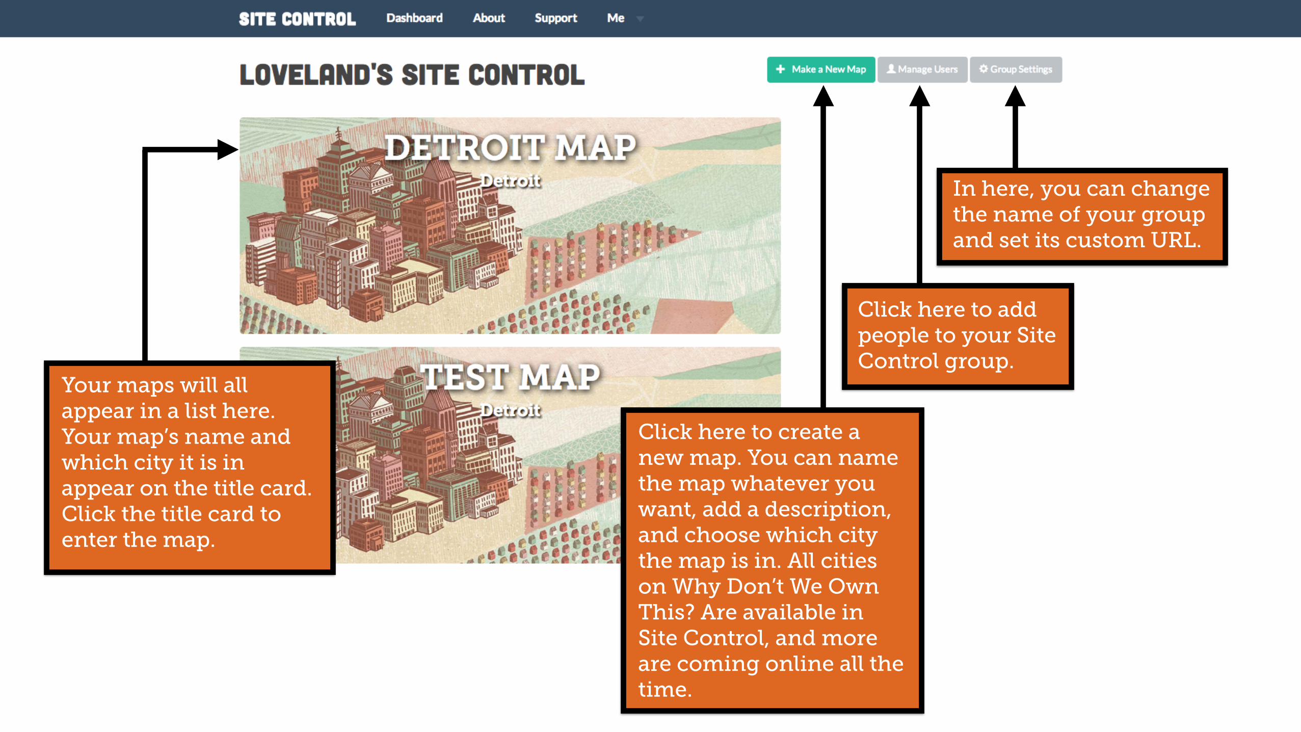
Click here to create a new map. You can name the map whatever you want, add a description, and choose which city the map is in. All cities on Why Don’t We Own This? Are available in Site Control, and more are coming online all the time.
Click here to add people to your Site Control group.
In here, you can change the name of your group and set its custom URL.
Your maps will all appear in a list here. Your map’s name and which city it is in appear on the title card. Click the title card to enter the map.

How to Navigate the Map in Site Control

How to Navigate the Map in Site Control
Manipulate the map with these tools
View activity, stats, content and setup of the map, and your Blexting survey

How to Navigate the Map in Site Control
Or click a boundary in the map to zoom into that region and isolate statistics

How to Navigate the Map in Site Control
You are now looking at the area whose boundary you clicked on, and limiting statistics and data to just this region

How to Navigate the Map in Site Control
Satellite View Toggle
Draw Boundaries
Boundary menu
Address search
Navigate Data Layers

How to Navigate the Map in Site Control
See a spreadsheet of all data contained in the map in the “Property Computer”
A feed of all the map’s tagged properties and photography
WHERE THE MAGIC HAPPENS

Set the name and description of the map Use “if /
then” statements to define how parcels are color coded
Take an existing CSV of parcel data and import it to your map to see the parcels and data in Site Control
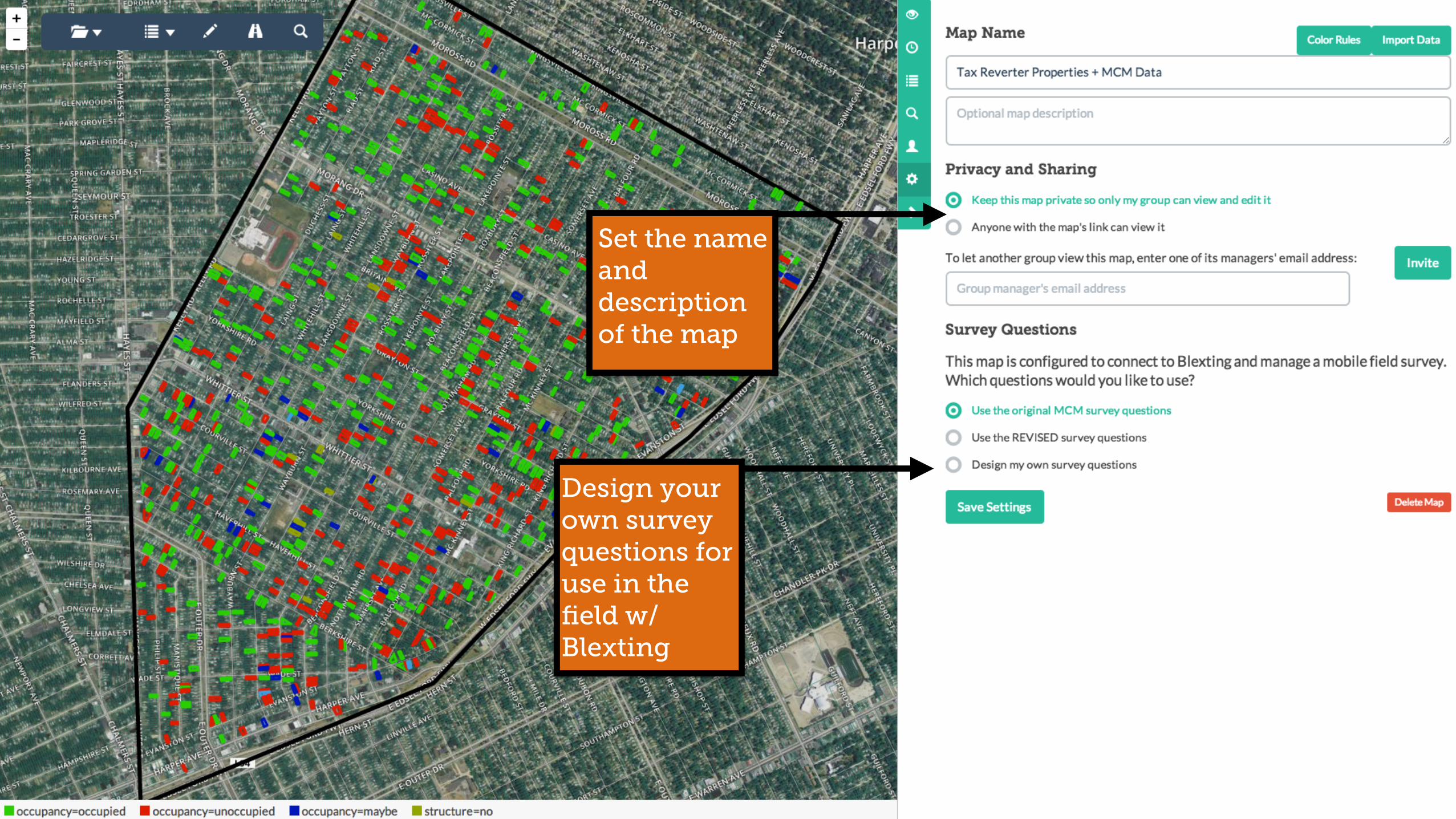
Set the name and description of the map
Design your own survey questions for use in the field w/ Blexting
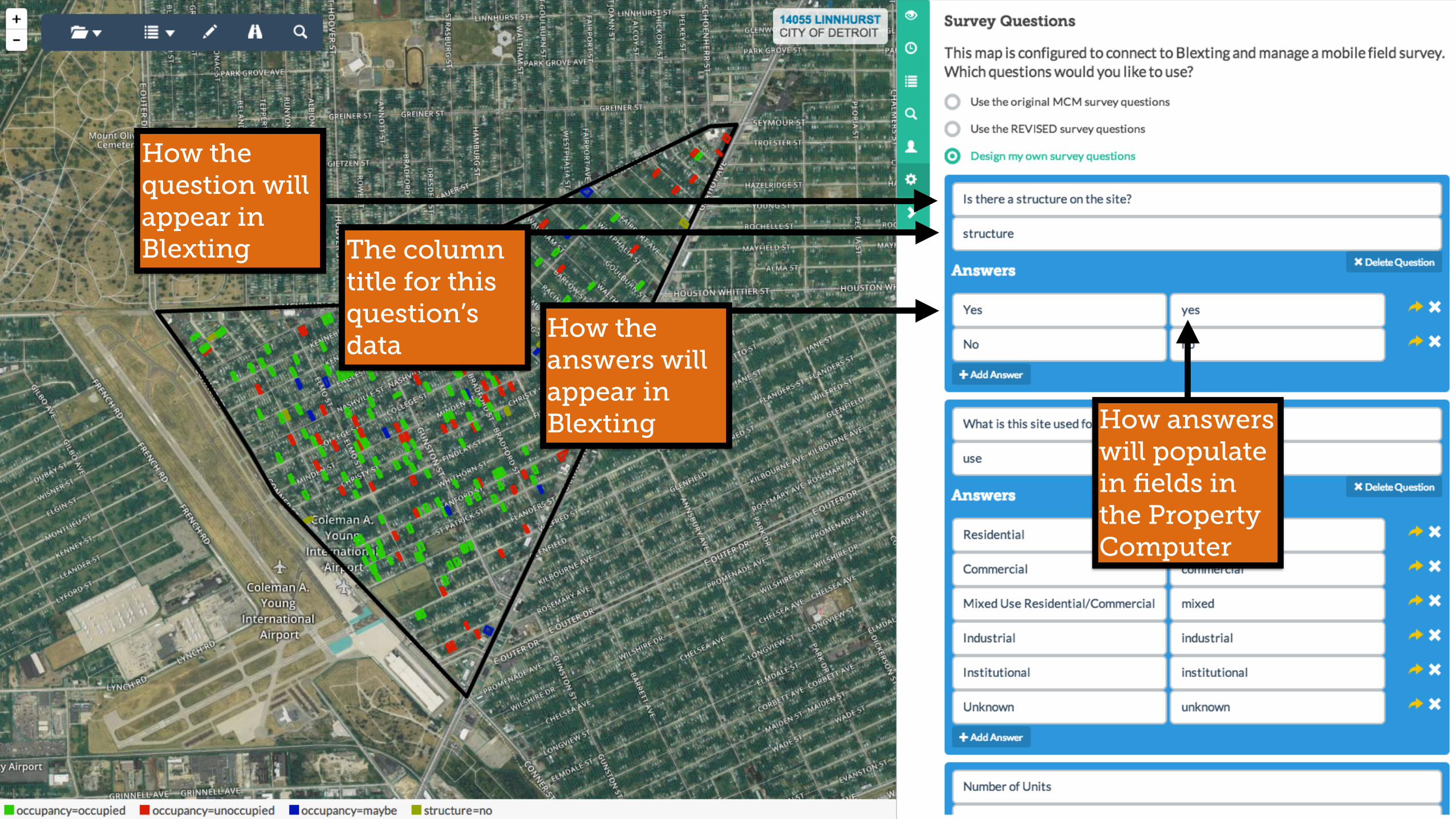
How the question will appear in Blexting The column
title for this question’s data
How the answers will appear in Blexting How answers
will populate in fields in the Property Computer

Blexting: A How To Guide!

Step 1: Download Blexting from the Play Store or App Store
Designed by: ZQ | www.designbolts.com
Free Vector (.ai, .eps)
Mock Up5

Designed by: ZQ | www.designbolts.com
Free Vector (.ai, .eps)
Mock Up5
Step 2: Open Blexting app. You will see a GPS Marker showing your location on a parcel map of the city

Designed by: ZQ | www.designbolts.com
Free Vector (.ai, .eps)
Mock Up5
Step 3: Tap the button in the upper left hand corner to log in to Blexting

Designed by: ZQ | www.designbolts.com
Free Vector (.ai, .eps)
Mock Up5
Step 4: If you have an account with Site Control, Why Don’t We Own This?, or Motor City Mapping, enter your e-mail address and password that you used when you created your account. Tap Sign In Or, tap Not A Member to sign up.
Designed by: ZQ | www.designbolts.com
Free Vector (.ai, .eps)
Mock Up5
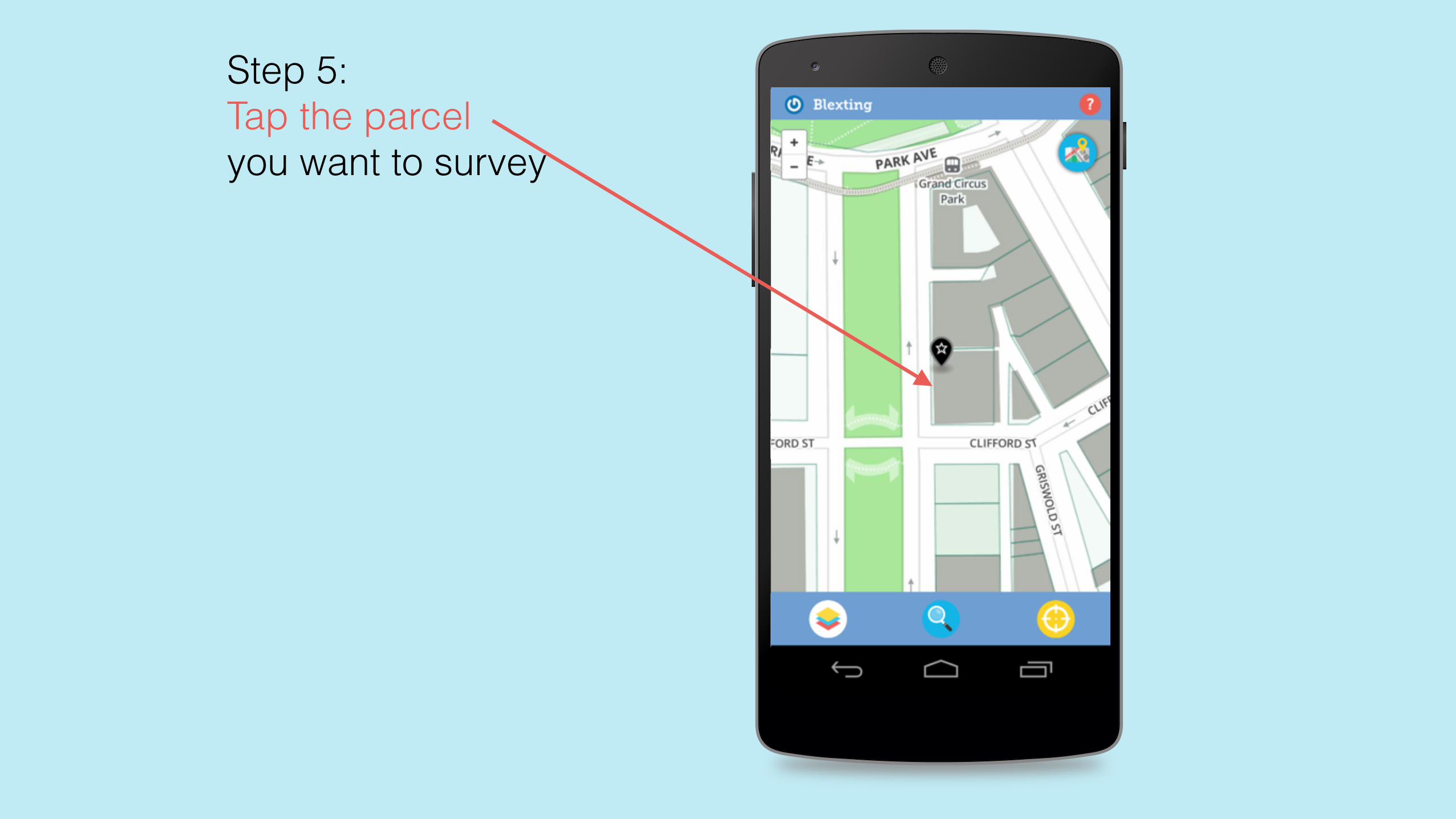
Step 5: Tap the parcel you want to survey
Designed by: ZQ | www.designbolts.com
Free Vector (.ai, .eps)
Mock Up5
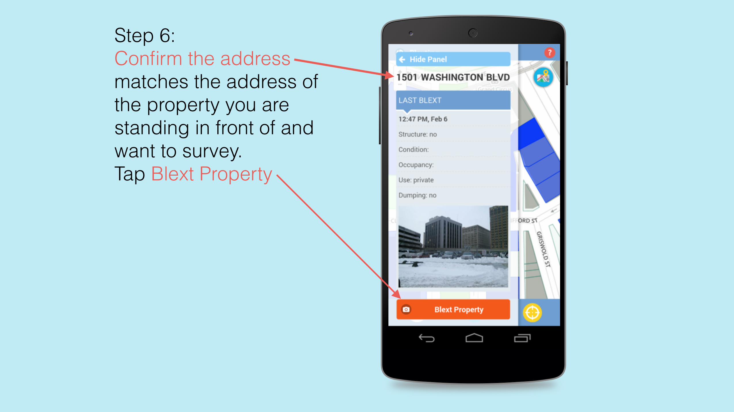
Step 6: Confirm the address matches the address of the property you are standing in front of and want to survey. Tap Blext Property
Designed by: ZQ | www.designbolts.com
Free Vector (.ai, .eps)
Mock Up5
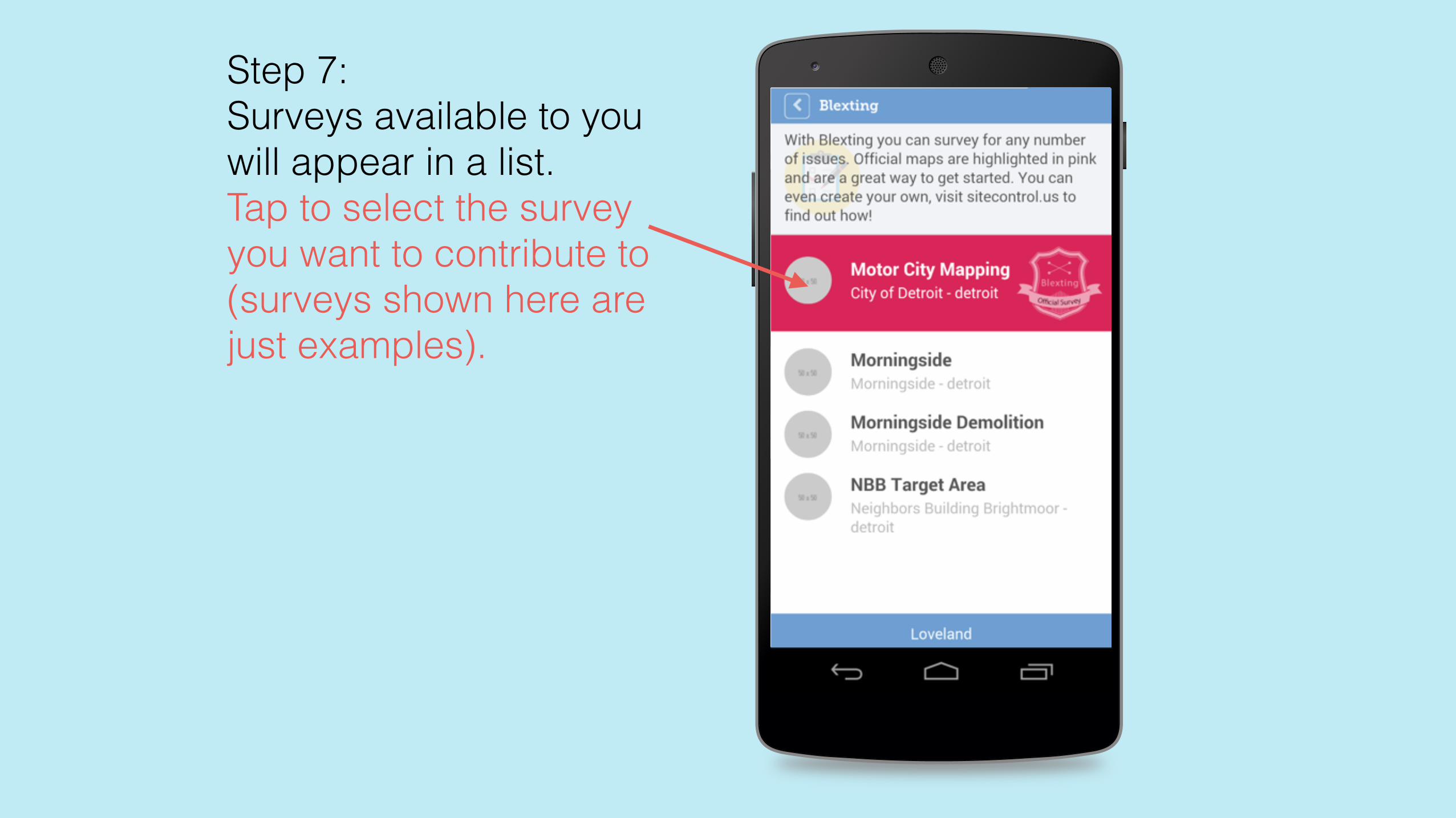
Step 7: Surveys available to you will appear in a list. Tap to select the survey you want to contribute to (surveys shown here are just examples).
Designed by: ZQ | www.designbolts.com
Free Vector (.ai, .eps)
Mock Up5
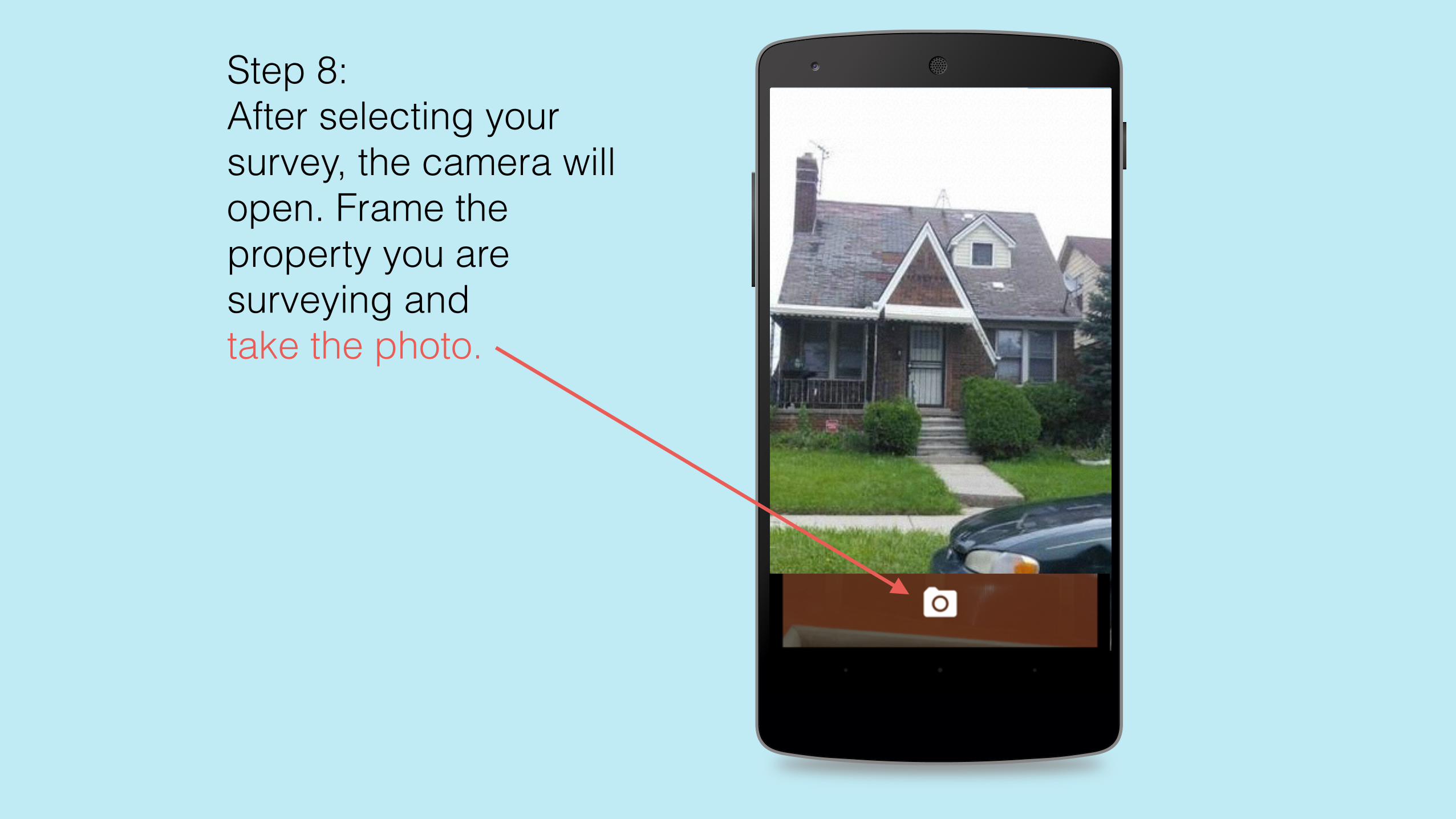
Step 8: After selecting your survey, the camera will open. Frame the property you are surveying and take the photo.

Designed by: ZQ | www.designbolts.com
Free Vector (.ai, .eps)
Mock Up5
Step 9: Tap the checkmark to approve the photo you’ve taken. You can retake the photo, if needed, by tapping the retake button. (This step may vary depending on device used to survey)

Designed by: ZQ | www.designbolts.com
Free Vector (.ai, .eps)
Mock Up5
Step 10: Survey questions will now appear. Simply tap the appropriate answer to the question to advance to the next survey question.

Designed by: ZQ | www.designbolts.com
Free Vector (.ai, .eps)
Mock Up5
Step 3: Tap the button in the upper left hand corner to log in to Blexting
Step 11: If you would like to switch the survey you are contributing to, tap the button in the upper left hand corner of the map.
Step 1: Download Blexting from the Play Store or App Store
Designed by: ZQ | www.designbolts.com
Free Vector (.ai, .eps)
Mock Up5
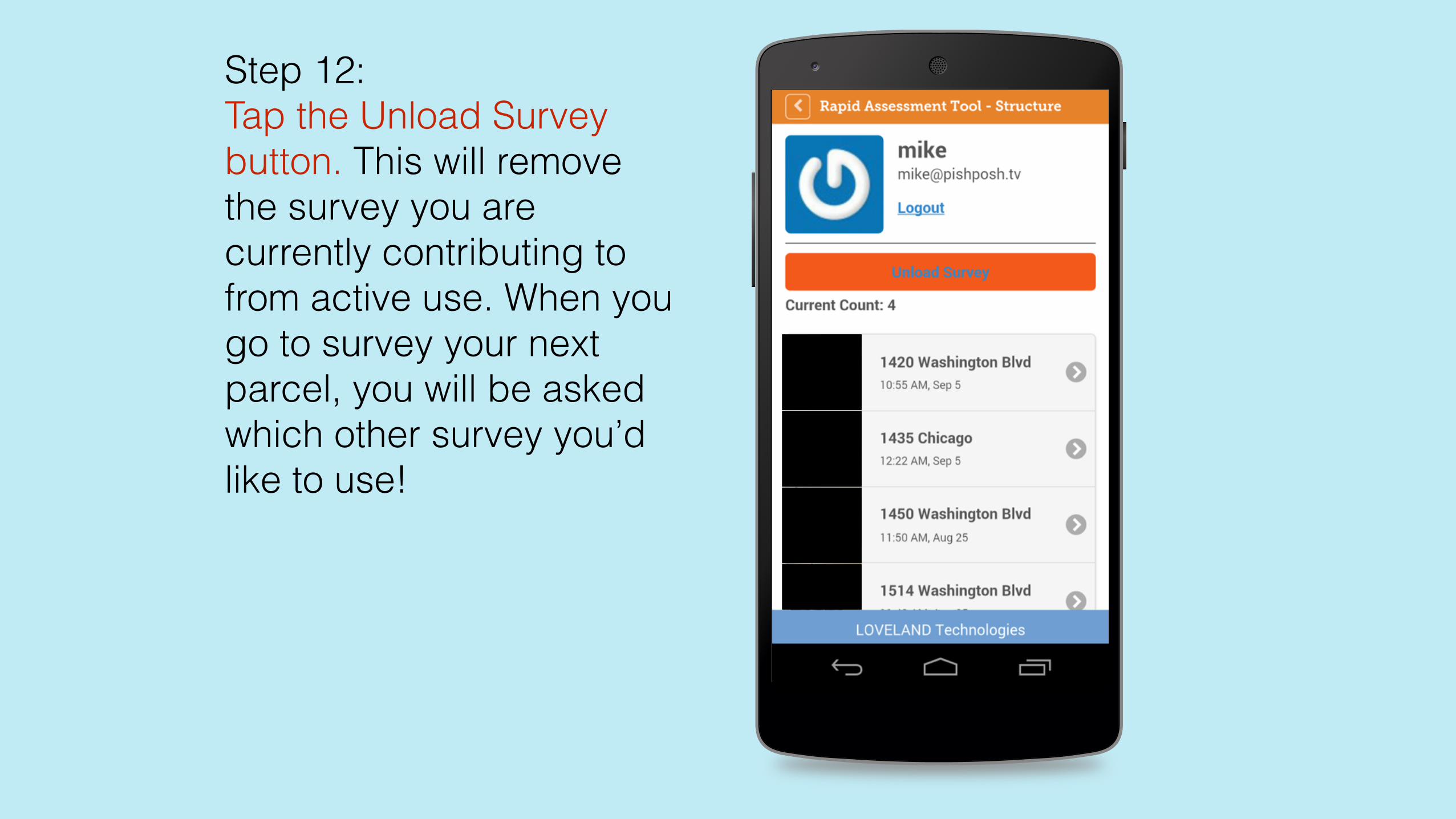
Step 12: Tap the Unload Survey button. This will remove the survey you are currently contributing to from active use. When you go to survey your next parcel, you will be asked which other survey you’d like to use!


