10
1 Snowmageddon
| Date post: | 02-Jan-2016 |
| Category: |
Documents |
| Upload: | rigel-ellis |
| View: | 19 times |
| Download: | 0 times |
1
Snowmageddon

- Numerical weather models...- All forecasts contain errors (either in
physics or initial analysis) that increase with time
- Doubling time of small initial errors ~1 to 2 days- Maximum large-scale (synoptic)
predictability ~10 to 14 days- Ensembles…
- A collection of models providing information on a range of plausible forecasts, statistical measures of confidence, and extend predictability
- Ensemble Model runs provide a range or “envelope” of solutions
- The spread of solutions can be used to provide probabilities or “confidence” limits for any forecasts
Weather forecasting: It’s impossible to be certain all of the time!
Numerical Weather Models (NWP) and Ensemble Systems
2
3
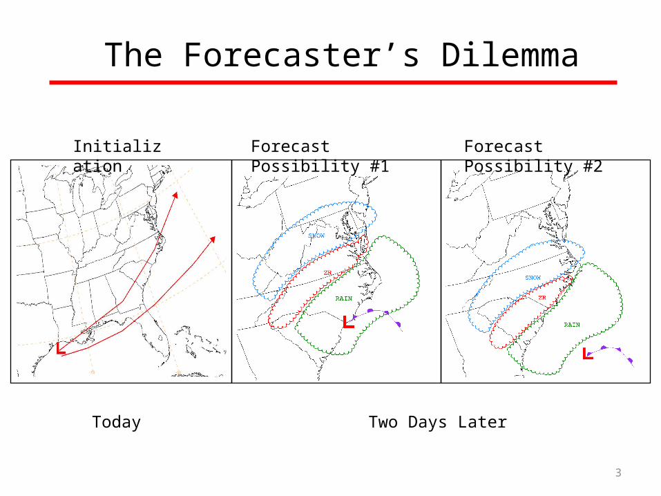
The Forecaster’s Dilemma
Initialization Forecast Possibility #1 Forecast Possibility #2
Two Days LaterToday
4
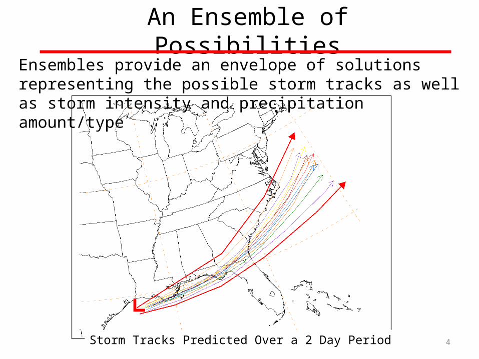
An Ensemble of PossibilitiesEnsembles provide an envelope of solutions representing the possible storm tracks as well as storm intensity and precipitation amount/type
Storm Tracks Predicted Over a 2 Day Period

5
3 daysprior
2 daysprior
1 day prior

6
HPC Snowfall Probabilities for Feb 6, 2010
3 Days Prior 2 Days Prior
1 Day Prior
Probability Legend
SLGT: At Least 10% ProbMDT: At least 40% ProbHIGH: At least 70% Prob
>12”
>12”>12”
7
Hurricane Sandy
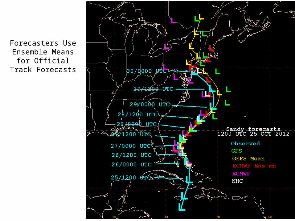
Forecasters Use Ensemble Means for
Official Track Forecasts
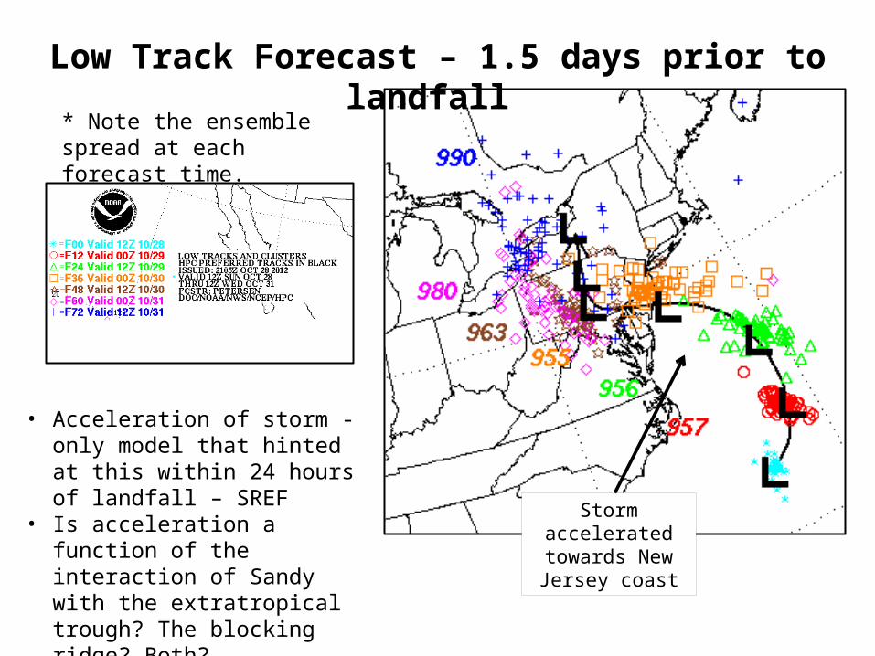
Low Track Forecast – 1.5 days prior to landfall
* Note the ensemble spread at each forecast time.
Storm accelerated towards New Jersey
coast
• Acceleration of storm - only model that hinted at this within 24 hours of landfall – SREF
• Is acceleration a function of the interaction of Sandy with the extratropical trough? The blocking ridge? Both?

• GEFS – February 14, 2012– Latest GFS, improved ensemble initialization– Resolution upgrade
• Horizontal: T190(~70km) T254 (~50km) out to 8 days• Vertical: 28 to 42 levels out to 16 days
Major FY2012 Implementations (cont.)
NH Anomaly Correlation for 500hPa Height
Period: September 1st – November 30th 2011
Week 2: Adding 3-4 days of skill
10


