Southeast Sector Settlement, A Stucco Statue, and Substantial Survey: The Caracol 1997 Season
Research Year: 1997 Culture: Maya Chronology: Late Classic to Terminal Classic Location: Belize Site: Caracol
Table of Contents
Abstract Resumen Southeast Sector Investigations Investigations in the Vicinity Structure A1 Survey Summary List of Figures Sources Cited
Abstract
The thirteenth season of the Caracol Project ran from the end of January through the beginning of April 1997. Excavations began the second week in February and continued through the last week in March. Major support for the 1997 field season came from the Foundation for the Advancement of Mesoamerican Studies, Inc. (FAMSI) and from
2
private donations to the University of Central Florida (UCF). The 1997 season had three major foci:
1. The investigation of open/collapsed/looted tombs from residential groups in the southeast sector of Caracol;
2. The investigation of the area excavated by Satterthwaite at the rear of Structure A1 for the removal of Caracol Stela 1 and Caracol Altar 1 (now in the Bliss Institute);
3. The enlargement of the recorded part of Caracol’s central area through transit-mapping.
Substantial accomplishments were made relative to each of the above three goals during the 1997 field season.
Resumen
La decimotercera temporada del Proyecto Caracol se llevó a cabo entre fines de enero y comienzos de abril de 1997. Las excavaciones comenzaron la segunda semana de febrero y continuaron hasta la última semana de marzo. El financiamiento más importante para la temporada de campo 1997 provino de la Fundación para el Avance de los Estudios Mesoamericanos, Inc. (FAMSI) y de donaciones privadas hechas a la Universidad del Centro de Florida (UCF). La temporada 1997 se concentró en tres cuestiones principales:
1. La investigación de las tumbas abiertas/colapsadas/saqueadas de los grupos residenciales del sudeste de Caracol;
2. La investigación del área excavada por Satterthwaite en la parte posterior de la Estructura A1 para retirar la Estela 1 de Caracol y el Altar 1 de Caracol (actualmente en el Instituto Bliss);
3. La ampliación de la parte registrada del área central de Caracol por medio de un mapeo hecho con teodolito.
Durante la temporada de campo 1997 se lograron varios objetivos en relación con cada una de las tres metas mencionadas.
Submitted 01/01/1998 by: Arlen F. Chase and Diane Z. Chase [email protected]
3
Southeast Sector Investigations
Between 1994 and 1995 a new episode of extensive looting occurred in the southeast portion of Caracol. In an attempt to better understand Caracol’s internal settlement prior to continued destruction from looting, the 1997 investigations focused on Caracol’s southeast sector. Previously, only limited work had been undertaken in this portion of the site. Open and/or collapsed tombs had been excavated in two groups and one eastern structure had been trenched. Thus, it was not clear to what degree the settlement in this area was similar to other areas more intensively investigated. The research undertaken in 1997 focused on testing four residential groups in this part of Caracol with six open/collapsed/looted tombs.
The four groups that were selected for excavation had all been identified by the 1995 or 1996 mapping teams as having either collapsed or open features that appeared to be tombs. These groups also contained a great diversity in domestic architecture and ranged in overall form from larger hilltop building complexes to smaller groups of low structures situated amid terraces in low-lying (almost bajo) terrain. Two groups were adjacent to the South Causeway while two were sited well away from this causeway. Given their combined architectural sizes and spatial distribution, it was felt that these groups would constitute a fairly representative sample of southeast sector settlement at Caracol.
Saraguate
The group nicknamed "Saraguate" is located 2.1 km distant from Caracol’s epicenter (as represented by Structure B1) and approximately 350 m east of the South Causeway; it is in the west-central portion of Map Quad 3I (Chase and Chase, 1987:63). The group is one of the largest architectural complexes in the southeast sector. It is situated on a small hill that bounds the eastern side of a low-lying terraced area that extends west to the South Causeway. In its final form, Saraguate was a "double-plaza" group, one of only a half dozen mapped settlement complexes of this kind at Caracol.
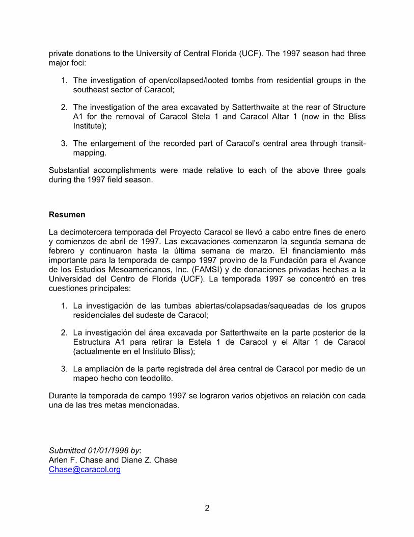
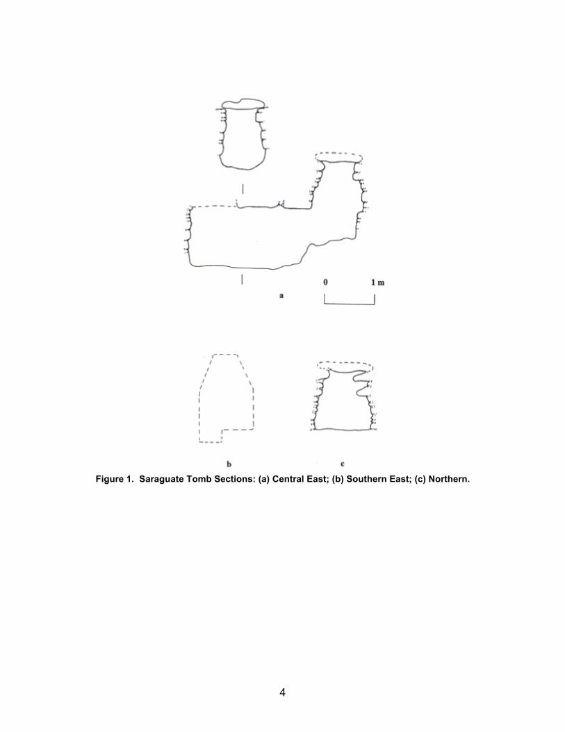
Saraguate had been the scene of extensive looting, which had gutted three eastern and one northern buildings. Although the looters’ trench through the north building in the northern plaza was drawn, the majority of the 1997 work focused on the southern plaza of Saraguate. Here both eastern buildings had been gutted by looters’ trenches. The exposed sections through these structures were recorded. Within each trench the looters had cut through at least one tomb. The looted southern east tomb (Figure 1b), occupying 3.08 m3, had been sliced in half and emptied of everything save a few bone fragments. A Preclassic vessel, however, had been placed in backdirt later dumped into this disturbed chamber. A test-pit to the front of the southern-most east building revealed the burial of a single supine female with head to the south (Figure 2). She was between 25 and 35 years of age at death. Two Late Classic vessels had been placed tangent to her right leg.
Figure 2. Saraguate Photograph of Burial in Front of Southern East Building.
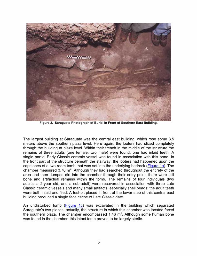
The largest building at Saraguate was the central east building, which rose some 3.5 meters above the southern plaza level. Here again, the looters had sliced completely through the building at plaza level. Within their trench in the middle of the structure the remains of three adults (one female; two male) were found; one had inlaid teeth. A single partial Early Classic ceramic vessel was found in association with this bone. In the front part of the structure beneath the stairway, the looters had happened upon the capstones of a two-room tomb that was set into the underlying bedrock (Figure 1a). The chamber measured 3.76 m3. Although they had searched throughout the entirety of the area and then dumped dirt into the chamber through their entry point, there were still bone and artifactual remains within the tomb. The remains of four individuals (two adults, a 2-year old, and a sub-adult) were recovered in association with three Late Classic ceramic vessels and many small artifacts, especially shell beads; the adult teeth were both inlaid and filed. A test-pit placed in front of the lower step of this central east building produced a single face cache of Late Classic date.
An undisturbed tomb (Figure 1c) was excavated in the building which separated Saraguate’s two plazas; actually, the structure in which this chamber was located faced the southern plaza. The chamber encompassed 1.46 m3. Although some human bone was found in the chamber, this intact tomb proved to be largely sterile.
6
In summary, excavations at Saraguate recovered information relating to three tombs, two other burials, and one cache. Additionally, three section drawings were made of looted buildings. The artifactual material indicates that Saraguate goes back to the Late Preclassic era and was occupied through at least the Late Classic Period.
Flattop
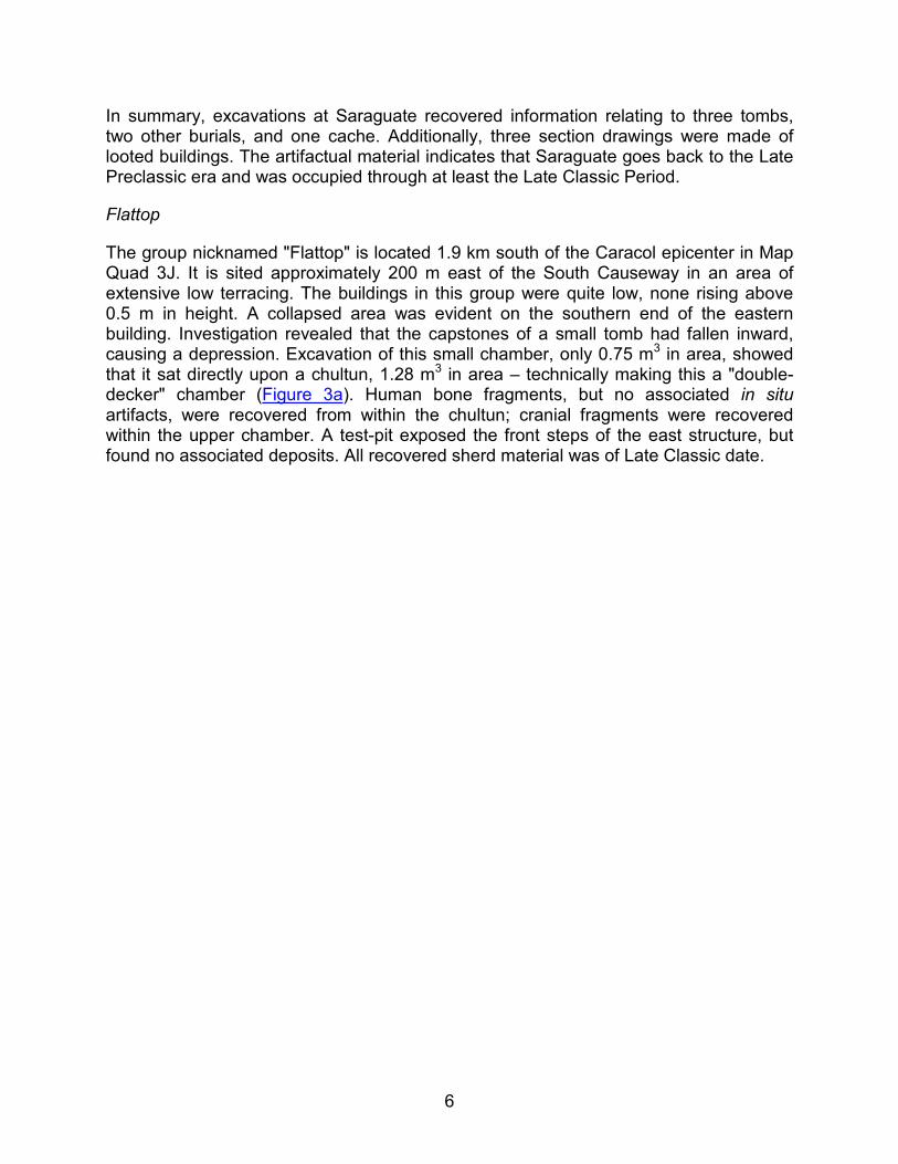
The group nicknamed "Flattop" is located 1.9 km south of the Caracol epicenter in Map Quad 3J. It is sited approximately 200 m east of the South Causeway in an area of extensive low terracing. The buildings in this group were quite low, none rising above 0.5 m in height. A collapsed area was evident on the southern end of the eastern building. Investigation revealed that the capstones of a small tomb had fallen inward, causing a depression. Excavation of this small chamber, only 0.75 m3 in area, showed that it sat directly upon a chultun, 1.28 m3 in area – technically making this a "double-decker" chamber (Figure 3a). Human bone fragments, but no associated in situ artifacts, were recovered from within the chultun; cranial fragments were recovered within the upper chamber. A test-pit exposed the front steps of the east structure, but found no associated deposits. All recovered sherd material was of Late Classic date.
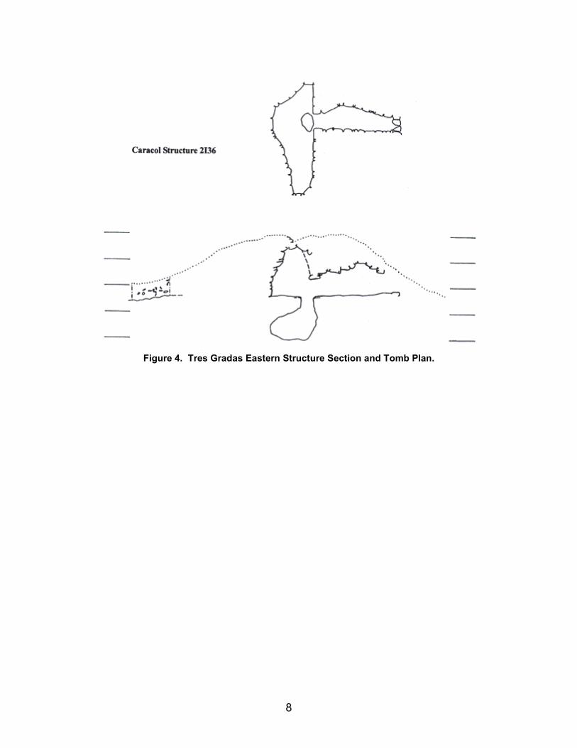
Figure 4. Tres Gradas Eastern Structure Section and Tomb Plan.
9
Figure 5. Tomb excavation at Tres Gradas with antechamber in foreground.
Tres Gradas
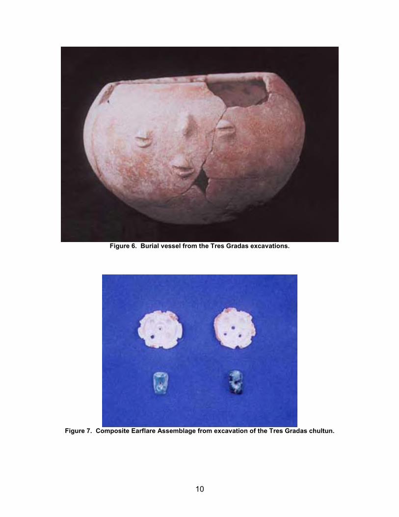
The group nicknamed "Tres Gradas" is also located 1.9 km distant from the Caracol epicenter. It is sited in Map Quad 2I, some 100 m west of the South Causeway on the side of a hill. A large east building, rising 2.0 m above the associated plaza, had a collapsed summit and an open rear passageway (Figure 4). The collapsed tomb was entered through a 4 m long entryway from the rear of the east building (Figure 5). The entrance terminated in a bee-hive-like chamber in the shape of a "D." The southern capstones of the tomb had fallen inward. Like Flattop, Tres Gradas was also double-decker chamber with a 7.34 m3 tomb atop a 2.56 m3 chultun cut into bedrock. The remains of a 7-year old child and three ceramic vessels were found in the upper chamber. The chultun (Figure 6) held the remains of an adult and another 7 to 8-year old child along with eight ceramic vessels. The adult’s teeth were filed. Shell and jadeite artifacts (Figure 7) were also recovered from within the chultun. The use of this double-decker chamber dates to the Terminal Classic era (post A.D. 790), making this one of the latest known chamber from Caracol. A test-pit in front of the east building produced Late Classic sherds and an unembellished ceramic cache vessel.
10
Figure 6. Burial vessel from the Tres Gradas excavations.
Figure 7. Composite Earflare Assemblage from excavation of the Tres Gradas chultun.
11
Insectos de Amor
The final southeast sector group investigated during the 1997 field season was nicknamed "Insectos de Amor" and is located 1.25 km distant from the site epicenter in Map Quad P. It is 100 m east of the South Causeway. The group is located on low, gently rising land between two terraces systems. The maximum height of structures within the group is 1.4 m. A collapsed tomb (Figure 3b) was evident within the core of the east building. Excavation proved it to run north-south and to have double benches separated by a narrow alleyway. The chamber enclosed an area of at least 3.63 m3 and had a formal northern entryway. The extreme width (1.5 m) of the chamber relative to its vault height (ca. 1.2 m) had probably led to the collapse of the roof. Although there was little accompanying artifactual material, the remains of at least five adults were recovered from within the tomb. A test-pit to the front of the east building produced two superimposed multiple burials. The upper interment was associated with three Late Classic ceramic vessels and contained the remains of two individuals, an adult with filed teeth and a 5 to 6-year old child. The lower interment also contained two individuals (an adult male and an adult female), one of whom had inlaid teeth. No artifactual items accompanied the lower burial.
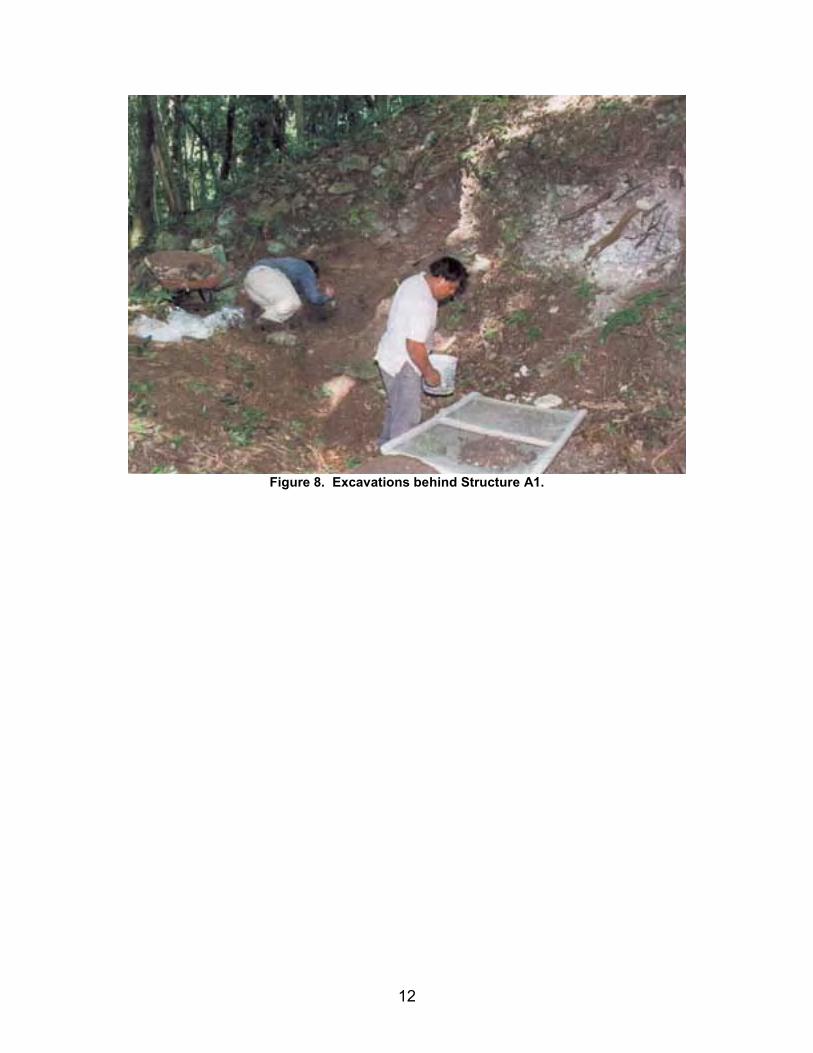
Investigations in the Vicinity Structure A1
Excavations were also carried out in the Caracol epicenter behind Structure A1 (Figure 8). Caracol Stela 1 and Caracol Altar 1 had been excavated and removed from this area in the 1950’s. A line of stone was noted washing out of the side of Linton Satterthwaite’s excavation area. Further excavation revealed that this feature was actually the eastern edge of a tomb that had once enclosed 3.63 m3 of space, but that subsequently had been purposefully filled in and buried by the Maya (Figures 3c and Figure 9).
12
Figure 8. Excavations behind Structure A1.
13
Figure 9. Structure A1 tomb before completion of excavation.
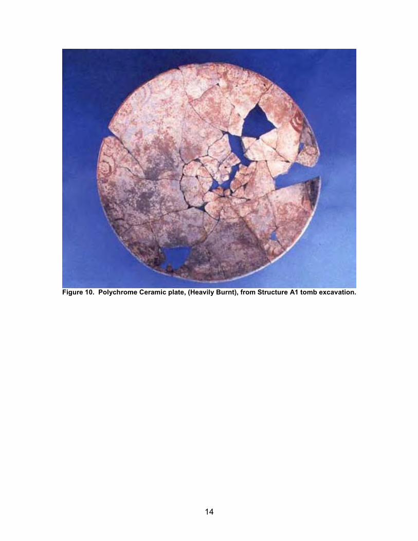
The cremated remains of three individuals (an adult, a 2-year old, and another sub-adult) were recovered from within this late 6th century interment along with parts of some 41 broken, but largely reconstructible, vessels (Figure 10 and Figure 11) and approximately 150 obsidian lancets.
Figure 11. "Flowerpot" vessel from Structure A1 tomb excavations.
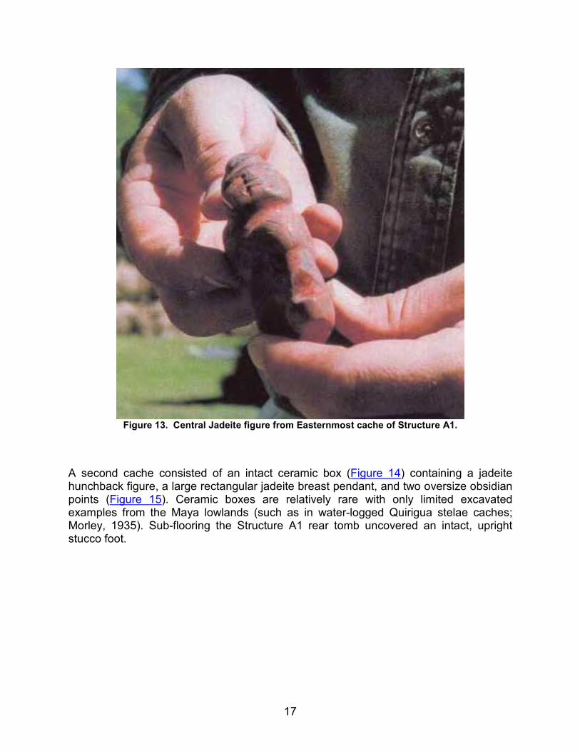
Excavation behind (to the west of) the tomb recovered two elaborate caches dating from the end of the Early Classic era. A lidded pottery barrel from the first cache (Figure 12) contained spondylous shells, "charlie chaplins," a mirror, and a large carved jadeite figure (Figure 13) - among other things.
16
Figure 12. Easternmost Cache vessels, in situ, from Structure A1 excavations.
17
Figure 13. Central Jadeite figure from Easternmost cache of Structure A1.
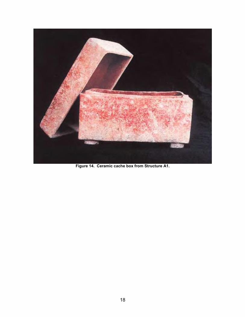
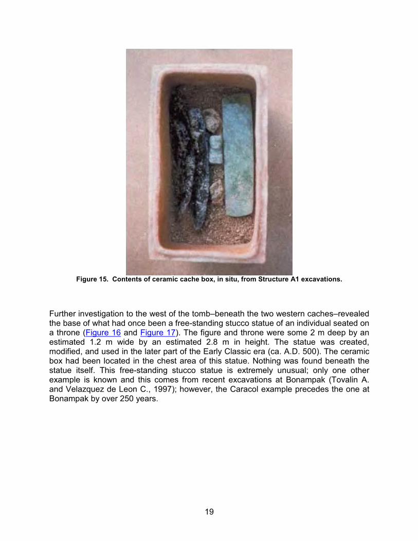
A second cache consisted of an intact ceramic box (Figure 14) containing a jadeite hunchback figure, a large rectangular jadeite breast pendant, and two oversize obsidian points (Figure 15). Ceramic boxes are relatively rare with only limited excavated examples from the Maya lowlands (such as in water-logged Quirigua stelae caches; Morley, 1935). Sub-flooring the Structure A1 rear tomb uncovered an intact, upright stucco foot.
18
Figure 14. Ceramic cache box from Structure A1.
19
Figure 15. Contents of ceramic cache box, in situ, from Structure A1 excavations.
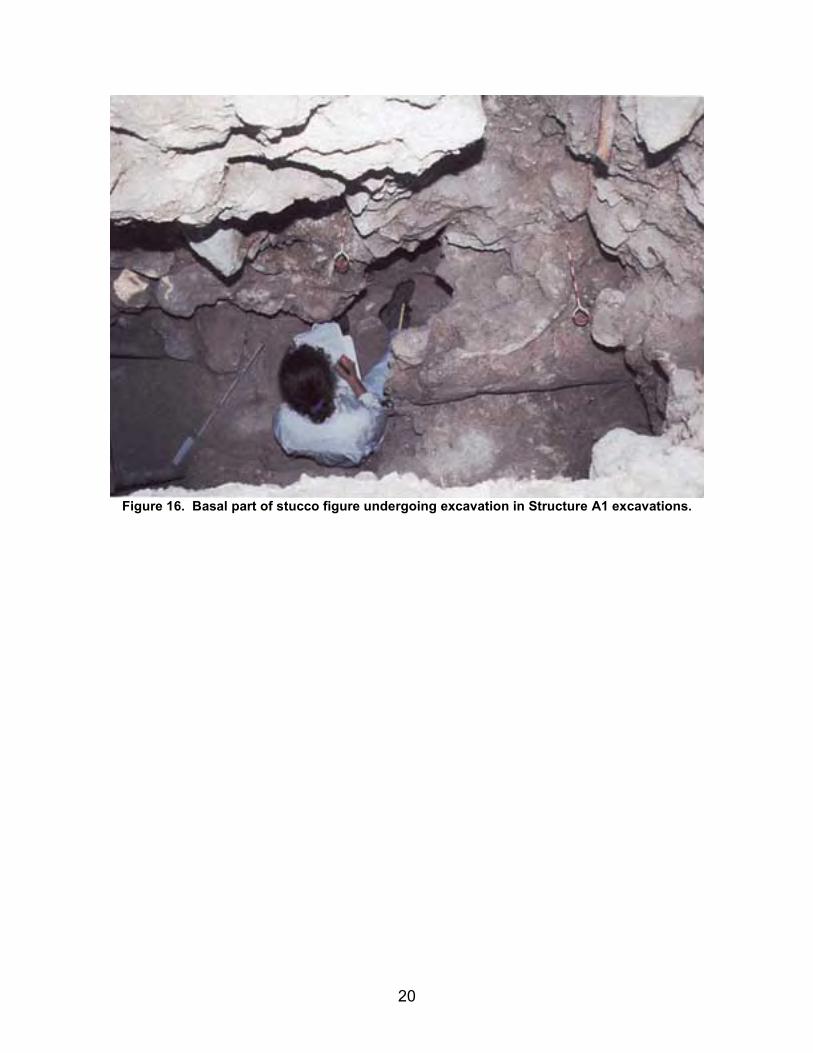
Further investigation to the west of the tomb–beneath the two western caches–revealed the base of what had once been a free-standing stucco statue of an individual seated on a throne (Figure 16 and Figure 17). The figure and throne were some 2 m deep by an estimated 1.2 m wide by an estimated 2.8 m in height. The statue was created, modified, and used in the later part of the Early Classic era (ca. A.D. 500). The ceramic box had been located in the chest area of this statue. Nothing was found beneath the statue itself. This free-standing stucco statue is extremely unusual; only one other example is known and this comes from recent excavations at Bonampak (Tovalin A. and Velazquez de Leon C., 1997); however, the Caracol example precedes the one at Bonampak by over 250 years.
20
Figure 16. Basal part of stucco figure undergoing excavation in Structure A1 excavations.
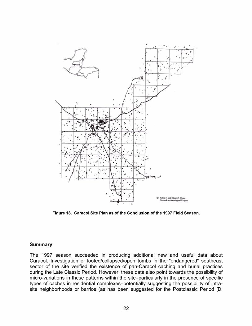
Mapping was also carried out in the southern and western parts of Caracol in an effort to increase the surveyed central area of the site. Almost 2 km2 of settlement were added to the Caracol map during the 1997 field season. The Pajaro-Ramonal terminus in the southeastern part of the site was embedded in a 1 km2 block of settlement and a strip of settlement 500 m wide by 3.0 kilometers in length filled in the sparsely represented western edge of the Caracol central map (Figure 18). At this point, over 16 km2 of Caracol’s core settlement has been recorded. Overall, approximately 17 km2 of the site have been transit mapped. Over 4,400 documented structures occur within this mapped area.
22
Figure 18. Caracol Site Plan as of the Conclusion of the 1997 Field Season.
Summary
The 1997 season succeeded in producing additional new and useful data about Caracol. Investigation of looted/collapsed/open tombs in the "endangered" southeast sector of the site verified the existence of pan-Caracol caching and burial practices during the Late Classic Period. However, these data also point towards the possibility of micro-variations in these patterns within the site–particularly in the presence of specific types of caches in residential complexes–potentially suggesting the possibility of intra-site neighborhoods or barrios (as has been suggested for the Postclassic Period [D.
23
Chase, 1986; D. Chase and A. Chase, 1988]). The 1997 southeast settlement investigations also provided needed coverage of this part of the site in terms of settlement history and longevity. Excavations encountered evidence of occupation that spanned the Preclassic through the Terminal Classic Periods. The 1997 work also provided the best evidence yet encountered for Terminal Classic occupation outside the epicenter and strongly suggested the continuation of Late Classic patterns into this era.
Investigations to the south of Structure A1 encountered an area with 50 to 100 years of concentrated and continued ritual activity in what is generally considered to be a non-traditional locus for ritual–the back side of a major pyramid. The excavations provided a series of unexpected finds–a tomb, a free-standing stucco statue, and two elaborate caches–that put the odd location of Caracol Stela 1 and Altar 1 into better (and more complex) context. The ceramic box and stucco figure also stand out as extremely unusual finds. However, the Structure A1 rear investigations also point to the need for further research in the vicinity of the A Plaza.
Finally, the 1997 survey added to previous seasons’ work to create 16 km2 of Caracol’s central area that have been transit mapped, out of about 17 km2 overall of the site’s settlement. This mapping is critical for greater interpretation of the residential settlement and overall layout of the site as these data allow for comparisons to be made with other large Classic centers, such as Tikal and Calakmul, and firmly demonstrate both the greater scale and density of occupation at Caracol during the Late Classic Period.
Note: Updates since the 1997 field season are available at: The Official Website of the Caracol Archaeological Project.
Figure 18. Caracol Site Plan as of the Conclusion of the 1997 Field Season.
Sources Cited
Chase, Arlen F. and Diane Z. Chase
1987 Investigations at the Classic Maya City of Caracol, Belize: 1985-1987. Monograph 3. San Francisco: Pre-Columbian Art Research Institute.
Chase, Diane Z.
1986 Social and Political Organization in the Land of Cacao and Honey: Correlating Archaeology and Ethnohistory of the Postclassic Lowland Maya. In Late Lowland Maya Civilization. J.A. Sabloff and E.W. Andrews V, eds. Pp. 347-377. Albuquerque: University of New Mexico Press.
Chase, Diane Z. and Arlen F. Chase
1988 A Postclassic Perspective: Excavations at the Maya Site of Santa Rita Corozal, Belize. Monograph 4. San Francisco: Pre-Columbian Art Research Institute.
25
Morley, Sylvanus G.
1935 Guide Book to the Ruins of Quirigua. Supplemental Publication 16. Washington: Carnegie Institution of Washington.
Tovalin Ahumada, Alejandro and J. Adolfo Velazquez de Leon Collins
1997 Anatomía de Una Estructura: El Edificio 15 de Bonampak. In Los Investigadores de la Cultura Maya 5. R. Encalada Argaez, ed. Pp. 55-70. México: Universidad Autónoma de Campeche.