+ All Categories
Home > Documents > Southern Sprawl: Land use Regulation and its Effects in ... Essay Competition... · Southern...

Southern Sprawl: Land use Regulation and its Effects in ... Essay Competition... · Southern...

Date post: 02-Apr-2018
Category:
Upload: phungtu
View: 217 times
Download: 1 times
Share this document with a friend
37
1 University of Auckland, Faculty of Law LAWENVIR 401 Resource Management Law Paper in Lieu of Examination Southern Sprawl: Land-use Regulation and its Effects in Houston, Texas. By Andrew McIndoe, 1551269 Abstract: A combination of local government land-use regulations and private deed covenants have contributed to the maintenance of a very low population and employment density in Houston, Texas. This low density is reflected in the sprawling nature of the city’s urban form. This paper analyses how specific land-use restrictions, both public and private in nature, have contributed to this state of affairs. It then examines how these restrictions and the low-density urban form they promote have contributed to the twin problems of automobile dependency and social segregation in the city. It suggests that, despite the absence of formal use-zoning laws, private deed restrictions, and to a lesser extent City ordinances, have aided the creation of single-use residential and commercial zones that have exacerbated these two problems. It concludes that greater public regulation is required to mitigate the negative effects of sprawl, which are disproportionately harmful to the less wealthy citizens of the city.
Transcript

1

University of Auckland, Faculty of Law

LAWENVIR 401 Resource Management Law

Paper in Lieu of Examination

Southern Sprawl: Land-use

Regulation and its Effects in

Houston, Texas. By Andrew McIndoe, 1551269

Abstract: A combination of local government land-use regulations and private deed

covenants have contributed to the maintenance of a very low population and employment

density in Houston, Texas. This low density is reflected in the sprawling nature of the

city’s urban form. This paper analyses how specific land-use restrictions, both public and

private in nature, have contributed to this state of affairs. It then examines how these

restrictions and the low-density urban form they promote have contributed to the twin

problems of automobile dependency and social segregation in the city. It suggests that,

despite the absence of formal use-zoning laws, private deed restrictions, and to a lesser

extent City ordinances, have aided the creation of single-use residential and commercial

zones that have exacerbated these two problems. It concludes that greater public

regulation is required to mitigate the negative effects of sprawl, which are

disproportionately harmful to the less wealthy citizens of the city.

2

Introduction

Houston, Texas is unique amongst large American cities in that it has no zoning laws regulating land

use. Use zoning, under which specified areas of land may only be used for certain uses such as

residence or commerce, has often been criticised for producing urban sprawl, automobile dependency

and social segregation in many American metropolises. Yet the example of Houston illustrates that a

lack of use-zoning does not exempt a city from these issues. The city is one of the most sprawling in

the United States. Houston’s paradigm of urban development, which combines a local government

with a pro-growth and pro-low-density development outlook, and the creation and enforcement of

land use regulations by groups of private citizens, has led the city to a well-deserved reputation as a

“poster child for sprawl”. 1

At the same time, Houston is a highly automobile dependent city, and

experiences high levels of social segregation.

This essay will examine how a range of regulations and legal instruments has led Houston to have one

of the lowest urban densities in America, a key factor in its sprawl. It will illustrate how Houston’s

political culture of laissez-faire individualism has led local government bodies to avoid instituting a

use-zoning policy while leaving much land-use regulation to private citizens through private deed

covenants. At the same time, however, the City government has sought to maintain a low-density city

through a range of other regulatory measures. This essay will examine how both private deed

restrictions and governmental regulation has contributed to Houston’s low-density urban form. It then

argues that deed restrictions, like use-zoning regulations in other cities, have created single-use zones

within the city, and have contributed to the same problems that use-zoning is often accused of

causing, namely automobile dependency and social segregation. It will thus analyse how Houston’s

low-density urban form has both contributed to, and is in turn perpetuated by automobile dependency,

and will analyse how the encouragement of low-density urban development has increased social

segregation, polarising the city between wealthy outer-ring suburbs and poor largely inner-city

neighbourhoods.

Ultimately, Houston’s current method of controlling urban development is producing a more

unliveable and unequal city. This essay suggests that the encouragement of low-density, private-

transit-reliant development, while consistent with the political ethos of the city’s elite and business

classes, is in fact detrimental to the wellbeing of many of its citizens.

1 Michael Lewyn “How Overregulation Creates Sprawl (Even in a City without Zoning)” (2004) 50 Wayne L

Rev 1171 at 1177.

3

The Political and Administrative Context of

Houston

In order to understand land use regulation in Houston it is necessary to briefly describe its political

culture, local government structure, and history.

Houston’s history of growth

Known today as one of America’s boomtown metropolises, Houston was founded on the inland Gulf

coast of Texas in 1836 as a relatively humble mercantile city.2 From the opening of the Spindletop oil

well in 1901, Houston developed into a pre-eminent global centre of the oil and petro-chemical

2 Zhu Qian “Planning a ‘World Class’ City without Zoning: the experience of Houston” in M Jenks, D Kozak

and P Takkanon World Cities and Urban Form: Fragmented, Polycentric, Sustainable? (Routledge, Abingdon,

2008) 219 at 220.

A map of the Houston region, with the Gulf of Mexico the east. Both of Houston’s major ring roads,

the I-610 and Beltway 8, can be seen. Source: http://sktmaps.blogspot.co.nz/2012/10/map-of-

houston-tx.html

4

industries. In 1914 the Houston Ship Channel connecting the city to the Gulf of Mexico was opened,

precipitating the building of oil refineries in the 1920s and 1930s.3 It experienced a boom during the

Second World War, supported by federal funding and private investment, and became the world’s

largest petrochemical manufacturing site.4 The energy sector, as well as a growing range of other

technical industries including medical research and NASA’s space centre provided the impetus for

Houston’s dynamic growth throughout the 1970s and 1980s. The huge clerical and administrative

apparatus required to sustain these industries led to a proliferation of large office blocks in the city;

205 office blocks over 100,000 square feet were constructed between 1970 and 1983.5 Houston’s

economy has diversified in recent years: while the energy industry accounted for 60% of the city’s

economic base in 1990, by 1999 that figure was down to 49%.6 It remains an economic powerhouse,

with the metropolitan area’s Gross Area Product in 2006 reaching $325.5 billion.7

Today Houston is the fourth most populous city in the United States, with a population of 2.1 million

as of 2010.8 Its metropolitan area has a population of 5.9 million.

9 In geographic terms the city is vast.

It is a “decentralised, low density city which sprawls more than 25 miles in each direction from

downtown”, with various nodes of business “connected by hundreds of miles of freeway.”10

The city

has a notably low population density compared with other American cities of a similar size.11

According to the 2010 national census it has a density of 3502 persons per square mile, compared to

27,013 per square mile in New York, 11,842 per square mile in Chicago, and 8092 per square mile in

Los Angeles.12

The primary mode of Houston’s growth has been lateral sprawl: between 1974 and

2002, the city’s land area quadrupled from 941 km2 to 3724 km

2.13

The land use policies that have

encouraged this low-density urban growth will be discussed in a subsequent section.

Houston’s inner-city neighbourhoods are bounded by the I-610 beltway. However, only about 25% of

Houston’s residents live within this “loop”; the majority of development has occurred outside the

inner city.14

The loop thoroughfare is a feature of many large American cities: Houston, however, has

not one, but two loop roads (the second being the ring-road known as Beltway 8), with a third being

3 Robert Dunphy Moving Beyond Gridlock: Traffic and Development (Urban Land Institute, Washington, D.C.,

1997) at 144. 4 At 221.

5 Robert Fisher, “Urban Policy in Houston, Texas” (1989) 26 Urban Studies 144 at 145.

6 Qian, above n 2, at 221.

7 The City of Houston “Facts and Figures” <http://www.houstontx.gov/abouthouston/houstonfacts.html>

8 United States Census Bureau “Community Facts: Houston city, Texas” (2010)

<http://factfinder2.census.gov/faces/nav/jsf/pages/community_facts.xhtml#none> 9 United States Census Bureau “CPH-T-5. Population Change for Metropolitan and Micropolitan Statistical

Areas in the United States and Puerto Rico (February 2013 Delineations): 2000 to 2010” (March 2013)

<http://www.census.gov/population/www/cen2010/cph-t/CPH-T-5.pdf > 10

Fisher, at 145. 11

Lewyn, above n 1, at 1176. 12

US Census Bureau “State and County QuickFacts” (2014) <http://quickfacts.census.gov/qfd/index.html> 13

H Oguz, A Klein and R Srinivasan “Predicting Urban Growth in a US Metropolitan Area with No Zoning

Regulation” (2008) 2 International Journal of Natural & Engineering Sciences 9 at 11. 14

Qian, at 225.

5

proposed as the city expands ever outwards.15

A self-professed “progrowth community”, the city

“puts few restrictions on development … [and is] an auto-oriented, outward-moving metropolitan

area.”16

Its booming suburban growth has resulted in “some of the largest and densest suburban

activity centers – edge cities – that have ever been assembled.”17

If Houston’s model of sprawling

development continues unchecked, it is likely that development will continue on the metropolis’

urban fringe, further expanding its surface area.18

15

Lewyn, at 1191. 16

Dunphy, above n 3, at 143. 17

At 143. 18

Oguz et al, above n 13. The researchers have modelled the Houston Metropolitan Area (Houston CMSA)

urban growth to 2030, suggesting if current patterns continue, growth will continue to be lateral.

6

Administration and Political Culture

The City of Houston is an incorporated home-rule municipality under section 5, Article 11 of the

Texas State Constitution, having been granted a Charter from the Congress of the Republic of Texas

in 1837, and again from the Texas Legislature in 1905.19

It is administered by its elected officials, the

Mayor and the 16-member City Council, who must work within the constitutional framework of the

City Charter.20

The Council passes ordinances and resolutions regarding the management of the city,

and thus is the public body with the greatest control over planning and urban development in Houston.

The Houston City government has authority to pass ordinances and resolutions within the city’s urban

boundaries, as well as limited authority within its Extraterritorial Jurisdiction (ETJ) – a 5-mile band

around the city boundaries, as mandated in the Texas Local Government Code.21

This includes the

authority to implement Chapter 42 of the Code of Ordinances, which deals with the development and

subdivision of land. The City of Houston has generally pursued an aggressive policy of annexing the

19

Charter, Code of Ordinances, City of Houston, Texas at footnote 1. 20

City of Houston “About City Government” <http://www.houstontx.gov/abouthouston/citygovt.html> 21

Texas Local Government Code § 42.021(a).

A map of the 11 City Council districts of Houston, as of 2011. The coloured areas indicate the

incorporated areas of the City. Source: http://electioninfo.wordpress.com/2011/09/19/election-

2011-houston-city-elections/

7

unincorporated land beyond its boundaries as it is empowered to do in the same Code.22

It is thus

constantly enlarging the area in which it wields regulatory power.23

The strident growth of the City of Houston’s administrative territory is at odds with the relatively

muted regulatory powers held by its public authorities. A significant feature of Houston’s political

culture is that the city’s public governance and growth strategy is driven largely by the private sector

rather than public bodies. Many commentators argue that this is a direct function of a strongly

libertarian and anti-government culture in Houston: 24

Houston’s rhetoric is for limited government intervention, low taxes and low expenditure on

public welfare, and a disinterest in social service and income redistribution programmes.

Indeed, Houston’s local government has a long taken a laissez-faire, highly non-interventionist

approach. Unregulated free market capitalism has been in many respects the guiding ideology of its

political and business elite,25

who are mistrustful of any manifestation of public governance which

seems “to represent in fact or fantasy the implementation of limits on the economic prerogative and

activity of the city's business community.”26

Government has been restricted – or, more accurately,

has restricted itself – to the provision of basic services.27

Local government’s ideological reticence to involve itself too heavily in the exercise of governing is

evident in public spending figures: in the early 1980s, Houston’s local government spent only $0.32

per person on urban planning, compared to $1.53 in nearby Dallas, and $7.24 in Kansas City.28

Historically, numbers of police have been extremely low compared to other large American cities,

despite a high murder rate.29

Low local government spending may allow for low taxes, but it also has

inevitable costs on public services and amenities. Houston has “an unusually limited array of city

services and an infrastructure of ageing streets, [and] inadequate and ageing water and sewer

systems”.30

The laissez-faire ethos by its nature entails that the burden of securing most public goods

lies upon private citizens. Civic associations in richer areas have generally been able to afford to pay

for amenities such as street lighting and road sealing; less wealthy neighbourhoods have often had to

go without these basic goods.31

Public antipathy to active governance is evidenced in the continual

22

Texas Local Government Code, s 43.021. 23

Joe Feagin “The Social Costs of Houston’s Growth” (1985) 9 International Journal of Urban and Regional

Research 164 at 164, 181. 24

Qian, above n 2, at 224. 25

Feagin, at 166. 26

Fisher, above n 5, at 146. Interestingly, he argues further that even the city’s poor and middle-class have

bought into this free-market philosophy – or at least remained quiescent about its ascendancy. See 145. 27

At 144. 28

Fisher, above n 5, at 144. 29

At 149. 30

Feagin, above n 23, at 168. 31

Fisher, at 153.

8

public rejection of proposed use-zoning laws every time they have been proposed by the City

government in referenda (in 1948, 1962 and 1993).32

Qian attributes this to a general perception that

single-use zoning would be “a violation of private property and personal liberty”, and perhaps even

akin to socialism, a much-maligned label in the United States.33

The laissez-faire ideology

underpinning civic life is also evident in the complete absence of state or city income taxes in

Houston.34

Thus, in line with this libertarian ethos, instead of strong public administration, the governance of the

city – including the provision of many services, the creation of urban development strategy, and the

regulation of land use – has lain with the private sector. Private bodies have often either undertaken

planning themselves, or have influenced or led public body planning processes.35

Local government

politics in Houston has always been heavily influenced by the private sector, leading some to term the

city’s administration as a form of “privatized politics”.36

Fisher notes the historically close association

between the Houston Chamber of Commerce, a private lobbying body comprised of local corporate

Chief Executives, and the City government. The Chamber has been able to influence City government

through: 37

frequent interchanges of Chamber personnel with city hall, social contacts and informal

meetings, co-optation of potential opponents, propaganda dissemination, provision of

research findings and plans to policy makers, and intensive lobbying.

This private sector-led governance has resulted in urban policy heavily weighted towards economic

growth at the expense of the provision of public services and amenities.38

For example, the prioritising

of large transport infrastructure projects, particularly the creation of hundreds of miles of freeways is

a clear sign of a focus on growth rather than other public issues such as liveability and air pollution. In

2005 Houston had nearly twice as many miles of freeway as Boston, despite only having 10 percent

more inhabitants, and had nearly as many miles as Chicago, despite that city being twice as populous

as Houston.39

It is clear that “local political history and culture determine distinct urban development

patterns”: the primacy of the private sector in Houston has thus led to planning outcomes that

32

Alexander Garvin The American City: What Works, What Doesn’t (2nd

ed, McGraw-Hill, New York, 2002) at

429. 33

Qian, above n 2, at 219, 226; Dunphy, above n 3 notes that opposition to a proposed 1947 zoning ordinance

decried zoning as socialist and un-American, at 144. 34

Fisher, at 146. 35

Qian, at 226. 36

See Fisher, at 147, Qian, at 223, 233. 37

Fisher, at 148. 38

Fisher, at 144, Qian, at 224. 39

Lewyn, above n 1, at 1191.

9

generally favour private over public interests.40

Feagin argues that the lack of emphasis on the

provision of public services has had negative social costs. As the private sector is concerned largely

with maximising its own profits, it will try and pass as many costs as possible on to third parties –

including the public. In allowing this practice to be the driving force behind urban development

planning, government actually “cooperate[s] in inflicting social costs on the urban citizenry.”41

Another way in which in the private sector has asserted substantial regulatory power in Houston is in

the creation of land use regulations. The regulation of land use is an illustrative example of the way in

which private regulation has materially affected the form of the city. While the Houston City

government has enacted a relatively comprehensive code of development (discussed subsequently),

private bodies have “filled the gaps” left by the lack of a formal zoning policy.42

Homeowner

associations and other civic groups have enacted various codes that limit land use, and set out

minimum standards for land use in individual neighbourhoods, almost always in the form of

restrictive covenants. These covenants are created by developers and homebuilders, and can be

enforced by residents of the subdivision in which the covenant applies, homeowners’ associations, or

the Houston City Attorney. Importantly, these covenants generally run with the land, and so bind

future purchasers and preserve the aesthetic value of neighbourhoods in perpetuity.43

The aim of this

private regulation is to “protect property values, amenities and homeowners’ quality of living in a

neighbourhood”:44

the provision of services is often of secondary importance, if valued at all.45

The details of these private regulations will be discussed in detail in the next section. What is

important to note is that on a broad level, land use is often regulated by private groups in the context

of individual, distinct neighbourhoods, rather than at a city-wide level. One of the central drawbacks

to leaving land use regulation to private bodies is that they can only regulate land over which

restrictive covenants exist. Because they are by nature focused on particular neighbourhoods or

subdivisions, they are ill-suited to addressing broader infrastructure issues such as traffic regulation,

water supply and pollution control.46

Yet the prevalence of private land use restrictions is amenable to

local government in Houston because it “shift[s] the burden [of enforcement] from the public to the

private sector”, and is consistent with a laissez-faire approach to government.47

40

Qian, above n 2, at 234. 41

Feagin, above n 23, at 165-166. 42

Qian, at 219. 43

At 226-227. 44

At 227. 45

At 227. 46

Garvin, above n 32, at 428-429. 47

Qian, at 228.

10

The primacy of “privatised” governance and planning in Houston has been criticised for creating or

exacerbating a number of social and environmental problems. The contribution of Houston’s land use

regulation system to the related issues of automobile dependency and social stratification will be dealt

with in detail subsequently. One final issue that should be noted briefly is the democratic deficit

created by the Houston government’s abrogation of its planning and regulatory powers. Fisher notes

how there is little space for citizens to participate in or critique the planning process and urban

development strategies, as these are now largely in the hands of private bodies.48

Poorer citizens in

particular are not favoured by a system of private land use regulation which requires private money to

fund enforcement, and so have very little ability to influence the decisions made about their

neighbourhoods and living environments. 49

The lack of avenues for public participation in Houston’s

urban development is something that can probably only be addressed by a more responsive local

government assuming greater oversight over the city’s planning and land use regulation.

Land Use Regulation in Houston

It is the thesis of this paper that the unique system of simultaneous public and private land use

regulation in Houston has generated several harmful social and environmental problems. This section

will outline the nature of land use regulation, focusing first on City government measures, and then on

private covenants. In doing so, it will explain how each measure contributes to Houston’s low-density,

or ‘sprawling’ form. It is the city’s low density that has exacerbated the city’s automobile

dependency, which will be discussed subsequently. Additionally, Houston’s land-use controls have

contributed to social segregation in the city, which will be analysed in the final section of this paper.

In this section each form of land use regulation will be addressed in turn, outlining how it encourages

a low-density urban form.

Local Government Regulation

Despite the lack of a formal zoning policy and a laissez-faire philosophy, Houston’s City government

has enacted a wide range of land-use regulations that have the effect of encouraging low-density

development in the City and its ETJ. It is interesting to note that this regulation of urban form is

present despite the city’s alleged antipathy towards government intervention in the market. As Talen

notes, “despite the mythology of rugged individualism, rules have always been an integral part of the

48

Fisher, above n 5, at 147. 49

Qian, at 230.

11

American experience”.50

Admittedly, many of Houston’s ordinances are not in and of themselves the

cause of urban sprawl in the city – many promote low-density no more than regulations in many other

cities. But it is clear that they favour low-density development over high-density infill development.

And when their effect is combined with private deed restrictions that promote low population density

to a much greater degree (discussed subsequently), the effect on urban form is great. The following

land use restrictions are set out in the city’s Code of Ordinances:

Minimum Lot Size

The City of Houston mandates a minimum lot size for each property that is part of a subdivision: this

is a major instrument in maintaining low-density urban form in Houston. The Code of Ordinances

requires that detached single-family residential lots in the City’s ETJ (i.e. in suburban areas) have a

minimum size of 5000 square feet, while properties in the City itself must be at least 3500 square

feet.51

Until the Code was changed in 1998, the 5000 square feet minimum applied to lots in the city

as well as in the ETJ.52

In an exception to the rule, since 1998 subdivision lots in the city may be as

small as 1400 square feet (on average, throughout the whole subdivision),53

provided that, inter alia,

more than 60% of the lot area is not covered by buildings, or more than 75% if the lot is on the corner

of a block.54

The ability to build in this way, especially in the City itself, has provided the opportunity

for the construction of more townhouses.55

In addition, developers may create lots smaller than the

mandated minimum area, but must compensate by providing a proportional amount of open space in

the subdivision which is, amongst other things “reasonably dry and flat”.56

To complement the minimum lot size requirements the City Council has also adopted an ordinance

allowing for neighbourhoods within the city that do not have a minimum lot size established by deed

restrictions to apply for a “special minimum lot size” to be designated in their area by the City

Council.57

This minimum lot size will be equivalent to the smallest lot in the largest 70 percent of lots

in the proposed block or area, or the smallest lot in the largest 60 percent of lots in areas within a

designated historic district.58

Thus, areas of the City with lot sizes that are predominantly much larger

than the new 3500 square feet minimum are able to apply to have their lower density of settlement

legally protected. Indeed, of all applications made for such designations between 2007 (when the new

rule was introduced) and 2012, the vast majority have secured minimum lot sizes above 5000 square

50

Emily Talen City Rules: How Regulations Affect Urban Form (Island Press, Washington D.C., 2012) at 4. 51

Code of Ordinances, City of Houston, Texas, § 42-181(a) 52

Lewyn, above n 1, at 1181. 53

Code of Ordinances, City of Houston, Texas, § 42-181(c). 54

§ 42-184. 55

Qian, above n 2, at 225. 56

Code of Ordinances, City of Houston, Texas, §§ 42-182, 42-183. 57

§ 42-197. 58

§ 42-202.

12

feet.59

The City Council states that the purpose of the provision is to “to preserve the lot size character

of a single-family residential neighbourhood”,60

and it has been noted in Houston media that the

ordinance has made it easier for neighbourhoods to maintain their relatively low densities than it was

under the previous more stringent regulations.61

The City of Houston itself notes that the special

minimum lot size ordinance is largely to protect against the redevelopment of some residential

neighbourhoods into townhouses.62

As the construction of townhouses would promote denser

development, it can be clearly inferred that the Houston government has a preference for maintaining

low-density settlement, at least where its citizens wish to maintain it.

These regulations have all contributed to the maintenance of the extremely low-density pattern of

settlement in Houston. The City of Houston justifies its minimum lot size policies by claiming that

they allow Houstonians to “maintain their neighborhood’s established character” and to “[p]reserve

the existing lot sizes and prevent incompatible development.”63

Certainly, the mandating of low-

density development works to preserve a pattern of dispersed and roomy suburban settlement, with no

crowded or high-rise structures to undermine the suburban nature of a subdivision. As of 2005, the

city had a housing density of two houses per acre.64

This is far below the minimum density required to

usefully support a public transit system, which Lewyn estimates is about seven to fifteen dwellings

per acre.65

Such spread out settlement means that relatively few people live within easy walking

distance of bus stops or train stations, and so such transit networks become impractical. Government

will often see no need to invest in a public transit system that will not usefully serve the public, thus

further exacerbating the problem and implicitly encouraging further low density development.66

Local

government also faces higher costs in providing infrastructure such as water and sewerage to a more

dispersed population.67

It is important to note that the City of Houston further encourages low-density

development by making these lot sizes minimum standards: developers are free to require even larger

lots in private covenants with homeowners.

59

City of Houston “Minimum Lot Size Approvals” (2012)

<http://www.houstontx.gov/planning/Neighborhood/prevailLotBldg.html> 60

Code of Ordinances, City of Houston, Texas § 42-197. 61 Jennifer Friedberg “New lot size, building line ordinances lift Heights residents” (3 April 2007) Houston

Chronicle Online <http://www.chron.com/neighborhood/heights-news/article/New-lot-size-building-line-

ordinances-lift-1796069.php> 62

City of Houston “Learn How You Can Protect the Character of Your Neighborhood” (2014)

<http://www.houstontx.gov/planning/Neighborhood/docs_pdfs/MLS_Brochure_2014.pdf> 63

Above n 62. 64

Lewyn, above n 1, at 1179. 65

At 1180. 66

At 1180. 67

Qian, above n 2, at 224-225.

13

The 1998 changes to allow smaller lot sizes within the City limits was a positive step towards denser

residential development that could have mitigated some of the detriments of low-density

development. In particular, the ability to reduce lot sizes to 1400 square feet allowed developers to

create townhouse sites to support denser habitation. Indeed, townhouse development inside the I-610

has increased since the regulatory changes, and some inner-city residential neighbourhoods are

experiencing periods of intensification and regeneration.68

However, the new ordinances have

ultimately proved relatively insignificant in halting low-density growth in Houston. This is for a

number of reasons. Firstly, the new ordinances are not retrospective, and thus apply only to the

creation of new subdivision lots. Thus, the vast majority of residential properties in Houston, which

were platted before 1998 (as of 2005, only 1.4 percent of Houston’s dwelling-houses had been built

since 1998),69

remain the same size, and so density remains low in many areas.70

Furthermore, most

new development since 1998 has occurred outside the City limits: these lots are still required to be at

68

Qian, above n 2, at 225. 69

Lewyn, above n 1, at 1182. 70

Qian, at 225.

The Houston-Galveston Area Council has forecasted significant population growth in Houston that

will see the city spread laterally. Unless measures to promote a higher population density within

existing boundaries are implemented, the city will continue to expand outwards. Source:

http://agrilife.org/highlandbayou/project-data-2/highland-bayou-characterization/land-use-and-

population/

14

least 5000 square feet in size. Before the 1998 changes to the Code, the mandating of minimum lot

size naturally caused the city to grow outwards. As the inner-city, with an effectively mandated

minimum density, reached saturation point, developers had to turn to the city fringes to create new

residential subdivisions.71

While smaller lots are now permitted in the City, these new rules only

apply to new developments, and so do not mitigate the low-density suburbs already built in the City

and the ETJ.

Building line/setback regulation

Houston’s city code, like most cities’, also requires that structures be sited a minimum distance from

the sidewalk. The setback distance differs depending on the type of street and type of building

concerned: for example, buildings abutting a designated major thoroughfare must be set back 25 feet

from the sidewalk,72

single family residential structures must be set back 20 feet on local streets,73

while buildings of any type within the central business district do not need to be set back at all.74

Like

with special minimum lot sizes, the Council allows homeowners in areas without deed restrictions that

specify building setbacks to apply for special minimum building lines to be established in their

neighbourhoods. Once again, this is attributed to a desire to maintain neighbourhood character and

“ensure that future buildings conform to existing building lines.”75

The special minimum building line

will be the smallest setback “of the 70 percent of the buildings in the proposed area farthest from the

public street”, or of 60 percent of buildings in historic districts.76

The setback requirements in both residential and non-residential areas contribute to low-density urban

form by reducing developers’ ability to build more apartments or other structures on a lot (provided of

course that the minimum lot size requirements would have allowed this). The setback area in front of

both businesses and apartment buildings is often devoted to parking space instead of supporting more

residential or business structures. Population and employment density is thus decreased.77

Minimum parking requirements

In a city well known for high rates of automobile use it is unsurprising that the City Council requires

developers to include certain numbers of off-street carparks within their subdivisions. For

subdivisions of single-family residential use, developers must ensure at least 2 off-street parking

71

Lewyn, at 1181. 72

Code of Ordinances, City of Houston, Texas, § 42-152. 73

§ 42-156(b). 74

§ 42-151(a). 75

City of Houston, above n 62. 76

Code of Ordinances, City of Houston, Texas, § 42-173(a). 77

Lewyn, at 1185-1186.

15

spaces per dwelling unit on each lot.78

Furthermore, where a property is served by a shared driveway

or access easement, and contains six or more dwelling units, an additional car park must be added for

every six dwelling units.79

Apartment buildings must be accompanied by 1.33 parking spaces per 1-

bedroom apartment, and 1.25 for an ‘Efficiency’ apartment:80

both thus require more parking spaces

than there are apartment-dwellers. As further illustrations of the mandating of generous parking, each

Houston hospital bed must be accompanied by 2.2 parking spaces, while bowling alleys must provide

5 spaces per lane.81

In both cases, the number of car parks is greater than the number of people who

would be expected to use that facility.

The provision of copious parking spaces has further contributed to Houston’s low density. Just as with

setback requirements, requiring businesses and residential developers to provide lots of parking

spaces means that they can’t use that space for further dwellings or business space. If developers were

able to put in only as many parking spaces as tenants or workers actually required, they could build on

the extra space created.82

This would create a greater population density in residential areas, and

greater employment density in business areas. Parking requirements contribute to the maintenance of

low-density urban form in two additional ways. Firstly, they “prevent infill redevelopment on small

lots, where fitting both a new building and the required parking is difficult and expensive.” Secondly,

they stop older buildings which do not include much or any off-street parking being used for new uses

(such as apartment buildings) which require a certain number of carparks.83

Minimum parking requirements may be useful in ensuring that developers do not provide insufficient

parking, and force customers or tenants to park on the street at the cost of surrounding businesses or

residents. However, when government mandates a minimum amount of parking, there is a risk that

this will be higher than the amount of parking that the market actually requires. In this respect, the

private sector may be best suited to decide on the provision of a sensible number of parking spaces

above a lower minimum, rather than the City government prescribing overly-generous parking areas.84

Best practice for car parking provision usually entails a consideration of a parking facility’s site and

market area as determinants for how much parking to provide. Factors such as current supply and

demand for parking spaces in an area, building occupancy, and the potential future development in the

78

Code of Ordinances, City of Houston, Texas, § 42-186(a). 79

§ 42-186(b). 80

An efficiency apartment is an American term for a studio apartment – that is, a one-room apartment in which

a bed, kitchenette and living area are contained in one room. 81

Code of Ordinances, City of Houston, Texas, § 26-492. 82

Lewyn, above n 1, at 1185. 83

Donald Shoup The High Cost of Free Parking (American Planning Association Planners Press, Chicago,

2011) at xxxi. 84

Shoup at xxxviii advocates for parking being supplied ‘in a fair market’, instead of government mandating

minimum parking requirements.

16

area all bear on the amount of parking spaces to be provided.85

However, when government sets a

blanket minimum parking requirement, these factors are not always fully taken into consideration, and

this risk of over-provision occurs.

In addition, the requirements of both parking and setback regulations have meant that “Houston's sea

of government-mandated parking is usually in front of most buildings”, where building is

prohibited.86

The contribution of this trend to automobile dependency and the creation of anti-

pedestrian cityscape will be explored in a subsequent section. The Houston Chronicle has noted in a

recent opinion editorial the desire of substantial numbers of Houstonians to focus on creating a

higher-density city, observing that “you can't get to high density if you mandate paving every other

square foot in the city [with parking]”.87

Minimum road width

City ordinances provide for minimum widths of rights-of-way, including all streets. Wide streets have

been a constant theme in the history of Houston’s urban form: the city’s founders built regular streets

that were 80 feet wide, while the major thoroughfare, Texas Avenue, was 100 feet wide.88

Today,

major thoroughfares must generally be a minimum of 100 feet wide, while local and “collector”

streets must be at least 50 or 60 feet wide depending on specific circumstances.89

This figure includes

sidewalks, but as sidewalks in Houston are on average only 4 feet wide, or sometimes are non-

existent, a major thoroughfare will generally be upwards of 90 feet wide, and a local road over 40 or

50 feet wide.90

As with large lots, parking requirements and building set-backs, large minimum road

widths reduce both population and employment density by reducing the land area on which businesses

and homes can be built.91

In one study, Houston had the greatest street area per capita of 15 major

American cities. It had 1585 square feet of street area per person compared to 345 square feet in New

York, 424 square feet in Chicago, 741 square feet in Los Angeles, and 1575 square feet in its Texan

neighbour, Dallas.92

85

John Dorsett “Downtowns, Cars, and Parking” in Roger Kemp (ed) Cities and Cars: A Handbook of Best

Practices (McFarland & Company, Jefferson, North Carolina, 2007) 15 at 16-17. 86

Lewyn, above n 1, at 1183. 87

Michael Skelly and Jeff Kaplan “Let businesses decide parking” (March 4 2013) Houston Chronicle online

<http://www.chron.com/default/article/Let-businesses-decide-parking-4327439.php.> 88

Dunphy, above n 3, at 143. 89

Code of Ordinances, City of Houston, Texas, § 42-122. Note that a collector street is “a public street that is

not a major thoroughfare or a local street, but that distributes traffic between major thoroughfares and other

streets.” (§ 42-1). 90

Lewyn, at 1187. 91

Qian, above n 2, at 225. 92

Shoup, above n 83, at 651.

17

Houston’s required street width is extremely wide compared to required minimums in other American

cities.93

For example, Portland, Oregon, is often held up as a model for compact, high-density growth:

a 1991 regulation – the so-called “skinny streets” ordinance – allowed for some streets in residential

areas to be only 20 feet wide, with parking on one side, or 26 feet wide with parking on both sides of

the street.94

This ordinance applied to areas where lots were over 5000 square feet – it was thus a

method of mitigating the low-density of large lot sizes that Houston could learn from if it too wants to

become a more densely-populated city.

Private Land Use Regulation

As we have seen, for a city with a decidedly laissez-faire governmental culture, the City of Houston is

active in regulating land use. On the other hand, private citizens have an equally prominent role in

devising and enforcing land use regulation in Houston. For, while the City regulates the use of land in

the ways described above, it does not zone specific areas of the city for specific residential, industrial

or commercial use (i.e. single-use zoning). Instead, the City essentially treats Houston as one large

zone (although there is a distinction between the City proper and the ETJ in some of the above

planning ordinances) in which the location of different land uses is not regulated. The absence of use-

zoning laws has contributed to the rise of homeowners’ associations and other citizen groups who

control land use and planning standards in their own neighbourhoods, largely through the use of

restrictive deed covenants.

Deed covenants are contractual agreements that limit what property-owners can do with their land, or

stipulate what they must do with it. They cover a multitude of land use issues. As private legal

instruments they differ from agreement to agreement, although there are often many commonalities.

Some covenants cover similar form issues as government zoning and planning laws, including

limiting land use to residential habitation in specific areas, requiring minimum lot sizes and minimum

setbacks, and limiting building height.95

Other covenants impose restrictions generally outside the

scope of government regulation, such as architectural and aesthetic requirements, minimum build

costs, and requirements to maintain the lot or exterior of a house to a certain standard.96

Before the

advent of zoning and subdivision regulation, restrictive covenants were the primary means by which

neighbourhood land use was regulated in the United States.97

Originally, they were used to “enforce a

certain “quality” of residential character … [and] to maintain low-density residential quality and to

93

Lewyn, at 1187. 94

John Fernandez “Boulder Redesigns Residential Streets to Focus on People Rather than Cars” in Roger Kemp

(ed) Cities and Cars: A Handbook of Best Practices (McFarland & Company, Jefferson, North Carolina, 2007)

65 at 68. 95

Qian, above n 2, at 227. 96

Bernard Siegan Land Use Without Zoning (Lexington Books, Lexington, Massachusetts, 1972) at 34. 97

Talen at 4.

18

cater to a certain economic class”.98

Restrictions such as minimum build cost could limit the ability of

lower-income residents to live in certain areas, while deep setback requirements limited the amount of

land that could be built on, thus making multi-family apartment blocks less feasible in areas of stand-

alone single-family residences, for example.99

While most other major American cities have adopted use-zoning as the predominant form of land-

use regulation, in Houston deed restrictions are still the norm. It is estimated that, as of 2008, 50-60

percent of residential land in Houston was subject to restrictive covenants.100

Covenants are usually

created by subdivision developers before subdivision lots have been sold, to bind future purchasers.

Most covenants state that any changes to land use restrictions must be approved by all other lot

owners in the subdivision.101

These restrictive covenants run with the land, thus binding future

purchasers and so maintaining a neighbourhood’s character and design standards despite changes in

home ownership.102

Nevertheless, many have specific termination dates, although these are generally

accompanied by provisions for automatic extension of the covenant unless a majority of homeowners

in a subdivision decide otherwise.103

The purpose of deed covenants remains essentially the same as it was in the early years of the 20th

century: to “protect neighbourhoods from change that would decrease property values”.104

Thus

enforcement lies primarily in the hands of subdivision residents, civic clubs and homeowner

associations in the neighbourhoods where deed restrictions apply, who can sue for violations of

covenants.105

In this respect, land use regulation enforcement is largely the preserve of the private

citizenry. This is a dynamic that sits well with the city government’s desire to shift the burden of

governance onto the private sector.106

However, despite the apparent primacy of the private sector in

covenant enforcement, the public sector in Houston does play a unique role as well. Under the Code

of Ordinances:107

(a) The city attorney is authorized to file or become a party to a restriction suit … The city

attorney is further authorized, as part of a restriction suit, to seek to compel the repair or

demolition of any structure or portion thereof that is in violation of this article to the extent of

noncompliance.

98

At 20. 99

At 21. 100

Qian, at 226. 101

Siegan, at 34. 102

Qian, at 226. 103

Siegan, at 34. Christopher Berry “Land Use Regulation and Residential Segregation: Does Zoning Matter?”

(2001) 3 American Law and Economic Review 251, states that most covenants are automatically renewed every

20 to 30 years, at 261. 104

Fisher, above n 5, at 152. 105

Berry, above n 103, notes that suits are technically civil litigation for breach of contract, at 261. 106

Qian, above n 2, at 228. 107

§ 10-553.

19

Restriction suits are suits for violation of various restrictions that are generally included in deed

covenants.108

Civil penalties of not more than $1000 per day are to be enforced against those violating

deed restrictions.109

Siegan notes that this public function is particularly useful to a private resident

seeking to uphold a covenant “who by himself might be unwilling to carry the financial burden.”110

Additionally, by putting some of the burden of enforcement upon government, these provisions

“address the collective action problems involved in monitoring and enforcing deed covenants.”111

In

sum, the enforcement of private deed restrictions is partly a public exercise, and thus uses public

funds to enforce land use regulations. Arguably then, in practice, there is little difference between

publically-enforced zoning laws throughout America, and Houston’s public enforcement of private

covenants.112

Because deed restrictions often stipulate requirements for such things as minimum lot sizes and

setbacks that are greater than the City-mandated minimums, they can have an even greater effect on

the city’s population density. As described above, the more land on which people are not living, the

less dense the city is.

One unique effect of deed restrictions is to establish what is in effect single-use zoning in Houston.113

Although the city has no zoning laws stipulating what uses land may be put to (e.g. residential,

commercial, industrial), the segregation of land use has been achieved to nearly the same degree by

deed restrictions.114

Covenants that require land to be used only for residential purposes, for example,

maintain the residential character of neighbourhoods in much the same way as a zoning ordinance

would. The implications of this on automobile dependency and social segregation will be discussed

subsequently.

Density and Automobile Dependency

The maintenance of Houston’s low-density urban form by land use regulation and restrictive

covenants has ensured that the city and its citizens are generally dependent on automobiles for

business and day-to-day life. This section of the essay will broadly outline how low-density growth,

including suburbanisation, has led to widespread reliance on cars in Houston. Then it will analyse

108

§ 10-551. 109

§ 10-552(a). 110

Siegan, above n 96, at 35. 111

Berry, above n 103, at 263. 112

Lewyn, above n 1, espouses this view at 1190-1191. 113

Qian, at 226. 114

At 227.

20

how the specific land use policies and instruments discussed above have contributed to the city’s

automobile dependency.

Cars and Suburbs: a symbiotic relationship

Houston’s dependence on the automobile is symptomatic of a trend that has shaped the urban form of

nearly all American cities since the end of the Second World War. From the 1950s onwards the

United States experienced the growth of suburbs around its historic city centres, facilitated by the

growing availability and accessibility of private automobiles:115

Low-density housing [therefore] became more feasible, and as a reaction to the industrial city,

town planners began separating residential and business centers by zoning … The city began

to decentralize and disperse.

These low-density suburbs grew on the urban fringes, spreading outwards. As with many “New

World Cities” there was little concern about land availability as a constraint on growth: land was seen

as a nearly infinite commodity to be annexed and developed.116

The space to build a stand-alone home

and the space to build new roads to access this home was an integral element of mushrooming urban

growth. The suburbanisation of American cities was fuelled by an ideology that feted private home-

ownership and stand-alone family houses,117

and mistrusted ‘the city’, perceived of as a crowded,

industrial space, both unsanitary and socially debilitating.118

Other cultural factors contributed to

suburban sprawl, including the desire for a sense of privacy that low-density settlement can

provide,119

and a belief that a suburb, away from the tightly-packed (and potentially dangerous) mass

of humanity in the central city, was the best place to raise children.120

While growing automobile ownership certainly allowed for suburban growth, this same growth

contributed to an increasing dependence on the automobile for suburbanites to the point where “use of

an automobile became not so much a choice but a necessity in the Auto City.”121

Vital to the urban

growth project was the construction of thousands of miles of highways to provide vehicular access to

the new fringe developments. The advent of the federal interstate highway system in 1956, combined

with Texas state road-building efforts of the same time saw a proliferation in freeways and roads

115

Peter Newman and Jeffrey Kenworthy Sustainability and Cities: Overcoming Automobile Dependence

(Island Press, Washington D.C., 1999) at 31. 116

At 36. 117

At 63. 118

At 37. 119

Dunphy, above n 3, at 33. 120

Newman and Kenworthy, above n 115, at 64. 121

At 31.

21

throughout the state, including in Houston.122

Houston’s city government agencies, with state and

federal aid and often in conjunction with private sector interests, have also invested in large amounts

of public roads to service the city’s ever-expanding suburbs. As of 2005, Houston was a national

leader in total freeway mileage, as described above.123

122

Dunphy, above n 3, at 144. 123

Lewyn, above n 1, at 1191.

22

While there have been recent expansions of aspects of Houston’s public transport networks, the

various agencies with responsibility for transportation planning in the region continue to prioritise the

expansion of the roading network. While some cities have attempted to mitigate the negative effects

of automobile dependency, including traffic congestion and environmental pollution, Houston, “rather

than being troubled by automobile dependency … accepts it and unrepentantly makes massive road

improvements”.124

The Texas Department of Transportation (TxDOT) has earmarked over US $1

billion for the construction of new roads and the expansion of existing ones in its Houston district in

2014.125

The Houston-Galveston Area Council, the public agency responsible for coordinating

transportation planning in the Houston region forecasted in its 2011-2014 Transportation

Improvement Program that of the $9.4 billion to be spent on “regionally-significant” transportation

projects in that period, $5.4 billion would go to projects for “the construction, widening, rehabilitation

and maintenance of the region’s roadway system”.126

This is compared to funding for bicycle and

pedestrian improvements of $78 million.127

The continuing expansion of Houston’s road network

encourages and to a large extent necessitates automobile use. Houston government agencies’

124

Dunphy, at 143. 125

Dug Begley “Boom in road construction continues into next year” (December 23 2013) Houston Chronicle

online <http://www.houstonchronicle.com/news/columnists/begley/article/Boom-in-road-construction-

continues-into-next-year-5089419.php> 126

Houston-Galveston Area Council “Houston-Galveston Area Council Transportation Improvement Program

2011-2014” <https://www.h-gac.com/taq/tip/docs/2011-14/20011-14%20tip%20execsum.pdf> at 3. 127

At 5.

23

The Katy Freeway in west Houston, opened in 2008, and which includes a tollway in the middle

lanes, is just one example of Houston’s continual appetite for large-scale roading projects.

Source: http://swamplot.com/katy-freeway-construction-officially-done/2008-10-29/

ideological commitment to road-network expansion is premised on the assumption that road-building

is “economic, normal, and necessary”.128

And crucially, just as highway construction theoretically

provides ease of access between the city and the suburbs, this ease of access encourages further urban

development on the city fringe. This in turn seems to justify the expansion of the highway network

which is required to serve these low-density developments: it is a self-perpetuating cycle of

development requiring roading, and roading prompting development.129

As Lewyn notes: “Houston's

government [has] spent its way to sprawl”.130

At the same time as promoting automobile use, Houston’s low-density settlement pattern has

discouraged the flourishing of an effective public transportation network. The lack of public transport

in turn increases automobile dependence. As mentioned earlier, low population density makes public

transport impractical because “very few people will live within walking distance of a bus or train stop,

which in turn means that very few people can conveniently use a bus or train”.131

Public transport in

the Houston (Harris County) area is administered by the Metropolitan Transit Authority (METRO), a

publically-created corporation. METRO maintains both bus and light rail networks in Houston.

However, low ridership reflects the supremacy of the car in the city. Use of METRO transit lines,

including bus, light rail, vanpools, and paratransit, has declined. In 2006 these services received 103

128

Newman and Kenworthy, above n 115, at 62. 129

Lewyn, above n 1, at 1193. 130

At 1191. 131

At 1180.

24

million trips: in 2012, only 84 million trips were made.132

Houston still has some of the lowest rates of

public transit ridership in America: in 2003, 88 percent of commuters still travelled to work by car.133

As discussed above, Houston’s low population density has justified a lack of local government

promotion of public transport. Newman and Kenworthy’s statistical analysis shows that low-density

cities have both lower transit cost recovery (i.e. the amount of money that government recoups on

public transit) than denser cities, and that the relative governmental priority for transit over roads

declines as urban population density decreases.134

As public transit becomes more costly, it is

generally a less favourable option for the administrators in charge of public purse-strings. Instead,

most public bodies in Houston seem to favour continued investment in automobile-oriented

investment.

How Land Use Regulation Encourages Automobile Dependence

This section explores how specific land regulation policies and instruments have led to low density,

and thus automobile dependence in Houston.

Policies such as minimum lot sizes and setback requirements explicitly require neighbourhoods to

have low population density. The link with auto-dependence is thus relatively clear. Low density of

housing and businesses reduces the walkability of an area: greater distances between homes in

residential areas, and between businesses in commercial areas mean that relatively few businesses or

houses are within comfortable walking distance of other businesses or houses. People generally have

to use their cars to get where they want to go.135

As discussed above, this low population density

cannot support wide-reaching public transit networks, meaning that cars are by default the primary

means of travel. There are a range of other City regulations that decrease neighbourhood walkability

and increase automobile dependence. For example, the requirement that intersections along major

thoroughfares be at least 600 feet apart creates long blocks that are not easily walkable by

pedestrians.136

To get to the opposite side of a block, pedestrians must walk a much greater distance

than if there were more streets intersecting the block which they could take: many will use their cars

where they might otherwise have walked.137

The pro-automobile ethos of the City of Houston is very

much apparent in such ordinances.

132

Dug Begley “Record U.S. transit ridership not matched in Houston” (March 10 2014) Houston Chronicle

online <http://blog.chron.com/thehighwayman/2014/03/record-u-s-transit-ridership-not-matched-in-houston/> 133

Lucas Wall “Event urges commuters to try 2-wheelers” (17 May 2003) Houston Chronicle online

<http://www.chron.com/news/houston-texas/article/Event-urges-commuters-to-try-2-wheelers-2118444.php> 134

Newman and Kenworthy, at 102, 116. 135

Lewyn, above n 1, at 1181. 136

Code of Ordinances, City of Houston, Texas, § 42-127(b). Lewyn notes studies suggesting that block lengths

of about 300 feet are desirable for walkability, at 1189. 137

For further discussion of how long blocks limit pedestrian connectivity see Talen, above n 50, at 73-80.

25

Ordinances stipulating minimum parking requirements and street widths decrease density, and so

contribute to automobile dependence in the same way as the regulations just described.138

However,

both also encourage the use of cars in other less obvious ways. The combination of minimum parking

requirements and setback ordinances has resulted in most Houston businesses and apartment blocks

locating their parking spaces in front of their buildings, adjacent to the street or sidewalk. Pedestrians

are therefore forced to walk through an “ocean of parking” to reach the premises.139

This decreases

walkability because it creates a visually unattractive space for pedestrians, lengthens the distance

pedestrians must walk to reach their destination, and possibly puts pedestrians in danger by making

them walk through areas used by motorists.140

Driving thus becomes a more attractive option.

In addition, because property owners must provide an overabundance of parking (i.e. at an artificial

level higher than that which the free market would require), the market price of parking effectively

becomes zero.141

This parking is not, however, “free”. Instead, the cost of maintenance and upkeep of

car parks and associated costs, as well as the loss of income from rent and potential development on

the car-parking site, falls upon business-owners and developers.142

These costs are then passed on to

consumers in the form of higher prices for goods and services. As Lewyn notes:143

It follows that minimum parking requirements constitute a government-mandated transfer of

wealth from nondrivers to drivers, and thus encourage driving and discourage other forms of

commuting.

As Shoup notes, people who cannot afford cars are forced to pay for parking spaces that they will not

use. At the same time, drivers are encouraged “to buy more cars and drive them more than they would

if they had to pay separately for parking.”144

Minimum parking requirements can therefore be seen to

simultaneously encourage automobile dependency both by reducing density, and by subsidising

drivers at the expense of non-drivers.

Minimum streets widths, as well as decreasing density and so encouraging automobile use, also

encourage drivers to drive faster. It has been found that wider streets subconsciously encourage

drivers to speed up.145

Large building setbacks further enhance a driver’s perception of open space,

and thus prompt him or her to speed. In order to stop speeding, it is recommended “to keep streets

138

Dunphy, for example, states the general rule that “low-density development means more automobile trips” at

33. 139

Lewyn, at 1184. 140

At 1184-1185. 141

At 1186. 142

Dorsett, above n 85, at 15. 143

At 7. 144

Shoup, above n 83, at xxxviii. 145

Dan Burden “Cities, Streets, and Cars” in Roger Kemp (ed) Cities and Cars: A Handbook of Best Practices

(McFarland & Company, Jefferson, North Carolina, 2007) 7 at 10.

26

physically or visually narrow”: requiring large minimum widths and large setbacks means that neither

is able to be achieved on many of Houston’s roads.146

Private land use restrictions have an equally aggravating effect on automobile dependence. Covenant

restrictions can contribute to low-density urban form and thus increased car usage by requiring

minimum lot sizes and building set-backs, in the same way that public regulation does. However, they

also have the effect of segregating land use, which is a key factor in increased automobile

dependence. Traditionally, single-use zoning’s mandated segregation of land uses into residential,

commercial and industrial zones has been seen as increasing car usage by requiring people to travel

large distances to visit another usage zone (for example, a citizen living in a residential area wanting

to go to a mall in a commercial area). But although it does not have such zoning policies, land use in

Houston is “only slightly less segregated [in land-use] than in most cities with zoning codes”.147

This

is largely due to deed restrictions which permit only certain types of land use, and so maintain the

homogeneity of residential areas.148

Residential areas therefore become not only single family, but

single use.149

Thus, a resident of a covenanted subdivision who wants to go shopping, must travel to

an area where shops are permitted to be built: such a journey will probably take place in a car because

of the substantial distance involved.150

So while single-use zoning – and its governmental

administrators – are often blamed for the car usage required by land use segregation,151

Houston is a

salutary example of how private regulation can have much the same effect. In addition, the state of

affairs in Houston demonstrates how the residential homogeneity sought by land use segregation

generally comes at the expense of the walkability that mixed-use neighbourhoods are capable of

producing.152

Land Use Regulation and Social Segregation

146

At 10. 147

Lewyn, above n 1, at 1191. 148

Qian, above n 2, at 233. It should be noted that Qian continues to say that: “nevertheless there is more

commercial strip development along major arterial streets than in zoned cities, a larger than average number of

oddly mixed land uses… and one of the tallest buildings in the world outside of a downtown area”, at 33.

Siegan, on the other hand, argues that the free market naturally leads to separation of incompatible land uses on

the basis that “certain locations and areas simply are economically more suitable for certain uses”, at 73-74. 149

Talen, above n 50 at 74. 150

Dunphy, above n 3, at 33. 151

See Lewyn’s discussion at 1191. 152

See Karina Pallagst Growth Management in the US: Between Theory and Practice (Ashgate Publishing

Limited, Aldershot, 2007) at 81, for a discussion of New Urbanism’s promotion of mixed-use communities as

vibrant and pedestrian-friendly models of urban development.

27

Houston’s system of land use control involving both City regulation and private deed covenants has

exacerbated and entrenched segregation between the wealthy and the poor in the city. A 2012 study

has shown that Houston has the highest rate of residential segregation of lower-income and upper-

income households of America’s ten largest metropolitan areas.153

The authors found that 37 percent

of lower-income households in Houston as whole were situated in census tract areas where the

majority of households were lower-income, while 24 percent of upper-income households were sited

in census tract areas where the majority of households were upper-income.154

In Houston, the general

pattern of segregation has been one of older inner suburbs populated with the city’s poorer citizens,

while the wealthy inhabit the newer, more spacious developments on the urban fringe.155

Without

153

Richard Fry and Paul Taylor The Rise of Residential Segregation by Income (Pew Research Center,

Washington, D.C., 2012) at 4. 154

At 2-3. Low-income households were those having less than two thirds of the national median income, while

upper-income households were those with more than double the national median income. 155

Mike Tolson “Segregation by income in Houston is among the starkest in U.S Houston” (August 1st, 2012)

Houston Chronicle online <http://www.chron.com/news/houston-texas/article/Study-More-here-living-in-areas-

with-similar-3755755.php>

A map based on 2012 data showing income levels in Houston census tracts (darker colours mean

higher incomes). Poorer households are clearly concentrated in the centre-east of the city, while

richer households are concentrated in the west, and in the suburban hinterland. Source: http://www.businessinsider.com.au/10-stark-maps-of-income-segregation-in-america-2013-12

28

undertaking a detailed analysis, the study noted that “[a]mong the factors that may play a role are

historical settlement patterns; local housing policies, zoning laws, real estate practices and migration

trends”.156

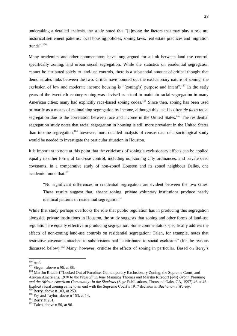
Many academics and other commentators have long argued for a link between land use control,

specifically zoning, and urban social segregation. While the statistics on residential segregation

cannot be attributed solely to land-use controls, there is a substantial amount of critical thought that

demonstrates links between the two. Critics have pointed out the exclusionary nature of zoning: the

exclusion of low and moderate income housing is “[zoning’s] purpose and intent”.157

In the early

years of the twentieth century zoning was devised as a tool to maintain racial segregation in many

American cities; many had explicitly race-based zoning codes.158

Since then, zoning has been used

primarily as a means of maintaining segregation by income, although this itself is often de facto racial

segregation due to the correlation between race and income in the United States.159

The residential

segregation study notes that racial segregation in housing is still more prevalent in the United States

than income segregation,160

however, more detailed analysis of census data or a sociological study

would be needed to investigate the particular situation in Houston.

It is important to note at this point that the criticisms of zoning’s exclusionary effects can be applied

equally to other forms of land-use control, including non-zoning City ordinances, and private deed

covenants. In a comparative study of non-zoned Houston and its zoned neighbour Dallas, one

academic found that:161

“No significant differences in residential segregation are evident between the two cities.

These results suggest that, absent zoning, private voluntary institutions produce nearly

identical patterns of residential segregation.”

While that study perhaps overlooks the role that public regulation has in producing this segregation

alongside private institutions in Houston, the study suggests that zoning and other forms of land-use

regulation are equally effective in producing segregation. Some commentators specifically address the

effects of non-zoning land-use controls on residential segregation: Talen, for example, notes that

restrictive covenants attached to subdivisions had “contributed to social exclusion” (for the reasons

discussed below).162

Many, however, criticise the effects of zoning in particular. Based on Berry’s

156

At 3. 157

Siegan, above n 96, at 88. 158

Marsha Ritzdorf “Locked Out of Paradise: Contemporary Exclusionary Zoning, the Supreme Court, and

African Americans, 1970 to the Present” in June Manning Thomas and Marsha Ritzdorf (eds) Urban Planning

and the African American Community: In the Shadows (Sage Publications, Thousand Oaks, CA, 1997) 43 at 43.

Explicit racial zoning came to an end with the Supreme Court’s 1917 decision in Buchanan v Warley. 159

Berry, above n 103, at 253. 160

Fry and Taylor, above n 153, at 14. 161

Berry at 251. 162

Talen, above n 50, at 96.

29

finding that the two have almost identical results with regard to segregation, the criticisms of zoning

are therefore largely applicable to other measures of land-use regulation too.

Zoning is said to seek to achieve social exclusion in two ways: by restricting the ways in which

certain land may be used (i.e. restricting land to single-family residential, multi-family residential,

commercial or industrial use), and by restricting the people who may live in an area (generally by

raising house prices and so excluding those without the money to buy into the area).163

In Houston,

the same can be said about deed restrictions and City planning ordinances.164

Deed restrictions and the

above-mentioned City ordinances that mandate minimum lot size and width, floor area, height

limitations and setback requirements are all examples of the second type of restriction. They all

contribute to raising the minimum cost of buying a property and/or building a house on it, thus

“limiting the numbers of eligible buyers”.165

Siegan discusses this relationship in relation to the

provisions often found in zoning ordinances (and also in many Houston deed restrictions):166

“… height limitations may exclude high rises, and coverage and setback requirements may

exclude inexpensive townhouses and duplexes. Large-lot or minimum floor-area standards

may exclude average- and lower-priced homes, and specified bedroom counts may exclude

three-bedroom apartments in some areas and efficiency and one-bedroom apartments in

others.”

Several of these requirements are part of Houston’s Code of Ordinances, and many are mandated by

private deed restrictions.167

At the same time, deed restrictions may limit the type of housing that can be built in a particular area,

ruling out cheaper townhouse and apartment structures that are more affordable to low-income

earners.168

Thus the exclusion of multi-family housing structures has become a predominant feature of

suburban American life through instruments such as deed restrictions.169

This facilitates social

segregation firstly by segregating homeowners from renters, thus segregating by income, and so, to

some extent, segregating by race as well.170

Accompanying residential segregation is the relative inability of poorer neighbourhoods to regulate

land use within their boundaries. The privatisation of land use regulation has had the negative effect

163

Siegan, at 88, and Berry, at 252, both discuss this distinction. 164

See Berry, above n 103, on this point. He does not, however, discuss City ordinances in relation to residential

segregation, instead focusing on the parallels between segregation under public measures (zoning) and private

measures (deed covenants). Houston City ordinances are to a large extent similar to many zoning ordinances,

except for their failure to mandate land-use separation. 165

Siegan, at 88 and Berry at 252-253. 166

At 88. 167

Qian, above n 2, notes at 227 that many of these requirements, among others, are included in some Houston

deed covenants. 168

Siegan, at 89. 169

At 89. 170

Berry at 267.

30

of leaving poorer neighbourhoods more vulnerable to ill-fitting mixed-use development. The

enforcement of deed restrictions is directly related to both an area’s household income and home-

ownership rates: the higher these are, the more likely that covenants are implemented.171

This is

probably due to the money it takes to take a suit over covenant violations to court, and perhaps due to

minority and disadvantaged groups’ lack of influence over city government, which may in practice be

required to get the City Attorney to take a suit on their behalf.172

Furthermore, as deed restrictions are

primarily devised for new subdivisions, many older inner-city neighbourhoods, with generally poorer

populations, lack these covenants. In such cases, the creation of new covenants in an area require the

consent of all property owners, which is often not able to be achieved.173

So, whether as a result of less enforcement of covenants, or a lack of covenants to begin with, in

poorer areas there has been a proliferation of generally negative mixed-use development, such as

landfills, incinerators and solid waste sites.174

One study has cited statistics showing that “the greater

the proportion of African American people in a community in the southeastern United States, the

more likely that community is to be situated near a hazardous waste site.”175

That is not to say that

mixed-use development in poor or rich neighbourhoods is negative – indeed, mixed-use development

is generally thought to be a positive goal for urban form. However the pattern of deed restriction

enforcement means that its negative effects harm the poor to a greater extent than other groups. The

low rates of covenant enforcement in poor areas may even encourage developers to build unsuitable

commercial or industrial developments there, because they know that it is unlikely that a suit will be

brought against them.176

Qian eloquently summarises the nature of this problem in Houston:177

“As subdivisions have grown older and as deed restrictions expire, other uses have

encroached upon them, resulting in a change in land use character. For instance, heavy

commercial and industrial uses exist alongside single family residences; small bungalows are

adjacent to commercial, industrial and vacant land … In many cases residential uses are

directly adjacent to heavy industries, toxic sites, and landfills. Such land development

strategies might satisfy pro-growth ideology, but they fail to alleviate the living circumstances

of the poor, and transfer the costs generated from growth to them.”

Houston’s lack of zoning allows the possibility for positive mixed-use development, and for the city

to escape the rise of monotonous single-use suburbia. However, a mixture of heavy land-use controls

171

Qian, at 230. 172

Fisher, above n 5, at 150. 173

Berry at 263. 174

Fisher, above n 5, at 150. 175

Robert Collin and Robin Collin “Urban Environmentalism and Race” in June Manning Thomas and Marsha

Ritzdorf (eds) Urban Planning and the African American Community: In the Shadows (Sage Publications,

Thousand Oaks, CA, 1997) 220 at 221. 176

Qian, above n 2, at 233. 177

At 233.

31

in more wealthy suburbs, and lax enforcement in poor suburbs means that this possibility has failed to

be realised.

32

Conclusion

Houston’s unique system of land-use regulation combines City ordinances with the predominant

system of private deed restrictions. These twin types of regulation have contributed in various ways to

low-density urban form, automobile dependence, and social segregation. Houston’s City Code

mandates a land-use pattern that maintains a relatively low population density throughout the city.

The reduction in minimum lot size within the City boundaries has allowed for the construction of

townhouses and low-rise apartments, which has contributed to a greater inner-city population density.

However, most development has occurred on the city fringes in the City’s extraterritorial jurisdiction,

where a minimum lot-size of 5000 square feet persists. Other city ordinances that contribute to low-

density settlement include setback requirement, minimum road widths and generous minimum

parking requirements.

But Houston’s city ordinances, while favouring low-density development, are not particularly extreme

in their substance. Instead, it is private deed restrictions that have had the greatest impact on

Houston’s population density, by allowing groups of residents or subdivision developers to require

minimum lot sizes in a subdivision or neighbourhood that are greater than those prescribed by law.

The provision for special minimum lot sizes in the City Code has a similar effect by allowing

minimum lot sizes to be set according to the lot sizes of other properties in the area, as long as this is

above the statutory minimum. In both cases, larger minimum lot sizes, when coupled with coverage

requirements, mean that, insofar as land is to be used for residential habitation, single-family homes

are often the only viable structures to build. Furthermore, deed restrictions often bar anything other

than single-family residential development, thus creating in many places monocultural single-use

residential zones.

Both public and private regulation tend towards low-density development. The city’s strongly

libertarian and non-interventionist political culture complement this aim by promoting a transport

network that favours private automobile use at the expense of public transit, which generally requires

relatively high population and employment density to be effective. The transportation planning budget

of the Houston-Galveston Area Council, the body in charge of transportation projects in the region,

clearly favours road-building over the creation of more public transit infrastructure. A regulatory

framework that promotes low-density development implicitly promotes automobile use as well: in this

respect Houston is merely one example of the United States-wide phenomenon of the “Auto City”.

While the absence of use zoning in Houston might be thought to contribute to less dependence on

automobiles, due to the theoretically closer proximity of residential pockets to commercial and retail

areas, this has not been the case. Deed restrictions which prohibit commercial land-use in residential

33

areas has in effect created a state of single-use zoning in much of Houston. Thus, citizens generally

still have to drive to access shops and employment centres.

Finally, it is clear that Houston’s policy of forbearing from zoning for land-use, and leaving any land-

use regulation up to individuals has not enabled the city to avoid the same problem of social

segregation that many blame on traditional single-use zoning policies. Deed restrictions, and to a

lesser extent city ordinances, have the effect of raising the cost of buying or constructing a home in

the area covered by the deed or ordinance. This creates segregation by income: only the wealthy can

afford to move into some areas, while poorer residents are grouped together in areas of low-cost

housing. Due to correlations between income and race, segregation by wealth often entails a degree of

segregation by race. This segregation is exacerbated by the greater rate of implementation of deed

restrictions in wealthier areas than in poorer areas. The costs associated with enforcing deed

restrictions, and perhaps the perception that the city government is less concerned with the interests of

poor residents means deed restrictions in poor areas often go unenforced. This is turn paves the way

for undesirable mixed-use development in these areas. This is illustrative of the way in which leaving

enforcement to private individuals rather than a local authority actively enforcing planning standards

can lead to the marginalisation of a city’s poorer citizens.

So what can be done to ameliorate Houston’s problems, especially as it looks set to continue

expanding in size and population? This is not a paper about urban design, so much of the debate about

the best way to manage city growth falls outside its scope. In brief, it is clear that sustained centrifugal

growth on the urban periphery at the same low-density as is currently mandated, will only increase the

problems discussed above. One strategy in particular that may be of use to city planners in Houston is

that prescribed by the urban design movement known, at least in the United States, as Smart Growth.

While Smart Growth is not in fact as coherent a movement as its snappy label would suggest, it

nevertheless encompasses several common policies towards urban design. Smart Growth posits that

the best sort of urban development is the creation and fostering of neighbourhoods that are “compact,

walkable, diverse, and connected”.178

It is opposed to current patterns of urban sprawl which have

turned America’s cities into a “collection of far-flung monocultures, connected only by the prosthetic

device of the automobile”.179

The movement advocates high-density infill development,180

the

promotion of mixed-use neighbourhoods,181

and the coordination of land use regulation and

transportation planning – particularly with regard to public transit.182

Such policies are intended to

178

Andres Duany, Jeff Speck, Mike Lydon The Smart Growth Manual (2010 McGraw Hill, New York) at [1.5]. 179

At xv-xvi. 180

At [1.6], [5.10]. 181

At [5.1]. 182

At [3.1], [6.6].

34

reduce automobile dependence and promote pedestrianism in cities, while discouraging the spread of

low-density single-use settlement.183

Such change in Houston would require both more proactive management by the City government, and

a broader shift in the ideology underpinning Houston’s culture of growth and sprawl. The laissez-faire

attitude that leaves much land-use regulation in the hands of private citizens would have to give way

to a stronger governmental emphasis on regulating Houston’s urban form. Despite the slow pace

generally required for such attitude shifts to occur, there is evidence that a growing number of

Houston residents would support such a shift. A 2013 survey of Houston residents showed that a

majority would prefer to live in more urbanised areas, in smaller houses, where walking – rather than

driving – was more of a possibility.184

The Houston City government must listen to its citizens, and

ensure that it does not allow the city’s urban form to continue to perpetuate problems such as

automobile dependence and social segregation. While it may not be a swift turn, the direction of this

archetypal Auto-City must surely change if these problems are to be dealt with.

183

At xvi, [3.11], [5.1]. 184

Kinder Institute for Urban Research “The 32nd

Kinder Institute Houston Area Survey” (Rice University,

Houston, 2013) at 6.

35

Bibliography

1. Legislation

Code of Ordinances, City of Houston, Texas.

Texas Local Government Code.

2. Books

Andres Duany, Jeff Speck, Mike Lydon The Smart Growth Manual (2010 McGraw Hill, New York).

Robert Dunphy Moving Beyond Gridlock: Traffic and Development (Urban Land Institute,

Washington, D.C., 1997).

Alexander Garvin The American City: What Works, What Doesn’t (2nd

ed, McGraw-Hill, New York,

2002).

Peter Newman and Jeffrey Kenworthy Sustainability and Cities: Overcoming Automobile

Dependence (Island Press, Washington D.C., 1999).

Karina Pallagst Growth Management in the US: Between Theory and Practice (Ashgate Publishing

Limited, Aldershot, 2007).

Donald Shoup The High Cost of Free Parking (American Planning Association Planners Press,

Chicago, 2011).

Bernard Siegan Land Use Without Zoning (Lexington Books, Lexington, Massachusetts, 1972).

Emily Talen City Rules: How Regulations Affect Urban Form (Island Press, Washington D.C., 2012).

3. Journal Articles and Book Chapters

Christopher Berry “Land Use Regulation and Residential Segregation: Does Zoning Matter?” (2001)

3 American Law and Economic Review 251.

Dan Burden “Cities, Streets, and Cars” in Roger Kemp (ed) Cities and Cars: A Handbook of Best

Practices (McFarland & Company, Jefferson, North Carolina, 2007) 7.

Robert Collin and Robin Collin “Urban Environmentalism and Race” in June Manning Thomas and

Marsha Ritzdorf (eds) Urban Planning and the African American Community: In the Shadows (Sage

Publications, Thousand Oaks, CA, 1997) 220.

36

John Dorsett “Downtowns, Cars, and Parking” in Roger Kemp (ed) Cities and Cars: A Handbook of

Best Practices (McFarland & Company, Jefferson, North Carolina, 2007) 15.

Joe Feagin “The Social Costs of Houston’s Growth” (1985) 9 International Journal of Urban and

Regional Research 164.

John Fernandez “Boulder Redesigns Residential Streets to Focus on People Rather than Cars” in

Roger Kemp (ed) Cities and Cars: A Handbook of Best Practices (McFarland & Company, Jefferson,

North Carolina, 2007) 65.

Robert Fisher, “Urban Policy in Houston, Texas” (1989) 26 Urban Studies 144.

Michael Lewyn “How Overregulation Creates Sprawl (Even in a City without Zoning)” (2004) 50

Wayne L Rev 1171.

H Oguz, A Klein and R Srinivasan “Predicting Urban Growth in a US Metropolitan Area with No

Zoning Regulation” (2008) 2 International Journal of Natural & Engineering Sciences 9.

Zhu Qian “Planning a ‘World Class’ City without Zoning: the experience of Houston” in M Jenks, D

Kozak and P Takkanon World Cities and Urban Form: Fragmented, Polycentric, Sustainable?

(Routledge, Abingdon, 2008) 219.

Marsha Ritzdorf “Locked Out of Paradise: Contemporary Exclusionary Zoning, the Supreme Court,

and African Americans, 1970 to the Present” in June Manning Thomas and Marsha Ritzdorf (eds)

Urban Planning and the African American Community: In the Shadows (Sage Publications, Thousand

Oaks, CA, 1997) 43.

4. Reports and Papers

Richard Fry and Paul Taylor The Rise of Residential Segregation by Income (Pew Research Center,

Washington, D.C., 2012).

Houston-Galveston Area Council “Houston-Galveston Area Council Transportation Improvement

Program 2011-2014” <https://www.h-gac.com/taq/tip/docs/2011-14/20011-

14%20tip%20execsum.pdf>

5. Internet Materials

Dug Begley “Boom in road construction continues into next year” (December 23 2013) Houston

Chronicle online <http://www.houstonchronicle.com/news/columnists/begley/article/Boom-in-road-

construction-continues-into-next-year-5089419.php>

Dug Begley “Record U.S. transit ridership not matched in Houston” (March 10 2014) Houston

Chronicle online <http://blog.chron.com/thehighwayman/2014/03/record-u-s-transit-ridership-not-

matched-in-houston/>

City of Houston “About City Government” <http://www.houstontx.gov/abouthouston/citygovt.html>

37

City of Houston “Facts and Figures” <http://www.houstontx.gov/abouthouston/houstonfacts.html>

City of Houston “Learn How You Can Protect the Character of Your Neighborhood” (2014)

<http://www.houstontx.gov/planning/Neighborhood/docs_pdfs/MLS_Brochure_2014.pdf>

City of Houston “Minimum Lot Size Approvals” (2012)

<http://www.houstontx.gov/planning/Neighborhood/prevailLotBldg.html>

Jennifer Friedberg “New lot size, building line ordinances lift Heights residents” (3 April 2007)

Houston Chronicle Online <http://www.chron.com/neighborhood/heights-news/article/New-lot-size-

building-line-ordinances-lift-1796069.php>

Michael Skelly and Jeff Kaplan “Let businesses decide parking” (March 4 2013) Houston Chronicle

online <http://www.chron.com/default/article/Let-businesses-decide-parking-4327439.php.>

Mike Tolson “Segregation by income in Houston is among the starkest in U.S Houston” (August 1st,

2012) Houston Chronicle online <http://www.chron.com/news/houston-texas/article/Study-More-

here-living-in-areas-with-similar-3755755.php>

United States Census Bureau “Community Facts: Houston city, Texas” (2010)

<http://factfinder2.census.gov/faces/nav/jsf/pages/community_facts.xhtml#none>

United States Census Bureau “CPH-T-5. Population Change for Metropolitan and Micropolitan

Statistical Areas in the United States and Puerto Rico (February 2013 Delineations): 2000 to 2010”

(March 2013) <http://www.census.gov/population/www/cen2010/cph-t/CPH-T-5.pdf >

US Census Bureau “State and County QuickFacts” (2014)

<http://quickfacts.census.gov/qfd/index.html>

Lucas Wall “Event urges commuters to try 2-wheelers” (17 May 2003) Houston Chronicle online

<http://www.chron.com/news/houston-texas/article/Event-urges-commuters-to-try-2-wheelers-

2118444.php>


Recommended