32
Spatial Analysis with Web GIS Pamela Kersh

Spatial Analysis with
Web GISPamela Kersh

AgendaSubhead goes here
• Introducing ArcGIS Online Spatial Analysis
• Workflows
• Scenarios
• Other Options
• Resources
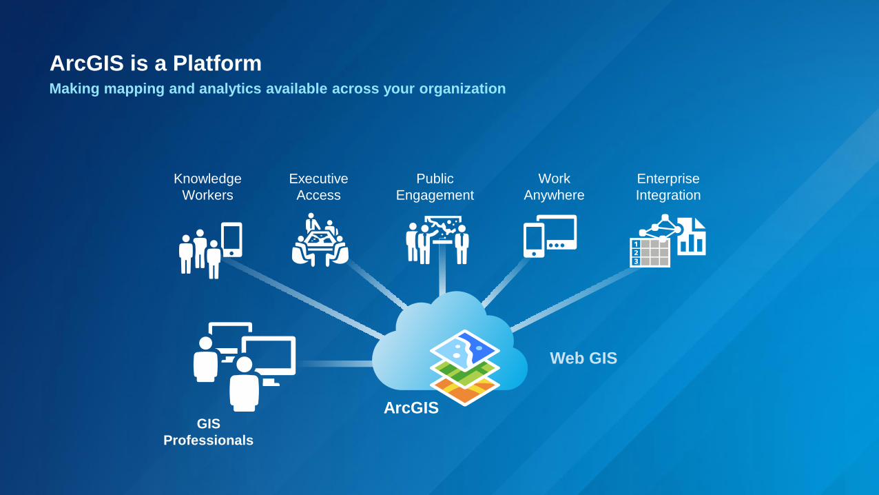
ArcGIS is a PlatformMaking mapping and analytics available across your organization
ArcGIS
Knowledge
Workers
Work
Anywhere
Public
Engagement
Executive
Access
Enterprise
Integration
Web GIS
GIS
Professionals
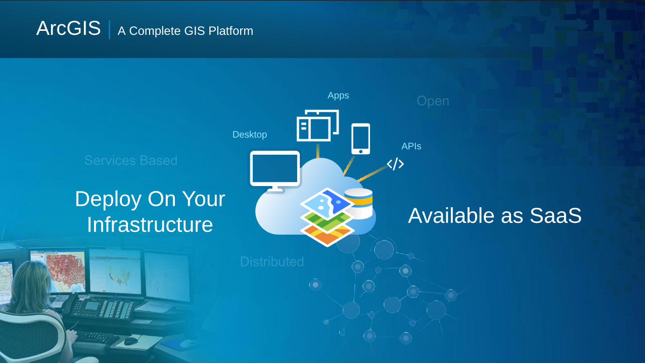
Apps
Desktop
APIs
Deploy On Your
Infrastructure
ArcGIS | A Complete GIS Platform
Available as SaaS

ArcGIS Web Map ViewerProviding the capability to create maps, perform analysis and share your findings

Spatial Analysis with ArcGIS Online
• Use analysis tools quickly, easily and intuitively
• Integrate analytics across your entire
organization’s workflows
• Unlock the power to discover relationships,
patterns and trends in data
• Help answer questions in a meaningful way

Analysis Tools
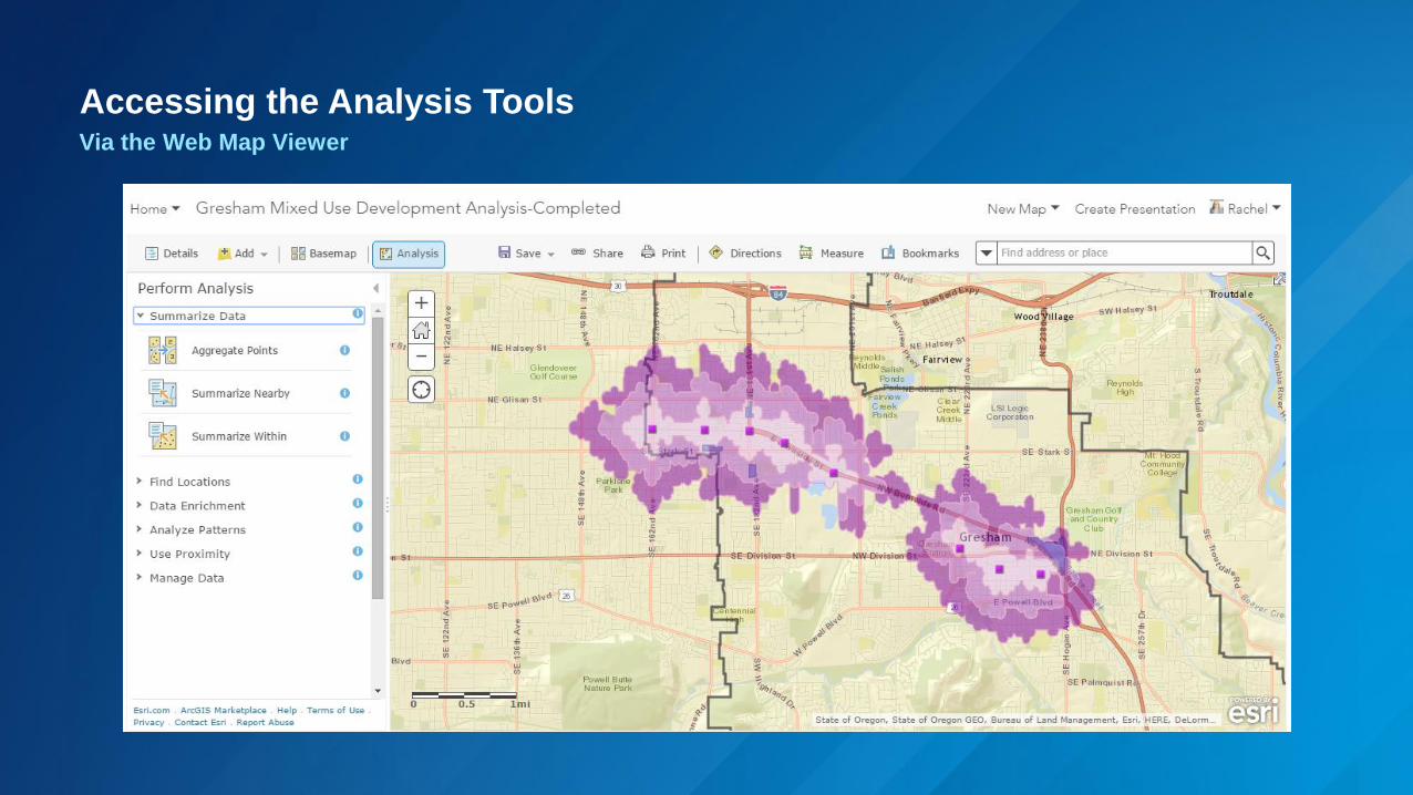
Accessing the Analysis ToolsVia the Web Map Viewer
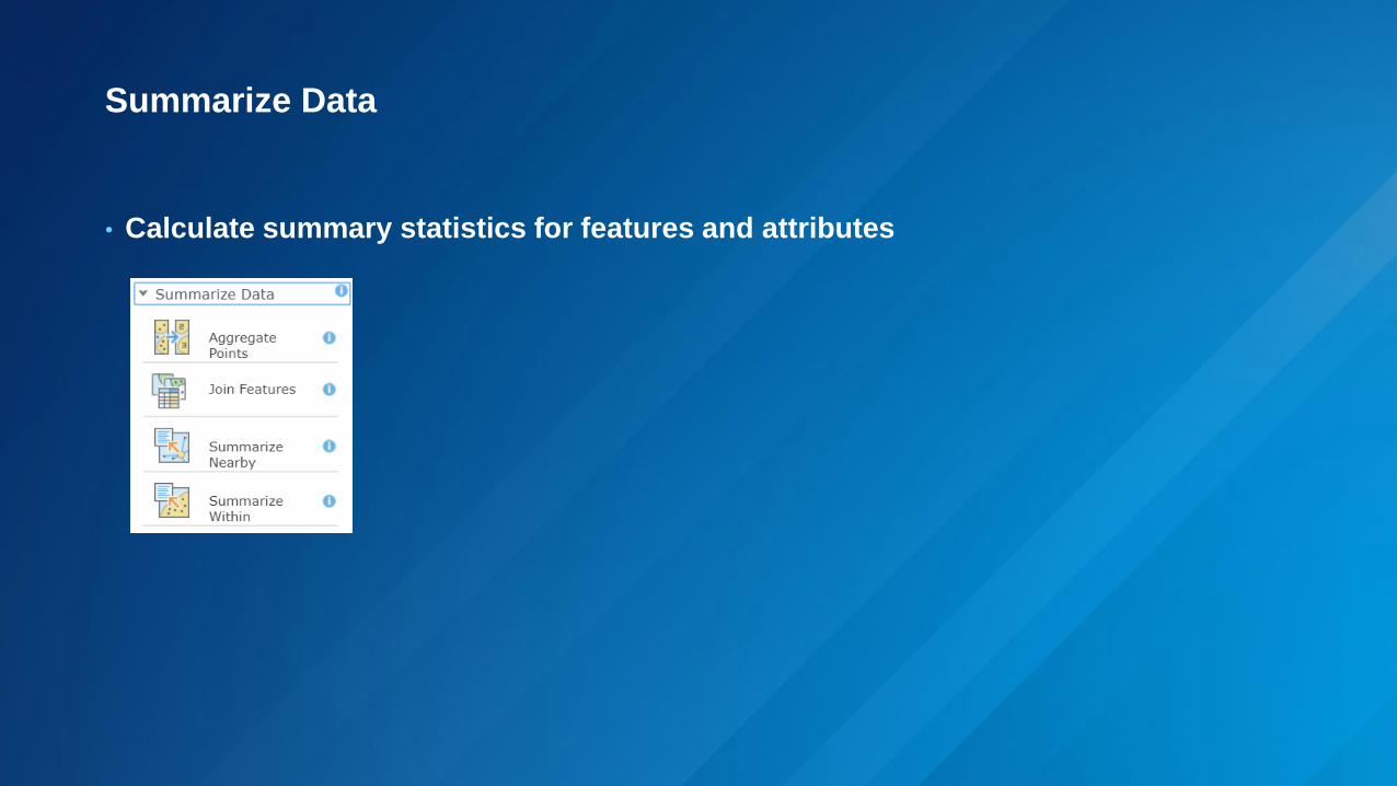
Summarize Data
• Calculate summary statistics for features and attributes

Find Locations
• Find features based on specified criteria
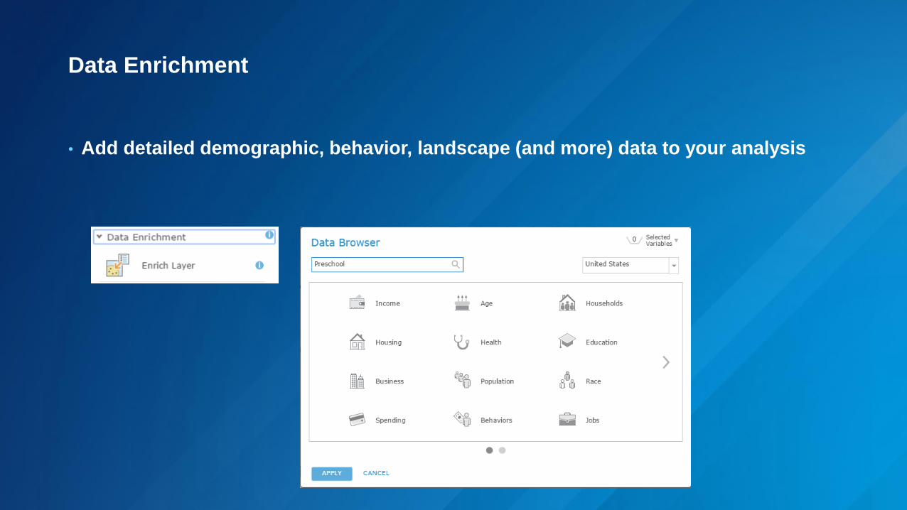
Data Enrichment
• Add detailed demographic, behavior, landscape (and more) data to your analysis

Analyze Patterns
• Identify, quantify and visualize spatial patterns in your data
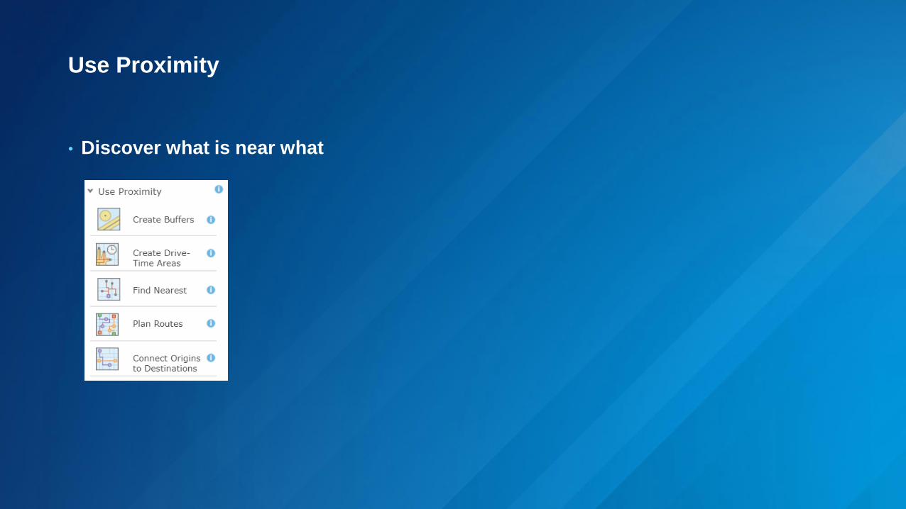
Use Proximity
• Discover what is near what

Manage Data
• Manipulate and combine data prior to or after analysis

Analysis Workflow

Analysis Workflow
Prepare Data
Add to Map
Perform Analysis
Review Results

Prepare Data
• Evaluate analysis needs
• Search online resources
• Create, publish and filter data Supported Data Types
✓ Feature service✓ Map service with feature layers✓ WFS layers✓ Hosted tile layers (query enabled)✓ ArcGIS Online Map Notes✓ ArcGIS Online route layers✓ CSV files✓ KML layers✓ GPS Exchange Format✓ Shapefile✓ GeoRSS Web feed✓ Map notes✓ Tables

Add to Map
• Bring data into web map viewer (ArcGIS Online or ArcGIS Enterprise)
• Symbology (Smart Mapping)
• Arcade expressions
• Save map
• Set access permissions
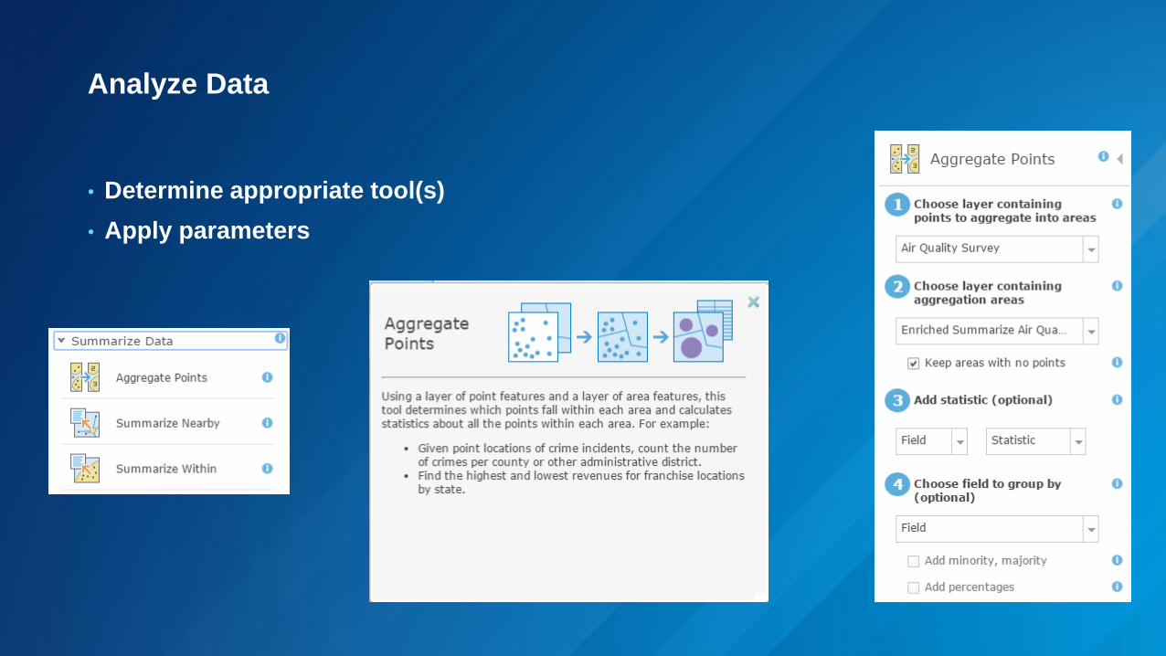
Analyze Data
• Determine appropriate tool(s)
• Apply parameters
Review Results
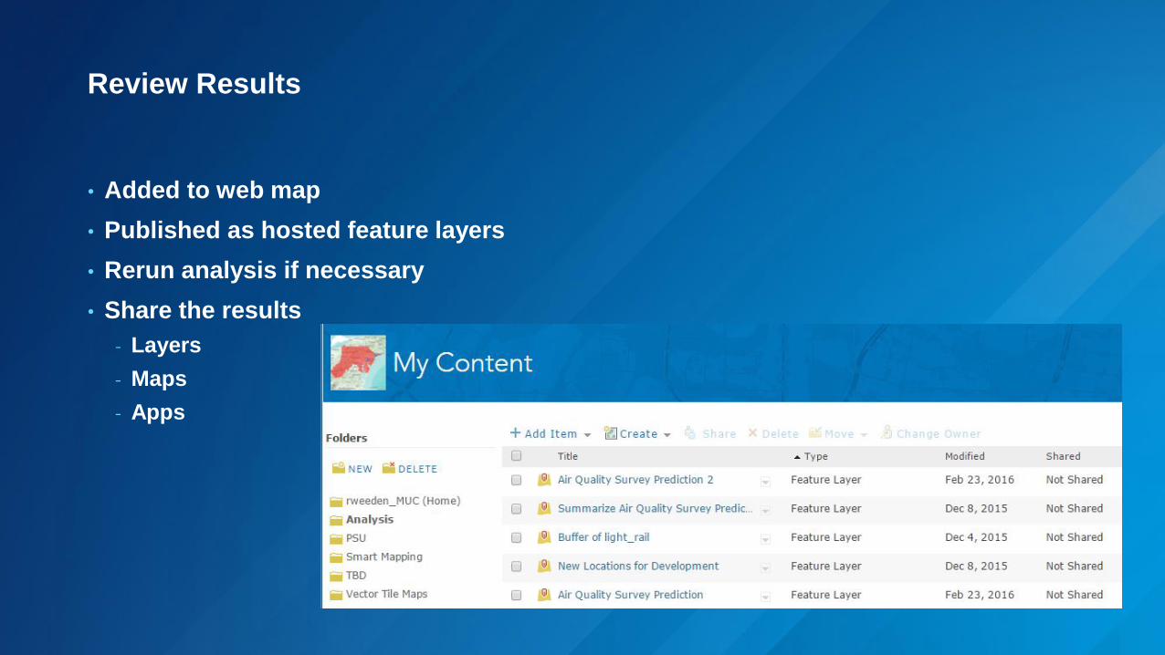
• Added to web map
• Published as hosted feature layers
• Rerun analysis if necessary
• Share the results
- Layers
- Maps
- Apps

Analysis Scenarios
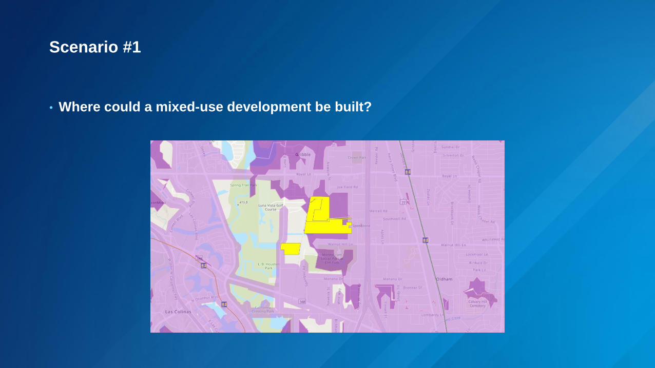
Scenario #1
• Where could a mixed-use development be built?

Scenario #1 Review
Where could a mixed-use development be built?
Add Data
• Light Rail
• Zoning
• Census Block Groups
Prepare Data
• Geoenrichment
• Smart Mapping
Perform Analysis
• Derive New Locations
• Drive Time
Review Results
• Save/share web map

Scenario #2
• Who is affected most by high air pollution levels?

Scenario #2 Review
Who is affected most by high air pollution levels?
Add Data
• Air Quality
• Neighborhoods
Prepare Data
• Filter
Perform Analysis
• Interpolate Points
• Summarize Within
• Enrich Layer
Review Results
• Smart Mapping (two variables)
• Save/share web map

Other Options

Big Data Spatial Analytics | Faster and Massively Scalable
Faster (10x+)
Power
Outages
(50+ Million)
Density
Imagery
Lidar:
Bare Earth
Hot Spots
Riparian AreasSpace-Time Cube
Lidar:
First Return
. . . Accessible from ArcGIS Pro and Python APILeveraging Distributed Computing and Parallel Processing
Image Server
Imagery / Raster
Image Processing
Classification
Change Detection
Topo
Suitability
Density
Corridors
Distance
Proximities
Interpolation
Features / Vectors
Space-Time Analytics
Hot Spots
Density
Buffer
Summarize
Aggregation
Construct Tracks
Find Similar
Spatial Join
GeoAnalytics Server

Many 2D and
3D Widgets
500,000+ Web Apps Created and Deployed
Web AppBuilder
ArcGIS App Builders | Frameworks for Configuring and Creating Apps
Access 25 Tools
Use your
Geoprocessing
Web Services

Summary
• Spatial analysis adds valuable insight by providing hosted tools that work
with your data in ArcGIS Online or ArcGIS Enterprise
• Performing spatial analysis via the web is easy and intuitive
• Use online spatial analysis to discover geographic relationships, patterns,
and trends
• Access online spatial analysis tools in the map viewer, in Web AppBuilder,
and leverage GeoAnalytics Server

What do you need?
• ArcGIS Online account or
Portal for ArcGIS instance
• Privileges
- Create items
- Publish hosted features
- Spatial analysis (including
Network Analysis,
Geoenrichment)
• Supported Layer Types
• Credits

Resources
• https://esri.box.com/v/ArcGISSpatialAnalysisLinks
• Learn ArcGIS
• Esri Training
• Tips for managing credits consumed by analysis tools