Special Winter Special Winter Weather Briefing Weather Briefing March 17, 2022 March 17, 2022 www.weather.gov/shv/briefing www.weather.gov/shv/briefing Matt Hemingway Matt Hemingway Meteorologist Meteorologist National Weather Service Shreveport, Louisiana National Weather Service Shreveport, Louisiana
Transcript
Special Winter Weather Special Winter Weather BriefingBriefing
Matt HemingwayMatt HemingwayMeteorologistMeteorologist
National Weather Service Shreveport, LouisianaNational Weather Service Shreveport, Louisiana
Overview This Evening-Wednesday Morning: This Evening-Wednesday Morning:
Precipitation will begin moving into the region from the west after midnight through Precipitation will begin moving into the region from the west after midnight through the wee hours of the morning.the wee hours of the morning.
Precipitation types will be mixed across the region, generally sleet and snow over Precipitation types will be mixed across the region, generally sleet and snow over the upper part of NE TX and along the I-30 corridor of SW AR. Areas farther north in the upper part of NE TX and along the I-30 corridor of SW AR. Areas farther north in SE OK and adjacent SW AR will likely be all snow.SE OK and adjacent SW AR will likely be all snow.
Along the I-20 corridor and south, a complete mixed big of precipitation will begin Along the I-20 corridor and south, a complete mixed big of precipitation will begin the event. the event.
Through the day on Wednesday:Through the day on Wednesday: Large upper trough will move in from the west and cool our temperatures aloft such Large upper trough will move in from the west and cool our temperatures aloft such
that precipitation should begin transitioning to all snow over most of the region by that precipitation should begin transitioning to all snow over most of the region by mid morning. mid morning.
Areas farther south from Deep East Texas into North Central Louisiana will likely see Areas farther south from Deep East Texas into North Central Louisiana will likely see a sleet/snow mix continue through late morning before transitioning to all snow. a sleet/snow mix continue through late morning before transitioning to all snow.
Accumulations:Accumulations: Winter Storm Warning generally along and north of I-20 means total accumulations of Winter Storm Warning generally along and north of I-20 means total accumulations of
up to a half inch of sleet and/or up to 4 inches of snow.up to a half inch of sleet and/or up to 4 inches of snow. Winter Weather Advisory farther south means total accumulations of less than a Winter Weather Advisory farther south means total accumulations of less than a
quarter inch of freezing rain (ice) and/or 1-3 inches of snow (leaning lower). quarter inch of freezing rain (ice) and/or 1-3 inches of snow (leaning lower).
National Weather Service Shreveport, LouisianaNational Weather Service Shreveport, Louisiana
Water Vapor Imagery
National Weather Service Shreveport, LouisianaNational Weather Service Shreveport, Louisiana
Upper low shifts eastas moisture increases
Current National MapCurrent National Map
National Weather Service Shreveport, LouisianaNational Weather Service Shreveport, Louisiana
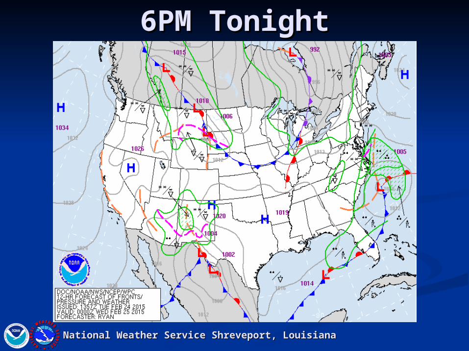
6PM Tonight6PM Tonight
National Weather Service Shreveport, LouisianaNational Weather Service Shreveport, Louisiana
MidnightMidnight
National Weather Service Shreveport, LouisianaNational Weather Service Shreveport, Louisiana
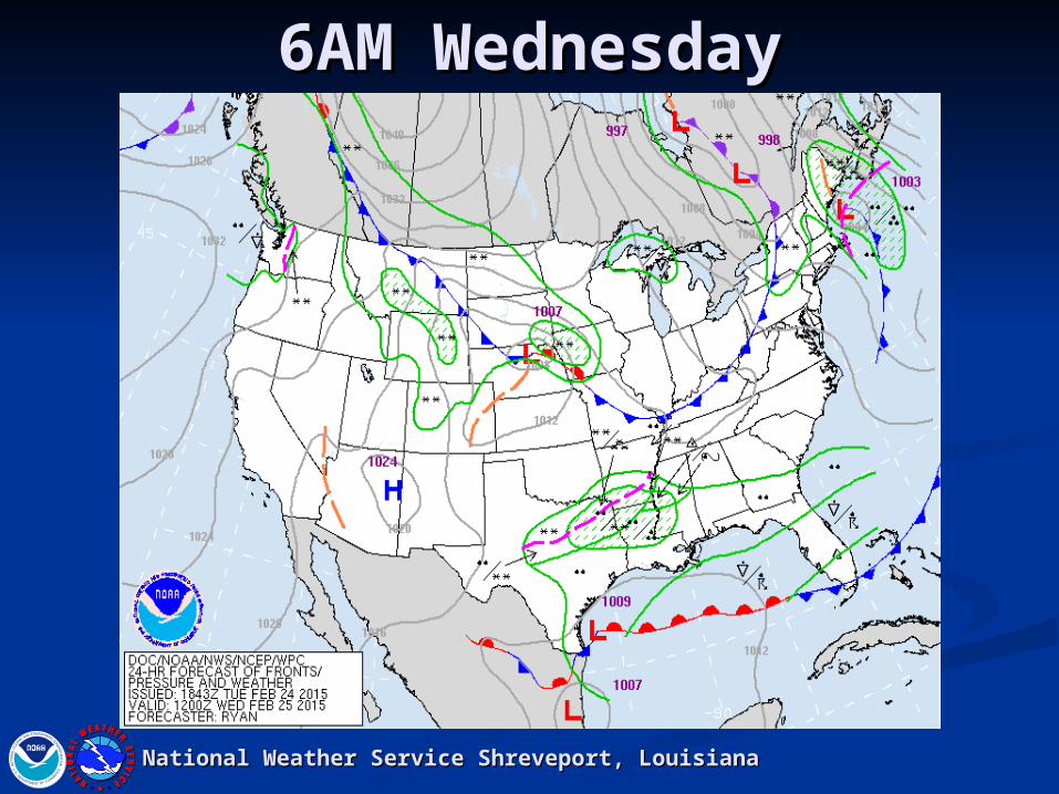
6AM Wednesday6AM Wednesday
National Weather Service Shreveport, LouisianaNational Weather Service Shreveport, Louisiana
Lows Wednesday AMLows Wednesday AM
National Weather Service Shreveport, LouisianaNational Weather Service Shreveport, Louisiana
Winter Storm WarningWinter Storm Warning
National Weather Service Shreveport, LouisianaNational Weather Service Shreveport, Louisiana
Winter Weather AdvisoryWinter Weather Advisory
National Weather Service Shreveport, LouisianaNational Weather Service Shreveport, Louisiana
Total Snow/Sleet Total Snow/Sleet AccumulationsAccumulations
National Weather Service Shreveport, LouisianaNational Weather Service Shreveport, Louisiana
1-2”
1-2”
2-4”
4-6”
2-4”
6PM Wednesday6PM Wednesday
National Weather Service Shreveport, LouisianaNational Weather Service Shreveport, Louisiana