PLANNING APPEAL BY: Hinton Properties (Grovefield Way) Ltd LAND AT NORTH ROAD WEST AND GROVEFIELD WAY CHELTENHAM STATEMENT OF CASE OF THE LOCAL PLANNING AUTHORITY Cheltenham Borough Council Reference: 16/02208/FUL Appeal Reference: APP/B1605/W/18/3200395
Transcript
PLANNING APPEAL BY:
Hinton Properties (Grovefield Way) Ltd
LAND AT NORTH ROAD WEST AND GROVEFIELD WAY
CHELTENHAM
STATEMENT OF CASE OF
THE LOCAL PLANNING AUTHORITY
Cheltenham Borough Council Reference: 16/02208/FUL
Appeal Reference: APP/B1605/W/18/3200395
1. Introduction
1.1 This appeal is against the refusal of a hybrid application for planning
permission with the following description:
Hybrid application seeking detailed planning permission for a 5,034
sq.m of commercial office space (Use Class B1), 502 sq.m day nursery
(Use Class D1), 1,742 sq.m supermarket food retail unit (Class A1), a
204 sq.m coffee shop retail unit and drive-thru (Use Classes A1 and
A3), with associated parking, landscaping and infrastructure works.
Outline planning permission sought for the erection of 8,034 sq.m of
commercial office space (Use Class B1), together with associated car
parking, landscaping and infrastructure works, with all matters
reserved (except access).
1.2 The application was validated by the Local Planning Authority (LPA)
on 13th December 2016.
1.3 The Planning Committee considered the application at their meeting
held on 14th December 2017. A copy of the Officer report to
committee is attached at appendix 1.
1.4 The Planning Committee resolved to refuse the application. A copy of
the minutes of the Committee meeting is attached appendix 2.
1.5 The applicant has now submitted an appeal against the refusal of the
application which is due be determined by Inquiry.
1.6 The reasons for refusal are as follows:
1 The site has extant consent for B1 office development and is
allocated for employment use (specifically B class employment or
Sui Generis uses that exhibit the characteristics of traditional B
class uses) within the emerging Cheltenham Plan (Pre-submission
version, December 2017).
The application is for a mixed use development with a
considerable and prominent part of the site being given over to
non-B1 uses including a supermarket, "drive thru" coffee shop and
day nursery.
The proposed non B1 uses will result in a reduction in the amount
of the site available for B1 office development along with the high
quality jobs this would provide. The amount of the site given over
to non B1 uses in combination with the prominent position they
would occupy on the site would result in a dilution of the
character and function of the site as a business and represent in
inappropriate balance between B1 and non B1 uses.
For these reasons the proposal is considered to be contrary to
policy SD1 of the Joint Core Strategy, policy EM2 of the adopted
Local Plan and emerging policy EM3 of the Cheltenham Plan (Pre-
submission version, December 2017).
2 Due to the mix of uses proposed, the development would result in
an increase in traffic on the surrounding road network into the
evenings and at weekends in addition to the AM and PM weekday
peaks. This would have an unacceptable impact upon the local
road network which is already heavily used. For these reasons the
proposal is considered to be contrary to policy INF1 of the Joint
Core Strategy.
3 The proposed layout of the site results in a predominance of
hardstanding and retaining structures which result a poor
appearance and do not create an attractive streetscape or strong
sense of place which responds to the character of this transitional
location. The position of buildings including the 'Drive thru' coffee
shop and supermarket, close to the edges of the site give the
layout a cramped and contrived appearance exacerbated by
exterior features such as the 'drive thru' lane and external yards.
The proposal is therefore harmful to the surrounding area by
reason of its visual impact and also fails to create a high quality
business environment in this edge of town location. For these
reasons the proposal is considered to be contrary to policy SD 4 of
the Joint Core Strategy and CP7 of the Local Plan.
2. The Site
2.1 The site will be described in full, however to briefly summarise; the
site comprises a parcel of land extending to 4.15 ha located north of
North Road West and west of Grovefield Way and immediately south
of the A40. To the north is a BMW dealership and beyond that is the
Park and Ride
2.2 At the time of validation the application site was within the
Greenbelt, however through the adoption of the JCS shortly before
the committee meeting at which this application was determined,
the site was removed from the greenbelt.
3. Site History
3.1 The LPA will make reference to the relevant planning history of the
site, which is outlined in full in the committee report at appendix 1
(paras 1.1.6 and 2).
3.2 Key relevant planning decisions are as follows:
3.2.1 Planning consent was originally given for the whole site (including the
BMW site), on appeal in May 2007 following a public inquiry.
3.2.2 Between 2009 and 2014 a series of reserved matters and extension
of time applications were made.
3.2.3 In March 2014 full planning permission was granted for the BMW
dealership which included vehicle sales and servicing facilities.
Amendments were made in 2015 and 2016 and the scheme has now
been implemented. The Council will show that the approach of the
Council in approving this scheme does not justify the appeal
proposal.
3.2.4 In 2014 outline planning permission was granted for up to 16,800
sqm of B1 employment use on the appeal site. This permission is
extant until October 2019.
4. Planning Policy
4.1 The Council’s case will be based on the following policy documents.
4.2 Section 38(6) of the Planning and Compulsory Purchase Act 2004
requires that “where in making and determination under the
planning Acts, regard is to be had to the development plan, the
determination shall be made in accordance with the plan unless
material consideration indicates otherwise.”
4.3 The development plan comprises the following.
4.4 Joint Core Strategy
Gloucester, Cheltenham and Tewkesbury adopted a Joint Core
Strategy (JCS) in November 2017.
Reference will be made to the JCS policies SD1, SD2, SD4, and INF1
of the Joint Core Strategy.
4.5 Cheltenham Borough Local Plan
The Cheltenham Borough Local Plan was adopted in June 2006. The
policies of the Local Plan were saved as set out in the Schedule of
saved local plan policies direction letter June 2009, see appendix 3. A
number of policies were replaced by policies in the Joint Core
Strategy as outlined in appendix 1 of the JCS and reproduced at
appendix 4.
Reference will be made to Cheltenham Borough Council Local Plan
The Cheltenham Plan will be a new planning document which will
guide development in Cheltenham and will be used in combination
with the JCS from which emerging policies derive support.
A pre-submission version of the Cheltenham Plan has recently
undergone a consultation exercise which ran from 12th February to
9th April 2018. The intention is to submit this for examination within
the next few months.
Reference will be made to policy EM3 of the Cheltenham Plan.
4.7 The Local Planning Authority will ensure that the Appellant and
Planning Inspectorate are updated as to ongoing progress with the
Plan.
4.8 As set out in the refusal reasons and the Planning Committee report
considerations the Planning Authority will refer to:
4.9 Government Advice
National Planning Policy Framework (NPPF)
National Planning Policy Guidance (NPPG)
4.10 Supporting Documents & Evidence Base
In addition to the policies mentioned above the LPA may make
reference to some or all of the following documents:
Cheltenham Economic Review 2018
JCS Economic Narrative and Strategic Options 2018
Evidence Base for Employment to support the JCS EiP
Topic Papers to support JCS EiP:
o ETOP 112 – Local Economy Paper October 2013
o ETOP 113 – Local Economy Paper – update July 2014
JCS Examination Documents:
o EXAM 9 Gloucester, Cheltenham and Tewkesbury JCS
Workspace Assessment Update (2014)
o EXAM74 Economic Forecasts Report (2011)
o EXAM 10 Employment Needs in Gloucestershire LEP
(2014)
o EXAM 132 Economic Development & Tourism Strategy
(2012 – 2015)
o EXAM 138 Employment Land Assessment Update (2015)
o EXAM 139 JCS Economic Update Paper
o EXAM 155 Opening Statement re. employment land
provision
o EXAM 180 JCS Economic Note update (2016)
Local Enterprise Partnership’s Strategic Economic Plan (SEP)
(2014)
Strategic Assessment of Land Availability (2017)
Non-Residential Land Use Monitoring Report (2017)
5. The Case of the Local Planning Authority
5.1 The Council’s case will consider the information available at the time
of the decision, updated by reference to more recent information on
the matters relevant to the reasons for refusal. The Council will
continue to work with the Appellants to narrow issues where this can
be achieved.
5.2 Having regards to the planning policies referred to in Section 4 above
the Council’s Case will demonstrate that:
1. The site has extant consent for B1 office development.
Planning permission for B1 office development was originally
granted on the site, whilst it was still in the Green Belt, due to
the severe shortfall in B-class employment land.
2. The JCS removed the site from the Green Belt on the basis of
the permission(s) which exist.
3. The site is allocated for employment use (specifically B class
employment or Sui Generis uses that exhibit the characteristics
of traditional B class uses) within the emerging Cheltenham
Plan (Pre-submission version, December 2017).
4. The appeal proposal is for a mixed use development, which in
addition to B1 office space also includes several other uses
including a supermarket, "drive thru" coffee shop and day
nursery.
5. The layout is such that a considerable area of the site is given
over to non B1 uses including. This part of the site is also the
most prominent, being adjacent to the Grovefield Way
entrance to the site.
6. The appellant in their statement of case suggest that only 15%
of the floor area will be given over to non B1 uses. However
the LPA contend that whilst this may be the case, the land-take
associated with the non B1 uses is considerably more, due to
parking and servicing requirements and the fact that the
buildings are single storey.
7. The proposed non B1 uses will result in a reduction in the
amount of the site available for B1 office development along
with the high quality jobs this would provide.
8. The amount of the site given over to non B1 uses in
combination with the prominent position they would occupy
on the site would result in a dilution of the character and
function of the site as a business and represent in
inappropriate balance between B1 and non B1 uses.
9. The case for the LPA will consider the extent to which other
comparable facilities are available nearby.
10. The appellant contends that the proposal reflects the modern
business environment and that retail uses can provide job
opportunities. However the LPA considers that the
introduction of these uses moves away from a high quality
business environment with these uses weakening, rather than
supporting the function of the site as a business park. Further,
whilst it is acknowledged that some jobs would be provided
within the non-B1 elements of the scheme, the economic
background papers, referred to above, demonstrate a strong
demand for office space. This is demonstrated by recent
planning applications in the vicinity. Therefore it is not
considered that the level of non-B1 proposed for this site is
justified.
11. The Appellant contends that Policy EM2 is out of date.
However the LPA contend that this is not the case. The policy
was recently saved by the JCS Inspector and recent appeal
decisions nearby state that EM2 is broadly in accordance with
the NPPF and should be given significant weight.
12. The proposal includes a supermarket and drive-thru coffee
shop. Due to the mix of uses proposed, the development
would result in an increase in traffic on the surrounding road
network into the evenings and at weekends. This would be in
addition to the AM and PM weekday peaks.
13. This would have an unacceptable impact upon the local road
network which is already heavily used. For these reasons the
proposal is considered to be contrary to policy INF1 of the Joint
Core Strategy.
14. The site is in a prominent location on the main entrance into
the west of the Cheltenham. It is visible from the A40 Golden
Valley as well as from closer vantage points such as Grovefield
Way. Further it abuts open countryside and adjoins the
greenbelt to the north and south. In this context a high quality,
landscape-led, design response is required.
15. The proposed layout of the site results in a predominance of
hardstanding and retaining structures which result a poor
appearance and do not create an attractive streetscape or
strong sense of place which responds to the character of this
transitional location.
16. The position of buildings including the 'Drive thru' coffee shop
and supermarket, close to the edges of the site give the layout
a cramped and contrived appearance exacerbated by exterior
features such as the 'drive thru' lane and external yards.
17. The proposal is therefore harmful to the surrounding area by
reason of its visual impact and also fails to create a high quality
business environment in this edge of town location. For these
reasons the proposal is considered to be contrary to policy SD
4 of the Joint Core Strategy and CP7 of the Local Plan.
5.3 The Council will respond to the Appellant’s Grounds of Appeal in full
and will conclude upon this appeal and suggest, without prejudice to
its case, the imposition of reasonable planning conditions should the
appeal be allowed.
5.4 The Council will request that this appeal is dismissed.
6. Presentation of Evidence at Inquiry
6.1 The Council anticipates at this stage that it will rely on evidence from
witnesses on the following topics:
Policy
Employment Land
Design
Highways
APPLICATION NO: 16/02208/FUL OFFICER: Mrs Emma Pickernell
DATE REGISTERED: 13th December 2016 DATE OF EXPIRY: 14th March 2017
WARD: Benhall/The Reddings PARISH:
APPLICANT: Hinton Properties (Grovefield Way) Ltd
AGENT: Hunter Page Planning
LOCATION: Land At North Road West And Grovefield Way, Cheltenham
PROPOSAL: Hybrid application seeking detailed planning permission for a 5,034 sq.m of commercial office space (Use Class B1), 502 sq.m day nursery (Use Class D1), 1,742 sq.m supermarket food retail unit (Class A1), a 204 sq.m coffee shop retail unit and drive-thru (Use Classes A1 and A3), with associated parking, landscaping and infrastructure works. Outline planning permission sought for the erection of 8,034 sq.m of commercial office space (Use Class B1), together with associated car parking, landscaping and infrastructure works, with all matters reserved (except access).
RECOMMENDATION: Permit subject to a 106 Obligation
This site map is for reference purposes only. OS Crown Copyright. All rights reserved Cheltenham Borough Council 100024384 2007
1. DESCRIPTION OF SITE AND PROPOSAL
1.1.1 Description of site
1.1.2 The application site is a parcel of land extending to 4.15 ha located north of North Road West and west of Grovefield Way and immediately south of the A40. To the north is the recently opened BMW dealership and beyond that is the Park and Ride.
1.1.3 Residential properties adjoin the site to the south, east and west.
1.1.4 At the time of writing the report the site was in the Green Belt however it is proposed to be removed from the Green Belt through the adoption of the JCS which will be discussed further below.
1.1.5 Background
1.1.6 There is a significant and complex history of planning applications for this site as follows (Full list at section 2):
Planning consent was originally given for the whole site (including the BMW site), on appeal in May 2007 following a public inquiry. The description of development was: Outline planning permission for B1 industrial uses and the extension to the Arle Court Park and ride facility.
A reserved matters application was approved in relation to the layout of the access road and parking and the siting of the proposed buildings (May 2009)
A reserved matters application was approved for landscaping masterplan, design code, boundary treatment, design and external appearance of phase 1, hard and soft landscaping for phase 1 and car parking provision. (December 2012)
An extension of time application for the implementation of the original outline consent was granted in June 2012. A subsequent Judicial Review application was refused.
In July 2010 a further reserved matters application was approved for phase 2 including the design and external appearance of buildings and hard and soft landscaping.
In May 2011 a reserved matters application was made which sought to amend the design handbook however this was quashed following judicial review as it was brought outside the time limit specified in the outline consent.
In August 2013 an application was made in respect of the reserved matters for the Extension of Time application.
In March 2014 full planning permission was granted for “flagship BMW, mini and motorrad dealership including vehicle sales and servicing facilities including creation of access form Grovefield Way”
Subsequent amendments to the above mentioned consent were approved during 2015 and 2016 and the scheme has now been implemented.
In 2014 outline planning permission was granted for: “Outline application for up to 16,800 sq.m. of B1 Employment Use (on part of site already having the benefit of an extant planning permission for 22,000 sq.m. of B1 Employment Use, granted permission under applications 05/00799/OUT and 10/00468/TIME)”. This permission is extant until October 2019.
1.1.7 Proposal
1.1.8 The current application is a ‘hybrid’ application meaning that some parts are in outline and some parts are full. The full application seeks consent of 5,034 sqm of commercial office space within two no. 3 storey flat roof buildings fronting the spine road, the elevations of which comprise a combination of glazing, grey cladding and stone. The scheme also provides for a, 502 sqm day nursery adjacent to the spine road in a single storey building the elevations of which would be white render a projecting grey aluminium roof and a pewter split face stone detail to the plinth. A 1,742 sqm food retail store (Aldi) is proposed adjacent to the southern boundary of the site which is a monopitched building the elevations of which comprise a mixture of render, silver and dark grey cladding with full height glazing on the east elevation and high level glazing on the north elevation. Finally a 204 sqm drive-thru coffee shop is proposed at the entrance to the site in the north eastern corner the elevations of which comprise pewter masonary, white render and a grey aluminium cladding. These ‘full’ elements of the proposal occupy the southern part of the site, adjacent to the BMW development and into the western portion of the site. The two office buildings are accessed off a spur into a 222 space car park and the supermarket, office and café are accessed off a spur into a 154 space car park.
1.1.9 The outline element of the proposal seeks consent for up to 8,034 sqm of commercial office space. The indicative plan suggests that this would be provided in two buildings located on the northern part of the site with parking around, however this is purely indicative at this stage.
1.1.11 The application site has a site area of 4.15 ha and therefore the development falls within category 10 (infrastructure projects) of Schedule 2 of the Town and Country Planning (Environmental Impact Assessment) Regulations 2017. It is therefore necessary that the Local Planning Authority offers a screening opinion in relation to whether or not the development proposed will have significant effects on the environment. This opinion informs whether or not the proposed development required an Environmental Impact Assessment.
1.1.12 The merits of the development will be discussed in the report however the site is not so sensitive in nature or the development of such a scale that an EIA is considered necessary. The indicative threshold suggested in available guidance is 20ha.
2. CONSTRAINTS AND RELEVANT PLANNING HISTORY Constraints: Greenbelt Relevant Planning History: 04/01790/OUT 15th December 2004 WDN Outline application for B1 industrial uses 05/00799/OUT 29th March 2006 REF Outline planning permission for B1 industrial uses and the extension to the Arle Court Park and ride facility 06/01427/OUT 5th September 2014 DISPOS B1 Business Park, extension to the Arle Court Park and Ride facility, new access, and exit slip road to A40
***PLEASE NOTE - THIS APPLICATION IS A NON-DETERMINATION PLANNING APPEAL*** 09/00720/REM 18th December 2009 APREM Application for the approval of reserved matters following the grant of Outline Permission ref 05/00799/OUT dated 01.05.07: 1. The landscape master plan for the whole site along with a landscape management plan and schedule of landscape maintenance; 2. A design handbook prepared to provide guidance against which the design and external appearance of future phases of the development will be assessed; 3. Details of boundary treatment; 4. The design, external appearance of the buildings to be constructed in Phase 1; 5. Details of hard and soft landscape design for Phase 1. 6. The car parking provision for all phases of the development. 10/00468/TIME 22nd June 2012 PER Extension of the time limit for implementation of planning permission reference 05/00799/OUT. (Outline planning permission for B1 industrial uses and the extension to the Arle Court Park and Ride facility) 12/01086/REM 21st August 2013 APREM Reserved matters in connection with permission 10/00468/TIME. Details of the access, siting, design, external appearance of the buildings and the landscaping of the site . In addition details required by conditions 4,6, 7, 8, 11, 12,13, 15 and 16 (full details of both hard and soft landscape works including proposed finished levels; means of enclosure; car parking layouts; other vehicle and pedestrian access and circulation areas; hard surfacing materials; minor artefacts and structures proposed; and existing functional services above and below ground; retained landscape features; surface water drainage works, incorporating sustainable drainage systems; the positions, design, materials and type of boundary treatment to be erected; landscape management plan, including long term design objectives, management responsibilities and maintenance schedules for all landscape areas; schedule of landscape maintenance for a minimum period of 5 years; detailed waste management strategy for the treatment, recycling, and re-use of waste arising from the construction of the development; renewable energy plan to provide sufficient on site renewable energy to reduce carbon dioxide emissions by at least 10%; Car parking levels on the site overall and for each completed building; secure covered cycle parking). 13/01101/FUL 14th March 2014 OBL106 Proposed erection of a flagship BMW, Mini and Motorrad dealership including vehicle sales and servicing facilities and will include the creation of an access from Grovefield Way 14/00656/FUL 12th January 2015 PER Erection of a flagship BMW, Mini and Motorrad Dealership including vehicle sales and servicing facilities including an access from Grovefield Way ( Revision to scheme approved 14 March 2014 under reference 13/01101/FUL - 1.Raising height of building by 1 metre to allow adjustments in floor levels to provide a mezzanine floor below ground level: 2. Rotation of vehicle ramp to allow access: 3. Increase in Motorrad element from 160 sq m to 190 sq m: 4. Revised highway layout to relocate BMW customer access point to west of approved position) 14/01323/OUT 12th December 2014 PER Outline application for up to 16,800 sq.m. of B1 Employment Use (on part of site already having the benefit of an extant planning permission for 22,000 sq.m. of B1 Employment Use, granted permission under applications 05/00799/OUT and 10/00468/TIME) 15/00788/AMEND 24th June 2015 PAMEND
Non material amendment to planning permission 14/00656/FUL - to update and amend the landscaping scheme 15/01848/FUL 4th March 2016 PER Creation of attenuation pond for car showroom and erection of green 2.4m 358 type fence along the boundary of the A40 16/00061/ADV 22nd February 2016 GRANT 3no. fascia signs, 5no. projecting/hanging signs & 11no. various other signs
3. POLICIES AND GUIDANCE
Adopted Local Plan Policies CP 1 Sustainable development CP 2 Sequential approach to location of development CP 3 Sustainable environment CP 4 Safe and sustainable living CP 5 Sustainable transport CP 6 Mixed use development CP 7 Design CP 8 Provision of necessary infrastructure and facilities GE 5 Protection and replacement of trees GE 6 Trees and development GE 7 Accommodation and protection of natural features CO 6 Development in the green belt NE 1 Habitats of legally protected species NE 4 Contaminated land EM 1 Employment uses EM 2 Safeguarding of employment land RT 1 Location of retail development RT 7 Retail development in out of centre locations UI 2 Development and flooding UI 3 Sustainable Drainage Systems TP 1 Development and highway safety TP 2 Highway Standards TP 3 Servicing of shopping facilities TP 6 Parking provision in development
National Guidance National Planning Policy Framework
4. CONSULTATIONS Planning Policy 19th January 2017
This is a hybrid application seeking detailed planning permission for:
5,034 sq.m of commercial office space (Use Class B1),
a 502 sq.m day nursery (Use Class D1),
a 1,742 sq.m supermarket food retail unit (Class A1),
a 204 sq.m coffee shop retail unit and drive-thru (Use Classes A1 and A3), with associated parking, landscaping and infrastructure works.
And outline planning permission for:
8,034 sq.m of commercial office space (Use Class B1), together with associated car parking, landscaping and infrastructure works, with all matters reserved (except access).
The site The application site comprises approximately 4.15 hectares of land adjacent and to the north-west of Grovefield Way and to the south of the A40. It can currently best be described as vacant agricultural land. The site falls within the Green Belt on the western edge of Cheltenham and is surrounded by a mix of residential, commercial and employment uses including Arle Court Park & Ride facility to the north east, commercial development including an ASDA Supermarket to the east, and residential development at the Reddings to the east and south east. A new BMW Dealership to the north east of the site is currently under construction and nearing completion. The site already benefits from an extant planning permission for B1 employment use but according to the applicant, this revised application (which reflects two distinct development phases) is now necessary to allow a more flexible approach to the timing of development on the site. Policy Framework Section 38(6) of the Planning and Compulsory Purchase Act 2004 requires that planning decisions should be taken in accordance with the relevant adopted Development Plan unless material considerations dictate otherwise. Therefore, in determining this application, the following must be considered:
The saved policies of the Cheltenham Borough Local Plan (CLP) Second Review 2006,
which comprise the adopted development plan, and;
Relevant material considerations which include:
o National Planning Policy Framework (NPPF)
o National Planning Practice Guidance (nPPG)
o The emerging Joint Core Strategy (JCS) and its evidence base.
o The emerging Cheltenham Plan (Part One) and its evidence base.
Core issues in this case The following are considered to be core issues in relation to this proposal and are considered in turn in the pages that follow:
The need for sustainable development;
The loss of Green Belt land;
Development of a retail establishment and coffee shop on an out-of-centre site;
The site’s retention solely for B1 uses as originally granted by planning permission in 2007.
The need for sustainable development NPPF Paragraphs 7-10 set out the definition of sustainable development highlighting and reinforcing the three dimensions - economic, social and environmental - and that new development should seek to achieve net gains across all three. Paragraph 14 sets out that the ‘golden thread’ of future decision making is the presumption in favour of sustainable development. For plan making this requires LPAs to positively seek
opportunities to meet the development needs of their area. In meeting these needs, the Framework requires that LPAs should objectively assess their needs with sufficient flexibility to adapt to rapid change. For decision-taking this means:
approving development proposals that accord with the development plan without
delay; and
where the development plan is absent, silent or relevant policies are out-of-date,
granting permission unless:
any adverse impacts of doing so would significantly and demonstrably outweigh the
benefits, when assessed against the policies in this Framework taken as a whole; or
specific policies in this Framework indicate development should be restricted.
Paragraph 17 sets out the core planning principles that should underpin the planning system both in plan making and decision taking. Paragraphs 18-21 seek to build a strong, competitive economy and re-iterate and expand on the core principles. Cheltenham Borough Local Plan Policy CP1 states that development will only be permitted where it takes account of the principles of sustainable development. Policy CP3 seeks to promote a sustainable environment. It sets out that development will only be permitted where it would not harm the setting of Cheltenham, not harm the landscape, conserve or enhance the built environment, promote biodiversity and avoid pollution and flooding. Policy CP5 relates to sustainable transport ensuring that new development is located and designed to minimise the need to travel. The loss of Green Belt land NPPF Paragraph 79 states the fundamental aim of Green Belt policy is to prevent urban sprawl by keeping land permanently open; the essential characteristics of Green Belts is their openness and their permanence. Paragraph 80 sets out five purposes served by Green Belts:
• to check the unrestricted sprawl of large built-up areas; • to prevent neighbouring towns merging into one another; • to assist in safeguarding the countryside from encroachment; • to preserve the setting and special character of historic towns; and • to assist in urban regeneration, by encouraging the recycling of derelict and other
urban land. Paragraph 87 states that inappropriate development is, by definition, harmful to the Green Belt and should not be approved except in very special circumstances. Paragraph 88 highlights that very special circumstances will not exist unless the potential harm to the Green Belt by reason of inappropriateness, and any other harm, is clearly outweighed by other considerations.
Cheltenham Borough Local Plan Although predating the NPPF, the approach of the adopted Cheltenham Borough Local Plan is entirely consistent. Policy CO6 presumes against development in the Green Belt except in very special circumstances. Development of a retail establishment and coffee shop on an out-of-centre site NPPF Paragraph 24 of the NPPF states that local planning authorities should apply a sequential test to planning applications for main town centre uses that are not in an existing centre and are not in accordance with an up-to-date Local Plan. They should require applications for main town centre uses to be located in town centres, then in edge of centre locations and only if suitable sites are not available should out of centre sites be considered. When considering edge of centre and out of centre proposals, preference should be given to accessible sites that are well connected to the town centre. Paragraph 26 states that when assessing applications for retail, leisure and office development outside of town centres, which are not in accordance with an up-to-date Local Plan, local planning authorities should require an impact assessment subject to the proposal meeting a 2500m2 floorspace threshold. Cheltenham Borough Local Plan Policy RT1 relates to the location of retail development and states: Retail development will be permitted, subject to the availability of suitable sites or buildings suitable for conversion, which relate to the role and function of retailing centres and their catchments only in the following sequence of locations:
a) the Central Shopping Area, subject to Policy RT 2; b) the Montpellier Shopping Area or the High Street West End Shopping Area, subject to
Policy RT 2; c) elsewhere within the Core Commercial Area, subject to Policy RT 1; d) district or neighbourhood shopping centres, subject to Policy RT 3; e) out-of-centre sites which are accessible by a regular choice of means of transport,
subject to Policies RT 7 and CP 5; In considering the location of retail development, developers and operators should demonstrate flexibility and realism in format, design, scale and car parking. Policy RT7 states that, subject to Policy RT 1, retail development outside defined shopping areas will be permitted only where:
a) a need for the additional floorspace has been demonstrated, and the proposals
b) individually or in conjunction with other completed and permitted retail development, would not harm the vitality and viability of the town centre as a whole or of a district or neighbourhood centre……
The site’s retention solely for B1 uses NPPF Paragaraph 19 states that: Planning should operate to encourage and not act as an impediment to sustainable growth. Therefore, significant weight should be placed on the need to support economic growth through the planning system.
Cheltenham Borough Local Plan Policy CP6 states that mixed use development will only be permitted on suitable sites that meet the following criteria:
a) where the uses are compatible with each other and adjoining land uses; and b) for schemes attracting a significant number of trips only in the Core Commercial Area;
or c) for other schemes, only in the Core Commercial Area, district or neighbourhood
centres, or in locations which are highly accessible by a regular choice of means of transport, excluding the residential parts of the conservation areas.
The policy also notes that where mixed uses are proposed on employment land, proposals will be subject to Policy EM2 (see below). Policy EM1 is concerned with employment uses and states: The development or change of use of land for employment use will be permitted where the development:
a) involves land already in employment use; or b) is on a land safeguarded for employment uses in this plan; or c) forms part of a mixed use development in accordance with Policy CP 6; and d) accords with Policies CP 4, BE 2, and HS 7.
Policy EM2 seeks to retain land that is currently or was last in use for employment purposes (in the B classes) unless one of the listed exception tests are met. It goes on to state that mixed use development will be permitted on employment land provided that certain criteria are met, including:
a) ‘any loss of existing floorspace would be offset by a gain in the quality of provision through modernisation of the existing site. This should secure or create employment opportunities important to Cheltenham’s local economy, and
b) the loss of part of the site to other uses does not have a detrimental impact on the range of types and sizes of sites for business uses in the area nor the continuing operation of existing business sites; and
c) the use is appropriate to the location and adds value to the local community and area.’ Assessment The need for sustainable development The NPPF makes clear that the presumption in favour of sustainable development should underpin decision making and, in this instance, that can be interpreted as meaning granting planning permission unless:
any adverse impacts of doing so would significantly and demonstrably outweigh the
benefits, when assessed against the policies in the NPPF as a whole; or
specific policies in the NPPF indicate development should be restricted.
The following matters should be considered in making an assessment of whether or not permission should be granted: The loss of Green Belt land The application site falls within the Green Belt and the proposed scheme when considered solely in Green Belt terms constitutes inappropriate development.
Inappropriate development is harmful by definition and the NPPF requires that when considering any planning application, substantial weight is given to harm to the Green Belt. In accord with the NPPF, it is therefore necessary to demonstrate that there are very special circumstances which clearly outweigh the harm to the Green Belt. The applicant suggests that the submitted proposals embrace a number of beneficial factors, including helping to address the employment land deficit. The applicant also draws attention to the fact that in allowing the appeal for B1 uses at the site in 2007, the Inspector concluded the serious shortfall in local employment land provision up to 2011 at least constituted the very special circumstances that justified the use of the Green Belt site for B1 development at that time. In the context of the current submission, the applicant considers the shortfall in the availability of employment land within the Borough today is equally as acute. In support of this, attention is drawn to the Joint Core Strategy Employment Land Review (ELR) 2011 which identified that the B-class employment land deficit increased since the time of the 2007 appeal. The Planning Policy Team does not dispute the above and draws attention to the more recent NLP Employment Land Assessment update (October 2015) which has been undertaken to inform the contents of the emerging Cheltenham Plan. The Assessment confirms the continued dearth in B-class employment land supply compared to anticipated future needs and, as a consequence, the Cheltenham Plan is considering allocating the application site for B-class employment purposes as part of a wider policy response to employment land management. Whilst the submitted proposals are not exclusively for B-class employment uses, it is accepted that overall, the proposal offers an opportunity for economic growth, which is a national objective and is an important material consideration set out in the NPPF. Development of a retail establishment and coffee shop on an out-of-centre site As the proposed development is located out of centre, the NPPF requires the applicant to demonstrate there are no suitable, available and viable sequentially preferable sites that could accommodate the proposed development. A sequential test has therefore been undertaken and concludes that “whilst allowing for a reasonable degree of flexibility and the requirement for a site to be available immediately, no sites have been identified for the proposed development that are sequentially superior and capable of accommodating the proposed development.” The submission identifies that the application site is demonstrably the most appropriate location for the proposed development. This is accepted and it is noted that several sites including 3 in the town centre have been discounted on the basis of a variety of constraints including the existence of existing permissions. In this instance, the applicant is not required to undertake an impact assessment because the proposal is smaller than the default threshold of 2500m2 (gross) stipulated in the NPPF. However, it is noted that an impact assessment has been undertaken to assist in the determination of the proposal and consider the effect on planned in-centre development and in-centre vitality and viability. By way of the submission, it is demonstrated that the proposal will result in only a small increase in trade diversion from the town centre over and above that associated with existing commitments in the Borough. It is considered this will have an ‘imperceptible’ impact on the sustained vitality and viability of the town centre, which remains strong, popular and attractive. It is also identified that the proposal will not adversely affect any other policy-protected centre in Cheltenham.
The site’s retention solely for B1 uses The proposed development does not fall completely within the B1 use class of development which currently benefits from planning permission at the site. As such, a key consideration in determining the acceptability of the proposed development is whether or not the proposed uses (B1, D1, A1 and A3) sufficiently contribute to meeting the employment needs of the Borough such that the aforementioned very special circumstances can still be considered applicable to this application and therefore justify development within the Green Belt. JCS Employment Land Review (2011) There has been a policy shift in recent years in relation to what is considered to constitute employment development and what is now regarded as economic growth. The Cheltenham Borough Council Employment Land Review (ELR) 2011 notes (at paragraph 1.7) the shift in regional and national planning policy that has sought to no longer restrict the consideration of employment uses to B use classes only. Accordingly, other non-B Class employment generating uses were considered as part of the study. The ELR also notes that the current key non-B Class sectors within the JCS area can be identified as retailing, health and social work and education and goes on to note that, in the light of the anticipated changes in employment levels in the various non B-Class sectors, the aforementioned sectors are likely to become more dominant by 2026. The above is a factor that has been given due recognition in the new Cheltenham Plan particularly through the emerging policy framework which proposes allowing changes of use to other job generating uses on some of the Borough’s existing B-class employment sites. However, it should also be noted that both the JCS and Cheltenham Plan are facilitating additional site provision to help address the identified shortfall in B-class employment land as part of a coordinated approach to employment land management in future. Previous planning decisions It is noted that the appeal inspector on the 2007 application did not seek to limit the permission to office development only, but considered the shortfall in local employment land provision amounted to the very special circumstances that justified the granting of permission for B1 use at that time. Given current, similar circumstances, it is not unreasonable to consider this stance is still valid today (although the aforementioned emerging plans are setting out to address this). In determining the application for the aforementioned BMW scheme in 2014, the determining officer considered that approving the scheme would not undermine the Borough Local Plan’s commitment to retain B-class uses under Local Plan Policy EM2 as the policy was of only limited relevance. Furthermore, that the loss of part of the Grovefield Way site to a Sui Generis Use which has some B-class characteristics would still generate much needed jobs. The same can be said to be true today; EM2 is concerned with protecting existing or last employment uses rather than unimplemented planning consents and is therefore of little relevance. Whilst it is retail use (rather than Sui Generis use) that has caused a loss of B-class use within today’s updated scheme, retail still contributes valuable employment opportunities and it is considered that the proportion of the floorspace proposed to be given over to retail (approximately 12%) is sufficiently small not to overly affect future prospects for B-class job provision at this location. It is also noted that the NPPF seeks to promote economic growth and does not distinguish between development that falls within B class uses or otherwise. Miscellaneous The site is situated within the Environment Agency’s Flood Zone 1 posing a low risk to flooding. It is noted the planning application is therefore accompanied by a Flood Risk Assessment as necessary and appropriate. The site will be accessed from Grovefield Way which runs between the A40 to the north east of the site, alongside the eastern site boundary and then southwards through the Reddings
towards Up Hatherley. The A40 provides access to the M5 Motorway some 2km to the west and Cheltenham town centre approximately 4km to the east. It is noted a Transport Assessment also accompanies the application and details impacts on the surrounding road network together with implications on walking, cycling and public transport. Summary Conclusion Taking all the above into account and on balance, the Planning Policy Team does not raise any objection to the principle of this scheme.
Very special circumstances for developing in the Green Belt at this location were
considered to exist by a planning inspector in 2007. Similar circumstances are considered
still to exist today (as evidenced through the 2011 Employment Land Review / JCS
process) and given the planning history of the site, the JCS Inspector has made clear there
is no purpose in retaining this land as Green Belt.
There remains a shortfall in B-class employment land across the Borough as evidenced by
both the 2011 Employment Land Review (undertaken for the JCS), and the 2015 Economic
Strategy (undertaken for the new Cheltenham Plan).
The JCS and its evidence base recognise the overriding importance of B-class employment
to the Borough whilst acknowledging that other uses may also have some employment
generating characteristics.
The retail element of the proposal equates to a very small amount (approximately 12%) of
the overall floorspace to be provided, and this small amount is job generating.
As it has not proved possible to identify sequentially superior sites at this time, it is
accepted that the proposal offers conformity with the priorities of the NPPF (Para 24) and
Policy RT1 of the adopted Cheltenham Borough Local Plan.
Sufficient evidence has been provided to demonstrate limited impact on town centre and
neighbourhood centre retailing arising from the scheme thus affording compliance with the
NPPF (Para 26) and Policy RT7 of the adopted Cheltenham Borough Local Plan.
The application site is situated within close proximity of a number of public transport routes,
a number of shops and opportunities for employment, schools and hospitals. It is therefore
situated within a sustainable location and conforms to the thrust of national planning policy
embodied within the NPPF together with the spatial priorities of the adopted Cheltenham
Borough Local Plan, including Policies CP1 and CP6.
The Cheltenham Plan is considering this site for a B-class employment land allocation as means of helping to address the identified shortfall in that employment use category.
12th September 2017 In response to the further consultation on this application, the policy team has no additional comments to make other than to note the provision of an indicative site plan for the area which indicates the potential layout of the of the office / business park element of the scheme. Clarification of the fact that construction of Office 1 and its associated road infrastructure and parking will take place within 12 months from the date of non-office use occupation as specified in the draft Unilateral Undertaking is also noted. In helping to convey the developer's intentions for the wider site, the additional information demonstrates the scheme's potential to help address the identified shortfall in B-class employment land across the Borough and help fulfil the emerging Cheltenham Plan's aspirations to develop the site for B-class employment in light of green belt proposals emanating from the JCS process.
Land Drainage Officer 20th January 2017 Given that the drainage strategy proposes the use of SuDS to attenuate flow up to the 1 in 100 year (+ 40% climate change) event and limits flow to no greater than green field scenarios; I raise no objection. Detailed drainage design and layout including SuDS features should be submitted in the first instance to the Lead Local Flood Authority. Email: [email protected] GCC Local Flood Authority (LLFA) 1st February 2017 I have reviewed the above planning application in relation to surface water drainage and flood risk. As this is a hybrid application I have separated my comments for Phase 2 & 3 as set out below. Phase 2 The Lead Local Flood Authority (LLFA) has no objection to this application but recommends that any approval is dependant on the below described Conditions which take account of the following comments. The applicant has outlined a surface water drainage strategy for Phase 2 of this development which incorporates the balancing pond approved and constructed for Phase 1. Surface water runoff from roofs and impermeable areas will be managed via a combination of permeable paving and cellular storage with a controlled discharge through a balancing pond at the Phase 2 pre-development Greenfield QBar runoff rate. This rate is 8.4 l/s but will combine with the existing 1.8 l/s entering the balancing pond from the access road runoff (Phase 1) resulting in a controlled discharge of 10.2 l/s. Discharge is to the unnamed watercourse at the northern boundary of the site. Please note that any related structures within this watercourse may require consent under the Land Drainage Act from Cheltenham Borough Council. Whilst a quantity of 487m3 of attenuation is attributed to the site's permeable paving it is unclear whether this surface water is to be discharged via the balancing pond and to the watercourse or whether it is proposed to infiltrate directly to ground. If infiltration is proposed evidence is required how this will be achieved given the ground investigation results provided. Clarification will be required within the detailed design on these points. Regarding the use of cellular storage, in addition to its inclusion in a detailed maintenance schedule the LLFA would wish to see details of how any proprietary system proposed can be effectively cleaned. Phase 3 This is an outline application and the LLFA has no objection to the proposed drainage strategy of discharging the Phase 3 surface water runoff to the same watercourse as Phase 2. This is the natural catchment for the runoff and it is proposed to limit the discharge to the pre-development Greenfield QBar rate of 5.7 l/s. It is recommended that any approval is also dependant on the below described Conditions. Conditions Condition 1: No development approved by the permission shall be commenced until a detailed drainage strategy based upon the approved drainage strategy submitted for Phase 2 and 3, Coirinthian Park, Cheltenham, Reference 16-6953 has been submitted to and approved in writing by the Local Planning Authority. If an alternative strategy or amendments are required, it must be submitted to and approved by the LPA. The drainage scheme shall be carried out in accordance with the approved details. Reason: To ensure the development is provided with a satisfactory means of drainage and
thereby preventing the risk of flooding. It is important that these details are agreed prior to the commencement of development as any works on site could have implications for drainage and water quality in the locality. Condition 2: No development shall be put in to use/occupied until a SUDS maintenance plan for all SuDS/attenuation features and associated pipework has been submitted to and approved in writing by the Local Planning Authority. The approved SUDS maintenance plan shall be implemented in full in accordance with the agreed terms and conditions. Reason: To ensure the continued operation and maintenance of drainage features serving the site and avoid flooding. NOTE 1 : The Lead Local Flood Authority (LLFA) will give consideration to how the proposed sustainable drainage system can incorporate measures to help protect water quality, however pollution control is the responsibility of the Environment Agency NOTE 2 : Future management of Sustainable Drainage Systems is a matter that will be dealt with by the Local Planning Authority and has not, therefore, been considered by the LLFA. NOTE 3: Any revised documentation will only be considered by the LLFA when resubmitted through [email protected] e-mail address. Please quote the planning application number in the subject field. 29th August 2017 I have reviewed the additional drainage and Flood Risk Assessment documents dated 1/8/17 reference: Issue 2, FRA-16-6953. The proposed discharge rates from Phases 2 & 3 remain as described in the applicant's first submission i.e. 10.2 l/s via the Highway pond for Phase 2 (and existing access road) and a proposed 5.7 l/s controlled by a separate device for Phase 3. Both Phases discharge to the watercourse on the site's northern boundary. The additional information clarifies that infiltration will not be viable and therefore the proposed permeable paving will accommodate surface water for storage only. The remaining storage requirement will be held in geocellular crates with the final amount to be determined in the detailed design stage. The LLFA therefore recommends that the Conditions suggested in correspondence dated 5 January 2017 remain valid. NOTE 1 : The Lead Local Flood Authority (LLFA) will give consideration to how the proposed sustainable drainage system can incorporate measures to help protect water quality, however pollution control is the responsibility of the Environment Agency NOTE 2 : Future management of Sustainable Drainage Systems is a matter that will be dealt with by the Local Planning Authority and has not, therefore, been considered by the LLFA. NOTE 3: Any revised documentation will only be considered by the LLFA when resubmitted through [email protected] e-mail address. Please quote the planning application number in the subject field.
Natural England 10th January 2017 Thank you for your consultation on the above dated 21 December 2016 which was received by Natural England on 21 December 2016. Natural England is a non-departmental public body. Our statutory purpose is to ensure that the natural environment is conserved, enhanced, and managed for the benefit of present and future generations, thereby contributing to sustainable development. The Wildlife and Countryside Act 1981 (as amended) The Conservation of Habitats and Species Regulations 2010 (as amended) Natural England's comments in relation to this application are provided in the following sections. Statutory nature conservation sites - no objection Natural England has assessed this application using the Impact Risk Zones data (IRZs) and is satisfied that the proposed development being carried out in strict accordance with the details of the application, as submitted, will not damage or destroy the interest features for which Badgeworth SSSI has been notified. We therefore advise your authority that this SSSI does not represent a constraint in determining this application. Should the details of this application change, Natural England draws your attention to Section 28(I) of the Wildlife and Countryside Act 1981 (as amended), requiring your authority to re-consult Natural England. Protected species We have not assessed this application and associated documents for impacts on protected species. Natural England has published Standing Advice on protected species. Page 2 of 2 You should apply our Standing Advice to this application as it is a material consideration in the determination of applications in the same way as any individual response received from Natural England following consultation. The Standing Advice should not be treated as giving any indication or providing any assurance in respect of European Protected Species (EPS) that the proposed development is unlikely to affect the EPS present on the site; nor should it be interpreted as meaning that Natural England has reached any views as to whether a licence is needed (which is the developer's responsibility) or may be granted. If you have any specific questions on aspects that are not covered by our Standing Advice for European Protected Species or have difficulty in applying it to this application please contact us with details at [email protected]. Local sites If the proposal site is on or adjacent to a local site, e.g. Local Wildlife Site, Regionally Important Geological/Geomorphological Site (RIGS) or Local Nature Reserve (LNR) the authority should ensure it has sufficient information to fully understand the impact of the proposal on the local site before it determines the application. Biodiversity enhancements
This application may provide opportunities to incorporate features into the design which are beneficial to wildlife, such as the incorporation of roosting opportunities for bats or the installation of bird nest boxes. The authority should consider securing measures to enhance the biodiversity of the site from the applicant, if it is minded to grant permission for this application. This is in accordance with Paragraph 118 of the National Planning Policy Framework. Additionally, we would draw your attention to Section 40 of the Natural Environment and Rural Communities Act (2006) which states that 'Every public authority must, in exercising its functions, have regard, so far as is consistent with the proper exercise of those functions, to the purpose of conserving biodiversity'. Section 40(3) of the same Act also states that 'conserving biodiversity includes, in relation to a living organism or type of habitat, restoring or enhancing a population or habitat'. Sites of Special Scientific Interest Impact Risk Zones The Town and Country Planning (Development Management Procedure) (England) Order 2015 requires local planning authorities to consult Natural England on "Development in or likely to affect a Site of Special Scientific Interest" (Schedule 4, w). Our SSSI Impact Risk Zones are a GIS dataset designed to be used during the planning application validation process to help local planning authorities decide when to consult Natural England on developments likely to affect a SSSI. The dataset and user guidance can be accessed from the data.gov.uk website We would be happy to comment further should the need arise but if in the meantime you have any queries please do not hesitate to contact us. For any queries regarding this letter, for new consultations, or to provide further information on this consultation please send your correspondences to [email protected]. We really value your feedback to help us improve the service we offer. We have attached a feedback form to this letter and welcome any comments you might have about our service. 5th September 2017 Thank you for your consultation. Natural England has previously commented on this proposal and made comments to the authority in our letter dated 10 January 2017 The advice provided in our previous response applies equally to this amendment although we made no objection to the original proposal. The proposed amendments to the original application are unlikely to have significantly different impacts on the natural environment than the original proposal. Should the proposal be amended in a way which significantly affects its impact on the natural environment then, in accordance with Section 4 of the Natural Environment and Rural Communities Act 2006, Natural England should be consulted again. Before sending us the amended consultation, please assess whether the changes proposed will materially affect any of the advice we have previously offered. If they are unlikely to do so, please do not re-consult us. Urban Design 28th September 2017 Comments: Access and connectivity
Please integrate the scheme layout with existing developments and wider movement network within and beyond the site, as well as prioritise movement by sustainable transport modes. Soft landscape Planting layout details appear random & there is no evidence of a planting strategy to demonstrate any logic to the detail information. Please submit a planting strategy drawing. Please submit a landscape management plan. Please submit a drawing clearly indicating existing vegetation and proposed planting arrangements Hard landscape Please submit a drainage and water management plan incorporating sustainable design. Please modify hard landscape proposal to facilitate pedestrian/cyclist access and reinforce a sense of place. Contradictory/unclear information - Unmatched legend/unexplained symbol in planting proposal and illustrative masterplan - Spelling error with planting schedule - East elevation of Office 1 didn't reflect the proposed design. Architects Panel 6th February 2017 Design Concept The Panel had no objection to the principle of the development on this site which had already received outline consent ref 14/01323/OUT. However, the panel had concerns that the quality of the architecture proposed was generally poor and a wasted opportunity for such a "gateway" site location on the edge of Cheltenham. Design Detail The panel felt the site layout of the approved Masterplan where the new buildings address the spine road was more successful than submitted scheme which is dominated by a sea of car-parks. The architecture is very bland and uninspiring. The spaces around the buildings provide no amenity value and the panel questioned the suitability of a Nursery in the location proposed. Recommendation Not supported. 13th October 2017 Design Concept The panel had already reviewed this application before. Revised drawings had been submitted which the panel thought was for a better scheme with improvements to the site layout and landscape treatment. Design Detail The panel remained concerned by the lack of external amenity spaces. The layout of the offices 2, 3 and 4 to the west of the site looked particularly cramped and could be improved.
Tree Officer 6th January 2017 The Tree Section does not object to this application providing various clarifications and adjustments can be made. Ash T21-The Root Protection Area of this tree is within the proposed car park. As such a suitably sized 'no dig' construction must be undertaken for parking in this area. T28 is recommended for re-coppicing back to the original coppice points. It may be more successful if the new coppice height can be changed to 1-1.5 metres. Trees 1-9 have been subject to an altered (increased) ground level. Whilst soil has been taken away from the trunk area, all new soil needs to be removed if these trees are to continue to thrive. This needs to be undertaken as a matter of urgency-whether planning permission is granted or not. All Tree Protective Fencing must be installed prior to the commencement of any on site-work. Trees within G38, 39, 40 +41 are primarily ash with an understory of hawthorn. It is important that this ash and hawthorn is retained and the proposed 'Buffer Mix' is acceptable. This should make this hedge line denser and act as a visual screen from/into properties along North Road West (Shakespeare Cottages) as it matures. Due to the native species nature of that proposed, this should also enhance local wildlife. Similarly, the 'woodland' (G34) screening between this site and the A40 needs to be retained. It appears to have been already thinned of weaker specimens and no further thinning work is currently required. It is noted that new trees are to be planted within this area (or just south of it). Whilst the overall palette of trees is acceptable (native species), the Outline Landscape Masterplan does not specify which trees are to be planted where-this needs clarification. Similarly, the planting size of the proposed trees are very large. It may be more cost effective to plant more numerous smaller trees along the edges of woodlands (or where such tree planting are not to become landscape features). Any financial savings could be put towards enhanced aftercare and maintenance. Similarly the Outline Landscape Masterplan needs clarification so it is clear where trees are to be planted. Given the apparent poor nature of the soil, planting pit details need to be submitted and agreed. Such planting pits should incorporate new soil as well as root barriers (where trees are to be planted near hard surfaces). It was noted that the soil within the site is very heavy clay. Such clay soil can become desiccated and shrink through tree root action which can lead to building subsidence. As such tree planting species selection needs to be carefully made and suitable foundation depths and designs made so that and such future nuisance will be avoided. 13th September 2017 Given that the majority of trees are of low BS5837 (2012) category and are due to be retained as well as a high quality soft landscape proposal, the CBC Tree Section does not object to this application providing various clarifications can be made as a part of the application or agreed as Reserved Matters: 1) The proposed Aldi supermarket is to be adjacent to North Road west and opposite
several private dwellings. The proposed Planting proposals drawing (no 07-sheet 2 of 3) of 23/6/17 shows boundary treatment planting of hedgerow species with several lime and pine oak and alder trees within metres of the side of this building. It is anticipated that if these trees are allowed to mature, they will be considered too close to this building and there will likely be pressure from the owners to remove them. Similarly, in winter months, such trees (other than the canopy of the pine) will not offer sufficient
screening to the residents of these properties. It may be better to choose evergreen species along this area. Holm oak (Quercus robur) is one such broadleaved evergreen which grows fast even in poor conditions and will also tolerate harsh pruning (away from the side of Aldi). It may be prudent to change the proposed Tilia cordata (lime) for shade tolerant hornbeam to grow adjacent as well as a high proportion of native holly within the hedgerow planting mix.
2) It is noted that there are many ash trees within this hedgerow along North Road West. Given that ash die-back has now reached Cheltenham, most ash trees are anticipated to have died within the next decade. As such new planting proposals along the whole of the boundary with North Road west should be reconsidered and significant numbers of proposed new alternative species should be proscribed. Alder trees may grow well and be suitable to this location.
3) The hedge line along North Road west is species rich and of significant ecological value, but requires maintenance. Details of all pruning/thinning should be agreed. This should also take account of the need to create space for new planting mix as recommended as well as proposed new trees.
4) There are also several 'stand alone' young ash trees along Grovefield Way which are shown as being retained. Such trees should now be removed and replaced. The planting of eg Japanese hornbeam (Carpinus japonica) may look well against the Acer X freemanii' Autumn Blaze' in the autumn.
5) It is noted that there are many ash trees adjacent to but outside this site boundary adjacent to the A40. Unless new trees are planted now, this dual carriageway could be substantially denuded of trees and views into the site from the A40 will be most apparent. Similarly, noise from the A40 traffic will be perceived to be more noticeable within the site. The absorption of airborne particulates will decrease if such an existing boundary treatment all but disappears. Agreement should be made with the County Council (the owner) to replant and this area.
6) Experience has shown that the ground is composed of a high proportion of heavy clay. Similarly, clay was spread over the surface of this site from the adjacent BMW site 3-4 years ago. As such all buildings must take account of such ground conditions in the foundation design. Alternatively, if buildings beginning to subside, the removal of trees to reduce/remove such incidence of subsidence may become inevitable.
7) Root trainers must be inserted into all tree pits where such tree pits are within or adjacent to hard surfacing. Whilst such root directors have been described within car parking areas, there are many shallow rooted trees (alder, birch etc) recommended in other hard landscaped areas.
8) There are no planting details evident for the western most part of this site (ie the Elmfarm side of the site). It is assumed that this is an oversight.
9) T's 26+27 (a blackthorn and a crab apple are situated outside the site and within the garden of Elm farm. It is also noted that there is a proposed parking area designated. Whilst the parking bays themselves are outside the Root Protection Area of these trees, and given that the land slopes away in this corner of the site, it is important that land levels are not increased to the boundary. Any such levelling must finish outside the 4.7 metres RPA of the adjacent apple.
GCC Highways Planning Liaison Officer 24th October 2017 Please see letter appended to this report. Environment Agency 22nd December 2016 Thank you for sending through this consultation. The checklist accompanying the consultation has ticked:
(i) Development within 8m of Main River (red lined on GIS map); However the watercourse at this location is an ordinary watercourse not a main river. As such the application does not feature in our checklist and we would refer you to our flood risk standing advice and advise you seek the advice of the Lead Local Flood Authority. 25th August 2017 We are in receipt of the additional information consultation for the above application. There was no checklist attached, however as advised at the time of the original application the development does not feature in our checklist for consultation and as such we would refer you to our Standing Advice and have no bespoke comments to make. Parish Council 11th January 2017 I am writing on behalf of Up Hatherley Parish Council. At our most recent meeting, those present unanimously agreed to endorse the previous communications from Councillor Roger Whyborn, one of our own members as as well as being a Borough Councillor (see below for his repeated comments). In addition to our wish to protect the unique local Green Belt from further desecration (it is the only one in the country which actively separates two large towns), we are particularly concerned about how the proposed development will impact on both local roads and smaller businesses. We also request sensible use of S106 money in order to develop a traffic scheme in the area which will work for everyone. We would also point out there appears to be a surfeit of vacant office space in Cheltenham so why build any more? Gloucestershire Centre For Environmental Records 9th January 2017 Biodiversity Report available to view in on line. Ward Councillors 21st September 2017 In my role as local ward councillor and a resident, having studied the revised plans and receiving much feedback from local residents I would like to confirm that I strongly oppose this application and my previous objections still stand. There is extremely strong public opposition to the development which is supported by Alex Chalk, Cheltenham's MP and Martin Horwood the Lib Dem parliamentary candidate for Cheltenham. I have encouraged residents to forward their objections to you Most repeat their existing objections on the basis that it still does not address the fundamental issues. In their view the proposal constitutes a real issue of overdevelopment and will have an adverse effect on the neighbourhood. Residents' objections and concerns to this proposal are as follows in no particular order:
Greenbelt The site is currently within the greenbelt for which the National Planning Policy Framework, is explicit in stating that Green Belt boundaries should only be altered in exceptional circumstances. This proposal is not an exceptional circumstance with absolutely no evidence of a need for additional retail outlets or a child nursery. Within a short distance of the proposed site there is already a supermarket and a drive-through coffee shop all available within maximum 5 minutes' walk. The area also has a great deal of existing childcare especially at The Reddings Community Centre adjacent to the site. The application attempts to pre-empt the current process of consultation and refinement of the emerging Joint Core Strategy. The Reddings Residents Association have lodged new evidence to the inspector in regard of this location which was not placed before her when the draft proposal was prepared. Until the inspector's findings are published, I do not believe that there are any valid grounds to permit consideration of this application. The proposal to remove greenbelt status from the site once developed will be 'the thin end of the wedge' Already, I am aware that Newland Homes are seeking to develop housing on the new "defensible" greenbelt boundary on the opposite side of North Road West, adjacent to the community centre. This is in spite of Cheltenham Borough Council having already made its strategic allocations for housing and the land having assessed as being undeliverable and unsustainable. As mentioned there are no exceptional circumstances to permit this proposed A and D class development within the greenbelt. The developer has extant outline planning permission for B1 office development which he could and should progress with. Flood risk. The development site has historically acted as soakaway and in more recently a run off for Grovefield Way. Since the adjacent BMW development has taken place localised flooded has occurred on many occasions not just as a result of heavy rain storms. The National Planning Policy Framework suggests that new developments should not pass on flooding to a neighbouring sites yet I am told by neighbouring homeowners that their properties did not flood before the BMW development. Since its existence neighbours have written complaining that because the drainage system is antiquated and generally combines foul and storm water even during moderate rainstorm, the manholes in North Road West regularly lift and local flooding occurs. The Reddings Community Association are of the belief that the existing drainage system does not have adequate capacity and should be assessed before permission is granted as any upgrade work required will be a taxpayers expense. The revised drawings do include additional water storage but it does seem that the discharge rates to the brook are unchanged and do not take account of the discharge that is already being directed there by the BMW development. Furthermore there are no calculations to show that the existing ditch drainage system can support the total discharge from both developments. In the absence of any obvious allowance for the site to be able to deal with the excess storm runoff from the A40 and Grovefield Way it seems logical that either Severn Trent Water/Gloucestershire Highways will need to improve the drainage from Grovefield Way to stop it flooding the development site and neighbouring properties or, that the proposed site designs need to be re adjusted to accommodate it. Traffic congestion. The transport infrastructure in this area is already congested without adding further Heavy Goods Vehicle traffic. The traffic problems that would be created by the proposed development are very serious with implications for The Reddings and the surrounding area. Traffic will be vastly increased along The Reddings, Grovefield Way and Hatherley Lane. Grovefield way, which was constructed as a link road is already unable to deal with the existing volumes of traffic at peak times and will become chronic with this proposed
development opening. There has been a considerable amount of additional large local developments since the applicants submitted 2013 report which have not been taken into account. In addition, the bus route 99 which serves staff and patients of both Cheltenham General and Gloucester Royal hospitals now stops at the Park and Ride which will inevitably encourage more traffic into the area and will increase the requirement for parking in the Park and Ride again not included within the traffic modelling A further important point picked up by The Residents' Association is that the applicant's transport statement reports that data was collected between 6 and 12 July 2016 and on Saturday 9 July. However, this is not a representative "neutral" month as set out in the Department of Transport's TAG Unit N.12 "Data sources and surveys" criteria. The transport statement report does not include consideration of servicing arrangements, or schedules, nor to undertake deliveries outside of normal opening hours although with the opening hours extending between 05:30 to 23:00, seven days per week, this would clearly be unpalatable in a largely residential area. This alone would be grounds to reject the application. I am also aware as discussed at an earlier meeting the use of the JCS traffic evidence is limited and that further traffic surveys would be needed to verify the statements made Residents have also raised concern about the Aldi service area, where delivery vehicles pulling into the supermarket car park will be close to the day care provision. The potential resulting conflict with users in particular the risk to the safety of children is considerable. Traffic pollution. The impact from the additional traffic created by the adjoining BMW showroom has been greater than anyone had envisaged. To increase it further would be disastrous. With the traffic becoming stationary with engines running, the pollution levels will inevitably increase. This is contrary to emerging evidence regarding pollution and health which is particularly detrimental on the physical and academic health of the very young. As well as the pollution danger to residents, there is also a health risk to drivers and passengers inside vehicles. Tests have shown that the majority of pollutants inside a car originate from the vehicle immediately in front. The type of situation where vehicles queue nose to tail at an average gap of 3 to 4 metres between vehicles is particularly bad. Some vehicles, notably buses and heavy goods also ingest their own emissions and studies have shown that the worst pollution levels can be inside buses in a queue. Cyclists and motor cyclists would also experience high pollution levels. Landscaping It is acknowledged that the landscaping has been improved. However, the landscaping is still short of what is required. More tree screening is required along the whole boundary of the site especially with Grovefield Way and Shakespeare cottages to mitigate the light pollution from the development, as was the inspector's intention in 2007. Light pollution to neighbouring buildings and road users will be further aggravated by sun reflecting off the abundance of glazing and white render contained within the buildings. Litter As a result of the existing drive through a short distance away residents already have to clear up huge amounts of rubbish thrown out of cars ruining the appearance of residential roads and the surrounding area and impacting on the wildlife already struggling in the area. No additional bins have been suggested or clear up plan. Damage to wildlife The loss of natural habitat in the area will dramatically affect the wildlife.
Parking There will be a further increase in parking in nearby roads from customers and employees of the new amenities. This has been proved by BMW staff not being allowed to park onsite and thereby parking in nearby residential areas. The applicant's intentions with regard how parking will be controlled is extremely worrying. As found with the 'Pure' office development insufficient parking provision was made as on any working day the nearby roads and pavements are clogged with parked vehicles. It is believed by residents that yet again the developer is being allowed to provide inadequate parking spaces and then just expecting neighbours and the Park and Ride to take the over spill. Currently neither Grovefield Way or the adjacent residual roads have any parking restrictions. Will a plan be developed to consider double yellow lining to avoid this potential issue before it even becomes a massive problem?. Opening Times The proposal to open between 05:30 to 23:00 hours, seven days per week, and 365 days of the year, is unacceptable it does not reflect any of the previous planning decisions and enforcements made upon other nearby similar businesses, and is entirely incompatible with a largely residential area. A controversial development of this size, located on Green Belt land does not appear to be offering anything back to the community in terms of improved or additional amenities. The developer has gone against the clear indications of the inspector at the 2007 appeal in many ways. This behaviour would not be tolerated from domestic owners and a great many residents feel it unfair that different rules seem to be being applied. The residents of The Reddings are looking to the planning authority to fairly apply all of the planning regulations, the emerging JCS and local plans, properly assess the local development and erosion of the greenbelt and defend the main aim and ambitions of the area, which is to create well-paid, quality employment and not to throw precious sites away and exacerbate the existing challenges. If local means local as the government have suggested then the community has spoken and their wishes and concerns should be listen to. For these reasons the application must be refused. 3rd January 2017 I have a number of concerns about application 16/02208/FUL in several areas, and this email should be reads as constituting an objection (unless my views change as a result of later argumentation):
I share residents' concerns acutely about the effect of traffic in the approaches to the Grovefield Way (B&Q) roundabout, and knock-on effects to Arle Court, particularly in peak hours. It should be remembered that, at the time of writing, the BMW garage is not operational so the amount of traffic it will add is not yet being experienced; though I would agree with residents that it will likely be at the beginnings and ends of the day, where the roads in this area to and from Arle Court are already at saturation point.
It also has the potential to push additional traffic through both Hatherley Lane and Hatherley Road, and the Reddings, in an attempt to avoid Grovefield Way. At the moment you will possibly be ware that GCC are holding ASDA S106 money for traffic calming, (let alone making the problem worse with this new development). This needs to be sorted out before proceeding. I would slightly clarify the position as raised by objectors from Springfield on this subject. The true problem was that GCC botched the consultation by not listening to the recommendations of councillors and residents, and this subject therefore needs to be revisited.
The master plan gives every appearance of overdevelopment for the size of plot, and the infrastructure supporting it. I have concerns about the number of people who are going to be working and shopping on a relatively small site in relation to the number and size of businesses on it.
Can you assure me that there will be an impact assessment on other businesses in the area, particularly given the proximity of both Asda and other day nurseries, also the "Springfield Stores" in The Reddings & the smaller shops in Hatherley. And question about Usage category/Green Belt.
The Costa Coffee drive-thru application is concerning. Either it is serving Aldi and the nearby developments in which case it doesn't need to be drive though, or it is catching passing traffic in Grovefield Way, in which case we should be concerned about yet more traffic movements to/from Grovefield Way. The matter we should particularly worry about is users of the BMW garage who on being forced to wait at the garage, as people do for various reasons, may find the Costa fare (with some food?) more attractive than the single coffee provided by the garage; so an easy pedestrian access between the sites I see as important, which does not currently appear to be the case. Environmental Health 22nd December 2016 I have reviewed this application and have no objections in principle, however further information will be required before the development can commence, hence I offer the following comments: Noise: The application includes an assessment of noise from the proposed development and how it will affect nearby noise-sensitive properties. The report has identified suitable limits for noise from a variety of sources including vehicle deliveries and fixed plant. I would therefore recommend that a condition is attached to any permission for this development that requires the detail of such plant to be approved before first use of the site. This condition is required to ensure there is no loss of amenity due to noise from these sources. I would also recommend a condition is attached that requires details of a delivery plan for the supermarket unit to be agreed before first use. Such a plan should identify suitable precautions to ensure that noise from this activity is kept to a minimum, and in any case within the levels identified in the presented acoustic report. Impact from construction As with all large construction sites there is a potential for an impact on existing property, I would therefore request that a plan is produced for the control of noise, dust and other nuisances from work of demolition and construction. Such a plan is likely to include limits on the hours of this work. Currently, CBC recommends the following working hours:
Monday - Friday 7:30AM - 6:00PM
Saturdays 8:00AM - 1:00PM
Sundays and Bank Holidays - No work producing noise audible beyond the site boundary, unless with prior approval.
If you have further queries, please let me know 23rd October 2017 With regard to this application I should like to see the inclusion of conditions reinforcing the applicant's recommendations in their Contaminated Land report.
Contaminated Land 1) Provide gas protection to CS2 of CIRIA C665. The type of building proposed is commercial and for this Table 8.6 of CIRIA 665 indicates that the following special protection measures are required in the new buildings.
Reinforced cast in-situ floor slab with at least 1200 gauge DPM
Beam block or precast concrete slab and at least 2000 gauge DPM/reinforced gas membrane
Underfloor venting
All joints and penetrations sealed Underfloor venting is not required in large spaces such as warehouse but it is required where smaller rooms such as offices are present. 2) TP12 at 0.15 m showed elevated lead in the made ground. Therefore the made ground (0.3m thick) should be replaced in the vicinity of TP12 if soft landscaping is proposed in this area. Historic England 5th January 2017 Thank you for your letter of 21 December 2016 notifying Historic England of the application for listed building consent/planning permission relating to the above site. On the basis of the information provided, we do not consider that it is necessary for this application to be notified to Historic England under the relevant statutory provisions, details of which are enclosed. If you consider that this application does fall within one of the relevant categories, or if there are other reasons for seeking the advice of Historic England, we would be grateful if you could explain your request. Please do not hesitate to telephone me if you would like to discuss this application or the notification procedures in general. We will retain the application for four weeks from the date of this letter. Thereafter we will dispose of the papers if we do not hear from you. Severn Trent Water Ltd 26th January 2017 Thank you for the opportunity to comment on this planning application. Please find our response noted below: Waste Water Comments With Reference to the above planning application the company's observations regarding sewerage are as follows. I can confirm that we have no objections to the proposals subject to the inclusion of the following condition: The development hereby permitted should not commence until drainage plans for the disposal of foul and surface water flows have been submitted to and approved by the Local Planning Authority, and The scheme shall be implemented in accordance with the approved details before the development is first brought into use. This is to ensure that the development is provided with a satisfactory means of drainage as well as to reduce or exacerbate a flooding problem and to minimise the risk of pollution Clean Water Comments
We have apparatus in the area of the planned development, the developer will need to contact Severn Trent Water, New Connections team as detailed below to assess their proposed plans for diversion requirements. To request a water map please follow the link, , https://www.stwater.co.uk/building-and-developing/estimators-and-maps/request-a-water-sewer-map/ select "Water and / or Sewer map request form" fill out the relevant details and fee payment and return to: 30th August 2017 Having received the consultation for the above planning application, I have the following comments to make. The submitted Flood Risk Assessment states all foul sewage is proposed to discharge to the public foul sewer, and all surface water is proposed to discharge to balancing ponds and ditch course. Based upon these proposals I can confirm we have no objections to the discharge of the drainage related condition. Please note for the use or reuse of sewer connections either direct or indirect to the public sewerage system the applicant will be required to make a formal application to the Company under Section 106 of the Water Industry Act 1991. They may obtain copies of our current guidance notes and application form from either our website (www.stwater.co.uk) or by contact our Development Services Team (Tel: 0800 707 6600). I trust you find the above in order, however, if you have any further enquiries then please do not hesitate to contact us. Cheltenham Civic Society 13th January 2017 We were not able to look at this in detail, as the papers were not available to us. But we oppose a development of this scale in the green belt. Nor are we convinced that a further supermarket is needed in this area. There is already substantial traffic congestion in this area, and the impact of such a proposal needs careful consideration. 21st September 2017 We are against development in the Green Belt when there are still several vacant sites and offices in the town centre; this type of development cannot be considered 'sustainable'. We question the impact on the local road network and query if there is sufficient parking. The development lacks any clear urban form and is relying on the landscaping to conceal an architecturally dull collection of buildings; the new BMW building presents a more refined example. This proposal is the type of development you would expect to see in North America not adjacent to the 'gateway' to a Regency town. Highways England 6th February 2017 Letter appended to this report The Reddings Residents Association 15th March 2017 Letter appended to this report
5. PUBLICITY AND REPRESENTATIONS The application was publicised by way of letters to 60 nearby properties, site notices and a notice in the paper. Over 330 letters of objection were received as were 2 letters of support. A petition has also been submitted.
The comments made will be provided in full to members however to briefly summarise the main issues raised were as follows:
More office space unnecessary in Cheltenham
No need for additional supermarket.
No need for a drive thru coffee shop
Unsuitable location for a nursery. Impact on existing providers.
Impact on congestion on local roads. Impact on Road Safety.
Will lead to parking on nearby streets. Insufficient parking on site.
Unacceptable to build on greenbelt
Brownfield sites are available which should be developed first
Noise, light and air pollution. Litter.
Impact on neighbouring properties
Cumulative impact with BMW
Unacceptable visual appearance
Impact on wildlife
Increased flooding and run-off
6. OFFICER COMMENTS
6.1 Determining Issues
As mentioned at 1.1.6 there is an extant outline consent for B1 uses on this site. As such the principle of development upon this site has been established. This will be elaborated on further. The policy context will be outlined as will the greenbelt issue. The key aspects of the current application which will be considered are employment, retail impact, design and layout, impact on neighbouring properties, access and highways issues, flooding and drainage, trees and landscaping, wildlife and ecology.
6.2 Background
The planning history has been outlined above. The principle of developing the site was first established by the appeal decision in 2007. Although the site was in the Green Belt the Inspector found that there were very special circumstances due to the serious shortfall
in local employment land provision which justified the granting of permission of B1 uses on the site.
As outlined above the evolution of the site has moved away from purely B1 uses through the granting of the BMW dealership. It was considered that this was acceptable as the proposed use entailed some B class elements and also some sui generis elements which are akin to employment uses and often found on employment sites such as servicing. The decision also took account of the wider definition of employment uses, beyond traditional B1 uses used in emerging policy. The key issue in terms of the principle of the current proposal is the introduction of non B1 uses and whether these are acceptable.
6.3 Policy
Section 38 (6) of the Planning and Compulsory Purchase Act 2004 requires that planning decisions should be taken in accordance with the relevant adopted Development Plan unless material considerations dictate otherwise. Therefore in determining this application the following must be considered:
The saved policies of the Cheltenham Borough Local Plan (CLP) Second Review 2006, which comprises the adopted development plan, and;
Relevant material consideration which include:
o National Planning Policy Framework (NPPF)
o National Planning Practice Guidance (NPPG)
o The emerging Joint Core Strategy (JCS) and its evidence bae
o The emerging Cheltenham Plan (part one) and its evidence base.
6.5 Green Belt
6.5.1 NPPF Paragraph 79 states the fundamental aim of Green Belt policy is to prevent urban sprawl by keeping land permanently open; the essential characteristics of Green Belts is their openness and their permanence. Paragraph 80 sets out five purposes served by Green Belts:
• to check the unrestricted sprawl of large built-up areas; • to prevent neighbouring towns merging into one another; • to assist in safeguarding the countryside from encroachment; • to preserve the setting and special character of historic towns; and • to assist in urban regeneration, by encouraging the recycling of derelict and other urban
land. Paragraph 87 states that inappropriate development is, by definition, harmful to the Green Belt and should not be approved except in very special circumstances. Paragraph 88 highlights that very special circumstances will not exist unless the potential harm to the Green Belt by reason of inappropriateness, and any other harm, is clearly outweighed by other considerations.
6.5.2 Cheltenham Borough Local Plan
Although predating the NPPF, the approach of the adopted Cheltenham Borough Local Plan is entirely consistent. Policy CO6 presumes against development in the Green Belt except in very special circumstances.
6.5.3 JCS
Policy SD5 of the JCS echoes the general aims of the NPPF. However the JCS proposes a change to the boundary of the Green Belt in the location of the proposed development in order to remove the parcel of land (including the BMW site) at Grovefield Way. The supporting text states “ a small change has been made to the Green Belt boundary in the area of the Reddings to provide a more appropriate boundary after an implemented permission at Grovefield Way”.
In her report the Inspector states: Two other relatively small areas are proposed for GB release, which are not identified within the Plan. One is located at Grovefield Way in the area of The Reddings where development is being built out. The other is in the area of the Old Gloucester Road and Arle Nurseries, which would provide a more appropriate GB boundary to the north of the West Cheltenham allocation and to the south of the North West Cheltenham allocation. Exceptional circumstances exist for both of these releases.
6.5.4 As is clear from the above commentary the likelihood is that the site will be removed from the Green Belt, however at the time of writing it falls within this designation. In policy terms the proposal represents inappropriate development within green belt and therefore it is necessary to consider whether there are very special circumstances which clearly outweigh the harm to the green belt.
6.5.5 As mentioned above the site has extant consent for B1 purposes which followed on from an
allowed appeal in 2007. In allowing that appeal the Inspector concluded that the serious shortfall in local employment land provision up to 2011 at least constituted the very special circumstances that justified the use of the Green Belt site for B1 development at that time
6.5.6 In the context of the current submission, the applicant argues that the shortfall in the
availability of employment land within the Borough today is equally as acute. The Joint Core Strategy Employment Land Review (ELR) 2011 identified that the B-class employment land deficit increased since the time of the 2007 appeal. The more recent NLP Employment Land Assessment Update which is dated October 2015 and has been undertaken to inform the emerging Cheltenham Plan, confirms the continued dearth in B-class employment land supply compared to anticipated future needs and, as a consequence, the Cheltenham Plan is considering allocating the application site for B Class employment purposes as part of a wider policy response to employment land management.
6.5.7 Whilst the proposals are not exclusively for B-class employment uses, it is accepted that
overall the proposal offers an opportunity for economic growth which is a national and local objective. The acceptability of the inclusion of non-B1 uses will be discussed below, however it is considered that the principle of developing the site for employment use has been established through the history of the site, including the original appeal decision and the extant consent and its impending removal from the green belt.
6.6 Employment 6.6.1 NPPF
Paragaraph 19 states that: Planning should operate to encourage and not act as an impediment to sustainable growth. Therefore, significant weight should be placed on the need to support economic growth through the planning system.
6.6.2 Cheltenham Borough Local Plan Policy CP6 states that mixed use development will only be permitted on suitable sites that meet the following criteria:
a) where the uses are compatible with each other and adjoining land uses; and b) for schemes attracting a significant number of trips only in the Core Commercial Area; or c) for other schemes, only in the Core Commercial Area, district or neighbourhood centres, or
in locations which are highly accessible by a regular choice of means of transport, excluding the residential parts of the conservation areas. The policy also notes that where mixed uses are proposed on employment land, proposals will be subject to Policy EM2 (see below). Policy EM1 is concerned with employment uses and states: The development or change of use of land for employment use will be permitted where the development:
a) involves land already in employment use; or b) is on a land safeguarded for employment uses in this plan; or c) forms part of a mixed use development in accordance with Policy CP 6; and d) accords with Policies CP 4, BE 2, and HS 7.
Policy EM2 seeks to retain land that is currently or was last in use for employment purposes (in the B classes) unless one of the listed exception tests are met. It goes on to state that mixed use development will be permitted on employment land provided that certain criteria are met, including:
a) ‘any loss of existing floorspace would be offset by a gain in the quality of provision through modernisation of the existing site. This should secure or create employment opportunities important to Cheltenham’s local economy, and
b) the loss of part of the site to other uses does not have a detrimental impact on the range of types and sizes of sites for business uses in the area nor the continuing operation of existing business sites; and
c) the use is appropriate to the location and adds value to the local community and area.’
6.6.3 JCS
Policy SD1 of the emerging JCS relates to employment (except retail development). In the preamble it states that In the NPPF, employment is considered in a wider sense than the traditional industrial, office and warehousing (B1, B2 and B8 uses). For example, uses such as retail hotels tourism, leisure facilities, education, health services and residential care, can also be large employment providers.
6.6.4 The policy states that employment related development will be supported at strategic allocations, at locations allocated for employment within the development plan, for the redevelopment of land already in employment use and for the development of new employment land within the PUA of Cheltenham.
6.6.5 Emerging Cheltenham Plan
The LPA is intending to commence public consultation on the Cheltenham Plan on 11th December. It is proposed to allocate the site in question as an employment site. The draft policy states: “Proposals for traditional B class employment uses or sui generis uses that exhibit the characteristics of traditional B class employment will be supported at these locations subject to being in accord with other relevant policies embodied within this plan”. The preamble to this policy states that the allocation provides an opportunity for the establishment of a modern business environment at an important gateway location. The Principal Urban Area is being amended to accommodate this allocation.
6.6.6 The proposed development does not fall completely within the B1 use class of development for which the site currently benefits. As such a key consideration in determining the acceptability of the proposed development is whether or not the proposed uses (B1, D1, A1 and A3) sufficiently contribute to meeting the employment needs of the Borough.
6.6.7 In terms of employment creation the documents submitted with the application suggest that the proposed development would generate 1,018 full time equivalent jobs. 26 of these would be within the supermarket, 20 would be within the coffee shop, 25 would be within the nursery. The remainder would be within the B1 uses; 365 within the buildings proposed as part of the full application and 582 within the buildings proposed in outline.
6.6.8 The applicant considers that the non-B1 elements, in addition to providing some
contribution to employment in their own right, also complement and facilitate the provision of traditional B1 employment on the site. They draw attention to the Employment Land Review (mentioned at 6.5.6) which highlights that a mix of employment uses on a site can encourage the provision of office based businesses, using the example of a hotel, restaurant or gym on a business park which can assist in making it a desirable location. They highlight the fact that no B1 office development has materialised due to market issues.
6.6.9 Officers accept the principle that some non-B1 uses within a business park environment
can make it more attractive to businesses who are considering potential locations for office accommodation, thereby facilitating economic development. However the amount and prominence of the non-B1 uses needs to be carefully considered in order to ensure that the site still primarily performs as a business park. It is also considered that the phasing of development is crucial to ensure that the assertions regarding the delivery of B1 office become a reality.
6.6.10 Officers had expressed concerns that within the proposed layout the non-B1 uses are
occupying the most prominent portion of the site when viewed from the entrance to the site off Grovefield Way. Whilst alterations have been made to the layout of the site, in essence the locations of the supermarket, coffee shop and nursery are broadly similar to those originally proposed. This appears to primarily be driven by the proposed operators in terms of access, visibility and operational requirements.
6.6.11 Whilst the distribution of the uses on the site has not significantly altered, the overall quality
of the scheme in terms of how the buildings address the street, the spaces between them and the landscape approach has improved since the submission of the proposal (this will be discussed further below). This helps to ensure that the business park has an ‘identity’ which is apparent from the entrance to the site to its furthest extent. As such whilst the non-B1 uses still occupy the eastern-most part of the site it is now considered that they will not appear as a separate parcel of commercial uses but will be integrated into the language of the site.
6.6.12 In terms of the floorspace provided the A1 (retail) element equates to 12% of the overall
floorspace. This is a relatively small amount and in itself does generate some jobs. 6.6.13 Bearing all of the above in mind officers do not consider that the inclusion of the non-B1
uses proposed dilutes the primary function of it as an employment site to an unacceptable degree.
6.6.14 Through the course of the application officers have sought to negotiate commitments as to
the delivery of the B1 office units and the phasing of development. There is a risk that if they are not delivered concurrently with the non-B1 uses there may be a significant period of time during which the eastern portion of the site is operational without any offices having been constructed on the site.
6.6.15 To this end the developer has agreed to construct and fit out office buildings 1 and 2 prior to the first occupation of any other units on site.
6.6.16 S.106 agreement 6.6.17 The above commitments would be secured via a s.106 agreement to which the developers
have agreed to sign up. Officers consider that this provides sufficient reassurance that the retail and other non B1 uses proposed would not be able to operate until such time as the office buildings were ready to occupy.
6.6.18 The NPPF states that the Government is committed to ensuring that the planning system
does everything it can to support sustainable economic growth. Planning should operate to encourage and not act as an impediment to sustainable growth. Therefore significant weight should be placed on the need to support economic growth through the planning system.
6.6.19 With this in mind, it is beholden upon the LPA to facilitate sustainable economic growth
wherever possible. The approach to delivery agreed through this s.106 provides a way to allow permission to be granted for the uses proposed, in the confidence that it will facilitate genuine economic development.
6.7 Retail Impact 6.7.1 NPPF
Paragraph 24 of the NPPF states that local planning authorities should apply a sequential test to planning applications for main town centre uses that are not in an existing centre and are not in accordance with an up-to-date Local Plan. They should require applications for main town centre uses to be located in town centres, then in edge of centre locations and only if suitable sites are not available should out of centre sites be considered. When considering edge of centre and out of centre proposals, preference should be given to accessible sites that are well connected to the town centre. Paragraph 26 states that when assessing applications for retail, leisure and office development outside of town centres, which are not in accordance with an up-to-date Local Plan, local planning authorities should require an impact assessment subject to the proposal meeting a 2500m2 floorspace threshold.
6.7.2 Cheltenham Borough Local Plan Policy RT1 relates to the location of retail development and states: Retail development will be permitted, subject to the availability of suitable sites or buildings suitable for conversion, which relate to the role and function of retailing centres and their catchments only in the following sequence of locations: a) the Central Shopping Area, subject to Policy RT 2; b) the Montpellier Shopping Area or the High Street West End Shopping Area, subject to
Policy RT 2; c) elsewhere within the Core Commercial Area, subject to Policy RT 1; d) district or neighbourhood shopping centres, subject to Policy RT 3; e) out-of-centre sites which are accessible by a regular choice of means of transport,
subject to Policies RT 7 and CP 5; In considering the location of retail development, developers and operators should demonstrate flexibility and realism in format, design, scale and car parking.
Policy RT7 states that, subject to Policy RT 1, retail development outside defined shopping areas will be permitted only where:
a) a need for the additional floorspace has been demonstrated, and the proposals b) individually or in conjunction with other completed and permitted retail development, would
not harm the vitality and viability of the town centre as a whole or of a district or neighbourhood centre……
6.7.3 As the proposed development is located out of centre, the NPPF requires the applicant to
demonstrate that there are no suitable, available and viable sequentially preferable sites that could accommodate the proposed development.
6.7.4 A sequential test has therefore been undertaken and concludes that “whilst allowing for a
reasonable degree of flexibility and the requirement for a site to be available immediately, no sites have been identified for the proposed development that are sequentially superior and capable of accommodating the proposed development”. The submission identifies that the application site is demonstrably the most appropriate location for the proposed development.
6.7.5 In this instance the applicant is not required to undertake an impact assessment because
the proposal is smaller than the default threshold of 2,500m2 (gross) stipulated in the NPPF. However, an impact assessment has been undertaken to assist in the determination of the proposal and consider the effect on planned in-centre development and in-centre vitality and viability.
6.7.6. The Local Planning Authority has commissioned an independent assessment of the Retail
Impact Assessment. The assessment agrees that subject to the Council’s own knowledge of the North Place site and the proposed relocation of the Council offices from the Promenade there are no suitable sites available in sequentially preferred locations and therefore the test is met.
6.7.7 The approved scheme at North Place was for: Erection of a mixed use development comprising; 5,792sqm (gross external floor space) of
class A1 food store, 739sqm (gross) of class A1 shops and 19sqm (gross) of class A2 within atrium space and 336sqm (gross) of class A3 (customer restaurant); multi-storey car park providing 634 spaces over 5 floors (300 spaces for public use and 334 spaces for food store customers); 143 no. residential units within a mix of 1, 2, 3, and 4 bedroom houses and flats, (57 units to be affordable) with associated 143 car parking spaces at ground and basement level; creation of new public open spaces; provision of new parking bays for buses and erection of a passenger information kiosk and waiting room; associated other operations to facilitate the mixed use development including alterations to and from the existing highway for vehicular, pedestrian and cycle access. All following the demolition of existing buildings and other built structures on the site.
6.7.8 Officers are ware that this scheme will not be going ahead in its current form and that
Morrisons are no longer involved in the site. As such it seems likely that an alternative proposal will come forward for this site, however it is not clear at this stage what form this will take or what mix of uses it will entail. In officer’s view the applicant are in a position where it is more or less impossible for them to pass the sequential test because of the lack of information over the intentions for North Place. However not passing the sequential test is not an adequate reason for refusal in its own right. It is necessary to consider whether the proposal would have any unacceptable retail impacts. These matters are discussed below.
6.7.9 The assessment goes on to consider the retail impact of the proposal. It concludes that the
impact on the town centre would not be significant. Caernarvon Road is a designated centre and the impact is material consideration. The centre comprises largely the Morrison store. The assessment concludes that there is no realistic risk of its closure as a result if the
proposals. It also concludes that the trade diversion from Bath Road would be very small. The assessment also concludes that there might be a small amount of trade diversion from Coronation Square however it could not be concluded to be a significant adverse impact. The impact tests are therefore passed.
6.7.10 The overall conclusion of the assessment is “that the proposal is in accordance with
national and local policy for retail development. In relation to the restaurant development, the proposal would serve a largely local need and the sequential test would be of little assistance in determining the application.”
6.7.11 Officers have no reason to conclude differently and as such it is considered that in terms of
retail impact the development of a supermarket in this location is acceptable.
6.4 Design and Layout
6.4.1 The NPPF states that good design is a key aspect of sustainable development. It asks that LPAs do not impose architectural styles or stifle innovation, however it does confirm that it is proper to seek to promote or reinforce local distinctiveness.
6.4.2 Policy CP7 of the Local Plan states that development will only be permitted where it is of a high standard of architectural design, adequately reflects principles of urban design, complements and respects neighbouring development and the character of the locality and/or landscape.
6.4.3 The existing planning permission for the site was in outline, however it was accompanied by indicative plans which suggested that the business park would be formed of a series of buildings which would be front onto a central spine road which led into the site. The scheme was intended to be ‘landscape led’.
6.4.4 The current application moves away from this approach in that the Supermarket is pushed back from the spine road. The proposals have undergone a number of revisions following on from officer feedback.
6.4.5 Officers initially had a number of concerns about the design and layout as follows:
It was considered that the initial drawings did not adequately demonstrate the change in levels across the site and how the buildings relate to one another, existing properties and the BMW building
In relation to the coffee shop there was concerns that there was a lack of landscaping around this building and that the parking spaces and drive thru lane were overly prominent. In combination with the retaining structures it was considered that this created a stark appearance and created a poor entrance to the site.
In relation to the supermarket it was again considered that there was a lack of landscaping around this building particularly between the rear of the building and North Road West. The building and car parking did not appear to respond to the change in levels adequately. There was also a general concern regarding the positioning of this building on this site with the car park in front which resulted in a lack of presence on the spine road and a visual dominance to the car park.
In relation to the nursery there was a concern that this was an uninteresting building which turned its back on the spine road and was set above the road with retaining structures dominating the back edge of the pavement. Its positioning on the site also
served to sever the commercial and B1 uses, exacerbating the concerns that officers had about the lack of integration.
There was a general concern across the site that the buildings did not adequately address the street, did not have sufficient landscaping and did not respond sufficiently to the change in levels resulting in large and unsightly retaining structures,
6.5.6 In response to the feedback a revised set of drawings was submitted and the consultation process was repeated. The key changes made were as follows:
An increased amount of illustrative material was submitted including a number of cross sections, a ‘fly through’ video of the site and 3D visualisations
In relation to the coffee shop an increased patio area has been added and the landscaping has been increased. The drive thru lane is in the same location, however some of the parking spaces have been relocated to allow the landscape buffer to be increased to create a better sense of arrival into the site.
In relation to the supermarket, it is still in the same location, however the rear yard has been relocated in order to allow an increased landscape buffer at the rear. Views of the supermarket across the site have been softened by the increasing of the landscaping with a pedestrian route through having been designed.
Furthermore the Happy Days Nursery has been rotated through 90 degrees so that it addresses the street and the building has been redesigned so that it incorporates more glazing in order to enliven the elevations.
The proposed position of the building also aligns it with office buildings 1 and 2 and has allowed the car park to be redesigned to allow a flow between the uses and uses ramps and pedestrian steps to provide links through and to straddle the levels in a softer way than was originally envisaged.
Office buildings 3 and 4 are still indicative however the revised drawings indicate them in revised locations which would give them more presence within the site, concealing some of the parking and having a better relationship with the residential neighbours to the west.
6.5.7 Officers now consider that the most serious shortcomings in the layout have been overcome. Whilst the indicative layout within the outline application did embody more of the ideals of urban design, it was purely indicative at that stage and the LPA are not able to resist realistic alternative designs where they reach an acceptable standard. The majority of the buildings (except the supermarket) do now front the spine road and the quality of the landscaping, the layout of the car park and the quality of the public spaces have been significantly improved.
6.5.8 It is considered that the relationship between offices 2 and 3 is a little cramped, however office 3 is within the outline element of the proposal and therefore there is scope to negotiate further on this part of the layout through the submission of reserved matters. It is considered prudent to add an informative to that effect to inform the design work going forward.
6.5.9 In terms of the layout of the site, officers consider this to be acceptable.
6.5.10 Turning now to the individual buildings. It is fair to say that the supermarket and coffee shop are of a relatively standardised design. However it is clear that all of the buildings which form part of the ‘full’ application use a similar architectural language and a similar palette of
materials. This has also been designed to pick up on the language, material and colours utilised within the BMW building. The nursery building is relatively simple in design, however as mentioned above it has been improved since submission and again uses features such as grey framing and projecting eaves to continue the narrative of the group of buildings. The office buildings present largely glazed elevations to the spine road which adds a sense of vibrancy and activity to the site. The other elevations are simpler with smaller windows and an undercroft area at ground floor. The buildings have been designed to be simple and flexible to allow for the requirements of different occupiers.
6.5.11 In the view of officers the standard of design of the individual buildings is acceptable and appropriate for a modern business park. It is considered that the buildings will appear as a family of buildings which is important in giving the site an identity as a high quality business park.
6.5.12 Turning now to the height of the buildings. The nursery and coffee shop are single storey, the supermarket is 1 – 2 storeys (with a mono-pitched roof and mezzanine and the office buildings are three storeys in height. However as mentioned above there is a change in levels across the site and the site is surrounded on three sides by highway and on three sides by residential properties. There is also an existing building on the site, BMW, which has a relatively powerful presence on the site and which has been mentioned in a high number of the objections which has been received. As such the LPA asked for a number of sections to be submitted to demonstrate how the proposed buildings fit into this context. These will be available for members to view however there are some considerations which arise from these:
At the eastern end of the supermarket the eaves line is approximately 300mm lower than that of the adjacent dwelling in North Road West and the buildings are 36.7m apart at that point.
The BMW building is approximately 8m higher than the highest parts of both the supermarket and the coffee shop.
The BMW building is approximately 5m higher than office 1.
6.5.13 These dimensions relate to comparisons from a fixed datum. The heights of the individual buildings themselves are as follows:
Coffee shop – 6.6m
Supermarket – 5.5 - 9.1
Nursery – 5.6m
Office 1 – 13m
Office 2 – 13m
6.5.14 The commercial uses at the eastern end of the site are relatively low with the height increasing towards the western end. None of the buildings proposed are as high as BMW and this will remain the most visually prominent element on the wider site. The office blocks are relatively tall however they require a presence within the street scene and if they were too diminutive they would not provide the focus or draw through to the rear of the site which it is hoped they will achieve.
6.5.15 Officers therefore are satisfied that the proposal is acceptable in terms of layout, the design of the buildings and their size and height.
6.6 Impact on neighbouring properties
6.6.1 The NPPF states that planning should always seek to secure a good standard of amenity for all existing and future occupants of land and buildings.
6.6.2 Local Plan policy CP4 states that development will only be permitted where it should not cause unacceptable harm to the amenity of adjoining land users and the locality.
6.6.3 As mentioned above planning permission exists on this site and the impact of the previous proposals upon neighbours will have been fully assessed. However the mix and distribution of development now proposed is markedly different and has the potential to have more of an impact upon neighbour amenity in terms of the presence of the buildings, their construction, servicing and on-going operation. As such it is important that all these aspects are carefully considered
6.6.4 In terms of the physical presence of the buildings the shortest distances between the proposed buildings and their nearest residential neighbour are as follows:
Coffee shop – 44m
Supermarket – 36m
Nursery – 88m
Office 1 – 82m
Office 2 – 103m
6.6.5 The positions of offices 3 and 4 are indicative but indicate approximately 55m from the nearest property.
6.6.6 The closest relationship is that of the properties of north road west and the supermarket. However bearing in mind the distances involved, the fact that the building slopes down towards the boundary and the landscape buffer that it is proposed it is not considered that the physical presence of the building would have a significantly harmful impact on amenity in terms of loss of light, privacy or overbearing impact.
6.6.7 With regards to construction, any problems which might arise can be dealt with separate legislation, however the Environmental Health officer has suggested that a condition is attached requiring a plan for the control of noise, dust and other nuisances which would include limits on the hours of work. CBC currently recommends the following working hours: Monday - Friday 7:30AM - 6:00PM Saturdays 8:00AM - 1:00PM Sundays and Bank Holidays - No work producing noise audible beyond the site boundary, unless with prior approval.
6.6.8 There is also the potential for deliveries to the supermarket to result in disturbance to the neighbouring properties. The loading bay has been located away from the most sensitive location, However the Environmental Health Officer has recommended that a delivery management plan be submitted and this will be required by condition.
The Office hours are not yet known, however given the quiet nature of the use these are not normally controlled through the planning process.
6.6.9 An acoustic report has been carried out which concludes that the impact on
neighbours would be acceptable and the Environmental Health Officer does not disagree with its findings or take issue with the proposed opening hours.
6.6.10 Details of a lighting scheme have been submitted with the application which indicate lux levels for the Full element of the proposals. The light spillage is shown to be minimal with a level of 0 at all neighbouring properties with a level of 1 clipping the front gardens of 9 and 10 Grovefield Way. This is well within acceptable levels and should not have an adverse impact upon neighbour amenity. A condition will be required to ensure a similar level of detail is provided for the outline elements of the scheme.
6.6.11 As such, subject to the proposed conditions mentioned above officers consider that
the impact of the proposal on neighbour amenity would be acceptable.
6.7 Access and Highways Issues
6.7.1 Chapter 4 of the NPPF relates to promoting sustainable transport. It says that decisions should take account of whether; the opportunities for sustainable transport modes have been taken up, safe and suitable access to the site can be achieved for all people and improvements can be undertaken within the transport network that cost effectively limit the significant impacts of the development. Development should only be prevented or refused on transport grounds where the residual cumulative impacts of development are severe.
6.7.2 Policy TP1 of the Local Plan states that development will not be permitted where it would endanger highway safety.
6.7.3 Policy INF1 of the JCS relates to the transport network. It states that developers should provide safe and accessible connections to the transport network to enable travel choice for residents and commuters. It states that planning permission will be granted only where the impact of development is not considered to be severe.
6.7.4 The planning application was accompanied by a Transport Assessment, Delivery Management Plan and Framework Travel Plan. These have been scrutinised by Highways England and the Local Highway Authority. The comments provided by both organisation will be reproduced in full for members however the main issues raised will be discussed below.
6.7.5 Highways England confirm that they have no objection to the proposal, following confirmation of proposed floorspace figures from the applicant. They accept the trip generation figures which have been provided. They confirm that under planning permission 14/01323/OUT the site has an extant ‘trip envelope’ for 441 and 460 two-way vehicle trips in the AM and PM peak respectively. These can be ‘netted off’ against the development proposals resulting in an additional impact of 18 and 16 additional two way vehicle trips in the AM and PM peak hours respectively. Based on the level of development trips anticipated to impact on M5 J11, taking into consideration extant peak hour trips Highways England accepts that the proposals do not constitute a severe impact on the SRN.
6.7.6 The County Highways Officer has also provided detailed comments. The main points arising from these are:
Sustainable travel services and opportunities are available on Grovefield Way to the south of the site, A40 east and west bound carriageways to the north east and Hatherley Lane, opposite ASDA to the east. There is a network of footpaths and cycleways servicing the site
There are bus services available at the stops located 350m to the south of the development site on Grovefield Way and 550m east on Hatherley lane. There are further stops on the A40 750m north east of the site. These services provide a reliable sustainable transport alternative to that of the private motor car and have the potential to encourage modal shift. A desirable distance to a bus stop is 500m, with up to 1000m being regarded as acceptable. Therefore the site is sustainably located and accessible via a number of non-car based alternative transport methods.
There is a new footway on the western side of Grovefield Way which was granted permission as part of the access arrangements for the BMW car sales garage.
over a 5 year period from January 2012 there were 13 recorded personal injury collisions of which 9 were recorded as slight injury ad 4 were recorded as serious injury. The reports attributed the causation as driver error or misjudgement rather than blame upon the highway and its layout. Therefore there are no highway safety deficiencies.
The proposal makes use of the existing access constructed for BMW which is suitable for the expected levels and type of traffic. The internal junctions provide adequate emerging visibility splays. Vehicle tracking drawings have been provided for each element which demonstrates that they can be accessed by suitable delivery and refuse vehicles. Delivery management plans for the Supermarket, coffee shop and nursery will be secured via condition.
Gloucestershire no longer has parking standards. Parking provision should be determined using the methodology set out in the NPPF. Office blocks 1 and 2 have parking provision of 222 spaces. The accumulation study determined a weekday peak demand of 22 spaces. The site is accessible to sustainable transport opportunities and regular bus services available within a reasonable walking distance. The site provides cycle parking and links with the cycle facilities. There would be a travel plan to encourage and support alternative means of travel.
The supermarket, coffee shop and nursery provide 154 spaces. The weekday peal demand was established as 69 spaces and the max weekend demand was recorded at 109 spaces. The development provides adequate levels of parking in accordance with the NPPF.
The outline element of the application provides access via a continuation of the main access road from Grovefield Way to a car park at the south western point of the development. This provides suitable access.
In terms of trip generation the proposed development will generate an additional 18 vehicle trips in the AM (to 459) and an additional 16 trips in the PM (to 476) weekday peaks compared to the extant permission. The impact is
being considered in the weekday peaks due to the background traffic that occurs at weekends being lower.
Surveys have demonstrated that vehicle flow is high within the Local Highway Network. The additional vehicle trips mentioned above on top of the base flow ad previously consented trips would not be regarded as a significant increase given the high levels of background flow. The previous planning history cannot be ignored and the sites extant permission will generate additional vehicle movements within the Grovefield Area. The impact of the previous proposals was considered to be acceptable and the current proposals do not result in significant levels of additional trips.
The concluding remarks are as follows:
“Grovefield Way and the local network to Arle Court Roundabout are constrained with high traffic flow and queues/delays at peak times. This may make the additional vehicle traffic generated by this development seem significant when assessed or viewed in isolation, however the previous extant permission carries significant weight in planning terms and must be considered when assessing the current proposal. Although each application has to be assessed on their own merits, this site has previously been deemed acceptable for development in planning terms for B1 Office Use. The number of additional trips generated by this current application compared to the extant permission, which can be implemented at any time, is not significant. There have also been no material changes in national and local planning policy since the previous applications permission was granted. It is for that reason that the highway authority finds no reasonable grounds for the refusal of permission to this application.”
6.7.7 The extant consent for the site was subject to the following condition (Condition 4):
6.7.8 The B1 Employment Use development hereby granted Outline Planning Permission shall not be occupied until such time as the contributions specified in the Section 106 Agreement completed in respect of Planning Permission reference 13/0110/FUL, granted 14 March 2014, for the erection of a flagship BMW, Mini and Motorrad dealership (or any subsequent planning permission(s) on the same land and subject to a similar Agreement) are triggered OR a separate Agreement under S106 is entered into to secure the delivery of the site-wide sustainable transport contributions on occupation of the B1 scheme hereby granted permission and the adoption of the Joint Core Strategy. Reason: To ensure that the development is not carried out and occupied in the absence of any guarantee that the consequential site-wide sustainable transport contributions are delivered.
6.7.9 The decision referred to in that condition was: Proposed erection of a flagship BMW, Mini and Motorrad dealership including vehicle sales and servicing facilities and will include the creation of an access from Grovefield Way.
6.7.10 This was granted subject to a s.106. It involved a contribution of £503,000 to be used
towards improvements to the South West Cheltenham Corridor. This was due in three equal instalments, the first of which is due on the date which the JCS is adopted or on occupation of the development (Development is already occupied).
6.7.11 A revised scheme was made for the BMW site as follows: 14/00656/FUL (Granted
21/1/15) : Erection of a flagship BMW, Mini and Motorrad Dealership including vehicle sales and servicing facilities including an access from Grovefield Way ( Revision to scheme approved 14 March 2014 under reference 13/01101/FUL - 1.Raising height of building by 1 metre to allow adjustments in floor levels to provide a mezzanine floor below ground level: 2. Rotation of vehicle ramp to allow access: 3. Increase in
Motorrad element from 160 sq m to 190 sq m: 4. Revised highway layout to relocate BMW customer access point to west of approved position)
6.7.12 This was granted subject to a s.106 which is attached to this email. This repeated the
requirement for £503,000 to be used towards improvements to the South West Cheltenham Corridor.
6.7.13 The legal agreement defines the South West Transport Corridor as The transport
corridors in and out of Cheltenham including:
a) The A40 west of the M5 b) Grovefield Way c) Up Hatherley Way d) Hatherley Way e) HAtherley Road f) The Reddings g) Reddings Road and h) Extension of the Park and Ride.
6.7.14 Given that the extant consent against which this application is being compared in
transport terms was subject to these contributions, it is considered that the current application needs to be linked also. The applicant is in agreement to this. Given that the first instalment falls due upon adoption of the JCS with the second and third instalments in the future legal advice is being sought as to the appropriate mechanism to secure this and this matter will be updated.
6.7.15 It is acknowledged that the proposal will have an impact upon the road work however
it has been demonstrated that the additional impact over and above that of the consented scheme is insignificant. The proposal meets all the technical requirements of new development, provides sufficient parking and provides options for sustainable travel. For these reasons the proposal is considered to be acceptable in terms of traffic, transport and accessibility.
6.8 Flooding and Drainage
6.8.1 The NPPF states that when determining planning applications local planning authorities should ensure flood risk is not increased elsewhere.
6.8.2 Policy UI2 states that development will only be permitted where it would not increase the quantity or rate of surface water run-off.
6.8.3 The planning application was accompanied by a Flood Risk Assessment (FRA) and surface water drainage strategy. The surface water drainage strategy for the full elements of the proposal incorporates the balancing pond approved and constructed for the BMW development. Surface water runoff from roofs and impermeable areas will be managed via a combination of permeable paving and cellular storage with a controlled discharge through a balancing pond at the pre-development greenfield runoff rate.
6.8.4 Detailed comments have been provided by the Local Lead Flood Authority (LLFA). They have confirmed that the proposed discharge of 8.4 l/s, which will combine with the 1.8 l/s entering the balance pond from BMW is acceptable. Discharge is to the unnamed watercourse at the northern boundary of the site.
6.8.5 The proposed permeable paving will accommodate surface water for storage only. The remaining storage requirement will be held in geocellular crates with the final amount to be determined in the detailed design stage.
6.8.6 The outline element of the proposal is subject to a strategy of discharging surface water at the pre-development greenfield rate. Again further information would be required by condition.
6.8.7 It is normal with large scale proposals for the detailed design of drainage strategies to be submitted via conditions when the technical construction designs are prepared. However it is necessary to set out a strategy which confirms that the proposal is capable of adequately handling surface water runoff. In this instance the LLFA have confirmed that this is the case.
6.8.8 As such it is considered that the scheme is compliant with the technical requirements and as such is acceptable in terms of flooding and drainage.
6.9 Trees and Landscaping
6.9.1 Policy GE5 of the Local Plan states that the LPA will resist the unnecessary felling of trees on private land.
6.9.2 Policy CP3 states that development should conserve or enhance the best f the built and natural environments.
6.9.3 The tree officer has confirmed that the majority of the trees are of a low category and are also proposed to be retained as part of the soft landscaping proposal.
6.9.4 The soft landscaping proposals are generally considered to be of a high quality however there are certain areas where inappropriate species are proposed and/or further details are required in relation to maintenance and planting as outlined in the comments above. It is considered that these matters can be dealt with appropriately through conditions.
6.10 Wildlife and Ecology
6.10.1 Policies NE1 and NE2 of the Local Plan relate to ecology and states that development which would harm protected species or a designated conservation site will not be permitted unless safeguarding measures can be put in place or other material factors override nature conservation considerations.
6.10.2 The NPPF states that planning permission should be refused for development resulting in the loss or deterioration of irreplaceable habitats unless the need for, and benefits of the development in that location clearly outweigh the loss.
6.10.3 The proposal was accompanied by an ecological assessment. The site was originally surveyed in 2006 and updated surveys were carried out in 2011, 2013 and 2016. Specific bat and badger surveys were also carried out. The report concludes that there are no overriding constraints to development. However it is proper to provide habitat opportunities and as such bat and bird boxes will be secured through the development and required by condition. Native planting will also be used within the landscaping scheme to provide enhancement in these areas.
7 CONCLUSION AND RECOMMENDATION
7.1 It is acknowledged that this is a controversial application which has attracted a high level of objection, not least from the Reddings Residents Association who have set out their concerns in detail. However a decision must be made on planning merits bearing in mind the relevant policies as set out above and the fall back position of the applicant in terms of the extant outline consent for B1 development on the site.
7.2 As mentioned above the NPPF makes it clear that the presumption in favour of sustainable development should underpin decision making and, in this instance that can be interpreted as meaning that planning permission should be granted unless:
Any adverse impacts of doing so would significantly and demonstrably outweigh the benefits, when assessed against the policies of the NPPF as a whole; or
Specific policies in the NPPF indicate development should be restricted.
As mentioned at 6.6.18 the NPPF identifies a key role for the planning system in contributing to building a strong, responsive and competitive economy.
7.3 As such the determination of this application comes down to considering the planning balance. Given that the site is to be removed from the Green Belt and has extant consent the key issues upon which this application turn are considered to be the inclusion of non B1 uses in principle, the implications of retail on the site and the acceptability of the individual buildings and layout.
7.4 It has been demonstrated that the provision of a retail use in this location would not have an adverse impact in terms of retail impact. The application has been the subject of a significant amount of negotiation in terms of the layout which has resulted in a much improved scheme which officers support. The inclusion of non B1 uses on the site, through the provisions of the s.106, will facilitate the provision of employment provision on the site, do not dilute the principle purpose of the site to an unacceptable degree and in themselves provide employment opportunities.
7.5 As such it must be concluded that there are no over-riding concerns in terms of the uses proposed or in the technical considerations which warrant the refusal of the application.
7.6 Therefore the recommendation is to permit the application subject to conditions and the signing of a s.106 agreement.
8 CONDITIONS / INFORMATIVES To follow as an update.


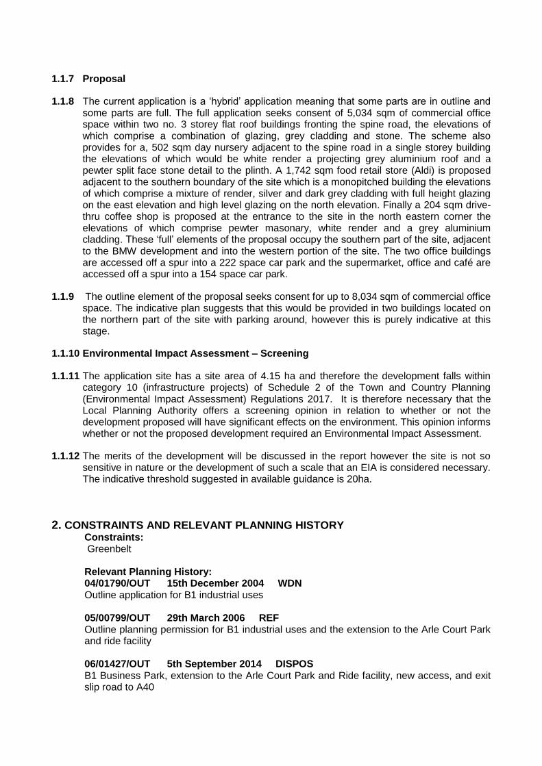


![[EH Team member] [Local Authority name] [Local Authority address] : [relevant telephone number]](https://static.documents.pub/doc/80x56/5681633e550346895dd3cf69/eh-team-member-local-authority-name-local-authority-address-relevant-56cc1654acd13.jpg)