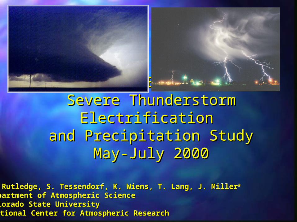
STEPS Severe Thunderstorm Electrification and Precipitation Study May-July 2000. S. Rutledge, S. Tessendorf, K. Wiens, T. Lang, J. Miller # Department of Atmospheric Science Colorado State University # National Center for Atmospheric Research. STEPS Objectives. - PowerPoint PPT Presentation
STEPS STEPS Severe Thunderstorm Severe Thunderstorm Electrification Electrification and Precipitation Study and Precipitation Study May-July 2000 May-July 2000 Rutledge, S. Tessendorf, K. Wiens, T. Lang, J. Miller Rutledge, S. Tessendorf, K. Wiens, T. Lang, J. Miller # partment of Atmospheric Science partment of Atmospheric Science lorado State University lorado State University ational Center for Atmospheric Research tional Center for Atmospheric Research
Transcript
STEPSSTEPSSevere Thunderstorm Severe Thunderstorm
Electrification Electrification and Precipitation Studyand Precipitation Study
May-July 2000May-July 2000
S. Rutledge, S. Tessendorf, K. Wiens, T. Lang, J. MillerS. Rutledge, S. Tessendorf, K. Wiens, T. Lang, J. Miller##
Department of Atmospheric ScienceDepartment of Atmospheric ScienceColorado State UniversityColorado State University##National Center for Atmospheric ResearchNational Center for Atmospheric Research
STEPS ObjectivesSTEPS ObjectivesTo gain a better understanding of interactions between kinematics,To gain a better understanding of interactions between kinematics,precipitation production and electrification in severe thunderstormsprecipitation production and electrification in severe thunderstormsover the High Plains.over the High Plains.
What are the conditions that differentiate supercell storms into high precipitation, What are the conditions that differentiate supercell storms into high precipitation, moderate precipitation, and low precipitation events?moderate precipitation, and low precipitation events?
Why do some severe storms produce anonymously large amounts of positiveWhy do some severe storms produce anonymously large amounts of positivecloud-to-ground lightning?cloud-to-ground lightning?
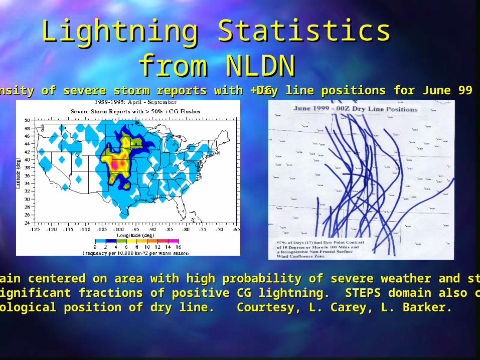
Lightning Statistics from Lightning Statistics from NLDNNLDN
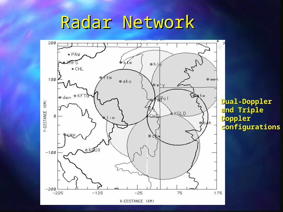
STEPS domain centered on area with high probability of severe weather and storms thatSTEPS domain centered on area with high probability of severe weather and storms thatproduce significant fractions of positive CG lightning. STEPS domain also correspondedproduce significant fractions of positive CG lightning. STEPS domain also correspondedto climatological position of dry line. Courtesy, L. Carey, L. Barker.to climatological position of dry line. Courtesy, L. Carey, L. Barker.
Density of severe storm reports with +CGDensity of severe storm reports with +CGDry line positions for June 99Dry line positions for June 99
STEPS highlightsSTEPS highlightsObservations of 8 weak events, 7 moderate storms, and 5 severe storms.Observations of 8 weak events, 7 moderate storms, and 5 severe storms.
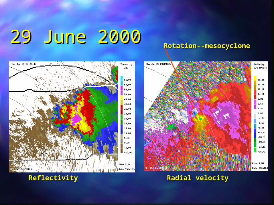
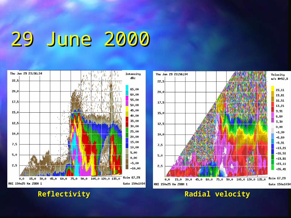
Highlights include major downburst events on 31 May and 19 June, a bow-echoHighlights include major downburst events on 31 May and 19 June, a bow-echoMCS on 11 June, LP supercells on 31 May and 5 July, and MP/HP supercells onMCS on 11 June, LP supercells on 31 May and 5 July, and MP/HP supercells on22 June, 24 June and 29 June.22 June, 24 June and 29 June.
STEPS information at STEPS information at http://www.mmm.ucar.edu/community/steps.htmlOperations journal (with text and radar summaries) at:Operations journal (with text and radar summaries) at:
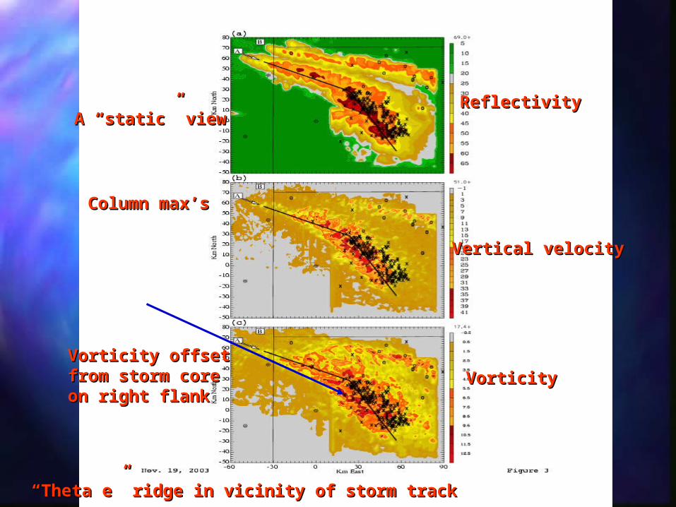
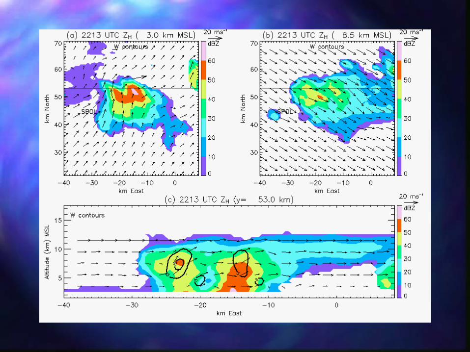
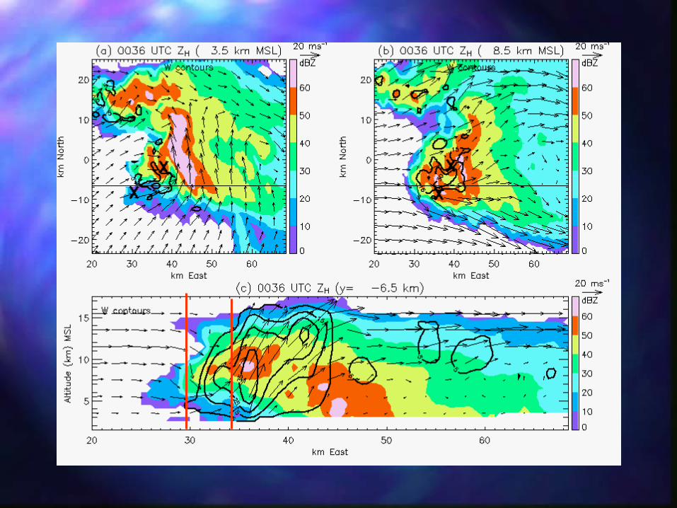
A “static” viewA “static” viewReflectivityReflectivity
Vertical velocityVertical velocity
VorticityVorticityVorticity offsetVorticity offsetfrom storm corefrom storm coreon right flankon right flank
Column max’sColumn max’s
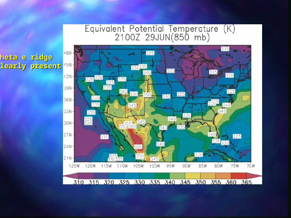
““Theta e” ridge in vicinity of storm trackTheta e” ridge in vicinity of storm track
Theta e ridge Theta e ridge clearly presentclearly present
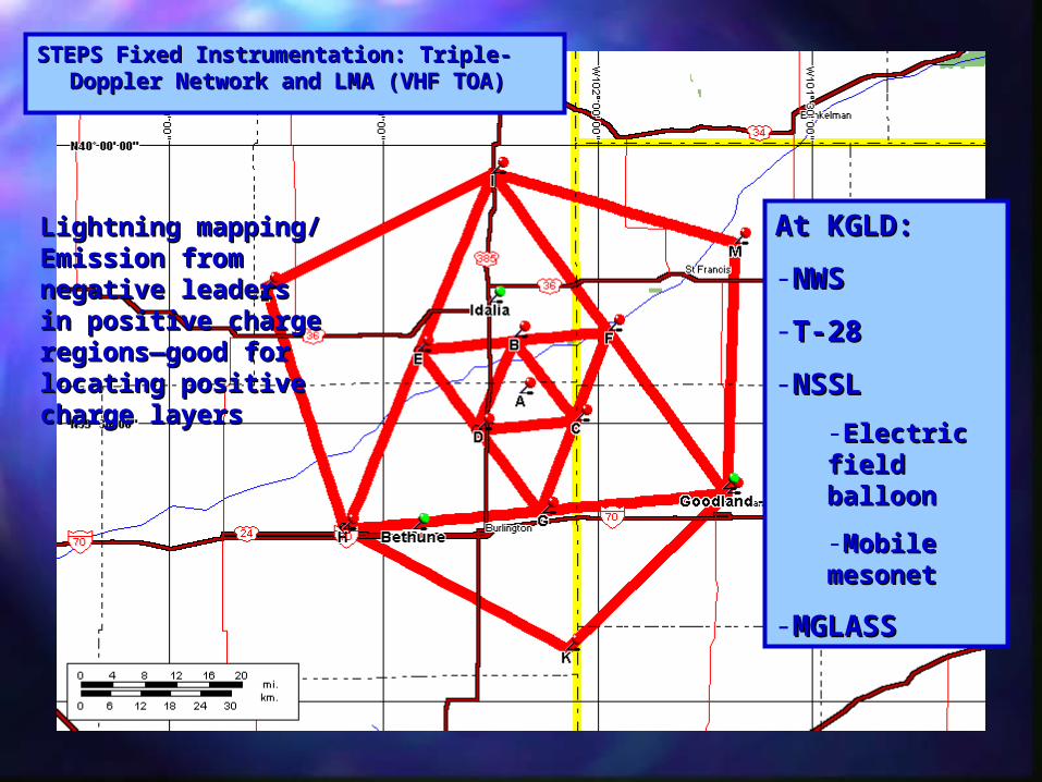
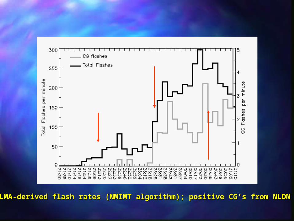
LMA-derived flash rates (NMIMT algorithm); positive CG’s from NLDNLMA-derived flash rates (NMIMT algorithm); positive CG’s from NLDN
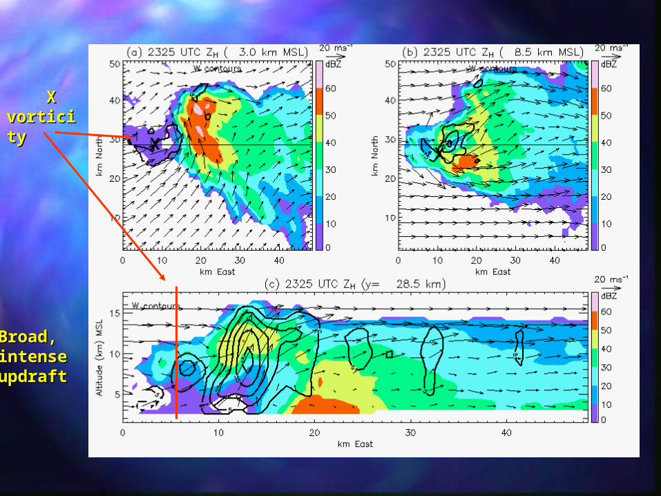
X X vorticitvorticityy
Broad,Broad,intenseintenseupdraftupdraft
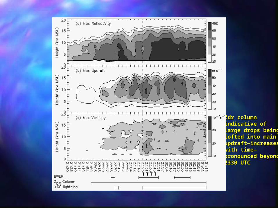
Zdr column Zdr column indicative ofindicative oflarge drops beinglarge drops beinglofted into mainlofted into mainupdraft—increasesupdraft—increaseswith time—with time—pronounced beyond pronounced beyond 2330 UTC2330 UTC
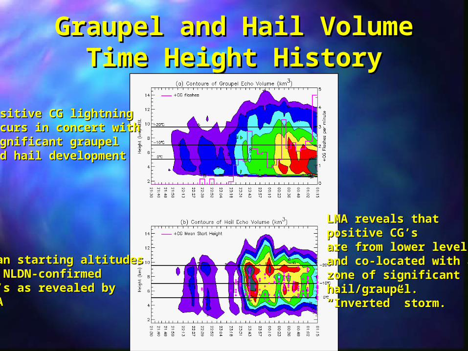
Graupel and Hail Volume Graupel and Hail Volume Time Height HistoryTime Height History
Mean starting altitudesMean starting altitudesof NLDN-confirmed of NLDN-confirmed CG’s as revealed byCG’s as revealed byLMALMA
LMA reveals thatLMA reveals thatpositive CG’spositive CG’sare from lower levelsare from lower levelsand co-located with aand co-located with azone of significantzone of significanthail/graupel. hail/graupel. ““Inverted” storm.Inverted” storm.
Positive CG lightning Positive CG lightning occurs in concert withoccurs in concert withsignificant graupelsignificant graupeland hail developmentand hail development
Positive CG locations during intense phase (first peak)Positive CG locations during intense phase (first peak)Ground strike locations; starting heights of CG’sGround strike locations; starting heights of CG’s
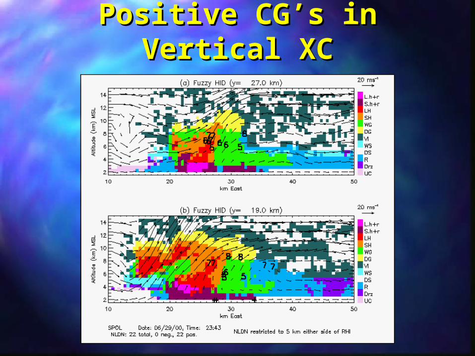
Positive CG’s in Vertical Positive CG’s in Vertical XCXC
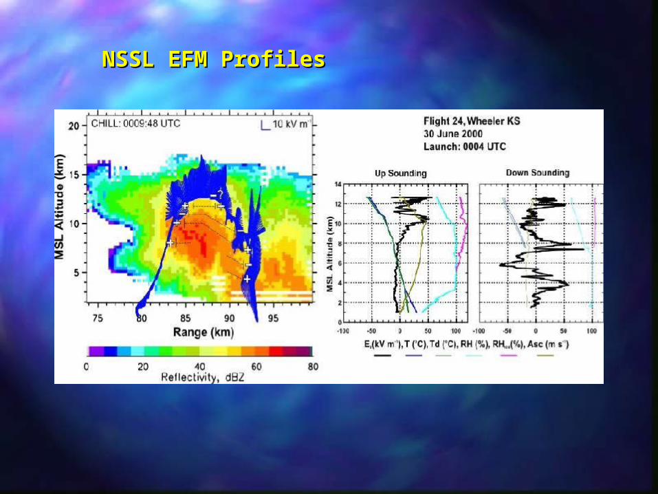
NSSL EFM ProfilesNSSL EFM Profiles
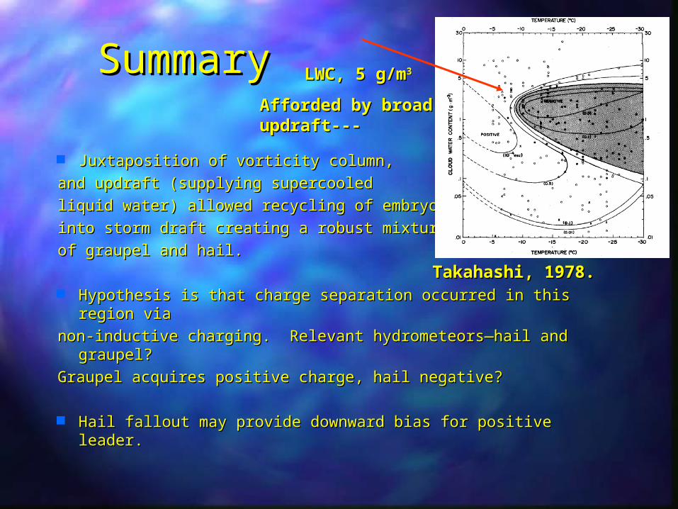
SummarySummary
Juxtaposition of vorticity column, Juxtaposition of vorticity column,
and updraft (supplying supercooled and updraft (supplying supercooled
liquid water) allowed recycling of embryosliquid water) allowed recycling of embryos
into storm draft creating a robust mixture into storm draft creating a robust mixture
of graupel and hail.of graupel and hail.
Hypothesis is that charge separation occurred in this region Hypothesis is that charge separation occurred in this region via via
non-inductive charging. Relevant hydrometeors—hail and non-inductive charging. Relevant hydrometeors—hail and graupel?graupel?