48
STREAMS
| Date post: | 03-Jan-2016 |
| Category: |
Documents |
| Upload: | horatio-ray |
| View: | 218 times |
| Download: | 2 times |

STREAMS
STREAMS• hydrology or geo-hydrology is the study of
streams or groundwater
• Basic nature of steams
• Definition, origin and course of stream
• definition and explanation
• a flowing body of water mostly contained in a channel at Earth’s surface
• running water is a powerful agent of erosion and principal sculpture of Earth’s landscape.
• perennial streams flow year round and intermittent (ephemeral) streams do not.
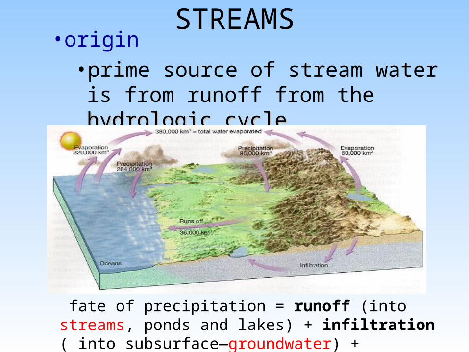
STREAMS• origin
• prime source of stream water is from runoff from the hydrologic cyclehydrologic cycle
fate of precipitation = runoff (into streams, ponds and lakes) + infiltration ( into subsurface—groundwater) + evaporation + transpiration ( used by plants)
STREAMS• stream course and retention of water in
channel
• path of stream can depend on:
• slope of land
• geologic structures as folds, fractures and faults
• rock hardness
• retention of water in channel depends largely on the presence and degree of channel coating by clay, silt or other impermeable substances

STREAMS
• Stream system
• tributaries
• smaller streams which collect and supply materials and water to the main stream
• main stream or main trunk
• the main stream which receives materials and water from the tributaries and is the prime transporter of materials in the stream system
STREAMS• Stream profile and related terms
• stream profile
• head
• mouth
• examples of mouth are juncture of stream with: another stream; a pond or lake; the ocean
• decreasing gradient of channel downstream
• slope of stream channel is greatest at head and smallest at mouth
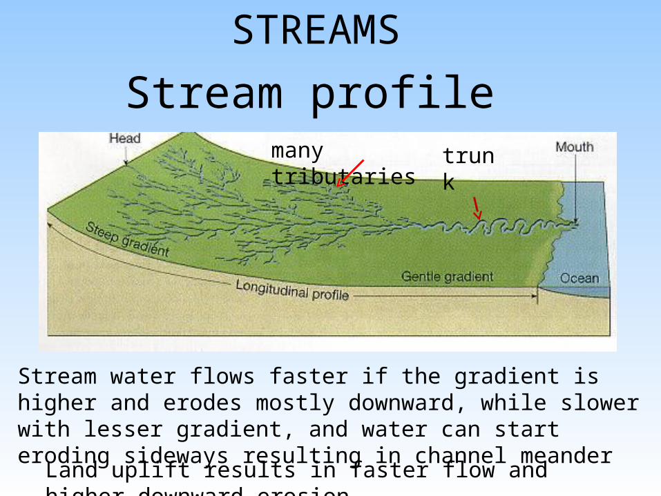
Stream profile
STREAMS
Stream water flows faster if the gradient is higher and erodes mostly downward, while slower with lesser gradient, and water can start eroding sideways resulting in channel meander
Land uplift results in faster flow and higher downward erosion
trunkmany tributaries

STREAMS• base level
• lowest level to which a stream can erode its channel
• local or temporary base levels include lakes, resistant rock formation(s) and streams which act as base level for their tributaries-- ultimate base level is sea level
• head-ward erosion and stream piracy
• head ward erosion is the extension of a channel head ward up the slope of erosion
• stream piracy is the diversion of waters of one stream by another stream and head ward erosion of pirating stream

STREAMS
Stream piracy and changing channel direction can cause large problems at local, state--national and international levels
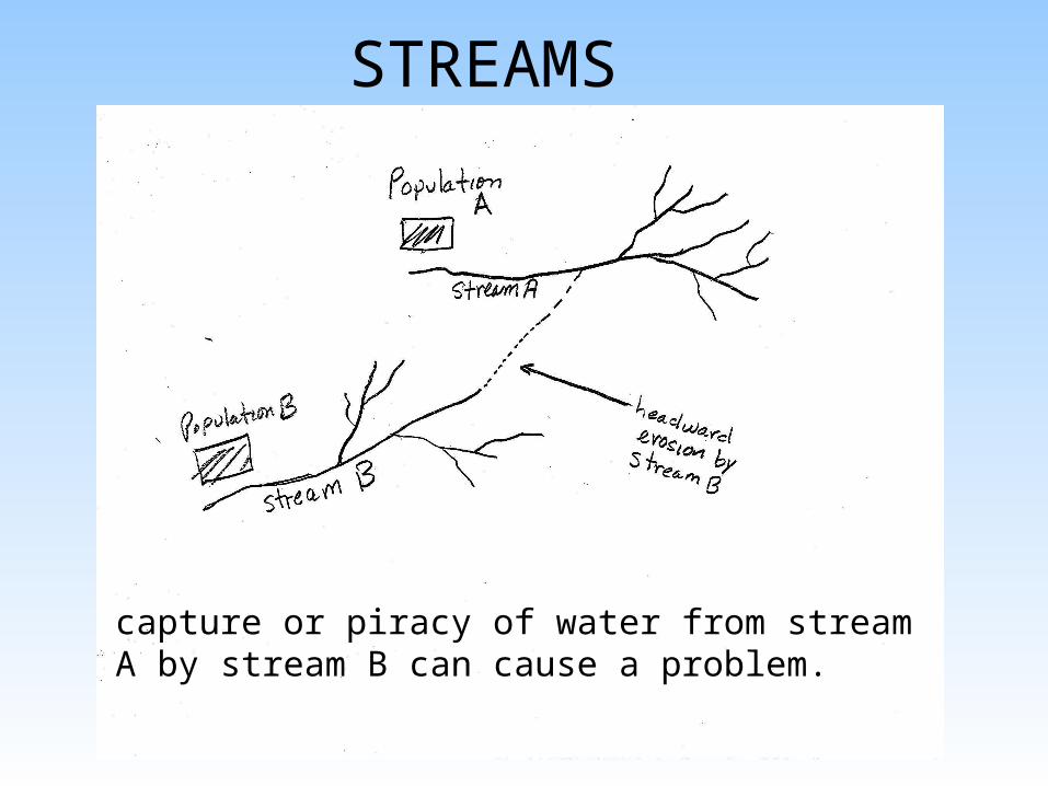
STREAMS
capture or piracy of water from stream A by stream B can cause a problem.
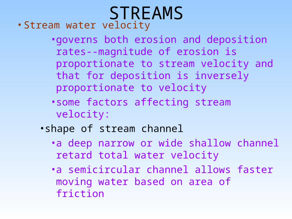
STREAMS• Stream water velocity
• governs both erosion and deposition rates--magnitude of erosion is proportionate to stream velocity and that for deposition is inversely proportionate to velocity
• some factors affecting stream velocity:• shape of stream channel
• a deep narrow or wide shallow channel retard total water velocity
• a semicircular channel allows faster moving water based on area of friction
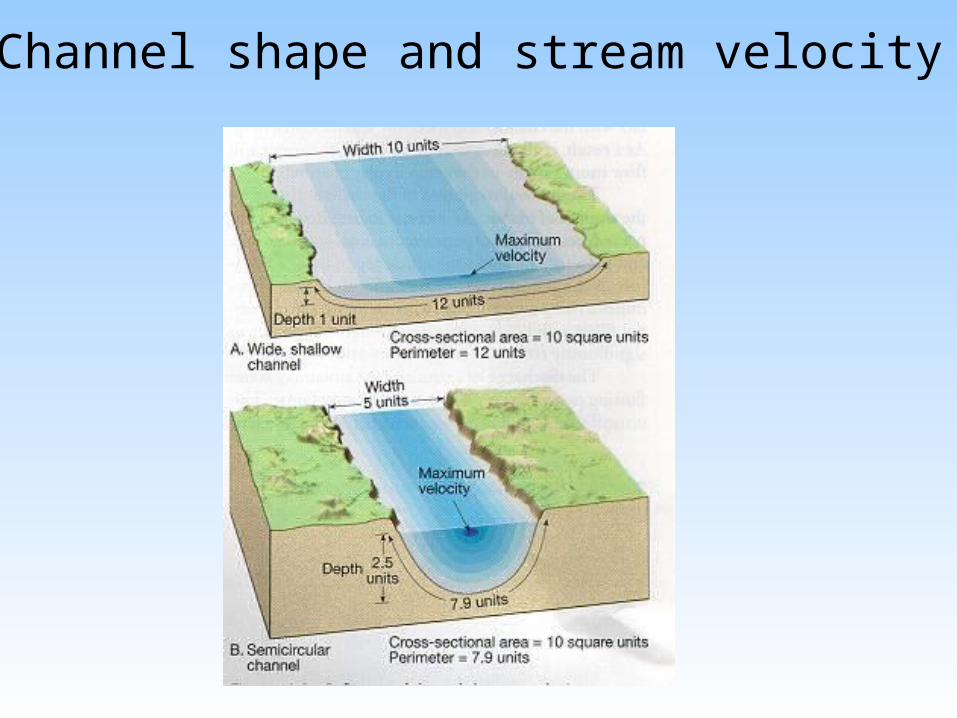
Channel shape and stream velocity
STREAMS• roughness of channel
• rough channel with boulders and large rocks causes a decrease of water velocity
• stream gradient
• is a measure of the slope of the channel expressed as the number of feet dropped per mile as measured between 2 points along the path of the stream
STREAMS• change in channel area along the stream
• if channel area increases downstream, water velocity decreases
• alluvial fans or deltas form when depositional rates of materials increase as velocity of water decreases--these features will be discussed in detail later
• Stream loads• materials carried by stream waters• stream competency refers to the maximum size
particle(see Wentworth’s scale) a stream can transport

STREAMS• suspended load
• suspended particles in stream waters
• usually includes clay and silt sizes
• most streams carry largest part of their load in suspension
• bed load
• particles which bounce or skip (saltation) while being transported by the stream
• for most streams sand size particles
• dissolved or solution load
• stream velocity has no influence on this--precipitation occurs based on water chem.
STREAMS• Stream and drainage patterns, drainage basins and
divides
• Stream patterns
• are in reference to shape of individual stream channel
• straight channel
• often present near headwaters where erosion is downward into the channel
• meander channel
• snakelike in shape and present downstream from the head--these are significant near the mouth

STREAMS
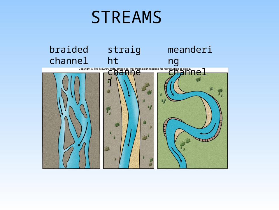
• braided channel
• stream channel which intertwines
• caused if slope or discharge of stream decreases
STREAMS
braided channel
straight channel
meandering channel

STREAMS
meandering channel braided channels
Photos of meandering and braided channels
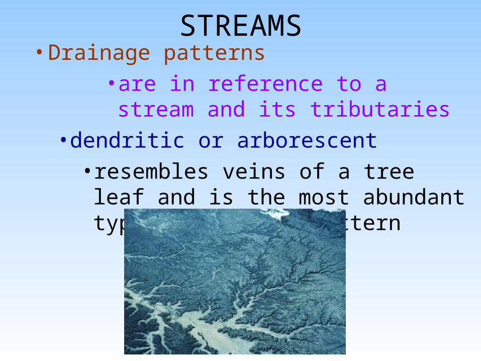
STREAMS• Drainage patterns
• are in reference to a stream and its tributaries
• dendritic or arborescent
• resembles veins of a tree leaf and is the most abundant type of drainage pattern

STREAMS• radial
• streams diverge from a central area like spokes from the hub of a wheel
• develops on volcanic cones or domal uplifts
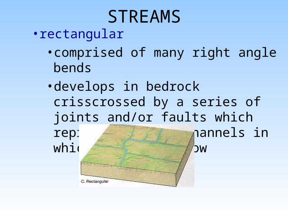
STREAMS• rectangular
• comprised of many right angle bends
• develops in bedrock crisscrossed by a series of joints and/or faults which represent precut channels in which water can flow
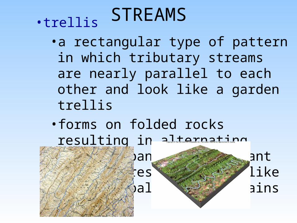
STREAMS• trellis
• a rectangular type of pattern in which tributary streams are nearly parallel to each other and look like a garden trellis
• forms on folded rocks resulting in alternating parallel bands of resistant and less resistant rock like in the Appalachian Mountains

STREAMS• Drainage basin and divide
• a drainage basin is the total land area that contributes water and material to a stream
• a divide is an elevated area which separates drainage basins and range in size from a ridge separating small gullies to continental divides which split continents into large drainage basins

Drainage basins and divides
STREAMS
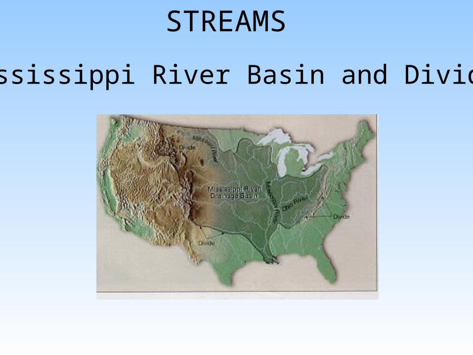
Mississippi River Basin and Divides
STREAMS
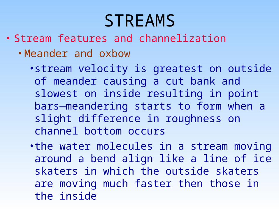
STREAMS• Stream features and channelization
• Meander and oxbow
• stream velocity is greatest on outside of meander causing a cut bank and slowest on inside resulting in point bars—meandering starts to form when a slight difference in roughness on channel bottom occurs
• the water molecules in a stream moving around a bend align like a line of ice skaters in which the outside skaters are moving much faster then those in the inside
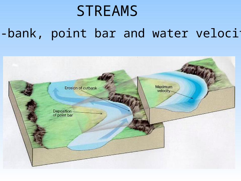
Cut-bank, point bar and water velocities
STREAMS
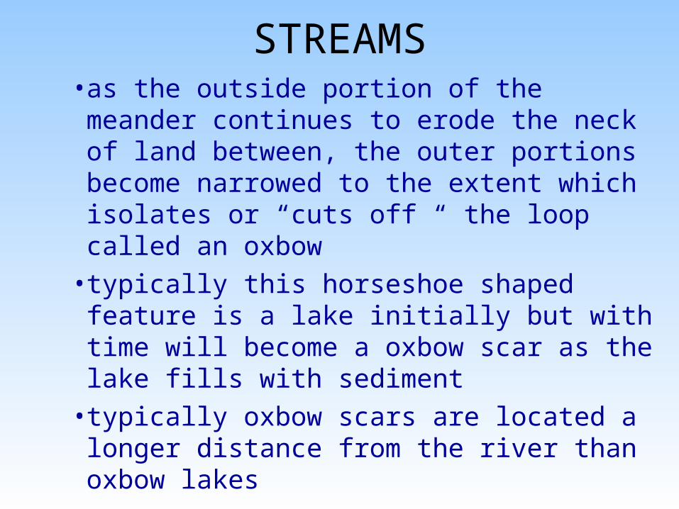
STREAMS• as the outside portion of the meander
continues to erode the neck of land between, the outer portions become narrowed to the extent which isolates or “cuts off “ the loop called an oxbow
• typically this horseshoe shaped feature is a lake initially but with time will become a oxbow scar as the lake fills with sediment
• typically oxbow scars are located a longer distance from the river than oxbow lakes

Formation of an oxbow
STREAMS
STREAMS
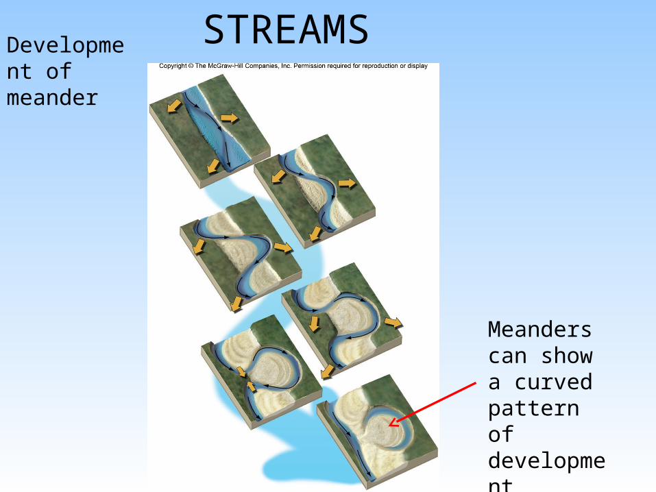
Meanders can show a curved pattern of development forming an oxbow
Development of meander

Oxbow Lakes

Meander scars
STREAMS
An older stage of stream meander development

STREAMS
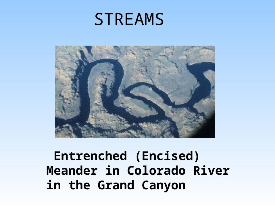
--an Entrenched (Encised) meander is a deepened meander channel caused by subsequent rejuvenation (uplift) of the channel--
STREAMS
Entrenched (Encised) Meander in Colorado River in the Grand Canyon
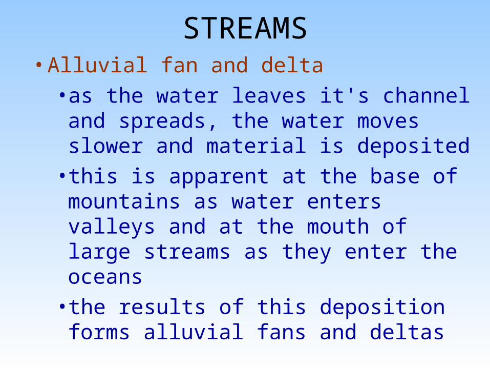
STREAMS• Alluvial fan and delta
• as the water leaves it's channel and spreads, the water moves slower and material is deposited
• this is apparent at the base of mountains as water enters valleys and at the mouth of large streams as they enter the oceans
• the results of this deposition forms alluvial fans and deltas
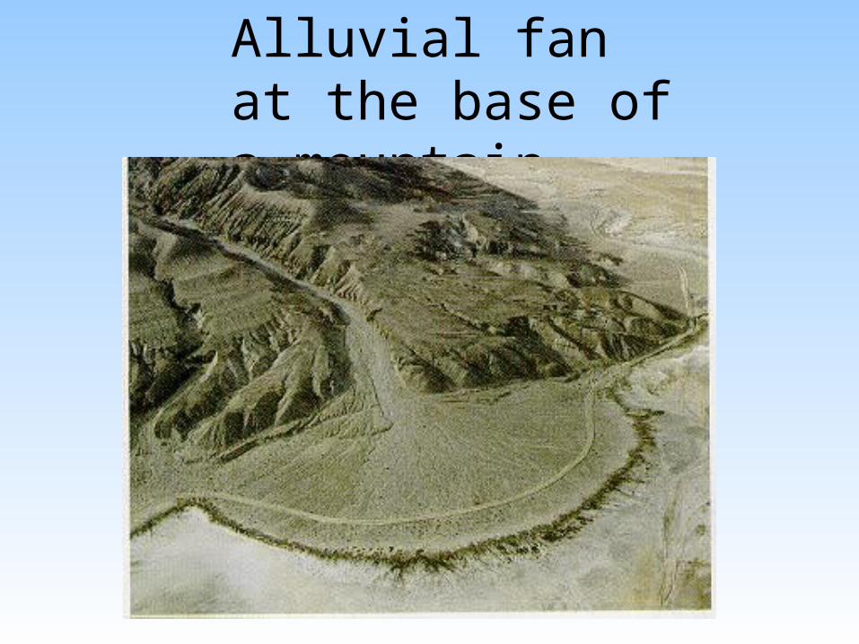
Alluvial fan at the base of a mountain
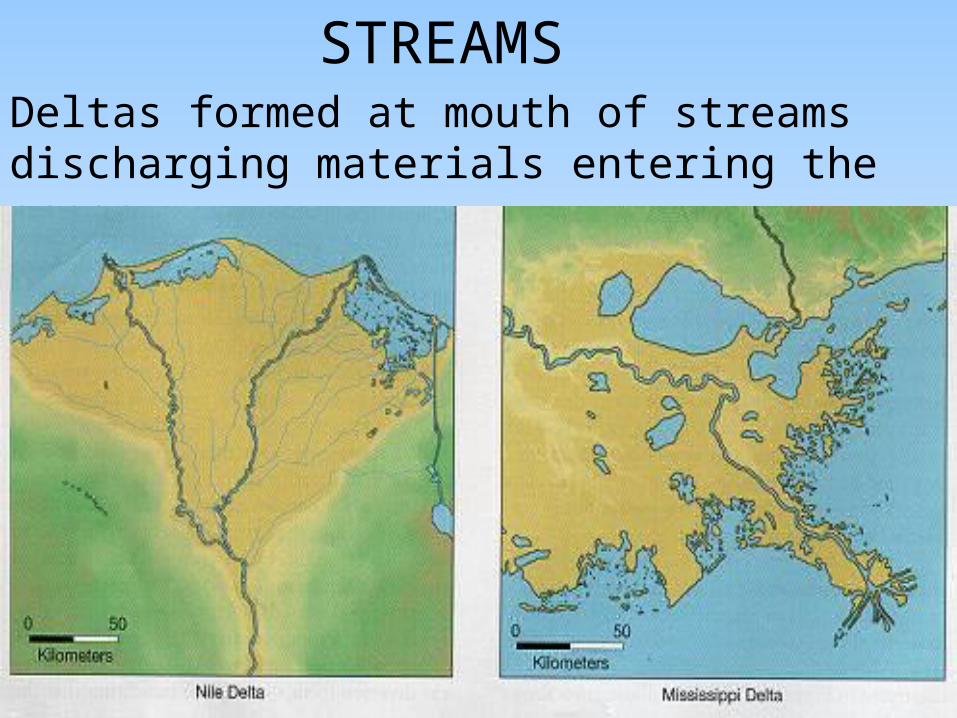
Deltas formed at mouth of streams discharging materials entering the ocean
STREAMS

STREAMS• Floodplain and natural levee
• a floodplain is a relatively flat region flanking large streams and formed by deposition of finer sediments during periodic flooding
• a natural levee is a ridge or platform built on the floodplain adjacent to and trending along the course of the stream and represents the highest area or point on a floodplain
• levees are caused during flooding and can inhibit subsequent flooding
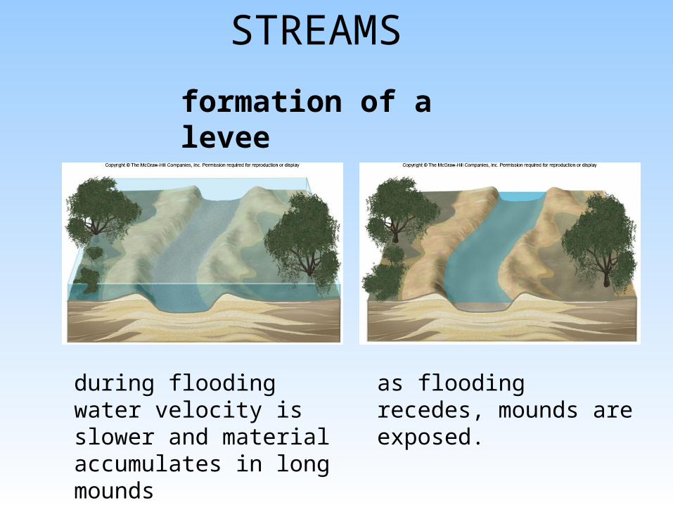
STREAMS
formation of a levee
during flooding water velocity is slower and material accumulates in long mounds
as flooding recedes, mounds are exposed.
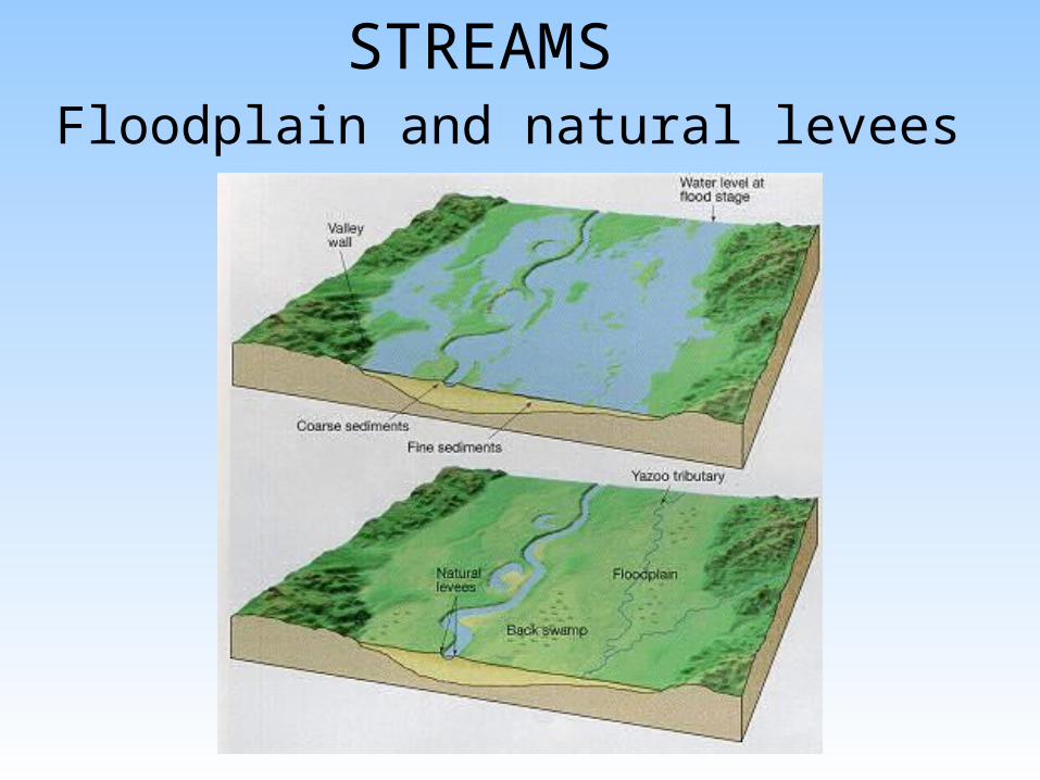
Floodplain and natural levees
STREAMS
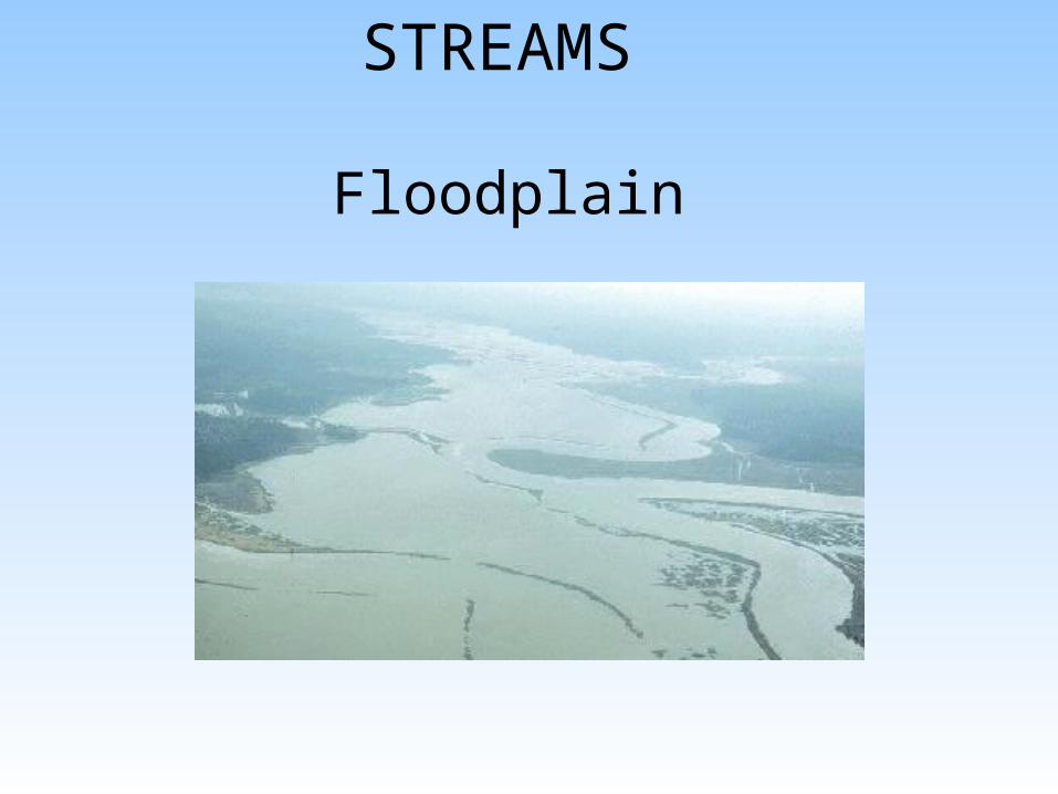
Floodplain
STREAMS
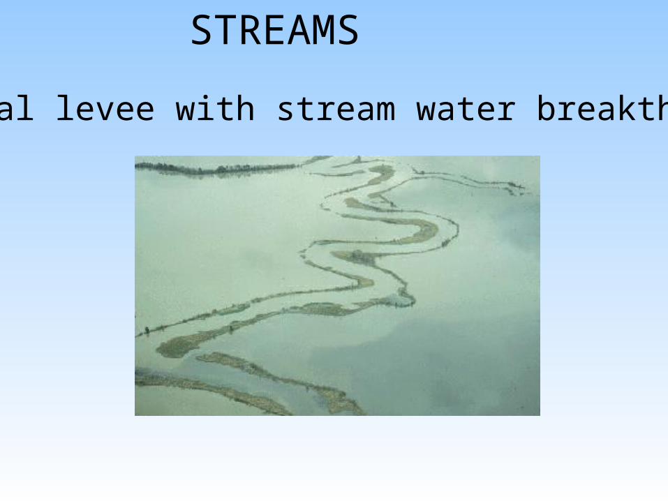
Natural levee with stream water breakthrough
STREAMS
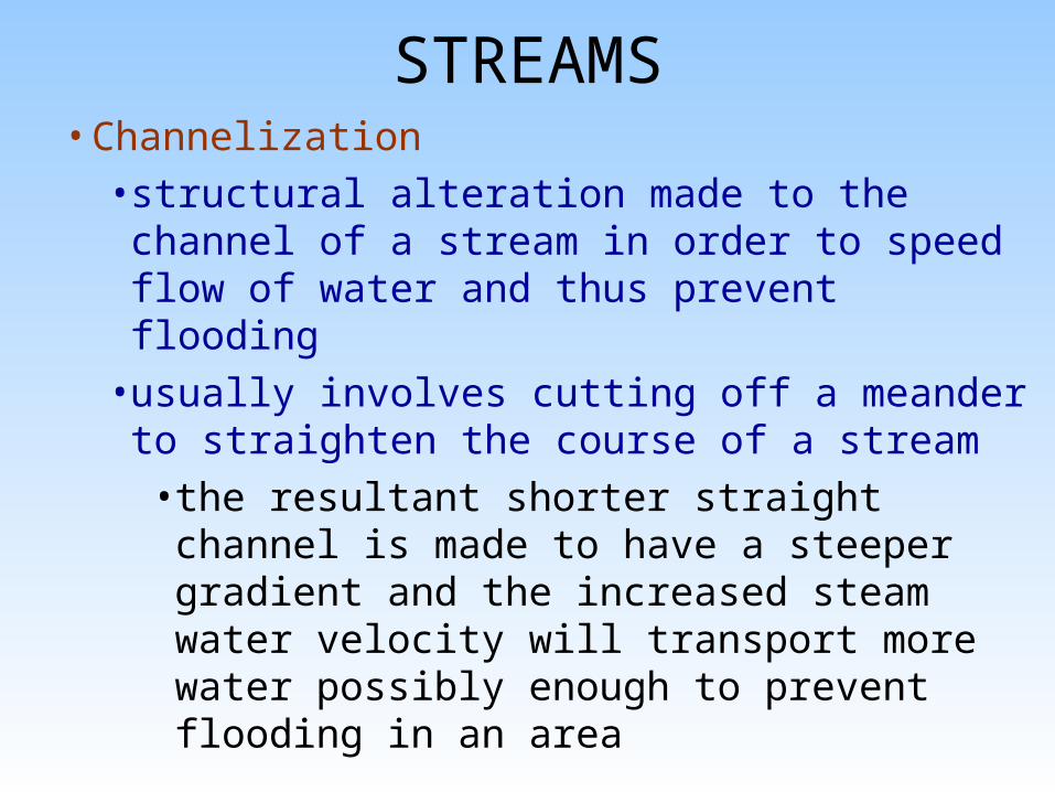
STREAMS• Channelization
• structural alteration made to the channel of a stream in order to speed flow of water and thus prevent flooding
• usually involves cutting off a meander to straighten the course of a stream
• the resultant shorter straight channel is made to have a steeper gradient and the increased steam water velocity will transport more water possibly enough to prevent flooding in an area

STREAMS
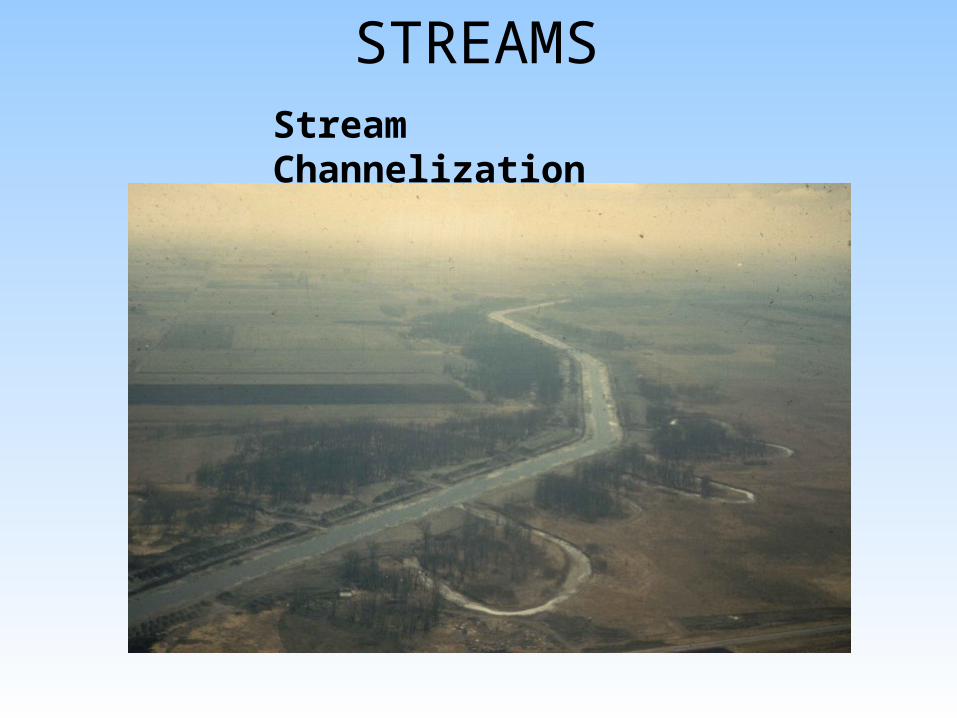
STREAMSStream Channelization
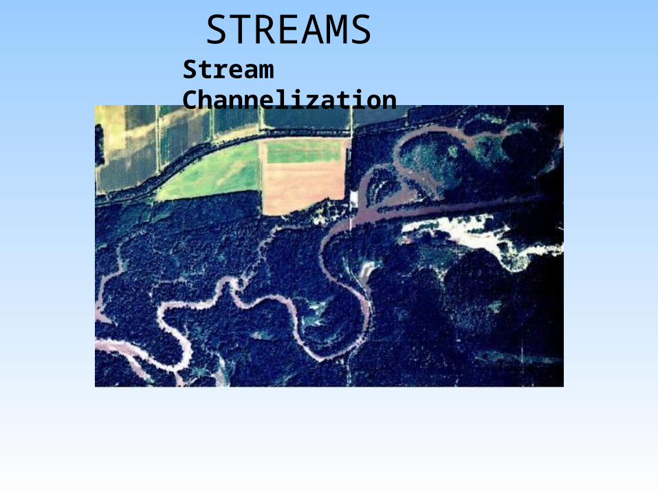
STREAMSStream Channelization
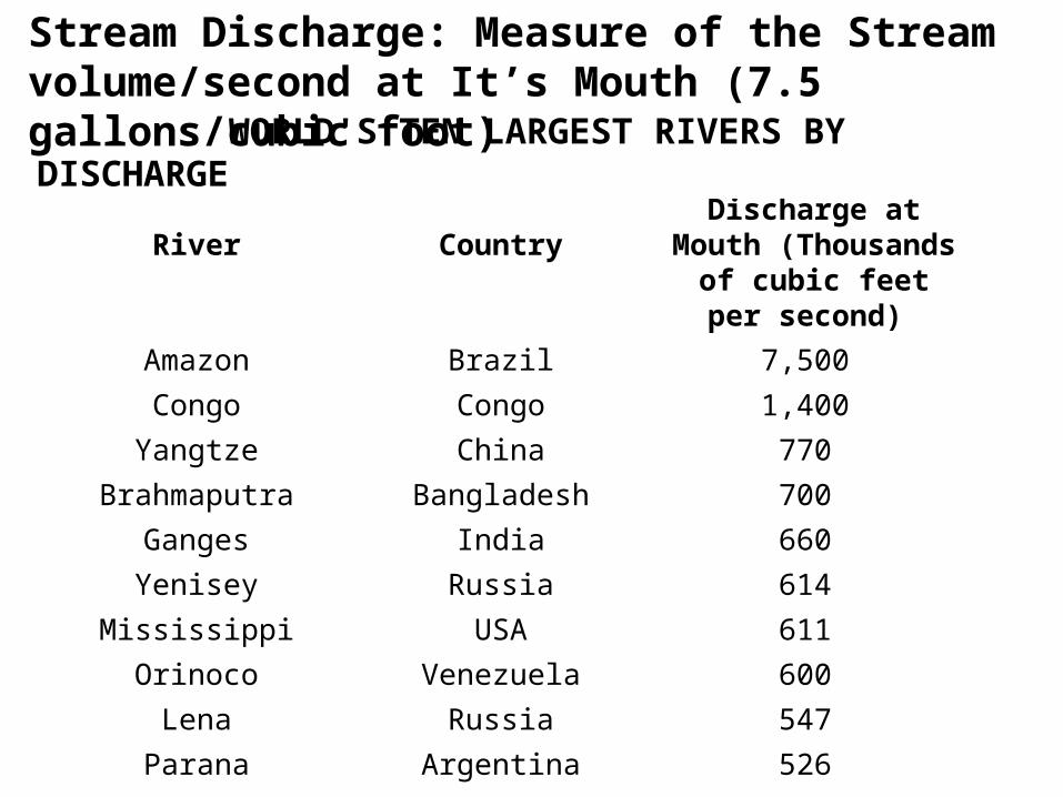
River Country Average Discharge at Mouth (Thousands of cubic feet per second)
Amazon Brazil 7,500
Congo Congo 1,400
Yangtze China 770
Brahmaputra Bangladesh 700
Ganges India 660
Yenisey Russia 614
Mississippi USA 611
Orinoco Venezuela 600
Lena Russia 547
Parana Argentina 526
WORLD'S TEN LARGEST RIVERS BY DISCHARGE
Stream Discharge: Measure of the Stream volume/second at It’s Mouth (7.5 gallons/cubic foot)


