17
Streets for Cycling Plan 2020 South Side Implementation Plan Public Meeting – 4/11/16 Mike Amsden, AICP Assistant Director of Transportation Planning
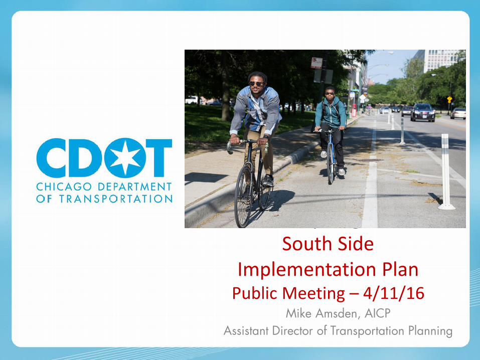
Streets for Cycling Plan 2020 South Side
Implementation Plan Public Meeting – 4/11/16
Mike Amsden, AICP Assistant Director of Transportation Planning

Why Bikes? And Why am I Here?

Citywide plan creating a world-class network of bike facilities that are safe and comfortable for all Chicagoans
Streets for Cycling Plan 2020
• Over 600-mile network of Neighborhood Bike Routes, Crosstown Bike Routes, and Spoke Routes
• Bike facility within ½ mile of every Chicagoan
• Released in 2012

Work with the Neighborhood Experts

Neighborhood Bike Routes
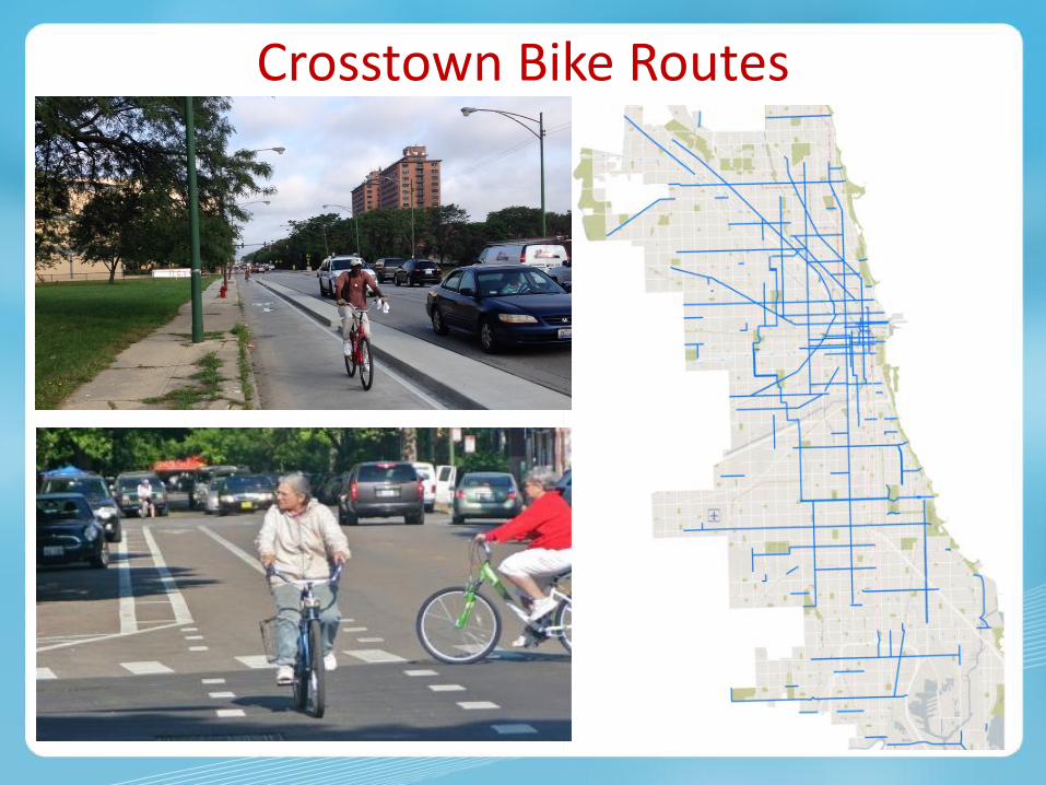
Crosstown Bike Routes

Spoke Routes

Streets for Cycling Plan Progress
• 108 miles of buffered or protected bike lanes installed
• 3 neighborhood greenways installed
• 290-mile bikeway network • Bicycling is the fastest growing
mode of transportation in Chicago
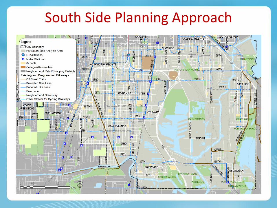
South Side Planning Approach

Community Input • Aldermen: Summer 2015
– Project update and CAG input
• Community Advisory Group: November 12, 2015 – Collected input on priorities for the community and draft priority routes

• Origins & Destinations • Safety / Crash History • Connectivity / Network Gaps • Crosses Barriers • Equity
• Community Support • Travel Demand / Ridership • Public Health Data • Access to Transportation
• Reviewed results of Active Transportation Alliance Bike Network Vision Study
• Reviewed criteria used by other cities • Criteria:
Route Analysis
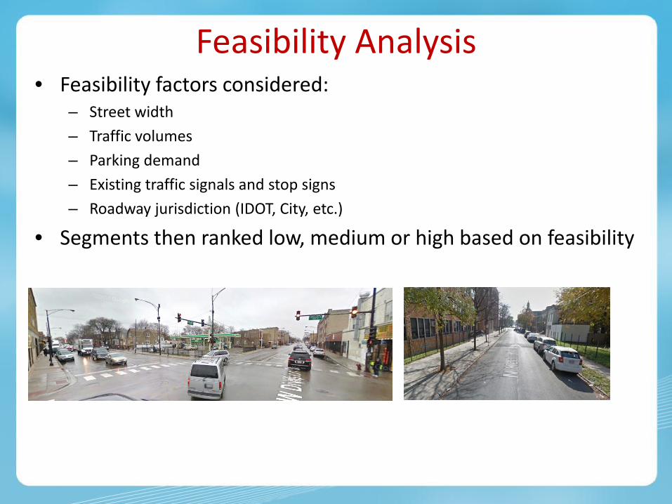
Feasibility Analysis • Feasibility factors considered:
– Street width – Traffic volumes – Parking demand – Existing traffic signals and stop signs – Roadway jurisdiction (IDOT, City, etc.)
• Segments then ranked low, medium or high based on feasibility

• Route Score and Feasibility Score combined to create an overall score
• Results in low, medium or high prioritization of routes
Route Score + Feasibility
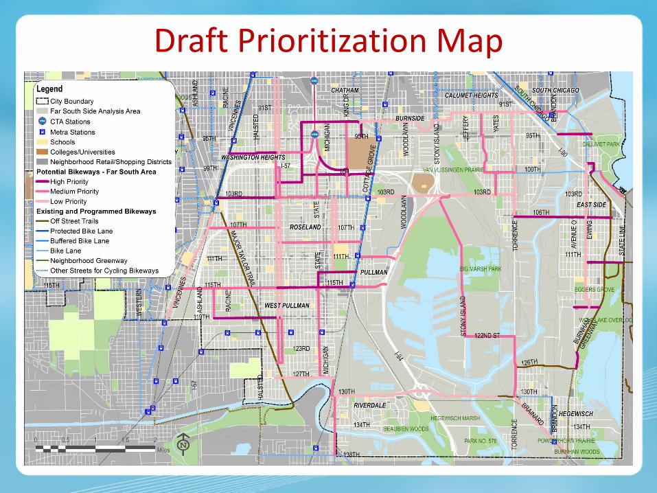
Draft Prioritization Map

• What are your priorities? What are the neighborhood’s priorities? • Help us prioritize routes!
We Want Your Feedback

West Side Implementation Process
Website www.chicagocompletestreets.org
Contact
Facebook facebook.com/CDOTNews
@ChicagoDOT
Thank You!


