5
DOWNTOWN WEST Transportation Planning Study SUMMARY OF FINAL PLANNING STUDY PUBLIC MEETING July 20, 2017

DOWNTOWN WESTTransportation Planning Study
17th
St.
NW
19th
St.
NW
13th
St.
NW
21St
St.
NW
14th
St.
NW
K St. NW
I St. NW
New York Ave. NWPennsylvania Ave. NW
H St. NWFoggyBottom-
GWU
FarragutWest
FarragutNorth
Archives-Navy MemorialFederal
Triangle
McPhersonSquare
Downtown West seeks to improve east-west travel for pedestrians and cyclists on Pennsylvania Avenue NW and persons using public transit along H and I Streets NW.
ABOUT THE PROJECT
New York Avenue NW at 15th Street NWH Street NW looking westPennsylvania Avenue looking southeast Pennsylvania Avenue and H Street Pennsylvania Avenue and H Street
Pennsylvania Ave. NW:
• Improve travel for cyclists: Develop alternatives for a cycle track (separated bicycle lanes)
• Improve the pedestrian realm: Identify opportunities to improve the pedestrian realm, including green infrastructure
H Street NW:
• Improve travel for buses:Assess the feasibility of a contraflow westbound bus lane
• Identify necessary operational improvements including at the intersections with New York Avenue and Pennsylvania Avenue
DOWNTOWN WESTTransportation Planning Study
FOR BOARDS
SUMMARY OF FINAL PLANNING STUDY PUBLIC MEETING
July 20, 2017

DOWNTOWN WESTTransportation Planning Study
FOR BOARDS
DOWNTOWN WESTTransportation Planning Study
17th
St.
NW
19th
St.
NW
13th
St.
NW
21St
St.
NW
14th
St.
NW
K St. NW
I St. NW
New York Ave. NWPennsylvania Ave. NW
H St. NWFoggyBottom-
GWU
FarragutWest
FarragutNorth
Archives-Navy MemorialFederal
Triangle
McPhersonSquare
Downtown West seeks to improve east-west travel for pedestrians and cyclists on Pennsylvania Avenue NW and persons using public transit along H and I Streets NW.
ABOUT THE PROJECT
New York Avenue NW at 15th Street NWH Street NW looking westPennsylvania Avenue looking southeast Pennsylvania Avenue and H Street Pennsylvania Avenue and H Street
Pennsylvania Ave. NW:
• Improve travel for cyclists: Develop alternatives for a cycle track (separated bicycle lanes)
• Improve the pedestrian realm: Identify opportunities to improve the pedestrian realm, including green infrastructure
H Street NW:
• Improve travel for buses:Assess the feasibility of a contraflow westbound bus lane
• Identify necessary operational improvements including at the intersections with New York Avenue and Pennsylvania Avenue
2
On Thursday, July 20, 2017, the District Department of Transportation held the final public meeting of the Downtown West Transportation Planning Study. The purpose of the meeting was to provide an overview of the project, present the recommended alternative, and gather feedback.
The meeting was open-house style with a formal presentation and question and answer period provided at 7:00 pm.
Outreach Efforts• Emails to over 275 subscribers to the project listserv
• Social media blasts to over 34,000 subscribers through Twitter
• All three Advisory Neighborhood Commissions within the study area notified
• Public meeting announcement issued by DDOT
• Date: July 20, 2017, 6:30-8:00 pm
• Location: George Washington University, Funger Hall
• 44 meeting attendees signed in
• 26 Title VI respondents
• 200+ comments received
MEETING QUICK STATS
EVENT SUMMARY

DOWNTOWN WESTTransportation Planning Study
FOR BOARDS
DOWNTOWN WESTTransportation Planning Study
17th
St.
NW
19th
St.
NW
13th
St.
NW
21St
St.
NW
14th
St.
NW
K St. NW
I St. NW
New York Ave. NWPennsylvania Ave. NW
H St. NWFoggyBottom-
GWU
FarragutWest
FarragutNorth
Archives-Navy MemorialFederal
Triangle
McPhersonSquare
Downtown West seeks to improve east-west travel for pedestrians and cyclists on Pennsylvania Avenue NW and persons using public transit along H and I Streets NW.
ABOUT THE PROJECT
New York Avenue NW at 15th Street NWH Street NW looking westPennsylvania Avenue looking southeast Pennsylvania Avenue and H Street Pennsylvania Avenue and H Street
Pennsylvania Ave. NW:
• Improve travel for cyclists: Develop alternatives for a cycle track (separated bicycle lanes)
• Improve the pedestrian realm: Identify opportunities to improve the pedestrian realm, including green infrastructure
H Street NW:
• Improve travel for buses:Assess the feasibility of a contraflow westbound bus lane
• Identify necessary operational improvements including at the intersections with New York Avenue and Pennsylvania Avenue
3
The following boards and maps were on display:
MEETING MATERIALS
Title Description
About the Project Study purpose, map, and existing condition photos
Study Schedule and Public Outreach
Description and intent of the study phases and the accompanying outreach activities
Building on Previous Work Descriptions of prior and related studies helpful to understanding the current planning study
Goal Statement & Objectives Discussion of the planning study’s goal and objectives
Existing Conditions Extended roll map showing existing conditions in the study area
Alternatives 1, 2, and 3 Individual detailed maps of the three alternatives considered
Matrix of Alternatives Charts comparing the Pennsylvania Avenue NW alternatives and the feasibility of the H Street NW bus lane
Recommended Alternative Large-format wall map offering a close up view of the recommended alternative and proposed improvements

DOWNTOWN WESTTransportation Planning Study
FOR BOARDS
DOWNTOWN WESTTransportation Planning Study
17th
St.
NW
19th
St.
NW
13th
St.
NW
21St
St.
NW
14th
St.
NW
K St. NW
I St. NW
New York Ave. NWPennsylvania Ave. NW
H St. NWFoggyBottom-
GWU
FarragutWest
FarragutNorth
Archives-Navy MemorialFederal
Triangle
McPhersonSquare
Downtown West seeks to improve east-west travel for pedestrians and cyclists on Pennsylvania Avenue NW and persons using public transit along H and I Streets NW.
ABOUT THE PROJECT
New York Avenue NW at 15th Street NWH Street NW looking westPennsylvania Avenue looking southeast Pennsylvania Avenue and H Street Pennsylvania Avenue and H Street
Pennsylvania Ave. NW:
• Improve travel for cyclists: Develop alternatives for a cycle track (separated bicycle lanes)
• Improve the pedestrian realm: Identify opportunities to improve the pedestrian realm, including green infrastructure
H Street NW:
• Improve travel for buses:Assess the feasibility of a contraflow westbound bus lane
• Identify necessary operational improvements including at the intersections with New York Avenue and Pennsylvania Avenue
4
A large wall map of the study area was presented to illustrate the recommended alternative. The format and size allowed participants to get a closer look at proposed improvements.
Meeting attendees were able to submit comments on specific locations using sticky notes.
INFORMATION EXHIBITS
DOWNTOWN WESTTransportation Planning Study
FOR BOARDS
DOWNTOWN WESTTransportation Planning Study
17th
St.
NW
19th
St.
NW
13th
St.
NW
21St
St.
NW
14th
St.
NW
K St. NW
I St. NW
New York Ave. NWPennsylvania Ave. NW
H St. NWFoggyBottom-
GWU
FarragutWest
FarragutNorth
Archives-Navy MemorialFederal
Triangle
McPhersonSquare
Downtown West seeks to improve east-west travel for pedestrians and cyclists on Pennsylvania Avenue NW and persons using public transit along H and I Streets NW.
ABOUT THE PROJECT
New York Avenue NW at 15th Street NWH Street NW looking westPennsylvania Avenue looking southeast Pennsylvania Avenue and H Street Pennsylvania Avenue and H Street
Pennsylvania Ave. NW:
• Improve travel for cyclists: Develop alternatives for a cycle track (separated bicycle lanes)
• Improve the pedestrian realm: Identify opportunities to improve the pedestrian realm, including green infrastructure
H Street NW:
• Improve travel for buses:Assess the feasibility of a contraflow westbound bus lane
• Identify necessary operational improvements including at the intersections with New York Avenue and Pennsylvania Avenue
5
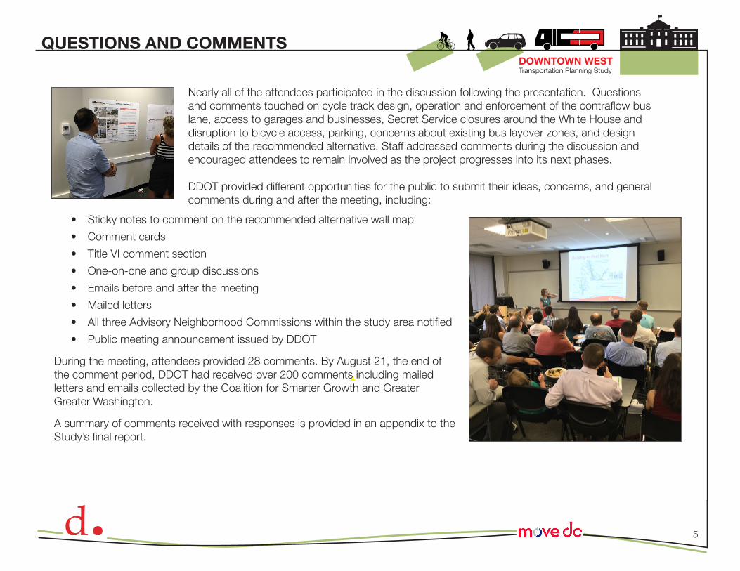
Nearly all of the attendees participated in the discussion following the presentation. Questions and comments touched on cycle track design, operation and enforcement of the contraflow bus lane, access to garages and businesses, Secret Service closures around the White House and disruption to bicycle access, parking, concerns about existing bus layover zones, and design details of the recommended alternative. Staff addressed comments during the discussion and encouraged attendees to remain involved as the project progresses into its next phases.
DDOT provided different opportunities for the public to submit their ideas, concerns, and general comments during and after the meeting, including:
QUESTIONS AND COMMENTS
• Sticky notes to comment on the recommended alternative wall map
• Comment cards
• Title VI comment section
• One-on-one and group discussions
• Emails before and after the meeting
• Mailed letters
• All three Advisory Neighborhood Commissions within the study area notified
• Public meeting announcement issued by DDOT
During the meeting, attendees provided 28 comments. By August 21, the end of the comment period, DDOT had received over 200 comments including mailed letters and emails collected by the Coalition for Smarter Growth and Greater Greater Washington.
A summary of comments received with responses is provided in an appendix to the Study’s final report.


