79
Surveying for Building Construction Prof. Mrs. C. Jayasinghe Senior Professor, Department of Civil Engineering, University of Moratuwa

Surveying for Building Construction
Prof. Mrs. C. Jayasinghe
Senior Professor,
Department of Civil Engineering,
University of Moratuwa
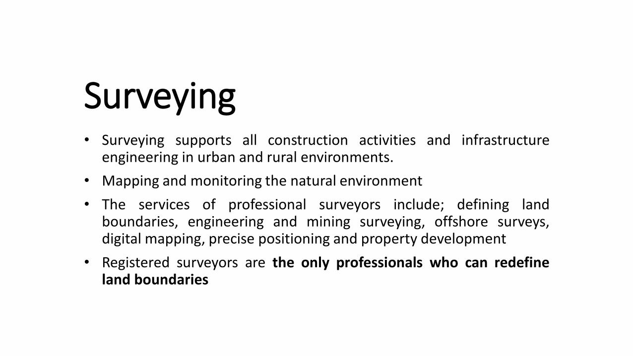
Surveying• Surveying supports all construction activities and infrastructure
engineering in urban and rural environments.
• Mapping and monitoring the natural environment
• The services of professional surveyors include; defining landboundaries, engineering and mining surveying, offshore surveys,digital mapping, precise positioning and property development
• Registered surveyors are the only professionals who can redefineland boundaries
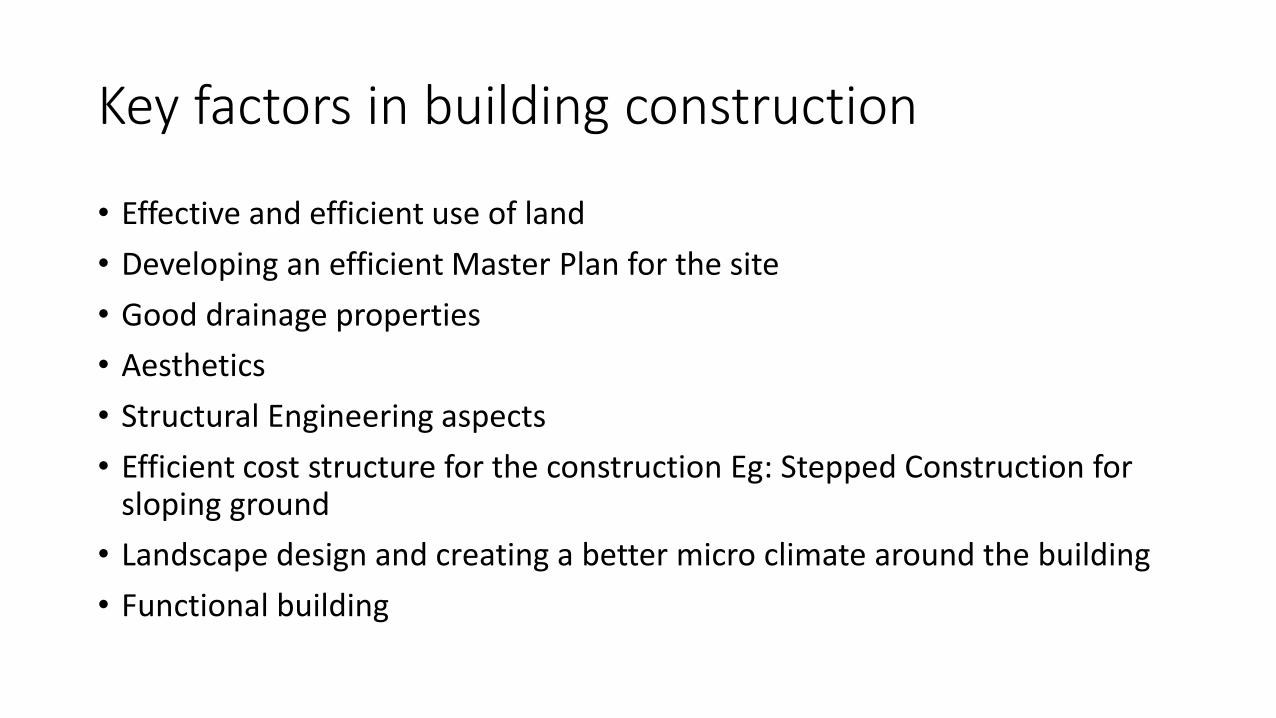
Key factors in building construction
• Effective and efficient use of land
• Developing an efficient Master Plan for the site
• Good drainage properties
• Aesthetics
• Structural Engineering aspects
• Efficient cost structure for the construction Eg: Stepped Construction for sloping ground
• Landscape design and creating a better micro climate around the building
• Functional building

What is a ‘Development Activity’
• Parcelling or sub-division of any land
• Erection / re-erection of structures
• Carrying out of buildings, engineering and other operations –on, over or under such land
• Change in use of any land or structure is used at present
(This does not affect agriculture or horticultural activities)

9m 6m
1.5m
16m
11m
10m
13m
110m
9m
1.5m strip for trees
N
Secondary
Access Road
Main access
road
Land sub division

Planning & Building Regulations
Land Sub Division and Amalgamation
Plot Size
Road Frontage
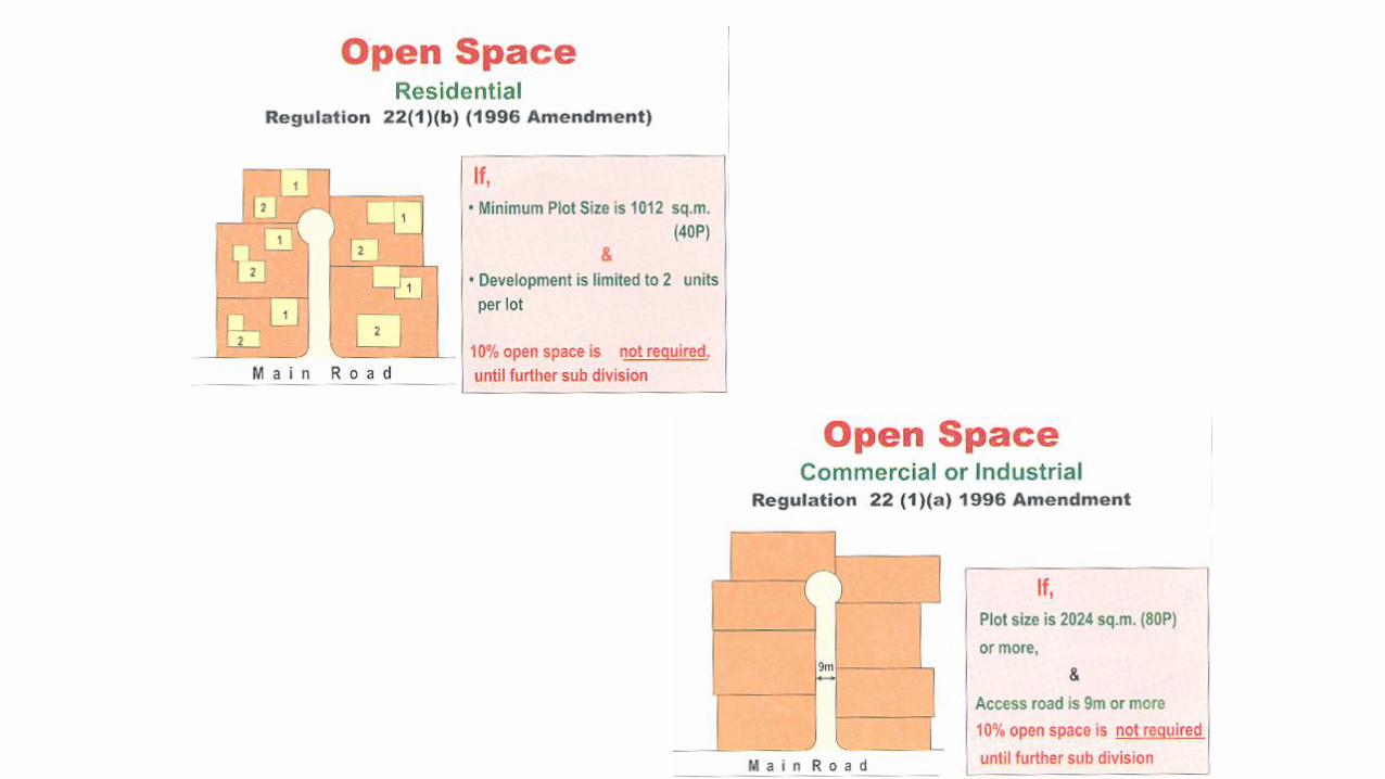
Open Space


Accessibility
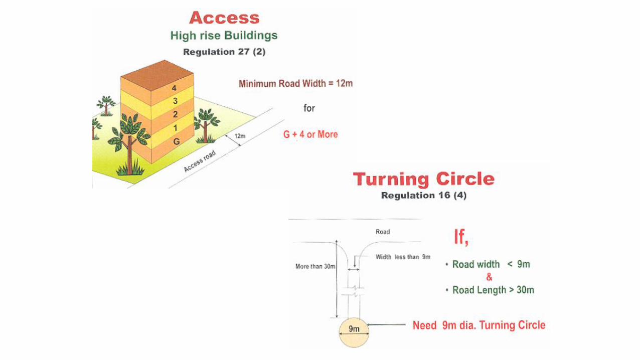
Access
Turning Circle
Splaying of Street Corners


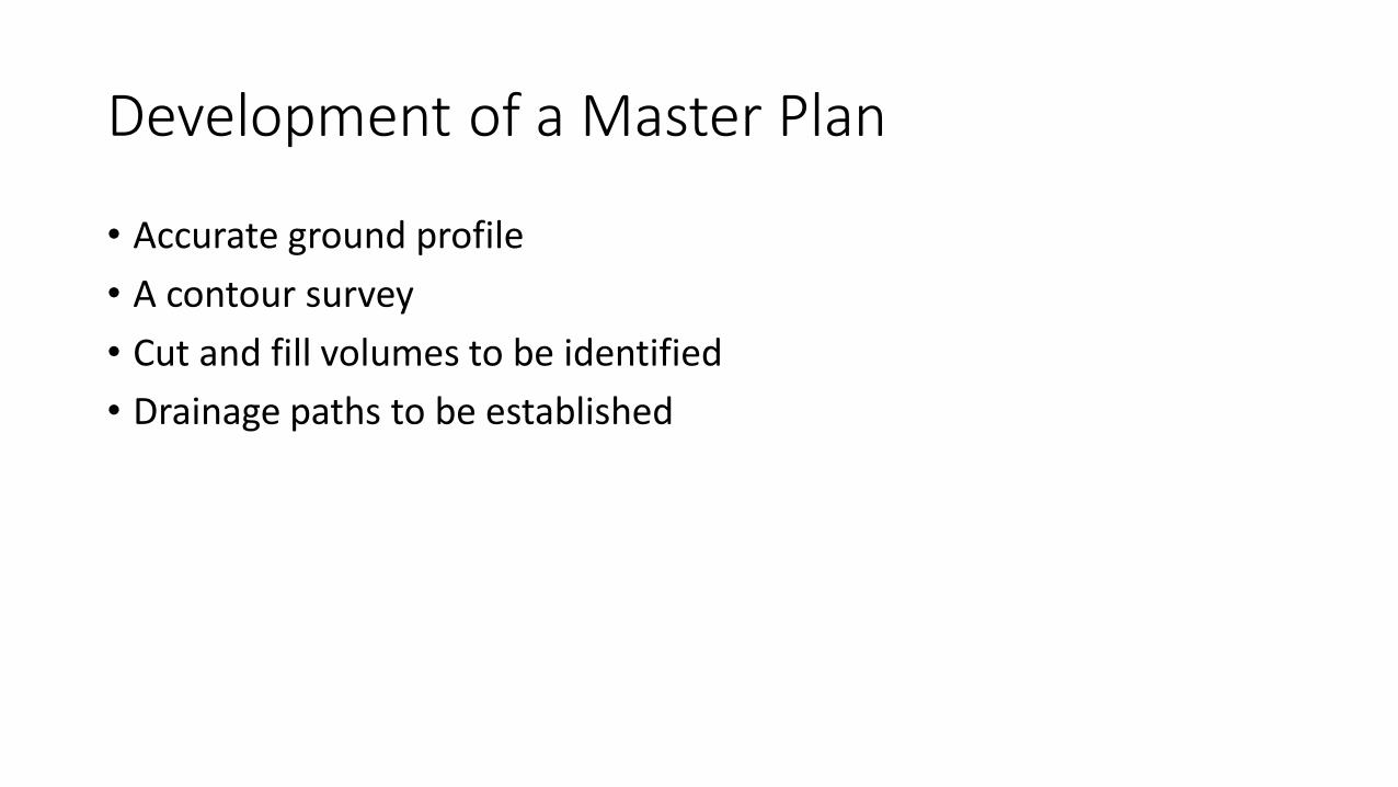
Development of a Master Plan
• Accurate ground profile
• A contour survey
• Cut and fill volumes to be identified
• Drainage paths to be established


The site was developed with a water body based on the ground profile identified
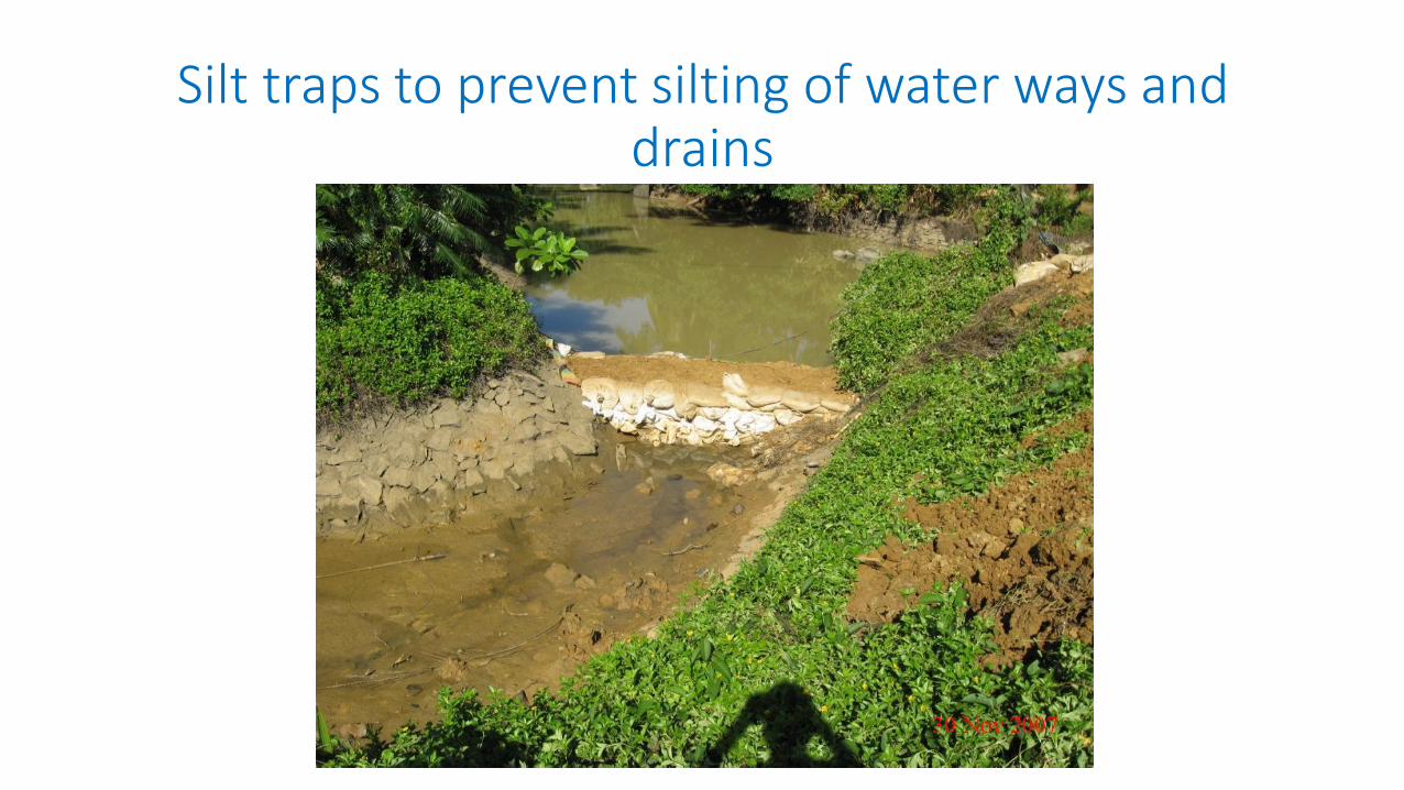
Silt traps to prevent silting of water ways and drains
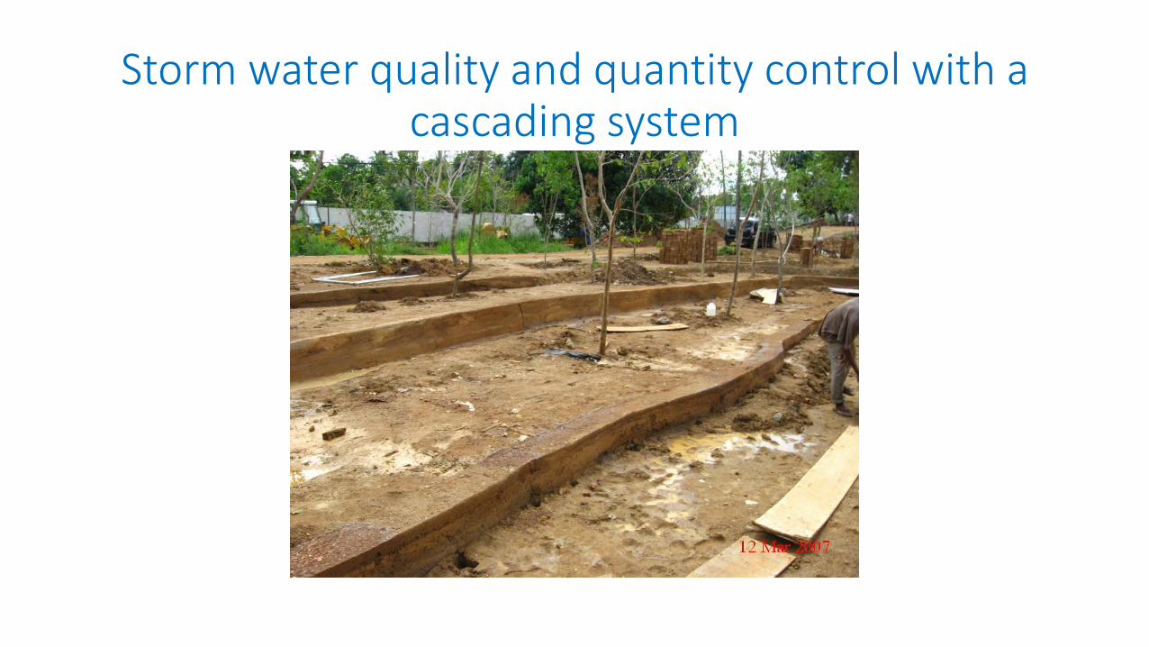
Storm water quality and quantity control with a cascading system

A green factory designed to suit the ground profile

A factory building with a water body to have a better surroundings

Tiered houses on undulating ground

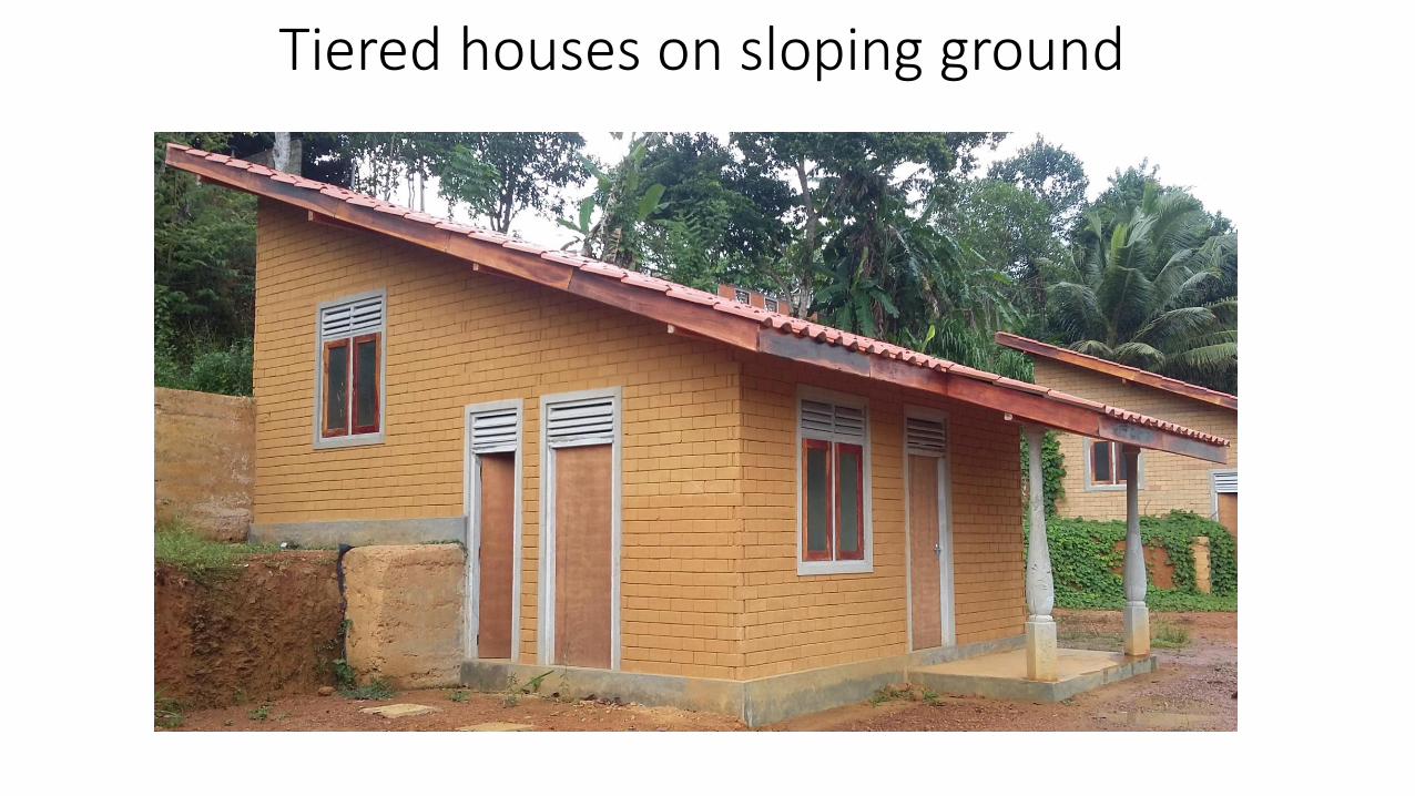
Tiered houses on sloping ground

Retaining wall to maintain slope stability
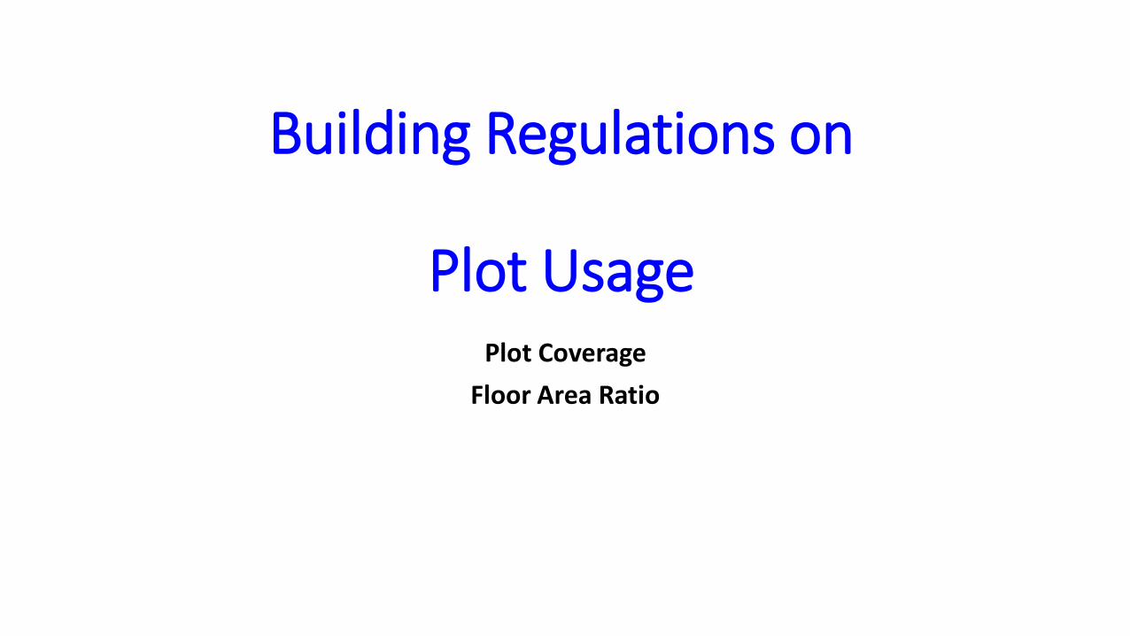
Building Regulations on
Plot UsagePlot Coverage
Floor Area Ratio


Building Category and Heights
Building Category
Building Heights


Open Space Around the Building
Front Space
Rear Space
Side Space


Regulations Inside The Building
Internal Heights
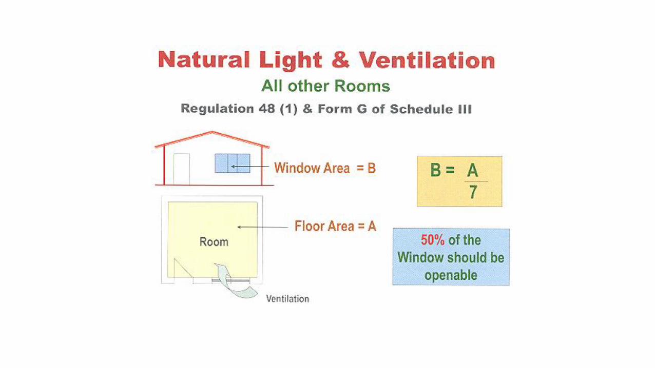
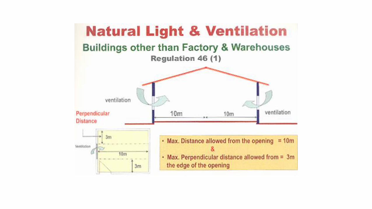
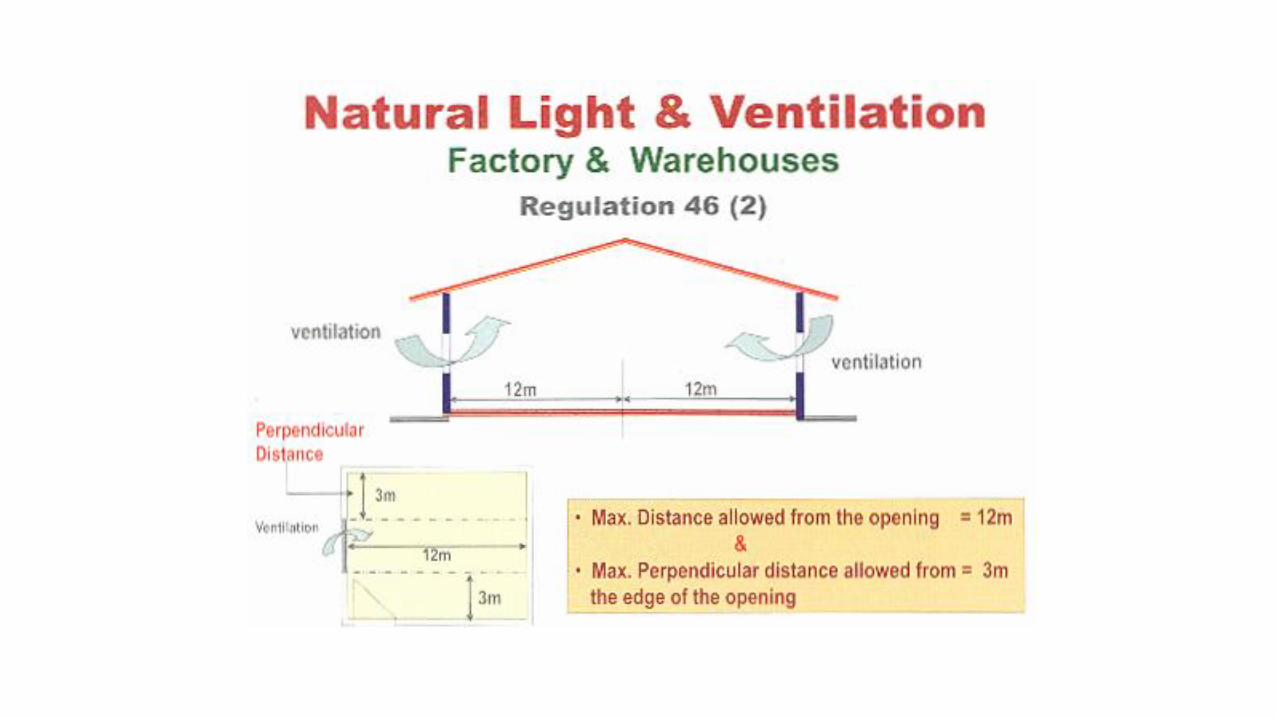
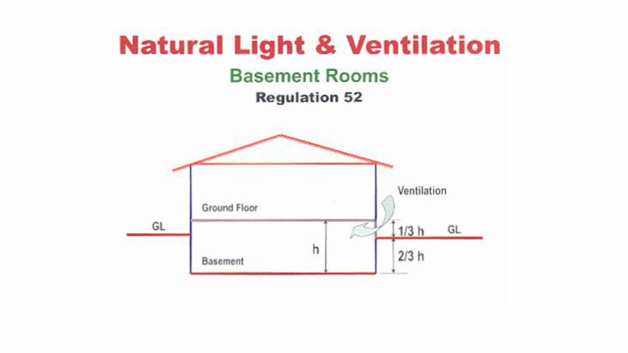
Natural Light and Ventilation
Floor Area & Internal Dimensions
Staircase


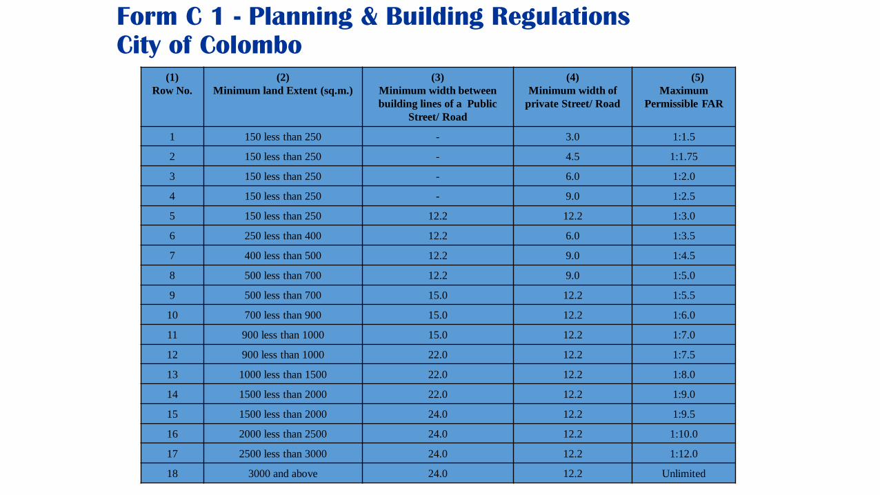
Form C 1 - Planning & Building Regulations
City of Colombo(1)
Row No.
(2)
Minimum land Extent (sq.m.)
(3)
Minimum width between
building lines of a Public
Street/ Road
(4)
Minimum width of
private Street/ Road
(5)
Maximum
Permissible FAR
1 150 less than 250 - 3.0 1:1.5
2 150 less than 250 - 4.5 1:1.75
3 150 less than 250 - 6.0 1:2.0
4 150 less than 250 - 9.0 1:2.5
5 150 less than 250 12.2 12.2 1:3.0
6 250 less than 400 12.2 6.0 1:3.5
7 400 less than 500 12.2 9.0 1:4.5
8 500 less than 700 12.2 9.0 1:5.0
9 500 less than 700 15.0 12.2 1:5.5
10 700 less than 900 15.0 12.2 1:6.0
11 900 less than 1000 15.0 12.2 1:7.0
12 900 less than 1000 22.0 12.2 1:7.5
13 1000 less than 1500 22.0 12.2 1:8.0
14 1500 less than 2000 22.0 12.2 1:9.0
15 1500 less than 2000 24.0 12.2 1:9.5
16 2000 less than 2500 24.0 12.2 1:10.0
17 2500 less than 3000 24.0 12.2 1:12.0
18 3000 and above 24.0 12.2 Unlimited

Form ‘C 2’
(1)
Building
Category
(2)
Maximum No. of
floors including
Ground Floor
(3)
Minimum site
frontage (m)
(4)
Maximum Plot
Coverage
(%)
(5)
Open Space Around the Building
(5.1)
Minimum
Rear Space (m)
(5.2)
Minimum on
one Side
Space (m)
(5.3)
Minimum
space on each
side (m)
Ground Floor 6.0 65 2.3 - -
2 6.0 65 2.3 - -
3 6.0 65 3.0 - -
4 6.0 65 3.0 - -
Inter mediate
Rise
5 8.0 65 3.0 2.0 -
6 10.0 65 4.0 2.0 -
7 14.0 65 4.0 3.0 -
8 16.0 65 4.0 3.0 -
Middle Rise 9 22.0 65 5.0 - 2.0
10 26.0 65 5.0 - 3.0
11 30.0 65 5.0 - 3.0
12 30.0 65 5.0 - 3.0
High Rise 13 35.0 50 6.0 - 4.0
14 35.0 50 6.0 - 4.0
15-20 40.0 50 6.0 - 6.0
21 & Above 40.0 50 6.0 - 6.0

SJK, Kaduwela, Maharagama, Homagama
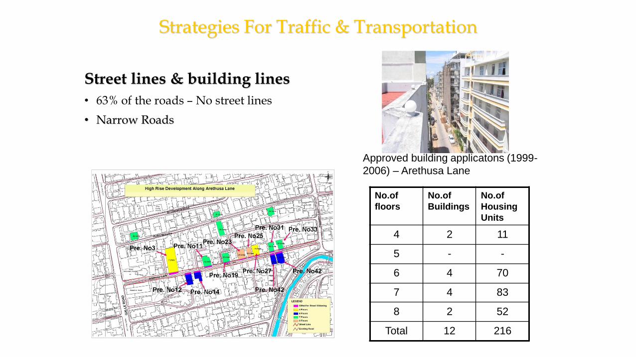
Strategies For Traffic & Transportation
Street lines & building lines
• 63% of the roads – No street lines
• Narrow Roads
Approved building applicatons (1999-
2006) – Arethusa Lane
No.of
floors
No.of
Buildings
No.of
Housing
Units
4 2 11
5 - -
6 4 70
7 4 83
8 2 52
Total 12 216

Qualified Person (QP)
Charted Engineer
Town Planner
Charted Architect
Licensed Surveyor

Duties of Qualified Person (QP)
Submit correct & clear information on plans
Certify the plans ensuring that plans are inconformity with the prevailing regulations
Submit to the LA to obtain approval
Supervise all building works & other development activities
Submit progress reports to the Authority
Prior to request of COC certify the plan

Important points
• All building designs should comply with the survey plans and data to function as proper indoor spaces.
• All relevant hi-tech tools such as GPS, laser scanners, mapping drones can be used to create 3D models of the ground and natural environment.

Land surveyor
A land surveyor, also known as a geomatics surveyor, creates site plans forconstruction and civil engineering projects by collecting data and mapping theshape of the land. They can work on a variety of different projects includingbridges, tunnels, roads, mining and quarrying among others. Some of the work theyare responsible for includes:
• Geomatics – gathering, storing, processing and delivering geographic information• Feasibility studies – carrying our surveys and assessments on potential
construction sites
• Geomechanics – monitoring land movement and subsidence caused naturally orduring the construction process
• Geospatial measurement – charting exact co-ordinates of site features using GPSand surveying instruments, mapping land use with satellite photography andproducing digital images of sites

What are the Different Types of Surveying in Construction
The history of surveying in construction goes back thousands of years. It’s an essential part of any construction project and as a result there are many different types of surveying that exist in the construction industry today.
• Land surveyor
• Building surveyor
• Technical surveyor
• Planning and developing surveyor
Building surveyor
• Building surveyors advise clients about the design and construction of new buildings.
• They need to have good communication and problem solving skills . Some of the work involved includes:
• make sure that properties meet building regulations and fire safety accessibility standards
• Dealing with planning applications
• Surveying properties to identify structural faults and making recommendations for repairs

Technical surveyor
Technical surveyors carry out various tasks, most of them in support of architects, chartered surveyors and engineers.
Their duties include:
• Draughting plans using computer software
• Helping with environmental impact assessments
• Supervising construction operatives at site

Planning and development surveyor
A planning and development surveyor’s main role is to assess, design and manage development projects.
• These projects can be varied and a planning and development surveyor would be involved in every stage of the project from initial site assessments to the completion of the entire project.
• The role of a planning and development surveyor would include:• Assessing whether plans are workable
• Assisting on planning applications
Highway Construction Surveying
• Highway surveying is a specialized type of land surveying generallyconducted for government agencies during the planning stages of ahighway development project.
• To find the best trace for the proposed highway• The goal of this survey is to determine the appropriate route where the
least amount of land will need to be moved• During the construction process, a highway construction surveyor can
ensure that progress is occurring as it should, and that the highway islocated precisely where it should be.
• After the highway is built, a highway survey can be used to provide anaccurate layout of roadways, utilities, storm drainage systems, overheadwires, nearby buildings, and other features of the landscape.
Highway Construction Surveying
• Surveyors assist engineers in the mapping of optimal routes
• This includes grading (slopes), curves and the creation of tunnels or other features along the highway route.
• It is necessary to understand the geographic restrictions and the layout of an area before attempting to determine the best route for placement of the highway.
• The most challenging part of highway planning is often the necessity of bridges or tunnels.
• Surveyors provide input on their location, and also monitor the highway construction process to ensure that the highway structures are located correctly.
Highway Construction Surveying
• After the road is built, further surveys may be required for a wide variety of reasons, including road repair or maintenance.
• Highway surveys are also used during the process of accident reconstruction and investigations.
• The latest technology with specialized laser equipment allows gathering of data required for a highway survey to be done from the roadside, virtually eliminating the need for road or lane closures.
• The highly accurate data delivered by these systems allows for the creation of detailed 3D maps showing not only the roadway, but also barriers, overhead wires and other features.

New highway project
• Map study• Reconnaissance survey• Preliminary survey• Location of final alignment• Detailed survey• Material survey• Geometric and structural design• Earth work• Pavement construction• Construction controls

Data needed for highway construction
Details to be collected from alternative routes during this survey
• Valleys, ponds, lakes, marshy land, hill, permanent structure and other obstruction.
• Value of gradient, length of gradient and radius of curve.
• Number and type of cross drainage structures.
• High Flood Level (HFL).
• Soil Characteristics
• Geological features.
• Source of construction materials – stone quarries, water sources
Preliminary survey:
Objective of preliminary survey are:
• To survey the various alternative alignments proposed after the reconnaissance and to collect all the necessary physical information and detail of topography, drainage and soil.
• To compare the different proposals in view of the requirements of the good alignment.
• To estimate quantity of earthwork and other construction details and to work out the cost of the alternate proposals.

Methods of preliminary survey
• Conventional approach-survey party : carries out surveys using the required field equipment, taking measurement, collecting topographical and other data and carrying out soil survey.
• Modern rapid approach: By aerial survey taking the required aerial photographs for obtaining the necessary topographic and other maps including details of soil and geology.
• Other related studies: Drainage, Hydrological survey, soil survey, Traffic and Material survey

Areal photograph or drone survey

Land utilization

Detailed survey
• Temporary benchmarks are fixed at intervals of about 250m and a tall drainage and underpass structure.
• Earthwork calculations and drainage details are to be work out from the level books.
• Cross sectional levels are taken at intervals of 50-100m in Plane terrain, 50-75m in Rolling terrain, 50 m in built – up area, 20 m in Hill terrain.
• CBR value of the soils along the alignment may be determined for design of pavement.
• The data obtained during detailed survey should be elaborated and complete for preparing detailed plans, design and estimates of project

Drawing and Report
• Preliminary survey plans
• Detailed plan and longitudinal section
• Detailed cross section
• Land acquisition plans
• Drawings of cross drainage and other retaining structures
• Drawings of road intersections
• Land plans showing quarries etc.

Responsibilities at Building site
• Advising clients about building/property issues, which can include technical, financial, legal, environmental/sustainability, building regulation and restoration matters
• undertaking building surveys.
• monitoring the deterioration or defects of a property and offering advice on repair work
• assessing the impact of unexpected damage on insurance, for example after a fire or flood
• writing technical reports
• negotiating the repair of work or a financial settlement if required
• planning and overseeing building work on small projects that don’t require an architect
• managing projects and/or multidisciplinary teams


![[PPT]PowerPoint Presentation - University of Delaware 486/Earthwork Notes.ppt · Web viewConstruction Methods & Management CIEG 486-010 Earthwork Earthwork Earthwork Earthwork Earthwork](https://static.documents.pub/doc/80x56/5ab3861f7f8b9ad9788e28f7/pptpowerpoint-presentation-university-of-486earthwork-notespptweb-viewconstruction.jpg)


