38
SUSSEX COUNTY COMPREHENSIVE PLAN COUNTY PLANNING AND ZONING COMMISSION WORKSHOP August 21, 2017
SUSSEX COUNTY COMPREHENSIVE PLANCOUNTY PLANNING AND ZONING COMMISSION WORKSHOP
August 21, 2017

TODAY’S WORKSHOP
Public Comment
Utilities Update
Economic Development Update
Future Land Use Discussion
Public Comment

UTILITIES
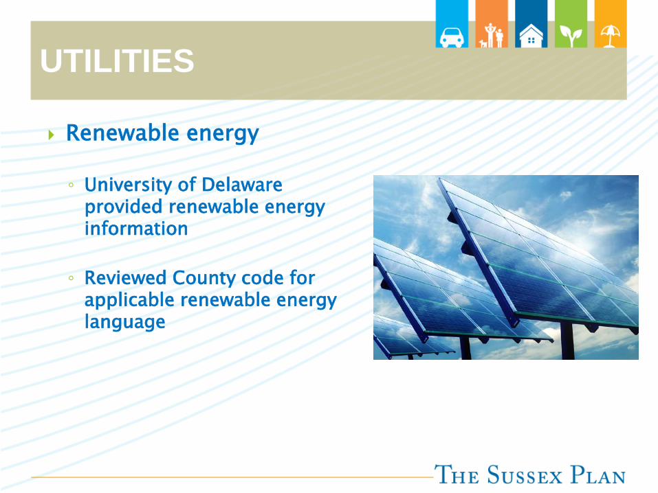
UTILITIES
Renewable energy
◦ University of Delaware provided renewable energy information
◦ Reviewed County code for applicable renewable energy language
ECONOMIC DEVELOPMENT
ECONOMIC DEVELOPMENT
2008 Economic Development Element
◦ Overview Top Employers Number of Jobs by Sector
◦ Economic Development Agencies
◦ Industrial Business Parks
◦ Agriculture Ag Preservation Overlay Ag Industry Overlay
◦ Economic Development Strategies
◦ State of Delaware Comprehensive Economic Development Strategy
ECONOMIC DEVELOPMENT
2018 Economic Development Element
◦ Introduction
◦ Agriculture and Forestry
◦ Tourism
◦ Economic Base and Employment
◦ Economic Development Resources
◦ Economic Development Goals, Objectives, and Strategies
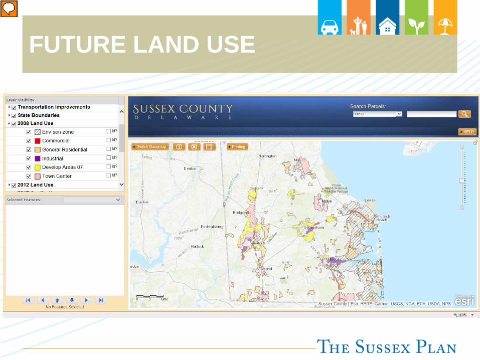
FUTURE LAND USE
FUTURE LAND USE
2008 Future Land Use Element
◦ Existing Land Use◦ Incorporated Municipalities◦ Developed and Protected Lands◦ Pace of Development◦ Location of Development◦ Future Land Use Plan Goals◦ Structure of the Future Land Use Plan◦ Growth Areas and Rural Areas◦ Delaware Strategies for State Policies and Spending◦ Future Land Use Map◦ Other Land Use Topics TDR, Ag. Preservation, Resource Protection Programs, Manufactured
Housing, Community Design Guidelines, Eligible Open Space

FUTURE LAND USE 2008 Future Land Use Recommended Densities and Uses Table

FUTURE LAND USE 2018 Future Land Use Table
◦ Removed C-1 from Highway Commercial Areas
◦ Added footnote to table for closed zones
◦ Added AR-1 to Town Center, Highway Commercial, and Planned Industrial
Future Land Use Plan Category Applicable Zoning DistrictsGrowth Areas
Municipalities N/A - town zoning applies
Town Center
Agricultural Residential District (AR-1)Neighborhood Business District (B-1)
Medium Density Residential District (M-R)General Residential District (GR)
High Density Residential District (HR-1 & HR-2)Commercial-Residential District (CR-1)
Marine District (M)Limited Industrial District (LI-1)
Urban Business District (UB)
Developing Area
Agricultural Residential District (AR-1)Neighborhood Business District (B-1)
Medium Density Residential District (M-R)General Residential District (GR)
High Density Residential District (HR-1 & HR-2)Commercial-Residential District (CR-1)
Marine District (M)Limited Industrial District (LI-1)
Light Industrial District (LI-2)Heavy Industrial District (HI-1)
Environmentally Sensitive Developing Area
Agricultural Residential District (AR-1)Neighborhood Business District (B-1)
Medium Density Residential District (M-R)General Residential District (GR)
Commercial-Residential District (CR-1)Marine District (M)
Limited Industrial District (LI-1)Light Industrial District (LI-2)
Vacation, Retire, Resident (VRP)
Mixed Residential Area
Agricultural Residential District (AR-1)Medium Density Residential District (M-R)
General Residential District (GR)Vacation, Retire, Resident (VRP)
Highway Commercial AreaAgricultural Residential District (AR-1)Neighborhood Business District (B-1)
Commercial-Residential District (CR-1)
Planned Industrial Area
Agricultural Residential District (AR-1)Limited Industrial District (LI-1)
Light Industrial District (LI-2)Heavy Industrial District (HI-1)
Rural Areas
Low Density AreaAgricultural Residential District (AR-1)Neighborhood Business District (B-1)
Commercial-Residential District (CR-1)
Protected LandsN/A - permanently protected Federally-owned, State-owned, or other land preserves, conservation easements, and agricultural
preservation easements
Agricultural Preservation Districts Agricultural Preservation Districts through the State's Farmland Preservation Program in Agricultural Residential District (AR-1)
Notes: AR-2 is a closed zoning district and should be treated as AR-1C-1 is a closed zoning district and should be treated as CR-1
FUTURE LAND USE
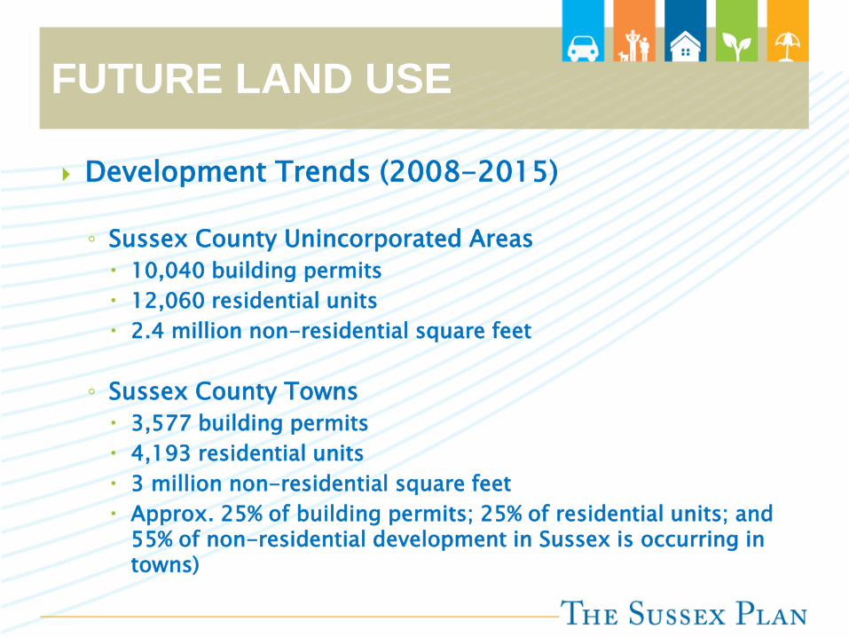
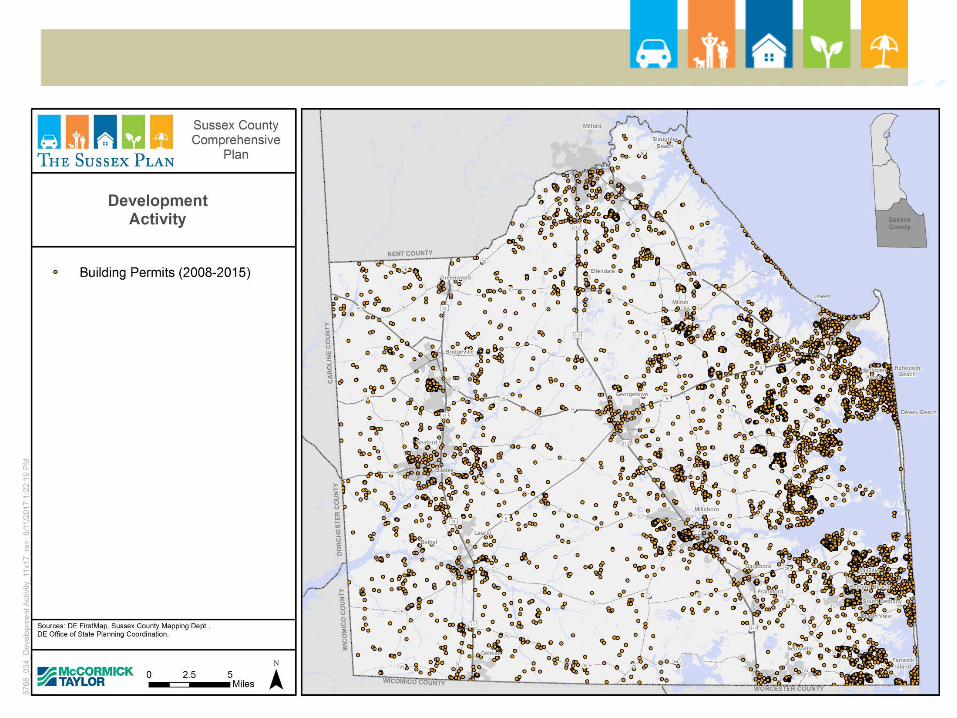
Development Trends (2008-2015)
◦ Sussex County Unincorporated Areas 10,040 building permits 12,060 residential units 2.4 million non-residential square feet
◦ Sussex County Towns 3,577 building permits 4,193 residential units 3 million non-residential square feet Approx. 25% of building permits; 25% of residential units; and
55% of non-residential development in Sussex is occurring in towns)

FUTURE LAND USE
Development Trends (2008-2015)◦ Sussex County Unincorporated Areas
Source: Delaware Office of State Planning Coordination 2008-2015 Building Permit Data
FUTURE LAND USE

FUTURE LAND USE Developing Areas / Mixed Residential
Analysis
◦ Areas where water and wastewater CPCNs intersect
◦ Parcel data shows that subdivision forming
◦ Permit data showing some properties have received permits


FUTURE LAND USE
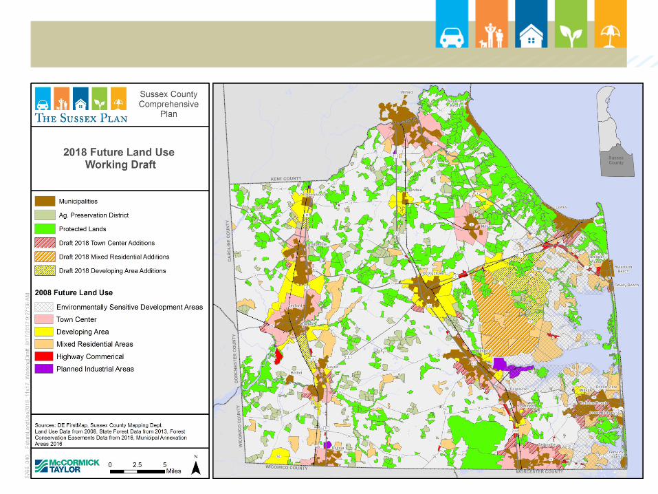
Mixed Residential and Developing Area DRAFT Additions
◦ The new developing area polygon on the eastern side of the County:
Northern boundary is Rt 9 Western boundary is Rt 5 and edge of MR at southern tip Eastern boundary is the edge of the Environmentally Sensitive
Development Area

FUTURE LAND USE
Mixed Residential and Developing Area DRAFT Additions
◦ The new Mixed Residential area polygon:
Northern boundary is Rt 9 Eastern boundary is Rt 5 and edge of MR at southwestern tip Southern boundary is Rt 24 Western boundary is Rt 5
FUTURE LAND USE
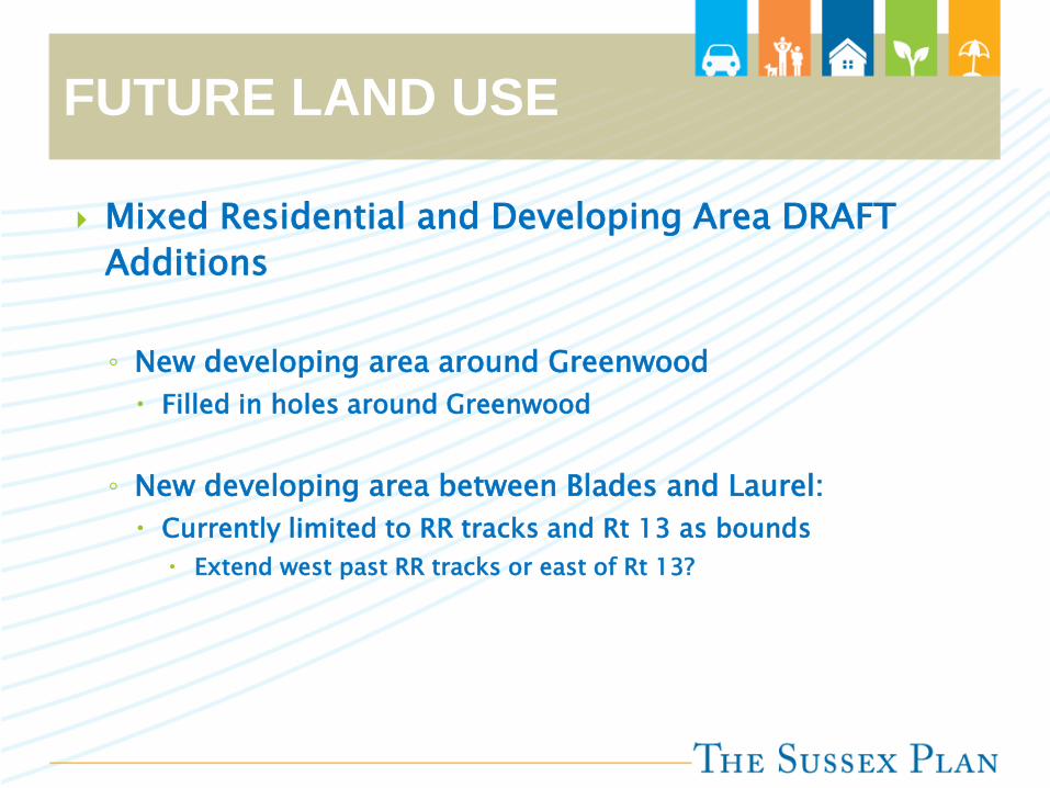
Mixed Residential and Developing Area DRAFT Additions
◦ New developing area around Greenwood Filled in holes around Greenwood
◦ New developing area between Blades and Laurel: Currently limited to RR tracks and Rt 13 as bounds
Extend west past RR tracks or east of Rt 13?

FUTURE LAND USE
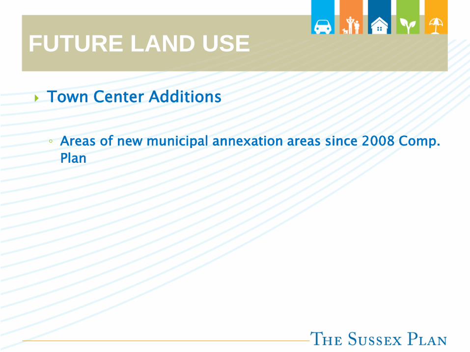
Town Center Additions
◦ Areas of new municipal annexation areas since 2008 Comp. Plan


FUTURE LAND USE
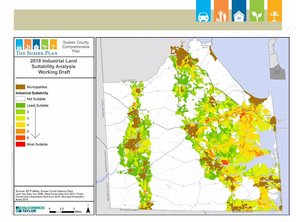
Potential Future Industrial Land Suitability Analysis
◦ Factors:
Adjacency to existing industrial-zoned land In Water CPCN In Sewer CPCN or Planning tier 1 or 2 Location on a principal or minor arterial or major collector Proximity to fiber optic In a natural gas or planned natural gas area Freight TBD
◦ Excluded if:
In a municipality Protected areas Ag. preservation Sewer tiers 4 and 5


FUTURE LAND USE
Feedback from Public Meetings
2
9
18
12
18
coastal areas
other
roadways corridors
rural areas
towns
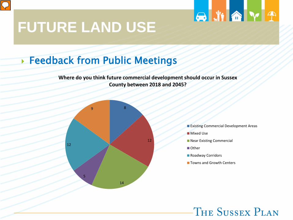
FUTURE LAND USE
Feedback from Public Meetings
8
12
14
5
12
9
Where do you think future commercial development should occur in Sussex County between 2018 and 2045?
Existing Commercial Development Areas
Mixed Use
Near Existing Commercial
Other
Roadway Corridors
Towns and Growth Centers
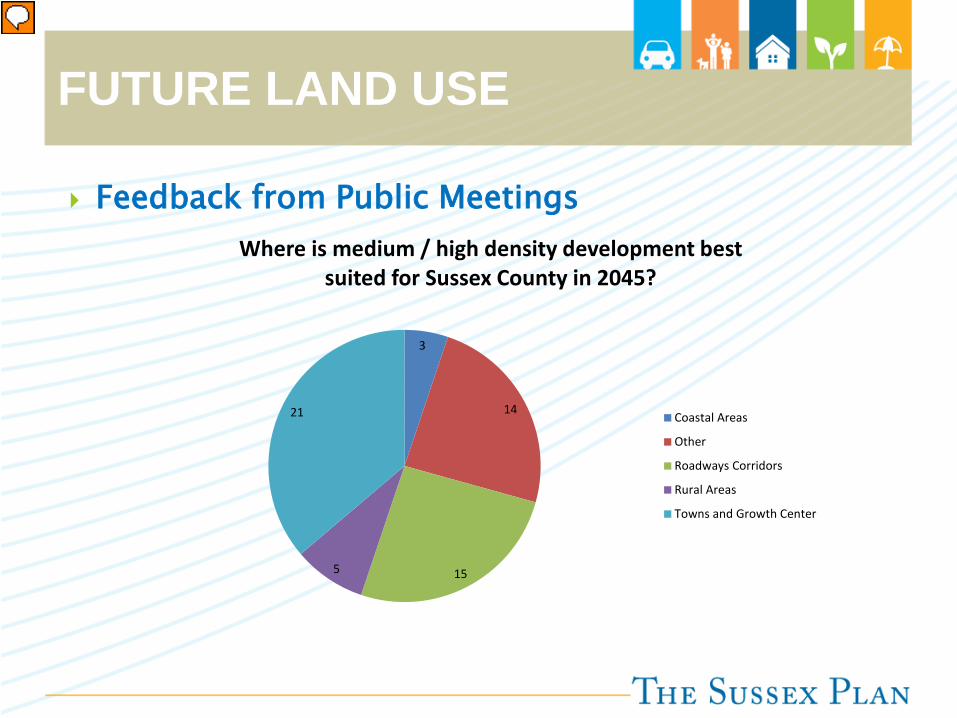
FUTURE LAND USE
Feedback from Public Meetings
3
14
155
21
Where is medium / high density development best suited for Sussex County in 2045?
Coastal Areas
Other
Roadways Corridors
Rural Areas
Towns and Growth Center

FUTURE LAND USE
Feedback from Public Meetings
4
25
8
11
7
Where is low density development best suited for Sussex County in 2045?
Coastal Areas
Rural Areas
Other
Towns and Growth Center
Roadway Corridors

FUTURE LAND USE
Town Centers◦ Part of municipal future annexation areas◦ Range of housing types (medium to high-density
residential, 4-12 units per acre)◦ Commercial and retail complement adjacent areas
Developing Areas◦ Newer, emerging growth areas◦ Located near main arterial roads◦ Mostly within future annexation areas◦ Potential to be served by water and sewer◦ Range of housing types (2 units per acre with
density bonus option to go to 4)

FUTURE LAND USE
Environmentally-Sensitive Developing Areas◦ Desirable locations for new housing◦ Contain ecologically important wetlands and coastal lands◦ Range of housing types ◦ Overlay, so underlying density prevails (most 2 units per acre,
up to 4 units with density bonus)◦ Option to net out tidal wetlands when calculating net tract size
Mixed Residential Areas◦ Existing residential development and lands where res.
Development proposed under GR and MR zoning districts◦ Non-residential development not encouraged◦ 4 units per acre single-family; 12 units per acre multi-family◦ Central water and sewer preferred

FUTURE LAND USE
Highway Commercial◦ Highway commercial corridors, shopping centers and other
large commercial vicinities geared toward vehicular traffic ◦ Also appropriate for hotels, motels, car washes, auto
dealerships, lumberyards and other larger-scale commercial uses not primarily targeted to the residents of immediately adjacent residential areas
Planned Industrial◦ Larger industrial uses including heavier industry, light
industry, warehousing, and flex space
Low Density Areas◦ AR-1◦ Protected Lands◦ Ag Preservation Districts

FUTURE LAND USE
Guidelines used to determine 2008 Future Land Use
◦ Proximity to an incorporated municipality or a municipal annexation area
◦ Presence of existing public sewer and public water service nearby
◦ Plans by the County to provide public sewage service within five years
◦ Location on or near a major road
◦ Character and intensity of surrounding development, including proposed development
◦ Location relative to major preserved lands
◦ The area’s environmental character
◦ How the area ranks according to the “Delaware Strategies for State Policies and Spending” document (Level 1, Level 2, Level 3, or Level 4)

FUTURE LAND USE
What changes were made in 2008
◦ Lands added to the annexation areas of certain incorporated municipalities, as shown in comprehensive plans adopted by these municipalities and certified by the State.
◦ Zoning map changes approved by Sussex County Council since the previous plan was completed.
◦ A few selected new “Developing Areas” that are intended to provide locations where density might be increased from the current zoning if the developer uses density bonus options.


