SWOT Measurements for Improving Understanding of Mid-Latitude Hydrology Franklin W. Schwartz School of Earth Sciences The Ohio State University September 15, 2008 Acknowledgements: National Science Foundation, Ganming Liu, Bo Zhang, Jerry Allen
Transcript
SWOT Measurements for Improving Understanding of
Mid-Latitude Hydrology
Franklin W. Schwartz
School of Earth Sciences
The Ohio State University
September 15, 2008Acknowledgements: National Science Foundation, Ganming Liu, Bo Zhang, Jerry Allen
• Example of pothole lake in South Dakota in Waubay Lakes chain• Typically, a product of an extremely hummocky, glacial terrain • Lakes are commonly found in closed basins, often saline, surrounded farmland
• TThousands of small lakeshousands of small lakes• Pothole lakes and wetlands occur Pothole lakes and wetlands occur together with few large recreational lakestogether with few large recreational lakes• Entire watershed area is hydrologically Entire watershed area is hydrologically closedclosed
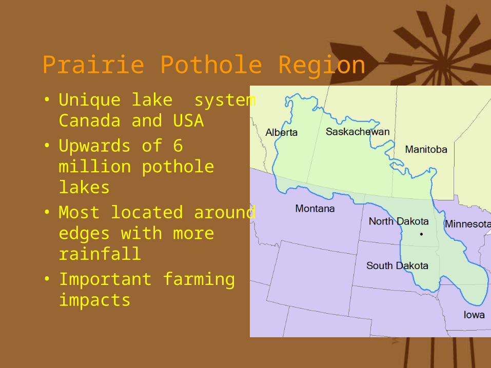
Prairie Pothole Region• Unique lake system
Canada and USA• Upwards of 6 million
pothole lakes • Most located around
edges with more rainfall
• Important farming impacts
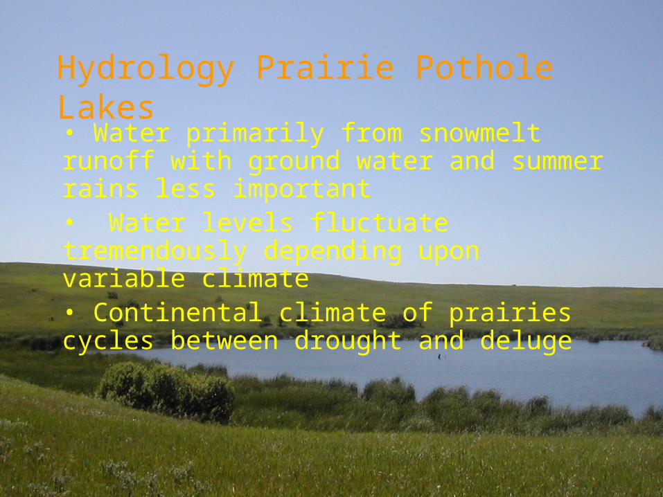
Hydrology Prairie Pothole Lakes• Water primarily from snowmelt runoff with ground water and summer rains less important• Water levels fluctuate tremendously depending upon variable climate• Continental climate of prairies cycles between drought and deluge
Waterfowl
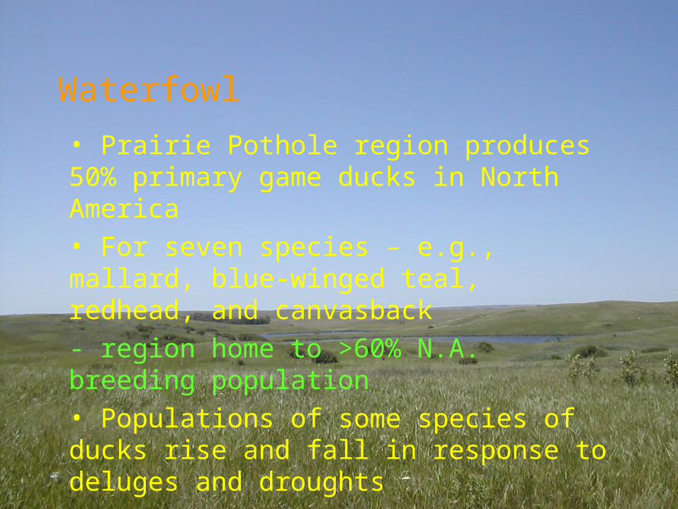
• Prairie Pothole region produces 50% primary game ducks in North America• For seven species – e.g., mallard, blue-winged teal, redhead, and canvasback - region home to >60% N.A. breeding population• Populations of some species of ducks rise and fall in response to deluges and droughts
• Hydrology and biology of these lakes and wetlands well understood- more than 30 years of study at Cottonwood Lakes Study Area
• Important role ground-water and surface water interactions
• Long-term monitoring at a few sites explained how pothole lakes responded to periodic drought and deluge
Why Study these Lakes?
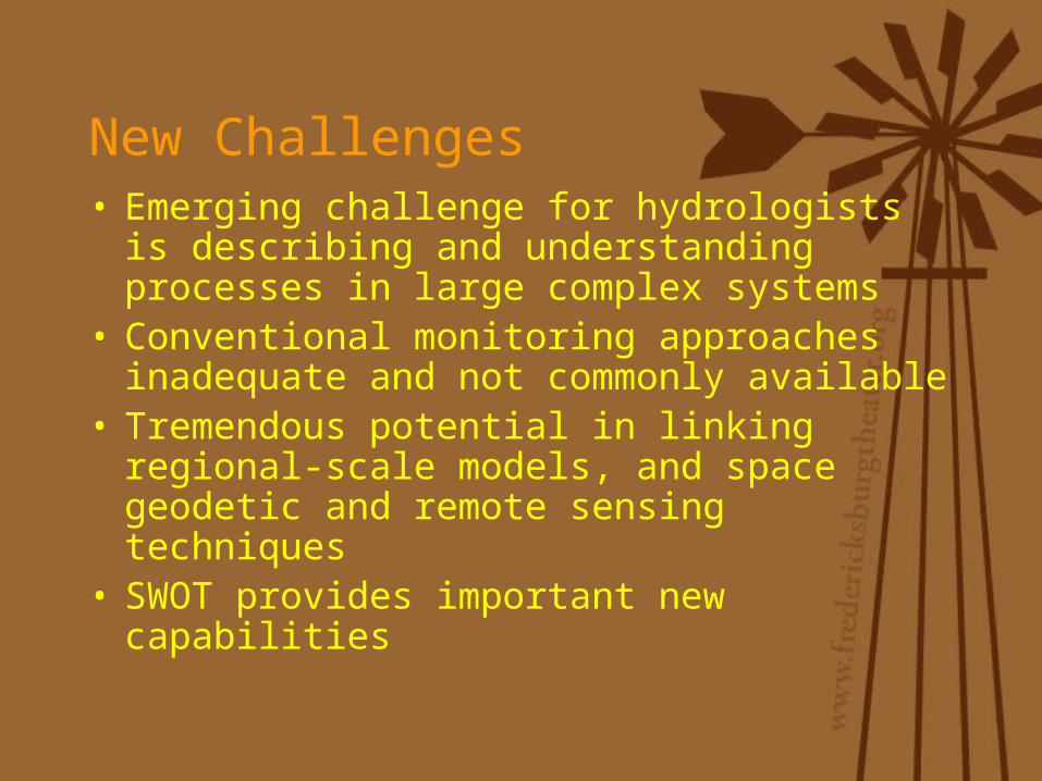
New Challenges• Emerging challenge for hydrologists is
describing and understanding processes in large complex systems
• Conventional monitoring approaches inadequate and not commonly available
• Tremendous potential in linking regional-scale models, and space geodetic and remote sensing techniques
• SWOT provides important new capabilities
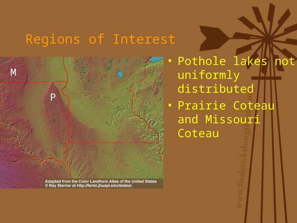
Regions of Interest
• Pothole lakes not uniformly distributed
• Prairie Coteau and Missouri Coteau
M
P
Lakes and Climate Variability
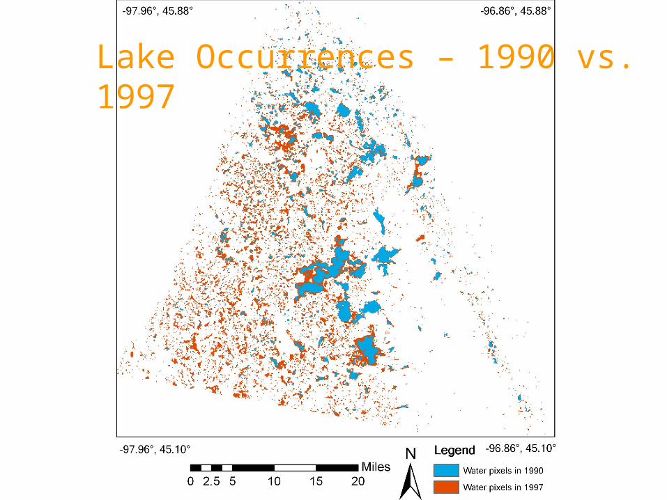
• Study area – tip of Prairie Coteau in SD
• Climate affects on water on landscape- change in numbers of lakes, size, volume - 1988-92 2rd drought century- 1993-1997 greatest deluge- observable by Landsat
Precipitation Waubay Lakes Area
2nd Drought 1st Deluge
Lake Occurrences – 1990 vs. 1997
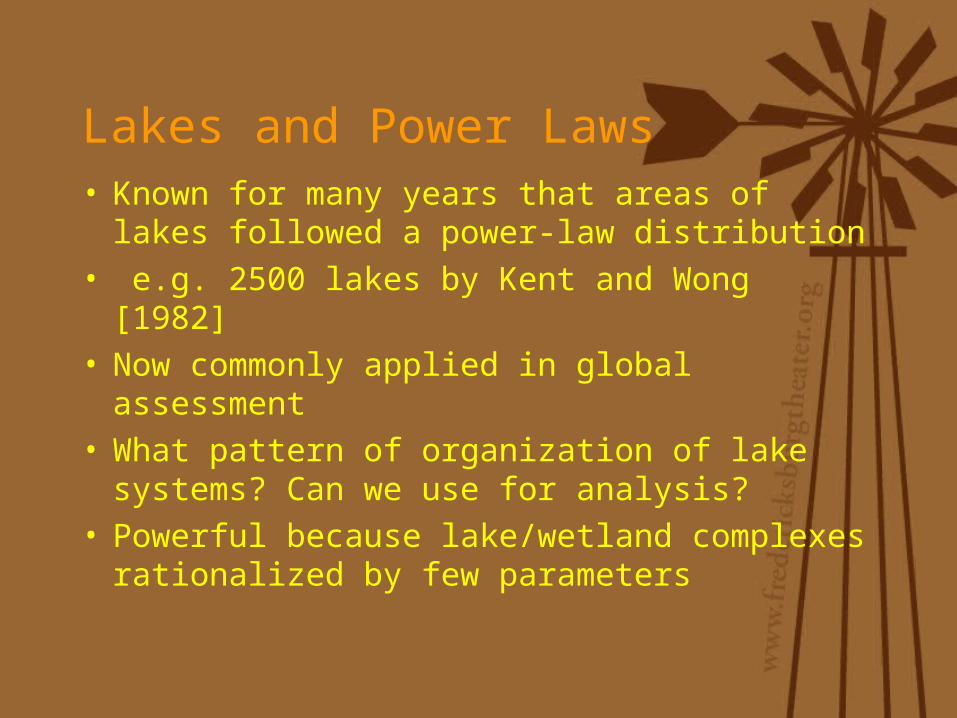
Lakes and Power Laws• Known for many years that areas of lakes
followed a power-law distribution• e.g. 2500 lakes by Kent and Wong [1982]• Now commonly applied in global
assessment • What pattern of organization of lake
systems? Can we use for analysis?• Powerful because lake/wetland complexes
rationalized by few parameters
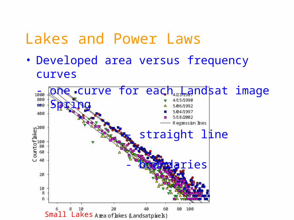
Small Lakes Large Lakes
Lakes and Power Laws• Developed area versus frequency curves
- one curve for each Landsat image – Spring - straight line - boundaries
Seasonal Effects• Within any year considerable variability
- spring to summer – small lakes impacted
Additional Imagery• Lines extend 1.5 orders magnitude in
area• Colored digital aerial photography• 1 meter resolution lets us measure
lakes areas of the order of 100 m2
Develop Test Area• Landsat
- Low res over big area• DOQQ
- Hi res over small area• Next Step
- power law for DOQQ- small area, fewer lakes
Are Lake Areas Self-Similar?
Dust Bowl Drought – 1930s• Aerial photographs commonly available
1939
2003
Extrapolate 1939 Photography
Conceptual Model• Area small lakes changes rapidly –
season• Area large lake changes slowly - cycles
Extensions• Modeling now underway to simulate
behavior of a lake complex 100,000 lakes
• Ganming Liu able to calibrate to power laws and long-term records for individual lakes
• Work will be helped when SWOT mission comes along- changes in storage great opportunity to recast power laws
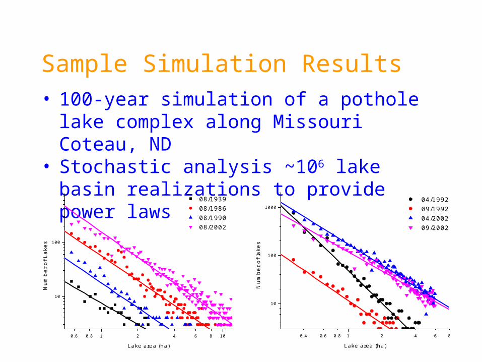
Sample Simulation Results• 100-year simulation of a pothole lake
complex along Missouri Coteau, ND• Stochastic analysis ~106 lake basin
realizations to provide power laws
0.6 0.8 1 2 4 6 8 10
10
100
08/193908/198608/199008/2002
Nu
mb
er
of L
ake
s
Lake area (ha)
0.4 0.6 0.8 1 2 4 6 8
10
100
1000 04/1992 09/1992 04/2002 09/2002
Num
ber
of la
kes
Lake area (ha)
Important Findings• Like others found that areas of lakes
obey a power-law function – 3.5 orders• No single power law because rapid shifts
as a function of climate- seasonal effects important
• Small lakes and large lakes respond to different climate signals
• For this reason, small lakes could be robust for small periods in a long drought