+ All Categories
Home > Documents > Synthesis of Research on Thinking & Learning in the Geosciences: Developing Representational...

Synthesis of Research on Thinking & Learning in the Geosciences: Developing Representational...

Date post: 27-Dec-2015
Category:
Upload: cathleen-hill
View: 214 times
Download: 0 times
Share this document with a friend
Popular Tags:
27
Synthesis of Research on Thinking & Learning in the Geosciences: Developing Representational Competence Kim A. Kastens (Lamont-Doherty Earth Observatory of Columbia University) Cathryn A. Manduca (SERC, Carleton College) Geological Society of America, 19 October 2009 An NSF REESE Synthesis Project
Transcript

Synthesis of Research on Thinking & Learning in the Geosciences:

Developing Representational Competence

Kim A. Kastens(Lamont-Doherty Earth Observatory of Columbia University)

Cathryn A. Manduca(SERC, Carleton College)

Geological Society of America, 19 October 2009

An NSF REESE Synthesis

Project

Knowledge Integration in Geosciences:

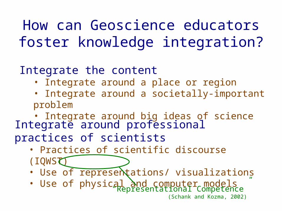
How to pull it all together?

So many terms

So manydata types

So many modes of inquiry

So manylocalities,

all different

No consensuscurriculum

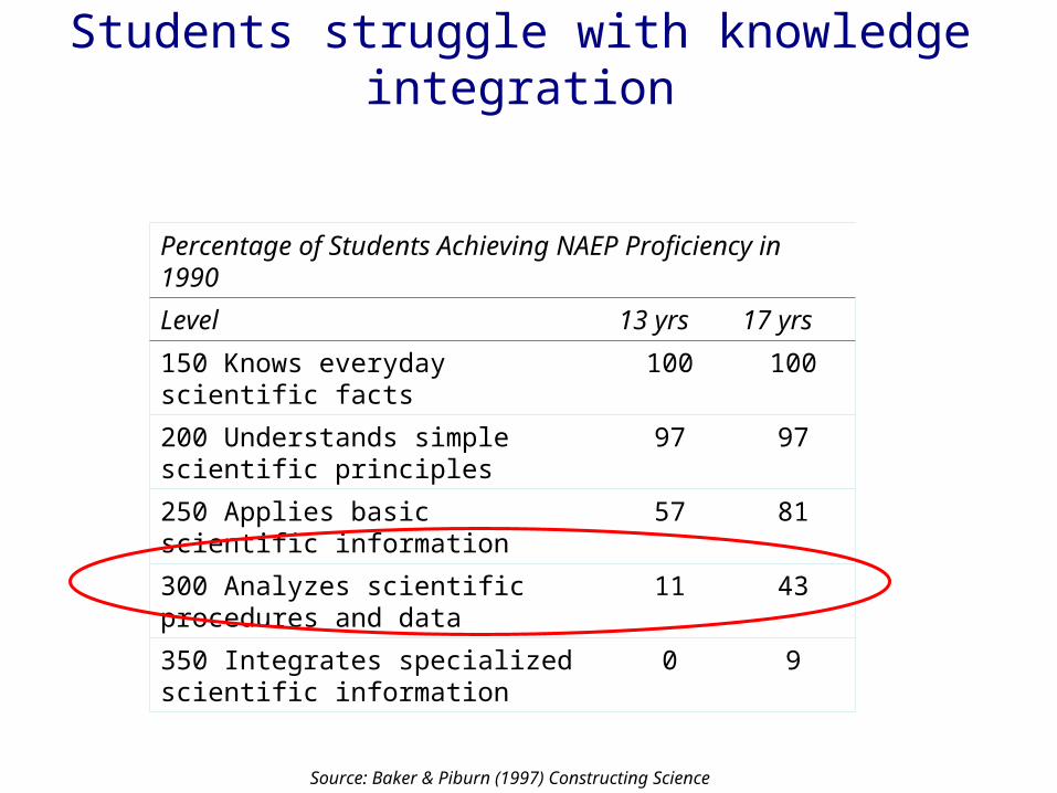
Students struggle with knowledge integration

Percentage of Students Achieving NAEP Proficiency in 1990

Level 13 yrs 17 yrs

150 Knows everyday scientific facts 100 100

200 Understands simple scientific principles

97 97

250 Applies basic scientific information 57 81

300 Analyzes scientific procedures and data

11 43

350 Integrates specialized scientific information

0 9

Source: Baker & Piburn (1997) Constructing Science

How can Geoscience educators foster knowledge integration?

Integrate around professional practices of scientists

• Practices of scientific discourse (IQWST)• Use of representations/ visualizations• Use of physical and computer models

Integrate the content• Integrate around a place or region• Integrate around a societally-important problem• Integrate around big ideas of science

“Representational Competence” (Schank and Kozma, 2002)

Big Problem for Geoscience Education:

• The Earth is 18 orders of magnitude larger than your classroom.

Classroom (exaggerated)

Earth

3. Use representations

There are three, and only three, ways to cope with this fundamental challenge:

http://www.school-assemblies-dinosaur-program.com/arts_in_education.htm

1. Bring small pieces of the Earth into your classroom (e.g. minerals, fossils)

2. Bring students out of the classroom to observe pieces of the Earth in nature.

http://eesc.columbia.edu/courses/v1010/index.html

Geoscientists use a lot of representations

Geoscientists use a lot of kinds of

representations

• What does it mean to have “representational competence”? • How can we foster this expertise?

Water in Oceans Water in Atmosphere

Evaporation

Temperature of AtmosphereGreenhouse Effect

Water in Oceans 2 Water in Atmosphere 2

Evaporation 2

Albedo Cloud cover

Four components of representational competence

1. Ability to read and write geoscientists’ conventional representations (basic literacy)

2. Metarepresentational understanding (the nature of representations and representational strategies)

3. Ability to invent suitable representations to record and convey novel concepts or new data types

4. Ability to make inferences about Earth processes from representations (“meaning-making”)

http://middlezonemusings.com/trust-chicken-egg/.

Concept of earthquak

e slip direction

1. Ability to read and write geoscientists’ conventional representations (basic

literacy)

2. Understanding about the nature of representations and representational

strategies

Adapted from Liben in Damon & Lerner, 2006.

(Earth)Learner

Insight from Clark & Wiebe (2000) Journal of Technology Studies, v26.

Data-driven Visualization Concept-driven Visualization

Reynolds et al. (2010)

Knowledge of representational strategies: Distinguish between…

Reynolds et al. (2010)

Universal Truths

Mantle wells upbeneath mid-ocean ridge

Mid-ocean ridge vulcanism is basaltic

Volcanoes occur above subduction zone

Conditional Truths

Arc vulcanism is only sometimes andesitic

Overriding plate is only sometimes continental

Continent-ocean boundary is only sometimes an active margin (subduction zone).

Concept-driven visualizations often overspecify; they commit to a single set of options.

The Blue Planet p. 152

Expert’s epistemological model of one data-driven visualization

Collaborator: Sandra Swenson

Insight from Dutrow (2007)

Representation suitable for data interpretation

Representation suitable for communicating

www.geography.wisc.edu/classes/geog331/VostokSlide400kweb.jpg

www.ferdinand-engelbeen.be/klimaat/eemian.html

Knowledge of representational strategies: Distinguish between…

3. Ability to invent suitable representations to record and convey novel concepts or new

data types

http://www.unh.edu/esci/greatmap.html http://en.wikipedia.org/wiki/File:William_Smith_(geologist).jpg

Portions of the first geological map and legend

Cross-section

William Smith

Source: Enyedy (2005).

Novices Invent Representational Strategies

Novices Invent Representational Strategies

Collaborators: Lynn Liben, Shruti Agrawal, Toru Ishikawa

Invented representations for dip angle

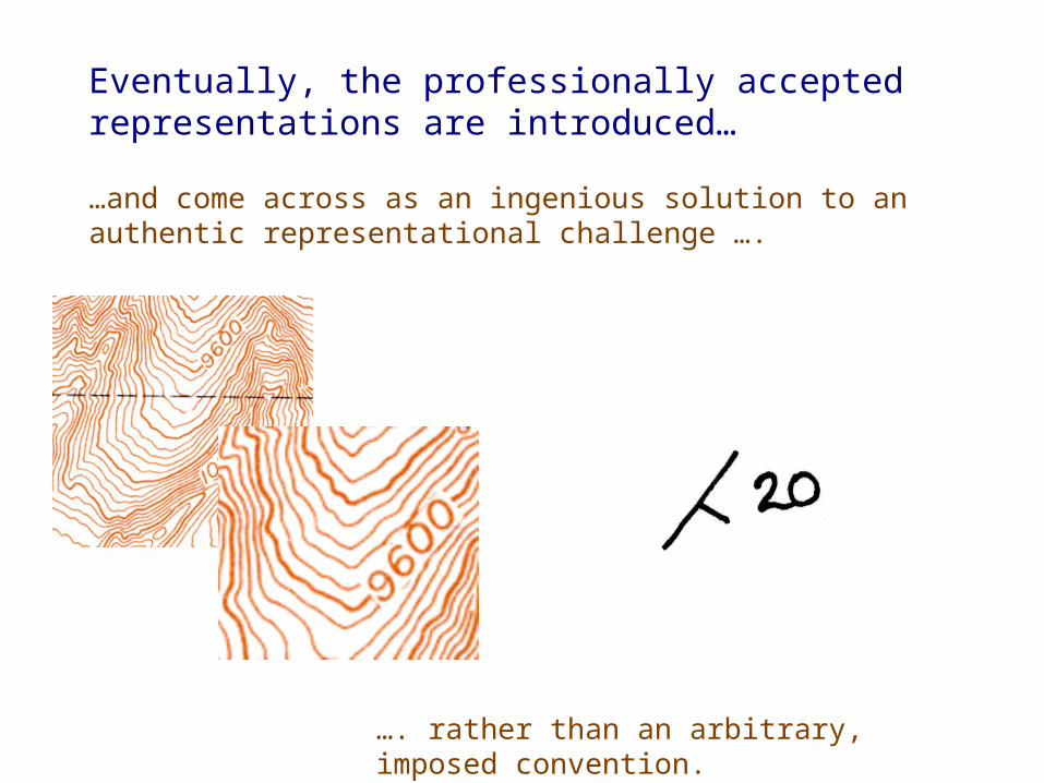
…and come across as an ingenious solution to an authentic representational challenge ….

Eventually, the professionally accepted representations are introduced…

…. rather than an arbitrary, imposed convention.

4. Ability to make inferences about Earth processes from representations

Divergent Plate Boundary

Divergent Plate Boundary

Transform Plate Boundary

Seamounts

Continental Fragment

Kastens, K.A., Macdonald, K.C., Becker, K., and Crane, K., 1979, Marine Geophysical Researches, 4, 129-151.

Suggestion for meaning-making: Hypothesis templates

Example: in a spatial representation, objects or phenomena are clustered.

There are recurring patterns in representations.

Hypothesis templates (continued)

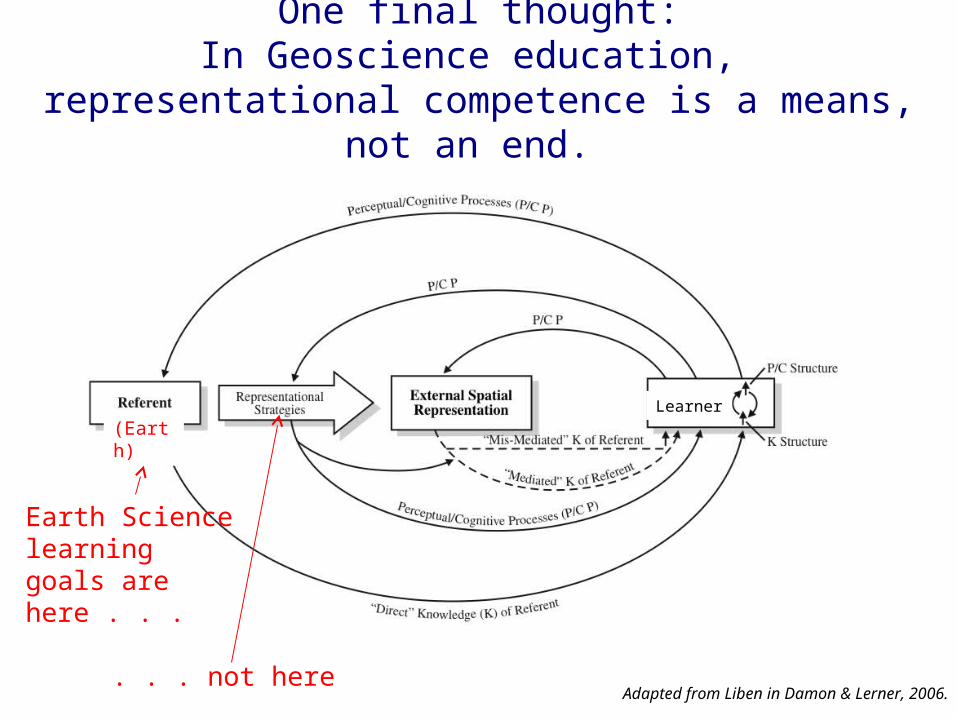
One final thought:In Geoscience education,

representational competence is a means, not an end.

Adapted from Liben in Damon & Lerner, 2006.

(Earth)

Earth Sciencelearning goals are here . . .

. . . not here

Learner

DeBruin, Richard (1970) 100 Topographic Maps: Illustrating Physiographic Features, p19.

Google Maps

Students no longer need representational strategy of topographic contours to examine landforms!

Learning goal: How glaciers shape the

landscape

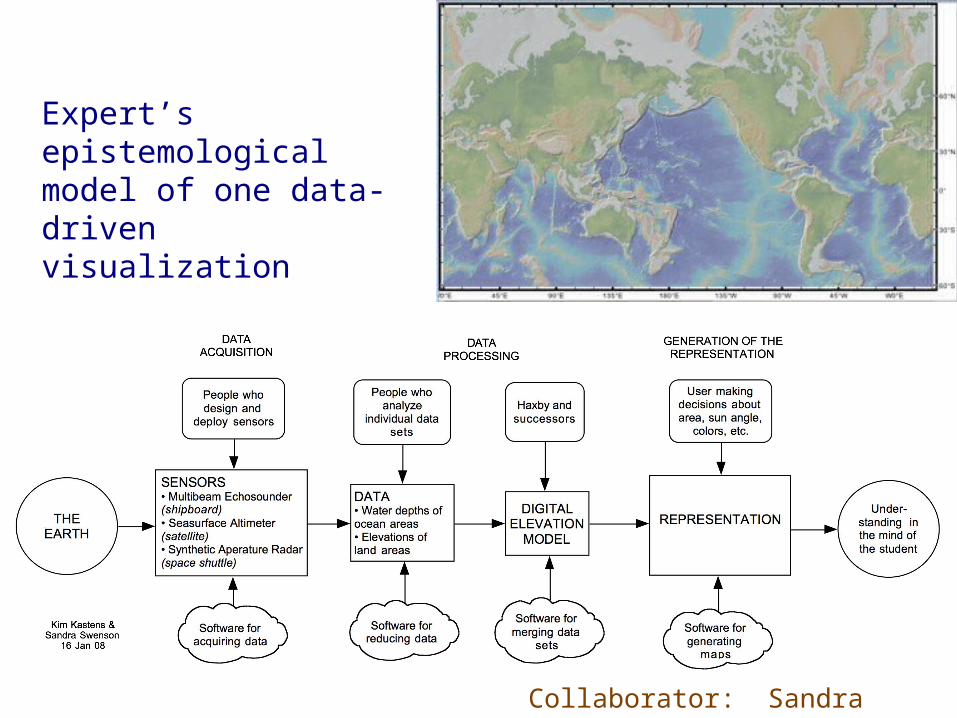
• Because of the size and spatial character of Earth phenomena, geoscientists use many and varied representations

• Competence in using representations is a core expertise in Geoscience which can serve as a unifying theme across the curriculum

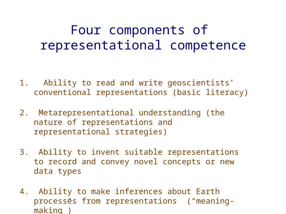
• Competencies include:• Ability to understand and produce standard Geo representations• Metarepresentational understanding about how representations work in general• Ability to invent effective representations to convey novel ideas or observations• Ability to infer meaning about Earth processes from representations

• Representational competence in Geosciences is a means not an end; the goal is to understand the referent, the Earth.

Summary

Join the conversation: serc.carleton.edu/earthandmind


Recommended