92
TELLICO RESERVOIR LAND MANAGEMENT PLAN
Prepared by
Tennessee Valley Authority Resource Stewardship
Tellico Reservoir Planning Team 804 Highway 321 North
Lenoir City, Tennessee 37771
June 2000
TELLICO RESERVOIR LAND MANAGEMENT PLAN
Blount, Loudon, and Monroe Counties, Tennessee
Responsible Federal Agency: Tennessee Valley Authority (TVA)
Abstract: TVA has prepared a Final Environmental Impact Statement (EIS) and a TVA comprehensive Land Management Plan (Plan) for the 12,643 acres (360.8 shoreline miles) of TVA land above the summer operating range (812-813 elevation) on Tellico Reservoir. The EIS documents the analysis of alternative uses of the TVA lands and their influence on the surrounding environment. The Plan provides a clear statement of how TVA would manage its land in the future, based on scientific, cultural, and economic principles. This Plan takes into account the comments received from the general public in the east Tennessee area. The Plan prepared for Tellico Reservoir is intended to guide TVA resource and property management decisions for the next ten years. It identifies the most suitable range of uses for 139 parcels of TVA public land. TVA considered two alternatives for making land use decisions for the TVA land around Tellico Reservoir. Under the No Action Alternative (Alternative A) TVA would continue to use the existing land use plan to manage TVA land on Tellico Reservoir. Under the Allocation Alternative (Alternative B), an updated and revised Tellico Reservoir Land Management Plan is proposed.
The draft of the EIS was distributed in February 2000. TVA received 34 sets of comments on the draft. The EIS includes responses to these comments. The full EIS and Tellico Reservoir Land Management Plan can be viewed on the Internet at http:llwww.tva.govlenvironment/reports/tellicoeis.
Requests for further information should be directed to:
Steven L. Akers Project Leader Tennessee Valley Authority 804 Highway 321 North Lenoir City, TN 37771-6440 Telephone: (865) 988-2430 Email: [email protected]
Cheryl V. Ward Project Leader Tennessee Valley Authority P.O. Box 1589 Norris, TN 37828-1589 Telephone: (865) 632-1531 Email: [email protected]
CONTENTS
1 . INTRODUCTION ...................................................................................................................................... 1
1.1. BACKGROUND ..................................................................................................................................... 1 1.2. PURPOSE ................... .. ............................................................................................................... 2 1.3. PROCESS ............................................................................................................................................... 2
2 . REGIONAL OVERVIEW ................................................................................................................... 5
2.1. THEPAST .............................................................................................................................................. 5 2.2. THE PROJECT .............................................................................................................................. 7 2.3. Tm PRESENT SHORELAND .................................................................................................................... 9 2.4. Rie FUTURE ......................................................................................................................................... 9
3 . RESERVOIR PLANNING GOALS AND OBJECTIVES .............................................................. 1 3
3.1. GOALS ................................................................................................................................................. 13 3.2. O B J E ~ V E S .................................................................................................................................... 14
4 . PAKCEL ALLOCATION .................................................................................................................... 17
........................................................................................................................ 4.1. ALLOCATION PROCESS 17 4.2. PARCEL DESCRIFTIONS .................................................................................................................... 2 2
APPENDIX A . TELLICO RESERVOIR PLANNING TEAM MEMBERS ........................................ 7 1
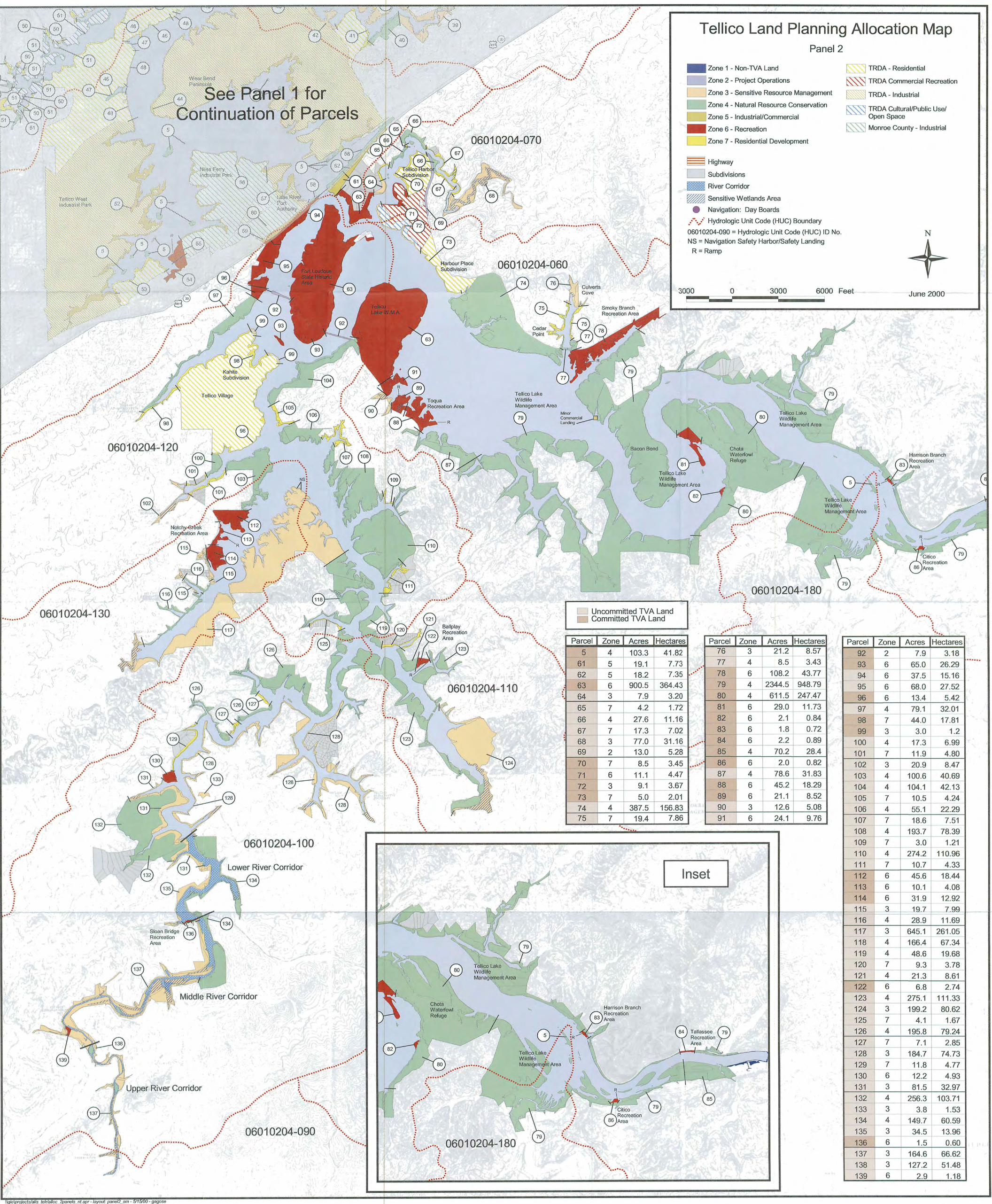
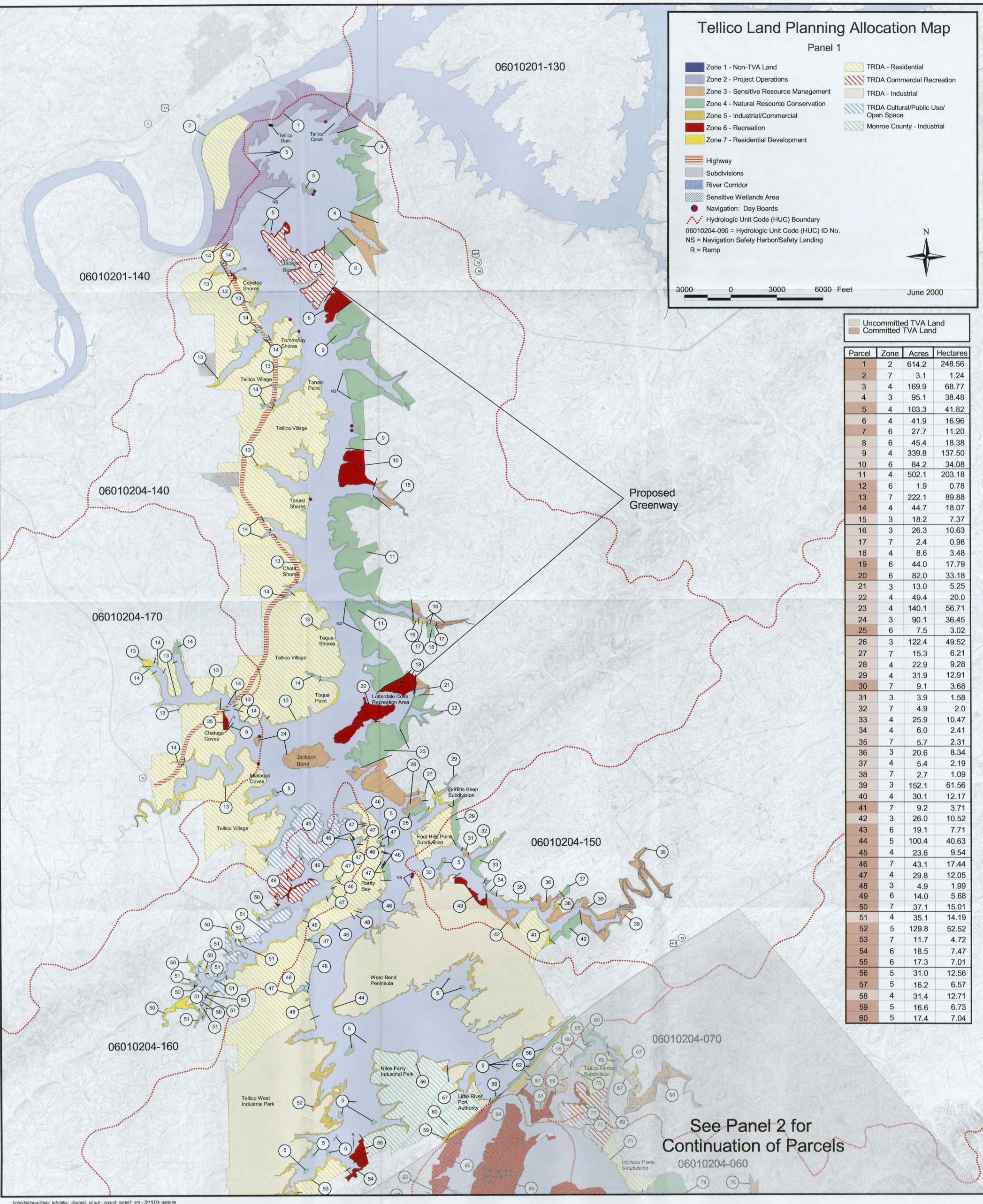
EXHIBIT 1 . PROPOSED LAND USE ALLOCATION MAP FOR ALTERNATIVE B ................................................................................................................ MAP POCKET
Introduction
1. INTRODUCTION
The Tellico Reservoir Land Management Plan (Plan) is the result of a study of the Tennessee Valley Authority (TVA)-owned land surrounding the Tellico Reservoir. This Introduction provides background information about management of TVA lands throughout its 67-year history, explains the purpose of the plan, and describes the process used to develop the plan. The Regional Overview describes the natural and social development of the reservoir and surrounding area. Reservoir Planning Goals and Objectives lists the objectives around which the plan was developed. Parcel Allocation includes a summary of the allocation process, zone definitions, and parcel descriptions documenting land use allocations. Proposed land use allocation map (Exhibit 1) is included in the pocket at the back of the document.
1.1. Background
The massive dam and reservoir construction program that was undertaken by TVA, following its creation in 1933, required the purchase of over one million acres of land for the creation of 34 reservoirs in five of the seven states in the Tennessee Valley region. Approximately 600,000 acres of that land lie above the summer pool elevation of the TVA reservoir system.
Arthur Morgan, Chairman of the TVA Board in the 1930s, viewed public land ownership as a tool to promote social objectives. Throughout its history, TVA has managed the reservoir lands under its stewardship to meet a wide range of regional and local resource development needs and to improve the quality of life, both within specific reservoir areas and throughout the Tennessee Valley. Reservoir properties, together with adjoining private lands, have been used for public parks, industrial development, commercial recreation, residential development, tourism development, forest and wildlife management, and to meet a variety of other needs associated with local communities and government agencies.
Today, TVA's land base Valleywide has been reduced to less than 265,000 acres. An increasing demand for and use of reservoir land sometimes results in conflicting and uneconomical land use patterns and friction between public and private use. These competing interests and development pressures, coupled with today's environmental awareness, underscore the necessity for a planned approach to the management of TVA's reservoir land and related resources.
TVA initiated a comprehensive reservoir land planning process in 1979. Since that time, land management plans have been completed and approved by the TVA Board of Directors for seven mainstream reservoirs (Pickwick, approved in 1981; Guntersville, approved in 1983; Kentucky, approved in 1985; Watts Bar, approved in 1988; Chickamauga, approved in 1989; Nickajack, approved in 1990;
TeElico Reservoir Land Management Plan 1
Introduction
and Wheeler, approved in 1995). In addition, two special studies have been completed for Fort Loudoun Reservoir and the Muscle Shoals/Wilson Dam Reservations.
Planning for the tributary reservoirs began in 1997 using a streamlined planning process. This plan utilizes the new planning process.
1.2. Purpose
The purpose of the Plan is to help TVA make decisions relating to future use of its land around Tellico Reservoir. Bv ~rovidine a clear statement of how TVA will , . - manage its land and by identifying land for specific uses, the plan helps minimize conflicting land uses and improve WA's responsiveness to the public concerning land use requests.
TVA's Vision is Generating Prosperity in the Valley. This vision will be accomplished by TVA setting the standard for:
Supplying low-cost reliable power - Meet the changing needs of power distributors and directly-served customers for energy products and services in changing markets.
Supporting a thriving river system - Minimize flood damage, maintain navigation, support power production, improve water quality, protect public health and the environment, and support recreational uses.
Stimulating economic growth - Provide services based on core expertise to solve regional problems, protect natural resources, create jobs, and build partnerships for public benefit.
TVA develops land plans to facilitate management of 265,000 acres of public land around its reservoirs. Plans are developed with participation by public agencies and officials, private organizations, and individuals. By providing a clear statement of how TVA-will manage public land and by identifying land for '
specific uses, a reservoir land plan minimizes conflicting land uses and makes it easier to handle requests for use of public land.
This plan will guide TVA resource management and property administration decisions on approximately 12,643 acres of land around Tellico Resewoir that are under TVA stewardship. It identifies the most suitable uses for 139 parcels of TVA land, providing areas for TVA Project Operations, Sensitive Resource Management, Natural Resource Conservation, Industrial/Commercial Development, Developed Recreation, and Residential Access. The planned acreage is TVA-retained (fee-owned) land and accounts for 360 miles or 99.8 percent of the total 361 miles of reservoir shoreline.
1.3. Process
Land planning is a systematic method of identifying and evaluating the most suitable use of TVA's land. It uses resource data; computer analysis; and input
Tellico Reservoir Land Management Plan
Introduction
from the public, other agencies, and TVA staff to allocate land to seven clearly defined planning zones (see Parcel Allocation for zone definitions):
Non-TVA Shoreland (e.g., flowage easement land) TVA Project Operations Sensitive Resource Management Natural Resource Conservation Industrial/Commercia1 Development Recreation Residential Access
TVA land management plans have a ten-year planning horizon. This plan was developed by a team of land managers and technical experts knowledgeable about the reservoir and its resources. A list of the planning team members is provided in - Appendix A-1. The planning team made land use decisions by integrating facts about agency and public needs, environmental conditions, and economic benefits. The pricess-includes:
Identification of existing landrights. All "committed lands" (parcels with existing commitments through transfers, leases, licenses, contracts, and TVA projects) are automatically allocated to designated use. No new field data is collected on such parcels. Compilation of existing resource data for all reservoir land. Field collection of new resource data for federally mandated categories (i.e., sensitive resources such as wetlands, threatened and endangered species, and archaeologylhistorical) on "uncommitted" land - e.g., land with no prior commitments, as defined above. Allocation of all land with identified sensitive resources (from existing or new data) to the Sensitive Resource Management Zone. Identification of issues and concerns about TVA reservoir land from the public and other local, state, and federal entities. Analysis of land capability and suitability by TVA resource managers based on subsequent ratingIranking of parcels for specific land uses. Initial allocation of uncommitted parcels by the TVA Land Planning Team - based on public input, TVA ratingslrankings, and capability analysis. Development of a Draft Environmental Impact Statement (DEIS) and plan based on proposed allocation. Shoreline categorization. Internal and external review of the DEIS and Plan. DEISPlan revisions. Approval of EIS and Plan by TVA Board of Directors.
Over the years, TVA has refined its land planning process to improve the efficiency of planning and the flexibility of the product. The land planning
Tellico Reservoir Land Management Plan
Introduction
process is conducted under National Environmental Protection Act (NEPA) regulations that call for environmental review of federal actions having the potential to impact the environment.
Tellico Reservoir Land Management Plan

Regional Overview
2. REGIONAL OVERVIEW
Tellico Reservoir is located within the portion of the upper Tennessee River Valley known as the Little Tennessee Watershed. This area falls entirely within the southern Appalachian Region which includes the Blue Ridge mountains section and the eastern Ridge and Valley section. The southern Appalachia Region is characterized by rugged topography, abundant rainfall, and a multitude of native plant and animal species. The amount of public national forest and park land in southern Appalachia is greater than anywhere east of the Mississippi River. Almost three-fourths of the land is forested.
2.1. The Past
Throughout the history of the Little Tennessee River Valley, the dominant theme has been humankind's continued efforts to exploit the river valley's resources. Starting with the Early Archaic Indian period (8000-6000 B.C.) and advancing to the Mississippian Indian period (900-1600 A.D.), Native Americans made ever increasing use of the valley's resources, its wild river, its fertile soil, and its deep forests. By the time the English colonists encountered the Native Americans in the valley, the Overhill Cherokees had supplanted the Dallas culture and were prospering in 12 towns along the river, with their principle towns being Chota and Tanasi.
In the mid-1700s, the English colonists from Virginia and South Carolina sought to enlist the Overhill Cherokees as trading partners and allies against the French and their Indian allies in the Ohio and Mississippi River Valleys. To secure relations and protect the Overhills from attacks by their enemies, South Carolina Governor William Henry Lyttleton ordered the construction of a fort in Overhill territory. During the French and Indian War, in September 1756, Captain Raymond Demere, with a party of militia and British Regulars, traveled to Overhill country to construct and garrison a fort. Completed in early 1757, the fort was named in honor of John Campbell, 4Ih Earl of Loudoun, who sewed as Commander-in-Chief of British forces in North America.
Again in 1776, the Cherokees--having listened to their warrior Chief Dragging Canoe--rose up against the white settlers, taking the side of the British against the Americans in the Revolutionary War, and again they were defeated with heavy losses. The Indians were powerless to stop the advancing flow of white settlement, for the pioneers and speculators all wanted the same thing-land. The Little Tennessee River Valley offered fertile bottomlands and forested uplands, an "American Canaan." In 1794, the United States Government constructed and garrisoned a Blockhouse across from the ruins of Fort Loudoun to pacify the region. From 1794 to 1807, the Blockhouse also served as a trading post and a center for negotiating treaties, all of which resulted in Indian concessions of land. The process of acquiring Indian land and dispersing the Indian population
Tellico Reservoir Land Management Plan 5
Regional Overview
culminated in the Indian Removal of 1838-9, in which the federal government rounded up any remaining Cherokees and forced them to march to eastern Oklahoma, on what has become known as the Trail of Tears.
Beginning in the early 1800s, white settlement spread throughout the valley, with large plantations worked by slaves prospering on the bottomlands, small farms cultivated by family labor struggling to succeed in the uplands; with churches and post offices established wherever settlers gathered. While most of the settlers were of Scotch-Irish descent, Germans settled Bat Island and Fork Creeks, founding a Lutheran Church, and Quakers settled throughout the region, gathered around their meeting house.
Successful settlement depended on development of and access to transportation systems. Ferries and flat boats were first used, followed by steamboats and stage coaches, and finally the railroad. Morganton prospered as a trading center in the era of ferries and steamboats and lost its trade when railroads drew the traffic away from the river.
While agriculture was the economic base of the valley, small industries, such as saw mills, grist mills, cotton gins, iron works, and tanyards added to the valley's development. Early in its settlement, the valley economy was linked through trade networks to urban centers in the region, such as Knoxville, and to neighboring states, such as Georgia.
With the coming of the Civil War, the region was divided in its loyalties, with many of the bottomland planters siding with the Confederacy and the upland farmers siding with the Union. Because of these divisions, often reflecting economic competition or linked to personal disputes, the area experienced small scale but intense outbreaks of violence, as members of families or neighbors fought each other. The only large-scale military action in the valley was the passage of Union or Confederate forces on their way to or from major battles elsewhere, with some minor skirmishes taking place. Due to the personal nature of the local conflict, in the postwar years, the churches and communities attempted to heal the wounds by organizing annual revival meetings at a site called the National Campground near Greenback.
In the late 1800s and early 1900s, the Little Tennessee River Valley experienced an explosion of community tanyards, small factories and banks, and especially town building, for example, Lenoir City and Vonore. Also, outside industries entered the region such as Babcock Lumber Company of Pennsylvania which cut the virgin forests and the Aluminum Company of America (ALCOA) which constructed dams on the untamed river. But the growth was uneven and often inadequate for the needs of the people or the corporation. For example, Babcock scarred the land as they exploited its resources.
Tellico Reservoir Land Management Plan
Regional Overview
When the Depression spread across the country, the valley's economy, which had never been healthy, shriveled as banks closed and factories shut down completely or reduced their workforce. Through New Deal legislation, some relief entered the valley. For example, a Civilian Conservation Corps (CCC) camp was established at Camp Wiley near Citico in the uplands. However, it was the Tennessee Valley Authority, signed into law in May 1933, which transformed the entire Tennessee Valley. Attached to TVA's Fort Loudoun Dam project, completed in 1943, was a plan for "placing a dam across the mouth of the Little Tennessee River." However, due to World War I1 construction limitations, the Fort Loudoun Extension was rejected and TVA shelved the plans.
In the 1950s, the Little Tennessee River Valley enjoyed some of the growth which spread across the nation with the return of prosperity. Transportation improved with the building of new roads and bridges, and with the increased ownership of cars. One-room schools were closed and school districts consolidated to offer better educational services. However, few industries moved up the river valley and many young people migrated to large cities outside the region in search of opportunities their hometowns could not offer.
In 1959 when TVA General Manager Aubrey "Red" Wagner called for new projects, he stressed the need to contribute to "regional development." He was especially interested in reviving the Tributary Area Development concept and when he became Chairman of the Board in 1962, the old Fort Loudoun Extension plan was revived and revised to include shoreline development.
2.2. The Project
The Tellico Dam, as it was named, was approved in 1966 and planned as an extension of the Fort Loudoun project. It diverts the flow from the nearby Little Tennessee River through a short canal into Fort Loudoun Reservoir. Construction began March 7, 1967. The discovery of the snail darter, a new species of fish that at the time had not been found anywhere else in the world, delayed construction for many years, and the project was not completed until November, 1979, at a cost of $141 million. The snail darter has since been found elsewhere and its federal status has changed from endangered to threatened.
Tellico Dam is a multipurpose project that became part of the Tennessee River system of dams and reservoirs. These dams and reservoirs were part of a bold plan for the unified development of the Tennessee River system recommended to Congress by TVA in 1936. The concept included plans to develop a 9-foot navigable channel extending from the mouth of the river near Paducah, Kentucky, to Knoxville, Tennessee, a distance of 650 miles.
Today, the system includes nine mainstream dams and 40 tributary dams. The system contributes substantially to the control of floods on the Tennessee, lower Ohio, and lower Mississippi Rivers, and provides many related benefits, including
Tellico Reservoir Land Management Plan 7
Regional Overview
a large supply of electric power. The Tellico Project extends the navigable channel of the Tennessee River system up the Little Tennessee River about 29 miles and diverts water for additional hydroelectric generating capacity at Fort Loudoun Dam on the Tennessee River.
The Tellico Project involved more than construction of the dam. It involved the assembly and acquisition of approximately 37,737 acres of land in Blount, Loudon and Monroe Counties. To make way for the reservoir, other project . .
activities included surveying, mapping, and clearing the reservoir area; removal of a bridge; relocating buildings, roads, cemeteries, power and telephone lines; and relocating 350 families.
When the dam was completed, Tellico Reservoir was filled to elevation 807 feet above sea level. At summer operating range (elevation 812-813), the reservoir extends 33 miles from the dam and has a surface area of approximately 16,500 acres with 361 miles of shoreline. The reservoir lies amidst the rolling farmlands, bottomlands and public forests of the Little Tennessee valley and is a picturesque body of water, easily accessible to residents of Lenoir City, Loudon, Maryville, Alcoa, Madisonville, and Knoxville.
Tellico Reservoir provided a new source of recreation. The management of water levels by the TVA provided a reliable and predictable water level for seasonal recreation. Tellico was conveniently accessible to area residents and provided an attractive site for industrial, residential, commercial, and public recreational developments.
In 1982, TVA and the newly-formed Tellico Reservoir Development Agency (TRDA) agreed to cooperate in the development, management, and sale of certain portions of the project lands. In November, 1982, TVA sold approximately 11,151 acres of project lands to TRDA for Industrial purposes; Commercial Recreation purposes; Residential purposes; Cultural/Public Uselopen Space Area purposes; and for the Tellico Parkway, a limited, controlled access road. TVA also conveyed to TRDA easements for Public Recreation over 348 acres and an option to purchase 520 additional acres for Industrial purposes. Other project lands have been conveyed for public purposes to the state of Tennessee, local governmental entities, and the Eastern Band of Cherokee Indians.
TRDA, in cooperation with TVA and other agencies, has developed the land for commercial, residential, recreational and industrial purposes. Although all development plans have yet to fulfill their potential, at least ten new industries have moved into the Vonore area, and Fort Loudoun State Historic Area and the Tellico Blockhouse attract locals and tourists. TVA has also granted easement to the Eastern Band of the Cherokees and money to develop a museum and memorials.
Tellico Reservoir Land Management Plan
Regional Overview
2.3. The Present Shoreland
Today, there are approximately 12,643 acres of Tellico Reservoir shoreland on which TVA can plan future uses. This public land includes about 361 miles of shoreline. Of the 361 miles of shoreline, 87.2 percent is owned and managed by TVA and 12.8 percent is managed by TRDA for purposes of residential and industrial development. TVA did not convey fee interest land below the 820-foot contour on the Tellico Reservoir. Zoning proposed under Alternative B would simply recognize that the marginal strip lands (those below 820-foot contour) would be classified to reflect the rights of the existing backlying property owners. Lake access rights are governed by the deed conveying the effected hacklying property and by Contract No. TV-60000A with the Tellico Reservoir Development Agency.
Tellico Reservoir has benefited from planned development and management of lands. There are now two marinas, a yacht club, ten industries, a barge terminal, and three planned residential complexes on Tellico Reservoir.
Forest resources managed by TVA are situated primarily on the descending right bank from Little Tennessee River Mile 13 to the dam and on the upper reaches of the reservoir from the Highway 411 bridge. There are approximately 5000 acres of forested land within the reservoir boundary, of which the majority are hardwoods.
2.4. The Future
Recent trends within the southern Appalachia region provide us with a glimpse of the kind of pressures that will bear on Tellico Reservoir in the future. Long-term shifts in the regional economy, social trends, along with broad shifts in recreational behavior, and current and anticipated environmental issues combine to frame a picture of thechallenges ahead and what it will take to protect places like Tellico Reservoir.
The population of Blount, Loudon, and Monroe Counties grew from 147,765 in 1990 to an estimated 172,545 in 1997. With increases in population, there has been expansion of urban and suburban areas into what were formerly rural and natural areas and an increase in the demand for recreational activities. Population for this area is projected to grow to about 196,870 by the year 2010 and 218,700 by 2020.
Continued growth and development will place increased demands on the reservoir. Extension of water service to areas such as western Blount County will accelerate growth and development in the coming years, as will the planned upgrading of area highways. Improvements to U.S. 411 will vastly improve access between Tellico Resrvoir and the Knoxville Metropolitan Airport and other locations. Scheduled improvements to two State highway links--Route 322 from
Tellico Reservoir Land Management Plan 9
Regional Overview
Sweetwater and Route 72-between Interstate 75 and the Tellico area will have similar effects.
The eastern shorelands of Tellico Reservoir are well-suited for outdoor recreation facilities. Such an investment, along with improved access, would enhance the area's role as a tourist destination and provide for public access, recreation, and enjoyment. Additional planned residential developments and full occupancy at the industrial parks would further stimulate area development within the next twenty years that would, in turn, impact conversion of land uses from rural to urban in the vicinity of the reservoir.
Trends affecting Tellico Reservoir mirror those of the larger region of which it is a part. The current population of the southern Appalachian Region is better- educated, older and has a higher net income than twenty years ago. More people throughout the region are moving out of urban areas and commuting to work. There is increased demand for real estate that includes attributes associated with a leisurely, rural life-style but affords access to the benefits of a metropolitan area. Thus development pressures on lakefront properties a short distance from urban centers are very high.
Respondents to a 1997 survey on Tellico Reservoir uses and land management were asked to report their preferences for future shoreline use allocation. A high proportion preferred keeping industrial, residential, and commercial recreational development steady, while increasing development of resource management areas, informal recreational areas, and preservation areas. Respondents also expressed priority be given for management of habitats, study areas, erosion control, water quality, boat ramps, and the preservation of natural areas, cultural artifacts, endangered species, public land with unique features, historic sites, and wetlands.
The most significant trend in recreation is an increase in both numbers of participants and the diversity of activities. The percentage of the population that participates in recreational activities like fishing, camping, and hiking has grown or remained stable. Future population changes are expected to result in major growth in less physically demanding activities, such as pleasure driving, sightseeing, nature and cultural resource study, and developed camping. Increased pressure on nature-based recreation settings and facilities is also expected in the future. Urban, suburban, and transitional settings where development is emerging are expected to increase at the expense of existing rural or natural-appearing settings. Public land will have to supply a larger portion of nature-based outdoor recreation opportunities as settings and opportunities on private land decline. Without better cooperation between public and private sectors, key natural and cultural settings on public land may be negatively affected by increasing density of development.
Environmental quality issues will become increasingly important as population and demands on the environment increase. The southern Appalachia region has
10 Tellico Reservoir Land Management Plan

Regional Overview
more species of native plants, animals, and insects than any other region with a similar climate in North America. The high mountains and abundant streams and rivers create a variety of habitat types that support thousands of species, many of which occur only in this region. Land that borders the streams, rivers, and waterbodies in the valleys is a significant contributor to this regional diversity. Riparian zones-strips of land bordering waterbodies--are characterized by many different native species often occurring as dense populations. Poor land use practices near the water and reductions in wetlands can threaten both this diversity of species and water quality. In southern Appalachia, generally, land conversion, breaking large areas of forest into smaller patches (known as forest fragmentation), invasions of non-native pest species, air and water pollution and other human-caused stresses are having an impact on these native resources
Non-native insect, disease and plant and animal species--such as the gypsy moth, dogwood anthracnose, the zebra mussel, hydrilla-are impacting the region. Some of the most pressing air quality issues relate to ground-level ozone, visibility, and acid rain. Land management or human activities adjacent to streams, rivers, and lakes can increase erosion into the aquatic system and lead to sedimentation, alter the natural shape of stream channels, change water chemistry, and impact aquatic organisms.
Two-thirds of reported water quality impairments within the southern Appalachian Region are from nonpoint sources such as septic tanks, agricultural runoff, stormwater discharges, and landfill and mining leachate. Agricultural impacts due to runoff containing commercial fertilizer, animal manure, and pesticides are greatest where slopes are greater than 3 percent and where agricultural operations are immediately adjacent to water bodies. Highways, especially those close to or crossing waterways, impact water quality in a number of ways. Capital investments in municipal and industrial wastewater treatment processes since the adoption of the Clean Water Act in 1972 have resulted in significant improvements in the quality of point-source discharges into waterways and, in turn, have reduced water pollution. As growth continues, further improvements will be necessary. Increases in the amounts of water withdrawn from surface waterbodies for use can have downstream impacts on the quality of water.
Tellico Reservoir is a unique resource that can be enjoyed by many future generations. For it to be enjoyed in the future it must be able to accommodate increased demands that are placed upon it or some of those demands must be curtailed. How Tellico Reservoir can best accommodate these increased demands will depend on the actions of government, business and civic leaders within the region, those who come to enjoy Tellico Reservoir, and those who own the land on or near its shoreline.
Tellico Reservoir's future will be affected by trends and issues that extend far beyond its shoreline. Population growth within the upper east Tennessee region,
Tellico Reservoir Land Management Plan 11
Regional Overview
land development and community planning practices, growing tourism and recreation economy, a growing diversity of recreational pursuits, as well as developments in upstream portions of the Little Tennessee Watershed will affect the quality of experience Tellico Reservoir provides. Close attention must be given to reserving shorelands with unique or special qualities, properly managing and conserving the natural resources of the shoreline, and protecting different uses so they can be enjoyed by the public.
Tellico Reservoir Land Management Plan
Reservoir Planning Goals and Objectives
3. RESERVOIR PLANNING GOALS AND OBJECTIVES
From its conception, the Tellico Project was planned as a multipurpose reservoir project for flood control, navigation, water supply, economic development, recreation, and electric power generation. This planning effort resulted in the project lands being allocated to meet anticipated demand for residential, commercial, and industrial development; recreation; wildlife management; forestry; cultural resource protection; agriculture; navigation; flood control; and power production. As a result of past management practices, public interest, and TVA partnerships with the TRDA and others, the Tellico Project goals and objectives have thus far been met. However, the Tellico Reselvoir area has changed greatly since the 1979 plan was implemented. This plan reevaluates the suitability and capability of Tellico Reservoir properties, still under TVA control, to identify properties that would best meet the current and future management objectives for Tellico Reservoir.
3.1. Goals
As previously stated; TVA's Vision is Generating Prosperity in the Valley. This vision will be accomplished by TVA setting the standard for:
Supplying low-cost reliable power - Meet the changing needs of power distributors and directly-served customers for energy products and services in changing markets.
Supporting a thriving river system - Minimize flood damage, maintain navigation, support power production, improve water quality, protect public health and the environment, and support recreational uses.
Stimulating economic growth - Provide services based on core expertise to solve regional problems, protect natural resources, create jobs, and build partnerships for public benefit.
Land plans support TVA's mission to manage a thriving river system and stimulate economic growth. The plans seek to integrate resource management goals, provide for optimum public benefit, and balance competing resource uses. The goals for each type of land use are as follows:
1. TVA Projects Goal - Maintain TVA facilities for flood control, navigation, power production/transmission, recreation, and water quality.
2. Watershed Management Goal - Manage TVA public lands to support TVA's efforts to maintain and improve water quality conditions and create sustainable watersheds.
3. Resource Management Goal - Manage TVA public land for the enhancement of natural resources for wildlife habitat, for human appreciation and use, and to protect sensitive resources such as significant archeological sites, endangered species and wetlands.
Tellico Reservoir Land Management Plan 13
Reservoir Planning Goals and Objectives
4. Economic Development Goal - Complement the region's economic development activities and promote sustainable communities/watersheds.
5. Recreation Goal - Meet public needs for recreational activities.
6. Residential Access Goal - Promote small corridor access, well-vegetated shorelines, and other attributes consistent with the TVA Shoreline Management Policy which protects shoreline and aquatic resources while providing reasonable access to the water.
3.2. Objectives
Land planning objectives for Tellico Reservoir were developed by the Little Tennessee Watershed Team using customer and TVA staff input received during the scoping or issue-gathering phase of the environmental review process. They reflect TVA's desire to manage TVA land on Tellico Reservoir in the public's best interest and are consistent with the TVA mission and its land planning goals. These objectives were used to allocate TVA land on Tellico Reservoir.
1. Assure the plan supports the original intent and overall objectives of the Tellico Reservoir Project. This is the premise around which the Tellico Reservoir Land Management Plan is structured.
To a great extent the original project needs for navigation, flood control, and electric power generation and distribution are satisfied under the existing plan. Future needs have been assessed and lands designated or currently used for protection and maintenance of the dam and related facilities; power generation and distribution; navigation operations; and navigation aides have been allocated for management under Zone 2, Project Operations.
Economic development trends in the Tellico Project area have been very good. The lands previously conveyed to TRDA and others for industrial and commercial purposes are being developed at a pace that meets the demand for such use. This plan further supports economic development by allocating additional lands (parcel 62) and the TVA shoreline fronting the previously conveyed industrial and commercial lands for management under Zone 5, IndustrialICommercial Development.
The reservoir has been and will continue to be a primary source for meeting the domestic water needs of the area. There is one major domestic water intake and treatment facility in operation.
Recreation interests are well served on lands previously conveyed for such use and on TVA lands that are allocated in this plan for management under Zone 6, Recreation. Recreation needs such as hiking and camping are further provided for on certain TVA lands allocated for management under Zone 2, TVA Project Operations; Zone 3, Sensitive Resource Management; and, Zone 4, Natural Resource Conservation.
Tellico Reservoir Land Management Plan

Reservoir Planning Goals and Objectives
2. Assure the plan is consistent with TVA policy and in compliance with other pertinent Federal and state requirements including the National Environmental Policy Act (NEPA) and applicable Presidential Executive Orders.
A concerted effort was made throughout the land use allocation phase of this plan to assure all issues identified during project scoping were addressed.
Extensive surveys were conducted on the affected TVA property to identify the presence of threatened or endangered species, cultural resources, wetlands, unique habitats, natural areas, and distinctive visual resources. These areas have been allocated for protection and management under Zone 3, Sensitive Resource Management.
Prior to any development or ground-disturbing activity resulting in the implementation of land use allocation under this plan, TVA policy will assure the action is in full compliance with Federal and state requirements, NEPA, and pertinent Presidential Executive Orders.
3. Assure the plan supports the objectives for development and/or management of Tellico Project lands under Contract No. TV-60000A between TVA and the Tellico Reservoir Development Agency (TRDA).
The plan more clearly identifies the areas on Tellico Reservoir where the abutting private property owner has retained rights of access over the adjoining TVA land and/or qualifies under Contract No. TV-60000A to purchase such rights which would allow construction of private water use facilities on the affected shoreline.
TVA, in cooperation with TRDA, will supplement Contract No. TV-60000A as may be necessary to improve the effectiveness of this partnership agreement.
4. Assure the plan protects the public's right of access to the waters of Tellico Reservoir.
Tellico Reservoir land below the 820-foot contour will be retained in fee by TVA. To the extent practicable the public's right of access on and across these properties will be preserved. In addition, public access opportunities are provided on land previously conveyed for recreation purposes and on land allocated in this plan for management under Zones 2,3,4, and 6.
5. Assure the plan maintains and provides opportunities for the continued enhancement of the quality of life afforded by the natural setting and recreational amenities on and along Tellico Reservoir.
Tellico Reservoir Land Management Plan

Reservoir Planning Goals and Objectives
Approximately 11,151 acres of TVA land was conveyed to TRDA through a comprehensive agreement referred to as Contract No. TV-60000A. Along with other svecifications, development standards were established to assure high qualiGdevelopment on all ~e l l i co Reservoir properties. These standards provide a good benchmark for use in assuring high quality development in the future.
When land is conveyed to the state and/or other agencies for public recreation use and development or for other purposes, conditions are incorporated in the conveyance instrument to protect TVA's and the public's interests in these lands. In addition, such lands would be subject to use and developmental standards established by the recipient.
6. Assure the plan maintains and provides enhancements to the economic value of lands surrounding Tellico Reservoir.
The developmental standards, visual quality, natural resources, recreational amenities, public access, and employment opportunities are considered to be very important to the area and have a direct influence on the economic value of Tellico Reservoir lands. This plan strives to maintain balance between these sometimes conflicting values.
7. Identify disposal property not suitable for management or property where disposal would further the overall objectives of the Tellico Project and this plan.
Under this plan two tracts of land are identified that are not considered necessary for the implementation of the plan or for future Project purposes.
The first tract is approximately 100-feet wide by 700-feet long and is surrounded on all sides by private land. It is located along Highway 129, across the highway from the reservoir, just downstream from Chilhowee Dam.
The second tract contains approximately 18 acres of land. This tract is located at Vonore on the opposite side of Highway 411 from the reservoir on the northeast side of the Little Tennessee River bridge. It is bounded by Highway 411, land previously conveyed to Tellico Area Services System (TASS) for a water intakeltreatrnent facility; and, by private property.
Tellico Reservoir Land Management Plan
Parcel Allocation
4. PARCEL ALLOCATION
The Tellico Reservoir allocation meeting took place on May 28,1998. Participants from TVA included:
Steven L. Akers, Tellico Reservoir Planning Project Leader, Little Tennessee Watershed Team
Donald C. Becker, Facilitator, Little Tennessee Watershed Team
Patsy R. Becker, Specialist, Stakeholder Programs
Spencer D. Boardman, Reservoir Land Planning Specialist, Watershed Technical Services
Robert E. Buchanan, Civil Engineer, Economic Development
Carline C. Bryant, Land Use Specialist, River Operations
Dennis T. Curtin, Program Administrator, Regional Natural Heritage Program
Harold M. Draper, NEPA Specialist, Environmental Management
Frank B. (Bucky) Edmondson, Boone Resewoir Planning Project Leader, Upper Holston Watershed Team
Charles Ellenburg, Recreation Specialist, Mideast Region
Ruth M. Horton, Land Use Specialist, Watershed Technical Services
Wesley K. James, Wildlife Biologist, Mideast Region
Khurshid K. Mehta, Attorney, Office of the General Counsel
Jack W. Miller, Land Use Specialist, Little Tennessee Watershed Team
Samuel C. Perry, Landscape Architect, Watershed Technical Services
Eric W. Rauch, Manager, Mideast Region, Resource Stewardship
Richard L. Toemisson, Environmental Scientist, Mideast Region
Richard W. Yarnell, Archaeologist, Watershed Technical Services
4.1. Allocation Process
During the allocation meeting, the location, existing conditions, and qualities of each parcel were discussed. As explained in the Introduction to this plan, the allocation team honored all existing commitment-that is existing leases, licenses, easements, and uses hy TVA. Land with identified sensitive resources was placed in the Sensitive Resource Management Zone. Allocation to the Residential Access Zone was based on Shoreline Management Initiative data and the requirements of Contract No. TV-60000A. The remaining parcels were allocated based on reservoir planning objectives and TVA staff recommendations, which were developed with public input. Decisions were made by consensus when possible. Unresolved issues were tabled for further research and discussion. Final allocation decisions were made by the team leader.
TeElico Reservoir Land Management Plan 17

Parcel Allocation
During the allocation meeting, the planning team allocated the TVA land to one of seven planning zones defied as follows:
18 Tellico Reservoir Land Management Plan
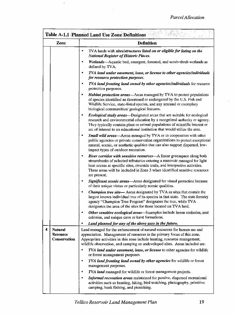
. . P1anned;Land Use Zone'Defmitions
Definition
Shoreland located above summer operating range that TVA does not own in fee or land never purchased by TVA. TVA is not allocating private or other non- TVA land. This category is provided to assist in comprehensive evaluation of potential environmental impacts of TVA's allocation decisions. Non-TVA shoreline includes:
Flowage easement land-Privately- or publicly-owned land where TVA has purchased the right to flood andlor limit structures. Flowage easement land is generally purchased to a contour elevation. Since this land is subject to TVA's Section 26a permitting requirements, the Shoreline Management Policy (SMP) guidelines discussed in the definition of Zone 7 would apply to flowage easement land fronting private residential development.
Privately-owned reservoir land-Including, but not limited to, Residential, IndustriallCommercia1, and Agricultural.
TVA reservoir land currently used for TVA operations and public works projects includes:
Land adjacent to established navigation opem6ions--Jacks, lock operations and maintenance facilities, and the navigation work boat dock and bases.
Land used for TVA powerprojects opemtions-Generation facilities, switchyards, transmission facilities, and rights-of-way.
Dam reservatton land--Areas used for developed and dispersed recreation, maintenance facilities, Watershed Team offices, research areas, and visitor centers.
Navigation safety hrborsllandings-Areas used for tying off commercial barge tows and recreational boats during adverse weather conditions or equipment malfunctions.
Navigation day boanls and b e a c o M e a s with structures placed on the shoreline to facilitate navisation.
Public workspmjecbs-Includes fire halls, public water intakes, public treatment plants, etc. phese pmjects are placed in this category as a matter of convenience and may not relate specifically to TVA projects.)
Highways adjusted due to the development of the TellicoProject- Includes highways that were relocated or elevated to a location or an elevation that would allow continued use during normal flood events.
Land planned for any of the above uses in the future.
Land managed for protection and enhancement of sensitive resources. Sensitive resources, as defined by TVA, include resources protected by state or federal law or executive order and other land featureslnatural resources TVA considers important to the area viewscape or natural environment. Natural resource activities such as hunting, wildlife observation, and camping on undeveloped sites may occur in this zone; but the overriding focus is protecting and enhancing the sensitive resource the site supports. Areas included are:
TVA-designated sites with potentially significant archeological resources.
Table A-1.1
1
2
3
Zone
Nnn-TVA Shoreland
TVAPmject operations
Sensitive Resource Management
Parcel Allocation
Tellico Reservoir Land Management Plan 19
Wetlands-Aquatic bed, emergent, forested, and scrub-sh~b wetlands as
W A land under easement, lease, or license to other agencieslindividu~k for resource protection purposes.
W A landfronting land owned by other agencieslindividuals for resource protection purposes.
Habitatprotection areas-Areas managed by TVA to protect populations of species identified as threatened or endangered by the U.S. Fish and Wildlife Service, state-listed species: and any unusual or exemplary biological communities/ geological features.
Ecological study areas-Designated areas that are suitable for ecological research and environmental education by a recognized authority or agency. They typically contain plant or animal populations of scientific interest or are of interest to an educational institution that would utilize the area.
Small wild a r e a s A r e a s managed by TVA or in cooperation with other public agencies or private conservation organizations to protect exceptional natural, scenic, or aesthetic qualities that can also support dispersed, low- impact types of outdoor recreation.
River corridor with sensitive resources-A linear greenspace along both streambanks of selected tributaries entering a reservoir managed for light
4 Natural Resource Conservation
boat access at specific sites, riverside trails, and interpretive activities. These areas will be included in Zone 3 when identified sensitive resources are present.
Significant scenic areas-Areas designated for visual protection because of their unique vistas or particularly scenic qualities.
Champion tree s i t e Areas designated by TVA as sites that contain the largest known individual tree of its species in that state. The state forestry agency "Champion Tree Program" designates the tree, while TVA designates the area of the sites for those located on TVA land.
Other sensitive ecological areas-Examples include heron rookeries, nest colonies, and unique cave or karst formations.
Land planned for any of the above uses in the fuhare.
Land managed for the enhancement of natural resources for human use and appreciation. Management of resources is the primary focus of this zone. Appropriate activities in this zone include hunting, resource management, wildlife observation, and camping on undeveloped sites. Areas included are:
W A land under easement, lease, or license to other agencies for wildlife or forest management purposes.
W A land fronting land owned by other agencies for wildlife or forest management purposes.
W A land managed for wildlife or forest management projects.
Informal recreation areas maintained for passive, dispersed recreational activities such as hunting, hiking, bud watching, photography, primitive camping, bank fishing, and picnicking.

Parcel Allocation
20 Tellico Reservoir Land Management Plan
,- , , . . . , , ,,, , , . , '. . . . .,,, . . . . , :., .,
~lmned:L&d .use Zone ~efinitiois .. . , , , , , . % . : . . . . . . , . Definition
Shoreline conservation areas-Narrow riparian strips of vegetation between the water's edge and TVA's backlying property that are managed for wildlife, water quality, or visual qualities. Such riparian zones contribute to the ecology of the reservoir by providing food and habitat for diverse populations of plants and animals normally found in these areas. Trees and understory vegetation protect water quality by filtering nutrients, sediments, and other pollutants from runoff before they reach the lake. They also provide shade, cover, and a food source for fish.
Wildlife observation areas-Areas with unique concentrations of easily obseoled wildlife that are managed as public wildlife observation areas.
River corridor withouf sensitive resources present-A river corridor is a linear greenspace along both streambanks of selected tributaries entering a reservoir managed for light boat access at specific sites, riverside trails, and interpretive activities. River corridors will be included in Zone 4 unless sensitive resources are present (see Zone 3).
Islands of 10 acres or less.
Land planned for any of the above uses in the future.
Land managed for economic development purposes. Areas included are:
TVA land under easement, lease, or license to other agencieslindividuals for industrial or commercial purposes.
TVA land fmnting land owned by other agencieslindividuals for industrial or commercial purposes.
Sites planned for future industrial use. Types of development that can occur on this land are:
Businessparks-TVA waterfront land which supports industrial or commercial development.
Industrialaccess-Access to the waterfront by backlying property owners across TVA property for water intake% wastewater discharge, or conveyance of commodities (i.e., pipelines, rail, or road). Barge terminals are associated with industrial access corridors.
Barge terminal sites-Public or private facilities used for the transfer, loading, and unloading of commodities between barges and trucks, trains, storage areas, or industrial plants.
Fleeting a reasS i t e s used by the towing industry to switch barges between tows or barge terminals which have both off-shore and on-shore facilities.
Minor commercial landing-A temporary or intermittent activity that takes place without permanent improvements to the property. These sites can be used for transferring pulpwood, sand, gravel, and other natural resource commodities between barges and trucks.
(Commercial recreation uses, such as marinas and campgrounds, are included in Zone 6.)
All reservoir land managed for concentrated, recreational activities that require capital improvement and maintenance, including:
TVA land under easement, lease, or license to other agencieslindividuals for recreational purposes.
TVA landfmnting hnd owned by other agencieslindividuals for recreational purposes.
,. , , . , . , ,
'~ible'i4-1.1-
5
6
Zone
Industrial! Commercia' Development
Recreation

Parcel Allocation
. . . . . , , . . , . ,. ., - . . . , . - , t . . .
-Table A-1.1 'planned .Land Use:Zone Definitions,-: - : ,, :.;-: . , . ,
, . , . , : , ' , , .
Tellico Reservoir Land Management Plan
Zone
Residential Access
Docks and Shoreline
Definition
TVA land developed for recreahbnnlpurposes such as campgrounds, and day-use areas.
Landplanned for any of the above uses in the future. Types of development that can occur on this land are:
Commercial recreation, e,g., marinas, boat docks, resorts, campgrounds, and golf courses.
Public recreation, e.g., local, state, and federal parks and recreation areas.
Greenways, linear parks located along natural features such as lakes or ridges, or along man-made features including abandoned railways or utility rights-of-way, which link people and resources together.
Water access sites, e.g., boat ramps, courtesy piers, canoe access, fishing piers, vehicle parking areas, picnic areas, trails, toilet facilities, and information kiosks.
TVA-owned lands where Section 26a applications and other land use approvals for residential shoreline alterations are considered. Requests for residential shoreline alterations are considered on parcels identified in this zone where such use was previously considered and where the proposed use would not conflict with the interests of the general public. As provided for in the SMP, residential access would be divided into three categories based on the presence of sensitive ecological resources.
The categories are: (1) Shoreline Protection* for shoreline segments that support sensitive ecological resources, such as federally-listed threatened or endangered species, high priority state-listed species, wetlands with high function and value, archaeological or historical sites of national significance, or which contain navigation restrictions; (2) Residential Mitigation for shoreline segments where resource conditions or navigation conditions would require special analysis and perhaps specific mitigation measures, or where additional data are needed; and (3) Managed Residential where no sensitive resources are known to exist.
Types of development/management that can occur on this land are:
Residential water use facilities, e.g., docks, piers, launching ramps/driveways, marine railways, boathouses, enclosed storage space, and nonpotable water intakes.
Residential access corridors, e.g., pathways, wooden steps, walkways, or mulched paths which can include portable picnic tables and utility lines.
Shoreline stabilization, e.g., bioengineering, riprap and gabions, and retaining walls.
Shoreline vegetation management on TVA-owned residential access shoreland.
Conservation easements for protection of the shoreline.
Other activities, e.g., fill, excavation, grading, etc.
other shoreline development are not permitted on land categorized as Protection.
Parcel Allocation
42. Parcel Descriptions
Information concerning the parcel size (in acres and hectares), location, zone, physical characteristics, land uselcover, unique features, history, and any conditions of use are contained in the following parcel descriptions. Each parcel is identified with a Hydrologic Unit Code (HUC) number. Watersheds across the United States are delineated by the U.S. Geological Survey using a nationwide system based on surface hydrologic features. This system divides the country into 21 regions (2-digit), 222 subregions (4-digit), 352 accounting units (6-digit), and 2,262 cataloguing units (8-digit). A hierarchical HUC consisting of 2 digits for each level in the hydrologic system is used to identify any hydrologic area.
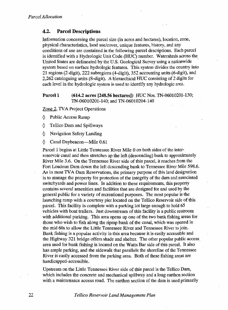
Parcel 1 (614.2 acres [248.56 hectares]) HUC Nos. TN-06010201-130; TN-06010201-140; and TN-06010204-140
Zone2, TVA Project Operations
0 Public Access Ramp
0 Tellico Dam and Spillways
0 Navigation Safety Landing
0 Canal Daybeacon-Mile 0.61
Parcel 1 begins at Little Tennessee River Mile 0 on both sides of the inter- reservoir canal and then stretches up the left (descending) bank to approximately River Mile 3.6. On the Tennessee River side of this parcel, it reaches from the Fort Loudoun Dam down the left descending bank to Tennessee River Mile 598.6. As in most TVA Dam Reservations, the primary purpose of this land designation is to manage the property for protection of the integrity of the dam and associated switchyards and power lines. In addition to these requirements, this property contains several amenities and facilities that are designed for and used by the general public for a variety of recreational purposes. The most popular is the launching ramp with a courtesy pier located on the Tellico Reservoir side of this parcel. This facility is complete with a parking lot large enough to hold 65 vehicles with boat trailers. Just downstream of this facility is a public restroom with additional parking. This area opens up one of the two bank fishing areas for those who wish to fish along the riprap bank of the canal, which was opened in the mid 60s to allow the Little Tennessee River and Tennessee River to join. Bank fishing is a popular activity in this area because it is easily accessible and the Highway 321 bridge offers shade and shelter. The other popular public access area used for bank fishing is located on the Watts Bar side of this parcel. It also has ample parking, and the sidewalk that parallels the shoreline of the Tennessee River is easily accessed from the parking area. Both of these fishing areas are handicapped-accessible.
Upstream on the Little Tennessee River side of this parcel is the Tellico Dam, which includes the concrete and mechanical spillway and a long earthen section with a maintenance access road. The earthen section of the dam is used primarily
22 Tellico Reservoir Land Management Plan
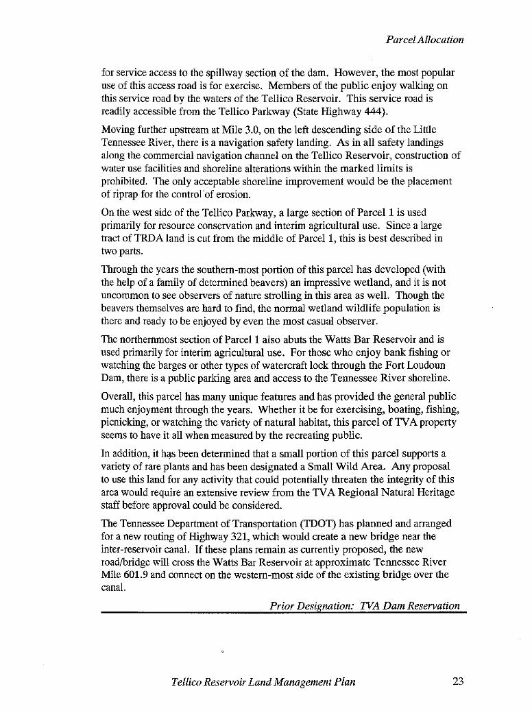
Parcel Allocation
for service access to the spillway section of the dam. However, the most popular use of this access road is for exercise. Members of the public enjoy walking on this service road by the waters of the Tellico Reservoir. This service road is readily accessible from the Tellico Parkway (State Highway 444).
Moving further upstream at Mile 3.0, on the left descending side of the Little Tennessee River, there is a navigation safety landing. As in all safety landings along the commercial navigation channel on the Tellico Reservoir, construction of water use facilities and shoreline alterations within the marked limits is prohibited. The only acceptable shoreline improvement would be the placement of riprap for the controlof erosion.
On the west side of the Tellico Parkway, a large section of Parcel 1 is used primarily for resource conservation and interim agricultural use. Since a large tract of TRDA land is cut from the middle of Parcel 1, this is best described in two parts.
Through the years the southem-most portion of this parcel has developed (with the help of a family of determined beavers) an impressive wetland, and it is not uncommon to see observers of nature strolling in this area as well. Though the beavers themselves are hard to find, the normal wetland wildlife population is there and ready to be enjoyed by even the most casual observer.
The northenunost section of Parcel 1 also abuts the Watts Bar Reservoir and is used primarily for interim agricultural use. For those who enjoy bank fishing or watching the barges or other types of watercraft lock through the Fort Loudoun Dam, there is a public parking area and access to the Tennessee River shoreline.
Overall, this parcel has many unique features and has provided the general public much enjoyment through the years. Whether it be for exercising, boating, fishing, picnicking, or watching the variety of natural habitat, this parcel of TVAproperty seems to have it all when measured by the recreating public.
In addition, it has been determined that a small portion of this parcel supports a variety of rare plants and has been designated a Small Wild Area. Any proposal to use this land for any activity that could potentially threaten the integrity of this area would require an extensive review from the TVA Regional Natural Heritage staff before approval could be considered.
The Tennessee Department of Transportation (TDOT) has planned and arranged for a new routing of Highway 321, which would create a new bridge near the inter-reservoir canal. If these plans remain as currently proposed, the new roadbridge will cross the Watts Bar Reservoir at approximate Tennessee River Mile 601.9 and connect on the western-most side of the existing bridge over the canal.
Prior Designation: W A Dam Reservation
Tellico Reservoir Land Management Plan
Parcel Allocation
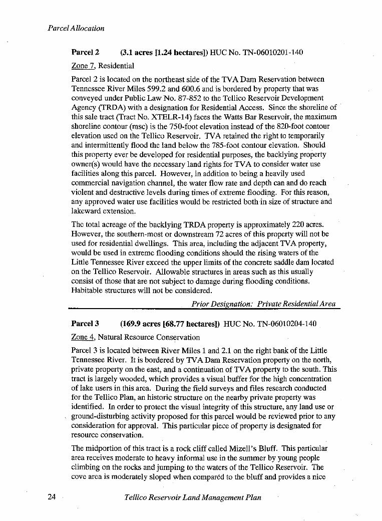
Parcel 2 (3.1 acres t1.24 hectares]) HUC No. TN-06010201-140
a, Residential
Parcel 2 is located on the northeast side of the TVA Dam Reservation between Tennessee River Miles 599.2 and 600.6 and is bordered by property that was conveyed under Public Law No. 87-852 to the Tellico Reservoir Development Agency (TRDA) with a designation for Residential Access. Since the shoreline of this sale tract (Tract No. XTELR-14) faces the Watts Bar Reservoir, the maximum shoreline contour (msc) is the 750-foot elevation instead of the 820-foot contour elevation used on the Tellico Reservoir. TVA retained the right to temporarily and intermittently flood the land below the 785-foot contour elevation. Should this property ever be developed for residential purposes, the backlying property owner@) would have the necessary land rights for TVA to consider water use facilities along this parcel. However, in addition to being a heavily used commercial navigation channel, the water flow rate and depth can and do reach violent and destructive levels during times of extreme flooding. For this reason, any approved water use facilities would be restricted both in size of structure and lakeward extension.
The total acreage of the backlying TRDA property is approximately 220 acres. However, the southern-most or downstream 72 acres of this property will not be - . - used for residential dwellings. This area, including the adjacent TVA property, would be used in extreme flooding conditions should the rising waters of the -
Little Tennessee River exceed the upper limits of the concrete saddle dam located on the Tellico Reservoir. Allowable structures in areas such as this usually consist of those that are not subject to damage during flooding conditions. Habitable structures will not be considered.
Prior Designation: Private Residential Area
Parcel 3 (169.9 acres [68.77 hectares]) HUC No. TN-06010204-140
Zone, Natural Resource Conservation
Parcel 3 is located between River Miles 1 and 2.1 on the right bank of the Little Tennessee River. It is bordered by TVA Dam Reservation property on the north, private property on the east, and a continuation of TVA property to the south. This tract is largely wooded, which provides a visual buffer for the high concentration of lake users in this area. During the field surveys and files research conducted for the Tellico Plan, an historic structure on the nearby private property was identified. In order to protect the visual integrity of this structure, any land use or ground-disturbing activity proposed for this parcel would be reviewed prior to any consideration for approval. This particular piece of property is designated for resource conservation.
The midportion of this tract is a rock cliff called Mizell's Bluff. This particular area receives moderate to heavy informal use in the summer by young people climbing on the rocks and jumping to the waters of the Tellico Reservoir. The cove area is moderately sloped when compared to the bluff and provides a nice
Tellico Reservoir Land Management Plan

Parcel Allocation
shelter for boaters who wish to take a break from the main channel. Sensitive resources have been identified on this site, and any proposed land disturbance must be coordinated with TVA's Cultural Resource staff.
Access to this parcel begins on the highway right-of-way from Highway 321 and continues on TVA land from that point.
Prior Designation: TVA Dam Reservation and Cultural/Public UselOpen Space Area
Parcel 4 (95.1 acres [38.48 hectares]) HUC No. TN-06010204-140
Zone3, Sensitive Resource Management
This parcel is between Little Tennessee River Mile 2.1 and 2.3 along the right descending bank and surrounds the Baker Hollow Cove. This tract of land is partially covered with a mixture of pine and hardwood forests, in addition to a small wetland in the inland point of the cove. This mixture of forest cover provides a year-round visual and noise buffer for people on both sides of the shoreline and should be maintained in such a way that these qualities are kept intact.
During the data collecting stage of this plan, several adult ospreys and sharp- shinned hawks were observed in the area. This cove provides an important foraging site for osprey, and the adjacent woods provide nesting andforaging habitat for the sharp-shinned hawk. Additionally, many of the shallow coves along Baker Hollow are used as foraging areas for breeding wood ducks. Because of the species of birds, wetland, and other remarkable characteristics found in this cove, this parcel is placed in Zone 3 to provide the protection it requires.
Prior Designation: CulturallPublic UselOpen Space Area
Parcel 5 (103.3 acres [41.82 hectares]) Various HUCs
Zone4, Natural'Resource Conservation
0 Islands
Parcel 5 is made up of numerous small islands, generally less than 10 acres (4.05 hectares) that dot the full length of the reservoir. Unless sensitive resources are identified on a particular island, it is zoned for Natural Resource Conservation. This designation allows the public to use islands for informal recreation activities such as camping, fishing, picnicking, etc., with little possibility of impacting a significant resource that normally requires special protection. Most of these islands have a mixture of pine or hardwood trees and offer the solitude that is often difficult to find on the mainland.
Prior Designation: CulturallPublic UselOpen Space Area
Tellico Reservoir Land Management Plan
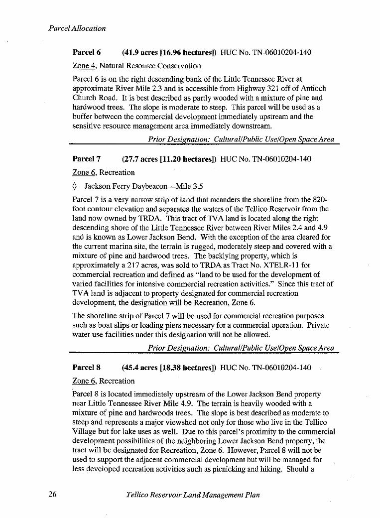
Parcel 6 (41.9 acres [16.96 hectares]) HUC No. TN-06010204-140
Zone4, Natural Resource Conservation
Parcel 6 is on the right descending bank of the Little Tennessee River at approximate River Mile 2.3 and is accessible from Highway 321 off of Antioch Church Road. It is best described as partly wooded with a mixture of pine and hardwood trees. The slope is moderate to steep. This parcel will be used as a buffer between the commercial development immediately upstream and the sensitive resource management area immediately downstream.
Prior Designation: CulturallPublic Uselopen Space Area
Parcel 7 (27.7 acres [11.20 hectares]) HUC No. TN-06010204-140
Zone, Recreation
0 Jackson Ferry Daybeacon-Mile 3.5
Parcel 7 is a very narrow strip of land that meanders the shoreline from the 820- foot contour elevation and separates the waters of the Tellico Reservoir from the land now owned by TRDA. This tract of TVA land is located along the right descending shore of the Little Tennessee River between River Miles 2.4 and 4.9 and is known as Lower Jackson Bend. With the exception of the area cleared for the current marina site, the terrain is rugged, moderately steep and covered with a mixture of pine and hardwood trees. The backlying property, which is approximately a 217 acres, was sold to TRDA as Tract No. XTELR-11 for commercial recreation and defined as "land to be used for the development of varied facilities for intensive commercial recreation activities." Since this tract of TVA land is adjacent to property designated for commercial recreation development, the designation will be Recreation, Zone 6.
The shoreline strip of Parcel 7 will be used for commercial recreation purposes such as boat slips or loading piers necessary for a commercial operation. Private water use facilities under this designation will not be allowed.
Prior Designation: CulturallPublic Uselopen Space Area
Parcel 8 (45.4 acres [18.38 hectares]) HUC No. TN-06010204-140
Zone 6 Recreation -7
Parcel 8 is located immediately upstream of the Lower Jackson Bend property near Little Tennessee River Mile 4.9. The terrain is heavily wooded with a mixture of pine and hardwoods trees. The slope is best described as moderate to steep and represents a major viewshed not only for those who live in the Tellico Village but for lake uses as well. Due to this parcel's proximity to the commercial development possibilities of the neighboring Lower Jackson Bend property, the tract will be designated for Recreation, Zone 6. However, Parcel 8 will not be used to support the adjacent commercial development but will be managed for less developed recreation activities such as picnicking and hiking. Should a
Tellico Reservoir Land Management Plan
Parcel Allocation
Greenway be developed along the east side of this part of the Tellico Reservoir, this parcel could serve as a terminal point for those who use this future amenity. If the conceptually proposed Greenway becomes a formal proposal, the compatibility of the proposal with this parcel's land use allocations or zoning would be considered and would be subjected to the appropriate level of additional environmental review. Regardless of the use for recreation, visual concerns would receive a high priority during any and all stages of development.
Prior Designation: Cultural/Public Uselopen Space Area
Parcel 9 (339.8 acres [137.5 hectares]) HUC No. TN-06010204-140
Zone4, Natural Resource Conservation
0 Navigation Safety Landing
0 Axley Chapel Daybeacon-Mile 6.1
This parcel is located on the right descending shore of the Little Tennessee River between approximate River Miles 5 and 6.2. This predominately wooded tract and its formed coves are the major viewshed for the residents of the Tellico Village. Lake users often enjoy mooring in these coves. In order to protect this viewshed and the other unique qualities found in the tract, this parcel has been placed in Natural Resources Management, Zone 4. Activities such as hiking, hunting, observing wildlife, and informal camping are often enjoyed on this section of TVA property.
The Tennessee Department of Environment and Conservation (TDEC) expressed an interest in the use of "this ribbon of land" to create a Greenway. Greenways are now recognized for their aesthetic value, the preservation of valuable open space for plants and wildlife, and the vast array of recreation opportunities afforded future generations. Since greenways generally require some infrastructure, such as trails, parking lots, and restrooms, and the primary focus is on recreation, the proposed Greenway would be placed in Zone 6, Recreation, while the balance of the land will remain in Zone 4, Natural Resource Conservation. If the conceptually proposed Greenway becomes a formal proposal, the compatibility of the proposal with this parcel's land use allocations or zoning would be considered and would be subjected to the appropriate level of additional environmental review.
There is a navigation safety landing located on the right descending shoreline of the Little Tennessee River at Mile 5.7. As in all safety landmgs along the commercial navigation channel on the Tellico Reservoir, construction of water- use facilities and shoreline alterations within the marked limits is prohibited. The only acceptable improvement would be the stabilization of the shoreline for the control of erosion. In addition to this safety landing, there are two navigational day boards located approximately at Little Tennessee River Mile 6.1.
The terrain on this parcel varies from moderate to steep, while the cover is for the most part a mixture of pines and a variety of hardwoods. With the exception of a few heavily used informal camp sites, this tract remains pristine and natural. A
Tellico Reservoir Land Management Plan 27
Parcel Allocation
small portion of the shoreline either qualifies or has outstanding access rights for private water-use facilities.
Douthit Cemetery remains private property with the deeded access rights intact and protected.
Prior Designation: Cultural/Public Uselopen Space Area
Parcel 10 (84.2 acres [34.08 hectares]) HUC No. TN-06010204-140
Zone6, Recreation
Parcel 10 is located on the right descending bank of the Little Tennessee River between River Miles 6.2 and 7.0 in the Coytee Springs area. Axley Chapel Road serves both as the landward boundary and road access to this parcel. With the exception of a sparse hardwood cover along the shoreline, this tract of TVA land is covered with variety of pine trees. The terrain is moderate. This parcel is heavily used for informal recreation activities such as camping and hunting.
This parcel is designated for day use recreation because of its capability to support a variety of recreation uses, ease of access, moderate terrain, and midpoint location between Lotterdale Cove and Lower Jackson Bend. Should the Tennessee Department of Environment and Conservation or other public agency develop a Greenway between these two points, this parcel could serve as an access hub for the Greenway day-use park.
If the conceptually proposed Greenway becomes a formal proposal, the compatibility of the proposal with this parcel's land use allocations or zoning would be considered and would be subjected to the appropriate level of additional environmental review.
If the conceptually proposed Coytee Springs Recreation Area becomes a formal proposal, the compatibility of the proposal with this parcel's land use allocations or zoning would be considered and would be subjected to the appropriate level of additional environmental review.
Prior Designation: CulturaNP~blic Uselopen Space Area
Parcel 11 (502.1 acres [203.18 hectares]) HUC No. TN-06010204-140
Zone, Natural Resource Conservation
This split tract of TVA land is located on the right descending bank of the Little Tennessee River between River Miles 7.0 and 9.4. The terrain ranges from very slight to moderate and is, for the most part, covered with a variety of hardwoods and patches of pine trees. Some of the upstream portions of this parcel are under interim agricultural contracts. For those concerned about navigation, there is a designated navigation safety landing located between River Miles 8.5 and 8.9.
This parcel is a major viewshed for the residents of the Tellico Village, as well as the lake users who enjoy this part of the Tellico Reservoir. In order to protect this viewshed and the other unique qualities found in the tract, this parcel has been placed in Natural Resource Conservation Zone 4. Activities such as hiking,
28 Tellico Reservoir Land Management Plan
Parcel Allocation
observing wildlife, and informal camping are often enjoyed on this parcel of TVA property. A potential Greenway proposal detailed in Parcel 9 is also included as a component of this parcel. The downstream segment of this parcel is accessible from h l e y Chapel Road while the upstream part can be accessed from the landward side of Lotterdale Cove Recreation Area.
Jackson Cemetery, which is located on this parcel, is privately owned. The deeded access rights to the cemetery remain intact and protected.
If the conceptually proposed Greenway becomes a formal proposal, the compatibility of the proposal with this parcel's land use allocations or zoning would be considered and would be subjected to the appropriate level of additional environmental review.
Prior Designation: CulturallPublic Uselopen Space Area
Parcel 12 (1.9 acres [0.78 hectare]) HUC No. TN-06010204-140
Zone6, Recreation
0 Popular Springs Recreation Area
Parcel 12 (XTTELR-13RE) still belongs to TVA, but the use of the land was conveyed to TRDA for Public Use Recreation purposes and is located approximately 2 miles south of the Tellico Dam on the Tellico Parkway. A concrete boat ramp, a fixedlfloating courtesy pier, and a parking lot for about 50 vehicles with attached boat trailers are located on this parcel. Since the primary purpose of this public access area is for the launching and loading of boats, activities such as swimming and fishing are not allowed at the boat ramp or on the courtesy pier.
Prior Designation: Public Use Recreation Area
Parcel 13 (222.1 acres 189.88 hectares]) HUC Nos. TN-06010204-140; W C NOS. TN-06010204-140-170
Zone7, Residential Access
0 Hall Ferry Lower Daybeacon-Mile 4.7: Hall Ferry Upper Daybeacon-Mile 4.9: Toliver Island Daybeacon-Mile 7.2: Fork Creek Daybeacon-Mile 11.3
This parcel, which follows the TVA property boundary as it meanders the shoreline from the 820-foot contour elevation, is designated for Residential Access. Under Contract No. W-6OOOOA, this parcel was defined as "shoreline strip" and is located along the left descending bank of the Little Tennessee River from Miles 3.6 to 11.9. The backlying property (property that touches TVA property) was formerly owned by TVA and was conveyed in two tracts to TRDA for the purpose of Residential Access. The tract numbers assigned to these two parcels are XTELR-14 and XTELR-12, with a total of 4,130 acres (1671.41 hectares). With a Residential Access designation and water access rights in place, water use facilities can be considered for approval. There are areas in this strip
Tellico Reservoir Land Management Plan 29

Parcel Allocation
where private water use facilities cannot be approved because the backlying property belongs to TRDA. These narrow strips are designated as "common property," and the private lots that touch them do not have the necessary land rights for the approval of private water use facilities.
Parcel 13 varies greatly in slope and cover types. Lot owners are encouraged to leave trees, which provide a natural stabilization to the shoreline and a visual and noise buffer not only for backlying property owners but for lake users as well. More and more lot owners realize this and leave the trees as they are and have only a pathway to reach their water use facility.
Prior Designation: Private Residential
Parcel 14 (44.7 acres [18.07 hectares] HUC Nos. TN-06010204-140; HUC NOS. TN-06010204-140-170
Zone, Natural Resource Conservation
This parcel is comprised of the "pocket inlets" that are either separated from the main reservoir by the construction of the Tellico Parkway or are located in the landward ends of coves where the rights for water use facilities do not exist. These small, scattered segments have a variety of vegetative covers, and the slope will vary from slight to sheer bluff. Some of these small segments have trees that line their shorelines, some contain functional wetlands, while others maintain an assortment of grasses and forbs. Since these covers are varied and the conducted surveys found no critical resources that required special protection, this parcel is designated as Zone 4.
The Tellico Parkway, which created many of these small segments, was transferred to TRDA as a limited-access, public use road and is identified as Tract No. XTELR-25. Though it connects Highway 321 to Highway 72, the portion that was conveyed to TRDA begins at the Tellico Village monument on the west end of the Tellico Dam Reservation and terminates at Highway 72 on the west for a total length of approximately 7.9 miles. By contractual agreement, it was subsequently conveyed to TDOT and is known as State Highway 444. The portion affecting the Dam Reservation is to be conveyed to TDOT in the near future.
Prior Designation: Residential Access
Parcel 15 (18.2 acres [737 hectares]) HUC No. TN-06010204-140
Zone3, Sensitive Resource Management
This relatively small parcel is located along the upper end of a small embayment on the right descending bank of the Little Tennessee River about River Mile 7. Part of this parcel is divided by a small road that connects with Axley Chapel Road and is sometimes used by hikers as an entry point to the adjoining TVA property. Just east of this parcel and off the reservoir is a privately-owned two- story log farmhouse that dates back to 1810. In order to protect the viewscape of this historic home, the vegetative buffer should remain between this structure and
30 Tellico Reservoir Land Management Plan
Parcel Allocation
TVA property. In addition, the surveys conducted on this parcel revealed several wetlands, and other sensitive resources. In order to fully protect these resources, any requests for facilities or activities on this parcel must be coordinated with the appropriate resource staff. If the conceptually proposed Greenway becomes a formal proposal, the compatibility of the proposal with this parcel's land use allocations or zoning would be considered and would be subjected to the appropriate level of additional environmental review.
Prior Designation: CulturallPublic Uselopen Space Area
Parcel 16 (26.3 acres r10.63 hectares]) HUC No. TN-06010204-140
Zone3, Sensitive Resource Management
Parcel 16 is located entirely on the east side of the East Tellico Parkway along both sides of Sinking Creek Embayment. With the exception of the small cleared land base sometimes used for agricultural purposes, the property is predominantly covered in hardwoods and a few pine trees. Our surveys found wetlands and cultural concerns not only along this cleared section but also along the upper reaches of Sinking Creek. For these reasons, Parcel 16 was designated for Zone 3. Just south of this parcel on private land is the National Campground which is on the National Register of Historic Places, The remaining structure still serves as a church pavilion and is claimed to be the oldest continuous undertaking of its type in the United States. To protect the visual integrity of this historic structure, as well as the other valuable resources that are a part of this parcel, any proposed land disturbance on TVA property must be coordinated with the appropriate resource staff.
Prior Designation: NaturallWildlife Area
Parcel 17 (2.4 acres [0.98 hectares]) HUC No. TN-06010204-140
Zone7, Residential Access
This parcel is divided along the shoreline by a segment of Parcel 16 because of the outstanding deeded rights of ingress/egress that apply to the individual pieces of Parcel 17. At these locations, TVA would consider requests from the adjoining property owner(s) for water use facilities. However, due to the narrow channel and the existence of several sensitive resources in the immediate area, the type and size of such facilities would be limited. There have been some small facilities authorized in this location. Parcel 17 is moderately steep with a combination of pine and hardwood trees which stabilize the shoreline and protect the view of the lake user from development in the immediate area.
Prior Designation: NaturallWildlife Area
Parcel 18 (8.6 acres 13.48 hectares]) HUC No. TN-06010204-140
Zone4, Natural Resource Consewation
This Sinking Creek Embayment parcel is moderately sloped and has predominantly pine forest cover with the exception of about one acre of field on
Tellico Reservoir Land Management Plan 31
Parcel Allocation
the southern most end. No sensitive resources were found and the parcel was placed in Natural Resource Conservation, Zone 4.
Prior Designation: NaturalIWildlife Area
Parcel 19 (44.0 acres [17.79 hectares]) HUC No. TN-06010204-140
_Zone, Recreation
0 Lotterdale Cove Recreation Area
Parcel 19 (X'MELR-14RE) is under permanent easement to TRDA for Public Use Recreation purposes and is divided into two segments. This parcel is used by the boating public. Amenities include a parking lot designed for vehicles with boat trailers and a double launching ramp. Near the ramp is a long pier that is used primarily by those who like to fish for crappie, bluegill, and other types of fish that depend on this sort of structure for cover and protection. This part of the Lotterdale Cove Recreation Area is available for public use year-round.
Those traveling by boat will find the access channel for the campground as well as the launching ramp near Little Tennessee River Mile 9.5 on the right descending bank. Highway access is available from the East Tellico Parkway.
Prior Designation: Public Use Recreation Area
Parcel 20 (82.0 acres [33.18 hectares]) HUC No. TN-06010204-140
Zone6, Recreation
0 Lotterdale Cove Recreation Area
0 Jackson Ferry Daybeacons (2FMile 9.7
This TVA fee land is under permanent easement to TRDA (XTTELR-14RE) for Public Use Recreation purposes. This parcel contains a fee campground with full hook-ups, swimming, and support facilities, and is connected by an access road from the East Tellico Parkway. TRDA has chosen to lease the management of this property and facilities to the private sector. This is a seasonal operation and is closed during winter months.
Parcel 20, with the exception of the commercial camping area, is heavily wooded with a slope that ranges from gentle to moderate. Those traveling by boat will find the access channel for the campground near Little Tennessee River Mile 9.5 on the right descending bank. By car, access is available from the East Tellico Parkway.
Prior Designation: Public Use Recreation Area
Parcel 21 (13.0 acres [5.25 hectares]) HUC No. TN-06010204-140
Zone3, Sensitive Resource Management
This small parcel is located just east of the East Tellico Parkway and is isolated from the main reservoir body by the highway. The northern section is gently
Tellico Reservoir Land Management Plan
sloped and is under an interim agricultural agreement. The slough that joins the Parkway and most of the interior of this parcel contains a series of wetlands that will be managed to enhance functions and values.
Prior Designation: CulturallPublic UselOpen Space Area
Parcel 22 (49.4 acres [20.00 hectares]) HUC No. TN-06010204-140
Zone4, Natural Resource Conservation
This parcel is located on the east side of the East Tellico Parkway and surrounds a slough that is not accessible by boat from the main part of the Tellico Reservoir. Most of this parcel is gently sloped and is covered with a mixture of pines and hardwoods. Just off the Parkway is an old road that is often used by lake users for informal recreation purposes. The water is shallow near the edge of this old road and the waves produced by watercraft on the main reservoir are blocked by the highway.
Immediately off TVA property and east of Parcel 22 are two dwellings of historic note. Both of these homes are currently in private ownership. To protect the visual integrity of these historic structures as well as other valuable resources that are a part of this parcel, any proposed land disturbance must be coordinated with the appropriate resource staff.
Prior Designation: CulturalIPublic UselOpen Space Area
Parcel 23 (140.1 acres r56.71 hectares]) HUC No. TN-06010204-140
Zone4, Natural Resource Conservation
Parcel 23 is located just south of the Lotterdale Cove Recreation Area and east of Jackson Island. By boat, this parcel is accessible east of Jackson Island from the Little Tennessee River at approximately River Miles 10.2 and 12.1. A large part of this property is covered with the typical mixture of hardwoods and pines, with a moderately steep slope to the water's edge. The parcel also contains areas of shallow soil and numerous rock outcroppings. Beginning on the east side of this parcel is an access road that connects the East Tellico Parkway. Blankenship Cemetery remains in private ownership, with the outstanding deeded rights for access and burial intact and protected.
Prior Designation: CulturaEIPublic ~ s e l o ~ e n Space Area
Parcel 24 (90.1 acres [36.45 hectares]) HUC No. TN-06010204-170
Zone3, Sensitive Resource Management
Jackson Island and the small island to the west represent a popular part of the Tellico Reservoir. Visually, these two islands are the most distinctive in the area and are readily seen not only by boaters but by those who live in the southern- most end of the Tellico Village. This parcel is accessible only by boat. Informal camping seems to be the most popular activity on Jackson Island because of its
Tellico Reservoir Land Management Plan 33
Parcel Allocation
short distance from the mainland. The small island currently supports an active great blue heron nesting colony.
Prior Designation: CulturalIPublic UselOpen Space Area
Parcel 25 (7.5 acres [3.02 hectares]) HUC No. TN-06010204-170
u, Recreation
0 Clear Creek Recreation Area
Parcel 25 (XTTELR-26RE) is under easement to TRDA for Public Use Recreation purposes. This public facility has a double launching ramp, a floating courtesy pier and a parking lot to accommodate about 50 vehicles with attached boat trailers. One reason for the popularity of this recreation area is its natural setting. Directly east, the first land seen after launching is the visually unique Jackson Island. To the south and at the entry point of Bat Creek is High Top (Bat Creek Knobs), which is one of the highest points on Tellico Reservoir. Another reason for this site's popularity is its reservoir midpoint location, which is about 10 River Miles from Vonore and about 11 River Miles from Fort Loudoun Reservoir.
Parcel 25 is just off the Tellico Parkway and with the exception of the parking lot, mostly wooded. The terrain varies from gentle to moderate. Since the primary
of this area is for the launching and loading of boats, activitiessuch as swimming and fishing are not allowed at the boat ramp or on the courtesy pier.
Prior Designation: Public Use Recreation Area
Parcel 26 (122.4 acres [49.52 hectares]) HUC No. TN-06010204-140
Zone3, Sensitive Resource Management
0 Navigation Dayboard-Mile 13.OR
This parcel is located on the right descending shoreline of the Little Tennessee River between approximate River Miles 12 and 13. The upstream portion has a distinctive bluff that can be seen by lake users and by residents of the Rarity Bay development located across the river. This section also contains a steep, forested terrain that is covered with exposed limestone. During the field surveys, several sensitive resources were identified. Because of these findings, Parcel 26 is placed in Zone 3 and will be managed in a way that will protect these valuable natural resources.
Prior Designation: Cultural/Public Uselopen Space Area
Parcel 27 (153 acres 16.21 hectares]) HUC No. TN-06010204-140
Zone7, Residential Access
This split parcel is located in two narrow sloughs located on the right descending shoreline of the Little Tennessee River at approximate River Miles 13 and 13.2. The topography ranges from moderate to steep. In both areas, the backlying or
34 Tellico Reservoir Land Management Plan
Parcel Allocation
adjoining property owners may qualify to purchase the necessary landrights required for the approval of water use facilities at a specific location along the shoreline. There are existing recreation easements in this area. The upstream segment of this parcel is adjacent to Griffitt's Keep Subdivision. The TVA property on the north side of this subdivision and the opposing shoreline is steep as well and creates a very narrow slough. Docks in this area may have a lakeward length restriction.
The downstream part of this parcel is essentially clear slope. Both segments of this parcel are located just west of East Tellico Parkway.
Prior Designation: Cultural/Public Uselopen Space Area
Parcel 28 (22.9 acres [9.28 hectares]) HUC No. TN-06010204-140
Zone4, Natural Resource Conservation
This parcel is located at Little Tennessee River Mile 13.1 on the right descending shoreline. With the exception of the interior "notch" that is naturally cut into this parcel, the typical mixture of hardwoods and pines is present. The slope on the downstream section is moderate, while the notch and the associated upstream peninsula are practically flat. No sensitive resources found in the area during the field surveys and some residential and shoreline development have occurred in the immediate area. Unauthorized vegetation removal affecting this parcel will be addressed appropriately.
Prior Designation: CulturallPublic Uselopen Space Area
Parcel 29 (31.9 acres [12.91 hectares]) HUC Nos. TN-06010204-140 and TN-06010204-150
Zone4, Natural Resource Conservation
Most of this split parcel is located immediately east of the East Tellico Parkway. The exception is a small portion that borders the shoreline of Baker Creek that is posted for informal recreation, day use only. The topography varies from low in the northern-most segments to road level over the remainder. The low area remains wet during the months of normal summer pool and is not accessible by boat from the main channel. Part of this parcel is road right-of-way and the remainder is covered with a mixture of pine and hardwood.
Prior Designation: Cultural/Public Uselopen Space Area
Parcel 30 (9.1 acres [3.68 hectares]) HUC No. TN-06010204-150
Zone7, Residential Access
Parcel 30 is a narrow strip of TVA property that fronts Foothills Pointe Subdivision. The parcel is located near Little Tennessee River Mile 13.5 and Mile 0.3 of Baker Creek. With the exception of the land near the Foothills Pointe Clubhouse and community docks, most of this parcel is covered with a mixture of pine and hardwoods. The topography of this parcel ranges from steep on the
Tellico Reservoir Land Management Plan 35
Parcel Allocation
downstream side to gentle on the upstream, Baker Creek side. Owners of lots that border this parcel qualify for the purchase of a recreation easement across TVA property. Once this easement is approved by the TVA Board of Directors and the permanent easement is granted, the lot owner has the necessary landrights in place that allows TVA to consider water use facilities along the shoreline that fronts their lot.
Prior Designation: Private Residential Area:
Parcel 31 (3.9 acres [1.58 hectares]) HUC No. TN-06010204-150
Zone, Sensitive Resource Management
This small parcel is located about Mile 0.75 on the right descending bank on a secondary channel known as Baker Creek and is on both sides of the East Tellico Parkway. Field surveys and files research conducted for this area indicated sensitive resources that require protective management. This area is affected by informal recreation use and is posted for day use only.
Prior Designation: CulturallPublic UselOpen Space Area
Parcel 32 (4.9 acres [1.98 hectares]) HUC No. TN-06010204-150
Zone7, Residential Access
Parcel 32 is located on the north side of the Baker Creek and is separated from this secondary channel and the Tellico Reservoir by the East Tellico Parkway. According to the outstanding deeded rights that govern this narrow tract of land, the adjoining land owner has "ingresslegress" rights (the right to apply for water use facilities) along this shoreline. Because this parcel is isolated from the main reservoir body, significant shoreline development is not anticipated.
This narrow tract of TVAproperty is very gently sloped from the water's edge and has a sparse covering of pine trees along most of the shoreline.
Prior Designation: Cultural/Public UselOpen Space Area
Parcel 33 (25.9 acres [10.47 hectares]) HUC No. TN-06010204-150
Zone4, Natural Resource Conservation
This parcel begins on a slough in Baker Creek and ends about Mile 1.2 of this secondary channel. In 1989, an easement was put in place for an underground gas pipeline that comes from the private property located to the east and crosses Baker Creek. The vegetation cover varies from light in the slough to heavily wooded on the Baker Creek side, and the slope is gentle to moderate throughout. No sensitive resources were identified during the field surveys and files research.
Prior Designation: Cultural/Public Uselopen Space Area
Tellico Reservoir Land Management Plan
Parcel Allocation
Parcel 34 (6.0 acres [2.41 hectares]) HUC No. TN-06010204-150
m, Natural Resource Conservation
This small parcel is divided by the East Tellico Parkway. Both sides have a sparse vegetative cover consisting of pine trees on a gentle slope. The northem-most end of this small parcel has ingresslegress rights for a specific adjoining property owner but it is located on the east side of the highway. Since the area is blocked from the reservoir by the parkway, access rights would be primarily used for the watering of livestock instead of water use facilities. No sensitive resources were found during the field investigations of this parcel.
Prior Designation: CulturallPublic UselOpen Space Area
Parcel 35 (5.7 acres 12.31 hectares]) HUC No. TN-06010204-150
Zone7, Residential Access
This narrow strip of land borders a segment of the northern shore of Baker Creek and has outstanding ingresslegress rights. Due to the narrow navigation channel of this location, length restrictions will apply to any water use facilities. This parcel is relatively flat with grass cover and a few hardwood clusters
Prior Designation: CulturallPublic UselOpen Space Area
Parcel 36 (20.6 acres 18.34 hectares]) HUC No. TN-06010204-150
Zone3, Sensitive Resource Management
The field surveys conducted on this parcel revealed several sensitive resources. The upstream segment of this parcel is covered with a mixture of pines and hardwoods, while the downstream portion is open. There are outstanding ingresslegress rights at defined locations within this parcel. Where the abutting property owner has ingressiegress rights, requests for water use facilities would be restricted as necessary to avoid and/or mitigate impacts to the existing resources
Prior Designation: Cultural/Public UselOpen Space Area
Parcel 37 (5.4 acres 12.19 hectares]) HUC No. TN-06010204-150
Zone4, Natural Resource Conservation
This parcel of TVA land is located on the north side of Baker Creek and has no direct contact with the normal waters of Tellico Reservoir. No sensitive resources were identified during the field surveys. The northem-most segment of this parcel is completely covered with a mixture of pines and hardwoods. The opposite side is clear of hard-stemmed vegetation. There are outstanding egress rights on this parcel.
Prior Designation: CulturallPublic UselOpen Space Area
Tellico Reservoir Land Management Plan 37

Parcel Allocation
Parcel 38 (2.7 acres [1.09 hectares]) HUC No. TN-06010204-150
Zone, Residential Access
This parcel has no sensitive resources that require special protection and has existing ingresslegress rights which would allow consideration of private water use facilities. This entire tract of land is covered with a mixture of pine and hardwood trees, and the slope is gentle. Because of the narrow stream in this part of Baker Creek, the length and size of any authorized water use facility would be limited.
Prior Designation: CulturallPublic UselOpen Space Area
Parcel 39 (152.1 acres [61.56 hectares]) HUC No. TN-06010204-150
Zone3, Sensitive Resource Management
Parcel 39 contains most of the upper reaches of Baker Creek. During the field surveys conducted for the development of this plan, several sensitive resources, including wetlands and rare terrestrial habitats, were identified. Any activity should be reviewed to ensure that the proposed project considers these sensitive resources. The initial segment of this parcel as traveled upstream should be managed to avoid visual impacts. Most of this long, meandering parcel is covered with a variety of hardwood and pine trees.
As on much of Baker Creek, there are existing ingresslegress rights available to some of the adjoining property owners. However, because of the physical characteristics of the stream and the surrounding TVA property, these rights would be used primarily for the authorized care and watering of livestock.
Prior Designation: CulturallPublic UselOpen Space Area
Parcel 40 (30.1 acres 112.17 hectares]) HUC No. TN-06010204-150
Zone4, Natural Resource Conservation
Field surveys did not identify any sensitive resource that requires special protection on this tract. Parcel 40 is gently sloped and completely covered with a variety of pine and hardwood trees. There is a small point that will qualify for a recreation easement but access to and use of the TVA shoreline property to an approved facility would be limited. This parcel will be managed for the enhancement of the natural resources.
Prior Designation: CulturallPublic Uselopen Space Area
Parcel 41 (9.2 acres r3.71 hectares]) HUC No. TN-06010204-150
Zone7, Residential Access
Parcel 41 is a strip of TVA land that fronts property (XTELR-16) transferred to TRDA for the purpose of residential development. Under this agreement, permits for privately-owned water use facilities and other land use approvals for residential shoreline alterations can be considered with the purchase of a recreation private
Tellico Reservoir Land Management Plan
Parcel Allocation
easement. Field surveys conducted for this plan, identified sensitive resources along parts of this shoreline. As these sites become involved in the purchase of a recreation easement, guidelines used to protect or mitigate sensitive areas will be applied.
Prior Designation: Private Residential Area and CulturallPublic Uselopen Space Area
Parcel 42 (26.0 acres [10.52 hectares]) HUC No. TN-06010204-150
Zone3, Sensitive Resource Management
Parcel 42 is located on the west bank of Baker Creek and borders the road right-of- way for East Tellico Parkway. About half of this tract is covered with a variety of pine trees, while the remaining half is a reverting field. The slope rises gently as it leaves the shoreline and rises sharply as it reaches the highway. Field studies revealed several sensitive resources that will be protected by Federal law or executive order.
Prior Designation: CulturalIPubEic Uselopen Space Area
Parcel 43 (19.1 acres [7.71 hectares]) HUC No. TN-06010204-150
Zone6, Recreation
0 Morganton Recreation Area
This property (XTTELR-15RE) is under easement to TRDA for Public Use Recreation purposes, The primary purpose of this area is for the launching and loading of boats, activities such as swimming and fishing are not allowed at the boat ramp or on the courtesy pier. The area has a launching ramp, courtesy pier, and a parking lot designed for about 40 vehicles with attached boat trailers. This area also sees considerable use by horseback riders and hunters as an access point to Morganton Peninsula (Wear Bend).
Prior Designation: Public Use Recreation Area
Parcel 44 (100.4 acres [40.63 hectares]) HUC Nos. TN-06010204-140 and TN-06010204-150
Zone5, Industrial/Commercial Development
0 Navigation Safety Landing-Mile 13.8R
0 Navigation Dayboards-Miles 13.7R and 18.1
This strip of land separates the waters of Tellico Reservoir from property XTELR- 10 that was conveyed to TRDA for Industrial/Commercia1 use and Development. This area is currently under a license agreement with the TWRA as a Wildlife Management Area (WMA). Under the license agreement, TWRA manages the shoreline strip as well as the adjoining TRDAproperty known as Morganton Peninsula (Wear Bend) for the benefit and enjoyment of the general public. This allows such temporary uses as hunting, hiking, picnicking, and interim uses in
Tellico Reservoir Land Management Plan 39

Parcel Allocation
agriculture. The purpose of this revocable license agreement is to allow the managed uses described above until TRDA decides to develop the tract.
The uppermost boundary of Parcel 44 is the 820-foot contour elevation and meanders from the Morganton Cemetery, which is privately owned and not included in this parcel, to the road right-of-way for Highway 411. The slope varies from gradual to vertical. Most of this shoreline is protected with a variety of trees and areas of rock outcroppings, while a relatively small portion is clear to the summer shoreline.
Prior Designation: Industrial Development Area
Parcel 45 (23.6 acres [9.54 hectares]) EIUC Nos. TN-06010204-140 and TN-06010204-160
Zone, Natural Resource Conservation
This strip of land that meanders along the 820-foot contour elevation borders a large tract of land (Tract No. XTELR-20) that was conveyed to TRDA with the designation of CulturalPublic Uselopen Space Area. During the early stages of planning the Tellico Project, the Bat Creek Knobs were used as a natural boundary between the future industrial and residential areas. Since these are among the highest points on the Tellico Reservoir, they still serve in that function today. The parcel is covered with a mixture of hardwood and pine trees and will be managed for natural resources. The road that accesses this property is located on the east side of State Highway 72 just north of the Bat Creek Bridge.
Prior Designation: Cultural/Public UselOpen Space Area
Parcel 46 (43.1 acres [17.44 hectares]) HUC Nos. TN-06010204-140 and TN-06010204-160
m, Residential Access
This narrow strip of shoreline fronts Rarity Bay Subdivision, a residential community that occupies a section of former TRDA-owned land. This segmented parcel meanders along the 820-foot contour elevation from the Bat Creek Bridge on Highway 72, around the Bat Creek Peninsula, ending at Little Tennessee River Mile 16.1. The placement of water use facilities and other types of shoreline alterations are restricted to areas that are defined in the recreation easement for Tract No. XTELR-158RE. The remaining lands are described in Parcels 47 and 48.
The recreation easement for Rarity Bay is governed by an Environmental Assessment prepared for the Bat Creek Peninsula designation change from Industrial to Residential Access. During that review several sensitive resources, including visual, were identified along the shoreline. Measures required for the protection of these resources are in place and regulated by the Environmental Assessment completed for the Rarity Bay project.
Tellico Reservoir Land Management Plan
Parcel Allocation
Rarity Bay has is own entrance on the east side of State Highway 72, about two miles north of Highway 411.
Prior Designation: Private Residential Area
Parcel 47 (27.8 acres [12.06 hectares]) HUC Nos. TN-06010204-140 and TN-06010204-160
Zone4, Natural Resource Conservation
This segmented parcel represents much of the remaining land that surrounds the Rarity Bay Subdivision and will serve as a buffer between the residential zones described in Parcel 46, (Recreation Easement XTELR-158RE). Sensitive resources were identified in some segments during the Environmental Assessment completed for Rarity Bay and no private water use facilities would be considered on this parcel. Any use or development of this property will be governed by the commitments of the environmental assessment.
The terrain on Parcel 47 varies from gentle to moderate slope and the vegetative cover ranges from a variety of hardwood and pines trees to a pasture-type setting.
Prior Designation: Private Residential Area
Parcel 48 (4.9 acres [1.98 hectares]) HUC Nos. TN-06010204-140 and TN- 06010204-160
Zone3, Sensitive Resource Management
Parcel 48 can best be described as sheer bluffs. The Environmental Assessment conducted for the Rarity Bay Subdivision defies these areas as visually distinctive and excludes them for consideration of any future development. Private water use facilities and/or ground disturbing activities on this parcel can not be authorized.
Prior Designation: Private Residential Area
Parcel 49 (14.0 acres [5.68 hectares]) HUC No. TN-06010204-160
Zone6, Recreation
Parcel 49 is a strip of land adjacent to property (portion of XTELR-20) that was sold to TRDA for commercial recreation development, and since impoundment has been viewed as a potential marina site. The TVA property meanders the 820- foot contour elevation along the left descending bank of Bat Creek between Mile 1.5 to about Mile 2. Most of this property, as well as the backlying TRDA property, is covered with a variety of pines, hardwoods and kudzu with a gentle to moderate slope.
Prior Designation: Commercial Recreation Area
Tellico Reservoir Land Management Plan

Parcel Allocation
Parcel 50 (37.1 acres 115.01 hectares]) HUC No. TN-06010204-160
m, Residential Access
These strips of land separate the Bat Creek Embayment from the narrow bands of property (Tract No. XTELR-20) conveyed to TRDA for Cultural/Public Uselopen Space Area purposes. Both outstanding ingresslegress rights and recreation easement qualifying points are present along this segmented parcel that meanders the 820-foot contour. This parcel lies along the upper end of the Bat Creek Embayment and the terrain ranges from slight to sheer bluff. The vegetative cover varies from a very dense mixture of pines and hardwoods to open fields. Informal recreation such as bank fishing is very common.
The shallow waters and narrow channels in the upstream portion will make the placement of water use facility difficult and the dock size and length more restrictive.
Prior Designation: Cultural/Public Uselopen Space Area
Parcel 51 (34.0 acres 113.74 hectares]) HUC No. TN-06010204-160
Zone4, Natural Resource Conservation
Parcel 51 is the balance of TVA-owned land fronting portions of TRDA property (Tract No. XTELR-20) and meanders along the 820-foot contour elevation. There are no outstanding or qualifying rights for water use facilities on this parcel and will serve as a riparian buffer. The terrain of this divided parcel varies from a very gentle slope to sheer rock bluff, Vegetative cover varies from open fields to heavy tree cover.
The northeast portion of the parcel is accessible by car from Highway 72, just north of the Bat Creek Bridge. The south and western-most portion is just off Highway 322, which connects to Highway 72 across from the entrance to Rarity Bay.
Prior Designation: CulturaWPublic UselOpen Space Area
Parcel 52 (129.8 acres [52.52 hectares]) HUC No. TN-06010204-140
Zone5, Industrial/Commercial Development
Parcel 52 is between the waters of Tellico Reservoir and land (XTELR-10) that was conveyed to TRDA for industrial development (Tellico West Industrial Park). The backlying property was conveyed to TRDA as Tract No. XTELR-10. This parcel follows the 820-foot contour stretches from Little Tennessee River Mile 16.5 to the head of Island Creek Embayment. Requests for the use of this narrow strip of TVA property will be for the support of indushial/commercial development and any use of this parcel that involves ground disturbing activities will require prior approval from TVA.
Tellico West Industrial Park currently has ten companies that employ approximately 5000 people. Increasing local employment and stimulating
Tellico Reservoir Land Management Plan
Parcel Allocation
economic development in the surrounding communities were two of the primary objectives for the Tellico Project. Projections for total industry and rate of employment have been exceeded, and the current trend continues to be positive.
Both entrances to this industrial park are located just north of the town of Vonore on Highway 72, which connects it to the newly widened 411 Highway and Interstate 75. Water is provided by the Tellico Area Service System (TASS) and a water treatment facility for both current and future industries is located on-site. Rail and barge services are also available.
During field surveys conducted for this plan, several sensitive resources were identified.
Prior Designation: Industrial Development Area
Parcel 53 (11.7 acres [4.72 hectares]) HUC No. TN-06010204-140
Zone7, Residential Access
This narrow strip of TVA-owned land (XTELR-17) fronts TRDA property and lies along the right descending bank of Island Creek. The backlying property was conveyed to TRDA for purposes of residential development. The shoreline is protected by a variety of pine trees and the natural slope is gentle to moderate. TVA retained the rights to intermittently and temporarily flood below the 822- foot contour elevation at this location. Field surveys conducted during this plan identified several sensitive resources.
Once development of the backlying property occurs, either the developer or neighboring property owner@) will qualify for the purchase of a recreation easement. However, due to shallow water along part of this parcel, private docks may not always be feasible. TVA will encourage use of community facilities rather than individual docks to serve this residential community.
Parcel 53 is accessible by traveling east from Highway 72 on Old Slag Road in the town of Voaore.
Prior Designation: Private Residential Access
Parcel 54 (18.5 acres [7.47 hectares]) HUC No. TN-06010204-140
Zone, Recreation
This parcel is affected by easements and a license agreements that were granted at no charge to the town of Vonore for public recreation and for purposes that otherwise benefit the general public. Some of the amenities authorized through these contracts include a public park with picnic tables and walking trails and a variety of public municipal buildings that are used for the benefit of Vonore. This parcel is located about 1.6 miles up Island Creek and is accessed from Old Slag Road in the town of Vonore.
Prior Designation: CulturallPublic Usefopen Space Area
Tellico Reservoir Land Management Plan 43
Parcel Allocation
Parcel 55 (17.3 acres [7.01 hectares]) HUC No. TN-06010204-140
Zone6, Recreation
0 Vonore Recreation Area
This parcel (XTTELR-16RE) is under easement to TRDA for Public Use Recreation purposes. This area's facilities include a parking lot designed for about 40 vehicles with boat trailers, a launching ramp, and a courtesy pier. The primary purpose of this area is for the launching and loading of boats, activities such as swimming and fishing are not allowed at the boat ramp or on the courtesy pier.
Parcel 55 is located just north of Old Slag Road in the town of Vonore. By boat, this parcel is located in Island Creek, which is on the left descending side of the Little Tennessee River near River Mile 16.5.
Prior Designation: Public Use Recreation Area
Parcel 56 (31.0 acres 112.56 hectares]) HUC No. TN-06010204-160
Zone5, Industrial/Commercial Development
This parcel fronts the Niles Ferry Industrial Park (Tract Nos. XTELR-5 and XTELR-6) conveyed to Monroe County, Tennessee for Industrial/Commercial development. Currently, this parcel, which meanders the 820-foot contour is under an interim license agreement with the Tennessee Wildlife Resources Agency (TWRA). The undeveloped portions of the Monroe County property are also under an agreement with TWRA. Both the TVA land and the Monroe County property are referred to in TWRA's Hunting Guide book as the Niles Ferry Unit.
At this writing, the Monroe County Industrial Development Committee has sold property to 5 industries while several more industries have expressed an interest at this location.
The Niles Ferry Industrial Park is located just off the newly widened 411 Highway. Water is supplied by the Tellico Area Service Systems and a waste water treatment plant serves not only the park but much of the local area as well. Rail and barge services are available.
Prior Designation: Industrial Development Area
Parcel 57 (16.2 acres [6.57 hectares]) HUC No. TN-06010204-140
Zone5, Industrial/Commercial Development
Parcel 57 is a narrow strip of land that meanders the 820-foot contour fronting land (XTELR-24) conveyed to TRDA for public port (barge) purposes. XTELR- 24 is adjacent to the Niles Ferry Industrial Park. This parcel is located on the left descending shore of the Little Tennessee River at Mile 19.9.
Prior Designation: Industrial Development Area
44 Tellico Reservoir Land Management Plan
Parcel Allocation
Parcel 58 (31.4 acres [12.71 hectares]) HUC Nos. TN-06010204-120 and TN-06010204-140
Zone4, Natural Resource Conservation
The primary use of this split section is to support the north face of Highway 411 and the bridge approaches. Field surveys conducted this plan found no sensitive resources. This parcel will be managed for highway protection, water quality and visual purposes.
Prior Designation: CulturalIPublic Uselopen Space Area
Parcel 59 (16.6 acres r6.73 hectares]) HUC No. TN-06010204-120 and TN-06010204-140
Zone5, Industrial/Commercia1 Development
This parcel of provides for protection of the right-of-way for Highway 411. the steep, tree lined banks serve as a visual and sound buffer for the adjacent industrial park. A small roadside park is located on the east end of this parcel. Access to the TVA radiological lab is located on the west end.
Prior Designation - Industrial Development Area
Parcel 60 (17.4 acres r7.04 hectares]) HUC Nos. TN-06010204-120 and TN-06010204-140
Zone5, 1ndustria11Commercia1 Development
This small tract of land identified as Tract No. XlTLER-5E was conveyed to Monroe County as part of the Niles Ferry Industrial Park (XTELR-5). TVA continues to hold the lease to this nrooertv which contains the Eastern Area
I . ,
Radiological Lab (EARL). The planned purpose of this one facility was to monitor environmental sarn~les taken from area nuclear plants. These services are now provided elsewhere, the facility is no longer in use and may be targeted for disposal in the future.
Prior Designation: Industrial Development Area
Parcel 61 (19.1 acres [7.73 hectares]) HUC No. TN-06010204-140
m, Industrial/Commercial Development
This parcel of land contains easements that were granted to Tellico Area Services System (TASS) for a water treatment plant, a maintenance building, storage area, and necessary roads. Since this parcel is highly visible from the reservoir, Highway 411, the Tellico Blockhouse access road, the easement areas and any improvements are required to be maintained and operated in good order and appearance to avoid possible adverse visual impacts. With the exception of an existing power line and the pump intake structure, the shore is lined with a variety of hardwood trees.
Prior Designation: Industrial Development Area
Tellico Reservoir Land Management Plan 45
Parcel Allocation
Parcel 62 (18.2 acres 17.35 hectares]) HUC No. TN-06010204-120
w, Industrial/Commercial Development
Parcel 62 is narrow strip of land that parallels the road right-of-way for Highway 411. Most of this parcel is covered with a mixture of pine and hardwood trees that serve along with the steep bank created by highway construction as a visual and noise buffer for travelers and surrounding neighboring property owners. The entrance to the TASS water treatment plant and the Tellico Blockhouse Historic site are located in the parcel.
Prior Designation: CulturallPublic Uselopen Space Area
Parcel 63 (900.5 acres 1364.35 hectares]) HUC Nos. TN-06010204-060; TN-06010204-070; TN-06010204-120; and TN-06010204-140
Zone6, Recreation
Parcel 63 consists of TVA land that has permanent rights and responsibilities transferred at no charge to the State of Tennessee Department of Environment - and Conservation in three separate easements. The Tellico Blockhouse (Tract No. XTTELR-7RE) is managed for public recreation, historic and scenic preservation, and wildlife management. Access to this parcel is provided by road easement Tract No. XTELR-9H. The Tellico Blockhouse was constructed in 1794 by then territorial governor William Blount upon the request of the Cherokee Indians. When Governor Blount stationed a small garrison of Federal troops in this newly built fort, the Indians saw this as a form of protection from the settlers moving into the territory. Governor Blount saw it as a way of controlling the settlerflndian situation during this turbulent time. In either case, the blockhouse was a major force for maintaining peace and order on the frontier. The original stone foundation of this structure can be easily reached by land after a short walk from the nearby parking lot or by boat via the courtesy dock located just inside the mouth of Nine Mile Creek. This parcel is located at Mile 20 on the right descending bank of the Little Tennessee River.
Fort Loudoun State Historic Park (Tract No. XTIELR-6RE). covers most of this island north of Highway 360 (Vonore-Citico Road). This land was conveyed to the State for public recreation, historic and scenic preservation, and wildlife management. Additionally easements were granted to the Fort Loudoun Association "for the purpose of operating and maintaining Old Fort Loudoun." Besides the historic fort and museum, there are other amenities such as hiking trails, beach area, picnic areas with a few pavilions, fishing pier and restroom facilities.
The third part of the parcel is the McGhee-Carson Peninsula (Tract No. XTTELR-28RE), over which the state was granted an easement for public recreation, historic and scenic preservation, and wildlife management. This area is under an interim agreement with TWRA and is managed as a WMA known as
Tellico Reservoir Land Management Plan
Parcel Allocation
the McGhee-Carson Unit which allows special hunts and field trials. The cemeteries located on this parcel remain in private ownership with outstanding deeded rights for access and burial.
Prior Designation: State Recreation Area
Parcel 64 (7.9 acres [3.20 hectares]) HUC No. TN-06010204-070
Zone, Sensitive Resource Management
Parcel 64 is located near the mouth of Nine Mile Creek overlooking the harbor of Tellico Harbor Marina and the Tellico Blockhouse Site. By agreement with the State of Tennessee, Department of Environment and Conservation, this parcel would be left in a natural, pristine state to protect the visual integrity as seen from Historic Fort Loudoun and the Tellico Blockhouse areas.
Prior Designation: CulturallPublic UselOpen Space Area
Parcel 65 (4.2 acres [1.72 hectares]) HUC No. TN-06010204-070
Zone7, Residential Access
This split parcel is a narrow, often steep strip of land that is covered with a variety of pine and hardwood trees. Several private docks are in place along the shoreline. Backlying property owners qualify for private recreation easements at this location so that requests for their water use facilities could be considered for approval. However, because of navigation concerns, length regulations would be imposed on any water use facilities.
Access to this parcel is available from Highway 411 on Clearview Road.
Prior Designation: Cultural/Public Uselopen Space Area
Parcel 66 (27.6 acres [11.16 hectares]) HUC No. TN-06010204-070
Zone, Natural Resource Conservation
This segmented parcel runs along Nine Mile Creek and ranges from moderately sloped open land to steeply sloped pine forest with hardwood patches. Highway 72 runs through or along a portion of this parcel and informal recreation is popular at the Highway 72 bridge. Backlying property owners at several points along the downstream portion of the parcel qualify for the purchase of private recreation easements. This parcel will be managed primarily as a riparian buffer.
Prior Designation: CulturallPublic UselOpen Space Area
Parcel 67 (17.3 acres [7.02 hectares]) HUC No. TN-06010204-070
Zone7, Residential Access
One part of this narrow strip of property meanders the right descending bank of Nine Mile Creek and fronts residential areas. Many backlying property owners
Tellico Reservoir Land Management Plan 47

Parcel Allocation
have outstanding rights of ingress/egress over this parcel. There is a sensitive wetland area which, may restrict the use of the property in the immediate area.
The other part of this parcel is on the left descending bank of Nine Mile Creek. - Backlying property owners along this part qualify to purchase private recreation easements. Due to navigation and other constraints facilities would be subject to - size restrictions.
Prior Designation: CulturallPublic UselOpen Space Area
Parcel 68 (77.0 acres [31.16 hectares]) HUC No. TN-06010204-070
m, Sensitive Resource Management
Both shorelines of this narrow stream are lined predominantly with hardwood and pine trees which provide bank stabilization and visual and noise buffer. Some of the backlying property owners adjacent to this parcel have either outstanding ingress/egress rights or would qualify for the purchase of a private recreation easement. Field studies conducted for this plan identified sensitive resources that require protection under Federal law or executive order. Other resources were identified that are ecological communities important to riparian zone management and water quality. Approval of docks and other shoreline amenities or alterations will be restricted as necessary to protect or mitigate impact to these resources.
Prior Designation: Cultural/Public UselOpen Space Area
Parcel 69 (13.0 acres C5.28 hectares]) HUC No. TN-06010204-070
m, Project Operations
This parcel is a narrow strip of property that contains a segment of Highway 72 which was relocated for the development of the Tellico Project (Road Project No. 65-2122). TVA transferred the easements and rights-of-way to the State of Tennessee for "highway purposes".
Prior Designation: State Highway
Parcel 70 (8.5 acres [3.45 hectares]) HUC No. TN-06010204-070
Zone7, Residential
Parcel 70 is the narrow strip of property that meanders along the 820-foot contour fronting Tellico Harbor Subdivision (XTELR-13). The backlying property (portion of XTELR-13) is described as Zone A in Supplement 3 of Contract TV- 60000A, which changed the original designation from Commercial Recreation to Residential Access and qualified backlying property owners to purchase private recreation easements.
Prior Designation: Private Residential Area
Tellico Reservoir Land Management Plan

Parcel Allocation
Parcel 71 (11.1 acres [4.47 hectares]) HUC No. TN-06010204-070
m, Recreation
Parcel 71 is a narrow strip of property that meanders along the 820-foot contour fronting property (portion of XTELR-13) which was conveyed to TRDA for Commercial Recreation Development. This property is the Tellico Harbor Marina site. Most of this property is used to contain the harbor limits that are approved for Tellico Harbor Marina. Within these harbor limits are boat slips, launching ramp with courtesy pier, gas pumps, pump-out station, lift station, dry storage, and floating restaurant.
Because of the heavy boat traffic common to marina areas, most of the shoreline of this parcel is stabilized with riprap. The remainder of the strip of land is protected with a mixture of pines and hardwoods.
Prior Designation: Commercial Recreation Area
Parcel 72 (9.1 acres [3.67 hectares]) HUC Nos. TN-06010204-060 and TN-06010204-070
Zone3, Sensitive Resource Management
Parcel 72 is a narrow strip of land that fronts property (XTELR-21) which was conveyed to TRDA for Cultural/Public UseJOpen Space Area. XTELR-21 is to be managed to protect and enhance the natural resources, scenic amenities, and be maintained in its natural state to preserve the natural, scenic view from the Fort Londoun State Historical Area.
The approximate location of this parcel is on the right descending shore between Little Tennessee River Miles 20 and 20.7 The shoreline varies from a moderate drop off to a high, sheer bluff. The parcel is completely covered with a mixture of pine and hardwood trees.
Prior Designation: CulturaEJPublic Uselopen Space Area
Parcel 73 (5.0 acres [2.01 hectares]) HUC No. TN-06010204-060
Zone7, Residential Access
Parcel 73 is located on the right descending bank of the Little Tennessee between River Miles 20.7 and 21.2, The backlying property represents a section of land (XTELR-13) conveyed to TRDA that has subsequently been developed as the Tellico Harbor Subdivision. Water access rights are in place to the adjoining property owners. Sensitive resources were identified that require special protection. As a result, water use facilities or other types of shoreline alterations cannot be considered for approval at these specific locations. And, because this area is within the viewshed of the Fort Loudoun Historic area, there are some restrictions to the type and appearance of approved water use facilities.
Tellico Reservoir Land Management Plan

Parcel Allocation
The downstream portion of this parcel is steep with a long drop-off to the water and is covered with a mixture of pines and hardwoods. The upstream section of this parcel has a moderate-to-slight slope to the water and is clear of hard-stem vegetation.
Prior Designation: Residential Access
Parcel 74 (387.5 acres [156.83 hectares]) HUC No. TN-06010204-060
Zone4, Natural Resource Conservation
Parcel 74, known as Carson Woods (Carson Island) and is located on the right descending bank of Little Tennessee River from Mile 21.3 upstream to the mouth of Hammontree Branch. Most of this parcel is covered with a mixture of pine and hardwood trees, with the exception of several small areas under interim agreements. One of these interim uses is a cooperative wildlife habitat development between the East Tennessee Bobwhite Chapter of Quail Unlimited and TVA.
TWRA and the Tennessee Department of Environment and Conservation have expressed interest in managing this property for (I) the wildlife habitat and (2) scenic integrity.
Several sensitive resources were identified and will remain protected. Calloway Cemetery, located within this parcel remains in private ownership, and interested parties have outstanding rights for access to and from this cemetery.
Access to this parcel is available from Highway 72 across from Carson Island Church.
Prior Designation: CulturallPublic Uselopen Space Area
Parcel 75 (19.4 acres v.86 hectares]) HUC No. TN-06010204-060
Zone7, Residential Access
Parcel 75 is divided by Hammontree Branch and is accessible to the main reservoir body through a culvert under Highway 72 that is large enough to handle most boat traffic. Hammontree Branch is located on the right descending shore of the Little Tennessee River at Mile 23.2. The backlying property owners have - - A - outstanding rights of ingress/egress which allows the authorization of private water use facilities and a limited amount of shoreline alteration.
With the exception of a few small areas, the shoreline is protected with a mixture of pines and hardwoods which serves as a natural buffer and visual screen. Parcel 75 has occasional steep terrain and but is predominantly gradually sloped.
Prior Designation: NaturallWildlife Area
Tellico Reservoir Land Management Plan

Parcel Allocation
Parcel 76 (21.2 acres [8.57 hectares]) HUC No. TN-06010204-060
Zone, Sensitive Resource Management
This parcel in the head of Hammontree Branch, is a mixture of pines, hardwoods open fields and is gently sloped. Water depth in this cove is shallow even in the summer months, which makes it conducive to continued establishment of wetlands in the area. Located on nearbv ~rivate land is a historic structure.
, L
Surveys conducted for the development of this plan identified several other sensitive resources. Due to these findings, this parcel will be managed for the protection and enhancement of these resources.
Prior Designation: NaturallWildlife Area
Parcel 77 (8.5 acres [3.43 hectares]) HUC No. TN-06010204-060
Zone4, Natural Resource Conservation
This small parcel is located on both sides of Hammontree Branch immediately upstream of the Highway 72 culvert. This parcel is affected by highway and road rights-of-way and would be managed as a riparian buffer.
Prior Designation: NaturallWildlife Area
Parcel 78 (108.2 acres [43.77 hectares]) HUC No. TN-06010204-060
Zone6, Recreation
0 Smoky Branch Recreation Area
Parcel 78 (XTTELR-19RE) was conveyed by easement to TRDA for public recreation use. This area is covered with a mixture of hardwood and pine trees with slopes ranging from gentle to moderate. The parcel, known as Smoky Branch Recreation Area, contains a parking launching ramp and courtesy pier. The primary purpose of this area is for boat access. Activities such as swimming and fishing are not allowed from the boat ramp or courtesy pier.
Prior Designation: Public Use Recreation Area
Parcel 79 (2344.5 acres [948.79 hectares]) HUC Nos. TN-06010204-060 and TN-06010204-180
Zone4, Natural Resource Conservation
0 Minor Commercial Landing
Parcel 79 is one of four separate WMAs on the Tellico Reservoir that are under agreement with TWRA.
This large parcel, with the exception of some breaks for other types of designated land uses, covers both sides of the Little Tennessee River from approximate Miles 23.3 to 33.1. TWRA holds a license agreement to use approximately 5,210 acres (2108.49 hectares) of land and water on the upper Tellico Reservoir for the management of a WMA and waterfowl refuge. This license has been renewed on
Tellico Reservoir Land Management Plan 51
Parcel Allocation
an annual basis since 1985. The arrangement with the state has proven very successful in achieving the long-term objectives of this arm of the Little Tennessee River. Therefore, the current agreement may be changed to an easement with longer tenure.
Located on the right bank of the Little Tennessee River at Mile 29.3 is a minor commercial landing site that is retained for the possible future use and handling of barge shipments.
Field studies conducted for the Tellico Plan identified several sensitive resources which supports the Ecological Study Area and Wildlife Observation Area located within this parcel.
Prior Designation: CuEtural/Public Uselopen Space Area and NaturallWildlife Area
Parcel 80 (611.5 acres [247.47 hectares]) HUC No. TN-06010204-060
Zone4, Natural Resource Conservation
Parcel 80 is within the Tellico WMA boundary and is under a separate agreement as the Chota Waterfowl Refuge. In order for TWRA to meet the objectives of this agreement, the refuge area may be closed to public-use activities, such as boating, hunting, and pedestrian and vehicular traffic at certain times of the year. Pedestrian and vehicular access will be open at all times to the Chota Memorial Site and the Jones Cemetery.
This refuge is located between Little Tennessee River Miles 25.8 and the Hiwassee-Alcoa power line (river 29.8). This unit is approximately 2,400 acres (971.28 hectares); with 611.5 acres over land and the remainder over water.
Prior Designation: CulturallPublic Uselopen Space Area
Parcel 81 (29.0 acres [11.73 hectares]) HUC No. TN-06010204-060
Zone 6 Recreation ->
0 Chota Memorial Site
The Eastern Band of Cherokee Indians were granted a permanent easement over this parcel (XTTELR-30RE), Chota Memorial Site, for the memorial and associated activities. Chota was the capital of the Cherokee nation during a portion of the 18Ih century and appears to have joined the town site of Tanasi located just downstream. Currently, this area has a parking lot that will accommodate about 30 vehicles and an interpretive trail on the peninsula that leads to the monument marking the former Overhill Cherokee town. This area is located at Little Tennessee River Mile 26.3 within the boundaries of the Chota Waterfowl Refuge
Prior Designation: Eastern Band of the Cherokee Indians Memorial Site
Tellico Reservoir Land Management Plan
Parcel Allocation
Parcel 82 (2.1 acres 10.84 hectares]) HUC No. TN-06010204-060
Zone6, Recreation
0 Tanasi Memorial Site
This small parcel of is the Tanasi Memorial Site located just downstream of the Chota Memorial Site. Under an agreement with TVA, the Tennessee Historical Commission Foundation maintains a memorial to commemorate Tanasi town site. Parcel 82 is within the Chota Waterfowl Refuge.
Prior Designation: State Recreation Area
Parcel 83 (1.8 acre 10.72 hectares]) HUC No. TN-06010204-060
Zone, Recreation
0 Harrison Branch Recreation Area
Parcel 83, (XTTELR-20RE) Harrison Branch Recreation Area, was conveyed to TRDA for public recreation purposes. The area is located on the right descending shore of the Little Tennessee River approximately 2.5 miles downstream of the Chilhowee Dam. A launching ramp, courtesy pier, and parking lot that can hold about 30 vehicles are located on this site. Activities such as swimming and fishing are not allowed at the boat ramp or the courtesy pier.
Prior Designation: Public Use Recreation Area
Parcel 84 (2.2 acres 10.89 hectares]) HUC No. TN-06010204-060
Zone6, Recreation
0 Tallahassee Recreation Area
Parcel 84, (XTELR-21RE) was conveyed to Tallahassee Recreation Area for public recreation purposes. The recreation area is located on Highway 72 along the right descending shore of the Little Tennessee River approximately 314 mile downstream of the Chilhowee Dam. A launching ramp, courtesy pier, and parking lot that will hold about 20 vehicles are located on this site. Activities such as swimming and fishing are not allowed at the boat ramp or on the courtesy pier.
Prior Designation: Public Use Recreation Area
Parcel 85 (70.2 acres [28.40 hectares]) HUC No. TN-06010204-060
Zone4, Natural Resource Conservation
Parcel 85 is not included in the TWRA's Tellico WMA and is currently under an interim agricultural agreement. The topography is flat and for the most part is open with hardwood trees along the shoreline. Files research indicates that sensitive resources may be in this area.
Prior Designation: CulturalJPublic Uselopen Space Area
Tellico Reservoir Land Management Plan 53

Parcel Allocation
Parcel 86 (2.0 acres [0.82 hectare]) HUC No. TN-06010204-060
Zone6, Recreation
0 Citico Recreation Area
Parcel 86 (XTELR- 22RE) was conveyed to TRDA for public recreation purposes. The area is located on the left descending shore of the Little Tennessee River a~proximatelv 1.75 miles downstream of the Chilhowee Dam. A courtesv
a.
pier and parking lot are on this parcel. Activities such as swimming and fishing are not allowed at the boat ramp or on the courtesy pier.
Prior Designation: Public Use Recreation Area
Parcel 87 (78.6 acres [31.8 hectares]) HUC No. TN-06010204-060
Zone4, Natural Resource Conservation
Parcel 87 is located on the left descending shore of the Little Tennessee River at approximate River Mile 23.2 and is divided by Miller Road. Field surveys identified several areas with sensitive resources. Even though this parcel is designated as a conservation zone, parts of it will be protected as defined in Sensitive Resource Management.
The lakeward side of this parcel receives some informal recreation use by the general public. The existing wetlands and gentle slope make this property attractive for wildlife observation during certain times of the year. The McGhee Cemetery located on this parcel is in private ownership with deeded access rights.
Prior Designation: CuEtural/Public Uselopen Space Area
Parcel 88 (21.1 acres [8.52 hectares]) HUC No. TN-06010204-060
Zone6, Recreation
0 Toqua Campground and Day-use Area
Parcel 88 (XTTELR-18RE) was conveyed to TRDA for public recreation purposes. This fee recreation area contains a campground with full hook-ups, beach area, fishing pier and launching ramp with courtesy pier. TRDA has chosen to lease this facility to the private sector. The area is closed during the winter months.
Parcel 88 is located on the left descending shore of the Little Tennessee River at approximate Mile 22.2. Highway access is provided by the Citico Road.
Prior Designation: Public Use Recreation Area
Parcel 89 (45.2 acres [18.29 hectares]) HUC No. TN-06010204-060
Zone6, Recreation
0 Toqua Recreation Area
Parcel 89 (XTTELR-18RE) was conveyed to TRDA for public recreation purposes. The amenities include a parking lot, double launching ramp, and
54 Tellico Reservoir Land Management Plan
Parcel Allocation
courtesy pier. Activities such as swimming and fishing are not allowed at the boat ramp or courtesy pier.
This area is accessible from Vonore by Highway 360 (Citico Road) and is located along the left descending bank of Little Tennessee River at Mile 22.
Prior Designation: Public Use Recreation Area
Parcel 90 (12.6 acres [5.08 hectares]) HUC No. TN-06010204-060
Zone3, Sensitive Resource Management
Parcel 90 is a small tract located just upstream of Toqua Recreation Area and is split by Highway 360 (Citico Road). Field studies identified several sensitive resources on the parcel. Any proposed land-disturbing activities would require additional review. Outstanding deeded ingresslegress rights affect the southwest portion of this parcel.
Prior Designation: CulturallPublic Uselopen Space Area
Parcel 91 (24.1 acres 19.76 hectares]) HUC No. TN-06010204-060
Zone6. Recreation
This parcel, known as "the Boot", serves as a buffer between the Toqua Recreation Area and the TDEC-managed McGhee-Carson Unit. TDEC has expressed an interest in managing this parcel for recreation purposes. With the exception of the "toe" and the outside borders, this parcel is clear of hard- stemmed vegetation and is under an interim agricultural agreement. Field surveys identified sensitive resources exist. These resources will be addressed as future management decisions are made on this parcel.
This parcel of TVA land is located off of Highway 360 (Citico Road) across from Toqua Church.
Prior Designation: CulturallPublic Uselopen Space Area
Parcel 92 (7.9 acres [3.18 hectares]) HUC No. TN-06010204-120
Zone2, Project Operations
Parcel 92 consist of the bridges and approach fills for Highway 360 which has been transferred to the Monroe County Highway Department. This road and the bridges are identified as Project No. 65-7047, Vonore-Toqua Road.
Prior Designation: Highway
Parcel 93 (65.0 acres [26.29 hectares]) HUC No. TN-06010204-120
Zone6, Recreation
0 Sequoyah Birthplace and Memorial Museum
Parcel 93 (XTIELR-27RE) is located on Fort Loudoun Island along the south side of Highway 360 (Citico Road). Included in this parcel is a small island
Tellico Reservoir Land Management Plan 55
Parcel Allocation
located at Tellico River Mile 2.1. The Eastern Band of Cherokee Indians were granted a permanent easement over this parcel for public/commercial recreation -use and development in association with this memorial of the American Indians' presence in the Tellico Reservoir project area. Current facilities and attractions include a parking lot, courtesy pier, pavilion, amphitheater, the Sequoyah Birthplace Museum, and the Cherokee Memorial (the final resting place of 191 individuals whose remains were exhumed prior to inundation of the Cherokee village in 1979).
If the conceptually proposed Eastern Band of Cherokee Indians Development becomes a formal proposal, the compatibility of the proposal with this parcel's land use allocations or zoning would be considered and would be subjected to the appropriate level of additional environmental review.
Prior Designation; Eastern Band of the Cherokee Indians Memorial Site
Parcel 94 (37.5 acres [27.5 hectares]) HUC Nos. TN-06010204-120 and TN-06010204-140
Zone6, Recreation
Parcel 94 includes 12.5 acres of land (Tract No. XTTELR-17RE) that was conveyed to TRDA for public recreation purposes. The parcel is located along Highway 411 immediately east of the Little Tennessee River bridge. The Eastern Band of the Cherokee Indians have expressed interest in use of this parcel for commercial recreation purposes. Much of the area is covered with a mixture of hardwoods, some pine trees and a kudzu infestation. Slope ranges from gentle to moderate. A small parking lot, launching ramp and fishing pier are located on the TRDA easement portion of this parcel.
Prior Designation: Public Use Recreation Area and Cultural/Public Uselopen Space Area
Parcel 95 (68.0 acres [27.52 hectares]) HUC Nos. TN-06010204-120 and TN-06010204-140
m, Recreation
Parcel 95 is located on the left descending bank of the Tellico River between River Mile 0.5 and the Citico Bridge. The terrain is gently sloped and for the most part is used for pasture under an interim agricultural agreement. Two private recreation easements are located on this parcel in the slough near Citico Bridge. No other properties adjoining this parcel qualify for easements.
The location of this tract in the developing area of Vonore makes the site desirable for a future public recreation use.
Prior Designation: CulturallPublic Uselopen Space Area
Tellico Reservoir Land Management Plan

Parcel Allocation
Parcel 96 (13.4 acres r5.42 hectares]) HUC No. TN-06010204-120
Zone6, Recreation
Parcel 96 is affected by a permanent easement (XTTELR-29RE) to the Eastern Band of Cherokee Indians over that portion above the 820-foot contour for the purpose of future home sites for the employees of the Sequoyah Memorial Project. No lake access or other rights were conveyed under the easement below the 820-foot contour. This parcel is covered with a mixture of hardwood and pine trees and is located on the west side of Citico Road on the left descending bank of the Tellico River at approximate Mile 1.5.
Prior Designation: Eastern Band of the Cherokee Indians Memorial Site
Parcel 97 (79.1 acres [32.01 hectares]) HUC No. TN-06010204-120
Zone4, Natural Resource Conservation
This parcel begins on the left descending shore of the Tellico River at approximate Mile 1.6 and runs the entire length along the north side of Fourmile Creek. From the mouth of Fourmile Creek to the small slough at Niles Ferrv - Road, the parcel is largely covered with hardwood trees and small areas of pine trees. From the slough at Niles Ferry Road to the head of Four Mile Creek, this - segment becomes narrow and is used primarily for road right-of-way. Early in the development of the Tellico Project several private recreation easements were granted in this area. However, due to highway safety and other concerns, recreation easements are no longer considered at this location. Outstanding ingresslegress rights also affect the parcel.
Two historic structures are located on private land in the immediate vicinity of this parcel. The parcel will be managed as a riparian buffer and to protect the visual integrity of these structures.
Prior Designation: CulturaNPublic Uselopen Space Area
Parcel 98 (27.8 acres [I125 hectares]) HUC No. TN-06010204-120
Zone7, Residential
Parcel 98 is the narrow ship of land fronting Kahiti Subdivision. It meanders the 820-foot contour along Fourmile Creek and portions of Tellico River. Kahiti Subdivision is located on land XTELRl8 that was conveyed to TRDA for residential development.
Water use facilities may be considered once they have been reviewed and approved by the Tellico Village Architectural Control Committee. Shoreline development in this subdivision is governed by the master plan for Tellico Village.
Tellico Reservoir Land Management Plan
Parcel Allocation
Parcel 98 varies in forest cover types from pine-hardwood mixes to pure pines, hardwoods and open fields.
Prior Designation: Private Residential
Parcel 99 (3.0 acres [1.2 hectares]) HUC No. TN-06010204-120
Zone3, Sensitive Resource Management
0 Kahite Subdivision
0 Navigation Dayboards
This split parcel meanders the 820-foot contour and serves as a visual buffer between Tellico Village's Kahiti Subdivision and Fort Loudoun State Historical Area and the Sequoyah Museum. The parcel fronts land (XTELR-21 and -22) that was conveyed to TRDA for this same purpose and is now part of Kahiti Subdivision. Parcel 99, has a variety of tree cover and will be maintained in its natural state. Private water use facilities can not be considered for approval on this parcel. However, bank stabilization through the use of riprap or bioengineering techniques may be considered.
Prior Designation: CulturalIPublic Uselopen Space Area
Parcel 100 (17.3 acres [6.99 hectares]) HUC No. TN-06010204-120
Zone4, Natural Resource Conservation
Parcel 100 is located in on the north shore of Corntassel Branch between Kahite and Lakeview Shores Subdivisions. The majority of this parcel is currently open field with tree cover along the shoreline. Some informal recreation occurs on the parcel. Field surveys identified areas of several sensitive resources. Because of these findings, any proposed use or activity for this parcel will be reviewed and approved by the appropriate staff. Future management decisions will address these resources as necessary.
Prior Designation: Cultural/Public Uselopen Space Area
Parcel 101 (11.9 acres [4.8 hectares]) HUC No. TN-06010204-120
Zone7, Residential Access
Parcel 101 fronts Lakeview Subdivision on the north shore of Corntassel Branch and Corntassel Shores Subdivision on the south shore. This entire parcel is affected by outstanding ingresslegress rights or would qualify for the purchase of private recreation easements. However, since some sensitive resources were identified on both sides of Corntassel Branch, any request for private facilities will be closely reviewed prior to approval.
Prior Designation: Cultural/Public Uselopen Space Area
Tellico Reservoir Land Management Plan
Parcel Allocation
Parcel 102 (20.9 acres [S.47 hectares]) HUC No. TN-06010204-120
Zone3, Sensitive Resource Management
Files research and field surveys conducted on this parcel for the plan identified several sensitive resources that require protective management. Parcel 102 is separated from the Tellico Reservoir by Corntassel Road and Chote View Road. Existing ingresslegress rights affect portions of this area. However, due to isolation from the main reservoir body and size of these embayments, shoreline development is not likely to occur at this location.
Prior Designation: CulturallPublic UselOpen Space Area
Parcel 103 (100.6 acres r40.69 hectares]) HUC Nos. TN-06010204-120 and TN-06010204-130
Zone, Natural Resource Conservation
This large, tree-covered parcel is located at Tellico River Mile 4.3, between Corntassel Branch and Notchy Creek. Field surveys conducted on this parcel identified isolated areas with sensitive resources requiring protective management, but the balance of the land will be managed for forest and wildlife purposes. A few areas qualify for the purchase of a private recreation easement. Avoidance or mitigation would be required for any proposal which could affect sensitive resources. Any access across TVA property to the approved water use facility would be limited to a pathway only.
Prior Designation: CuEturallPublic UselOpen Space Area
Parcel 104 (104.1 acres [42.13 hectares]) HUC No. TN-06010204-120
a, Natural Resource Conservation
Parcel 104 is located betweenHighway 360 (Citico Road) and Mile 3.6 on the right descending bank of the Tellico River. The northern edge of this parcel faces the Sequoyah Memorial Museum and the Fort Loudoun State Park and is considered part of the viewshed. Field studies identified sensitive resources at specific locations. Part of Parcel 104 will be managed for protection of the viewshed. While the balance will be managed for wildlife and forestry. A mixture of pine and hardwood trees covered a large part of this gently sloped parcel. The cleared areas on the ends are in interim agricultural use. Two secondary channel markers rest on the northem-most tip of this parcel. The westem-most part of this tract abuts Thunder Point Subdivision.
Prior Designation: CulturalIPublic Uselopen Space Area
Parcel 105 (10.5 acres [4.24 hectares]) HUC No. TN-06010204-120
Zone, Residential
Parcel 105 is a narrow strip located on the right descending bank of the Tellico River at approximate Mile 3.9. Secondary channel markers are located on both
Tellico Reservoir Land Management Plan 59
Parcel Allocation
ends. This partially cleared parcel has outstanding ingresslegress rights within certain boundaries. Field survevs identified several sensitive resources. Anv proposals for structures or other types of land-disturbing activities will be reviewed prior to approval.
Prior Designation: CulturallPublic Uselopen Space Area
Parcel 106 (55.1 acres r22.29 hectares]) HUC No. TN-06010204-120
Zone4, Natural Resource Conservation
Parcel 106 is gently sloping and covered with trees in the middle but essentially clear on both ends. Most of this property will be managed for purposes of wildlife and forestry. Sensitive resources were identified including visual concerns, which would be addressed as necessary in making future decisions regarding the use of this parcel.
Prior Designation: CulturalIPublic Uselopen Space Area
Parcel 107 (18.6 acres 17.51 hectares]) HUC No. TN-06010204-120
Zone7, Residential
Parcel 107 is located at Tellico River Mile 5 along the right descending bank. The terrain varies as it leaves the water from gentle to moderately steep, and vegetation coverage varies from clear to mixture of pines and hardwoods. Several private recreation easements have been granted throughout this parcel. The remaining adjoining lot owners would qualify to purchase an easement.
Prior Designation: NaturallWildlife Area
Parcel 108 (193.7 acres r78.39 hectares]) HUC No. TN-06010204-120
Zone4, Natural Resource Conservation
Parcel 108 has a high potential for forestry and wildlife management, especially when linked with the adjacent opposite shore parcels. A request from TWRA and TDEC further supports the designation of this parcel for natural resource conservation. This large parcel is located on the right descending bank of the Tellico River between Miles 5 and 6. The parcel is covered with a mixture of pines and hardwoods and small openings. Slopes vary from steep to gradual and the area is used for informal recreation uses such as mooring, camping and bank fishing. Field surveys and files research identified several sensitive resources. These areas would be considered in future management decisions. On the upstream end two small areas qualify for the purchase of private recreation easements. This location is currently under an interim agricultural agreement. The parcel supports a navigational day board that marks this secondary channel.
Prior Designations: CulturalIPublic Uselopen Space Area and NaturallWildlife Area
60 Tellico Reservoir Land Management Plan
Parcel Allocation
Parcel 109 (3.0 acres [1.21 hectares]) HUC No. TN-06010204-120
Zone7, Residential Access
This narrow strip is located in Kennedy Branch and is clear of any hard-stem vegetation. Outstanding ingresslegress rights allow the approval of private water use facilities across the entire parcel. No sensitive resources were identified. Under these conditions, this parcel is designated as Zone 7 and will be managed as Residential Access. Currently, there are approved private water use facilities on this parcel.
Prior Designation: Cultural/Public Uselopen Space Area
Parcel 110 (274.2 acres [110.96 hectares]) HUC No. TN-06010204-120
Zone4, Natural Resource Conservation
Parcel 110 is a large parcel that is completely covered with a mixture of pines and hardwoods except for two small sections located east of Highway 360 (Citico Road). The terrain varies from moderate to steep with small, visually significant coves that offer a quiet getaway for lake users.
The two small sections located on the east side of Hiehwav 360 are isolated from - the main body reservoir. Outstanding ingresslegress rights exists in each of these sections but the likelihood of significant shoreline development would be minimal
No sensitive resources requiring protective management were identified. When linked with the adjoining parcels; this parcel has high partnership opportunities with other organizations such as the National Wild Turkey Federation and TWRA. ~nformal recreation activities such as hunting, bank fishing and camping are common uses.
Prior Designations: CuEtural/Public Uselopen Space Area and NaturallWildlife Area
Parcel 111 (10.7 acres 14.33 hectares]) HUC No. TN-06010204-120
Zone, Residential
This parcel is located on the right descending bank of the Tellico River at approximate Mile 6.8 and fronts the Lost Village Subdivision. Several private recreation easements have been granted throughout this parcel. The remaining adjoining lot owners would qualify to purchase an easement. Because of current guidelines concerning the removal of vegetation, access will be more restrictive.
Prior Designation: Natural/Wildlife Area
Tellico Reservoir Land Management Plan

Parcel Allocation
Parcel 112 (45.6 acres [18.44 hectares]) HUC No. TN-06010204-130
Zone6, Recreation
The land for Parcel 112 (XITELR-25RE) was conveyed to TRDA for public recreation purposes. The area, covered with a mixture of pines and hardwoods, is currently undeveloped but could be developed to meet future recreation demand.
Prior Designation: Public Use Recreation Area
Parcel 113 (10.1 acres [4.08 hectares]) HUC No. TN-06010204-130
Zone6, Recreation
0 Notchy Creek Recreation Area
Parcel 113 (XT17ELR-25RE) was conveyed to TRDA for public recreation purposes. Known as the Notchy Creek Recreation Area (Razors Landing), it is located about three quarters of a mile up the Notchy Creek Embayment, Tellico River Mile 4.7. The area is under a management contract with Monroe County and facilities include a parking, launching ramp, courtesy pier and several picnic tables.
Prior Designation: Public Use Recreation Area
Parcel 114 (31.9 acres [12.92 hectares]) HSJC No. TN-06010204-130
Zone6, Recreation
0 Notchy Creek Campground
Parcel 114 (XTTELR-25RE) was conveyed to TRDA for public recreation purposes. This parcel contains a fee campground with full hook-ups, swimming and support facilities. TRDA has chosen to lease the management of these facilities to the private sector and is closed during the winter months.
Most of this parcel is covered with a mixture pine and hardwood trees. '
Prior Designation: Public Use Recreation Area
Parcel 115 (19.7 acres [7.99 hectares]) HUC No. TN-06010204-130
Zone 3, Sensitive Resource Management
This segmented parcel has several sensitive resources. Located on the left descending bank of Notchy Creek and along Corntassel Road, this area is easily accessed by boat or car. The parcel provides informal recreation such as picnicking, bank fishing and offers some riparian protection.
One private recreation easement was previously granted across the road from the Camp and Davidson Subdivision. Under this allocation, no future easements would be granted.
Prior Designation: NaturallWildlijie Area
Tellico Reservoir Land Management Plan
Parcel Allocation
Parcel 116 (28.9 acres [11.69 hectares]) HUC No. TN-06010204-130
Zone4, Natural Resource Conservation
With the exception of a small, tree-lined slough, this narrow strip of land serves primarily as road right-of-way for Notchy Creek Road. The lakeward segment of this parcel receives some informal recreation use such as bank fishing and camping. In the southern slough, there are outstanding ingresslegress rights, but because this area is isolated from the main reservoir body, the likelihood of significant shoreline development would be minimal. Field surveys identified several sensitive resources and any proposal for land disturbing activities would require review. This parcel will be managed primarily as a riparian buffer.
Prior Designation: NaturallWildlife Area
Parcel 117 (645.1 acres [261.05 hectares]) HUC Nos. TN-06010204-100: - TN-06010204-120 and TN-06010204-130
Zone3, Sensitive Resource Management
This large parcel includes the western-most end, the entire right descending bank of Notchy Creek Embayment and continues up the left descending bank of the Tellico River to about Mile 6.1. Parcel 117, known as the Notchy Creek Knobs, is among the highest points on the reservoir and is covered with an extensive hardwood forest. The property is an excellent habitat for wildlife and when combined with surrounding tracts of land, also has an immediate and impressive visual impact. The distinctive visual quality will be protected on this parcel. Several sensitive resources were identified.
A couple of areas qualify for the purchase of a private recreation easement but to protect the sensitive resources mentioned above, the size of the easement areas, as well as the vegetation removal for access and would be restricted.
Prior.Designations: Cultural/Public UseiOpen Space Area and Natural/Wildlife Area
Parcel 118 (166.4 acres [6734 hectares]) HUC No. TN-06010204-120
Zone4, Natural Resource Conservation
Parcel 118 is located on the left descending bank of the Tellico River between Miles 6.1 and 7.4. This large parcel is covered with an extensive hardwood forest that creates an excellent habitat for wildlife. Because of its size, good access, habitat diversity, and manageability, this parcel has good potential for the development of resource management partnerships with both nongovernmental organizations (e.g., National Wild Turkey Federation, Quail Unlimited, Tennessee Retriever Club, etc.) and other public resource agencies. Several sensitive resources were identified. Even though this tract is designated for natural resource conservation, areas with identified sensitive resources will be managed for protection. Any proposed request for land use or other type of land- disturbing activity will be reviewed.
Tellico Reservoir Land Management Plan 63
Parcel Allocation
TVA has a 50' right-of-way that would allow access to the southern portion of this parcel.
Prior Designations: CulturallPublic Uselopen Space Area and NaturallWildlife Area
Parcel 119 (48.6 acres [19.68 hectares]) HUC No. TN-06010204-110 and TN-06010204-120
Zone4, Natural Resource Conservation
Parcel 119 maintains the visual characteristics of this area near the mouth of Ballplay Creek. Located on the downstream junction of Ballplay Creek and Mile 7.4 of the Tellico River, it is covered with a mixture of pines and hardwoods. Sensitive resources were identified and will receive protective management.
Prior Designation: NaturaNWildlife Area
Parcel 120 (9.3 acres [3.78 hectares]) HUC No. TN-06010204-110
m, Residential Access
0 Navigation Dayboard
The north side of this narrow slough fronts Lakeside Mountain Vista Subdivision which has defined ingresslegress rights. The south face of this parcel has similar rights but is not recognized as a developed subdivision. Vegetation management on this residential parcel is typical of the older developments.
A navigation dayboard is located on the westem-most end of this parcel which marks the secondary navigation channel of Ballplay Creek.
Prior Designation: NaturaNWildlife Area
Parcel 121 (21.3 acres [8.61 hectares]) HUC No. TN-06010204-110
Zone4, Natural Resource Conservation
Parcel 121 is covered with a mixture of pines and hardwoods and rises high above the waters of the Tellico Reservoir. Much of the downstream, narrow portion of this parcel has outstanding ingresslegress rights. Shoreline development will be restricted to protect the visual resources identified for this parcel.
Prior Designation: NaturallWildlife Area
Parcel 122 (6.8 acres [2.74 hectares]) HUC No. TN-06010204-110
Zone6, Recreation
0 Ballplay Recreation Area
Parcel 122 (XTIXLR-23RE) was conveyed to TRDA for public recreation purposes and is accessible from Highway 360 (Citico Road). Amenities on this
Tellico Reservoir Land Management Plan
Parcel Allocation
parcel include a parking lot, launching ramp, and courtesy pier. Activities such as swimming and fishing are not allowed at the boat ramp or on the courtesy pier.
Prior Designation: Public Use Recreation Area
Parcel 123 (275.1 acres 1111.33 hectares] HUC No. TN-06010204-100 and TN-06010204-110
Zone4, Natural Resource Conservation
This large parcel is divided by the Highway 360 on both sides of Ballplay Creek. With the exception of the areas along the highway, this parcel is covered with a mixture of pines and hardwoods. Currently two interim use agricultural licenses are in place in the southern portion of this parcel along Bat Creek. Sensitive resources were identified. It will be managed primarily for the enhancement of the natural resources and the protection of these sensitive resources.
Due to the amount of road access in this parcel, informal recreation such as swimming, bank fishing, primitive camping, and picnicking is common.
Prior Designation: NaturallWildli,fe Area
Parcel 124 (199.2 acres 180.62 hectares]) HUC No. TN-06010204-130
Zone3, Sensitive Resource Management
The thin, northern portion of this parcel lies along Citico Road. There are outstanding rights of ingress/egress in the most northern slough which is isolated from the main body of the reservoir.
The larger portion of parcel is located between the county road and the Ballplay Creek. Several sensitive resources were identified and the land will be managed for their protection and/or enhancement. Natural resource management activities such as forest or wildlife management can occur in this zone, but the overriding focus will be on the protection of sensitive resources.
The upland portions of this parcel are covered with a pine forest while the low ground is covered by the more rare to the area hardwoods.
Prior Designation: Natural/Wildlife Area
Parcel 125 (4.1 acres 11.67 hectares] HUC No. TN-06010204-110
Zone7, Residential Access
This parcel fronts Mountain Vista Subdivision. The slope over most of this parcel is steep, and covered by a mixture of pines and hardwoods. Several private recreation easements have been granted throughout this parcel. The remaining adjoining lot owners would qualify to purchase an easement.
Prior Designation: NaturallWildlife Area
Tellico Reservoir Land Management Plan 65
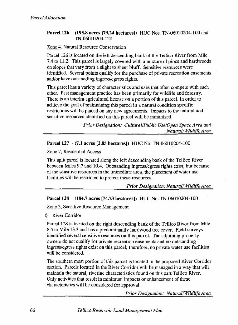
Parcel Allocation
Parcel 126 (195.8 acres [79.24 hectares]) HUC Nos. TN-06010204-100 and TN-06010204- 120
Zone, Natural Resource Conservation
Parcel 126 is located on the left descending bank of the Tellico River from Mile 7.4 to 11.2. This parcel is largely covered with a mixture of pines and hardwoods on slopes that vary from a slight to sheer bluff. Sensitive resources were identified. Several points qualify for the purchase of private recreation easements andlor have outstanding ingresdegress rights.
This parcel has a variety of characteristics and uses that often compete with each other. Past management practice has been primarily for wildlife and forestry. There is an interim agricultural license on a portion of this parcel. In order to achieve the goal of maintaining this parcel in a natural condition specific restrictions will be placed on any new agreements. Impacts to the natural and sensitive resources identified on this parcel will be minimized.
Prior Designation: CulturallPublic Uselopen Space Area and Natura NWildlife Area
Parcel 127 (7.1 acres [2.85 hectares]) HUC No. TN-06010204-100
Zone7, Residential Access
This split parcel is located along the left descending bank of the Tellico River between Miles 9.7 and 10.4. Outstanding ingresslegress rights exist, but because of the sensitive resources in the immediate area, the placement of water use facilities will be restricted to protect these resources.
Prior Designation: NaturallWildlife Area
Parcel 128 (184.7 acres [74.73 hectares]) HUC No. TN-06010204-100
Zone3, Sensitive Resource Management
0 River Corridor
Parcel 128 is located on the right descending bank of the Tellico River from Mile 8.5 to Mile 13.3 and has a predominantly hardwood tree cover. Field surveys identified several sensitive resources on this parcel. The adjoining property owners do not qualify for private recreation easements and no outstanding ingresslegress rights exist on this parcel; therefore, no private water use facilities will be considered.
The southern most portion of this parcel is located in the proposed River Corridor section. Parcels located in the River Corridor will be managed in a way that will maintain the natural, riverine characteristics found on this part Tellico River. Only activities that result in minimum impacts or enhancement of these characteristics will be considered for approval.
Prior Designation: NaturalIWildlife Area
Tellico Reservoir Land Management Plan

Parcel Allocation
Parcel 129 (11.8 acres [4.77 hectares]) HUC No. TN-06010204-100
Zone7, Residential Access
Parcel 129 is located on the left descending bank of the Tellico River. This narrow strip of land is partially covered with a blend of pines and hardwoods. Outstanding ingress/egress rights and qualifying points for purchase of private recreation easements exist and private water use facilities have previously been authorized to adjoining owners.
Prior Designation: NaturalIWildlife Area
Parcel 130 (12.2 acres [4.93 hectares]) HUC No. TN-06010204-100
Zone6, Recreation
0 Proposed Public Access Site
This heavily wooded parcel is located on the left descending bank of the Tellico River near Mile 12. The parcel is proposed for the location of an access area and ramp to replace the inaccessible ramp located at the Sloan Bridge. This would meet the access needs that were intended for this part of the Tellico River since the initial planning project. At this time, the nearest developed access point is the Ballplay Recreation Area which is approximately 5 River Miles downstream.
Field surveys identified sensitive resources, therefore, any proposed development of this parcel must ensure compliance with the Federal laws and executive orders.
Prior Designation: NaturallWildlife Area
Parcel 131 (81.5 acres [32.97 hectares]) HUC No. TN-06010204-100
Zone3, Sensitive Resource Management
0 River Corridor
Parcel 131 is a long, narrow band of property along the left descending bank of the Tellico River between Miles 12.2 to 13.7 and includes the sloughs in Millsaps Branch, Cagle Branch and Harris Branch. Several sensitive resources were identified. One area on Harris Branch qualified for the purchase of a private recreation easement but because it is location across a public road from the reservoir, such requests would be denied. The upstream portion of this parcel is considered to be within the Lower River Corridor.
Parcels located in the River Corridor will be managed in a way that will maintain the natural, riverine characteristics found on this part Tellico River. Only activities that result in minimum impacts or enhancement of these characteristics will be considered for approval.
Prior Designations: CulturallPublic UselOpen Space Area and Namral/Wildlife Area
Tellico Reservoir Land Management Plan 67
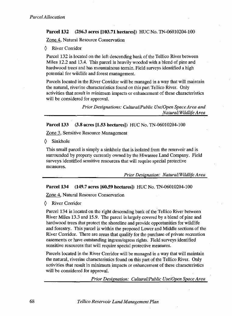
Parcel Allocation
Parcel 132 (2563 acres [103.71 hectares]) HUC No. TN-06010204-100
Zone4, Natural Resource Conservation
0 River Corridor
Parcel 132 is located on the left descending bank of the Tellico River between Miles 12.2 and 13.4. This parcel is heavily wooded with a blend of pine and hardwood trees and has mountainous terrain. Field surveys identified a high potential for wildlife and forest management.
Parcels located in the River Corridor will be managed in a way that will maintain the natural, riverine characteristics found on this part Tellico River. Only activities that result in minimum impacts or enhancement of these characteristics will be considered for approval.
Prior Designations: Cultural/Public Uselopen Space Area and NaturallWildlife Area
Parcel 133 (3.8 acres [1.53 hectares]) HUC No. TN-06010204-100
Zone3, Sensitive Resource Management
0 Sinkhole
This small parcel is simply a sinkhole that is isolated from the reservoir and is surrounded by property currently owned by the Hiwassee Land Company. Field surveys identified sensitive resources that will require special protective measures.
Prior Designation: NaturallWildlife Area
Parcel 134 (149.7 acres [60.59 hectares]) HUC No. TN-06010204-100
Zone 4 Natural Resource Conservation -7
0 River Corridor
Parcel 134 is located on the right descending bank of the Tellico River between River Miles 13.3 and 15.9. The parcel is largely covered by a blend of pine and hardwood trees that protect the shoreline and provide opportunities for wildlife and forestry. This parcel is within the proposed Lower and Middle sections of the River Corridor. There are areas that aualifv for the ourchase of vrivate recreation easements or have outstanding ingresslegress rights. Field surveys identified sensitive resources that will require special protective measures.
Parcels located in the River Corridor will be managed in a way that will maintain the natural, riverine characteristics found on this part of the Tellico River. Only activities that result in minimum impacts or enhancement of these characteristics will be considered for approval.
Prior Designation: CulturalIPublic Uselopen Space Area
Tellico Reservoir Land Management Plan
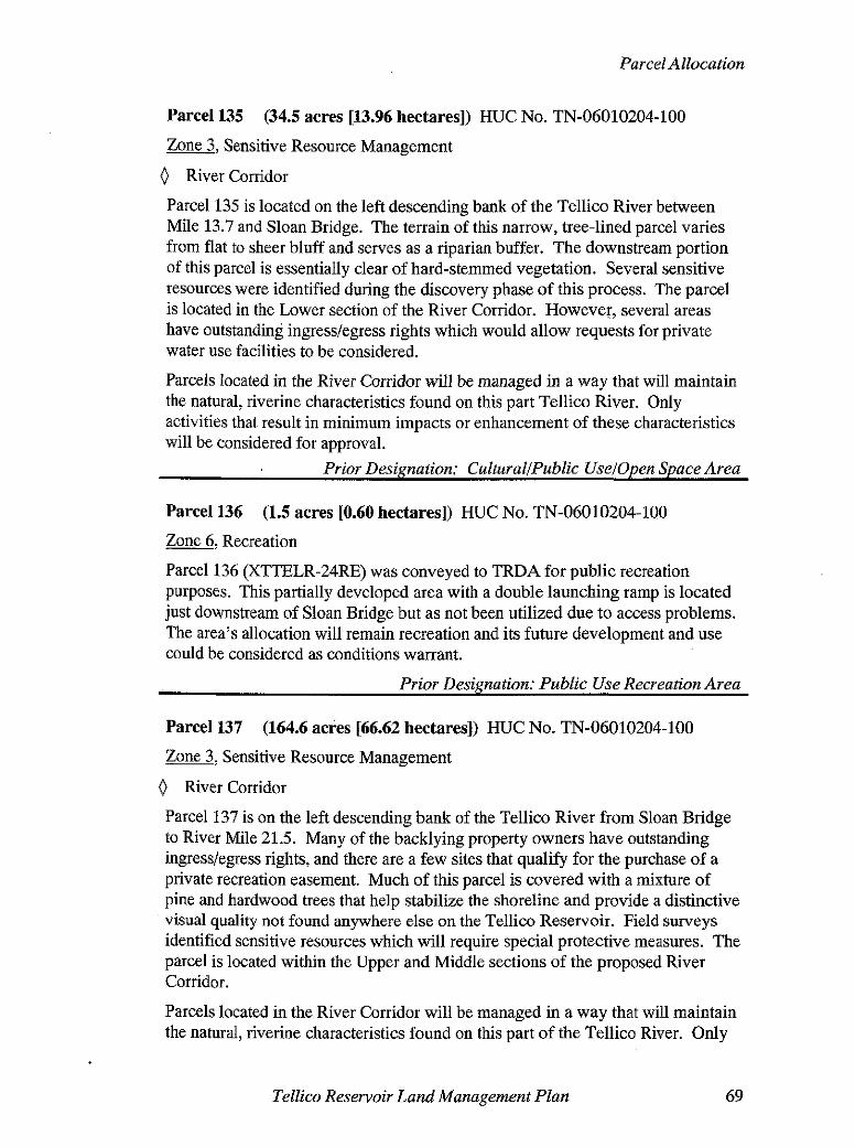
Parcel Allocation
Parcel 135 (34.5 acres [13.96 hectares]) HUC No. TN-06010204-100
Zone3, Sensitive Resource Management
0 River Corridor
Parcel 135 is located on the left descending bank of the Tellico River between Mile 13.7 and Sloan Bridge. The terrain of this narrow, tree-lined parcel varies from flat to sheer bluff and serves as a riparian buffer. The downstream portion of this parcel is essentially clear of hard-stemmed vegetation. Several sensitive resources were identified during the discovery phase of this process. The parcel is located in the Lower section of the River Corridor. However, several areas have outstanding ingresslegress rights which would allow requests for private water use facilities to be considered.
Parcels located in the River Corridor wifl be managed in a way that will maintain the natural, riverine characteristics found on this part Tellico River. Only activities that result in minimum impacts or enhancement of these characteristics will be considered for approval.
Prior Designation: CuEtural/Public Uselopen Space Area
Parcel 136 (1.5 acres [0.60 hectares]) HUC No. TN-06010204-100
&&, Recreation
Parcel 136 (XTTELR-24RE) was conveyed to TRDA for public recreation purposes. This partially developed area with a double launching ramp is located just downstream of Sloan Bridge but as not been utilized due to access problems. The area's allocation will remain recreation and its future development and use could be considered as conditions warrant.
Prior Designation: Public Use Recreation Area
Parcel 137 (164.6 acres [66.62 hectares]) HUC No. TN-06010204-100
Zone3, Sensitive Resource Management
0 River Corridor
Parcel 137 is on the left descending bank of the Tellico River from Sloan Bridge to River Mile 21.5. Many of the backlying property owners have outstanding ingress/egress rights, and there are a few sites that qualify for the purchase of a private recreation easement. Much of this parcel is covered with a mixture of pine and hardwood trees that help stabilize the shoreline and provide a distinctive visual quality not found anywhere else on the Tellico Reservoir. Field surveys identified sensitive resources which will require special protective measures. The parcel is located within the Upper and Middle sections of the proposed River Corridor.
Parcels located in the River Corridor will be managed in a way that will maintain the natural, riverine characteristics found on this part of the Tellico River. Only
Tellico Reservoir Land Management Plan 69

activities that result in minimum impacts or enhancement of these characteristics will be considered for approval.
Frequent flooding occurs in this area.
Prior Designation: CulturallPublic UselOpen Space Area
Parcel 138 (127.2 acres [51.48 hectares]) HUC Nos. TN-06010204-090 and TN-06010204-100
Zone3. Sensitive Resource Protection.
0 River Corridor
Parcel 138 is located on the right descending bank of the Tellico River from Mile 15.9 to 19.3 and in the Middle and Upper sections of the proposed River Corridor. Sensitive resources were identified that will require the special protection under Federal and state laws. The terrain varies from slight to sheer bluff and holds some of the most distinctive visual qualities found on the reservoir. Most of the shoreline of this parcel is protected by a mixture of pine and hardwood trees. Outstanding rights of ingresslegress exist as well as points that qualify for the purchase of a private recreation easement. Frequent flooding occurs in this area.
Parcels located in the River Corridor will be managed in a way that will maintain the natural, riverine characteristics found on this part of the Tellico River. Only activities that result in minimum impacts or enhancement of these characteristics will be considered for approval.
Prior Designation: Cultural/Public UselOpen Space Area
Parcel 139 (2.9 acres C1.18 hectares]) HUC Nos. TN-06010204-100
a, Recreation
0 Proposed Public Access Site
0 River Corridor
This small parcel is located on the left descending bank at approximate River Mile 18.5 of the Tellico River. Due to its location and accessibility by existing road, this parcel is well-suited as a recreation area that offers an opportunity for canoe and light boat access. The Tennessee Wildlife Resources Agency has expressed an interest in managing the area. Facilities could including steps, small ramp and parking. Field studies identified sensitive resources. In order to protect the integrity of these resources, any land disturbing activity proposed for this parcel would be reviewed.
Prior Designation: CulturallPublic UselOpen Space Area
Tellico Reservoir Land Management Plan

APPENDIX A. Tellico Reservoir Planning Team Members
Akers, Steven L., Little Tennessee Watershed Team, Land Use Specialist~Tellico Reservoir Planning Project Leader
Becker, Donald C., Watershed Projects Specialist
Becker, Patsy R., Specialist/Melton Hill Reservoir Planning Project Leader
Blackburn, Jerry D., Little Tennessee Watershed Team, Program Administrator
Boardman, Spencer D., Reservoir Lands Planning Specialist
Cuthbertson, Darrell C., Little Tennessee Watershed Team, Land Use Specialist
Draper, Harold M., NEPA Specialist
Duffey, Janet L., Little Tennessee Watershed Team, Land Use Specialist
Edmondson, Frank B. (Bucky), Upper Holston Watershed TeamISenior Land Use Specialist/Boone Reservoir Planning Project Leader
Ellenburg, Charles H., Mideast Region, Land Use Specialist (Recreation)
Falco, Paul S., Little Tennessee Watershed Team, Senior Land Use Specialist
Farrell, Robert (Woody) G., Little Tennessee Watershed Team, Team Manager
Horton, Ruth M., Land Use Specialist
James, Wesley K., Mideast Region, Wildlife Biologist
McHone, Brenda L., Little Tennessee Watershed Team, Clerk
Miller, Jack W., Little Tennessee Watershed Team, Land Use Specialist
Newman, Joyce K., (retired) Little Tennessee Watershed Team, Land Information Technician
Rauch, Eric W., Mideast Region Manager
Searcy, Charlene B, Little Tennessee Watershed Team, Land Information Technician
Toennisson, Richard L., Mideast Region, Environmental Scientist
Tellico Reservoir Land Management Plan


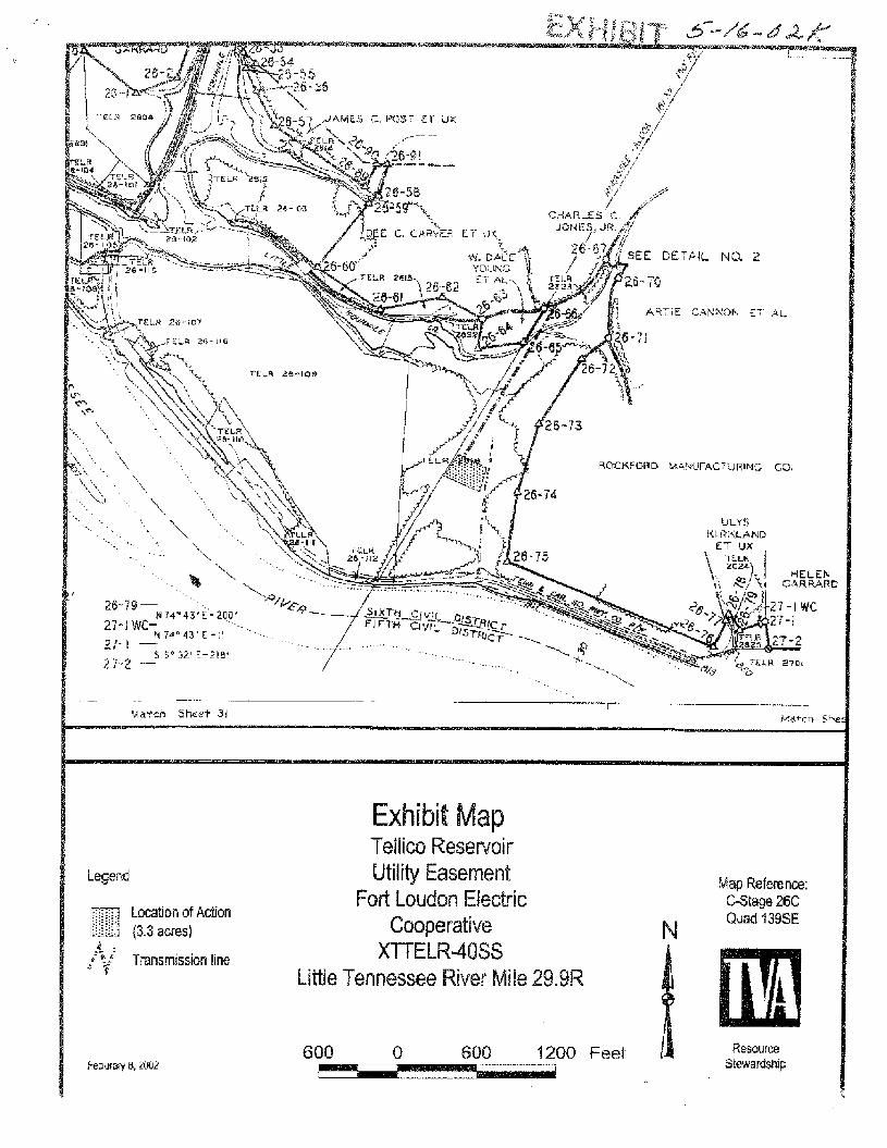
Legend
Exhibit Map Teflim Reservsi r Utility Easement
Fofi Loudon Electric Cooperative
MTELR4OSS Little Tennessee River Mile 29.9R
Map Refence: GStw 26G
N Quad 739SE
600 1200 Feat Resource Stewamsh~p
April 49, 2002
REQUEST FOt? GCARD APFRB'JAL - PRBPGSED d{@.DlFlCATiON OF TRANSFER INST'R2MENT - TENNESSEE 'ArlLDCIF-'E RESOLIRCES AGE!\LCWSTATE OF TENNESSEE -TRACT NO. XTFHR-2 - SULLIVAN CGiINTY, TENNESSEE - FORT FATWICK HENRY RESERVOiR
REQUESTED ACT!ON: That the Board autharite w~theirt charge, except for payment of TVA's acirninistrafive costs, the rnodificati~n of a restrictive ;ovenant affecting appsaxirnately 0.50 acre oi former TVA land on Fort Patrick Henry Reservoir (portion of Tract No, XTFHR-2) in Sultivarr County, Tennessee.
CRITICAL SUCCESS FACTORS: e Achieve excellence in stakeholder relations and communications.
Balance competing demands and optimize the river system.
VALUE OF PROPOSED ITEM TO THE PEOPLE OF THE VALLEY: This action supports the management sf pubfie properly by a State agency and will contribute value to public recreation oppoflunities in the Tennessee Valley resulting from the rnultipie benefits provided by WA's reservoir system.
KEY POINTS: On August 18, $958, TVA transferred 2.6 acres of land (Tract No. XTFHR-2) to the State 6f Tennessee (State) for public recreation purposes only. Bill and Brenda Wallen, owners of land adjoining Tract No. XTFHR-2, constructed a portion of their house and septic system on an zgproxirnate 0.30-acre portion of Tract NO. XTFHR-2. TheTennessee Wildlife Resources Agency (TWRA) on behalf of thestate has requested that TVA modify t h e transfer instrsrnent (Contract No. TV-20238A) to permit residential use on this 0.30-acre portion to allow the State to exchange it with the Wallens for an approximate 0.24-acre tract of private land adjacent to Tract No. XTFHR-2. The agreement between the State and the Wallens will provide provisions needed to protect TVA program interests. The value of this instrument modification and the private land to be exchanged have each been appraised at $8,700 by an independent agent for TWRA.
JUSTIFICATION: This proposal will not adversely impact TVA's operations and ajI required program, legal, and environmental coordinations, reviews, and approvals have been completed. This modification would facilitate the State's effort to resolve an encroachment affecting this propefl-hy. W R A has agreed to pay TVA's administrative costs, which will be approximately $10,000 and which will be recovered by the State from the Wallens.

E?ien Robinsan Page 2 Apsil 17, 2002
CONTACT: - Tardy S, Hobbs; Manager, Upper Holston Wafeis!7ect Team, 423-239-2C03
0. J. Zeringue President and Chief Operating Officer ET 12A-K
HES Attachments: Exhibit and Vicinity Maps cc: W. Terry Baston, MR 3H-C
Darlene H. Bradiey, CST 7A-C Amy T. Bums, MR 2X-C J. R. Bynurn, LP 3K-C M. H. Dunn, Elf I f A-K B. K. Ellis, N WPI 2A-N M. 4. Jackson, WT 4 1 A-K J. E. Long, Jr., ET 12A-K
R. A. Loving, WT 1 1 6 - K M, 0. Medford, HWT I2D-NST K. S, RawEs, HRT f2C-NST J. A. Scalice, LP 68-C D. N. Smith, ET 12A-K D. LeAnne Stribley, ET 12A-K G. M. Vincen?, MR 3K-C ELSMS, EB 5G-C fw/ altachmentsj

PROPOSEF BOARD RESG!,!JTION
WtiEREAS IR t S55, TdA, p u r s ~ a n t to Ssction 4(k)(aj of t r i ~ Tah~r?essee Valley Ar~thor:ty Ac! C S '1 933, as atxended, transferred tc .he State of 'Tel?nessee a tract. of land un Fort Pztrjck Henry Reservcir in Su!livan C O U F ~ ~ ~ : Tennessee, rlesig~atecl in W A land records as "'Tract No. XTFHR-2, subject to a restriction tP6at it be used for p ~ b t i c rec rea t i~~ ! ptrposas ci-rly; and
WHEREAS the Tennessee Wildlife Resources Agencjr I-ras requestnci that WA, as agent of t he United States of America, modify the instrument of transfer to airow residential use of a 6.30-acre portion of said tract to resolve an encroachment: and
'NHEREAS t he Board has determined that i t wili not be adverse to the interests of the United States or W A to so modify the transfer instrument; and
WHEREAS it has been determi~ed that the prcposed modification is not a major federal action having a significant impact on tP,e human environment and that, accordingiy, an environmental impact statement is not required;
BE IT RESOLVED, That the Board of Directors hereby authorizes and directs the Manager, Realty Services, or the designee thereof upon payment of WA's administrative costs, to execute and deliver to the State of Tennessee a recordable instrument evidencing the modification to the extent herein prov~ded, in such form as t he General Counsel or the designee thereof shall approve, subject to such terms and conditions as are necessary to cover and protect WA's statutory obligations, program requirements, and other interests.
Prepared by Barry B. Walton; approved by mm , dat5 Y/ /~Q

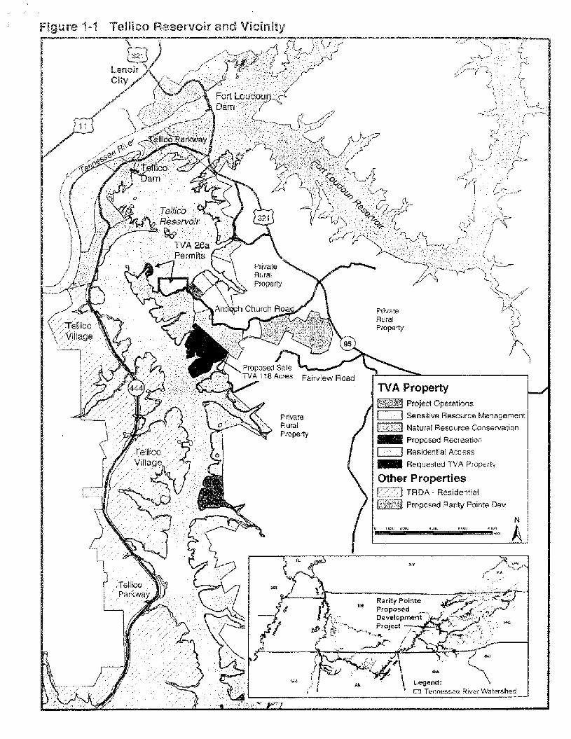
Figure 1-1 Tellics Reservoir and Vicinity
Ellen Robinson, ET 42A-K (5)
REQUEST FOR BOARD APPROVAL - PROPOSED SALE OF REAL PROPERTY TO CTR PROPERTIES, INC. (RARITY CGMMUNITIES), (TRACT NO. XTELR-238) - PFSQPQSE9 GRANT Of Pf RMANENT EASEMENTS TO TELLICU RESERVOIR 9EVELOPMENT AGENCY (TRACT NO. XTTEL-R- 44 RE AND XSTELR-45RE) - PROPOSED LAND USE ALLOCATION CHANGES TO THE TELLICO RESERVOIR LAND MANAGEMENT PLAN - LOUDON AND MONROE COUNTIES, TENNESSEE - 'TELLiCCI RESERVOIR
REQUESTED ACTION: -- a That the Board of Directors authorize the surplus and sale, pursuant to Section 4(k)(aj
of the W A Act, as amended, of approximately 116.4 acres of TVA property {Tract No. XTELR-236) in Loudon County, Tennessee, tu Rarity Communities far the purpose of residential and eornrnerclai recreation development.
* f hat the Board approve, pursuant to 40 3.S.C. 5 1314, the grant of noncommercial, nonexclusive permanent easements affecting app~oxirnately 273.6 acres in Loudon and Monroe Counties, Tennessee (Tract Nos. XTTELR-44WE and -45RE) tc! the Tellico Reservoir Deveiopment Agency (TRDA) for recreation and naturaf resource conservation management purposes to support, the mitigation being required af Rarity Communities as a condition of the sate of the TVA land. in support of the foregoing actions, that the Board approve the following land use allocation changes to the Tellico Reservoir Land Management Plan (Yellico Land Plan):
r Release the natural resource conservation and recreation altocation from the Tellico Land PIan of approximately 7 16.4 acres prop~sed to be sold to Rarity Communities. Change the allocation of 7.3 acres, which is the remaining TVA property fronting the 1 f 6.4 acres currently ailocated for recreation, from recreation to natural resource conservation. This land and the additional remaining TVA land fronting the 1 j6.4 acres will provide a protective buffer for wetlands and water quality.
o Allocate the 256 azras of land to be cor~veyed to TVA by Rarity Communities as recreation (1 17 acres) and natural resource conservation (1 39 acres). Change the allocation of 17.6 acres from natural resource conservation to recreation at the location where Rarity Communities wilt be developing public recreational facilities as part of t h e mitigation.
CRITICAL SUCCESS FACTORS: - Balance competing demands and optimize the river system. Achieve excellence in stakeholder relations and communications. Promote development through targeted, sustainable growth initiatives.

EIlcn Robinso? Page 2 ,~uEy 8 , 2003
VALUE OF PR-@POSED l?EP?l TO TbiE PEOPLE OF THE VALLE,YY Phis action supparts and will contribute vatue to residentiai, recreational, ai:d economic devetopment in the Tennessee Valley resuiting fron; the multiple benefits provlded by TVA's reservoir system.
KEY P Q I N B 0 [Ilichael Ross, President af LTR Properties, tnc. (Rarity Communities), requested that
TVA sell approximately 'I 16.4 acres of land for residentiai and commercial recreation devel~prnent.
r Rarity Communities plans fo utilize the 't 16.4-acre tract, in addition to 2% acres acquired from TRDA and 294 acres af private land to develop approximately 1,200 residential units, a todge-spa, marina, championship golf course, and retail shops. Since the 21 6 acres purchased from TRDA are restricted to commercial recreation use, residential units on that portion will be available as vacation homes, but will not be available as primary residences.
r Rarity Communities estimates the total costs of the proposed development at $470 million and projects it to generate approximateiy 503 jobs over t h e next ten years during construction and 66 permanent jobs at completion of the project. Because of the loss of public recreational and natural resource management opportunities on the 11 6.4-acre tract, Rarity Communities has agreed to
Develop 17.6 acres of W A land for public recreation purposes, at an estimated cost of $97,000. The Greenway Trail Head Recreation Area will have paved road access, paved parking far 18 vehicles, a toilet building, and six picnic tabfes. Acquire 255 acres of industrial land from TFZDA, Tract No. TELR-5324 (the Wildcat Rock site), and convey it to TVA.
TRDA has agreed to assume management responsibilities for the two mitigation tracts for recreation and natural resource conservation purposes. The two nonexclusive grants of easement will be conveyed to TRDA, without charge, to support its management activities. The easements will include the right to construct, operate, and maintain recreational facilities upon the receipt of prior written approval from TVA.
t, The proposed action will not result in any flood or power storage capacity losses. r An environmental impact statement was prepared and a record of decision will be
issued. T'he recommended action reflects Alternative E, the preferred alternative, in the Rarity Pointe final environmental impact statement.
JUST1 FICATION: This prop~saI wil! not adversely impact N A operations and all required program, tegal, and environmental coordination, reviews, and approvals have been completed and obtained. In accordance with the requirements of the FVA Act and Executive Order No, 11 609 for Section 4(k)(a) transfer, the approval of the General Services Administration has been obtained.
R3rity C~lmmunities has agreed to pay TGA the fair market value cf the 3 16.4 acres (the conveyance of the Wildcat Rock site plus $1,438,OQQ). Rarity also agreed to pay TVk's administrative costs fcr the review of the pr~posai and completion of an environrxental impact statement, which will be approximately $3! tj70W0. A comparative market analysis has been perffirmed far the two easements recornmendeu to be granted to TRDA.
CONTACT: Robert G. Farrell, Team Manager, Little Tennessee Watershed, 865-988-2431
0. J. Zeringue President and Chief Operating Officer ET 12A-K
HES Attachments: Exhibit and Vicinity Maps GC: Jack A. Bailey, MI? 3K-C John M. Hoskins, WT 4C-K
W. Terry Boston, MR 3H-C K. J. Jackson, WT 11A-K Darlene H. Bradley, CST 7A-C 4. E. Long, Jr., ET 12A-M John Bradley, OCP 2A-NST R. A. Loving, LP 5A-C Amy T. Burns, MR 2X-C M. 0. Medford, QCP 1 F-NST J. W, Bynurn, LP 3K-C Anda A. Ray, SF 6D-C M. H. Dunn, ET I IA-K J. A. Scalice, LP 6A-C B. K. Eilis, PJRB 2A-N D. LeAnne Stribley, ET 12A-K Charlene Evans, ET 1 1A-K (wl attachmentsj EDMS, El3 5G-@ (wl attachments) Theresa A. Fiaim, ET 12A-K