22
www.terrasolid.com TerraScan New Features Arttu Soininen 22.01.2019

www.terrasolid.com
TerraScanNew Features
Arttu Soininen 22.01.2019
• Support for reading PTS file format (used with static scanner data)• Faster reading of many text file formats• Dimension, Normal X, Normal Y and Normal Z field types added to user defined point file formats• Parameter attribute added to user defined point file formats• Scan display close keyin command for closing display mode dialog• Convert geoid model supports Norwegian geoid model (href2016b_nn2000_euref89.txt)• Copy from reference supports copying Echo length and Parameter attributes• Sorting by Line and time, Line, scanner and time and Xy location added to pulldown menu and to
macro action• Addon source codes now include Visual Studio solution file
Various Improvements

• Better load balancing for multiple threads in many computation routines
• Faster routines:• Point display in view windows• Assign groups• Compute normal vectors• Classify / Surface points• Smoothing xyz
Speed Improvements
• View tower previous keyin command for moving to previous tower in View Tower Spans list• View tower next keyin command for moving to next tower in View Tower Spans list
• Compute distance macro action supports computing distance from points to powerline wires
Powerline Improvements
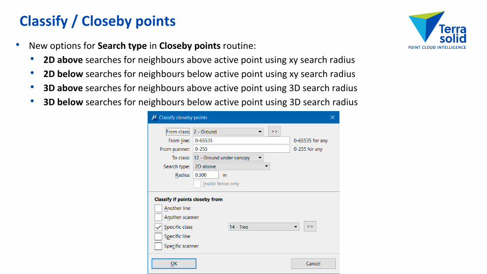
• New options for Search type in Closeby points routine:• 2D above searches for neighbours above active point using xy search radius• 2D below searches for neighbours below active point using xy search radius• 3D above searches for neighbours above active point using 3D search radius• 3D below searches for neighbours below active point using 3D search radius
Classify / Closeby points
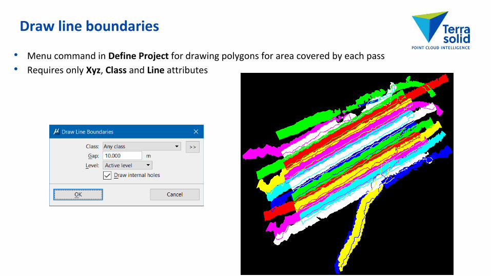
• Menu command in Define Project for drawing polygons for area covered by each pass• Requires only Xyz, Class and Line attributes
Draw line boundaries

• Match Roof Elevation tool for modifying a roof plane equation so that selected vertices match elevations of neighbouring patches
• Tolerance setting for intersection lines in Check Building Models and Draw Roof Lines
Improvements in Building Vectorization
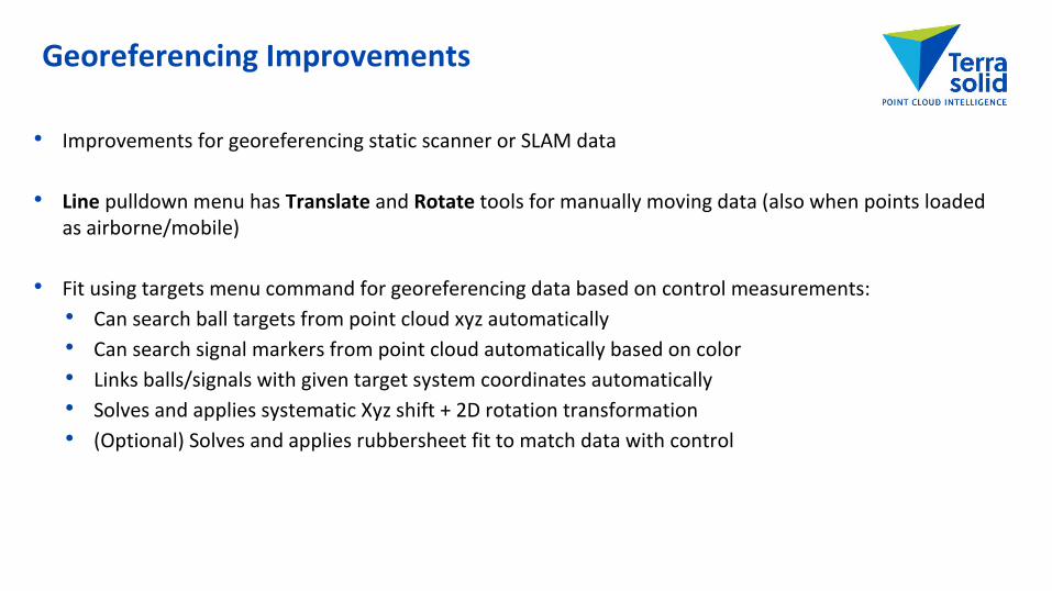
• Improvements for georeferencing static scanner or SLAM data
• Line pulldown menu has Translate and Rotate tools for manually moving data (also when points loaded as airborne/mobile)
• Fit using targets menu command for georeferencing data based on control measurements:• Can search ball targets from point cloud xyz automatically• Can search signal markers from point cloud automatically based on color• Links balls/signals with given target system coordinates automatically• Solves and applies systematic Xyz shift + 2D rotation transformation• (Optional) Solves and applies rubbersheet fit to match data with control
Georeferencing Improvements
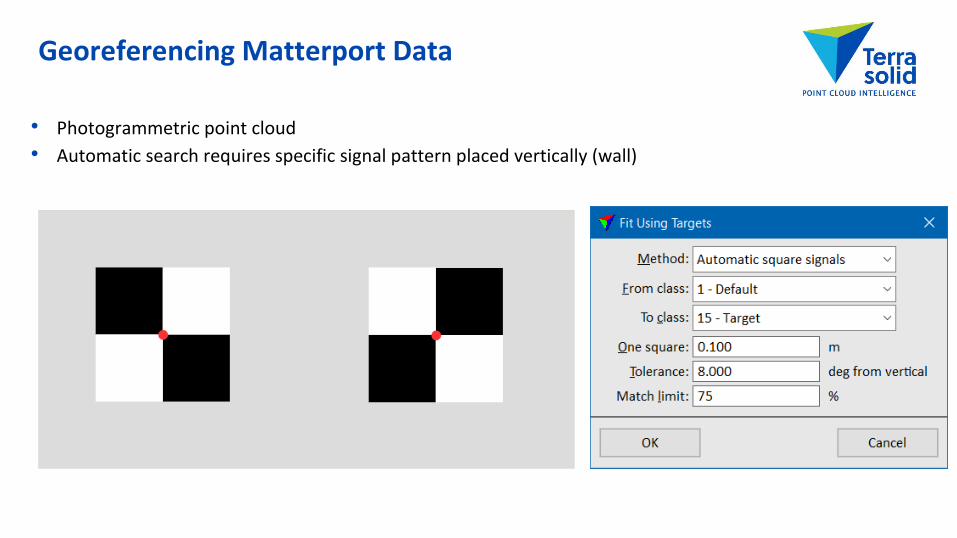
• Photogrammetric point cloud• Automatic search requires specific signal pattern placed vertically (wall)
Georeferencing Matterport Data
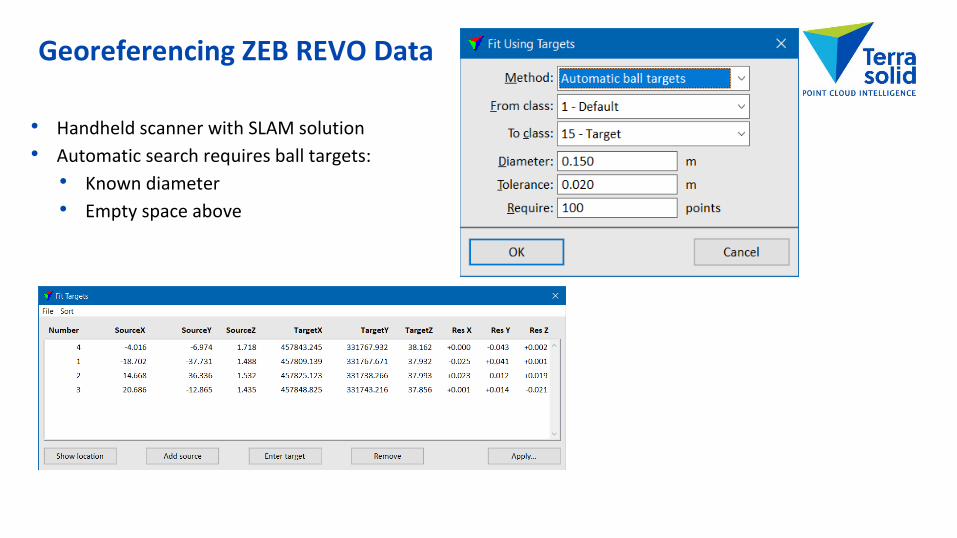
• Handheld scanner with SLAM solution• Automatic search requires ball targets:
• Known diameter• Empty space above
Georeferencing ZEB REVO Data

• Menu command and macro action for cutting long range measurements if there are shorter measurements from same line closeby
• Reduces noise level in the data set• Use with mobile/backpack/handheld scanners which may see the same location multiple times from a
single pass
Line / Cut long range
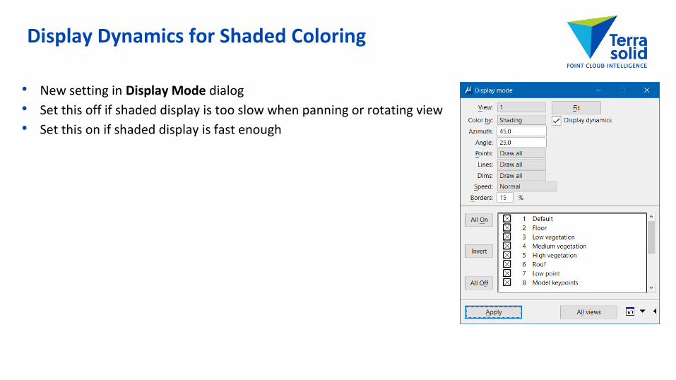
• New setting in Display Mode dialog• Set this off if shaded display is too slow when panning or rotating view• Set this on if shaded display is fast enough
Display Dynamics for Shaded Coloring

• Borders setting replaces Use depth in Display Mode• Depth separation setting removed from Scan Settings• Borders controls how many foreground points get black borders• Easier to control and same setting works for with different data sets and viewing angles
• Use normal setting changes brightness of points based on normal vector direction• Works with constant color type coloring modes: Class, Dimension, Echo, Line, ...
Display Improvements

• Views can display all points or a subset of points called Displayset• Displayset is useful when you want to concentrate on a limited area or on a specific feature• If Displayset is empty, views always display using all of the points
Displayset
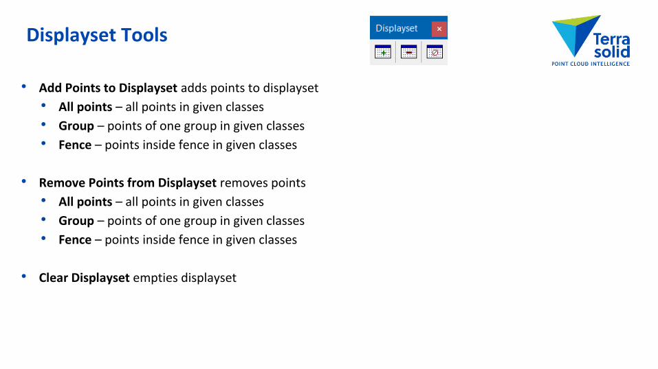
• Add Points to Displayset adds points to displayset• All points – all points in given classes• Group – points of one group in given classes• Fence – points inside fence in given classes
• Remove Points from Displayset removes points• All points – all points in given classes• Group – points of one group in given classes• Fence – points inside fence in given classes
• Clear Displayset empties displayset
Displayset Tools
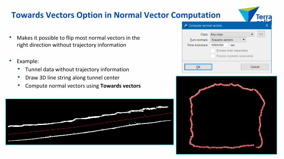
• Makes it possible to flip most normal vectors in the right direction without trajectory information
• Example:• Tunnel data without trajectory information• Draw 3D line string along tunnel center• Compute normal vectors using Towards vectors
Towards Vectors Option in Normal Vector Computation
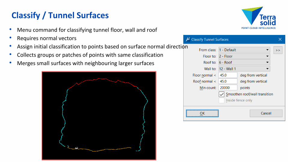
• Menu command for classifying tunnel floor, wall and roof• Requires normal vectors• Assign initial classification to points based on surface normal direction• Collects groups or patches of points with same classification• Merges small surfaces with neighbouring larger surfaces
Classify / Tunnel Surfaces

• Classifies grouped points based on average vegetation index value of the group
Groups / Classify / By vegetation index

• Group / Copy from closest menu command modifies points which have no group assignments• Copies group value from closest grouped point in given classes• Workflow for using thinned data in classification:
• Thin points moving some of the points to 'Unnecessary density' class• Run classification on active points• Copy class to 'Unnecessary density' points from closest classified point• Copy group to 'Unnecessary density' points from closest grouped point
Group / Copy from closest

• New method in grouping trees• Watershed method groups trees starting with local highest points• Trunk method requires good number of hits on tree trunks
• Very high density airborne laser data• Mobile laser data• Static scanner data
• Trunk method can correctly group:• Leaning trees• Small trees under a tall tree
Trunk Method in Grouping

• Add Points to Group adds points in given classes inside fence to a group• Any – all points inside fence• One group – points from one group inside• Non-grouped – points not assigned to any group
• Clear Group Fence clears group assignment of points inside fence
Add Points to Group & Clear Group Fence

• Menu command for checking groups in an organized way• Gives a list of groups user can go thru• Automates view setup showing selected group• Selected group automatically becomes active displayset• Four user definable classification buttons
Inspect Groups


